Williams EA Nov 3 06 with BLM corrs ASSESSMENT T-Abbs Allotment, 109-1G & 1H, Muckleshoot Tribe...
30
November 3, 2006 ENVIRONMENTAL ASSESSMENT EA # OR-130-07-EA-001 Mining Proposal T-Abbs Allotment, 109-1G & 1H, Muckleshoot Tribe Auburn, Washington Prepared by: La Pianta LLC February 1, 2007
-
Upload
truongkhanh -
Category
Documents
-
view
215 -
download
2
Transcript of Williams EA Nov 3 06 with BLM corrs ASSESSMENT T-Abbs Allotment, 109-1G & 1H, Muckleshoot Tribe...
November 3, 2006
ENVIRONMENTAL
ASSESSMENT
EA # OR-130-07-EA-001
Mining Proposal
T-Abbs Allotment, 109-1G & 1H, Muckleshoot Tribe
Auburn, Washington
Prepared by: La Pianta LLC February 1, 2007
ENVIRONMENTAL ASSESSMENT T-Abbs Allotment, 109-1G & 1H, Muckleshoot Tribe
Executive Summary
La Pianta LLC has prepared this Environmental Assessment for the proposed gravel mining operation on the T-Abbs Allotment, 109 -1G & 1H, Muckleshoot Tribe parcels of land within the Muckleshoot Reservation of the Muckleshoot Indian Tribe, a federally recognized Indian Tribe, in Auburn, Washington (also commonly known as the “Williams Property”). The proposed sand and gravel extraction operation will provide material for various construction projects throughout the region. Pursuant to the regulations implementing the provisions of National Environmental Policy Act of 1969, 40 CFR 1500 - 1508, three alternatives have been evaluated as part of this assessment. The first alternative, the proposed action, involves the mining of 500,000 bank cubic yards of material from the property, leaving approximately 130,000 bank cubic yards of material in place for use by the Tribe for its own future projects. The second alternative proposes to remove all of the material from the property, and the last alternative is the “no action” alternative. The first alternative is preferred because of practical and efficient removal of material, annual royalty income for the Tribe, and positioning of the property for future development by the Tribe while preserving readily available materials for use in the Tribe’s projects.
The T-Abbs Allotment, 109 -1G & 1H, Muckleshoot Tribe parcels comprise 12.8 acres within a mining district of 250 acres on the south side of State Highway SR 18, including two large mining operations to the west and south – the adjacent 77-acre Meade Pit operated by La Pianta and the 160acre Miles Pit operation west of that. Work within these two operations has been decreasing, with 67 acres now reclaimed or under reclamation. Of the 12.8 acres in this proposal, only 8 acres are proposed for mining, so the environmental impacts from this project combined with what remains of the existing two operations will be less than the impacts of those two operations at their height of production, and the impacts are simple to mitigate. Accordingly, the extraction of sand and gravel from this property is a beneficial interim land use in consideration of present and future activities in the project area.
ii

Table of Contents
Chapter 1. Purpose and Need for the Proposed Action ................. 1
A. Purpose and Need for the Proposed Action ........................... 1B. Description of the Property...................................................... 1
I. General Location ........................................................... 1
II. Legal Description........................................................... 2
III. Governing Regulations and Guidelines ........................ 2
Chapter 2. Proposed Action and Alternatives ................................. 4
A. Description of the Alternatives ................................................ 4
I. Alternative A (Proposed Action) .................................... 4
II. Alternative B .................................................................. 4
III. Alternative C.................................................................. 4B. Comparison of the Alternatives ............................................... 5C. Process of Scoping the Alternatives ....................................... 5D. Proposed Mitigation Common to Alternatives A and
B .............................................................................................. 6
Chapter 3. Affected Environment and Environmental Consequences .................................................................................. 8
A. Land ........................................................................................ 8
I. Topography ................................................................... 8
II. Soils............................................................................... 9B. Cultural & Archaeological Resources...................................... 9C. Environmental ....................................................................... 10
I. Air Resources.............................................................. 10
II. Water Resources......................................................... 10
III. Vegetation ................................................................... 11
IV. Wildlife......................................................................... 12
iii
V. Noise and Light ........................................................... 14D. Traffic .................................................................................... 14E. Economics............................................................................. 15
I. Employment ................................................................ 15
II. Income......................................................................... 16F. Physical Elements ................................................................. 16
I. Aesthetics.................................................................... 16
II. Public Health and Safety............................................. 16
III. Resource Use Patterns ............................................... 17G. Environmental Justice ........................................................... 18H. Cumulative Effects ................................................................ 19
Chapter 4. Consultation and Coordination.................................... 21
A. Public Involvement Process .................................................. 21B. Agencies/Organizations/Individuals Consulted..................... 21C. List of Preparers .................................................................... 22
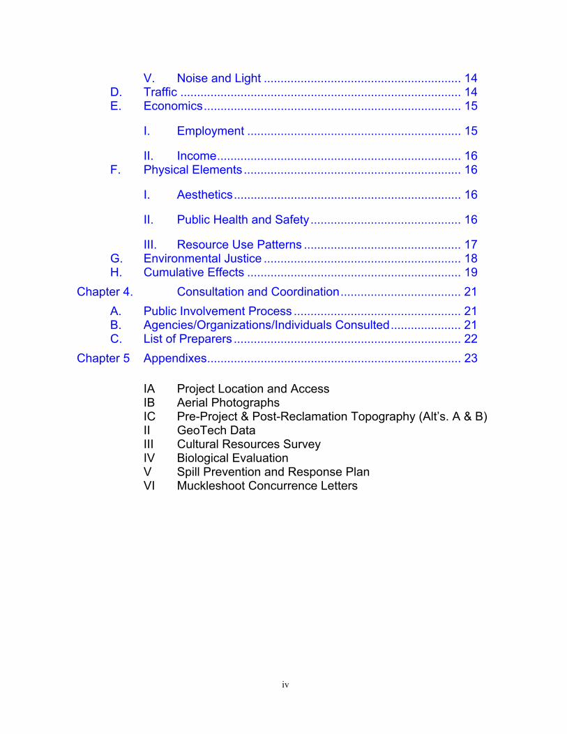
Chapter 5 Appendixes............................................................................ 23
IA Project Location and Access IB Aerial Photographs IC Pre-Project & Post-Reclamation Topography (Alt’s. A & B) II GeoTech Data III Cultural Resources Survey IV Biological Evaluation V Spill Prevention and Response Plan VI Muckleshoot Concurrence Letters
iv

ENVIRONMENTAL ASSESSMENT T-Abbs Allotment, 109-1G & 1H, Muckleshoot Tribe
Project Information
EA Number: OR-130-07-EA-001
Federal Lease Serial Number: ____________
King County Tax Parcel Number: the northern parcel of 2021059001
General Location: A portion of NE ¼ of NW ¼ of Section 20, T21N, R5E, located east of downtown Auburn, Washington, on the south side of State Highway SR 18 midway between the Auburn Way and Auburn/Black Diamond Road exits.
Acreage: approximately 12.8 acres
Lessor: The Muckleshoot Indian Tribe 39015 - 172nd Avenue Southeast Auburn, WA 98092 Attn: Ken Lewis – Realty Officer Attn: Roger Blaylock – Planning Attn: Rob Otsea – Tribal Attorney Phone 253/939-3311 FAX 253/939-5311 [email protected] [email protected] [email protected]
Applicant/Lessee/Operator: La Pianta LLC P.O. Box 88028 Tukwila, WA 98138 Attn: Mark Segale Phone 206/575-2000 FAX 206/575-1837 Email: [email protected]
v

BLM:
Consultants:
Geotech:
BIA:
U.S. Department of the Interior Bureau of Indian Affairs Puget Sound Agency 2707 Colby Avenue, #1101 Everett, WA 98201 Attn: Stanley Surridge Phone 425/258-2651 FAX 425/259-1593
U.S. Department of the Interior Bureau of Land Management Spokane District Office 1103 North Fancher Spokane, WA 99212 Attn: Kelly Courtright Phone 509/536-1218 FAX 509/536-1275 Email: [email protected]
U.S. Department of the Interior Bureau of Land Management Wenatchee Field Office 915 Walla Walla Avenue Wenatchee, WA 98801 Attn: Brent Cunderla Phone 509/665-2100 FAX 509/665-2121 Email: [email protected]
GeoEngineers 1101 Fawcett Ave., # 200 Tacoma, WA 98402 Attn: Gary Henderson Phone 253/383-4940 FAX 253/383-4923 Email: [email protected]
vi
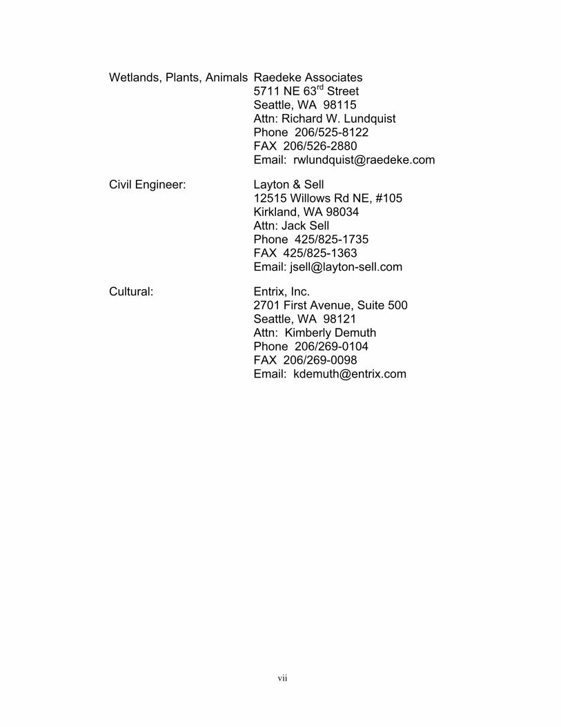
Wetlands, Plants, Animals Raedeke Associates 5711 NE 63rd Street Seattle, WA 98115 Attn: Richard W. Lundquist Phone 206/525-8122 FAX 206/526-2880 Email: [email protected]
Civil Engineer: Layton & Sell 12515 Willows Rd NE, #105 Kirkland, WA 98034 Attn: Jack Sell Phone 425/825-1735 FAX 425/825-1363 Email: [email protected]
Cultural: Entrix, Inc. 2701 First Avenue, Suite 500 Seattle, WA 98121 Attn: Kimberly Demuth Phone 206/269-0104 FAX 206/269-0098 Email: [email protected]
vii

ENVIRONMENTAL ASSESSMENT T-Abbs Allotment, 109-1G & 1H, Muckleshoot Tribe
Chapter 1. Purpose and Need for the Proposed Action
A. Purpose and Need for the Proposed Action
La Pianta LLC, a Washington limited liability company (“La Pianta”), and The Muckleshoot Indian Tribe of the Muckleshoot Reservation, a federally recognized Indian Tribe (the “Tribe”), propose to develop Indian lands (the “Property”) for aggregate resource extraction that will economically benefit the Tribe, its members, families, and the community. The Mining and Reclamation Plan submitted by La Pianta as part of this proposal describes the proposed operation. The material extracted from the Property will be used by La Pianta for various construction projects in the region, as gravel base and pit run fill material. In total, the Tribe will grant to La Pianta the right to remove 500,000 bcy (“bank cubic yards” in their natural undisturbed state) of gravel and sand, leaving an estimated 130,000 bcy of material on the Property for future use by the Tribe.
The need for this proposal is to achieve an optimal use of the vacant and unused T-Abbs Allotment, 109 -1G & 1H, Muckleshoot Tribe parcels resulting in royalty income for the benefit of the Tribe and its members. In addition, the remaining material on the Property will be readily accessible to the Tribe for its own future projects. It will also increase the development potential of the parcel by reducing its elevation with respect to surrounding parcels.
Two Federal actions will need to be taken. First, the issuance and approval of a BIA sand and gravel lease, along with approval of the Environmental Assessment for the BIA mining lease. Second, a separate decision letter by BLM for approval of the Mining and Reclamation Plan.
B. Description of the Property
I. General Location
The Property is located in Auburn, Washington, and is an approximately 12.8 acre rectangular parcel with approximate dimensions of 868’ x 659’. The northern boundary of the parcel adjoins State Highway SR 18, and it lies roughly midway between the Auburn Way and
1

Auburn/Black Diamond Road exits (see Appendix IA). The Meade Pit operated by La Pianta is located to the west and south of the Property. La Pianta also owns the vacant parcel to the east of the Property. The Tribe owns land south of the Meade Pit. The Property is landlocked, with no legal access, ingress or egress, so vehicle access will be through the adjacent Meade Pit, which is serviced by Auburn/Black Diamond Road.
Attached hereto as Appendix IB is an aerial photo map showing the Property location and surrounding parcels in relation to each other. The Property is part of a mining district, comprised of two large existing operations, the Miles Pit at 160 acres (by the Miles Sand & Gravel Company) and the Meade Pit at 77 acres (by La Pianta, who is also proposing the work herein). With the Property included at 12.8 acres, the mining district is 250 acres total. Work is declining at the Miles Pit and Meade Pit, with 67 acres reclaimed or being reclaimed, leaving 178 acres still active (including 8 active acres of the 12.8 total acres under this proposal). Consequently, the combined impacts from this proposal and the two existing operations in their current state (at 178 acres) is less than the combined impact of the two existing operations at their height of production (at 237 acres). See also the Cumulative Impacts section herein.
II. Legal Description
The Property is more particularly described as follows:
T-Abbs Allotment, 109 -1G & 1H, Muckleshoot Tribe
III. Governing Regulations and Guidelines
The T-Abbs Allotment, 109 -1G & 1H, Muckleshoot Tribe Property is the northernmost land in a group of parcels recorded together in King County as tax parcel #2021059001, and part of the Indian trust lands held by the Federal Government for the benefit of the Tribe. It is subject to Muckleshoot land use plans and permit regulations.
Authority for leasing the mineral resources on the Muckleshoot Indian Reservation tribal lands is found in 25 CFR 211.2, where operations management is officially delegated to 43 CFR 3590 – Solid Minerals (Other Than Coal) Exploration and Mining Operations. Part 211 of Title 25 CFR covers the leasing of tribal Indian lands for mineral development.
BLM’s authority to manage mining operations on tribal Indian lands are delegated within 25 CFR part 211.4, referring to operating standards
2
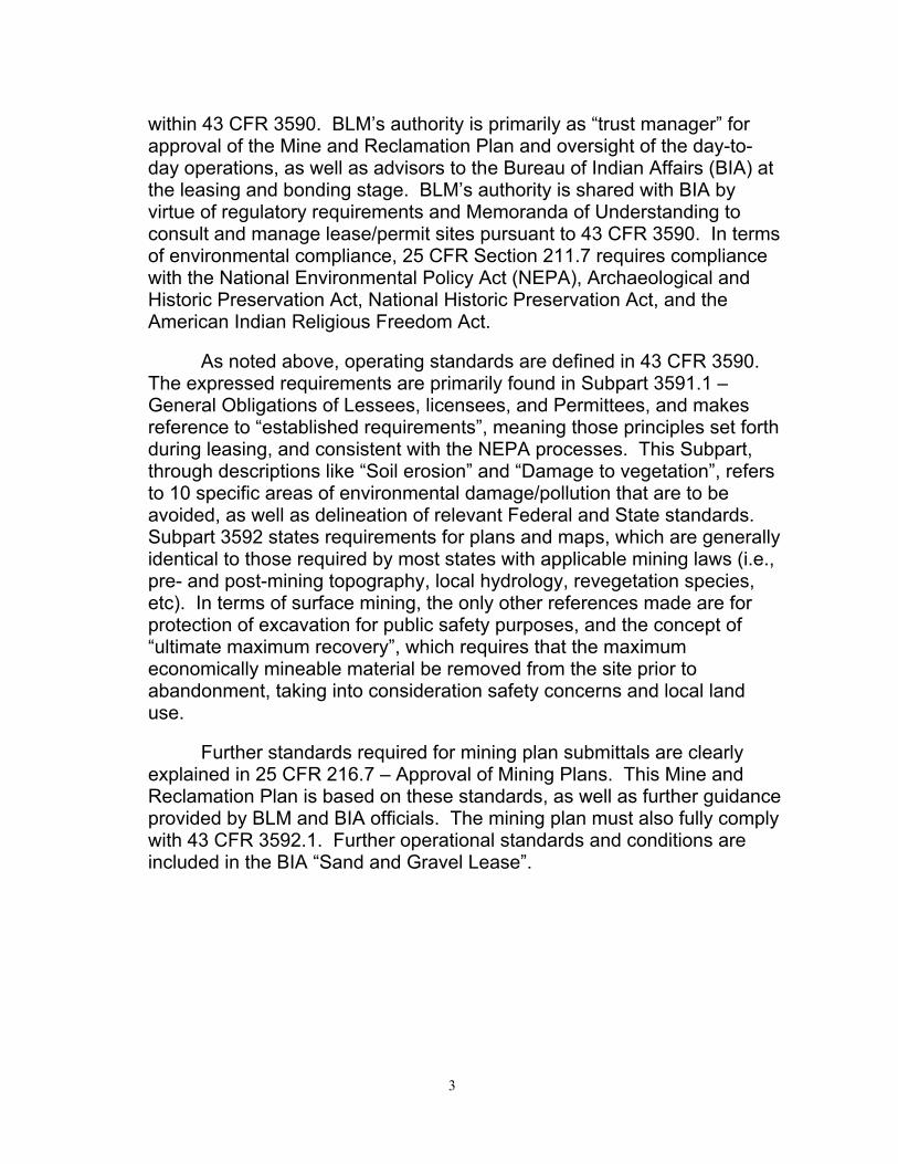
within 43 CFR 3590. BLM’s authority is primarily as “trust manager” for approval of the Mine and Reclamation Plan and oversight of the day-today operations, as well as advisors to the Bureau of Indian Affairs (BIA) at the leasing and bonding stage. BLM’s authority is shared with BIA by virtue of regulatory requirements and Memoranda of Understanding to consult and manage lease/permit sites pursuant to 43 CFR 3590. In terms of environmental compliance, 25 CFR Section 211.7 requires compliance with the National Environmental Policy Act (NEPA), Archaeological and Historic Preservation Act, National Historic Preservation Act, and the American Indian Religious Freedom Act.
As noted above, operating standards are defined in 43 CFR 3590. The expressed requirements are primarily found in Subpart 3591.1 – General Obligations of Lessees, licensees, and Permittees, and makes reference to “established requirements”, meaning those principles set forth during leasing, and consistent with the NEPA processes. This Subpart, through descriptions like “Soil erosion” and “Damage to vegetation”, refers to 10 specific areas of environmental damage/pollution that are to be avoided, as well as delineation of relevant Federal and State standards. Subpart 3592 states requirements for plans and maps, which are generally identical to those required by most states with applicable mining laws (i.e., pre- and post-mining topography, local hydrology, revegetation species, etc). In terms of surface mining, the only other references made are for protection of excavation for public safety purposes, and the concept of “ultimate maximum recovery”, which requires that the maximum economically mineable material be removed from the site prior to abandonment, taking into consideration safety concerns and local land use.
Further standards required for mining plan submittals are clearly explained in 25 CFR 216.7 – Approval of Mining Plans. This Mine and Reclamation Plan is based on these standards, as well as further guidance provided by BLM and BIA officials. The mining plan must also fully comply with 43 CFR 3592.1. Further operational standards and conditions are included in the BIA “Sand and Gravel Lease”.
3

ENVIRONMENTAL ASSESSMENT T-Abbs Allotment, 109-1G & 1H, Muckleshoot Tribe
Chapter 2. Proposed Action and Alternatives
A. Description of the Alternatives
I. Alternative A (Proposed Action)
The first alternative, which is the proposed action, is for BIA to issue a lease and BLM to approve the Mining and Reclamation Plan for mining of the western portion of the elevated area of the Property (Appendix IC), and leave undisturbed material in place along the eastern side of the Property. From a total of approximately 630,000 bcy, La Pianta will remove 500,000 bcy and 130,000 bcy will be left for the Tribe’s future use. La Pianta will extract material by proceeding from the Meade Pit east and northward into the elevated area which is located in the southern part of the Property. La Pianta will conduct its operations with dozer assisted front-end loaders and/or excavators, and remove the material from the site by use of highway trucks. Topsoil and overburden will be stripped and stockpiled using scrapers, graders or dozers. The remaining gravel supply on the Property will be left untouched in the elevated area along the eastern side of the parcel, with a 2:1 slope from the pit floor to its top as shown in the Mining and Reclamation Plan. When the mining work is completed, there will be an access road in place to the remaining material for future mining by the Tribe, and the majority of the Property will be at an elevation that aligns with the adjacent Meade Pit floor.
II. Alternative B
The second alternative is for BIA to issue a lease and BLM to approve the Mining and Reclamation Plan for mining of all of the elevated area of the Property, removing all 630,000 bcy of material. Accordingly, the same material as Alternative A would be removed, along with the additional material on the eastern side that Alternative A left behind. Under this alternative, there would be no material remaining for the Tribe to use in its future projects. (see also Appendix IC).
III. Alternative C
The final alternative is the so-called “no action” alternative, in which case the Property would remain in its present state with no change to its
4
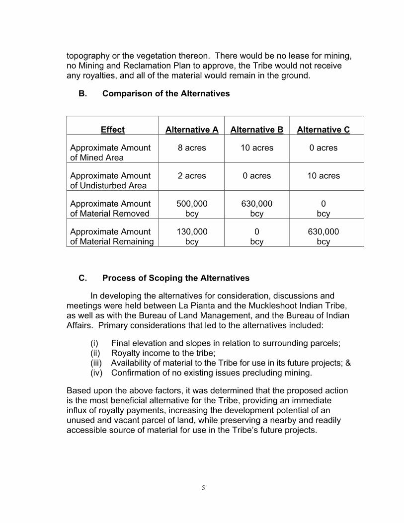
topography or the vegetation thereon. There would be no lease for mining, no Mining and Reclamation Plan to approve, the Tribe would not receive any royalties, and all of the material would remain in the ground.
B. Comparison of the Alternatives
Effect Alternative A Alternative B Alternative C
Approximate Amount of Mined Area
8 acres 10 acres 0 acres
Approximate Amount of Undisturbed Area
2 acres 0 acres 10 acres
Approximate Amount of Material Removed
500,000 bcy
630,000 bcy
0 bcy
Approximate Amount of Material Remaining
130,000 bcy
0 bcy
630,000 bcy
C. Process of Scoping the Alternatives
In developing the alternatives for consideration, discussions and meetings were held between La Pianta and the Muckleshoot Indian Tribe, as well as with the Bureau of Land Management, and the Bureau of Indian Affairs. Primary considerations that led to the alternatives included:
(i) Final elevation and slopes in relation to surrounding parcels; (ii) Royalty income to the tribe; (iii) Availability of material to the Tribe for use in its future projects; & (iv) Confirmation of no existing issues precluding mining.
Based upon the above factors, it was determined that the proposed action is the most beneficial alternative for the Tribe, providing an immediate influx of royalty payments, increasing the development potential of an unused and vacant parcel of land, while preserving a nearby and readily accessible source of material for use in the Tribe’s future projects.
5
D. Proposed Mitigation Common to Alternatives A and B
Mitigation measures consist of two aspects: discretion during production operations, and successful reclamation procedures. In terms of day-to-day procedures, La Pianta will follow the most recent industry standards for responsible operation. These procedures will include, but are not limited to:
• The organic layer of material will be stockpiled and protected for the duration of mining. At the conclusion of mining, it will be spread on the new site surfaces in accordance with the Mining and Reclamation Plan.
• All vehicles on the Property will have exhaust systems in compliance with applicable federal and state vehicle standards and requirements.
• Dust shall be controlled by a water truck, as needed.
• Ditches will be created to direct stormwater to holding and infiltration areas.
• La Pianta will not store fuels or hazardous materials on the Property to protect groundwater. Fueling of trucks will occur off the Property, and a clean-up program will be in place for any leaks or spills that might occur (see Appendix V). If necessary, 911 will be called along with coordination with local authorities.
• Upon completion of mining, the mined areas of the site will be hydroseeded in accordance with the Mining and Reclamation Plan.
• Haul trucks and employee vehicles will travel strictly on approved roads, and will comply with prudent speeds posted or appropriate for conditions.
• La Pianta will comply with all applicable federal, state, and local laws and regulations with regard to fire, health, and safety.
• Fire extinguishers will be kept on site and in all heavy equipment to rapidly control the spread of a small fire. Mining equipment and water trucks will be used to help suppress larger fires.
• If any evidence of cultural and/or archaeological resources is encountered during active excavation operations, earthmoving
6
activities in that area will be curtailed until the Tribe has been notified and the proper course of action determined.
Reclamation procedures are covered in detail in the Mining and Reclamation Plan. The activities can be summarized as:
• Existing vegetation will be chipped and mixed into the organic topsoil layer that will be stockpiled on the Property during mining. Stockpiles will be stabilized by track-walking and/or seeded as needed. This material will be placed over the site at the conclusion of mining in accordance with the Mining and Reclamation Plan.
• The pit walls in a mined out segment will be left at a 2:1 slope or as noted in the Mining and Reclamation Plan.
• Remaining equipment, surface facilities, parking areas and any other articles that were not on the project site prior to mining will be removed from the site. All evidence of their existence on the site will be reclaimed.
• The site will be hydroseeded in accordance with the Mining and Reclamation Plan, using a grass mix as noted therein.
7

ENVIRONMENTAL ASSESSMENT T-Abbs Allotment, 109-1G & 1H, Muckleshoot Tribe
Chapter 3. Affected Environment and Environmental Consequences
A. Land
I. Topography
The site is rectangular, approximately 868’ x 659’, and 12.8 acres in size (see Appendix IB and IC). The southern approximately 8 acres of the Property is elevated, and fairly flat, averaging about 275’ +/-. Northward, the site slopes down abruptly to approximately elevation 80’ where it abuts the southern edge of Highway SR 18. There are also abrupt slopes just off the Property along its west and south sides leading down into the adjacent Meade Pit property. There are also slopes down to Highway SR 18 just beyond the east side of the Property, within a vacant parcel of land owned by La Pianta of approximately 30 acres.
Impact and Mitigation
Alternatives A & B: Mining in Alternatives A and B is proposed on the elevated portion of the Property, lowering the elevation from approximately 275+/- down to a new pit floor gentle slope ranging from 240’ to 215’, where it will align with the adjoining Meade Pit property. In the case of Alternative A, the mining would stop short of the eastern edge of the Property, leaving an untouched north/south strip 175’ in width. In Alternative A where the mining would stop short of the eastern property line, the elevation would slope upward toward the east from the new pit floor up to the elevation of the existing portion that will remain. In Alternative B, the slope upward would be at the eastern edge of the Property, leading up to the existing elevation of the parcel to the east.
Mitigation will be accomplished at final grading per the Mining and Reclamation Plan, and will include a 2:1 slope along the eastern side of the Property and a matching and continuation of grades between the Property and the Meade Pit land to the west and south.
Alternative C: No impacts or mitigation, as the topography would remain as-is and unchanged.
8

II. Soils
The site is covered by a layer of organic material averaging approximately 8” thick, below which is a gravel layer that is close to 40’ feet thick, and below that is glacial till. Soil boring logs are attached as Appendix II and show material layers of fine to coarse gravel with sand, and brown coarse gravel with cobbles and sand.
Impact and Mitigation
Alternatives A & B: During mining, the organic layer of material will be removed and stockpiled, and the gravel layers will be mined and hauled off the Property. Stockpiles will be stabilized by track-walking and/or seeded as needed. After mining is complete, the effects thereof will be mitigated by distributing all of the stockpiled soil across the mined area in accordance with the Mining and Reclamation Plan (6” minimum overall, and up to 12” on slopes as quantities allow). Under Alternative B, more soil will be disturbed and gravel mined, and a greater area of land will need to be reclaimed.
Alternative C: No impacts or mitigation, as the soils would remain as-is and undisturbed.
B. Cultural & Archaeological Resources
The Property was surveyed for cultural and archaeological resources by Entrix, Inc., and their report is attached as Appendix III. There were no indications of resources on the site, nor are any anticipated.
Impact and Mitigation
Alternatives A & B: No specific mitigation is planned. The site will be carefully watched during mining operations, and the Tribe will be contacted upon discovery of any cultural resources. Operations will immediately cease in that area until the proper course of action is determined.
Alternative C: No impacts or mitigation, as the site would not be disturbed.
9

C. Environmental
I. Air Resources
The Property is currently vacant and not in use. Air quality in the area is the result of prevailing ambient conditions: car and truck exhaust from adjacent Highway SR 18, and the current mining operations from the adjacent Meade Pit and Miles Pit beyond that. The mining activity proposed for the Property would be similar to the existing Meade Pit operation, using the open pit method with excavation equipment and trucks for hauling.
Impact and Mitigation
Alternatives A & B: Impacts will be comprised of two sources: (1) exhaust emissions from mining equipment and trucks, and (2) dust from the soil, each of which only occurring during times of actual mining. La Pianta shall mitigate these impacts by causing all vehicles on the Property to have exhaust systems in compliance with applicable federal and state vehicle standards and requirements, and dust shall be controlled by a water truck as needed.
Alternative C: No impacts or mitigation, as there will be no new vehicles or site disturbance.
II. Water Resources
The project site is not located near any streams or wetlands, nor is there any standing water onsite. The nearest off-site features are White Lake, located approximately 1,200 feet to the west, an unclassified stream course approximately 600 to 800 feet to the east, and the Green River which is at least 1,000 feet to the north and on the opposite side of the SR 18 freeway and also SE Auburn/Black Diamond Road. The King County 2003 sensitive areas inventory shows no mapped surface waters on the site. Stormwater percolates quickly through the organic layer and through the gravel layer below, resulting in no water leaving the Property. Mining will occur between approximately elevations 275’ and 215’, and groundwater is well below at approximately elevation 85’ (per telephone conversation with City of Auburn Water Engineer Duane Huskey). No water will be drawn from the ground for mining operations or water trucks (e.g. public fire hydrant will be used to supply water truck). No residential or domestic wells are on or within the immediate vicinity of the Property, as determined by a search of the Washington State Department of Ecology database of domestic wells and certificated water rights.
10
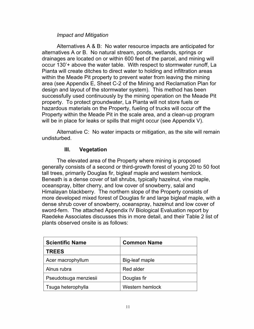
Impact and Mitigation
Alternatives A & B: No water resource impacts are anticipated for alternatives A or B. No natural stream, ponds, wetlands, springs or drainages are located on or within 600 feet of the parcel, and mining will occur 130’+ above the water table. With respect to stormwater runoff, La Pianta will create ditches to direct water to holding and infiltration areas within the Meade Pit property to prevent water from leaving the mining area (see Appendix E, Sheet C-2 of the Mining and Reclamation Plan for design and layout of the stormwater system). This method has been successfully used continuously by the mining operation on the Meade Pit property. To protect groundwater, La Pianta will not store fuels or hazardous materials on the Property, fueling of trucks will occur off the Property within the Meade Pit in the scale area, and a clean-up program will be in place for leaks or spills that might occur (see Appendix V).
Alternative C: No water impacts or mitigation, as the site will remain undisturbed.
III. Vegetation
The elevated area of the Property where mining is proposed generally consists of a second or third-growth forest of young 20 to 50 foot tall trees, primarily Douglas fir, bigleaf maple and western hemlock. Beneath is a dense cover of tall shrubs, typically hazelnut, vine maple, oceanspray, bitter cherry, and low cover of snowberry, salal and Himalayan blackberry. The northern slope of the Property consists of more developed mixed forest of Douglas fir and large bigleaf maple, with a dense shrub cover of snowberry, oceanspray, hazelnut and low cover of sword-fern. The attached Appendix IV Biological Evaluation report by Raedeke Associates discusses this in more detail, and their Table 2 list of plants observed onsite is as follows:
Scientific Name Common Name TREES Acer macrophyllum Big-leaf maple
Alnus rubra Red alder
Pseudotsuga menziesii Douglas fir
Tsuga heterophylla Western hemlock
11
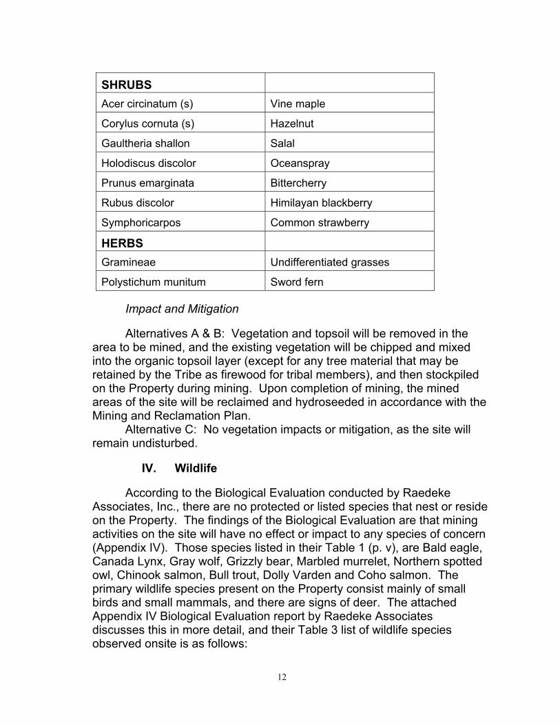
SHRUBS Acer circinatum (s) Vine maple
Corylus cornuta (s) Hazelnut
Gaultheria shallon Salal
Holodiscus discolor Oceanspray
Prunus emarginata Bittercherry
Rubus discolor Himilayan blackberry
Symphoricarpos Common strawberry
HERBS Gramineae Undifferentiated grasses
Polystichum munitum Sword fern
Impact and Mitigation
Alternatives A & B: Vegetation and topsoil will be removed in the area to be mined, and the existing vegetation will be chipped and mixed into the organic topsoil layer (except for any tree material that may be retained by the Tribe as firewood for tribal members), and then stockpiled on the Property during mining. Upon completion of mining, the mined areas of the site will be reclaimed and hydroseeded in accordance with the Mining and Reclamation Plan.
Alternative C: No vegetation impacts or mitigation, as the site will remain undisturbed.
IV. Wildlife
According to the Biological Evaluation conducted by Raedeke Associates, Inc., there are no protected or listed species that nest or reside on the Property. The findings of the Biological Evaluation are that mining activities on the site will have no effect or impact to any species of concern (Appendix IV). Those species listed in their Table 1 (p. v), are Bald eagle, Canada Lynx, Gray wolf, Grizzly bear, Marbled murrelet, Northern spotted owl, Chinook salmon, Bull trout, Dolly Varden and Coho salmon. The primary wildlife species present on the Property consist mainly of small birds and small mammals, and there are signs of deer. The attached Appendix IV Biological Evaluation report by Raedeke Associates discusses this in more detail, and their Table 3 list of wildlife species observed onsite is as follows:
12
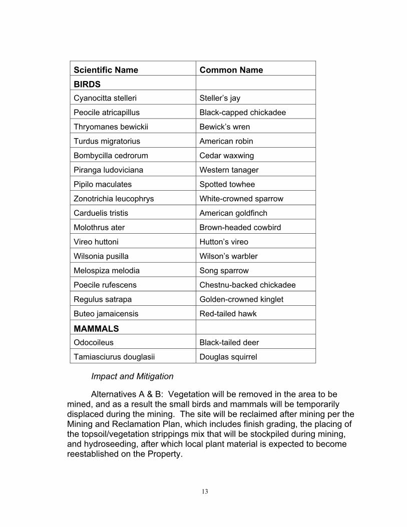
Scientific Name Common Name BIRDS Cyanocitta stelleri Steller’s jay
Peocile atricapillus Black-capped chickadee
Thryomanes bewickii Bewick’s wren
Turdus migratorius American robin
Bombycilla cedrorum Cedar waxwing
Piranga ludoviciana Western tanager
Pipilo maculates Spotted towhee
Zonotrichia leucophrys White-crowned sparrow
Carduelis tristis American goldfinch
Molothrus ater Brown-headed cowbird
Vireo huttoni Hutton’s vireo
Wilsonia pusilla Wilson’s warbler
Melospiza melodia Song sparrow
Poecile rufescens Chestnu-backed chickadee
Regulus satrapa Golden-crowned kinglet
Buteo jamaicensis Red-tailed hawk
MAMMALS Odocoileus Black-tailed deer
Tamiasciurus douglasii Douglas squirrel
Impact and Mitigation
Alternatives A & B: Vegetation will be removed in the area to be mined, and as a result the small birds and mammals will be temporarily displaced during the mining. The site will be reclaimed after mining per the Mining and Reclamation Plan, which includes finish grading, the placing of the topsoil/vegetation strippings mix that will be stockpiled during mining, and hydroseeding, after which local plant material is expected to become reestablished on the Property.
13
Alternative C: No wildlife impacts or mitigation, as the site will remain undisturbed.
V. Noise and Light
While the Property is currently vacant, there are existing noise and light impacts originating from cars and trucks on the adjacent SR 18 freeway, as well as from excavation equipment and trucks at the current mining operations occurring on the adjacent Meade Pit and Miles Pit beyond. The nearest residences from the Property are located approximately 1/3 mile to the southeast.
Impact and Mitigation
Alternatives A & B: Mining will be conducted using the open pit method, with impacts from excavation equipment and trucks occurring only when mining is actually taking place (there will be periods of inactivity). All equipment and trucks will have exhaust mufflers per government regulations. Given that the proposal herein is similar in type and location to the existing operations, and the fact that the City is not aware of any complaints from the public regarding these operations (phone discussion with City zoning enforcement officer Chuck Joiner, 9/28/06), noise and light are not expected to be issues and no additional mitigation is proposed.
Alternative C: No light or noise impacts or mitigation, as there will be no new vehicles or site disturbance.
D. Traffic
There is no current traffic activity attributable to the Property because it is a vacant unused parcel of land. Truck traffic from the two existing adjacent mining operations (Meade Pit and Miles Pit) exits the area under Highway SR 18 to the northwest of the Property, and then turns east on Auburn/Black Diamond Road where it continues approximately 1.2 miles to the interchange with Highway SR 18, where trucks disburse throughout the region. (see Appendix 1A) The primary traffic on the haul route is from the Miles Pit operation which is a large regional high-volume combined sand and gravel processing plant and concrete ready mix operation, while the Meade Pit operation contributes traffic as well.
14

Impact and Mitigation
Alternatives A & B: This proposal is to mine approximately 8 acres of the Property (of the 12.8-acre total). The proposed mining traffic will have periods of high activity and inactivity, depending on the demand for material and time of year. While actual trips could vary widely higher or lower, an average of 4 truckloads per hour can be calculated using 500,000 bcy divided by 5 years (used here for conservative purposes of analysis rather than the full 7 years of the lease), then by 10 bcy per truckload, then by 12 months, then by 26 hauling days per month, at 8 hours per day. The traffic from this 8-acre proposal will amount to a very small percentage of the total traffic on the haul road, given that there are 170 acres active at the other two operations sharing the haul road (Meade Pit at 52 acres, and Miles Pit at 118 acres). Furthermore, the total now at 183 active acres between the three operations will be less than the existing two operations at their height of production on 237 acres. Meade Pit had projected 124 truck trips per day in its 1999 SEPA to the City of Auburn, and it is now down from that, having gone from 77 acres to the current 52 acres, so the road can absorb the additional trips from this proposal. Lastly, the existing mining operations in the area have been active for many years with no complaints from the public (phone discussion with City zoning enforcement officer Chuck Joiner, 9/28/06). No traffic mitigation is proposed for this mining operation.
Alternative C: No impacts or mitigation, as there will be no new vehicles or site disturbance.
E. Economics
I. Employment
Alternatives A & B: The present mining operation in the Meade Pit employs 2 - 5 workers on-site during full production, and up to 20 highway truck drivers. The current staffing level would also be adequate for mining the Property, where these workers would be able to continue their work at the conclusion of the Meade Pit operation. The exact number of employees will vary per market demand for material.
Alternative C: No new impacts or mitigation, as there would be no new operation or employees. There would also be no ongoing employment for Meade Pit employees after conclusion of the work there.
15

II. Income
Alternatives A & B: The unused and inactive Property does not generate income for the Tribe in its current state. Under Alternatives A and B, mining of the Property would provide significant royalty income to the Tribe, as well as providing ancillary and tangential benefits for nearby local businesses as a result of employees spending their income in the area. Under Alternatives A and B the Tribe would receive royalties for 500,000 bcy and 630,000 bcy of material, respectively.
Alternative C: Under Alternative C the Tribe would receive no royalty income.
F. Physical Elements
I. Aesthetics
The site is covered with young trees and shrubs. Being up on a plateau, the only portion visible to the public is the northern edge of the mining area located high above Highway SR 18, along the top of the steep slope.
Impact and Mitigation
Alternatives A & B: When mining occurs under either Alternative A or B, the vegetation will be removed from the elevated area to be mined. At the conclusion of mining, the mined area will be reclaimed and hydroseeded. From the SR 18 freeway drivers will see a more distinct edge at the top of the north slope, which will diminish over time as vegetation becomes reestablished. The slope will still be approximately 125’ high, so the actual mined area above will not be visible to the public. The existing vegetation on the undisturbed portion of the north slope will remain in its current condition further screening the view, with existing trees continuing to grow upward as a visual screen.
Alternative C: No impacts or mitigation, as the site will remain undisturbed.
II. Public Health and Safety
The Property lies east and north of the existing Meade Pit property. The Meade Pit area is fenced, including along the property lines adjoining the west and south sides of the Property. The Property will be accessed by the same road that serves the Meade Pit land, which is secured by a
16
locked gate. North of the Property is a steep slope that leads down to Highway SR 18, which is fenced at the right-of-way line along the north side of the Property. East of the Property is vacant land owned by La Pianta that is vacant and overgrown, and also has a steep slope farther east. Excluding Highway 18 to the north, there is no public pedestrian or vehicle traffic within approximately 1/3 mile to the west, south or east, and the area in between is all private property and secured. There will be little risk of fire to the Property or adjacent areas due to the nature of the work and because vegetation will be stripped at the start of mining operations.
Impact and Mitigation
Alternatives A & B: Given the existing fencing and topography noted above, there are no expected impacts to public health and safety with this proposal. The public does not have access to the area, and is not active in the area. No mitigation is proposed other than to keep existing fences and gates secure.
Alternative C: No impacts or mitigation, as the site will remain undisturbed.
III. Resource Use Patterns
Activities on the properties immediately surrounding the Property include: mining to the west and south (Meade Pit), freeway to the north (Highway SR 18), and similar inactive vacant land to the east. Further out is more mining to the west (Miles operation), the Muckleshoot Casino operation to the south (beyond the Meade Pit), residential tracts to the southeast (approximately 1/3 mile away), and a rural residential area with minor commercial uses to the north across the SR 18 freeway and the Auburn/Black Diamond Road.
Impact and Mitigation
Alternatives A & B: The proposed mining operation is consistent with the other activity and development in the area surrounding the project. There is no impact to area resource patterns identified. The mining of the Property will reduce the elevation of the Property similar to surrounding land, making the Property more conducive to similar development in the future than in its current elevated state.
Alternative C: No impacts or mitigation, as the site will remain undisturbed.
17

G. Environmental Justice
The assessment of environmental justice in the NEPA process was instituted pursuant to Executive Order 12898 in 1994, and requires that each federal agency “….shall make achieving environmental justice part of its mission by identifying and addressing … disproportionately high and adverse human health or environmental effects of its programs, policies, and activities on minority and low-income populations … .” The environmental justice screening is a compilation of data designed to determine if ethnic or low-income populations exist within the geographic area impacted by a federal action. For proposed operations as described in the Mining and Reclamation Plan, the main considerations in environmental justice screening would be to:
• Determine if disenfranchised populations would be displaced bythe proposed actions.
• Identify adverse affects of environment or human health.
• Determine net benefits from the proposed actions.
In the immediate impact area, minority and low income populations exist throughout the community of Auburn, Washington. However, there are no residences within the proposed project area; so no one will be displaced by the proposed operations. The closest residential area is located 1/3 of a mile away from the proposed operation and based upon the lack of any impact on these residences from the Meade Pit operation, the proposed project will similarly not impact this residential area. In terms of human health, this Environmental Assessment and the affiliated Mining and Reclamation Plan indicate that there will be no impacts beyond the active mining area. There will be no additional burden to the area as mining operations exist currently on the Meade Pit and Miles Pit to the immediate west and south of the project area. Nevertheless, dust, light and noise will be mitigated as provided herein, and the potential impacts are not disproportionate relative to the general population.
Net benefits from the proposed action include:
• Royalty payments to the Tribe for the benefit of its members and the community.
• Contributions to the socio-economic advancement of the Tribe.
• Preparation and reclamation of the land to a more economically usable and socially beneficial state.
18

H. Cumulative Effects
The T-Abbs Allotment, 109 -1G & 1H, Muckleshoot Tribe Property lies within a gravel mining district in south Auburn, Washington. The overall district area is approximately 250 acres, comprised of two existing operations (the Miles operation on 160 acres, and the La Pianta operation in the Meade Pit on 77 acres), together with this proposed operation on a site of approximately 12.8 acres. (see Appendix IB map) This area is bounded by the SR-18 freeway along the north side, by open land and single family homes to the east, by a casino parking lot and commercial land to the south, and by M Street SE along the west side lined with a mix of commercial and residential.
The two large existing operations have been active for over 20 years. In particular, the 160-acre Miles operation has been a regional high-volume combined sand and gravel processing plant and concrete ready mix facility. The La Pianta operation in the 77-acre Meade Pit has also been a regional supplier of sand and gravel. Both facilities have been operating under permits from the City of Auburn, and the City is not aware of any complaints from the public regarding these operations (phone discussion with City zoning enforcement officer Chuck Joiner, 9/28/06).
The primary impacts of the existing operations in the area have been the clearing of the land and truck traffic. Stormwater runoff has been contained within the properties, due to the pervious nature of the sites. Air and noise have not been issues, as the sites are distant from residences and large enough to contain those impacts. During mining wildlife has also been displaced to the adjoining vacant lands, primarily to the east onto the T-Abbs Allotment, 109-1G & 1H, Muckleshoot Tribe Property and beyond (see Appendix 1B aerial photo).
This proposed project on the T-Abbs Allotment, 109-1G & 1H, Muckleshoot Tribe Property is expected to have the same impacts, but to a much lesser extent due to its smaller size. The project is proposed within a site of 12.8 acres of which approximately 8 acres would be disturbed, which represent only 3.2 percent of the total area of the overall mining district. In addition to the 4+ acres of the parcel that will remain undisturbed, wildlife will also relocate to the adjoining vacant 30-acre parcel on the east, which connects directly to a wildlife corridor system along the bluff to the east and southeast, leading then to the Green and White River corridors.
19

The cumulative impacts of the three projects now will be far less than the impacts of the two Miles and La Pianta operations at their height of production, due to reduced rates of production. Both operations are now nearing completion with lessening impacts. Miles reported 42 acres reclaimed of their 160 acre total per requirements of their DNR Reclamation Plan (in their January 2006 annual report to the Washington State Department of Natural Resources, per phone conversation with Tara in the Mining Reclamation office). On the La Pianta property, mining is complete on 25 acres of the total 77 acres, with reclamation ongoing. Of the total 250 acres in the mining district, 170 acres are still active plus 8 acres of the 12.8-acre Property in this proposal. The 67 acres of the district that are now reclaimed or being reclaimed, will provide over 8 times more wildlife habitat area than the 8 acres that will be disturbed by this proposal.
Regarding future impacts and long term effects, the impacts outlined above are temporary, as they will cease when mining operations are complete and the properties are reclaimed (Meade Pit and T-Abbs Allotment, 109-1G & 1H, Muckleshoot Tribe Property by 12/31/12; Miles Pit date not determined). After mining, there will be no disturbance to air, noise, stormwater runoff or traffic. The land will be reclaimed, and wildlife habitat will become reestablished. The land will be at a lower elevation than it was prior to mining, and with the gravel removed it will be available for development in the future, but there are no specific plans by property owners at this time for the properties.
20

ENVIRONMENTAL ASSESSMENT T-Abbs Allotment, 109-1G & 1H, Muckleshoot Tribe
Chapter 4. Consultation and Coordination
A. Public Involvement Process
The Property is located away from residential and commercial areas, separated by the existing gravel mines to the west and south, and the vacant land to the east. The Property is south of the SR 18 freeway, which lies nearly 200’ lower than the Property to be mined. The public does not see or come into contact with the Property. In addition, the public will not feel the impact from the proposed operation, since the 8 acres proposed to be mined represent less than 5% of the 178 active acres remaining in the mining district, and the overall level of mining is down from the previous 237 acres of active mining (when there were no complaints from the public as noted previously).
Therefore, no exceptional public process is proposed other than the standard public notices published in the local newspaper and review/appeal periods as the application is processed.
The Tribe has reviewed the project documents and issued concurrence letters, included herein as Appendix VI.
B. Agencies/Organizations/Individuals Consulted
Muckleshoot Indian Tribe – Ken Lewis, Roger Blaylock, Rob Otsea and James Cross
BLM, Spokane District Office – Kelly Courtright BLM, Wenatchee Field Office – Brent Cunderla BIA, Puget Sound Agency – Stanley Surridge City of Auburn – Duane Huskey, Chuck Joiner Washington State Department of Resources – Tara in mining office King County GIS Center mapping Washington Department of Archaeology and Historic Preservation Washington State Department of Ecology wells database USFWS, NMFS & WDFW (per Appendix IV Biological Evaluation)
21

C. List of Preparers
Overall EA document: La Pianta LLC, by Mark Hancock and Mark Segale
Geotech Report: GeoEngineers, by Gary Henderson, Steve Helvey, John Biggane
Wetlands, Plants and Animals Report: Raedeke Associates, by Rick Lundquist, Ken Raedeke, Marlo Mytty, Danette Fuhrer
Cultural Report: Entrix, Inc., by Kimberly Demuth, Dawn Laybolt Civil Engineer: Layton & Sell, by Jack Sell
22
ENVIRONMENTAL ASSESSMENT T-Abbs Allotment, 109-1G & 1H, Muckleshoot Tribe
Chapter 5 Appendixes
The following appendixes are attached to and made part of this Environmental Assessment by this reference:
Appendix Title
IA Project Location and Access
IB Aerial Photographs
IC Pre-Project & Post-Reclamation Topography (Alt’s. A & B)
II GeoTech Data
III Cultural Resources Survey
IV Biological Evaluation
V Spill Prevention and Response Plan
VI Muckleshoot Concurrence Letters
23