Why study these areas? Consider: -The presence of three unique ecosystems in a relatively short...
46
-
Upload
richard-gaines -
Category
Documents
-
view
216 -
download
1
Transcript of Why study these areas? Consider: -The presence of three unique ecosystems in a relatively short...
Why study these areas?
Consider:
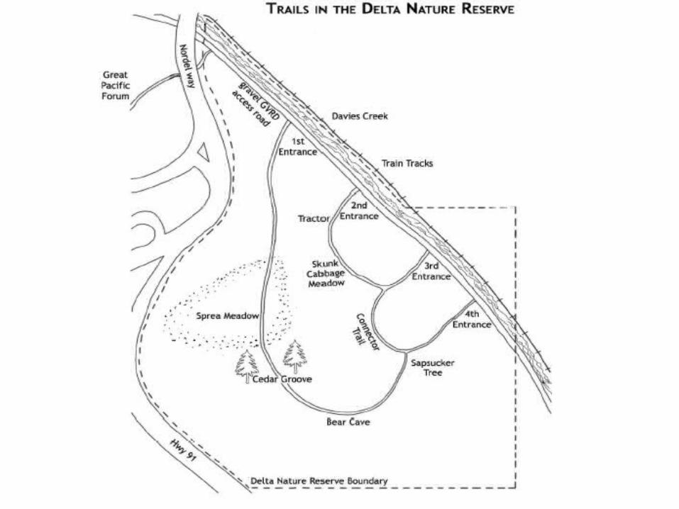
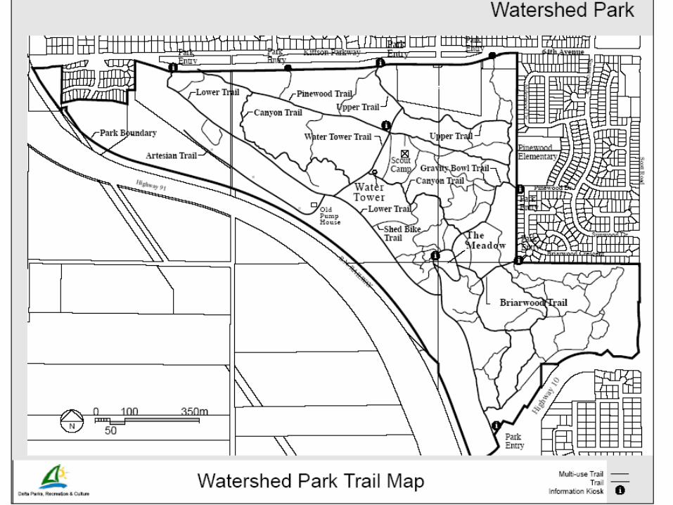
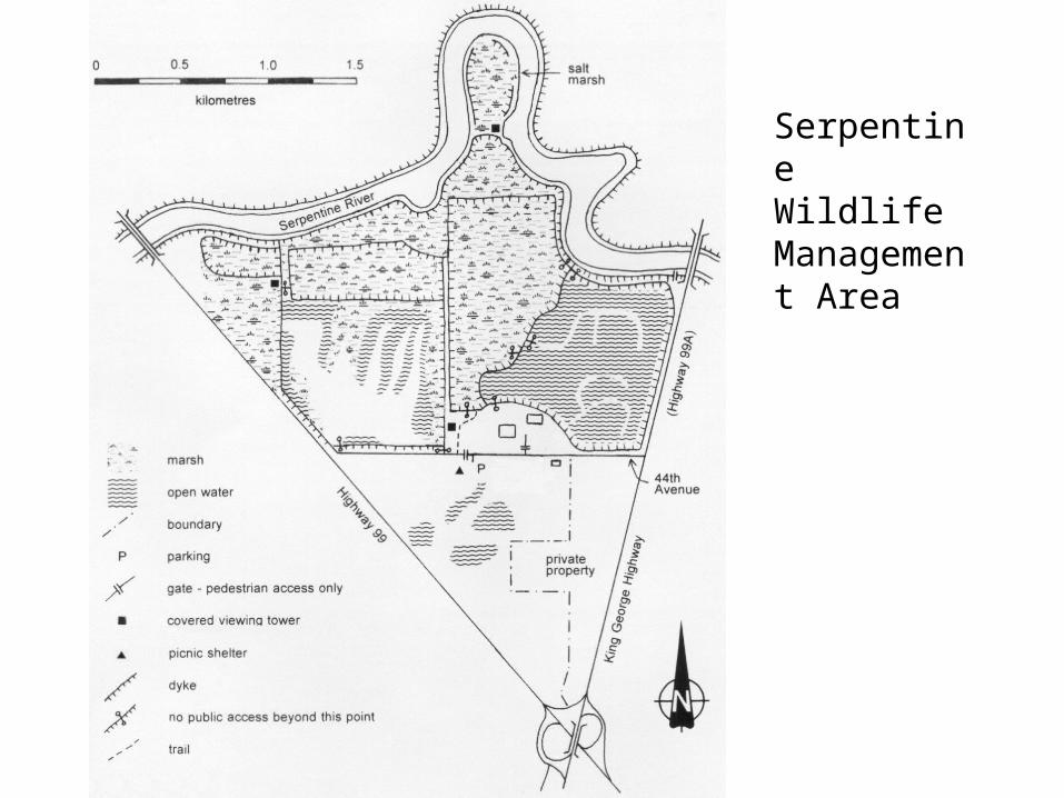
-The presence of three unique ecosystems in a relatively short distance (see map handout)
- The unique value of each of these areas as described in the Preparation Exercises
Research Question: Which key factor(s) account for the significant differences in vegetation types between the Delta Nature Reserve (Burns Bog), Watershed Park, and the Serpentine Wildlife Management Area?
Hypothesis: You design one. Based upon your preparation exercise readings and exercises and looking over the Factors Affecting Biomes/Ecosystems web, hypothesize as to the main factor(s) determining the differences in vegetation type.
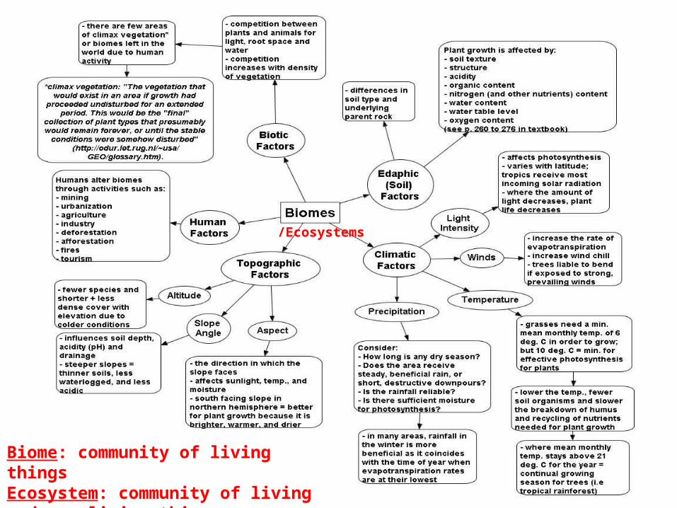
/Ecosystems
Biome: community of living thingsEcosystem: community of living and non-living things
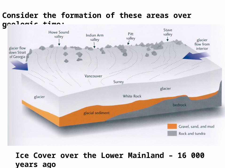
Consider the formation of these areas over geologic time:
Ice Cover over the Lower Mainland – 16 000 years ago
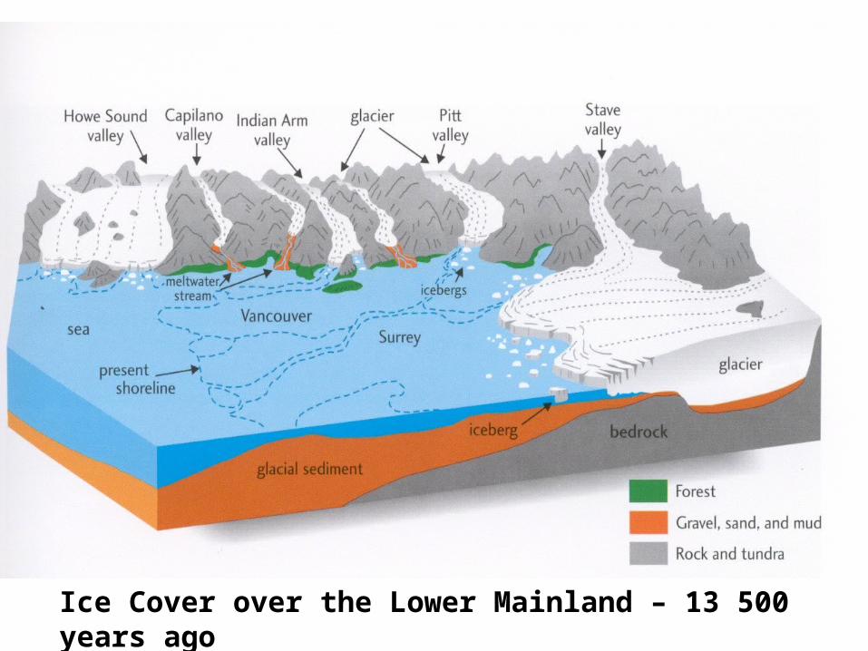
Ice Cover over the Lower Mainland – 13 500 years ago
Note: Source for the previous two slides –
p. 39 and 51 of:
Clague, John, and Bob Turner. Vancouver, City On
The Edge. Vancouver: Tricouni Press,
2003.
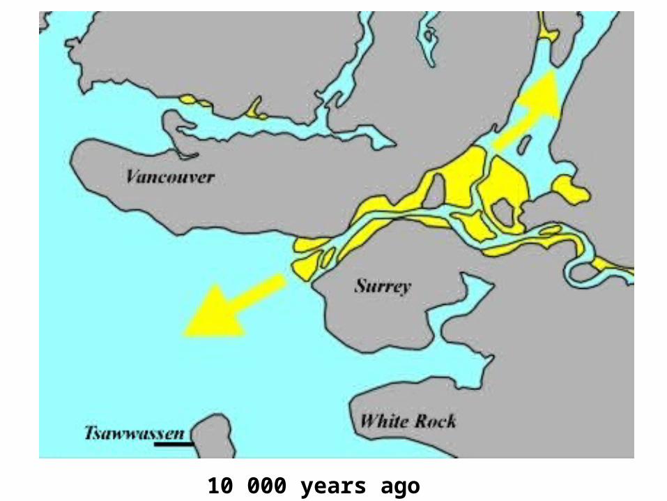
10 000 years ago
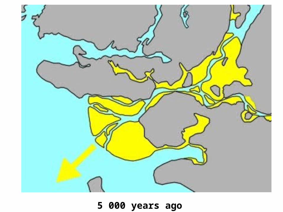
5 000 years ago
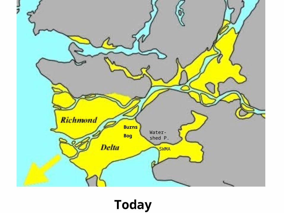
Today
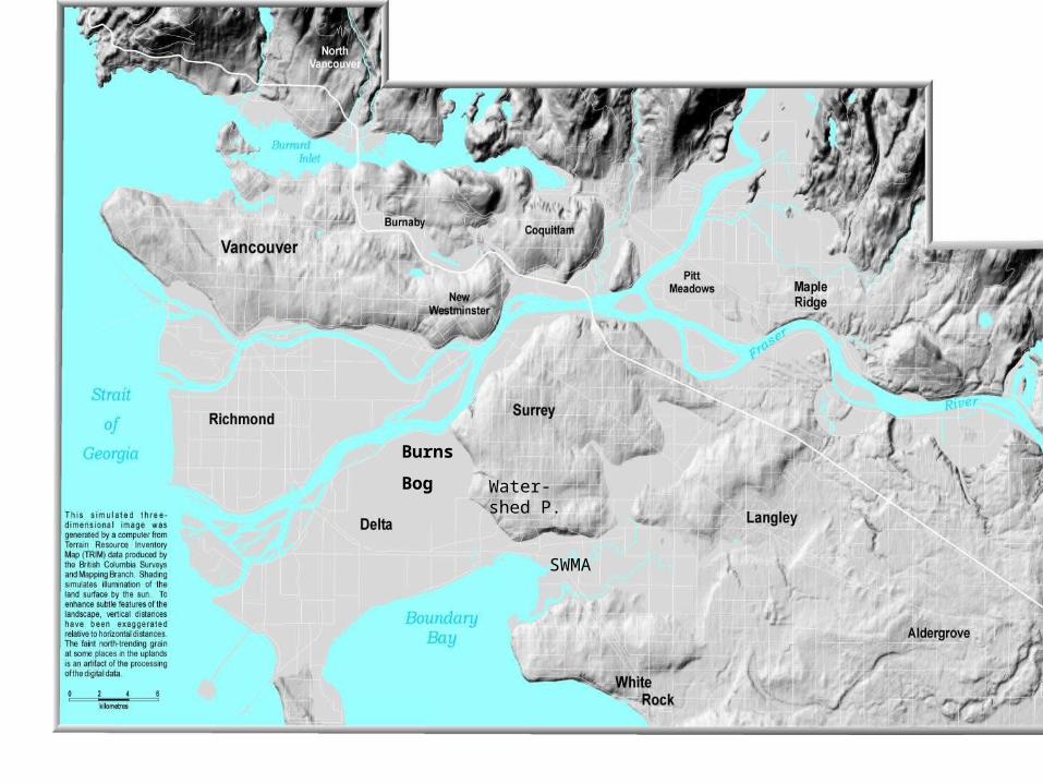
Burns
BogWater-shed P.
SWMA
Note: Source for the previous three slides –
Natural Resources Canada. Geoscape Vancouver: The
Fraser River Delta. Jan. 3, 2008 <
http://geoscape.nrcan.gc.ca/vancouver/fraser_e.php>.
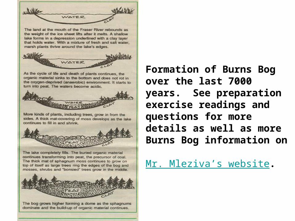
Formation of Burns Bog over the last 7000 years. See preparation exercise readings and questions for more details as well as more Burns Bog information on Mr. Mleziva’s website.
Burns
Bog Water-shed P.
SWMA
Note: Source for the previous slide –
Turner, Bob. Vancouver’s Landscape. Feb. 12, 2008
<http://gsc.nrcan.gc.ca/urbgeo/vanland/images/vanland_v7_3.jpg>.
Burns
Bog
Watershed
Park
SWMA
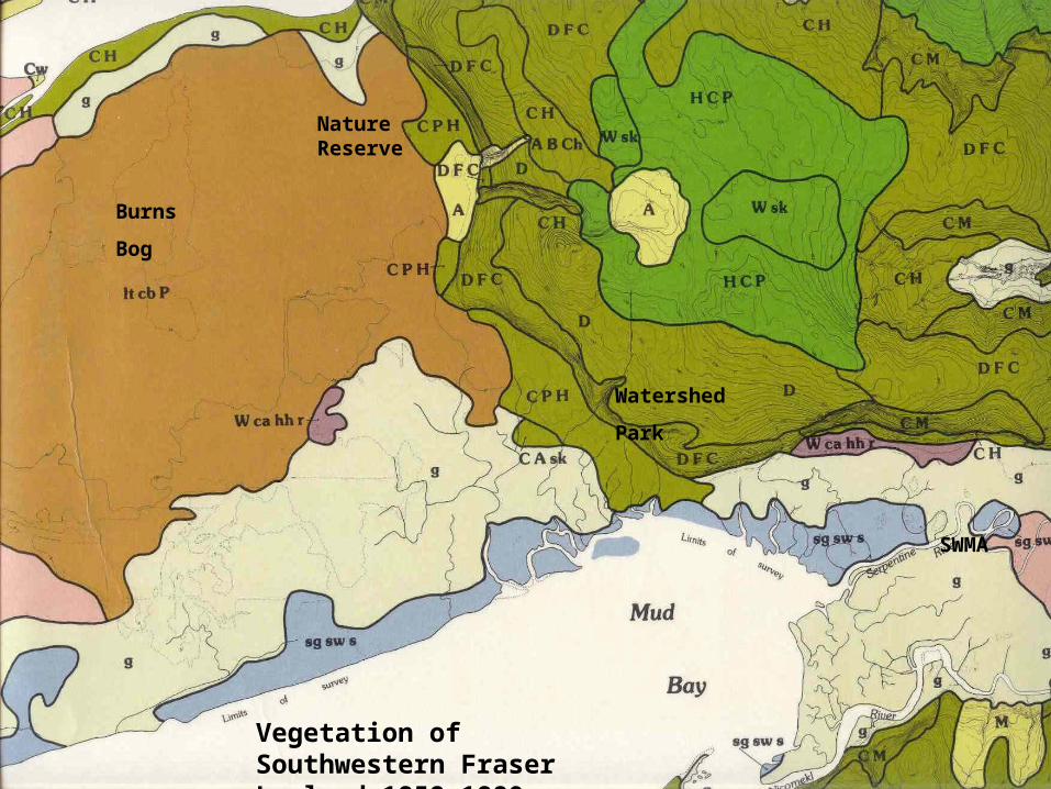
Vegetation of Southwestern Fraser Lowland 1858-1880
Nature Reserve
Vegetation of Southwestern Fraser Lowland 1858-1880
Burns Bog – It cb P = Labrador Tea: labrador tea (lt), cranberry (cb), salal, Pine (P)
mP = Moss with scrub pine: sphagnum (m), scattered pine (P), Hemlock, Spruce.
Watershed Park – DFC = Mixed Coniferous: Douglas fir (D), Grand fir (F), Cedar (C), [Hemlock], [Pine], [Spruce], Alder, Dogwood, vine maple, briars.
D = Douglas Fir: Douglas fir (D), [Cedar], salal, oregon grape, hawthorn
Serpentine Wildlife Management Area – g = Prairie: grass (g)g W hh ca = Prairie grass with shrubs: grass (g), Willow (W), hardhack (hh), crabapple (ca)sg sw s = Salt marsh: saltgrass (g), saltwort (sw), sedge(s)
Special Notes:Underlined species = dominant
[Bracketed species] = minor occurence
Capitalized species = part of tree canopy, not capitalized = understory
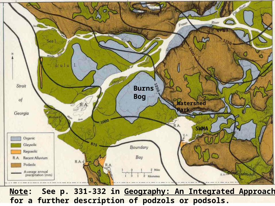
Burns Bog
Watershed Park
SWMA
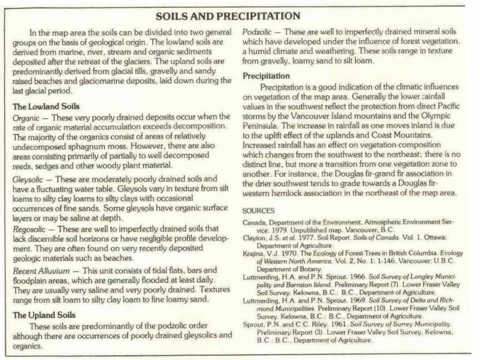
Note: See p. 331-332 in Geography: An Integrated Approach for a further description of podzols or podsols.
Note: Source for the previous four slides –
North, M.E.A., and M.W. Dunn. Environment Canada. Lands Directorate.
Vegetation of Southwestern Fraser Lowland 1858-1880 (Poster).
Canada: Minister of Supply and Services Canada, 1979.
Watershed Park
SWMA
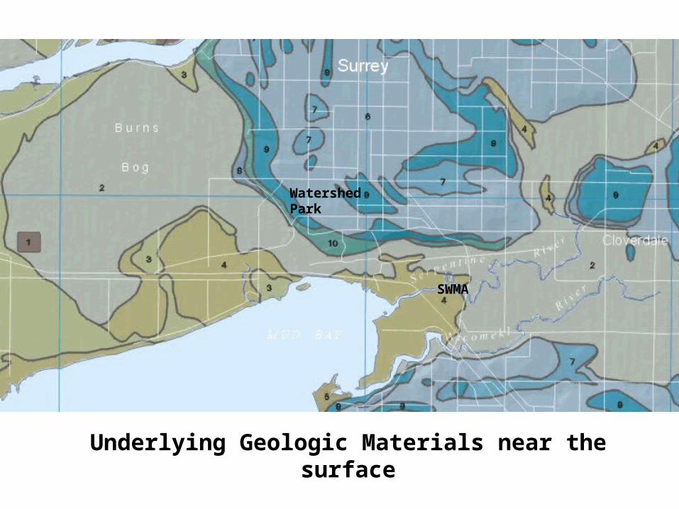
Underlying Geologic Materials near the surface
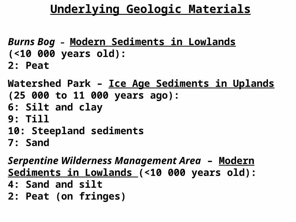
Underlying Geologic Materials
Burns Bog – Modern Sediments in Lowlands (<10 000 years old): 2: Peat
Watershed Park – Ice Age Sediments in Uplands(25 000 to 11 000 years ago): 6: Silt and clay9: Till 10: Steepland sediments 7: Sand
Serpentine Wilderness Management Area – Modern Sediments in Lowlands (<10 000 years old):4: Sand and silt2: Peat (on fringes)
Note: Source for the previous two slides –
Turner, Bob. Geomap Vancouver. Feb. 11, 2008
<http://gsc.nrcan.gc.ca/urbgeo/geomapvan/index_e.php>.
To what extent have humans altered these three sites since the late 1800s? - Consider preparation exercise readings and Burns Bog information on Mr. Mleziva’s website.
So what actually will we be doing on the day of the field study????

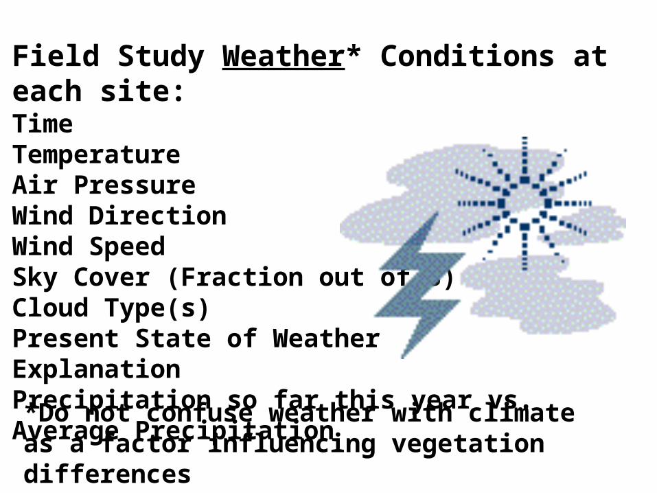
Field Study Weather* Conditions at each site:TimeTemperatureAir PressureWind DirectionWind SpeedSky Cover (Fraction out of 8)Cloud Type(s) Present State of WeatherExplanationPrecipitation so far this year vs. Average Precipitation
*Do not confuse weather with climate as a factor influencing vegetation differences

Go Through the Checklist of Items that you need to bring to ensure that you are prepared.
Research Question: Which key factor(s) account for the significant differences in vegetation types between the Delta Nature Reserve (Burns Bog), Watershed Park, and the Serpentine Wildlife Management Area?
Hypothesis: You design one. Based upon your preparation exercise readings and exercises and looking over the Factors Affecting Biomes web, hypothesize as to the main factor(s) determining the differences in vegetation type.
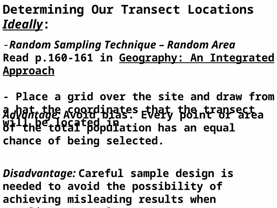
Determining Our Transect Locations Ideally:
-Random Sampling Technique – Random AreaRead p.160-161 in Geography: An Integrated Approach
- Place a grid over the site and draw from a hat the coordinates that the transect will be located in
Advantage: Avoid bias. Every point or area of the total population has an equal chance of being selected.
Disadvantage: Careful sample design is needed to avoid the possibility of achieving misleading results when sampling over a large area.
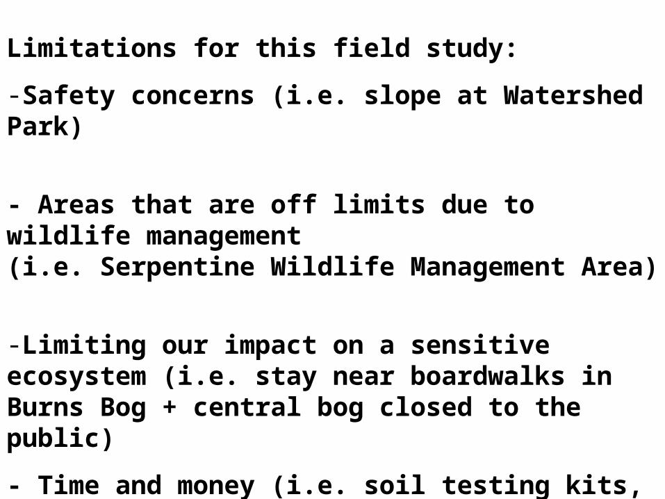
Limitations for this field study:
-Safety concerns (i.e. slope at Watershed Park)
- Areas that are off limits due to wildlife management(i.e. Serpentine Wildlife Management Area)
-Limiting our impact on a sensitive ecosystem (i.e. stay near boardwalks in Burns Bog + central bog closed to the public)
- Time and money (i.e. soil testing kits, bus rentals); ideally, we would want to do much more than just two transects for each site to better reflect the nature of the “total population”.
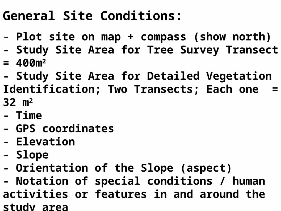
General Site Conditions:
- Plot site on map + compass (show north)- Study Site Area for Tree Survey Transect = 400m2 - Study Site Area for Detailed Vegetation Identification; Two Transects; Each one = 32 m2
- Time- GPS coordinates - Elevation- Slope- Orientation of the Slope (aspect)- Notation of special conditions / human activities or features in and around the study area i.e. farming, tourism, etc.
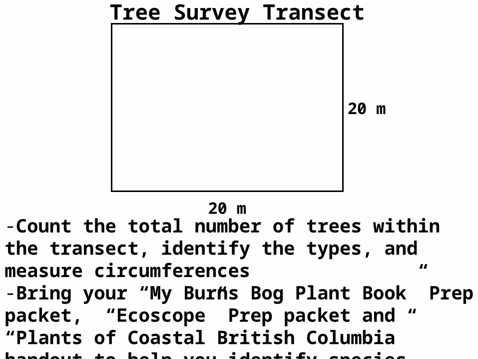
Tree Survey Transect
20 m
20 m
-Count the total number of trees within the transect, identify the types, and measure circumferences -Bring your “My Burns Bog Plant Book” Prep packet, “Ecoscope” Prep packet and “Plants of Coastal British Columbia” handout to help you identify species – Take a picture of the entire transect
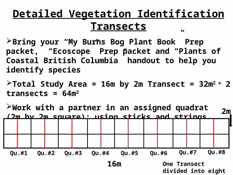
Detailed Vegetation Identification TransectsBring your “My Burns Bog Plant Book” Prep packet, “Ecoscope” Prep packet and “Plants of Coastal British Columbia” handout to help you identify species
Total Study Area = 16m by 2m Transect = 32m2 x 2 transects = 64m2
Work with a partner in an assigned quadrat (2m by 2m square); using sticks and strings, divide your 4m2 quadrat into four quarters to make analysis easier.
16m
Qu.#1 Qu.#2 Qu.#3 Qu.#4 Qu.#5 Qu.#6
One Transect divided into eight quadrats
2m
Qu.#7 Qu.#8
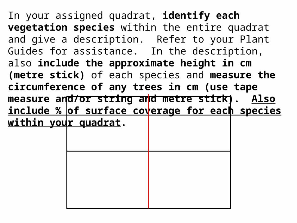
In your assigned quadrat, identify each vegetation species within the entire quadrat and give a description. Refer to your Plant Guides for assistance. In the description, also include the approximate height in cm (metre stick) of each species and measure the circumference of any trees in cm (use tape measure and/or string and metre stick). Also include % of surface coverage for each species within your quadrat.
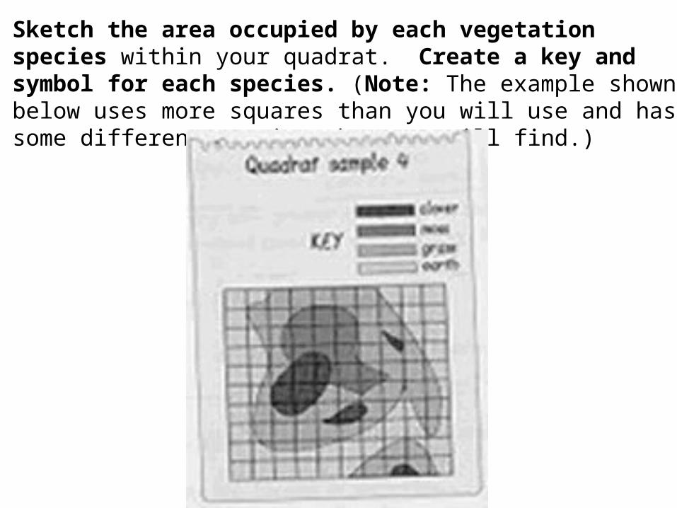
Sketch the area occupied by each vegetation species within your quadrat. Create a key and symbol for each species. (Note: The example shown below uses more squares than you will use and has some different species than you will find.)
Take pictures of your quadrat – remember to put something into the picture for scale (eg clipboard).
Take picture(s) of the entire transect – have a person in the picture for scale.
Take a picture looking upwards at the top of the canopy (if present) to give a sense of the amount of light intensity. Note: We will try to measure the actual light intensity using a light metre placed in the ground in each quadrat.
Describe soil conditions – colour, composition, texture. Is it mineral based or organic based? Take a picture.
We will dig one hole for each transect (as close as possible to Quadrat 1 for Transect 1 and near Quadrat 8 for Transect 2) to expose a profile for the soil and try to reach the water table and take a pH strip reading at the water table. Take a picture. We will collect two soil samples from each of these profiles four inches (10 cm) below the surface (as instructed by the soil testing kit) and later test for pH, nitrogen, phosphorous, and potash content.
We will take three pH meter readings in each quadrat and average the data for each quadrat. These readings will be consistently taken from the middle and towards opposite sides of each quadrat . This is called Systematic Sampling (see p.161-162). Advantage: Ease of use.Disadvantage: All points do not have an equal chance of selection – it may either overstress or miss an underlying pattern.
We will also, if available, get a pH reading for sitting water in or around the transect.
We will also later test for moisture content via a drying process and measuring mass before and after. In particular we will want to see if peat is indeed composed of 90% water and 10% solids and how do the peat samples differ from samples at the other sites.
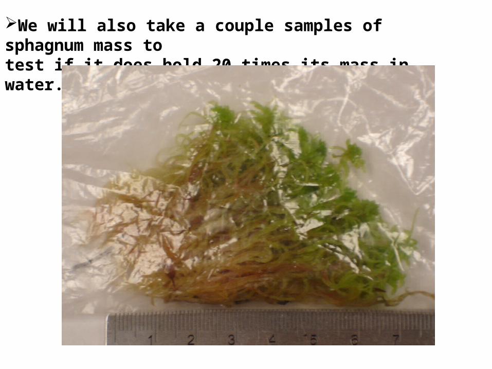
We will also take a couple samples of sphagnum mass to
test if it does hold 20 times its mass in water.
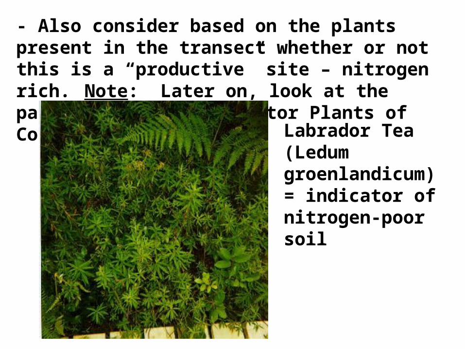
- Also consider based on the plants present in the transect whether or not this is a “productive” site – nitrogen rich. Note: Later on, look at the packet entitled “Indicator Plants of Coastal BC”.
Labrador Tea (Ledum groenlandicum) = indicator of nitrogen-poor soil
Serpentine Wildlife Management Area

Task List
-Fix long sticks and strings (16m-18m) for Detailed Vegetation Identification Transects – check for 1m labelled intervals(no repairs needed this year)- Fix small sticks and string: measure each 2.75m long and re-tie + tape secure (Carol C., Andrew M., Ben M., Mark G., and Josh L.)- Fix four 20m long strings attached to sticks for the Tree Survey Transect - check for 5m labelled intervals (no repairs needed this year)
- Test ph and soil moisture metres Elise B. and Kate B. , Elizabeth S. and Miranda V.
- Test light metres (Andrew M. and Carol C., Annika T. and Jelena D.)- Complete in HL class
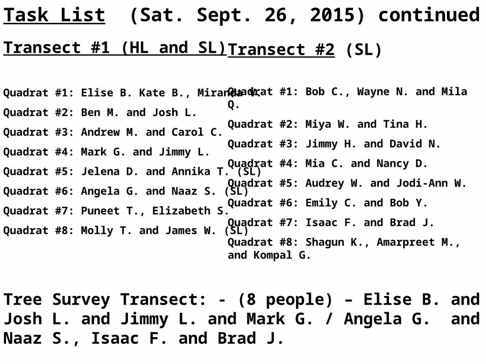
Task List (Sat. Sept. 26, 2015) continued
Transect #1 (HL and SL)
Quadrat #1: Elise B. Kate B., Miranda V.
Quadrat #2: Ben M. and Josh L.
Quadrat #3: Andrew M. and Carol C.
Quadrat #4: Mark G. and Jimmy L.
Quadrat #5: Jelena D. and Annika T. (SL)
Quadrat #6: Angela G. and Naaz S. (SL)
Quadrat #7: Puneet T., Elizabeth S.
Quadrat #8: Molly T. and James W. (SL)
Tree Survey Transect: - (8 people) – Elise B. and Josh L. and Jimmy L. and Mark G. / Angela G. and Naaz S., Isaac F. and Brad J.
Transect #2 (SL)
Quadrat #1: Bob C., Wayne N. and Mila Q.
Quadrat #2: Miya W. and Tina H.
Quadrat #3: Jimmy H. and David N.
Quadrat #4: Mia C. and Nancy D.
Quadrat #5: Audrey W. and Jodi-Ann W.
Quadrat #6: Emily C. and Bob Y.
Quadrat #7: Isaac F. and Brad J.
Quadrat #8: Shagun K., Amarpreet M., and Kompal G.
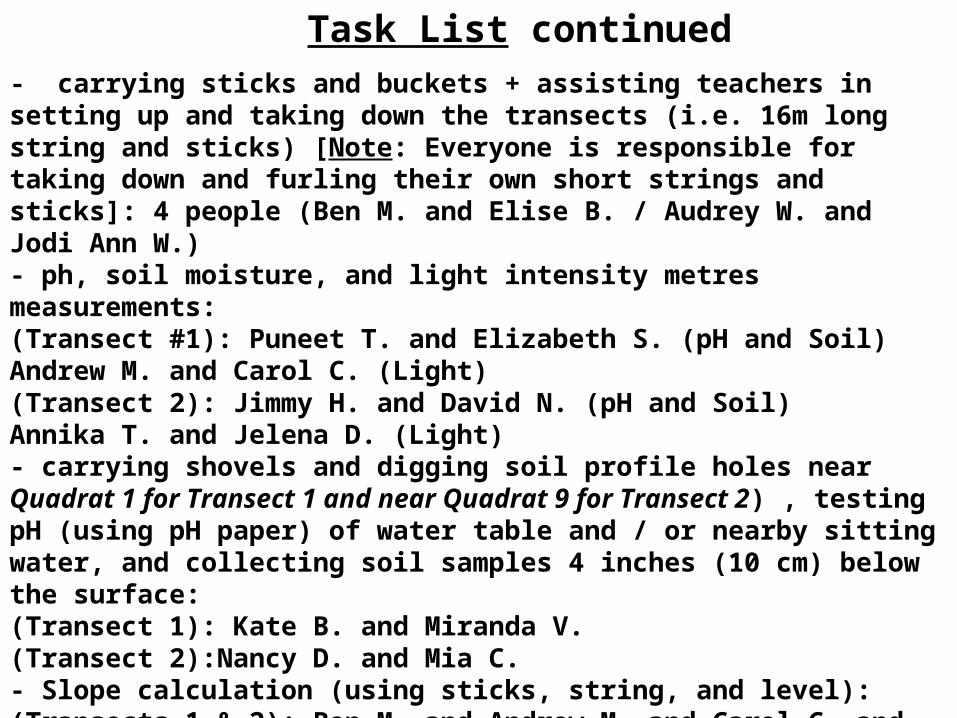
- carrying sticks and buckets + assisting teachers in setting up and taking down the transects (i.e. 16m long string and sticks) [Note: Everyone is responsible for taking down and furling their own short strings and sticks]: 4 people (Ben M. and Elise B. / Audrey W. and Jodi Ann W.)- ph, soil moisture, and light intensity metres measurements: (Transect #1): Puneet T. and Elizabeth S. (pH and Soil) Andrew M. and Carol C. (Light)(Transect 2): Jimmy H. and David N. (pH and Soil) Annika T. and Jelena D. (Light)- carrying shovels and digging soil profile holes near Quadrat 1 for Transect 1 and near Quadrat 9 for Transect 2) , testing pH (using pH paper) of water table and / or nearby sitting water, and collecting soil samples 4 inches (10 cm) below the surface:(Transect 1): Kate B. and Miranda V.(Transect 2):Nancy D. and Mia C.- Slope calculation (using sticks, string, and level): (Transects 1 & 2): Ben M. and Andrew M. and Carol C. and Kate B.- Lat. and Long. + elevation: (Transect 1): Ben M.(Transect 2): Bob Y.
Task List continued

Task List continued
- Soil sample testing for pH, nitrogen, phosphorous, and potash and Measuring mass of soil samples and sphagnum moss samples before and after drying:
Tues. Sept. 29– 3:10pm to 5:00pm Angelo L. and Puneet T. and Jimmy L. and Miya W. and Tina H.
Wed. Sept. 30– 3:15pm to 4:00pmAngelo L. and Puneet T. and Jimmy L.