What is Geography? Geography is the study of place and space. Study of human activity, the natural...
20
What is Geography? • Geography is the study of place and space . • Study of human activity, the natural environment, and the relationship between the two (human-environment interactions). • Geographers look at where things are and why they are there .
-
Upload
hugo-flowers -
Category
Documents
-
view
233 -
download
6
Transcript of What is Geography? Geography is the study of place and space. Study of human activity, the natural...
What is Geography?• Geography is the study of place and space.
• Study of human activity, the natural environment, and the relationship between the two (human-environment interactions).
• Geographers look at where things are and why they are there.
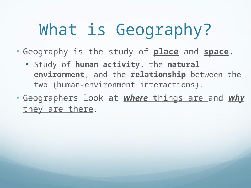
What is Latitude? Run parallel to Equator
Measures North and South
90 degrees North latitude
90 degrees South latitude
Important lines of Latitude:
1. Equator
2. Tropic of Cancer
3. Tropic of Capricorn
4. Arctic Circle
5. Antarctic Circle
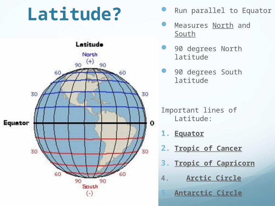
What is Longitude?
Run parallel to Prime Meridian
Measures East and West
180 degrees of East longitude
180 degrees of West longitude
Total = 360 degree circle
All lines meet at North Pole and stretch to South Pole
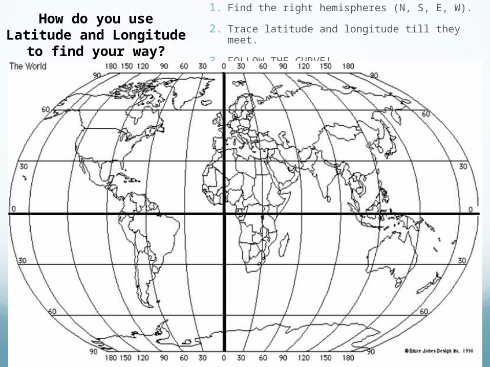
How do you use Latitude and Longitude to find your way?
1. Find the right hemispheres (N, S, E, W).
2. Trace latitude and longitude till they meet.
3. FOLLOW THE CURVE!

Parts of A Map Title – explains the subject of the
map
Compass Rose – shows the “Cardinal Directions”, meaning North, South, East, and West
Legend or “Key” - shows and explains the symbols used on the map
Scale – shows the true size of the objects shown on the map
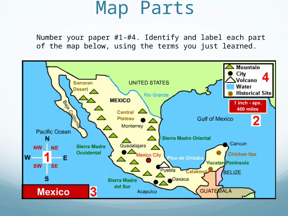
Activity: Identify the Map Parts
Number your paper #1-#4. Identify and label each part of the map below, using the terms you just learned.

What main types of maps
are there?
PHYSICAL MAPS
POLITICAL MAPS
THEMATIC MAPS

Physical Maps
Show natural features such as landforms and physical borders; lakes, rivers, mountain ranges, and things that were around before humans
Physical Borders – Borders defined by a physical feature
Example - Rio Grande River, between USA and Mexico

Political Maps
Show features on the earth’s surface that humans created.
Examples of things on a political map?
Political Borders – borders created by governments
National and State Borders,
City Limits, capitals

Thematic Maps
Thematic maps can be tricky, there are many different kinds.They all do the same thing… they show information
Some common thematic maps:
Population maps
Weather maps
Resource maps
Topographic maps

BAYPart of a large body of
water that extends ino a shorline, generally smaller than a gulf
Chesapeake Bay
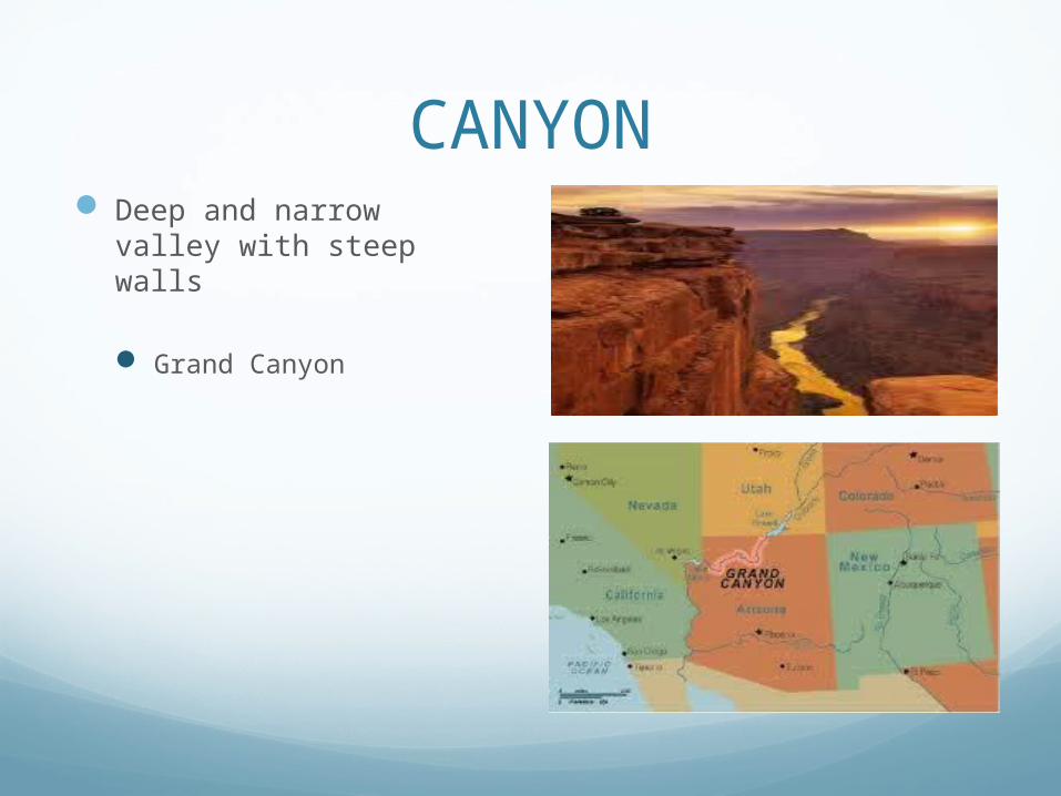
CANYON Deep and narrow valley
with steep walls
Grand Canyon
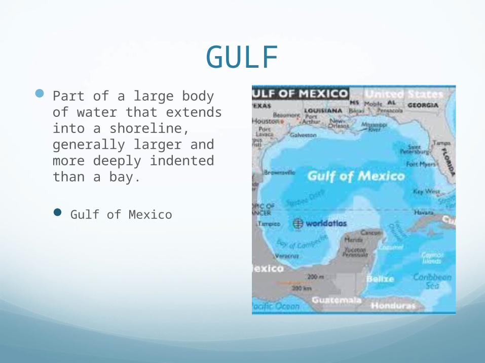
GULF Part of a large body of
water that extends into a shoreline, generally larger and more deeply indented than a bay.
Gulf of Mexico

HARBOR A sheltered place along a
shoreline where ships can anchor safely
Boston Harbor
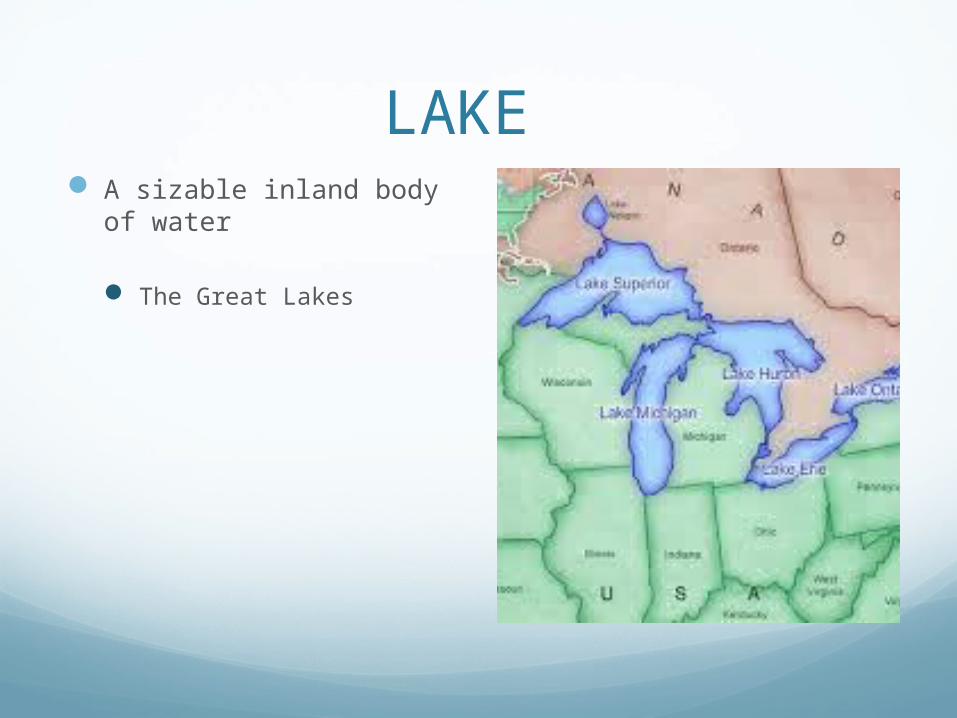
LAKE A sizable inland body of
water
The Great Lakes
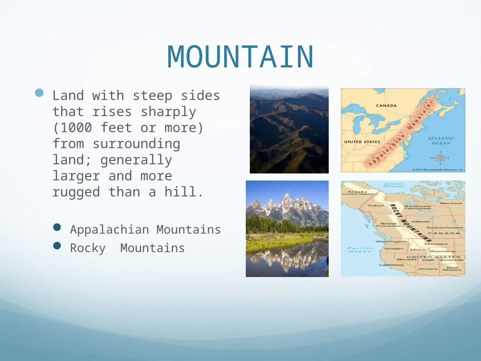
MOUNTAIN Land with steep sides
that rises sharply (1000 feet or more) from surrounding land; generally larger and more rugged than a hill.
Appalachian Mountains Rocky Mountains

OCEAN One of the four major
bodies of salt water that surround the continents
Atlantic Ocean Pacific Ocean
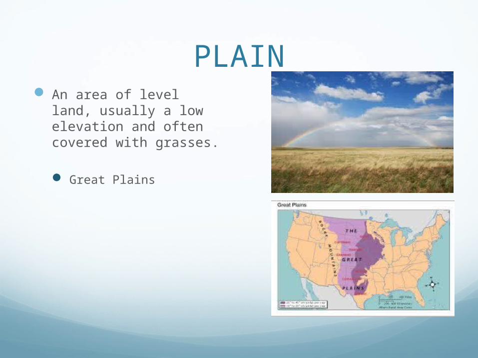
PLAIN An area of level land,
usually a low elevation and often covered with grasses.
Great Plains

RIVER Large natural stream of
water that runs through the land.
Mississippi River Missouri River Ohio River Hudson River Rio Grande River

Geography Unit Map Practice
Directions: Label and color the following: