WFO OKX – Topics in WDM Michael L. Ekster Severe Weather Warning Technology Workshop 12 July 2005.
19
WFO OKX – Topics in WDM Michael L. Ekster Severe Weather Warning Techn ology Workshop 12 July 2005
-
Upload
bret-picton -
Category
Documents
-
view
216 -
download
3
Transcript of WFO OKX – Topics in WDM Michael L. Ekster Severe Weather Warning Technology Workshop 12 July 2005.

WFO OKX – Topics in WDM
Michael L. Ekster
Severe Weather Warning Technology Workshop
12 July 2005

Area of ResponsibilityArea of Responsibility
2005 Population: 18.6 million (6.3% US Pop)

Major Programs
• Public• Aviation• Marine• Hydrology• Severe Weather• Hazmat/Terrorism• Fire Weather• Upper Air• Tropical

Issues during an event
• Largest media market in the world• NYC OEM needs constant updates• Spotter reports
- Almost 100 phone calls PER HOUR• Office has been short staffed for the last 3 years • Below average experience (especially on Radar)

Issues...
• Never enough AWIPS workstations- 9 Tafs (3 major hubs) – almost need 2 forecasters for Tafs alone - Warnings- Statements- At least one forecast desk for routine product updates (what if a watch is issued?)- Public Service- Mesoanalysis?- Sectorization? (huge marine community!)

Issues…• Forecaster to population ratio
-One forecaster per 1.86 million people• WFO OKX gets hit from all sides – 12 months of the year
- Severe convective events
- Winter storms
- Tropical threat
- Hazmat
- Busiest aviation City in the world
- Very large marine community
• Given weather threats and population, could very well be the most stressful FO in the country
• Help?

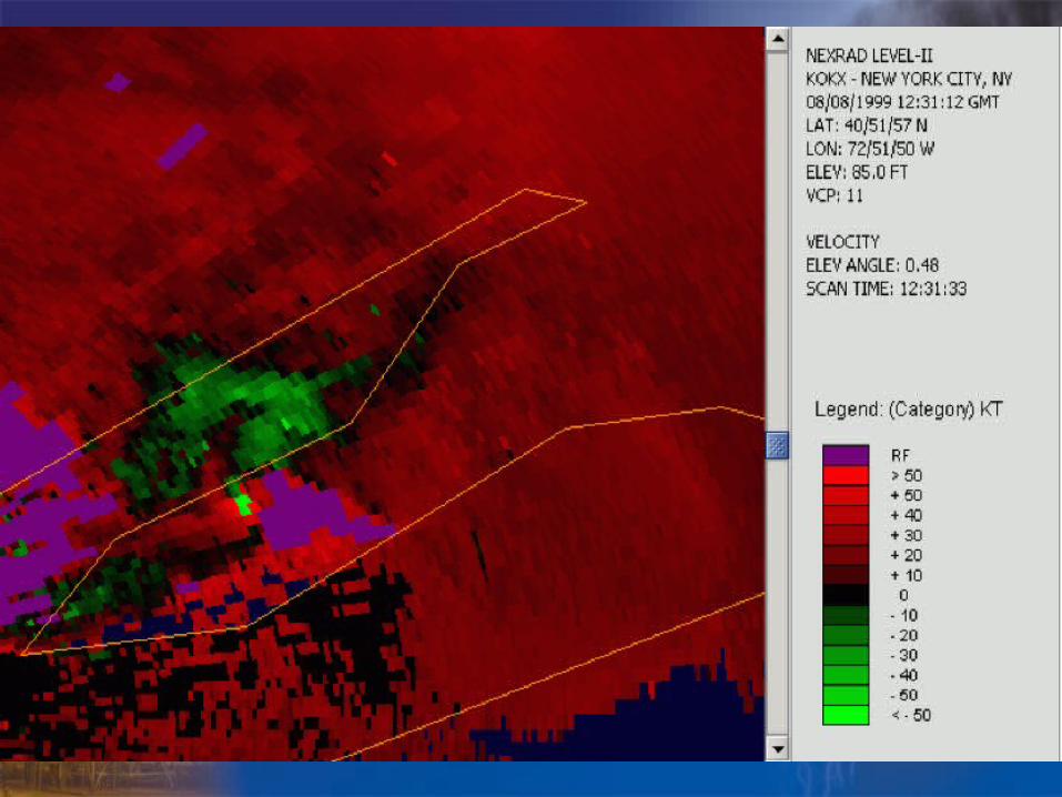
Radar/WDM Issues• Sampling problems
-Average height of lowest radar slice in the region of the CWA that usually receives worst convective weather is 7-12 kft

Radar/WDM Issues
• Pulse severe thunderstorms- Frequent occurrence- Can be deadly due to pop. density- One pulse tstm anywhere in the cwa can adversely affect 100k+ people- Need to find a way to achieve better lead times (especially over the most urbanized areas)- 5 minute lead times are nearly worthless here

Radar/WDM Issues• Urban flooding
- Some areas of NYC develop flash flooding with rainfall rates of less than 1”/hr.- Some areas of NYC can take a lot more- Rainfall estimations/Z-R relationships continue to be a challenge for many- Significant subway flooding Summer ’04 – no FFW!
Worst event for the city since 9/11
• Hydroview- Does not update in a timely manner (~ every 3 hours during an event)- Someone has to call the gages – takes away from doing other important tasks
Training is key
• Technology generally works, but is only as good the user!
• Must train staff on mesoscale processes and analysis of them – much better situational awareness
• AWOC/DLOC excellent courses, but how much is really relevant to Northeast severe weather?
- Storm scale signatures not as classic here
- Big consequences still do result – population
- WES makes up for some of this, but how about an AWOC type course for Eastern U.S. WFOs?
- Focus on mesoanalysis and storm scale signatures would be excellent


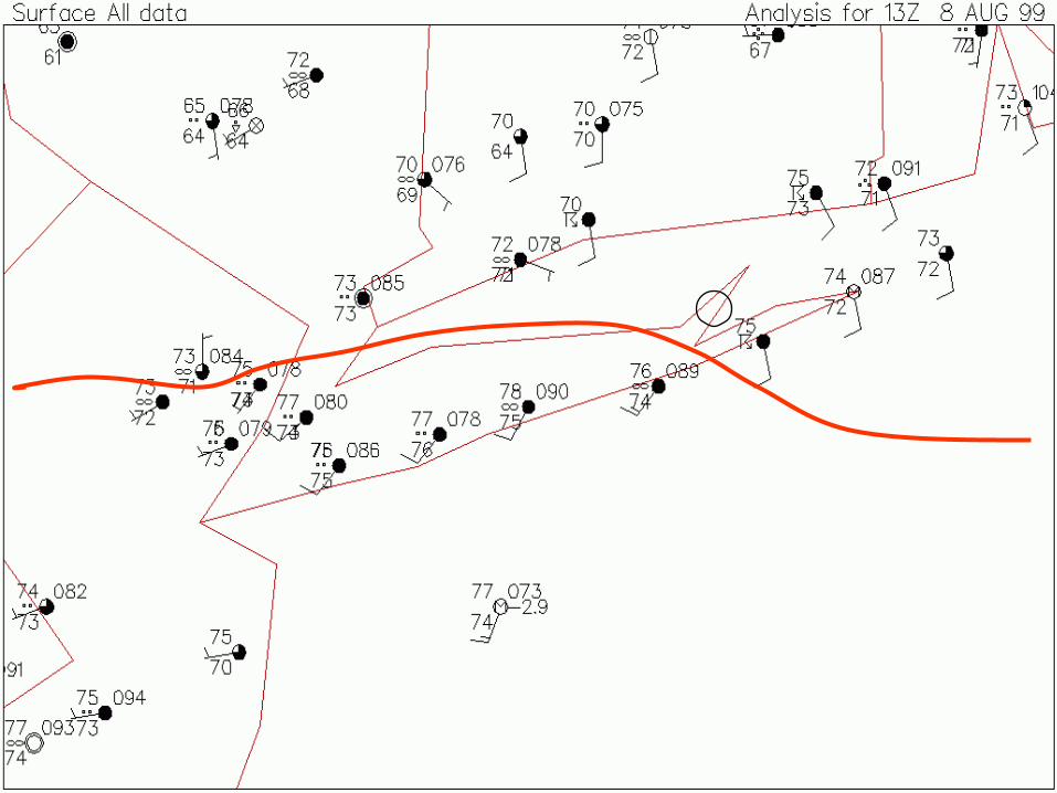

12z 08Aug99 OKX sounding

0-3 km CAPE
Very low LCL
Sounding modified for conditions immediately on the
cool side of the boundary
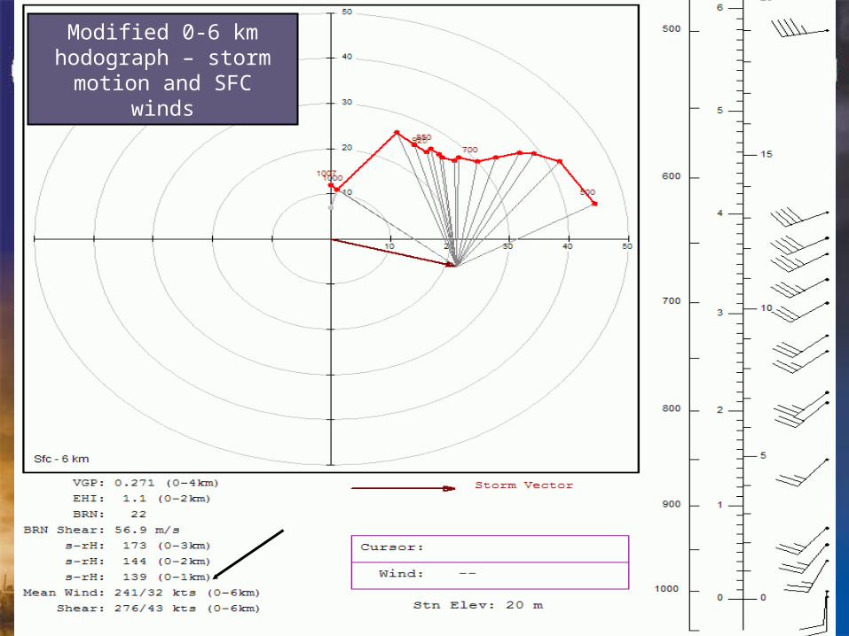
Modified 0-6 km hodograph – storm motion
and SFC winds