West Midlands Key Route Network WALSALL WOLVERHAMPTON · Flows on minor roads such as B roads...
20
WEST BROMW I West Midlands Key Route Network Black Country Route
Transcript of West Midlands Key Route Network WALSALL WOLVERHAMPTON · Flows on minor roads such as B roads...

W O LV E R H A M P TO NWA L S A L L
D U D L E Y
BIRMINGHAM
W E S TB R O M W I C H
S O L I H U L L
C O V E N T RY
W O R C E S T E R S H I R E
WA R W I C K S H I R E
S TA F F O R D S H I R E
L I C H F I E L D
West Midlands Key Route NetworkBlack Country Route

M6 Toll
M6 Toll M
42
M42
M40M
5M42
A38(M
)
M5
M5
M5
M6
M6
M54
M6
M69
M5
M6
M6
M6
M6
A460
A46
2
A4038
A449
A4041
A51
27
A38
A5
A38
A446
A452
A45
A38
A40
31
A461
A44
1
A38
A38
A40
36
A43
5
A34
A41
A45
A45
A45
A4114
B4098
A44
4
A44
4
B411
3
A4600
A4082
A46
A46
A429
A428
A4037
A41
A454
A34
A452
A5
A5
A452
A4123
A459
A459
A4101
A4100
A458
A456
A456
A4040
A40
40
A40
30
A4040
A452A4123
B412
1A34
A454
A463
A454
A4124
A4124
A461
A4148
A491
A41
A47
A4540
A457A4182
A42
52
A44
9
B4171
23 1
10a
11a
4a 3a
10
11
12
9
78
16 5
7a
7 3a4
9
T3
3
2
6
5
4
2
3
4
21 3
W O LV E R H A M P TO N
WA L S A L L
D U D L E Y
BIRMINGHAM
W E S TB R O M W I C H
S O L I H U L L
C O V E N T RYW O R C E S T E R S H I R E
WA R W I C K S H I R E
S TA F F O R D S H I R E
L I C H F I E L D
0
0
1km 2km 3km 4km 5km
1m 2m 3m 4m 5m
F O L E S H I L LM E R I D E N
H A L L G R E E N
M O S E L E Y
YA R D L E Y
S A LT L E Y
E R D I N GTO NP E R RY B A R R
G R E AT B A R R
K I N G S TA N D I N G
S U T TO NC O L D F I E L D
B R O W N H I L L S
W E D N E S B U RY
S E D G L E Y
B I L S TO N
W E D N E S F I E L D
O X L E Y
P E N N
S E L LYOA K
H A R B O R N E
N O RT H F I E L D
S M E T H W I C K
O L D B U RY
B E A R W O O D
WA L S G R AV E
H A L E S O W E NS TO U R B R I D G E
B R I E R L E YH I L L
P E N S N E T T
K I N G S W I N F O R D
BirminghamAirport
Birmingham Cross City
A38, A38(M), A47, A435, A441, A4400, A4540, A5127, B4138, B4144, B4145, B4148, B4154
Birmingham Outer Circle A4030, A4040, B4145, B4146
Birmingham to Stafford A34
Black Country Route A454(W), A463, A4444
Black Country to Birmingham A41
Coventry to Birmingham A45, A4114(N), B4106
East of Coventry A428, A4082, A4600, B4082
East of Walsall A454(E), B4151, B4152
Kingswinford to Halesowen A459, A4101
Lichfield to Wednesbury A461, A4148
North and South Coventry A429, A444, A4053, A4114(S), B4098, B4110, B4113
Northfield to Wolverhampton A4123, B4121
Pensnett to Oldbury A461, A4034, A4100, B4179
Sedgley to Birmingham A457, A4030, A4033, A4034, A4092, A4182, A4252, B4125, B4135
Solihull to Birmingham A34(S), A41, A4167, B4145
Stourbridge to Wednesbury A461, A4036, A4037, A4098
Stourbridge to North of Wolverhampton
A449, A460, A491
UK Central to Brownhills A452
West Bromwich Route A4031, A4041
West of Birmingham A456, A458, B4124
Wednesfield to Wednesbury A462, A4038
Wolverhampton to Brownhills A4124
Wolverhampton to Halesowen A459, B4171
A5, A45, A46, A446, A452 Operated by Highways England – Trunk Roads – not part of KRN
Strategic Road Network Operated by Highways England – Motorways – not part of KRN
M6 Toll Operated by Midland Expressway Limited – not part of KRN
West MidlandsKey Route Network
West Midlands Key Route Network (KRN) Map, Version 1.0, August 2017 Contains OS data © Crown copyright and database right (2017)
Figure 1
2
RO
UT
E DESC
RIPT
ION
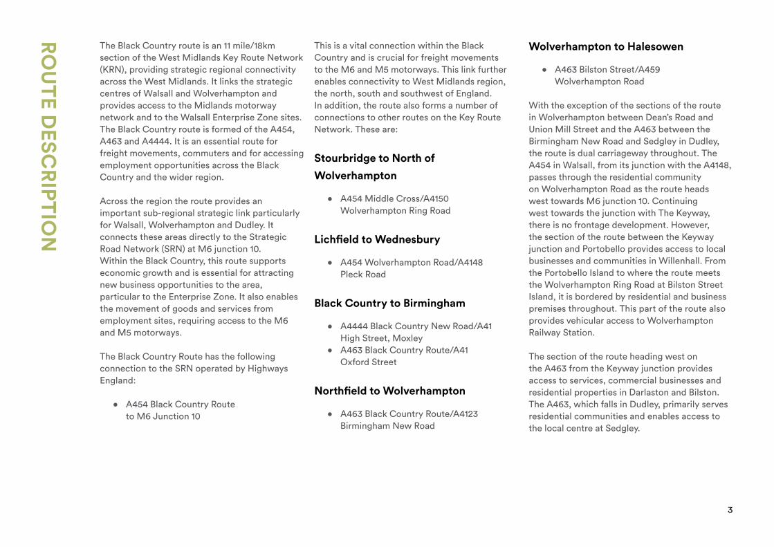
The Black Country route is an 11 mile/18km section of the West Midlands Key Route Network (KRN), providing strategic regional connectivity across the West Midlands. It links the strategic centres of Walsall and Wolverhampton and provides access to the Midlands motorway network and to the Walsall Enterprise Zone sites. The Black Country route is formed of the A454, A463 and A4444. It is an essential route for freight movements, commuters and for accessing employment opportunities across the Black Country and the wider region.
Across the region the route provides an important sub-regional strategic link particularly for Walsall, Wolverhampton and Dudley. It connects these areas directly to the Strategic Road Network (SRN) at M6 junction 10.Within the Black Country, this route supports economic growth and is essential for attracting new business opportunities to the area, particular to the Enterprise Zone. It also enables the movement of goods and services from employment sites, requiring access to the M6 and M5 motorways.
The Black Country Route has the following connection to the SRN operated by Highways England:
• A454 Black Country Route to M6 Junction 10
This is a vital connection within the Black Country and is crucial for freight movements to the M6 and M5 motorways. This link further enables connectivity to West Midlands region, the north, south and southwest of England.In addition, the route also forms a number of connections to other routes on the Key Route Network. These are:
Stourbridge to North of
Wolverhampton
• A454 Middle Cross/A4150 Wolverhampton Ring Road
Lichfield to Wednesbury
• A454 Wolverhampton Road/A4148 Pleck Road
Black Country to Birmingham
• A4444 Black Country New Road/A41 High Street, Moxley
• A463 Black Country Route/A41 Oxford Street
Northfield to Wolverhampton
• A463 Black Country Route/A4123 Birmingham New Road
Wolverhampton to Halesowen
• A463 Bilston Street/A459 Wolverhampton Road
With the exception of the sections of the route in Wolverhampton between Dean’s Road and Union Mill Street and the A463 between the Birmingham New Road and Sedgley in Dudley, the route is dual carriageway throughout. The A454 in Walsall, from its junction with the A4148, passes through the residential community on Wolverhampton Road as the route heads west towards M6 junction 10. Continuing west towards the junction with The Keyway, there is no frontage development. However, the section of the route between the Keyway junction and Portobello provides access to local businesses and communities in Willenhall. From the Portobello Island to where the route meets the Wolverhampton Ring Road at Bilston Street Island, it is bordered by residential and business premises throughout. This part of the route also provides vehicular access to Wolverhampton Railway Station.
The section of the route heading west on the A463 from the Keyway junction provides access to services, commercial businesses and residential properties in Darlaston and Bilston. The A463, which falls in Dudley, primarily serves residential communities and enables access to the local centre at Sedgley.
3

W O LV E R H A M P TO NWA L S A L L
D U D L E Y
BIRMINGHAM
W E S TB R O M W I C H
S O L I H U L L
C O V E N T RY
W O R C E S T E R S H I R E
WA R W I C K S H I R E
S TA F F O R D S H I R E
L I C H F I E L D
Key FactsRoute Length:11 miles/18km
Volume of Traffic in 2016:*174.35 million vehicle kilometres
Main Centres served:Walsall and Wolverhampton
Coordinating Highway Authority:West Midlands Combined Authority
Responsible Local Highway Authority:City of Wolverhampton Council, Dudley
Metropolitan Borough Council and Walsall Council
Number of KSI collisions 2014-2016:19
Figure 2
*This figure has been calculated using AADT link data. Flows on minor roads such as B roads
therefore may not be included.
4

RO
UT
E PERFO
RM
AN
CE
5
Congestion, Delay, Reliability Table 1: AM Peak Congestion Related Delays
This route represents 3% of the total length of the West Midlands Key Route Network. According to the latest data available from 2016, this route had a minimum annual average daily flow (AADF) of 11,700 vehicles, a maximum of 41,700 with an average of 25,700 AADF.
There are three main locations along the length of this route where there are significant volumes of traffic congestion. These are:
• From the A454 Keyway Junction up to M6 Junction 10 and continuing along the A454 Wolverhampton Road to where it meets the A4148 Pleck Road. This is the most congested section of the route and is being addressed through a major infrastructure improvement at M6 Junction 10 with the start of works scheduled for 2018.
• Along the Willenhall Road from its junction with Neachells Lane to where the route meets the A4150 Wolverhampton Ring Road.
• The short stretch of the route through the Bilston Urban Village along the A463 from the A41 Oxford Street junction to the Coseley Road junction.
The locations of the most significant congestion-related delays (>60 sec/km) are set out in Tables 1 and 2.
Road Location Direction
A463 Gospel End Street, Vicar Street to Bull Ring, Sedgley Eastbound
A463 Bilston Street, School Street to A459 High Street, Sedgley Westbound
A454 Willenhall Road, Colliery Road to Old Heath Road, Wolverhampton
Eastbound
A454 Willenhall Road, Plascom Road to Lower Walsall Street, Moseley Westbound
A454 Willenhall Road, Hurstbourne Crescent to Neachells Lane, Moseley Village
Eastbound
A454 Willenhall Road, Uplands Avenue to Stow Heath Lane, Moseley Village
Westbound
A454 Willenhall Road, Somerford Place/New Street to Neachells Lane, Portobello
Westbound
A454 Willenhall Road, Noose Lane to Somerford Place/New Street, Portobello
Eastbound
A454 Black Country Route, The Keyway, Willenhall, to M6 Junction 10, Bentley
Eastbound
A454 Wolverhampton Road, M6 Junction 10 (including gyratory) to Bloxwich Lane, Bentley
Eastbound
A454 Wolverhampton Road, Bloxwich Lane, Bentley, to M6 Junction 10 Westbound
A454 Wolverhampton Road, A4148 Pleck Road to Primley Avenue, Walsall
Westbound
A454 Wolverhampton Road, Lane Avenue to A4148 Pleck Road, Walsall Eastbound

RO
UT
E PERFO
RM
AN
CE
6
Peak hour journey time on the sections of the route experiencing the highest delays has been found to be 150% higher than (i.e. 2½ times) the equivalent free flow time, which is based on the average journey time between 22:00 – 06:00.
A particular impact of the congestion is to create problems with access to Wolverhampton Station, New Cross Hospital, Walsall Manor Hospital and the Wednesfield, Willenhall, Bilston and Wednesbury industrial areas which may supply to companies that rely on just-in-time deliveries.
Table 2: PM Peak Congestion-Related Delays
Road Location Direction
A463 Black Country Route, A41 Oxford Street to Bankfield Road, Bilston
Westbound
A454 Middle Cross/Lower Horsley Fields, Cross Street to A4150 Wolverhampton Ring Road
Westbound
A454 Willenhall Road, Cross Street to Neachells Lane, Moseley Village
Eastbound
A454 Willenhall Road, Somerford Place/New Street to Neachells Lane, Portobello
Westbound
A454 Willenhall Road, Noose Lane to Somerford Place/New Street, Portobello
Eastbound
A454 Black Country Route, The Keyway, Willenhall, to M6 Junction 10 (including gyratory)
Eastbound
A454 Wolverhampton Road, A4148 Pleck Road, Walsall, to M6 Junction 10 (including gyratory)
Westbound
A454 Wolverhampton Road, Raleigh Street to A4148 Pleck Road, Walsall
Eastbound
Average Speeds
The average speed for the route in the AM Peak is between 10-20 mph throughout its busiest sections. The areas approaching the M6 at junction 10 and the Willenhall Road in Wolverhampton are particularly slow during both the morning and evening peak periods and can be as slow as less than 10 mph. The sections where average peak speeds are lower than 10 mph mostly occur at junctions along this route, they are as follows:
• M6 J10 roundabout• A454 Marshland Way to M6 J10
roundabout (eastbound only)• A454 B4484 Bilston Road to
Moseley Rd/Neachells Lane

RO
UT
E PERFO
RM
AN
CE
Junction Capacity Issues
• A454 Wolverhampton Road/A4148 Pleck Road junction• A454 Wolverhampton Road/M6 Junction 10• A454 The Keyway/B4464 Somerford Place (Portobello Island)• A454 Willenhall Road/Neachells Lane junction• A454/A4150 Bilston Island junction• A4444/A41 Moxley junction• A463 Black Country Route/A41 Oxford Street junction• A463 Shaw Road/A4123 Birmingham New Road• A463 Bilston Street/A459 High Street junction
There are currently several junctions along the route where the evidence suggest there are capacity issues restricting the free flow of traffic. These are:
7

West MidlandsKey Route NetworkBlack Country Route
Roads
Key
Figure 3 KRN 5 – Black Country Route
ReedswoodPark
IKEA
A454
A463
A4123
A452
A45
M6 Toll
M6 Toll
M42
M42
M40M
5
M42
M5
M5
M5
M6
M54
M6
M5
M6
M6
M6
M6
A38
A446
W O LV E R H A M P TO N WA L S A L L
D U D L E Y
W E S TB R O M W I C H
S O L I H U L L
W O R C E S T E R S H I R E
WA R W I C K S H I R E
S TA F F O R D S H I R E
L I C H F I E L D
F O L E S H I L LM E R I D E N
H A L L G R E E N
M O S E L E Y
YA R D L E Y
S A LT L E Y
E R D I N GTO NP E R RY B A R R
G R E AT B A R R
K I N G S TA N D I N G
S U T TO NC O L D F I E L D
B R O W N H I L L S
W E D N E S B U RY
S E D G L E Y
B I L S TO N
W E D N E S F I E L D
O X L E Y
P E N N
S E L LYOA K
H A R B O R N E
N O RT H F I E L D
S M E T H W I C K
O L D B U RY
B E A R W O O D
WA L S G R AV E
H A L E S O W E NS TO U R B R I D G E
B R I E R L E YH I L L
P E N S N E T T
K I N G S W I N F O R D
Russells HallHospital
BirminghamAirport
Queen Elizabeth Hospital
H
23 1
10a
4a 3a
10
11
9
78
16 5
7a
7
9
T3
3
2
6
5
4
3
4
2 3
23 1
10a
11a
4a 3a
10
11
12
9
78
16 5
7a
7 3a4
9
T3
3
2
6
5
4
2
3
4
21 3
The Route
Strategic Road Network operated by Highways England
Flooding area
Congestion area
Junction capacity issue
KSI hotspot zone – high number of serious or fatal incidents
Housing development area
Named site of strategic importance
District and local centres
Environment, Flows and Junction Capacity
Route Safety
Key Considerations
W O LV E R H A M P TO NWA L S A L L
D U D L E Y
BIRMINGHAM
W E S TB R O M W I C H
S O L I H U L L
C O V E N T RY
W O R C E S T E R S H I R E
WA R W I C K S H I R E
S TA F F O R D S H I R E
L I C H F I E L D
8

RO
UT
E SAFET
Y
Improving Road Safety is critical to the overall vision of the West Midlands Strategic Transport Plan – Movement for Growth. The development of a new West Midlands Road Safety Strategy and Action Plan will make reference to the current West Midlands forecasts to achieve a 40% reduction in Fatalities and Serious Injury casualties by 2020, from the 2015 baseline.
During the 2016 calendar year, we noted the following key statistics:
Collisions
• 63 collisions, involving 137 vehicles• Main contributory factor: Failed to look properly (pedestrian) (24% of all collisions)
o There was 1 serious and 20 slight injuries attributed to this group.• Main contributory factors
o Disobeyed Give Way or Stop sign or markings (5% of all collisions) o 57% of serious injuries attributed to this group o Aggressive driving (5% of collisions)
Casualties
• Total casualties: 96• Killed and Seriously Injured: 7
(7% of all casualties, up 2% when compared to 2015 figure of 4 of 85) o Killed: 0 (0% of all casualties, down by 1%) o Seriously injured: 7 (7% of all casualties, up by 3%)
• Slights: 89 (93% of all casualties)
Casualty Types
We noted the following key statistics in relation to casualties falling into specific groups:
• Pedestrians: 7 (an increase of 0.2% compared to 2015)• Powered Two wheel vehicles: 8 (a reduction of 1% compared to 2015)• Pedal cyclists: 5 (an increase of 0.5% compared to 2015)• Car occupants: 76 (an increase of 0.3% compared to 2015)
9
RO
UT
E SAFET
Y
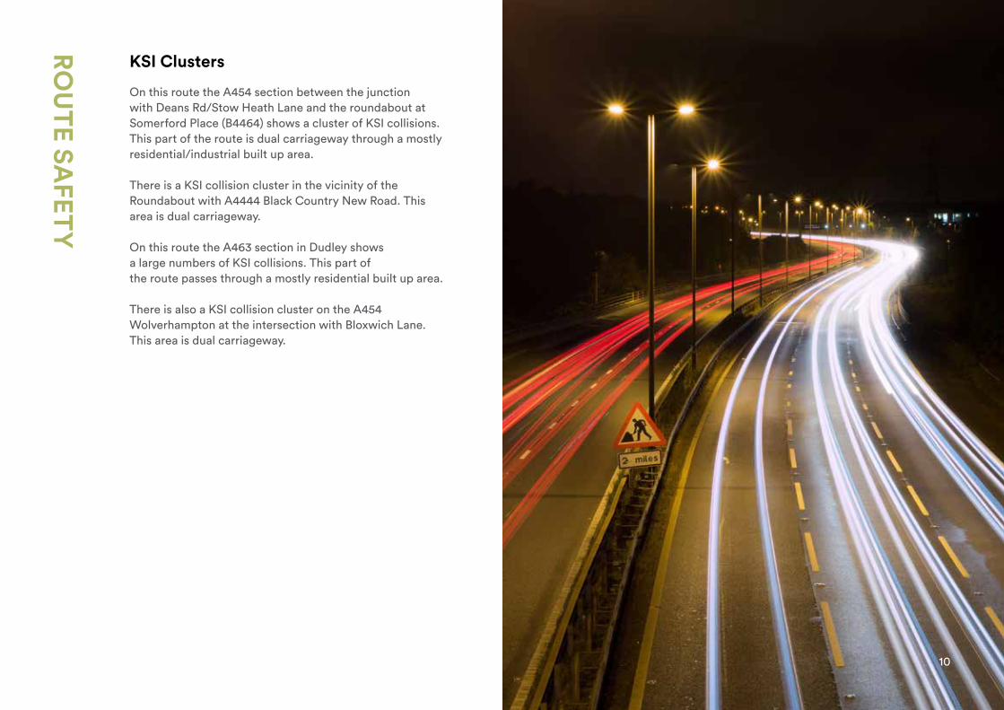
KSI Clusters
On this route the A454 section between the junction with Deans Rd/Stow Heath Lane and the roundabout at Somerford Place (B4464) shows a cluster of KSI collisions. This part of the route is dual carriageway through a mostly residential/industrial built up area.
There is a KSI collision cluster in the vicinity of the Roundabout with A4444 Black Country New Road. This area is dual carriageway.
On this route the A463 section in Dudley shows a large numbers of KSI collisions. This part of the route passes through a mostly residential built up area.
There is also a KSI collision cluster on the A454 Wolverhampton at the intersection with Bloxwich Lane. This area is dual carriageway.
10

CYC
LING
On the approach to M6 Junction 10 along the A454, there is limited provision for cyclists and the road is 40mph dual carriageway. The junction itself at the motorway (Junction 10) also poses severance for active travel. There is a shared use bus lane along Wolverhampton Road on approach to Pleck Road junction (A4148). The dual carriageways on the route has no provision for cycling (A4444/A454/A463 – Black Country Route). There is a small section of shared use pathway along the A4444 between the Lunt Junction and Moxley Junction. The Keyway Junction also poses a challenge for active travel. The canal towpath network through Darlaston provides access to the town centre via an off road option. There is limited provision within the Dudley section of the route.
From the Portobello Island through to the west of Deans Road there is a 40mph dual carriageway with limited opportunity for shared use footways due to the current condition. From Deans Road to Wolverhampton Ring Road, the route is a single carriageway with high traffic volumes.
The railway bridge at Lower Horseley Fields Road poses a challenge for cyclists on the route.
11

PUBLIC
TR
AN
SPOR
T
The built up residential sections of the A454 are well served by route 529 buses which provide a high frequency service giving access to Wolverhampton City Centre and Walsall Town Centre. The other sections of the route are less well served as can be seen in Table 3:
The average bus speed along this route is 9.5mph (data taken from the 529 bus route).
The average total number of daily bus trips is 9,782 (route 529 included in this total only).
There are bus lanes on the section between Wolverhampton Ring Road and Deans Road and inbound between the M6 Junction 10 and Walsall Ring Road.
The corridor is paralleled by Core Bus Network corridors in the West Midlands Strategic Transport Plan - Movement for Growth. At present there are no plans to extend the proposed Sprint Rapid Transit to serve this route.
Table 3: Main Bus Routes
Road(s) Served Frequency Route No.
A463 Bilston – Willenhall Every 60 mins 57
A463 Woodcross – Bilston Every 60 mins 223
A454 Wolverhampton – Portobello & M6 Jct. 10 – Walsall Every 8 mins 529
A454 Wolverhampton - Portobello Every 20 mins 545
*Note- All daily averages have been obtained by analysing 15 days data (Mon-Fri) during the month of March 2017.
In terms of rail, the A454 section of the route terminates in Wolverhampton and Walsall.In Wolverhampton the route links directly to the railway station and provides easy access to the bus station. The railway station at Wolverhampton also has park and ride facilities. Midland Metro currently terminates at Wolverhampton St. Georges which is within close proximity to the A4150 Wolverhampton Ring Road. In Walsall the route enables access to the town’s railway station situated in the north of the town centre. The route crosses Midland Metro Line 1 in the vicinity of the Bilston Stop and Bus Station.
The West Midlands Strategic Plan - Movement for Growth identifies parallel rail/rapid transit/tram-train service between Walsall and Wolverhampton with new stations at Darlaston and Willenhall and between Stourbridge and Brownhills via Wednesbury and Walsall.
12
FREIG
HT A
ND
LOG
ISTIC
S
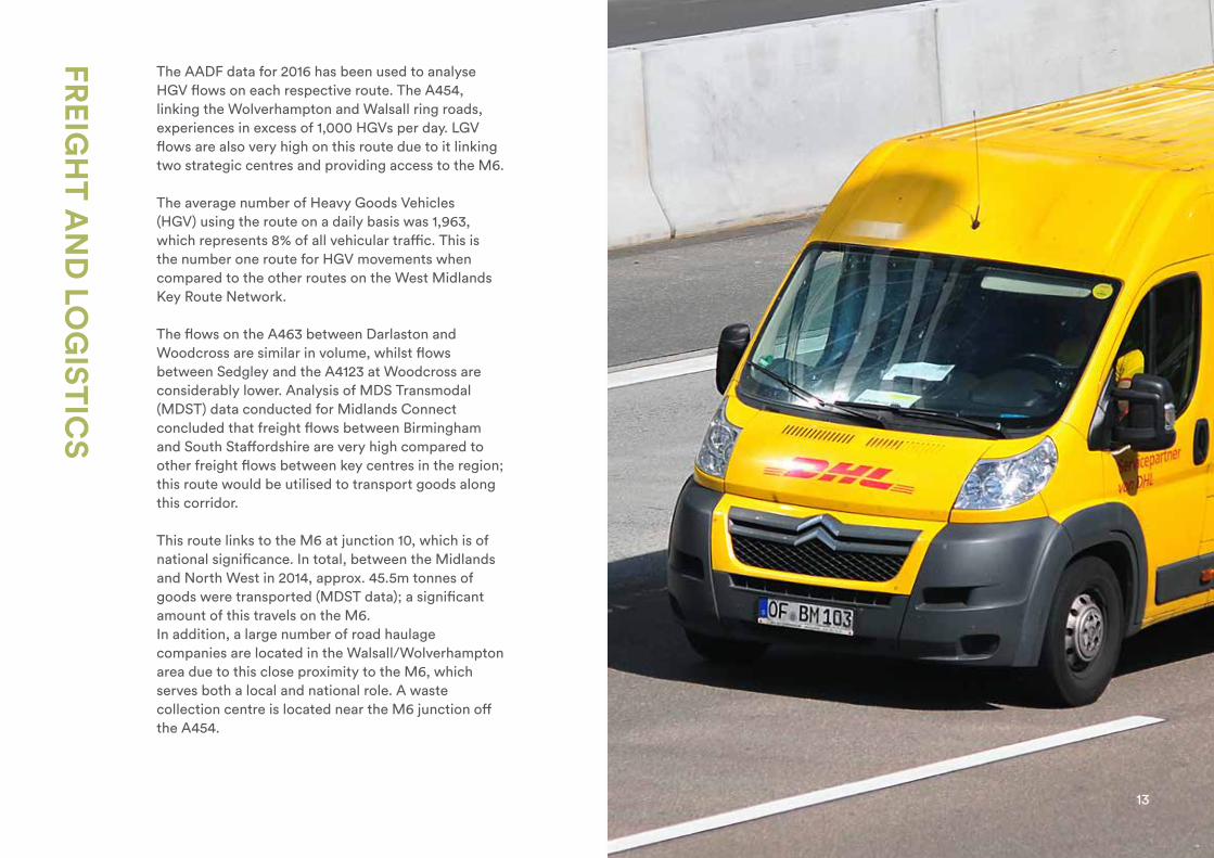
The AADF data for 2016 has been used to analyse HGV flows on each respective route. The A454, linking the Wolverhampton and Walsall ring roads, experiences in excess of 1,000 HGVs per day. LGV flows are also very high on this route due to it linking two strategic centres and providing access to the M6.
The average number of Heavy Goods Vehicles (HGV) using the route on a daily basis was 1,963, which represents 8% of all vehicular traffic. This is the number one route for HGV movements when compared to the other routes on the West Midlands Key Route Network.
The flows on the A463 between Darlaston and Woodcross are similar in volume, whilst flows between Sedgley and the A4123 at Woodcross are considerably lower. Analysis of MDS Transmodal (MDST) data conducted for Midlands Connect concluded that freight flows between Birmingham and South Staffordshire are very high compared to other freight flows between key centres in the region; this route would be utilised to transport goods along this corridor.
This route links to the M6 at junction 10, which is of national significance. In total, between the Midlands and North West in 2014, approx. 45.5m tonnes of goods were transported (MDST data); a significant amount of this travels on the M6.In addition, a large number of road haulage companies are located in the Walsall/Wolverhampton area due to this close proximity to the M6, which serves both a local and national role. A waste collection centre is located near the M6 junction off the A454.
13
NET
WO
RK
RESILIEN
CE A
ND
INT
ERA
CT
ION
S
The route has parallel strategic roads - the A41 and A4038 to the south and A4124 Wednesfield Road to the north. There is some degree of resilience contained within the Black Country network. However, certain critical sections can cause grid-lock, including the motorway network access points. There is a general lack of intermodal network resilience, with a lack of local services and stations between Walsall and Wolverhampton and lack of parking capacity at existing stations.
Given the existing capacity constraints in the peaks in the Black Country network, a restriction on any of the roads will have considerable adverse implications for journey times on the remainder of this route and surrounding routes.
The A454 in Wolverhampton and Walsall is used as an Emergency Diversion Route by Highways England when there are closures or incidents on the Strategic Road Network. In conjunction with the Black Country to Birmingham KRN Route it connects M6 junction 10 to M5 junction 1, avoiding the M5/M6 interchange at Ray Hall. In conjunction with the Lichfield to Wednesbury KRN Route it connects M6 junctions 9 & 10; and in conjunction with the Stourbridge to North of Wolverhampton KRN Route it connects M6 junction10 to M54 junction 2 and onto M6 junctions 11 & 12.
Such usage significantly exacerbates the congestion problems identified above.
Flooding on this route impacts on the overall performance, safety of road users and affects the lives of those living in the vicinity. The evidence gathered indicates that there are some areas on this route that pose a flood risk. These are:
• The section of the route on the A454 Wolverhampton Road between Primley Avenue and M6 Junction 10.
• Along the A454 Black Country Route to the east of where it passes over The Crescent and Willenhall Road.
• The A4444 Black Country New Road between the Lunt Island and Hughes Road.
• A section on the A463 Black Country Route between the A41 Oxford Street Island and Hall Street.
• The westbound section of the A454 Willenhall Road between Portobello Island and the Neachells Lane junction.
Resilience Diversion Route Flooding
14
W O LV E R H A M P TO NWA L S A L L
D U D L E Y
BIRMINGHAM
W E S TB R O M W I C H
S O L I H U L L
C O V E N T RY
W O R C E S T E R S H I R E
WA R W I C K S H I R E
S TA F F O R D S H I R E
L I C H F I E L D
West MidlandsKey Route Network Black Country Route
Roads
Key
KRN 5 – Black Country Route
A454
A463
A41
23
A41
A452
A45
M6 Toll
M6 Toll
M42
M42
M40M
5
M42
M5
M5
M5
M6
M54
M6
M5
M6
M6
M6
M6
A38
A446
W O LV E R H A M P TO N
WA L S A L L
D U D L E Y
BIRMINGHAM
W E S TB R O M W I C H
S O L I H U L L
W O R C E S T E R S H I R E
WA R W I C K S H I R E
S TA F F O R D S H I R E
L I C H F I E L D
F O L E S H I L LM E R I D E N
H A L L G R E E N
M O S E L E Y
YA R D L E Y
S A LT L E Y
E R D I N GTO NP E R RY B A R R
G R E AT B A R R
K I N G S TA N D I N G
S U T TO NC O L D F I E L D
B R O W N H I L L S
W E D N E S B U RY
S E D G L E Y
B I L S TO N
W E D N E S F I E L D
O X L E Y
P E N N
S E L LYOA K
H A R B O R N E
N O RT H F I E L D
S M E T H W I C K
O L D B U RY
B E A R W O O D
WA L S G R AV E
H A L E S O W E NS TO U R B R I D G E
B R I E R L E YH I L L
P E N S N E T T
K I N G S W I N F O R D
Russells HallHospital
C O V E N T RY
BirminghamAirport
Queen Elizabeth Hospital
H
WA L 0 9 – N OT R E P O RT I N G
WA L 1 0 – R E P O RT I N G
W O L 1 4 BN OT R E P O RT I N GW O L 1 5 AN OT R E P O RT I N G
W O L 3 A – N OT R E P O RT I N G
W O L 4 B – N OT R E P O RT I N G
W O L 3 BN OT R E P O RT I N G
W O L 4N OT R E P O RT I N G
W O L 7 AN OT R E P O RT I N GW O L 9 B 1 N OT R E P O RT I N G
W O L 4 A – R E P O RT I N GW O L 5 B – R E P O RT I N G
23 1
10a
4a 3a
10
11
9
78
16 5
7a
7
9
T3
3
2
6
5
4
3
4
2 3
23 1
10a
11a
4a 3a
10
11
12
9
78
16 5
7a
7 3a4
9
T3
3
2
6
5
4
2
3
4
21 3
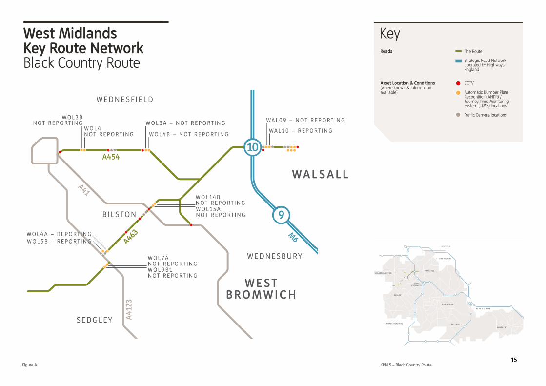
Asset Location & Conditions(where known & information available)
The Route
Strategic Road Network operated by Highways England
CCTV
Automatic Number Plate Recognition (ANPR) / Journey Time Monitoring System (JTMS) locations
Traffi c Camera locations
Figure 415

PUBLIC
HEA
LTH
AN
D EN
VIR
ON
MEN
T
There are inequalities in health between the local authorities within the West Midlands – at local authority level the lowest healthy life expectancy at birth for men is 56.4 years, and the highest is 63.8 years. Amongst women the lowest is 59 years and highest 67.9 years. Similarly there are inequalities in healthy life expectancies within each local authority. Closing this gap in health inequalities and increasing the healthy life expectancy by 2030 is an objective of the WMCA’s Strategic Economic Plan.
The section of the Black Country Route between the A463 and A41 has some of the lowest heathy life expectancies within the WMCA, lower than the UK average of 83. Although this area does not have a high proportion of residents over the age of 65, a large proportion of people report limited day to day activities; in addition households around the junction are less likely to have an adult in work.
The route falls within the Walsall and Dudley Air Quality Management Areas (AQMA) declared for Nitrogen Oxide (NO2), as well as Wolverhampton AQMA, declared for (NO2) and Particulate Matter (PM10).
The West Midlands has significant air quality problems. Every year there are between 2,000 and 2,400 deaths caused by air pollution. This is a huge health issue for people in the region, increasing the risk of lung disease and heart disease. There are parts of our region where considerable action such as the introduction of Clean Air Zones (CAZs) is required by Government to improve air quality.
16

ASSET C
ON
DIT
ION
Across the West Midlands the local authorities have a statutory duty to maintain its highway network in a safe condition. This also includes carrying out routine maintenance of highway assets which could include up to 12 specific groups. An Asset Management Plan is produced which aims to ensure that any future issues with the assets could be address in a proactive way.
Carriageway Condition
The condition of the carriageway across this route is generally in a good and safe condition. Over the past few years there has been a programme of planned capital maintenance carried out at various sites along this route including the A454 and A463.
Footway Condition
The footway condition across this route is mixed with some sections in a good and safe condition and others rated fair to poor.
Structures
There are identified 22 highway structures consisting of 7 bridges, 4 culverts, 3 subways and 8 retaining walls on the Black Country Route, which are systematically inspected and maintained. The overall condition of these structures is in a good to very good.
Further details on asset condition can be found in the Technical Annex.
17

REG
ION
AL C
ON
SIDER
AT
ION
S
Development proposals directly affecting this route
Housing
• Horseley Fields/Qualcast Road 400 dwellings (2017-25)• Bilston Urban Village 478 dwellings (2017-25)• Darkhouse lane 250 dwellings (2025-30)
Employment
• Willenhall Sewerage Works 1400 jobs (2025-30)• Keyway Retail Park 700 jobs (2025-30)
Development proposals indirectly affecting this route
Housing
• Heath Town Estate 225 dwellings (2017-25)
Employment
• Darlaston Enterprise Zone 7800 jobs (2017-25)• Former Moxley Tip 1500 jobs (2017-30)• Dale Street/Citadel Junction 650 jobs (2017-20)
Committed Transport Improvements (as outlined in Movement for Growth - 2026 Delivery Plan for Transport)
• Walsall to Wolverhampton Local enhancements (new stations at Willenhall and Darlaston)• Pinfold Bridge, Wednesfield Road, Wolverhampton• M5-J10
18
GLO
SSARY
AADF – Annual average daily flow
AQMA – Air Quality Management Areas
DfT – Department for Transport
EDR – Emergency Diversion Route
HGV – Heavy Goods Vehicles
HLE – Healthy life expectancy
HS2 – High Speed Rail Two
JTMS – Journey Time Measurement Systems
KRN – Key Route Network
KSI – Killed or seriously injured
LE – Life expectancy
LEP – Local Enterprise Partnership
LSOA – Lower Layer Super Output Areas
MDST – MDS Transmodal
MSOA – Middle Layer Super Output Areas
PIA – Personal injury accidents
SRN – Strategic Road Network
STDEP – Sustainable Transport Delivery Excellence Programme
TfWM – Transport for the West Midlands
TCG – Tactical Co-ordination Group
UKTI – UK Trade and Investment
UTMC – Urban Traffic Management Control
VMS – Variable Message Sign
WM – West Midlands
WMCA – West Midlands Combined Authority
19

REFER
ENC
ES
AADF Data:AADF counts for A roads on each route: https://bit.ly/2fbapuc
Route Safety:Reported casualty and accident rates by urban and rural roads, road class, road user type, severity and pedestrian involvement, Great Britain, 2015.
Committed Schemes: West Midlands Combined Authority. Movement for Growth: The West Midlands Strategic Transport plan.
West Midlands Strategic Cycle
Network:West Midlands Combined Authority Board Report, 20 January 2017, item 4.3 - Strategic Cycle Networkhttps://bit.ly/2hrrCAi
Freight Information:MDS Transmodal Data. Provided in Confidence for Midlands Connect Freight Study.
Enterprise Zones:https://bit.ly/2uZLDTe https://bit.ly/2u7DCN1
Road Haulage Companies: UK Trade & Investment Road Haulage Industry, Midlands Hauliers. Provided in Confidence for Midlands Connect Freight Study.
National Cycle Routes, Sustrans:https://bit.ly/18FFBsT
HS2 Connectivity Package:HS2 Growth Strategy, Connectivity Programme. GBSLEP. https://bit.ly/2woBqxp
Average Speeds and Congestion Data:West Midlands Strategic Highways Phase 2: Key Route Network Definition and Outline Performance. Produced by Mott Macdonald for West Midlands Integrated Transport Authority. March 2016.
Route Safety:Department for Transport. Reported Road Casualties Great Britain, annual report: 2015.https://bit.ly/2hrcIdb
Air Quality Management Areas:Department for Environment, Food and Rural Affairs, March 2017 AQMA Dataset.https://bit.ly/2fEdulf
Male and Female Healthy Life
Expectancy:Office for National Statistics. Life Expectancy (LE) and Healthy Life Expectancy (HLE) at birth for males by Middle Layer Super Output Areas (MSOAs) in England, 2009 to 2013. Published 2015. https://bit.ly/2vwtxd1
Childhood obesity:Public Health England. National Child Measurement Programme data from 2012/13 to 2014/15, aggregated by MSOA. Published 2016https://bit.ly/2p3ocVV
Younger population:ONS: 2011 Census aggregate data. Population aged 0-17, as a percentage of total population by LSOA.
Older population:ONS: 2011 Census aggregate data. Population aged 65+, as a percentage of total population by LSOA.
Living with a disability:ONS: 2011 Census aggregate data. Households with at least one person living with a disability, as a percentage of all households by LSOA.
Unemployment:ONS: 2011 Census aggregate data. No adults in employment in household, as a percentage of all households by LSOA.
West Midlands Cycling Charter:https://bit.ly/2xbg4oK
20