Weddell - PLan, The Planning Action Network Inc · Introduction Weddell is to be a new city planned...
32
Weddell Design Forum A Summary of the Outcomes of a Workshop to explore Issues + Options for the future City of Weddell 27 September - 1 October 2010 Darwin Convention Centre, Darwin A report to the Northern Territory Government from the consultant leaders of the Weddell Design Forum NOVEMBER 2010 Tropical, Sustainable, Liveable
Transcript of Weddell - PLan, The Planning Action Network Inc · Introduction Weddell is to be a new city planned...

Weddell Design ForumA Summary of the Outcomes of a Workshop to explore Issues + Options for the future City of Weddell27 September - 1 October 2010 Darwin Convention Centre, Darwin
A report to the Northern Territory Government from the consultant leaders of the Weddell Design Forum
NOVEMBER 2010 Tro
pic
al, S
ust
ain
able
, Liv
eab
le

i.
ForewordBy 2018, Palmerston will be at capacity, vacant blocks around Darwin will be developed. Darwin is one of the fastest growing cities in Australia. While much of this growth will be absorbed by in-fill development in Darwin’s existing suburbs and new Palmerston suburbs, we have to start planning now for the future growth of the Territory.
Our children and grandchildren will want to live in houses that are in-tune with our environment. They will want to live in a community that connects people with schools, work, shops and recreation facilities that are within walking distance rather than a car ride away.
Achieving this means starting now with good land use planning, setting aside strategic transport corridors and considering the physical and social services that will be needed.
The Weddell Conference and Design Forum gave us a blank canvas on which to paint ideas, consider the picture and recalibrate what we had created.
It was a unique opportunity rarely experienced by our planning professionals and engineers to consider the views of the community, the imagination of our youth and to engage with such a range of experts.
We hope this broad engagement process will lead to innovative master planning and design options for the new tropical, sustainable and liveable city of Weddell so we create a place that people live in by choice, not necessity.
Now that we have generated the debate, considered the constraints, come up with some solutions and challenged each other on what the future looks like, we need to develop a realistic and practical roadmap to Weddell.
Considering the Outcomes of the Weddell Design Forum is the first step in this process. I thank everyone who has contributed so far and look forward to the broad, honest and valued input of Territorians from all walks of life to our planning for the future city of Weddell.
David RitchieChief ExecutiveDepartment of Lands and Planning, Northern Territory
ContentsIntroduction 1
The Site + Growth Context 2
Community Input 4
Special Interest Groups 5
Key Issues for Weddell 6
Scenarios 9
Design Outcomes 10
Traffic + Streets 26
Indicative Development Costs 27
Conclusions + Recommendations 28
Weddell Design Team 30
Disclaimer
This Report provides a summary of the Weddell Design Forum process and outcomes. It is not comprehensive and does not fully document the wide range of discussions and investigations that contributed to the Outcomes. Both the Design Outcomes and this Report were prepared in good faith, based upon preliminary studies and provisional data on development costs and demand. As such, the information contained in this document should not be relied upon for any other purpose.
November 2010
This report was prepared by Wendy Morris (Ecologically Sustainable Design Pty Ltd) and Stephen Bowers (Novus Urban Pty Ltd), lead consultants to the Northern Territory Government for the Weddell Design Forum. Additional input was provided by other members of the Weddell Design Forum team. Graphic design and document production by Deicke Richards.
Published by the Northern Territory Government
Further information on Weddell can be found on the dedicated website www.growingnt.nt.gov.au

1.
IntroductionWeddell is to be a new city planned as the next major increment of growth for the Darwin Region. It is south of Palmerston, and is bounded by the Elizabeth and Blackmore Rivers, the Middle Arm Peninsula and the Stuart Highway. It has capacity for 50,000 people, as well as significant capacity for employment uses, community uses, parkland and recreation.
The vision for Weddell is for it to be a leading edge tropical, sustainable and liveable City, demonstrating innovative approaches to sustainable transport, jobs self-sufficiency, environmental management and mixed use development.
The Weddell Conference and Design Forum was a week-long initiative, hosted by the Northern Territory Department of Lands and Planning, to engage with the public to explore future options for the development of Weddell, and to provide a framework for the next stages of work relating to the planning of Weddell.
This event provided a wonderful opportunity for both the general and professional community of Darwin to participate, alongside internationally-renowned urban design leaders, to test a range of scenarios for the future form and extent of growth for Weddell.
Around 400 people attended the Weddell Conference and selected sessions of the Weddell Design Forum, of which around 50 members of the Darwin professional community (Government, private and non-profit) participated fully for three days in the Design Forum.
At present, the Weddell site comprises largely native forest in Government ownership and a smaller area of privately owned rural land. Over the past year, technical studies relating to Weddell have been initiated, and are at various stages of completion. These studies provided very valuable input to the Design Forum.
Over the week, eight different design teams produced designs in response to eight different scenarios. Input to the designs was also obtained from community ideas and the input of specialist groups who were consulted during the Forum.
This brochure has been prepared to firstly document the Forum Outcomes, and secondly to provide a basis for further community discussion on the range of issues and options for the future development of Weddell.
Weddell Design Forum ObjectivesThe Weddell Design Forum had the following objectives:
Explore, through place-based design, how Weddell may be -developed as a leading tropical, sustainable and liveable city for around 50,000 people
Explore how Weddell may optimise its role in the context of -predicted growth both across the Greater Darwin Region, and in relationship to the adjoining Middle Arm Industrial Precinct
Produce a range of design concept plans for Weddell, -illustrating the design implications of the different approaches that can be taken to key parameters (such as biting insects, water interface, urban density and mixed use, jobs self-sufficiency and sustainable transport, innovative service provision and environmental management)
Provide a range of design concept plans for Weddell to -stimulate professional and community debate and discussion on the choices and trade-offs
Test the adequacy of existing technical information, and inform -the ongoing Weddell technical and feasibility studies through revealing information requirements and providing hypothetical urban structures for evaluation
Inform the location options for major infrastructure, about -which decisions may be required in the short term
Reveal the potential implications and impacts on current -growth strategies for surrounding areas (including Palmerston and its new south east suburbs, Noonamah, Berry Springs and Coolalinga) arising from the development of Weddell
Identify implications for the structure of long term urban -growth around the Darwin Harbour
Inform the scope and approach to the proposed Weddell -Design Competition.

2.
The Weddell Urban Growth AreaWeddell is around 40km from central Darwin, and 19km south of Palmerston. It is around 12-18km west of the extensive rural residential population of Litchfield Shire focussed around Coolalinga, Humpty Doo and Howard Springs.
The Weddell site is around 6,000 hectares in area. Around 3,000-4,000ha is potentially suited to urban development. The site is bisected by the Adelaide to Darwin rail line. Land generally to the west of the line is unsuited to residential development but may provide some areas for industrial development and infrastructure.
The site is currently served by two unsealed roads – Jenkins Road, which links the Stuart Highway to the Channel Island Road and Elizabeth River bridge, and Finn Road, which runs south from Jenkins Road to Berry Springs. Around half of the site drains north to the Elizabeth River, and the other half drains southwest to the Blackmore River. Jenkins Road runs generally along the ridgeline.
The site is largely undeveloped, with the western two thirds being public land covered with savannah woodland, and the eastern third being private land, with some low intensity farming uses and a privately owned airfield.
Site ConstraintsPrior to the Design Forum, detailed site constraints information was compiled into a composite Constraints Map, shown opposite. The key constraints include flood-prone land and waterlogged soils, biting insect impact areas, archaeological heritage sites, conservation-zoned land, existing and future major infrastructure corridors, and assets such as the MKT airfield. Additional constraints are still being identified relating to areas of environmental protection and cultural heritage.
The Design Teams used the composite Constraints Map, shown opposite, as a base plan to inform their designing. Not all constraints represent a complete prohibition to development, but rather they indicate that the issues need to be addressed.
Indicative Residential Development RatesA range of indicative growth rate forecasts for Weddell have been prepared to the year 2021, assuming development commences around 2014. These estimates indicate that the size of Weddell in 2021 could range from around a high of 4,160 dwellings (10,500 population) to a low of 1,270 dwellings (3,200 population). In part, this depends on whether Darwin’s growth is focussed towards completing Palmerston East first, or whether Palmerston East and Weddell grow concurrently.
Growth estimates from 2021 onwards range from an additional 950 dwellings per annum under a high growth scenario to 530 dwellings per annum under a low growth scenario.
Under a high growth scenario, Weddell could reach a population of 40,000-50,000 in 25 years (2035). By contrast, under a low growth scenario, it may only be around 20,000-25,000 people by 2035. This wide range in potential growth rates and size forecasts for Weddell presents significant challenges for its design and financing, and highlights the need to provide a highly robust and adaptable urban structure for the future city.
The Site + Growth Context
Weddell Locality Plan
Elizabeth River, upstream of bridge
Looking east along Jenkins Road from the Finn Road junction

3.
The Weddell composite Constraints Map showing contours, roads and major constraints affecting the site.The three bands of yellow, orange and red depict the three biting insect constraint zones based on different degrees of intervention to reduce the biting insect impacts.

4.
Community InputThe Weddell Conference and Design Forum sought to achieve high levels of community input and engagement in the process. Community awareness was raised through:
A dedicated Weddell website— -www.growingnt.nt.gov.au
Outreach to key community stakeholders, interest groups and -professional groups
Extensive print and television advertising. -
Community input and participation was sought through:
Pre Conference + Forum“Have Your Say” feedback from the website -
Comment Sheets from Community Forums -
Weddell Ideas Competition -
Outreach to key community stakeholders, special interest -groups and professional groups.
During Conference + Design ForumPublic Attendance at the Conference -
Facilitated Group Discussion on a range of questions at the -Conference
Special Interest Group Consultation -
Attendance by invitation at the Design Forum -
Public attendance at two Design Review Sessions during the -Design Forum
Public attendance at Presentation of Design Forum Outcomes -
Post Conference + Design ForumPublic attendance at November forum to present this Weddell -Design Forum Outcomes Summary Booklet
General distribution of this Weddell Design Forum Outcomes -Booklet in hard and soft copy
Weddell website – ‘Have Your Say’ and ‘See What Others -Have Said’ and continued access to resources and records of Conference and Design Forum
During the Conference and Design Forum over 400 people participated. Those who participated came from a broad cross section of the Northern Territory community and included elected representatives from Territory and Local Government, government
departments and agencies, non-government organisations, land owners, residents, designers, architects, planners, engineers, surveyors and members of the local community. There was limited engagement with indigenous representative groups and further culturally appropriate engagement is necessary.
Ideas CompetitionAs part of the community engagement process, an Ideas Competition was held prior to the Conference and Design Forum. School students and community members were invited to conceive and design their vision of what a future City of Weddell could be. The short-listed entries were on prominent display during the Conference and Design Forum. The winning entries were presented during the Conference. Details of the entries are on the Weddell website.
Small Group ConsultationAt the conclusion of the first day of the Conference, the attendees were asked to break into groups of 6–8 with a facilitator to ask a selection of the following questions:
What types of parks and public open spaces should be -provided in Weddell?
How can we reduce car dependence in Weddell and how can -we support walking, cycling and public transport use?
How can we increase housing density and diversity whilst also -creating a city with a strong tropical urban character?
What are the key features of a liveable, attractive, vibrant town -centre for Weddell?
How can we improve housing affordability in Weddell? Is the -price of housing the only issue or should we be concerned about the costs of living in Weddell as part of affordability?
How can we generate sufficient jobs in Weddell and Middle -Arm? What sort of jobs should they be?
How can we make Weddell a water or river-focussed city, -given the constraints of biting insects, mangroves, flooding and storm surge?
What are the most important aspects of sustainability that -Weddell should demonstrate?
Should new housing differ from that in recent estates such as -Lyons, Rosebery, Gunn, Bellamack etc? If so, how? And how can it be more affordable?
5.
Special Interest GroupsDuring the Design Forum, the team conducted consultations with several groups having a special interest in Weddell. The groups consulted, and some of the issues raised, are summarised below. This does not represent a comprehensive list of all groups having an interest in Weddell. A number of other key groups were represented through involvement of members in the Design Teams.
MKT AirfieldDuring a comment session within the conference, a community group representing the interests of the MKT airfield made strong representations in regard to the airfield’s current use and the need to consider this existing use when planning Weddell.
A stakeholders’ consultation was conducted and information relating to the airfield’s use operation and history was received from the airfield owners and users.
Several design teams were briefed to consider the potential continuation of this use and its impact on design.
Local GovernmentElected representatives as well as senior staff from Darwin City Council, Palmerston City Council and Litchfield Council attended a consultation session during the Forum. Key issues identified were:
Governance model for a future Weddell - An extension of -Palmerston, part of Litchfield or a new local authority?
Timing of services and social infrastructure - Not to burden -existing services in Palmerston
Weddell as part of Greater Darwin needs the support of better -public transport in the wider region.
Social InclusionDuring the Forum a consultation session was held with key stakeholder groups involved in providing social services to the community. These included the Northern Territory Council of Social Services, the Council of Churches, the NT Shelter and Council of the Aging.
The process sought to identify previous and current social issues of greenfield suburban development and ways to address these issues at Weddell. Ideas developed were extensive and may be found in detail on the Weddell website.
Key inputs:
Provide multipurpose community facilities -
Social Services to be provided earlier rather than later -
Cater for a diverse population -
Good urban design to create a sense of community. -
YouthDuring the Forum a consultation session was held with invited youth representatives from an array of existing groups such as the Youth Round Table, Young Professionals and Social Youth Outreach. A wide range of proposals were developed for consideration and are listed on the Weddell website.
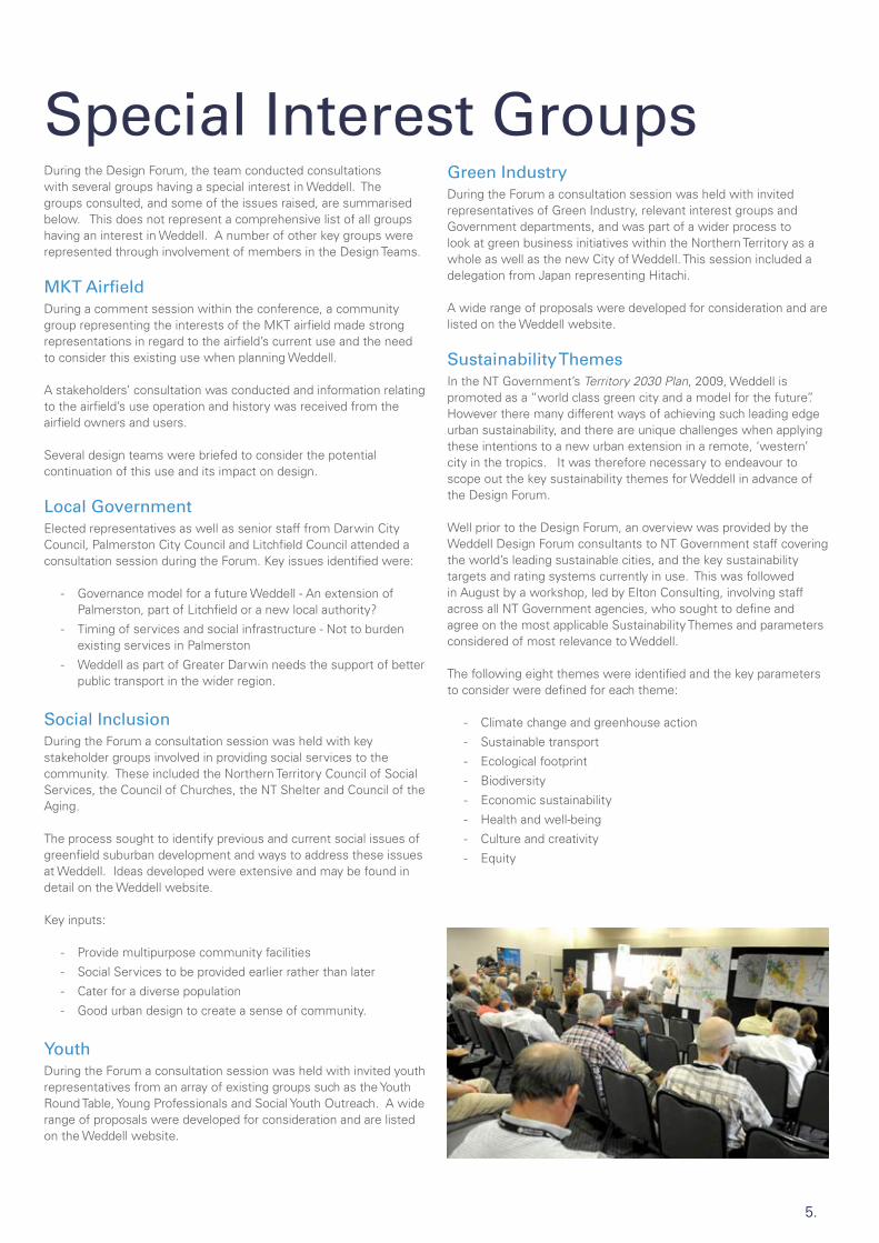
Green IndustryDuring the Forum a consultation session was held with invited representatives of Green Industry, relevant interest groups and Government departments, and was part of a wider process to look at green business initiatives within the Northern Territory as a whole as well as the new City of Weddell. This session included a delegation from Japan representing Hitachi.
A wide range of proposals were developed for consideration and are listed on the Weddell website.
Sustainability ThemesIn the NT Government’s Territory 2030 Plan, 2009, Weddell is promoted as a “world class green city and a model for the future”. However there many different ways of achieving such leading edge urban sustainability, and there are unique challenges when applying these intentions to a new urban extension in a remote, ‘western’ city in the tropics. It was therefore necessary to endeavour to scope out the key sustainability themes for Weddell in advance of the Design Forum.
Well prior to the Design Forum, an overview was provided by the Weddell Design Forum consultants to NT Government staff covering the world’s leading sustainable cities, and the key sustainability targets and rating systems currently in use. This was followed in August by a workshop, led by Elton Consulting, involving staff across all NT Government agencies, who sought to define and agree on the most applicable Sustainability Themes and parameters considered of most relevance to Weddell.
The following eight themes were identified and the key parameters to consider were defined for each theme:
Climate change and greenhouse action -
Sustainable transport -
Ecological footprint -
Biodiversity -
Economic sustainability -
Health and well-being -
Culture and creativity -
Equity -

6.
Key Issues for WeddellThe design of the new City of Weddell as a leading edge sustainable city (or indeed even just as a conventional urban expansion) confronts many challenging issues. Some, but by no means all, of the key issues identified for the Design Team prior to the Forum included the following:
What + When?Should Weddell start soon and grow slowly? Or should its start be delayed until a relatively high rate of growth is assured for the first ten years or so, in order to create a critical mass justifying early provision of facilities such as schools, shops and public transport? What impact will the rate of growth have on infrastructure costs and land prices?
Should Weddell start at all? There is a view held by some that Darwin should consolidate and intensify north of the Elizabeth River, rather than establishing another new greenfield city.
But how much do we know about the capacity for infill? As part of the design for Weddell, the Virginia area north of the River will need to be investigated as part of this question.
How Big?The Weddell site has an indicative urban capacity of over 100,000 people, and including the Virginia area, possibly much higher than that. So should we only plan for a city of 40,000 to 50,000, or should we plan to the long term urban edge?
Where to Start?A key challenge for Weddell is to determine where growth should start. Outside the biting insect constraint? Proximity to Jenkins Road services? Proximity to INPEX? And how can we mitigate the sense of isolation and remoteness associated with early development surrounded by forest, with minimal local services? Should the 3,000-person INPEX workers village, currently proposed for Howard Springs, be built instead in Weddell as an early catalyst?
Jenkins Road - a place to start?
Infrastructure ServicesShould we continue planning for conventional power, water and sewer services? Or, given the target for Weddell is to be a model, leading edge, sustainable city, should we now be testing and costing alternative power sources, water recycling and innovative sewerage treatment.
Street Types + Networks Most recent urban arterial roads and local street patterns in Greater Darwin are designed for a car-dependant lifestyle. If we want Weddell to be very supportive of public transport, walking and cycling, the street pattern, typology and management philosophy needs to change radically.
Street networks will need to be much more interconnected; arterials will not be back-fenced, but will be pedestrian-friendly integrators lined by mixed use development. Traffic lights will be preferred to roundabouts, and bus stops will be located on street patterns that minimise customer walking distance. High quality footpaths and shade trees will complement narrower residential street pavements.
Rokeby Road, Subiaco - a typical pedestrian-friendly main street
Biting Insects Mapping of biting insects has revealed very high counts of midges in the north west and west of Weddell. These require mitigation by various means if urban development is to be able to engage with the Elizabeth River or extend west of Finn Road.
The conventional Darwin solution has been to allow rural residential development as a buffer. However, this use is inconsistent with the vision of Weddell as a leading edge sustainable city.
Other midge mitigation measures include use of industry as a buffer, or low-tide stream barrages (which drown the midge breeding areas), or high walls and possibly other treatments. However, many of the treatments are unproven, and their environmental impact has not been assessed.
7.
Typical vegetation
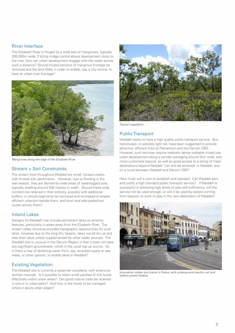
Public TransportWeddell seeks to have a high quality public transport service. Bus transitways, or possibly light rail, have been suggested to provide attractive, efficient links to Palmerston and the Darwin CBD. However, such services require relatively dense walkable mixed use urban development along a corridor averaging around 2km wide, and more customers beyond, as well as good access to a string of major destinations beyond Weddell. Can this be achieved in Weddell, and on a route between Weddell and Darwin CBD?
How much will it cost to establish and operate? Can Weddell earn and justify a high standard public transport service? If Weddell is successful in achieving high levels of jobs self-sufficiency, will the service not be used enough, or will it be used by people coming from beyond, to work or play in the new destination of Weddell?
Innovative rubber tyre trams in Padua, with underground electric rail and battery power backup
River Interface The Elizabeth River is fringed by a wide belt of mangroves, typically 200-300m wide. If biting midge control allows development close to the river, how can urban development engage with the water across such a distance? Should limited sections of mangrove frontage be removed and the land filled, in order to enable, say, a city centre, to have an urban river frontage?
Mangroves along the edge of the Elizabeth River
Stream + Soil ConstraintsThe stream lines throughout Weddell are small, incised creeks, with limited size catchments. However, due to flooding in the wet season, they are flanked by wide areas of waterlogged soils, typically totalling around 200 metres in width. Should these wide corridors be retained in their entirety, possibly with additional buffers, or should segments be narrowed and re-shaped to enable efficient urbanism beside them, and short and safe pedestrian routes across them?
Inland LakesDesigns for Weddell may include permanent lakes as amenity features, particularly in areas away from the Elizabeth River. The stream valley structure provides topographic opportunities for such lakes, however due to the long Dry Season, lakes would dry up and lose their value unless supplemented by other water sources. The Weddell site is unusual in the Darwin Region in that it does not have any significant groundwater, which is the usual top-up source. So is there a way of obtaining water from, say, recycled supply or sea water, or other options, to enable lakes in Weddell?
Existing Vegetation The Weddell site is currently a savannah woodland, with extensive termite mounds. Is it possible to retain small patches of this forest effectively within urban areas? Can good mature trees be retained in lots or in urban parks? And how is the forest to be managed where it abuts urban edges?

8.
JobsA sustainable Weddell will require high numbers of jobs to minimise external travel, road costs and congestion in the Greater Darwin Region. Should jobs be established first, before the residential development? What level of jobs self-sufficiency should be the target – 60%?, 75%? (By comparison, Palmerston is quite low, at 42%).
What sort of jobs should be sought? Industrial development itself does not generate large numbers of jobs; it’s the service businesses that support it, together with knowledge and information economy businesses, or major regional facilities such as hospitals and universities, which generate many of today’s jobs. How can these be catalysed in Weddell?
MKT AirfieldThe MKT airfield is a private light aircraft airfield located in Weddell, just north of Jenkins Road. It is used by a wide range of organisations and individuals, and the main runway is now sealed. Is it possible and beneficial to retain this airfield, without significant impact on the future urban area? If so, can its role be expanded to provide a significant general aviation hub for Weddell and Middle Arm? Are there other sites in or near Weddell that are more suitable for a second airport for Darwin, that can provide a high quality general aviation airport, and which has less impact on future urban land? Working with MKT representatives at the start of the Forum, the constraints on future height and type of development associated with retaining the main runway were estimated, and are illustrated below.
The MKT airfield is 1,200m long. Clearance of 350m, to each end, without buildings, trees or poles, is needed. Then no houses within 1,000m and building height maximum ramped up at 3%. Width of clear zone is based on 150m at centre, fanned out 7.5º to the 1,000m line.
FerryThere has been strong interest in establishing a fast ferry from Weddell to the Darwin CBD. However, where would a ferry terminal be located? Can it operate well up into the Elizabeth River? And if not, will it be remote from the urban development it is trying to serve? Will there be sufficient customer support to justify a frequent service?
Shallow rock ledges prohibit ferry access upstream
Urban AgricultureThere has been very strong interest from the public for Weddell to incorporate community farms and urban agriculture. This would enable local food production as well as retaining some rural character within the new city.
However urban agriculture will require adequate sources of water. As groundwater is not available, other sources will need to be identified, such as urban stormwater capture or recycled water from sewerage treatment. In addition, further investigations are needed to identify areas of appropriate soil types.
3,200m total buffer
1,900m no building zone
350m clearance each end
10m high max.
3%
MKT airstrip, 1200m long
9.
ScenariosApproachThe workshop involved defining eight different growth scenarios to ensure the many different parameters for Weddell’s future could be designed, tested and debated in a realistic, site-responsive manner. Two scenarios focussed around the following four themes:
Prosperous City -
Water City -
Diverse and Affordable City -
Sustainable City. -
In addition to a key theme, each scenario was required to address other parameters including city size and extent, growth rate, starting point, response to biting insect constraints, major form of public transport, development density, jobs self-sufficiency, external connections, retention or otherwise of MKT airfield, etc These parameters broadly covered the likely range of known variables that could influence the future urban structure and extent of Weddell.
On the first and second days, the teams produced preliminary concepts in response to their scenario, and presented these to the wider group for comment and review. On the third day, the focus was on providing more detailed designs for parts of the plans, including indicative street layouts and building layouts for key nodes or housing typologies. Perspective sketches were prepared of some special places. The scenarios were not synthesised into a ‘preferred outcome’; rather they were resolved sufficiently to present a plausible design response emphasising their key parameters.
TeamsThe Design Forum participants were grouped into eight teams. Each team was led by a highly experienced urban designer, bringing skills from across Australia and beyond, and their extensive knowledge of sustainable urbanism at the city-wide scale. Each team contained people with a range of skills, technical expertise and local knowledge who all contributed a huge amount of input to their group. Relevant expertise was matched to the Scenario theme wherever possible.
Order of Scenario DescriptionsThe scenario outcomes are described in the following pages. The smaller and lower density cities are presented first, followed by the larger-scale higher density cities. Scenarios D, E and F focussed on Weddell as a city to grow to around 40,000-50,000 people; Scenario G was somewhat larger; whilst Scenarios A, B, C and H tested a city out to the long term urban edge of Weddell and environs, possibly accommodating over 120,000 people.
Land Use Graphic Colour CodeAll scenario plans use the same colour code, as follows:
Retail Commercial
Medium Density Residential
Conventional Residential
Industrial Urban Parkland
The colour refers to the predominant use at ground floor level; other uses may occur at upper levels, particularly in centres and along mixed use corridors.
Summary of ScenariosScenario A - Mixed Use City (Prosperous City)Innovative jobs and business development driving population growth. Green industry and knowledge economy emphasis / mixed-use vibrancy. Target >60% jobs self-sufficiency. Create high amenity first node /village that becomes a ‘must see’ for international urban designers.
Scenario B - Industrial City (Prosperous City)INPEX-led industrial development focus; major freight rail demand (provide for extensive / truck / rail / port interchange). Test providing major industrial areas as west part of Weddell in lieu of Glyde Point. Generate very high levels of jobs self-sufficiency to reduce external travel demand.
Scenario C - River City (Water City)Optimise interaction with Elizabeth River, controlling midges but minimising loss of mangroves. Accelerate industrial development east of rail to create a midge buffer. Provide higher densities around a light rail spine, servicing a large city with riverfront CBD.
Scenario D - Inland Water City (Water City)Focus urban centres and density towards creeks, inland lakes and valleys with attractive water features. Create improved mixed-use, walkable, diverse urbanism relative to recent suburbs.
Scenario E - Economical City (Diverse & Affordable City)Cost-effective and affordable to Government. Maximise growth on Government land. Minimise unnecessary expenditure on trunk infrastructure but increase expenditure on provision of early community services and facilities, and on urban amenity.
Scenario F - Affordable City (Diverse & Affordable City)Provide more affordable housing, through a wide range of diverse housing products and lower-priced house and land packages. Explore impact of varying lot size and frontage width on cost of lots for single dwellings. Explore costs of varied road reserve and pavement widths.
Scenario G - Environmental City (Sustainable City)Weddell as a “Green City”. Maximise environmental sustainability whilst achieving good urban sustainability including passive solar management. Test potential for creating urban agriculture/community gardens.
Scenario H - Transit City (Sustainable City)Optimise urban sustainability. Create a large, efficient city with denser mixed-use towns and walkable neighbourhoods structured to support efficient bus transit way and possible future light rail to Palmerston and Darwin. Aim for >60% jobs self-sufficiency. Create new Weddell City Centre but maintain strong role for Darwin CBD.
10.
Design Outcomes
Lake, reservoir + stormwater treatment detail
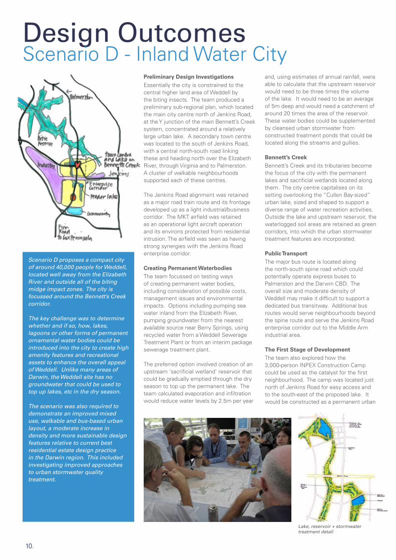
Scenario D - Inland Water CityPreliminary Design Investigations Essentially the city is constrained to the central higher land area of Weddell by the biting insects. The team produced a preliminary sub-regional plan, which located the main city centre north of Jenkins Road, at the Y junction of the main Bennett’s Creek system, concentrated around a relatively large urban lake. A secondary town centre was located to the south of Jenkins Road, with a central north-south road linking these and heading north over the Elizabeth River, through Virginia and to Palmerston. A cluster of walkable neighbourhoods supported each of these centres.
The Jenkins Road alignment was retained as a major road train route and its frontage developed up as a light industrial/business corridor. The MKT airfield was retained as an operational light aircraft operation and its environs protected from residential intrusion. The airfield was seen as having strong synergies with the Jenkins Road enterprise corridor.
Creating Permanent Waterbodies The team focussed on testing ways of creating permanent water bodies, including consideration of possible costs, management issues and environmental impacts. Options including pumping sea water inland from the Elizabeth River, pumping groundwater from the nearest available source near Berry Springs, using recycled water from a Weddell Sewerage Treatment Plant or from an interim package sewerage treatment plant.
The preferred option involved creation of an upstream ‘sacrificial wetland’ reservoir that could be gradually emptied through the dry season to top up the permanent lake. The team calculated evaporation and infiltration would reduce water levels by 2.5m per year
and, using estimates of annual rainfall, were able to calculate that the upstream reservoir would need to be three times the volume of the lake. It would need to be an average of 5m deep and would need a catchment of around 20 times the area of the reservoir. These water bodies could be supplemented by cleansed urban stormwater from constructed treatment ponds that could be located along the streams and gullies.
Bennett’s Creek Bennett’s Creek and its tributaries become the focus of the city with the permanent lakes and sacrificial wetlands located along them. The city centre capitalises on its setting overlooking the “Cullen Bay-sized” urban lake, sized and shaped to support a diverse range of water recreation activities. Outside the lake and upstream reservoir, the waterlogged soil areas are retained as green corridors, into which the urban stormwater treatment features are incorporated.
Public TransportThe major bus route is located along the north-south spine road which could potentially operate express buses to Palmerston and the Darwin CBD. The overall size and moderate density of Weddell may make it difficult to support a dedicated bus transitway. Additional bus routes would serve neighbourhoods beyond the spine route and serve the Jenkins Road enterprise corridor out to the Middle Arm industrial area.
The First Stage of DevelopmentThe team also explored how the 3,000-person INPEX Construction Camp could be used as the catalyst for the first neighbourhood. The camp was located just north of Jenkins Road for easy access and to the south-east of the proposed lake. It would be constructed as a permanent urban
Scenario D proposes a compact city of around 40,000 people for Weddell, located well away from the Elizabeth River and outside all of the biting midge impact zones. The city is focussed around the Bennett’s Creek corridor.
The key challenge was to determine whether and if so, how, lakes, lagoons or other forms of permanent ornamental water bodies could be introduced into the city to create high amenity features and recreational assets to enhance the overall appeal of Weddell. Unlike many areas of Darwin, the Weddell site has no groundwater that could be used to top up lakes, etc in the dry season.
The scenario was also required to demonstrate an improved mixed use, walkable and bus-based urban layout, a moderate increase in density and more sustainable design features relative to current best residential estate design practice in the Darwin region. This included investigating improved approaches to urban stormwater quality treatment.

11.
Land use and urban structure
Stage 1 + town centre detail Artists impression of the lakeside
neighbourhood, rather than as a temporary facility. Finn Road would be sealed early, down to the Cox Peninsula Road to encourage additional traffic to help support Weddell’s early neighbourhoods.
Efficient Development of Land The team concentrated urban development onto Government land and found with efficient layout and a moderate increase in density, around 40,000 people could be accommodated in the unconstrained Government land. At a later stage, the urban area could be extended towards Noonamah.
City AttractorsAs regional teaching hospital was proposed in the city centre combined with an education and research centre focussing on medical, dental and veterinary sciences. This could be supported by a specialist agriculture and veterinary studies secondary college. A regional sporting facility, similar to the Fred’s Pass Complex, is shown at the southern end of the city.
Conclusion This plan provides for a city of similar population to Palmerston but occupying less overall area. Because of the unmitigated biting insect constraints, the city will essentially be a town in a forest. There will be gradual development of industry to the west on and near Middle Arm and the railway.
However, it is likely that substantial areas of woodland would remain for a long time, as the lack of groundwater or other large-scale fresh water supply will limit land use for agriculture. Management of the town’s woodland setting, particularly in relation to fire, will require consideration.
12.
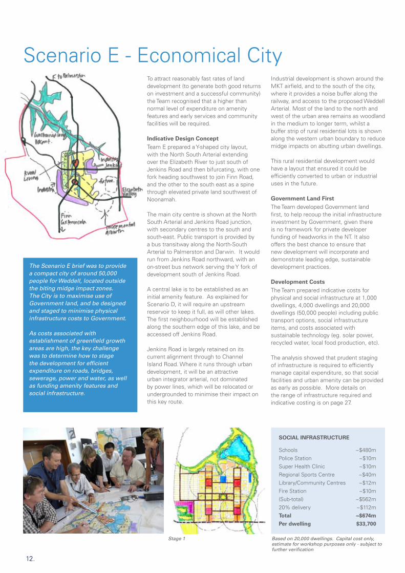
Scenario E - Economical City
Stage 1 Based on 20,000 dwellings. Capital cost only, estimate for workshop purposes only - subject to further verification
To attract reasonably fast rates of land development (to generate both good returns on investment and a successful community) the Team recognised that a higher than normal level of expenditure on amenity features and early services and community facilities will be required.
Indicative Design ConceptTeam E prepared a Y-shaped city layout, with the North South Arterial extending over the Elizabeth River to just south of Jenkins Road and then bifurcating, with one fork heading southwest to join Finn Road, and the other to the south east as a spine through elevated private land southwest of Noonamah.
The main city centre is shown at the North South Arterial and Jenkins Road junction, with secondary centres to the south and south-east. Public transport is provided by a bus transitway along the North-South Arterial to Palmerston and Darwin. It would run from Jenkins Road northward, with an on-street bus network serving the Y fork of development south of Jenkins Road.
A central lake is to be established as an initial amenity feature. As explained for Scenario D, it will require an upstream reservoir to keep it full, as will other lakes. The first neighbourhood will be established along the southern edge of this lake, and be accessed off Jenkins Road.
Jenkins Road is largely retained on its current alignment through to Channel Island Road. Where it runs through urban development, it will be an attractive urban integrator arterial, not dominated by power lines, which will be relocated or undergrounded to minimise their impact on this key route.
Industrial development is shown around the MKT airfield, and to the south of the city, where it provides a noise buffer along the railway, and access to the proposed Weddell Arterial. Most of the land to the north and west of the urban area remains as woodland in the medium to longer term, whilst a buffer strip of rural residential lots is shown along the western urban boundary to reduce midge impacts on abutting urban dwellings.
This rural residential development would have a layout that ensured it could be efficiently converted to urban or industrial uses in the future.
Government Land FirstThe Team developed Government land first, to help recoup the initial infrastructure investment by Government, given there is no framework for private developer funding of headworks in the NT. It also offers the best chance to ensure that new development will incorporate and demonstrate leading edge, sustainable development practices.
Development Costs The Team prepared indicative costs for physical and social infrastructure at 1,000 dwellings, 4,000 dwellings and 20,000 dwellings (50,000 people) including public transport options, social infrastructure items, and costs associated with sustainable technology (eg. solar power, recycled water, local food production, etc).
The analysis showed that prudent staging of infrastructure is required to efficiently manage capital expenditure, so that social facilities and urban amenity can be provided as early as possible. More details on the range of infrastructure required and indicative costing is on page 27.
The Scenario E brief was to provide a compact city of around 50,000 people for Weddell, located outside the biting midge impact zones. The City is to maximise use of Government land, and be designed and staged to minimise physical infrastructure costs to Government.
As costs associated with establishment of greenfield growth areas are high, the key challenge was to determine how to stage the development for efficient expenditure on roads, bridges, sewerage, power and water, as well as funding amenity features and social infrastructure.
SOCIAL INFRASTRUCTURE
Schools ~$480mPolice Station ~$10mSuper Health Clinic ~$10mRegional Sports Centre ~$40mLibrary/Community Centres ~$12mFire Station ~$10m(Sub-total) ~$562m20% delivery ~$112mTotal ~$674m
Per dwelling $33,700

13.
Land use and urban structure
Typical neighbourhood Artists impression of the first phase of development under Scenario E
Growth RatesThe Team considered optimal growth rates for Weddell, and reviewed the impact of planned major expansion of rural living zones nearby on the growth rates and land values in Weddell, as well as competition from land releases in Palmerston’s Eastern Suburbs, which are likely to continue until around 2018.
The Team found there needs to be sufficient market depth for a fast start-up growth rate for Weddell, to pay a return for infrastructure investment and create a viable community.
Conclusion Like Scenario D, this plan provides for a city slightly larger than Palmerston, but on less overall area. Because of the biting insect constraints, the city will essentially be surrounded by forest, remote from the river and harbour. The challenge is to create sufficient amenity and services to generate early sales momentum and attract ‘buyers of choice’ to this pioneering location, at reasonably fast growth rates, which then need to be maintained.
By careful staging of development and maximising use of existing infrastructure, development costs can be moderated; however they remain high, especially for the first 1-4,000 dwellings.
The required fast start-up rate for Weddell will be problematic if there is direct competition from either low cost, minimally-serviced rural residential lots nearby, or from competing urban lots in the Palmerston Eastern Suburbs.

14.
Scenario F - Affordable CityWhilst generally constrained to within the midge-free zone (to save expenditure on biting insect mitigation) the Team sought to encroach closer to the Elizabeth River to improve the public transport customer base along the North South Arterial route, and to justify better road links to Coolalinga. Coolalinga was recognised as the nearest large centre and was seen as very important in providing services for the early stages of Weddell.
Affordability InvestigationsThe Team began with a detailed examination of all the factors contributing to housing costs and household affordability. These included aspirational, purchasing, living and public cost affordability. They scoped out the key ways of addressing each of these factors.
Testing Heavy RailThe Team established that the existing single freight train line cannot share with passenger trains because of scheduling conflicts, risk of delays, and threat to the freight rail economics and viability. If the track was required for passenger rail, a second track would be required, but this would still provide a less than ideal shared service.
More importantly, the rail line does not pass through Palmerston, nor through the future Weddell urban area (because of biting midge constraints and other factors), nor does it serve many major destinations in Greater Darwin. Thus the Team concluded it would be better to establish public transport on a route that would run through the new urban area, using a mode such as bus or light rail that was more easily integrated into a walkable urban fabric.
Indicative tropical house Duplex typology
Scenario F focussed on how to optimise Weddell for affordable housing provision, in the context of providing much greater diversity of housing types and improved environmental performance of both the dwellings and the overall urban area.
The Team was also tasked with testing whether the existing freight rail line could be used to provide a passenger rail service to Darwin CBD. If not, a modest cost and efficient suburban bus network was to be provided.
Housing TypologiesThe Team produced a wide range of housing typologies to address the key design challenges of affordability, housing choice and sustainable design. Street and lot layout principles were established to complement these typologies, including neighbourhood layouts to provide a good choice of conventional housing as well as smaller lots and other higher density housing.
Indicative Design ConceptThe Team F Weddell City concept urbanises land generally east of the Finn Road alignment, across to and including a key node at Noonamah. Urban development also extends northward to abut the Elizabeth River, requiring some mitigation of the midge biting zone. The main CBD is located east of Bennett’s Creek, with a diverted Jenkins Road alignment providing the main spine arterial before it heads west to the Middle Arm industrial area. The MKT airfield was retained, and surrounding areas identified for industrial development.
An additional new upstream Elizabeth River bridge helps catalyse a rationalised road link from Jenkins Road north to Coolalinga.
The team explored a different town and neighbourhood structure to the other Teams. In essence, its layout is based on a 1.6km arterial street grid located on ridgelines, with towns and neighbourhood centres, bus routes, and denser mixed use development along this network. Lower intensity uses such as parks, schools, power easements and green corridors are then concentrated into the valleys at centre of the grid, and fringed with lower density housing.
The street orientation was strongly controlled to an east/west and north/south alignment, to facilitate house siting

15.
Land use and urban structure
Neighbourhood structure based on a one-mile grid
City Centre Park with 3-4 storey mixed-use buildings
optimised for solar protection and breeze capture in the Top End.
In the northwest of the site, the Team provided a large regional park, embracing the Elizabeth Riverfront and two key mangrove-fringed inlets. Provided water could be sourced, urban agriculture and community farms could be established within this park. Other land to the west, within the midge zone, could be retained for either industrial or longer term urban expansion (in conjunction with midge mitigation).
Conclusion Scenario F explored the diversity of factors influencing housing affordability and then tested a more frugal urban structure, with fewer walkable neighbourhood centres and bus routes, to help reduce overall development costs.
It also expanded the scale of the city to around 70,000 to 80,000 people to help reduce overall infrastructure costs, and to make good use of all of the relatively unconstrained land east of the biting insect constraint line.
The method of biting insect mitigation to enable urban development around the upper Elizabeth River as shown, was not resolved. A tidal management barrage in the river, as explained later for Scenario C, may be required.
3 bed apartment typology

16.
Scenario G - Environmental City
L-shaped city form for Weddell Coolalinga transformed into a new town
Environmental Protection PoliciesThere is a well-established policy against construction of a lake on the Elizabeth River. The Team also identified the following Government policies relating to development setbacks from waterways:
200m from mangrove edges -
100m from major stream lines -(applied from the edge of the waterlogged soil areas)
50m and 25m setbacks respectively -for minor streams and gullies.
When these setbacks are applied to the main Bennett’s Creek corridor for example, it results in a corridor of around 200-300m wide. The team debated the pros and cons of such a divisive feature in urbanism, and then proceeded to prepare an urban structure to try to minimise the divisive effect by locating the main urban spines and nodes along the ridgelines.
Indicative Design ConceptThe Team proposed an urban structure around a green corridor public park network based on retaining the Elizabeth River and all stream lines in their natural state, and applying the recommended setbacks. Stormwater cleansing features are incorporated into the greenways to retain high water quality.
Some biting insect mitigation is assumed in breeding areas west of the railway; this enabled urban development towards the west.
The resultant city form is an L-shaped spine running north-south, and then west to link to the Middle Arm Industrial Area and the future Weddell Arterial. Street layout is east-west/north-south to optimise
passive shading and breeze capture for dwellings. Noonamah is retained as rural residential, with all new urban development concentrated towards the north-west, creating a city of around 90-100,000 people. Longer-term urban extensions can occur to the south and south-east, adding around 40,000 people.
Key attractors proposed include a Green Technology Precinct, solar farm, National Indigenous Arts and Cultural Centre, a major recycling centre, community agriculture, botanical gardens and wildlife sanctuaries, and an extensive cycleway network. Extensive forest areas are retained and managed as part of a carbon offset program.
Public TransportThe Team investigated routing the main public transport spine (busway) north then west through Weddell to join the Weddell Arterial route to Darwin CBD.
However, despite concern over the long ‘dead running’ distance through Virginia if no midge mitigation occurred along the Elizabeth River, and the stream setbacks outlined above were applied to its urbanism, the North South Arterial was chosen as the busway route because of its direct link to Palmerston.
Detailed City Centre PrecinctThe Team prepared a detailed layout for the new Weddell CBD, located at the junction of Jenkins Road and the North South Arterial, east of the Bennett’s Creek parkway.
A major hospital provides the southern anchor and overlooks the greenway. The new City of Weddell Civic Precinct is the northern anchor.
Scenario G emphasised Weddell as a ‘green’ city, focussing on applying environmental protection policies and principles whilst also providing sustainable walkable urbanism.
Opportunities for community gardens, local food production and urban agriculture were considered, together with recycling initiatives and alternative transport networks.

17.
Bennett’s Creek as it currently stands with an artists impression of it’s possible futureWeddell city centre on main north-south spine next to Bennett’s Creek greenway
CoolalingaThe Team also explored the potential for additional urban development to occur north of the Elizabeth River, in areas that were both better served by existing services and facilities and better located relative to Greater Darwin than Weddell.
Specifically the Team tested the potential for the growing Coolalinga/Freds Pass retail and community services node to transform into a complete town. They identified a range of areas potentially suited to residential development, including larger sites to the east of Fred’s Pass, and gradual intensification of rural living lots to the west and south.
ConclusionThe ‘Green Sustainability’ team produced an outcome that balanced retention of large natural corridors and forest areas with a relatively efficient urban structure, supporting a strong City Centre well located to serve the longer term urban area. The challenge of justifying a bus transitway via an undeveloped Virginia was identified.
The potentially high costs of establishment and management of the very wide greenways, together with the loss of potential urban land, need to be thoroughly investigated. There would also be benefits in investigating selective narrowing of the stream corridors at key nodes to improve walkable connections across it and community safety for users.
The potential for transformation of Coolalinga into a mixed use town was revealed, and more detailed investigation of its residential potential seems to be warranted.
Land use and urban structure

18.
Scenario B - Industrial City
Inland port
The Team focussed on how to maximise jobs self-sufficiency in Weddell/Middle Arm, through provision of diverse employment opportunities, to increase the City’s overall sustainability and reduce external travel generation.
Industrial Development and JobsOver 1,200 hectares of industrial land is predicted to be required in the Greater Darwin Region by 2025. Whilst West Weddell/Middle Arm has sufficient land to take much of this, it needs major catalysts to help attract extensive new industry. In addition to INPEX and extended freight rail and road train access, the Team investigated an intermodal, container-based ‘Inland Port’, and an expanded general aviation MKT airfield, as key catalysts.
Job generation in industrial areas is low, with Darwin typically supporting only 15 jobs/ha in light industrial areas, and INPEX could be as low as 1-2 jobs/ha. To generate high rates of jobs self-sufficiency for Weddell, targeted by the Team at 75%, it will be vital for the large industrial area itself to catalyse many support business jobs within urban Weddell. For 40,000 people (16,000 dwellings), a total of over 14,000 jobs are needed to achieve 75% jobs self-sufficiency.
Indicative Design ConceptThe Weddell urban area is concentrated into two north-south spines feeding to a large high amenity city centre on the Elizabeth River, and two new bridge crossings. One of these directly connects the North-South Arterial to Finn Road.
Around 500ha of industrial development is proposed for West Weddell along the rail, and more at Middle Arm. The Inland Port is located near the proposed sewerage farm,
with the existing rail line moved westward to provide sufficient length and resolve access issues. The inland port is 2.5km long.
A second industrial area of around 200ha is located along the Stuart Highway at Noonamah, to capitalise on the Stuart Highway access and proximity to existing populations.
Jenkins Road becomes an important east-west business boulevard, connecting the Noonamah, MKT and West Weddell/Middle Arm employment precincts, incorporating two town centres along it. The overall population shown is around 80-100,000, with further urban potential south of the railway. Sufficient business areas are provided to generate around 75% jobs self-sufficiency.
No urban development is shown on the Virginia side of the Elizabeth River, as the Team wanted to concentrate development within a compact self-sufficient Weddell. However, this area should be retained for future urban development, as it has high amenity river proximity and good regional access.
Arterial Road NetworkThe plan shows a highly interconnected grid of arterial and sub-arterial urban streets, all with frontage development, rather than back fences. Provided that the 75% jobs self-sufficiency is achieved, traffic estimates for a population of up to 40,000 show most of the network will be two-lane roads, with limited segments planned for four-lanes after the population passes 40,000. Only the Channel Island Bridge will require duplication in this first phase.
Scenario B focussed on designing a city associated with significant early industrial growth catalysed by INPEX. Industrial development will concentrate onto Middle Arm and along the western edge of Weddell, thus helping to reduce the biting midge constraint, and enabling a larger scale mixed use city, which can have a high amenity interface with the Elizabeth River.
The team also calculated indicative traffic volumes and distribution for an interim population of 40,000, and prepared a suite of more sustainable street types appropriate to Weddell.
Park Edge Street - parks can accommodate services if needed but wide verge is unnecessary
3.4m 1.5mPATH VERGE
5.5mVEHICLES
RESERVATION 12.0m +
1.6m

19.
Artists impression of the inland port with heavy industryPlan showing Middle Arm Industrial + Inland Port
The network will support an on-street bus service providing good access to all the dispersed destinations within and abutting Weddell. Around 10% of all trips are assumed on public transport. The main internal bus routes will be designed to have bus priority features, well-located bus stops and high pedestrian amenity. No bus transitway or light rail is proposed northward from the River, as external travel demand to Palmerston and Darwin CBD will be more limited, and can be handled with on-road bus priority lanes.
More information on the arterial road network, traffic volumes and street types is on page 26.
Further InvestigationsWhilst traffic volumes have been estimated for this Scenario, assuming 40,000 people and 75% jobs self-sufficiency, it is necessary to set up a sustainable transport model for Weddell and the Greater Darwin Region, so that a range of higher population scenarios and different jobs self-sufficiency and public transport mode share can be tested.
It is also important for the Inland Port strategic site to be more fully investigated in the short term, to ensure that its future development is not compromised by the major sewerage farm, water reservoir and roadworks planned for the vicinity.
ConclusionThe Team showed that there is significant capacity, suitable land and good strategic locations for industrial development around Weddell. They also established that in order to generate high levels of jobs for the future Weddell population, the industrial and business development should lead the residential development.
Land use and urban structure

20.
Scenario A - Mixed Use CityEarly InvestigationsTeam A investigated several possible design options to achieve this outcome. First they considered whether to dam the Elizabeth River at its current bridge, to create a large lake with extensive waterfront urban amenity for the adjoining city centre (and eliminate the biting insects). However, the team found that a lake would destroy about 5% of Darwin Harbour’s mangroves, and this was considered too much of an environmental loss. In addition, a lake would create environmental issues for a water body that would be freshwater during the Wet, but topped up with saltwater during the dry. Instead, Team A adopted a low-tide tidal management barrage on the Elizabeth River, upstream of Mitchell Creek, retaining a substantially-intact mangrove edge to the river, and requiring urban amenity to be created away from the riverfront. They also located light industrial development along the Railway, to mitigate the biting insects.
Local Jobs StrategyThis plan indicatively provides for around 60% of total jobs needed locally. Key success factors for achieving this include:
Capturing INPEX-generated support -businesses
A high amenity city centre to attract -knowledge workers with choice
A strategically-planned integrator -arterial network, to facilitate business development
Upgrading the MKT airfield as a major -general aviation hub
Early provision of the INPEX -construction workers accommodation at the key junction of Finn and Jenkins Roads, to inspire early development
First neighbourhood at Jenkins + Finn Road junction which will grow to become the first town centre
Rejected lake scheme
a permanent innovative mixed use neighbourhood
Industrial development flanking the -Railway, with heavy industry west of the Railway and light industry to its east, more compatible with adjoining mixed-use urban development
Mixed-use development and home- -based businesses compatibly integrated throughout Weddell.
INPEX-inspired Business CentreIn anticipation of business spinoffs from INPEX, the design proposes a new business-oriented mixed-use centre along the new east-west link between INPEX and the city centre. The Railway crossing and No Name Road are to be re-aligned slightly to strengthen the movement economy of this centre, located just east of the Railway.
Public TransportThe design proposes a bus transitway corridor, from Palmerston through Zuccoli and Virginia, then passing southwest to cross the River to the city centre. Bus services would extend from the city centre, west to Middle Arm, south to Finn Road and Berry Springs, and east to Noonamah.
City CentreThe proposed City Centre overlooks and capitalises on the tropical amenity of the mangrove-lined Elizabeth River, and locates at the key junction of a westward link to the INPEX/Middle Arm industrial precinct, and a southward link to Finn Road. Locating the city centre this far west puts it closer to INPEX and related early development.
The design proposes two small creek branches be dammed for high amenity lakes, which are to be topped up by saltwater pumped from the Elizabeth River.
Scenario A proposes a large city of over 100,000 people, emphasising innovative mixed use development, with its city centre focusing on the Elizabeth River, in response to major mitigation of the biting insect impacts. The plan was required to deliver over 60% jobs self-sufficiency, or around 0.7 jobs per household.
They were required to strategically locate a hospital and university, consider an airport, and catalyse a strong jobs link to Middle Arm. In addition, they were required to establish the 3,000-person INPEX Workers Village in Weddell as an exemplar design first stage neighbourhood.

21.
Artists impression of the riverwalk - urban amenity in the Town Centre
Detail of INPEX village as core of first neighbourhood
These small scenic and recreational lakes should inspire higher densities fronting them. The design proposes a hospital and university as key anchors within the city centre.
“INPEX Pioneer Village”An innovative ‘INPEX Pioneer Village’ is proposed to catalyse the first stage of development for Weddell, at the intersection of Jenkins, Finn and No Name Roads. Whilst isolated, this site is relatively close to INPEX, and has the advantage of existing road infrastructure, power and water along Jenkins Road. The strategic position of this centre should help it to flourish and become Weddell’s first small town centre.
The design shows a small street-based centre with retail and local services, along with high amenity parks. The workers village might be modelled on the Darwin Airport Resort, a ‘village in a tropical garden’, with housing provided in a diversity of forms - cottages, duplexes, apartments, etc. The Workers Dining Hall and other facilities would front the street, and double as a café/restaurant/pub/corner store for the first neighbourhood. Small businesses could establish along the main streets to provide the many services required by the workers village.
Both Jenkins and Finn Roads would be sealed at an early stage to encourage traffic through the neighbourhood.
ConclusionThis transit-oriented and highly mixed-use jobs-rich design for Weddell capitalises on INPEX, the river, and the existing movement network. It could support a population of about 100,000.
Land use and urban structure

22.
Scenario H - Transit City
City centre detail
The team proposed a maximum treatment of midge breeding areas with a tidal barrage just upstream of the existing Elizabeth River bridge, so that the City can focus development around the River amenity and on infill north of the river, through Virginia and Zuccoli.
Maximise Urban Development along the Light Rail Corridor To optimise urban sustainability and minimise car dependence, the design proposes construction of the light rail from Darwin CBD to Palmerston, then through Virginia to Weddell “from Day One”. Light rail needs dense mixed-use walkable urbanism along its length, to maximise transit riders, and support cyclists and pedestrians, resulting in less car dependence.
Development would commence along this route in the north with new nodes in southern Zuccoli, and then along a relocated North-South Arterial corridor paralleling the River’s north shore, connecting up areas of Government-owned and private undeveloped land from the Mitchell Creek, through Virginia to Gulnare Road. The light rail route then crosses the River and heads through a dense river-fronting township en route to Weddell’s new city centre, before turning southeast to link to a new Noonamah township on the Stuart Highway.
Development density and intensive mixed uses are concentrated within 1km of the light rail corridor, with lower density development beyond, which is served by a bus network concentrated towards the Weddell City Centre. The city, as shown including areas north of the river, has a population of up to 200,000.
City CentreA large north-south oriented city centre straddles the light rail corridor in the centre of the Weddell site. The city centre is the focus of a ‘deformed wheel’ arterial network radiating to the extremities of Weddell and beyond. These links include existing Jenkins and Finn Roads, another new link from the south-west and Cox Peninsula, a new northerly route to the west of Bennett’s Creek, crossing the river to Virginia, and the re-aligned north-south arterial to Gulnare.
Biting Insect Mitigation As this Scenario incorporates extensive early urban development between Palmerston and Weddell, to provide a continuous urban corridor supporting the light rail, early mitigation of biting insects is required. As breeding areas along both the Elizabeth River and its tributaries need to be treated, a low-tide barrage would be constructed just beside the Elizabeth River bridge (see Scenario C for more barrage details). The structure would serve a dual purpose by being designed to support the duplication of the road bridge, in accord with traffic projections.
A linear belt of industrial development is focused along the railway to mitigate midge dispersal from the south-west breeding areas, whilst a large Nature Reserve is located in the north-west of Weddell, just south of the Elizabeth River in the most constrained biting insect area.
Environmental Trade-offs The Elizabeth River Nature Reserve in the northwest is to be a major park as it retains an attractive area of native vegetation; it has extensive riverfront; the country is hilly and is bisected by two attractive mangrove inlets, which contain a significant number of
The Scenario H design proposes a dense, populous, jobs-rich highly sustainable city, inspired by and focusing along a light rail corridor from Darwin CBD via Palmerston and Virginia to Weddell and Noonamah. The Light Rail is to be constructed at the outset, so that Weddell can grow in response to good public transport.
The Scenario is to optimise urban sustainability over environmental protection within the City, and compensate by retention of intact environmental areas beyond the city.

23.
Artists impression of the light rail in the main streetIndicative structure plan
archaeological sites. It is similar in size to the Charles Darwin National Park.
The Team identified that the existing stream corridors were very wide, and in places were divisive to efficient urban development. In response, the plan shows these corridors narrowed, particularly around street crossings, to improve development yield close to the light rail, and to help reduce walking distances and ensure passive surveillance across the parkway.
Energy-efficient House Design The Team also investigated a current concern in Darwin relating to the recently-introduced national Five Star House Energy rating requirements. This rating was seen as not supportive of naturally-ventilated houses. However, it was concluded that it is possible to work within this framework and that a separate Tropical Five Star Rating was not needed.
ConclusionThis design exemplifies urban sustainability using a corridor-based urban structure of dense jobs-rich transit-oriented development, inspired by extensive frontage amenity along both sides of the Elizabeth River and Bennett’s Creek, and made possible by a low tide midge-mitigation barrage at the Elizabeth River bridge.
This design is based on two key parameters: that the light rail is established prior to the urban development; and that the large areas of undeveloped land north of the river around Virginia can be developed as an urban corridor by choosing an alternative route for the North South Arterial. These areas would be developed prior to Weddell, and be staged to follow the light rail construction.
Land use and urban structure

24.
Scenario C - River CityEarly Designing The sub-regional plan located the City Centre overlooking the river, capitalising on a proposed light rail corridor linking north to Palmerston and Darwin, and terminating in the south at a substantial Noonamah township capitalising on the Stuart Highway.
Six relatively self-sufficient, 20,000-person mixed-use townships, support the CBD. The Virginia township north of the river has a proposed hospital, well-located to serve Greater Darwin’s southern population. The MKT airfield is retained and provides an opportunity for a small business centre nearby.
Addressing the RiverCapitalising on the proximity to the river was a key issue given the tidal mangroves support such a profusion of biting insects. The question of how, where and whether a tidal management barrage could be constructed across the Elizabeth River was investigated.
A ‘barrage’ is a constructed tidal management barrier, whose height can allow most tides to flow over it, but which can raise the levels of the lowest tides. Midges are understood to breed on the tidal mud flats at the low-level margins of the mangroves. The theory of this design is, if a barrage were to be constructed that raised the low water level above the midge-breeding area, then we might be able to destroy these areas, and their impact.
This barrage also supports a road bridge which links a secondary north-south corridor of development between the railway and the light rail corridor down the middle of Weddell.
An additional means of reducing midge impacts on Weddell is to develop a band of industrial land between the new city and the other main midge-breeding mangroves west of the railway. This band is generally too wide for midges to cross.
Lastly, the design proposes dams on the two small southern tributaries of the river on either side of the CBD, to form high amenity saltwater urban lakes, similar to the one at Darwin’s Waterfront. These dams will flood midge-breeding areas and involve removal of the mangroves to create an urban water interface. The perspective sketch shows how this lake might appear with the CBD beyond, viewed from the top of the dam wall.
Public TransportA citywide light rail corridor is proposed linking Darwin’s CBD through Palmerston and Weddell, terminating at Noonamah. An efficient local bus network passes through Weddell’s other neighbourhood and town centres to feed the main public transport corridor, where passengers potentially could change to an ‘express light rail’ along the corridor to Darwin’s CBD.
A ferry to link Weddell to the Darwin CBD was investigated. However, it was rejected, as the terminal would need to be at the existing Elizabeth River Bridge because of upstream rock ledges. This is remote from Weddell and users would need car parking or bus transfer. This area is also a severe biting midge zone.
Bennett’s Creek & Wetland ParkwaysWaterlogged soil areas along the stream lines are retained as large green parkways. These run between town centres and should inspire relatively dense urban development along streets fronting them,
Sub-regional plan
The Scenario C design is for a large and compact transit-oriented city of about 140,000 people for Weddell. It is to capitalise on the Elizabeth River and reduce the biting midge impacts by means of tidal management barrages and early industrial development along the railway, while retaining most of the mangroves.
The team were also required to investigate a possible fast ferry service to the Darwin CBD.

25.
narrowed in part to provide good passive surveillance to parkway users.
Efficient Development of LandThe plan proposes the spatially efficient development of both Government and private lands within and adjoining Weddell. It shows potential redevelopment of some rural living areas, such as north and east of Virginia, which might follow development of nearby public land.
Issues for Further ResearchIt is important to test construction and monitoring of a small scale tidal barrage on a small mangrove-lined tidal creek to show whether the proposed tidal management system would work to reduce the midge breeding without the midges simply migrating upslope, and without significant loss of mangroves due to the slightly higher ‘low tide’ levels.
This scenario proposes several two-lane bridges over the Elizabeth River instead of one multi-lane primary bridge. This design would thereby provide better connectivity, but these benefits need to be tested against the costs.
Conclusion This is perhaps the most ambitious of the scenarios. If implemented, a relatively large and sustainable transit-oriented city may emerge, focusing on a new CBD overlooking a relatively midge-free Elizabeth River parkway, flanked by high amenity saltwater lakes.
The size of this city may initially seem daunting. However this large city may absorb substantial future urban growth that might otherwise expand to negatively impact the remainder of the undeveloped shores of Darwin Harbour.
Artists impression of the lake parkwayLow tide barrage to destroy midge breeding areas - with bridge and street crossing on top of it
River city centre at Virginia crossing with saltwater lakes to east and west

26.
Traffic + StreetsDuring the Forum, some preliminary investigations occurred into future indicative traffic volumes, possible arterial street network layouts, and into more sustainable and climatically-suitable street types and cross-sections.
Traffic Volumes As no suitable traffic model exists for Darwin at present (particularly one that adequately incorporates sustainable transport modes and mixed land uses), it was not possible to generate indicative traffic volumes for each Scenario. Instead a ‘generic’ model derived from the Scenario B Plan was set up, and traffic volumes were calibrated based on the following parameters:
40,000 people (around 16,000 dwellings) -
75% jobs self-sufficiency (75% of the number jobs needed by -the Weddell population would be provided south of the river)
10% of all trips by public transport -
A street pattern of relatively closely-spaced integrator arterials -(no back fences), and a highly interconnected local street network, both strongly supportive of walking and cycling.
Based on these parameters, the indicative total vehicles per day (vpd) are shown in the plan opposite. As a broad principle, streets with less than 20,000vpd are two-lane, and those under 40,000vpd require four lanes. Throughout Weddell, all arterials and river crossings can be two-lane streets, with the exception of the Channel Island Road bridge crossing, which would need to be duplicated to four lanes. The north-south arterial from Virginia would also need to be four lanes.
These traffic volumes provide a broad estimate of the approximate volumes that could be expected with the other Scenarios assuming similar parameters. More modelling is needed to test traffic volumes for the fully developed 100,000+ populations, and for the higher traffic volumes generated by a 40,000 population if a much lower level of jobs self-sufficiency is targeted. Palmerston, for example, has a relatively low jobs self-sufficiency figure of 42%.
Appropriately-spaced arterial and sub-arterial/local connector streets, based on the potential long term population, will be critical to achieving a high amenity urban environment at reasonable cost and minimal traffic congestion. Most scenarios have worked to an 800m spacing of these higher order streets, as this is also supportive of a bus network within around 400m of all dwellings and destinations.
Street TypesKey principles identified for more sustainable street types in Weddell included minimising pavement width to ensure slow local traffic speeds and compatibility with cyclists; minimised pavement width to cut down on urban heat capture; verge width sufficient to accommodate efficient services, trees and footpaths; and median streets with central swales for use when stormwater quality treatment is proposed within the street.
Four street sections were proposed for local streets and two are shown below. They include a typical local street, a park edge street, a typical connector street and a median-swale street. Specific designs were not provided for arterial streets, however the West Australian Liveable Neighbourhoods Code (Western Australian Planning Commission, Edition 4, 2008) provides cross sections for integrator arterials.
3.5m 1.5mPATH
RESERVATION 19.5m
VERGE5.5m
VEHICLES2.0mTREEPARK /
2.0mTREEPARK /
3.5m VERGE
1.5mPATH
Weddell Connector Streets - volumes around 3,000 vehicles per dayMost Local Streets - volumes <2,000 vehicles per day
3.4m 1.5mPATHVERGE
7.2m VEHICLES
RESERVATION 17.0m
1.5mPATH
3.4m VERGE
Gas
Pipe
line
WeddellSewage
TreatmentFacility
StraussWater
Treatment
NOONAMAH
Alice Springs - Darwin Railway
Alice Springs - D
arwin R
ailway
Arterial Corridor
BERRY SPRINGS
ROAD
ELR
UN
DIE
AVENUE
RA
DFO
RD
RO
AD
MADSEN ROAD
GIRRAWEEN ROAD
KINNERLEY ROAD
RO
AD
BEES
CREEK
ROADGULNARE
RO
AD
BEES
CREEK
GOODE ROAD
ARM
MID
DLE
ROAD
ROAD
COX PENINSULA
FIN
NRO
AD
ROAD
ARNHEM
STUA
RT
HIG
HW
AY
LOWTHER ROAD
VIR
GIN
IA
AVE
CHANNEL ISLAND
HIGHWAY
JENKINS ROAD
NO NAME
34,000
26,000
38,000
17,000
16,000
2,000
12,000
8,000
5,000
18,000
8,000
8,000
3,000
COOLALINGA
1:200,000

27.
Indicative Development CostsIndicative costs for physical, social and environmental infrastructure for a new city at Weddell were considered during the Design Forum. Prior costings were available for major physical infrastructure and the typical costs of residential land development. The workshop also estimated typical costings for social, community or environmental infrastructure as these components were considered critical to ensure that Weddell is able to become a successful and sustainable city of choice, rather than a low income fringe residential estate.
Based on the Team E design, but broadly applicable to most scenarios, the Team first itemised the key elements relating to roads, public transport, social infrastructure, and alternative technology. Based on efficient staging, an estimation was made of the typical overall costs for the first 1,000 dwellings, 4,000 dwellings and 10,000 dwellings for physical and social/environmental infrastructure. It must be stressed that all costs are indicative estimates only, and all require further verification.
Indicative Costs for 4,000 DwellingsThe typical costs for physical and social/environmental infrastructure were estimated for 4,000 dwellings as follows:
Capital Works Social/Environ Infrastructure
Landscape - lake stg 2 $8m Landscape $36m
Roads $22m Schools $80m
Water $8m Corner store/community $3m
Power $25m Police $7m
Sewerage $40m Health Clinic $8m
Recycled Water $16m Bus terminal $1m
Subtotal $119m Affordable Housing (contribution) $75m
Site Infrastructure Third pipe reticulation $2m
$75k-$90k+ per lot: $240m Subtotal $212m
Land CostsA typical block of land broadly involves the following cost inputs:
Capital works costs - include the physical infrastructure that -is needed to get services (including power, sewer, water and major streets) to a development area
Site infrastructure costs – include construction of a -subdivision, including streets, reticulated services, stormwater treatment, basic landscaping and park establishment
Community and environmental infrastructure – including -schools, community centres, public transport, establishment of initial retail outlets, environmental management, alternative power sources, recycled water, amenity infrastructure, jobs and business development services, etc (not all of these are directly incorporated into the land price)
Land cost – purchase and holding costs for private land; -various methods for valuing Government land
Developer profit – a percentage added to the total costs paid -by the developer.
However, not all community and environmental infrastructure costs are typically included in the price of land; some costs are borne by Government such as a new school, and some are borne
by householders such as the installation of photovoltaic cells on houses. They have been included below to indicate the total attributable costs for new development at Weddell.
The table below provides a summary of the estimated costs for 4,000 dwellings (10,000 population) based on the indicative physical and social/environmental infrastructure costs shown.
Lan
d C
ost
s
Social + Environmental Infrastructure$50,000-$70,000 per dwellingsOn-budget expenditure over time
Lead-in Infrastructure$40,000 per dwelling
Construction + Local Infrastructure$82,500 per dwelling
Development Profit @ 20%$45,000 per dwelling
Raw Land Value$50,000 per dwelling
Public Transport CostsEstimates for the costs of light rail, bus transitway and on-street bus were made (excluding any land cost), together with an estimate of the total trips likely, and the average cost per trip. Based on a large city of 40,000 dwellings (100,000 population), this ranged from $30 per trip for light rail, to $8 per trip for bus transitway and $7.50 per trip for on-street bus, based only on customers generated by Weddell’s population. More work is required to estimate the passenger loads generated beyond Weddell, especially to help justify the higher costs of light rail construction. It also showed that the bus transitway might be only slightly higher in cost per trip than an on-street bus service; this is because it can attract greater passenger numbers.
Influence of Growth Rates A key influence on development costs will relate to Weddell’s rate of growth. This influences how fast or slow Government is able to recoup its expenditure on physical infrastructure to establish Weddell as a new urban area, as well as how quickly Government can justify expenditure on community infrastructure, which itself helps support higher growth rates.
As the expenditure required for the first 1-4,000 dwellings will be high, it is important to ensure that the initial development phase is delivered at a relatively high growth rate. This could require a delayed start, to minimise external competition.
Cost-effective SustainabilityFinally the team itemised and costed the numerous sustainability features and carbon reduction contributors that could be incorporated into Weddell. Key influences on keeping costs down included ensuring that each parameter was considered properly at the relevant scale of design: house – block - neighbourhood – city, so that for example, a street layout creates lots of appropriate solar orientation to suit siting of naturally-ventilated dwellings.

28.
Conclusions + RecommendationsWhat the Scenario Outcomes have told usThe Scenario Outcomes explored the constraints and opportunities of the study area using best practice Sustainable Urban Design principles and tested a variety of options for the future development of Weddell. Options included how Weddell related to the Elizabeth River; how Weddell related to Palmerston, Darwin and Litchfield, modes of transport, and choices about city size and shape, amount of jobs self-sufficiency, housing density and diversity, and when, where and how to start.
The Scenarios revealed that there still remain many choices about the future form of Weddell. In addition, each Team investigated a specific issue (such as traffic generation, development costs, water interface, biting insect control, housing typologies, transit options etc), and the outcomes of these specific investigations need to be synthesised into the next iteration of designs.
It is recommended that the scenarios should be reviewed and analysed, with the deletion of now unlikely propositions, and with the benefit of information from further studies. A further design iteration soon will likely deliver a narrower range of scenarios for consideration, and inform a comprehensive work program for planning the future City of Weddell.
More Technical StudiesA range of technical studies have been completed, or are in the process of being completed. Through the Design Forum many of these studies were tested by the place-based design process. A number of current studies will need to be re-scoped and further studies will be required to inform the next iteration of the design concept.
It is recommended that the following Technical Studies are initiated or re-scoped:
Trial small low tide midge mitigation barrages in upper creek -catchments, and investigate other ways of dealing with key midge breeding sites
Investigate options for, and impacts of, an Elizabeth River low -tide midge mitigation barrage
Consider whether more substantial midge control approaches -should be explored for the Mitchell/Brooking Creeks to improve urban yield potential in Zuccoli
Extend the Weddell technical studies to cover potential urban -areas on Government and private land between Zuccoli and the Elizabeth River
Progress environmental investigations into how existing -vegetation might be retained and managed, and identify special trees and other assets of particular significance to the indigenous community, or with landscape retention value
Undertake investigations into the potential of the Weddell soils -for urban agriculture, community farms or gardens, and the water supply options
Establish an appropriate traffic model for Weddell and -Greater Darwin that has the capacity to properly incorporate sustainable transport parameters
Investigate options for more sustainable trunk infrastructure -(such as renewable power etc) provision, rather than predicating and costing Weddell infrastructure based on conventional practice
Investigate options for urban stormwater quality treatment -solutions that require less land take than current solutions
Investigate in detail the option for an ‘Inland Port’ along the -railway line
Investigate the potential for MKT airfield, or other sites, to -become a general aviation hub
Confirm the conclusions about the potential ferry terminal. -
In addition, it is recommended that all other Weddell technical studies should be reviewed in the light of the Design Forum, and any additional requirements for re-scoping be identified.
City-Wide Sustainable Growth StrategyThe Design Forum identified the need for Weddell to be considered in the context of a comprehensive Greater Darwin Sustainable Growth Strategy. The strategy should explore in detail the extent to which intensification of existing areas can be an alternative to Weddell, or a short term option to defer starting Weddell.
A key purpose of the Strategy should be to determine the most appropriate form of public transport system for Darwin, and thus, in future, Weddell. This will involve consideration of routes, modes, location of key destinations and jobs nodes, required customer loads, as well as considering the diversity of housing and public realm improvements to help transform Darwin into a more walkable, attractive, comfortable and resilient city. Options for provision of, and costs of, major road infrastructure should also be explored. The strategy should also examine the costs to Government of the timely provision of infrastructure for different growth options.
It is recommended that the next stages of planning for Weddell be done in conjunction with a comprehensive Greater Darwin Sustainable Growth Strategy that will include determination of an appropriate public transport strategy for the city’s growth.
When Weddell?High growth rate scenarios indicate Weddell should be brought on sooner rather than later – with estimates of 15,000 dwellings by 2025… However, the low growth rate scenario (around 5,000 dwellings by 2025) suggests Weddell should commence later, and that it could be challenging to fund adequate early services and social infrastructure to create a successful and viable community. Premature land release at Weddell could struggle to compete with concurrent Palmerston Eastern Suburbs land releases on sales rates, land price and cost-efficiency.
The early success of Weddell will depend strongly on high levels of up-front investment to quickly create an appealing and functional community with good transport and social infrastructure, a great public realm and visible sustainability features. This will require significant seed funding by Government, coupled with innovative ‘point of difference’ marketing to ensure it attracts a diverse population. The creation of a successful community in Weddell will also require the delivery of significant jobs ahead of, and concurrent with, housing development.
As Weddell’s growth is highly dependent on the progress of the INPEX project, the proposed INPEX workers village could be relocated to Weddell and used as a catalyst for the generation of early physical and social infrastructure.

29.
It is recommended that detailed financial modelling now occur on the interplay between Government expenditure requirements for Weddell’s physical, social, environmental and urban amenity infrastructure and the required growth rates.
It is recommended that strategies be adopted that promote delivery of early jobs to Weddell through release of industrial and commercial lands, and business facilitation. The option of the proposed INPEX workers village being moved to Weddell should be explored.
Delivering SustainabilityAs Weddell Team Leader Paul Murrain said: “Sustainable cities are easy… we just need to do everything differently!” It was clear through the sustainability consultation processes used for the Design Forum that there are a wide range of views within Government, Industry and the wider Community as to what sustainable development is, and what that implies for Weddell and for that matter, the Greater Darwin Region itself. The Scenario Outcomes enable discussion on sustainability for Weddell to relate to real choices and real issues derived of the place. What are the priorities? What is achievable? Can and should Weddell be a ‘World Class Green City’ whilst the rest of Darwin is not?
The designs developed through the Design Forum have applied best practice Sustainable Urbanism principles, and the results are quite different from most current development in Darwin, most existing standards within the planning scheme, and most design standards applied by the Department of Lands and Planning and Darwin Region Local Authorities. For example, proposed residential density per hectare is higher than currently being developed in the Darwin Region, and is necessary to support any credible sustainability outcomes such as earning early and adequate public transport, and early delivery of social infrastructure and local retail.
It is recommended further work be undertaken prioritising the most important sustainable development parameters, and setting sustainability targets. More investigations should then be undertaken as part of the next Weddell design phase to determine how these might best be achieved.
It is recommended a Tropical Sustainable Neighbourhoods Development Code be developed and applied to new urban development across Greater Darwin.
Financial Feasibility + Costs of Land ReleaseCosting for the early phases of Weddell show that overall development costs per dwelling are high, but for legitimate reasons. Opening up a new development front is usually expensive, even as conventional land development. But for Weddell, there will be extra costs to deliver early community services, facilities and amenity features to create a destination of choice and to support affordable living - early schools, shops, support services, catalyst job generators and so on. There will also be extra costs to deliver ‘sustainable development’ items (such as renewable power, enhanced public transport mode and services, recycled water, environmental management, etc). It is recommended that comprehensive financial feasibility (development costs and returns) modelling be set up for Weddell, covering both Government land and private land. With this, issues such as potential sources of funding, cash flows and sales rates can be investigated.
Housing Affordability + DiversityConventional urban fringe land release may no longer be the automatic affordable housing choice in Darwin, particularly when such areas are provided with adequate social facilities and environmental infrastructure. This is similar to many other Australian cities… new land and housing is expensive (its new!), and living on the fringe of cities adds to living expenses (especially travel and car ownership costs).
We need to provide a diverse range of affordable housing choices throughout the Greater Darwin Region, including Weddell. To offer affordable living in Weddell, it will be critical to provide a range of housing choices, with high amenity to support smaller lot or medium density housing types. The Weddell scenarios demonstrated that housing would need to be provided as around 50% of conventional lots, and 50% as other, denser, housing types.
It is recommended that further investigation occur into providing a good range of affordable housing options across Greater Darwin. Options such as urban infill are more likely to deliver affordable outcomes when properly costed, as they capitalise on existing or affordably augmented infrastructure.
Weddell’s housing vision... half conventional lots and half urban housing types
Weddell Design CompetitionThe Forum Outcomes reveal the wide range of choices still evident in the future shape, location, extent and structure of Weddell, and the complex issues underlying further refinement of the future framework for Weddell. However, there was broad concurrence that the first neighbourhoods or first town centre should be located around the Jenkins and Finn Road junction, west of Bennett’s Creek, and generally north to the potential lake site.
In order to get the best return on investment from the proposed Design Competition, it is recommended to limit it to ideas for the initial precinct of Weddell, and to focus it towards providing a suite of tropical, sustainable building typologies embracing the Weddell Vision. These could range from conventional housing, small lot housing, apartments and medium rise mixed use buildings, to public buildings such as urban schools and integrated community centres.
Diverse Living Choices
COMPACT LIVINGApartments, Townhouses, Duplex + Small Lots
TRADITIONAL LIVINGOn 500sqm - 1,000sqm LotsTypical Frontage 15m - 20m

30.
Weddell Design TeamWorkshop Leader: Wendy Morris(Ecologically Sustainable Design)Workshop Chair: Stephen Bowers(Novus Urban)
Team A
Design Team Leader: Clive Alcock (Annand Alcock Urban Design)Michael HolmesJo CruickshankRichard HortonLeone SmithIan WinchBrigid OulsnamSam Shepherd
Team B
Design Team Leader: Jim Higgs (TTM Consulting)Rean LourensGeoff HorniPero PericJohn DelaneyLeonard LynchMark Norman
Team C
Design Team Leader: Chip Kaufman (Ecologically Sustainable Design)Ross MuirAllan WarchotLeigh EldridgeChris MakepeacePat ColemanTerry O’NeillMike Nicholls
Team D
Design Team Leader: Chris Humphries(Department of Lands and Planning, NT)Gerry Wood MLAPeter SomervillePhill PiperPaul PurdonJune D’RozarioCassie BoyleJohn Pudney
Team E
Design Team Leader: Evan Jones(Responsive Environments)Terry BurnsRichard MuDave WestLeanne TaylorJeremy ClarkRhonan O’BrienSarah Rummery
Team F
Design Team Leader: Malcolm Mackay(Mackay Urban Design)Brendan LawsonKen HawkinsNick ThorpeJohn MulkearnsRobyn LesleyJustin GillCate HaysSteve Bennett
Team G
Design Team Leader: Peter Richards(Deicke Richards)Linda HenningPaul GrahamStuart BlanchGraham FaganLissa Herrmann
Team H
Design Team Leader: Paul Murrain(Urban Designer, London)Steve GilmourMartin KlopperPhil CrossJennifer HarlockRobin KnoxKeith SavageCindy Robson
Resources:
Gerhard VisserRiaan StassenMike AshtonDavid Malone
Perspective Artist: Peter Edgeley
Design Team Support:
Sharron NoskePaula TimsonMark MeldrumKaren YoungJenna LovettNicola SmallacombeAnn JacobsKaren White
AcknowledgementsThe Weddell Team Leaders would like to thank all Design Team Members for their very valuable and diverse contributions to the outcomes. We appreciate also that some team members were not philosophically in support of their scenarios, whilst other team members did not support any development at Weddell.
Notwithstanding, they all willingly and constructively contributed to the design process in the spirit of testing their scenarios. A team member’s name listed under a scenario does not imply that any or every team member endorses or supports the design outcomes produced.