Web Soil Survey- · PDF fileFigure 1 Web Soil Survey- Step 1- Once to the website, click on...
4
Figure 1 Web Soil Survey- https://websoilsurvey.sc.egov.usda.gov/App/HomePage.htm Step 1- Once to the website, click on Start WSS button. This will open to the page seen in figure 1.
Transcript of Web Soil Survey- · PDF fileFigure 1 Web Soil Survey- Step 1- Once to the website, click on...

Figure 1
Web Soil Survey- https://websoilsurvey.sc.egov.usda.gov/App/HomePage.htm
Step 1- Once to the website, click on Start WSS button. This will open to the page seen in figure 1.

Figure 2
Search for a site by
address or city and state
as described in Step 2
Area of Interest buttons. You can
choose how to delineate your area of
interest, as described in Step 3
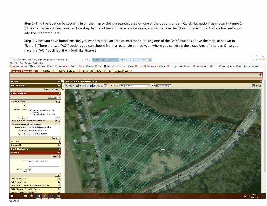
Figure 3
Step 2- Find the location by zooming in on the map or doing a search based on one of the options under “Quick Navigation” as shown in Figure 2.
If the site has an address, you can look it up by the address. If there is no address, you can type in the city and state in the Address box and zoom
into the site from there.
Step 3- Once you have found the site, you want to mark an area of interest on it using one of the “AOI” buttons above the map, as shown in
Figure 2. There are two “AOI” options you can choose from, a rectangle or a polygon where you can draw the exact Area of Interest. Once you
have the “AOI” outlined, it will look like Figure 3
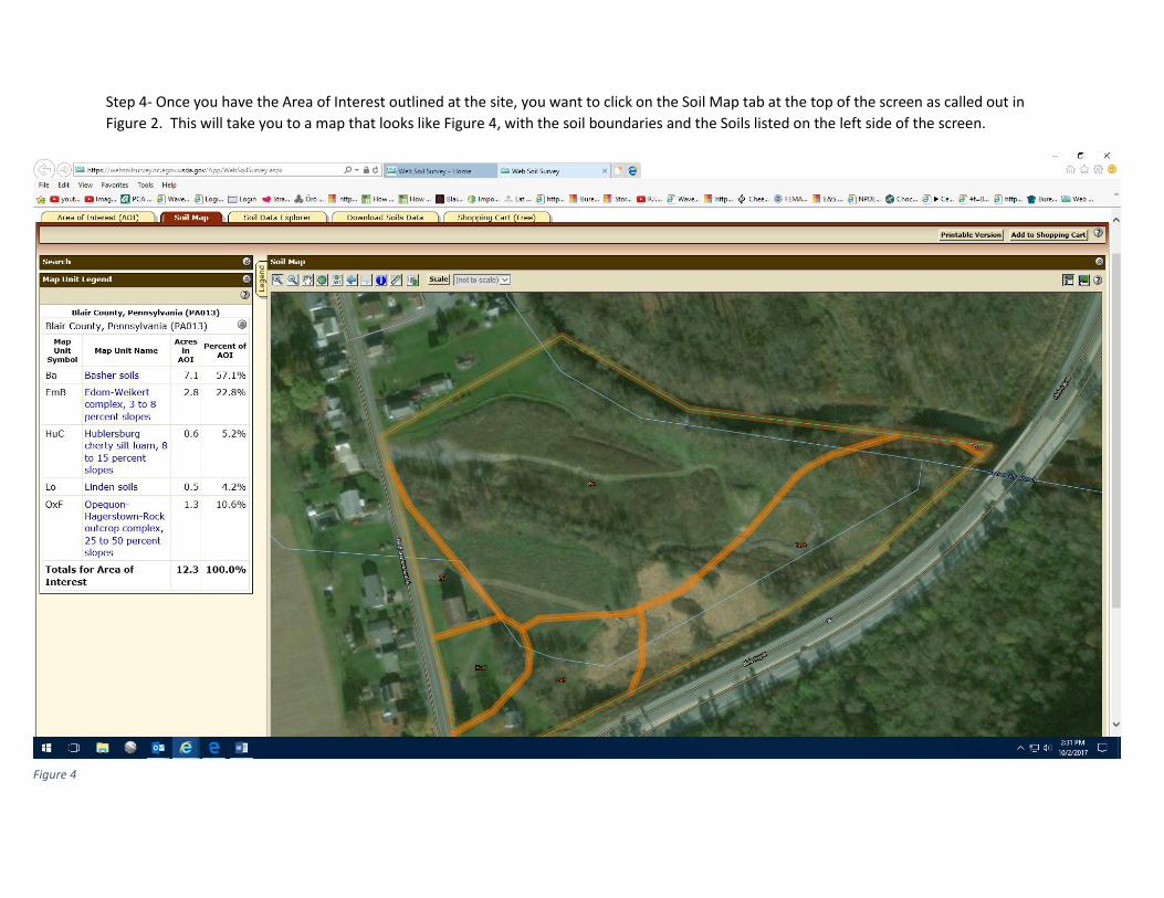
Figure 4
Step 4- Once you have the Area of Interest outlined at the site, you want to click on the Soil Map tab at the top of the screen as called out in
Figure 2. This will take you to a map that looks like Figure 4, with the soil boundaries and the Soils listed on the left side of the screen.