WEATHER DECISION SUPPORT SYSTEM III · (HRPT)—the same source of data used by professional...
22
WEATHER DECISION SUPPORT SYSTEM III Overlays
Transcript of WEATHER DECISION SUPPORT SYSTEM III · (HRPT)—the same source of data used by professional...
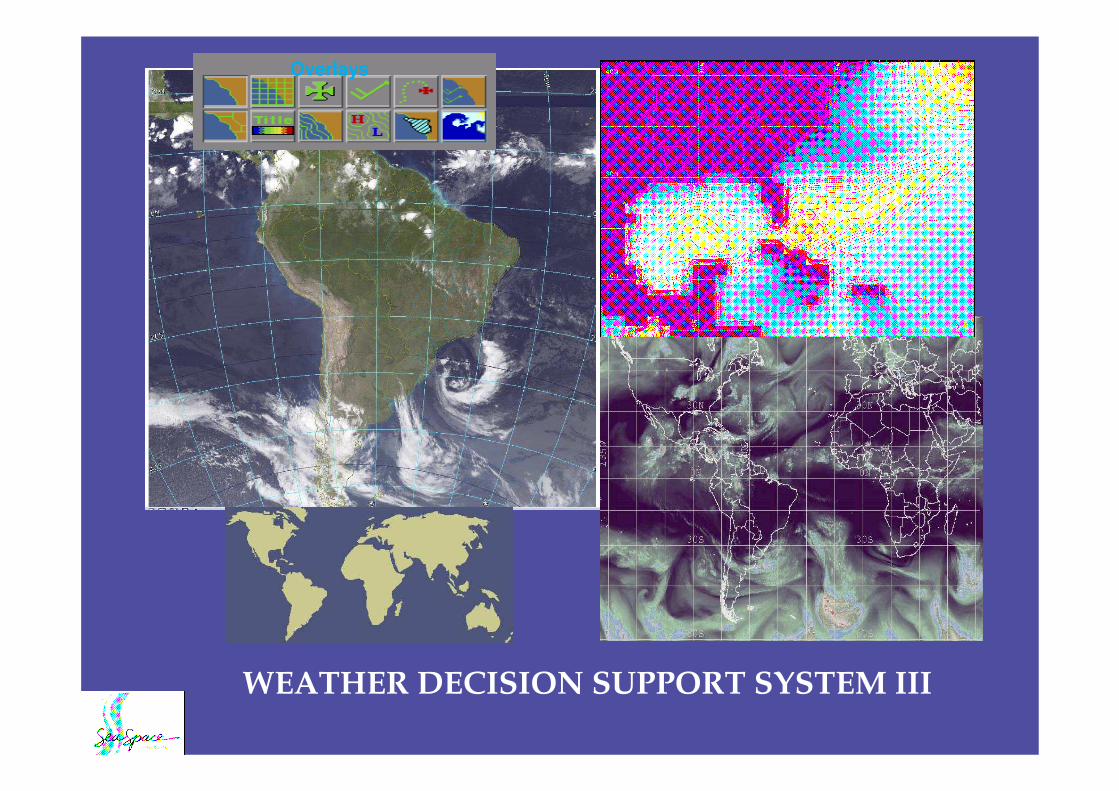
WEATHER DECISION SUPPORT SYSTEM III
Overlays

What is WDS?
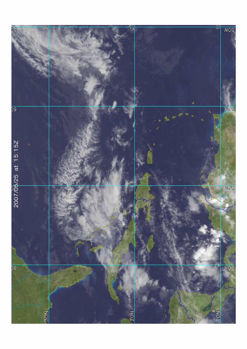
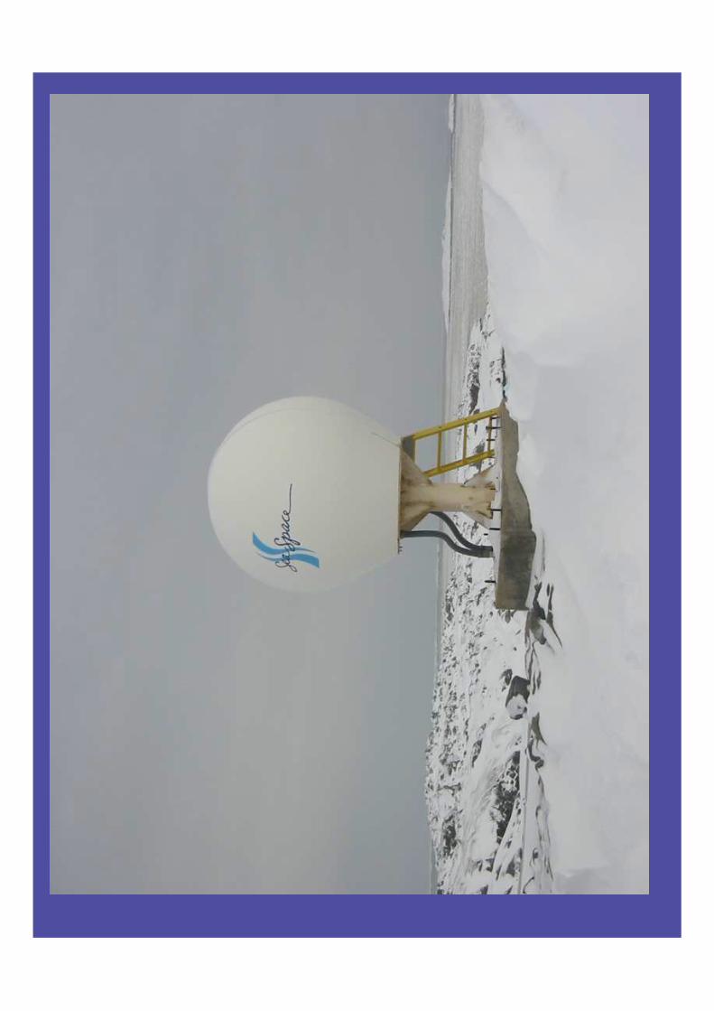
The WDS System is a sophisticated workstation, equipped with an antenna and receiver for tracking weather satellites and acquiring the signals they broadcast. The WDS System produces local weather imagesfrom high-resolution data that it receives from satellites operated by the U.S. National Oceanicand Atmospheric Administration (NOAA). Thedata is directly broadcast from the satellites via asignal called High-Resolution Picture Transmission(HRPT)—the same source of data used by professional meteorologists.The antenna is housed inside a radome, a durablefiberglass covering that protects the antenna fromthe elements. A Global Positioning System (GPS)antenna provides the WDS System with theaccurate position and time information it requiresto track weather satellites.New images arrive on a regular schedule to provide the mariner with the most updated weather information. These images are supplemented with wind, wave height,and text forecast data. The easy-to-use software interface lets you apply maps,grids, titles, and weather overlays to images, changeimage colors, or animate a sequence of images, all withpoint-and-click control.

LRIT
WDS III is also capable of gettingimages from a constellation of geostationary weather satellites.
These satellites are spaced around the globe so that, among them, they provide coverage of most of the Earth except forthe polar regions.
Weather imagery from around the world are produced from Low Resolution Information Transmission (LRIT) datareceived from the geostationary satellites. LRIT (the greatly improved replacementfor WEFAX) provides a synoptic view,
enabling you to see entire weather systems affecting your immediate areaand beyond.

WDS-III System Components
ddddddd
iid

17
NOAA/DMSP, L/S-Band, 1.0m aboard USS Kittyhawk
TeraScan Polar Satellite Shipboard TrackingTeraScan Polar Satellite Shipboard Tracking SystemsSystems�


WorldMetTM
In addition to images from satellites, WDS-III can also receive and display forecasted conditions, including wave height, local area text forecasts, and surface winds.
WorldMet data services can alsoprovide the mariner, user selected products such as Potential Fishing zones, Data Fusion products and highresolution MODIS data on a subscriptionbasis.
These forecasts and additional data products are available to ships equipped with high speed wireless data communications.


Why do all of us do what we do?


Thank You for taking the time to attend!