Waterway Corridors - Home | Melbourne Water · 1 Introduction 2 2 Purpose of the guidelines 3 3...
24
Waterway Corridors Guidelines for greenfield development areas within the Port Phillip and Westernport Region
-
Upload
phungtuong -
Category
Documents
-
view
215 -
download
0
Transcript of Waterway Corridors - Home | Melbourne Water · 1 Introduction 2 2 Purpose of the guidelines 3 3...

Waterway CorridorsGuidelines for greenfield development areas within the Port Phillip and Westernport Region

1 Introduction 2
2 Purpose of the guidelines 3
3 What is a waterway corridor? 3
4 Scope of the guidelines 4
5 Objectives for waterway corridors in greenfield development areas 5
6 Principles underlying the guidelines 6
7 Waterway corridors for existing waterways 8
7.1 Minimum standard setback widths 8
7.2 How do setbacks vary with position in the catchment? 9
7.3 Setback sub-zones 12
7.4 Determining waterway corridor width and extent in existing waterways 15
8 Waterway corridors for constructed waterways 16
8.1 Constructed waterway corridor widths 16
8.2 Determining waterway corridor width in constructed waterways 17
9 Incorporating site specific values and urban design elements into waterway corridors 19
9.1 Site specific values 19
9.2 Ownership and ongoing maintenance of the waterway corridor 20
10 Waterway Corridor Guideline review process 21
Contents
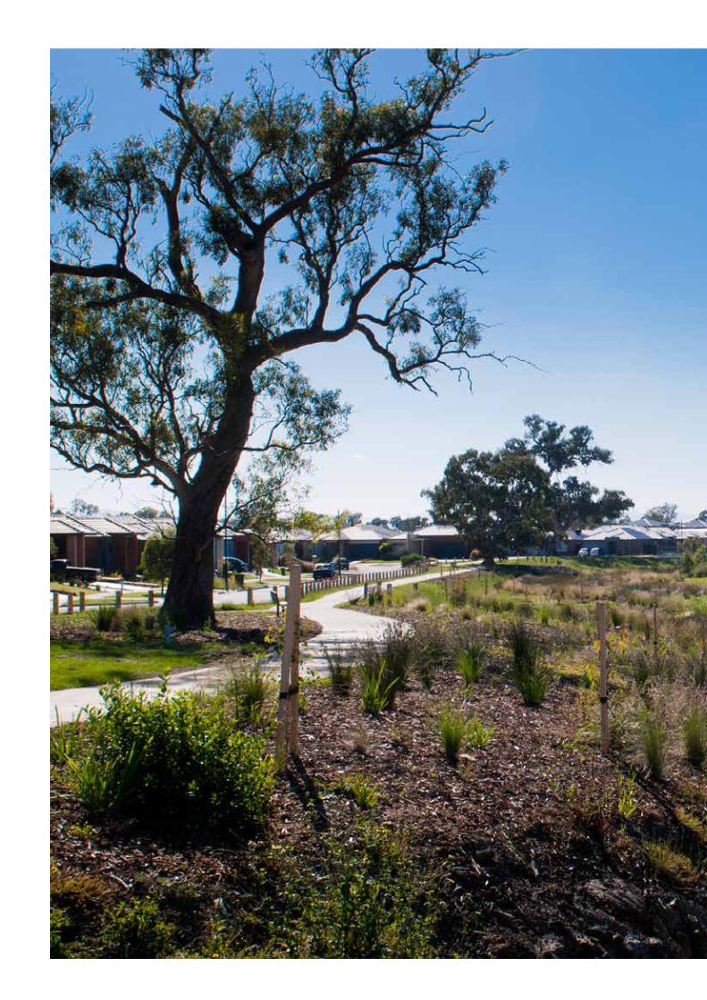
Front Cover: Lower Werribee River; an example of the waterway values present on many of the waterways within the urban growth boundary that these guidelines will help to protect.

2 / Melbourne Water / October 2013
1 Introduction
Melbourne Water is the caretaker of river health for the 8,400 kilometres of waterway in the Port Phillip and Westernport region. As part of its role, Melbourne Water has a duty of care to establish and maintain riparian zones along all our waterways to improve waterway health.
The waterways of the Port Phillip and Westernport region are major environmental and social assets, which are highly valued by the community and hold particularly high levels of cultural heritage significance. Waterways are important reserves of biodiversity and provide valuable habitat and corridors for native fish, birds, amphibians and mammals such as platypus, and provide, in many cases, a setting for recreational activities. In combination, these attributes (and others) are referred to as river health.
There has been significant improvement in river health in the Port Phillip and Westernport region over recent decades, and some waterways in the region are in excellent condition (in terms of river health). However, nearly half are in poor or very poor condition, and more than 200 kilometres of waterways need to be carefully managed as urban development spreads into currently undeveloped areas.
Urban development represents both a great challenge and a great opportunity for river health. The preservation, rehabilitation and restoration of appropriate riparian zones1 in urban developments is essential if the river health objectives as defined in the Healthy Waterways Strategy2 are to be met. The size and condition of the riparian zone is important for channel bed and bank stability, water quality, and aquatic and riparian biodiversity, which are all cornerstones of a healthy waterway and catchment system.
1 The area immediately adjacent to the waterway is referred to as the ‘riparian zone’; the waterway (bed and banks) and riparian zones on both banks are collectively defined as the ‘waterway corridor’.
2 Melbourne Water 2012, ‘Healthy Waterways Strategy (draft)’.

Waterway Corridors / 3
2 Purpose of the guidelines
These guidelines have been developed to provide a consistent, strategic approach to the management of riparian zones in greenfield developments.
They define minimum standards for waterway corridor widths, vegetation quality, infrastructure and activities permitted within waterway corridors.
As caretaker of waterway health in the Port Phillip and Westernport region, Melbourne Water has an obligation to ensure that appropriate provisions are made to ensure waterway resilience and function in the face of environmental pressures such
as urban development. These guidelines will facilitate a consistent and strategic approach for government authorities, local government and developers to create environmentally and socially sustainable waterway corridors in new developments.
These guidelines do not remove the need for detailed environmental assessment of waterways and their surrounding environs prior to development occurring.
3 What is a waterway corridor?
A waterway corridor is defined (for the purposes of these guidelines) as the waterway channel and its associated riparian zones.
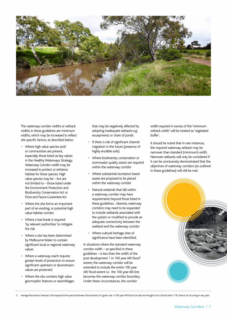
Assigning a waterway corridor preserves areas of the riparian zone that protect or enhance native vegetation, river health and biodiversity in some cases, the waterway corridor may also be able to support a level of passive recreational use or some stormwater treatment elements.
The waterway corridor is the area of land that is required to help ensure a resilient waterway system – both ecologically and socially – that can effectively absorb and/or recover from damaging processes without losing core functionality.
In greenfield development sites waterway corridors are created through the modification of title boundaries during the subdivision process to preserve the waterway corridor for specified purposes. Melbourne Water is a statutory referral agency in this process and provides comment on planning permit applications as referred by the Responsible Authority and has the power under the Water Act 1989 to require reserves and/or easements for the purpose of drainage
and waterway management. Ultimately, the waterway corridor may be considered non-developable for either, or both, of these management requirements.
The width of waterway corridor required to meet the objectives of the corridors varies depending on the type of waterway (physical morphology, vegetation type, geologic setting etc). You can find more detailed information in Sections 5 and 6. These corridors establish the optimum balance between river health, biodiversity, social amenity, asset protection and developable land requirements. The minimum waterway corridor widths specified in these guidelines are based on the best available science, are compatible with current legislation and comparable to waterway corridor management in other jurisdictions.
The approach to calculating the waterway corridor width at a particular location depends on whether the waterway is an existing waterway or an artificial waterway that will be constructed as part of urban development, as well as considering any site specific factors such as environmental values, recreation uses or landscape characteristics.
In existing waterways the waterway corridor is defined by setbacks from the waterway that specify the minimum distance from the waterway on each side of the channel to urban development features such as roads and subdivisional lots. For new or existing
constructed channels the standard waterway corridor is defined as the sum of the width of the waterway channel and the setbacks on both banks, as described in Section 7.
In constructed waterways, an alternative approach is used to define waterway corridor widths, as there is no pre-existing waterway channel from which to define setbacks. Waterway corridor widths in constructed waterways are scaled according to the hydraulic width of the constructed waterway. The hydraulic width concept (as described in detail in Section 8) is a well understood variable in constructed waterway design across the development industry.
For both constructed and existing waterways there are a number of other factors (described in Section 6) that may require urban development to be located further from the waterway than specified by the minimum waterway corridor width (e.g. flood protection or the presence of highly sensitive flora and fauna).
In addition to the width of waterway corridors, these guidelines also specify controlled activities and infrastructure within the waterway corridors, and riparian zone management requirements. These requirements are described for existing waterways (Section 7) and constructed waterways (Section 8).

4 / Melbourne Water / October 2013
4 Scope of the guidelines
The guidelines apply only to greenfield development areas, which are defined as areas identified for urban development (residential, commercial or industrial) by state and/or local government, located on or beyond the boundaries of existing urban development.
Melbourne Water prepares Development Services Schemes or strategies for greenfield development areas that determine the surface water management infrastructure requirements within each catchment.
The guidelines do not apply to:
• Redevelopmentzones,i.e.sitesthatarebeing redeveloped from some previous development use (e.g. development of a factory into a housing estate)
• Infilldevelopment,i.e.sitesthatmaynothave been previously developed but are surrounded by existing development.
• Ruralwaterwaysinforestedandagricultural catchments that are not subject to urban development.
• Wetlandsystems,bothnaturalandmanmade. Protection and management of these systems require considerations in addition to those covered in these guidelines, especially when they are managed for biodiversity purposes.
These guidelines focus on regional drainage assets, which can be perennial (always flowing) and ephemeral (flowing sometimes) rivers and/or creeks with catchments greater than 60 hectares. They also provide recommendations for local waterways/drainage lines that are commonly managed by organisations other than Melbourne Water. Please see section 7.2 for more information regarding smaller, local drainage assets.
The guidelines apply to all subdivisions of two lots or more.
Note: these guidelines do apply to parcels of land that may be surrounded by development within existing Development Services Schemes.

Waterway Corridors / 5
5 Objectives for waterway corridors in greenfield development areas
The objectives for waterway corridors in greenfield development areas of the Port Phillip and Westernport are:
• Toprotect,enhanceorrestoreriverhealth and biodiversity
• Toenablesomecomplementaryuseof waterways for recreational purposes and infrastructure (if appropriate) while maintaining primary river health, flood protection and biodiversity functions
• Toprovideeffectivefloodprotection.
Waterway corridors and associated riparian vegetation provide a range of river health functions, including:
• Provisionoffoodandhabitatforaquaticfauna
• Provisionofbreeding,feedingandhabitatfor terrestrial fauna
• Provisionofcorridorsforfaunamovement up and down the waterway
• Provisionoffaunarefugiaindevelopedlandscapes and enhancing links between remaining habitats that would otherwise remain fragmented
• Stabilisationofchannelbanksagainsterosion
• Shadingandmaintenanceofnaturaltemperatures within waterways
• Reducingsedimentsandpollutantsthatreach waterways through overland flow
• Maintenanceandimprovedwaterqualitythrough filtering and nutrient cycling within the riparian zone and vegetated buffer zone
• Allowanceforinclusionofsomestormwater treatment systems within vegetation buffer zones if appropriate
• Allowspacefornaturalmigrationofthewaterway channel, especially in areas with highly erosive soil types
• Recruitinglargewoodydebrisintothestream and for riparian habitat over the long term.
Riparian zones differ from terrestrial lands in several ways: they often have more fertile soils, higher moisture levels and different plant species. Due to these factors, riparian zones provide the habitat features needed by a diverse range of wildlife species.
Riparian zones may also provide space for recreation and social activities. They provide an interface between urban development and waterways and visual amenity. Although Melbourne Water is the caretaker of waterways and has a primary objective of protecting and enhancing the health of waterways, we recognise the benefits of healthy, accessible riparian zones to communities and the importance of engaging the community with waterways and river health. This document is intended to provide clarity for the creation of waterway corridors that will balance the needs of the environment and the community in urban developments.
Waterways are also an extremely important component of the landscape in terms of indigenous cultural heritage as reflected in the Aboriginal Heritage Act 2006 and Regulations 2007. These list the land within 200m of a named waterway as being ‘culturally significant’. By protecting and enhancing riparian areas, we can assist in preserving and in some cases, enhancing, cultural heritage values.
The objectives for waterway corridors were used to identify optimum waterway corridor widths, riparian vegetation zones, and permitted activities and infrastructure.

6 / Melbourne Water / October 2013
6 Principles underlying the guidelines
The development of the guidelines is underpinned by a number of principles:
• Theminimumwaterwaycorridorwidthsand riparian vegetation zoning required to meet the river health / biodiversity and social objectives described above are based on the best available science and riparian management practice in Australia and worldwide
• Theminimumwaterwaycorridorwidthsalso take into account the scale of vegetation required to provide robust and self-sustaining riparian vegetation communities over the long-term. Narrow waterway corridors require high levels of maintenance and plant replacement to prevent weed invasion, and do not provide the minimum spacing requirements for riparian trees (which are generally required components of healthy riparian vegetation communities in urban developments)
• Theminimumrequiredwaterwaycorridor width varies dependant on stream order, which increases with distance downstream of headwater streams. Smaller waterways in the headwaters of catchments will have smaller riparian zone widths and large waterways in the downstream area of a catchment will have wider riparian zones. This ensures that waterway corridors are at an appropriate spatial scale for the size of the waterway in any given location
• Waterwaysdonotneedtohave‘permanent’ or ‘flowing’ water to be considered waterways under the Water Act 1989. Therefore ephemeral waterways are also considered ‘waterways’ for the purpose of these guidelines
• Twodistinctripariansub-zonesareidentified within the waterway corridor: a core riparian zone (CRZ) of high quality native vegetation immediately adjacent to the waterway to provide the greatest biodiversity benefit; and, a robust vegetated buffer (VB) between the core riparian zone and the edge of the waterway corridor to protect the high value vegetation in the core riparian zone from ‘edge effects’
• WhileMelbourneWaterissupportiveof community interaction and use of waterway corridors, infrastructure and recreational activities will be limited in the high value ‘core riparian zone’ to protect river health and biodiversity values. There is more flexibility in locating public open space assets (such as shared pathways) in the ‘vegetated buffer’. It should be noted that a development’s Public Open Space contribution is a council requirement and is determined/approved separately to Melbourne Water’s waterway corridor requirements.
Waterway Corridors / 7
The waterway corridor widths or setback widths in these guidelines are minimum widths, which may be increased to reflect site specific factors, as described below:
• Wherehighvaluespeciesand/or communities are present, especially those listed as key values in the Healthy Waterways Strategy, Waterway Corridor width may be increased to protect or enhance habitat for these species. High value species may be – but are not limited to – those listed under the Environment Protection and Biodiversity Conservation Act or Flora and Fauna Guarantee Act
• Wherethesiteformsanimportantpart of an existing, or potential high value habitat corridor
• Whereafuelbreakisrequired ‘by relevant authorities’ to mitigate fire risk
• Whereasitehasbeendeterminedby Melbourne Water to contain significant local or regional waterway values
• Whereawaterwayreachrequiresgreater levels of protection to ensure significant upstream or downstream values are protected
• Wherethesitecontainshighvaluegeomorphic features or assemblages
that may be negatively affected by adopting inadequate setbacks e.g. escarpments or chain of ponds
• Ifthereisriskofsignificantchannelmigration in the future (presence of highly erodible soils)
• Wherebiodiversityconservationorstormwater quality assets are required within the waterway corridor
• Wheresubstantialrecreationbasedassets are proposed to be placed within the waterway corridor
• Naturalwetlandsthatfallwithina waterway corridor may have requirements beyond those listed in these guidelines. Likewise, waterway corridors may need to be expanded to include wetlands associated with the system or modified to provide an adequate connectivity between the wetland and the waterway corridor
• Whereculturalheritagesitesofsignificance have been identified.
In situations where the standard waterway corridor width – as specified in these guidelines – is less than the width of the post development 1 in 100 year ARI flood3 extent, the waterway corridor will be extended to include the entire 100 year ARI flood extent i.e. the 100 year ARI line becomes the waterway corridor boundary. Under these circumstances, the corridor
width required in excess of the ‘minimum setback width’ will be treated as ‘vegetated buffer’.
It should be noted that in rare instances, the required waterway setback may be narrower than standard (minimum) width. Narrower setbacks will only be considered if it can be conclusively demonstrated that the objectives of waterway corridors (as outlined in these guidelines) will still be met.
3 Average Recurrence Interval is the expected time period between flood events of a given size. A 100 year ARI flood can also be thought of as a flood with a 1% chance of occurring in any year.
8 / Melbourne Water / October 2013
“ Porero ilignis adi que nonseris sum, ut as veliam que con eumquiae quosant expe maio vitam, que quiatur? Qui dunto mi, sam, simet omnis ent quid quam rest restrum dolore sus velecatem.”

Waterway Corridors / 9
7 Waterway corridors for existing waterways
Existing waterways are typically well-defined channels, which may flow permanently or only during the wetter months of the year.
They will generally require only localised modification such as bank re-profiling, strengthening and/or revegetation as part of urban development. The condition of existing waterways in greenfield development areas is variable, but they are important environmental and social assets.
The approach to defining waterway corridor widths and riparian zones in existing waterways is based on the application of setback widths, as described in the following sections.
7.1 Minimum standard setback widths
Three standard setback widths apply to existing waterways in the Port Phillip and Westernport region: 20 m, 30 m and 50 m. These setback widths have been defined following a comprehensive review of waterway management science in Australia and worldwide. They provide a balance between achieving river health and biodiversity objectives, providing for recreation and visual amenity and maximising developable land.
The setback widths apply to both banks and are measured from a setback reference point as shown in Figure 1 (below).
The reference point is generally the Top of Bank (break of slope from the river bank to surrounding land) of the waterway. In some cases top of bank may not be easily defined, and an alternative reference point such as a hydraulic measurement may be required instead. Melbourne Water will provide further direction on how to determine and locate the reference point at specific sites as required. Please contact Melbourne Water on 131722 to request this information.
CROSS-SECTION VIEW
PLAN VIEW
Setback Setback
Referencepoint
Referencepoint
Figure 1. Schematic illustration of setback from waterway
10 / Melbourne Water / October 2013
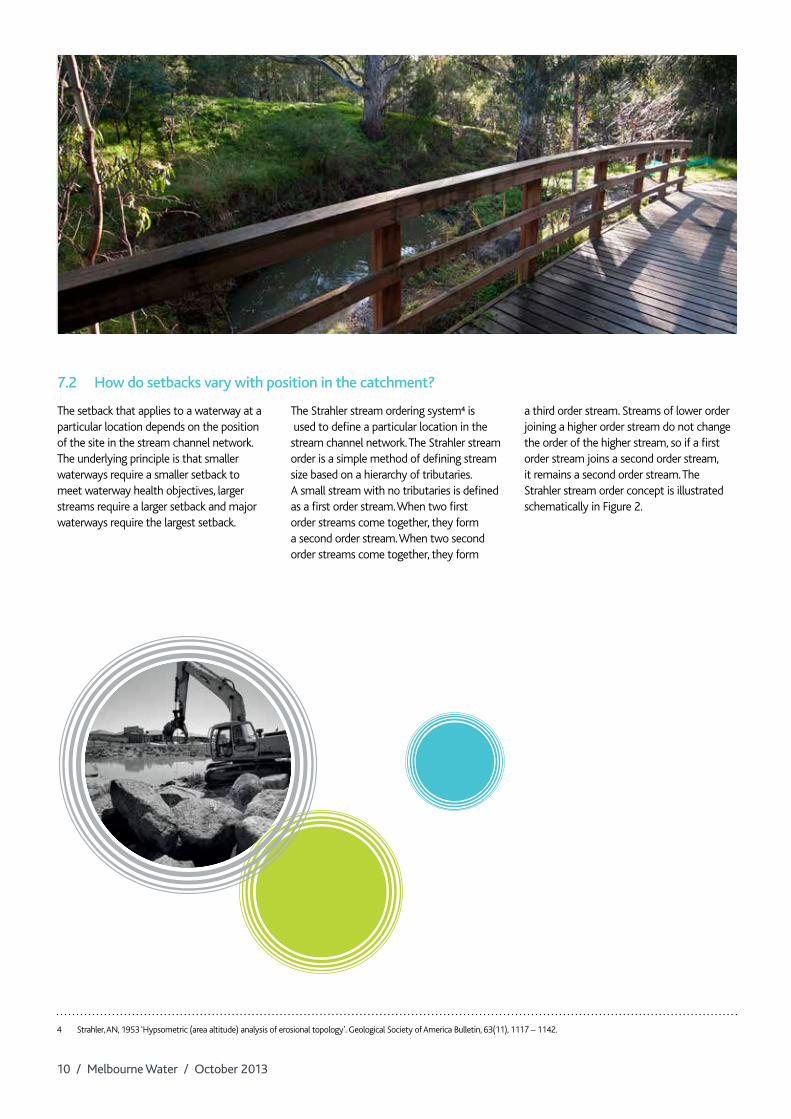
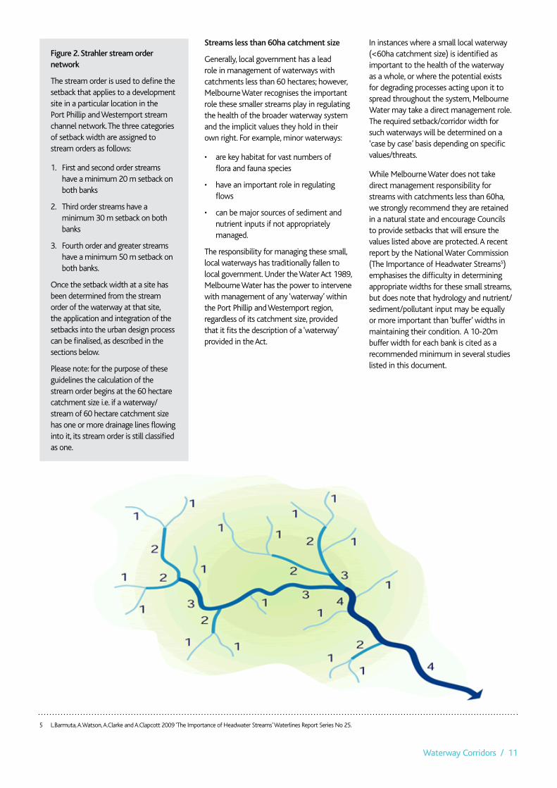
7.2 How do setbacks vary with position in the catchment?
The setback that applies to a waterway at a particular location depends on the position of the site in the stream channel network. The underlying principle is that smaller waterways require a smaller setback to meet waterway health objectives, larger streams require a larger setback and major waterways require the largest setback.
The Strahler stream ordering system4 is used to define a particular location in the stream channel network. The Strahler stream order is a simple method of defining stream size based on a hierarchy of tributaries. A small stream with no tributaries is defined as a first order stream. When two first order streams come together, they form a second order stream. When two second order streams come together, they form
a third order stream. Streams of lower order joining a higher order stream do not change the order of the higher stream, so if a first order stream joins a second order stream, it remains a second order stream. The Strahler stream order concept is illustrated schematically in Figure 2.
4 Strahler, AN, 1953 ‘Hypsometric (area altitude) analysis of erosional topology’. Geological Society of America Bulletin, 63(11), 1117 – 1142.
Waterway Corridors / 11
Streams less than 60ha catchment size
Generally, local government has a lead role in management of waterways with catchments less than 60 hectares; however, Melbourne Water recognises the important role these smaller streams play in regulating the health of the broader waterway system and the implicit values they hold in their own right. For example, minor waterways:
• arekeyhabitatforvastnumbersof flora and fauna species
• haveanimportantroleinregulatingflows
• canbemajorsourcesofsedimentandnutrient inputs if not appropriately managed.
The responsibility for managing these small, local waterways has traditionally fallen to local government. Under the Water Act 1989, Melbourne Water has the power to intervene with management of any ‘waterway’ within the Port Phillip and Westernport region, regardless of its catchment size, provided that it fits the description of a ‘waterway’ provided in the Act.
In instances where a small local waterway (<60ha catchment size) is identified as important to the health of the waterway as a whole, or where the potential exists for degrading processes acting upon it to spread throughout the system, Melbourne Water may take a direct management role. The required setback/corridor width for such waterways will be determined on a ‘case by case’ basis depending on specific values/threats.
While Melbourne Water does not take direct management responsibility for streams with catchments less than 60ha, we strongly recommend they are retained in a natural state and encourage Councils to provide setbacks that will ensure the values listed above are protected. A recent report by the National Water Commission (The Importance of Headwater Streams5) emphasises the difficulty in determining appropriate widths for these small streams, but does note that hydrology and nutrient/sediment/pollutant input may be equally or more important than ‘buffer’ widths in maintaining their condition. A 10-20m buffer width for each bank is cited as a recommended minimum in several studies listed in this document.
Figure 2. Strahler stream order network
The stream order is used to define the setback that applies to a development site in a particular location in the Port Phillip and Westernport stream channel network. The three categories of setback width are assigned to stream orders as follows:
1. First and second order streams have a minimum 20 m setback on both banks
2. Third order streams have a minimum 30 m setback on both banks
3. Fourth order and greater streams have a minimum 50 m setback on both banks.
Once the setback width at a site has been determined from the stream order of the waterway at that site, the application and integration of the setbacks into the urban design process can be finalised, as described in the sections below.
Please note: for the purpose of these guidelines the calculation of the stream order begins at the 60 hectare catchment size i.e. if a waterway/stream of 60 hectare catchment size has one or more drainage lines flowing into it, its stream order is still classified as one.
5 L.Barmuta, A.Watson, A.Clarke and A.Clapcott 2009 ‘The Importance of Headwater Streams’ Waterlines Report Series No 25.

12 / Melbourne Water / October 2013
6 The Healthy Waterways Visions communicate Melbourne Water’s longer term aims for the form and function of waterways in the Port Phillip and Westernport region. The visions provide one consistent Melbourne Water view of what the form and function of waterways could be in 20-years and articulate the levels of service that we need to apply to get there.
7.3 Setback sub-zones
As described earlier, there are two sub-zones within each of the setback widths. The sub-zones have different roles in meeting the overall setback objectives and different activities and infrastructure requirements.
The two sub-zones are:
• thecoreriparianzone(CRZ)• thevegetatedbuffer(VB).
The relationship between these sub-zones is shown in Figure 3
The core riparian zone is fully vegetated with native vegetation selected in accordance with the vegetation component of the Healthy Waterways Visions6 . Depending on various factors such as geographic location, stream form and current condition, the required vegetation type may vary from
ReferencePoint
Vegetatedbuffer
Core riparianzone
Setback
Vegetatedbuffer
Core riparianzone
Setback
ReferencePoint
Waterway corridor
Stream channelCRZVB
Road
CROSS-SECTION VIEW
PLAN VIEW
Figure 3. Schematic illustrations of setback sub-zones in cross-section (top) and plan view (bottom). Core riparian zone is shown as CRZ and vegetated buffer as VB.
ReferencePoint
Vegetatedbuffer
Core riparianzone
Setback
Vegetatedbuffer
Core riparianzone
Setback
ReferencePoint
Waterway corridor
Stream channelCRZVB
Road
CROSS-SECTION VIEW
PLAN VIEW

Waterway Corridors / 13
primarily trees and shrubs through to predominately native grass cover. The core riparian zone provides the main river health and biodiversity functions of the riparian setback. It is the area immediately adjacent to the waterway, and the vegetation in this zone provides the shading, nutrient and wood inputs to the stream required for healthy instream ecosystem function.
The vegetated buffer protects the core riparian zone from edge effects that will impact on vegetation and fauna in the core riparian zone. These edge effects include:
• weedinvasionfromadjacentareas
• lightpenetration
• micro-climatechanges
• litter/pollution
• trampling
A 10 m wide vegetated buffer running immediately adjacent and parallel to the core riparian zone is required to protect the core riparian zone for all three standard widths. Therefore, although the width of the core riparian zone varies according to stream order, the width of the adjacent vegetated buffer remains constant at 10m (Table 1).
The ‘vegetated buffer’ vegetation type will vary from site to site, but will need to be designed in such a way that the integrity of the core riparian zone is protected. In many cases this will require this zone having similar vegetation to the core riparian zone. Melbourne Water will provide guidance on a site specific basis regarding the type of vegetation required.
Table 1. Core riparian zone and vegetated buffer widths for different overall setback widths in existing channels
In order to maintain the river health and biodiversity value of the riparian buffers in the waterway corridors it is necessary to limit the extent to which the vegetated buffer is impacted by services and infrastructure. As described above, riparian buffers provide a corridor through which fauna can travel across the landscape and habitat for fauna that do not migrate, hence optimisation of vegetation quality within this zone will greatly improve the ecological effectiveness of the waterway corridor.
Every effort should be made to locate underground services such as power, water and sewerage outside the core riparian zone to maintain the integrity of waterway function. Similarly, sports ovals, playgrounds, and maintenance tracks should also be located outside the core riparian zone, as they may create a barrier to faunal movement, despite being vegetated.
Wherever possible, shared pathways should also be located outside the core riparian zone and should meet the standards defined in Shared Path Guidelines7 (available on the Melbourne Water website). While Melbourne Water has a strong preference for the assets and features listed above to be wholly located outside of the core riparian zone, partial placement of assets within this zone will be considered in situations where it is absolutely necessary or where a clear benefit to the community and/or environmental health can be demonstrated.
In some instances, stormwater treatment systems such as constructed wetlands and bio-retention systems may be located within the core riparian zone – subject to Melbourne Water approval – but should form a relatively small proportion of the area of the core riparian zone so as not to degrade its ecological function or put the asset at undue risk from flooding and/or stream migration.
Fire breaks may be required adjacent to areas of vegetation. The Core Riparian Zone and Vegetated Buffer Zone will usually consist of dense vegetation, and should not be included in any fire break. Fire breaks must meet the requirements of relevant public authorities, and will generally require space in addition to the waterway corridor. In some instances roads that are located adjacent to a waterway corridor may suffice as a fire break.
Determining fire break requirements is a shared responsibility between all associated land owners and managers, therefore Melbourne Water recommends developers engage with these agencies early in waterway corridor design process, to determine what requirements will need to be met (both fire break and building design as outlined in AS 3959-2009).
OvErAll SETbACk WIdTH (M)
COrE rIPArIAn zOnE WIdTH (M)
vEgETATEd buFFEr WIdTH (M)
20 m 10 m 10 m30 m 20 m 10 m50 m 40 m 10 m
7 Melbourne Water, 2009, Shared Path Guidelines.
14 / Melbourne Water / October 2013
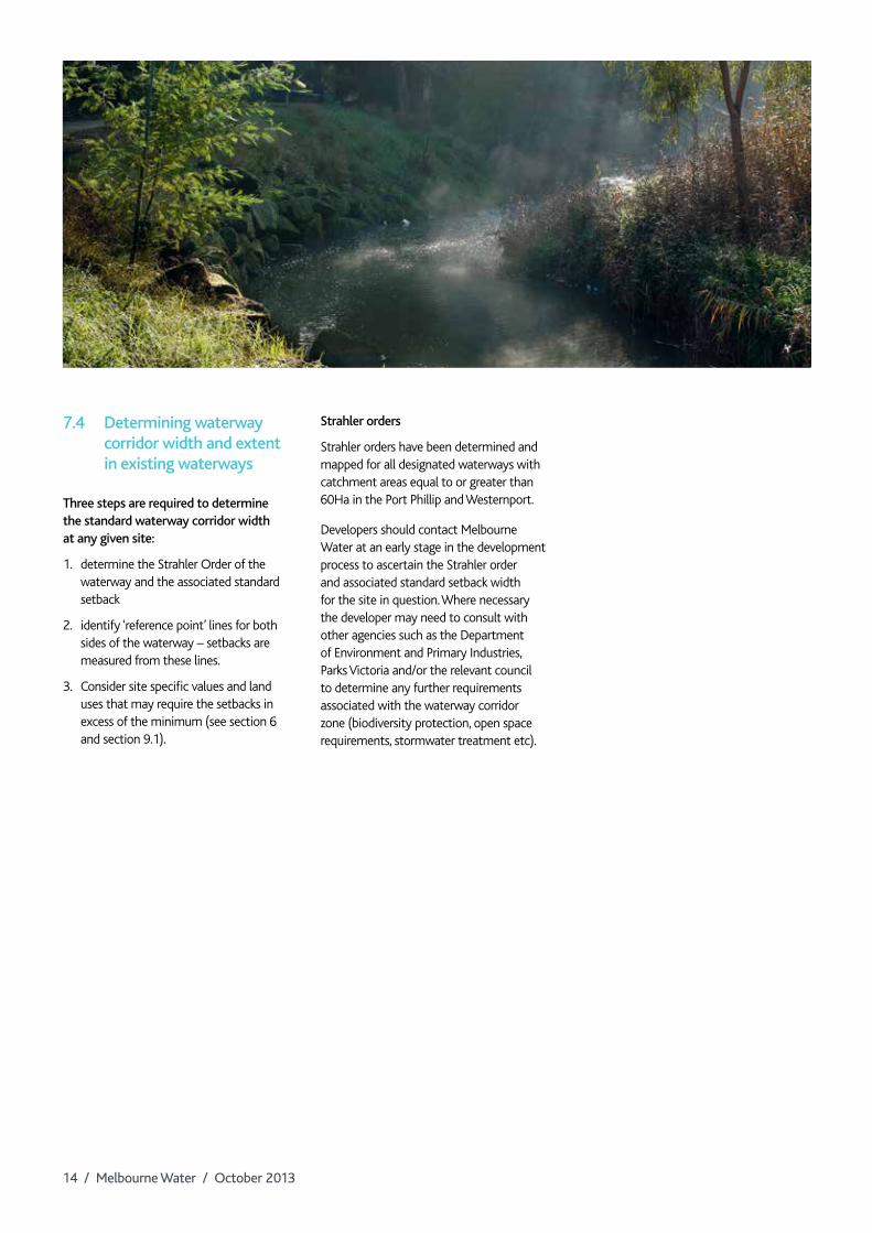
7.4 determining waterway corridor width and extent in existing waterways
Three steps are required to determine the standard waterway corridor width at any given site:
1. determine the Strahler Order of the waterway and the associated standard setback
2. identify ‘reference point’ lines for both sides of the waterway – setbacks are measured from these lines.
3. Consider site specific values and land uses that may require the setbacks in excess of the minimum (see section 6 and section 9.1).
Strahler orders
Strahler orders have been determined and mapped for all designated waterways with catchment areas equal to or greater than 60Ha in the Port Phillip and Westernport.
Developers should contact Melbourne Water at an early stage in the development process to ascertain the Strahler order and associated standard setback width for the site in question. Where necessary the developer may need to consult with other agencies such as the Department of Environment and Primary Industries, Parks Victoria and/or the relevant council to determine any further requirements associated with the waterway corridor zone (biodiversity protection, open space requirements, stormwater treatment etc).
Waterway Corridors / 15
8 Waterway corridors for constructed waterways
greenfield urban development often requires the construction of artificial waterways to effectively drain stormwater from urban areas. In recent years the approach to designing constructed waterways has moved from being solely or primarily concerned with efficient drainage to a more holistic approach that balances drainage requirements with the need to provide an environmental and social asset for new communities.
Melbourne Water has a responsibility to establish and maintain healthy riparian zones along all its waterways, whether existing or constructed. There is therefore a need to provide waterway corridors for constructed waterways as well as existing ‘natural’ waterways. However, to set the corridor width, an alternative approach is required because there are significant differences between existing and constructed waterways , the most important for the purpose of these guidelines being, that there is no natural top of bank point in a constructed waterway to use as a setback reference point
The approach to defining constructed waterway corridor widths is founded on the principles outlined in Section 6, and based on the concept of ‘hydraulic width’, which is defined as the width of the water surface at the 1 in 100 year ARI flow level in the channel.
8.1 Constructed waterway corridor widths
Constructed waterways are completely artificial waterways that have been created where either a small existing waterway/drainage line has required expansion or there was no existing waterway/drainage line prior to development. Construction of a waterway may be required to: enhance channel capacity, provide flood conveyance/protection and provide drainage outfall with a stable channel and an aesthetically pleasing landscape with some degree of habitat and ecological function.
The waterway corridor width for constructed waterways is defined as a factor of the hydraulic width of the main channel of the waterway. Hydraulic width is defined as the width of the water surface in metres at the 1 in 100 year ARI post development flow level in the channel.
By scaling the waterway corridor width to the hydraulic width, the resulting waterway corridor widths will be sized according to position in the catchment, which is consistent with the underlying principle that smaller waterways – which carry smaller flows – require a smaller setback to meet the objectives for setbacks, whilst larger streams carry more flow and will require a larger setback and major waterways require the largest setback in order to meet both hydraulic and ecological objectives.
Constructed waterway corridor widths are also classified into the CRZ and VB sub-zones. The sub-zones have different roles in meeting the overall setback objectives and different activities and infrastructure requirements, as described for existing waterways in Section 7.3.
16 / Melbourne Water / October 2013
8.2 determining waterway corridor width in constructed waterways
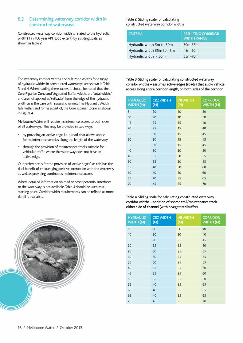
Constructed waterway corridor width is related to the hydraulic width (1 in 100 year ARI flood extent) by a sliding scale, as shown in Table 2.
The waterway corridor widths and sub-zone widths for a range of hydraulic widths in constructed waterways are shown in Table 3 and 4. When reading these tables, it should be noted that the Core Riparian Zone and Vegetated Buffer widths are ‘total widths’ and are not applied as ‘setbacks’ from the edge of the hydraulic width as is the case with natural channels. The Hydraulic Width falls within and forms a part of, the Core Riparian Zone as shown in Figure 4.
Melbourne Water will require maintenance access to both sides of all waterways. This may be provided in two ways:
• byprovidingan‘activeedge’i.e.aroad,thatallowsaccess for maintenance vehicles along the length of the waterway
• throughtheprovisionofmaintenancetrackssuitableforvehicular traffic where the waterway does not have an active edge.
Our preference is for the provision of ‘active edges’, as this has the duel benefit of encouraging positive interaction with the waterway as well as providing continuous maintenance access.
Where detailed information on road or other potential interfaces to the waterway is not available, Table 4 should be used as a starting point. Corridor width requirements can be refined as more detail is available..
CrITErIA rESulTIng COrrIdOr WIdTH rAngE
Hydraulic width 5m to 30m 30m-55m
Hydraulic width 35m to 45m 45m-60m
Hydraulic width > 50m 55m-70m
HydrAulIC WIdTH (M)
Crz WIdTH (M)
vb WIdTH (M)
COrrIdOr WIdTH (M)
5 20 10 30
10 20 10 30
15 25 15 40
20 25 15 40
25 30 15 45
30 30 15 45
35 30 15 45
40 30 20 50
45 35 20 55
50 35 20 55
55 40 20 60
60 40 20 60
65 40 25 65
70 45 25 70
HydrAulIC WIdTH (M)
Crz WIdTH (M)
vb WIdTH (M)
COrrIdOr WIdTH (M)
5 20 20 40
10 20 20 40
15 20 25 45
20 25 25 50
25 30 25 55
30 30 25 55
35 30 25 55
40 35 25 60
45 35 25 60
50 35 25 60
55 40 25 65
60 40 25 65
65 40 25 65
70 45 25 70
Table 3. Sliding scale for calculating constructed waterway corridor widths – assumes active edges (roads) that allow vehicle access along entire corridor length, on both sides of the corridor.
Table 4. Sliding scale for calculating constructed waterway corridor widths – addition of shared trail/maintenance track either side of channel (within vegetated buffer)
Table 2. Sliding scale for calculating constructed waterway corridor widths

Waterway Corridors / 17
Vegetatedbuffer
Core riparianzone
Hydraulic widthCore riparian
zone
Waterway corridor
Active edgeVegetated
buffer
While ‘active edges’ need to allow vehicle access along the entire reach of the waterway, this does not mean a ‘road’ needs to extend the whole length of the waterway. If sections of waterway cannot have ‘active edges’ but still allow vehicular access to the waterway, the widths in Table 3 can be used as a guide for corridor width.
The pilot channel (conveys regular flows and is typically 3 month ARI capacity) of a constructed waterway may move across the waterway corridor width along its length, but the design should ensure that the channel does not come within 10m of the edge of the corridor.
This will ensure continuity of the riparian zone; while also providing a suitable buffer should channel erosion occur in the future. Likewise, the entire ‘waterway corridor’ may meander if deemed functionally appropriate during the design phase.
Figure 4. Example of setback sub-zones for constructed waterways

18 / Melbourne Water / October 2013
Waterway Corridors / 19
9 Incorporating site specific values and urban design elements into waterway corridors
9.1 Site specific values
As described in the Section 6, the waterways corridor widths presented in these guidelines are the standard widths to be adopted within greenfield urban developments. Following the definition of the minimum standard waterway corridors for a site (as described in the previous sections) specific investigations should be undertaken to identify factors that may lead to the variation in the waterway corridor widths, i.e. where the setback may need to be greater or narrower to locally account for site values and/or constraints. To recap from Section 6, these factors may include (but not be limited to):
• Highvaluespeciesand/orcommunitiesmay require increased setbacks to protect habitat for these species
• Wherethesiteformsanimportantpartof an existing, or potential high value habitat corridor
• Wherethesitecontainshighvaluegeomorphic features or assemblages that may be negatively affected by setting inadequate waterway corridor widths (e.g. backwaters, rocky outcrops or escarpments)
• WhereasitehasbeendeterminedbyMelbourne Water to contain significant local or regional waterway values
• Wherebuiltassetsrequireprotectionfrom potential future channel migration (especially important in areas with highly erodible soils)
• Whereawaterwayreachrequiresgreaterlevels of protection to ensure significant upstream or downstream values are protected
• Ifthe100yearfloodextentexceedsthe standard waterway corridor width defined in these guidelines then the setback will be defined by the flood extent.
Where other land uses such as recreation or fire buffers also lead to requirements for land near a waterway, other relevant planning mechanisms will be used to provide for those purposes as required. All expected land uses within and adjacent to the waterway corridor should be considered together as early as possible in the planning process to enable an integrated and efficient corridor plan.
Depending on the shape of the line joining the setback reference points, the overall corridor width may not fit well with the intended subdivisional layout of the development site. It may be possible to adjust the setback line – creating a variable setback width, or in some cases – to fit better with the design of the development, provided built assets/infrastructure are not put at risk and there is no net loss in the total waterway corridor width and waterway functionality.
It will always be Melbourne Water’s preference for the corridor width to remain constant, avoiding narrow sections that barriers to fauna movement or negatively affect waterway function i.e. reduction of setbacks on one bank will be compensated with an equal increase in setback on the opposite bank.
Allowing for these types of variations is intended to provide flexibility when fitting the subdivisional layout around the waterway corridor. The final configuration of the waterway corridor in a greenfield site (i.e. the width of the overall setback, core riparian zone and vegetated buffer) must be agreed with Melbourne Water during the planning phase for the development.
net gain
In some instances, vegetation Net Gain offsets may be allowed to be established on land within greenfield development areas that is to be transferred to Melbourne Water; this includes waterway corridors. Please contact the Melbourne Water on 131 722 if you wish to explore options for placement of Net Gain offsets within waterway corridors.

20 / Melbourne Water / October 2013
9.2 Ownership and ongoing maintenance of the waterway corridor
Once a waterway corridor has been incorporated into the development plan, attention turns to the design and construction of civil and landscaping works that may be required and then to the ongoing maintenance responsibilities for the waterway, the riparian zones and any adjacent open space and associated infrastructure. Waterway corridors are nearly always vested as Reserves in favour of either the local Council or Melbourne Water (the party in whom the land is vested becomes the land owner). Typically, because of the multiple uses of the waterway corridor, the Reserve is vested in favour of Council with a Memorandum of Common Provisions easement created over the Reserve area in favour of Melbourne Water. That way, both parties’ interests are accounted for. Accompanying the creation of the Reserve and any easements is a Maintenance Agreement which details the areas and actions that Council and Melbourne Water are responsible for maintaining.
Other options such as singular authority ownership with easements/maintenance agreements in the name of other concerned authorities may also be appropriate; so might involvement of private parties such as Owners Corporations (e.g. Golf Courses). Lastly, service/utility providers may also require an easement in their favour to be created within the waterway corridor Reserve for assets such as power lines, gas mains, water mains, sewerage pipelines, and telephone/internet cables etc.
The following principles should be applied when developing arrangements for ownership and ongoing maintenance of various components of the waterway corridor:
Ownership of the waterway corridor
• Wheretherearepublicusebenefits,itisMelbourne Water preference that Council, or DEPI take ownership of the Reserve.
• WheretheReserveistobemanagedfor the singular purpose of waterway management, Melbourne Water will normally take ownership of the Reserve.
• WheretheReserveisinCouncil/DEPIownership, Melbourne Water will require a Memorandum of Common Provisions easement in our favour to be created on the Plan of Subdivision to enable access to undertake the range of maintenance activities included in the Schedule to the Maintenance Agreement.
• Wherethereareprivateinterestsimmediately adjacent to the waterway and it is not possible to create a Reserve for the waterway corridor for example, the waterway runs through a golf course, Melbourne Water will require a Memorandum of Common Provisions easement to be created over the waterway on the Plan of Subdivision.
Maintenance of the waterway corridor
• MelbourneWaterassumesresponsibilityfor maintaining vegetation within the channel bed to the edge of ephemeral plantings on the banks, i.e. the regularly ‘wetted’ areas usually associated with the lower banks and ongoing maintenance of the physical integrity of the bed and banks
• Intheabsenceofpublicusebenefits,Melbourne Water will take responsibility of maintaining vegetation on the bed, banks, core riparian zone and vegetated buffer if this land is to be managed purely for waterway health purposes.
• CouncilorDEPI/ParksVictoriawillassumeongoing maintenance responsibility for any part of the waterway corridor where there is an intended recreational use. In most instances this will be part of, or the entire, vegetated buffer, but may include sections of the core riparian zone where recreational assets such as pedestrian bridges cross through this area. Such areas will be clearly marked on the plan that accompanies the schedule of maintenance activities each party is responsible for.
Where Melbourne Water is responsible for maintaining the waterway corridor, we will do so to Melbourne Water standards; if a higher standard is required then the authority requiring the higher standard will be responsible for any additional works required.
Involvement of third parties
• Involvementofapartyotherthan,orin addition to, Council on freehold land where Melbourne Water has a waterway management interest, will require the creation of a Section 173 Agreement. The Section 173 Agreement is a legally binding agreement that ensures that the requirements of the accompanying Maintenance Agreement, and Schedule/Plan of activities that each party is responsible for are maintained in perpetuity. The s173 Agreement is tied to the land upon which the waterway corridor has been created.
• Inthecaseofmultiplepartiessharingmanagement interests for land vested in the crown, a management agreement of some form (options would need to be explored as to the most appropriate for the particular situation) will need to be entered into to ensure effective delineation of maintenance responsibility.
While Melbourne Water will work with key stakeholders to determine ongoing ownership and maintenance responsibilities as early in the planning process as possible (e.g. Precinct Structure Plans/Conservation Management Plans), it is expected that the ownership and maintenance responsibilities of many waterway corridor Reserves will need to be decided on a case by case basis later in the planning process as information required to assess against the guiding principles listed above become available.

Waterway Corridors / 21
10 Waterway Corridor guideline review process
Recognising the complex and continuously evolving nature of waterway science and town planning theory, Melbourne Water will undertake regular reviews of these guidelines with the intention of providing the very best service to all key customers and stakeholders.
Melbourne Water will conduct an initial review of these guidelines 12 months from the initial launch date, and then conduct subsequent reviews every 24 months.
Melbourne Water welcomes feedback on the guidelines and their implementation success at all times and will endeavour to involve all key stakeholders and customers in the review process. Feedback can be provided via telephone (131 722) or via online submission.

Melbourne Water 990 La Trobe Street Docklands VIC 3008
PO Box 4342 Melbourne Victoria 3001
Telephone 131 722 melbournewater.com.au
ISBN 978-1-921603-95-2 (print) ISBN 978-1-921603-96-9 (web)
© Copyright 2013 Version 1, October 2013
Melbourne Water Corporation. All rights reserved.