Warcop Flood Investigation Report (DRAFT
32
Warcop Flood Incident Investigation Report Warcop, Cumbria Flood Event 5 th December 2015 This flood investigation report has been produced by the Environment Agency as a key Risk Management Authority under Section 19 of the Flood and Water Management Act 2010 in partnership with Cumbria County Council as Lead Local Flood Authority.
Transcript of Warcop Flood Investigation Report (DRAFT

Warcop
Flood Incident Investigation Report
Warcop, Cumbria
Flood Event 5th December 2015 This flood investigation report has been produced by the Environment Agency as a key Risk
Management Authority under Section 19 of the Flood and Water Management Act 2010 in
partnership with Cumbria County Council as Lead Local Flood Authority.

Environment Agency Cumbria County Council
2 Creating a better place
Version
Prepared by
Reviewed by
Approved by
Date
Draft for
comment Richard James Jaime Ball Ruth Goodall 31 August 2016
Rev 1
The Environment
Agency Cumbria
and Lancashire
The Environment
Agency Cumbria
and Lancashire
Nov 2016

Environment Agency Cumbria County Council
3
Contents Executive Summary .................................................................................................................................................... 4
Introduction ................................................................................................................................................................. 5
Scope of this Report ..................................................................................................................................................... 5
Flooding History ............................................................................................................................................................ 6
Event Background ...................................................................................................................................................... 9
Flooding Incident .......................................................................................................................................................... 9
Flood Investigation ................................................................................................................................................... 13
Rainfall Event .............................................................................................................................................................. 13
Impacts and Likely Causes of Flooding ...................................................................................................................... 14
Recommendations .................................................................................................................................................... 20
Next Steps ................................................................................................................................................................. 24
Appendices ................................................................................................................................................................ 25
Appendix 1: Acronyms and Glossary ......................................................................................................................... 26
Appendix 2: Summary of Relevant Legislation and Flood Risk Management Authorities ......................................... 29
Appendix 3: Useful contacts and links ........................................................................................................................ 31

Environment Agency Cumbria County Council
4 Creating a better place
Executive Summary
The flooding experienced in Warcop on the 5th December 2015 was severe and was the result of the
effect of Storm Desmond. This storm caused a period of prolonged, intense rainfall across Northern
England, falling on an already saturated catchment, and led to high river levels and flooding throughout
Cumbria and beyond.
In response to the flood event, this Section 19 Flood Investigation Report has been completed by the
Environment Agency as a key Risk Management Authority (RMA) working in partnership with Cumbria
County Council as the Lead Local Flood Authority (LLFA), under the duties as set out in Section 19 of
the Flood and Water Management Act 2010. This report provides details on the flooding that occurred in
Warcop on the 5th December, and has used a range of data collected from affected residents,
professional partners, site visits, surveys of the area, and data collected by observers and river & rainfall
telemetry during the flood event.
There are no formal Environment Agency flood defences within Warcop. A number of residents within
Warcop do, however, employ property resilience measures which may reduce the impact of a flood
event.
Based upon a review of the site observations, local resident photographs and the Environment Agency
flood event data it is concluded that the flooding mechanisms at this location are primarily a result of
Main River fluvial flooding from the Lowgill Beck, Crooks Beck and surface water from the adjacent
valley sides.
During the flood event fluvial floodwater exceeded the capacity of the river channel and spilled into the
adjacent floodplain. Consequently 11 residential properties were impacted by internal flooding by the
December 2015 flood event at this location.
17 actions have been recommended in this report to manage future flood risk in Warcop, which will
require the involvement of a number of organisations and the local community.
Any additional information that residents and others can provide to the Environment Agency and
Cumbria County Council to help develop our understanding of the flooding is welcomed. A lot of
information has already been provided, much of which has been used to inform this report. The scale of
this report means that not every piece of information can be incorporated into the document. Any
additional information should be provided to:
http://www.cumbria.gov.uk/planning-environment/flooding/floodriskassessment.asp

Environment Agency Cumbria County Council
5
Introduction
Under Section 19 of the Flood and Water Management Act (2010) Cumbria County Council, as Lead Local Flood Authority (LLFA), has a statutory duty to produce Flood Investigation Reports for areas affected by flooding. Section 19 of the Flood and Water Management Act states: (1) On becoming aware of a flood in its area, a lead local flood authority must, to the extent that it
considers it necessary or appropriate, investigate: (a) which risk management authorities have relevant flood risk management functions, and (b) whether each of those risk management authorities has exercised, or is proposing to
exercise, those functions in response to the flood. (2) Where an authority carries out an investigation under subsection (1) it must —
(a) publish the results of its investigation, and (b) notify any relevant risk management authorities.
This section of the Act leaves the determination of the extent of flood investigation to the LLFA. It is not practical or realistic for Cumbria County Council to carry out a detailed investigation into every flood incident that occurs in the County, but every incident, together with basic details will be recorded by the LLFA. Only those with 5 or more properties/businesses involved will have investigations published. An investigation will be carried out, and a report prepared and published by the LLFA when the flooding impacts meet the following criteria:
where there is ambiguity surrounding the source or responsibility of flood incident,
internal flooding of one property that has been experienced on more than one occasion,
internal flooding of five properties has been experienced during one single flood incident and
there is a risk to life as a result of flooding. As a flood Risk Management Authority (RMA), the Environment Agency have partnered with Cumbria County Council (CCC) to produce the 53 flood investigation reports across Cumbria.
Scope of this Report
This Flood Investigation Report is:
an investigation on the what, when, why, and how the flooding took place resulting from the 5th-6th December 2015 flooding event and
a means of identifying potential recommendations for actions to minimise the risk or impact of future flooding.
This Flood Investigation Report does not:
interpret observations and measurements resulting from this flooding event. Interpretation may be undertaken as part of the subsequent reports,
provide a complete description of what happens next. The Flood Investigation Reports outline recommendations and actions that various organisations and authorities can do to minimise flood risk in affected areas. Once agreed, the reports can be used by communities and agencies as the basis for developing future plans to help make areas more resilient to flooding in the future. For further information on the S19 process, including a timetable of Flood Forum events and associated documentation, please visit the County Council website at:
http://www.cumbria.gov.uk/floods2015/floodforums.asp
To provide feedback on the report please email [email protected].

Environment Agency Cumbria County Council
6 Creating a better place
Flooding History
Warcop is a village in the Eden district of Cumbria, located at NY7214, north of Kirkby Stephen and
south of Appleby in Westmorland. The village is located near several Environment Agency Main Rivers,
including the River Eden, the Lowgill Beck and Crooks Beck. The area is part of the upper River Eden
river catchment and drains eventually to the Solway Firth and ultimately to the Irish Sea.
The main source of the flooding in Warcop is from the Lowgill Beck, Crooks Beck and surface water
runoff. The flood risk from the watercourses mostly affects the residential properties along Brookside and
Castlehill Road. The Environment Agency currently monitors the condition of over 2.5 km of the
watercourse, including Crooks Beck, from Hayber Lane to near Penkeld by carrying out visual
inspections on a periodic basis. Visual inspections are also carried out after significant events that may
have caused damage or deposition of debris in the river basin. Over the last 3 years visual inspections
have been carried out in January 2013, March 2014 and on 12 December 2015 following the floods.
Maintenance is carried out on 135 m of Crooks Beck and was last carried out in February 2016 to
remove a number of fallen trees. Routine maintenance is also carried out annually to manage flood risk
by removing bed weed and controlling vegetation growth in the river channels in this area. Crooks Beck
has benefitted from Environment Agency maintenance in the form of vegetation management, and post-
event debris clearance in the past. The Environment Agency intends to continue with this programme as
long as funding permits.
The local community has shown an interest in increasing their own maintenance of the channel by
planning to undertake the grass cutting through the summer to improve the aesthetics of the village.
There are no formal flood defences in Warcop and the Environment Agency does not operate a Flood
Warning Service in Warcop.
A site location map of Warcop, the main rivers and the surrounding area is shown in
Figure 1 (overleaf).
Warcop has a history of flooding, with the earliest reported incident occurring in 1968. It has reportedly
experienced minor flood events approximately 6 times in the intervening period and the latest recorded
incident was in 2009 when the flooding from the River Eden cut off access and egress to the southern
side of the village.
The November 2009 event was estimated to be an event with a probability greater than 1% Annual
Exceedence Prabability (AEP). The annual exceedence probability (AEP) describes the likelihood of a
specified flow rate (or volume of water with specified duration) being exceeded in a given year. There are
several ways to express AEP as shown in Table 1. Throughout this report AEP is expressed as a
percentage. As such an event having a 1 in 100 chance of occurring in any single year will be a 1% AEP
event.
Table 1 Probabilities of Exceedance
AEP (as percent) AEP (as
probability)
Annual recurrance
interval (ARI)
50% 0.5 2-year
20% 0.2 5-year
10% 0.1 10-year
4% 0.04 25-year
2% 0.02 50-year
1% 0.01 100-year
0.1% 0.001 1000-year

Environment Agency Cumbria County Council
7

Environment Agency Cumbria County Council
8 Creating a better place
Figure 1 Location Map

Environment Agency Cumbria County Council
9
Event Background
This section describes what is known about the timing and extent of the flood incident in December 2015
and identifies the areas that are known to have flooded.
Flooding Incident On the morning of the 5th December 2015 Warcop was affected by severe fluvial flooding from the
Lowgill Beck and the Crook Beck (Photograph 1 and Photograph 2). The first reported incidents of
property flooding occurred at 04:30 hours and the flood reportedly peaked between 19:30 hours and
21:30 hours later that day. The severity and magnitude of the flood flows on the Lowgill Beck resulted in
flood damage to the coping and parapet of Warcop Bridge (Photograph 3 and Photograph 4).
The flooding in Warcop was made worse by a combination of surface water runoff from the hillside to the
south of Warcop and the local sewerage system reaching capacity. The flooding incident resulted in 11
reported instances of internal property flooding (Photograph 5) and additional external flooding of
outbuildings and gardens (Photograph 6).
Photograph 1: Fluvial flooding on Brookside during the 5th December 2015 Flood Event Source: ITV [http://www.itv.com/news/border/update/2016-01-08/watch-flooding-in-warcop/]
OS NGR NY 74696 15402

Environment Agency Cumbria County Council
10 Creating a better place
Photograph 2: Fluvial flooding on Brookside during the 5th December 2015 Flood Event Source: ITV [http://www.warcop.org.uk/warcop-clean-up-after-the-floods/ ]
OS NGR NY 74647 15369
bnv
Photograph 3: Extent of damage on Warcop Bridge looking downstream 5th December 2015, no timestamp
OS NGR NY 74800 15456

Environment Agency Cumbria County Council
11
Photograph 4: Flood Damage on Warcop Bridge over the Lowgill Beck, looking south 15th December 2015, no timestamp
OS NGR NY 74800 15456
Photograph 5: Residential property flooded on Brookside 15th December 2015, no timestamp
OS NGR NY 74765 15419

Environment Agency Cumbria County Council
12 Creating a better place
Photograph 6: Outbuildings flooding at the Croft 5th December 2015, no timestamp
OS NGR NY 74847 15527

Environment Agency Cumbria County Council
13
Flood Investigation This section of the report provides details of the rainfall event that caused the flooding and any previous flood history in the area.
Rainfall Event
December 2015 was the wettest calendar month on record with much of the northern UK receiving double the average December rainfall. This also followed a particularly wet November and as such much of the soil within the Cumbria catchments was already saturated. From the 4th to the 7th of December there was a period of prolonged, intense rainfall caused by Storm Desmond. Over this period, new 24 hour and 48 hour rainfall records were set for the UK. Both of these were within Cumbria and broke the previous records set during the November 2009 Cumbria floods. Table 2 shows the record levels of rainfall that fell prior to the flooding event. Table 3 shows the rainfall more widely recorded over the catchment on the 4th and 5th December 2015. Figure 2 shows the location of rain gauges downstream at Appleby and upstream of Warcop at Great Musgave, Kirkby Stephen and Aisgill.
Table 2 : UK Rainfall Record1
Previous record November 2009
Current Record December 2015
Location mm Location mm
24 hour rainfall
Appleby 316.4 Appleby 341.4
48 hour rainfall
Warcop 395.6 Warcop 405
Return periods (calculated using historical rainfall event data) have been calculated for this event. Two of these locations have recorded rainfall that is estimated to be rarer than 0.1% AEP.
Table 3 Rainfall recorded at gauges around Appleby
Monitoring Station
Rainfall (mm) Estimated Annual
Exceedance Probability2
4th December 5th December Rolling 24 hour
Rainfall
Appleby Castle Gauge not open during this period
Gauge not open during this period
Gauge not open during this period
Appleby Mill Hill 50.3 61.6 111.9
Brackenber 13.2 76.6 82.6
Aisgill 9.44 97.5 104.75
1 Taken from met office – www.metoffice.gov.uk/public/weather/climate-extremes
http://www.metoffice.gov.uk/climate/uk/interesting/nov2009 2 Calculated using FEH DDF methodology, this estimation is not calibrated for values with an AEP less than 0.1%

Environment Agency Cumbria County Council
14 Creating a better place
Figure 2: Location of rain gauge stations in the upstream of Warcop
River Flow Measurement
The Environment Agency do not operate a flood flow gauging station on either the Lowgill Beck or
Crooks Beck. Whilst flood flows were recorded on the River Eden, the flooding in Warcop was a result of
the flows on Lowgill Beck and Crooks Beck. It is therefore not possible to analyse how critical the flood
flows were during the 5th December 2015 event.
Impacts and Likely Causes of Flooding
A site visit was undertaken on Monday 25/4/16 by the Capita AECOM survey team. The weather was
clear and cold. The survey team initiated the site visit with a visual inspection of Lowgill Beck, the
adjacent residential properties and bridges over the watercourses.
Key features, observations and photographs from the site visit are presented in Figure 3 (overleaf).
Warcop

Environment Agency Cumbria County Council
15
Figure 3 Key Observations

Environment Agency Cumbria County Council
16 Creating a better place
The Lowgill Beck is flanked by relatively flat floodplains which are not significantly elevated above the dry weather flow in the watercourse (Photograph 7). The floodplains were lightly vegetated and were well maintained at the time of the site visit. Property thresholds on Brookside Road were observed as being only slightly higher than road level which may result in an increased level of flood risk to these properties (Photograph 8).
Photograph 7: Crooks Beck looking downstream
OS NGR NY 74735 15424
Photograph 8: Property thresholds on Brookside Road
OS NGR NY 74731 15415
Brookside Road passes over the Lowgill Beck via a small twin arch bridge (‘Warcop Bridge’ as shown in Photograph 9). This structure has a very limited flow capacity due to low soffit levels relative to river bed levels. The limited capacity of this structure resulted in floodwater bypassing the structure and damaging the coping and parapet due to the magnitude of the flood flows (as shown previously in Photograph 4). At the time of the site visit the flood damage had been repaired and the structure restored to its original condition. A larger arch bridge spans the Crooks Beck immediately north of Warcop Bridge (‘New Warcop Bridge’). This structure has a much greater capacity than Warcop Bridge, although evidence of coping loss was observed on site (Photograph 10).
Photograph 9: Warcop Bridge over the Lowgill Beck
OS NGR NY 74797 15454
Photograph 10: Bridge over the Crooks Beck
looking upstream
OS NGR NY 74823 15493

Environment Agency Cumbria County Council
17
There are a number of surface water flowpaths leading into the centre of Warcop due to the topography
of the wider river valley (as shown in Photograph 11, Photograph 12 and Photograph 13). A
significant surface water flowpath was observed by local residents on Shoregill during the 5th December
2015 flooding incident (not pictured) as surface water exceeded the capacity of the local drainage
system during the event. This surface water flooding was compounded by blocked drains and gullies in
this area and combined with the fluvial flooding on Brookside.
Photograph 11: Potential surface water flowpath on the B9259
OS NGR NY 74814 15517
Photograph 12: Potential surface water
flowpath on the B9259
OS NGR NY 74834 15565
Photograph 13: Potential surface water flowpath near Lane Cottage
OS NGR NY 74769 15403
The local sewerage network around Brookside and Shoregill is pumped to a sewerage treatment works
that is located approximately 600m north of this area. Local residents accounts of the 5th December
2015 flooding imply that the pumping station on Brookside was overwhelmed as a result of the surface
water and fluvial floodwater entering and exceeding the capacity of the local drainage network.
Based upon a review of the site observations, local resident photographs and the Environment Agency flood event data it is concluded that the flooding mechanisms at this location are primarily a result of:

Environment Agency Cumbria County Council
18 Creating a better place
Significant fluvial flows on the Lowgill Beck and Crooks Beck exceeding the capacity of the river channel and spilling laterally onto the floodplain on Brookside and the area around the Croft
The fluvial flooding was exacerbated by limited capacity under both Warcop Bridge and New Warcop Bridge. The former resulted in damage to the coping and parapet over the bridge, whilst the latter resulted in rising water resulting in external flooding around the adjoining outbuildings.
Surface water from the adjacent valley sides impacted on a number of residential properties around Brookside and Shoregill. The volume of surface water exceeded the capacity of the local drainage network. The effective capacity of the network was also reduced as a result of debris and siltation within the highways gullies at these locations. This source of flooding combined with the fluvial floodwater from the Crooks Beck.
The local sewerage pumping facility was overwhelmed by the volume of floodwater and resulted in backing up of wastewater entering the system.
The various flooding mechanisms across Warcop are illustrated in Figure 4.

Environment Agency Cumbria County Council
19
Figure 4 Flooding Mechanisms

Environment Agency Cumbria County Council
20 Creating a better place
Recommendations
Table 2 details recommended actions for various organisations and members of the public to consider.
Table 2: Recommended Actions for Warcop
Cumbria Flood
Partnership
Theme
Action by
Recommended Action
Timescale
Str
eng
the
nin
g D
efe
nce
s
Environment Agency
An initial assessment of
Warcop will be carried out to
appraise whether a flood
mitigation scheme could be
technically or economically
feasible against Flood
Defence Grant-in-Aid criteria.
Improve flood plain utilisation
to increase the potential to
reduce the risk to property on
Brookside.
Nov 2017
Risk management authorities, operating authorities and asset owners
Assess the vulnerability of
key infrastructure* to future
flooding events, and take
action to reduce the risk.
* Roads, railways, power
supplies, water supplies,
telecommunications, gas,
sewage treatment works and
bridges
2017
Ma
inte
na
nce
Environment Agency
Investigate opportunities to
provide flood flow attenuation
in the river catchment
upstream of Warcop (i.e.
slowing the flow with leaky
dams and tree planting)
2017
Cumbria County Council
Investigate the current
performance of the highways
drainage network around
Brookside and Shoregill.
Consider capacity
improvements if necessary.
Winter 2016

Environment Agency Cumbria County Council
21
Ma
inte
na
nce
Environment Agency
Improve the published
maintenance programme to
make it easier for
communities to find out what
and where maintenance is
planned.
2017
Cumbria Flood Risk Strategic
Partnership
Support local communities,
landowners / occupiers to
carry out maintenance works
legally.
Ongoing
Co
mm
un
ity
Resilie
nc
e
Eden District Councils
Promote the uptake of
property level resilience
grants available to
householders and businesses
affected by the 2015 floods.
March 2017
Cumbria Local Resilience
Forum
Stakeholder engagement and
community resilience:
Cumbria Local Resilience
Forum to work proactively
with the local communities to
improve awareness of flood
risk, severe weather warnings
and resilience to subsequent
events. Emphasis should be
placed on preparing for
flooding before an event
happens.
2016
Cumbria Local Resilience
Forum
Communication: Continue to
encourage residents to report
issues of flooding. Outline
who this should be reported
to and what mechanisms are
available to report flooding
(phone, email, mobile app
etc.). Additional information
could be made available
through the council website.
This would be used to ensure
as many records as possible
are noted.
Ongoing

Environment Agency Cumbria County Council
22 Creating a better place
Community Resilience
Network (subgroup of
Cumbria Local Resilience
Forum)
Encourage the community in
Warcop to have an
Emergency Plan in place and
support the community to
develop and test the
effectiveness
2017
Cumbria Flood Risk Strategic Partnership Cumbria County Council, district authorities, Environment Agency
Develop multi agency flood plans to ensure organisations and local communities are ready for Winter 2016.
2016
Planning authorities; Cumbria County Council, Eden District Council, Lake District National Park, Yorkshire Dales National Park
Update strategic flood risk
assessments (local councils'
documents which represent
their understanding of flood
risk across their district) by
using the latest knowledge
and data following Storm
Desmond.
Summer 2017
Eden District Council
Update long term spatial
plans (which are used to
decide where housing and
other building works can take
place) in response to Storm
Desmond.
Review by 2021
Up
str
ea
m m
an
ag
em
en
t
Environment Agency and
Cumbria County Council as
lead local flood authority
Identify land management
opportunities and locations
for natural flood management
projects by working with
landowners, commoners, and
the farming communities to
use their knowledge of the
catchment. These will include;
soil aeration, bunds, leaky
dams, woodland creation,
woodland management and
river restoration.
2017

Environment Agency Cumbria County Council
23
Environment Agency and
Natural England
Investigate and seek
opportunities to undertake
projects such re-meandering
channels and re-connecting
rivers to the natural flood
plain as part of the Cumbrian
River Restoration Strategy.
2021
Natural England and Forestry
Commission
Seek opportunities to
increase the uptake of natural
flood management measures
through schemes such as
Countryside Stewardship and
Catchment Sensitive Farming
as part of an integrated
approach to managing
catchment.
TBA
Natural England
Update Catchment Sensitive
Farming proposals (including
new Farm Advice Framework
contracts) to include natural
flood management advice.
2017

Environment Agency Cumbria County Council
24 Creating a better place
Next Steps
The Cumbria Floods Partnership has brought together a wide range of community representatives and
stakeholders from a variety of sectors to plan and take action to reduce flood risk. The Cumbria Floods
Partnership, led by the Environment Agency, has produced a 25 year flood action plan for the Cumbrian
catchments worst affected by the December 2015 flooding.
The plan considers options to reduce flood risk across the whole length of a river catchment including
upstream land management, strengthening flood defences, reviewing maintenance of banks and
channels, considering water level management boards, and increasing property resilience. The Cumbria
Floods Partnership structure below details how these 5 themes are being delivered in the Flood Action
Plans which will be completed in July 2016.
The ‘Cumbria Floods Partnership’ was set up by Flood Minister Rory Stewart MP following December’s
floods, and includes all of Cumbria’s Flood Risk Management Authorities. They are working alongside
the existing ‘Cumbria Strategic Partnership’, which was formed as part of the Flood and Water
Management Act 2010 and comprises of the County’s Flood Risk Management Authorities (RMAs)
including the Environment Agency, Cumbria County Council, Local Authorities, and United Utilities. Both
partnerships are working with communities, businesses, and relevant stakeholders to understand and
reduce flood risk across Cumbria.
The figure below helps demonstrate how the two partnerships are working together:
Cumbria Flood Partnership and Cumbria Strategic Partnership

Environment Agency Cumbria County Council
25
Appendices
Environment Agency Cumbria County Council
26 Creating a better place
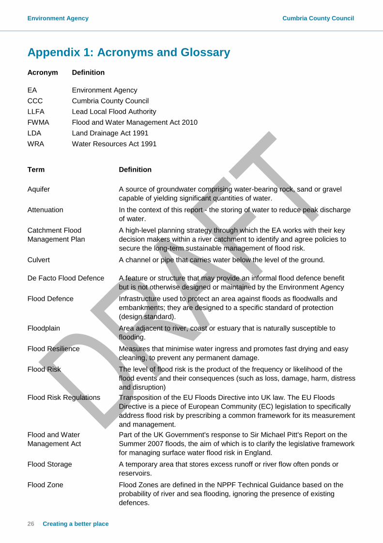
Appendix 1: Acronyms and Glossary Acronym
Definition
EA Environment Agency
CCC Cumbria County Council
LLFA Lead Local Flood Authority
FWMA Flood and Water Management Act 2010
LDA Land Drainage Act 1991
WRA Water Resources Act 1991
Term
Definition
Aquifer A source of groundwater comprising water-bearing rock, sand or gravel
capable of yielding significant quantities of water.
Attenuation In the context of this report - the storing of water to reduce peak discharge
of water.
Catchment Flood
Management Plan
A high-level planning strategy through which the EA works with their key
decision makers within a river catchment to identify and agree policies to
secure the long-term sustainable management of flood risk.
Culvert A channel or pipe that carries water below the level of the ground.
De Facto Flood Defence A feature or structure that may provide an informal flood defence benefit
but is not otherwise designed or maintained by the Environment Agency
Flood Defence Infrastructure used to protect an area against floods as floodwalls and
embankments; they are designed to a specific standard of protection
(design standard).
Floodplain Area adjacent to river, coast or estuary that is naturally susceptible to
flooding.
Flood Resilience Measures that minimise water ingress and promotes fast drying and easy
cleaning, to prevent any permanent damage.
Flood Risk The level of flood risk is the product of the frequency or likelihood of the
flood events and their consequences (such as loss, damage, harm, distress
and disruption)
Flood Risk Regulations Transposition of the EU Floods Directive into UK law. The EU Floods
Directive is a piece of European Community (EC) legislation to specifically
address flood risk by prescribing a common framework for its measurement
and management.
Flood and Water
Management Act
Part of the UK Government's response to Sir Michael Pitt's Report on the
Summer 2007 floods, the aim of which is to clarify the legislative framework
for managing surface water flood risk in England.
Flood Storage A temporary area that stores excess runoff or river flow often ponds or
reservoirs.
Flood Zone Flood Zones are defined in the NPPF Technical Guidance based on the
probability of river and sea flooding, ignoring the presence of existing
defences.

Environment Agency Cumbria County Council
27
Term
Definition
Flood Zone 1 Low probability of fluvial flooding. Probability of fluvial flooding is < 0.1%
Flood Zone 2 Medium probability of fluvial flooding. Probability of fluvial flooding is 0.1 –
1%. Probability of tidal flooding is 0.1 – 0.5 %
Flood Zone 3a High probability of fluvial flooding. Probability of fluvial flooding is 1% (1 in
100 years) or greater. Probability of tidal flooding is 0.5%(1 in 200 years)
Flood Zone 3b Functional floodplain. High probability of fluvial flooding. Probability of
fluvial flooding is >5%
Fluvial Relating to the actions, processes and behaviour of a water course (river or
stream)
Fluvial flooding Flooding by a river or a watercourse.
Freeboard Height of flood defence crest level (or building level) above designed water
level
Functional Floodplain Land where water has to flow or be stored in times of flood.
Groundwater Water that is in the ground, this is usually referring to water in the saturated
zone below the water table.
Inundation Flooding.
Lead Local Flood Authority As defined by the FWMA, in relation to an area in England, this means the
unitary authority or where there is no unitary authority, the county council
for the area, in this case Cumbria County Council.
Main River
Watercourse defined on a ‘Main River Map’ designated by DEFRA. The EA
has permissive powers to carry out flood defence works, maintenance and
operational activities for Main Rivers only.
Mitigation measure An element of development design which may be used to manage flood
risk or avoid an increase in flood risk elsewhere.
Overland Flow Flooding caused when intense rainfall exceeds the capacity of the drainage
systems or when, during prolonged periods of wet weather, the soil is so
saturated such that it cannot accept any more water.
Residual Flood Risk The remaining flood risk after risk reduction measures have been taken into
account.
Return Period The average time period between rainfall or flood events with the same
intensity and effect.
River Catchment The areas drained by a river.
Sewer flooding Flooding caused by a blockage or overflowing in a sewer or urban drainage
system.
Sustainability To preserve /maintain a state or process for future generations
Sustainable drainage
system
Methods of management practices and control structures that are designed
to drain surface water in a more sustainable manner than some
conventional techniques.

Environment Agency Cumbria County Council
28 Creating a better place
Term
Definition
Sustainable development Development that meets the needs of the present without compromising
the ability of future generations meeting their own needs.
Sustainable Flood Risk
Management
Sustainable Flood Risk Management promotes a catchment wide approach
to flooding that uses natural processes and systems (such as floodplains
and wetlands) to slow down and store water.
Topographic survey A survey of ground levels.
Tributary A body of water, flowing into a larger body of water, such as a smaller
stream joining a larger stream.
Watercourse All rivers, streams, drainage ditches (i.e. ditches with outfalls and capacity
to convey flow), drains, cuts, culverts and dykes that carry water.
Wrack Marks An accumulation of debris usually marking the high water line.
1 in 100 year event Event that on average will occur once every 100 years. Also expressed as
an event, which has a 1% probability of occurring in any one year.
1 in 100 year design
standard
Flood defence that is designed for an event, which has an annual
probability of 1%. In events more severe than this the defence would be
expected to fail or to allow flooding.

Environment Agency Cumbria County Council
29
Appendix 2: Summary of Relevant Legislation and Flood
Risk Management Authorities
The table below summarises the relevant Risk Management Authority and details the various local source of flooding that they will take a lead on.
Flood Source
Environment Agency
Lead Local Flood Authority
District Council
Water Company
Highway Authority
RIVERS
Main river
Ordinary watercourse
SURFACE RUNOFF
Surface water
Surface water on the highway
OTHER
Sewer flooding
The sea
Groundwater
Reservoirs
The following information provides a summary of each Risk Management Authority’s roles and responsibilities in relation to flood reporting and investigation. Government – DEFRA develop national policies to form the basis of the Environment Agency’s and the LLFA’s work relating to flood risk. Environment Agency has a strategic overview of all sources of flooding and coastal erosion as defined in the Act. As part of its role concerning flood investigations this requires providing evidence and advice to support other Risk Management Authorities (RMA’s). The EA also collates and reviews assessments, maps, and plans for local flood risk management (normally undertaken by LLFA). Lead Local Flood Authorities (LLFAs) – Cumbria County Council are the LLFA for Cumbria. Part of their role requires them to investigate significant local flooding incidents and publish the results of such investigations. LLFAs have a duty to determine which RMA has relevant powers to investigate flood incidents to help understand how they happened, and whether those authorities have, or intend to, exercise their powers. LLFAs work in partnership with communities and flood RMA’s to maximise knowledge of flood risk to all involved. This function is carried out at CCC by the Local Flood Risk Management Team. District and Borough Councils – These organisations perform a significant amount of work relating to flood risk management including providing advice to communities and gathering information on flooding. These organisations are classed as RMA’s. Water and Sewerage Companies manage the risk of flooding to water supply and sewerage facilities and the risk to others from the failure of their infrastructure. They make sure their systems have the

Environment Agency Cumbria County Council
30 Creating a better place
appropriate level of resilience to flooding and where frequent and severe flooding occurs they are required to address this through their capital investment plans. It should also be noted that following the Transfer of Private Sewers Regulations 2011 water and sewerage companies are responsible for a larger number of sewers than prior to the regulation. These organisations are classed as RMA’s Highway Authorities have the lead responsibility for providing and managing highway drainage and certain roadside ditches that they have created under the Highways Act 1980. The owners of land adjoining a highway also have a common-law duty to maintain ditches to prevent them causing a nuisance to road users. These organisations are classed as RMA’s Flood risk in Cumbria is managed through the Making Space for Water process, which involves the cooperation and regular meeting of the Environment Agency, United Utilities, District/Borough Councils and CCC’s Highway and LFRM Teams to develop processes and schemes to minimise flood risk. The MSfWGs meet approximately 4 times per year to cooperate and work together to improve the flood risk in the vulnerable areas identified in this report by completing the recommended actions. CCC as LLFA has a responsibility to oversee the delivery of these actions. Where minor works or quick win schemes can be identified, these will be prioritised and subject to available funding and resources will be carried out as soon as possible. Any major works requiring capital investment will be considered through the Environment Agency’s Medium Term Plan process or a partners own capital investment process. Flood Action Groups are usually formed by local residents who wish to work together to resolve flooding in their area. The FAGs are often supported by either CCC or the EA and provide a useful mechanism for residents to forward information to the MSfWG.

Environment Agency Cumbria County Council
31
Appendix 3: Useful contacts and links
Sign up for Flood Warnings https://www.gov.uk/sign-up-for-flood-warnings Environment Agency – Prepare your property for flooding; a guide for householders and small businesses to prepare for floods https://www.gov.uk/government/publications/prepare-your-property-for-flooding Environment Agency – What to do before, during and after a flood: Practical advice on what to do to protect you and your property https://www.gov.uk/government/publications/flooding-what-to-do-before-during-and-after-a-flood Environment Agency – Living on the Edge: A guide to the rights and responsibilities of riverside occupiers https://www.gov.uk/government/publications/riverside-ownership-rights-and-responsibilities Flood and Water Management Act 2010: http://www.legislation.gov.uk/ukpga/2010/29/contents Water Resources Act 1991: http://www.legislation.gov.uk/all?title=water%20resources%20act Land Drainage Act: http://www.legislation.gov.uk/all?title=land%20drainage%20act

Environment Agency Cumbria County Council
32 Creating a better place