Volume XX — Reports of International Arbitral Awardslegal.un.org/riaa/volumes/riaa_XX.pdf ·...
344
REPORTS OF INTERNATIONAL ARBITRAL AWARDS RECUEIL DES SENTENCES ARBITRALES VOLUME XX
Transcript of Volume XX — Reports of International Arbitral Awardslegal.un.org/riaa/volumes/riaa_XX.pdf ·...

REPORTS OF INTERNATIONALARBITRAL AWARDS
RECUEIL DES SENTENCES ARBITRALES
VOLUME XX

UNITED NATIONS PUBLICATION
Sales No. E/F.93.V3
ISBN 92-1-033069-2
Copyright © United Nations, 1994All rights reserved
Manufactured in the United States of America

REPORTS OF INTERNATIONALARBITRAL AWARDS
RECUEIL DES SENTENCESARBITRALES
VOLUME XX
UNITED NATIONS — NATIONS UNIES


TABLE OF CONTENTS
TABLE DES MATIÈRES
Page
Foreword vii
Avant-propos ix
PARTI
Case concerning the location of boundary markers in Tababetween Egypt and Israel
Affaire concernant l'emplacement des balises frontalières à Taba,entre l'Egypte et Israël
Decision of 29 September 1988 1Sentence du 29 septembre 1988 1
PART II
Case concerning the delimitation of maritime boundary betweenGuinea-Bissau and Senegal
Affaire de la délimitation de la frontière maritime entre la Guinée-Bissau et le Sénégal
Decision of 31 July 1989 119Sentence du 31 juillet 1989 119
PART III
Case concerning the difference between New Zealand and Franceconcerning the interpretation or application of two agree-ments, concluded on 9 July 1986 between the two States andwhich related to the problems arising from the RainbowWarrior Affair
Affaire concernant les problèmes nés entre la Nouvelle-Zélande etla France relatifs à l'interprétation ou à l'application de deux
Page
accords conclus le 9 juillet 1986, lesquels concernaient lesproblèmes découlant de l'affaire du Rainbow Warrior
Decision of 30 April 1990 215Sentence du 30 avril 1990 215
Index (English) 285Index (Français) 309
VI
FOREWORD
The present volume is made up of three arbitration cases, namely,the case concerning the location of boundary markers in Taba betweenEgypt and Israel, the case concerning the delimitation of maritimeboundary between Guinea-Bissau and Senegal and the case concerningthe difference between New Zealand and France concerning the inter-pretation or application of two agreements concluded between the twoStates and which related to the problems arising from the RainbowWarrior Affair.
As a general rule, the awards are printed in English or French,whichever was the language of the original. In order to facilitate consul-tation of the material, head-notes have been prepared in both Englishand French.
This volume, like volumes IV to XIX, was prepared by the Codifi-cation Division of the Office of Legal Affairs.
vn


AVANT-PROPOS
Le présent volume contient trois affaires d'arbitrage : l'affaire con-cernant l'emplacement des balises frontalières à Taba entre l'Egypte etIsraël; l'affaire de la délimitation de la frontière maritime entre laGuinée-Bissau et le Sénégal et l'affaire concernant les problèmes nésentre la Nouvelle-Zélande et la France relatifs à l'interprétation oul'application de deux accords conclus le 9 juillet 1986, lesquels concer-naient les problèmes découlant de l'affaire du Rainbow Warrior.
Les textes figurant aux sections I à III sont reproduits dans leurversion originale anglaise ou française. Pour faciliter autant que possiblela consultation de ces sentences, on les a fait précéder de notes som-maires rédigées à la fois en anglais et en français.
Le présent volume, comme les volumes IV à XIX, a été établi par laDivision de la codification du Bureau des affaires juridiques de l'Orga-nisation des Nations Unies.
IX


PARTI
Case concerning the location of boundary markersin Taba between Egypt and Israel
Decision of 29 September 1988
Affaire concernant l'emplacement des balises frontalièresà Taba, entre l'Egypte et Israël
Sentence du 29 septembre 1988

CASE CONCERNING THE LOCATION OF BOUNDARYMARKERS IN TABA BETWEEN EGYPT AND ISRAEL
29 SEPTEMBER 1988
Critical period for which the location of boundary markers represents legalboundary between the States—Critical period in respect of appropriate evidence—Suc-cession of States to territory—Estoppel—Acquiescence and de facto agreement—Con-duct of a party as evidence of its acquiescence—Conduct of both parties as evidence oftheir acquiescence—The principle of stability of boundaries—Relevance of eventssubsequent to the critical period.
Decision of the Tribunal in the absence of conclusive evidence and on the basis of"better" claim—"Preponderance of evidence" rule—Relevance of maps to determiningboundary markers—Inconsistency between existing boundary line and the description ofsuch line in a boundary agreement—Evidentiary value of publications—The absence ofintended intervisibility in the boundary markers—The principle of non licet—Executionof the award—The powers of the Tribunal.
TABLE OF CONTENTS
Paras.
I. THE ARBITRAL PROCEEDINGS
A. Introduction 1-3B. The Principal Provisions of the Compromis and their Implemen-
tation 4-19C. The Factual Background of the Dispute 20-108
1. Introduction 20-222. The Taba Crisis of 1906 23-323. The Delimitation and Demarcation of the 1906 Line 33-58
a. Negotiations and Survey 33-44b. The 1 October 1906 Agreement 45-51c. The Demarcation of the Line 52-58
4. The Subsequent History of the Separating Line 59-104a. The Pre-Mandate Period (1907-1923) 59-70b. The Mandate Period (1923-1948) 71-83c. The Post-Mandate Period (1948-1982) 84-104
5. The Parker Pillar 105-108D. Contentions of the Parties 109-163
1. Egypt's Contentions 109-1402. Israel's Contentions 141-163
II. REASONS FOR THE AWARD
A. Preliminary Issues 164-1811. The Task of the Tribunal 164-177

4 EGYPT/ISRAEL
Paras.
a. Meaning of the phrase "the recognized international bound-ary between Egypt and the former mandated territory ofPalestine" 169-175
b. Restrictions imposed upon the Tribunal concerning thelocations advanced by the Parties 176-177
2. The Admissibility of Egypt's Claim for BP 91 178-181B. The Fourteen Pillar Locations 182-245
1. The Nine Northernmost Pillars 182-187a. Boundary Pillar 7 188b. Boundary Pillars 14 and 15 189-190c. Boundary Pillar 17 191d. Boundary Pillar 27 192e. Boundary Pillar 46 193f. Boundary Pillars 51 and 52 194-195g. Boundary Pillar 56 196
2. Boundary Pillars 85, 86, 87 and 88 197-213a. Boundary Pillars 85, 86 and 87 198-199
(i) Do the locations of the existing pillars contradict the 1906Agreement? 200-208
(ii) The legal situation in case of contradictions betweenexisting pillar locations and the 1906 Agreement 209-211
b. Boundary Pillar 88 212-2133. Boundary Pillar 91 214-245
a. Israel's Alternative Locations 217-225b. Egypt's Location 226
(i) Periods during which boundary pillars were in existenceat the Parker site and at the site of BP 91(E) 227-229
(ii) The argument that Parker had no authority to take part inthe demarcation process and that the Parker pillar waswrongly located 230-233
(iii) The argument that BP 91(E) was a trig point erroneouslymarked as a boundary pillar 234-235
(iv) The argument that neither BP 91(E) nor the Parker pillarwas intervisible with BP 90 236-237
(v) The argument that BP 91(E) is not "the final pillar" nor"at the point of Ras Taba on the western shore of theGulf of Aqaba" and the question of non licet 238-244
c. Conclusion 245C. Execution of the Award 246-250
Pages
DISPOSITIF 130-131
Dissenting Opinion of Prof. Ruth Lapidoth 133-213Table of Contents 133-134
Appendix A: The Arbitration Compromis of 11 September 1986 215-225Appendix B: The 1 October 1906 Agreement 227-229Appendix C: General Area Map 231Appendix D: Southern Portion of the Map included with the Compromis . . 232
CASE CONCERNING BOUNDARY MARKERS IN TABA 5
AWARD
In the Dispute Concerning Certain Boundary Pillars between theArab Republic of Egypt and the State of Israel
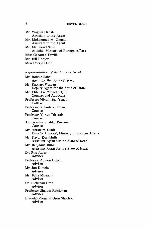
Representatives of the Arab Republic of Egypt:Ambassador Nabil Elaraby
Agent for the Arab Republic of EgyptAmbassador Ahmed Maher El-Sayed
Deputy Agent for the Arab Republic of Egypt, Director, Legal andTreaties Department, Ministry of Foreign Affairs
Ambassador Mohab MokbelDeputy Agent for the Arab Republic of Egypt
Professor Derek Bowett, Q. C.Counsel and Advocate
Sir Ian Sinclair, Q. C.Counsel
Professor Talaat El-GhoneimyCounsel
Professor Ahmed El-KoshieryCounsel
Professor Georges Abi-SaabCounsel
Mr. Samih SadekCounsel
Professor Mofeed ShehabCounsel
Professor Salah AmerCounsel
Dr. Amin El-MahdyLegal Counsellor
Mr. Fathy NaguibLegal Counsellor
Professor Nicolas ValticosAdvisor
Mr. Walter SohierAdvisor
Professor Yuonan RizkExpert
Major-General Khairy El-ShamaaMilitary Advisor
Colonel Mohammed El-ShenawyMilitary Advisor
Mr. Ahmed FathallahFirst Secretary, Egyptian Mission in Geneva
6 EGYPT/ISRAEL
Mr. Waguih HanafîAssistant to the Agent
Mr. Mohammed M. GomaaAssistant to the Agent
Mr. Mahmoud SamiAttaché, Ministry of Foreign Affairs
Miss Gehanne TewfikMr. Bill HarperMiss Cheryl Dunn
Representatives of the State of Israel:Mr. Robbie Sabel
Agent for the State of IsraelMr. Raphael Walden
Deputy Agent for the State of IsraelMr. Elihu Lauterpacht, Q. C.
Counsel and AdvocateProfessor Nissim Bar-Yaacov
CounselProfessor Yehuda Z. Blum
CounselProfessor Yoram Dinstein
CounselAmbassador Shabtai Rosenne
CounselMr. Abraham Tamir
Director General, Ministry of Foreign AffairsMr. David Kornbluth
Assistant Agent for the State of IsraelMr. Benjamin Rubin
Assistant Agent for the State of IsraelDr. Ron Adler
AdviserProfessor Amnon Cohen
AdviserMr. Jon Kimche
AdviserMr. Felix Mizrachi
AdviserDr. Elchanan Oren
AdviserProfessor Shalom Reichman
AdviserBrigadier-General Oren Shachor
Adviser

CASE CONCERNING BOUNDARY MARKERS IN TABA 7
Colonel Joel SingerAdviser
Brigadier-General (retd.) Dov SionAdviser
Lieutenant Colonel Haim SrebroAdviser
Mr. Gershon SteinbergAdviser
Dr. Mala TaboryAdviser
Mr. Michael P. WallaceAdviser
Mrs. Ora SeidnerCoordinator
Mrs. Shirley RainbowSecretaryThe Tribunal, composed ofGunnar Lagergren, PresidentPierre Bellet,Dietrich Schindler,Hamed Sultan, andRuth Lapidoth,
delivers the following Award:
I. THE ARBITRAL PROCEEDINGS
A. Introduction
1. The Arab Republic of Egypt ("Egypt") and the State of Israel("Israel") concluded a Treaty of Peace on 26 March 1979. Article I ofthe Treaty of Peace provides that: " 1 . The state of war between theParties will be terminated and peace will be established betweenthem . . . " and "2. Israel will withdraw all its armed forces and civil-ians from the Sinai behind the international boundary . . . and Egypt willresume the exercise of its full sovereignty over the Sinai." Article II ofthe Treaty of Peace establishes that the permanent boundary betweenEgypt and Israel is "the recognized international boundary betweenEgypt and the former mandated territory of Palestine".
2. A Joint Commission was established pursuant to Article IV ofthe Treaty of Peace for the purpose of, among other functions, "organ-izing] the demarcation of the international boundary" as set forth inArticle IV(3) (d) of the Appendix to Annex I to the Treaty of Peace. Inthe course of the Joint Commission's work relating to the demarcation ofthe international boundary, the precise locations of some of the nearly100 pillars demarcating the boundary line could not be agreed upon priorto 25 April 1982, the date established pursuant to Annex I to the Treaty
8 EGYPT/ISRAEL
of Peace for the final Israeli withdrawal behind the international bound-ary. On 25 April 1982, the Parties agreed to submit the remainingtechnical questions concerning the international boundary "to anagreed procedure which will achieve a final and complete resolution, inconformity with Article VII of the Treaty of Peace". In the interim, eachParty agreed "to move behind the lines indicated by the other".
3. Article VII of the Treaty of Peace provides that:1. Disputes arising out of the application or interpretation of
this Treaty shall be resolved by negotiations.2. Any such disputes which cannot be settled by negotiations
shall be resolved by conciliation or submitted to arbitration.Negotiations between the Parties, assisted through the mediation ofrepresentatives of the United States of America as contemplated by the25 April 1982 Agreement, did not result in any agreement. The Partiesthen agreed on 11 September 1986 to submit to arbitration their differ-ences regarding the location of fourteen of the boundary pillars demar-cating their international boundary between a point on the coast of theMediterranean Sea near Rafah to a point called Ras Taba on the westernshore of the Gulf of Aqaba. The Parties also agreed that the locations oftwo other disputed pillars depended directly on the decision made by thearbitral tribunal regarding neighbouring disputed pillars.
B. The Principal Provisions of the Compromisand Their Implementation
4. The Arbitration Compromis of 11 September 1986 provided forthe establishment of the Tribunal and identified its five Members: RuthLapidoth, nominated by the Government of Israel, Hamed Sultan,nominated by the Government of Egypt, Pierre Bellet, Dietrich Schind-ler, and Gunnar Lagergren, named as President of the Tribunal. TheTribunal first met in Geneva, Switzerland on 8 December 1986 at LeSaugy in Genthod and was formally constituted on 10 December 1986 inthe Alabama Room of the Hôtel de Ville of the Republic and Canton ofGeneva in the presence of the Agents for the Parties and certain invitedguests. Basic procedural questions were resolved during the first, sec-ond, and third meetings of the Tribunal on 8, 9, and 10 December 1986,including the timetable for the submission of the written pleadings andthe appointment of Professor Bernard Dutoit of the University of Lau-sanne as temporary Registrar of the Tribunal.
5. Article VIII, paragraph 3, of the Compromis provides that:The proceedings shall consist of written pleadings, oral hearings and visits, to siteswhich the Tribunal considers pertinent, in accordance with the following schedule:
(A) The written pleadings shall include the following documents:(i) A memorial, which shall be submitted by each party to the Tribunal within
150 days of the first session of the Tribunal, and(ii) A counter-memorial, which shall be submitted by each party to the Tribunal
within 150 days of the exchange of memorials, and(iii) A rejoinder, if a party, after informing the other party, notifies the registrar
within 14 days of the exchange of counter-memorials of its intention to file a re-

CASE CONCERNING BOUNDARY MARKERS IN TABA 9
joinder. In the event of such notification by one party, the other party shall also beentitled to submit a rejoinder. The rejoinders shall be submitted to the Tribunalwithin 45 days of the notification . . .
(B) The oral hearings and the visits shall be conducted in such order and insuch manner as the Tribunal shall determine. The Tribunal shall endeavor to com1
plete its visits and the oral hearings within 60 days of the completion of the submis-sion of the written pleadings . . .
6. In accordance with this Article, the Parties exchanged theirMemorials on 13 May 1987 in the presence of the President and thetemporary Registrar. Pursuant to Article V of the Compromis, andduring August 1987, the President appointed as Registrar Douglas Rei-chert, Member of the Bar of the State of California and presently locatedin Geneva. The Counter-Memorials were exchanged on 12 October 1987in the presence of the Tribunal and the Registrar, convened for theoccasion to discuss procedural matters related to the schedule of thevisit and the hearing. By the drawing of a lot, it was determined thatEgypt would present first its oral arguments at the hearing, followed byIsrael. At the joint request of the Parties, Rejoinders were submitted on1 February 1988 in the presence of the Tribunal and the Registrar,convened to finalize the schedule for the remainder of the proceedings.The various written pleadings were accompanied by Annexes, includingmaps, documents, and two models.
7. The Tribunal conducted a visit to selected sites within thedisputed areas on 17 February 1988. The Tribunal's visit itinerary wasestablished in consultation with the Parties. Air and ground transporta-tion within the disputed areas was provided by the Multinational Forceand Observers (MFO), an organisation established by the Parties pur-suant to the Treaty of Peace and charged, inter alia, with maintainingsecurity in the Taba area pursuant to Article XI of the Compromis.
8. In parallel with the Tribunal's activities during the writtenphase of the proceedings, a Chamber was constituted pursuant to Arti-cle IX of the Compromis to "explore the possibilities of a settlement ofthe dispute." Article IX provides:
1. A three-member chamber of the Tribunal shall explore the possibilities of asettlement of the dispute. The three members shall be the two national arbitratorsand, as selected by the President of the Tribunal sometime before the submission ofthe suggestions, one of the two non-national arbitrators.
2. After the submission of counter-memorials, this chamber shall give thor-ough consideration to the suggestions made by any member of the chamber fora proposed recommendation concerning a settlement of the dispute. Suggestionsbased upon the memorials, the counter-memorials, and other relevant submis-sions shall be presented to the chamber commencing from the month immediatelypreceding the counter-memorials. The chamber shall thereafter consider these sug-gestions, and the counter-memorials, during the period after submission of the coun-ter-memorials until the completion of the written pleadings. Any proposed recom-mendation concerning a settlement of the dispute which obtains the approval of thethree members of the chamber will be reported as a recommendation to the partiesnot later than the completion of the exchange of written pleadings. The parties shallhold the report in strictest confidence.
3. The arbitration process shall terminate in the event the parties jointly in-form the Tribunal in writing that they have decided to accept a recommendation of

10 EGYPT/ISRAEL
the chamber and that they have decided that the arbitration process should cease.Otherwise, the arbitration process shall continue in accordance with this Com-promis.
4. All work pursuant to the above paragraphs absolutely shall not delay thearbitration process or prejudice the arbitral award, and shall be held in the strictestconfidence. No position, suggestion, or recommendation, not otherwise part of thepresentation of a party's case on the merits, shall be brought to the attention of theother members of the Tribunal, or be taken into account in any manner by any ofthe members of the Tribunal in reaching their arbitral decision.
9. The Chamber was composed of the two national arbitrators,Hamed Sultan and Ruth Lapidoth, and Pierre Bellet, who was selectedby the President on 1 September 1987. The Chamber convened fol-lowing the exchange of the Counter-Memorials on 12 October 1987,appointed Mr. Bellet as its Chairman, and empowered him to meet withthe Agents of the Parties separately and together. The Chamber met on13 October 1987, 6-7 January 1988, and 3 February 1988 followingmeetings between the Chairman and the Agents for the Parties.
10. Since the Compromis provides that the mandate of the Cham-ber expired with the ' 'completion of the written pleadings", and in orderto permit the Chamber to take into consideration the arguments con-tained in the Rejoinders, an arrangement was made with the Parties thatthey should informally exchange their Rejoinders on 1 February 1988 asdecided, but that the formal filing, and hence the completion of thewritten pleadings, be extended until 1 March 1988.
11. On 1 March 1988, the Chairman of the Chamber informed thePresident of the Tribunal and the Agents of the Parties that the Chamberregretted not having been able to propose to the Parties any recommen-dation for a settlement of the dispute, despite their efforts to find areasonable proposal which might be acceptable to both Parties.
12. The oral arguments were heard in private during two roundsfrom 14 March to 25 March 1988 and from 11 April to 15 April 1988 in theSalle du Grand Conseil and in the Alabama Room of the Hôtel de Ville inGeneva. At the opening of the hearing, a short video film was presentedby Israel. During the hearing, 13 witnesses gave testimony, 10 presentedby Egypt and 3 by Israel. One additional witness for Egypt, unable toattend the hearing for health reasons, provided, with the leave of theTribunal, an affidavit concerning his testimony.
13. A number of additional maps, photographs, and documentswere introduced during the hearing by both Parties with the consent or atthe request of the Tribunal. In response to the testimony of an expertwitness for Egypt that one of the photographs submitted by Israel mightnot be authentic, Israel requested leave to introduce additional wit-nesses in order to testify with regard to the authenticity of the series ofphotographs in question. The Tribunal considered the question butdecided, with one Member dissenting, that there was no reason at thetime to grant the request. The original print of the questioned pho-tograph was later submitted for inspection by the Tribunal and nofurther action was taken.

CASE CONCERNING BOUNDARY MARKERS IN TABA 11
14. The Tribunal wishes to commend the Parties for the spirit ofcooperation and courtesy which permeated the proceedings in generaland which thereby rendered the hearing a constructive experience.
15. In connection with its present task, the Tribunal notes thefollowing important provisions of the Compromis and related docu-ments regarding the functions of the Tribunal and the rendering of itsAward.
Article II
The Tribunal is requested to decide the location of the boundary pillars of therecognized international boundary between Egypt and the former mandated ter-ritory of Palestine, in accordance with the Peace Treaty, the April 25, 1982 Agree-ment, and the Annex.
Article VIII, paragraph 1
The Tribunal shall apply the provisions of this Compromis.
Article XI
1. In accordance with the provisions of the agreement of 25 April 1982:(A) Egypt and Israel agree to invite the MFO to enter Taba and maintain
security therein through the establishment of an observation post in a suitable topo-graphic location under the flag of the MFO in keeping with the established standardsof the MFO. Modalities for the implementation of this paragraph have been discus-sed and concluded by Egypt and Israel through the liaison system before the signa-ture of the Compromis. The interpretation and implementation of this paragraphshall not be within the jurisdiction of the Tribunal.
(B) During the interim period any temporary arrangements and/or any activ-ities conducted shall not prejudice in any way the rights of either party or be deemedto affect the position of either party or prejudge the final outcome of the arbitrationin any manner.
(C) The provisions of the interim period shall terminate upon the full imple-mentation of the arbitral award.
2. The Tribunal shall have no authority to issue provisional measures con-cerning the Taba area.
16. The relevant provisions of the Treaty of Peace were notedabove in the Introduction.
17. The 25 April 1982 Agreement provides:Egypt and Israel agree on the following procedure for resolving the remaining tech-nical questions concerning the international boundary, in conformity with all therelevant provisions of the Treaty of Peace, which they have been unable to resolvethrough negotiations. Egypt and Israel agree that these questions shall be submittedto an agreed procedure which will achieve a final and complete resolution, in confor-mity with Article VII of the Treaty of Peace. Pending conclusion of the Agreement,each party agrees to move behind the lines indicated by the other. The parties agreeto request the Multinational Force and Observers to maintain security in theseareas. In the interim period, activities which have been conducted in these areasshall continue. No new construction projects will be initiated in these areas. Meet-ings will be held between Egypt and Israel to establish the arrangements which willapply in the areas in question, pending a final determination of the boundary demar-cation questions. Representatives of the United States Government will participatein the negotiations concerning the procedural arrangements which will lead to the
12 EGYPT/ISRAEL
resolution of matters of the demarcation of the International Boundary betweenMandated Palestine and Egypt in accordance with the Treaty of Peace, if requestedto do so by the Parties. The temporary arrangements hereby or subsequently estab-lished and the activities conducted pursuant thereto shall not be deemed to affect theposition of either party, or prejudge the final outcome.
18. The Annex to the Compromis provides:1. A dispute has arisen on the location of the following boundary pillars of the
recognized international boundary between Egypt and the former mandated ter-ritory of Palestine: 7, 14, 15, 17, 27, 46, 51, 52, 56, 85, 86, 87, 88, and 91. The partiesagree that boundary pillars 26 and 84 are on the straight lines between boundarypillars 25 and 27, and 83 and 85, respectively, and that the decision of the Tribunalon the locations of boundary pillars 27 and 85 will establish the locations of bound-ary pillars 26 and 84, respectively. The parties agree that if the Tribunal establishesthe Egyptian location of boundary pillar 27, the parties accept the Egyptian locationof boundary pillar 26, recorded in Appendix A; and, if the Tribunal establishesthe Israeli location of boundary pillar 27, the parties accept the Israeli locationof boundary pillar 26, recorded in Appendix A. The parties agree that if the Tri-bunal establishes the Egyptian location of boundary pillar 85, the parties accept theEgyptian location of boundary pillar 84, recorded in Appendix A; and, if the Tri-bunal establishes the Israeli location of boundary pillar 85, the parties accept theIsraeli location of boundary pillar 84, recorded in Appendix A. Accordingly, theTribunal shall not address the location of boundary pillars 26 and 84.
2. Each party has indicated on the ground its position concerning the locationof each boundary pillar listed above. For the final boundary pillar No. 91, which is atthe point of Ras Taba on the western shore of the Gulf of Aqaba, Israel has indicatedtwo alternative locations, at the granite knob and at Bir Taba, whereas Egypt hasindicated its location, at the point where it maintains the remnants of the boundarypillar are to be found.
3. The markings of the parties on the ground have been recorded in Appen-dix A.
4. Attached at Appendix B is the map referred to in Article II of the Treaty ofPeace, which provides:
The permanent boundary between Egypt and Israel is the recognized inter-national boundary between Egypt and the former mandated territory of Pales-tine, as shown on the map at Annex II, without prejudice to the issue of thestatus of the Gaza Strip. The parties recognize this boundary as inviolable.Each will respect the territorial integrity of the other, including their territorialwaters and airspace.A 1:100,000 map is included in order to permit the indication of the locations of
the 14 disputed boundary pillars advanced by the parties and provides an index toAppendix A. The Tribunal is requested to refer to the general armistice agreementbetween Egypt and Israel dated 24 February 1949.
5. The Tribunal is not authorized to establish a location of a boundary pillarother than a location advanced by Egypt or by Israel and recorded in Appendix A.The Tribunal is also not authorized to address the location of boundary pillars otherthan those specified in paragraph 1.
19. In connection with the formulation of its Award, the Tribunalalso notes the following further provisions of the Compromis:
Article XII
1. The Tribunal shall endeavor to render its award within 90 days of thecompletion of the oral hearings and visits. The award shall state the reasons uponwhich it is based.

CASE CONCERNING BOUNDARY MARKERS IN TABA 13
2. The award shall be deemed to have been rendered when it has been pre-sented in open session, the agents of the parties being present, or having been dulysummoned to appear.
3. Two original copies of the award, signed by all members of the Tribunal,shall immediately be communicated by the President of the Tribunal to each of theagents. The award shall state the reason for the absence of the signature of anymember.
4. The Tribunal shall decide the appropriate manner in which to formulate andexecute its award.
5. Any member of the Tribunal shall be entitled to deliver a separate or dissen-ting opinion. A separate or dissenting opinion shall be considered part of the award.
6. The Tribunal shall at the joint request of the parties incorporate into itsaward the terms of any agreement between the parties relating to the issue.
Article XIII
1. Any dispute between the parties as to the interpretation of the award or itsimplementation shall be referred to the Tribunal for clarification at the request ofeither party within 30 days of the rendering of the award. The parties shall agreewithin 21 days of the award on a date by which implementation will be completed.
2. The Tribunal shall endeavor to render such clarification within 45 days ofthe request, and such clarification shall become part of the award and shall not beconsidered a provisional measure under the provisions of Article XI (2) of thisCompromis.
Article XIV
1. Egypt and Israel agree to accept as final and binding upon them the awardof the Tribunal.
2. Both parties undertake to implement the award in accordance with theTreaty of Peace as quickly as possible and in good faith.
C. The Factual Background of the Dispute
1. Introduction20. During the 19th century and before, the territories of present-
day Egypt and Israel were both contained in the Ottoman Empire.However, in 1841, the Sultan conferred upon Mohammed Ali the here-ditary Pashalik of Egypt, creating thereby, within boundaries defined bythe Sultan, a privileged vassal State within the Empire. Egypt wasempowered to administer the territory of Sinai. The precise bounds ofthis administrative control of territories in Sinai fluctuated during thereign of the first three Khedives and the western limits of the neigh-bouring Vilayet of Hedjaz were never clearly expressed.
21. The Suez Canal was opened in 1869. In order to secure theCanal as its route to India, Great Britain occupied Egypt in 1882 without,however, seeking to alter the formal status of the Khediviate as anOttoman vassal. On 24 October 1885, Great Britain and Turkey con-cluded a Convention relative to Great Britain's special status in Egypt-ian affairs.
22. Upon the succession of Abbas Hilmi as Khedive in January1892, the British Agent and Consul General in Cairo, Sir Evelyn Baring

14 EGYPT/ISRAEL
(later Lord Cromer), was concerned by the apparent differences be-tween the wording of the Firman of Investiture issued to Abbas Hilmi bythe Sultan on 27 March 1892 and that issued to his predecessor. The newFirman made no mention of the Sinai territories administered by theprevious Khedives and defined the territory of the Khediviate of Egyptin terms of the line from Rafah to Suez. The Grand Vizier of the Sultansent a telegram to the Khedive on 8 April 1892, confirming that cer-tain Egyptian garrisons outside of the Sinai, including Aqaba, were tobe restored to the Vilayet of Hedjaz, but that the status quo of Khe-dival administration of the parts of the Sinai lying east of the Rafah-Suezline was to be maintained. It may be noted that the land route acrossSinai for the Haj was apparently falling into disuse at the time. LordCromer wrote to Tigrane Pasha, the Egyptian Minister for ForeignAffairs, on 13 April 1892 and informed him that Great Britain consentedto this confirmation of Egypt's administration of Sinai, adding his under-standing that the Sinai peninsula consisted of "the territory bounded tothe east by a line running in a south-easterly direction from a point ashort distance to the east of El Arish [which apparently meant Rafah] tothe head of the Gulf of Akaba", leaving Aqaba itself in the Vilayet ofHedjaz.
2. The Taba Crisis of 190623. At the end of December 1905, Lord Cromer received intel-
ligence from Constantinople that the Sultan had been informed of Egypt-ian plans to construct "barracks" on the Sinai frontier near Aqaba andthat he had decided to establish a Turkish guardhouse there first. On2 January 1906, Lieutenant W. E. J. Bramly, the Inspector of Sinai (atitle equivalent to Governor), was instructed by the British ActingDirector of Intelligence for the area in Cairo, Captain R. C. R. Owen, toform a small post at Naqb el Aqaba. He was informed that he might findthat the Turks had already established a post at the spot and that heshould avoid a confrontation.
24. On 10 January 1906, Bramly reported that he had establishedhimself at the foot of the Naqb el Aqaba, in Marashash (present-dayEilat) at the mouth of the Wadi el Arabi near to a well at the head of theGulf, had met with the Turkish Kaimakam (head of district) at Aqaba,and had ascertained that Turkey was claiming Taba and Kuntilla, bothplaces with water which Egypt considered to be west of the Rafah-Aqaba line asserted by Lord Cromer. Bramly proposed that he and aTurkish representative should demarcate the boundary and that hewould thereafter map it, as he had been sketching maps of the area forthe War Office and the Palestine Exploration Fund over the previoustwo years.
25. On 14 January 1906, Bramly reported that he had met with theCommandant of Aqaba and had decided to return to Nekhl, the mainEgyptian garrison in the center of the Sinai, after agreeing to remove histents at Marashash upon receipt from the Commandant of a writtenclaim by Turkey to the place. He stated that he would observe Turkishactions on the frontier while awaiting further instructions.

CASE CONCERNING BOUNDARY MARKERS IN TAB A 15
26. Owen then dispatched the Egyptian Coast Guard steamer"Nur el Bahr", with Saad Bey Rifaat, the former Egyptian Comman-dant at Aqaba prior to 1892, and 50 men to re-occupy the Naqb el Aqabaand, if Bramly thought necessary, Taba also. On 23 January 1906, theCommander of the "Nur el Bahr" wrote to Bramly in Nekhl to informhim that, on their arrival at Taba, they had encountered a Turkish officerwho refused them permission to land and had threatened to fire on theship if they so attempted. The Egyptian force established itself onnearby Pharaon Island instead.
27. Bramly joined the force at Pharaon and received instructionsdated 28 January 1906 from Captain A. C. Parker, the Assistant Directorof Intelligence in Cairo, to hold his position but to see to it that nothing inthe nature of hostilities should take place. On 14 February 1906, Owensent Parker to replace Bramly at Pharaon and instructed Bramly toreturn to Nekhl and resume administration of the Sinai territory since itappeared to him that resolution of the crisis might take some time.
28. The British Ambassador in Constantinople meanwhile sug-gested a joint delimitation of the Sinai frontier, but Turkey objected,arguing that it was impossible to change the description of Egyptianterritory already effected by the Imperial Firman of Investiture of 1892.Negotiations continued for several months.
29. On 27 March 1906, Lord Cromer suggested to the ForeignOffice in London that the main point had become to achieve withdrawalof Turkish troops from Egyptian territory and that demarcation was nowless important. He regretted the absence in the 8 April 1892 telegramfrom the Grand Vizier mentioned above of any definition of the easternlimit of the Sinai, and referred to his definition given at the time in hisletter of 13 April 1892. Lord Cromer then suggested a refinement of thatdefinition, which he felt could be achieved through an exchange ofdiplomatic notes between Great Britain and Turkey, confirming that thefrontier was as defined in his note of 13 April 1892, but describing thelimits more precisely as: "the territory bounded to the east by a straightline running from Rafah—a point a short distance east of El-Arish—in asouth-easterly direction to a point on the Gulf of Akaba, lying threemiles to the west of the existing fort of Aqaba".
30. Turkey rejected this definition, reserving to itself the right tointerpret the 1892 Firman, which spoke only of the Suez-Rafah line asthe frontier of Egypt, and the right to revoke at any time the GrandVizier's telegram of 8 April 1892 regarding Egyptian administration ofthe Sinai to the east of the Suez-Rafah line. Turkey argued that Taba wasa dependency of Aqaba, and informed the Khedive that it was contem-plating the extension of the Hedjaz railway to Aqaba and from thence toSuez. The railway would traverse the Sinai peninsula south of the Suez-Rafah line referred to in the 1892 Firman as constituting the actual limitof Egyptian territory. The Sultan's special representative, sent to Cairoto settle the dispute, nonetheless suggested a compromise line from ElArish to Ras Mohammed.
31. These proposals and positions greatly alarmed the British,who viewed the Rafah-Aqaba line as vital to the security of the Canal.

16 EGYPT/ISRAEL
Lord Cromer suggested that forceful measures were necessary, but notin the area of the Sinai, in order to persuade the Sultan to accept theBritish understanding of the Egyptian administrative frontier.
32. An ultimatum was addressed to the Sultan on 3 May 1906,underscored by a British naval threat to seize certain Turkish islands inthe Mediterranean, giving the Sultan 10 days in which to agree toevacuate Taba and to a demarcation of the line from Rafah to the head ofthe Gulf of Aqaba on the basis of the 8 April 1892 telegram. The Sultanagreed to evacuate Taba and on 13 May 1906 the Turkish forces at Tabawere withdrawn. On 14 and 15 May 1906, Great Britain and Turkeyexchanged diplomatic notes expressing their agreement "to delimit andrecord on a map", prepared jointly by representatives of the Sultan andthe Khedive, "the line of demarcation running approximately straightfrom Rafeh in a south-easterly direction to a point on the Gulf of Akabanot less than 3 miles from Akaba".
3. The Delimitation and Demarcation of the 1906 Linea. Negotiations and Survey33. On 22 May 1906, the Khedive appointed Ibrahim Fathi Pasha
and Captain Owen as his representatives for the settlement of thefrontier between Aqaba and Rafah with the representatives of the Ot-toman Government. He gave them full powers to agree to whateverpetty changes were deemed necessary to the boundary line, which hedescribed as beginning at "Rafeh, near El Arish, and takfing] a south-easterly direction until it ends in a point on the Gulf of Akaba at least3 miles from Akaba" and that it "should be an approximately straightline".
34. In May, Mr. E. B. H. Wade and Mr. B. F. E. Keeling from theSurvey Department of the Egyptian Ministry of Finance were assignedto accomplish the difficult task of rapidly and accurately charting theterritory along the length of the expected frontier line. Owing to the hotdesert conditions during the summer months, a triangulation survey wasruled out. Instead, the surveyors decided to conduct their survey bydetermining the latitude of a number of intervisible points, designatedastronomical stations, the azimuth of the lines connecting them, andthen to calculate the longitude of each point after ascertaining, as ac-curately as possible, the longitude of the two end points of this chain ofastronomical stations established near to the hypothetical straight linefrom Rafah to the point at least three miles from Aqaba.
35. Owen and Fathi Pasha left Cairo on 24 May 1906, joined thesurveyors and the "Nur el Bahr" at Suez, and arrived at Aqaba on26 May 1906. Wade established a site for astronomical observations atTaba, describing it as A.I.
36. The Egyptian Commissioners had their first meeting in Aqabawith Muzaffer Bey and Fahmi Bey, the two Commissioners appointedby the Sultan, on 27 May 1906. Wade, who had expected to be able toreturn to Taba on 28 May for his astronomical observations, insteaddetermined the azimuth of a line he made at Aqaba. On the 29th heestablished his station A.2 near the camp at Aqaba. From A.2 he could

CASE CONCERNING BOUNDARY MARKERS IN TABA 17
see the granite knob at Taba, near to which he had established his sta-tion A.I.
37. Wade finally returned to Taba on 30 May and determined thelatitude of his station A. 1. On 31 May, he established a station B. 1 on the"conspicuous granite knob on shore at Taba", from which he could seeA.2, not having been able to see A.2 from A.I.
38. Meanwhile, on 29 May 1906, all of the Commissioners rode upthe Naqb el Aqaba to the head of the pass on to the plateau where theNekhl-Aqaba and Gaza-Aqaba roads meet. In their initial discussion,the Turkish Commissioners indicated that they were most interested insecuring the whole of the Naqb el Aqaba as it was "part of Aqaba" andnecessary to its security. Owen reported to Lord Cromer the day of thisvisit that he thought that "we can without any loss to ourselves give theTurks the Nakb-el-Akaba, provided we hold the head of it . . . Ourfrontier line, I think, will then run along the ridge north of Taba in anortherly direction till it reaches a prominent hill (which we have namedJebel Ibrahim) about 1,000 yards from the head of the Nakb-el-Akaba,and from thence to the head of the pass and edge of the plateau . . . We,of course, keep Taba, running the boundary line in such a way that noposition can command the Wadi-el-Taba, which will be our road down toTaba and so to the Gulf of Akaba."
39. In one of two Reports of 3 June 1906, Owen further describedhis proposal for the course of the line in the area of the Naqb el Aqaba.He "proposed that the boundary-line should commence on the Gulf ofAkaba at Ras Taba, that is at the point where the ridge north of Tabameets the sea, thence along ridge in a north-westerly direction up to acertain fixed point, thence north-east, south of Jebel Ibrahim to Mufrak,the head of the pass and edge of plateau . . ." In later descriptions,Owen referred to "Jebel Fort" in place of the "fixed point".
40. There was much discussion in the early meetings of the loca-tion of the point at least "3 miles from Akaba" where the boundary linewas intended to start. The Turkish Commissioners advanced severalinterpretations; among them that this could be measured from Naqbel Aqaba up on the plateau, construing the Naqb el Aqaba as part of thelocality of Aqaba, that this could be measured directly across the Gulffrom Aqaba Fort, or that the boundary should commence at Taba. TheEgyptians claimed that the point "3 miles from Akaba" was intended tobe measured around the Gulf, along the shoreline, to Marashash. Owenhad written to Parker on 1 June 1906 that the location of this point would"probably decide to whom Kassima, which is the most important pointalong the line, belongs". He added that "[w]e must have Kassima." Inhis General Report, written after returning to Cairo in October, Owenremarked that the starting point of the boundary was "the principal andmost difficult point to decide" in the early discussions.
41. The general procedure thereafter was for Keeling to proceedin advance and to beacon places he felt could serve as astronomicalstations to which he could tie his topographical observations, onceWade had made the necessary astronomical observations and calculatedthe values for these points so that they could be plotted on the map

18 EGYPT/ISRAEL
paper. In all, 16 astronomical stations were established by Wade. TheCommissioners apparently travelled with the main camp, while recon-noitering the areas where they believed the boundary should pass.
42. Owen next reported on 12 June 1906 from Mayein that thesurveyors, owing to the rough nature of the terrain and the limited timeavailable to them, were only able to make "a fairly rough though veryaccurate survey".
43. The Commissioners eventually reached Rafah on 28 June1906. Wade reported that, on 30 June 1906, he observed the local timeand latitude for his station A. 13. This station was established 80 metressouth of the marble frontier pillars at Rafah, which had been long beforeerected to indicate the frontier of Egypt. From Rafah, time signals wereexchanged by telegraph with the Helwan Observatory in Cairo in orderto establish the longitude of A. 13. From this information, Wade was ableto calculate the latitude and longitude of all of his astronomical stations,as well as of the marble pillars themselves. In early July 1906, thesurveyors then worked on their map in El Arish.
44. Owen next reported on 10 July 1906, after receiving from thesurveyors the completed maps of the area along the Rafah-Aqaba line,that the discussions again had become difficult since the Turkish Com-missioners indicated that they lacked full powers. Difficult and pro-longed discussions followed. They were not crowned with success untilafter the Sultan on 11 September 1906 issued an Imperial Iradé to thefollowing effect, inter alia: " 1. The starting-point of the line on the Gulfto be Marashash. 2. Such commanding positions of Nagb-el-Akaba asare necessary to Akaba from a strategic point of view are to remain onthe Turkish side, while Mofrak is to be left to Sinai" (from a telegram of12 September 1906 from Sir N. O'Conor to Sir Edward Grey). Anagreement on the line was reached soon thereafter and signed on 1 Oc-tober 1906.
b. The 1 October 1906 Agreement45. While the Egyptian Commissioners requested that the
agreement be written in French, the Turkish Commissioners insisted onTurkish, as that was the official language for communications betweenthe Sultan and the Khedive. The negotiated text was therefore written inTurkish and then translated from Turkish into Arabic and then from theArabic translation into English for the benefit of the English-speakingmembers of the Egyptian delegation. The British decided that it wasimportant to conclude the agreement rapidly, and so the decision wastaken not to attempt to correct the inconsistencies between the informalEnglish translation and the authentic Turkish text, or to refine furtherthe language. English translations were printed in a number of officialsources and apparently were relied on thereafter. This expediency hasled to some questions of interpretation in the present case, as it trans-pired that up until after the conclusion of the Compromis in 1986, noauthorities since before the First World War had ever consulted theauthentic Turkish text, not even the Parties to this dispute. The Tri-bunal, unless it specifies otherwise, will follow in this Award the general

CASE CONCERNING BOUNDARY MARKERS IN TABA 19
practice of the Parties and refer to the contemporaneous English transla-tion as included in Owen's General Report.
46. The Agreement, signed at Rafah on 1 October 1906, reads inArticle 1:
The administrative separating line, as shown on map attached to this Agree-ment, begins at the point of Ras Taba on the western shore of the Gulf of Akaba andfollows along the eastern ridge overlooking Wadi Taba to the top of Jebel Fort, fromthence the separating line extends by straight lines as follows:
From Jebel Fort to a point not exceeding 200 metres to the east of the top ofJebel Fathi Pasha, thence to that point which is formed by the intersection of aprolongation of this line with a perpendicular line drawn from a point 200 metresmeasured from the top of Jebel Fathi Pasha along the line drawn from the centre ofthe top of that hill to Mofrak Point (the Mofrak is the junction of the Gaza-Akaba andNekhl-Akaba roads). From this point of intersection to the hill east of and over-looking Thamilet-el-Radadi—place where there is water—so that the Thamila (orwater) remains west of the line, thence to top of Ras Radadi, marked on the above-mentioned map as (A 3), thence to top of Jebel Safra marked as (A 4), thence to topof eastern peak of Um Guf marked as (A 5), thence to that point marked as (A 7),north of Thamilet Sueilma, thence to that point marked as (A 8), on west-north-westof Jebel Semaui, thence to top of hill west-north-west of Bir Maghara (which is thewell in the northern branch of the Wadi Ma Yein, leaving that well east of theseparating line), from thence to (A 9), from thence to (A 9 bis) west of Jebel Megrah,from thence to Ras-el-Ain, marked as (A 10 bis), from thence to a point on Jebel UmHawawit marked as (A 11), from thence to half-distance between two pillars (whichpillars are marked at (A 13)) under a tree 390 metres southwest of Bir Rafeh, it thenruns in a straight line at a bearing of 280° of the magnetic north—viz., 80° to thewest—to a point on a sand-hill measured 420 metres in a straight line from the above-mentioned pillars, thence in a straight line at a bearing of 334° of the magneticnorth—viz., 26° to the west—to the Mediterranean Sea, passing over hill of ruins onthe sea-shore.
47. Egypt made a new translation of the Agreement directly intoEnglish in August 1987, which reads in its first part of Article 1:
The Separating Line, as shown on map attached to this AGREEMENT, begins atRas Taba on the western shore of the GULF OF AKABA and extends to the summit ofthe mountain called JEBEL FORT, passing by the summits of the mountains lying eastof and overlooking WADI TABA, and from the summit of JEBEL FORT the SeparatingLine extends by straight lines as follows: . . .
48. Israel disagrees with certain aspects of this translation andresponded in its Rejoinder with another translation into English, ren-dering the same passage as follows:
The separating line as shown on the map attached to this agreement begins atRas Taba, which is situated on the western shore of the Gulf of Akaba, and arrives atthe hill called Jabal Fort while passing by the heights that are [situated] at theeast[ern side] of Wadi Taba and overlook this Wadi, and from this hill it continuesstraight as follows.
49. Article 2 of the Agreement provides that the separating linedescribed by Article 1 was "indicated by a black broken line on dupli-cate maps . . . signed and exchanged simultaneously with the Agree-ment". The Parties do not differ on this translation. The fate of theseduplicate maps annexed to the Agreement is not clear. Owen reportedthat "[t]he original Agreement and map were sent to the British Agencyfrom Rafeh on the 5th October, 1906' '. All trace of this copy disappearedafter 1926, and the British Government informed the Parties in 1985 that

20 EGYPT/ISRAEL
it believes that the copy it had received may have been destroyed duringa rapid evacuation of the British Embassy in Cairo, e.g. in 1952 or 1956.Turkey's copy of the map, however, is reportedly still in Turkish ar-chives. A photocopy of a map, sent by Turkey and asserted to be a copymade from the map annexed to the original Agreement, was submittedby Egypt, but Israel contests the authority of the map since there is notrace of the signatures reported to have been made to the map andalleges that portions of the line indicated thereon are manifestly atvariance with the terms of Article 1 in the vicinity of the terminus of theline near Rafah and at astronomical station A.5.
50. Article 3 provides:Boundary pillars will be erected, in the presence of the Joint Commission, at
intervisible points along the separating line, from the point on the Mediterraneanshore to the point on the shore of the Gulf of Akaba.
Egypt's new translation did not differ from this version, but Israelsubmitted a different direct English translation:
Pillars will be erected while the officials of each side are present, in such amanner that from the one of them the other will be seen, the length of the SeparatingLine from the point on the Mediterranean shore as far as the point on the shore ofthe Gulf of Akaba.
51. In addition, it may be noted that Articles 5,6, and 7 provide:Art. 5. Should it be necessary in future to renew these pillars, or to increase
them, each party shall send a representative for this purpose. The positions of thesenew pillars shall be determined by the course of the separating line as laid down inthe map.
Art. 6. All tribes living on both sides shall have the right of benefiting by thewater as heretofore—viz., they shall retain their ancient and former rights in thisrespect.
Necessary guarantees will be given to Arab tribes respecting above.Also Turkish soldiers, native individuals and gendarmes, shall benefit by the
water which remained west of the separating line.Art. 7. Armed Turkish soldiers and armed gendarmes, will not be permitted to
cross to the west of the separating line.
c. The Demarcation of the Line52. Owen stated in his General Report that, "[w]ith reference to
Article 3 of the Agreement, it was decided that telegraph poles beerected in the presence of the Commissioners at intervisible points alongthe boundary line". Wade was recalled from Cairo to assist this opera-tion, and an Egyptian officer and a Turkish officer also joined theBoundary Commission to observe the placement of the telegraph poles,as they both would be present for the subsequent construction by theEgyptian Department of Public Works of the masonry pillars at the siteof each telegraph pole.
53. A few days after concluding the Agreement, and after Wadeand the necessary materials had arrived from Cairo, the Commissionerscommenced placing telegraph poles along the boundary line near Rafah,and then started down the line towards Taba on 6 October 1906. Wadereported that the demarcation operations were on the whole uneventful.After setting up the poles around Rafah, the first traverse from A. 13 to

CASE CONCERNING BOUNDARY MARKERS IN TAB A 21
A. 11 took three days, and Wade stated that he was able to keep the lineof intervisible telegraph poles "perfectly straight", although his tech-nical discussion concedes that the margin of error could be as much as12 metres on either side of the abstract straight line between the astro-nomical stations. Later on, in the area just north of astronomical sta-tion A.9 bis, Wade reported that the line of telegraph poles had deviatedfrom the intended line by 500 metres to the east, and that while two of thepoles placed off the straight line were corrected after discovery of theerror, some earlier ones were accepted by the Commissioners as placed,apparently in the interest of bringing the work to conclusion withoutlosing time.
54. Owen reported that the Commissioners arrived at Taba onWednesday, 17 October 1906, after having erected "[njinety intervisiblepillars . . . on the boundary line . . . at varying intervals from 1/2 kilom.to 3 kilom. ' '. Between the pillar placed on Jebel Fort and the pillar at RasTaba, Owen reported that two pillars were erected on the ' 'Taba Hills".Wade's account conflicts with this in two respects. He reported that thefinal pillars were set on 18 October 1906 and that three pillars wereerected on the "east cliffs of Taba" between the beacon placed on JebelFort and the beacon placed at the point where the east cliffs "strike thegulf. Everyone then left the area, the work having been completed.
55. As noted above, arrangements had been made for the con-struction by the Public Works Department of Egypt of masonry pillars atthe site of each telegraph pole. Very little evidence concerning thisproject was submitted in these proceedings. As mentioned above, it wasintended to be done under the supervision of an Egyptian officer, in thepresence of a Turkish officer, both of whom had been summoned toparticipate in the October demarcation operations. It appears from therecords produced that Parker, who had in the meantime been namedGovernor of Sinai, was present during at least the first part of theoperations, as well as the two Turkish Commissioners. Mr. NaumShoucair, the Secretary to the Egyptian Commissioners, seems to havebeen present again, as he relates certain features of the operation in hissubsequent book published in 1916.
56. Parker's 1906 diaries, although not those for 1907, were pro-duced by Egypt, having been located in the possession of his daughter inEngland. Parker's diary shows that he came overland from Suez viaNekhl and arrived at Taba on 5 December 1906, where he was met bythe Egyptian Coast Guard steamer "Aida" with stores on 7 December1906. The Turkish Commissioners were not yet in Aqaba, and he wasinstructed to wait. Finally, on 31 December 1906, he met in Aqaba withthe Turkish Commissioners Muzaffer Bey and Fahmi Bey and theyreached an agreement that the masonry pillars would be constructed2 metres high, topped by one metre of iron. In the afternoon, they allwent to Taba, and Parker took a series of photographs of the group andof the construction of the first pillar. These photographs were intro-duced by Egypt in these proceedings.
57. Ottoman documents from October 1911 clearly indicate thatthe border was marked by officials assigned by both sides. The letter of

22 EGYPT/ISRAEL
22 October states that "it is obvious that there is no need for such workto be done again".
58. Shoucair wrote later in his book that the first pillar was built on31 December 1906 at Ras Taba and numbered 91. He related that the lastpillar, numbered 1, was built on 9 February 1907 and that the absence ofwater at certain places along the route had complicated the task.
4. The Subsequent History of the Separating Linea. The Pre-Mandate Period (1907-1923)59. Events concerning the boundary during the first few years
involved two joint operations of Egyptian and Ottoman authorities torepair pillars. Parker stated in his monthly summary for November 1908to the Intelligence Department in Khartoum that it was reported thatseveral pillars near to Rafah had become unstable due to the shiftingsand. His report for May 1909 related that arrangements had been madewith the Turkish authorities and in late April 1909 a Turkish officer waspresent for the rebuilding or repair of eight pillars, six of which wereidentified as pillars 8-13 near Rafah. The British Consul in Jerusalempassed on a similar report on 26 May 1909 to the Foreign Office. Again,in February 1911, the British Consul in Jerusalem reported that a jointTurkish-Egyptian delegation was to be present at the re-erection ofsome boundary columns in the Beersheba district which had fallen downduring the heavy rains that season.
60. A number of maps from this period, introduced into the recordof this proceeding, appear to be based on the 1906 Wade/Keeling surveymap or derivative copies of that map, at least with respect to the areanear to the separating line, including, for instance, the map printed in the1908-09 Rushdi book and the 1911 Survey Department of Cairo map. Inaddition, the first trigonometrical and plane table survey map of the areawas prepared during this period. On 16 May 1908, the British War Officeproposed to the Egyptian Government that they collaborate on theproduction of a detailed map of the Sinai Peninsula, whereby the Surveyof Egypt would do the basic trigonometrical work and the detail surveywould be done by Royal Engineers of the British War Office. This wasagreed, and each winter from 1908 to 1914 teams worked in the fieldpreparing the detail for the maps based on the Egyptian triangulation,which apparently was completed by 1911. Work along the boundaryarea started from the north in 1911 and evidently reached the Taba areaduring the 1914 season, although the map recites that the survey workwas completed in 1913.
61. In connection with this survey, on 27 September 1911, theGrand Vizier received an intelligence report that on 5 September 1911the British had dug a trench on the border, carried out a survey, and thata bedouin had claimed to have seen the British secretly remove severalborder signs. At about the same time, the Egyptian authorities made arequest that the surveyors not be prevented from taking short-cuts andcrossing over into Turkish territory. This request was apparently ap-proved in Jerusalem. Finally, the Ottoman authorities decided in late
CASE CONCERNING BOUNDARY MARKERS IN TABA 23
October 1911 to dispatch a Turkish officer to check whether any modi-fications or changes had been made to the line.
62. During the winter of 1914, the Turkish side of the border in theNegev from Rafah over to the Dead Sea and south to Aqaba was to besurveyed under the auspices of the Palestine Exploration Fund, a non-governmental organisation which had also sponsored earlier surveys ofnorthern Palestine regions. The group was headed by Captain S. F.Newcombe, who had participated up till then in the Sinai surveys for theBritish War Office. Two civilians accompanied the surveyors to under-take archeological work during February 1914, Mr. T. E. Lawrence andMr. C. L. Woolley. While Newcombe, accompanied by Lawrence, wasin the Aqaba region in February, the Commander at Aqaba refused himpermission to survey the area along the border in the vicinity of Aqaba.Consequently, the survey was incomplete.
63. Apparently, however, the actual detail survey for the Tabaand Ras el Naqb areas on the Egyptian side of the border was under-taken in 1914, for during the course of the proceedings, the Partiesdiscovered in the British Library the original surveyor's field sheets andclean tracings made from those sheets used in the construction of theSinai map by the War Office in 1915. These field sheets were registeredat the War Office in London on 6 June 1914. Drawn on a scale of1:125,000, the original sheet for Wadi Taba indicates some pillars on theheights east of the Wadi, and, in particular, with some technical explana-tion, two pillars just near the shore. The tracing of this original, whichapparently was used in the preparation of the map itself, only picked upone of these pillars, the one further up the ridge from the shore. Thatpillar, indicated at an elevation of 298 feet, was marked as a boundarypillar on both versions of the map printed in 1915 in England at the scalesof 1:125,000 and 1:250,000. Owing to the war, the map apparently wasnot publicly released at the time. (But see paragraph 75 below.)
64. In August 1914, Egypt established posts at Taba and at Ras elNaqb and used them to observe developments in Aqaba, as there werereports of large troop movements throughout the region. In October1914, Turkey entered the war on the side of the central European powersand, in November, Great Britain imposed martial law in Egypt. Finally,in December, Great Britain declared a Protectorate over Egypt due tothe state of war with Turkey.
65. In early 1915, Great Britain withdrew its forces towards theSuez Canal and Turkey occupied much of the Sinai, remaining thereuntil El Arish was taken in December 1916. No evidence has beensubmitted regarding the boundary during the war period, except thatGermany produced a 1:250,000 map of the Sinai based on a road surveyit conducted for Turkey in 1915.
66. During the fall of 1917, Allied forces advanced into Palestinefollowing the fall of Aqaba in July 1917 to the Arabs of the Hedjaz.
67. At this time, the Survey of Egypt conducted a trigonometricaland plane table survey of the area of Aqaba on the scale of 1:40,000. Themap produced in 1917 from this survey, a small portion of which wasintroduced into these proceedings, shows two boundary pillars near the
24 EGYPT/ISRAEL
shore on the ridge east of Wadi Taba, one on a cliff at the shoreline andanother at a triangulated position at an elevation of 298 feet. The map,however, apparently produced for military purposes, was not givenpublic distribution. The triangulation information, dated perhaps 1917but possibly based on earlier survey work, still exists according totestimony elicited under cross-examination of an expert witness forEgypt, but was not submitted in evidence.
68. Following the war, British forces occupied both sides of theseparating line and the Turks were not to return. In Article 101 of theTreaty of Sèvres of 10 August 1920 concerning the terms of peace withTurkey, which treaty never entered into force, Turkey had to renounceall rights and titles over Egypt. By Articles 16 and 17 of the Treaty ofLausanne of 24 July 1923, which replaced the Treaty of Sèvres and didbecome effective, Turkey renounced all rights and titles over territorieslying outside of the Turkish frontiers established by the treaty, and thiswas declared effective with respect to Egypt and the Soudan as of 5 No-vember 1914, the date on which Great Britain instituted martial law inEgypt.
69. Egypt sought independence from British rule after the war,but negotiations with Great Britain foundered largely on the question ofcontinued British military occupation in order to protect the Canal.Instead, Great Britain achieved this objective by unilaterally termi-nating the Protectorate and recognizing Egypt as an independent sov-ereign State on 28 February 1922, but reserving to its discretion fourareas of interest, including in particular the defense of Egypt and thesecurity of its communications, evidently meaning the Canal.
70. On 17 February 1922, Mr. H. J. Llewellyn Beadnell, of theSurvey of Egypt, visited Taba during his exploration of the Sinai and tiedhis survey to the "penultimate beacon" and took a photograph of itshowing a plaque with the number 90 on it. This photograph, discoveredby the Parties during the proceedings, was submitted by both Parties.
b. The Mandate Period (1923-1948)
71. By the time the Council of the League of Nations had ap-proved the text of the Mandate for Palestine on 24 July 1922, and laterwhen the Mandate finally entered into force on 29 September 1923, noboundaries had been established for the mandated territory. The Pream-ble to the Mandate Resolution recites that the Principal Allied Powershad decided to entrust to Great Britain the mandate for Palestine,"within such boundaries as may be fixed by them". Article 5 of theMandate stipulated, however, that:
The Mandatory shall be responsible for seeing that no Palestine territory is ceded orleased to, or in any way placed under the control of, the Government of any foreignPower.
72. A few years later, in answer to a question raised on 16 July1925 in the British House of Commons with regard to the status ofAqaba, Mr. McNeill answered for the Government of Great Britain that"[t]he line dividing the territories under Egyptian and Turkish adminis-tration respectively was defined in 1906 by a boundary commission and

CASE CONCERNING BOUNDARY MARKERS IN TABA 25
has not since been modified". He informed the questioner that "Akabalies a few miles to the east of this line".
73. On 6 October 1925, Great Britain invited Egypt to recognizethe special situation of Great Britain in the territory of Palestine. TheEgyptian Prime Minister and Minister for Foreign Affairs, Ahmed ZiwerPasha, did so in a letter to the British High Commissioner in Cairo of4 February 1926, but reserved Egypt's position regarding the Egyptianfrontier with Palestine since the Mandate provided that the frontiers ofPalestine would be decided at a later date "by the Principal AlliedPowers' '. The letter concluded that the Egyptian frontier with Palestinecould not in any way be affected by the delimitation of the frontiers ofPalestine.
74. Following consultations with the relevant British authorities,the British High Commissioner informed the Egyptian Foreign Ministerby letter of 25 June 1926 in response to the letter of 4 February that "thePalestine and Egyptian frontier as defined in the year 1906 will be in noway affected by the delimitation of the frontiers of the mandated ter-ritory of Palestine".
75. In 1926 the Survey of Egypt published the 1915 British Map ofthe Sinai at the scale of 1:250,000. The Tribunal was not informed whenthe 1915 British Map was made public by Great Britain. It remained theonly map for some time which plotted the position of individual bound-ary pillars along the line. In subsequent years, the authorities of man-dated Palestine repeatedly sought survey information from the Surveyof Egypt concerning the locations of the boundary pillars in orderto describe accurately the south-western boundary of Palestine, butthe Survey of Egypt replied that the boundary pillars had never beensurveyed.
76. On 4 April 1932, the Eastern Department of the British For-eign Office issued a lengthy memorandum on the question of the fron-tiers of mandated territories in the Middle East due to a question raisedin the League of Nations concerning the necessity of submitting thefrontiers of mandated territories to the Principal Allied Powers or to theCouncil of the League for approval. Attached to this memorandum wasan annex describing the frontiers of each of the mandated territories.The description of the Egypt-Palestine frontier affirmed that the then-present frontier was the same as the "Separative Administrative Line"established by the 1 October 1906 Agreement, but remarked that theline "does not appear at any stage to have been formally constitutedan international frontier". After noting the letter of 4 February 1926from the Egyptian Government to the British High Commissioner, theannex stated that the assurance given in response to Egypt's reservation"seems to imply recognition by His Majesty's Government and theEgyptian Government of the 1906 line as the definitive frontier betweenPalestine and Egypt".
77. In 1933, Mr. R. H. Mitchell, a geologist in Palestine, presenteda geological map of the Naqb el Aqaba area, part of a mineral conces-sion, on which were plotted nine boundary pillars from Ras el Naqb tothe shore. The map shows two pillars near to the shore on the ridge to the

26 EGYPT/ISRAEL
east of Wadi Taba. A number of other details, such as buildings andruins, also appear on the map.
78. Great Britain's Report for 1935 to the Council of the League ofNations on the administration of Palestine and Trans-Jordan describedthe south-western boundary of the mandated territory of Palestine in thefollowing terms:
From a point on the Mediterranean coast north-west of Rafa, passing in a south-easterly direction to the south-west of Rafa, to a point west-north-west of AinMaghara; thence to the junction of the Gaza-Aqaba and Nekl-Aqaba roads, fromwhence it continues to the end of the boundary line at the point of Ras Taba on thewestern shore of the Gulf of Aqaba.
This description was repeated in subsequent Reports for the years 1936and 1937.
79. During the years 1935-38, the Survey of Egypt apparentlyconducted a survey in the Sinai to update the 1915 British Map andcoordinate it with Egyptian maps of the southern Sinai regions at thescale of 1:100,000. A surveyor was sent to Taba to determine the courseof the Taba-Mofrak road which had recently been improved for motor-ized vehicles. That road crossed over into Palestine in order to utilize theroute up the Wadi el Masri in the Naqb el Aqaba, an area whichNewcombe had not been permitted to survey in 1914. The surveyor'ssketch map of the area submitted in these proceedings reproduced thesame pillars as those shown on the 1915 British Map. The depiction ofthe boundary on the map itself, with most of its pillars, is very similar tothat shown on the 1915 British Map. New details, however, of thetopography in the Naqb el Aqaba appeared for the first time on this map.
80. During World War II, the British Army compiled all availablesurvey data on trigonometrical points in Palestine, and included infor-mation obtained from the Survey of Egypt concerning points along theSinai boundary. This information was then organized in the form of listscovering specified areas. The list relevant to the Sinai boundary wascalled Trig List 144.
81. During 1943, the British also apparently conducted two sur-veys: an aerial survey based on photographs taken in April 1943 and adetailed ground survey about which the Tribunal received little specificinformation. The aerial survey resulted in a large-scale map of the Aqabaarea, including Taba, introduced by Egypt in these proceedings.
82. Following the war, a Foreign Office official, Mr. D. M. H.Riches, in a letter dated 16 April 1947 to Mr. W. Low of the Air Ministry,recalled the 1926 recognition by Great Britain that the delimitation of thefrontiers of the mandated territory of Palestine in no way altered the linedefined in 1906 and observed that "although the 1906 boundary-line wasa Turkish creation, its position as the correct and suitable line betweenPalestine and Egypt has not been called into question since that time.The status of the countries which it divides has changed since 1906, butnot the line."
83. It appears that a British military camp at Rafah, which ap-parently had grown in importance during World War II, extended overthe 1906 frontier into Egyptian territory along a strip 2 miles wide by

CASE CONCERNING BOUNDARY MARKERS IN TABA 27
7 miles long. In January 1947 the Governor of Sinai informed the Rafahcamp Commander that he intended to construct a fence along the fron-tier in that area to prevent smuggling and that the fence would bisect thecamp. The British authorities attempted to have the camp's perimeterfence continue to be deemed the frontier for practical reasons, but theEgyptian Minister of National Defence refused this request and reaf-firmed the fixed nature of the frontiers of Egypt.
c. The Post-Mandate Period (1948-1982)84. By 1947, the United Kingdom announced its intention to give
up the Mandate for Palestine and requested the United Nations GeneralAssembly to form a Special Committee to prepare recommendations onthe question of the future government of Palestine. The Special Commit-tee recommended a Plan of Partition with Economic Union, which theGeneral Assembly adopted by its Resolution 181(11) of 29 November1947.
85. With the end of the Mandate on 14 May 1948, the State ofIsrael was proclaimed as an independent State. The Act of Indepen-dence took effect at one minute after midnight of 14/15 May 1948.Military forces from neighbouring States simultaneously entered Pales-tine and informed the United Nations Security Council on 15 May 1948that they intended to restore order. Hostilities between the forces of thenew State of Israel and the Arab forces ensued. The United NationsSecurity Council ordered a truce, considering that the situation in Pales-tine constituted a threat to the peace within the meaning of Article 39 ofthe Charter of the United Nations, appointed a Mediator, and on 16 No-vember 1948 decided to establish an armistice to facilitate the transitionfrom the truce to a permanent peace in Palestine, calling upon the partiesdirectly involved to seek agreement on the establishment of an armisticeas a provisional measure under Article 40 of the United Nations Charter.
86. The General Armistice Agreement between Egypt and Israelwas entered into at Rhodes on 24 February 1949. The Armistice Agree-ment established a general armistice between the armed forces of thetwo Parties and provided that no military or para-military forces ofeither Party were to pass over the Armistice Demarcation Line set forthin Article VI of the Agreement, nor elsewhere violate the internationalfrontier. Article IV of the Agreement affirmed the following principle inits paragraph 3:
It is further recognized that rights, claims or interests of a non-military character inthe area of Palestine covered by this Agreement may be asserted by either Party,and that these, by mutual agreement being excluded from the Armistice negotia-tions, shall be, at the discretion of the Parties, the subject of later settlement. It isemphasized that it is not the purpose of this Agreement to establish, to recognize, tostrengthen or to weaken or nullify, in any way, any territorial, custodial or otherrights, claims or interests which may be asserted by either Party in the area ofPalestine or any part or locality thereof covered by this Agreement . . .
87. Article V provided in part:1. The line described in Article VI of this Agreement shall be designated as the
Armistice Demarcation Line . . .

28 EGYPT/ISRAEL
2. The Armistice Demarcation Line is not to be construed in any sense as apolitical or territorial boundary, and is delineated without prejudice to rights, claimsand positions of either Party to the Armistice as regards ultimate settlement of thePalestine question.
88. Article VIII provided for the demilitarization of the area com-prising the village of El Auja and vicinity. Paragraph 4 of that Articlestipulated that "[t]he road Taba-Qouseima-Auja shall not be employedby any military forces whatsoever for the purpose of entering Pales-tine".
89. A Mixed Armistice Commission was established to supervisethe execution of the Agreement and maintained its headquarters at ElAuja pursuant to Article X.
90. Finally, Article XI provided:No provision of this Agreement shall in any way prejudice the rights, claims andpositions of either Party hereto in the ultimate peaceful settlement of the Palestinequestion.
91. Similar Armistice Agreements were thereafter entered intobetween Israel and Lebanon, Jordan, and Syria.
92. On 10 March 1949, shortly after the Armistice Agreement withEgypt was signed, Israeli military forces established a post at Umrash-rash (present-day Eilat). Each day thereafter a group travelled to Tabato fetch water, having reached an arrangement with the Egyptian officerthere. During some of these visits, the Israeli soldiers and a Governmentpress official took photographs of the area, several of which were placedin the archives of the Government of Israel and introduced in theseproceedings. Some of the private photos by the soldiers were alsointroduced in these proceedings.
93. General Sadek Pasha of the Egyptian Army on 21 March 1949directed a complaint about the use of the Taba well by Israeli soldiers toGeneral Riley of the United Nations Truce Supervision Organization(UNTSO), which led to an investigation of the matter in conjunctionwith that of the Aqaba area in general. General Riley observed that therewas no other road from Taba to Mofrak than passed through the Pales-tine side of the frontier and that Egyptian personnel used this route. Forthis reason, he suggested that Egypt continue to allow Israeli soldiers todraw water from the Taba well as part of this local arrangement. How-ever, General Sadek Pasha decided instead to stop using the roadbetween Taba and Mofrak, and closed off transborder access to the well,informing General Riley of this decision on 28 March 1949. Two dayslater the Mixed Armistice Commission decided that its Taba observerwas no longer required.
94. During the so-called Sinai war of 1956, the General Assemblyof the United Nations on 2 November 1956 adopted a resolution urgingall parties involved in hostilities in the area to agree to an immediatecease-fire and urging all parties to the Armistice Agreements to with-draw behind the armistice lines. It thereafter decided on 5 November1956 to form a United Nations Command for an Emergency Interna-tional Force (UNEF) to secure and supervise the cessation of hostilities.Israeli forces ultimately withdrew from the Sinai and the Gaza Strip in
CASE CONCERNING BOUNDARY MARKERS IN TABA 29
March 1957 and UNEF forces were deployed on the Egyptian side of thearmistice line.
95. In order to fulfil UNEF's functions, UNEF officials erectedbarrel markers as navigation aids for its patrols at some locations alongthe armistice line. In many places, however, the border pillars had longsince disappeared since no effort apparently had been made to maintainthem since 1911 and several armies had crossed the frontier since then.These barrels were apparently therefore placed on the basis of theavailable map information. Surveys were conducted by UNEF in thisarea to place as accurately as possible the markers, but it was empha-sized at all times that these markers were not necessarily placed "on thefrontier". They also were movable, and some were later found to haveshifted position with the sand dunes on which they were placed.
96. The Survey of Israel apparently conducted a thorough surveyof the frontier area during May 1960, and placed new pipe markers at anumber of points on the western side of the UNEF patrol route in theKuntilla area. UNEF considered that its patrol route lay entirely on thewestern side of the armistice line.
97. Egypt introduced a large-scale map in Hebrew produced byIsrael in 1964 showing the Taba and Ras el Naqb areas. This map alsoshows two pillars near the shore on the ridge above Wadi Taba, as wellas essentially the same line, but with more pillars than depicted on the1915 British Map and its derivatives. An Arabic version of this map,printed in 1967 at a scale of 1:50,000, was also introduced by bothParties, plotting the same two pillars near the shore at Taba, as well as allof the pillars in the Ras el Naqb area.
98. Little other information concerning the Taba area is availablefor this period. The Egyptian Army, which pursuant to its agreementwith UNEF was deployed at least 5 kilometres from the armistice line,planned to make a comprehensive survey of the southern portion of thefrontier in 1964, but ultimately desisted. No UNEF patrols covered theTaba area, and, except for occasional night patrols, no Egyptian forcesvisited Wadi Taba from 1956 until after the Treaty of Peace was signed in1979. UNEF operations relevant to the present dispute ceased after the1967 war, when UNEF was disbanded. The second UNEF force, estab-lished after the 1973 war, was deployed elsewhere in the Sinai untilwithdrawn after the conclusion of the Treaty of Peace.
99. The Treaty of Peace resulted from the Framework for theConclusion of a Peace Treaty between Egypt and Israel, signed on17 September 1978 at the end of the Camp David Conference. In theFramework, Egypt and Israel agreed, among other things, to the with-drawal of Israeli armed forces from Sinai and "the full exercise ofEgyptian sovereignty up to the internationally recognized border be-tween Egypt and mandated Palestine". The Treaty of Peace, concludedon 26 March 1979 as noted earlier, again defined the internationalboundary between Egypt and Israel, and expressed it in Article II interms of "the recognized international boundary between Egypt and theformer mandated territory of Palestine". Attached to the Treaty ofPeace were a number of maps, including one on a scale of 1:250,000

30 EGYPT/ISRAEL
indicating the international boundary. The name "Ras Taba", whichhad not appeared on any maps since before 1910, was printed at thesouthern end of the line.
100. The Joint Commission formed pursuant to the Treaty ofPeace was charged with demarcating the boundary and it undertook thistask in 1981-82. The Israeli Delegation to the Joint Commmission pro-posed on 20 September 1981, in an outline for the working plan forPhase II of the Israeli withdrawal, and in relation to the demarcation ofthe international boundary and Lines A, B, and D, all defined in theTreaty of Peace, that "the work of the sub-committee on survey, in-cluding preliminary reconnaissance tours, plan and timetable for themarking of the International Boundary. . . " be continued, that the workmethod consist of "locating the existing border stones on aerial pho-tographs and in sections where these boundary stones are missing tolocate the points of the boundary according to the description in the 1906agreement", and that the marking in the field and the setting of theremaining boundary markers be carried out.
101. Israeli survey teams conducted a preliminary reconnais-sance of the state of the markers along the boundary and presented theresults of these investigations, in the form of photograph albums, toEgypt during 1981. Joint inspections of portions of the boundary tookplace from October to December 1981. A report prepared by the Israelidelegation dated 8 November 1981 on Demarcation of the InternationalBoundary stated that the starting point of work was the border stonessituated along the line, noting that some were clearly "stones erected in1906" and others were stones and markings erected at later dates. Afterthe first week of work, only one border stone indicated by the Israelisurveyors had been confirmed by the Egyptian delegation and 18 othersremained under study in that section of the boundary by the Egyptiansurvey experts.
102. By this time, according to the Israeli report, the Joint Com-mission and its sub-committee on the demarcation of lines had agreedupon two authentic sources for "the identification and delimitation ofthe International Boundary". The two sources, as described by theIsraeli delegation, were first, "[t]he positions of the border stoneserected in 1906", and second, where no border stones exist, the verbaldescription of the boundary in the 1906 Agreement. The same reportobserved that due to the low precision of survey methods in 1906, thepositions of some stones were not as exact as they would be if the workwere done today.
103. The survey teams continued their demarcation work duringNovember 1981 and by 3 December 1981 reached agreement on loca-tions for over seventy pillars along the boundary, including some newlocations for original pillars and the locations for some additional pillarssettled upon in order to mark more precisely the course of the boundary.
104. When the survey teams visited the Taba and Ras el Naqbareas on 3 December 1981, however, the Parties were only able to agreeon the pillar locations of BP 83, BP 89, and BP 90, as well as the utilityof a new pillar location north of BP 89, which they designated BP 88,

CASE CONCERNING BOUNDARY MARKERS IN TABA 31
although they were not able to concur on the precise location for thisnew pillar. Following several attempts to reach agreement on the re-maining locations during January, February, and March 1982, includingefforts at the highest level of the Joint Commission, the Parties con-cluded their agreement regarding the initial procedure for resolvingboundary questions, referred to above as the 25 April 1982 Agreement.The Joint Commission was thereafter apparently dissolved in accord-ance with the Treaty of Peace and its remaining functions transferred tothe Liaison System established thereby.
5. The Parker Pillar
105. In the course of the proceedings, it became clear that aboundary pillar ("the Parker pillar' ') formerly existed at a location in theTaba area not recorded by either Party in Appendix A to the Com-promis. The Parker pillar, identified from the Parker photographs andfrom maps, was located on a cliff which used to be above the shoreline inthe Taba area. The cliff was removed during construction of the roadalong the western shore of the Gulf of Aqaba in about 1970. The pillaritself had apparently disappeared sometime after 1949 and before 1967.
106. Evidence for the existence of the Parker pillar was submittedby both Parties, and consists primarily of the Parker photographs from31 December 1906, photographs of the pillar at the Parker location takenin 1949, and maps and survey information gathered at various timessince 1914. The original field sheet from 1914 shows that the surveyormarked two pillar locations near the shore in the Taba area. But thetracing of that work only reproduces one pillar. The actual map, basedon the tracing, also only shows one pillar, identified there as a boundarypillar, located an an elevation of 298 feet. The evidence indicates that thepillar was located at a trig point. The 1917 map of the Aqaba area alsoshows a trig point at an elevation of 298 feet, identified as a boundarypillar, but also another pillar on the cliff at the shore. The 1933 Mitchellmap, introduced by Israel, clearly shows on a large scale the two pillars,identifying both as boundary pillars by their numbers BP 90 and BP 91,and their placement on the boundary line indicated on the map. Israelasserted during the oral proceedings that the 1943 ground survey iden-tified the Parker pillar, but the actual survey information was not sub-mitted to the Tribunal. Finally, a 1964 Survey of Israel map, introducedby Egypt, clearly shows pillars at both the Parker and at the BP 91(E)locations. The same applies to a 1967 map in Arabic, introduced by bothParties.
107. As already noted above, Parker took photographs of the firstpillar erected at Taba on 31 December 1906, introduced by Egypt, andIsrael introduced several 1949 photographs of the pillar at the Parkerlocation. Both Parties observed that the photographs from 1906 and 1949show differences in the pillars (the pillar shown in the 1949 photographsbeing shorter, having an iron flange extending out of the top, and aplaque stuck on the side with the number 91 engraved in it). The pillarshown in the 1949 photographs is substantially similar in these respectsto the pillars shown in other photographs taken in the area, first that of apillar numbered 90 and photographed by Beadnell in 1922, and second
32 EGYPT/ISRAEL
those pillars numbered 85, 86, and 87 photographed by Egypt for theseproceedings. On the basis of these differences, Israel alleges that newpillars must have been erected in the area sometime between 1907 and1922, probably in 1917, and that these new pillars were not necessarilyconstructed at the same locations as the original telegraph poles or themasonry pillars that replaced them.
108. While a new pillar was erected at or practically at the locationof the Parker pillar, Israel does not concede that the Parker pillar waslegally a correct boundary pillar. Israel further alleges that the pillarerected at the location BP 91(E) and photographed by Beadnell in 1922was not at the location of any boundary pillar in 1906 and that thislocation had originally been established as a trig point. Israel alleges thatthe constructor of the 1915 British Map may have taken the trig pointfor a boundary pillar and so erroneously indicated a boundary pillar atthat location on the map. When replacement pillars were allegedly con-structed in the area thereafter, Israel believes it was done on the basis ofthe pillars shown on the map, including the pillar shown at the elevationof 298 feet corresponding to BP 91(E). In the case of the replacementpillar at the Parker location, which was not shown on the 1915 BritishMap, Israel believes that this must have been done on the basis ofwhatever remains were present of the original Parker pillar. Egyptcontends, for its part, that whatever the reasons for the construction of anew pillar at the Parker location and its different style from the originalParker pillar, the pillar at BP 91(E) marked on the 1915 British Map andphotographed by Beadnell had always been a boundary pillar, sup-porting this conclusion with the indication by Wade that three pillars hadbeen erected between the pillar placed on Jebel Fort and the pillar at theParker location on Ras Taba at the locations of BP 89, BP 90, andBP 91(E), respectively.
D. Contentions of the Parties
1. Egypt's Contentions
109. Egypt, in its Memorial, made the following submissions:In view of the facts, historical evidence, documents and the statement of law
referred to in this Memorial; andConsidering that under the Compromis the Parties have requested the Tribunal
to decide the location of certain boundary pillars of the recognized internationalboundary between Egypt and the former mandated territory of Palestine, namely,Pillars 7, 14, 15, 17, 27, 46, 51, 52, 56, 85, 86, 87, 88 and 91; and
Considering further that each Party has recorded in its description cards inAppendix A to the Compromis its position concerning the location of each boundarypillar listed above;
May it please the Tribunal, rejecting all claims and submissions to the contrary,to adjudge and declare that the location of each such boundary pillar as set forth inthe Egyptian description cards in Appendix A to the Compromis, as further de-scribed and identified in Part VI(D) of this Memorial, is the exact location of suchboundary pillar on the recognized international frontier between Egypt and theformer mandated territory of Palestine.

CASE CONCERNING BOUNDARY MARKERS IN TABA 33
These submissions were reaffirmed in Egypt's Counter-Memorial, butthe following submissions were set forth in the Egyptian Rejoinder:
. . . Egypt requests the Tribunal to adjudge and declare:A. That BP 91, identified in the Compromis as being the one remaining pillar
on the recognized international boundary between Egypt and the Former MandatedTerritory of Palestine following agreed BP 90, is at the location set forth in theEgyptian description card in Appendix A to the Compromis and marked on theground and is not at either of the alternative locations set forth in the Israeli descrip-tion cards in Appendix A to the Compromis;
B. That the remaining boundary pillars in dispute on the recognized inter-national boundary (as specified in the Annex to the Compromis) are at the locationsset forth in the Egyptian description cards in Appendix A to the Compromis andmarked on the ground and are not at the locations set forth in the Israeli descriptioncards in Appendix A to the Compromis.110. These two submissions were reiterated during the hearing.111. Egypt contends that the task of the Tribunal under Article II
of the Compromis is to identify the locations of the disputed pillars of theboundary defined in Article II of the Treaty of Peace. In Egypt's conten-tion, the formulation of the boundary between Egypt and Israel as "therecognized international boundary between Egypt and the former man-dated territory of Palestine" implies that 24 July 1922 is the critical dateat which time the Tribunal must establish the factual location of bound-ary pillars as representing the legal boundary between Egypt and Pales-tine. This date, being the date when the Council of the League of Nationsadopted the Mandate for Palestine, was selected since it constituted thefirst date on which the two distinct entities of Egypt and mandatedPalestine could be said both to have attained status on the internationalplane. Egypt contends that this early date is the appropriate one in termsof application of the concept of the critical date. In the course of theproceedings, however, Egypt conceded that 14 May 1948, the date onwhich the Mandate expired, or any date within the period of the Man-date, could just as well serve as the critical date since the Parties were inagreement that no changes had occurred in the boundary during thatperiod.
112. Egypt alleges that the Tribunal must weigh the claims of theParties on the basis of the physical, geodesic, cartographic, photo-graphic, documentary, and other evidence of the location of pillars onthe ground on the critical date—as against whatever conclusions couldbe reached on the basis of evidence of the situation prior to the crit-ical date—and in light of the conduct of relevant parties after the criti-cal date, to the extent that such conduct confirms the understandingreached of what the situation was on the critical date.
113. Egypt alleges that the effect of application of the critical dateconcept is thus to fix the boundary in time and to bring into operation thegeneral legal principles of the stability and finality of boundaries, thesuccession of States to territory, estoppel, acquiescence, and de factoagreement so as to preclude Israel's claims based on application of theterms of the 1906 Agreement.
114. With respect to the Taba area, Egypt contends that thelocation of BP 91 at "Ras Taba" is at an elevation of 91 metres on the
34 EGYPT/ISRAEL
eastern ridge overlooking Wadi Taba, where remains of the boundarypillar were found in 1981 during the work of the Joint Commission. Thislocation is identified on the relevant description card in Appendix A tothe Compromis as BP 91(E).
115. Egypt alleges that this location is consistent with evidence ofwhat the Commissioners in 1906 understood as ' 'Ras Taba' ' and with thestrategic considerations which underlay the negotiations concerning thecourse of the boundary line. Owen wrote that Ras Taba was "the pointwhere the ridge north of Taba meets the sea". Owen had moreoverrejected during the negotiations the Turkish proposal that the line rundown the thalweg of the Wadi. Egypt points out that thé text of the 1906Agreement speaks of the line running along the eastern ridge, not in theWadi. Egypt does not consider the granite knob as part of the easternridge, but rather as an isolated feature in the bed of the Wadi.
116. Egypt draws support for its location for BP 91 from the 1915British Map, which plotted a boundary pillar at the location of BP 91 (E)and does not show any further pillar nearer to the shore. Egypt pointsout that pre-1915 maps do not indicate the location of any boundarypillars on the line except those which were placed at Wade's astro-nomical stations and used subsequently as points of reference for thedelimitation and demarcation of the line. Egypt also considers that pre-1915 maps are not accurate in the sense that the topographical featureson the maps are shown by conventional symbols rather than the moreprecise contour lines produced by the plane table survey methods em-ployed in preparation of the 1915 British Map, even though most of thesepre-1915 maps clearly indicate that the boundary line did not end close toan astronomical station at Taba, as Israel contends.
117. Egypt further alleges that a boundary pillar is plotted at thelocation of BP 91(E) on all maps produced since 1915 showing boundarypillars along the boundary line. The maps submitted by Egypt in thiscategory include the original 1915 British Map, a 1922 oil-concessionmap based on the 1915 British Map, a reproduction of the 1915 Mapmade by the Survey of Egypt in 1926, and a revised version prepared ona larger scale by the Survey of Egypt between 1935 and 1938. Egyptnoted that the 1917 map and the 1933 Mitchell Map introduced by Israelboth show a boundary pillar at the location BP 91(E). A large-scale mapincluding the Taba area and produced by the British War Office in 1943also plotted a boundary pillar at an elevation of 91 metres at the locationof BP 91(E). Large-scale maps produced after the Mandate period,showing the armistice line, also indicate a pillar at BP 91(E), includingthe map attached to the Compromis.
118. Egypt draws further support for BP 91(E) from lists of sur-veyed trigonometrical points in the region which identify the location ofBP 91(E) as a boundary pillar. A list of triangulation points in thevicinity of Aqaba and a sketch of those positions was found in thearchives of the Survey of Egypt, together with a copy of an unsignedletter dated 6 December 1931 addressed to the Acting Director of Sur-veys of the Survey of Palestine, in response to a request dated 27 No-vember 1931. The sketch, on a scale of 1:40,000, shows triangulated

CASE CONCERNING BOUNDARY MARKERS IN TABA 35
boundary pillars identified as A.3, B 83, B 85, and B 90. Written inpencil next to these locations, evidently by a different hand, are thelabels L 193, L 192, L 191, and L 190, respectively. The list enclosedwith the letter gives ' 'provisional final values" for the four boundary pil-lars plotted on the sketch, plus a boundary pillar at A.4 not shownthereon, with altitudes in feet. For B 90, the values given are: Lati-tude 29°29'36.8", Longitude 34°54'07.3" with an altitude of 298 feet.
119. Egypt also submitted a photocopy of a survey card with thename of Dr. Ball on it, showing the same coordinates as on the 1931 list,expressed however to the nearest hundredth of a second and showingthe elevation in metres rather than feet. Egypt alleges that this card wasmade in 1941, although a witness for Israel testified that Dr. Ball hadretired from the Survey of Egypt by 1936. The card also shows that theoriginal coordinates were later revised by someone using a different penand slightly different handwriting to read: Latitude 29°29'35.66", Lon-gitude 34°54'07.15", altitude 91.65 metres. Three sets of grid coordi-nates, also apparently later added to the card, are also given.
120. Egypt also produced the first edition of Trig List No. 144,"probably produced during 1941-45 and probably before 1943" by aBritish military survey organisation established in 1941: the SurveyDirectorate of the General Headquarters Middle East. The list has beendescribed as "a compendium of survey information, some pre-[WorldWar II], some Wartime revision. The earliest material is informationdrawn from the work of the civil Surveys of Palestine and Egypt." Thelist, consisting of two pages, shows rectangular coordinates of trigpoints on the Palestine Grid. It gives coordinates and heights for eachpoint to the nearest metre. The last entry on the list shows a "thirdorder" trig point identified as a boundary pillar, labelled 190, with thecoordinates Eastings 140 295, Northings 878 478, and height of 91.6 me-tres. A second edition of this list, consisting of 19 pages, was prepared in1956, covering a larger area and superseding former trig lists, includingthe first edition of Trig List No. 144. The same values for boundary pillar190 are found on page 17 of the second edition of the list.
121. On 10 August 1960, Major General Amin Hilmy II, Com-mander of the Egyptian Liaison to UNEF, wrote to Lt. General P. S.Gyani, Commander of UNEF, enclosing a list of surveyed points of theinternational frontier between Egypt and Palestine intended to assistUNEF in its identification of the international frontier. This list includedan entry for a boundary mark identified as point LI90 with coordinatesfrom the 35th Meridian East of x = 1043 829.86, y = 290 495.24, altitude91.65 metres, in these proceedings, uncontestedly assumed to be equiv-alent to the values shown on the 1931 list, to those shown on Dr. Ball'ssurvey card for the Egyptian Grid coordinate system, and to thoseexpressed for the point in Trig List No. 144, which used the PalestineGrid system. Egypt alleged that General Hilmy's list would presumablyhave been transmitted to Israel by UNEF, although no direct evidencefor this was produced from UNEF files.
122. The existence of a boundary pillar at the location of BP 91(E)is also supported by a photograph of the pillar made in 1922 by Beadnell,

36 EGYPT/ISRAEL
of the Survey of Egypt, and a photograph from the Israel GovernmentPress Office, dated March 1949. General Hamdy, a witness for Egypt,stated that in 1949 there was only one pillar in the Taba area, not nearthe sea but up on the mountain at the side of BP 91(E). The testimony ofMr. Yigal Simon, a witness for Israel, that a pillar taken to be a boundarypillar was on the site in 1966-67 was also cited by Egypt in support for itslocation BP 91(E).
123. Egyptian presence in the Wadi was demonstrated by refer-ence to the establishment of an outpost in 1914 and after 1917 a FrontierDistricts Administration post, as well as the guest house outfitted nearthe granite knob in 1932 and the continuous military presence from 1949to 1956.
124. Finally, Egypt invoked the description given by J. M. C.Plowdenin her book Once in Sinai published in 1940, where she writeson page 281 : "Shortly after quitting Taba we passed round the base of ahigh hill upon whose summit a cairn marks the frontier. There is,however, nothing on the beach to indicate the exact moment when wecrossed into Palestine."
125. The conduct of Israel with respect to the line in the Taba areais also invoked by Egypt to demonstrate the understanding of the line bythe Parties. Egypt notes that Israel withdrew from Sinai, including Taba,in 1957 and established its forces behind the ridge east of Taba. ABackground Paper on the Gulf of Aqaba, submitted by the Israel Minis-try of Foreign Affairs to the Secretary-General of the United Nations inMay 1956, described the frontier between Egypt and Israel as running"from a point south of Umm Rash Rash in a northeasterly direction"that "coincides with the former international frontier between Pales-tine and Egypt, confirmed by the General Armistice Agreement.. . of24 February 1949".
126. In the Ras el Naqb area, Egypt contends that the existingpillars at the locations claimed for BP 85, BP 86, and BP 87 are fullyconsistent with the terms of the 1906 Agreement and the descriptions ofthe demarcation operations given by Owen and Wade. Wade provided atechnical description of how he laid out the line in this area with a chainand prismatic compass in order to comply with the description of theboundary in this area contained in Article 1 of the 1906 Agreement.
127. More importantly, in Egypt's view, its pillar locations areplotted on the 1915 British Map and in subsequent maps referred toabove. In addition, Egypt alleges that all maps produced prior to thedispute, including the pre-1915 maps and maps prepared between 1948and 1982 by the Survey of Israel, show the line as claimed by Egypt andreadily distinguishable from the line as claimed by Israel, no matter thescale of the map.
128. The same trig lists as mentioned above contain similar infor-mation concerning certain of the boundary pillars in this area. Forinstance, the list accompanying the 1931 letter refers to a station B 85,identified also on the sketch as L 191. The equivalent coordinates forthis point also appear in Dr. Ball's survey cards, both editions of TrigList No. 144, and General Hilmy's letter. The coordinates thus given

CASE CONCERNING BOUNDARY MARKERS IN TABA 37
correspond to BP 85(E). Similarly, the coordinates for BP 87(E) appearin Dr. Ball's survey cards as a boundary mark 87 or L 113 and also inGeneral Hilmy's letter, but in neither occasion with a given altitude.
129. Egypt also invokes Israeli conduct in this area since the 1949Armistice, in particular the withdrawal in 1957 behind the line indicatedby the pillars now asserted by Egypt as representing the boundary. Inaddition, Egypt notes that UNEF forces were deployed in the area andpresented three witnesses who had participated in the Yugoslav bat-talion of UNEF stationed in the Ras el Naqb area. Two of these wit-nesses testified that their camp, patrol routes, and an observation post inthe area were all located to the east of the line now claimed by Israel,which would have been inconsistent with Israel's requirement at thetime that UNEF only be deployed west of the armistice line, i.e. onEgypt's side of the line.
130. Egypt moreover contends that BP 88 should be placed at thelocation identified as BP 88(E) since that corresponds to the coordinatesand the angle of the turning point of the line derived from the 1935-38map, which Egypt alleges was the rationale for the agreement of theParties in the Joint Commission to erect a new pillar at that location.Egypt contends in this connection that Article 1 of the 1906 Agreementdoes not provide guidance for the location of this pillar between BP 89and that on Jebel Fort as, in Egypt's interpretation, the text does notindicate that the "eastern ridge' ' or Wadi Taba extend any further than apoint about 600 metres north-west of BP 89.
131. With respect to the nine disputed pillars north of the Ras elNaqb area, Egypt bases its claimed locations on a variety of reasons.
132. For disputed boundary pillars nos. 7, 14, 15, and 17, Egyptdoes not find any physical evidence at the places it believes the pillarsshould be located and disputes the relevance of the UNEF markers orother alleged remnants invoked by Israel at the corresponding disputedlocations. The basis for Egypt's claim at each of these locations is theindication of a boundary pillar on its 1935-38 map of the area.
133. Egypt states that the 1935-38 map, as well as all otherpre-Peace Treaty maps, uniformly show a straight line between BP 3and BP 14. BP 7(E) and BP 14(E) both are located on this straight line,whereas the locations claimed by Israel diverge from this line. Egyptalso alleges that the Joint Commission agreed to apply the criterion ofstraightness for the location of boundary pillars in this area.
134. Egypt determined its location for BP 15(E) by measuring theangle of the change in direction of the line at BP 14 shown on the 1935-38map as well as the distance from the mark for BP 16, and then applyingthat data by electronic measuring means to the ground. Egypt allegesthat this location is confirmed by assessing the coordinates for the pillarindicated on the map.
135. Egypt's case for BP 17(E) is based again on the 1935-38 map,which it alleges shows a boundary pillar at a certain distance on theprolongation of the straight line drawn from BP 19 through BP 18 to-wards the location for BP 17. By measuring the distance shown on the

38 EGYPT/ISRAEL
map and applying it along the straight line on the ground, Egypt allegesthat it has established the location for BP 17(E).
136. For BP 27(E), Egypt bases its claim on a cement trig pointmarker found at the location in 1981 and the information contained onone of Dr. Ball's survey cards, Trig List No. 144, and the list attached tothe Hilmy letter, all of which indicate that the boundary marker at thislocation was used as a trig point.
137. For BP 46, 51, and 56, Egypt bases its claims on remnants ofthe original pillar found at each of these locations piled a few metresfrom the pipe marker or remnants invoked by Israel. Egypt contests therelevance of such pipe markers.
138. Egypt's cases for BP 46(E) and BP 56(E) are based on thepile of stones found at each site in 1981. Egypt also alleges that BP 46(E)lies on the prolongation of a straight line extended from BP 48 throughBP 47 to BP 46(E), as shown on the 1935-38 map.
139. Egypt's claim for BP 51(E) is based, first of all, on meas-urements of distances and angles derived from the 1935-38 map andapplied to the ground with electronic devices. Egypt also alleges that thelocation thus derived is confirmed by the presence of remnants of theoriginal boundary pillar found at the site.
140. Finally, Egypt's case for BP 52(E) is based on the depictionon all pre-1982 maps of a straight line in this region between BP 51 andBP 53. Egypt derives its location on the straight line from measurementstaken from the 1935-38 map and applied to the ground between disputedlocation BP 51(E) and agreed BP 53.
2. Israel's Contentions
141. In its Memorial, Israel requested the Tribunal:to decide the location of the boundary pillars of the recognized international bound-ary between Egypt and the former mandated territory of Palestine specified inparagraph 1 of the Annex to the Compromis
(i) as being at the locations advanced by Israel and indicated in Appendix A tothe Annex of the Compromis and/or
(ii) as not being at the locations advanced by Egypt and indicated in Appen-dix A to the Annex of the Compromis.
In its Counter-Memorial, Israel submitted that:The Tribunal should decide that:Principal submissions:
1. As regards BP 91: . . .a. Egypt has abandoned its claim to a location for BP 91 at the point iden-tified by Egypt as BP 91 E in the relevant Egyptian description card inAppendix A of the Compromis;b. The claim by Egypt to a location for BP 91 at a point other than BP 91 Eis not admissible;c. In the absence of any admissible claim by Egypt to a location for BP 91conflicting with Israel's claim to a location for BP 91 at either of the loca-tions identified on the Israeli description cards as BP 91 I (G.K.) or BP 91 I(B.T.), the location of BP 91 is at one or the other of the latter locations.
2. As regards the Boundary Pillars other than BP 91: for the reasons set out inChapters 9 of the [Israeli Memorial] and Part V of the present Counter-Memorial,

CASE CONCERNING BOUNDARY MARKERS IN TABA 39
the Boundary Pillars other than BP 91 are at the locations advanced by Israel andindicated in Appendix A to the Annex of the Compromis.
3. Further or in the alternative, as regards all the disputed Boundary Pillars,they are not at the locations advanced by Egypt and indicated in Appendix A to theAnnex of the Compromis.Alternative submission:
As regards all the Boundary Pillars specified in paragraph 1 of the Annex to theCompromis,
(i) the pillars are situated at the locations advanced by Israel and indicated inAppendix A to the Annex of the Compromis and/or
(ii) the pillars are not situated at the locations advanced by Egypt and indicatedin Appendix A to the Annex of the Compromis.
Israel reaffirmed these submissions at the end of its Rejoinder andduring the hearing.
142. With respect to the task of the Tribunal, Israel contends thatthe Tribunal must decide, in conformity with Article II of the Com-promis, the course of the legal boundary adopted by the Parties inArticle II of the Treaty of Peace and express the line in terms ofthe location of boundary pillars where these are in dispute. The legalboundary, according to Israel, is "the recognized international bound-ary" which separated Egypt from the mandated territory of Palestine.
143. Israel alleges that Great Britain, as mandatory power inPalestine, and Egypt had both explicitly recognized in 1926 the linedefined in 1906 as that boundary, and that Great Britain had assuredEgypt that its boundary would not be affected by the delimitation of theboundaries of Palestine. By virtue of a renvoi, or referral, to the 1906Agreement made by Egypt and Great Britain in 1926, and in the absenceof any explicit agreement between Egypt and Great Britain defining thefrontier of Egypt and Palestine, Israel contends that the Tribunal is,pursuant to the Treaty of Peace and the Compromis, referred to theterms of the 1906 Agreement to determine the course of the legal bound-ary. For Israel, any pillars or pillar remains which are at variance withthe terms of the 1906 Agreement are of no significance since no pillars ofwhatever nature, type, or designation were ever recognized as boundarypillars during the period of the Mandate, which Israel agrees is thelegally relevant period according to the Treaty of Peace for the definitionof the boundary between Egypt and Israel. Israel further contends thatthe several conventions between the Parties related to the boundary,with their implicit reference to the 1906 Agreement, are sufficient for theTribunal's task and that the Egyptian reliance on general principles oflaw is unnecessary.
144. In the Taba area, Israel contends that BP 91 is on the graniteknob at a location intervisible with BP 90, identified on the relevantdescription card. This location, while approximate in the sense that itfalls within a small zone near to the shore intervisible with BP 90, issupported by its proximity to the geographical feature identified byIsrael as "Ras Taba", being the promontory or cape on which thegranite knob is located. The combination of these factors satisfies theconditions laid down by the 1906 Agreement: the description of thecourse of the boundary line contained in Article 1 as "at the point of Ras

40 EGYPT/ISRAEL
Taba on the western shore of the Gulf of Akaba" and the requirement ofintervisibility between pillars set forth in Article 3.
145. Further support for this location is drawn from the contem-poraneous reports made by Owen and Wade in 1906 and 1907 respect-ively regarding Ras Taba and in the description given by Shoucair in his1916 book that the 91st pillar was placed "on a small hill" which theCommissioners had named "Ras Taba".
146. Israel also draws support for BP 91(1) on the granite knobfrom several maps produced soon after the demarcation of the boundaryin October 1906. The map attached to Owen's Report is captioned "mapannexed to the Agreement of 1 st October 1906' '. This map, as well as themap attached to the Wade Report, the 1909 Turkish military map, andthe 1916 Turkish-German map, show the line ending at a triangle, whichin the context could only represent Wade's astronomical station A.Ior B.I. Israel contends that the triangle represents B.I.
147. Israel finds confirmation of its claim for BP 91 on the graniteknob in the description of Egyptian boundaries contained in the Statis-tical Yearbook of Egypt for 1909, which reads in relevant part:
East.—The boundary follows the line laid down in 1907 from Rafa, near El Arish, tothe head of the Gulf of Aqaba at Taba (lat. 29°29'12" N. and long. 34°55'05" E.,granite knob on the shore). Thence down the Red Sea . . .
148. Israel alleges that additional evidence indicating a Turkishpolice or frontier post down in the Wadi during the years immediatelyfollowing the 1906 Agreement supports the conclusion that the 1906 lineended at BP 91(1) on the granite knob. In this connection, Israel cites theguidebook by Meistermann, Guide du Nil au Jourdain, published in1909 (repeated in 1913), at page 190:
On laisse à gauche le ouâdi Mezarik (lh. 10), puis on arrive au ouâdi Tabah(15 min.), qui possède un puits d'eau saumâtre entouré de quelques palmiers doums,et une citerne en bonne maçonnerie. Cet endroit acquit une certaine notoriété en1906. Les troupes turques l'avaient occupé, malgré les protestations des Anglais;définitivement il est resté dans le territoire égyptien. Mais en deçà de l'oasis passe lanouvelle frontière de l'empire ottoman, sur laquelle veille un poste de soldats turcs,casernes dans un petit fort.
La route fléchit vers l'est et contourne un petit cap, râs el Masri, traversé par lagorge du naqb es Sath (1 h.). Dans la direction du nord court une chaîne de basalte,de granit et de porphyre d'une coloration remarquable . . .
A similar description found in Baedeker's Palestine and Syria (5th éd.1912), also invoked by Israel, reads at page 213:
In about 1 hr. 10 min. we reach the Wâdi Mezârik; 1/4 hr. the Wâdi Tâba, with abitter spring and dum-palms. Close by is a cistern of red stone. Just beyond is theEgyptian-Turkish frontier, with a Turkish military post. The Râs el-Masri, a pro-montory of dark stone, is rounded (1 hr.) . . .
Israel suggests that a rest house located next to the granite knob andprepared from "an old building" for visiting officials by the EgyptianFrontier Districts Administration in 1932-33 may be a reference to theTurkish military post noted by Meistermann and Baedeker. Further,Israel cites the April 1913 Sudan Intelligence Report, a centralizedBritish compilation of reports from agents throughout the Middle East,where on page 6 "[i]t is reported that . . . a Pasha with two guns have

CASE CONCERNING BOUNDARY MARKERS IN TABA 41
arrived at Akaba. The guns are said to have been placed in position atTaba and on J. Bereio."
149. Finally, Israel submits a photograph published in June 1946in Western Arabia and the Red Sea, part of the Geographical HandbookSeries prepared by the British Naval Intelligence Division, showing therest house near the granite knob and a "cairn", which itself, althoughnot alleged to be a boundary pillar, is alleged to be related to theboundary and intervisible with BP 90.
150. Israel also contends, in the alternative, that BP 91, if it is notfound by the Tribunal to have been located at the granite knob, musthave been located at the site near Bir Taba identified in the descriptioncards, which site is also intervisible with BP 90.
151. Apart from satisfying the conditions of the 1906 Agreement,Israel contends that the alternative location is supported by severaldescriptions of the boundary made by officials of the British Govern-ment during the Mandate period which all mention "Bir Taba" in con-junction with the boundary line. The first of these descriptions is foundin another volume of the Geographical Handbook Series in December1943 on Palestine and Transjordan. The book describes the south-ern and south-western boundaries of Palestine at page 1 as extending"[f]rom Akaba along the gulf to Bir Taba and then north-westwards tothe Mediterranean immediately north-west of Rafa . . . " It likewisedescribes at page 522 the Sinai-Palestine frontier in the vicinity of Aqabaas running "north-west from Bir Taba, about 8 miles south-west ofAkaba round the coast of the gulf. Furthermore, on 16 September1945, in response to an inquiry from the Colonial Office prompted by arequest for information from the Anglo-Iranian Oil Company, a ForeignOffice official minuted his response regarding "the actual length of thecoast line in the Gulf of Aqaba deemed to be Palestine territory" bystating that "[t]he Palestinian coast line on the Gulf of Aqaba extendsfrom a point two miles west of the village of Aqaba as far as Bir Taba. . .The frontier between Egypt and Palestine follows the former boundarybetween Egypt and the Ottoman Empire, as drawn in 1906 . . . " On17 September 1945, the Map Section of the Research Department of theForeign Office issued an inter-departmental memo to the Eastern De-partment describing the Palestine-Transjordan boundary as runningalong the coast west and south-west "a distance of 6 1/2 miles to BirTaba", where the Palestine-Sinai boundary leaves the coast and runs ina north-west direction. A Note describing the boundaries in the neigh-bourhood of Aqaba was attached to the minutes of a meeting held on30 October 1945 in the Colonial Office. The Note states that the Pales-tine-Egypt boundary follows the old boundary between Egypt and theOttoman Empire. "It leaves the Gulf of Aqaba at Bir Taba and then goesnorth-westwards to the Mediterranean."
152. In the Ras el Naqb area, Israel contends that the existingpillars on the ground are not properly situated in respect to the geo-graphic features of Wadi Taba and its eastern ridge, Jebel Fort, JebelFathi Pasha, and the Mofrak, invoked in the description of the course ofthe line contained in Article 1 of the 1906 Agreement. According to

42 EGYPT/ISRAEL
Israel, the pillar locations claimed by Egypt in this area are not on theboundary line because they do not overlook Wadi Taba from the east,and are not located on Jebel Fort or near Jebel Fathi Pasha as stipulatedin the 1906 Agreement. Moreover, Israel contends that the burden ofproving the authenticity of the existing pillars lies with Egypt.
153. Israel alleges that Wadi Taba extends nearly as far north asthe edge of the Ras el Naqb plateau near to the Nekhl road and that,according to the terms of Article 1 of the 1906 Agreement, the disputedpillars placed from Ras Taba up to or close to Jebel Fort must have beenon the heights overlooking the Wadi, as are the pillars at the agreedlocations of BP 89 and BP 90. Israel contends that Wadi Taba, in itsupper reaches, follows a drainage line which does not bear any name onany maps. Israel further alleges that it could not be either of the tribTutaries identified on some maps as Wadi Gasairiya or Wadi Haneikiya.Support for this contention is drawn from Owen's understanding of theextent of Wadi Taba as shown by his "rough map" of the area includedwith his letter to Lord Cromer of 3 June 1906 and from his description ofnearby features, such as Jebel Fathi Pasha, overlooking part of WadiTaba.
154. The feature of Jebel Fort, in Israel's view, overlooks thebeginning of Wadi Taba and is represented on the map attached to theWade Report of 1907 at Israel's location for BP 86. Israel also arguesthat its location is on the real Jebel Fort since the feature better satisfiesthe description of a fortress.
155. Likewise, the feature of Jebel Fathi Pasha, in Israel's view,dominates the Ras el Naqb area and coincides on the Wade Map withIsrael's location for BP 85. Further support for this assertion is found inOwen's and Wade's descriptions of the area. While the 1906 Agreementstipulates that the line passes within 200 metres of the summit of JebelFathi Pasha and the Owen and Wade Reports indicate that two pillarswere erected in this locality, Israel, after having added a pillar location(BP 87(1)) south of its location for Jebel Fort, now claims only one pillarlocation in order to respect the number of pillars agreed to by the JointCommission.
156. The locations of BP 88(1) and BP 87(1) were selected in lightof the description in Article 1 of the 1906 Agreement that the line fromRas Taba to Jebel Fort "follows along the eastern ridge overlookingWadi Taba"
157. In response to Egypt's reliance on the deployment of UNEFforces, Israel contends that this is evidence only of the course of thearmistice line which was established without prejudice to the politicalfrontier between Egypt and Israel.
158. With respect to the pillars north of the Ras el Naqb area,Israel bases its claims on a variety of reasons.
159. Israel's claim for BP 7(1) is based on concrete remains of anauthentic pillar and the proximity of a UNEF barrel marker, found about9 metres west of the base of the hillock on which BP 7(1) is located.Israel alleges that UNEF markers constitute strong, though not irrebut-
CASE CONCERNING BOUNDARY MARKERS IN TABA 43
table, evidence of the boundary. Israel also alleges that all pillars in thisarea were agreed to on the basis of remnants and not straight lines.
160. Israel's case for BP 14(1) is based on the discovery at the sitein 1981 of a concrete-filled pipe of the same type agreed to indicate thelocations of BP 8, 11, and 16 and all apparently UNEF pipe markers.Israel also alleges that BP 14(1) was a boundary pillar/trig point coordi-nated by the Survey of Egypt and included as a boundary pillar locationin the Hilmy letter.
161. For BP 15(1) and BP 17(1), Israel's claims are based on slightremnants of an authentic boundary pillar and corroborated by unspeci-fied information drawn from a UNEF survey.
162. Israel's case for BP 27(1) is based on an inference drawn froma 1955 Israeli survey description card that the authentic pillar was nextto the cement trig point marker found on the site in 1981 and advanced byEgypt as BP 27(E). The survey card contains a sketch of the cement trigpoint and the old pillar. The pillar shown on the sketch was not at the sitein 1981. The location of BP 27(1), taken to be the location of the oldpillar, was derived by extending lines through multi-layered concretepyramid markers placed along the armistice line in this area by Israelbefore 1956. BP 27(1) is the point where these lines intersect.
163. Israel's claimed locations at BP 46(1), BP 51(1), BP 52(1),and BP 56(1) are based on various steel pipes or the remains of theirconcrete bases erected by Israel in the early 1960s to mark the armisticeline. Israel alleges that such steel pipes marked the agreed locations ofBP 42, 43, 44, 49, 53, and 55. Israel disputes the relevance of the pilesof stones found near to the pipe markers at BP 46(1), BP 51(1), andBP 56(1) on the grounds that no base of an original pillar was found underthe stones to indicate the location of the original pillar, as was the case atother agreed locations. Israel alleges that the original base was used ineach instance for the pipe markers and that the stones were displaced forthis purpose.
II. REASONS FOR THE AWARD
A. Preliminary Issues
1. The Task of the Tribunal
164. Article II of the Compromis states:The Tribunal is requested to decide the location of the boundary pillars of therecognized international boundary between Egypt and the former mandated ter-ritory of Palestine, in accordance with the Peace Treaty, the April 25, 1982 Agree-ment, and the Annex.
165. The relevant Article II of the Treaty of Peace of 26 March1979 stipulates, inter alia:
The permanent boundary between Egypt and Israel is the recognized internationalboundary between Egypt and the former mandated territory of Palestine, as shownon the map at Annex II, without prejudice to the status of the Gaza Strip. TheParties recognize this boundary as inviolable . . .

44 EGYPT/ISRAEL
166. Article IV(3) of the Treaty of Peace provides that a "JointCommission will be established to facilitate the implementation of theTreaty, as provided for in Annex I [concerning Israeli withdrawal andsecurity arrangements]".
167. The 1982 Agreement specifies that "[representatives of theUnited States Government will participate in the negotiations con-cerning the procedural arrangements which will lead to the resolution ofmatters of the demarcation of the International Boundary betweenMandated Palestine and Egypt in accordance with the Treaty of Peace, ifrequested to do so by the parties". (See also Article IV(3)(d) of theAppendix to Annex I to the Treaty of Peace.)
168. The demarcation matters referred to in the 1982 Agreementare reduced in the Annex to the Compromis to the location of fourteen"boundary pillars of the recognized international boundary betweenEgypt and the former mandated territory of Palestine" (see also thepreamble to the Compromis).
a. Meaning of the phrase "the recognized international boundarybetween Egypt and the former mandated territory of Palestine"
169. The formula concerning "the recognized internationalboundary between Egypt and the former mandated territory of Pales-tine" originated in the 1978 Camp David Accords and was repeated, in aslightly revised form, in the 1979 Treaty of Peace and the 1986 Com-promis. This description of the boundary is not very clear or specific,particularly the word "recognized" is in the context ambiguous.
170. As has been stated above in paragraph 143, Israel submitsthat both Great Britain, as mandatory power, and Egypt in 1926 explic-itly recognized the line defined in 1906 as the boundary between Egyptand Palestine. By virtue of this renvoi to the 1906 Agreement, Israelcontends, the Tribunal is referred to the line defined in the 1906 Agree-ment, not to the boundary pillars established pursuant thereto. TheTribunal cannot share this view. First of all, the expressions "defined in1906' ' and ' 'defined by the 1906 Agreement' ', which were used in Britishand Egyptian declarations in 1926, do not have a particular technicalmeaning in the sense that they refer only to the description of theboundary line in the Agreement to the exclusion of the demarcation ofthe boundary also expressly provided for by the 1906 Agreement. It canhardly have been the meaning of the declarations of Great Britain andEgypt in 1926 that the demarcation of the boundary, as it took place in1906-07, could be disregarded. It is important in this respect that bothGreat Britain and Egypt were well acquainted with the demarcatedboundary. Egypt had taken part in the demarcation of the boundary.Both States had made surveys and produced maps of the region, bothbefore and during the time of the British Mandate over Palestine. The1915 British map and the 1926 and 1935-38 Egyptian maps even indicatefhe location of boundary pillars. Neither State ever questioned thedemarcated line.
171. It would also hardly be understandable why the Treaty ofPeace and the Compromis should refer to "the recognized international

CASE CONCERNING BOUNDARY MARKERS IN TABA 45
boundary between Egypt and the former mandated territory of Pales-tine" if reference could just as well have been made directly to the 1906Agreement. Moreover, Israel's contention that the boundary line pro-posed by it corresponds to "the legal line" as defined by the 1906Agreement, while the Egyptian line, which in its southern part is basedon boundary pillars, deviates from the Agreement, has not been con-firmed by the evidence submitted to the Tribunal, as will be shown laterin the Award.
172. The Tribunal will therefore have to decide the locations ofthe fourteen boundary pillars on the basis of the boundary betweenEgypt and the former mandated territory of Palestine as it was demar-cated, consolidated, and commonly understood during the period of theMandate (29 September 1923-14 May 1948, also referred to as "thecritical period"). Although both Parties referred to 24 July 1922 as thestarting date of the Mandate, the Tribunal considers that 29 September1923, the date of the formal entry into force of the Mandate, is theappropriate date in the circumstances.
173. In so far as there are doubts as to where the boundary pil-lars stood during the period of the Mandate or for confirmation of itsfindings, the Tribunal, for its part, will also consider the 1906 Agree-ment, but merely as an indice among others, as to what was the situationon the ground during the critical period. In the same way, the Tribunalwill consider any relevant evolution with regard to the delimited anddemarcated boundary prior to the critical period.
174. In this context it is worth mentioning that even when theAnnex to the Compromis refers to "the final boundary pillar No. 91" itadopts literally and without qualifications the following words from thetranslation of the 1906 Agreement included in Owen's General Report:"at the point of Ras Taba on the western shore of the Gulf of Akaba".
175. Events subsequent to the critical period can in principle alsobe relevant, not in terms of a change of the situation, but only to theextent that they may reveal or illustrate the understanding of the situa-tion as it was during the critical period. However, in the present case theTribunal has felt it to be of only limited use to consider events belongingto the troublesome period after the termination of the Mandate andduring which period also the nations involved were not the same asbefore.
b. Restrictions imposed upon the Tribunal concerning the loca-tions advanced by the Parties
176. The Annex to the Compromis provides further that the Tri-bunal is not authorized to establish a location of a boundary pillar otherthan a location advanced by Egypt or by Israel and recorded in Appen-dix A. The Parties agree that, if the evidence of one Party is notconclusive in itself, the Tribunal has to weigh the evidence of one Partyagainst that of the other, and the decision will be in favour of the Partywith the "better" claim. However, it has also been proposed by Egypt,with Israel in opposition, that this power to decide according to the"relative weight" of evidence may be translated into physical distance,

46 EGYPT/ISRAEL
namely: if there is no proof for locations A and B claimed by therespective Parties, but there is proof for location C which is physicallynearer to A than to B, the Tribunal may attribute this evidence to A andconsider this as "preponderance of evidence". The Tribunal does notconsider it to be either logical or reasonable to draw such conclusions.The "preponderance of evidence" rule means that the Tribunal mayfind for location A in the above example if the evidence for A is strongerthan the evidence for B. But if there is no evidence for A, it cannot bereplaced by evidence for C, even if C is physically nearer to A than to B.
177. The Tribunal must also consider the meaning of the word"address" in the following sentence in paragraph 5 of the Annex: "TheTribunal . . . is not authorized to address the location of boundarypillars other than those [fourteen] specified in paragraph 1. " Does thismean that the Tribunal may not discuss any other pillar, or does it meanmerely that the Tribunal may not adopt any decision concerning otherpillars? The Tribunal holds the second interpretation to be the correctone. The word "address" appears also in paragraph 1 of the Annex.There, the Parties state that the location of pillars 26 and 84 depends onthe location of pillars 27 and 85 respectively, and that therefore "theTribunal shall not address the location of boundary pillars 26 and 84".Certainly, in this context the prohibition to "address" those pillarsconcerns only the adoption of a decision on their location. It is onlylogical that the word "address" should be given the same interpretationin two paragraphs of the same Annex. Hence, the Tribunal is notprecluded from discussing "other" locations, but it may not adopt anydecision on their location. In particular, the Tribunal has not the task todetermine the course of the boundary from BP 91 to the shore andbeyond.
2. The admissibility of Egypt's claim for BP 91(E)
178. Egypt produced with its Memorial the so-called Parker pho-tographs (see paragraphs 105-108 above) and submitted that they estab-lished the location of BP 91(E), because the pillar shown therein was ator in the immediate vicinity of BP 91(E). Israel could conclusivelydemonstrate that the Parker photographs are not related to BP 91(E).They show instead a pillar erected 284 metres apart from the locationBP 91 (E) in horizontal distance and 64 metres in vertical distance. Israelargues that Egypt, by claiming a location for BP 91 at the site of theParker pillar, had abandoned its claim to BP 91 (E) and hence to anylocation of which the Tribunal is permitted to take cognizance. Inprocedural terms, Israel in effect asks the Tribunal to declare that theEgyptian claim for BP 91 (E) is no longer admissible because Egypt wasnow asking for another location and that, in the absence of an admissibleEgyptian claim to a location for BP 91, the Tribunal must find in favourof one or the other of the Israeli locations.
179. Egypt states that it is a blatant distortion of Egypt's positionto maintain that Egypt has abandoned its claim to BP 91 (E). In itsMemorial, Egypt submits that the Tribunal should "adjudge and declarethat the location of each such boundary pillar as set forth in the Egyptiandescription cards in Appendix A to the Compromis . . . is the exact

CASE CONCERNING BOUNDARY MARKERS IN TABA 47
location of such boundary pillar on the recognized international fron-tier". In the final paragraph of the Egyptian Counter-Memorial, Egyptreaffirms its "Submissions" in the Memorial. And once again in the"Submissions" in the Egyptian Rejoinder, Egypt requests the Tribunalto adjudge and declare that "BP 91 . . . is at the location set forth in theEgyptian description card in Appendix A to the Compromis".
180. Egypt submits that at the time when the Memorial was pre-pared, Egypt was unable to identify precisely where, on the easternridge overlooking Wadi Taba, the site of the original pillar shown in thephotographs was. This explains why, in the Memorial, the Parker pho-tos were cited as demonstrating conclusively that neither of the claimedIsraeli locations for BP 91 could be correct and as indicating the exist-ence of a pillar "at or in the immediate vicinity of the location indicatedby Egypt".
181. It follows from these contentions that Egypt, when it sub-mitted with its Memorial the Parker photographs, was erroneously ofthe opinion that the Parker pillar stood at or in the immediate vicinity ofthe location of BP 91(E). When it realized its error, however, it re-iterated in the Counter-Memorial, in the Rejoinder, and at the oralproceedings its Submissions made in the Memorial. The location ofBP 91(E) falls undoubtedly within the scope of all these Submissions.Under these circumstances, there is no reason to disregard Egypt'sclaim for BP 91(E). Evidently, the Tribunal is not authorized to decideon the location of the Parker pillar.
B. The Fourteen Pillar Locations
1. The Nine Northernmost Pillars
182. The Parties have neither in their written nor in their oralpleadings put much emphasis on the nine northernmost disputed pil-lars nos. 7, 14, 15, 17, 27, 46, 51, 52, and 56. This lack of attention isunderstandable in light of the fact that the distances between the dis-puted pillar locations are very small. In four instances the disputed pillarlocations are less than six metres apart, in another four between 34 and65 metres, and in one case about 145 metres. In only two of these casesdoes the difference of the respective locations create a divergence ofmore than 20 metres between the boundary lines claimed by Egypt andIsrael. In addition, the nine pillars are situated in an uninhabited desertregion where apparently no essential interests of the Parties are involvedand little evidence was available to assist the Parties or the Tribunal inthe establishment of the pillar locations. Moreover, despite the Tribu-nal's request, the Parties did not even succeed in producing a coherentlarge-scale map showing the disputed locations of the nine pillars.
183. The facts and contentions with regard to these nine pillarlocations submitted during the written and oral proceedings proved tobe largely inconclusive. The Tribunal must take into account the rela-tive strength of the titles invoked by the Parties, as stated in para-graph 176 above and as was done by the arbitrator in the Island ofPalmas case (2 RIAA 869-70).

48 EGYPT/ISRAEL
184. The Parties base their respective claims on several types ofevidence whose relative weight must be examined. First, for most of thedisputed pillar locations, one or the other Party alleges the existence ofremnants of original boundary pillars. In addition, other types of mark-ers, some erected by UNEF and others by the Survey of Israel duringthe 1950s and 1960s, are alleged by Israel to indicate the boundary pillarlocations in several places. In no case of alleged remnants of originalpillars, however, could the Tribunal find sufficient evidence demon-strating that the loose stones considered as remnants actually markedthe location of an original boundary pillar, even if it is accepted that thestones might have come from original boundary pillars. As to UNEFmarkers or markers erected by the Survey of Israel, the Tribunal simi-larly finds no sufficient evidence as to the accuracy of their placement orcertainty of their origin. Second, in the absence of alleged remnants orother physical markers, Egypt bases its claims on map evidence. Egyptsystematically derives information concerning coordinates, elevation,and distances regarding its disputed pillar locations from its 1935-38 mapof the Sinai. The Tribunal does not consider these map-based indica-tions to be conclusive since the scale of the map (1:100,000) is too smallto demonstrate a location on the ground as exactly as required in theseinstances where the distances between disputed pillar locations aresometimes only of a few metres. By way of illustration, it is sufficient torecall that on a map of the scale of 1:100,000, 1 millimetre on the maprepresents 100 metres on the ground. On the other hand, maps can be ofsome assistance, for instance where they show straight lines through anumber of boundary pillars. They will be taken into consideration in thisrespect.
185. The Parties in some cases also refer to the terms of the 1906Agreement and the Owen and Wade Reports on the delimitation anddemarcation of the boundary. As was stated in paragraph 173 above, theTribunal considers the 1906 Agreement in cases of doubt as to whereboundary pillars stood during the critical period. The 1906 Agreementand the two Reports, however, contain little relevant information con-cerning these nine pillar locations. For instance, the fact that the 1906Agreement and the two Reports mention that some of the disputedboundary pillars were set at locations of Wade's astronomical stations(BP 27 on A. 11, BP 46 on A.9 bis) is not helpful. Even if it were possibleto translate accurately the old coordinates of the astronomical stationsgiven by Wade into exact locations on the ground today, this would nothelp distinguish between the claims of the Parties at these locations, asthey are literally next to each other. Neither does the requirement ofintervisibility of boundary pillars, stipulated by Article 3 of the 1906Agreement, lead to any results since no undisputed information as tointervisibility was given to the Tribunal. The Parties did not in fact putany decisive weight on the question of intervisibility in respect of thesenorthern pillars. The 1906 Agreement and the Owen and Wade Reportsare thus relevant only as to their indications concerning straight linesdrawn through a number of boundary pillars.
186. In two cases (BP 14 and BP 27), the Parties assert that theirlocations coincide with a trig point identified as a boundary pillar. The
CASE CONCERNING BOUNDARY MARKERS IN TABA 49
Tribunal will take this evidence into account, but only found it to bedeterminative in one case (BP 14).
187. Where no other relevant evidence for a pillar location hasbeen produced by the Parties, the Tribunal will, in a subsidiary way,consider which of the claimed locations is on or closest to a straight lineextended through adjacent agreed pillars, and decide on that basis. Thissubsidiary criterion seems legitimate in cases where the Joint Commis-sion of 1906 intended to establish a straight line through a number ofboundary pillars (see paragraph 53 above) and in view of the fact that itwas the aim of the parties to the 1906 Agreement that the boundaryshould run approximately straight from Rafah to a point on the Gulf ofAqaba (see paragraphs 29, 32-34 above). The fact that the parties to the1906 Agreement spoke of an "approximately" straight line (see para-graphs 32 and 33) and that they did not in fact achieve an exactly straightline, is no argument against choosing the location which is closer to thestraight line. If it is impossible to ascertain the original location of a pillarand if no other indications are available, the straight line is the criterionbest corresponding to the intention which was at the basis of the 1906Agreement. The best means at the disposal of the Tribunal to ascertainwhich pillar location is on or closer to the straight line are, in the viewof the Tribunal, the description cards supplied by the Parties in Appen-dix A to the Compromis. The description cards give indications as tostraight lines only on one side of the disputed pillar locations, not onboth sides. The Tribunal had to rely on the straight lines extendedthrough adjacent pillars rather than on the straight line from Rafah toTaba since the position of the disputed pillar locations could not beexactly identified relative to this straight line for want of a coherentlarge-scale map which the Parties did not succeed in producing for theTribunal.
a. Boundary Pillar 7188. For BP 7 the Parties dispute the significance of map evidence
and certain remnants, which, as has been stated, cannot be consideredas decisive. The Tribunal notes that according to the 1906 Agreementthe boundary line was to proceed straight between astronomical sta-tions A. 13 (BP 3) and A. 11 (BP 27). The maps presented to the Tribunalshow, however, that the line between these two points is not in factperfectly straight, but forms a slight irregular curve. The imperfectnature of this stretch of the boundary is implicit from the contentions ofthe Parties and is confirmed by Wade's description of the techniques heemployed in this area for the placement of the original telegraph poles.The Tribunal will therefore decide on the basis of straightness relative toneighbouring agreed pillars as shown on the relevant description cards.The description cards for BP 7(E) and BP 7(1) show that there is anabsolutely straight line connecting the Egyptian location for BP 7(E)to BP 10, the angle at BP 8 being 180°00'00", while the angle at the samelocation on Israel's card is 179°06' 17". The Tribunal therefore decides infavour of Egypt's location BP 7(E).

50 EGYPT/ISRAEL
b. Boundary Pillars 14 and 15
189. The Tribunal considers it appropriate to consider these twoconsecutive pillar locations together. In both instances, the Partiesagain disagree on the significance of map evidence and certain remnantsor other physical markers. For BP 14, however, the Tribunal notes thatthe coordinates of a boundary pillar in this area are indicated on the listof coordinates attached to the letter of General Hilmy of 10 August 1960.This list, prepared by Egypt, gives the coordinates for trig point L 174,identified as a frontier pillar. The coordinates on the list do not match thecoordinates asserted by Egypt in its pleadings for BP 14(E) but insteadseem to coincide with BP 14(1). The Tribunal therefore decides in favourof Israel's location BP 14(1).
190. For BP 15, in the absence of any other relevant criterion, thestraight line relative to neighbouring pillars is decisive, as was the casefor BP 7. Having decided in favour of Israel's location for BP 14, itfollows from the description cards that Israel's location BP 15(1) iscloser to the straight line between BP 14(1) and the agreed location ofBP 16. The Tribunal therefore decides in favour of Israel's locationBP 15(1).
c. Boundary Pillar 17
191. For BP 17, the Parties also disagree on the significance ofmap evidence and certain remnants found on the ground. The straightline is again the only relevant criterion on which the Tribunal can rely.The only data available to the Tribunal to determine the relative straight-ness of the line are the angles at BP 18 shown on the respective descrip-tion cards for BP 17. The angle is 180°14'19" on the Egyptian cardand 179°33' 18" on the Israeli card. Egypt's location BP 17(E) is thereforeslightly closer to the straight line than Israel's location. The Tribunaltherefore decides in favour of Egypt's location BP 17(E).
d. Boundary Pillar 27
192. With regard to BP 27, Egypt's and Israel's locations are only1.77 metres apart. Here the Parties dispute the significance of a trigpoint marker. Egypt's location BP 27(E) is based on a cement trigpoint marker found on the site in 1981 and allegedly identical with trigpoint L 172 identified as a boundary pillar on one of Dr. Ball's surveycards and on the list attached to General Hilmy's letter. Israel, on theother hand, bases its claim on a Survey of Israel description card from1955 for its trig point 559 Q. The card contains an illustration showingnext to the cement trig point marker a masonry construction identifiedas an old boundary pillar, which in Israel's opinion is the correct locationof BP 27. Neither the cement trig point nor the masonry pillar exist anylonger. As no further evidence is available, the Tribunal, on the basis ofthese submissions, has no possibility to ascertain which of the twolocations is the correct one. It has therefore to rely on its subsidiarycriterion, the straight line. As the Egyptian location is closer to thestraight line, it decides in its favour.
CASE CONCERNING BOUNDARY MARKERS IN TABA 51
e. Boundary Pillar 46
193. In the case of BP 46, the Parties dispute the significance ofa pile of loose stones near to a modern pipe marker. In these circum-stances, the straighter line is again the only adequate criterion forthe decision. Egypt contends that BP 46 lies on the prolongation of astraight line extended from BP 48 through BP 47 to BP 46, as shown onthe 1935-38 map, and alleges that its location BP 46(E), based on a pile ofloose stones, is on such a straight line. Israel, for its part, points to thefact that the description cards demonstrate that its location BP 46(1) iscloser to the straight line asserted by Egypt than Egypt's locationBP 46(E). In fact, the description cards for BP 46 show that the angle atBP 47 for the line between BP 48 through BP 47 to the disputed loca-tions of BP46 is 180°01'19" for Israel's location and 180°03'50" forEgypt's location. The Tribunal therefore decides in favour of Israel'slocation BP 46(1).
f. Boundary Pillars 51 and 52
194. The Tribunal considers it appropriate to deal with BP 51 andBP 52 together. As at other locations, the Parties disagree on the signi-ficance of loose stones and of a pipe marker at the site of BP 51 and thesignificance of map evidence versus remnants for BP 52. Israel main-tains that its location is on a hilltop, as in the case of other agreed pillarlocations in the area where deviations were made from the straight line.
195. The Tribunal notes that the 1906 Agreement stipulates astraight line between astronomical station A.8 (BP 53) and "the top ofthe hill west-north-west of Bir Maghara" (BP 51). In addition, Wade'sReport makes clear that he verified with the theodolite, together withone of the Turkish Commissioners, that the position of the telegraphpole placed at BP 52 was "in line with" BP 53 at A.8 on the summit ofGebel Samawi and BP 51. Moreover, all maps from the critical period,which indicate the boundary line, show a straight line between thelocation of BP 51 and BP 53. The Tribunal notes that Egypt's linebetween BP 51(E) and BP 53 is straight while Israel's line forms adistinct angle at BP 52(1), being separated from BP 52(E) by 145 metres.Israel objects against this reasoning that Egypt had determined itslocation for BP 52(E) on the basis of the straight line between undis-puted BP 53 and BP 51(E), the location of which it had already decidedon other grounds. Since the Tribunal takes the straight line betweenBP 51 and BP 53 as the basis of its decision, it is clear that only the twoEgyptian locations can be considered in conformity with this require-ment. At BP 51 the Egyptian and the Israeli locations are only 5 metresapart, while at BP 52 they have a distance of about 145 metres. Thisshows that even if a straight line were drawn between the Israeli locationof BP 51 and the uncontested BP 53, the Egyptian location would beconsiderably closer to the straight line than the Israeli one. The Tribunaltherefore decides for the Egyptian location of BP 51 and BP 52.
g. Boundary Pillar 56
196. For BP 56, the Parties again dispute the significance of loosestones and a pipe marker at the site. No other relevant criterion is

52 EGYPT/ISRAEL
available than the straight line relevant to the neighbouring agreedpillars, in this case, agreed BP 58 through agreed BP 57 to BP 56. Thedescription card for BP 56(E) shows an angle of 180°18'50" at the loca-tion of BP 57. The description card for BP 56(1) shows an angle of180°16'12" at the same location. Israel's location BP 56(1) is thereforeslightly closer to the straight line than Egypt's location. The Tribunaltherefore decides in favour of Israel's location BP 56(1).
2. Boundary Pillars 85, 86, 87, and 88
197. The Parties disagree on the locations of the four consecutivepillars 85, 86, 87, and 88 in the Ras el Naqb area. As to pillars 85, 86,and 87, Egypt bases its claim on the fact that old pillars are at theEgyptian locations. Egypt considers them to be the original pillarserected in 1907 at the site of the temporary poles. Egypt also refersto maps of different periods which indicate pillars at these locationsor show the boundary line passing through these locations. Israel rec-ognizes that pillars exist at these locations but asserts not only thattheir origin is uncertain but also that their locations do not correspondto the 1906 Agreement. Article 1 of this Agreement mentions the namesof several places which determine the course of the boundary line inthis area (Wadi Taba, Jebel Fort, Jebel Fathi Pasha). Israel contendsthat the Egyptian locations do not correspond to the correct places ofthese geographical features and are therefore in contradiction with theAgreement. As to pillar 88, the Parties agree that no such pillar hadpreviously existed. The Joint Commission in 1981 decided to add a newpillar in order to indicate more clearly the course of the boundary line,but could not agree on its precise location. The addition of pillar 88 led tothe renumbering of the following pillars.
a. Boundary Pillars 85, 86, and 87
198. Before dealing more closely with the arguments of the twoParties, the Tribunal considers it necessary to point to some facts whichare relevant with regard to the existing pillars and the boundary line asindicated on maps. There is no clear evidence that the existing pillars atlocations BP 85(E), BP 86(E), and BP 87(E) are original pillars erectedin 1907. The fact that their shape is different from the pillar seen on theParker photographs of 1906 suggests that they were erected or rebuilt ata later date. However, there is no doubt that boundary pillars have beenat their present locations at least since 1915. Several maps producedfrom 1915 on show pillars at the Egyptian locations, especially the 1915British Map and the maps of the Survey of Egypt of 1926 and 1935-38.Moreover, all other maps submitted to the Tribunal dating from 1906through the entire period of the British mandate over Palestine up to1982, on which the boundary line of 1906 is indicated (approximately25 maps), show the same direction and shape of this line as does the lineformed by the existing pillars. Slight differences which can be observedmay easily be explained by the inexactness of several maps. No mapmade before 1982 shows a line similar to the one corresponding toIsrael's locations for pillars 85, 86, and 87. On no such map does theboundary line form a sharp break at BP 85 as it does if one follows

CASE CONCERNING BOUNDARY MARKERS IN TABA 53
Israel's locations. While on all pre-1982 maps the angle at BP 85 iswidely open (mostly approximately 135°) the angle of the line drawnthrough BP 85(1) is much smaller (approximately 75°). On no map from1906 to 1982 does the boundary line at BP 85 lie as far west as Israelclaims. This can easily be recognized not only by the form of theboundary line but also if one compares the relative positions of Israel'sand Egypt's locations for BP 85 in relation to the triangular flat area onthe plateau north of BP 85 which can be seen on most maps. TheTribunal can therefore assume that boundary pillars were in existence atEgypt's locations for BP 85, 86, and 87 during the entire period of theBritish mandate over Palestine.
199. On the basis of these facts and the contentions of the Par-ties, the Tribunal will, under the two following headings, examine twoquestions. First: Do the locations of the existing boundary pillars atBP 85(E), 86(E), and 87(E) contradict the 1906 Agreement? Secondly: Ifsuch a contradiction exists, is it the line formed by the pillars or the linedescribed by the 1906 Agreement which prevails?
i) DO THE LOCATIONS OF THE EXISTING PILLARS CONTRADICT THE1906 AGREEMENT?
200. As has been stated above in paragraph 172, the Tribunal hasto base its decision on the recognized international boundary as itexisted between Egypt and Palestine during the period of the Britishmandate. The 1906 Agreement is therefore to be taken into considera-tion only in order to clarify the situation which existed during thisperiod. It is with this proviso that the Tribunal will examine the con-tention that the locations of the existing pillars at BP 85(E), BP 86(E),and BP 87(E) are in contradiction with the 1906 Agreement.
201. Article 1 of the 1906 Agreement reads in its initial part asfollows:
The administrative separating line, as shown on the map attached to this Agreement,begins at the point of Ras Taba, on the Western shore of the Gulf of Akaba, andfollows along the eastern ridge overlooking Wadi Taba to the top of Jebel Fort; fromthence the separating line extends by straight lines as follows:
From Jebel Fort to a point not exceeding 200 metres to the east of the top ofJebel Fathi Pasha . . .
As already mentioned, Israel asserts that three places mentioned in thisprovision, viz., Wadi Taba, Jebel Fort, and Jebel Fathi Pasha, have beenincorrectly identified on the ground by the persons who erected thepillars and by Egypt.
202. According to the 1906 Agreement, the boundary line shouldpass through the top of Jebel Fort and lie at a distance not exceeding200 metres east of Jebel Fathi Pasha. However, on the map attached toWade's Report of 1907 ("the Wade Map"), Jebel Fort and Jebel FathiPasha are indicated considerably to the west of the boundary line, theboundary line itself taking the same course as shown on all maps. Thisdiscrepancy leads Israel to conclude that the boundary line has to bedrawn more to the west in order to pass through the top of Jebel Fort and

54 EGYPT/ISRAEL
to a point not exceeding 200 metres east of Jebel Fathi Pasha. A furthermap, the Turkish Military Map of 1909, which does not mention JebelFort, indicates Jebel Fathi Pasha also more west of the boundary linethan would correspond to the 200 metres mentioned in the 1906 Agree-ment. A third map, the 1911 Egyptian Map, shows Jebel Fort west of theboundary line while it remains uncertain to which feature the wordsJebel Fathi Pasha exactly refer. These three maps are the only ones infavour of Israel's contentions, but, as has been mentioned, the boundaryline on these maps takes the same course as the one shown on all theother maps.
203. On other maps which were also produced in the years of theconclusion of the Agreement and of the demarcation of the boundary,Jebel Fort and Jebel Fathi Pasha are in accordance with Egypt's loca-tions and with the corresponding boundary line. Two other maps madeby Wade in July 1906, the "Wade Original" and the "Wade SketchMap" (also called "Wade Survey" and "Aqaba-Rafah Map") confirmEgypt's claim. Although neither map shows the boundary line (theywere made before the demarcation), the names of both Jebel Fort andJebel Fathi Pasha appear in places corresponding to Egypt's locations.The 1907 British War Office Map also shows both Jebel Fort and JebelFathi Pasha at Egypt's locations and in their correct relation to theboundary line.
204. The maps invoked by Israel, taken alone, do therefore hardlyfurnish sufficient evidence against the correctness of the existing bound-ary pillar locations. This seems all the more being the case as even themaps invoked by Israel show differences among each other. Althoughthere is no obvious explanation for the deviations on a few maps, one hasto bear in mind that all maps concerned have a very small scale (the mapattached to the Wade Report 1:500,000) and do not show a particularprecision. Both Parties repeatedly observed during the pleadings thatthe maps in question differ in many details. It may also be pointed to thefact that on the Wade Map attached to his Report, which is the principalevidence of Israel, the words "Ras Taba" are printed in a place whichneither of the Parties considers as correct.
205. Israel points to a further discrepancy of maps which, how-ever, relates to Jebel Fathi Pasha only. Most maps dating from 1906 to1911 and which have a scale not smaller than 1:100,000 show, in theregion of Jebel Fathi Pasha, a group of three small hills close together(Wade Original, Wade Sketch Map, the map alleged to have beenannexed to the authentic Turkish text of the 1906 Agreement, 1906Egyptian Map, Rushdi Map, 1911 Egyptian Map). On all of these maps,except on the Wade Original and the Wade Sketch Map which weremade before demarcation, the boundary line runs between the middleand the eastern hill. According to Egypt, the middle hill is Jebel FathiPasha. However, Israel points out that on two maps (Wade Original and1906 Egyptian Map) the words "Jebel Fathi Pasha", or an abbreviationof them, are printed next to the westernmost of the three hills andtherefore do not support Egypt's position. On other maps, however, thewords "Jebel Fathi Pasha" rather relate to the middle hill or can be

CASE CONCERNING BOUNDARY MARKERS IN TABA 55
related to either the middle or the western hill (Wade Sketch Map,Rushdi Map, and 1911 Egyptian Map). Here again, we are in the pres-ence of a difference of maps which are not too reliable as to details. Thefact that on some maps the words ' ' Jebel Fathi Pasha' ' for one reason oranother are not printed exactly where the Parties claim they ought tohave been printed can hardly be taken as convincing evidence to dis-prove the correctness of the boundary line as it is indicated on mostmaps and demarcated on the ground.
206. Israel advances another argument against the correctness ofEgypt's locations. It refers to Article 1 of the 1906 Agreement whichstates that the separating line "follows along the eastern ridge over-looking Wadi Taba to the top of Jebel Fort' '. Israel argues that accordingto this provision Jebel Fort must lie at the end of the eastern ridgeoverlooking Wadi Taba or, at least, not too far from that end. Egypt'slocation of Jebel Fort, obviously, lies far away from Wadi Taba (WadiTaba as understood either by Egypt's or by Israel's definition, as will bestated below). Israel contends that only its location of Jebel Fort is inaccordance with Article 1 of the 1906 Agreement. Israel's contentionpresupposes, however, that Wadi Taba is understood according toIsrael's definition. While Egypt asserts that Wadi Taba embraces onlythe region between Taba and the point north of BP 89 where Wadi Tababifurcates into three tributaries, Israel contends that Wadi Taba doesnot end at this point but continues into the middle one of the threetributaries. Israel's location of Jebel Fort has, consistent with its conten-tion, been placed on the eastern ridge of this middle tributary.
207. Israel's argumentation depends on two assumptions: First,on a particular interpretation of Article 1 of the 1906 Agreement, andsecondly, on the definition of Wadi Taba. As to the interpretation ofArticle 1 of the 1906 Agreement, the Tribunal cannot see any incom-patibility between Egypt's location of Jebel Fort and Article 1. Thewording of Article 1 does not require that Jebel Fort must be on theeastern ridge of Wadi Taba or a point not far from it. It does not excludethat Jebel Fort lies at a considerable distance from the end of the easternridge. It may also be observed that both according to Owen and to Wade,Jebel Fort is not considered to be on the "east cliffs" or the "TabaHills". As to the definition of Wadi Taba, there is no conclusive evi-dence for the Israeli view. In almost all maps which show the designa-tion "Wadi Taba", this designation is printed in the lowest part of theWadi. On only two maps the designation ' 'Wadi Taba' ' is used for one ofthe tributaries above the bifurcation north of BP 89. One is Owen's"rough map" of 1906 which in fact is a handmade sketch obviouslydesigned from memory only. Wadi Taba on this sketch reaches up to theplateau of Ras el Naqb and is met in its higher part by Wadi Tuéba. Asthe three tributaries of Wadi Taba north of BP 89 are not distinguishedon this sketch it seems hardly possible to draw the conclusion from itthat it must be the middle tributary which is Wadi Taba. The other map isthe 1933 Mitchell Map on which the eastern, not the middle, tributary isdesignated as "Wadi Taba". Only two further pre-1948 maps give anindication as to the names of the tributaries, but do not designate any of
56 EGYPT/ISRAEL
them as "Wadi Taba": the 1915 British Map and the 1935-38 EgyptianMap. Both maps show the names "W. Haneikiya" for the westerntributary and " W. Gasairiya' ' for the eastern tributary, but give no namefor the middle tributary. The contention that the middle tributary bearsthe name "Wadi Taba" finds no basis in any pre-1982 document or mapsubmitted to the Tribunal.
208. The Tribunal therefore arrives at the conclusion that thelocations of the existing boundary pillars 85, 86, and 87 are not incontradiction with the 1906 Agreement.
ii) THE LEGAL SITUATION IN CASE OF CONTRADICTIONS BETWEENEXISTING PILLAR LOCATIONS AND THE 1906 AGREEMENT
209. Although the Tribunal does not find any contradiction be-tween the existing boundary pillar locations and the 1906 Agreement itwill also examine the question whether in case of such contradiction it isthe line formed by the existing pillars or the line described by the 1906Agreement which prevails. Such an examination seems appropriate inview of a complete exploration of the case.
210. Article 3 of the 1906 Agreement states that "[b]oundarypillars will be erected, in the presence of the Joint Commission, atintervisible points along the separating line . . . " The demarcation tookplace in two phases: first, the erection of provisional telegraph polesduring October 1906, and, secondly, the replacement of them by per-manent masonry pillars between 31 December 1906 and 9 February1907. Both operations were carried out in the presence of the Egyptianand Turkish Commissioners or representatives. As to the first opera-tion, the Owen and Wade Reports confirm the cooperation of bothParties. For the second operation, the Parker photographs of 31 Decem-ber 1906 show the presence of the Commissioners or representatives ofboth sides at the erection of the first masonry pillar. As to the rest of thepillars, the collaboration of the Parties has to be presumed since Arti-cle 3 of the 1906 Agreement prescribes it and no party ever claimed thatthe Agreement had not been correctly executed. (See paragraph 170above.) At two later occasions, in 1909 and 1911, Turkish and Egyptianofficials cooperated in the rebuilding of certain boundary pillars. If aboundary line is once demarcated jointly by the parties concerned, thedemarcation is considered as an authentic interpretation of the bound-ary agreement even if deviations may have occurred or if there are someinconsistencies with maps. This has been confirmed in practice and legaldoctrine, especially for the case that a long time has elapsed sincedemarcation. Ress concludes an examination of cases with the followingstatement: "If the parties have considered over a long time the demar-cated frontier as valid, this is an authentic interpretation of the relevantinternational title." (Ress, The Delimitation and Demarcation of Fron-tiers in International Treaties and Maps, Institute of International Pub-lic Law and International Relations in Thessaloniki 1985, pp. 435-37,especially 437; see also Miinch, "Karten im Vôlkerrecht", Gedàchtnis-schrift fur Friedrich Klein, Munich 1977, p. 344) It may also be referred
CASE CONCERNING BOUNDARY MARKERS IN TABA 57
to the Judgment of the International Court of Justice in the Temple casewhere the Court states:
In general, when two countries establish a frontier between them, one of the primaryobjects is to achieve stability and finality. This is impossible if the line so establishedcan, at any moment, and on the basis of a continuously available process, be calledin question, and its rectification claimed, whenever any inaccuracy by reference to aclause in the parent treaty is discovered. Such a process could continue indefinitely,and finality would never be reached so long as possible errors still remained to bediscovered. Such a frontier, so far from being stable, would be completely pre-carious. (1962 ICJ Reports 34)
It is therefore to be concluded that the demarcated boundary line wouldprevail over the Agreement if a contradiction could be detected. As hasbeen stated, no such contradiction exists.
211. For these reasons, the Tribunal decides in favour of Egypt'slocations BP 85(E), BP 86(E), and BP 87(E).
b. Boundary Pillar 88212. Egypt's and Israel's locations for this new pillar are near the
top of the same hill, only 44.53 metres apart and apparently at the sameelevation, with the Egyptian location on the eastern side, the Israeli onthe western side of the hill. Egypt argues that its location corresponds topre-1982 maps and to the coordinates of the place where the boundaryline forms a slight bend, which can be seen on the 1935-38 map. Israeldisputes Egypt's methodology and contends that pillar 88 must satisfythe requirement of being situated on "the eastern ridge overlookingWadi Taba' '. Israel therefore places the pillar at a point from where onecan look down into the middle of the three tributaries, which it considersto be Wadi Taba. Egypt's location does not overlook this tributary.
213. Since no previous pillar 88 is known to have existed, theTribunal has to choose the one of the two locations which fits morelogically into the context of the neighbouring pillars. The Tribunal takesinto consideration that no conclusive evidence could be found to showthat the middle tributary of Wadi Taba bore the name Wadi Taba. TheIsraeli argument that pillar 88 must overlook this tributary cannot there-fore have any weight for the Tribunal. Furthermore, the Tribunal hasarrived at the conclusion that Article 1 of the 1906 Agreement does notpresuppose that the "eastern ridge overlooking Wadi Taba" extends allthe way up to Jebel Fort. There is therefore no necessity to place the newpillar on the eastern ridge overlooking Wadi Taba, wherever that ridgemay be. As no other criterion is available, the Tribunal has to base itsdecision on the straight line criterion to which the parties to the 1906Agreement repeatedly referred during their negotiations leading to theconclusion of the Agreement (see paragraphs 29 and 32-34 above) andwhich has already been used by the Tribunal with regard to several of thenorthern pillars (see paragraph 187 above). In the circumstances ofBP 88, the Tribunal finds it most appropriate to take the straight linebetween Egypt's location BP 87(E), accepted by the Tribunal, and theagreed location of BP 89 as the basis for its decision. The two neigh-bouring pillars are here recognizable on the maps and on the ground.
58 EGYPT/ISRAEL
Egypt's location is closer to the straight line. For these reasons, theTribunal decides in favour of Egypt's location BP 88(E).
3. Boundary Pillar 91
214. The Tribunal has from the beginning been conscious of theparticular importance both Parties attach to pillar 91. Indeed, the Annexto the Compromis contains a sentence dealing specifically with thispillar:
For the final pillar No. 91, which is at the point of Ras Taba on the western shore ofthe Gulf of Aqaba, Israel has indicated two alternative locations, at the granite knoband at Bir Taba, whereas Egypt has indicated its location, at the point where itmaintains the remnants of the boundary pillar are to be found.
215. The positions of the Parties with regard to BP 91 were moststrongly affected during the written and oral proceedings by the so-called Parker photographs, submitted by Egypt with its Memorial (seeparagraphs 105-108 and 178-181 above). These photographs show apillar at a location on a cliff above the shoreline of Taba which does notcorrespond to any of the three locations advanced by the Parties forBP 91. The pillar had disappeared by the time Israel removed part of thecliffs on which it was built when constructing a new road along the coastaround 1970.
216. The existence of the Parker pillar has considerable repercus-sions on the claims of the two Parties concerning BP 91. If the Parkerpillar was correctly located as the first (or final, if one takes the oppositedirection) pillar in 1906 and formed part of the international boundaryline during the critical period, it excludes the two locations advanced byIsrael for the final pillar location. On the other hand, if the Parker pillarexisted during the critical period, the pillar at the Egyptian location ofBP 91 was not the final pillar at that time. In view of the considerableimpact on the Parties' claims for BP 91, the Tribunal will have to takethe question of the Parker pillar into consideration when examining theclaims concerning BP 91. The Tribunal is, however, excluded by para-graph 5 of the Annex to the Compromis from taking any decision on thelocation of this pillar.
a. Israel's Alternative Locations
217. Israel advances two alternative locations for BP 91 : BP 91(1)(east)—the location on the westerly lower end of the granite knob—andBP 91(I)(west)—the location at Bir Taba. In the oral proceedings, Israelconcentrated its arguments on BP 91(1) (east), without abandoning thealternative location. Israel brought forward several arguments in favourof its locations which will be taken into consideration, together withcontrary arguments, in the following paragraphs.
218. Israel's strongest argument is based on intervisibility. Israelargues that its locations are intervisible with the preceding pillar (agreedpillar 90) while Egypt's location is not. Israel argues that intervisibilitybetween boundary pillars is mandatory, because Article 3 of the 1906Agreement provides that "[b]oundary pillars will be erected . . . atintervisible points". Owen's Report also states that "[n]inety intervis-ible pillars were erected". It is not contested that intervisibility exists
CASE CONCERNING BOUNDARY MARKERS IN TABA 59
for the two Israeli locations but not for the Egyptian location. The valueof this argument will be judged in connection with BP 91(E) (see para-graphs 236-237 below). The argument will lose its weight if it can beshown—as will be shown in paragraph 237 below—that BP 91(E), inspite of the lack of intervisibility, was a regular pillar of the recognizedinternational boundary between Egypt and the former mandated ter-ritory of Palestine.
219. Israel also advances map evidence. It relies principally onthe maps attached to the Wade and Owen Reports, as well as on twomilitary maps from 1909 and 1916, because these appear to show theboundary as terminating at a triangle which must be one of the astro-nomical stations A. 1 or B. 1. However, only two maps, the 1909 Turkishmilitary map and the 1916 Turkish-German map, show the boundary lineclearly ending in a triangle. On the maps attached to the Owen and WadeReports, the boundary line ends at the eastern edge of the triangle. Asthe scale of these maps is 1:500,000 and the triangle is relatively large, noconclusions can be drawn from these maps as to where the line in factended. It is furthermore uncertain whether the triangle on these mapsrepresents A.I or B.I. Other maps of the early years clearly show theboundary line ending east of the triangle and therefore rather at thelocation of the Parker pillar. This applies to the 1906 Survey of Egyptmap, the 1907 British War Office map, the 1908-09 Rushdi map, and the1911 Survey Department of Cairo map. In view of such divergences,evidence drawn from the early maps with regard to the final pillarlocation cannot lead to any clear conclusion. All later maps (from1915 on), except the 1916 Turkish-German map, show the line passingthrough BP 91(E) or both BP 91(E) and the Parker site, as will be shownin paragraphs 227-228 below.
220. Israel furthermore argues that the Statistical Yearbook ofEgypt for 1909 identified the boundary as terminating at the graniteknob. However, the evidentiary value of such technical publications,designed to provide general information, is low, for such publicationsare not designed as authoritative statements about boundaries. They fallwithin the category of what could be described as encyclopaedic ref-erence books and not administrative acts. In any event, that reference tothe terminal point of the boundary disappeared in the following years,and certainly throughout the critical period of the Mandate there is noevidence that either Egypt or Great Britain relied upon that one, isolatedreference to the granite knob as evidence of the terminal point. Israel'sargument is also weakened by the fact that the Statistical Yearbook ofEgypt for 1909 refers to the coordinates of astronomical station B.I,which was on the top of the granite knob. Israel's location for BP 91(1)(east), however, is at a considerable distance from it at the western endof the granite knob, almost at the bottom of the Wadi.
221. Other evidence produced by Israel proved to be inconclu-sive. A photograph of a cairn of stones next to the western end of thegranite knob, taken in 1936, does not prove that the stones formed aboundary pillar. The object is even so badly recognizable that it cannotbe said what it really was. Israel furthermore alleges & presence of a

60 EGYPT/ISRAEL
Turkish military post in the Wadi Taba in the time following the con-clusion of the 1906 Agreement. It refers in this connection to statementsin the Meistermann and Baedeker guidebooks and to the fact that in1913 the Sudan Intelligence Report stated that a Turkish gun had beenplaced in position at Taba. All three references to a possible Turkishpresence in the Wadi Taba can well be taken as indices in favour of theIsraeli locations, but they are not conclusive as to where the boundaryline actually ran. A Turkish presence in the Wadi Taba could also beexplained by other grounds, such as the right under Article 6 of the 1906Agreement for Turkish soldiers to cross over to the Egyptian side todraw water from the well at Bir Taba. It also has to be kept in mind that aboundary pillar was at the Parker site, well visible from the Wadi, in 1906and in later years (see paragraph 227 below). A possible Turkish pres-ence at Taba can therefore hardly prove that the boundary line reachedthe shore at another location.
222. Several arguments have also been brought forward againstIsrael's locations. One of them, the erection of the Parker pillar in 1906and its existence during the critical period, has already been mentioned.If the Parker pillar was in fact the first (or final) pillar of the boundary lineas recognized during the critical period, it excludes both locationsproposed by Israel for BP91. This argument will be dealt with inparagraph 233 below.
223. At neither of its locations could Israel show any evidence ofpillar remnants. Nor was Israel able to produce any photographic or mapor other evidence showing that telegraph poles or boundary pillars hadexisted at either location at any time.
224. Another argument against the Israeli locations stems fromArticle 1 of the 1906 Agreement, which provides that the separating line,which begins at Ras Taba, "follows along the eastern ridge overlookingWadi Taba" or, in the new translation from the official Turkish textpresented by Egypt, "passing by the summits of the mountains lyingeast of and overlooking Wadi Taba", or, in the new translation pre-sented by Israel, "while passing by the heights that are [situated] at theeast[ern side] of Wadi Taba and overlook this Wadi' '. This description isconfirmed by statements in the Owen Report ("following along the topof the ridge north of Wadi Taba" and "the boundary-line, as finallyagreed upon, runs for the most part along the watershed") and in theWade Report ("[b]y the afternoon there was nothing left than to placethe beacons on the eastern margin of Wadi Taba" and "[t]hen two morealong the line of east cliffs of Taba and one at the point where they strikethe gulf"). Neither of the two Israeli locations is in conformity withthese descriptions. The lines connecting agreed pillar 90 with the twoIsraeli locations do not follow the ridge of the hills east and north of Tabanor do they overlook Wadi Taba, but run to a great extent within WadiTaba and Wadi Khadra (see map no. 4 attached to Israel's Memorial).Furthermore, the eastern Israeli line, before it reaches the hill uponwhich BP 90 is situated, touches partly the bottom of the eastern mar-gin, but at no place its ridge. The western Israeli line, before reaching thehill at BP 90, nowhere touches either the eastern margin or the eastern

CASE CONCERNING BOUNDARY MARKERS IN TAB A 61
ridge of Wadi Taba. It is also notable in this connection that during thenegotiations between Turkey and Egypt in 1906 the Turkish proposalthat the line run down the thalweg of the Wadi was rejected. Also, it isquestionable whether the granite knob, which is one of the two Israelilocations, could be considered part of the eastern ridge since it isseparated from it by the area on which a road and a hotel complex wasbuilt.
225. Israel's case for the granite knob is also weakened by the factthat Israel's location is not on the top of the granite knob, whereastronomical station B.I was situated. Israel did not claim the topbecause it is not intervisible with BP 90. Rather, Israel claims an incon-spicuous place at the western end of the long-stretched granite knobwhere intervisibility exists, at à height of only a few metres above thebottom of the Wadi. This place evidently does not correspond to thedescription given by Wade as "the point where the east cliffs . . . strikethe gulf.
b. Egypt's Location226. Egypt's claim for BP 91(E) is closely related with the ques-
tion of the Parker pillar. It seems appropriate therefore to state at theoutset during which periods boundary pillars were in existence at thetwo locations of the Parker site and the site of BP 91(E).
i) PERIODS DURING WHICH BOUNDARY PILLARS WERE IN EXIST-ENCE AT THE PARKER SITE AND AT THE SITE OF BP 9 1 ( E )
227. The Parker pillar was erected on 31 December 1906 as thefirst masonry pillar of the boundary. Neither Party contests that it wasbuilt as a boundary pillar although Israel argues that it was wronglylocated. The continuing existence of the Parker pillar was confirmed bythe surveys of 1914 and 1917 (see paragraphs 63 and 67 above), indirectlyby the Beadnell photograph of 1922 which shows a pillar at the place ofBP 91(E), and which Beadnell described as the "penultimate beacon",by the Mitchell map of 1933, by the 1949 photographs introduced byIsrael, by the 1964 Survey of Israel map, by the 1967 map in Arabic, andby an MFO map. In 1967, according to a witness, Mr. Yigal Simon, theParker pillar was no longer in existence. Around 1970 its site wasdestroyed in connection with the construction of the road along theshore. This evidence demonstrates that the Parker pillar must have beenin existence during most of the years between 1906 and 1967, includingthe period of the Mandate. It is possible that it was damaged or de-stroyed sometime after 1906, particularly during World War I, as the1949 photograph shows a structure different from the 1906 photograph.But there is no doubt, and Israel confirmed it during the oral pro-ceedings, that one must proceed from the assumption that the Parkerpillar existed during the critical period.
228. As to the pillar at BP 91 (E), there is no evidence with respectto the erection of this pillar in 1906-1907 nor with regard to its existencein the following years. The first evidence of its existence appears onthe 1915 British map, which shows a boundary pillar at the elevation of

62 EGYPT/ISRAEL
298 feet (91 metres) conforming to BP 91(E). A pillar at BP 91(E) is alsoconfirmed by the 1917 Survey of Egypt map, the 1922 Beadnell photo-graph, the 1933 Mitchell geological map, the 1935-38 Egyptian map, the1943 British map, the lists of trig points prepared during the mandateperiod (1937 survey letter, Dr. Ball's 1941 survey card, and First EditionTrig List 144, probably produced in 1943), and one of the 1949 photo-graphs submitted by Israel. Furthermore, Egyptian and Israeli wit-nesses confirmed that they had seen a pillar at BP 91(E) in 1949 and1964. Although Israel contests that BP 91(E) was erected during thedemarcation process in 1906-07 and argues that it was originally a trigpoint marker which by error was reconstructed as a boundary pillar,around 1917, it does not contest that at least from this time on there was apillar at the location of BP 91(E) which remained there during the criticalperiod and thereafter until it was destroyed sometime between 1967 and1981.
229. After having determined that boundary pillars were in exist-ence at the site of the Parker pillar as well as at that of BP 91(E)during the critical period, the Tribunal has to examine Israel's argu-ments that these pillars were wrongly located and therefore cannot beconsidered as part of the boundary line. Israel advances mainly fourarguments which shall be taken into consideration under the followingfour headings.
ii) THE ARGUMENT THAT PARKER HAD NO AUTHORITY TO TAKEPART IN THE DEMARCATION PROCESS AND THAT THE PARKERPILLAR WAS WRONGLY LOCATED
230. The Parker photographs show that the masonry pillars whichwere to replace the provisional telegraph poles were erected in thepresence of the two Turkish Commissioners, who had already taken partin the erection of the telegraph poles in October 1906, and of Parker,then Governor of Sinai. The two Egyptian Commissioners who weremembers of the Joint Commission no longer took part in this stage of thedemarcation. No evidence exists concerning the reasons for this changenor on Parker's authorization. Israel contends that Parker was notauthorized to take part in the demarcation as the representative ofEgypt. It furthermore alleges that the Parker pillar was not placed at thesite where the telegraph pole for the final pillar site had been placed inOctober 1906.
231. The question whether Parker had any authority to take partin the work of the Joint Commission cannot be answered either posi-tively or negatively as no evidence was submitted relating to this point.The Tribunal has to base its decision on the fact that Parker took part inthe demarcation process as a representative of Egypt and was notcontested in that function at that time nor at any later time. Therefore,there is no basis for Israel's submission. As to the site of the Parkerpillar, the Tribunal could find no indication in any of the documentssubmitted to it that the first masonry pillar was placed at a site differentfrom that on which a telegraph pole had been placed two and a half

CASE CONCERNING BOUNDARY MARKERS IN TABA 63
months earlier. Israel's assertion is all the less acceptable as the sametwo Turkish Commissioners were present at both occasions. It is hardlylikely that they would have agreed to change the site against Turkey'sinterests. In the years following the demarcation, Turkey never madeany complaint about the location of this first boundary pillar, althoughthis was one of the most crucial of all the pillars of the boundary line andwell visible from the coast line and the Gulf. The fact that Turkey, in1909 and 1911, collaborated with Egypt in the repair and rebuilding ofpillars which had become unstable—although not pillars of the southernregion—and that Turkish authorities became suspicious when, in 1911,the British War Office and the Survey of Egypt carried out a survey ofthe area, shows that Turkey did not neglect the observation of thisboundary.
232. An implicit recognition of the demarcated line by Turkey canalso be seen in the Ottoman documents of October 1911 which confirmthe demarcation that had taken place (see paragraph 57 above).
233. The Tribunal therefore comes to the conclusion that, even ifParker had not been properly empowered to represent Egypt in the JointCommission and even if the Parker pillar had not been placed at the samelocation as the telegraph pole—assumptions for which no evidencecould be found—the parties to the Agreement of 1906 had, by theirconduct, agreed to the boundary as it was demarcated by masonrypillars in 1906-07 and to the location of the Parker pillar as the final pillarof the boundary line at that time.
iii) THE ARGUMENT THAT BP 9 1 ( E ) WAS A TRIG POINT ERRO-NEOUSLY MARKED AS A BOUNDARY PILLAR
234. Israel contends that at the site of BP 91(E) no boundary pillarwas erected in 1906-07. It assumes that a mere trig point was laterestablished at this location, possibly in 1911 or in 1914, and that the mapconstructor of the 1915 British map by mistake took the trig point for aboundary pillar and marked it as such. Israel furthermore assumes thatthe pillar at BP 91(E) may have been destroyed by the Turks between1915 and 1917 and that after their retreat it may have been rebuiltmistakenly as a boundary pillar on the basis of the 1915 map. Egypt, onthe other hand, points to the fact that Beadnell, when surveying theregion in 1922, spoke of BP 91(E) (then No. 90) as the "penultimatebeacon, the position of which was determined years ago by an inter-national boundary commission". This statement, Egypt argues, con-firms that the pillar was erected in 1906-07. Egypt also contends that ifBP 91(E) had not existed as a boundary pillar from the beginning, therewould have been one pillar missing in the numbering of that time be-tween BP 89 (now 90) and the Parker pillar whose number was 91.
235. None of these arguments really proves what the Partiesintend to prove. The Tribunal therefore must base its decision on thosefacts on which no doubt exists. It is not contested that at least fromaround 1917 and throughout the critical period until a time after 1967there was a boundary pillar at the location of BP 91(E) which, during this

64 EGYPT/ISRAEL
whole period, was considered to be a boundary pillar. It was marked assuch on the ground, on maps, on trig lists, and affirmed by photographs.This suggests that throughout the Mandate period both Egypt and GreatBritain treated it as a boundary pillar. Indeed, even Israel itself did notadvance this argument of an error in identification until the oral pro-ceedings. The Tribunal considers that where the States concerned have,over a period of more than fifty years, identified a marker as a boundarypillar and acted upon that basis, it is no longer open to one of the Partiesor to third States to challenge that long-held assumption on the basis ofan alleged error. The principle of the stability of boundaries, confirmedby the International Court of Justice (see paragraph 210 above), requiresthat boundary markers, long accepted as such by the States concerned,should be respected and not open to challenge indefinitely on the basis oferror. The Israeli submission is all the more unfounded as not even Israelitself considers the different elements of its argumentation—the mistakeof the map constructor, the destruction of the trig point marker by theTurks, and the erroneous rebuilding of a boundary pillar—as proven,but only as possibilities.
iv) THE ARGUMENT THAT NEITHER BP 9 1 ( E ) NOR THE PARKER PIL-LAR WAS INTERVISIBLE WITH BP 90
236. As has been stated earlier, Article 3 of the 1906 Agreementprovides that boundary pillars will be erected "at intervisible points".Israel argues that BP 91(E) is not intervisible with agreed pillar 90 andtherefore is in contradiction with the 1906 Agreement. It is true that theAgreement does not provide for any exceptions to intervisibility. Yet, itseems that this principle was not complied within the course of thedemarcation of the pillars which were to be located "along the easternridge overlooking Wadi Taba". In fact, there is no intervisibility be-tween the sites of BP 90 and either BP 91(E) or the Parker pillar. Thereis intervisibility only between BP 91(E) and Parker.
237. There are several indications which may explain the lack ofintervisibility. Firstly, Wade in his Report does not mention intervisi-bility between the last three pillars. Although this is not exceptional ashe did not mention intervisibility in all cases where it existed, the silenceconcerning intervisibility between the last three pillars becomes sig-nificant if seen in connection with Wade's other statements. With regardto the last pillars he writes: "These are of quite a different characterfrom the preceding, and the text of the treaty must be carefully studied toappreciate them, but they presented no difficulty.'! Wade refers to thedifference existing between the two sectors of Article 1 of 1906 Agree-ment. In the first sector, the line between Ras Taba and Jebel Fort isdescribed in geographical terms ("along the eastern ridge overlookingWadi Taba") while in the second sector in terms of straight lines be-tween specified points. While in the second case intervisibility seems tobe essential, it does not seem absolutely necessary in the first case,because the boundary follows the line of the cliffs. Secondly, referring tothe days immediately preceding those when the last beacons (telegraphpoles) were set, Wade writes: "From this cause and also from the

CASE CONCERNING BOUNDARY MARKERS IN TABA 65
desirability of bringing the whole business to a conclusion, movementswere exceedingly rapid." This may also explain why intervisibility atthe end of the demarcation was not observed. Wade's description of thelast day of the demarcation (18 October 1906) furthermore suggests thatthe Commissioners did not climb the hills but remained in the Wadi andselected points on the hills which were visible from sites in the Wadi. Allthese indications may explain why intervisibility was not observedalthough there is no absolute certainty in this respect. However, as theTribunal has already come to the conclusion that both the Parker pillarlocation and the location of BP 91(E) were recognized by the Statesconcerned as forming part of the boundary line during the critical period,lack of intervisibility cannot affect this finding since the boundary line,in spite of non-intervisibility, was accepted by the parties concerned.
V) THE ARGUMENT THAT BP 9 1 ( E ) IS NOT "THE FINAL PILLAR" NOR"AT THE POINT OF RAS TABA ON THE WESTERN SHORE OF THEGULF OF AQABA" AND THE QUESTION OF NON LICET
238. Paragraph 2 of the Annex to the Compromis states:Each party has indicated on the ground its position concerning the location of eachboundary pillar listed above. For the final boundary pillar No. 91, which is at thepoint of Ras Taba on the western shore of the Gulf of Aqaba, Israel has indicatedtwo alternative locations, at the granite knob and at Bir Taba, whereas Egypt hasindicated its location, at the point where it maintains the remnants of the boundarypillar are to be found.
239. Israel argues that if the Parker pillar existed throughout theperiod of the Mandate, it is logically and legally impossible for theTribunal to find that BP 91(E) satisfies the definition in paragraph 2 ofthe Annex. BP 91(E), as Israel states, was not "the final pillar" duringthe critical period nor situated "at the point of Ras Taba on the westernshore of the Gulf of Aqaba". Israel contends that if the Tribunal findsthat Israel's case for BP 91(1) is not acceptable, it must decide that, as aresult of the existence of the Parker pillar, Egypt's case is not acceptableeither since BP 91(E) does not satisfy these conditions. In these circum-stances, Israel contends, the Tribunal cannot decide in favour of eitherParty, because paragraph 5 of the Annex stipulates that the "Tribunal isnot authorized to establish a location of a boundary pillar other than alocation advanced by Egypt or by Israel and recorded in Appendix A."This Israel characterizes as a situation of non licet that has nothing to dowith the absence of applicable law leading to non liquet. Non licet existswhen for some other reason the Tribunal cannot reach a decision on themerits of the case.
240. Egypt affirms that it was not aware that the pillar shown inthe Parker photographs was at a different location than BP 91(E) when itsubmitted its Memorial. It furthermore argues that the adjective "final"in the Annex refers to what the Parties understood by it in 1986, not whatit may have signified in 1906. And in 1986, they meant the pillar followingagreed boundary pillar No. 90. Egypt asserts that, if the "final pillarargument" succeeded and the Tribunal decided that none of the threelocations indicated by the Parties for BP 91 was the correct one, this

66 EGYPT/ISRAEL
would mean the frustration of the arbitration and would be contrary towhat both Parties accepted in the preamble to the Compromis, namely"to resolve fully and finally" the dispute that had arisen.
241. The question which the Tribunal has to decide is whetherBP 91(E) satisfies the test of being "the final boundary pillar . . . at thepoint of Ras Taba on the western shore of the Gulf of Aqaba' '. It must bestated beforehand that the words "final pillar" and "at the point of RasTaba on the western shore of the Gulf of Aqaba" in paragraph 2 of theAnnex would not have been necessary in order to identify the locationBP 91(E) and the two alternative locations of BP 91(1) since the threelocations had been unequivocally fixed by the Parties. Yet, as thesewords have been adopted by the Parties, they must be interpreted by theTribunal.
242. The words ' 'final pillar' ' must be seen in connection with thefirst sentence of paragraph 2 of the Annex which states that "[e]achparty has indicated on the ground its position concerning the location ofeach boundary pillar listed above". According to paragraph 3, themarkings of the Parties on the ground have been recorded in Appen-dix A. Appendix A contains the description cards concerning the loca-tions for each contested pillar. It is clear that an indication on the groundwould not have been conceivable for the Parker pillar, given the disap-pearance of its site around 1970. The location of BP 91(E) was the lastpillar location along Egypt's claimed line which in 1986 could be in-dicated on the ground. BP 91(E) was also the final or last pillar in theseries of fourteen pillars mentioned in the first sentence of paragraph 1and cannot at the same time be considered to be the ' 'penultimate" pillarin the context of the Compromis. In view of this situation, it cannot beassumed that a Party to the Compromis could have signed the sentencecontaining the words "final pillar" having the Parker pillar in mind andwith the expectation that BP 91(E) would thereby be excluded before-hand as a possible choice for the location of BP 91. Such conduct wouldhave been contradictory and not consistent with the wish, affirmedby the Parties in the preamble of the Compromis, "to resolve fullyand finally" the dispute between them and "to fulfill in good faiththeir obligations, including their obligations under this Compromis". Itwas therefore not incorrect to designate it as the ' 'final pillar' ' at thatmoment.
243. It is obvious that the words in the Annex ' ' at the point of RasTaba' ' and "on the western shore of the Gulf of Aqaba' ' were taken fromArticle 1 of the 1906 Agreement. Evidently, in 1906 they referred to theParker pillar, not to BP 91(E). However, the essential aspect is not thefact that the words ' 'at the point of Ras Taba on the western shore of theGulf of Aqaba" originally were conceived for the Parker pillar andcould, in the time of the Mandate, be understood in this sense only. Thedecisive question is whether these words, in 1986, could reasonably beunderstood as applying to BP 91(E). The words "at the point of RasTaba" were circumscribed by Owen in the following way: "That is thepoint where the ridge north of Taba meets the sea. ' ' Wade, in his Reportof 1907, wrote that the last beacons were erected at points "along the

CASE CONCERNING BOUNDARY MARKERS IN TABA 67
line of east cliffs of Taba and one at the point where they strike the gulf '.It follows from these descriptions that Ras Taba was identified with theend of the cliffs lying north and east of Wadi Taba. The exact point wasfixed by the Joint Commission in 1906. Also significant is what is statedin Israel's Memorial with regard to a translation of a sentence in Shou-cair's The History of Sinai (1916) regarding Ras Taba: "This translationhas been specially checked and it appears that the meaning which theoriginal Arabic conveys is that the point [the beginning of the separatingboundary] was given the name 'Ras Taba' by those involved in theestablishment of the boundary there." As BP 91(E) is situated on theridge east of Taba its location could reasonably be understood as beingin conformity with the words "at the point of Ras Taba".
244. The words "on the western shore of the Gulf of Aqaba"contain two qualifications. The word "western" means that Taba is onthe western, not on the eastern, shore of the Gulf. The words "on theshore" mean that the pillar was to be at a distance not far from the shoreand visible from the shore. While the location of the Parker pillarundoubtedly fits this description better, the location of BP 91(E), whichis situated on the cliffs and from where one has a large view over theGulf, at a distance of approximately 170 metres from the shore, alsocould reasonably be understood as lying "at the point of Ras Taba on thewestern shore of the Gulf of Aqaba". The Tribunal therefore comes tothe conclusion that Israel's plea of non licet cannot be admitted and thatEgypt is not precluded from claiming BP 91(E).
c. Conclusion245. On the basis of the foregoing considerations, the Tribunal
decides that the boundary pillar No. 91 is at the location advanced byEgypt, BP 91(E), and marked on the ground as recorded in Appendix Aof the Compromis.
C. Execution of the Award
246. The Tribunal notes that Article XII of the Compromis con-tains, in paragraph 4, the requirement that the Tribunal "shall decide theappropriate manner in which to formulate and execute its award".
247. The Tribunal's decisions on the formulation of the award arereflected in the award itself. So far as execution of the award is concer-ned, the Tribunal would observe that Article XIV of the Compromisprovides as follows:
1. Egypt and Israel agree to accept as final and binding upon them the awardof the Tribunal.
2. Both parties undertake to implement the award in accordance with theTreaty of Peace as quickly as possible and in good faith.
248. Egypt has in this context stated that the Parties need somevery limited agreement on rebuilding of missing pillars. BP 90 is a goodexample as to type and style of pillars to be established.
249. Israel has proposed that the execution should be entrusted tothe Liaison System set up under the Treaty of Peace.

68 EGYPT/ISRAEL
250. The Tribunal accepts both of these proposals and thereforedecides that the execution of this Award shall be entrusted to the LiaisonSystem described in Article VII of Annex I to the Treaty of Peacebetween the Arab Republic of Egypt and the State of Israel. Agreedboundary pillar No. 90 may serve as an example as to type and style ofpillars to be established.
DISPOSITIF
FOR THESE REASONS, AND AFTER DELIBERATION,
THE TRIBUNAL
1. Decides unanimously that Boundary Pillar No. 7 is situated atthe location advanced by Egypt and recorded in Appendix A to theArbitration Compromis of 11 September 1986;
2. Decides unanimously that Boundary Pillar No. 14 is situated atthe location advanced by Israel and recorded in Appendix A to theCompromis;
3. Decides unanimously that Boundary Pillar No. 15 is situated atthe location advanced by Israel and recorded in Appendix A to theCompromis;
4. Decides unanimously that Boundary Pillar No. 17 is situated atthe location advanced by Egypt and recorded in Appendix A to theCompromis;
5. Decides unanimously that Boundary Pillar No. 27 is situated atthe location advanced by Egypt and recorded in Appendix A to theCompromis;
6. Decides unanimously that Boundary Pillar No. 46 is situated atthe location advanced by Israel and recorded in Appendix A to theCompromis ;
7. Decides unanimously that Boundary Pillar No. 51 is situated atthe location advanced by Egypt and recorded in Appendix A to theCompromis;
8. Decides unanimously that Boundary Pillar No. 52 is situated atthe location advanced by Egypt and recorded in Appendix A to theCompromis;
9. Decides unanimously that Boundary Pillar No. 56 is situated atthe location advanced by Israel and recorded in Appendix A to theCompromis;
10. Decides by four votes to one that Boundary Pillar No. 85 issituated at the location advanced by Egypt and recorded in Appendix Ato the Compromis;
11. Decides by four votes to one that Boundary Pillar No. 86 issituated at the location advanced by Egypt and recorded in Appendix Ato the Compromis;
CASE CONCERNING BOUNDARY MARKERS IN TABA 69
12. Decides by four votes to one that Boundary Pillar No. 87 issituated at the location advanced by Egypt and recorded in Appendix Ato the Compromis;
13. Decides by four votes to one that Boundary Pillar No. 88 issituated at the location advanced by Egypt and recorded in Appendix Ato the Compromis;
14. Decides by four votes to one that Boundary Pillar No. 91 issituated at the location advanced by Egypt and recorded in Appendix Ato the Compromis;
15. Decides unanimously that the execution of this Award shall beentrusted to the Liaison System described in Article VII of Annex I tothe Treaty of Peace of 26 March 1979 between the Arab Republic ofEgypt and the State of Israel.
Rendered at the Hôtel de Ville in Geneva on 29 September 1988.Two original copies shall be given to the Agent for the Arab Re-
public of Egypt, two shall be given to the Agent for the State of Israel,and one shall be placed in the archive of the Tribunal.
Gunnar LAGERGREN
Pierre BELLET Ruth LAPIDOTHDissenting Opinion
Hamed SULTANDouglas REICHERT
Dietrich SCHINDLER Registrar
Dissenting Opinion of Prof . Ruth Lapidoth
In Conformity with Article XII, paragraph 5, of the Compromis,Professor Ruth Lapidoth delivers the following Dissenting Opinion:
TABLE OF CONTENTS
Paras.
INTRODUCTION 1-2
I. THE POWERS OF THE TRIBUNAL 3-6
II. THE RECOGNIZED INTERNATIONAL BOUNDARY OF THE PERIOD OF THE
MANDATE 7-49The object of the recognition is the line delimited by the 1906 Agreementand demarcated by the telegraph poles 7-41The principle of the permanence and stability of boundaries applies to
the 1906 Agreement line 42-48
III. THE TABA AREA: PILLAR NUMBER 91 50-165
A. The location of the pillar according to the basic documents 51-53
70 EGYPT/ISRAEL
Paras.
B. The conditions that BP 91 must fulfil 54-76i) it has to be the final pillar on the boundary; and
ii) it must be "at the point of Ras Taba on the western shore of theGulf of Aqaba" 55-65
iii) it has to be intervisible with BP 90 66-75C. Egypt's location for BP 91 77-97D. Israel's locations for BP 91 98-149
The Granite KnobThe reasons for its rejection by the majority 98-110The positive case for 91(1) (Granite Knob) 111-149
i) It is the final pillar 112ii) It is on Ras Taba 113-116
iii) It is intervisible with BP 90 117The evidence 119-146
The Bir Taba alternative 147E. Conclusion and the problem of non licet 150-165
IV. THE RAS AN-NAQB AREA: PILLARS 85, 86, 87 166-184
V. PILLAR NUMBER 88 185-189
VI. CONCLUSIONS 190-196
Introduction1. To my great regret, I must dissent from the conclusions of the
majority and its views on many essential points, in particular with regardto the Taba area. With all due respect, I consider that the majority hassanctioned pillars erroneously erected at locations inconsistent withthe lawfully recognized international boundary between Egypt and theformer mandated territory of Palestine. Moreover, the majority hasforced an artificial, illogical interpretation on the Compromis by as-serting that two different locations, 284 metres apart, both can beconsidered to be the location of the final pillar of the boundary on RasTaba.
2. Leaving aside for the moment the contents of the majorityopinion, the important fact should be stressed that the Parties, Egyptand Israel, have submitted their conflict to a procedure for the peacefulsettlement of disputes, as befits States that are at peace with each otherand wish to fulfil their obligation under the law of nations to settle theirinternational disputes by peaceful means.

CASE CONCERNING BOUNDARY MARKERS IN TAB A 71
I. The Powers of the Tribunal1
3. The Arbitration Compromis restricts the powers of the Tri-bunal in very precise terms to a decision concerning "the location of the[14] boundary pillars of the recognized international boundary . . . "(Article II). Moreover, upon Egypt's insistence, each Party was toindicate "on the ground its position concerning the location of eachboundary pi l lar . . . " and "[the] Tribunal is not authorized to establish alocation of a boundary pillar other than a location advanced by Israel orby Egypt . . . " (Annex, Article 5).
4. It is rare for the powers of an arbitral tribunal to be limited insuch a way. Usually, the tribunal is empowered to establish a boundaryor part thereof according to its own opinion and not necessarily inaccordance with the line claimed by either of the parties.21 have foundonly few cases where the tribunal was limited to choosing in law be-tween the boundaries claimed by the parties ("exclusive disjunction"),and in two of those cases the award in fact did not abide by the limitation(The Chamizal Arbitration, 1911,3 and the Northeastern Boundary of theU.S. case, 18274).
5. It is even rarer for an arbitral tribunal to be asked to decide onthe location of specific boundary pillars, and I have not found any suchcase.
6. The Tribunal's functions are so restrictively defined that no-body, in particular not Egypt which insisted on this limitation, should besurprised if the Award does not fully resolve the boundary dispute, eventhough the Parties have declared in the preamble to the Compromis thatthey "wish to resolve fully and finally" their dispute. The Party that sowished to restrict the powers of the Tribunal is fully responsible if theTribunal is unable to settle the whole dispute.II. The Recognized International Boundary of the Period of the Man-
date7. The Peace Treaty, and the Compromis in its wake, speak of
"the recognized international boundary between Egypt and the formermandated territory of Palestine". Thus, the Parties, instead of delin-eating the boundary in terms of specified geographical locations, havereferred to the boundary that existed during the Mandate. This bound-ary, in turn, as shown below, was based on the separating administrativeline between the Vilayet of Hejaz and Governorate of Jerusalem and theSinai Peninsula, agreed upon on 1st October 1906 by the Turkish Sultan-ate, which at that time was the sovereign power in the whole area, andthe Egyptian Khediviate, which was in a vassal status with regard to
1 The background to this arbitration and the contentions of the Parties have beenpresented in the first part of the majority opinion, and will not be reiterated here.
2 See, e.g., the many examples quoted in A. L. W. Munkman, "Adjudication andAdjustment—International Judicial Decisions and the Settlement of Territorial andBoundary Disputes", British Year Book of International Law, 46th year, 1972-1973,pp. 1-116.
3 American Journal of International Law, Vol. 5, 1911, pp. 782-833.4 Moore, International Arbitrations, Vol. I, p. 119.

72 EGYPT/ISRAEL
Turkey but in fact subject to British dominance. We thus have a two-stage renvoi: the 1979 Peace Treaty contains a renvoi to the recognizedmandatory boundary, and the latter in turn refers us back to the 1906 lineas laid down by the Agreement and recognized during the mandatoryperiod, as shown below.
8. The Agreement of 1st October 1906 was signed at Rafah by aJoint Turko-Egyptian Commission after a survey of the area and afterlong negotiations. The whole operation was undertaken due to strongpressure by Great Britain which at the time was in control of Egypt, andwith a leading role played by British experts.
9. Article I of the 1906 Agreement describes the boundary line asstarting "at the point of Ras Taba on the western shore of the Gulf ofAkaba' ', and ending at the Mediterranean Sea near Rafah (these expres-sions will be analyzed later). Article II reports that the separating linehas been indicated by a black broken line on duplicate maps to be signedand exchanged simultaneously with the Agreement. Unfortunately, theoriginal maps have apparently disappeared. Egypt has received fromTurkey and submitted to the Tribunal a map which it considers to be acopy of the original maps, but the reliability of this copy is doubtful sinceit does not bear the signature of the parties as foreseen in Article II, andbecause its depiction of the boundary in the Rafah area is manifestlyerroneous (it deviates considerably from the description in the Agree-ment). Article III foresees that "[b]oundary pillars will be erected, in thepresence of the Joint Commission, at intervisible points along the sepa-rating line . . . " Article IV places the pillars under the protection ofTurkey and Egypt while Article V lays down the procedure for therenewal of the pillars and for increasing their number if the need arises.The remaining articles (VI-VIII) deal with the preservation of ownershiprights on both sides of the line, and with the right to benefit from thewater situated to the west of the separating line (the provisions con-cerning water were necessary since the line left almost all the wells andsprings under Egyptian control).
10. Soon after the signing of the Agreement, the border wasdemarcated on the ground by telegraph poles, which were later replacedby permanent masonry pillars. We have two detailed reports by Britishofficials on the survey and on the erection of the telegraph poles,5 butvery little information on the construction of the permanent pillars. Noreport of the Joint Commission nor any Turkish report on any of thevarious operations has been submitted to the Tribunal.
11. The main information concerning the masonry pillars relatesto a controversial pillar erected on the shore of the Gulf of Aqaba on31 st December 1906 of which a photograph was found in the late Captain
5 E. B. H. Wade, with additions by B. F. E. Keeling and J. I. Craig, A Report on theDelimitation of the Turco-Egyptian Boundary Between the Vilayet of the Hejaz and thePeninsula of Sinai (June-September 1906), Ministry of Finance, Egypt, SurveyDepartment, Cairo, National Printing Department, 1907 (hereinafter "Wade Report");Captain R. C. R. Owen, General Report on the Proceedings of the Sinai BoundaryCommission, October 28th, 1906, Archives of the British Government (hereinafter"Owen's General Report").

CASE CONCERNING BOUNDARY MARKERS IN TABA 73
Parker's personal effects by his daughter (hence the short name Parkerpillar). The location of this pillar coincides neither with the location forBP 91 claimed by Egypt nor with the alternative locations claimed byIsrael, and each Party relies on it to refute the claims of the other Party.
12. During the period of the Mandate the two neighbours—Egyptand Great Britain for Palestine—recognized the boundary which hadbeen established in pursuance of the 1906 Agreement. The questionupon which the present arbitration turns is: what exactly is the linerecognized during the mandatory period? There are at least four possibleanswers:
(a) the line defined in the 1906 Agreement;(b) the line demarcated by the telegraph poles in October 1906;(c) the line formed by the masonry pillars built in 1906-07 which
replaced the telegraph poles; and(d) the line formed by any pillars which existed de facto on the
ground in 1923 and which may have been erected after 1906-07.Since neither Party claims that there is a discrepancy between the linedelimited by the 1906 Agreement and the one demarcated by the tele-graph poles, no distinction need be made between these lines.
13. My colleagues are of the opinion that the recognized inter-national boundary during the mandatory period was the line formed bythe masonry pillars in place during the period of the Mandate, even ifsome of these pillars were misplaced or constructed unilaterally after1906-07.
14. I cannot share this view. A careful analysis of the relevantdocuments has led me to the conclusion that the relevant boundary is theone corresponding to the 1906 Agreement and the telegraph poles. Bythe various acts of recognition of the boundary during the mandatoryperiod, the limitrophe entities, Egypt and Great Britain (for Palestine),adopted the boundary line of the 1906 Agreement, without reference toany changes on the ground which may have occurred subsequent to thatAgreement. This recognition is manifested in many documents, some ofthem of an international character and others being in the nature ofcorrespondence between different departments in the same country.Some emanate from the central authority (in Great Britain, in Palestine,or in Egypt) and others from another government department (mostlythe one in charge of surveying). Some constitute acts of recognitionof the boundary while others merely prove the existence of such rec-ognition. The wording is not always the same. Thus, in a letter byAhmed Ziwer Pasha, then Prime Minister and Minister of ForeignAffairs of Egypt, to Lord Lloyd, the British High Commissioner inEgypt, dated 4th February 1926, Egypt recognized the Palestine Man-date while making
toutes réserves en ce qui concerne les frontières de l'Egypte avec la Palestine, qui nesauraient être en aucune façon affectées par la délimitation des frontières palesti-niennes [which according to the Preamble to the Terms of the Mandate may be fixedlater].

74 EGYPT/ISRAEL
Ziwer Pasha did not specify what were the boundaries in question, butthe British official reply of 25th June 1926 specifically refers to the"frontiers as defined in the year 1906" (letter from British High Com-missioner in Egypt, Lord Lloyd, to Abdel Khaled Sarwat Pasha, thenMinister for Foreign Affairs of Egypt), and apparently Egypt agreed tothe contents of this reply. Ziwer Pasha had in fact invited a reply to hisletter, and the result of its receipt was the identification of the 1906 lineas the boundary between Egypt and the mandated territory of Palestine.
15. Other texts also refer to the boundary of mandatory Palestineas defined in 1906, i.e. Mr. McNeill's reply for the British Governmentin the House of Commons, on 16th July 1925; the letter of 7th February1926 from Mr. N. Henderson, British Minister to Egypt, to Sir AustenChamberlain, Secretary for Foreign Affairs; the letter dated 30th April1926 from Mr. L. S. Amery, Secretary of State for the Colonies, to LordPlumer, British High Commissioner for Palestine; Lord Plumer's letterof 20th May 1926 to Mr. L. S. Amery, the description in the Geograph-ical Handbook on Palestine and Transjordan (1943) by the British NavalIntelligence Division; and Minute by Mr. H. Beeley, the Foreign Sec-retary's Adviser on Palestine Affairs, of 16th September 1945.
16. In other documents there is a clear reference to the boundaryas defined by the 1906 Agreement, i.e. the letter dated 8th March 1932from the Surveyor General of Egypt to the Director of Surveys, Surveyof Palestine; the letter dated 28th November 1935 from the ColonialOffice to Mr. M. Nurock; the letter dated 16th January 1936 from theChief Secretary of the Government of Palestine to the Commissioner ofLands and Surveys and the reply dated 13th February 1936; the letterdated 6th February 1936 from Mr. Richards of the Survey of Egypt toMr. H. G. Le Ray, Survey of Palestine, which speaks of "intervisiblepillars placed in the ground by the Joint Commission after the agreementwas signed"; the letter dated 8th January 1943 from the Director ofSurveys, Survey of Palestine, Mr. H. G. Le Ray, to the Pales Press Co. ;and the annex to a Foreign Office Memorandum of 4th April 1932 onFrontiers of "A" Mandated Territories. Another important document,which in fact refers to the line defined in the 1906 Agreement by using theexpressions of the Agreement, although it does not mention the Agree-ment expressis verbis, is the Minutes of the 7th Meeting (6th June 1935)of the 27th Session of the Permanent Mandates Commission of theLeague of Nations held in June 1935 (for text of these documents, seeMemorial of Israel, annexes 63-82 and Counter-Memorial of Egypt,annex 9). Moreover, in the Statistical Yearbooks of Egypt for the years1910, 1913, 1916, 1926, 1928, 1929, and 1930 it is said that Egypt "estlimitée à l'est par la ligne de démarcation arrêtée par la CommissionTurco-égyptienne le premier octobre 1906" (The words "le premieroctobre 1906" were added from 1913 onwards). In the 1909 StatisticalYearbook there is a reference to this boundary line and to the 1906Agreement (despite the misprint of 1905 for 1906) in the note at thebottom of the page.
17. The most important among the above documents are the Sta-tistical Yearbooks of Egypt, Mr. McNeill's reply in the House of Com-

CASE CONCERNING BOUNDARY MARKERS IN TABA 75
mons (1925), the 1926 exchange of letters between Egypt's Minister ofForeign Affairs and the British High Commissioner in Egypt, and the1932 Memorandum of the Foreign Office with the detailed definition ofthe boundaries.
18. These various documents confirm that the internationalboundary recognized by Egypt and the Mandatory Power was the onedefined in 1906 by the 1st October Agreement and demarcated by thetelegraph poles, irrespective of any later developments. This was theline commonly understood by the parties during the time of the Mandateto represent the valid and recognized boundary (cf. majority opinion,paras. 170-172). The various texts do not at all refer to the location ofcertain pillars on the ground. There is thus no reason to prefer pillars, orlater maps plotting those pillars, over the line described in the Agree-ment, which is the line to which the texts specifically refer, when thereare clear indications that the pillars in question have been erroneouslyplaced, or unilaterally erected at a later date.
19. The preference for the boundary as it has been established byan agreement is in conformity with the principle of uti possidetis iuris,recently considered by a Chamber of the International Court of Justicein the Burkina FasolMali Frontier Dispute case (1986): "[I]ts firstaspect, emphasized by the Latin genitive juris, is found in the pre-eminence accorded to legal title over effective possession as a basisfor sovereignty."6
20. In fact, the majority's conclusion in favour of various loca-tions claimed by Egypt is based on several assumptions which I do notconsider justified, namely, that pillars at those locations were builtduring 1906-07 at the site of the telegraph poles placed in pursuance ofthe 1906 Agreement; that this process was part of the demarcation of the1906 line; and that in international law demarcation prevails over de-limitation.
21. I cannot agree to any of these premises. There is no proof thatthe pillars at the locations claimed by Egypt were established in 1906-07,and since these locations are in my opinion inconsistent with the termsof the 1906 Agreement (see detailed discussion below, in paras. 90-95;167-184), no presumption as to their establishment in 1906-07 arises.
22. Moreover, with regard to the pillar in the Taba area, 91(E), themajority itself has expressed doubt on the date of its establishment:"The first evidence of its existence appears on the 1915 British map"(para. 228). Most probably this pillar was built several years after theerection of the 1906-07 masonry pillars which replaced the telegraphpoles (see below, para. 83), and thus could not have been part of thedemarcation, irrespective of the question of whether this replacementaction in 1906-07 was part of the original demarcation process.
23. The majority places heavy weight on the fact that the pillar at91(E) existed on the ground when the Mandate for Palestine was estab-lished. But its physical existence in 1923 does not mean that it was builtwith the other masonry pillars erected in 1906-07.
6ICJ Reports 1986, p. 554, at p. 556.

76 EGYPT/ISRAEL
24. The second premise of the majority is, as mentioned, that thereplacement of the telegraph poles by masonry pillars in 1906-07 waspart of the demarcation process.
25. However, unlike my colleagues, I consider that this replace-ment operation was not at all part of the demarcation process andhence the location of these pillars should not be given overriding weight.The answer to the question whether the erection of permanent pillars inthe wake of temporary markers is part of the process of demarcationdepends on the specific agreement concluded by the parties and on therelevant circumstances: the degree of care with which the temporarymarkers had been established compared with the degree of care appliedin the replacement operation, whether the replacement was undertakenunilaterally or bilaterally, and whether the replacement operation wasproperly reported.
26. In sharp contrast to the earlier operations, no official report onthe erection of the masonry pillars in 1906-07 has been submitted to theTribunal. All we know about it is contained in a few laconic references,such as a sentence in H. G. Lyons's Introduction to the Wade Report (hementions in passing that the permanent signals "have been replaced bymasonry marks"), in a private diary and set of photographs by CaptainParker, and in a short reference in Shoucair's book.7 This is a far cryfrom the detailed joint report about each pillar which should be made in aproper demarcation procedure. As Stephen B. Jones states in his mostauthoritative handbook on boundary-making, "[t]he most importantand elaborate document prepared by a demarcation commission is itsfinal report, sometimes called the boundary protocol". The authordescribes in detail all the information which such a report should in-clude.8 According to Prof. Charles Rousseau, ' 'le résultat de la démarca-tion . . . est consigné dans des protocoles . . . ou des procès-verbaux",and the technical "abornement" too is reported in a procès-verbal.9
27. There are several circumstances which support the conclu-sion that the parties did not consider the erection of the masonry pillarsas part of the demarcation process: the telegraph poles were fixed by themembers of the Joint Turko-Egyptian Commission with the help of thesurveyors who had surveyed the area prior to the delimitation; the sameofficials and experts had also participated in the delimitation phase(negotiation and conclusion of the 1906 Agreement). At least two ofthose involved have written detailed reports about the whole operation,including a specific description of the erection of the poles—the difficul-ties encountered, how they were overcome, the location of the poles.Both of them—Mr. Wade (a surveyor-engineer) and Captain Owen—as
7 Naum Bey Shoucair, Ancient and Modern History of Sinai and its Geography,with a Summary of the History of Egypt, Syria and Lebanon, Iraq and the ArabianPeninsula, Cairo (1916), p. 615.
8 S. B. Jones, Boundary-Making: A Handbook for Statesmen, Treaty Editors andBoundary Commissions, Carnegie Endowment for International Peace, Washington,D.C., 1945, pp. 197-200. See also A. O. Cukwurah, The Settlement of Boundary Disputesin International Law, Manchester University Press, 1967, p. 79.
9 Ch. Rousseau, Droit International Public, Vol. 3, Paris, Sirey, 1977, pp. 270-71.

CASE CONCERNING BOUNDARY MARKERS IN TABA 77
well as the Director General of the Survey of Egypt, Mr. H. G. Lyons,referred to the erection of the telegraph poles as the demarcation pro-cess (Wade's Report, p. 50, and Introduction, p. 2; Owen's GeneralReport, p. 6). Neither of these experts nor any of the Egyptian membersof the Joint Commission were present at the replacement operation.Captain Parker who probably10 was present at the erection of the firstmasonry pillar, was not a member of the Joint Commission. Very littleinformation, mostly inconclusive, was left on the replacement processand no official report was submitted.
28. It thus follows that the delimitation and the erection of thetelegraph poles completed the process of the establishment of theboundary line. The erection of the final pillars was only to be a technicaloperation which should not have involved any measurements or tech-nical expertise. In no document is it spoken of as "demarcation", and itwas not recorded in an official, detailed report, as befits a properdemarcation process or "abornement".
29. The third premise of the majority concerns the relative weightof demarcation as compared with delimitation. The majority gives abso-lute preponderance to the demarcation relying on two articles, one byProf. F. Munch11 and the other by Prof. G. Ress,12 in particular onthe following quotation from the latter: "If the parties have consideredover a long time the demarcated frontier as valid, this is an authenticinterpretation of the relevant international law title" (majority opinion,para. 210). However, neither author supports an absolute preference fordemarcation over delimitation. Of particular interest is Prof. G. Ress'sopinion that "[p]robably demarcation . . . only shifts the burden ofevidence to the party which wants to argue that the demarcation waswrong" (at p. 435).
30. Developing Prof. Ress's approach a little further, one mightsay that the relative weight of delimitation and demarcation depends onthe circumstances of each case, i.e. the degree of precision and of detailin the delimitation agreement, the seriousness of the pre-delimitationsurvey, the degree of care with which the demarcation has been effectedand reported,13 and of course whether it was undertaken unilaterally orbilaterally.
31. As stated above, several circumstances point to the con-clusion that the erection of the masonry pillars in 1906-07 was not part ofthe demarcation (paras. 25-28). However, even if this stage had beenpart of the demarcation, as the majority claims, and had thus beenincluded in the renvoi, this would only—to use Prof. Ress's approach
10 The word "probably" is intended to express some doubt since, according toN.B. Shoucair, Captain Parker left for Nakhl immediately after agreement on the shape ofthe boundary pillars was reached—see Naum Bey Shoucair, op. cit., note 7, p. 615.
11 F. Miinch, "Karten im Volkerrecht", Gedàchtnisschrift fur Friedrich Klein,Munich, 1977, pp. 335-354 at p. 344.
12 G. Ress, "The Delimitation and Demarcation of Frontiers in International Treatiesand Maps", in National and International Boundaries, Thesaurus Acroasium, Vol. XIV,Institute of International Public Law and International Relations of Thessaloniki, 1985,pp. 395-458, at p. 437.
13 See notes 8 and 9, supra.

78 EGYPT/ISRAEL
—shift the burden of proof to the Party that challenges the correctness ofthese pillars. This burden is amply discharged by several facts.
32. Our analysis of the flaws in the erection of the 1906-07 pillarscenters at this stage on the Parker pillar, although neither Party hasclaimed it as the location for BP 91, since it is the pillar about whichmore information is available and since it is crucial for the decisionconcerning the Taba area.
33. First, this pillar was built at the wrong location since it did notconform to the criterion of intervisibility which had been laid down bythe 1906 Agreement as a mandatory requirement.
34. Second, its construction was not properly reported, neither ina joint report nor even in a unilateral one.
35. Moreover, according to Article 3 of the 1906 Agreement, theboundary pillars had to be erected in the presence of the Joint Commis-sion. But there is no record of the presence of the Egyptian members ofthat Commission when the Parker pillar was built. Captain Parker, whoprobably was present, was not a member of that Commission. There isno trace of any authority given to Captain Parker to demarcate theboundary or to deviate from the express provisions of the Agreement,whereas with regard to the earlier stages the full powers of the EgyptianCommissioners were recorded (Owen's General Report, p. 13). Theonly reference to any authority which Colonel Parker may have thoughtto have had are the words ' ' [i]t fell to my lot to arrange the building of thepillars (150 [sic!], I think) marking the line . . . " which he used in alecture given twenty years later (1927).M The vague expression ' 'it fell tomy lot", coupled with the mistake concerning the number of the pillars,precludes a conclusion on the existence of a proper authorization in1906.
36. It follows that even if the Parker pillar had been built withinthe framework of a demarcation process, no presumption in favour ofthis "demarcation" would prevail since its location does not complywith the mandatory intervisibility requirement of the 1906 Agreement,the "demarcation" of the whole line was not properly reported, and thepillar was not erected with proper authority.
37. My colleagues rely on the fact that "Turkey never made anycomplaint about the location of this first boundary pillar . . . " and that"Turkey, in 1909 and 1911, collaborated with Egypt in the repair andrebuilding of pillars which had become unstable . . . " (para. 231).
38. However, the lack of complaint over such a short period(1907-1914) cannot cure a defect stemming from a contradiction betweenthe Parker pillar and a basic provision of the 1906 Agreement. More-over, the lack of complaint is counterbalanced by two relevant facts:first, during the same period there was effectively a Turkish presencewest of the Parker pillar site (see below, paras. 141-142); and second, on
14 Published in the Journal of the Central Asian Society, Vol. XV, 1928, p. 3, andreproduced in H. V. F. Winstone, The Diaries of Parker Pasha, Quartet Books, London,1983, at p. 201.
CASE CONCERNING BOUNDARY MARKERS IN TABA 79
the two Turkish maps of that period—the 1909 Turkish military map andthe 1916 Turkish-German map—the boundary ends considerably to thewest of that site, at the Granite Knob (see below, paras. 132-134).
39. As to the effect of the rebuilding of certain pillars jointly byEgypt and Turkey: without going into the question of the possible effecton the specific pillars which have so been rebuilt, it is clear that thiscollaboration could have no effect on other pillars, in particular theParker pillar, which were not included in the joint rebuilding operation.
40. The situation in the Ras an-Naqb area is somewhat different.These locations do fulfil the requirement of inter visibility, but on theother hand they contradict the physical description of the boundary aslaid down in the 1906 Agreement (as shown below in paras. 166-184).Moreover, any presumption in favour of these pillars loses its basis dueto the events of the war: the old pillars erected in 1907 were mostprobably destroyed during World War I (see majority opinion, para.107), in which Britain and Turkey fought on opposite sides. After Tur-key's withdrawal, the new ones could only have been built without jointparticipation. Under these circumstances any presumption in favour ofthe existing pillars loses its ground.
41. It follows that the main premises of the majority opinion arenot well founded: the pillar at the location claimed by Egypt for BP 91was not built in 1906-07 and thus could not be considered part of anyoperation undertaken in that year; the 1906-07 erection of masonrypillars was not in the nature of demarcation; and even if, arguendo, ithad constituted an act of demarcation, the presumption in favour of thecorrectness of such demarcation has been countered by the proof thatthe Parker pillar and the Ras an-Naqb pillars contradicted the delimita-tion Agreement, by the lack of a proper report, and by the absence ofnecessary authority.
42. In their opinion, my colleagues have expressed a preferencefor "the situation on the ground", relying in particular on a pronounce-ment of the International Court of Justice in the Temple ofPreah Vihearcase (1962)15 which sanctifies the permanence and stability of estab-lished boundaries. I wholeheartedly agree that boundaries have to bestable and permanent, but the question in our case is, which line is therelevant boundary? Is it the line that was established by the telegraphpoles, or is it some other line deviating from the one prescribed by the1906 Agreement? There can be no doubt in my mind that the stability andpermanence referred to in the Temple ofPreah Vihear case should beattributed to the de jure boundary, the line delimited and demarcated in1906. This was the line recognized during the mandatory period, and thisis the line to which the principle of quieta non movere applies.
43. In this context I again wish to refer to the Burkina FasolMaliFrontier Dispute case (1986),16 where the Chamber of the InternationalCourt of Justice distinguished between the notions of utipossidetis jurisand uti possidetis facti, and preferred the former.
15ICJ Reports 1962, p. 34.16 See supra, note 6.
80 EGYPT/ISRAEL
44. In trying to derive some guidance from the Temple case, wehave to remember several points on which the facts in the present casediffer considerably from the background of that case. As already men-tioned, during the time of the Mandate—the critical period—the partiesdid not refer to the boundary as it may have been on the ground or oncertain maps, but they expressly referred instead to the line defined inthe 1906 Agreement. Moreover, any later change to the detriment ofPalestine was excluded since the mandatory Power was precluded fromceding any of the original territory of Palestine, as laid down in Article 5of the text of the Mandate:
The Mandatory shall be responsible for seeing that no Palestine territory shallbe ceded or leased to, or in any way placed under the control^of the Government ofany foreign Power.
The last phrase—"or in any way placed . . ."—excludes any loss ofterritory, whether by commission or omission, whether expressly or byan implied acquiescence. It follows that the mandatory authorities werenot entitled to change the boundary as laid down by the 1906 Agreement.In fact they did not intend to change it, nor did they change it.
45. The circumstances in the present case differ from those in theTemple case on several additional points. First, the Parties to thisarbitration explicitly used in their Compromis, at least with regard to thefinal pillar, the precise language of the 1906 Agreement, thus expressingtheir intention that this Agreement is the controlling factor. Second,unlike the facts in the Temple case, in the present one (contraryto the majority's opinion) the maps drawn between 1906 and 1915 to alarge extent support the 1906 line as understood by Israel (see below,paras. 132-134). Third, another important difference concerns the rel-ative precision of the boundary agreement: the 1906 Turko-EgyptianAgreement was more detailed and specific in its description of theboundary than the 1904 Franco-Siamese agreement dealt with in theTemple case. The reason may be that with regard to the Turko-EgyptianAgreement, a proper survey had been undertaken before the signing ofthe Agreement, whereas the Franco-Siamese boundary was apparentlynot so well surveyed prior to the conclusion of the agreement. This mayexplain why in the Temple case so much weight was given to the 1907(post-treaty) map.
46. On the question whether the principle formulated in the Tem-ple case requires the continued validity of an erroneous border whichhas for a long time been recognized, it is interesting to refer to a 1980judgment of the Swiss Federal Court concerning the boundary betweenthe cantons of Valais and Ticino.I7 After the building of a new road on thebasis of a 1947 map, the canton of Valais claimed the map to be inac-curate and asserted that the borderline between the two cantons wasshown correctly on an 1872 map. The dispute was decided by the Swiss
17 The Nufenenpass case, Entscheidungen des Schweizerischen Bundesgerichts ausdem Jahre 1980, Amtliche Sammlung, 106 Band, Ib. Teil, p. 154. For a summary inEnglish, see International Law Reports, Vol. 75, 1987, pp. 114-121.
CASE CONCERNING BOUNDARY MARKERS IN TAB A 81
Federal Court on the basis of public international law applied by anal-ogy, and it distinguished it from the Temple case:
Der Umstand, dass der Kanton Wallis weder im Zusammenhang mit der Planungund dem Bau der Nufenenstrasse noch im Verfahren der Gewàhrung der Bundes-beitrage Vorbehalte zur Grenzfrage angebracht hat, besitzt an sich erhebliches Ge-wicht. Das umstrittene Gebiet ist indessen sehr klein . . . Vor dem Strassenbau wardieses Gebiet vôllig unwegsam und ohne jede wirtschaftliche Bedeutung . . . Unterdiesen Umstànden—die sich von denjenigen im zitierten Fall des Tempels von PreahVihear wesentlich unterscheiden—kann dem Kanton Wallis nicht zur Last gelegtwerden, dass er die Abweichung der Kartengrenze von dem nach seiner Auffassungrichtigen Grenzverlauf zunàchst nicht erkannte und erst nach Abschluss der Bau-arbeiten die Frage der Grenzziehung aufwarf. Man wiirde an die Sorgfaltspflicht derKantone bei der rechtlichen Sicherung ihrer Grenzen iiberhohte Anforderungenstellen, wollte man von ihnen verlangen, in abgelegenen und unerschlossenen Ge-bietenjederzeit auch minime Abweichungen auf Landeskarten und anderen offiziô-sen Dokumenten vom realen Grenzverlauf festzustellen und entsprechende Schrittezur Wanning des Status quo zu untemehmen (at p. 168).
This Swiss case has some interesting similarities to the present arbitra-tion. The disputed area was relatively small, uninhabited, and withouteconomic importance. Only when a road was built did it acquire someeconomic interest. Under these circumstances, the Swiss FederalCourt found that Valais's legal claim should not be prejudiced by thatcanton's unawareness, prior to the dispute, of the discrepancy betweenthe location of the boundary on modern maps, and the line on olderones—the line which Valais submitted to be the correct one. In the viewof the Court, a different conclusion would have put too heavy a burdenof alertness on the cantons. Thus the Court rejected the validity of aboundary which had been erroneously depicted for a long time.
47. In the present case too, the area in dispute is small, almostuninhabited, and did not have any economic value until it was opened totourism as a result of the building of the road to Sharm ash-Sheikh andthe establishment of the vacation facilities in the Taba area. In thecritical period (the Mandate period), it was of no economic or touristicvalue, and did not attract any attention.
48. The probable absence of a demarcation between Valais andTicino does not affect the relevance of that case. First, in this Arbitra-tion there is disagreement about the demarcation, as discussed above(whether the erection of the masonry pillars is part of the demarcationprocess or not), and second, because, as explained earlier, even a properdemarcation only shifts the burden of proof to the party that challengesit.
49. To sum up, the Treaty of Peace refers to the boundary recog-nized during the British Mandate and the latter refers us to the lineestablished by the 1906 Agreement. The majority errs in assuming thatthe recognized international boundary during the mandatory period wasformed by the pillars that in fact existed on the ground, whether wronglyor rightly erected. Those pillars had never been "recognized' ' during theMandate period. The express documentary references relating the rec-ognition of the mandatory boundary to the 1906 Agreement or to the

82 EGYPT/ISRAEL
1906 line establish beyond doubt the overriding dominance of the de-limitation provided in the Agreement and the demarcation by the tele-graph poles. It excludes giving any effect to contradicting or modifyingelements which could be found on the ground or in maps. It is the legaland lawful 1906 line which deserves protection for the sake of stabilityand permanence.
III. The Taba Area: Pillar Number 91
50. Turning now to the main pillar in dispute, I shall discuss:(A) the description of the pillar in the basic documents;(B) the conditions that BP 91 has to fulfil;(C) Egypt's location for BP 91;(D) Israel's locations for BP 91; and(E) conclusion and the problem of non licet.
A. The location of the pillar according to the basic documents
51. This description can be found in three provisions. First, Arti-cle 1 of the 1906 Agreement states that "[t]he administrative separatingline, as shown on map attached to this Agreement, begins at [the pointof] Ras Taba on the western shore of the Gulf of A k a b a . . . " (the words"the point of ' appear in the English translation used by Owen and Wadeand later published in British and Foreign State Papers, but they wereomitted in the two recent translations prepared by the Parties during thepresent arbitration).
52. Second, the Compromis says, in the Annex, paragraph 2:For the final boundary pillar No. 91, which is at the point of Ras Taba on the westernshore of the Gulf of Aqaba, Israel has indicated two alternative locations, at thegranite knob and at Bir Taba, whereas Egypt has indicated its location, at the pointwhere it maintains the remnants of the boundary pillar are to be found.
It is most remarkable that all other boundary pillars are mentioned in theCompromis (Annex A, paragraph 1) only by numbers, but with regard toBP 91 the Parties themselves have given a detailed geographical de-scription, no doubt inspired by the text of the 1906 Agreement, but byitself a valid expression of their intentions in 1986.
53. Third, according to the Compromis, "[t]he markings of theparties on the ground have been recorded in Appendix A" (Annex,paragraph 3). In this Appendix, Egypt marked the "Remnants", whileIsrael marked (a) an "Approximate Location at the Granite Knob' ', and(b) "Bir Taba".
B. The conditions that BP 91 must fulfil
54. The 1906 Agreement and the 1986 Compromis have laid downa number of conditions which the proper BP 91 has to fulfil: it has to bethe final pillar of the boundary, it must be at the point of Ras Taba on thewestern shore of the Gulf of Aqaba, and it has to be intervisible with thepreceding pillar, namely agreed BP 90. For convenience, the two firstconditions will be discussed together.
CASE CONCERNING BOUNDARY MARKERS IN TABA 83
i) IT HAS TO BE THE FINAL PILLAR ON THE BOUNDARY; AND
ÏÏ) IT MUST BE ' 'AT THE POINT OF RAS TABA ON THE WESTERN SHORE OFTHE GULF OF AQABA"
55. The Compromis describes BP 91 as "the final boundary pillarNo. 91. . . " (Annex, paragraph 2). In order to interpret this expression,it might be helpful to read it in its context, namely, in conjunction withparagraph 1 of the Annex. This paragraph tells us that "[a] dispute hasarisen on the location of the following boundary pillars of the recognizedinternational boundary . . .". Since the whole dispute is defined byreference to certain boundary pillars on the recognized internationalboundary identified according to their number on that boundary, theexpression "final boundary pillar" in paragraph 2 of the Annex can onlymean the final boundary pillar of that recognized international bound-ary. I don't see any contradiction, as the majority does, between thelocation of 91(E) being on the one hand the final one mentioned in the listof disputed locations and on the other hand the penultimate pillar of theboundary (para. 242).
56. Moreover, the fact that the pillar has to be "at the point of RasTaba on the western shore of the Gulf of Aqaba" also shows that we aredealing with the final, ultimate pillar near the water, since this is pre-cisely where the boundary is defined to commence according to the 1906Agreement (see also paras. 62-64).
57. "Ras", when mentioned in the context of a shore, meanscape—a headland or a promontory. According to Dr. Y. Tony's Dic-tionary of Geographical Terms, "ras" means "part of the land whichprotrudes into the sea or alluvium or a sharp tongue [a long narrow stripof land projecting into a body of water] or part of the land that continuesinto the sea' '.18 As an example of a Ras in the same area, one can mentionRas Muhammad at the entrance to the Gulf of Aqaba. As alreadymentioned (para. 51), the word "point" does appear in the 1906 transla-tion used by the Commissioners, but it does not appear in the morerecent translations from the Turkish by experts for the Parties to thearbitration. However, since the word does appear in the text of theCompromis itself, the Tribunal is bound to take it into consideration.
58. In the discussion of the locations advanced by Egypt (91(E))and by Israel (91(1)), I shall deal with the question of which one fulfils thecondition of being the location of the final pillar. Here only the generalproblems raised by the majority will be dealt with.
59. My colleagues have expressed the opinion that "[ejvidently,in 1906 they [the words concerning the conditions of being the final pillarand at the point of Ras Taba] referred to the Parker pillar, not toBP 91(E) . . . " (para. 243). They are, nevertheless, of the opinion that in1986, BP 91 (E) could also have been designated as the "final pillar"since "[i]t is clear that an indication on the ground would not have beenconceivable for the Parker pillar location . . .", and "[t]he location of
18 Dr. Youssef Tony, Dictionary of Geographical Terms, 2d éd., Cairo (in Arabic).
84 EGYPT/ISRAEL
BP 91(E) was the last pillar location along Egypt's claimed line which in1986 could be indicated on the ground" (para. 242).
60. This conclusion is based on an erroneous assumption of facts.In 1986 there was no hindrance to indicate the Parker location on theground. Although the cliff had been removed when the road was built,the ground below the cliff does exist and could easily have been in-dicated.
61. As to the condition of being ' 'at the point of Ras Taba on thewestern shore of the Gulf of Aqaba' ', my colleagues consider that ' ' [t]hewords 'on the shore' mean that the pillar was to be at a distance not farfrom the shore and visible from the shore" (para. 244).
62. However, when a delimitation agreement designates a com-mencement of the boundary "on the shore", the plain meaning of thewords is that the boundary starts on the shore, near the waterfront. Themost authoritative author on boundary-making, S. B. Jones, makes adistinction between the term "coast", which may connote both shoreand hinterland, and "shore", which "refers to the belt within tiderange".19 Since there is only little tide in the Gulf of Aqaba, the expres-sion "within tide range" can only mean: very close to the shore. If theParties' intention had been to indicate a place not far from the shore, theAgreement and the Compromis would have said "near the shore' ' or ' 'inthe vicinity of the shore".
63. Moreover, this conclusion also follows from the wording ofArticle III of the 1906 Agreement:
Boundary pillars will be erected, in the presence of the Joint Commission, at inter-visible points along the separating line, from the point on the Mediterranean shore tothe point on the shore of the Gulf of Aqaba (emphasis added).
This article too proves that the pillars have to be as close as possible tothe sea itself. The description of the demarcation in the Rafah areashows that the Commissioners in fact erected the pillar close to thebeach, approximately 45 metres from the water's edge. There is horeason to assume that on the Gulf of Aqaba it was farther removed.
64. According to the majority, "the words 'at the point of RasTaba . . .' originally were conceived for the Parker pillar and could, inthe time of the Mandate, be understood in this sense only" (para. 243),and "the location of the Parker pillar undoubtedly fits this descriptionbetter", but they nevertheless consider that "the location of BP 91(E). . . also could reasonably be understood as lying 'at the point of RasTaba on the western shore of the Gulf of Aqaba' " (para. 244). How-ever, if the Parker location fulfilled this condition, then the location ofthe pillar beyond it could not logically fulfil the same condition. If themajority's opinion were correct, this would mean that two pillars wereerected on Ras Taba—the Parker pillar and a pillar at the location of91(E)—a possibility which is clearly contradicted by Owen and Wadewho stated that one pillar was erected on "Ras Taba on the Gulf ofAqaba" (Owen's General Report, p. 7; Wade's Report, pp. 53 and 65)(see also infra, para. 159).
19 S. B. Jones, op. cit., note 8, at p. 148.

CASE CONCERNING BOUNDARY MARKERS IN TABA 85
65. The said conditions by their very nature can be fulfilled onlyby one location, and by stating that two locations fulfilled them, themajority in fact disregarded these conditions, contrary to the provisionsof the 1906 Agreement and the 1986 Compromis. (I shall later come backto this problem below in paras. 162-164.)
Hi) IT HAS TO BE INTERVISIBLE WITH BP 90
66. As mentioned above, the 1906 Agreement foresaw that"[b]oundary pillars will be erected, in the presence of the Joint Commis-sion, at intervisible points . . .". This is a clear, straightforward pro-vision which, contrary to the opinion expressed by the majority, im-poses intervisibility as a mandatory requirement without exception. Therequirement of intervisibility was included in the Agreement itself andnot merely in technical recommendations to the surveyors. The auxil-iary verb "will" in the Agreement means, in this context, a mandatorycondition and is synonymous with "shall".20 The imposition of therequirement of intervisibility by the Agreement conforms to a generaltechnique of good boundary demarcation.21 Owen's General Reportconfirms that this mandatory requirement was in fact followed, since hestates that "[n]inety intervisible pillars were erected on the boundaryline . . ." (p. 7). The use of the past tense in the Report—"were"—shows that intervisibility was in fact achieved. Wade's report mentionsintervisibility several times (e.g., pp. 50, 53,54, 55,64,65) and Shoucairalso refers to it.22
67. The element of intervisibility was so important that evenduring the period of the Mandate it was mentioned at least three timesin the letter from the Survey of Egypt to the Survey of Palestine of6th February 1936 ("Intervisible marks have been put in by a joint com-mission . . ."; ". . . the intervisible pillars placed in the ground by thejoint commission after the agreement was signed . . ."; and then aprofessional recommendation that "boundaries should be defined asstraight lines joining consecutive intervisible points . . ."). Similarly, ina letter of 8th March 1932 from the Surveyor General of the Survey ofEgypt sent in reply to a question from the Survey of Palestine, it is saidthat ' ' [t]he Boundary was demarcated on the ground by Pillars erected atintervisible points".
68. Intervisibility was in fact achieved all along the line in 1906.The few minor deviations which Egypt points out exist today can easily
20 See D. Rushworth in Verbatim Record (V.R.), p. 557. Since I intend to rely withregard to several important matters on the testimony of Mr. D. Rushworth, the expertwitness on behalf of Israel, it is appropriate to mention at this point some of his profes-sional credentials. He is a graduate in civil engineering from London University and has apost-graduate diploma in geodesy from Oxford University. He is a Chartered LandSurveyor. He has much experience in surveying, cartography, and demarcation, acquiredpartly in the British army and partly in civilian functions. His experience relates to both theUnited Kingdom and overseas countries, including several Arab countries.
21 S. B. Jones, op. cit., note 8, p. 215.22 N. B. Shoucair, op. cit., note 7, p. 614.

86 EGYPT/ISRAEL
be explained, as confirmed by Commander P. B. Beazley's Report andtestimony.
69. My colleagues agree that ' 'the Agreement does not provide forany exceptions to intervisibility" (para. 236), but they accept Egypt'scontention that in the southern part of the boundary intervisibilitywas not complied with. The majority relies on the fact that Wade inhis Report does not mention intervisibility between the last three pil-lars, and they consider that this silence, together with the differencein the character of the boundary in the south, point in the directionthat intervisibility was dispensed with and that the Commissioners in1906 were content to rely on the verbal description of the boundary(para. 237). Moreover, from the fact that according to Wade the Com-missioners were in a hurry, my colleagues conclude that "the Commis-sioners did not climb the hills but remained in the Wadi and selectedpoints on the hills which were visible from sites in the Wadi" (para. 237).
70. None of these conjectures seems warranted. As to Wade'ssilence on intervisibility along the last stretch: the majority too agreesthat with regard to other stretches of the boundary as well he does notexpressly mention that intervisibility was achieved, although in fact itcertainly was adhered to. Moreover, a very careful analysis of Wade'sReport on demarcation, at page 53, reveals that by implication he doesmention the existence of intervisibility along the last stretch as well. Hesays that "I accompanied the Commissioners and assisted them gen-erally, but as explained no technical assistance or instrumental workwas required . . ." (p. 53). The words "as explained" refer us back tothe preceding paragraph, where Wade describes the demarcation in theThamilet el Radadi area: ' 'the summits to be beaconed were within easydistance of one another and visible throughout, so that the selection ofintervening points in the plain required practically no technical help."Actually Wade's words mean that the achievement of intervisibility inthis area required no technical help since in practice all the Commission-ers had to do was to look and to follow their sight.
71. The fact that during the last days of the erection of the tele-graph poles the Commissioners proceeded rapidly, does not warrant themajority's conclusion that the Commissioners gave up intervisibility(see D. Rushworth's evidence, V.R., p. 563). In particular, I have notfound any basis or hint to support the assumption that the Commis-sioners selected points on the hills which were intervisible with sites inthe Wadi. Such action would not constitute compliance with the re-quirement of intervisibility: intervisibility means mutual sight betweentwo consecutive boundary poles, not visibility between each of themand a third point. There is thus no basis for the assumption of themajority that, due to the configuration of the terrain and the fact that theCommissioners were in a hurry, they disregarded the 1906 Agreementand gave up intervisibility south of Jebel Fort.
72. Finally, it is unthinkable that an experienced surveyor likeWade and careful official like Captain Owen would give up intervisibilityat an important pillar of the boundary without specifically mentioning itin their meticulous Reports (see D. Rushworth, in V.R., p. 566).
CASE CONCERNING BOUNDARY MARKERS IN TABA 87
73. It follows that the considerations based on the demarcationreport relied upon by the majority to dispense with the requirement ofintervisibility are not convincing.
74. According to the second consideration of the majority, lackof intervisibility is irrelevant since "the Parker pillar location andthe location of BP 91(E) were recognized by the States concerned asforming part of the boundary line during the critical period . . . "(para. 237).
75. Again, with all due respect, I must differ. The texts analyzedin Chapter II above (paras. 7-49) show that during the period of theMandate the two neighbouring entities had recognized the boundary asdefined by the 1906 Agreement. If the parties had intended to recognizethe pillars that de facto existed on the ground, they could have done so,but in no text or letter is to be found a reference to the situation in thefield.
76. To sum up : the 1906 Agreement and the 1986 Compromis haveestablished three conditions which BP 91 must fulfil: it has to be the finalpillar of the boundary at the southern end of the line, and logically onlyone location can fulfil this condition; it has to be "at the point of RasTaba on the western shore of the Gulf of Aqaba", and again, there is nobasis whatsoever for the argument that two locations may logically be atthat place; and it has to be intervisible with agreed BP 90 since inter-visibility is a mandatory requirement in the 1906 Agreement, and thisrequirement was in fact complied with at the erection of the telegraphpoles. The opinion that intervisibility is irrelevant since the Parker pil-lar and 91(E) were recognized by Egypt and mandated Palestine asboundary pillars is based on the erroneous premise that the recognizedboundary was formed by the de facto pillars even in case of a contradic-tion with the 1906 Agreement.
C. Egypt's location for BP 9111. There is no doubt that there are remnants of an old pillar-type
construction at the location of 91(E) but there is no evidence that it waserected in 1906. On the contrary, the very trustworthy expert witness,Mr. D. Rushworth, has explained how this pillar was subsequently builtby mistake at what was originally a mere trig point, and he based hisexplanation on the field sheets of the 1915 map (to be discussed below inpara. 83).
78. Both Parties agree that at 91(E) physically existed a pillarduring the mandatory period, but, as shown in Chapter II, this is irrele-vant for the definition of the recognized boundary.
79. According to the 1906 Agreement, the line is supposed tofollow ' ' along the eastern ridge overlooking Wadi T a b a . . . " (Article 1 ),and, according to Wade, the beacons were placed "on the easternmargin of Wadi Taba" (p. 53). But the location of 91(E) is not onthe eastern margin of Wadi Taba, and it hardly overlooks the Wadi.Standing at 91(E), one can see only the southern tip of the Wadi, since91(E) is located on the second group of cliffs, far beyond the margin ofthe Wadi.

88 EGYPT/ISRAEL
80. The majority found that due to divergencies in the 1906-1915maps, "evidence drawn from the early maps with regard to the finalpillar location cannot lead to any clear conclusion" (para. 219).
81. A careful study of the maps of that period has led me to theconclusion that not one of the early maps confirms that the 91(E) lo-cation is on the boundary. These are the map attached to Owen's Gen-eral Report, 1906; the map attached to Wade's Report, 1907; the 1909Turkish military map; the 1907 British War Office map; the 1916 Turk-ish-German map; the 1906 Survey Department of Cairo map; the mapincluded in Rushdi's book (1910-11); the map included in Hertslet's Mapof Africa by Treaty, 3rd éd., Vol. Ill, No. 373, p. 1201, H. M.'StationeryOffice, 1909; and the 1911 Survey Department of Cairo map.
82. According to the majority opinion, "[t]he first evidence of[the] existence [of a pillar at 91(E)] is the 1915 British map, which showsa boundary pillar at the elevation of 298 feet (91 metres) conforming toBP 91(E)" (para. 228). The existence of this pillar was confirmed bylater maps, by various trig lists, and by photos—the 1922 Beadnell photoas well as a photo taken by an Israeli in 1949 (para. 228).
83. However, we have heard convincing expert evidence that onthe 1915 British map, a trig point was marked, by mistake, as a bound-ary pillar (D. Rushworth's testimony, V.R., p. 588) and perhaps latercaused the erection of a boundary pillar on that spot. The expert,Mr. D. Rushworth, based his opinion on a careful study of the variousfield sheets made in the preparation of that map.
84. Other shortcomings which shed doubt on the reliability of the1915 British map are the fact that it does not show the Parker pillar whichprobably existed de facto at that time, and that it misplaces the change inthe direction of the boundary line which occurs at today's agreed BP 90and shifts it into Wadi Khadra. Probably all the later maps and trig lists,as well as the actual existence of the pillar at the location of BP 91(E),have their origin in the error in the 1915 map.
85. The authority of the 1915 British map is even further reduceddue to the publication soon afterwards of the Turkish-German map of1916, which describes the boundary very differently, as running alongthe margin of the Wadi, at the foot of the eastern hills, and ending at thetriangle which represents the astronomical station on the Granite Knob.
86. In order to be able to evaluate properly the weight of the 1915British map and those made in its footsteps, one does not have to delveinto the difficult question of the probatory value of maps in general. AsProf. F. Miinch has said, "[d]ie Rolle der Karten kann sehr verschiedensein, und je nachdem kann ihr rechtlicher Gehalt von Null bis zu einemHôchstwert gehen. ' '23 [The role of maps can vary greatly, and dependingon the circumstances, their legal weight can go from zero up to amaximum value.] As to the 1915 British map, its reliability may bequestioned due to the above-mentioned mistakes (para. 84); second, itcontradicts the earlier, 1906-1915 maps, which should be preferred since
1 F. Munch, op. cit., note 11, at p. 335.

CASE CONCERNING BOUNDARY MARKERS IN TABA 89
they were made closer to the delimitation and demarcation operations;and third, to the extent that it deviates from the 1906 line it is irrelevant,since the boundary recognized during the critical period was the 1906line as such (see above, Chapter II). Any later maps, trig points, andpillars which deviate from this line are not included in the two-stagerenvoi on which the Egypt-Israel boundary is based.
87. The majority is not disturbed by any doubts or disagreementconcerning the origin of the pillar at 91(E) since it is of the opinion that' 'at least from around 1917 and throughout the critical period until a timeafter 1967 there was a boundary pillar at the location of BP 91(E), . . .[and] throughout the Mandate period both Egypt and Great Britaintreated it as a boundary pillar" (para. 235).
88. However, ceterum censeo (paras. 7-49), in my opinion thephysical existence of pillars at certain locations during the critical periodis not the decisive factor.
89. According to the majority, the principle of stability of bound-aries supports the 91(E) location, where a pillar existed de facto:
The principle of the stability of boundaries, confirmed by the International Court ofJustice . . ., requires that boundary markers, long accepted as such by the Statesconcerned, should be respected and not open to challenge indefinitely on the basis oferror (para. 235).
The majority erroneously attributes stability to boundary markerswhereas the principle of stability and permanence applies not to markersbut to boundaries lawfully established and recognized.
90. The question arises whether the location of 91(E) fulfils thethree conditions, discussed earlier (paras. 54-76), upon which the properlocation of boundary pillar 91 depends.
i and ii) DOES 91(E) FULFIL THE CONDITIONS OF HAVING BEEN DURINGTHE CRITICAL PERIOD THE FINAL PILLAR AND AT THE POINT OF RASTABA ON THE WESTERN SHORE OF THE GULF OF AQABA?
91. On this matter, I refer back to my general discussion of thesetwo conditions (paras. 55-65). Assuming, as the majority does, thevalidity of de facto existing pillars, 91(E) cannot be considered as thefinal pillar: during the critical period, there was another pillar nearer tothe end of the boundary—the pillar at the Parker location, and it was notimpossible to mark that location on the ground in 1986. The majority'sassumption that both the Parker and the 91(E) locations can be con-sidered as the final pillar amounts to disregarding this condition, as doesthe assumption, contrary to Wade's and Owen's Reports, that both canbe considered to be on Ras Taba.
92. The majority considers that in view of certain statements byOwen and Wade, 91(E) could also fit into the description of being on RàsTaba: In Owen's 3rd June 1906 report to Lord Cromer he describes RasTaba as "the point where the ridge north of Taba meets the sea' ' ; Wadementions the erection of a telegraph pole where "the east cliffs of WadiTaba . . . strike the gulf of Aqaba" (p. 56), and that the beacons wereplaced "on the eastern margin of Wadi Taba" (p, 53). Neither of these

90 EGYPT/ISRAEL
descriptions fits 91(E), which is up on the cliffs, rather removed from themargin of the Wadi, and the cliffs do not strike the Gulf at that location.
93. According to Shoucair,24 Ras Taba, on which the boundarycommenced, was a small hill on the left side of Wadi Taba at ("ind" inArabic) its mouth. This description cannot be associated with the loca-tion of 91(E) which is not on a small hill but high up, and quite remotefrom the mouth of the Wadi.
94. We will see later that all these descriptions far better suit theIsraeli location on the Granite Knob.
iii) DOES 91(E) FULFIL THE CONDITION OF INTERVISIBILITY?
95. Certainly not, and both Parties agree on that. I have explainedabove (at paras. 69-75) that the majority's opinion that intervisibility wasdispensed with in the southern part of the boundary and that inter-visibility has become irrelevant due to the existence of non-intervisiblepillars during the period of the Mandate is based on erroneous assump-tions of fact and law.
96. To sum up : the remnants at 91 (E) do not prove that 91 (E) is theproper location for Boundary Pillar 91, since there is no proof that thepillar at 91(E) was built in 1906; on the contrary, the first proof of itsexistence is a map made as late as 1915. It was probably built as aconsequence of an error in that map. Its factual existence during theperiod of the Mandate is not relevant. 91(E) is not situated on the easternmargin of Wadi Taba but on a more remote cliff, and it hardly overlooksthe Wadi. Its role as a boundary pillar is contradicted by all the earliermaps. The 1915 British map and the subsequent trig lists and photoscannot endow 91(E) with validity since the markers deviate from the lineprescribed in 1906 and recognized by Egypt and Great Britain. As to theprinciple of stability and permanence of boundaries, it applies to the1906 line which was the subject of the renvoi, not to "boundary mark-ers" which deviate from it. 91(E) is not acceptable since it was not thefinal pillar during the mandatory period, it was not located at the point ofRas Taba on the western shore of the Gulf of Aqaba and it completelylacks intervisibility with agreed pillar 90.
97. I wish to emphasize that my mentioning the Parker pillar asproof that 91(E) could not have been the final pillar should not beconstrued as any recognition of the legality or validity of this pillar. TheParker pillar simply shows that according to the criterion chosen byEgypt herself and by the majority—a criterion which I reject—91(E)could not have been the final pillar.
D. Israel's locations for BP 9198. My colleagues have emphasized the lack of remnants or of
other evidence showing that an actual boundary pillar had existed at thelocations designated by Israel (para. 223). However, with regard to
24 N. B. Shoucair, op. cit., note 7, p. 62.

CASE CONCERNING BOUNDARY MARKERS IN TABA 91
many pillar locations no remnants were found, a fact which in a wild andarid area ravaged by several wars should not come as a surprise. More-over, Israel's case is based on the premise that a telegraph pole waserected at 91(1), not a masonry pillar.
99. The majority criticizes the specific location of 91(1) on thewestern slope of the Granite Knob: "Israel's case for the granite knob is. . . weakened by the fact that Israel's location is not on the top of thegranite knob, where astronomical station B.I was situated." Actually,the majority itself gives the answer: "Israel did not claim the top be-cause it is not intervisible with BP 90" (para. 225). Or, in the words ofthe expert witness, Mr. D. Rushworth:
I would certainly regard that as a second-best solution. Obviously the place onewould prefer to have it . . . would be on the top of the Granite Knob. But if, whenI got there, I found that 90 was not intervisible . . . you would take the second-bestsolution, of putting it lower down on the Granite Knob (V.R., p. 566; see alsostatement by E. Lauterpacht, Q.C., at V.R., pp. 418-419).
100. In other words: the astronomical station B.I on the GraniteKnob was intervisible with A.2 at Aqaba, and the boundary polesestablished at present BP 87 (whether 87(E) or 87(1)), as well as atpresent BP 89, were intervisible with B.I, which was to be the locationof the final pole (today's BP 91). When the Commissioners reached B. 1,located on the Granite Knob, they must have shifted the location of 91from the top of the Knob to its western slope, in order to ensureintervisibility between 91 and the pole immediately before it, namelytoday's BP 90.
101. The majority doubts that the location for 91(1) suits thephysical description of the boundary (para. 224). Unfortunately neitherthe Agreement nor Wade and Owen have described the location of thelast pillar with sufficient precision and therefore one can only try tointerpret their cursory descriptions. Owen's General Report (pp. 7, 8)and Wade's Report (p. 53) say that the last pillar was erected at or on RasTaba. As will soon be shown, the Granite Knob is on Ras Taba. Wadealso speaks about placing "the beacons on the eastern margin of WadiTaba" (p. 53) and about the erection of the remaining beacons "atsuitable points on the east cliffs of Wadi Taba, and at the point wherethey strike the gulf of Aqaba" (p. 56). According to the Agreement, theline begins at Ras Taba, as mentioned above, "and follows along theeastern ridge overlooking Wadi Taba to the top of Jebel Fort".25
25 The majority brings two additional quotations from the reports: Owen used theexpression "following along the top of the ridge north of Wadi Taba" (at p. 3), but thisdescription is included in his analysis of the negotiations, not of the Agreement itself.However that may be, Israel's location for BP 91 is in conformity with this text sinceOwen speaks of the ridge north of Wadi Taba. The second quotation according to which"[t]he boundary-line, as finally agreed upon, runs for the most part along the watershed"(Owen, General Report, p. 10) is a general observation concerning the whole boundaryand does not deal specifically with the Taba area: "no part of the boundary runs along awatershed in [this] area . . . there are lots of watersheds . . . here. Each of these ridgesforms a watershed, but I don't see the line running along any of them . . . I would havethought it almost impossible to plot a line anything like the proposed lines that wouldstick to watersheds" (testimony by Mr. D. Rushworth, V.R., p. 653).
92 EGYPT/ISRAEL
102. These various descriptions lead to the following commondenominator: the last pillar was to be and was located at Ras Taba, andthe preceding ones on the eastern ridge or east cliffs overlooking theWadi, or on its margin. Wade's words about the location of a pillarwhere the east cliffs "strike the gulf of Akaba" suit the Granite Knob: itis composed of granite, like the other southern cliffs to the east of WadiTaba and south of Wadi Khadra and in contradistinction to the hills onthe west side. The Knob is part of a group or chain of lower hills,including the one on which the MFO observation post is located, thatline the eastern margin of the Wadi.
103. The majority doubts whether the location of 91(1) on theGranite Knob can be considered to be the point where the east cliffsstrike the Gulf. First, they mention the fact that Israel's location forBP 91 is not on the top of the Knob but on its slope (para. 225).Nevertheless, as explained earlier (para. 99), 91(1) is located on theGranite Knob, which is the eastern cliff that strikes the Gulf. Second,the majority is of the opinion that "it is questionable whether the graniteknob . . . could be considered part of the eastern ridge since it isseparated from it by the area on which a road and a hotel complex wasbuilt" (para. 224).
104. On the position of the Granite Knob, one has to refer againto the words of Mr. D. Rushworth, the expert witness. When asked byMr. Lauterpacht, Q.C., what would be the terminus of the eastern ridge,he replied:
. . . you're conscious perhaps more of a wall than a ridge and that wall certainly . . .leads right down and the Granite Knob appears . . . to be almost part of that wall. Infact, it does appear to be part of that wall if you're far back (V.R., p. 561)
or elsewhere. . . the land flows down to it through a number of minor features to finish in theGranite Knob (V.R., p. 649).
105. Although the Granite Knob is not part of the higher easterncliffs and there is some distance between it and those cliffs, the Knob isnevertheless the place where the first range of east cliffs of the Wadistrike the Gulf. As explained by Mr. Rushworth, the Granite Knobappears to be part of the eastern cliff wall of the Wadi, irrespective of thedistance that separates it from the higher cliffs.
106. The area between the lower ridge to which the Granite Knobbelongs and the higher cliffs cannot be considered to be part of the Wadi,since the latter is the area of the watercourse. The difference anddistinction between the Wadi itself and the area between the GraniteKnob and the higher cliffs is also apparent from the flora: only in the areaof the Wadi itself one can see the bushes and trees that usually grow in aWadi, whereas in the area between the lower and the higher cliffs nosuch natural vegetation can be discerned.
107. Thus the line claimed by Israel leaves almost the whole Wadiin Egyptian territory, as required by Captain Owen (Owen's GeneralReport, p. 8).
108. As mentioned, according to the 1906 Agreement the line"follows along the eastern ridge overlooking Wadi Taba to the top of

CASE CONCERNING BOUNDARY MARKERS IN TABA 93
Jebel Fort". But since the hills to the east of the southern part ofthe Wadi (south of its junction with Wadi Khadra) are broken anddissected,26 there is practically no ridge in that area. Soon after thesedissected heights change into a ridge, the line claimed by Israel joins thatridge. Up to this point, the boundary line runs from the Granite Knobalong the eastern margin of Wadi Taba ("most of the way it is huggingthe eastern side of the Wadi, the wall on the eastern side") and only fora very short distance is it actually in the Wadi bed (V.R., p. 651). Atno place is it in the thalweg—a line which had been proposed by Turkeyand rejected by Egypt (Owen's General Report, p. 3; majority opinion,para. 224).
109. It follows that the location of 91(E) on the Granite Knobconforms to the various geographical descriptions found in the 1906Agreement and in the Wade and Owen Reports: it is situated where theeast cliffs strike the Gulf, it leaves almost the whole Wadi under Egyp-tian control, and it permits the boundary line to pass on the easternridges close to the point where such a ridge starts.
110. Let me stress again that the Granite Knob marks the easternboundary of Wadi Taba and overlooks considerable parts of the Wadi,whereas the Egyptian location for BP 91 is beyond the hills that flank theWadi and it overlooks only a small part of the very last stretch of theWadi.
111. The case for 91(1) (Granite Knob) is based on the abovephysical description, on the fact that this location fulfils the three condi-tions that the correct location for BP 91 has to fulfil, and on variousevidentiary material.
i) THE LOCATION OF BP 91(l) (GRANITE KNOB) CORRESPONDS TO THEFINAL PILLAR AS REQUIRED BY THE 1986 COMPROMIS
112. Since the Granite Knob is very close to the shore, it fulfils thecondition of being the final pillar.
ii) BP 91(i) (GRANITE KNOB) IS LOCATED "AT THE POINT OF RAS TABAON THE WESTERN SHORE OF THE GULF OF AQABA" AS REQUIRED BYTHE 1906 AGREEMENT AND BY THE 1986 COMPROMIS
113. This expression appeared in all the documents related to the1906 delimitation and demarcation, as well as in Shoucair's book of1916. As mentioned above (para. 57), the word "Ras", when used inrelation to a shore, means a cape, promontory, or headland. A cape is:
[a] relatively extensive land area jutting seaward from a continent or large islandwhich prominently marks a change in or interrupts notably the coastral trend.27
26 " . . . it is a very uneven wall, at times only a few feet high and running back inlittle gullies and other times rising almost cliff-like. That is south of Wadi Khadra. It is avery broken wall." (Rushworth, V.R., p. 649; see also V.R., p. 560.)
27 A Dictionary of Geological Terms, American Geological Institute, New York,1962, as quoted in Egypt's Counter-Memorial.

94 EGYPT/ISRAEL
114. As can be seen on various large-scale maps and, in particular,on the aerial photographs of the area, the promontory on which theGranite Knob is located is the only cape in that area.28 It is a piece of landthat protrudes into the sea which prominently marks a change in thecoastal trend. The feature of the Ras continues also under the water intothe sea as can be discerned by the bare eye of the layman. On some mapsthis area is designated as Ras Taba and on others as Ras el-Masri. Thefact that these two names refer to the same cape is well illustrated by thesketch map included in Ms. J. M. C. Plowden, Once in Sinai (1940),which describes her 1937 journey. On the map, reproduced on page 279of her book, the cape is very conspicuous and it is accompanied by thewords "Ras el-Misri (Taba Point)". Probably she used the expressionTaba Point instead of Ras Taba because of the sharp-pointed configura-tion the promontory has on her sketch.
115. The identification of Ras Taba as the cape on which theGranite Knob is located^âlso corresponds to the description in Shou-cair's book:29
The beginning of the separating boundary was made at a small hill (Akamah saghi-rah) on its [the Wadi's] left side at ["ind" in Arabic] its mouth at the Gulf which wasnamed "Ras Taba".
The Granite Knob is certainly a "small hill", and the cape on which it islocated is on the left side of the Wadi by its mouth at the Gulf. It fits thisdescription much better than both 91(E) and the Parker location.
116. The map published in Rushdi Pasha's book on The Questionof Aqaba (1910-11) also confirms that the cape on which the GraniteKnob is located bears the name of Ras Taba. On this map the trianglenear the shore, i.e. the astronomical station on the Granite Knob, issurrounded by the words Ras Taba, Ras being written (in Arabic) to itsright and Taba to its left.
Hi) 91(l) ON THE GRANITE KNOB IS CLEARLY INTERVISIBLE WITHAGREED BP 90
117. Neither any of the Parties nor the majority has contested theexistence of intervisibility between agreed BP 90 and 91(1) (GraniteKnob).
118. It follows that the Granite Knob fulfils the three conditionsfor the correctness of BP 91 : it fits the location of the final pillar on theshore, it is situated on Ras Taba, and it is intervisible with BP 90.
119. Now I shall proceed to examine the various pieces of evi-dence that prove that the boundary ended at the Granite Knob.
120. Of major importance is the information contained in theStatistical Yearbook of Egypt for 1909. In describing the boundaries ofEgypt in the east, it is said that "[t]he boundary follows the line laiddown in 1907 from Rafa, near El Arish, to the head of the Gulf of Aqaba
D. Rushworth, V.R., pp. 565, 609.N. B. Shoucair, op. cit., note 7, at p. 62.
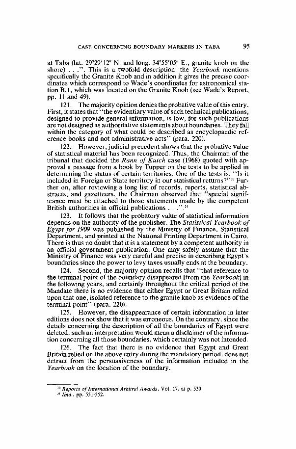
CASE CONCERNING BOUNDARY MARKERS IN TABA 95
at Taba (lat. 29°29'12" N. and long. 34°55'05" E., granite knob on theshore) . . .". This is a twofold description: the Yearbook mentionsspecifically the Granite Knob and in addition it gives the precise coor-dinates which correspond to Wade's coordinates for astronomical sta-tion B.I, which was located on the Granite Knob (see Wade's Report,pp. 11 and 49).
121. The majority opinion denies the probative value of this entry.First, it states that ' 'the evidentiary value of such technical publications,designed to provide general information, is low, for such publicationsare not designed as authoritative statements about boundaries. They fallwithin the category of what could be described as encyclopaedic ref-erence books and not administrative acts" (para. 220).
122. However, judicial precedent shows that the probative valueof statistical material has been recognized. Thus, the Chairman of thetribunal that decided the Rann of Kutch case (1968) quoted with ap-proval a passage from a book by Tupper on the tests to be applied indetermining the status of certain territories. One of the tests is: "Is itincluded in Foreign or State territory in our statistical returns?"30 Fur-ther on, after reviewing a long list of records, reports, statistical ab-stracts, and gazetteers, the Chairman observed that "special signif-icance must be attached to those statements made by the competentBritish authorities in official publications . . .".31
123. It follows that the probatory value of statistical informationdepends on the authority of the publisher. The Statistical Yearbook ofEgypt for 1909 was published by the Ministry of Finance, StatisticalDepartment, and printed at the National Printing Department in Cairo.There is thus no doubt that it is a statement by a competent authority inan official government publication. One may safely assume that theMinistry of Finance was very careful and precise in describing Egypt'sboundaries since the power to levy taxes usually ends at the boundary.
124. Second, the majority opinion recalls that "that reference tothe terminal point of the boundary disappeared [from the Yearbook] inthe following years, and certainly throughout the critical period of theMandate there is no evidence that either Egypt or Great Britain reliedupon that one, isolated reference to the granite knob as evidence of theterminal point" (para. 220).
125. However, the disappearance of certain information in latereditions does not show that it was erroneous. On the contrary, since thedetails concerning the description of all the boundaries of Egypt weredeleted, such an interpretation would mean a disclaimer of the informa-tion concerning all those boundaries, which certainly was not intended.
126. The fact that there is no evidence that Egypt and GreatBritain relied on the above entry during the mandatory period, does notdetract from the persuasiveness of the information included in theYearbook on the location of the boundary.
30 Reports of International Arbitral Awards, Vol. 17, at p. 530."Ibid., pp. 551-552.
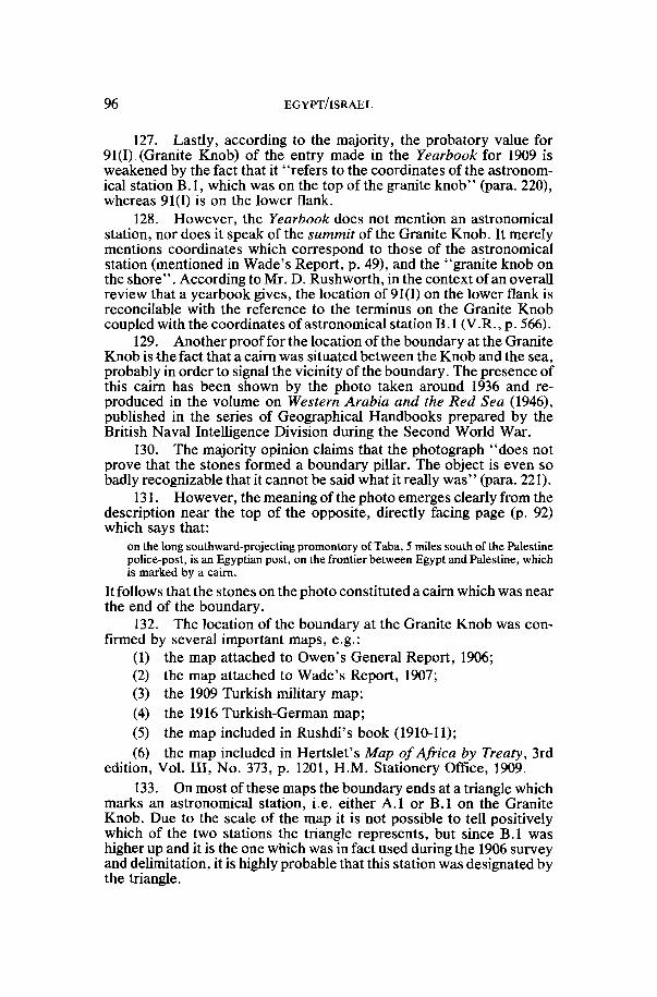
96 EGYPT/ISRAEL
127. Lastly, according to the majority, the probatory value for91(1) (Granite Knob) of the entry made in the Yearbook for 1909 isweakened by the fact that it "refers to the coordinates of the astronom-ical station B.I, which was on the top of the granite knob" (para. 220),whereas 91(1) is on the lower flank.
128. However, the Yearbook does not mention an astronomicalstation, nor does it speak of the summit of the Granite Knob. It merelymentions coordinates which correspond to those of the astronomicalstation (mentioned in Wade's Report, p. 49), and the "granite knob onthe shore' '. According to Mr. D. Rushworth, in the context of an overallreview that a yearbook gives, the location of 91(1) on the lower flank isreconcilable with the reference to the terminus on the Granite Knobcoupled with the coordinates of astronomical station B. 1 (V.R., p. 566).
129. Another proof for the location of the boundary at the GraniteKnob is the fact that a cairn was situated between the Knob and the sea,probably in order to signal the vicinity of the boundary. The presence ofthis cairn has been shown by the photo taken around 1936 and re-produced in the volume on Western Arabia and the Red Sea (1946),published in the series of Geographical Handbooks prepared by theBritish Naval Intelligence Division during the Second World War.
130. The majority opinion claims that the photograph "does notprove that the stones formed a boundary pillar. The object is even sobadly recognizable that it cannot be said what it really was" (para. 221).
131. However, the meaning of the photo emerges clearly from thedescription near the top of the opposite, directly facing page (p. 92)which says that:
on the long southward-projecting promontory of Taba, 5 miles south of the Palestinepolice-post, is an Egyptian post, on the frontier between Egypt and Palestine, whichis marked by a cairn.
It follows that the stones on the photo constituted a cairn which was nearthe end of the boundary.
132. The location of the boundary at the Granite Knob was con-firmed by several important maps, e.g.:
(1) the map attached to Owen's General Report, 1906;(2) the map attached to Wade's Report, 1907;(3) the 1909 Turkish military map;(4) the 1916 Turkish-German map;(5) the map included in Rushdi's book (1910-11);(6) the map included in Hertslet's Map of Africa by Treaty, 3rd
edition, Vol. Ill, No. 373, p. 1201, H.M. Stationery Office, 1909.
133. On most of these maps the boundary ends at a triangle whichmarks an astronomical station, i.e. either A.I or B.I on the GraniteKnob. Due to the scale of the map it is not possible to tell positivelywhich of the two stations the triangle represents, but since B.I washigher up and it is the one which was in fact used during the 1906 surveyand delimitation, it is highly probable that this station was designated bythe triangle.

CASE CONCERNING BOUNDARY MARKERS IN TABA 97
134. On the Turkish version of the 1916 Turko-German map, theline ends even to the west of the triangle.
135. According to the majority, the map evidence is not con-clusive. First, it is said that "[o]n the maps attached to the Owen andWade Reports, the boundary line ends at the eastern edge of the' trian-gle" (para. 219). However, what counts is that the boundary ends at thetriangle.
136. The majority mentions three other maps of that period onwhich the boundary does not end at the Granite Knob:
(1) the 1907 British War Office map;(2) the 1906 Survey Department of Cairo map;(3) the 1911 Survey Department of Cairo map.137. Although the location on these maps is not identical with the
Granite Knob, the line still seems to run to a location far removed from91(E). It runs to the west of the cliffs on which 91(E) is located, whereasthe line claimed by Egypt, i.e. between agreed BP 90 and 91(E), ispractically east of that line of cliffs.
138. Moreover, among the maps of that period (1906-1915), moreweight should be given to those attached to the Owen and Wade Re-ports: ' ' [t]hey were produced by the people who were on the ground andwe are very clear as to exactly how they were produced . . . and theyhave been published . . . They seem to me to be the key maps in thewhole business" (D. Rushworth, V.R., p. 613).
139. The majority opinion questions the value of the maps thatsupport the location of the Granite Knob as the end of the boundary bypointing to the fact that these maps are drawn on a very small scale whilethe triangles are relatively large (para. 219). Whatever may be the impactof the smallness of the scale on other aspects of those maps, with regardto the southern end of the boundary they clearly show that the line endsat the triangle, which corresponds to the astronomical station on theGranite Knob.
140. As the majority points out, "[a]ll later maps (from 1915 on),except the 1916 Turkish-German map, show the line passing throughBP 91(E) or both 91(E) and the Parker site . . . " (para. 219). But since,as explained above (paras. 7-49), the recognized boundary is the line thatwas established in 1906, the earlier maps made close to that date are ofmuch greater importance than the later ones.
141. The location of the boundary at the Granite Knob has alsobeen confirmed by the Turkish presence in the area.
142. This presence is mentioned in records of various travellers.Thus Meistermann, in the 1909 edition (repeated in 1913) of his bookGuide du Nil au Jourdain, says that "en deçà de l'oasis [referring to theBir and the palms] passe la nouvelle frontière de l'empire ottoman, surlaquelle veille un poste de soldats turcs, casernes dans un petit fort. Laroute fléchit vers l'est et contourne un petit cap, ras el Masri . . ." .Baedeker, in his 4th edition of Palestine et Syrie (1912), also says that"aussitôt après [after the Bir and the Palms] on franchit la frontièreturco-égyptienne (postes militaires turcs). On contourne en lh. le cap

98 EGYPT/ISRAEL
ras el Masri . . . " . Moreover, this Turkish presence in the area is alsoconfirmed by the Sudan Intelligence Report of April 1913, which says"that a Pasha with two guns has arrived in Akaba. The guns are said tohave been placed in position at Taba and J. Bereio".
143. The majority considers that these facts "are not conclusiveas to where the boundary line actually ran" (para. 221).
144. However, even if these indices do not describe the preciselocation of the line, they prove that it could only be near the Wadi (i.e. atthe Granite Knob) or in it (i.e. at Bir Taba), and definitely not at the siteof 91(E) which is up on the cliffs quite remote from the mouth of theWadi.
145. Second, the majority considers that ' '[a] Turkish presence inthe Wadi Taba could also be explained by other grounds, such as theright under Article 6 of the 1906 Agreement for Turkish soldiers tocross over to the Egyptian side to draw water from the well at Bir Taba' '(para. 221).
146. However, although Article 6 permits Turkish soldiers to"benefit by the water which remained west of the separating line", it isnot clear that in order thus to "benefit", the soldiers were permitted tocross the line (see the telegram dated 2nd October 1906 and the lettersdated 6th and 13th October from M. De C. Findlay to Sir Edward Greyand telegram of 12th September 1906 from Sir N. O'Conor to Sir EdwardGrey concerning the water). In any case, it is clear that they were notpermitted to cross the line when armed (Article 7 of the 1906 Agree-ment). When Meistermann and Baedeker spoke of "poste de soldatsturcs casernes dans un petit fort" and "postes militaires turcs", theycertainly did not mean the mere presence of unarmed soldiers.
147. As for the alternative location for 91 proposed by Israel, i.e.the Bir Taba location, this alternative was based on the following con-siderations:
(1) Undoubtedly, there is intervisibility between this location andagreed BP 90.
(2) Several texts and descriptions specifically mention Bir Taba asthe boundary (see majority opinion, para. 151).
148. Comparing the Bir Taba and the Granite Knob alternatives,the question arises which of the two corresponds better to the re-quirements that pillar 91 has to fulfil. Both of them may be considered asthe final location near the shore, both are intervisible with agreed BP 90,and both are supported by evidence. Since the Granite Knob alternativeis the one that is located on the cape of Ras Taba, I believe that it is thecorrect location for BP 91.
149. To sum up, the location of 91 on the western slope of theGranite Knob conforms to the description in the 1906 Agreement as wellas the Wade and Owen Reports since it is on Ras Taba, it is the firsteastern cliff which strikes the Gulf, and it overlooks the Wadi; it is thelocation for the final pillar since it is near the waterfront; it is located onthe only cape or promontory in the area which bears the name Ras Tabaon some maps, Ras el-Masri on others, and both names on one sketch

CASE CONCERNING BOUNDARY MARKERS IN TABA 99
map; it also corresponds to the description in Shoucair's book; and it isclearly intervisible with agreed BP 90. The fact that the boundary lineends at the Granite Knob is supported by the Statistical Yearbook ofEgypt for 1909, by the 1936 photo of a cairn in its vicinity, by many mapsof the period immediately following the 1906 Agreement, and by theTurkish presence in the vicinity (described by two skilled and experi-enced observers and by a British Intelligence Report).
E. Conclusion and the problem of non licet
150. When considering the location of BP 91, several basic factshave to be remembered. First we are dealing with a two-stage renvoiwhich leads us to the recognized boundary of the mandatory perioddefined in terms of the 1906 Agreement. Whatever may be the situationunder general international law, there can be no doubt that in this casethe parties recognized the legal 1906 line and not any "situation on theground".
151. If, as the majority opinion assumes, the two parties—Egyptand Great Britain—during the period of the Mandate had wished torecognize the line of the pillars actually existing in 1923 (or, perhaps, in1926, the year in which the recognition took place), they could haveexpressly said so, instead of referring to the 1906 line.
152. Moreover, there is a logical flaw in the majority's opinion: if,as my colleagues assume, the pillars existing on the ground at that time,i.e. at 91 (E) and at the Parker site, constituted the recognized boundary,how can such recognition be reconciled with the fact that Egypt claimsnot to have had any knowledge prior to the oral hearings of this Arbitra-tion of the pillar that was at the Parker site (see, e.g., Egypt's Rejoinder,p. 34; V.R., pp. 659, 691, and 801)?
153. Turning now to the question which claim better suits the linelaid down by the 1906 Agreement, it is obvious that the location of 91(1)conforms to the description in the Agreement as well as in Wade's andOwen's Reports: south of BP 90, the line runs along the eastern marginof the Wadi and ends at the place where the eastern cliffs strike the Gulf,i.e. at the Granite Knob. The Egyptian location for 91, on the otherhand, is beyond the first group of cliffs, the line between this locationand agreed BP 90 is mainly east of the hills above Wadi Taba, and 91(E)itself hardly overlooks the Wadi.
154. 91(1) (Granite Knob) is confirmed by most of the early maps,while 91(E) conforms to the post-1915 maps. However, the earlier mapsare the more relevant ones since they describe the situation in the periodto which the act of recognition refers.
155. The designation of the Granite Knob instead of the site of91(E) for a boundary pillar is also in conformity with the travaux prépa-ratoires surrounding the conclusion of the 1906 Agreement. Mr. M. DeC. Findlay, Deputy to Lord Cromer and Acting Agent and Consul-General in Egypt at that time, mentioned in his letters of 10th July and30th July 1906 to Sir Edward Grey, the British Foreign Secretary, thatthe British-Egyptian negotiators had expressed themselves to be pre-pared, in exchange for Turkish concessions in the northern part of the

100 EGYPT/ISRAEL
boundary (in particular in the Kusseima area), to take into considerationTurkey's needs in the south for the protection of Aqaba (see also Owen'sGeneral Report, p. 6). Turkey's great concern in this matter was alsodescribed in Rushdi Pasha's book on The Question of Aqaba (1910-11).An Egyptian, viz. British, outpost on the cliff of 91(E) would certainlyhave constituted a danger for Aqaba and hence it is quite logical thatsince Turkey renounced her claim to Kusseima and Ein Kadiss, CaptainOwen and his team left the cliff on which 91(E) is situated to Turkey.
156. Last but not least, in the eyes of an expert surveyor, theGranite Knob is a much better suited location of a boundary than 91(E)or the Parker location (D. Rushworth, V.R., pp. 561-565).
157. Turning now to the three conditions that BP 91 has to ful-fil—intervisibility with BP 90, being the final pillar and being at the pointof Ras Taba (see supra, paras. 54-76; 91-96; 111-118)—it is obvious thatthe Granite Knob fulfils them, and 91(E) does not. The majority istherefore in a dilemma. Since my colleagues have ruled that the pillarswhich actually existed on the ground during the period of the Mandate,whatever be their origin, have to be sanctioned, they have preferred91(E) to the Granite Knob. But since this location does not fulfil thethree conditions, the majority opinion practically disregards these con-ditions by using an unconvincing reasoning.
158. As to intervisibility, my colleagues consider that the situa-tion on the ground prevails even if it contravenes a mandatory re-quirement expressly included in the 1906 Agreement (paras. 74-75).
159. As to the condition that BP 91 has to be the final pillar andon the point of Ras Taba, my colleagues are of the opinion that boththe Parker site and 91(E) can be considered as final and on the Ras,although logically only one pillar can be the final one, and according toWade and Owen only one pole was erected on the Ras (see also supra,paras. 61-65).
160. In fact, the Parker site and 91(E) are mutually exclusive withregard to the fulfilment of the two conditions of being the final pillar andat the point of Ras Taba. If the Parker pillar existed, then by no stretch ofimagination could 91(E) be the final pillar and on Ras Taba.
161. On the other hand, the existence of the Parker pillar is noimpediment to a finding for 91(1) on the Granite Knob since the case forthis location is based on the recognition of the 1906 line by the author-ities during the period of the Mandate, irrespective of any pillars whichmay have existed on the ground between 1923 and 1948.
162. When a Tribunal is confronted with a limited choice and noneof the alternatives conforms to the law or the Compromis, it has a duty torefrain from designating a location, and it cannot artificially increase itspowers or discretion by disregarding its limitations.
163. Probably the majority resorted to the above interpretation inorder to avoid a situation wherein it would not have been able to give apositive decision on the disputed location of the pillar, perhaps fearingthe spectre of a non liquet ruling. But a ruling that neither Party hasproven its case is a far cry from non liquet and has nothing to do with it.

CASE CONCERNING BOUNDARY MARKERS IN TABA 101
According to Sir Gerald Fitzmaurice, in a case "where the partiesrequest the tribunal to decide exclusively by reference to a certainspecific criterion . . . or where the question put to the tribunal directs itto such a criterion as the basis of decision . . . but where . . . thearguments of neither party find any support by reference to this par-ticular criterion . . . ", the result would be that the tribunal cannot give adecision and such abstention would not be considered a non liquet?2
164. The majority's decision to consider that two locations fulfilthe conditions of being at the location of the final pillar and of being onthe shore at Ras Taba practically amounts to disregarding these condi-tions. The words of the Compromis do not permit the Tribunal tooverlook these explicit conditions.
165. In conclusion, it is necessary to emphasize the incompleteresult created by the decision of the majority. Since my colleagues haveadopted a location for BP 91 which is not at the end of the boundary onthe shore, the question where the line is to run from BP 91 remains open.IV. The Ras an-Naqb Area: Pillars 85, 86, 87
166. In this area as well, the main disagreement between themajority's opinion and mine concerns the relative weight of the 1906line, on the one hand, and the situation on the ground in the criticalperiod, on the other hand. The majority considers that there is con-formity between the pillars existing de facto and the line established bythe 1906 Agreement, and that if there had been a contradiction, theformer should prevail. With all due respect, I think that there is adiscrepancy between the 1906 line and the actual pillars, and that the1906 line should be preferred since this is the one that was recognizedduring the period of the Mandate.
167. The disagreement concerning this discrepancy dependsmainly on the identification of certain geographical features in relationto which the Agreement defines the boundary.
168. There are old pillars in the area at the locations claimed byEgypt, and on the various maps the boundary runs in accordance withEgypt's claim.
169. With regard to this area, the Agreement defines the boundaryas follows:
The . . . line . . . follows along the eastern ridge [or heights or summits—accordingto other translations] overlooking Wadi Taba to the top of Jebel Fort; . . . FromJebel Fort to a point not exceeding 200 metres to the east of the top of Jebel FathiPasha . . .
Thus, the location of the boundary pillars depends on the identificationof Wadi Taba, Jebel Fort, and Jebel Fathi Pasha.
170. The majority has accepted the correctness of Egypt's claimand has expressed the opinion that this claim is not contradicted by thelocation of the physical features mentioned in the 1906 Agreement.According to the majority opinion, on several maps the physical features
32 Sir Gerald Fitzmaurice, "The Problem of non-liquet: Prolegomena to a Re-statement", in Mélanges offerts à Charles Rousseau, Paris, Pedone, pp. 89-112, at p. 95.

102 EGYPT/ISRAEL
of Jebel Fort and Jebel Fathi Pasha in relation to which the boundary isdefined in the Agreement, are situated in accordance with Egypt's claim(the Wade Aqaba-Rafah sketch map of July 1906, the Wade Topograph-ical Sketch Map of July 1906, the 1907 British War Office Map). As to theidentity of Wadi Taba, it is based according to Egypt on the premise thatthis Wadi continues to the north under the name of Wadi Gasairiya, orthat it does not stretch farther north than the bifurcation of the wadiswhich occurs north of agreed pillar 89 (the latter alternative has beenadopted by the majority opinion).
171. I have come to the conclusion that the Israel location forthese features is more in conformity with the 1906 Agreement and that itexcludes the Egyptian location for the boundary.
172. As to Wadi Taba, it seems to me that the wording of theabove provision of the Agreement implies, contrary to the majority'sopinion, that the Wadi continues to the north, to the vicinity of JebelFort ("following along the eastern ridge overlooking Wadi Taba to thetop of Jebel Fort. . .") . The fact that the Wadi continues much farthernorth beyond the bifurcation is confirmed by Owen's "Rough Map"(sent on 3 June 1906 to Lord Cromer) on which Wadi Taba continues tothe north, to the Nakhl road. Moreover, from Wade's Report too onegets the clear impression that the Wadi continues farther north: Wadementions a delay caused by the fact that the Turkish depot at the Mufraqby an oversight had not received orders to vacate that station, andthen adds: "Next morning they had left and we descended into WadiTaba . . ." (p. 53). This sentence conveys the impression that WadiTaba goes north to the vicinity of the Mufraq. Similarly, and perhapseven more convincingly, in his journal for 18 October, we find thefollowing entry: "In the morning we found post vacated. Descendedinto Wadi Taba and set up a beacon on its east cliff at a point from whichthe beacon on Gebel "Fort" is visible . . ." (p. 65). This entry showsthat the Wadi reaches the area of the Mufraq, and that the first pillarsouth of Jebel Fort was already on the cliffs of Wadi Taba. Moreover,according to Owen, even Jebel Fathi, which is located farther north thanJebel Fort, "overlooks part of Wadi Taba" (Owen's General Report,p. 6); it follows that the Wadi has to continue far north.
173. As to the question where is the continuation of the Wadito the north, one has to remember that north of agreed pillar 89 theWadi bifurcates into three tributaries, the western one named WadiHaneikiya and the eastern one Wadi Gasairiya. On the maps, the middleone has no name on it, and it is logical that it should be the continuation(or the northern part) of Wadi Taba since it has no other name and sinceit merges naturally, without any break, into the southern Wadi Taba.The middle tributary perfectly suits the text of the Agreement since ithas a range of mountains on its eastern side, going almost as far north asIsrael's location for Jebel Fort (86(1)).
174. Egypt's definition of Wadi Taba is not convincing. If, asEgypt has claimed in its Rejoinder, Wadi Gasairiya were the northernpart of Wadi Taba, then the boundary line would run to a certain extentwest of the Wadi, whereas the 1906 Agreement provides that it should be

CASE CONCERNING BOUNDARY MARKERS IN TABA 103
east of Wadi Taba. Moreover, the two Parties have agreed to add a newpillar, No. 88, on a certain hill; although they disagree on the exactlocation of the pillar, there is agreement about the hill on which it shouldbe located. This hill is to the west of Wadi Gasairiya, whereas it is to theeast of the middle tributary claimed by Israel to be the northern WadiTaba.
175. As to the alternative Egyptian claim that there is no northernWadi Taba and that it stretches only from the Gulf to the bifurcation ofthe three tributaries (V.R., p. 748), this claim contradicts the wording ofthe 1906 Agreement (which, as mentioned above, speaks of a Wadi thatgoes almost up to Jebel Fort), the Owen rough map, Wade's Report, andOwen's Report.
176. As to the identification of Jebel Fort: Israel's Jebel Fort(86(1)) corresponds to the description in the 1906 Agreement since it isjust to the north of northern Wadi Taba, at the end of the easternmountains overlooking the Wadi. The mountain identified by Israel asJebel Fort, much more than the Egyptian one, looks like a fortress: it isthe most dominant feature on the plain, it dominates the plateau to thenorth-west, and it can be seen from Aqaba. The mountain identified byEgypt as Jebel Fort, on the other hand, is in fact in the lower area, belowthe plateau.
177. Moreover, at the Israeli Jebel Fort there stands a cairn ofstones shaped like a truncated pyramid (according to the descriptioncard for 86(1) in Appendix A to the Compromis). This could have beenone of the original temporary markers which the Commissioners erectedin 1906 at some places in order to mark the locations before the erectionof the telegraph poles (as recorded in Wade's Report, p. 61).
178. Again, the topography of Israel's Jebel Fathi conforms morethan Egypt's location with Owen's description, according to whichJebel Fathi "commands the flank of the upper part of the Nakb and JebelRaschdi . . . and also overlooks part of Wadi Taba" (Owen's GeneralReport, p. 6).
179. Several maps of that period describe the physical features ofthe two mountains—Jebel Fort and Jebel Fathi Pasha—in accordancewith Israel's claim: Wade's 1907 map, the 1909 Turkish military map(only Jebel Fathi, Jebel Fort not being marked), the 1911 Survey Depart-ment of Cairo map (on this map Jebel Fort is even farther west thanaccording to Israel's claim). With regard to the last mentioned map, themajority considers it uncertain as to which feature the words Jebel FathiPasha exactly refer (para. 202). The uncertainty flows from the locationof those words in their transcription in Roman letters, whereas it is clearthat the name in Arabic letters points to the location claimed by Israel forthis mountain. Each of these maps comes from a different source, andhence their special importance. Of particular weight is the Wade 1907map attached to his Report: it has the advantage of being made by aprofessional surveyor who participated as the leading expert in therelevant proceedings—the survey, the delimitation (the conclusion ofthe 1906 Agreement), and the demarcation. Moreover, his 1907 map was

104 EGYPT/ISRAEL
adopted by the British Foreign Office in Hertslet's Map of Africa byTreaty, 3rd edition, Vol. Il l , p. 373.
180. As mentioned above, the Tribunal relies on three maps whichallegedly confirm the Egyptian location for Jebel Fort and Jebel FathiPasha, two of them being early (1906) sketches by Wade. His 1907 map,however, confirms the Israeli location. It is submitted that preferenceshould be given to the 1907 Wade Report map: it may be assumed that,unless another conclusion is justified by special circumstances, a latermap madeby the same surveyor is an improvement over the earlier onesand is more accurate.
181. Although according to the 1906 Agreement the boundaryshould go through the top of Jebel Fort and through "a point notexceeding 200 metres to the east of the top of Jebel Fathi Pasha", on themaps which support Israel's identification of these features, the bound-ary line does not pass through them. It appears, however, that where ona map there is a contradiction between, on the one hand, a description ofphysical features or topographical details inserted on the basis of asurvey (in this case Wade's survey) and, on the other hand, a boundaryline which may have been added later by a draughtsman, it is thephysical features to which more weight should be given.33
182. It thus follows that the Israeli locations for pillars 85, 86 and87 are more in conformity with the physical description of the 1906Agreement, and, after due consideration, I have come to the conclusionthat this fact carries more weight than the location of the boundary lineon maps and the location of the existing pillars, since the act of recogni-tion in the period of the Mandate referred to the line established by the1906 Agreement and not to any pillars which may contradict it. More-over, one has to remember that the erection of the masonry pillars in1906-07 was not part of the demarcation process (supra, paras. 25-28)and that apparently the pillars that existed at the time of the Mandatewere not the original ones (majority opinion, para. 107; see also supra,para. 40).
183. As to the question whether the boundary line as traced onmaps or its geographical description in the 1906 Agreement shouldprevail, in the present circumstances it is the geographical descriptionwhich should carry more weight. If the original map which was part ofthe Agreement had been found, it would of course have been relevant,and any contradiction between the text and the map would have had tobe resolved on the basis of the rules on interpretation of treaties. Buteven in such a case, probably "the description in the treaty shouldprevail".34
184. To sum up: the Egyptian locations for pillars 85, 86, 87conform to pillars existing on the ground and to the boundary traced onthe maps. The Israeli locations, on the other hand, conform to thephysical description of various geographical features by which the 1906
33 See D. V. Sandifer, Evidence Before International Tribunals, revised edition,1975, p. 236. See also Mr. Rushworth's testimony on map-making, V.R., p. 567 et seq.
34 G. Ress, op. cit., note 12, at p. 421.

CASE CONCERNING BOUNDARY MARKERS IN TABA 105
Agreement has described the boundary. Under such circumstances, it isthe geographical description which has to be preferred due to the su-premacy of the Agreement.
V. Pillar Number 88
185. With regard to BP 88 both the factual and the legal situationsare unique. BP 88 is to be a new pillar on the boundary, so there was noold pillar nor remnants thereof for the Parties to consider. The fact thatthe Parties asked the Tribunal to decide the location of a boundary pillarof the recognized international boundary between Egypt and the formermandated territory of Palestine at a place where no pillar previouslyexisted amply demonstrates that the task of the Tribunal is not limited todetermining where pillars existed during the period of the Mandate butrather extends to the decision on the proper location of pillars of the legalboundary. The boundary indicated on maps may have assisted theParties in determining on which hill to place BP 88, but such mapevidence was of no assistance to the Tribunal since the locations of 88(1)and 88(E) are on the same hill and the distance between them is too small(44.63 metres) to appear on the available maps. Rather, the Tribunalcould only distinguish between the claimed locations on the basis of theterms of the 1906 Agreement and the way it was implemented by the1906 Joint Commission with respect to the placement of neighbouringpillars.
186. Israel's location for BP 88 is based on the premise that theWadi to the west of the hill on which BP 88 should stand is Wadi Taba,and we know from the Agreement that this sector of the boundaryshould run "along the eastern ridge overlooking Wadi Taba. . . " . ThusBP 88 should be at a place where it overlooks the Wadi from the east.
187. Even though the majority does not accept the Israeli iden-tification of Wadi Taba, it should have preferred the Israeli location forBP 88 since the nearest pillars in that region, agreed BP 89 and agreedBP 90, both also stand on the western side of the ridge, overlooking thenearby Wadi, whatever its name, from the east. It is thus logical thatBP 88 too should be on the western side of the ridge. (A comparison with87(E) in this context is not helpful since 87(E) is on top of a small peakand therefore one cannot say that it is on the eastern or on the westernside. 87(1), however, is on the western side of the ridge.)
188. The majority has instead decided that "[a]s no other criterionis available, the Tribunal has to base its decision on the straight linecriterion to which the parties to the 1906 Agreement repeatedly re-ferred . . . " (para. 213), and they have applied this principle by choosingfor BP 88 the location which is closest to a straight line betweenBP 87(E) and BP 89.
189. This reasoning is both unnecessary, as discussed above, anderroneous. There is no valid basis for the straight line criterion south ofJebel Fort because straight lines are not mentioned for this sector of theboundary in the 1906 Agreement and neither Wade nor Owen refer tosuch a line. In fact, south of Jebel Fort, the line formed by the telegraphpoles was not straight, but changed direction at every pillar. The general

106 EGYPT/ISRAEL
directive that the boundary line should run in an approximately straightline from Rafah on the Mediterranean to the terminus on the Gulf ofAqaba (see majority opinion, paras. 29, 32-34) cannot serve as a crite-rion in view of the limitation involved in the adverb "approximately",coupled with the smallness of the distance between the two claimedlocations, and the configuration of the boundary in the southern sector.It should also be remembered that neither of the Parties has based itsarguments with regard to BP 88 on the relevance of a straight line.
VI. Conclusions
190. The Tribunal has been asked to decide, in accordance withthe 1979 Treaty of Peace, the 1982 Agreement, and the 1986 Compromis,the location of certain boundary pillars of the recognized internationalboundary of the period of the Mandate, as this constitutes the boundarybetween Egypt and Israel.
191. The boundary recognized by Egypt and Great Britain is theline established by the 1906 Agreement, which does not necessarilycoincide with the line formed by the pillars that existed de facto on theground during the critical period.
192. The 1906 line, as laid down in the Agreement and describedby Wade and by Owen, confirms the location on the Granite Knob forBP 91 in the Taba area, and the locations of 85(1), 86(1), and 87(1) in theRas an-Naqb region. The proper location for the new pillar No. 88 is at88(1) on the ridge that overlooks the adjoining Wadi, as do the neigh-bouring pillars.
193. Unfortunately, however, my colleagues have preferred tolocate BP 88 at 88(E) since it is closer to a straight line—a method whichin my opinion is not applicable to this area. As to the other pillarlocations in dispute, the majority has preferred to sanction the situationwhich existed de facto on the ground during the critical period and thishas led them to adopt the location claimed by Egypt.
194. The location chosen by my colleagues in the Taba area doesnot fulfil a mandatory requirement of the 1906 Agreement, i.e. inter-visibility, and two conditions included in the 1986 Compromis, i.e. that ithas to be the final pillar on the boundary and situated at the point of RasTaba on the western shore of the Gulf of Aqaba.
195. With all due respect, I wish to repeat that in my opinion 91(1)(Granite Knob) is the right location for BP 91, according to the 1906Agreement, the 1986 Compromis, the relevant maps (1906-1916), andvarious other pieces of evidence.
196. It is regrettable that the majority has not decided for 91(1) onthe Granite Knob, which would have solved the dispute fully, butinstead has decided for the location claimed by Egypt, which is not onlythe wrong one because it does not fulfil the criteria of the 1906 Agree-ment and the 1986 Compromis, but also leaves unresolved the course ofthe boundary line beyond 91(E).
Ruth LAPIDOTH

CASE CONCERNING BOUNDARY MARKERS IN TABA 107
APPENDIX A
Arbitration Compromis
Egypt and Israel,Reaffirming their adherence to the provisions of the Treaty of Peace
of 26 March 1979, and their respect for the inviolability and sanctity ofthe recognized international boundary between Egypt and the formermandated territory of Palestine,
Recognizing that a dispute has arisen, as defined in Article II of thisCompromis, on the location of fourteen boundary pillars of the recog-nized international boundary between Egypt and the former mandatedterritory of Palestine as stipulated in accordance with the Annex, whichthe parties wish to resolve fully and finally,
Recalling their obligation under the United Nations Charter tosettle disputes by peaceful means,
Considering the conclusion and implementation of this agreementas an integral part of the process of furthering peaceful and good rela-tions between them,
Affirming their intention to fulfill in good faith their obligations,including their obligations under this Compromis,
Recalling their obligation to settle disputes in accordance withArticle VII of the Treaty of Peace,
Confirming their commitment to the provisions of the agreement of25 April 1982, between them,
Having resolved to establish an arbitration tribunal,Have agreed to submit the dispute to binding arbitration, in
accordance with the following procedures:
Article I1. The arbitration tribunal (hereinafter called "the Tribunal")
shall be composed of the following members: Hamed Sultan, nominatedby the Government of Egypt, Ruth Lapidoth, nominated by the Govern-ment of Israel, Pierre Bellet, Dietrich Schindler, and Gunnar Lagergren,who shall be the President of the Tribunal.
2. Once the Tribunal has been constituted, its composition shallremain unchanged until the award has been rendered. However, in theevent a member nominated by a government is or becomes unable forany reason to perform his or her duties, the original nominating govern-ment shall designate a replacement member, within 21 days of such asituation. The President shall consult with the parties in the event thePresident believes such a situation has arisen. Each party is entitled toinform the other party in advance of the individual it would designate inthe event of such a situation occurring. In the event the President of theTribunal or a non-national member of the Tribunal is or becomes unablefor any reason to perform his or her duties, the two parties shall meetwithin seven days and shall endeavor to agree on a replacement within21 days.

108 EGYPT/ISRAEL
3. Where a vacancy has been filled after the proceedings havebegun, the proceedings shall continue from the point they had reached atthe time the vacancy had occurred. The newly appointed arbitrator may,however, require that the oral proceedings and visits be recommencedfrom the beginning.
Article IIThe Tribunal is requested to decide the location of the boundary
pillars of the recognized international boundary between Egypt and theformer mandated territory of Palestine, in accordance with the PeaceTreaty, the April 25, 1982 Agreement, and the Annex.
Article III1. Each party will be entitled to submit to the Tribunal any evi-
dence which that party considers relevant to the question.2. A party may, by notice in writing through the registrar, call
upon the other party to make available to it any specified document orother evidence which is relevant to the question and which is, or is likelyto be, in the possession or under the control of the other party.
3. At any time during the arbitral proceedings the Tribunal maycall upon either party to produce additional documents or other evi-dence relevant to the question within such a period of time as theTribunal shall determine. Any documents or other evidence so pro-duced shall also be provided to the other party.
4. The Tribunal may request that a nonparty to this Compromisprovide to it documents or other evidence relevant to the question. Anydocuments or other evidence so provided shall be transmitted simulta-neously to both parties.
5. The Tribunal will review all documents and other evidencesubmitted to it.
Article IV1. The participation of all Tribunal members shall be required for
the award. The presence of all members shall also be required for allproceedings, deliberations and decisions other than the award exceptthat the President may determine that the absence of not more than asingle member from any proceeding, deliberation, or decision other thanthe award, is justified for good cause.
2. In the absence of unanimity, decisions, including the award,will be taken by a majority vote of the members.
Article V1. The seat of the Tribunal shall be at Geneva, Switzerland.2. The President of the Tribunal shall, with the approval of the
parties, appoint a registrar who shall be located at the seat of theTribunal. The President and the parties shall endeavor to reach agree-ment on the appointment of the registrar within 21 days of the entry intoforce of this Compromis. The registrar shall be the regular channel ofcommunications to and from the Tribunal. The President shall serve in

CASE CONCERNING BOUNDARY MARKERS IN TAB A 109
such capacity until the registrar is appointed. The proceedings underthis Compromis will not be delayed by the inability of the parties to agreeon the appointment of a registrar.
Article VI1. The remuneration of the members of the Tribunal shall be
borne equally by both parties.2. The general expenses of the Tribunal shall be borne equally by
both parties.3. Each party shall bear its own expenses incurred in, or for, the
preparation and presentation of its case.4. The parties shall agree upon the amount of remuneration of the
members, in consultation with the President.5. The registrar, in consultation with the President, shall keep a
record of all general expenses and shall render a final accounting to theparties.
6. The Tribunal may, in consultation with the parties, engage suchstaff and obtain such services and equipment as may be necessary.
Article VII1. Within 21 days of the entry into force of this Compromis, each
party shall appoint its agent for the purposes of the arbitration.2. Each party may nominate a deputy or deputies to act for its
agent. The agent may be assisted by such counsel, advisors and staff asthe agent deems necessary.
3. Each party shall communicate the names and addresses of itsrespective agent and deputy or deputies to the other party and to theTribunal.Article VIII
1. The Tribunal shall apply the provisions of this Compromis.2. Within 30 days of the entry into force of this Compromis, the
Tribunal shall meet.3. The proceedings shall consist of written pleadings, oral
hearings and visits, to sites which the Tribunal considers pertinent, inaccordance with the following schedule:
(A) The written pleadings shall include the following documents:(i) A memorial, which shall be submitted by each party to the
Tribunal within 150 days of the first session of the Tribunal, and(ii) A counter-memorial, which shall be submitted by each
party to the Tribunal within 150 days of the exchange of memorials,and
(iii) A rejoinder, if a party, after informing the other party,notifies the registrar within 14 days of the exchange of counter-memorials of its intention to file a rejoinder. In the event of suchnotification by one party, the other party shall also be entitled tosubmit a rejoinder. The rejoinders shall be submitted to the Tri-bunal within 45 days of the notification.
110 EGYPT/ISRAEL
Written pleadings shall be filed simultaneously with the registrarand then be transmitted simultaneously by the registrar to each party.Notwithstanding this provision, a party may file its pleading at the end ofthe time period specified, even if the other party has not done so.
The Tribunal may, if it deems it necessary, or at the request of oneparty, and after hearing the views of the parties, decide, for good cause,to extend the time periods for the submission of written pleadings. Byagreement, the parties may exchange their written pleadings prior to theexpiration of the period provided in paragraph 3 of this article.
The original of every pleading shall be signed by the agent. It shallbe accompanied by a copy of the pleading, certified by the respectiveagent, and by 30 additional copies for communication by the registrar tothe other party. It shall also be accompanied by copies, certified by therespective agent, for communication by the registrar to each of themembers of the Tribunal. Any documents and maps quoted or referredto in a pleading shall, whenever possible, be annexed to the pleading.The registrar shall specify such additional copies as may be required.
After the end of the written pleadings, no additional papers ordocuments may be submitted, except with the permission of the Tri-bunal. The Tribunal shall provide the other party an opportunity torespond if it has permitted the submission of an additional paper ordocument.
The registrar shall file all submissions received. The registrar shallmake such files available for perusal by either party on request, and shallinform the other party of such requests.
(B) The oral hearings and the visits shall be conducted in suchorder and in such manner as the Tribunal shall determine. The Tribunalshall endeavor to complete its visits and the oral hearings within 60 daysof the completion of the submission of written pleadings.
The oral hearings and the deliberations shall be held at the seat ofthe Tribunal or such place as the Tribunal, with the agreement of the twoparties, may determine. Each party shall be represented at the oralhearings by its agent and/or deputies and by such counsel and advisorsas it may appoint.
If a party submits an affidavit to the Tribunal in support of its case,the other party shall, on request, be given an opportunity to cross-examine the deponent. Each party will be permitted to present wit-nesses and to cross-examine witnesses of the other party at the oralhearings.
Each party shall facilitate the visits of the Tribunal. The agent ofeach party, and such other individuals as the agent may determine, shallbe entitled to accompany the Tribunal during the visits. Members of theTribunal shall be accorded by each party the privileges and immunitiesapplicable under customary international law. The Tribunal shall beaccompanied by such expert, technical or other staff as it deems neces-sary.
(C) If the Tribunal determines that without good cause a party hasfailed within the prescribed time to appear or present its case at any
CASE CONCERNING BOUNDARY MARKERS IN TABA 111
stage of the proceedings, the Tribunal may determine how to proceedwith the arbitration process and to render its award on the merits.
(D) At the time of the rendering of the award, the award and thewritten pleadings shall be made public, unless otherwise agreed by theparties. The registrar shall keep a transcript of the oral hearings, and itshall be made available to the parties as soon as possible. With theagreement of the two parties, this transcript shall be made public at thetime of the rendering of the award.
4. Subject to these provisions, the Tribunal shall, as the needarises and as appropriate, and after consulting with the parties, decideon any necessary supplementary procedures, taking into account inter-national practice.
5. The Tribunal may engage experts. The Tribunal shall hear andtake the views of the parties into consideration before any such en-gagement.
Article IX1. A three-member chamber of the Tribunal shall explore the
possibilities of a settlement of the dispute. The three members shall bethe two national arbitrators and, as selected by the President of theTribunal sometime before the submission of the suggestions, one of thetwo non-national arbitrators.
2. After the submission of counter-memorials, this chamber shallgive thorough consideration to the suggestions made by any member ofthe chamber for a proposed recommendation concerning a settlementof the dispute. Suggestions based upon the memorials, the counter-memorials, and other relevant submissions shall be presented to thechamber commencing from the month immediately preceding the coun-ter-memorials. The chamber shall thereafter consider these suggestions,and the counter-memorials, during the period after submission of thecounter-memorials until the completion of the written pleadings. Anyproposed recommendation concerning a settlement of the dispute whichobtains the approval of the three members of the chamber will bereported as a recommendation to the parties not later than the comple-tion of the exchange of written pleadings. The parties shall hold thereport in strictest confidence.
3. The arbitration process shall terminate in the event the partiesjointly inform the Tribunal in writing that they have decided to accept arecommendation of the chamber and that they have decided that thearbitration process should cease. Otherwise, the arbitration processshall continue in accordance with this Compromis.
4. All work pursuant to the above paragraphs absolutely shallnot delay the arbitration process or prejudice the arbitral award, andshall be held in the strictest confidence. No position, suggestion, orrecommendation, not otherwise part of the presentation of a party'scase on the merits, shall be brought to the attention of the other membersof the Tribunal, or be taken into account in any manner by any membersof the Tribunal in reaching their arbitral decision.
112 EGYPT/ISRAEL
Article XThe written and oral pleadings, and the decisions of the Tribunal,
and all other proceedings, shall be in English.
Article XI1. In accordance with the provisions of the agreement of 25 April
1982:(A) Egypt and Israel agree to invite the MFO to enter Taba and
maintain security therein through the establishment of an observationpost in a suitable topographic location under the flag of the MFO inkeeping with the established standards of the MFO. Modalities for theimplementation of this paragraph have been discussed and concluded byEgypt and Israel through the liaison system before the signature of theCompromis. The interpretation and implementation of this paragraphshall not be within the jurisdiction of the Tribunal.
(B) During the interim period any temporary arrangements and/orany activities conducted shall not prejudice in any way the rights ofeither party or be deemed to affect the position of either party orprejudge the final outcome of the arbitration in any manner.
(C) The provisions of the interim period shall terminate upon thefull implementation of the arbitral award.
2. The Tribunal shall have no authority to issue provisionalmeasures concerning the Taba area.
Article XII1. The Tribunal shall endeavor to render its award within 90 days
of the completion of the oral hearings and visits. The award shall statethe reasons upon which it is based.
2. The award shall be deemed to have been rendered when it hasbeen presented in open session, the agents of the parties being present,or having been duly summoned to appear.
3. Two original copies of the award, signed by all members ofthe Tribunal, shall immediately be communicated by the President of theTribunal to each of the agents. The award shall state the reason for theabsence of the signature of any member.
4. The Tribunal shall decide the appropriate manner in which toformulate and execute its award.
5. Any member of the Tribunal shall be entitled to deliver aseparate or dissenting opinion. A separate or dissenting opinion shall beconsidered part of the award.
6. The Tribunal shall at the joint request of the parties incorporateinto its award the terms of any agreement between the parties relating tothe issue.
Article XIII1. Any dispute between the parties as to the interpretation of the
award or its implementation shall be referred to the Tribunal for clari-fication at the request of either party within 30 days of the rendering of

CASE CONCERNING BOUNDARY MARKERS IN TAB A 113
the award. The parties shall agree within 21 days of the award on a dateby which implementation will be completed.
2. The Tribunal shall endeavor to render such clarification within45 days of the request, and such clarification shall become part of theaward and shall not be considered a provisional measure under theprovisions of Article XI (2) of this Compromis.Article XIV
1. Egypt and Israel agree to accept as final and binding upon themthe award of the Tribunal.
2. Both parties undertake to implement the award in accordancewith the Treaty of Peace as quickly as possible and in good faith.Article XV
This Compromis shall enter into force upon the exchange of in-struments of ratification.
DONE at Giza on the 11th day of September 1986.
For the Government of the Arab Republic of Egypt
Nabil ELARABYBadr HAMMAM
For the Government of the State of Israel
A. TAMIRDavid KIMCHE
Witnessed by: Richard W. MURPHYAlan J. KRECJKO
ANNEX
1. A dispute has arisen on the location of the following boundary pillars of therecognized international boundary between Egypt and the former mandated territory ofPalestine: 7, 14, 15, 17, 27, 46, 51, 52, 56, 85, 86, 87, 88, and 91. The parties agree thatboundary pillars 26 and 84 are on the straight lines between boundary pillars 25 and 27,and 83 and 85, respectively, and that the decision of the Tribunal on the locations ofboundary pillars 27 and 85 will establish the locations of boundary pillars 26 and 84,respectively. The parties agree that if the Tribunal establishes the Egyptian location ofboundary pillar 27, the parties accept the Egyptian location of boundary pillar 26, re-corded in Appendix A; and, if the Tribunal establishes the Israeli location of boundarypillar 27, the parties accept the Israeli location of boundary pillar 26, recorded in Appen-dix A. The parties agree that if the Tribunal establishes the Egyptian location of bound-ary pillar 85, the parties accept the Egyptian location of boundary pillar 84, recorded inAppendix A; and if the Tribunal establishes the Israeli location of boundary pillar 85, the
114 EGYPT/ISRAEL
parties accept the Israeli location of boundary pillar 84, recorded in Appendix A. Ac-cordingly, the Tribunal shall not address the location of boundary pillars 26 and 84.
2. Each party has indicated on the ground its position concerning the location ofeach boundary pillar listed above. For the final boundary pillar No. 91, which is at thepoint of Ras Taba on the western shore of the Gulf of Aqaba, Israel has indicated twoalternative locations, at the granite knob and at Bir Taba, whereas Egypt has indicated itslocation, at the point where it maintains the remnants of the boundary pillar are to befound.
3. The markings of the parties on the ground have been recorded in Appendix A.4. Attached at Appendix B is the map referred to in Article II of the Treaty of
Peace, which provides:The permanent boundary between Egypt and Israel is the recognized internationalboundary between Egypt and the former mandated territory of Palestine, as shownon the map at Annex II, without prejudice to the issue of the status of the Gaza Strip.The parties recognize this boundary as inviolable. Each will respect the territorialintegrity of the other, including their territorial waters and airspace.
A 1:100,000 map is included in order to permit the indication of the locations of the14 disputed boundary pillars advanced by the parties and provides an index to Appen-dix A. The Tribunal is requested to refer to the general armistice agreement betweenEgypt and Israel dated 24 February 1949.
5. The Tribunal is not authorized to establish a location of a boundary pillar otherthan a location advanced by Egypt or by Israel and recorded in Appendix A. TheTribunal also is not authorized to address the location of boundary pillars other thanthose specified in paragraph 1.
APPENDIX B
AGREEMENT signed and exchanged at Rafeh on (13 Shaban, 1324, 18thAilul 1322), 1st October, 1906, between the Commissioners of theTurkish Sultanate and the Commissioners of the EgyptianKhediviate, concerning the fixing of a separating administrativeline between the Vilayet of Hejaz and Governorate of Jerusalemand the Sinai Peninsula.
EL MIRALAI Staff Officer Ahmed Muzaffer Bey, and El Bim-bashi Staff Officer Mohammed Fahmi Bey as Commissioners of theTurkish Sultanate, and Emir El Lewa Ibrahim Fathi Pasha and ElMiralai R. C. R. Owen Bey as Commissioners of the Egyptian Khedi-viate, having been entrusted with the delimitation of the administrativeseparating line between the Vilayet of Hejaz and Governorate of Jeru-salem and the Sinai Peninsula, have in the name of the Turkish Sultanateand the Egyptian Khediviate agreed as follows:
Article 1. The administrative separating line, as shown on mapattached to this Agreement, begins at the point of Ras Taba on thewestern shore of the Gulf of Akaba and follows along the eastern ridgeoverlooking Wadi Taba to the top of Jebel Fort, from thence the sepa-rating line extends by straight lines as follows:

CASE CONCERNING BOUNDARY MARKERS IN TABA 115
From Jebel Fort to a point not exceeding 200 metres to the east ofthe top of Jebel Fathi Pasha, thence to that point which is formed by theintersection of a prolongation of this line with a perpendicular line drawnfrom a point 200 metres measured from the top of Jebel Fathi Pashaalong the line drawn from the centre of the top of that hill to Mofrak Point(the Mofrak is the junction of the Gaza-Akaba and Nekhl-Akaba roads).From this point of intersection to the hill east of and overlookingThamilet-el-Radadi—place where there is water—so that the Thamila(or water) remains west of the line, thence to top of Ras Radadi, markedon the above-mentioned map as (A 3), thence to top of Jebel Saframarked as (A 4), thence to top of eastern peak of Um Guf marked as(A 5), thence to that point marked as (A 7), north of Thamilet Sueilma,thence to that point marked as (A 8), on west-north-west of JebelSemaui, thence to top of hill west-north-west of Bir Maghara (whichis the well in the northern branch of the Wadi Ma Yein, leaving thatwell east of the separating line), from thence to (A 9), from thence to(A 9 bis) west of Jebel Megrah, from thence to Ras-el-Ain, marked as(A 10 bis), from thence to a point on Jebel Um Hawawit marked as(A 11), from thence to half distance between two pillars (which pillarsare marked at (A 13)) under a tree 390 metres south-west of Bir Rafeh, itthen runs in a straight line at a bearing of 280° of the magnetic north—viz., 80° to the west—to a point on a sand-hill measured 420 metres in astraight line from the above-mentioned pillars, thence in a straight line ata bearing of 334° of the magnetic north—viz., 26° to the west—to theMediterranean Sea, passing over hill of ruins on the sea-shore.
Art. 2. The separating line mentioned in Article 1 has been in-dicated by a black broken line on duplicate maps (annexed to thisAgreement), which shall be signed and exchanged simultaneously withthe Agreement.
Art. 3. Boundary pillars will be erected, in the presence of theJoint Commission, at intervisible points along the separating line, fromthe point on the Mediterranean shore to the point on the shore of the Gulfof Akaba.
Art. 4. These boundary pillars will be under the protection of theTurkish Sultanate and Egyptian Khediviate.
Art. 5. Should it be necessary in future to renew these pillars, or toincrease them, each party shall send a representative for this purpose.The positions of these new pillars shall be determined by the course ofthe separating line as laid down in the map.
Art. 6. All tribes living on both sides shall have the right ofbenefiting by the water as heretofore—viz., they shall retain their an-cient and former rights in this respect.
Necessary guarantees will be given to Arab tribes respecting above.Also Turkish soldiers, native individuals and gendarmes, shall ben-
efit by the water which remained west of the separating line.Art. 7. Armed Turkish soldiers and armed gendarmes, will not be
permitted to cross to the west of the separating line.

116 EGYPT/ISRAEL
Art. 8. Natives and Arabs of both sides shall continue to retain thesame established and ancient rights of ownership of waters, fields, andlands on both sides as formerly.
Commissioners of the Turkish Sultanate,
(Signed) Miralai Staff Officer MUZAFFERBimbashi Staff Officer FAHMI
Commissioners of the Egyptian Khediviate,
(Signed) Emir Lewa IBRAHIM FATHIMiralai R. C. R. OWEN

CASE CONCERNING BOUNDARY MARKERS IN TABA
APPENDIX C
117
MAP No- 1
THE EGYPT • ISRAEL ARBITRATION TRIBUNALESTABUSHED IN ACCORDANCE WITH THE COMPROMIS
SIGNED 11 SEPTEMBER 1980.

118 EGYPT/ISRAEL
APPENDIX D
^.r- M n i m\ï* • m\:\j<m&mte.
ç r . :J- •••r^.jri •.-. . " \ r- -- • • • - " i \ — » * i -»— - ; , - -sw :-v..*-::-j:--:-_'V:*J
i^^-^v-y. . >•••• - y ^ - f •.-'•.• •yy yù£<>&£$-.•
^ T fg- ^ ^ ^ ^ C T ^J^ J.
PART II
Case concerning the delimitation of maritime boundarybetween Guinea-Bissau and Senegal
Decision of 31 July 1989
Affaire de la délimitation de la frontière maritimeentre la Guinée-Bissau et le Sénégal
Sentence du 31 juillet 1989


AFFAIRE DE LA DÉLIMITATION DE LA FRONTIÈREMARITIME ENTRE LA GUINÉE-BISSAU ET LE SÉNÉGAL*
SENTENCE DU 31 JUILLET 1989
Delimitation of maritime boundaries—The question of the binding character of anexchange of letters between colonial powers on the former colonies in respect of theirboundaries—Law applicable to the interpretation of a treaty—The question of interpreta-tion of a treaty in accordance with the international law that existed at the time of itsconclusion—The question of nullity of a treaty because of its incompatibility with pe-remptory norms of international law—The question of nullity of a treaty because theprocess of its ratification was inconsistent with internal law—Succession of States inrespect of treaties—The effect of non-registration of a treaty with the Secretary-Generalof the United Nations on its validity—The issue as to whether a treaty on delimitation ofmaritime boundaries can determine maritime zones or spaces which did not exist at thetime of the conclusion of the treaty.
M. Barberis, présidentM. Gros, M. Bedjaoui, arbitresM. Torres Bernârdez, greffierEn l'affaire de la détermination de la frontière maritime entre la
République de Guinée-Bissau, représentée par :S. E. M. Fidélis Cabrai de Almada, ministre de l'éducation, de la
culture et des sports, comme agent; S. E. M. Pio Correia, secrétaired'Etat aux transports, comme co-agent; S. E. M. Boubacar Touré,ambassadeur de la Guinée-Bissau auprès de la Belgique, de la Commu-nauté économique européenne et de la Suisse, M. Joâo Aurigema CruzPinto, juge à la Cour suprême, le lieutenant de vaisseau FelicianoGomes, chef de l'Etat-Major de la Marine, M. Mario Lopes, chef decabinet du président du Conseil d'Etat, Mme Monique Chemillier-Gendreau, professeur à l'Université de Paris VII, M. Miguel GalvâoTeles, avocat, M. Antonio Duarte Silva, ancien assistant de la Facultéde droit de Lisbonne, ancien professeur à l'Ecole de droit de Guinée-Bissau, comme conseils; M. Maurice Baussart, géophysicien, M. Andréde Cae, géophysicien, comme experts;
* The Award was rendered in French and Portuguese.On 23 August 1989, Guinea-Bissau filed in the Registry of the International Court of
Justice an Application instituting proceeding against Senegal in respect of a disputeconcerning the existence and the validity of the Award. The Court delivered its judgmenton 12 November 1991 upholding the existence and the validity of the Award. For thejudgment of the Court see, Case concerning the Arbitral Award of 31 July 1989 (Guinea-Bissau v. Senegal), 1CJ, Reports (1991).
121
122 GUINÉE-BISSAU/SÉNÉGAL
et la République du Sénégal, représentée par :S. E. M. Doudou Thiam, avocat à la Cour, ancien bâtonnier, mem-
bre de la Commission du droit international, comme agent; M. BirameNdiaye, professeur de droit, M. Ousmane Tanor Dien, conseiller di-plomatique du Président de la République du Sénégal, M. Tafsir MalickNdiage, professeur de droit, comme co-agents; M. Daniel Bardonnet,professeur à l'Université de droit, d'économie et de sciences sociales deParis, associé de l'Institut de droit international, M. Lucius Caflisch,professeur à l'Institut universitaire de hautes études internationales deGenève, membre de l'Institut de droit international, M. Paul De Vis-scher, professeur émérite à la Faculté de droit de l'Université catholiquede Louvain, membre de l'Institut de droit international, M. Ibou Diaïte,professeur à la Faculté des sciences juridiques et économiques de Da-kar, comme conseils; M. Samba Diouf, ingénieur géologue, M. AndréRoubertou, ingénieur hydrographe, Mme Isabella Niang, maître-assis-tante à la Faculté des sciences de Dakar, M. Amadou Tahirou Diaw,maître-assistant à la Faculté des sciences de Dakar, comme experts;
Le Tribunal, ainsi composé, rend la sentence suivante :1. Les Gouvernements de la République du Sénégal et de la Ré-
publique de Guinée-Bissau ont signé à Dakar le 12 mars 1985 un accordde compromis d'arbitrage ainsi conçu :
Le Gouvernement de la République du Sénégal et le Gouvernement de la Ré-publique de Guinée-Bissau,
Reconnaissant qu'ils n'ont pu résoudre par voie de négociation diplomatique ledifférend relatif à la détermination de leur frontière maritime,
Désirant, étant donné leurs relations amicales, parvenir au règlement de cedifférend dans les meilleurs délais, et à cet effet ayant décidé de recourir à unarbitrage,
Sont convenus de ce qui suit :
Article premier
1. Le Tribunal arbitral (ci-dessous appelé le Tribunal) sera composé de troismembres désignés de la manière suivante :
Chaque Partie nommera un arbitre de son choix;Le troisième arbitre qui fera fonction de Président du Tribunal sera nommé d'un
commun accord par les deux Parties; ou, à défaut, ce choix sera effectué d'uncommun accord par les deux arbitres, après consultation des deux Parties.
2. Les trois membres du Tribunal sont obligatoirement des ressortissantsd'Etats tiers.
Les arbitres devront être désignés dans un délai de 60 jours après la signature duprésent compromis.
3. Au cas où le Président ou un autre membre du Tribunal viendrait à fairedéfaut, la vacance serait comblée par un nouveau membre désigné par le Gouver-nement qui a nommé le membre qui doit être remplacé dans le cas des deux arbitresdésignés respectivement par les deux Gouvernements, ou par renouvellement de laprocédure prévue au paragraphe précédent dans le cas du Président.
Article 2
II est demandé au Tribunal de statuer conformément aux normes du droit inter-national sur les questions suivantes :

AFFAIRE DE LA DÉLIMITATION DE LA FRONTIÈRE MARITIME 123
1. L'Accord conclu par un échange de lettres, le 26 avril 1960, et relatif à lafrontière en mer, fait-il droit dans les relations entre la République de Guinée-Bissauet la République du Sénégal ?
2. En cas de réponse négative à la première question, quel est le tracé de laligne délimitant les territoires maritimes qui relèvent respectivement de la Répu-blique de Guinée-Bissau et de la République du Sénégal ?
Article 3
Le siège du Tribunal est fixé à Genève (Suisse).
Article 4
Le Tribunal ne pourra statuer que s'il est au complet.2. Les décisions du Tribunal relatives à toutes questions de fond ou de pro-
cédure, y compris toutes les questions concernant la compétence du Tribunal etl'interprétation du compromis, seront prises à la majorité de ses membres.
Article 5
1. Les Parties, dans un délai de 30 jours à partir de la signature du présentcompromis, désigneront chacune, pour les besoins de l'arbitrage, un agent et des co-agents, et communiqueront le nom et l'adresse de leurs agents respectifs à l'autrePartie et au Tribunal.
2. Le Tribunal, dès sa constitution, après consultation avec les deux agents,désignera un greffier.
Article 6
1. La procédure devant le Tribunal sera contradictoire. Elle comportera deuxphases : l'une écrite et l'autre orale.
2. La phase écrite consistera en :a) Un mémoire qui sera soumis par la République de Guinée-Bissau, au plus
tard quatre mois après la constitution du Tribunal;b) Un contre-mémoire qui sera soumis par la République du Sénégal, au plus
tard quatre mois après le dépôt du mémoire présenté par la République de Guinée-Bissau;
c) Une réplique, présentée par la République de Guinée-Bissau deux mois auplus tard après le dépôt du contre-mémoire par la République du Sénégal;
d) Une duplique présentée par la République du Sénégal deux mois au plus tardaprès le dépôt de la réplique de la République de Guinée-Bissau.
Article 7
1. Les plaidoiries écrites et orales seront en français et/ou en portugais; lesdécisions du Tribunal seront dans ces deux langues.
2. Le Tribunal, en tant que de besoin, pourvoira aux traductions et aux inter-prétations, sera habilité à engager le personnel de secrétariat, à nommer des experts,et prendra toutes mesures quant aux locaux et à l'achat ou à la location d'équi-pements.
Article 8
Les dépenses générales de l'arbitrage seront arrêtées par le Tribunal et suppor-tées également par les deux Gouvernements; mais chaque Gouvernement suppor-

124 GUINÉE-BISSAU/SÉNÉGAL
tera les frais propres entraînés par ou pour la préparation et la présentation de sesthèses.
Article 9
1. Quand les procédures devant le Tribunal auront pris fin, celui-ci fera con-naître aux deux Gouvernements sa décision quant aux questions énoncées à l'arti-cle 2 du présent compromis.
2. Cette décision doit comprendre le tracé de la ligne frontière sur une carte. Acette fin, le Tribunal sera habilité à désigner un ou des experts techniques pourl'assister dans la préparation de cette carte.
3. La décision sera pleinement motivée.4. Les deux Gouvernements décident ou non de publier la sentence et/ou les
pièces de procédure écrites ou orales.
Article 10
1. La sentence arbitrale sera revêtue de la signature du Président du Tribunalet du greffier. Celui-ci remettra une copie conforme établie dans les deux languesaux agents des deux Parties.
2. La sentence sera définitive et obligatoire pour les deux Etats qui seronttenus de prendre toutes les mesures que comporte son exécution.
3. Le texte original sera déposé aux archives des Nations Unies et de la Courinternationale de Justice.
Article 11
1. Aucune activité des Parties pendant la durée de la procédure ne pourra êtreconsidérée comme préjugeant de leur souveraineté dans la zone objet du compromisd'arbitrage.
2. Le Tribunal a le pouvoir de prescrire, à la demande de l'une des Parties et siles circonstances l'exigent, toutes les mesures provisoires à prendre pour sauvegar-der les droits des Parties.
Article 12
Le présent compromis entrera en vigueur à la date de sa signature.EN FOI DE QUOI, les soussignés, dûment autorisés par leurs Gouvernements
respectifs, ont signé le présent compromis.FAIT en double exemplaire à Dakar, le 12 mars 1985, en langues française et
portugaise, les deux textes faisant également foi.
2. En vertu de l'article premier de ce compromis, ont été nommésmembres du Tribunal, par la Guinée-Bissau, M. Mohammed Bedjaouiet, par le Sénégal, M. André Gros dans le délai prévu de 60 jours. Enapplication du même article du compromis, la Guinée-Bissau et le Sé-négal ont nommé d'un commun accord M. Julio A. Barberis commetroisième arbitre et Président du Tribunal après un délai d'une année.
3. Dès sa constitution, le 6 juin 1986, le Tribunal, après avoirconsulté les agents des Parties, a désigné M. Etienne Grisel commegreffier du Tribunal, conformément à l'article 5, paragraphe 2, du com-promis. M. Etienne Grisel ayant par la suite démissionné, le Tribunal,après avoir consulté les agents des Parties, a désigné, le 6 septembre1988, M. Santiago Torres Bernârdez comme greffier du Tribunal.

AFFAIRE DE LA DÉLIMITATION DE LA FRONTIÈRE MARITIME 125
4. En application de l'article 5, paragraphe 1, du compromis, leGouvernement de la Guinée-Bissau a désigné comme agent S. E. M. Fi-délis Cabrai de Almada et le Gouvernement du Sénégal S. E. M. Dou-dou Thiam.
5. Genève ayant été fixée par l'article 3 du compromis commesiège du Tribunal, un accord relatif au statut, aux privilèges et auximmunités du Tribunal en Suisse a été conclu entre les Parties et l'Etathôte. L'accord a pris la forme d'un échange de notes entre le Dépar-tement fédéral des affaires étrangères de la Suisse et les Ambassades dela République du Sénégal à Berne et de la République de la Guinée-Bissau à Bruxelles.
6. La séance constitutive du 6 juin 1986 a eu lieu, en présence desParties, au Centre international de conférences de Genève.
7. Le 14 mars 1988, le Tribunal a tenu une séance spéciale en lasalle de 1'Alabama à l'Hôtel de ville de Genève où, au cours d'unecérémonie, les Membres du Tribunal et des délégations des Parties ontété reçus par le Conseil d'Etat de la République et Canton de Genève.
8. Les séances du Tribunal ont eu lieu, tout d'abord, dans deslocaux mis à sa disposition par les autorités suisses au Centre inter-national de conférences de Genève et à la Villa Lullin à Genthod (Ge-nève), puis dans des locaux que le Tribunal s'est procurés lui-même,notamment au siège de l'Organisation internationale du Travail.
9. En ce qui concerne la procédure, le Tribunal est convenu des'inspirer autant que possible des règles de procédure de la Cour inter-nationale de Justice et d'adopter en tant que de besoin des décisions deprocédure complémentaires.
10. Le mémoire de la Guinée-Bissau a été déposé le 6 octobre 1986et le contre-mémoire du Sénégal le 6 février 1987, dans les délais fixéspar les dispositions de l'article 6, paragraphe 2, alinéas a et b, ducompromis du 12 mars 1985. A la demande des Parties, le Tribunal aaccepté de prolonger les délais prévus à l'article 6, paragraphe 2, alinéasc et d, du compromis pour la réplique de la Guinée-Bissau et la dupliquedu Sénégal. La Guinée-Bissau a déposé sa réplique le 6 juin 1987 et leSénégal sa duplique le 6 octobre 1987, à savoir dans les délais tels queprorogés par le Tribunal.
11. L'affaire s'étant alors trouvée en état, le Tribunal, après avoirconsulté les agents des Parties, a fixé la date de l'ouverture de laprocédure orale au 14 mars 1988. Il a été convenu que les représentantsde la Guinée-Bissau prendraient la parole en premier.
12. Au cours des 16 audiences privées tenues à la Villa Lullin àGenthod (Genève) les 14, 15, 16, 21, 22, 23, 26 et 29 mars 1988, leTribunal a entendu, pour la Guinée-Bissau, LL. EE. MM. Cabrai deAlmada et Pio Correia, le lieutenant de vaisseau Gomes, M. Lopes,Mme Chemillier-Gendreau, et MM. Galvâo Teles, Duarte Silva, Baus-sart et de Cae; et, pour le Sénégal, S. E. M. Thiam, MM. De Visscher,Bardonnet, Caflisch, Diaïte, Roubertou et Diouf et Mme Niang.
13. La Guinée-Bissau a fait comparaître comme expert M. Gran-din. M. Grandin a fait une déclaration et a répondu aux questions qui lui
126 GUINÉE-BISSAU/SÉNÉGAL
ont été posées par le conseil de la Guinée-Bissau. Le Sénégal n'a pas faitcomparaître d'autres experts que ceux qui faisaient partie de sa déléga-tion. Aucune des Parties n'a fait comparaître de témoins.
14. Se prévalant de la faculté ouverte par l'article 9, paragraphe 2,du compromis, le Tribunal a désigné, après consultation des agents desParties, le capitaine de frégate Peter Bryan Beazley comme expert tech-nique du Tribunal.
15. Dans la phase écrite de la procédure, les conclusions ci-aprèsont été présentées par les Parties :
Au nom de la Guinée-Bissau, dans le mémoire :Plaise au Tribunal décider que :— Les règles de la succession d'Etats en matière de traités (art. 11, 13 et 14 de
la Convention de Vienne du 23 août 1978 sur la succession d'Etats en matière detraités) ne permettent pas au Sénégal d'opposer à la Guinée-Bissau l'échange delettres passé le 26 avril 1960 entre la France et le Portugal et qui est d'ailleurs frappéde nullité absolue et d'inexistence;
— Ainsi la délimitation maritime n'a jamais été fixée entre le Sénégal et laGuinée-Bissau;
— La délimitation des mers territoriales des deux Etats se fera en application del'article 15 de la Convention sur le droit de la mer du 10 décembre 1982 selon le tracéd'une ligne d'équidistance (azimut 247°) à partir des lignes de base des deux Etats;
— Pour la délimitation des plateaux continentaux et des zones économiquesexclusives, l'examen de toutes les circonstances pertinentes et la recherche deméthodes adaptées afin d'aboutir à une solution équitable donnant des résultatsvoisins se situant entre les azimuts 264° et 270°, c'est entre ces deux lignes que devraêtre fixée la délimitation maritime entre les deux Etats.
Les conclusions dans la réplique de la Guinée-Bissau réitèrent celles dumémoire reproduites ci-dessus à ceci près que dans le premier alinéa lemot "conclu" remplace le mot "passé" pour qualifier l'échange delettres du 26 avril 1960 et que l'adjectif "absolue" qualifiant la nullité nefigure plus dans la réplique.
Au nom du Sénégal, dans le contre-mémoire :Plaise au Tribunal :
Rejeter les conclusions de la République de Guinée-Bissau;
Dire et juger :
Que par l'échange de lettres du 26 avril 1960 "au sujet de la frontière en merentre la République du Sénégal et la Province portugaise de Guinée", la France et lePortugal ont, dans le plein exercice de leur souveraineté et conformément auxprincipes qui régissent la validité des traités et accords internationaux, procédé à ladélimitation d'une frontière en mer;
Que cet Accord, conforté par le comportement ultérieur des parties contractan-tes autant que par celui des Etats souverains qui leur ont succédé, fait droit dans lesrapports entre la République de Guinée-Bissau et la République du Sénégal.
Les conclusions dans la duplique du Sénégal réitèrent celles du contre-mémoire reproduites ci-dessus, à ceci près que dans le dernier alinéa lesmots "et complété" sont insérés entre le mot "conforté" et les mots"par le comportement ultérieur".
16. Au cours de la procédure orale, les conclusions ci-après ontété présentées par les Parties :

AFFAIRE DE LA DÉLIMITATION DE LA FRONTIÈRE MARITIME 127
Au nom de la Guinée-Bissau, à l'audience du 26 mars 1988, après-midi :
Plaise au Tribunal décider que :1) Le Sénégal ne peut opposer à la République de Guinée-Bissau l'échange de
lettres du 26 avril 1960 entre la France et le Portugal.Une telle inopposabilité découle :— D'une interprétation correcte des règles de Vuti possidetis juris, qui concer-
nent uniquement les frontières terrestres et ne s'étendent pas aux délimitationsmaritimes;
— De la non-publication de l'Accord au Portugal et en Guinée;— Du droit des peuples à disposer d'eux-mêmes et du processus de libération
du peuple de Guinée-Bissau, déjà entamé à la date de l'Accord franco-portugais;— Du principe de la souveraineté permanente des peuples et des Etats sur leurs
richesses et leurs ressources naturelles, aujourd'hui exprimé dans l'article 13 de laConvention de Vienne sur la succession d'Etats du 23 août 1978.
L'échange de lettres franco-portugais se trouve en outre frappé de nullité abso-lue pour violation des principes du jus cogens; et de nullité pour non-conformitéavec la norme fondamentale du droit contemporain en matière de délimitation mari-time, et pour violation manifeste de normes du droit interne d'importance fon-damentale concernant la compétence pour conclure des traités. Il se trouve éga-lement frappé de non-existence.
Ainsi, l'Accord conclu par l'échange de lettres du 26 avril 1960 ne fait pas droitdans les relations entre la République de la Guinée-Bissau et la République duSénégal, aucune délimitation maritime n'étant fixée entre elles.
2) La délimitation des eaux territoriales entre les deux Etats devra se faire parapplication de l'article 15 de la Convention sur le droit de la mer du 10 décembre1982, selon le tracé d'une ligne d'équidistance en direction de l'azimut 247°, à partirdes lignes de base des deux Etats.
Pour la délimitation des plateaux continentaux et des zones économiquesexclusives, l'examen de toutes les circonstances pertinentes et la recherche desméthodes appropriées afin d'aboutir à une solution équitable donnant des résultatsse situant entre les directions des azimuts de 264° et 270°, c'est entre ces deux lignesque devra être fixée la délimitation maritime entre les deux Etats.
Au nom du Sénégal, à l'audience du 29 mars 1988, après-midi :Plaise au Tribunal :Rejeter les conclusions du Gouvernement de la République de Guinée-Bissau;Dire et juger :Que, par l'échange de lettres du 26 avril 1960 "au sujet de la frontière en mer
entre la République du Sénégal et la Province portugaise de Guinée", la France et lePortugal ont, dans le plein exercice de leur souveraineté et conformément auxprincipes qui régissent la validité des traités et accords internationaux, procédé à ladélimitation d'une frontière en mer;
Que cet Accord, conforté et complété par le comportement ultérieur des Partiescontractantes autant que par celui des Etats souverains qui leur ont succédé, faitdroit dans les rapports entre la République du Sénégal et la République de la Guinée-Bissau;
Quelle que soit la réponse du Tribunal à l'article 2, paragraphe 1, du com-promis, et pour l'ensemble des motifs exposés par la République du Sénégal, lafrontière en mer entre la République du Sénégal et la République de Guinée-Bissauest constituée par la ligne d'azimut 240° du phare du cap Roxo et par son prolon-gement rectiligne exhaussé à la colonne d'eaux surjacentes;
Que son point d'aboutissement est situé à l'intersection de cette même ligned'azimut 240° et de la limite des 200 milles marins.

128 GUINÉE-BISSAU/SÉNÉGAL
17. Par ordonnance du 18 janvier 1989 du Tribunal, les Parties ontété priées de présenter, avant le 1er avril 1989, une note supplémentairesur tout renseignement dont elles pourraient avoir connaissance ouqu'elles seraient à même de se procurer relativement aux ressourceseffectives ou potentielles en matière de pêche et d'hydrocarbures de lazone contestée et à leur localisation géographique. En réponse à cettedemande, le Sénégal et la Guinée-Bissau ont déposé, dans le délai fixé,des notes concernant les renseignements mentionnés.
18. Le différend soumis au Tribunal en vertu du compromis d'ar-bitrage du 12 mars 1985 reproduit au paragraphe 1 ci-dessus est undifférend d'ordre juridique entre la République du Sénégal et la Répu-blique de Guinée-Bissau, c'est-à-dire entre deux Etats qui sont limitro-phes et qui occupent la partie de l'Afrique occidentale baignée parl'océan Atlantique comprise entre, d'une part, la Mauritanie située aunord du Sénégal et, d'autre part, la Guinée située au sud de la Guinée-Bissau, à l'exception, bien entendu, de la partie qui appartient à laGambie, laquelle est enclavée dans le Sénégal et possède également unlittoral sur l'océan Atlantique. En tant que tel, ce différend n'a pu naîtrequ'après l'accession à la pleine souveraineté et indépendance, sur leplan international, du territoire non autonome qui a été le dernier à êtredécolonisé. Cela est admis tant par la République du Sénégal que par laRépublique de Guinée-Bissau. Cependant, dans la naissance du dif-férend, l'appréciation que ces deux Etats ont du sens et de la portée àattribuer à certains accords et agissements de leurs Etats prédécesseursrespectifs a joué un rôle de toute première importance.
19. Le Sénégal, territoire français d'outre-mer depuis 1946, de-vint le 25 novembre 1958, par décision de l'Assemblée territoriale séné-galaise, un Etat autonome au sein de la Communauté instituée alors parla Constitution française, choix qui avait été accepté le 28 septembre dela même année en référendum par le peuple sénégalais. En janvier 1959,le Sénégal, toujours au sein de la Communauté, forma avec le Soudanfrançais la Fédération du Mali. Cette Fédération obtint l'indépendancele 4 avril 1960, accédant pleinement à la souveraineté le 20 juin 1960. Parla suite, la Fédération du Mali s'étant dissoute, le Sénégal devint le20 août 1960, sous le nom de République du Sénégal, un Etat indépen-dant et souverain distinct et séparé de celui de la République du Mali(ancien Soudan). La République du Sénégal a été admise aux NationsUnies le 28 septembre 1960. De son côté, la Guinée-Bissau, dont l'in-dépendance fut proclamée le 24 septembre 1973 par l'Assemblée natio-nale populaire, avait été jusqu'alors sous l'administration du Portugal.L'indépendance de la Guinée-Bissau a été le fruit d'une longue lutte delibération nationale d'abord politique, puis, à partir du début de 1963,menée militairement par le Parti africain pour l'indépendance de laGuinée et du Cap-Vert (PAIGC) contre le Portugal, qui était à cetteépoque sous le régime de M. Antonio de Oliveira Salazar. Par un traitéconclu à Alger le 26 août 1974, le Portugal reconnut la Guinée-Bissau

AFFAIRE DE LA DÉLIMITATION DE LA FRONTIÈRE MARITIME 129
comme Etat indépendant et souverain. L'admission de la Guinée-Bissauaux Nations Unies a eu lieu le 17 septembre 1974.
20. Antérieurement aux événements qui ont conduit à la sou-veraineté et à l'indépendance internationales de la République du Sé-négal et de la République de Guinée-Bissau, la France et le Portugalavaient conclu certains accords de délimitation entre leurs possessionsrespectives d'Afrique occidentale. C'est ainsi que, par une Conventionsignée à Paris le 12 mai 1886, le Portugal et la France établirent unedélimitation entre la Guinée portugaise (aujourd'hui République deGuinée-Bissau), d'une part, et les colonies françaises du Sénégal(aujourd'hui République du Sénégal) au nord et de la Guinée (aujour-d'hui République de Guinée) au sud et à l'est, d'autre part, en vertu delaquelle la frontière terrestre entre la Guinée-Bissau et le Sénégal aboutitsur l'océan Atlantique au cap Roxo. Il convient également de noter quela Convention spécifie qu'appartiendront au Portugal
toutes les îles comprises entre le méridien du cap Roxo, la côte et la limite sudformée par une ligne qui suivra le thalweg de la rivière Cajet et se dirigera ensuite ausud-ouest à travers la passe des Pilotes pour gagner 10° 40' latitude nord avec lequelelle se confondra jusqu'au méridien du cap Roxo.
Il n'est pas contesté entre les Parties au présent différend que la déli-mitation effectuée par cette Convention franco-portugaise de 1886 dé-finit la frontière terrestre entre la République du Sénégal et la Répu-blique de Guinée-Bissau. Les deux Parties s'accordent également àconsidérer que la Convention franco-portugaise de 1886 ne définit pas lafrontière maritime entre la République du Sénégal et la République deGuinée-Bissau.
21. Or, si les Parties au présent différend sont d'accord sur le senset la portée de la Convention franco-portugaise de 1886, elles ne le sontpas du tout en ce qui concerne l'Accord conclu, par échange de lettres,le 26 avril 1960 entre la France et le Portugal en vue de définir la frontièreen mer entre la République du Sénégal (à l'époque Etat autonome ausein de la Communauté) et le territoire portugais de Guinée. Un décretportugais du 26 février 1958 autorisant le Ministre de l'outre-mer à signerun contrat de concession avec la société Esso avait provoqué desobjections de la France. Il s'ensuivit une négociation à Lisbonne, du 8 au10 septembre 1959, afin de parvenir à un accord de délimitation de la merterritoriale, des zones contiguës et du plateau continental. Le 10 septem-bre 1959 les négociateurs établirent des "recommandations" qui furentsoumises aux deux Gouvernements. La première de ces "recommanda-tions" est à l'origine du contenu de l'Accord du 26 avril 1960. L'Accordfut publié au Journal officiel en France ainsi que dans ceux de laCommunauté et de la Fédération du Mali, mais non dans le Journalofficiel du Portugal ni de sa Province de Guinée, et ne fut enregistré auSecrétariat de l'Organisation des Nations Unies ni par la France ni par lePortugal.
22. La République de Guinée-Bissau considère que l'échange delettres franco-portugais ci-dessus est frappé de nullité et d'inexistence etque, en tout état de cause, il ne lui serait aucunement opposable. Parcontre, selon la République du Sénégal, l'Accord franco-portugais du

130 GUINÉE-BISSAU/SÉNÉGAL
26 avril 1960 ferait droit dans les rapports entre elle et la République deGuinée-Bissau en ce qui concerne leur frontière maritime. Il en résulteque pour la République de la Guinée-Bissau il n'y aurait aucune délimi-tation maritime entre elle et la République du Sénégal, une telle délimita-tion devant en conséquence être effectuée ex novo, tandis que pour laRépublique du Sénégal une délimitation maritime existerait déjà etcorrespondrait à celle résultant de l'Accord franco-portugais du 26 avril1960. Ces positions divergentes des Parties expliquent que l'article 2 ducompromis d'arbitrage du 12 mars 1985 demande au Tribunal de répon-dre, en premier lieu, à la question de savoir si l'Accord du 26 avril 1960fait droit dans les relations entre la République du Sénégal et la Répu-blique de Guinée-Bissau, et qu'il demande également au Tribunal, encas de réponse négative à cette question, quel serait le tracé de la lignedélimitant les territoires maritimes de la République du Sénégal et de laRépublique de Guinée-Bissau.
23. La République de Guinée-Bissau affirme que quand, en sep-tembre 1977, des négociations entre les Parties commencèrent, sur soninitiative, en vue de résoudre la question de la détermination de lafrontière maritime entre elles, la Guinée-Bissau n'avait pas même con-naissance de l'existence de l'échange de lettres franco-portugais du26 avril 1960 et que la République du Sénégal ne s'en serait prévalue aucours des négociations qu'à partir de 1978. Pour sa part, le Sénégalaffirme qu'il a toujours été au courant des négociations franco-portu-gaises à l'origine de l'Accord du 26 avril 1960, la délégation françaiseayant inclus un membre sénégalais, qu'il s'est constamment appuyé surla frontière maritime des 240° définie par l'Accord de 1960 et que laGuinée-Bissau a également respecté l'Accord, n'a pas protesté contrecelui-ci pendant de nombreuses années et que la proclamation d'in-dépendance de la Guinée-Bissau, en se référant aux frontières des eauxterritoriales, admettait implicitement la limite des 240°.
24. Il convient également de signaler dès maintenant que le désac-cord entre les Parties au présent différend à propos de l'échange delettres franco-portugais du 26 avril 1960 ne concerne pas seulement lapériode postérieure à l'indépendance de la Guinée-Bissau ou la périodepostérieure au commencement des négociations de 1977 ci-dessus men-tionnées. Le désaccord s'étend aussi à la question de l'application qui aété faite de l'Accord de 1960 avant ces dates. Par exemple, la Guinée-Bissau soutient que quand, en 1963, les autorités portugaises ont auto-risé les recherches d'hydrocarbures dans la zone, elles l'ont fait sansaucun souci d'une frontière maritime, ce qui prouverait qu'elles con-sidéraient une telle frontière comme inexistante. De son côté, le Sénégalsouligne que l'Accord franco-portugais de 1960 a été appliqué par tousles intéressés et que, malgré les incidents survenus dès 1963 entre lui etle Portugal, ce dernier pays n'aurait jamais contesté l'Accord et l'auraitrespecté. Le Sénégal soutient qu'il s'est glissé une erreur matérielledans une réponse donnée par l'administration sénégalaise à l'Ambas-sade d'Italie, erreur qui aurait été corrigée un mois plus tard, et affirmequ'il a toujours exercé ses compétences étatiques dans la zone (octroides permis de pêche ou de recherches et d'exploitation d'hydrocar-
AFFAIRE DE LA DÉLIMITATION DE LA FRONTIÈRE MARITIME 131
bures, protestations contre des violations, etc.) en s'appuyant sur lafrontière en mer établie par l'Accord franco-portugais de 1960.
25. D'autres événements marquèrent encore la genèse du dif-férend. Quelques incidents en mer survinrent en effet, en particulier en1977, en 1978 et, de nouveau, en 1984, quand le Sénégal autorisa laconstruction de plates-formes de forage dans la zone contestée, ce quiprovoqua une protestation de la part du Gouvernement de la Républiquede Guinée-Bissau. D'autre part, en 1985, une loi de la République deGuinée-Bissau concernant un nouveau système de lignes de base droitesde ce pays donna lieu à une protestation du Sénégal auprès du Secrétairegénéral de l'Organisation des Nations Unies.
26. Ces événements n'empêchèrent pas cependant de poursuivreles négociations entre les Parties commencées en 1977, négociationsqui, dès 1982, portèrent, pour l'essentiel, sur la conclusion d'un com-promis d'arbitrage. Le 12 mars 1985 ce compromis était conclu et, le7 avril 1986, le choix des trois arbitres était intervenu.
27. Le seul objet du différend soumis par les Parties au Tribunalporte donc sur la détermination de la frontière maritime entre la Répu-blique du Sénégal et la République de Guinée-Bissau, question qu'ellesn'ont pu résoudre par voie de négociation. Il s'agit d'une délimitationentre territoires maritimes adjacents qui concerne des espaces mari-times situés dans l'océan Atlantique au large des côtes du Sénégal et dela Guinée-Bissau. Les Parties n'ont pas manqué de signaler à l'attentiondu Tribunal, dans leurs pièces écrites aussi bien qu'au cours des plai-doiries, toute une série de données géographiques, géologiques et mor-phologiques relatives à la zone concernée par la délimitation et à leurscôtes, en vue d'éclairer le Tribunal dans sa tâche. A ce stade du raison-nement, le Tribunal ne voit pas la nécessité de donner une définitionprécise de la zone où la détermination de la frontière maritime doits'effectuer, ni de dire quel serait, pour le Tribunal, l'effet des diversesparticularités, géographiques notamment, sur la situation juridique.
28. La Guinée-Bissau, dont la côte est très découpée par desestuaires de cours d'eau et bordée par les îles de l'archipel des Bijagos,est située entre la frontière de la Guinée-Bissau avec la Guinée et le capRoxo. Le Sénégal est au nord de la Guinée-Bissau, et ses côtes s'éten-dent tout d'abord entre le cap Roxo et la frontière avec le sud de laGambie, puis de la frontière avec le nord de la Gambie jusqu'à lafrontière avec la Mauritanie. Selon le Sénégal, l'Accord franco-portu-gais de 1960 faisant droit entre les Parties, la frontière maritime entre leSénégal et la Guinée-Bissau serait constituée par la ligne d'azimut 240°du phare du cap Roxo et par son prolongement rectiligne vers le large.Pour la Guinée-Bissau, par contre, la délimitation des eaux territorialesentre les deux pays suivrait le tracé d'une ligne d'équidistance corres-pondant à l'azimut 247° à partir de la ligne de base des deux Etats, etcelle relative à la délimitation du plateau continental et des zones éco-nomiques exclusives, qui lui ferait suite, se situerait entre les azimuts264° et 270°, ce dernier azimut correspondant à un parallèle.

132 GUINÉE-BISSAU/SÉNÉGAL
29. D'après l'article 2 du compromis arbitral, le Tribunal doitrépondre d'abord à la question suivante :
L'Accord conclu par un échange de lettres, le 26 avril 1960, et relatif à lafrontière en mer, fait-il droit dans les relations entre la République de Guinée-Bissauet la République du Sénégal ?
30. Avant de passer à l'examen de cette question, il convient depréciser la compétence du Tribunal à ce sujet. Ce Tribunal a été créé parun traité international conclu entre la République de Guinée-Bissau et laRépublique du Sénégal pour décider, en premier lieu, si l'Accord franco-portugais du 26 avril 1960 fait droit entre elles. On pourrait s'interrogersur la compétence d'un tribunal arbitral pour examiner la validité d'untraité conclu par deux Etats qui n'ont pas donné leur consentement à untel examen et qui n'ont pas participé à la procédure arbitrale. De même,la question pourrait se poser de savoir comment un pays qui n'est paspartie à un traité peut en invoquer la validité ou la nullité.
31. Il convient de relever qu'en l'espèce il ne s'agit pas de deuxEtats ayant créé un Tribunal pour qu'il décide de la validité ou de lanullité d'un accord conclu entre d'autres pays qui leur seraient tota-lement étrangers, comme ce serait le cas, par exemple, si ce Tribunalavait à se prononcer sur la validité ou la nullité d'un accord entre laNorvège et l'Uruguay.
Le présent litige concerne un accord entre deux pays dont lesParties sont les successeurs. Le Sénégal et la Guinée-Bissau sont,respectivement, les successeurs de la France et du Portugal. Quoique laGuinée-Bissau ait déclaré la "table rase" quant à l'application destraités conclus par le Portugal, les deux Parties ont reconnu le principede Yuti possidetis africain proclamé par l'Organisation de l'unité afri-caine et ils l'ont réitéré expressément dans le présent arbitrage.
En outre, de la conduite observée par la République de Guinée-Bissau et par la République du Sénégal dans cet arbitrage on peut inférerqu'elles agissent en tant que successeurs du Portugal et de la Francerespectivement, c'est-à-dire en tant qu'Etats qui, par le jeu de la succes-sion d'Etats, se sont substitués au Portugal et à la France dans laresponsabilité des relations internationales du territoire de la Guinée-Bissau et du territoire du Sénégal, respectivement. En effet, le faitd'invoquer devant le Tribunal des causes d'inexistence ou de nullité del'Accord de 1960 ou de se présenter devant lui comme détenteur desdroits dérivés de cet Accord implique que l'on se reconnaît comme suc-cesseur d'un des Etats qui l'ont conclu.
32. Les deux pays admettent être les successeurs des Etats quiont conclu l'Accord de 1960, mais leurs avis sont divergents quant auxnormes régissant la succession entre Etats. Ainsi, alors que le Sénégalaffirme que la succession joue pour l'Accord de 1960, la Guinée-Bissausoutient la thèse contraire.
33. Un Etat successeur peut faire valoir devant un tribunal tousles moyens et toutes les exceptions qu'aurait pu invoquer l'Etat auquel ilsuccède. Par conséquent, la Guinée-Bissau, en tant qu'Etat successeur,a la faculté d'invoquer devant le Tribunal toutes les clauses de nullitéqu'aurait pu soulever le Portugal au sujet de l'Accord de 1960. La

AFFAIRE DE LA DÉLIMITATION DE LA FRONTIÈRE MARITIME 133
Guinée-Bissau peut aussi exposer devant le Tribunal les motifs d'inop-posabilité qui, d'après elle, feraient obstacle à la succession en ce quiconcerne cet Accord. De même, le Sénégal peut aussi faire valoir devantle Tribunal toutes les causes qui, à son avis, confirmeraient l'existenceet la validité de l'Accord et ses effets en l'espèce.
34. Le Tribunal va donc analyser l'Accord de 1960, dans la me-sure où il pourrait faire l'objet d'une succession entre Etats et quant àses effets dans les relations entre la Guinée-Bissau et le Sénégal. Lavalidité de cet Accord dans les relations entre le Portugal et la France etles effets qu'il pourrait encore avoir entre ces deux pays n'est pas miseen cause par la présente sentence, laquelle n'aura évidemment d'effetqu'entre les Parties à l'arbitrage.
35. La Guinée-Bissau a exposé les diverses raisons sur lesquelleselle se fonde pour affirmer que l'Accord de 1960 ne fait pas droit dans sesrelations avec le Sénégal. D'un point de vue juridique, il est possible declasser ces raisons en quatre catégories : I) Causes d'inexistence et denullité, II) Causes d'inopposabilité, III) Non-enregistrement de l'Ac-cord au Secrétariat de l'Organisation des Nations Unies, et IV) Exis-tence d'un droit de vérification ou de révision. Le Tribunal analyseraséparément chacune des raisons invoquées.
I. — LES CAUSES D'INEXISTENCE ET DE NULLITÉINVOQUÉES PAR LA GuiNÉE-BlSSAU
36. Dans quelques passages de son mémoire (par exemple p. 117,129, 130, 158, 164 et 246) et de sa réplique (p. 203 et 339), la Guinée-Bissau parle de l'inexistence de l'Accord de 1960. La compétence de ceTribunal est fondée sur le compromis arbitral dont il tire son existence etil y trouve les limites de sa juridiction. La première question à laquelledoit répondre le Tribunal est celle-ci : "L'Accord... fait-il droit dansles relations entre la République de Guinée-Bissau et la République duSénégal ?" Cette question implique l'existence d'un traité. Si, par con-tre, la question était "Y a-t-il un accord relatif à la frontière enmer... ?", le problème serait différent. Dans cette deuxième hypo-thèse, l'Etat qui plaiderait l'existence de l'Accord aurait à la prouver.Mais, étant donné les termes de la première question contenue dansl'article 2 du compromis arbitral, l'Accord est présumé exister et celuiqui allègue sa nullité doit établir celle-ci. Par conséquent, pour ce qui estde Y onus probandi, les causes d'inexistence signalées par la Guinée-Bissau seront considérées par le Tribunal comme causes de nullité.
A) Incompatibilité de l'Accord de 1960avec des normes internationales du jus cogens
37. La première cause de nullité invoquée par la Guinée-Bissauest que l'Accord du 26 avril 1960 serait incompatible avec certaines

134 GUINÉE-BISSAU/SÉNÉGAL
normes juridiques internationales appartenant au jus cogens. En cesens, la Guinée-Bissau dit dans son mémoire que la règle qui consacre ledroit des peuples à disposer d'eux-mêmes aurait le caractère d'unenorme imperative. A son tour, cette norme serait "accompagnée decorollaires", qui auraient aussi la caractéristique de faire partie du droitinternational impératif (p. 140). Parmi ces corollaires se trouverait leprincipe de la souveraineté permanente sur les ressources naturelles,principe qui, d'après la Guinée-Bissau (PV/3, p. 131), ne serait que "ledéveloppement logique" du principe d'autodétermination des peuples.
Pour la Guinée-Bissau la violation, dans le cas présent, des normesdu jus cogens concernant le droit des peuples à disposer d'eux-mêmesainsi que la souveraineté permanente sur les ressources naturelles seprésenterait sous deux aspects différents : i) en premier lieu, il y auraitune contradiction avec l'Accord de 1960, car celui-ci constituerait unealiénation de territoire, ce qui serait contraire au principe de la sou-veraineté permanente sur les ressources naturelles; ii) en second lieu, leprocessus de libération aurait déjà été en cours au moment de la signa-ture de l'Accord, ce qui rendrait celui-ci incompatible avec le principedu droit des peuples à disposer d'eux-mêmes.
38. La règle de la souveraineté permanente sur les ressourcesnaturelles est précisée dans les résolutions 1803 (XVII) et 2158 (XXI) del'Assemblée générale des Nations Unies. Le paragraphe I, 1, de larésolution 1803 (XVII) concerne le "droit de souveraineté permanentedes peuples et des nations sur leurs richesses et leurs ressources natu-relles", et le paragraphe I, 1, de la résolution 2158 (XXI) réaffirme "ledroit inaliénable de tous les pays d'exercer leur souveraineté perma-nente sur leurs ressources naturelles". La règle contenue dans cesrésolutions de l'Assemblée générale des Nations Unies garantit à cha-que Etat le droit d'exploiter ses propres ressources et reconnaît àchacun le droit de nationaliser les richesses se trouvant sur son territoireet qui seraient exploitées par des entreprises étrangères.
39. L'application du principe de la souveraineté permanente surles ressources naturelles présuppose que les ressources dont il s'agit setrouvent dans le territoire de l'Etat qui invoque ce principe. Dans le casprésent, l'Accord de 1960 a déterminé quel était le territoire relevant dechaque Etat, c'est-à-dire qu'il établit ce-qui appartient à chacun. Avantl'Accord, les limites maritimes n'étaient pas fixées et, par conséquent,aucun des deux Etats ne pouvait affirmer qu'une fraction déterminée dela zone maritime était "sienne". D'un point de vue logique, la Guinée-Bissau ne peut soutenir que la norme qui a déterminé quel était sonterritoire maritime (l'Accord de 1960) lui a enlevé une partie du territoiremaritime qui était "le sien". Cette affirmation ne pourrait avoir de sensque s'il y avait eu une norme juridique antérieure qui aurait attribué ceterritoire à la Guinée-Bissau, ce qui n'a pas été démontré au cours duprésent arbitrage. Celui qui prétend avoir été dépouillé d'une partie de
AFFAIRE DE LA DÉLIMITATION DE LA FRONTIÈRE MARITIME 135
son territoire ou de ses ressources naturelles doit d'abord démontrerqu'ils lui appartenaient.
Il en résulte que le principe de la souveraineté permanente sur lesressources naturelles n'est pas applicable au cas présent.
40. La Guinée-Bissau affirme que la signature de l'Accord de 1960est en contradiction avec un corollaire qui découle du principe del'autodétermination des peuples selon lequel, après le déclenchementd'un processus de libération, l'Etat colonisateur ne pourrait concluredes traités portant sur des éléments essentiels du droit des peuples.Cette norme, n'étant qu'un corollaire, dériverait son existence juridiqueet son caractère impératif du principe fondamental mentionné. Donc,selon la Guinée-Bissau, le principe d'autodétermination des peuplesaurait pour conséquence logique une restriction du jus tractatus del'Etat colonisateur à partir du début d'un processus de libération natio-nale. En outre, cette restriction aurait le caractère de norme de juscogens.
41. La doctrine actuelle du droit international s'est abondammentoccupée du jus cogens, surtout à partir de la Convention de Vienne sur ledroit des traités de 1969. Une partie de cette doctrine fait apparaître lejus cogens comme composé de normes d'une hiérarchie supérieure. Lesétudes sur la notion de jus cogens et l'identification des normes ayant untel caractère ont été souvent influencées par des conceptions idéo-logiques et par des attitudes politiques. Du point de vue du droit destraités, le jus cogens est simplement la caractéristique propre à certainesnormes juridiques de ne pas être susceptibles de dérogation par voieconventionnelle.
42. Le respect du principe de l'égalité des droits des peuples et deleur droit à disposer d'eux-mêmes est mentionné au paragraphe 2 del'article premier de la Charte des Nations Unies comme étant un desbuts de l'Organisation, et ce principe a fait l'objet ultérieurement deformulations globales ou partielles, dans certains instruments etdocuments internationaux, notamment dans certaines résolutions del'Assemblée générale des Nations Unies comme celles concernant la"Déclaration sur l'octroi de l'indépendance aux pays et aux peuplescoloniaux" [résolution 1514 (XV)] de 1960, invoquée à plusieurs re-prises par la Guinée-Bissau au cours du présent arbitrage (voir parexemple mémoire, vol. I, p. 139, 141 et 145; PV/1, p. 113 et 122; PV/13,p. 112 et 113), et la "Déclaration relative aux principes du droit inter-national touchant les relations amicales et la coopération entre les Etatsconformément à la Charte des Nations Unies" [résolution 2625 (XXV)]de 1970.
43. La Guinée-Bissau présente la règle suivant laquelle le justractatus serait frappé d'une restriction à partir du début d'un processusde libération nationale comme un corollaire du principe du droit despeuples à disposer d'eux-mêmes. De l'avis du Tribunal, la relation entre

136 GUINÉE-BISSAU/SÉNÉGAL
ces deux propositions n'est pas un cas de corollaire dans lequel la véritéd'une proposition peut être déduite de l'autre par une simple opérationde logique formelle. La Guinée-Bissau n'a pas apporté la preuve ou ladémonstration de ce que la relation logique qui existe entre les normessoit celle d'un corollaire. La simple affirmation qu'entre deux proposi-tions il y a une certaine relation logique n'est pas suffisante. La règleinvoquée par la Guinée-Bissau a un contenu qui ne peut être déduit dudroit des peuples à disposer d'eux-mêmes. Elle constitue une normejuridique indépendante du principe de l'autodétermination et qui est liéeplutôt au principe de l'effectivité et aux règles sur la formation de l'Etatdans la sphère internationale.
44. Un Etat né d'un processus de libération nationale a le droitd'accepter ou non les traités qu'aurait conclus l'Etat colonisateur aprèsle déclenchement du processus. Dans ce domaine, le nouvel Etat jouitd'une liberté totale et absolue, et il n'existe aucune norme imperativequi l'oblige à déclarer nuls les traités conclus pendant cette période ou àles récuser.
La Guinée-Bissau n'a pas établi dans le présent arbitrage que lanorme invoquée par elle serait devenue une règle de jus cogens, soit parla voie coutumière, soit par la formation d'un principe général de droit.
45. Dans le cas présent, la Guinée-Bissau allègue que la France,en signant l'Accord de 1960, a violé au préjudice du Sénégal un corol-laire du principe de l'autodétermination des peuples selon lequel l'Etatcolonisateur ne pourrait conclure, après le déclenchement d'un proces-sus de libération nationale, des traités portant sur des éléments essen-tiels du droit des peuples. D'après la Guinée-Bissau cet Accord seraitnul et, s'agissant d'une norme du jus cogens, le Sénégal n'aurait pas ledroit de confirmer le traité. La norme sur laquelle se fonde la Guinée-Bissau existe en droit international, mais, comme il est dit au paragrapheprécédent, elle n'appartient pas au jus cogens. Le Sénégal avait donc laliberté totale et absolue d'accepter ou non l'Accord de 1960. En vertu decette faculté, le Sénégal l'a accepté et il invoque maintenant son applica-tion devant ce Tribunal. La Guinée-Bissau, pour sa part, n'a pas le droitde demander au Tribunal la nullité de l'Accord de 1960 en se fondant surune violation par la France de la norme invoquée, au préjudice duSénégal.
46. La Guinée-Bissau soutient également que le Portugal auraitviolé, à son préjudice, la même règle déjà mentionnée, laquelle ne seraitqu'un corollaire du principe de l'autodétermination des peuples. Elleaffirme plus précisément que le Portugal n'avait pas en 1960 la com-pétence nécessaire pour signer l'Accord : "Ni l'une ni l'autre des puis-sances coloniales en 1960 ne disposaient plus de la plénitude de sou-veraineté nécessaire pour conclure" (PV/3, p. 133).
47. Afin de prouver l'applicabilité de cette règle au cas présent, laGuinée-Bissau cherche à démontrer qu'en avril 1960, date de l'Accordfranco-portugais, le processus de libération nationale en Guinée étaitdéjà commencé.
Aussi bien dans sa réplique qu'au cours des audiences, la Guinée-Bissau a surtout retracé l'évolution du processus de libération nationale

AFFAIRE DE LA DÉLIMITATION DE LA FRONTIÈRE MARITIME 137
dans la province portugaise de Guinée. D'après les preuves fournies, lapériode qui va de 1955 à 1960 est caractérisée par la fondation, en Guinéeou à l'étranger, de diverses associations, quelques-unes clandestines,qui déclaraient avoir pour but ultime l'indépendance de leur pays. Ainsi,il se crée en 1955 à Bissau le Mouvement d'indépendance nationale de laGuinée portugaise (MING), formé d'un groupe de commerçants, defonctionnaires et d'étudiants, mouvement qui disparaîtra l'année sui-vante. En septembre 1956 est fondé à Bissau le Parti africain de l'in-dépendance (PAI), lequel, à partir d'octobre 1960, s'appellera PAIGC.En 1958 apparaît le Mouvement anticolonial (MAC) qui est le résultatdes travaux d'un petit groupe d'études, réuni à Paris en novembre 1957,sur la situation et les perspectives de lutte dans les colonies portugaises.En 1959 est constitué le Front de libération de la Guinée et du Cap-Vert(FLGCV). En 1960, le PAIGC et le Mouvement populaire de libérationde l'Angola (MPLA) créent le FRAIN (Front révolutionnaire africainpour l'indépendance des colonies portugaises). Cet organisme n'auraqu'un an d'existence et il sera remplacé en 1961 par la Conférence desorganisations nationalistes des colonies portugaises (CONCP).
Pendant cette période, et plus précisément le 3 août 1959, a lieu larépression ouvrière de Pidjiguiti, au cours de laquelle 50 personnestrouvent la mort. Cet éyénement devient le symbole de la lutte delibération nationale.
Le 3 août 1961, le PAIGC proclame le passage de la lutte politique àl'insurrection nationale. Quelques actes de sabotage sont alors commis,ce qui provoque un grand nombre d'emprisonnements. La lutte arméeen Guinée ne commencera qu'en janvier 1963 (réplique, vol. I, p. 213;PV/3, p. 64).
48. Pour sa part, le Portugal avait pour politique de nier l'exis-tence de ses propres colonies. Il se considérait comme un Etat unitaireconstitué de provinces situées sur plusieurs continents. Pendant lesannées 60, le Portugal continua de représenter ses provinces d'outre-mer auprès aussi bien de l'Organisation des Nations Unies que d'autresorganisations internationales. En 1972 l'Assemblée générale des Na-tions Unies, dans sa résolution 2918 (XXVII), affirma "que les mou-vements de libération nationale de l'Angola, de la Guinée (Bissau) et duCap-Vert et du Mozambique sont les représentants authentiques desvéritables aspirations des peuples de ces territoires", mais sans désignerlesdits mouvements par leur nom. La résolution 3113 (XXVIII) réitéracette idée, et enfin la résolution 3294 (XXIX) réaffirma "que le FrenteNacional para a Libertaçâo de Angola, le Movimento Popular de Liber-taçâo de Angola, le Partido Africano da Independencia da Guiné e CaboVerde, le Frente de Libertaçâo de Moçambique et le Movimento deLibertaçâo de Sâo Tome e Principe... sont des représentants authen-tiques des peuples intéressés". Jusqu'en 1973 le Portugal exerça auxNations Unies la représentation de la province d'outre-mer de Guinée.Le 17 décembre 1973, la résolution 3181 I (XXVIII) de l'Assembléegénérale reconnut les pouvoirs des représentants du Portugal unique-ment pour l'Etat situé à l'intérieur des frontières européennes, en leurdéniant toute représentativité pour le Mozambique, l'Angola et la Gui-

138 GUINÉE-BISSAU/SÉNÉGAL
née-Bissau. Cette résolution n'était que la conséquence logique de larésolution 3061 (XXVIII) du 2 novembre 1973 par laquelle l'Assembléegénérale se félicitait de l'accession à l'indépendance de la Guinée-Bissau.
49. Le Sénégal affirme que le principe d'autodétermination despeuples est apparu après 1960 et ne peut être appliqué rétroactivement.Quant au corollaire que la Guinée-Bissau tire de ce principe, selon lequell'Etat colonisateur ne pouvait conclure certains traités concernant sonterritoire colonial à partir du moment où un processus de libération étaitdéclenché, le Sénégal l'a accepté dans les plaidoiries (PV/9, p. 62), maisil nie que la situation en Guinée en 1960 puisse être considérée commeétant celle du déclenchement d'un processus de ce genre.
50. Dans un processus de libération nationale il y a toujours àl'origine un petit groupe d'hommes décidés qui s'organise et qui, petit àpetit, développe une activité sur les plans intellectuel, politique et mili-taire jusqu'à obtenir l'indépendance de leur pays. La durée de ce proces-sus et les méthodes à appliquer dépendent de divers facteurs, parmilesquels on peut citer la politique de l'Etat colonisateur et l'aide que lemouvement de libération reçoit de l'étranger. Dans le processus delibération on parvient à un stade où les aspirations du mouvement sontprécisées et où il est organisé institutionnellement. Après s'être struc-turé, le mouvement peut commencer à agir et il sort de la clandestinité.L'action n'est pas forcément menée sur le plan de la guérilla, il peuts'agir seulement d'une activité politique. Mais il faut souligner quel'élément décisif du succès ou de l'échec d'un mouvement de libérationest toujours le concours de la volonté populaire.
51. Dans ce processus de formation d'un mouvement de libéra-tion nationale, la question juridique ne consiste pas à identifier l'instantprécis où celui-ci est né en tant que tel. Ce qu'il importe de savoir, c'est àpartir de quand son activité a eu une portée internationale.
Ainsi que l'a fait observer le Sénégal, il existe aujourd'hui enEurope occidentale et dans d'autres parties du monde divers mou-vements indépendantistes. Il n'est pas possible d'affirmer que l'activitéde tel ou tel d'entre eux a une portée internationale du simple fait qu'ils'est constitué en organisation ou qu'il s'est livré à certaines manifesta-tions publiques.
De telles activités ont une portée sur le plan international à partir dumoment où elles constituent dans la vie institutionnelle de l'Etat ter-ritorial un événement anormal qui le force à prendre des mesures excep-tionnelles, c'est-à-dire lorsque, pour dominer ou essayer de dominer lesévénements, il se voit amené à recourir à des moyens qui ne sont pasceux qu'on emploie d'ordinaire pour faire face à des troubles occa-sionnels.
Dans le cas de ce qui était alors la Guinée portugaise, le Tribunal n'apas à examiner si le processus de libération nationale avait ou noncommencé en avril 1960; ce qu'il faut rechercher c'est si les activités parlesquelles ce processus se manifestait en avril 1960 avaient ou non uneportée internationale.

AFFAIRE DE LA DÉLIMITATION DE LA FRONTIÈRE MARITIME 139
52. La Guinée-Bissau a dit à ce propos dans son mémoire (p. 62)en se référant à la période de la signature de l'Accord du 26 avril :"1959/1960, on ne peut pas dire encore que l'intégrité des compétencesportugaises soit entamée sur le plan territorial". En outre, à plusieursreprises a été confirmée dans le présent arbitrage l'affirmation de lasentence arbitrale du 14 février 1985 entre la Guinée et la Guinée-Bissauen ce sens que la guerre de libération n'a commencé qu'en 1963 enGuinée portugaise (réplique, vol. I, p. 213; PV/3, p. 64). Quant auxNations Unies, ce n'est qu'en novembre 1973, c'est-à-dire après laproclamation de l'indépendance de la Guinée-Bissau, qu'elles adoptentune résolution selon laquelle le Portugal ne représente plus ce pays. Iln'a pas été apporté, en l'espèce, de preuves établissant qu'en 1960 la vieinstitutionnelle de ce qui était alors la Guinée portugaise connaissait desbouleversements tels que l'Etat dût recourir à des mesures extraordi-naires pour assurer le déroulement normal des activités civiles et pourgarantir la sécurité publique.
Pour toutes ces raisons, la norme qui restreint la capacité de l'Etatune fois qu'un processus de libération est déclenché n'est pas applicableà la situation qui existait en 1960 en Guinée portugaise.
B) Violation du droit interne
53. La Guinée-Bissau soutient que l'Accord par échange de notesdu 26 avril 1960 est nul car, lors de sa signature, aussi bien le Portugalque la France auraient commis une violation de normes du droit interned'importance fondamentale.
Pour ce qui est du droit portugais, à la signature de l'Accord de1960, c'est la Constitution du 11 avril 1933 qui était en vigueur. Sonarticle 2 dispose que l'Etat ne peut aliéner aucune partie du territoirenational sans le consentement de l'Assemblée nationale. D'autre part,l'article 91, paragraphe 9, précise que l'Assemblée nationale a com-pétence pour "définir os limites dos territôrios da Naçao". En ce quiconcerne la conclusion des accords, la procédure serait indiquée dansles articles 81, paragraphe 7, 91, paragraphe 7, et 102, paragraphe 2.D'après ces articles, il appartenait à l'Assemblée nationale d'approuverles conventions et accords internationaux conclus par le Gouverne-ment, exception faite des cas d'urgence. La Constitution de 1933 neprévoyait pas le système d'accords en forme simplifiée. Cette pratiqueaurait néanmoins été acceptée par le Portugal et elle aurait été utiliséepour les accords portant sur des sujets qui n'étaient pas de la com-pétence de l'Assemblée nationale (mémoire, p. 112). De l'analyse de cesdispositions la Guinée-Bissau conclut que, selon la Constitution por-tugaise de 1933, l'Accord de 1960 aurait dû être soumis à l'approbationde l'Assemblée nationale. Cette violation du droit constitutionnel auraitun caractère "manifeste" et, en vertu de la règle codifiée à l'article 46de la Convention de Vienne sur le droit des traités, l'Accord franco-portugais serait nul.

140 GUINÉE-BISSAU/SÉNÉGAL
Le Sénégal n'est pas de cet avis. Son argumentation se fonde surune interprétation différente des textes constitutionnels ainsi que sur lefait que, en plus du texte écrit de la Constitution, il faudrait considérer' 'un ensemble de coutumes et de pratiques qui ont sensiblement altéré lasignification première des textes constitutionnels" (contre-mémoire,p. 40). En particulier, le Sénégal affirme que la compétence accordée àl'Assemblée nationale par l'article 91 de la Constitution n'est pas exclu-sive et qu'elle pouvait être déléguée au Gouvernement (article 91, para-graphe 13).
Pour faire cette affirmation il se fonde sur le fait que le chapitre III,titre III de la partie II de la Constitution en vigueur en 1960, concernantles attributions de l'Assemblée nationale, fait une différence entre cellesindiquées à l'article 91 et celles mentionnées à l'article 93. Pour cesdernières, la Constitution spécifie qu'il s'agit de "materia da exclusivacompetencia de Assembleia National", alors que l'article 91 ne con-tient rien à ce sujet. Cette circonstance, ajoutée à ce qui est dit au para-graphe 13 de l'article 91, permettrait de déduire que les matières men-tionnées dans cet article pourraient être déléguées. De même, le Sénégalsoutient que l'article 2 ne serait pas applicable à l'Accord de 1960 parcequ'il ne s'agit pas d'une aliénation de territoire mais d'une délimitationterritoriale. Le Sénégal expose d'autre part la jurisprudence internatio-nale et les précédents diplomatiques sur la nullité des traités pour causede violation du droit interne. Sur cette question il parvient à la constata-tion que la conclusion de l'Accord de 1960 n'implique aucune violationmanifeste du droit interne portugais. Il dit à ce propos :
L'Accord de 1960 a été conclu par échange de notes à l'intervention, du côtéportugais, d'un homme qui cumulait les fonctions de Chef du Gouvernement, deMinistre des affaires étrangères et d'homme fort du régime politique du Portugal etqu'à ce seul titre un tel engagement bénéficie d'une présomption absolue de validité(contre-mémoire, p. 131).
Le Sénégal affirme aussi quela "dérive constitutionnelle" que le Portugal a connue durant plus de 35 ans sous lerégime autoritaire établi par le Président Salazar a eu pouf effet de réduire à un rôlesymbolique l'autorité de l'Assemblée nationale et, notamment, les fonctions qui luiavaient été confiées par la Constitution en matière d'approbation des traités inter-nationaux (contre-mémoire, p. 131).
Dans sa réplique, la Guinée-Bissau réitère que, selon la Constitution de1933, la compétence assignée à l'Assemblée nationale par l'article 91n'était pas susceptible de délégation (p. 144). La Guinée-Bissau signaleque parmi les accords en forme simplifiée souscrits par le Portugal il n'yen a aucun concernant la délimitation (p. 38). Quant à la réalité cons-titutionnelle vécue pendant le régime de M. Antonio de Oliveira Salazar,la réplique dit que "la Constitution de 1933 n'est jamais devenue,spécialement en ce qui concerne les normes de compétence et de forme,une Constitution nominale" (p. 166). Et, plus loin, elle ajoute : "LaConstitution portugaise de 1933 avait force normative et la répartition decompétences et les formes qu'elle établissait devaient être respectées"(p. 168).
La duplique du Sénégal confirme la position de cet Etat sur lerégime en vigueur au Portugal en 1960 et sur la validité internationale de

AFFAIRE DE LA DÉLIMITATION DE LA FRONTIÈRE MARITIME 141
l'Accord signé cette année-là. Quant à la pratique portugaise en matièrede délimitation, la duplique fait état de deux accords par échange delettres conclus avec le Royaume-Uni en 1936/1937 et en 1940.
Dans leurs plaidoiries, les deux Parties ont développé les argumentsexposés dans la phase écrite de la procédure.
54. Avant d'analyser la question de la nullité éventuelle de l'Ac-cord franco-portugais pour violation manifeste du droit interne, il fautcommencer par déterminer quelle est la loi applicable.
Il existe un principe général selon lequel le droit à appliquer à unesituation déterminée doit être celui qui était en vigueur au moment oùelle s'est produite (affaire de l'île de Palmas, ONU, Recueil des senten-ces arbitrales, vol. II, p. 845). Par conséquent, le cas présent doit êtreexaminé à la lumière du droit international en vigueur en 1960. LeTribunal ne s'attardera donc pas à analyser la Convention de Vienne surle droit des traités (1969), pas plus que la question, débattue dans celitige, de savoir si l'une de ses clauses, en particulier l'article 46, cons-titue ou non la codification d'une norme du droit international général.
55. Le fait pour un Etat d'être ou n©n en conformité avec son droitinterne lorsqu'il signe un traité international et l'importance de ce faitsous l'angle du droit des gens n'étaient régis par aucun traité général en1960. Les normes applicables en la matière appartenaient au droit cou-tumier. Quant à la pratique judiciaire et arbitrale, il n'existait aucunprécédent de traité déclaré nul parce que l'un des Etats contractantsaurait violé son droit interne en le signant. Les précédents diploma-tiques n'étaient pas uniformes mais, en général, on peut en déduire queseule une violation grave et évidente du droit interne aurait pu justifierune déclaration de nullité d'un traité.
Le Tribunal estime que sa décision à ce sujet doit être régie par leprincipe de la bonne foi. Celui-ci était, indubitablement, la règle obser-vée par les Etats en 1960 en ce qui concerne la conclusion d'un accordinternational.
56. Pour examiner si un traité a été conclu conformément au droitinterne d'un Etat, il faut tenir compte du droit en vigueur dans le pays,c'est-à-dire du droit tel qu'il est réellement interprété et appliqué par lesorganes de l'Etat, y compris par ses organes judiciaires et administratifs.
57. Dans cet ordre d'idées, il faut tout d'abord analyser la Cons-titution politique de la République portugaise de 1933, qui était envigueur en 1960. D'après ce texte, le Président de la République re-présente la Nation, dirige la politique extérieure et a la faculté de"ajustar convençôes internacionais" (article 81, paragraphe 7). L'exer-cice de cette faculté constitutionnelle du Président fut attribué en 1938au Ministre des affaires étrangères par le décret-loi 29319. L'article 91,paragraphe 7, dispose que l'Assemblée nationale est compétente pour"aprovar, nos termos do No. 7° do artigo 81°, as convençôes e tratadosinternacionais". D'autre part, le paragraphe 9 du même article confère àF Assemblée nationale la compétence de "définir os limites dos terri-tôrios da Naçâo". De plus, l'article 81, paragraphe 7, déjà cité, spécifie
142 GUINÉE-BISSAU/SÉNÉGAL
que les traités souscrits par le Président seront soumis par le Gouver-nement à l'approbation de l'Assemblée nationale.
Il résulte de ces clauses que la façon ordinaire de conclure unaccord international selon la Constitution portugaise était la suivante :signature autorisée par le Président de la République, présentation par leGouvernement à l'Assemblée et approbation par celle-ci. La Constitu-tion prévoyait aussi que le Gouvernement pouvait "em casos de urgên-cia, aprovar as convençôes e tratados înternacionais" (article 109,paragraphe 2).
58. Dans la pratique, la compétence de l'Assemblée nationales'est vue restreindre pour deux raisons principales. En premier lieu, auPortugal, ainsi que dans la plupart des pays, la pratique se développa deconclure des accords par échange de lettres. En second lieu, le Gouver-nement finit par invoquer régulièrement des raisons d'urgence afin de sesubstituer à l'Assemblée dans l'approbation des traités internationaux.Le fait, de la part du Gouvernement, d'invoquer systématiquement desraisons d'urgence fit que, ainsi que le dit un commentateur, "quasetivesse desaparecido a aprovaçâo parlamentar" (Marcello Caetano,Manual de Ciência Politica e Direito Constitucional, 6e éd., Lisbonne,1972, tome II, p. 617).
D'après la Guinée-Bissau, les accords par échange de lettres por-taient sur des sujets qui n'étaient pas de la compétence de l'Assembléenationale. Pourtant, la pratique de cette époque fait apparaître les cho-ses sous un jour différent. C'est ainsi que l'Assemblée nationale n'estpas intervenue pour approuver la Charte des Nations Unies, ni lesaccords de 1943 et de 1971 avec les Etats-Unis d'Amérique sur la basedes îles Açores, ni les accords de limites des 11 mai 1936/28 décembre1937 et 29 octobre 1940 avec le Royaume-Uni.
La Guinée-Bissau invoque la nullité de l'Accord de 1960 pourdéfaut d'approbation parlementaire. Dans le texte de cet instrument, leMinistre des affaires étrangères par intérim du Portugal laissait entendreà son cosignataire, l'Ambassadeur de France, que l'Accord entrait envigueur au moment de la signature. Lorsque deux pays concluent unaccord par échange de lettres, accord qui, pour des raisons constitution-nelles, exige l'approbation du Parlement de l'un d'eux, il est d'usage defaire mention de cette circonstance dans le texte ou au cours de lanégociation. Cela ne s'est pas fait en l'occurrence.
59. Si l'on considère le texte de l'Accord du 26 avril 1960, l'in-tervention sporadique de l'Assemblée nationale dans l'approbation desconventions internationales, le fait que quelques textes aussi importantsque la Charte des Nations Unies n'ont pas été approuvés par elle et quel'Accord a été signé par M. Antonio Oliveira Salazar, chef incontesté durégime à caractère autoritaire qui existait alors au Portugal, on peutconclure que le Gouvernement français a eu des raisons de croire, entoute bonne foi, que le traité signé était valable.
60. La Guinée-Bissau fait valoir aussi, comme preuve de la nullitéde l'Accord de 1960, que la France aurait violé son droit interne lors desa conclusion. Le seul Etat qui pourrait invoquer cette cause de nullité

AFFAIRE DE LA DÉLIMITATION DE LA FRONTIÈRE MARITIME 143
est le Sénégal. La Guinée-Bissau n'a pas qualité pour soumettre cetteréclamation au Tribunal.
** *
II. — LES CAUSES D'INOPPOSABILITÉ INVOQUÉESPAR LA GUINÉE-BISSAU
61. En plus des causes de nullité mentionnées, la Guinée-Bissausoutient que l'Accord conclu entre la France et le Portugal le 26 avril1960 ne lui est pas opposable, c'est-à-dire que, à supposer même que cetAccord fût valable, la succession d'Etats ne s'opérerait pas dans le casd'espèce et ses règles ne s'appliqueraient donc pas dans les relationsentre le Sénégal et la Guinée-Bissau.
La question de la succession d'Etats en matière de limites a revêtuune importance toute particulière en Amérique pendant le xixe siècle enraison de l'accession à l'indépendance des Etats nés de l'empire colonialespagnol. Dans certains cas, les nouveaux Etats décidèrent d'un com-mun accord que les limites internationales de leurs territoires respectifsseraient celles qui existaient déjà pour marquer les divisions adminis-tratives de l'époque coloniale. Dans d'autres cas, les Etats revendiquè-rent comme faisant partie de leur territoire national ce qui correspondaitauparavant à une vice-royauté, à une audience ou à une capitaineriegénérale. Dans toutes ces hypothèses, on avait recours à l'ancien droitcolonial {"derecho de Indias") afin de déterminer les limites inter-nationales entre les nouveaux Etats. Cette façon de fixer les limitesinternationales est connue sous le nom de utipossidetis ou utipossidetisjuris.
En Afrique, par contre, Yuti possidetis a un sens plus large car ilconcerne aussi bien les limites entre des pays nés d'un même empirecolonial que celles qui à l'époque coloniale avaient déjà un caractèreinternational du fait qu'elles séparaient des colonies appartenant à desempires coloniaux différents.
62. Dans le cas présent, les Parties sont d'accord sur le fait que lestraités de limites signés pendant la période coloniale continuent d'êtrevalables entre les nouveaux Etats. Pour ce motif, la "table rase" dé-clarée par l'Assemblée populaire de la Guinée-Bissau le 24 septembre1973 pour les traités conclus par le Portugal n'est pas applicable auxtraités sur les frontières. Ainsi, le Sénégal et la Guinée-Bissau recon-naissent que leur frontière terrestre est déterminée par la Conventionfranco-portugaise du 12 mai 1886. De même, il est utile de rappeler quel'Organisation de l'unité africaine, dont les deux Parties sont membres,a adopté le 21 juillet 1964 au Caire une résolution par laquelle "tous lesEtats Membres s'engagent à respecter les frontières existant au momentoù ils ont accédé à l'indépendance" (doc. AGH/Rés. 16).
Bien que les deux Parties soient d'accord sur le fait que la succes-sion est la règle dans le domaine des traités de frontières, elles diffèrenten ce qui concerne l'étendue du contenu de cette norme. Le Sénégal

144 GUINÉE-BISSAU/SÉNÉGAL
soutient qu'il y a eu succession dans le cas présent, tandis que la Guinée-Bissau affirme que jouent des exceptions diverses qui ont pour con-séquence que la succession n'opère pas pour l'Accord de 1960.
Le Tribunal analyse ci-dessous les exceptions à la règle de lasuccession en matière de traités de limites exposées par la Guinée-Bissau.
A) La délimitation des frontières maritimes
63. La Guinée-Bissau soutient que la succession d'Etats ne s'ap-plique pas aux frontières maritimes.
Une frontière internationale est la ligne formée par la successiondes points extrêmes du domaine de validité spatial des normes de l'ordrejuridique d'un Etat. La délimitation du domaine de validité spatial del'Etat peut concerner la surface terrestre, les eaux fluviales ou lacustres,la mer, le sous-sol ou l'atmosphère. Dans tous les cas, le but des traitésest le même : déterminer d'une manière stable et permanente le domainede validité spatial des normes juridiques de l'Etat. D'un point de vuejuridique, il n'existe aucune raison d'établir des régimes différents selonl'élément matériel où la limite est fixée. L'arrêt de la Cour internationalede Justice en l'affaire Plateau continental de la mer Egée constitue en cesens un précédent [C.I.J. Recueil 1978, p. 35 et 36. Voir aussi affairePlateau continental (Tunisie/Jamahiriya arabe libyenne), C.I.J. Recueil1982, p. 98 et 131; affaire Délimitation de la frontière maritime dans larégion du golfe du Maine, C.I.J. Recueil 1984, p. 246 et suiv.].
64. L'un des arguments invoqués par la Guinée-Bissau est l'ab-sence des cas où la question de la succession s'est posée pour lesfrontières maritimes. Le droit de la mer, sauf pour des questions denavigation et pour quelques autres concernant la pêche, ne s'est déve-loppé qu'à une période relativement récente et on ne peut prétendretrouver des précédents au siècle dernier, époque où les États de l'Amé-rique latine accédèrent à l'indépendance. Une analyse des litiges sur-venus dans cette partie du monde et concernant les frontières démontrequ'il n'a été question des frontières maritimes que dans deux cas : celuidu canal de Beagle et celui de la baie de Fonseca. Dans le premier, ils'agissait de l'interprétation du Traité de limites argentino-chilien de1881, et, par conséquent, la règle de Yuti possidetis n'a pas été appli-quée. Par contre, s'agissant de la baie de Fonseca, la Cour centramé-ricaine de Justice décida que les limites avec la haute mer que laCouronne de Castille avait établies dans cette baie étaient dévolues en1821 à la République fédérale de l'Amérique centrale et, postérieu-rement, au Salvador, au Honduras et au Nicaragua (Anales de la Cortede Justicia centroamericana, t. VI, nos 16-18, p. 100 et 131).
Un autre précédent qu'on peut citer est la Convention anglo-danoise du 24 juin 1901 concernant les limites des pêcheries qui, parsuccession du Danemark, est restée applicable à l'Islande jusqu'en
AFFAIRE DE LA DÉLIMITATION DE LA FRONTIÈRE MARITIME 145
1951; mention en fut faite par sir Humphrey Waldock dans son opinionindividuelle en l'affaire Compétence en matière de pêcheries (C.I.J.Recueil 1974, p. 106 et suiv.).
Il est possible enfin de faire état de plusieurs cas de successionen matière de limites maritimes concernant l'Asie, conséquence de ladécolonisation qui a suivi la seconde guerre mondiale. Les cartes géo-graphiques de la Malaisie, des Philippines et du Brunei, par exemple,présentent comme limites maritimes des lignes dont l'origine remonte àl'époque coloniale. Si les cas de succession d'Etats aux frontières mari-times ne sont pas nombreux, la Guinée-Bissau, pour sa part, n'a invoquéaucun précédent dans lequel on aurait appliqué la "table rase" à unefrontière maritime établie à l'époque coloniale.
65. Un autre argument avancé par la Guinée-Bissau pour différen-cier les frontières terrestres des frontières maritimes est que ces der-nières ne fixent de limites que pour certaines matières, telles que lapêche ou l'exploitation des ressources naturelles. Au contraire, lesfrontières terrestres fixeraient des limites juridictionnelles qui seraientvalables pour toute activité ou dans tous les domaines. En réalité celan'est pas exact. Il existe de nombreux cas où la frontière terrestre entredeux pays n'est pas concrétisée par une ligne unique mais par plusieurs.Ainsi, on peut citer des exemples où la limite sur la surface terrestre necoïncide pas avec la limite fixée pour le sous-sol, en général quandl'exploitation de mines se trouve enjeu. Dans des fleuves séparant deuxEtats, il y a parfois une limite pour ce qui concerne la division des îles etune autre, différente, pour la division des eaux. La ville où siège ceTribunal est précisément séparée de la France par deux lignes de déli-mitation différentes.
Le fait qu'une frontière délimite des juridictions dans tous lesdomaines ou seulement pour quelques-uns d'entre eux n'est pas uneraison valable d'établir des régimes juridiques différents.
66. La thèse soutenue par la Guinée-Bissau au cours du présentarbitrage n'est pas compatible avec l'attitude qui avait été la siennejusqu'à ce jour. En effet, dans la note 3032/CNE/SG/77 adressée le4 novembre 1977 par le Comissariado de Estado dos Negocios Estran-geiros à l'Ambassade du Sénégal il était affirmé que la frontière maritimeentre les deux Etats était fixée par la Convention franco-portugaise de1886 (mémoire, annexe 6 bis). Le même critère était maintenu dans lanote du 3 avril 1979 adressée par le représentant de la Guinée-Bissauau représentant spécial du Secrétaire général de l'Organisation desNations Unies à la troisième Conférence sur le droit de la mer (réplique,annexe 3). Bien que, plus tard, et comme conséquence de la sentencearbitrale du 14 février 1985 dans l'affaire Délimitation de la frontièremaritime (Guinée/Guinée-Bissau), il ait été reconnu que la Conventionde 1886 avait seulement défini les frontières terrestres, ces notes démon-trent que la Guinée-Bissau acceptait la succession d'Etats en matière defrontières maritimes. Le compromis arbitral du 18 février 1983, souscritpar la Guinée-Bissau et la Guinée, invoque ' 'la déclaration solennelle dela réunion des chefs d'Etat et de gouvernement de l'Organisation del'unité africaine tenue au Caire du 17 au 21 juillet 1964, au cours de
146 GUINÉE-BISSAU/SÉNÉGAL
laquelle les Etats Membres firent le serment de respecter les frontièresexistant au moment où ils ont accédé à l'indépendance". Etant donnéque le compromis arbitral concernait seulement la délimitation d'unefrontière maritime, cette mention signifie que les deux Parties ont re-connu que ce principe était applicable à cette catégorie de frontières. Et,dans les plaidoiries du même arbitrage, la Guinée-Bissau a aussi reconnuque la succession d'Etats opère en matière de traités sur les frontièresmaritimes (plaidoiries, compte rendu intégral n° 8, p. 76 et 77).
B) Durée de VAccord
67. La question de l'ancienneté de l'Accord est exposée de deuxpoints de vue par la Guinée-Bissau. D'une part, elle soutient que sontnuls les traités internationaux conclus par un Etat colonisateur au sujetd'un territoire dépendant, dès lors que le processus de libération estentamé et que les traités en question portent sur des éléments essentielsdu droit des peuples à disposer d'eux-mêmes. D'autre part, elle affirmeque seuls sont opposables à l'Etat successeur les traités internationauxayant une certaine durée, durée qu'elle ne précise pas. Ainsi, dans sonmémoire, la Guinée-Bissau se réfère à Yuti possidetis et déclare que" . . . la logique et les fondements du principe entraînent qu'il ne s'ap-plique qu'aux traités conclus de longue date" (p. 87). Et, plus loin, ellesignale "la nécessité de distinguer les délimitations anciennes de cellesplus récentes qu'il faudrait alors soustraire au champ d'application de larègle de Yuti possidetis'" (p. 89).
68. Le Tribunal a déjà précisé que l'Accord de 1960 fut souscrit13 ans avant l'indépendance de la Guinée-Bissau et à une époque où leprocessus de libération en Guinée portugaise n'avait pas d'effets sur leplan du droit des gens. Les accords portant sur les limites signées parl'Etat colonisateur avant que le processus de libération n'ait eu uneportée internationale ne doivent remplir aucune condition spéciale d'an-tériorité pour être opposables à l'Etat successeur. La Guinée-Bissau n'apu prouver, au cours de cet arbitrage, l'existence d'aucune norme dedroit international exigeant cette condition.
C) Absence de publicité de l'Accord
69. La question de la publicité de l'Accord de 1960 a été présentéede diverses façons au cours de la procédure arbitrale.
La Guinée-Bissau a exposé dans son mémoire que l'Accord du26 avril ne fit l'objet d'aucune publication au Portugal. Elle a précisé à cepropos que l'obligation de le publier était prévue par les articles 81,paragraphe 9, et 150, paragraphe 2, de la Constitution portugaise de1933. Ce dernier article se rapporte à la publication des actes devant

AFFAIRE DE LA DÉLIMITATION DE LA FRONTIÈRE MARITIME 147
entrer en vigueur dans les provinces d'outre-mer et il a été renforcé parla suite par la loi organique d'outre-mer des 27 juin 1953 et 25 mai 1955.Cette absence totale de publicité aurait eu comme conséquence quel'Accord de 1960 aurait été ignoré des autorités de la Guinée-Bissau aumoment de l'indépendance. A l'appui de cette thèse, ce pays décrit lasituation où il se trouvait lors de la déclaration d'indépendance. Il venaitde sortir d'une longue guerre de libération qui avait épuisé son peuple etl'avait enfoncé encore davantage dans la pauvreté. En outre, la popula-tion était en grande partie analphabète et son niveau culturel était bas(mémoire, p. 64).
70. S'appuyant sur ces faits, la Guinée-Bissau a soutenu quel'Accord de 1960 lui était inopposable parce qu'il lui était inconnu et ellea aussi affirmé que l'inobservation des dispositions constitutionnel-les concernant la publicité implique une violation manifeste du droitinterne, ce qui justifie la nullité de l'Accord (mémoire, p. 150 et 152).
Le Sénégal, de son côté, a apporté plusieurs preuves tendant àdémontrer que l'Accord de 1960 avait fait l'objet de quelque publicité et,dans une certaine mesure, était connu dans les milieux internationaux.
71. Le défaut de publicité a donc été invoqué dans le mémoire dela Guinée-Bissau comme cause de nullité pour violation manifeste dudroit interne et comme cause d'inopposabilité de l'Accord.
Cette attitude a été abandonnée dans les plaidoiries, où la Guinée-Bissau a déclaré qu'elle ne posait pas "l'invalidité internationale del'Accord par absence de publication" mais que "la publicité et l'ef-ficacité interne d'un traité dans une colonie conditionnent la successionà ce traité de l'Etat nouvellement indépendant" (PV/14, p. 164).
72. L'Accord du 26 avril 1960 n'a pas été conclu dans le secret et,au moment de l'indépendance de la Guinée-Bissau (1973), il avait déjàfait l'objet d'une certaine publicité. Son texte fut publié au Journalofficiel de la République française des 30-31 mai 1960, au Journal officielde la Communauté du 15 juin 1960 et au Journal officiel de la Fédérationdu Mali du 20 août 1960. De même, l'Accord figure dans le Recueil destraités et accords de la France (t. II, p. 12 à 14) publié en 1966 ainsi quedans l&Revue générale de droit international public (vol. 64,1960, p. 891et 892). L'Accord fut aussi invoqué par les Parties en litige dans lesaffaires Plateau continental de la mer du Nord et il fut mentionné par lejuge Fouad Ammoun dans son opinion individuelle jointe à l'arrêt de laCour internationale de Justice dans ces affaires (Ç.I.J. Recueil 1969,p. 126). Il est aussi mentionné dans le volume 4 du Digest of Inter-national Law de Whiteman (1965), dans l'ouvrage de J. Lang intitulé"Le plateau continental de la mer du Nord" (Paris, 1970, p. 114) et dansle commentaire publié dans Y Annuaire français de droit international(1969, p. 236).
73. L'argumentation de la Guinée-Bissau procède de l'idée que,en raison de l'absence de publicité, l'Accord de 1960 n'était pas opposa-ble à la population de la Guinée portugaise d'après la législation alors envigueur. Partant de ce fait, la Guinée-Bissau affirme que, si le traitén'était pas opposable à la population de la colonie portugaise, il ne l'estpas davantage à l'Etat successeur dans ce territoire (PV/3, p. 21).

148 GUINÉE-BISSAU/SÉNÉGAL
74. Il faut souligner d'abord que l'obligation du Portugal de pu-blier l'Accord dans sa province africaine de Guinée relevait exclu-sivement du droit interne portugais. De même, l'obligation que le Por-tugal aurait pu avoir de publier officiellement cet Accord à Lisbonneétait aussi une obligation du droit interne portugais. Le manquement àcette obligation ne peut donc pas être considéré comme un manquementpar le Portugal à une obligation qui lui serait imposée par le droitinternational. Le seul aspect de la publication des traités qui fasse l'objetd'une réglementation internationale est celui qui a trait à l'enregis-trement des traités, notamment au Secrétariat de l'Organisation desNations Unies, question qui sera examinée par le Tribunal plus loin.
75. Cela dit, il convient maintenant de reprendre l'argumentationde la Guinée-Bissau, exposée au paragraphe 73. Selon ce raisonnement,à cause de l'indépendance la succession aurait eu lieu entre la Guinéeportugaise et la Guinée-Bissau. Du point de vue du droit international,ce point de départ est erroné, car la succession de souveraineté s'estproduite entre le Portugal et la Guinée-Bissau. Une succession d'Etats atoujours lieu entre Etats, le Portugal et la Guinée-Bissau dans le casd'espèce, pas entre une partie d'un Etat, comme l'était la Guinée por-tugaise en 1960, et un Etat nouveau créé sur le même territoire. Laviolation éventuelle du droit interne consistant en ce que le Portugal n'apas dûment publié l'Accord de 1960 dans son ancienne colonie africainene peut être invoquée par son successeur sur le plan internationalcomme cause d'inopposabilité de cet Accord. Et on peut encore moinsfaire valoir cette inopposabilité par rapport à un Etat tiers qui a donné àl'Accord la publicité requise. Il faut ajouter aussi que, comme il a étéindiqué au paragraphe 72, l'Accord de 1960 n'était pas un traité secret.Les concepts d'accord non publié et d'accord secret ne sont nullementsynonymes.
76. La Guinée-Bissau dit aussi qu'elle n'a pas reçu de notificationde la part du Portugal relativement à l'Accord de 1960, qu'elle lui amême demandé des éclaircissements à ce sujet, mais qu'elle n'a jamaisreçu de réponse (PV/1, p. 92). La question des notifications échangéesentre le Portugal et la Guinée-Bissau sur l'Accord de 1960 et l'éventuelleresponsabilité qui pourrait en découler intéressent les rapports entre cesdeux pays et ne relèvent pas de la compétence de ce Tribunal.
III. — NON-ENREGISTREMENT DE L'ACCORD DE 1960AU SECRÉTARIAT DE L'ORGANISATION DES NATIONS UNIES
77. En plus des causes de nullité et d'inopposabilité examinées, laGuinée-Bissau soutient aussi (mémoire, p. 152 à 156 et 159) que, commel'Accord de 1960 n'a pas été enregistré au Secrétariat de l'Organisationdes Nations Unies (Article 102 de la Charte), il ne peut être invoqué dansle présent arbitrage.
78. Sur ce point, il y a lieu de souligner que le Tribunal n'est pas unorgane des Nations Unies et que, par conséquent, la disposition del'Article 102, paragraphe 2, de la Charte n'est pas applicable.

AFFAIRE DE LA DÉLIMITATION DE LA FRONTIÈRE MARITIME 149
En outre, il convient de relever qu'il ne semble pas logique d'affir-mer que l'Accord de 1960ne peut être invoqué devant ce Tribunal, de lapart d'un pays qui a conclu un compromis arbitral attribuant à ce mêmeTribunal compétence pour décider précisément si cet Accord fait droitentre les Parties. L'absence d'enregistrement de l'Accord du 26 avril1960 n'est pas une raison valable pour empêcher les Parties de s'enprévaloir dans le présent arbitrage.
IV. — EXISTENCE D'UN DROIT DE VÉRIFICATION OU DE RÉVISION
79. La Guinée-Bissau soutient aussi que, si l'Accord de 1960 luiétait opposable, elle
serait fondée à exiger la vérification du caractère équitable de la ligne découlant decet accord, y compris dans le cadre d'une éventuelle application de cet accord(réplique, p. 274).
Selon elle, ce droit de vérification ou de révision de l'Accord existelorsqu'un traité conclu sous le régime des Conventions de Genève de1958 régit, par le jeu de la succession, les relations d'un Etat qui n'ajamais été partie à ces conventions, mais qui est en revanche partie à laConvention de Montego Bay.
Cet argument est présenté par la Guinée-Bissau à titre subsidiaire(réplique, p. 273 et 274), dans l'hypothèse où l'Accord de 1960 lui seraitopposable. La thèse principale de ce pays est que l'Accord de 1960 luiest inopposable, car il s'agit d'une frontière maritime pour laquelle lasuccession serait inopérante (voir supra, paragraphes 63 à 66).
Le droit de vérification ou de révision invoqué par la Guinée-Bissaupeut avoir son origine, soit dans le droit conventionnel, soit dans le droitnon écrit. En ce qui concerne le droit conventionnel, la Guinée-Bissause fonde sur la Convention de Montego Bay, particulièrement sur lesarticles 74 et 83. Le Tribunal se borne à constater que la Convention de1982 ne s'applique pas en l'espèce attendu qu'elle n'est pas encoreentrée en vigueur. Cela ne veut pas dire qu'il interprète les articles 74 et83 de cette Convention de manière à reconnaître l'existence d'un droitde révision ou de vérification. Pour ce qui a trait au droit non écrit, iln'existe actuellement en droit international positif aucune norme cou-tumière ni aucun principe général de droit autorisant les Etats qui ontconclu un traité valable concernant une délimitation maritime, ou leurssuccesseurs, à vérifier ou à réviser son caractère équitable.
V. — LE DOMAINE DE VALIDITÉ MATÉRIEL DE L'ACCORD DE 1960
80. De l'analyse faite par le Tribunal dans les sections I, II, IIIet IV de la présente sentence se dégage la conclusion que l'Accord de1960 est valable et opposable au Sénégal et à la Guinée-Bissau.
150 GUINÉE-BISSAU/SÉNÉGAL
Quant à la frontière maritime, cet Accord prescrit :Jusqu'à la limite extérieure des mers territoriales, la frontière serait définie par
une ligne droite, orientée à 240°, partant du point d'intersection du prolongement dela frontière terrestre et de la laisse de basse mer, représenté à cet effet par le pharedu cap Roxo.
En ce qui concerne les zones contiguës et le plateau continental, la délimitationserait constituée par le prolongement rectiligne, dans la même direction, de la fron-tière des mers territoriales.
Ce texte détermine clairement la frontière maritime pour ce qui atrait à la mer territoriale, à la zone contiguë et au plateau continental.Ces trois domaines constituaient le droit de la mer en 1960, date de lasignature de l'Accord. Toutefois le Sénégal a développé devant le Tri-bunal la thèse selon laquelle l'Accord de 1960 devrait être interprétécomme s'appliquant aussi à la délimitation des zones économiquesexclusives et, en ce sens, il a avancé plusieurs arguments que le Tribunalanalysera séparément.
81. Le premier argument est énoncé dans le contre-mémoire(p. 316, note 534) et fait référence au compromis arbitral. Le Sénégalconstate que les Parties, chacune pour des motifs différents, inter-prètent l'article 2 du compromis arbitral dans le sens qu'on devraitarriver à fixer une frontière en mer unique. Cela signifierait, d'après leSénégal, que si le Tribunal parvenait à la conclusion que l'Accord de1960 fait droit, la frontière tracée par cet Accord devrait valoir pourtoute l'étendue du plateau continental et également pour les zoneséconomiques exclusives.
Le compromis arbitral du 12 mars 1985 est le traité qui a créé leTribunal et qui en définit la compétence, les pouvoirs délégués par lesParties et les règles principales régissant sa constitution, mais il necontient aucune règle particulière sur le droit matériel à appliquer auxquestions auxquelles le Tribunal doit répondre. L'article 2 du com-promis dit simplement que le Tribunal doit statuer "conformément auxnormes du droit international". Il n'y a pas dans le compromis dedispositions énonçant des règles matérielles spéciales applicables àl'affaire. Par rapport au droit de fond, le compromis de 1985 ne contientdonc aucune norme spécifique et se borne à demander au Tribunal dedécider selon le droit des gens.
82. Un deuxième argument a été présenté par le Sénégal au coursdes plaidoiries (PV/10, p. 213). Selon cet argument, interpréter l'Accordde 1960 dans le sens qu'il ne s'appliquerait qu'à certains territoires etnon pas à l'ensemble des espaces maritimes reviendrait à soutenirimplicitement que cet Accord est partiellement valable et partiellementnul, ce qui serait contraire à certaines règles sur la divisibilité desdispositions des traités.
Il ne s'agit pas ici d'une question de nullité. Le Tribunal a déjà ditclairement dans la présente sentence que l'Accord de 1960 est valable,entièrement valable. La question que le Tribunal doit maintenant ré-soudre concerne exclusivement l'interprétation de cet Accord et nonpas sa validité ou sa nullité. Or l'interprétation du sens et de la portéed'un texte conventionnel est une opération juridique qui ne doit pas être

AFFAIRE DE LA DÉLIMITATION DE LA FRONTIÈRE MARITIME 151
confondue avec celle tendant à déclarer la nullité d'un traité ou d'une deses clauses.
83. Le Sénégal considère aussi que la pratique subséquente àl'Accord de 1960 et l'acquiescement de chaque Etat à la législation del'autre sur l'étendue vers le large des différents espaces maritimesauraient donné naissance à un accord tacite ou à une coutume bilatéralequi aurait fixé comme limite pour les eaux de la zone économiqueexclusive ou la zone de pêche la ligne même de l'Accord de 1960(duplique, p. 183 et suiv.; PV/11, p. 34, 41 et 42).
Le Tribunal ne recherche pas ici s'il existe une délimitation deszones économiques exclusives fondée sur une norme juridique autre quel'Accord de 1960, telle qu'un accord tacite, une coutume bilatérale ouune norme générale. Il cherche seulement à voir si l'Accord, en lui-même, peut être interprété de manière à englober la délimitation del'ensemble des espaces maritimes actuellement existants.
84. Le Sénégal soutient enfin que l'Accord de 1960 doit être inter-prété en tenant compte de l'évolution du droit de la mer. Il faudraitprolonger et exhausser la frontière maritime établie par l'Accord selonles exigences fonctionnelles, tout à fait essentielles pour maintenir desrapports de bon voisinage et de sécurité. Un accord de délimitation nedevrait pas comporter de lacunes, et celles-ci doivent être combléesselon le bon sens et la nature des choses (PV/11, p. 42).
85. Le Tribunal estime que l'Accord de 1960 doit être interprété àla lumière du droit en vigueur à la date de sa conclusion. C'est unprincipe général bien établi qu'un fait juridique doit être apprécié à lalumière du droit en vigueur au moment où il se produit, et l'applicationde cet aspect du droit intertemporel à des cas comme celui de la présenteespèce est confirmée par la jurisprudence en matière de droit de la mer(International Law Reports, 1951, p. 161 et suiv.; The International andComparative Law Quarterly, 1952, p. 247 et suiv.).
A la lumière de son texte et des principes de droit intertemporelapplicables, le Tribunal estime que l'Accord de 1960 ne délimite pas lesespaces maritimes qui n'existaient pas à cette date, qu'on les appellezone économique exclusive, zone de pêche ou autrement. Ce n'est, parexemple, que très récemment que la Cour internationale de Justice aconfirmé que les règles relatives à la "zone économique exclusive"peuvent être considérées comme faisant partie du droit internationalgénéral en la matière (C.I.J. Recueil 1982, p. 74, Recueil 1984, p. 294,Recueil 1985, p. 33). Interpréter un accord conclu en 1960 de manière àcomprendre aussi la délimitation d'espaces comme "la zone économi-que exclusive" impliquerait une véritable modification de son texte et,selon un dictum bien connu de la Cour internationale de Justice, untribunal est appelé à interpréter les traités et non pas à les réviser (C.I.J.Recueil 1950, p. 229, Recueil 1952, p. 196, Recueil 1966, p. 49). Il nes'agit pas ici de l'évolution du contenu, ni même de l'étendue, d'unespace maritime qui aurait existé en droit international lorsque l'Accordde 1960 a été conclu, mais bel et bien de l'inexistence en droit inter-national d'un espace maritime comme la "zone économique exclusive"à la date de la conclusion de l'Accord de 1960.

152 GUINÉE-BISSAU/SÉNÉGAL
Par contre, en ce qui concerne la mer territoriale, la zone contiguëet le plateau continental, la question se présente tout autrement. Cestrois notions sont expressément mentionnées dans l'Accord de 1960 etelles existaient à l'époque de sa conclusion. En fait, l'Accord lui-mêmespécifie que son objet est de définir la frontière en mer "en tenantcompte des Conventions de Genève du 29 avril 1958", élaborées par lapremière Conférence des Nations Unies sur le droit de la mer, et cesConventions de codification définissent les notions de "mer territo-riale", de "zone contiguë" et de "plateau continental". En ce quiconcerne le plateau continental, la question de savoir jusqu'à quel pointla ligne frontière se prolonge peut se poser aujourd'hui, étant donnél'évolution accomplie par la définition du concept de "plateau continen-tal". En 1960 deux critères servaient à déterminer l'étendue du plateaucontinental : celui de la ligne bathymétrique de 200 mètres et celui del'exploitabilité. Ce dernier impliquait une conception dynamique duplateau continental, puisque sa limite extérieure était fonction du déve-loppement de la technologie et, par conséquent, susceptible de se dé-placer de plus en plus vers le large. En vertu du fait que le "plateaucontinental" existait dans le droit international en vigueur en 1960 et quela définition du concept d'un tel espace maritime comportait alors lecritère dynamique indiqué, on peut conclure que l'Accord franco-portugais délimite le plateau continental entre les Parties dans toutel'étendue de la définition actuelle de cet espace maritime.
Pour ce qui est de cette question, il ne reste donc qu'à préciser lesens et la portée de l'expression "une ligne droite orientée à 240°" dansl'Accord de 1960.
86. Au sujet de l'expression qui vient d'être mentionnée, la Gui-née-Bissau a fait observer (réplique, p. 252) qu'il n'y a pas de "lignedroite" sur le globe terrestre et qu'il en résulte une imprécision tech-nique qui rendrait l'Accord inapplicable, car il n'est pas précisé si laligne en question est une ligne loxodromique ou géodésique. A unedistance de 200 milles de la côte, l'écart entre les deux types de ligneserait de plusieurs kilomètres.
L'Accord de 1960 comporte-t-il vraiment une imprécision tech-nique sur ce point qui le rendrait inapplicable ? Pour répondre à cettequestion, il faut déterminer le sens exact de l'expression "une lignedroite orientée à 240°" dans l'Accord de 1960. Il est certain que les mots"ligne droite" peuvent se rapporter à une ligne tracée aussi bien sur unecarte en projection de Mercator que sur une carte utilisant un autresystème. Il n'est pas douteux non plus qu'une ligne droite tracée sur unecarte en projection de Mercator acquiert une certaine courbure lors-qu'elle est reportée sur une autre carte marine, de même qu'une lignedroite tracée sur une carte marine employant une projection autre que laprojection de Mercator devient courbe après sa transposition sur unecarte établie selon ce dernier système.

AFFAIRE DE LA DÉLIMITATION DE LA FRONTIÈRE MARITIME 153
Mais le texte de l'Accord de 1960 ne parle pas seulement d'une"ligne droite", il fait également état d'une "ligne... orientée à 240°".Cela permet d'écarter toute ligne géodésique, car une telle ligne neremplirait pas la condition d'observer l'orientation de 240°, attenduqu'elle offre la particularité de ne pas couper les méridiens et les paral-lèles sous un angle constant. La seule ligne qui remplirait une tellecondition serait une loxodromie. En outre, sur le croquis attaché auxtravaux préparatoires de l'Accord de 1960, la ligne de 240° apparaîtcomme une ligne loxodromique. Il y a donc lieu de conclure que la ' 'lignedroite orientée à 240°" que vise l'Accord de 1960 est une ligne loxo-dromique.
87. En tenant compte des conclusions ci-dessus auxquelles leTribunal est parvenu et du libellé de l'article 2 du compromis arbitral, ladeuxième question, de l'avis du Tribunal, n'appelle pas une réponse desa part.
Au surplus, le Tribunal n'a pas jugé utile, étant donné sa décision,de joindre une carte comprenant le tracé de la ligne frontière.
88. Vu les motifs qui ont été exposés, le Tribunal décide par deuxvoix contre une :
De répondre à la première question formulée dans l'article 2 ducompromis arbitral de la façon suivante : l'Accord conclu par unéchange de lettres, le 26 avril 1960, et relatif à la frontière en mer, faitdroit dans les relations entre la République de Guinée-Bissau et laRépublique du Sénégal en ce qui concerne les seules zones mentionnéesdans cet Accord, à savoir la mer territoriale, la zone contiguë et leplateau continental. La "ligne droite orientée à 240°" est une ligneloxodromique.
Pour : M. Julio A. Barberis, président,M. André Gros (arbitre).
Contre : M. Mohammed Bedjaoui (arbitre).FAIT à Genève, le trente et un juillet mil neuf cent quatre-vingt-
neuf, en deux exemplaires, en français et en portugais, le texte françaisfaisant foi. Ces exemplaires seront déposés aux archives du Secrétariatde l'Organisation des Nations Unies et de la Cour internationale deJustice.
Le Président,{Signé) Julio A. BARBERIS
Le Greffier,(Signé) Santiago TORRES BERNÀRDEZ

154 GUINÉE-BISSAU/SÉNÉGAL
M. Julio A. Barberis, président, joint une déclaration à la sentence.M. Mohammed Bedjaoui, arbitre, joint à la sentence l'exposé de
son opinion dissidente.(Paraphé) J. A. B.(Paraphé) S. T. B.
Déclaration de M. Julio A. Barberis
J'estime que la réponse donnée par le Tribunal à la première ques-tion posée par le compromis arbitral aurait pu être plus précise. En effet,j'aurais répondu à cette question de la façon suivante :
L'Accord conclu par un échange de lettres, le 26 avril 1960, et relatif à lafrontière en mer, fait droit dans les relations entre la République de Guinée-Bissau etla République du Sénégal en ce qui concerne la mer territoriale, la zone contiguë etle plateau continental, mais il ne fait pas droit quant aux eaux de la zone économiqueexclusive ou à la zone de pêche. La "ligne droite orientée à 240°" visée dansl'Accord du 26 avril 1960 est une ligne loxodromique.
Cette réponse partiellement affirmative et partiellement négativeest, à mon avis, la description exacte de la situation juridique existantentre les Parties. Comme la Guinée-Bissau l'a suggéré au cours de cetarbitrage (réplique, p. 248), cette réponse aurait habilité le Tribunalà traiter dans la sentence la deuxième question posée par le compro-mis arbitral. La réponse partiellement négative à la première questionaurait attribué au Tribunal une compétence partielle pour répondre à ladeuxième, c'est-à-dire pour le faire dans la mesure où la réponse à lapremière question eût été négative.
Dans ce cas, le Tribunal aurait été compétent pour délimiter leseaux de la zone économique exclusive* ou la zone de pêche entre lesdeux pays. De cette façon, le Tribunal aurait pu trancher le différendd'une manière complète car, en vertu de la réponse à la premièrequestion du compromis arbitral, il aurait déterminé la limite pour la merterritoriale, la zone contiguë et le plateau continental, comme la sen-tence vient de le faire, et moyennant la réponse à la deuxième question,le Tribunal aurait pu déterminer la limite pour les eaux de la zoneéconomique exclusive ou la zone de pêche, limite qui aurait pu ou noncoïncider avec la ligne établie par l'Accord de 1960.
(Signé) Julio A. BARBERIS
Opinion dissidente de M. Mohammed Bedjaoui
1. Je regrette de ne pouvoir rejoindre le point de vue de mes deuxcollègues du Tribunal. Ils ont pu affronter de grands problèmes tels queles normes de jus cogens concernant le droit des peuples à disposerd'eux-mêmes et la souveraineté permanente sur les ressources et riches-
* Je me réfère aux "eaux" de la zone économique exclusive et je crois nécessaired'apporter cette précision car il arrive parfois que cette notion englobe aussi le plateaucontinental comme, par exemple, à l'article 56 de la Convention de Montego Bay de1982.
AFFAIRE DE LA DÉLIMITATION DE LA FRONTIÈRE MARITIME 155
ses naturelles. Au sujet de ce dernier principe, la sentence décide en sonparagraphe 39 : "L'application du principe de la souveraineté perma-nente sur les ressources naturelles présuppose que les ressources dont ils'agit se trouvent dans le territoire de l'Etat qui invoque ce principe...Avant l'accord (de 1960), les limites maritimes n'étaient pas fixées, et,par conséquent, aucun des deux Etats ne pouvait affirmer qu'une frac-tion déterminée de la zone maritime était "sienne".
Je crains que la sentence ne fasse ici une confusion entre le "droit"de tout Etat à un domaine maritime et 1'"exercice" effectif de ce droitpar une opération concrète de délimitation de la frontière maritime. LaCour internationale de Justice avait considéré le droit de chaque Etat sur"son" plateau continental (c'est-à-dire sur les zones de ce plateau quidoivent lui revenir) comme un droit "inhérent", et plus tard la Conven-tion de Montego Bay a consacré elle aussi ce droit dans le même esprit.Le raisonnement du paragraphe 39 de la sentence perd donc de vue ledroit "inhérent" de chaque peuple sur "son" domaine maritime mêmesi celui-ci n'est pas encore concrètement délimité. L'une des grandesnouveautés du droit de la mer actuel est qu'il consacre un droit à unterritoire maritime qui existe indépendamment et antérieurement à toutedélimitation.
Ce paragraphe de la sentence ajoute que, "d'un point de vuelogique, la Guinée-Bissau ne peut affirmer que la norme qui a déterminéquel était son territoire maritime (l'Accord de 1960) lui a enlevé unepartie du territoire maritime qui était "le sien". Cela me paraît compor-ter une erreur de raisonnement essentielle. En réalité la Guinée-Bissauconteste que l'Accord de 1960 puisse représenter "la norme qui adéterminé quel était son territoire maritime" et c'est la raison pourlaquelle elle a précisément soutenu que cet accord est nul. La norme estpour la Guinée-Bissau non pas l'Accord de 1960 mais le droit "inhérent' 'de tout Etat côtier.
2. Mais était-il nécessaire pour le Tribunal de s'engager dans cesvoies qui l'entraînaient vers des solutions contestées ? Pour exprimermon opinion dans le présent différend, il me suffira, quant à moi,d'examiner la question de l'opposabilité de l'échange de notes franco-portugais du 26 avril 1960 avant celle de sa validité. Le premier point àdéterminer me paraît en effet de savoir si la Guinée-Bissau est liée ounon par cet accord. Ce n'est qu'après avoir vérifié qu'un accord estopposable à un Etat que l'examen de la validité de cet accord revêt unsens, faute de quoi cet examen demeure d'un intérêt théorique.
3. La présente opinion dissidente comporte deux volets. Je suisparvenu à la conclusion que l'Accord du 26 avril 1960 est inopposable àla Guinée-Bissau de sorte que je n'ai nullement à me prononcer sur lavalidité de cet accord. J'ai ainsi le devoir tout d'abord d'expliquer, dansun premier volet, comment je suis arrivé à cette conclusion. Celle-cim'imposera alors, et ce sera le second volet, de procéder à une délimita-tion ex novo des espaces maritimes relevant de chacune des deuxParties.

156 GUINÉE-BISSAU/SÉNÉGAL
4. Dans la première partie, le problème qui se pose à titre de pointde départ est celui de la qualité juridique de la République de Guinée-Bissau par rapport à l'échange de lettres franco-portugais du 26 avril1960. Le Portugal et la France, Etats ayant eu chacun en ce qui leconcerne la responsabilité des relations internationales l'un de la Gui-née-Bissau et l'autre du Sénégal, ont négocié les 8, 9 et 10 septembre1959 deux "recommandations" dont la première a fait l'objet le 26 avril1960 d'un échange de lettres constituant un accord en forme simplifiée.Au moment de la négociation comme à celui de la signature de cetaccord, le Portugal était encore la puissance administrante de la Guinée-Bissau. La libération de la Guinée-Bissau a entraîné une successiond'Etats par décolonisation, et on peut dire que le Portugal avait la qualitéd'Etat prédécesseur et la Guinée-Bissau celle d'Etat successeur. Je neme prononce pas sur la date exacte, ni même approximative, à laquelleils ont pris l'un et l'autre ces qualités respectives, date sur laquelle lesdeux parties au différend ont amplement disputé. Je me borne à con-sidérer le fait.
5. La relation France-Sénégal est un peu plus complexe. Certesl'indépendance du Sénégal a donné naissance là aussi à une situation desuccession d'Etats par décolonisation et le Sénégal est juridiquement unEtat successeur de la France, Etat juridiquement prédécesseur. Maisquelle était la qualité du Sénégal à la date précise de la conclusion del'Accord de 1960 ? A la date du 26 avril 1960, sinon même à celle du8 septembre 1959, date du début des négociations, le Sénégal n'était plusjuridiquement un "territoire d'outre-mer" de la France, c'est-à-dire unterritoire encore dépendant de celle-ci. A la différence de la Guinée-Bissau, qui n'est à aucun moment apparue comme un Etat dans toute laphase de négociation et de conclusion de l'accord, le Sénégal, lui, afiguré déjà comme un Etat. C'est ainsi que le territoire maritime àdélimiter concernait, selon les termes mêmes de l'accord, d'une part la"République" du Sénégal et d'autre part la "Province portugaise" deGuinée. D'un côté, nous sommes en présence d'une délégation du"Portugal", Etat affichant et professant une volonté unitaire, et, del'autre, d'une délégation dite de la "Communauté" française. Le Por-tugal déclarait agir pour son compte au sujet de "sa" "province"guinéenne, tandis que la France se présentait ' 'au nom de la Républiquefrançaise et de la Communauté", selon l'accord.
6. Mais il faut être plus précis encore à ce sujet, car il ne semblepas que, à cette date finale du processus d'indépendance du Sénégal, laFrance,ait pu entreprendre quoi que ce fût dans cette région "en sonnom propre". Par ailleurs, si les formes juridiques, en rapport avec lanaissance de la Communauté française de 1958, imposaient effecti-vement que la France parlât au nom de la "Communauté", d'autrestextes et d'abord l'accord lui-même ont précisé qu'elle agissait plusprécisément "au nom de la République du Sénégal' '. La note interne du26 avril 1960, n° 941.1, de M. Franco Nogueira indique en son paragra-phe 2 que le Gouvernement français a conclu l'accord "en son nompropre et au nom de la République du Sénégal". Un spécialiste du droitd'outre-mer français, le professeur François Luchaire, considère que,

AFFAIRE DE LA DÉLIMITATION DE LA FRONTIÈRE MARITIME 157
au regard de la Constitution française de 1958, les pays africains sousadministration française devaient être réputés avoir obtenu leur indé-pendance juridiquement au jour où, en septembre 1958, leurs popula-tions ont été appelées à se prononcer sur leur statut futur. Leur votepour savoir s'ils entendaient ou non rester dans la Communauté fran-çaise constituait un véritable vote d'autodétermination; l'option de l'in-dépendance immédiate complète était en effet offerte, tout comme cellede membre de la Communauté française; elle y était aussi ouverte que laseconde. La Guinée de Conakry en avait du reste profité1.
7. De fait, la République du Sénégal, c'est-à-dire l'Etat que cetteRépublique suppose nécessairement, a été créée à la suite de ce voted'autodétermination. De fait aussi, et a fortiori en 1960, le Sénégal étaitautonome lors de la conclusion de l'accord. Il ne fait donc pas de doutequ'il n'est pas possible de considérer le Sénégal comme ayant accédé àl'accord par voie de succession. Du reste, il était clair dans les termesque le Sénégal avait ' 'participé " à la négociation et à la conclusion de cetaccord. Sa participation intervint même à un double titre, dans la mesured'une part où la délégation qui a négocié et conclu cet accord était cellede la "Communauté" dont le Sénégal faisait partie, et d'autre part oùl'un des membres de la délégation, M. Latrihle, était de nationalitésénégalaise, au dire de la Partie sénégalaise au présent différend. Ainsi ilparaît évident que le Sénégal a participé et non pas succédé à l'accord.Par ailleurs, la Partie sénégalaise au différend a produit devant le Tri-bunal une correspondance diplomatique du Ministre des affaires étran-gères de France au Premier Ministre du Sénégal annonçant à ce dernierl'ouverture de la négociation à Lisbonne et le priant de désigner unreprésentant à cette négociation. Le Sénégal se trouve ainsi dans unesituation hybride. S'il est certain qu'il n'est pas partie à l'Accord de 1960par voie de succession, c'est qu'il était une partie contractante origi-naire, tant par la voie de la représentation d'Etat que par celle de laparticipation directe au titre à la fois de membre de la Communautéet de membre participant effectif. Il devait être considéré d'une partcomme ayant donné un mandat de représentation à la France et d'autrepart comme participant direct et effectif par l'intermédiaire de l'un deses ressortissants.
8. Si l'analyse ci-dessus est correcte, il en ressort qu'au regard decet accord la situation juridique de chacune des deux Parties à la
1 C.I.J., Différend frontalier Burkina Faso/Mali, arrêt du 22 décembre 1986, Recueil1986, p. 653, opinion individuelle du juge ad hoc François Luchaire :
" . . . Le processus colonial doit être considéré comme totalement achevélorsque les populations d'une colonie ont été à même d'exercer (leur) droit de libredétermination. Pour ce qui concerne les territoires d'outre-mer français* lephénomène colonial a donc disparu le 28 septembre 1958 lorsque par un acte de libredétermination — par un référendum dont personne n'a contesté la sincérité — cesterritoires ont choisi leur statut. C'est ainsi que le Sénégal avait alors choisi lestatut "d'Etat membre de la Communauté" en 1958 et "à compter de cette date lesterritoires d'outre-mer français ne peuvent donc plus être considérés comme descolonies."
* Le Sénégal était un territoire d'outre-mer français.

158 GUINÉE-BISSAU/SÉNÉGAL
présente instance était radicalement différente : le Sénégal était un Etatpartie à l'accord, tandis que la Guinée-Bissau était un Etat tiers au mêmeaccord. Avant d'en venir à cette qualité de la Guinée-Bissau, il importede relever au passage que le reproche fait par la Guinée-Bissau auSénégal de n'avoir pas fait une déclaration de succession à l'accord neparaît nullement fondé. Le Sénégal n'était pas successeur à l'accord,mais bien un Etat partie qui n'avait aucunement à faire une telle décla-ration.
9. Ainsi donc, sur le point particulier des "acteurs" de la succes-sion d'Etats, on doit tenir pour établi d'une part que le Sénégal n'étaitpas un Etat successeur mais bien un Etat partie à l'accord, pour y avoirtant participé que s'y être fait représenter, et que la France n'était pas unEtat prédécesseur, mais plutôt un Etat partie elle-même, ou du moins unEtat mandaté ayant pouvoir de représentation. Si la France estime avoiragi au nom du Sénégal, c'est alors une affaire de représentation et demandat et non une question de succession d'Etats. Dans la relationPortugal/Guinée-Bissau par contre, le Portugal était en 1958 et 1960 unEtat unitaire responsable de "sa province de Guinée" et était doncl'Etat partie à cet accord, tandis qu'à son indépendance la Guinée-Bissau pouvait être considérée comme un Etat tiers à l'accord, à la suitede la déclaration générale de non-succession faite par l'Assembléepopulaire de Guinée-Bissau le 24 septembre 1973. Autrement dit le droitde la succession d'Etats ne peut être introduit comme droit applicable àl'espèce, ni du fait de la France, ni de celui du Portugal, d'ailleursétrangers tous deux au procès, non plus que du fait du Sénégal, maisseulement grâce à la Guinée-Bissau, qui du reste en a vite épuisé laressource en se déclarant Etat tiers au regard de l'accord.
10. Si de la question des "acteurs" de la succession d'Etats, onpasse à présent à celle de la "matière successorale", on observe quel'échange de lettres franco-portugais de 1960 est un instrument conven-tionnel, disons "bilatéral" pour simplifier la relation complexe, hybrideet ambiguë qu'il établissait entre le Portugal d'une part et la France, laCommunauté et le Sénégal d'autre part; à ce titre disons que :
1) C'est un traité (sans qualifier davantage le nombre des Etatsparticipants);
2) C'est un traité de frontière; et
3) C'est un traité de frontière maritime.
11. Sur le premier point relatif au contenu formel de l'acte, laGuinée-Bissau a adopté une position claire et constante. Par applicationdu principe de la tabula rasa, elle a rejeté toute succession à l'échangede lettres franco-portugais du 26 avril 1960, pour avoir écarté tous lestraités conclus par le Portugal et applicables à la province guinéenne. Sion s'en tient à la déclaration générale précitée de 1973, ainsi qu'à lapratique des Nations Unies et au droit coutumier de la successiond'Etats, l'Etat successeur est, au nom du principe de la tabula rasa,surtout dans le cas de succession par décolonisation, un Etat ' 'tiers" parrapport à tous les accords et traités auxquels il n'a pas expressément fait
AFFAIRE DE LA DÉLIMITATION DE LA FRONTIÈRE MARITIME 159
acte de succession. Le principe de la tabula rasa évoque bien cettecondition juridique particulière dans laquelle se trouve l'Etat succes-seur. Le principe est la non-succession, sauf décision contraire, taciteou expresse, de l'Etat considéré. Aussi bien pour les traités mul-tilatéraux que pour les accords bilatéraux, l'Etat successeur part d'unesituation de non-succession qui fait de lui un Etat tiers aux accords dès lepoint de départ de la tabula rasa. L'idée essentielle qui anime en effet laConvention de Vienne du 23 août 1978 sur la succession d'Etats enmatière de traités est que l'Etat successeur, sauf cas exceptionnelsprécisés par la Convention, ne devient pas automatiquement partie auxtraités conclus par son prédécesseur pour le territoire transféré. L'arti-cle 16 de la Convention de Vienne précitée dispose que dans le cas de ladécolonisation : "Un Etat nouvellement indépendant n'est pas tenu demaintenir un traité en vigueur et d'y devenir partie du seul fait qu'à ladate de la succession d'Etats le traité était en vigueur à l'égard duterritoire auquel se rapporte la succession d'Etats." Il faut relever desurcroît la circonstance dirimante en l'espèce, à savoir que l'Accord de1960 ne paraissait nullement avoir été mis en vigueur par la puissanceadministrante en Guinée dite portugaise. Et, dans son rapport à l'As-semblée générale, la Commission du droit international, qui transmettaità cette dernière le projet qui allait devenir la Convention de Vienne,déclarait : "Un Etat nouvellement indépendant aborde son existenceinternationale libre de toute obligation de continuer à appliquer lestraités en vigueur à l'égard de son territoire"2 (souligné par moi). Dans laprésente affaire, la Guinée-Bissau ne s'est pas contentée d'invoquer,pour un cas d'espèce déterminé, dans une circonstance particulière, leprincipe de la tabula rasa relativement à tel traité; elle a fait beaucoupplus : une déclaration générale de non-succession. C'est un fait dont ilserait difficile de ne pas tenir compte juridiquement.
12. C'est dire, au passage, qu'il n'est pas possible de souscrire àl'affirmation du paragraphe 31 de la sentence où l'on relève que "\efaitd'invoquer devant le Tribunal des causes d'inexistence ou de nullité del'Accord de 1960... implique que l'on se reconnaît comme successeurd'un des Etats qui l'a conclu" (souligné par moi). Le raisonnement quiinspire le paragraphe 31 aurait été irréprochable si la Guinée-Bissauavait elle-même "invoqué" le bénéfice de l'accord. Tel n'est pas le cas.Elle se défend au contraire contre son application. De plus, la Guinée-Bissau ne fait pas valoir seulement l'inexistence ou la nullité de cetaccord, mais surtout son inopposabilité qu'elle a plaidée à titre prin-cipal, fait qu'il importe de souligner et que le paragraphe 31 sembleregrettablement perdre de vue. Or l'inopposabilité implique, elle, et detoute évidence, que la Guinée-Bissau n'est pas successeur à cet accord.Ce serait une situation paradoxale que de considérer une déclarationgénérale de non-succession aux traités comme impliquant à titre de
2 Rapport A/9610, dans Annuaire de la Commission du droit international, 1974,vol. II, 1** partie, p. 166 à 280 (voir commentaire sous article numéroté 15).
160 GUINÉE-BISSAU/SÉNÉGAL
point de départ... une succession à l'un d'entre eux. La tabula rasa nepeut pas "impliquer" son contraire3.
13. Si l'on prend en considération l'élément factuel incontestablede déclaration de non-succession, la situation se présente sous unedouble face :
a) La Guinée-Bissau, et c'est son droit, a rejeté toute succession àtous les accords sauf manifestation de volonté contraire. Il n'y a pas eu,concernant l'Accord de 1960, dont elle ignorait d'ailleurs l'existence,une telle manifestation. Force donc est de considérer comme point dedépart, et selon la norme de la tabula rasa en matière de successiond'Etats, que la Guinée-Bissau est un Etat tiers à l'Accord de 1960;
b) II convient de rechercher, à travers ce mécanisme, ou d'autres,de la succession d'Etats, si, malgré sa déclaration générale de non-succession, la Guinée-Bissau pourrait être liée néanmoins par un telaccord, en raison en particulier de la nature de celui-ci.
14. Il reste en effet à savoir si, par son contenu matériel de traitéde "frontière" et de frontière "maritime", l'échange de lettres de 1960comporte une spécificité telle qu'elle permettrait de mettre en échec ceprincipe du droit international de la succession d'Etats qu'est la tabularasa. C'est le second point à examiner. De fait, la théorie de la tabularasa comporte une exception pour les traités et régimes de frontière. Jem'abstiens pour l'instant de préciser davantage la nature de celle-ci.
15. Un premier temps de la démonstration est nécessaire :II faut tout d'abord se demander si la Guinée-Bissau adhère à l'idée
d'automatisme dans la succession aux traités de frontières. La questionn'est pas superflue dès lors que Yuti possidetis pour les frontièresterrestres a été combattu dès l'origine par quelques Etats africains. Ilfaut donc savoir si la Guinée-Bissau comptait au nombre de ceux-là et sidans la présente affaire elle a marqué quelque distance à l'égard de cetteexception au principe de la tabula rasa en matière de traités de fron-tières.
3 Cela dit on ajoutera, à titre tout à fait subsidiaire, que la qualité d'Etat successeurne dépend pas nécessairement de la position adoptée par cet Etat à l'égard d'un accorddéterminé. D'abord parce qu'on peut imaginer qu'un Etat qui n'a nullement la qualitéd'Etat successeur puisse invoquer dans une instance le bénéfice d'un traité tout en étanttiers par rapport à ce ui-ci, si sa situation entre dans les exceptions qui existent auprincipe de l'effet relatif des traités. Ce seul fait d'invoquer le traité ne peut lui valoir laqualité générale d'Etat successeur. Ensuite et à l'inverse la qualité d'Etat successeurn'est conditionnée exclusivement ni par la succession aux traités ni par la succession àl'un d'entre eux en particulier, l'Accord de 1960. La succession d'Etats embrassed'autres traités que celui de 1960 et d'autres matières que les traités. Même si un Etatinvoque l'application intégrale de la tabula rasa, il n'en est pas moins vrai qu'il peut êtreun Etat dirsuccésseur, au regard d'autres domaines. C'est bien le cas de la Guinée-Bissau, qui est un Etat successeur du Portugal mais nullement à cause du fait, inexactd'ailleurs, qu'il aurait "invoqué" l'Accord de 1960.

AFFAIRE DE LA DÉLIMITATION DE LA FRONTIÈRE MARITIME 161
16. L'OUA a admis le principe de Yuti possidetis qu'elle a con-sacré indirectement dans sa Charte de mai 1963 et plus directement danssa résolution du Caire de 1964. Comme le dit l'arrêt de la Chambre de laC.I.J. dans l'affaire du Burkina Faso/Mali :
Les nombreuses déclarations faites par des responsables africains, lors de l'in-dépendance de leur pays, contenaient en germe les éléments de Yuti possidetis :elles confirmaient le maintien du statu quo territorial au moment de l'accession àl'indépendance et posaient le principe du respect aussi bien des frontières résultantdes accords internationaux que de celles issues de simples divisions administrativesinternes. La Charte de l'Organisation de l'unité africaine n'a pas négligé le principede Yuti possidetis, mais elle ne l'a qu'indirectement évoqué en son article 3 auxtermes duquel les Etats membres affirment solennellement le principe du respect dela souveraineté et de l'intégrité territoriale de chaque Etat. Mais dès la premièreconférence au sommet qui suivit la création de l'Organisation de l'unité africaine, leschefs d'Etat africains, par leur résolution susmentionnée [AGH/Rés. 16 (I)], adoptéeau Caire en juillet 1964, tinrent à préciser et à renforcer le principe de Yuti possidetisjuris qui n'apparaissait que de façon implicite dans la charte de leur organisation4.
17. La Guinée-Bissau n'a pas manifesté son hostilité à l'égard dece principe, alors que certains autres Etats l'ont fait, tels le Maroc ou laSomalie. On peut donc tenir pour acquis que le principe s'impose à elle,dès lors qu'elle n'ajamais nié son caractère obligatoire, ni au cours de salutte de libération nationale, ni depuis son indépendance. Par ailleurs,elle n'a à aucun moment plaidé, en la présente affaire, contre le principede l'uti possidetis, alors qu'elle aurait pu tenter de le faire. Au reste, l'undes points d'accord entre les Parties dans cette instance est précisémentle respect du principe de Yuti possidetis. Là où elles divergent entreelles, c'est sur l'étendue de ce principe et non pas sur son existence etson caractère obligatoire.
18. Dès lors, il est tout à fait superflu, aux fins de la présenteaffaire, de s'appesantir plus longuement sur le caractère général etobligatoire du principe de Yuti possidetis. Toute réserve, hésitation,discussion ou interrogation portant sur le principe est sans pertinenceici, qu'elle se fonde sur le principe de l'autodétermination qui a parucomme conceptuellement contradictoire avec Yuti possidetis, ou qu'ils'agisse de toute autre considération, dès lors que, pour la présenteaffaire, les deux Parties ont affirmé clairement leur adhésion à ce prin-cipe. C'est à mes yeux un élément du droit applicable voulu par lesParties, au-delà de toute autre considération de droit international gé-néral qui pourrait justifier et imposer l'application de ce principe.
19. Dans la sentence il est question d'un principe d'utipossidetisqui serait spécifiquement africain. Au paragraphe 61, notamment, lasentence a voulu distinguer entre, d'une part, l'expérience de l'Amé-rique latine au xixe siècle, où seules les frontières coloniales adminis-tratives, comme celles de la Couronne d'Espagne, avaient été érigées en
4 C.I.J., Arrêt du 22 décembre 1986, Recueil 1986, p. 565 et 566, par. 22.
162 GUINÉE-BISSAU/SÉNÉGAL
frontières internationales intangibles et, d'autre part, l'expérience del'Afrique au xxe siècle, où toutes les frontières, qu'elles aient existéentre deux empires coloniaux ou au sein d'un même empire colonial, ontété érigées en frontières internationales également intangibles. Est-ce àdire que le principe de Yuti possidetis ne protège pas les frontièresanciennement établies entre deux empires coloniaux en Amérique la-tine, et héritées par exemple aujourd'hui tant par le Brésil antérieu-rement portugais que par les Etats voisins, ex-colonies espagnoles,anglaises, françaises ou hollandaises ? En tout état de cause, je ne croispas qu'il faille opposer Yuti possidetis latino-américain à un uti pos-sidetis qui serait proprement "africain" et typiquement tel. Cela meparaît infondé. La doctrine ne me semble le faire nulle part. La sentencefait ici une innovation aux conséquences incontrôlables et à l'utilitéindémontrée.
20. Mais ce qu'il est piquant d'observer à ce sujet pour la suite,c'est que la sentence opère ainsi une distinction, à des fins juridiques jesuppose, donc en vue d'établir un régime juridique différencié entre lesfrontières terrestres selon qu'elles séparent deux anciens empires colo-niaux ou au contraire qu'elles existent dans le cadre d'un même ancienempire colonial. Ce faisant, la sentence paraît prête à prendre deuxdirections contradictoires, d'une part pousser implicitement à une dif-férenciation de régimes juridiques pour des frontières terrestres, maisd'autre part affirmer une unité de régime pour des frontières terrestres etmaritimes. Si l'on trouve assez de raisons pour distinguer déjà entre lesrégimes des frontières terrestres, à plus forte raison devrait-on s'inter-dire de reconnaître un même régime juridique à la fois aux frontièresterrestres et maritimes.
21. Il convient maintenant de savoir si les délimitations maritimesdonnent naissance sur le plan juridique à de véritables frontières, àl'instar des frontières terrestres. La Guinée-Bissau a soutenu qu'il étaitillégitime d'assimiler les délimitations maritimes aux frontières terres-tres de sorte que Yuti possidetis, dont elle ne nie pas le caractèreobligatoire pour les frontières terrestres, ne trouve pas, selon elle,application pour les délimitations maritimes. Le Sénégal, qui soutient lecontraire, a alors reproché à la Guinée-Bissau de tenter de nier auxlimites maritimes la qualité et le caractère de frontières.
22. Sur ce point, j'estime que les délimitations maritimes donnentlieu à l'existence de "frontières" véritables. L'étendue des compéten-ces de l'Etat est sans doute différente pour les limites maritimes parrapport aux frontières terrestres. Mais cette différence est de degré nonde nature, même si certaines limites maritimes ne "produisent" pas uneexclusivité et une plénitude de compétence étatique. Serait-elle unedifférence de nature qu'elle n'empêcherait nullement, à mon point devue, de considérer une limite maritime comme équivalant à une "fron-tière", dès lors qu'on entend par là une ligne ayant pour fonction de

AFFAIRE DE LA DÉLIMITATION DE LA FRONTIÈRE MARITIME 163
distinguer le domaine d'exercice des compétences de l'Etat par rapportaux espaces où se développe la juridiction d'un autre Etat ? Il est exactque le droit de la mer, du moins dans l'état actuel de son développement,a mis en forme une série de compétences reconnues à l'Etat côtier qu'ilserait difficile d'assimiler toutes à une souveraineté étatique, c'est-à-dire à une plénitude et à une exclusivité de compétences par l'Etat qui enbénéficie. Mais cela ne suffit pas pour créer une différence fondamentaleentre les limites maritimes et les frontières terrestres, au point de sou-tenir que les premières ne constitueraient pas des frontières; d'autantplus d'ailleurs que même dans le domaine des frontières terrestres, onobserve une certaine diversification de régimes.
23. D'ailleurs, je ne pense pas que le Sénégal interprète correc-tement la position de la Guinée-Bissau. Celle-ci ne me paraît pas avoirsoutenu que les limites maritimes ne sont pas des frontières. Elle asimplement soutenu que ces limites-là, qui sont des frontières aussi,obéissent toutefois à un régime juridique distinct et récent qui les dif-férencie des frontières terrestres, au point que cette différence justifie,selon elle, une différence de traitement quant à Yuti possidetis. C'estcette question qu'il convient d'examiner à présent.
24. Dans le souci de vérifier le sens des mots par application desrègles d'interprétation codifiées par la Convention de Vienne de 1969sur le droit des traités, les Parties se sont livrées à des considérationssémantiques qui me paraissent toutes secondaires et superflues. LaGuinée-Bissau s'est plu à relever de nombreux textes, dont ceux desConventions de Genève de 1958 et de la Convention de Montego Bay de1982 sur le droit de la mer, qui vont jusqu'à éviter apparemment d'uti-liser l'expression "frontière" pour désigner les "délimitations" mari-times. Sans nier que ces dernières "produisent" des lignes séparatricesqui sont de véritables frontières, la Partie guinéenne observe toutefoisque le sens ordinaire du terme ' 'frontière' ', et surtout son sens juridique,réserve l'usage de^e mot aux terres et que Yutipossidetis n'est applica-ble qu'à ces frontières terrestres. Tel n'est pas le point de vue duSénégal, qui estime qu'on ne peut exclure les délimitations maritimes dela catégorie de frontières assujetties à l1'utipossidetis pour la seule raisonque ces délimitations ne sont pas mentionnées ni dans les textes perti-nents visant Y uti possidetis, ni dans les travaux préparatoires, ni dans ladoctrine.
25. A. Thomas, dans son Dictionnaire général de la langue fran-çaise du commencement du XVIIe siècle à nos jours (1890-1900), a définila "limite" comme la "partie extrême ou s'arrête un territoire, undomaine", et la "frontière" comme la ''''limite qui sépare le territoired'un Etat de celui d'un Etat voisin". Le Tribunal arbitral des deuxGuinée, dans sa sentence du 14 février 1985, considère quant à lui que le"terme "limite"... n'a pas le sens juridique précis de frontière mais unsens plus large". On ne peut aller plus loin sur le plan sémantique et il
164 GUINÉE-BISSAU/SÉNÉGAL
convient de relativiser beaucoup les conséquences qu'on peut tirer del'usage de tous ces mots5.
26. Par contre, il est un fait incontestable et nullement contestépar les Parties que les textes pertinents relatifs au principe de Vutipossidetis n'indiquent nulle part que l'expression "frontière" vise aussiles frontières maritimes. Mais les Parties tirent de ce fait des conséquen-ces diamétralement opposées. La Guinée-Bissau en conclut que le prin-cipe ne s'étend pas à cette catégorie de frontières (RGB, p. 88), tandisque le Sénégal en déduit pour sa part que le silence des textes signifiesimplement que ceux-ci n'établissent aucune distinction entre frontièresterrestres et maritimes (CMS, p. 162). Le silence est effectivementd'une interprétation toujours difficile et parfois hasardée en droit. Jeconsidère que dans le cas présent il s'agit d'un silence d'exclusion plutôtque d'inclusion implicite. L'obligation de succéder aux traités de fron-tières ne s'applique pas aux délimitations maritimes car les auteurs destextes en question n'avaient eu à aucun moment en vue cette catégorieparticulière de traités et il n'existait d'ailleurs pas de traités de limitesmaritimes qu'on pût transmettre à l'Etat successeur. Et, de fait, je neconnais pas personnellement d'exemple d'un accord de cette sorteimposé à un Etat successeur par application du principe de Vuti pos-sidetis.
27. Il n'existe pas de "travaux préparatoires" susceptiblesd'éclairer sur les intentions des auteurs de la Charte de l'Organisationde l'unité africaine et de la résolution adoptée au Caire en 1964 par leschefs d'Etat d'Afrique, lorsqu'ils se sont référés, implicitement dans laCharte et explicitement dans cette résolution, au principe de l'intan-gibilité des frontières héritées de la colonisation. Ayant été toutefoismêlé d'assez près, à un titre ou à un autre, aux préoccupations africainesdes années 60, je puis porter un témoignage personnel. En donnant droitde cité à Vuti possidetis, les dirigeants africains avaient exclusivementen vue la question de l'intangibilité des frontières terrestres. A la suitedes indépendances africaines en chaîne des années 60, il a été donnénaissance à une situation où d'une part plusieurs ethnies coexistaientdans un même Etat (Etat polyethnique) et où d'autre part une mêmeethnie se trouvait à cheval sur deux ou plusieurs Etats (ethnie multi-nationale). Seule la crainte des Etats africains nouvellement indépen-dants de voir cette situation potentiellement explosive faire éclater desEtats encore fragiles après les reflux coloniaux a poussé lçs dirigeantsafricains à consacrer l'intangibilité des frontières terrestres et à "rati-
5 On remarquera simplement qu'après que la chambre de la Cour internationale deJustice eut utilisé l'expression "frontière" maritime dans son arrêt concernant le golfe duMaine en empruntant cette formulation au texte du compromis conclu entre les deuxParties, la Cour a décidé prudemment dans une autre affaire de ne plus suivre laformulation des Parties. L'affaire en cours intitulée d'abord "Frontière maritime dans larégion située entre le Groenland et Jan Mayen" est ainsi devenue "Délimitation maritimedans la région située entre le Groenland et Jan Mayen".

AFFAIRE DE LA DÉLIMITATION DE LA FRONTIÈRE MARITIME 165
fier" sagement, une seconde fois en quelque sorte, l'Acte général deBerlin, qui, par le partage de l'Afrique, avait été historiquement àl'origine de cette situation. On n'avait jamais songé aux frontièresmaritimes, qui ne pouvaient intéresser qu'un horizon différent, le milieuaquatique, où par définition ces problèmes ethniques ne se posaient pas.
28. On aura aussi remarqué que, à aucun moment dans les travauxpréparatoires, ceux-là accessibles, concernant, d'une part, la Conven-tion de Vienne sur la succession d'Etats en matière de traités et, d'autrepart, celle sur la succession d'Etats en matière de biens, archives etdettes d'Etat, toutes deux ayant consacré sur le plan international leprincipe de l'intangibilité de l'héritage colonial dans le domaine destraités et régimes frontaliers, on ne trouve nulle part dans les déclara-tions des délégations participantes la moindre allusion aux frontièresmaritimes, à des époques pourtant (1978 et 1983) où la Convention sur ledroit de la mer de 1982 était largement dans tous les esprits. J'ai vécu cestravaux préparatoires en une quadruple qualité de membre de la Com-mission du droit international, de rapporteur spécial sur la successiond'Etats en matière de biens, archives et dettes d'Etat, de chef de déléga-tion à la Conférence des plénipotentiaires de Vienne de 1978 et d'auteur-expert des Nations Unies à celle de 1983.
29. Il ne faut pas non plus perdre de vue la réalité que le simple bonsens rappelle, à savoir que pour protéger un héritage, il faut encore quecet héritage... existe ! Il serait vain de créer une règle concernant unecatégorie qui n'existe pas. Les pères fondateurs des institutions poli-tiques africaines pouvaient d'autant moins songer à légiférer sur laquestion de l'intangibilité des frontières maritimes que celles-ci n'exis-taient pratiquement pas. En fait, il n'y avait tout simplement pas d'héri-tage colonial à préserver en matière de frontières maritimes ! Il n'estdonc pas exact d'affirmer que les dirigeants africains (et même lesplénipotentiaires de Vienne de 1978 et de 1983) visaient les frontièresmaritimes lorsqu'ils légiféraient sur la question de l'intangibilité desfrontières héritées de la colonisation.
30. Il faut également bien se représenter que la prétention visant àétendre aujourd'hui le champ d'application de Yutipossidetis aux fron-tières maritimes survient au moment où l'application de ce principe auxfrontières terrestres elles-mêmes ne va pas sans difficultés6. En effet, onobserve dans les temps présents une résurgence des critiques adresséesau principe de Y uti possidetis en Afrique et au moins un des conseils du
6 Cf. parmi une très abondante littérature, l'ouvrage récent de Marie-ChristineAquarone, Les frontières du refus. Six séparatismes africains, Paris, éditions du CNRS,1988.
166 GUINÉE-BISSAU/SÉNÉGAL
Sénégal, qui soutient aujourd'hui devant le Tribunal l'extension duprincipe aux frontières maritimes, s'était interrogé dans ses travauxscientifiques sur la solidité et la validité du même principe pour lesfrontières terrestres elles-mêmes. Des conflits frontaliers ont éclaté surle continent. On présente Y uti possidetis sans jamais oublier de rappelerqu'il s'applique à des frontières présentées par ailleurs avec une insis-tance aujourd'hui renouvelée, comme "injustes", "artificielles" etcon-çues au gré des intérêts des empires coloniaux. Cela alimente encoreplus les impatiences à l'égard de ce qui est considéré comme un droitcertes, mais un droit "injuste" cependant et cela menace la solidité del'édifice. Un nouveau discours politique sur les frontières terrestresafricaines se développe, à tel point que les instances régionales tententde saisir toutes occasions pour faire confirmer la validité du principeainsi menacé — sans du reste jamais songer l'étendre aux frontièresmaritimes. Il est un fait que dans ce nouveau discours on revient sanscesse sur ce caractère "arbitraire" des frontières (terrestres) parcequ'elles enferment les Etats dans des cadres spatiaux qui ne coïncidentpas avec, entre autres, les réalités ethniques et historiques des peuplesafricains. Cela n'est pas du tout une démarche de nature à favoriser lemaintien du statu quo, c'est-à-dire le respect dû au principe de Y utipossidetis juris. D'autant plus que ce discours, sensible à la crise éco-nomique et aux fléaux du sous-développement qui frappent plus du-rement que jamais le continent africain, n'hésite plus à opposer les pays"favorisés" (grande étendue territoriale, richesse du sous-sol et du sol,débouchés sur la mer.. .) , et les pays "défavorisés" (minuscules, pau-vres en ressources, enclavés... ), clivage que les partages coloniaux ontaggravé par les tracés frontaliers.
31. Or c'est précisément en cette période où le principe de Y utipossidetis reçoit dangereusement des coups de boutoir et ne parvientque difficilement à maintenir son intégrité en vue d'une saine applicationà ces frontières coloniales terrestres qu'il est proposé d'étendre lechamp d'application de ce principe aux limites maritimes. Le moinsqu'on puisse dire est que cette proposition de développement spatial duprincipe prend à rebrousse-poil une certaine opinion publique africaine.
32. On doit bien noter cependant que le Sénégal s'était défendu del'assimilation pure et simple des deux types de frontières. Il reconnaîtl'existence de spécificités propres à chacun d'eux et soutient qu'aujour-d'hui s'est développée une diversification du concept de frontière au furet à mesure que de nouveaux espaces sont découverts par l'homme.Cela me paraît parfaitement exact. Ce qui l'est moins en revanche c'estde partir précisément de cette constatation comme justification pouraligner en toute automaticité le statut juridique des délimitations de cesnouveaux espaces sur celui des territoires terrestres. Une réaction plusnaturelle nous préparerait à tout le contraire, c'est-à-dire qu'à cettediversification du concept devrait correspondre une diversification cor-rélative de statuts. L'évolution dira plus tard si une unification de statuts

AFFAIRE DE LA DÉLIMITATION DE LA FRONTIÈRE MARITIME 167
ou de régimes s'imposera, en faisant valoir par exemple une certaineidentité d'objet et de finalité pour ces différentes limites et frontières.Elle dira aussi, cette évolution, jusqu'où l'unification de statuts pourraaller. Mais partir de l'unification, par un postulat invérifiable, seraitpréjuger cette évolution d'une part et assimiler, par des analogies sinondouteuses du moins fragiles, des espaces différents par nature d'autrepart. Le droit, dans ses processus de création normative, ne procède pasainsi. Je n'aperçois pas, dans l'état actuel du droit, au nom de quelcritère on pourrait justifier l'application automatique de Yutipossidetis àdeux types d'espaces différents et le faire ainsi pour un principe qui,comme celui-là, constitue une exception à la tabula rasa et à la sou-veraineté de l'Etat, donc d'interprétation stricte.
33. En d'autres termes, les deux Parties sont sinon d'accord, dumoins pas très éloignées l'une de l'autre, sur le fait que les règlesapplicables en droit international à la frontière terrestre ne sont pastoutes transposables à la frontière maritime, ne serait-ce qu'à cause de ladifférence physique des deux espaces et à la nature différente des deuxmilieux. De là, le problème est de savoir si le principe de Yutipossidetisfigure parmi ces règles non transposables d'une catégorie de frontière àl'autre. Pour sa part la Guinée-Bissau a longuement insisté sur la naturedifférente des espaces en cause, sur les liens radicalement différents quechacun d'eux entretient avec les populations concernées et sur la naturedistincte des droits que l'Etat exerce dans chaque cas. Le Sénégal poursa part ne conteste pas les différences de statut juridique entre lesdeux institutions puisque manifestement chacune d'elles obéit à cer-taines règles qui lui sont propres. Mais il ne va pas jusqu'à reconnaîtreque le principe de Yuti possidetis compte au nombre des normes quidoivent rester propres aux frontières terrestres et il l'étend aux fron-tières maritimes principalement parce qu'il trouve une parenté d'objec-tif entre les deux institutions, dont la finalité est d'éviter les conflits etd'instaurer la paix entre les populations.
34. Je considère que les différences de milieux sont patentes etirréductibles; que la notion de souveraineté et ses conséquences tellesque l'inviolabilité territoriale n'ont pas, ou pas encore, leur place dansles espaces maritimes de sorte que l'Etat étranger peut mener certainesactivités dans ces espaces placés sous juridiction d'un autre Etat; que demême une autre notion, celle d'effectivité, développe ses effets, jusqu'àce jour, plus difficilement dans les espaces maritimes que dans lesespaces terrestres; et qu'enfin, contrairement aux accords frontaliersterrestres, qui sont librement négociés sans devoir obéir à une logiquepréétablie, les accords de délimitations maritimes obéissent aujourd'huiquant à eux à un principe général d'équité. Mais surtout, si ces règles etd'autres encore existent pour différencier les deux institutions, à plusforte raison il me paraît imprudent d'aligner l'une sur l'autre ces deuxinstitutions, sans motif impérieux, en appliquant à toutes les deux indif-féremment une norme telle que Yuti possidetis qui est pourtant unprincipe très vigoureux et très "lourd" au point de tenir en respect leprincipe sacro-saint de la souveraineté de l'Etat. Si, dans l'état actuel dedéveloppement du droit de la mer, le statut et le régime juridiques des

168 GUINÉE-BISSAU/SÉNÉGAL
délimitations maritimes n'accordent pas de souveraineté à l'Etat côtier,comme je l'ai relevé, je ne vois pas comment on peut logiquementaffirmer que l'accord qui établit précisément ces délimitations mari-times est assimilable au traité de frontière terrestre qui établit, lui, enrevanche la souveraineté de l'Etat.
35. En conséquence il ne me paraît pas douteux que les limitesmaritimes sont des frontières, mais d'une nature ou d'une catégoriedifférente. Elles connaissent, et doivent connaître de ce seul fait, unstatut et un régime juridiques que cette différence a déjà imposés pour cequi concerne les procédures de conclusion des accords qui les créent.De ce seul fait aussi elles n'appellent pas nécessairement l'applicationdu principe de Yuti possidetis.
36. Certes la sentence précise avec raison, en son paragraphe 63,que "la délimitation du domaine de validité spatiale [des normes del'ordre juridique de l'Etat] peut concerner la surface terrestre, les eauxfluviales ou lacustres, la mer, le sous-sol ou l'atmosphère". Elle ajouteque "d'un point de vue juridique il n'existe aucune raison d'établir desrégimes différents selon l'élément matériel où la limite est fixée". Jecrains de ne pouvoir suivre le Tribunal. En matière de frontières, le droitaérien, le droit de l'espace et le droit de la mer n'obéissent pas auxmêmes principes, règles et schémas que le droit des frontières terres-tres. Il est parfaitement exact que dans tous les cas de délimitation le butest le même, à savoir déterminer d'une manière stable et permanente ledomaine de validité spatial des normes juridiques d'un Etat. Mais lesnormes applicables pour réaliser de telles délimitations doivent néces-sairement être adaptées au milieu auquel elles s'appliquent et à l'élé-ment matériel propre à ce milieu. Le droit n'est pas une constructionabstraite complètement détachée de la réalité qu'elle entend régir. Ladifférence entre les éléments matériels appelle très naturellement unedifférence de régimes juridiques et lorsqu'il n'en va pas ainsi danscertains cas, parce qu'une même construction juridique comporte par-fois assez de plasticité pour s'adapter partiellement à deux élémentsmatériels différents, ce n'est là qu'une exception qui confirme la règle.
37. La sentence rejette, en son paragraphe 65, l'argument de laGuinée-Bissau d'après lequel les frontières maritimes ne fixent de limi-tes que pour certaines matières, telles que la pêche ou l'exploitation desressources naturelles, alors que les frontières terrestres établissent tou-tes les compétences en toute plénitude. La sentence relève au contrairequ'"il existe de nombreux cas où la frontière terrestre entre deux paysn'est pas concrétisée par une ligne unique mais par plusieurs". Il estexact en effet qu'on peut citer des exemples où la limite sur la surfaceterrestre ne coïncide pas avec la limite fixée pour le sous-sol, en généralquand l'exploitation de mines se trouve en jeu. Mais la sentence nerépond pas directement à l'argument de la Guinée-Bissau. Cette der-nière a raison de faire observer que le droit commun des frontièresmaritimes et celui des frontières terrestres diffèrent matériellement, ence que le premier est particulier et le second général. Si toutefois onconstate dans la réalité des régimes particuliers dans les frontièresterrestres aussi, cela ne constitue que l'exception confirmant la règle.
AFFAIRE DE LA DÉLIMITATION DE LA FRONTIÈRE MARITIME 169
Cette exception, pour aussi fréquente qu'on peut l'imaginer, n'est riend'autre qu'un aménagement conventionnel précis qui est toujours possi-ble mais qui n'en reste pas moins exorbitant du droit commun desfrontières terrestres.
38. Je ne puis suivre la Partie sénégalaise lorsqu'elle fait valoirque : "La distinction que la Guinée-Bissau établit entre accords dedélimitations maritimes et accords de délimitations terrestres du pointde vue de leur forme et du point de vue de leur statut au regard des règlesde la succession d'Etats ne repose sur aucune règle de droit internationalpositif. Au contraire, tous les auteurs sont d'accord pour dire qu'il n'y apas de différence d'objet ou d'autorité entre traités en forme solennelleet accords en forme simplifiée." (PV/9, p. 21.) Il est exact que les deuxcatégories de traités possèdent juridiquement une autorité égale; mais ladifférence essentielle réside dans leur mode de conclusion justifié par lefait que les traités en forme solennelle passent par une procédure lourdeparce qu'ils sont considérés comme politiquement plus importants. LeSénégal a rappelé que l'accord de Munich du 29 septembre 1938 portantcession de territoire a été conclu en forme simplifiée. C'est justementl'exemple à éviter car beaucoup d'auteurs ont conclu à la nullité de cetaccord. Si, comme le déclare le Sénégal, la stabilité des frontièresterrestres se justifie par des raisons tenant à la paix des populations quioccupent ces territoires, cette ratio legis suffit par elle-même à justifierune non-assimilation pour les espaces maritimes qui ne peuvent êtreoccupés de la même manière par les populations.
39. Je vois un autre argument se profiler pour rejeter la thèse duSénégal. Celui-ci invoque le point de vue du juge Gilbert Guillaume qui,alors qu'il était directeur des affaires juridiques au Ministère françaisdes affaires étrangères, écrivait ce qui suit : "Ni la zone économiqueexclusive, ni le plateau continental ne peuvent être assimilés au terri-toire au sens de l'article 53 de la Constitution française", celui quiréglemente la cession de territoire. C'est dire qu'au moins en ce quiconcerne la manière de les traiter dans la Constitution française, leslimites maritimes possèdent leur spécificité et ne peuvent être assimi-lées au territoire terrestre. N'est-ce pas tout ce que souhaitait démontrerla Guinée-Bissau ? Il y a dans cette remarqué assez de raisons pourconsidérer comme tout le contraire d'une évidence le fait d'appliquerautomatiquement le principe de Yutipossidetis en le transposant, sansaucune précaution et par un simple et irrésistible automatisme, du casdes frontières terrestres à celui des limites maritimes.
40. La prudence s'impose en effet, car il ne faudrait pas perdre devue le fait que le principe de Yutipossidetis constitue une exception aucaractère relatif des traités, donc une exception qui limite le principe dela souveraineté d'Etat. Or, en saine doctrine, une exception doit êtred'interprétation stricte. On ne saurait étendre automatiquement uneexception imposant à l'Etat successeur un traité de frontière terrestre aucas d'une délimitation maritime. L'avenir pourra peut-être conduire à

170 GUINÉE-BISSAU/SÉNÉGAL
l'assimilation des frontières maritimes aux frontières terrestres, à lasuite d'une évolution possible. Mais il ne paraît pas légitime de procéderdès maintenant à une confusion automatique de statuts.
41. Il faut observer qu'en fin de compte la Partie sénégalaise, cefaisant, esquisse un régime juridique assez sélectif des limites mari-times. D'un côté elle soutient que les accords portant sur des délimita-tions maritimes sont des instruments fondamentaux pour la paix despeuples et de ce fait doivent être protégés par une intangibilité quefournit opportunément une extension du champ d'application initial duprincipe de Yuti possidetis. Mais dans le même temps elle affirme queces accords, pour aussi fondamentaux et élevés qu'ils soient, peuventêtre conclus selon la procédure la plus légère et la plus dépouillée qui soiten droit international, c'est-à-dire celle des accords en forme simplifiéequi ne requiert ni d'un côté ni de l'autre le contrôle et l'approbation desreprésentants des peuples, ceux-là mêmes dont on cherche à garantir lapaix et la sécurité.
42. Je crains que, en déclarant l'Accord de 1960 opposable à laGuinée-Bissau contre sa volonté manifestée dès 1973 et toujours pré-sente aujourd'hui, le tribunal de céans n'ait apporté une innovationjuridique de taille aux conséquences majeures. L'une de ces implica-tions signifierait que les espaces maritimes sont soumis à la compétenceexclusive et plénière de l'Etat côtier, c'est-à-dire à sa souverainetétotale, ce qui bouleverserait le droit de la mer actuel tel qu'il vient d'êtrecodifié par la communauté internationale dans la Convention de Mon-tego Bay. Il est difficile d'échapper à cette conséquence : on ne peut parexemple prétendre que les limites maritimes sont assimilables aux fron-tières terrestres qui sont tributaires du principe de Yuti possidetis, sanstoutefois aller jusqu'à affirmer que toutes les règles du droit inter-national applicables aux frontières terrestres sont transposables pourles frontières maritimes. Le souci de cohérence interdit une sélectionopportune de règles en fonction de critères indéterminés.
43. Selon le Sénégal, la Guinée-Bissau, qui soutient devant letribunal de céans l'inapplicabilité de Yuti possidetis aux limites mari-times, a elle-même fait valoir le contraire en d'autres circonstances. LeSénégal rappelle en effet que dans le passé la Partie guinéenne "elle-même n'a fait aucune distinction entre frontières terrestres et maritimesen ce qui concerne le principe de Yuti possidetis'" (CMS, p. 158). C'estainsi que le représentant permanent de la Guinée-Bissau auprès desNations Unies à New York, l'Ambassadeur Gil Fernandez, a pu dé-clarer en sa lettre du 30 avril 1979 : "Le Gouvernement de la Républiquede Guinée-Bissau, fidèle aux principes de l'Organisation de l'unité afri-caine (OUA), réaffirme son engagement à respecter les frontières héri-tées de la colonisation. En conséquence le seul document juridique quenous reconnaissons comme valable pour la délimitation des eaux ter-ritoriales et du plateau continental entre notre pays et la République duSénégal est la Convention franco-portugaise de 1886" (PV/9, p. 32), sur

AFFAIRE DE LA DÉLIMITATION DE LA FRONTIÈRE MARITIME 171
la base de laquelle la seconde recommandation du 10 septembre 1959avait été mise au point par les négociateurs du futur Accord de 1960. LeTribunal a repris à son compte l'argument sénégalais (paragraphe 66 dela sentence). Je ne puis le suivre. Il est indéniable que par cette lettre laGuinée-Bissau aurait admis l'application de Yuti possidetis aux fron-tières maritimes si la Convention de 1886 avait réellement établi unefrontière maritime. Mais cela n'est pas le cas si l'on veut bien se référer àla sentence arbitrale rendue le 14 février 1985 par le Tribunal arbitraldans l'affaire des deux Guinée.
44. Invoquant le même type d'argumentation, le Sénégal a rap-pelé un autre fait sur lequel le Tribunal l'a suivi (paragraphe 66 de lasentence). Par une note de protestation du 4 novembre 1977 contrel'arraisonnement qu'il a fait d'un chalutier guinéen, Yllha de Fogo, auparallèle du cap Roxo, la Guinée-Bissau a souligné les conséquencesgraves, selon elle, de "toute tentative de révision unilatérale du Traitéfranco-portugais de 1886 quant à l'intangibilité des frontières héritées dela colonisation' ' (PV/9, p. 33 et 34 à 40). On sait que selon la sentence du14 février 1985 la Convention de 1886 avait établi un polygone envelop-pant les îles de Guinée-Bissau et délimitant ce que le Portugal con-sidérait comme "ses eaux intérieures" dans sa colonie. Un tel polygonen'est pas une frontière maritime.
Le Tribunal de céans relève que le compromis arbitral passé le18 février 1983 entre la Guinée-Bissau et la Guinée s'est référé auprincipe de l'intangibilité des frontières héritées de la colonisation. LeTribunal en a conclu que, "étant donné que le compromis arbitralconcernait seulement la délimitation d'une frontière maritime, cettemention signifie que les deux Parties ont reconnu que ce principe étaitapplicable à cette catégorie de frontières" (paragraphe 66 de la sen-tence). Cette vue des choses n'est pas fondée. Dans l'affaire citéeGuinée/Guinée-Bissau, la Convention de 1886, qui était en cause, déter-minait les frontières terrestres et cela suffit pour expliquer la référence àla déclaration de 1964 sur l'intangibilité des frontières coloniales.
45. Dans le même esprit, le Sénégal a fait valoir — et le Tribunal aretenu — la thèse que la Guinée-Bissau serait d'autant moins crédiblequ'elle aurait elle-même soutenu un point de vue radicalement contrairedans une instance opposant les deux Guinée (PV/9, p. 33). La Courinternationale de Justice a précisé les conditions dans lesquelles Y estop-pel peut être invoqué {Barcelona Traction, première phase, Recueil1964, p. 23; Plateau continental de la mer du Nord, Recueil 1969, p. 26,paragraphe 30; et surtout Golfe du Maine, Recueil 1984, paragra-phes 130 à 146). \J estoppel a été vu par la doctrine sous l'angle del'expression unilatérale de volonté d'un Etat formulée en des circons-tances antérieures et sur laquelle il ne peut revenir sans porter atteinteaux principes fondamentaux de la bonne foi et de l'équité. Selon la Cour"Yestoppel [est] lié à l'idée de forclusion" {Golfe du Maine, paragra-phe 130) plus qu'à celle d'acquiescement. "La forclusion serait d'ail-leurs l'aspect procédural et Y estoppel l'aspect de fond du même prin-cipe" {ibid.). Un Etat ne peut faire aujourd'hui ce qu'il a contesté hier.
172 GUINÉE-BISSAU/SÉNÉGAL
Mais en l'espèce je ne peux pas suivre les conclusions du Tribunal(paragraphe 66 de la sentence). D'une part, il y a lieu de nuancerbeaucoup la réalité, les points de vue successifs de la Guinée-Bissau,d'une procédure à l'autre, n'étant nullement aussi contradictoires qu'onle dit ici. Il ne faut pas se borner à la référence aux pages 76 et 77 ducompte rendu des plaidoiries guinéennes dans cette procédure-là. Lalecture complète des pages 75,76,77 et 78 de ce compte rendu montre aucontraire que la Guinée-Bissau a contesté très nettement et très clai-rement l'applicabilité de Yutipossidetis aux limites maritimes. D'autrepart, il est clair que le principe de l'autorité relative de la chose jugée faitque chaque affaire est un "unicum" indépendant de celui qui le précèdeet de celui qui le suit. Ensuite, la stratégie des Parties est libre et elle peutvarier d'une affaire à une autre. Les Parties ne sont nullement liées parune attitude prise antérieurement par elles; à plus forte raison un tri-bunal reste-t-il entièrement souverain et libre par rapport tant à ladécision d'un autre tribunal arbitral que, plus encore, par rapport à lastratégie retenue par une Partie dans une affaire qui lui est soumise etdavantage encore dans une affaire qui l'a précédé devant une instancedifférente. Enfin et surtout — et à supposer même que la Guinée-Bissaueût plaidé dans la précédente affaire l'application de Vuti possidetis auxfrontières maritimes, ce qui n'est pas le cas — ce n'est pas parce que laGuinée-Bissau a cru à une erreur que le Tribunal doit impérativementadopter celle-ci. Une erreur reste une erreur même si celui qui ladénonce aujourd'hui l'a faite hier, comme la Guinée-Bissau.
46. Restait enfin l'analyse de la jurisprudence de la Cour inter-nationale de Justice à laquelle les deux Parties à la présente instance sesont livrées pour y rechercher un appui à leurs thèses respectives. LeTribunal de céans y a fait une allusion (paragraphe 63 de la sentence) enépousant le point de vue sénégalais. Cette jurisprudence se réduit envérité à un seul arrêt, celui rendu par la Cour internationale de Justice enl'affaire Mer Egée et où un passage se lit comme suit :
Qu'il s'agisse d'une frontière terrestre ou d'une limite du plateau continental,l'opération de délimitation entre Etats voisins est essentiellement la même. Ellecomporte le même élément inhérent de stabilité et de permanence et est soumise à larègle qui veut qu'un traité de limites ne soit pas affecté par un changement fon-damental de circonstances.
Les deux Parties à la présente instance interprètent différemment cettejurisprudence. On sait que, pour établir l'incompétence de la Cour, laTurquie avait invoqué la réserve que la Grèce avait faite à l'Acte d'ar-bitrage de 1928 pour exclure les différends sur le statut territorial. LaCour n'a pu donner raison à la Turquie qu'en comprenant parmi lesdifférends de cette nature ceux concernant l'étendue géographique duplateau continental, ce qui lui valut des critiques sévères de la doctrine.Langavant souligna que la Cour, en cet arrêt, avait donné à la notion deplateau continental un effet rétroactif, alors même que cette notion étaitjuridiquement inconnue en 1928.
47. Il ne faut pas non plus perdre de vue que cet arrêt isolé, etpeut-être même de circonstance, doit être ramené à ses proportions

AFFAIRE DE LA DÉLIMITATION DE LA FRONTIÈRE MARITIME 173
réelles. La Cour aurait été la dernière à nier que les espaces maritimessont des "territoires". En tant que tels, ils devaient donc être couvertspar la réserve grecque à l'Acte d'arbitrage de 1928 qui visait les dif-férends sur le statut "territorial". Par ailleurs l'arrêt se réfère au "chan-gement fondamental de circonstances". La Partie sénégalaise à laprésente instance assimile la succession d'Etats à un changement fon-damental de circonstances, ce qui n'est peut-être pas tout à fait illé-gitime. Mais on peut se demander toutefois si l'invocation de cettecirconstance ne doit pas être réservée seulement à l'Etat contractantoriginaire pour tout bouleversement qui se produirait chez lui, l'Etatsuccesseur étant un Etat tiers non concerné par le traité ou par quelquechangement chez lui. Quoi qu'il en soit, cette jurisprudence de 1978inspirée assurément par une conception "territoriale" et géographiquedu plateau continental fondée sur la notion de prolongement naturel, estaujourd'hui dépassée par la définition juridique de ce plateau qui prendlargement en compte le critère de distance.
48. On ne peut pas considérer comme allant tout à fait de soil'extension de Y uti possidetis aux frontières maritimes, alors même quecelles-ci ne sont apparues que récemment en droit moderne de la mer.C'est pourquoi d'ailleurs le Tribunal de céans n'a pu relever que deuxcas, et il le reconnaît (paragraphe 64 de la sentence), où des frontièresmaritimes ont été enjeu en Amérique latine, continent par excellence deY uti possidetis7. Encore le premier cas, celui du canal de Beagle, n'est-il
7 Tout au plus pourra-t-on ajouter, vraiment en marge, une affaire entre le Nicaraguaet le Royaume-Uni concernant la souveraineté du premier sur "la côte des Mosquitos ettranchée par une sentence arbitrale de l'Empereur d'Autriche François-Joseph Ier. Danscette affaire le principe de Y uti possidetis, bien solidement implanté sur la terre ferme,est allé pour ainsi dire jusqu'à son extrême limite lorsqu'il parvint jusqu'à la côte desIndiens Mosquitos et jusqu'au port franc de San Juan del Norte, sans jamais s'aventurerau-delà, en mer. Le mémoire du Gouvernement du Nicaragua ("Exposé par leGouvernement de Nicaragua des faits relatifs aux points en discussion avec leGouvernement de Sa Majesté britannique", Paris, Typographie Georges Chamerot,1879, en français) précisait que "le port de San Juan del Norte et la côte des Mosquitosont appartenu, de tout temps, à la souveraineté de l'Espagne, aux droits de laquelle asuccédé le Nicaragua" (p. 24). Et, faisant toujours application d'un uti possidetisexclusivement terrestre, le même mémoire ajoutait : "Tous les droits territoriaux del'Espagne sur les anciennes possessions ont fait retour aux Etats qui se sont formés plustard, et cette propriété doit être considérée comme appartenant à ces mêmes Etats... "{ibid., p. 59). Le Royaume-Uni n'avait même pas accepté que la côte fût nicaraguayennepar succession d'Etats, à plus forte raison une quelconque portion d'espace maritime.Les conclusions du contre-mémoire du Royaume-Uni comportent un point 15 ainsirédigé : "(15) That the limits of the port ofGreytown (c'est le port de San Juan del Norte)described in the decree of 20 February 1861 (c'est un décret du Nicaragua), as extendedthree miles to the East and three to the West, from the central point of the City should berevised, and that the northern limits of the Port should be defined." (Tous les documentsconcernant cette affaire, écritures des Parties et sentence de l'Empereur d'Autriche, sontregroupés, certains en documents manuscrits en espagnol ou en allemand gothique, dansl'ouvrage récent "Der Wiener Schiedsspruch von 1881 : e. Dokumentation zur Schlich-tung d. Konfliktes zwischen Grossbritannien u. Nicaragua um Mosquitia (eingeleitet u,hrsg. von Gunter Kahle unter Mitw. von Barbara Potthast.—Kôln; Wien: Bôhlau,1983".)

174 GUINÉE-BISSAU/SÉNÉGAL
nullement pertinent, la règle de Yuti possidetis n'ayant pas été appli-quée, comme l'indique le Tribunal lui-même. Il ne reste donc plus qu'uncas isolé et atypique, celui de la baie de Fonseca, qui met en jeu unproblème plutôt de mer territoriale et de baie historique et pour lequel laCour centraméricaine de justice décida, selon le Tribunal de céans, queles limites avec la haute mer que la Couronne de Castille avait éta-blies dans cette baie étaient dévolues en 1821 à la République fédéraled'Amérique centrale et, postérieurement, au Salvador, au Honduras etau Nicaragua.
49. L'affaire est très spécifique, intéressant un golfe ceinturé partrois Etats, le Honduras, El Salvador et le Nicaragua, et considérécomme une "baie historique" à l'instar "des baies de Chesapeak etDelaware aux Etats-Unis ou de celles de Conception, Chaleur et Mira-miche au Canada", déclare l'arrêt de la Cour centraméricaine. Le golfede Fonseca fut découvert au xvie siècle par les Espagnols et, à l'éman-cipation de l'Amérique centrale, cette possession fut transférée, indi-vise, au "patrimoine" de la République fédérale centraméricaine for-mée de cinq Etats. Le golfe de Fonseca constituait en réalité une merterritoriale indivise. Si Yutipossidetis avait réellement été appliqué à lafrontière maritime entre cette baie et la haute mer pacifique, les cinqpays fédérés, et non pas seulement les trois côtiers (Honduras, ElSalvador et Nicaragua) auraient chacun eu droit (je ne sais pas commentd'ailleurs) à une partie de cette baie indivise. Par la suite, lorsque laRépublique fédérale fut dissoute, ce ne sont pas les trois Etats côtiersmais seulement deux d'entre eux, le Honduras et le Nicaragua, quiconclurent en 1960 un traité de partage de la baie. C'est un traité qui adéterminé leurs droits respectifs et non pas Y uti possidetis. La Conven-tion pour la délimitation des frontières entre le Nicaragua et le Hondurasa fixé en 1900 les frontières terrestres entre les deux pays ainsi qu'uneligne divisoire dans les eaux du golfe de Fonseca, considéré comme eauxterritoriales et eaux d'une baie historique.
50. Je n'aperçois donc rien dans la sentence de la Cour cen-traméricaine du 9 mars 1917, rendue dans cette affaire très particulièredu golfe de Fonseca, dont les eaux étaient traditionnellement et inté-gralement assimilées aux territoires terrestres, qui puisse indiquer clai-rement que la haute juridiction centraméricaine de San José de CostaRica a entendu appliquer et consacrer le principe de Y uti possidetis auxfrontières maritimes proprement dites.
51. Changeant de continent, la sentence du Tribunal de céansinvoque "un autre précédent" (paragraphe 64) qui aurait été créé par laConvention anglo-danoise du 24 juin 1901 concernant les limites despêcheries, qui, par succession du Danemark, est restée applicable àl'Islande jusqu'en 1951. La sentence prête un peu trop à l'opinionindividuelle de sir Humphrey Waldock (C.I.J. Recueil 1974, p. 106). Il yaurait eu application de Yuti possidetis pour les frontières maritimes sien l'espèce la Convention anglo-danoise de 1901 avait été imposéeautomatiquement à l'Islande. Or tel n'est pas le cas. L'Islande, devenueindépendante, a négocié directement avec le Royaume-Uni un nouveautraité, en forme d'échange de lettres, en date du 11 mars 1961. Ainsi le
AFFAIRE DE LA DÉLIMITATION DE LA FRONTIÈRE MARITIME 175
Royaume-Uni a conservé, pour peu de temps d'ailleurs, son activitétraditionnelle de pêche dans les eaux proches de l'Islande non pas envertu de Vuti possidetis, mais par accord entre les deux Parties.
52. Quant à la référence aux limites maritimes concernant l'Asie(Malaisie, Philippines et Brunei), auxquelles le Tribunal de céans ren-voie (paragraphe 63 in fine), elle n'est absolument pas pertinente. Il nesuffit pas d'affirmer que "les cartes géographiques de la Malaisie, desPhilippines et du Brunei, par exemple, présentent comme limites mari-times les lignes dont l'origine remonte à l'époque coloniale". Il fautsurtout prouver que lesdites lignes ont été imposées à ces Etats nouvel-lement indépendants par application d'une règle supposée d'obligationde succéder aux traités coloniaux de délimitation maritime. La réponseest radicalement non. C'est par la voie conventionnelle que ces limitesont été acceptées par les Etats intéressés.
53. Je passerai très rapidement sur la question soulevée par laGuinée-Bissau et selon laquelle un traité de frontière hérité par l'Etatsuccesseur en vertu de Vuti possidetis implique en général une certaineancienneté. La sentence décide en son paragraphe 68 in fine que "laGuinée-Bissau n'a pu prouver, au cours de cet arbitrage, l'existenced'aucune norme de droit international exigeant cette condition" (cellede la "durée" de l'accord en vue de son opposabilité). Il y a là uneerreur. Tout d'abord la Guinée-Bissau n'a jamais soutenu devant leTribunal "l'existence d'une norme de droit international". Elle a invo-qué non pas une norme mais la logique de l'institution. Mais de pluset quoique postérieure à l'accord franco-portugais de 1960, la résolu-tion 2625 (XXV) adoptée à l'unanimité par l'Assemblée générale desNations Unies le 24 octobre 1970 et portant Déclaration sur les septprincipes de droit international touchant les relations amicales et lacoopération entre Etats conformément à la Charte, est applicable àl'espèce car elle ne faisait que codifier des principes coutumiers. Orcette déclaration avait tenu à préciser à deux reprises que le territoired'une colonie est ""séparé et distinct" de celui de la puissance adminis-trante et le demeure aussi longtemps que ce territoire n'a pas obtenu sonindépendance. Il est clair en effet que, sous l'empire de la Charte desNations Unies, il n'est pas du pouvoir de la puissance administrante dedisposer du statut territorial de la colonie, surtout dans la période dite"suspecte" où elle est en difficultés avec un mouvement d'indépen-dance, comme c'était le cas en Guinée-Bissau en 1960.
Ainsi l'Accord de 1960 paraît avoir disposé du statut territorial d'unterritoire non autonome qui jouissait d'un droit "inhérent" à un espacemaritime. Un tel droit est préexistant à toute délimitation.
54. Le principe fondamental de l'effet relatif des traités ne permetde toute évidence de développer cet effet qu'entre les Parties contrac-
176 GUINÉE-BISSAU/SÉNÉGAL
tantes, sauf exceptions légales limitativement prévues. La Guinée-Bissau n'existait pas en tant qu'Etat en 1960, date de la conclusion del'accord considéré ici et il est donc clair qu'elle n'était pas un Etat partieà cet instrument. Dès lors, elle ne peut avoir que la qualité d'Etat tierspar rapport à l'accord en question. Ce statut est d'ailleurs dans la logiquedu droit international de la succession d'Etats, dont le principe de latabula rasa signifie bien que l'Etat successeur aborde la successionex nihilo, en n'accueillant un accord que par l'effet de sa volonté expri-mée d'y succéder. La Guinée-Bissau est incontestablement un Etat tiersde ce point de vue.
55. Elle le serait, dans cette perspective, même si l'accord con-sidéré avait été préalablement ' 'reçu régulièrement dans le droit colonialen vigueur dans la province portugaise de Guinée. Or tel n'est même pasle cas, et la Guinée-Bissau n'avait même pas eu connaissance de l'exis-tence de cet échange de lettres de 1960. La condition formelle de validitéet d'opposabilité de l'accord dans ce territoire alors dépendant était sapublication en Guinée-Bissau par les autorités administrantes portu-gaises. Les Parties à la présente instance se sont opposées à diversesreprises sur la question de la notoriété et de la publicité de l'Accord de1960 par les divers Etats ou entités concernés. Bien des démonstrationsprésentées sur ce point me paraissent superflues ou non pertinentes. Ilimporte peu que l'accord considéré ait été publié par la France, tant dansson Journal officiel que dans celui de la Communauté, ou par le Sénégaldans le Journal officiel de la Fédération du Mali8. Le propos exclusif iciest de savoir si, d'une manière ou d'une autre, l'accord considéré abénéficié d'une notoriété et d'une publicité en territoire guinéen.
56. De ce point de vue, le seul qui devrait intéresser le Tribunalsur cette question, la situation est à la fois claire et édifiante. Toutd'abord, il n'est pas contesté par le Sénégal que l'échange de lettres n'afait l'objet d'aucune publication officielle à Lisbonne de la part de laPartie contractante portugaise. Ce fait est déjà par lui-même assezinexplicable, même par une dérive constitutionnelle. Une condition deforme fait donc défaut. Je fais cette constatation sans me prononcersur les conséquences juridiques internes ou internationales de cetteimperfection juridique formelle. Je l'évoque tout simplement parce queLisbonne est un des relais indispensables pour le passage de l'ac-cord de l'ordre juridique métropolitain à celui de la province portugaisede Guinée. Dans ce relais "métropolitain", ou ce point d'appui, estinexistant.
57. Mais même s'il avait existé, il n'aurait pas suffi, à lui seul, àfaire entrer l'accord franco-portugais dans l'ordre juridique colonialen vigueur en Guinée-Bissau. Car en effet, traditionnellement — et surce point le système juridique portugais ressemble au français pour
8 On remarquera au surplus que même cette publication à Dakar n'a pas empêché lesautorités sénégalaises elles-mêmes d'ignorer l'existence de cet accord lorsqu'elles ontofficiellement répondu à l'Ambassade d'Italie sur ce point comme suit : "II n'existe pasd'accord international; les deux pays acceptent pour le moment le tracé de la frontièremaritime héritée de l'époque coloniale, c'est-à-dire : le tracé au 272 à partir du point dechute de la frontière terrestre." (Contre-mémoire, vol. II A : Annexe 3.)
AFFAIRE DE LA DÉLIMITATION DE LA FRONTIÈRE MARITIME 177
l'outre-mer —, un texte de loi adopté ou de traité conclu par la puissanceadministrante ne peut être automatiquement étendu à la colonie ou auterritoire d'outre-mer, sans quoi les habitants de la métropole et ceux dela colonie auraient eu exactement les mêmes droits et les mêmes de-voirs, ce qui n'aurait pas correspondu à la philosophie du systèmecolonial. Pour qu'un texte pût trouver application dans un territoire nonautonome, il devait y être expressément introduit dans le droit de ceterritoire, pas seulement d'ailleurs par une simple publication de cetexte dans ce territoire, mais par une décision appropriée des autoritésmétropolitaines. Bref, le territoire non autonome était placé sous l'em-pire de ce qu'on appelait le principe de spécialité législative et le prin-cipe de spécialité conventionnelle; leur dénomination même est suf-fisamment évocatrice du régime législatif et conventionnel très spécialdu territoire non autonome.
58. Or, à l'inexistence du "relais" métropolitain s'est ajoutéel'absence de toute décision d'application à la Guinée-Bissau et de toutepublication d'ailleurs, si bien que l'Accord de 1960, conclu à Lisbonne,est resté en quelque sorte juridiquement "retenu" dans cette mêmecapitale, comme s'il n'intéressait nullement le territoire guinéen qui enétait pourtant le support, ou plus exactement comme si la puissanceadministrante entendait, contrairement à son propre droit, affirmer quel'application de l'accord ne regardait pas le peuple et le territoire gui-néens mais dépendait exclusivement du pouvoir central de Lisbonne.Cela paraît si vrai que le Portugal non seulement n'a pas publié l'accorden Guinée-Bissau ni pris une décision réglementaire ou législative pourle déclarer applicable à ce territoire, mais paraît avoir tout fait pourrendre cet accord véritablement "étranger" à la Guinée-Bissau.
59. C'est ainsi que le décret portugais du 22 novembre 1963, quiaurait été une occasion idéale et exceptionnelle de rendre la Guinée-Bissau concernée par cet accord puisqu'il définissait ou redéfinissaitle territoire de cette province portugaise, a complètement ignoré cetaccord. A moins de considérer que le Portugal avait une conception duterritoire qui se limitait au territoire terrestre en excluant complètementle territoire maritime (ce qui serait une justification supplémentaire etinattendue de la distinction entre frontières terrestres et frontières ma-ritimes aux fins d'inapplication de Yuti possidetis à ces dernières !),force est de constater que la puissance administrante semblait avoir uneconception qui lui était propre quant au destinataire final de l'accord.Pour le Portugal cet instrument exprimait sa souveraineté et sa respon-sabilité internationales, le territoire d§ Guinée-Bissau ne constituantqu'un point d'appui ou un support de cette souveraineté.
60. De même, le Gouvernement du Portugal ne semble nullementavoir cherché à mettre à profit l'adoption de son décret-loi du 27 juin1967 fixant les lignes de base droites de la Guinée-Bissau, pour faireréférence à cet échange de lettres du 26 avril 1960. On ne trouve pas lamoindre trace de celui-ci même dans le préambule du décret-loi. Etpourtant si l'on pouvait à la rigueur considérer le décret de 1963 commevisant exclusivement le territoire terrestre, on ne peut plus en direautant du décret-loi de 1967.

178 GUINÉE-BISSAU/SÉNÉGAL
61. Il n'entre pas dans ma mission de rechercher l'explication dece comportement du Portugal. Je me borne à le constater. De même, mecontenterai-je de constater qu'après ces textes réglementaires de 1963 et1967 qui concernaient directement la Guinée-Bissau, le Portugal a prisun texte intéressant, lui, un de ses organes centraux, en l'occurrencel'état-major de la marine nationale portugaise, sans pour autant visernon plus l'Accord de 1960. Il s'agit des instructions du pouvoir centralde Lisbonne à sa marine de guerre, dites "Instructions militaires con-fidentielles", datées de 1971, et visant assez étrangement les deux"recommandations" du 10 septembre 1959, comme si ni l'une ni l'autren'avaient été concrétisées par l'Accord du 26 avril 1960. Il y a là uneénigme et selon toutes apparences une manière de méconnaître cetinstrument, qui va au-delà de sa non-publication, comme s'il s'agissaitd'une dénonciation de l'accord considéré.
62. Quelle que soit l'explication qu'on trouverait à ce compor-tement, il reste, et c'est l'essentiel ici, que le Portugal n'a procédé nipour ce qui concerne son territoire métropolitain (aux fins d'applicationde l'accord par ses organes centraux) ni pour ce qui regarde sa provinced'outre-mer directement intéressée, à une publicité officielle de l'ac-cord. Je ne puis qu'en conclure que l'Accord du 26 avril 1960 estjuridiquement inachevé. Cela suffit à bloquer, pour ce qui concerne cetinstrument, le mécanisme de la succession d'Etats déclenché en 1974par l'accession de la Guinée-Bissau à l'indépendance.
63. Mais de plus, à l'inexistence du "relais" juridique de Lis-bonne, et à celle de l'autre relais dans la province coloniale, s'ajoutel'absence de tout relais établi par la Guinée-Bissau indépendante. Celle-ci, Etat successeur du Portugal, mais Etat tiers à l'accord particulier de1960 qui n'était d'ailleurs jamais entré dans son ordre interne colonial, aappliqué par la déclaration générale de non-succession formulée parl'Assemblée populaire le 24 septembre 1973 le principe de la tabula rasaqui suppose les traités antérieurs effacés de son territoire. Du reste, surce point, la Guinée-Bissau n'a eu aucun mal à gommer l'Accord de 1960dont on sait qu'elle ne pouvait le reconnaître faute même de le connaîtreet dont on a observé aussi qu'il n'y avait laissé aucune trace par lavolonté du Portugal.
64. Par la suite, la Guinée-Bissau avait demandé au Portugal de luicommuniquer la liste des accords conclus par lui et intéressant l'an-cienne province coloniale. La Partie guinéenne a signalé, et la Partiesénégalaise n'a pas contesté, que la Guinée-Bissau a demandé le 3 jan-vier 1978 au Portugal des renseignements sur les engagements inter-nationaux du Portugal concernant la Guinée-Bissau (PV/1, traduction,p. 5). En particulier, la Guinée-Bissau, qui venait d'avoir quatre moisauparavant des entretiens avec le Sénégal, en septembre 1977, sur ladélimitation maritime entre les deux pays, a demandé au Portugal de larenseigner sur l'existence ou non d'un traité en ce domaine, sur la valeurjuridique des recommandations du 10 septembre 1959, ainsi que sur lesprocédures internes portugaises de signature, ratification et publicationdu traité éventuel de délimitation maritime. Le Portugal n'a donnéaucune réponse à ces demandes (PV/1, p. 6, traduction, et p. 74 à 113 du
AFFAIRE DE LA DÉLIMITATION DE LA FRONTIÈRE MARITIME 179
texte original) jusqu'à la fin de la procédure orale en mars 1988 en laprésente affaire.
65. Ce silence du Portugal est à rapprocher du comportement de lapuissance administrante en 1963, 1967 et 1971, qui semblait ignorerl'Accord de 1960 pour des raisons inconnues. Un tel silence paraît biense situer dans la logique de ces divers comportements antérieurs. Il y a làun faisceau d'éléments cohérents dont le résultat inévitable sera d'em-pêcher le déclenchement automatique du phénomène de la successiond'Etats. Un tel blocage de celle-ci par le fait du comportement duPortugal se conjugue avec le fait volontaire de non-succession sou-verainement décidé par la Guinée-Bissau. Le non-consentement à êtrelié par l'Accord de 1960 a connu trois manifestations significatives, l'unegénérale en 1973, lorsque l'Assemblée populaire de Guinée-Bissau adéclaré faire application du principe de la tabula rasa pour tous lestraités antérieurs à l'indépendance, l'autre particulière, lorsque les di-rigeants du nouvel Etat ont proclamé leur indépendance sans mention-ner les limites maritimes du nouvel Etat dont la déclaration d'indépen-dance avait pourtant défini l'assiette territoriale d'une manière précise,la troisième enfin, également spécifique, lorsque le Gouvernement de laGuinée-Bissau a prié celui du Portugal de le renseigner tout particu-lièrement sur l'existence éventuelle d'un accord de délimitation mari-time et n'a obtenu aucune réponse.
66. Dans leur déclaration d'indépendance les dirigeants de laGuinée-Bissau ont poussé le souci de la précision jusqu'à livrer deschiffres sur la superficie de leur territoire; ils auraient sûrement été aussiprécis et n'auraient pu oublier ou négliger l'Accord de 1960 sur la limitemaritime avec le Sénégal s'ils en avaient connu l'existence et acceptéd'y succéder. Le territoire, dit cette déclaration, "couvre une superficieterrestre de 36 125 km2 et les eaux territoriales, ce qui correspond à lazone désignée dans le passé comme colonie de Guinée portugaise".Pour aussi assimilable au territoire terrestre qu'elles le soient en raisondu plein exercice de la souveraineté sur leur étendue, la mention des"eaux territoriales" dans cette déclaration n'en témoigne pas moins dusouci évident des dirigeants de la Guinée-Bissau de ne pas négliger lemilieu maritime. Ils auraient de ce fait fait référence à la limite en meravec le Sénégal si, la connaissant, ils avaient eu l'intention d'y succéder.Tenus par leur déclaration générale de tabula rasa, ils se devaient alorsd'y apporter une exception expresse et claire s'ils avaient "connu" et"reconnu" l'accord.
67. C'est dire, pour toutes les raisons évoquées ci-dessus, que jeregrette de ne pouvoir suivre le point de vue exprimé aux paragraphes 70à 76 de la sentence. On y décrit abondamment la publicité reçue parl'Accord de 1960 dans ' 'les milieux internationaux' ', ainsi qu'en France,au Mali et au Sénégal. Ces développements-là sont strictement sanspertinence, car :
a) "La publicité et l'efficacité interne d'un traité dans une colonieconditionnent la succession de l'Etat nouvellement indépendant à ce

180 GUINÉE-BISSAU/SÉNÉGAL
traité" (PV/14, p. 164). C'est bien celal'"inopposabilité". Cela signifieque le problème n'est pas la connaissance de l'accord par les "milieuxinternationaux" (paragraphe 70 de la sentence), ou par la France, leSénégal ou le Mali (paragraphe 72 de la sentence), mais par la Guinée-Bissau à laquelle on oppose ledit accord. Or, sur ce point, la sentencen'apporte pas et ne peut pas apporter la preuve de la connaissance dutraité par la Guinée-Bissau, faute de sa publication dans ce territoire (enplus de la non-publicité dans le territoire métropolitain).
b) La Guinée-Bissau n'a jamais soutenu que "l'Accord du 26 avril1960... a . . . été conclu dans le secret" (début du paragraphe 72 de lasentence). Elle affirme, et c'est la réalité, que le comportement duPortugal (absence de publication tant à Lisbonne qu'à Bissau, absten-tion soigneuse de citer l'accord au moins à deux importantes occasionsdans deux textes fondamentaux où il aurait dû normalement figurer etintéressant la Guinée-Bissau) a abouti à entourer cet accord d'unegrande discrétion, du côté portugais, tant au Portugal que dans la co-lonie.
c) Les références données au paragraphe 72 sont donc sans perti-nence et auraient dû rester étrangères à la sentence. Les publicationsqu'elles visent ont au surplus été faites dans des pays étrangers et dansdes langues étrangères à la Guinée-Bissau.
68. Il est clair, certes, que le Portugal n'avait pas une obligationimposée par le droit international de publier tant à Lisbonne qu'à Bissaul'Accord de 1960 (cf. le paragraphe 74 de la sentence). Il est exact qu'ils'agissait seulement d'une obligation de droit interne portugais. Si laGuinée-Bissau avait engagé une action en responsabilité contre le Por-tugal pour cette violation, le Tribunal arbitral aurait été en droit de ladébouter car il ne s'agit pas d'une obligation de droit international. Maisla situation est toute différente ici; la Guinée-Bissau ne revendique riencontre le Portugal; elle se borne à se défendre dans une instance et à seprotéger contre un texte que le Portugal s'est abstenu de lui faire con-naître et qu'un Etat tiers par rapport à elle, le Sénégal, lui oppose.Vouloir traiter de la même manière ces deux situations différentes n'estpas correct. La Guinée-Bissau n'a pas demandé au Tribunal de condam-ner le Portugal et ce, ni pour violation d'une obligation de droit inter-national (qui d'ailleurs n'existe pas), ni pour manquement à une obliga-tion de droit interne portugais (pour lequel le Tribunal est d'ailleursincompétent). Par contre, elle demande bien au Tribunal de prendrecette violation du droit interne portugais à tout le moins comme un fait etde tirer de la constatation de ce simple fait les conséquences évidentesqui en découlent quant à l'inopposabilité de l'accord (et non quant à sanullité ou son inexistence). Je ne vois pas comment il serait possibled'esquiver ce fait et de ne pas tenir compte de cet élément, capital enl'espèce, de l'ignorance de l'accord par la Guinée-Bissau.
69. Je dois à présent vérifier si l'inopposabilité à la Guinée-Bissaude l'échange de lettres du 26 avril 1960, que je déduis tant de l'inap-

AFFAIRE DE LA DÉLIMITATION DE LA FRONTIÈRE MARITIME 181
plicabilité du principe de Yutipossidetis aux délimitations maritimes quede l'absence de publicité, trouve confirmation ou infïrmation dans lapratique étatique subséquente à l'accord en question. Du fait que jen'examine pas le problème de la validité de l'accord entre toutes lesParties contractantes, je n'envisagerai pas la question de la confirmationde cette validité par le comportement subséquent de la France, duPortugal ou du Sénégal. Il importe donc de limiter l'examen à la pratiquede la Guinée-Bissau, la seule pertinente dès lors qu'il s'agit de vérifieruniquement l'inopposabilité de l'Accord de 1960 à cet Etat.
70. Mais avant de procéder à cet examen, je voudrais rappelercomme suit le contexte juridique et l'esprit dans lequel cette analyse dela pratique de la Guinée-Bissau me paraît devoir être entreprise :
a) II est plus qu'évident qu'un Etat ne peut imposer une délimita-tion territoriale unilatéralement à un autre Etat (C.I.J., affaire Plateaucontinental Tunisie-Libye, Recueil 1982, paragraphes 87, 90, 92 et 95;affaire Golfe du Maine, Recueil 1984, paragraphes 81 et 112). Le tribunaldes deux Guinée a considéré comme contraires au droit international etinopposables à la Guinée-Bissau les décrets par lesquels le Président dela République de Guinée, M. Sékou Touré, prétendait fixer la frontièremaritime internationale entre son pays et la Guinée-Bissau en suivantdes parallèles. Me référant à un cas pourtant moins radical, je ne partagepas pour autant l'opinion individuelle du juge Ago qui, en l'affairePlateau continental Tunisie-Libye, 1982, avait estimé que la réglementa-tion adoptée le 16 avril 1919 par le Gouvernement italien de la Tripo-litaine et de la Cyrénaïque délimitait la frontière maritime entre laTunisie et la Libye, du seul fait que la voix de la Tunisie ne s'était pasélevée pour s'y opposer. Lorsqu'il s'agit d'une frontière, qu'elle soitmaritime ou terrestre d'ailleurs, officiellement reconnue comme telle,on doit nécessairement être plus exigeant en raison de l'importancepolitique de l'opération. En tout cas, l'établissement d'une frontière doitrésulter d'un accord et ne pas se fonder fragilement sur l'absence d'op-position de la part de l'une des parties;
b) Dans l'évaluation soigneuse de la pratique ultérieure des Etats,il faut rappeler que jamais une pratique ne peut aboutir à créer deseffectivités dans le domaine maritime comme elle pourrait en établirdans le domaine terrestre;
c) Comme l'a dit la Cour internationale de Justice dans son arrêt de1969 en l'affaire Plateau continental de la mer du Nord, "l'acquies-cement... suppose... une acceptation claire et constante" (C.I.J.Recueil 1969, p. 26, paragraphe 145). La pratique d'un Etat n'engendrede droits et d'obligations que dans la mesure où elle s'avère suffisam-ment uniforme, constante et non contradictoire pour fonder l'existenced'un accord explicite;
d) Enfin, nous croyons appliquer le droit là où nous ne créonsparfois qu'un climat d'un saisissant surréalisme. C'est ce qui risque dese produire en particulier si on applique les mêmes critères pour déceleret analyser la pratique dans deux Etats aussi différents qu'un Etatdéveloppé et un autre qui ne l'est pas. La pratique exprime réellementun choix, une volonté et une rationalité lorsqu'elle est le fait d'un Etat

182 GUINÉE-BISSAU/SÉNÉGAL
développé maîtrisant son arsenal juridique, connaissant parfaitementl'état de ses engagements internationaux et possédant les moyens maté-riels et technologiques appropriés pour les comportements qu'il adopteen toute connaissance de cause. Par contre, est-on certain que la pra-tique reflète effectivement un choix et une volonté libres lorsqu'elle estle fait de pays écrasés par un sous-développement en tous domaines, nepossédant parfois même pas dans leur administration centrale un servicejuridique, si modeste ou nominal soit-il, ne disposant souvent pas desarchives coloniales, ni d'agents en nombre et en qualification, ni encoremoins de moyens matériels ou techniques pour connaître leurs droits etles exercer en fait conformément à leurs intérêts ? Dans ce contexteréel, je n'ai nullement été surpris par exemple que la Guinée-Bissau n'aitjamais connu le texte de l'Accord de 1960. De même, n'ai-je eu à aucunmoment le moindre doute sur la parfaite bonne foi du Sénégal à traversses attitudes successives, quand d'abord il parut ignorer l'existence del'Accord de 1960 — tant en 1977 lors des premières négociations avecla Guinée-Bissau que dans ses correspondances contradictoires avecl'Ambassade d'Italie — et lorsque, ensuite, il découvrit et opposa à laGuinée-Bissau l'existence de cet accord. Il y a là quelques exemples quiexpriment certaines réalités de beaucoup de pays en voie de dévelop-pement qui, confrontés à de dures difficultés de toute nature, agissentponctuellement dans le quotidien bien plus pour assurer une survieprécaire que pour faire valoir intégralement leurs droits ou en créercorrectement d'autres. De telles réalités recommandent une grandeprudence, voire une sérieuse réserve, pour accueillir la pratique commesource de droit en de telles circonstances. Ce serait un droit bien fragileque celui qui reposerait exclusivement sur une pratique observée dansces conditions.
71. C'est sous le bénéfice de ces observations que je voudraisanalyser la pratique subséquente de la Guinée-Bissau. Ce qui frappec'est que tout laisse penser que la Guinée-Bissau n'a jamais connul'existence de l'Accord de 1960 avant que le Sénégal ne l'invoque devantelle et qu'elle n'adresse en 1978 une note au Portugal le priant del'informer sur d'éventuelles négociations à son sujet. Tout examen dela pratique de la Guinée-Bissau depuis la proclamation de son indé-pendance jusqu'aux premières négociations sénégalo-guinéennes (1973-1977) me paraît donc s'exclure de lui-même, comme me paraît s'exclureaussi tout examen portant sur la période postérieure à la cristallisationdu différend (1985 à aujourd'hui). C'est donc de l'automne 1977 auprintemps 1985 qu'il faut examiner le comportement de la Guinée-Bis-sau. Il est clair, et ce n'est pas une surprise car on pouvait s'y attendre,que rien dans le comportement de la Guinée-Bissau ne permet d'ac-créditer l'idée qu'elle a accepté la ligne d'azimut de 240° établie parl'Accord de 1960.
72. La Partie sénégalaise a cependant fait valoir que la Guinée-Bissau a respecté cette ligne pendant cette période et a considéré ce faitcomme une reconnaissance de l'Accord de 1960. L'argument est dan-gereux. S'il fallait le suivre, cela signifierait que la bonne foi ne peutjamais exister entre Etats et qu'il ne faut jamais la présumer dans les
AFFAIRE DE LA DÉLIMITATION DE LA FRONTIÈRE MARITIME 183
relations internationales. Et, pourtant, quoi de plus normal, en tout casde plus recommandable, que ce devoir d'abstention de l'Etat en tout cequi peut préjuger une négociation ou une décision juridictionnelle àvenir ? Je ne vois pas de raison — et la Partie sénégalaise n'en a avancéaucune — de suspecter la Guinée-Bissau d'un comportement contraireà celui de tout Etat qui est tenu de bonne foi de respecter la zonelitigieuse en attendant l'issue du règlement en cours.
73. Je ne peux que tenir pour irréprochable l'attitude de la Guinée-Bissau quand, pendant toute cette période, elle s'est abstenue d'en-treprendre une quelconque activité dans la zone litigieuse en attendantl'issue du différend. Attitude irréprochable et aussi parfaitement cohé-rente car, durant la même période, la Guinée-Bissau a élevé des protes-tations chaque fois qu'elle apprenait que le Sénégal déployait quant à luides activités dans cette zone. Ces deux attitudes de la Guinée-Bissau secomplètent et s'éclairent mutuellement. En respectant la ligne des 240°,cet Etat n'a pas acquiescé à l'Accord de 1960 puisqu'il a fait des re-présentations au Sénégal pour des activités dans la zone litigieuse.
74. Les Parties se sont livrées à de longues démonstrations pourse répondre mutuellement sur de nombreux points touchant la prati-que subséquente, mais ne me paraissent pas pertinents. J'en évoquequelques-uns à titre surabondant. La Partie sénégalaise a en particuliersoutenu que "les comportements de l'Etat prédécesseur peuvent éga-lement lier l'Etat successeur" (PV/9, p. 104), en interprétant la sentencePalmas du 4 avril 1928 et celle du Tribunal des deux Guinée du 14 février1985. Autrement dit, un Etat successeur qui a dûment exprimé son refusde succéder à un accord déterminé reste néanmoins lié. . . par un telaccord du fait de la pratique de son prédécesseur fondée elle-même surcet accord ! C'est d'abord remettre en cause le principe de la tabularasa, un des principes fondamentaux du droit de la succession d'Etatsen matière de traités, parce qu'en effet, dans cette conception, l'Etatsuccesseur, quoi qu'il fasse, ne parvient jamais à se défaire d'un accordconclu par son prédécesseur : s'il l'évacué par la grande porte, par unedéclaration de non-succession, cet accord l'envahit par la fenêtre, grâceà une succession forcée à la pratique subséquente de l'Etat prédéces-seur. Et la situation serait la même, selon le Sénégal, si l'accord n'avaitpas existé du tout : "Quand bien même l'Accord de 1960 n'aurait pasexisté, la Guinée-Bissau se serait trouvée liée par la frontière en mer de240° du cap Roxo en raison du seul comportement notoire du Portugal"(PV/9, p. 104). Cette thèse est inacceptable parce que aboutissant à unrésultat absurde et pour de nombreuses autres raisons dont la moindreest que "qui peut le plus peut le moins" ; si l'Etat successeur est admis àinvoquer le principe de la tabula rasa pour écarter un accord, on ne voitpas comment il pourrait être lié par une simple pratique, ou par n'im-porte quelle autre conséquence de cet accord.
75. Au surplus, ce serait faire en la circonstance grand cas de lapratique erratique, incohérente et sans épaisseur du Portugal, lequel n'ad'ailleurs jamais invoqué l'accord dans ses relations internationales, etdont les textes pertinents de droit colonial se rapportant à la Guinée-Bissau ont été pris dans l'ignorance ou la méconnaissance de cet accord.

184 GUINÉE-BISSAU/SÉNÉGAL
Si le droit international tire, assez prudemment du reste, des conséquen-ces juridiques de la pratique des Etats, ladémarche ne peut être légitimeque pour autant qu'elle concerne les Etats auteurs et acteurs directs decette pratique. Hors de là, et en particulier s'il s'agit d'Etats succes-seurs, on débouche inévitablement sur des absurdités.
76. Le Sénégal s'est ainsi référé, entre autres, à la pratique pétro-lière de la Guinée-Bissau, dans laquelle il aperçoit deux phases. Durantla première (1973-1977), le nouvel Etat est resté silencieux et ce silenceest interprété par le Sénégal comme un assentiment au comportement del'ancienne puissance administrante. Outre qu'il vient d'être répondu àcet argument, il faut observer que le silence est d'interprétation péril-leuse en droit et que s'agissant de pratique relative à un traité defrontière, ce silence paraît insuffisant. Durant la seconde phase, leSénégal considère que le respect par la Guinée-Bissau de la ligne de 240°dans les contrats pétroliers (accord Petrominas du 9 février 1984) cons-titue une pratique confirmative. Il a été répondu à cet argument aussi,qui perd de vue le principe de la bonne foi avec laquelle un Etat doit agirpour respecter la zone litigieuse en attendant l'issue du différend.
77. Au terme de l'analyse ci-dessus, il m'apparaît que l'échangede lettres franco-portugais du 26 avril 1960 est un traité pour lequel laGuinée-Bissau n'a pas exprimé son consentement à être liée. De ce fait,il ne lui est pas opposable en tant que "traité" d'abord. Il m'apparaîtensuite que sa nature de traité établissant une "frontière maritime" nepermet pas de le placer sous l'empire du principe de Yutipossidetisjuriset ne saurait donc lui valoir de la part de la Guinée-Bissau une successionautomatique et obligatoire par exception aux principes de la souverai-neté des Etats, du libre consentement à être lié par un traité et de l'effetrelatif des traités.
78. Etant ainsi parvenu à la conclusion que l'échange de lettresfranco-portugais de 1960 n'est pas opposable à la Guinée-Bissau et nepeut donc faire droit entre celle-ci et le Sénégal pour la délimitation deleur frontière en mer, je me dois à présent de procéder ex novo à cettedélimitation.
79. La première question qui se pose est celle du droit applicablepour réaliser une telle opération. L'Accord de 1960 n'étant pas opposa-ble, ni cet accord ni les sources de droit auxquelles il renvoie ne seraientpertinents en l'espèce. En conséquence, et en particulier, on ne peutprendre en considération les "principes contenus dans le rapport de laCommission du droit maritime des Nations Unies et des textes desarticles 1, 2 et 4 de la Convention sur la mer territoriale et la zonecontiguë conclue à la Conférence sur le droit de la mer qui a eu lieu à
AFFAIRE DE LA DÉLIMITATION DE LA FRONTIÈRE MARITIME 185
Genève en 1958"9. Ce passage déterminait le droit appliqué pour con-clure l'Accord de 1960 et non pas le droit applicable au présent litigedésormais sans lien avec ledit accord. Le rejet de l'Accord de 1960entraîne le rejet du droit qui a servi à le conclure10.
Et de toutes les façons l'accord ne pouvait pas concerner la zoneexclusive, inconnue à l'époque. Par ailleurs le Sénégal, qui avait ratifiéles Conventions de Genève de 1958, avait dénoncé d'abord le 9juin 1971la Convention à laquelle il est fait référence ci-dessus et relative à la merterritoriale et à la zone contiguë et ensuite le 1er mars 1976 la Conventionsur le plateau continental, tandis que la Guinée-Bissau n'ajamais adhéréà aucune de ces Conventions, de sorte que les Parties au présent dif-férend sont toutes deux étrangères à ce droit conventionnel interna-tional.
80. Quant à la Convention de Montego Bay du 10 décembre 1982sur le droit de la mer, la Guinée-Bissau et le Sénégal l'ont ratifiée tousdeux; mais elle n'est pas encore entrée en vigueur. Il est clair cependantque cette particularité ne les fait nullement échapper à l'application decette convention. Celle-ci doit s'imposer à eux non pas en tant qu'en-semble de règles conventionnelles internationales (puisque non encoreentrées en vigueur), mais en tant qu'ensemble de règles acceptées pareux. Certes, en l'espèce les deux Parties ne sont pas d'accord entre elleset se contestent mutuellement le droit d'invoquer telle ou telle règle ou àl'inverse la liberté de s'en affranchir. Mais l'opération de ratification dela Convention par chacune des deux Parties signifie disponibilité dechaque Partie à l'appliquer à toute autre qui accepterait d'en faireautant. La ratification représente un engagement définitif et final qui, entoute bonne foi, impose à chacun des deux Etats de se considérercomme obligatoirement lié à l'égard de l'autre par la Convention.
81. Mais pour couper court à toute discussion, il faut observer quele Sénégal et la Guinée-Bissau ont prié le Tribunal de céans de trancherle présent différend "conformément aux normes du droit internatio-nal". Celajustifie à l'évidence de tenir compte des règles coutumières etde tout ce qui est devenu coutumier dans le droit conventionnel inter-national de la mer tant de 1958 que de 1982, et quelles que soient lespositions particulières ou le statut juridique spécifique de chaque Partieà l'égard de l'une ou de l'autre Convention. Déjà, le tribunal franco-britannique dans l'affaire Mer d'Iroise avait, dans sa sentence du 30 juin1977, déclaré devoir ' 'prendre en considération Y évolution du droit de lamer", et, de son côté, la Cour internationale de Justice, dans l'affaireDélimitation du plateau continental Tunisie!Libye, avait estimé qu'elleaurait "tenu compte d'office des travaux de la Conférence même si
9 Compte tenu des conversations du 10 septembre 1958, fait par le Ministre portugaisdes affaires étrangères, point II, par. A.
10 On aura sans doute observé que le droit de référence pour les deux Partiescontractantes de l'Accord de 1960 est constitué par l'une, et non par toutes les Con-ventions de Genève de 1958, la seule convention sur la mer territoriale et la zone con-tiguë, ce qui pourrait confirmer que les Parties non seulement n'avaient pas en vue lazone économique exclusive, à l'époque inconnue, mais ne voulaient en fait, au départ,délimiter conventionnellement que la mer territoriale et la zone contiguë.

186 GUINÉE-BISSAU/SÉNÉGAL
les Parties n'en avaient rien dit dans le compromis" (lequel l'avaiteffectivement priée de les prendre en considération). Les juridictionsinternationales, tant arbitrales que judiciaires, ont donc pris en compteex officio les règles coutumières du droit de la mer dans son "évolution' 'et à travers les "travaux" de la Conférence. A plus forte raison doit-onretenir le texte définitif de ces "travaux" concrétisant cette évolution,chaque fois que ce texte recèle une règle coutumière.
82. Dès lors, il n'est pas nécessaire de se prononcer sur desquestions, devenues secondaires dans cette perspective, et soulevéespar l'une des Parties à rencontre de l'autre. C'est ainsi que tout examenparaît superflu sur le point de savoir si le droit de dénonciation unila-térale par un Etat d'un traité multilatéral est ou non possible alors que letraité considéré ne l'a pas prévu, comme c'est le cas pour les Conven-tions de Genève de 1958.
83. En conclusion, le Tribunal ayant été prié de juger confor-mément aux normes de droit international, le droit applicable est bien cedroit international coutumier, appliqué, interprété et développé par lesdécisions judiciaires et arbitrales. En fin de compte, les deux Parties auprésent différend sont d'accord, somme toute, sur le droit applicable,lorsque l'une considère qu'il se ramène à la "recherche d'une solutionéquitable au moyen de principes équitables, l'équidistance étant uneméthode parmi tant d'autres pour parvenir à une telle solution' ' (Contre-mémoire du Sénégal, paragraphe 330) et que l'autre Partie en convientparfaitement (Réplique de la Guinée/Bissau, p. 275).
84. Il importe de déterminer la zone litigieuse le plus simplementpossible. Elle me paraît tout naturellement délimitée par les prétentionsdes Parties consignées dans leurs conclusions respectives : au sud, ils'agit de la ligne des 240° partant du phare du cap Roxo et obtenue parapplication de l'échange de lettres franco-portugais du 26 avril 1960 telleque la demande la République du Sénégal; au nord, c'est une ligne quipartirait du cap Roxo et qui aurait pour direction un parallèle d'azimut270b, telle que semble la demander la République de Guinée-Bissau.C'est à l'intérieur de ce triangle représentant la zone disputée que laligne séparatrice des domaines maritimes respectifs des deux Partiesdevra être tracée.
85. La zone litigieuse est bien celle comprise entre les lignesd'azimuts 270° et 240° qui situent les prétentions extrêmes des deuxParties à partir du cap Roxo11.
11 Les prétentions du Sénégal sont bien déterminées : c'est la ligne des 240° fixée parl'accord franco-portugais de 1960; celles de la Guinée-Bissau sont nécessairementindéterminées car elle réclame une délimitation ex novo et attend précisément duTribunal qu'il fixe une ligne. Toutefois, la vision que la Guinée-Bissau croit avoir d'unrésultat équitable de la délimitation l'a poussée à proposer au Tribunal des chiffres qui,au fil de l'argumentation, se situent dans une fourchette entre 262° et 270°, sans d'ailleursjamais atteindre ce dernier chiffre maximal correspondant à un parallèle. Je le prends icià titre indicatif comme limite extrême.
AFFAIRE DE LA DÉLIMITATION DE LA FRONTIÈRE MARITIME 187
La ligne séparatrice que je dois tracer se situera donc nécessai-rement à l'intérieur de l'angle formé par ces deux lignes d'azimuts2707240°. Mais alors, il peut paraître étrange et même contraire àl'équité que la position de la ligne soit ainsi par avance enfermée dans unangle défini par les Parties, c'est-à-dire qu'elle soit "prédéterminée"alors même que je suis invité à procéder à une délimitation ex novo dontni les Parties ni moi-même ne pouvons connaître le résultat avant mêmetoute application des principes équitables aux circonstances pertinentesde l'affaire. Cela paraîtrait une manière d'orienter le choix des arbitresou de dicter leur solution, cette limitation de la liberté d'appréciationet de jugement étant incompatible avec la fonction juridictionnelle.L'hypothèse dans laquelle une ligne "produite" par application desprincipes équitables du droit moderne de la mer se situerait soit en deçàde 240°, soit au-delà de 270°, serait alors embarrassante pour l'arbi-tre comme pour les Parties. Il naîtrait par là un conflit entre les exigen-ces de l'équité qui imposeraient en ce cas une ligne en dehors de cetangle 2407270° et les demandes respectives des Parties au-delà des-quelles l'arbitre ne peut se prononcer sans enfreindre le principe ultrapetita. En cette situation, oh ne doit pas perdre de vue que l'arbitre esttenu par les termes du compromis et par ceux des conclusions desParties. Ce sont les uns et les autres qui assignent et déterminent samission sans laquelle il ne pourrait exister ni délimitation équitable, nidélimitation de quelque nature que ce soit.
86. Cependant, avant de se demander si le conflit envisagé dansl'hypothèse embarrassante considérée ci-dessus est soluble et commentil peut l'être, il faut savoir si un tel conflit peut effectivement surgir dansla réalité concrète. Car chacune des deux Parties considère que sasolution est équitable, soit à la suite de l'Accord de 1960, soit parapplication de principes et méthodes appropriés. Il est donc hautementdu domaine du raisonnable d'escompter que la solution équitable àlaquelle l'arbitre doit parvenir en toute indépendance de jugement, sesituera nécessairement quelque part entre les prétentions extrêmes desdeux Parties et nullement ailleurs. Les deux Parties ont travaillé devantle Tribunal sous le contrôle critique et vigilant l'une de l'autre. Il estraisonnable de penser qu'elles ont balisé toutes les plages du possiblepour les arbitres. Il reste malgré tout que la manière dont le juge oul'arbitre est amené à apprécier l'équité d'une solution se trouve limitéeen fait par la volonté des Parties elles-mêmes.
87. Bien entendu, cette zone disputée à laquelle je me dois delimiter mon examen ne se confond nullement avec l'ensemble plus vastedes domaines maritimes des deux Parties. Celui de la Guinée-Bissau estcompris entre une ligne encore indéterminée située quelque part dans lazone litigieuse et une seconde ligne coïncidant avec l'azimut de 236° audépart du point de chute de la frontière terrestre entre la Guinée-Bissauet la Guinée (frontière tracée par la sentence arbitrale du 14 février1985).

188 GUINÉE-BISSAU/SÉNÉGAL
88. Quant au domaine maritime du Sénégal, il a la particularitéd'être constitué par deux espaces très distincts, l'un situé en deçà de lafrontière maritime sud-gambienne et représenté par tout ou partie de lazone disputée selon la sentence du Tribunal de céans et l'autre corres-pondant à une tout autre zone s'étendant au-delà de la frontière mari-time nord-gambienne et se poursuivant jusqu'à la limite maritime pourl'instant indéterminée entre le Sénégal et la Mauritanie12.
Cette situation d'un Sénégal possédant deux domaines maritimesséparés très distinctement par le domaine d'un autre Etat est assezexceptionnelle dans le monde sans être toutefois unique. Dans la merdes Caraïbes, le domaine maritime des Pays-Bas (au titre des îlesd'Aruba, de Curaçao et de Bonaire) scinde celui du Venezuela, ainsi quecelui de la République dominicaine; une situation analogue est observa-ble entre les Antilles françaises et la même République dominicaine;dans le golfe arabo-persique, le domaine maritime de l'Emirat d'Ajmansépare en deux celui de l'Emirat de Sharjah; sur l'Atlantique, l'espacemaritime portugais divise en deux celui de l'Espagne; en Méditerranée,le domaine maritime de la Principauté de Monaco interrompt celui de laFrance; il en est de même de toutes les enclaves comme Hong Kong ouSingapour ou Gibraltar ou Ceuta. Mais il est incontestable que le cas duSénégal est le plus typique et le plus saisissant sans doute à cause du faitque les frontières maritimes gambiennes sont constituées par deuxparallèles qui hachent au couperet les espaces maritimes du Sénégal.
89. Contrairement à cette réalité, le Sénégal a plaidé Vunité de sonterritoire maritime, en enclavant le domaine maritime de la Gambie,apparemment, d'une part, pour mieux justifier la prise en compte par leTribunal de la longueur de l'ensemble du littoral sénégalais et, d'autrepart, pour mieux vérifier le caractère équitable de la ligne des 240° par uncalcul de proportionnalité entre les longueurs de côtes et les surfa-ces maritimes. Il a en effet soutenu que ' 'la zone économique gambiennese trouve complètement enclavée dans celle du Sénégal, et de façon
12 Le Sénégal a soutenu avoir établi conventionnellement avec la Mauritanie lafrontière maritime qui sépare ces deux Etats. Le document produit par lui devant leTribunal, outre qu'il constituait un document "nouveau" sur le plan de la procédure, etqu'il était par endroits illisible, n'était en réalité qu'un simple procès-verbal d'uneréunion ministérielle tenue en janvier 1971 à Saint-Louis-du-Sénégal et poursuivie àNouakchott. A la section VI de ce procès-verbal consacrée à la "détermination etdélimitation de la frontière maritime", on lit que "la frontière maritime sera déterminéepar la normale à la côte de l'océan Atlantique à partir de la borne définie ci-dessus".Cette borne est celle qui était prévue par le décret français du 8 décembre 19.. (33 ou35 ?, chiffres illisibles) et qui devait être construite sur l'emplacement des ruines de la"maison G . . . " (nom illisible). Il faut donc observer :
i) Qu'il ne s'agit pas d'un traité;ii) Que ce simple procès-verbal illisible n'est même pas signé et qu'il peut n'avoir
constitué qu'un simple projet dans des négociations qui n'auraient pas abouti;iii) Qu'il comporte d'ailleurs un paragraphe 4 précisant qu'"après approbation de
ces conclusions, les deux gouvernements désigneront une commission d'experts quidevra matérialiser sur le terrain le tracé proposé, à une date dont le choix est laissé àl'initiative du Gouvernement du Sénégal";
iv) Et que le Sénégal n'a apporté aucune preuve de 1"'approbation" de cette"proposition" de tracé par les deux gouvernements.

AFFAIRE DE LA DÉLIMITATION DE LA FRONTIÈRE MARITIME 189
nette... La zone économique du Sénégal est bien d'un seul tenant et(...) la présence de la Gambie n'introduit aucune rupture incontourna-ble (Réplique de la Guinée-Bissau, p. 329)" [PV/12, p. 211].
90. Ce point de vue me paraît infondé. L'espace maritime prolon-geant vers le large celui de la Gambie au-delà de 200 milles ne peut pasrevenir au Sénégal et permettre à celui-ci d'assurer la jonction entre sesdeux domaines maritimes de part et d'autre de la Gambie. Si le Sénégalse réfère bien à la zone économique exclusive, l'espace considéré vers lelarge au-delà des 200 milles ne peut appartenir ni à la Gambie ni auSénégal; il relève soit de la haute mer, soit de la zone économique del'Etat en vis-à-vis, le Cap-Vert, puisque la largeur de la zone écono-mique exclusive ne saurait excéder les 200 milles. Et, si l'on se réfère auplateau continental, cette même étendue située au-delà de 200 milles enprolongement du domaine gambien ne pourrait pas non plus appartenirau Sénégal. Ou bien elle reviendrait à la Gambie si son plateau continen-tal peut géologiquement se poursuivre au-delà des 200 milles (à supposerd'ailleurs que les droits de l'Etat en vis-à-vis, le Cap-Vert, le permet-tent), ou bien elle relèverait de la zone internationale des fonds marinsconstituant le patrimoine commun de l'humanité. Qu'il s'agisse donc dela zone économique exclusive ou du plateau continental, on ne voit pasquelle peut être la base du titre juridique du Sénégal. Ainsi l'espacegambien représente une barrière étanche scindant en deux le domainemaritime sénégalais.
91. Quoi qu'il en soit, même si l'espace maritime du Sénégal étaitd'un seul tenant, cela ne serait pas une circonstance propre à faireprendre en considération la totalité de la longueur du littoral sénégalaispour la solution de la présente espèce. Comme je le préciserai plus loin,il convient de prendre en compte uniquement la côte pertinente dansl'espèce considérée et celle-ci est ici le littoral de la Casamance. Parailleurs, pour vérifier a posteriori l'équité du résultat obtenu, il n'est pasnécessaire de se référer à la superficie totale des deux domaines mari-times du Sénégal de part et d'autre de celui de la Gambie. La surface dela zone sud est la seule pertinente à cette fin, car l'équité exige seulementqu'un kilomètre de côte du Sénégal puisse avoir approximativement lemême pouvoir générateur de zones du plateau continental qu'un mêmekilomètre de côte de la Guinée-Bissau.
92. La détermination du droit applicable à laquelle il a été procédéaux paragraphes 79 à 83 ne fournit en matière de délimitation maritimeque certains principes de base visant à réaliser un but essentiel qui estd"'aboutir à une solution équitable" (articles 74 et 83 de la Conventionde Montego Bay). C'est ce que le Tribunal arbitral franco-britannique de1977, puis la Chambre de la Cour en l'affaire Golfe du Maine ont appeléla "norme fondamentale". Les règles applicables sont celles qui per-mettent de considérer que des étendues de sol sous-marin adjacentesaux côtes d'un Etat font partie du plateau continental de celui-ci (règlessur le titre juridique) et celles qui permettent, au vu de titres juridiques

190 GUINÉE-BISSAU/SÉNÉGAL
concurrents avancés par des Etats voisins, de procéder à une délimita-tion entre ces Etats (règles de délimitation proprement dites). Les fac-teurs à prendre en considération pour procéder à cette délimitation nesont plus qualifiés expressément d"'équitables", puisqu'il ne s'agit paslà d'une qualité intrinsèque mais d'un caractère qui se vérifie dans uncontexte déterminé. L'adjectif équitable semble ainsi réservé au résultatau point qu'il a été soutenu que l'équité est passée du plan des moyens àcelui du résultat.
93. Cette évolution a rencontré de sévères critiques dans la doc-trine, d'ailleurs curieusement adressées plus souvent au juge ou à l'ar-bitre qu'au législateur lui-même, qui en est pourtant le vrai responsable.On a pu regretter que soient détruits "les acquis de la constructionjuridique de 1958, de l'arrêt de 1969 et de la sentence de 1977 par l'emploid'une formule vide de contenu"13. On a parlé de 1"'impressionnismejuridique" dont la Cour aurait fait preuve dans l'affaire Plateau conti-nental Tunisie-Libye1*. On a déploré le caractère intuitif et arbitraire deses jugements15. Mais c'est le législateur international lui-même qui aconféré au juge et à l'arbitre un tel pouvoir d'appréciation, en lui don-nant comme outil cette norme, qui méritait d'autant moins d'être bap-tisée norme "fondamentale" qu'elle était quasiment vide de contenu.Comme le remarque un auteur, "la liberté d'appréciation dont jouissentles juges reflète très fidèlement leur situation d'un droit dont les tensionset les mouvements contradictoires qui le parcourent en tous sens débou-chent sur des compromis où la souplesse confine parfois à la vacuité"16.A cette relative vacuité de la norme s'ajoute la fluidité, voire l'insaisis-sabilité du concept d'équité, qui m'ont amené avec les présidents Jime-nez de Arechaga et José Maria Ruda à défendre la Cour et à appeler ladoctrine à ne pas s'étonner d'un certain "subjectivisme prétorien [que]les plus belles dissertations juridiques sur l'équité ne parviendront pas àéliminer.. ."17.
94. Je n'en suis que plus à l'aise pour regretter la conception que laCour internationale de Justice s'est faite de la "norme fondamentale",dont le contenu, vidé déjà par le législateur, l'a été davantage et inu-tilement par sa jurisprudence. La Cour internationale de Justice a eneffet pris position sur cette question dans l'affaire Plateau continental
13 Opinion dissidente du juge Gros, affaire Golfe du Maine, C.I.J. Recueil 1984.14 Decaux, dans Annuaire français de droit international, 1982, p. 358; Elizabeth
Zoller, "Recherche sur les méthodes de délimitation du plateau continental", dansRevue générale de droit international public, 1982, p. 655.
15 Opinion dissidente du juge Koretsky, C.I.J., Mer du Nord, Recueil 1969, p. 166;opinions dissidentes du juge Gros, C.I.J., Tunisie-Libye, Recueil 1982, p. 150, 152, 156,et C.I.J., Golfe du Maine, Recueil 1984, p. 377, 379, 382; opinions dissidentes des jugesOda et Schwebel, Recueil 1982, p. 161, 181 et 183; Elizabeth Zoller, op. cit., p. 677 et678; Eric David, "La sentence arbitrale du 14 février 1985 sur la délimitation de lafrontière maritime Guinée-Guinée-Bissau", dans Annuaire français de droit inter-national, 1985, p. 365; Queneudec, "L'affaire du plateau continental entre la France et leRoyaume-Uni, dans Revue générale de droit international public, 1979, p. 74 et 75.
16 Eric David, op. cit., p. 365.17 Opinion conjointe des juges Ruda, Bedjaoui et de Arechaga, C.I.J., Délimitation
du plateau continental Malte-Libye, Recueil 1985, p. 90.
AFFAIRE DE LA DÉLIMITATION DE LA FRONTIÈRE MARITIME 191
entre la Tunisie et la Libye. Elle a considéré que la formule suivantlaquelle "l'application de principes équitables doit aboutir à un résultatéquitable" est une simple façon de s'exprimer qui, "bien que courante,n'est pas entièrement satisfaisante, puisque l'adjectif "équitable''' qua-lifie à la fois le résultat à atteindre et les moyens à employer pour yparvenir' '. Elle a alors ajouté :
C'est néanmoins le résultat qui importe : les principes sont subordonnés àl'objectif à atteindre. L'équité d'un principe doit être appréciée d'après l'utilité qu'ilreprésente pour aboutir à un résultat équitable. Tous les principes ne sont pas en soiéquitables; c'est l'équité de la solution qui leur confère cette qualité. Les principesqu'il appartient à la Cour d'indiquer doivent être choisis en fonction de leur adéqua-tion à un résultat équitable. Il s'ensuit que l'expression principes équitables nesaurait être interprétée dans l'abstrait : "C'est une vérité première de dire que cettedétermination doit être équitable, le problème est surtout de définir les moyens parlesquels la délimitation peut être fixée de manière à être reconnue comme équi-table18."
95. Mais s'il est vrai que, comme l'affirme la Cour, "tous lesprincipes ne sont pas en soi équitables", alors le fait de préciser que lesprincipes (en plus du résultat) doivent être équitables n'est pas dépourvude sens. Cela signifie donc que le juge devrait écarter les principes qui nesont pas équitables. Ainsi, il paraît nécessaire d'affirmer que la rédac-tion nouvelle de l'article 83 de la Convention de Montego Bay n'avaitpas pour but de préconiser n'importe quel principe pourvu que le résul-tat final soit équitable. Cet article devait en réalité être interprété defaçon plus exigeante en obligeant de vérifier le caractère équitable tantau niveau des principes retenus qu'à celui du résultat obtenu. C'est à unedouble opération et à une pesée double que l'article 83 devrait inviter. Etc'est la seule voie pour sortir le droit des délimitations maritimes del'arbitraire.
96. D'ailleurs, le passage cité ci-dessus de l'arrêt de la Cour en1982 ne semble pas avoir tenu compte réellement des circonstances danslesquelles l'expression "principes équitables" a finalement disparu dutexte définitif de l'article 83. Cela fut le résultat d'un compromis auxtermes duquel l'expression "principes équitables" n'a été suppriméeque moyennant la suppression aussi de la mention "la méthode del'équidistance le cas échéant".
97. Il est vrai que la Convention de 1982, œuvre monumentalede compromis divers, a ramené, dans sa difficile recherche du consen-sus général, à la portion congrue la "norme fondamentale". Mais cen'est pas une raison pour que les juridictions internationales ramènentcelle-ci à moins encore. Dans un premier mouvement la Cour a affirméen 1982, en l'affaire Tunisie-Libye citée ci-dessus, que l'expression"principes équitables" devait être entendue comme si l'épithète "équi-table" n'existait pas. Et deux ans plus tard dans un second mouvement,la même Cour, par sa Chambre en 1984, a considéré que même les"principes" en question n'existaient pas encore {C.I.J. Recueil 1984,p. 290) et qu'il conviendrait de les qualifier plus modestement de "cri-tères" {C.I.J. Recueil 1984, p. 292). Il y a là une dérive judiciaire assez
18 C.I.J. Recueil 1982, par. 70.

192 GUINÉE-BISSAU/SÉNÉGAL
fâcheuse, dans la mesure où de proche en proche disparaissent tant lecaractère équitable des principes que les principes eux-mêmes, pourenfin ne retenir que le résultat. Le juge ou l'arbitre ne saurait posséderun pouvoir discrétionnaire dans le choix des principes à appliquer. Ildoit dégager des principes qui sont eux-mêmes équitables. La vérifica-tion du caractère équitable doit en conséquence s'effectuer à deuxniveaux différents : celui des moyens employés et celui du résultatobtenu grâce à ces moyens.
98. La présente espèce pose un problème de délimitation essen-tiellement latérale entre deux Etats qui sont limitrophes, même si unepartie des côtes de la Guinée-Bissau apparaît en très discrète oppositionvis-à-vis des côtes du Sénégal. Les règles valables pour le titre juridiqued'un Etat sur son plateau continental sont distinctes des normes applica-bles pour une opération de délimitation et un problème de cohérenceentre ces deux séries de règles se pose alors, surtout lorsqu'il s'agit deprocéder à une délimitation frontale. Mais, s'agissant ici d'une délimita-tion latérale, cette question de cohérence se pose moins.
99. Examinons les facteurs géographiques pertinents en l'espèce.Ils sont au nombre de trois : la configuration du littoral, la directiongénérale de celui-ci et sa longueur. Pour appréhender ces trois caracté-ristiques de la nature et procéder à une comparaison qui, dans certainscas, doit être chiffrée, l'homme est contraint de se livrer à des opéra-tions, de procéder à des constructions et de faire diverses mesures, lesunes et les autres ne pouvant qu'approximativement respecter la nature.C'est ainsi qu'il donne une évaluation chiffrée des longueurs d'un lit-toral, îles comprises, qu'il "lisse" la façade maritime pour livrer arith-métiquement une direction générale des côtes, et qu'il trace des lignesde base normales ou droites aux fins de délimitation. Les évaluationsainsi fournies par les Etats à travers leur législation, ou par leurs conseilsdans une instance juridictionnelle, sont de ce fait fort rarement conver-gentes, là où pourtant la géographie fournit des éléments physiquesirréductibles et inescamotables d'une réalité qui devrait s'imposer indis-cutablement à tous. L'équité doit en conséquence rester vigilante à cepremier stade déjà, face à ces approximations certes nécessaires pourl'entendement de l'homme, mais parfois trop complaisamment sollici-tées par lui dans ses tentations de corriger la nature à son avantage.
100. Les deux Parties n'ont en effet pas la même vision de laréalité géographique; elles possèdent deux lectures différentes d'unequestion pourtant de pur fait. Elles ont chacune sa perspective et ont faitchacune ses prises de vue selon la distance qu'on prend par rapport àl'objectif à examiner. Pour trancher ces désaccords partisans, j 'ai ledevoir de ne pas examiner de très loin comment se présente toute la côte

AFFAIRE DE LA DÉLIMITATION DE LA FRONTIÈRE MARITIME 193
occidentale de l'Afrique. Je ne puis, du moins dans cette phase d'iden-tification et de prise en compte des facteurs géographiques pertinents,regarder encore de plus haut, comme d'un satellite, toute la carte del'Afrique. Cela ne m'intéresse pas non plus de regarder la Terre à partirde Sirius, et de dire, détaché, qu'elle est ronde et convexe. Ce qui estpertinent c'est la côte, ou plus exactement la portion de côte de chacundes deux Etats qui demandent la détermination de leur frontière en mer.Il faut envisager et retenir ces littoraux tels qu'ils sont en configurationréelle, avec ce qu'ils ont et rien que ce qu'ils ont.
101. Pour toutes ces raisons, je ne ferai usage, dans toute lamesure possible, que des données brutes de la nature en recourant austrict minimum aux extrapolations de l'homme. Je ne voudrais ici, enparticulier, nullement utiliser les lignes de base droites sur lesquelles lesdeux Parties ont savamment et longuement discuté.
102. Si je m'en tiens à cette ligne de conduite de recherche équita-ble des facteurs géographiques, je constate ce qui suit :
Tout d'abord un regard global sur les deux pays montre que lasituation ici est un mélange de banalité et de forte originalité à la fois. LeSénégal et la Guinée-Bissau sont deux Etats limitrophes, dont la posi-tion géographique l'un à l'égard de l'autre établit un rapport d'adjacenceentre eux et appelle donc une délimitation latérale.
Mais l'un de ces deux Etats limitrophes, le Sénégal, a la quadrupleparticularité :
i) De posséder un littoral à configuration "banale" surtout au sud,où la côte est rectiligne de manière frappante;
ii) D'avoir un Etat tiers en vis-à-vis, le Cap-Vert, à une distanceinférieure à deux fois 200 milles;
iii) De posséder un littoral interrompu par un autre Etat tiers, laGambie, avec lequel il a conclu en 1975 un accord de délimitationmaritime donnant comme frontières en mer deux parallèles; et enfin
iv) De n'avoir produit aucun document pertinent établissant que ladélimitation ait eu lieu avec le Cap-Vert à l'ouest et avec la Mauritanieau nord.
Le second Etat partie à la présente instance arbitrale, la Guinée-Bissau, a quant à lui la triple particularité :
i) D'avoir une façade maritime qui est tout le contraire de la bana-lité grâce, d'une part, à ses côtes particulièrement échancrées et dé-chiquetées et, d'autre part, à la présence d'un grand "bouclier" d'îlesconférant à cette façade une convexité certaine;
ii) De posséder de ce fait une partie de ses côtes en très partielle ettrès discrète opposition par rapport à celles du Sénégal; et
iii) D'avoir obtenu par une sentence arbitrale du 14 février 1985 unefrontière en mer avec la Guinée-Conakry constituée par une ligne briséeépousant un azimut de 236°.

194 GUINÉE-BISSAU/SÉNÉGAL
103. Le littoral du Sénégal a une configuration lissée par les soinsde la nature elle-même sur la majeure partie de sa longueur. La côte neconnaît pas un dessin tourmenté. Elle n'éclate pas en îles, îlots etrochers. La partie pertinente de cette côte à prendre en considération enla présente affaire est celle limitée au sud de la Gambie. Cette démarcheme paraît entièrement justifiée à ce premier stade, où doit prévaloirl'approche micro-dimensionnelle tenant compte des longueurs de côtespertinentes, c'est-à-dire de celles qui, en toute équité, possèdent unpouvoir générateur de zones de plateau continental sans risque d'en-traîner un effet d'enclavement, un butoir ou un écran pour d'autreslongueurs de côtes, ou une divergence trop injustifiée. De ce point devue, la côte sénégalaise de Casamance me paraît constituer équitable-ment le littoral "pertinent" aux fins de la présente délimitation. Celittoral pertinent de Casamance est pratiquement rectiligne et "poli", àune exception près, celle de la côte allant du cap Roxo au cap Skirring,qui n'est d'ailleurs que de 5 milles. La nature vient ici au secours del'homme, qui n'a pas besoin de recourir à des extrapolations hasardéespour déterminer tant la direction générale de cette côte pertinente que salongueur. Le Sénégal a été doté là par cette nature d'un littoral qui n'estni convexe ni concave mais bien rectiligne et épousant une directiongénérale pratiquement nord-sud, d'azimut 358° environ, à dire d'expertindépendant qui lui trouve une longueur de 44 milles.
104. Dans toute opération de délimitation, qu'elle soit frontale oulatérale, la jurisprudence internationale ne prend en général en con-sidération que les longueurs de côtes "pertinentes". Elle écarte lesportions de côtes géographiquement étrangères à l'opération de déli-mitation à effectuer19.
19 En vérité la jurisprudence internationale offre une gamme complète de solutions,depuis la prise en compte d'une portion seulement du littoral de chaque Partie, jusqu'àl'invocation des longueurs de côtes d'Etats tiers (voisins), en passant par la prise enconsidération de la totalité des côtes des deux Parties au différend. Mais il s'agit, pour lesdeux dernières hypothèses, de cas d'espèce; seule me paraît être d'une solidepermanence jurisprudentielle le recours à la notion d'une partie qualifiée de "pertinente"des côtes des deux Etats litigants. La totalité de la longueur du littoral des deux Parties aété retenue par le Tribunal arbitral des deux Guinée, depuis le cap Roxo jusqu'à la pointeSallatouk, parce que "les Parties ont fondé leur argumentation sur le littoral ainsientendu" (paragraphe 92 de la sentence du 14 février 1985). Le même Tribunal arbitralest même allé au-delà en intégrant les longueurs de côtes d'Etats voisins parce qu'il étaitpréoccupé de répartir en toute équité le facteur de la "divergence", et il a forgé leconcept de "littoral long" qu'il a opposé à celui de "littoral court". Il négligeait ainsi lepoint de vue du juge Koretsky selon lequel "les considérations "macrogéographiques"n'ont absolument aucune pertinence, sauf dans l'hypothèse improbable où l'onsouhaiterait redessiner la carte politique d'une ou de plusieurs régions du monde"(C.I.J., Plateau continental de la mer du Nord, Recueil 1969, p. 162). Il me paraîtcependant légitime de recourir, en tant que de besoin, à la macrogéographie, maisseulement a posteriori et à titre de simple vérification du caractère équitable du résultatobtenu par la microgéographie des côtes "pertinentes", et encore seulement lorsque lescirconstances peuvent s'y prêter. C'est à ces conditions que ce double champ de visionsuccessif serait valable.
Dans beaucoup d'autres affaires, c'est la notion logique de côtes "pertinentes" quiest appliquée par la jurisprudence internationale. Il suffit de citer l'affaire Délimitationdu plateau continental Malte-Libye (C.I.J. Recueil 1985) ou encore l'affaire Plateaucontinental Tunisie-Libye (C.I.J. Recueil 1982, par. 131 et 132).
AFFAIRE DE LA DÉLIMITATION DE LA FRONTIÈRE MARITIME 195
105. Je reviendrai plus loin plus complètement sur cette questionlorsqu'il faudra vérifier le caractère équitable d'une délimitation par laprise en compte du rapport de proportionnalité entre les longueurs decôtes et les surfaces maritimes attribuées. Je me borne pour l'instant auxremarques ci-après. Dans l'affaire Délimitation du plateau continentalentre Malte et la Libye, un conseil de Malte avait développé une théoriequalifiée de "projection radiale" ou multidirectionnelle des côtes deMalte pour faire valoir en l'espèce considérée la majeure partie de lalongueur des côtes de Malte face à celles beaucoup plus étendues de laLibye. Ecartant sans hésitation cette théorie de la projection tous azi-muts des côtes, la Cour a retenu les parties des côtes maltaises qui fontstrictement face à celles de la Libye. A la théorie de la projectionmultidirectionnelle, elle a préféré celle de la projection frontale. Il en vade même lorsqu'il s'agit d'une délimitation latérale concernant deuxEtats limitrophes dont la Cour ne prend que les longueurs des parties decôtes adjacentes qu'elle estime "pertinentes", c'est-à-dire nécessairesà l'opération de délimitation. La relation géographique entre les côtes dedeux Etats ne peut être génératrice d'un rapport juridique créateurd'espaces maritimes que si cette relation géographique est possible. Orelle ne peut l'être que si elle est établie entre des parties de côtesappropriées ou pertinentes. Dans une délimitation entre la France etl'Italie ou l'Espagne, le juge ne prendrait pas en considération la lon-gueur de toutes les côtes françaises, celles de la Manche et de l'Atlan-tique comprises. Il n'existe pas de relation géographique créatrice dedroit entre ces deux dernières et les côtes méditerranéennes de l'Italieou de l'Espagne. Elles sont étrangères les unes aux autres. De plus, lejuge ne retiendrait même pas toute la longueur de la côte française enMéditerranée, mais plus sûrement la longueur des côtes du golfe du Lionpour une délimitation avec l'Espagne, et celles des côtes du golfe deGênes pour une délimitation avec l'Italie.
106. Mais au surplus, dans la présente affaire, la délimitation faiteentre la Gambie et le Sénégal crée une situation juridique très par-ticulière, décrite déjà ci-dessus et aboutissant à l'existence de deuxespaces maritimes distincts relevant du Sénégal. Seul le littoral séné-galais de Casamance générateur d'un espace maritime et d'un plateaucontinental dans la partie sud concerne la présente affaire. La délimita-tion sénégalo-gambienne constitue une circonstance établissant unerupture dans l'ensemble du littoral sénégalais dont le juge ne sauraitéviter de tenir compte. On ne peut établir de relation entre les côtessénégalaises au nord de la Gambie et les côtes de la Guinée-Bissau, maisseulement entre ces dernières et les côtes sénégalaises au sud de laGambie qui leur sont adjacentes. Cette rupture est "incontournable".
107. Il sera enfin observé au passage que le Sénégal ne pouvait pasemporter la conviction dès lors qu'il a demandé la prise en compte de lalongueur de l'ensemble de ses côtes, alors que dans le même temps il aproposé au Tribunal de retenir un tronçon long de 5 milles entre le capRoxo et le cap Skirring dont l'influence dans le cadre d'une ligned'équidistance se serait fait sentir jusqu'à 200 milles au large, rendant
196 GUINÉE-BISSAU/SÉNÉGAL
ainsi nulle toute autre influence du restant de la côte sénégalaise dont ilrevendiquait la prise en compte.
108. Quant à la Guinée-Bissau, elle offre en revanche à la vue dugéographe, de l'expert et du juriste un littoral dont l'originalité est assezmarquée pour ne pas passer inaperçue. Le littoral de Guinée-Bissau,avec ses grandes îles, ses îlots, ses rochers et ses fragments de massesterrestres, a la particularité incontestable d'avancer dans la mer. C'estun "bouclier" terrestre tenu par un gigantesque Neptune face aux flots.Cet ensemble d'îles est consubstantiel à la masse terrestre et constitueune partie du littoral à de nombreux endroits submergés par les eaux. Lamer a envahi la terre en laissant visibles des parties de ce littoral sousforme d'îles. S'il existe une caractéristique très frappante, c'est bien ence pays la présence des îles. C'est ce qui identifie et singularise laGuinée-Bissau. La capitale de cet Etat est elle-même située dans une îleet le nom du pays est lui-même emprunté à une île. L'insularité d'unepartie de la Guinée-Bissau, dont la capitale, constitue bien une circons-tance pertinente comme rarement c'est le cas. De plus il existe unerelation si étroite entre la mer et la terre, une telle intimité entre elles,qu'on ne sait plus distinguer le bras de mer du bras de terre. L'expres-sion de Saint-John Perse à propos de la presqu'île de Giens, endroitprivilégié où "la terre accompagne l'homme à la mer", s'appliqueparfaitement à la Guinée-Bissau.
109. Si par la pensée on découvre un instant ce territoire des eauxqui le submergent, on s'aperçoit que la terre ferme se continue en unepente très douce de 0,4 %, à raison donc de 4 mètres par kilomètre,jusqu'à une distance de près de 100 km vers le grand large. Enlevons,toujours par la pensée, cette mince pellicule d'eau et on s'aperçoit alorsque le pays possède un prolongement qui mérite pleinement ici d'êtrequalifié de "naturel". La façade maritime de Guinée-Bissau n'est pascomposée d'îles lointaines, isolées de la terre et éloignées les unes desautres. La réalité montre au contraire que ces îles constituent uneavancée du territoire terrestre sur la masse duquel elles sont chevillées.Toutes ensemble elles figurent le socle terrestre émergé, après inonda-tion du continent. Elles connaissent une faible profondeur d'eau, moinsde 20 mètres pour certaines et moins de 10 mètres pour la plupart.Certaines îles toutes proches du continent, comme celle de Bolama, sonttelles que les animaux peuvent les atteindre à marée basse, comme l'afait remarquer le président Grant des Etats-Unis dans sa sentence arbi-trale du 21 avril 187020.
110. Quand j'essaie d'enlever par la pensée cette mince pelliculed'eau pour découvrir ce spectacle de la nature, en fait je n'ai pas besoinde le faire; la nature le fait tous les jours pour moi. Le phénomène de la
20 Moore, History and Digest of International Arbitrations to which the UnitedStates has been a Party. Washington, 1898, vol. II, p. 1921.

AFFAIRE DE LA DÉLIMITATION DE LA FRONTIÈRE MARITIME 197
marée montre cette intimité extraordinaire entre la terre et la merpuisque 8 000 km2, c'est-à-dire un quart du territoire terrestre de laGuinée-Bissau, sont tous les jours découverts et recouverts par la merdans un flux et reflux incessants. Il est rare de trouver un pays compara-ble dont le quart du territoire disparaît tous les jours pour ressurgirensuite. On ne peut trouver une circonstance plus pertinente que cebouclier d'îles d'une Guinée "semi-insulaire".
111. Il n'est donc pas possible de gommer ces îles qui constituentle vrai littoral de la Guinée-Bissau. Si en effet la façade maritime esttoute terre qui borde la mer, et si le littoral est la limite de la terre ou lelieu de jonction ou de contact de la terre avec la mer, c'est bien alors cebouclier dense composé d'une multitude d'îles, c'est cette gigantesquepatte d'oie, ou ces hippopotames assoupis dans l'eau, qui constituent lelittoral de la Guinée-Bissau. Celle-ci n'est pas du tout un Etat archi-pélagique au sens où l'entend la Convention de Montego Bay ou au sensgéographique commun; mais elle est sûrement un Etat semi-insulaire,dont les îles revêtent une grande importance pour la détermination de lacourbure de la façade maritime de ce pays, de la direction générale decelle-ci et de la longueur de son littoral.
112. En conséquence, le fait géographique ainsi considéré, et nepouvant l'être autrement, confère à la façade maritime de la Guinée-Bissau une forme générale incontestablement convexe. La longueur dulittoral guinéen, en tenant compte des îles et selon une méthode pon-dérée, est de 154 milles à dire d'expert indépendant.
113. Mais les données de la nature, à prendre normalement encompte dans une délimitation, ne se ramènent pas exclusivement àcelles livrées par la géographie côtière des deux parties au présentdifférend. Faut-il retenir pour examen les données géologiques et géo-morphologiques comme éléments pertinents aux fins de la délimita-tion ? Sur cette question, ma réponse, articulée en deux temps, s'ali-mentera aux considérations théoriques qui ont, à la suite d'une rapideévolution, négligé le recours aux solutions décryptées dans les plis etreplis mystérieux des sites géologiques et géomorphologiques, puis,dans un second temps, aux considérations purement pratiques qui, enl'espèce, montrent que ces facteurs géologiques et autres ne sont d'unepertinence que très limitée et tout compte fait d'aucun secours pourl'approche d'une solution.
114. L'idée de ''limite naturelle'', constituée par des montagnes,des cours d'eau, ou divers accidents caractéristiques de la nature, n'ajamais pu s'imposer aux Etats pour la délimitation de leurs frontièresterrestres alors même que cette limite est visible à l'œil nu. Il est douteuxque la science juridique accepte pour les espaces maritimes ce qu'ellerefuse pour les espaces terrestres, et donne droit de cité à des "limitesnaturelles" constituées par un accident géologique important et signi-ficatif alors qu'une telle limite, elle, n'est même pas visible à l'œil nu.
198 GUINÉE-BISSAU/SÉNÉGAL
L'homme qui a toujours boudé le relief terrestre pourtant visible nepouvait que bouder davantage le relief sous-marin qui échappe à sa vue.
115. C'est peut-être pourquoi la notion de "prolongement natu-rel" a si mal résisté à la poussée du concept de "distance" qui tend àocculter les facteurs géologiques et géomorphologiques. C'est aussipourquoi le juriste possède une définition juridique du plateau conti-nental assez affranchie de celle du géologue ou du géographe. C'estencore pourquoi les facteurs géologiques et géomorphologiques re-vêtent une importance quasiment nulle dans la pratique conventionnelledes Etats21. C'est enfin pourquoi la jurisprudence internationale n'a tenucompte ni de la "fosse norvégienne" (C.I.J., Plateau continental de lamer du Nord, Recueil 1969, paragraphes 4 et 45), ni de la "fosse cen-trale" (Tribunal franco-britannique pour la mer d'Iroise, 1911, para-graphe 107), ni du "sillon tripolitain" (C.I.J., Plateau continental Tu-nisie/Libye, Recueil 1982, paragraphe 66), ni du "chenal nord-est"(C.I.J., Délimitation dans le golfe du Maine, Recueil 1984, paragraphes51 et 56), ni enfin de la "rift zone" ou "zone d'effondrement" (C.I.J.,Plateau continental Malte/Libye, Recueil 1985).
116. Mais il convient tout aussitôt d'observer qu'au stade actueld'évolution du droit de la mer et de la jurisprudence internationalecorrespondante, il serait sans doute hasardeux d'affirmer que les fac-teurs géologiques et géomorphologiques ont complètement perdu toutepertinence et ne sont générateurs d'aucune conséquence juridique. Lajurisprudence de la Cour en Y affaire du plateau continental de la merdu Nord de 1969 et celle du Tribunal arbitral de la mer d'Iroise de 1977ne sont peut-être pas assez nettes sur ce point. Mais dès les affai-res Tunisie/Libye {C.I.J. Recueil 1982, paragraphe 80) et Golfe du Maine(C.I.J. Recueil 1984), la Cour et l'une de ses Chambres ont bienmontré que si le "sillon tripolitain" pour la première ou le "chenalnord-est" pour la seconde avaient l'un et l'autre marqué une solutionde continuité certaine, elles auraient considéré ce facteur géologiquecomme pertinent. Ainsi la jurisprudence internationale n'ajamais indi-qué expressément que ces facteurs géologiques doivent être toujoursécartés dans l'absolu et quelles que soient les circonstances. Le fait quela jurisprudence n'ait pas tenu compte de la géologie s'explique semble-t-il non pas par la non-pertinence en soi de ce facteur, mais par l'insuf-fisance des preuves scientifiques avancées dans tel ou tel cas d'espèce.C'est l'absence de tel phénomène géologique pertinent, ou le caractèredouteux de sa présence, qui a entraîné la jurisprudence à ne pas tenircompte de la géologie.
117. Dans l'affaire TunisieILibye, la Cour internationale de Jus-tice est même allée jusqu'à déclarer qu'elle ' 'n'exclut pas forcément quecertaines configurations géomorphologiques du fond de la mer ne cons-tituant pas vraiment des interruptions du prolongement naturel d'une
21 L'accord de délimitation entre la Colombie et la République dominicaine n'a paspris en compte la fosse d'Aruba pourtant profonde de 4 600 mètres; la prodigieuse "fossedes Caymans" (profonde de 2 900 m, longue de 1 700 km et large de 100 km) ne semblepas avoir beaucoup compté dans l'accord Cuba-Haïti.

AFFAIRE DE LA DÉLIMITATION DE LA FRONTIÈRE MARITIME 199
partie par rapport au prolongement naturel de l'autre, puissent néan-moins être retenues aux fins de la délimitation comme circonstan-ces pertinentes, propres à la région" (C.I.J. Recueil 1982, paragra-phe 68, p. 58).
118. En vérité la Cour, qui a pour fonction d'appliquer et non pasde créer le droit, n'a pas décidé elle-même de l'éclipsé des facteursgéologiques, due plutôt à l'action du législateur international. Le destindes facteurs géologiques est nécessairement lié à celui du concept deprolongement naturel. Or la Convention de Montego Bay du 10 décem-bre 1982 a reconnu le titre juridique de l'Etat côtier sur son plateaucontinental par la mise en œuvre d'un concept de "distance", venus'ajouter, et parfois se substituer, à celui de "prolongement naturel". Sila Convention de 1982 n'a nullement négligé le concept de "prolon-gement naturel" (son article 76 s'y réfère dès le premier paragraphe),elle n'en a pas moins introduit spectaculairement un autre critère, celuide distance.
119. Le relatif effacement du concept de prolongement naturelpar rapport à celui de distance ne pouvait qu'entraîner l'éclipsé desconsidérations géologiques et morphologiques. La Cour internationalede Justice qui mit en avant, dans son arrêt de 1969 en l'affaire Plateaucontinental de la mer du Nord, la notion de prolongement naturel, l'atenue elle-même pour un principe essentiellement relatif. L'absence decoïncidence entre la notion juridique de plateau continental et sa réalitéphysique, l'absence de lien impératif et nécessaire entre le fondement dutitre de l'Etat côtier sur son plateau continental et les principes dedélimitation, le fait que la Cour a le devoir de faire triompher l'équitécomme résultat plus que le principe du prolongement naturel qui parfoisn'y concourt pas, et enfin les nouvelles tendances du droit de la merexprimées dans les articles 76 et 83 de la Convention de Montego Bay,ont contribué à ce relatif effacement de l'institution du prolongementnaturel et, par voie de conséquence, des facteurs géologiques et géomor-phologiques.
120. Je n'ai pas observé de désaccord fondamental sur le planthéorique entre la Guinée-Bissau et le Sénégal au sujet tant du conceptde prolongement naturel que des facteurs géologiques et géomorpho-logiques. Minimisant plus ou moins ou négligeant peu ou prou lesconsidérations théoriques et analyses jurisprudentielles évoquées ci-dessus, les deux Parties se sont laissées entraîner l'une et l'autre àrecourir à la géologie. Sur la légitimité de ce recours aux facteursphysiques sous-marins ainsi que sur la place de la notion de prolon-gement naturel, elles s'accordent (Contre-Mémoire, paragraphes 319et 322; Réplique, p. 286 et 287). Mais chaque Partie a tenté de déduire deces caractéristiques physiques de la zone des éléments favorables à sathèse. Selon la Guinée-Bissau, la structure et les sédiments des fondsmarins de la région donnent aux failles qui s'y trouvent une direction est-ouest qui justifierait une ligne de délimitation d'azimut 270° entre lesespaces maritimes des deux Etats (Réplique, p. 287; PV/5, p. 153 et 154).Mais, pour le Sénégal, le relief et les structures géologiques des fondsmarins de la région donnent une direction nord-est (Contre-Mémoire,

200 GUINÉE-BISSAU/SÉNÉGAL
paragraphes 319 et 322; ibid., paragraphes 19 à 49 et annexes 7 et 8;Duplique, paragraphes 434 à 454, PV/11, p. 153, 154 à 160, 161 et 251).
121. Je ne peux suivre aucune des deux Parties sur ce terrain-là.D'abord pour les raisons que j'ai indiquées ci-dessus et qui montrentassez, à la suite de l'analyse de la jurisprudence internationale, unerelative défaveur à l'égard du relief et des structures des fonds sous-marins. "La géographie oui, la géologie non". Et ensuite parce que, del'avis même des deux Parties, la géologie sous-marine de la région neconnaît pas d'accidents exceptionnels et majeurs. La Guinée-Bissau areconnu que "ces failles... ne sont pas importantes"", même si ellessont "non négligeables". Les différenciations géologiques ou morpho-logiques des fonds marins devant le Sénégal et la Guinée-Bissau ne serévèlent pas suffisantes pour constituer des limites naturelles pour leursdomaines maritimes respectifs. On ne perdra pas de vue non plus le faitqu'il ne s'agit pas en l'espèce de délimiter seulement le plateau continen-tal, mais de tracer aussi avec une limite latérale unique la ligne divisoireétablissant la zone économique exclusive, pour laquelle la structuregéologique ou géomorphologique des fonds marins est strictement sanspertinence. C'est tout au plus si les indicateurs géologiques ou géo-morphologiques, pour aussi discrets qu'ils soient, peuvent constituerdes éléments complémentaires de vérification a posteriori du carac-tère équitable de la délimitation obtenue par la combinaison d'autresfacteurs.
122. Il convient à présent de songer à une méthode de délimita-tion permettant d'obtenir une ligne, c'est-à-dire de faire une construc-tion intellectuelle qui, appliquée aux facteurs pertinents déjà identifiés,produirait une solution équitable. A la différence d'une règle, une mé-thode n'est par définition pas obligatoire.
Si la proximité vise le lien juridique existant entre le dessin de lafaçade maritime d'un Etat et les surfaces maritimes engendrées parcelle-ci, la manière classique d'appliquer la règle de la proximité est defaire appel tout naturellement à la méthode de l'équidistance. Aucunpoint de la ligne obtenue par ce mode de délimitation ne doit être plusproche de la côte d'un Etat que de celle de l'autre Etat, sur toute lalongueur de cette ligne.
Mais les lignes de base choisies par les Parties peuvent devenir enl'espèce assez déterminantes. Si l'on choisit par exemple l'une des troislignes de base de la Guinée-Bissau et qu'on la rapporte à la ligne de laissenormale du Sénégal, on obtiendra, selon la Guinée-Bissau, non pas unemais trois lignes d'équidistance et le résultat en serait 20 000 km2 dedifférence entre les cas extrêmes (PV/6, p. 183).
123. Par ailleurs, la méthode d'équidistance risque en l'espèce deproduire certains effets "pervers". Par exemple, si l'on calculait lesdistances à partir du rivage continental sans tenir compte de l'existencedes îles Bijagos qui forment un vaste archipel, on méconnaîtrait la forte

AFFAIRE DE LA DÉLIMITATION DE LA FRONTIÈRE MARITIME 201
réalité géographique de la Guinée-Bissau. En revanche, le fait de traitercomme un point de la côte un îlot isolé et éloigné de l'archipel peutcomporter l'inconvénient de créer un littoral fictif. Si l'on s'appuie surun saillant de la côte très proche du point de départ de la délimitationmais qui s'écarte de la direction générale de la côte, on crée aussi unlittoral fort éloigné du réel. C'est ce qui se produit avec le promontoireformé par le cap Skirring qui joue le rôle d'un butoir dans le mécanismede l'équidistance et empêche la ligne obtenue d'exprimer tout le dessinde la côte cachée par ce butoir. Ainsi la côte du Sénégal ne serait prise encompte que pour 5 milles (distance entre le cap Roxo et le cap Skirring)alors que la ligne d'équidistance est censée avoir effet jusqu'à 200 milles.Et si l'on prend des points saillants proches l'un de l'autre pour déter-miner des points d'équidistance, la position de ces derniers devient deplus en plus incertaine à mesure qu'on s'éloigne de la côte, ce qui risqued'aboutir à des marges d'erreur considérables. Une ligne d'équidistancejusqu'à 200 milles risque d'être très inéquitable si elle est prédéterminéepar la prise en compte des points du cap Skirring et du cap Roxo situésseulement à 5 milles l'un de l'autre.
Bref, l'équidistance, qui n'est pas du tout en soi inéquitable, abou-tit, à partir d'une certaine distance de la côte, 50 à 100 milles, à uneindétermination qui rend arbitraire le tracé de la ligne avec tous lesrisques d'iniquité (Réplique, p. 304). Comme au surplus le mécanismede son tracé ne prend en compte que certains points critiques du littoral,ourlets ou saillants de la côte, elle n'assure pas l'équité dans les surfacesattribuées.
124. Etant donné ces inconvénients et quelques autres de la mé-thode d'équidistance en l'espèce, la Guinée-Bissau a suggéré l'applica-tion d'autres modes de délimitation, dont l'un est celui de la "courbemédiane". Celle-ci a été définie par des points en mer situés à la mêmedistance curviligne du point frontière que les deux points associés surchaque littoral et à égale distance de ces deux points (Mémoire, p. 225).Elle aurait le mérite "de franchir l'opacité des points butoirs", de rester"insensible aux accidents de la ligne de rivage quels qu'ils soient" et de"prend[re] en compte tout le littoral de chacun des deux pays voisins"(ibid.). Cette méthode produirait, selon la Guinée-Bissau, une ligned'azimut 264°.
125. Le Sénégal considère que cette méthode peut se révéler utiledans des situations très complexes, mais qu'elle ne serait pas adaptée àdes configurations simples ou caractérisées par les lignes de base droi-tes. Il la tient pour "parfaitement arbitraire" car son résultat dépendraitde la distance choisie entre d'une part le point d'aboutissement de lafrontière terrestre (cap Roxo) et d'autre part les points de constructionsur les lignes de base. Ainsi le résultat de la méthode serait tributaire dela ligne de base utilisée par la Guinée-Bissau et contestée par le Sénégal.Celui-ci ajoute que la courbe médiane proposée par la Guinée-Bissaudonnerait "une frontière complète qui serait construite pour sa grandepartie sur deux éléments géographiques seulement : côté Sénégal, untronçon de côte très voisin de la frontière sud de la Gambie; côté Guinée,

202 GUINÉE-BISSAU/SÉNÉGAL
les seuls bancs du Rio Grande. Dans les deux cas un butoir parfait quimasque complètement la géographie des deux pays" (PV/12, p. 184).
En bref, le Sénégal reproche essentiellement à la méthode d'unepart l'effet très réduit qu'elle donnerait au segment cap Roxo-cap Skir-ring et d'autre part la prise en compte intégrale des lignes de base droitesguinéennes du 17 mai 1985 joignant le cap Roxo aux bancs du RioGrande (PV/12, p. 213; Contre-Mémoire, paragraphes 447 et 448; Du-plique, paragraphe 433).
126. L'expert du Tribunal a analysé la méthode de la courbemédiane et son application à l'espèce. Les résultats de cette méthodeparaissent dépendre assez largement des distances retenues. En d'au-tres termes, la méthode semble présenter un élément de subjectivité.Appliquée à des lignes de côtes réelles, elle peut, selon les intervalleschoisis, profiter à l'une ou à l'autre Partie. De surcroît, s'il s'agit delignes droites (lignes de base ou direction générale de la côte), le recoursà cette méthode devient un cas particulier d'application de l'équidis-tance consistant à prendre la bissectrice de l'angle formé par les lignesconsidérées. La méthode proposée n'élimine pas entièrement ni necorrige en l'espèce les effets négatifs qu'aurait l'application de l'équidis-tance classique.
127. Une seconde méthode proposée par la Guinée-Bissau estcelle de la "courbe de la distance moyenne" qu'elle définit ainsi : "enchaque point en mer on calcule toutes les distances à l'ensemble despoints visibles du littoral et on en prend la valeur moyenne; la courbesera le lieu des points d'égale distance moyenne" (Mémoire, p. 225).Cette méthode donnerait, selon la Guinée-Bissau, une ligne d'azi-mut 265°.
Le Sénégal admet que cette méthode permet de corriger deux effetspervers de la méthode classique d'équidistance : le premier est que danscertains cas la totalité d'une frontière maritime peut être conditionnéepar un nombre minime de points sur la côte d'un pays donné, voire parun seul point; et le second est que l'équidistance peut conduire à attri-buer à des îles un poids disproportionné à leur importance (Contre-Mémoire, paragraphe 366).
128. Le Sénégal reconnaît aussi que la méthode proposée neprivilégie aucun point de la côte. Mais il relève qu'elle n'accorde pas àces points une valeur équitable, ce qui aboutit, selon lui, à des résultatsinacceptables. Elle pénaliserait notamment les Etats dotés d'une longuecôte visible et favoriserait les Etats ayant des côtes courtes. Par ailleurselle aggraverait les inconvénients de la méthode d'équidistance clas-sique pour ce qui concerne les îles. En fait, si la côte visible insulaireentrait en ligne de compte, la distance moyenne serait écourtée du côtéde l'Etat exerçant la souveraineté sur les îles considérées et l'espacemaritime masqué par les côtes insulaires serait traité comme s'il s'agis-sait d'un territoire émergé (Contre-Mémoire, p. 366).
129. Le Sénégal résume ci-après d'une façon plus ramassée lesgriefs qu'il articule à rencontre de la méthode de la distance moyenne :
i) Elle privilégie l'Etat dont le littoral visible est moins étendu;

AFFAIRE DE LA DÉLIMITATION DE LA FRONTIÈRE MARITIME 203
ii) Elle privilégie l'Etat doté d'îles situées à son large. De plus, laGuinée-Bissau fait intervenir à la fois le secteur d'une île visible d'unpoint en mer et son secteur invisible ou son "ombre propre" (Réplique,p. 308 et 309), ce qui a pour conséquence de pousser vers le nord lespoints situés en mer à égale distance moyenne;
iii) En procédant au calcul de la proportionnalité, la Guinée-Bissaua tenu compte du seul littoral pertinent du Sénégal, c'est-à-dire laCasamance, mais s'agissant en revanche de l'application de la méthodede la distance moyenne, cette restriction disparaît (PV/12, p. 214 etsuiv.).
130. Dans sa réplique, la Guinée-Bissau a reconnu très simple-ment certains des inconvénients de la méthode de la distance moyennequ'elle a proposée : "Participant d'une recherche de proximité, lacourbe de la distance moyenne garde les défauts inhérents à touteintroduction de distance au littoral, notamment avec ses indétermina-tions lorsque l'éloignement s'accroît. Aussi n'est-elle pas proposée auTribunal comme pouvant constituer en soi un moyen de délimitation"(Réplique, p. 310). Compte tenu de cette déclaration et des incon-vénients déjà signalés de cette méthode, il n'y a pas lieu d'apprécier iciplus avant son utilité pour la présente espèce.
131. La Guinée-Bissau a proposé enfin une troisième méthode dedélimitation, celle assez originale de "l'isodistance" (Mémoire, p. 226).Elle est expliquée comme suit : "Selon la logique à la fois naturelle etjuridique, le littoral n'est pas une frontière mais une courbe de transitionentre zones relevant de la même juridiction. Le littoral est là où aujour-d'hui le niveau de la mer s'est arrêté; il a pu s'arrêter plus haut ou plusbas, il pourra le faire dans des siècles. Le littoral n'est donc qu'une desnombreuses courbes. Une ligne de côte n'est pas autre chose qu'unecourbe de niveau terrestre d'altitude zéro, c'est-à-dire une isobathe zéroet n'a pas plus de signification que les autres courbes de niveau terres-tres ou sous-marines" (PV/6, p. 211). Compte tenu de cela, "la courbed'isodistance se définit, à partir de la limite des eaux territoriales,comme la ligne d'équidistance des isobathes successives ou bien commela perpendiculaire à ces isobathes" (PV/6, p. 193). "Courbe d'équidis-tance des lignes littorales successives qui résulteraient d'un retrait pro-gressif de l'océan, l'isodistance fait la synthèse de la méthode de l'équi-distance et des caractères essentiels actuels du plateau continental ausens physique" (PV/6, p. 194 à 200). L'isodistance intègre en somme lesdeux critères du prolongement naturel et de la distance à la côte (PV/6,p. 201).
132. Ainsi fondée sur le relief sous-marin, cette technique semblecontredire l'évolution du droit international contemporain qui enregis-tre le déclin des facteurs géologiques et géomorphologiques et celui enparticulier de la notion de prolongement naturel. Mais cette méthode nepeut pas être récusée en soi pour ce seul fait. Le Sénégal considère que"son originalité n'est égalée que par l'absence de tout fondement dans lapratique et la jurisprudence" (PV/12, p. 251). Mais le fait qu'une mé-thode n'ait pas reçu la consécration de la pratique, des Etats et de lajurisprudence n'est pas décisif car il s'agit précisément d'une méthode

204 GUINÉE-BISSAU/SÉNÉGAL
encore neuve. Une objection plus forte est que l'isodistance semble nepouvoir "s'appliquer qu'à des géographies convenablement lissées...dont tous les éléments perturbateurs, générateurs d'effets pervers iné-quitables, ont été éliminés au préalable, par des procédés nécessai-rement étrangers à la méthode elle-même" (PV/12, p. 201), "qui luienlèvent donc toute objectivité" (PV/12, p. 203).
133. Ce panorama des méthodes de délimitation, de l'équidis-tance et de ses versions améliorées (courbe médiane, courbe de ladistance moyenne et courbe de l'isodistance) suggère l'impossibilité deprendre en compte aucune d'elles en l'espèce.
134. Dans la présente affaire, il s'avère manifeste que le facteurgéographique le plus caractéristique est la présence d'un large bouclierd'îles en Guinée-Bissau. Celle-ci s'est définie comme semi-insulaire, oumême comme amphibie en raison de la remarquable intimité existantentre la terre et la mer dans ce pays. Le problème majeur est donc dedéterminer ce que l'équité peut recommander et produire comme trai-tement pour ces îles. Cela revient à évaluer leur importance exacte parrapport au domaine continental de la Guinée-Bissau (superficie, popula-tion, activité économique) et leur degré de rattachement (distance,terrain découvert à marée basse, eaux saumâtres). Ces îles, dont lamajorité constitue un ensemble traditionnellement dénommé "archipeldes Bijagos" (arquipélago dos Bijagos), sont en fait déterminantes,comme on l'a déjà vu, pour l'appréciation de la nature du littoral deGuinée-Bissau et de la configuration générale de ses côtes. La Guinée-Bissau ne serait pas ce qu'elle est sans les Bijagos. La présence del'archipel des Bijagos est déterminante en l'espèce autant pour le calculde la longueur des côtes que pour l'établissement de la délimitationlatérale. Quels que soient la méthode ou le procédé de délimitationqu'on applique, il convient de tenir compte de ce trait essentiel de lafaçade maritime de la Guinée-Bissau constituée par la présence de cesîles et par leur lien étroit avec le continent, ce qui n'est pas sansconséquence sur l'établissement de la direction générale de la côte de laGuinée-Bissau.
135. Le Tribunal des deux Guinée a, quant à lui, distingué troiscatégories d'îles :
i) Les îles côtières, proches de la terre ferme et souvent reliées àcelle-ci à marée basse, sont "considérées comme partie intégrante ducontinent";
ii) Les îles Bijagos, dont la plus éloignée est à 37 milles du continentet la plus proche à 2 milles et qui ne sont jamais distantes de plus de5 milles les unes des autres;
iii) Les îlots éparpillés plus au sud au milieu des hauts fonds22.
22 Sentence du 14 février 1985, par. 95.

AFFAIRE DE LA DÉLIMITATION DE LA FRONTIÈRE MARITIME 205
136. La troisième catégorie s'élimine d'elle-même en l'espèce.Tout ce qui existe au-delà de la grande île d'Orango vers le sud ne peutavoir aucune influence sur la présente délimitation. On ne retiendra icique les deux premières catégories. A leur sujet, il surgit cependant leproblème de savoir jusqu'où l'on doit aller vers l'ouest au large et celapose d'une part la question de la prise en compte de l'ensemble dit"Baixos do Rio Grande" (bancs du Rio Grande, avec leurs hauts fondsdécouvrants, leurs rochers, leurs autres éléments naturels et leur phare)et d'autre part de l'île d'Unhocomo avec sa pointe extrême sud-ouestd'Anqueiêramedi. La Guinée-Bissau a plaidé pour la prise en comptedes bancs du Rio Grande et du phare, arguant du fait que sans cela laligne des 240° paraîtrait inéquitable parce qu'elle serait plus proche deces bancs que de la côte sénégalaise.
137. Les deux Parties se sont très longuement expliquées sur les"Baixos do Rio Grande", lorsqu'elles ont fait valoir chacune son sys-tème de lignes de base. Le droit de la mer permet à certaines conditionsl'utilisation de hauts fonds découvrants comme points d'appui pour deslignes de base. Selon l'article 13 de la Convention de Montego Bay quidéfinit le haut fond découvrant, la laisse de basse mer sur un tel hautfond peut être prise comme ligne de base si ce haut fond se trouveentièrement ou en partie à une distance du continent ou d'une île côtièrene dépassant pas la largeur de la mer territoriale, soit 12 milles. Or ladistance existant entre ce phare (installé sur ce haut fond) et l'île deCaravela, île côtière comme l'a indiqué le Tribunal arbitral des deuxGuinée, est de 11,3 milles.
138. L'article 7, alinéa 4, de la même Convention de 1982 sur ledroit de la mer prescrit que les hauts fonds découvrants ne doivent pasêtre utilisés comme extrémités ou points d'appui de lignes de basedroites "à moins que des phares n'y aient été construits". Le Sénégalconsidère que les lignes de base droites adoptées par la Guinée-Bissaupar sa loi du 17 mai 1985 ne lui sont pas opposables principalementratione temporis, d'abord parce qu'elles sont postérieures au com-promis du 12 mai 1985 par lequel la Guinée-Bissau et le Sénégal ontconstitué et saisi le Tribunal de céans, et ensuite parce qu'elles reposentsur un haut fond découvrant qui, au moment de leur établissement, necomportait ni phare, ni installation similaire.
139. Il est certain que le projet de construire un phare sur les bancsdu Rio Grande date de la fin des années 50, que ce projet a été évoquéau cours des négociations franco-portugaises de 1959 (rapports ducapitaine de Boavida), et que le phare a été finalement construit parles autorités de Guinée-Bissau en 1984, c'est-à-dire avant la date ducompromis et avant la loi du 17 mai 1985 par laquelle la Guinée-Bissau adéfini à nouveau ses lignes de base. L'une des fonctions d'un compromisest d'empêcher les parties de modifier unilatéralement et à leur profitane situation existante. La loi guinéenne du 17 mai 1985 n'a pas àproprement parler modifié la situation à l'avantage de la Guinée-Bissauen créant un droit. Celui-ci a été créé antérieurement, lorsqu'en 1984 laGuinée-Bissau a installé le phare, et cette installation était destinée,depuis 1959 déjà, à permettre de prendre les bancs du Rio Grande

206 GUINÉE-BISSAU/SÉNÉGAL
comme point d'appui d'une ligne de base droite. Au surplus, s'il fallaitécarter les lignes de base établies en 1985, on retomberait sur celles quiavaient été construites en 1978 et qui sont encore plus favorables à laGuinée-Bissau.
140. Mais quoi qu'il en soit, et quel que soit le bien-fondé de laposition de la Guinée-Bissau en ce qui concerne les bancs du RioGrande, il ne me paraît ni nécessaire ni approprié de poursuivre l'exa-men des arguments échangés par les Parties à propos de leurs systèmesde lignes de base respectifs. J'avais plus haut pris le parti d'éviter derecourir chaque fois que cela est possible aux constructions de l'hommeà partir des données de la nature. Et les systèmes de lignes de base,produit des artifices humains, ont donné lieu, un peu partout, à despoussées vers le large déplorées par la doctrine et prises en compteseulement en partie par le nouveau droit de la mer.
141. Reste le problème de l'île d'Unhocomo, "sentinelle avancéede l'archipel des Bijagos" selon l'expression d'un représentant du Sé-négal (PV/12, p. 205 à 210). C'est une île assez exiguë et relativementéloignée de la côte, de sorte que sa prise en considération ne se recom-mande pas avec une force particulière.
142. Il convient à présent d'indiquer quel effet l'équité imposeraitde donner aux îles. Epurée des îles, la direction générale des côtesguinéennes est calculée comme étant de 132°, mais cette estimation n'estpas équitable car elle ne tient pas compte des îles et la ligne obtenue pourcette direction générale va jusqu'à exclure Bissau, la capitale de l'Etatsituée dans une île derrière laquelle passerait cette direction généraledes côtes. Une orientation générale de la côte tenant compte des îles lesplus pertinentes (Caravela à sa pointe extrême sud-ouest d'Acudama,Uomo et Orango à sa pointe extrême sud-ouest) donnerait une orienta-tion générale de la côte guinéenne de 160°.
143. Ainsi si l'on écarte, comme indiqué ci-dessus, les îles du sudde l'archipel des Bijagos, de même que la petite île d'Unhocomo àl'extrême ouest de cet archipel, la direction générale du littoral de laGuinée-Bissau est donnée par la ligne d'azimut 160° tracée du cap Roxojusqu'à la pointe d'Acudama qui est le point le plus occidental des îlesprincipales de l'archipel. Une telle épure permet d'éviter de donner uneimportance inconsidérée à l'île exiguë et désolée d'Unhocomo. Quant àla direction générale de la côte continentale de la Guinée-Bissau, ellepeut être représentée par la ligne partant du cap Roxo vers le rivage del'île de Catunco située au nord du Rio Cumbija. Cette direction généralede la côte jusqu'à l'extrémité sud des principaux éléments de l'archipeldes Bijagos est représentée, comme cela a été déjà indiqué, par unazimut de 132°.
144. Le Sénégal a soutenu que la tendance actuelle de la pratiquedes Etats et de la jurisprudence internationale est de n'accorder qu'uneffet partiel aux territoires insulaires. Le Tribunal franco-britannique

AFFAIRE DE LA DÉLIMITATION DE LA FRONTIÈRE MARITIME 207
pour la délimitation en mer d'Iroise n'a accordé qu'un demi-effet àl'archipel côtier des Sorlingues distant de 21 milles seulement des côtesbritanniques. La Cour internationale de Justice n'a reconnu qu'un demi-effet à l'archipel côtier des Kerkennah dans l'affaire Tunisie-Libye,alors même que cet ensemble insulaire n'est qu'à 11 milles de la côtecontinentale dont il est séparé par un bras de mer dont la profondeurn'est supérieure à 4 mètres que dans certains chenaux et fosses. De plus,l'archipel est entouré de hauts fonds découvrants formant autour de luiune ceinture large de 9 à 27 km (C.I.J. Recueil 1982, paragraphe 128). LaChambre de la Cour, en l'affaire Délimitation dans la région du golfe duMaine, n'a accordé qu'un demi-effet pour l'île de Seal au large de laNouvelle-Ecosse {C.I.J. Recueil 1984, paragraphe 222), et c'est un effetseulement d'un quart que la Cour a reconnu aux îles maltaises (C.I.J.Recueil 1985, paragraphe 73).
145. La longueur de la façade occidentale de l'archipel, figuréepar une ligne allant de la pointe d'Acudama dans l'île Caravela à lapointe d'Ancumbe dans l'île d'Orango est d'environ 33 milles selonl'expert du Tribunal. Cette longueur est relativement comparable à lacôte pertinente du Sénégal (Casamance) qui est de 44 milles et qui nepossède pas d'îles. Il ne serait pas équitable de donner à la façadeoccidentale de l'archipel, allant d'Acudama à Ancumbe, la même impor-tance pour la délimitation qu'à la côte continentale du Sénégal. C'estpourquoi un demi-effet devrait suffire.
146. Dès lors, il convient de tracer à cette fin une ligne constituantla bissectrice de l'angle ayant pour sommet le cap Roxo et pour côtésd'une part la direction générale de la façade occidentale de l'archipel desBijagos (Roxo-Acudama, 160°) et d'autre part la direction générale de lacôte continentale (Roxo-Catunco, 132°). Cela donne une ligne d'azimut146° concrétisant ce demi-effet insulaire.
147. La République du Sénégal a soutenu que la République deGuinée-Bissau a accepté une ligne d'azimut 240° déterminant la merterritoriale de chacun des deux Etats. Si tel est le cas, la délimitation àlaquelle l'arbitre procède pour les espaces maritimes autres que la merterritoriale doit avoir pour point de départ un point situé à la limiteextérieure de cette mer territoriale définie par une ligne orientée à 240°.L'arbitre ne peut pas en effet juger ultra petita. Mais en réalité je ne voisnulle part que la Guinée-Bissau ait accepté l'azimut 240° pour sa merterritoriale. Dans ses conclusions, qui la lient et lient le Tribunal, elle ademandé, pour cette partie, l'application du droit de la mer, c'est-à-direl'équidistance qui, contrairement à l'Accord de 1960, donne un azimutde 247° pour la mer territoriale. Au surplus, ni dans les écritures de laRépublique de Guinée-Bissau, ni dans ses plaidoiries, ni explicitement,ni implicitement, l'azimut 240° n'a été accepté par elle jusqu'à 12 milles.Par conséquent, la question ne se pose pas en termes de jugement ultrapetita. La ligne qui doit être tracée partira donc nécessairement du capRoxo sans tenir compte de l'azimut 240°.
148. Il est possible à présent de tracer la ligne qui constitue, danscette délimitation ex novo, la limite maritime entre la République deGuinée-Bissau et la République du Sénégal. On prendra la bissectrice de

208 GUINÉE-BISSAU/SÉNÉGAL
Limite maritime entrela République de Guinée-Bissau
et la République du Sénégal(252°)
AFFAIRE DE LA DÉLIMITATION DE LA FRONTIÈRE MARITIME 209
l'angle ayant pour sommet le cap Roxo et pour côtés d'une part ladirection générale de la façade maritime guinéenne obtenue après attri-bution d'un demi-effet à ses îles principales (146°) et d'autre part ladirection générale de la côte pertinente sénégalaise (358°). Cela donneune ligne d'azimut 252°.
149. Il importe maintenant de vérifier le caractère équitable durésultat obtenu. La notion de "longueur de côtes" est un fait physiqueque la jurisprudence internationale s'est limitée jusqu'ici à utilisera posteriori comme élément de vérification du caractère équitabled'une délimitation proposée, à la suite de la traduction juridique de cefait physique dans un critère de "proportionnalité" à observer entre leslongueurs des côtes et les surfaces maritimes qu'elles génèrent. Lesjuridictions internationales continuent de prendre la "proportionnalité"comme un critère subsidiaire ou à titre d'élément accessoire.
150. Je le prendrai ici comme élément de vérification aussi, car unautre usage ne se justifierait pas en l'espèce. Mais auparavant, je vou-drais faire observer que ce facteur physique devrait être considérécomme plus que cela, c'est-à-dire comme un critère de délimitation àl'instar des autres, spécialement d'ailleurs dans les délimitations fron-tales comme celle à laquelle la Cour internationale de Justice a procédéen l'affaire Malte-Libye. Il est certes clair que ce facteur de proportion-nalité n'a pas trouvé sa place dans le fondement du titre car la "normefondamentale" de l'article 83 de la Convention de 1982 ne le mentionnenulle part. Mais en vérité la norme fondamentale ne mentionne guèreplus les autres principes qu'on applique pourtant. Elle se borne à pres-crire un résultat équitable. La raison de retenir ce principe est en réalitétrès forte, car "ce rapport (de proportionnalité) doit être respecté envertu du principe fondamental suivant lequel la délimitation doit êtreéquitable" (Tunisie-Libye, C.I.J. Recueil 1982, p. 75, paragraphe 103).Donc déjà une puissante raison qu'il y aurait de le retenir est tirée du lienétroit qu'il entretient tout naturellement avec la notion d'équité qui, elle,est contenue dans la norme fondamentale.
151. Il existe une nécessité logique de prendre en compte, et passeulement au stade du test a posteriori, le facteur de la longueur descôtes exprimé dans le "rapport de proportionnalité", car c'est lui quiexprime quantitativement le pouvoir générateur de zones maritimes. Untel pouvoir dépend, entre autres, de la longueur des côtes. Chaque Etatcôtier possédant un titre égal sur des espaces maritimes, ses côtes sontprésumées disposer d'un pouvoir égal d'engendrer un domaine de juri-diction maritime. C'est en ce sens qu'on peut parler ici du principe del'égalité des Etats. Comme l'a dit la Cour c'est la côte, et donc salongueur, ' 'qui est déterminante pour créer le titre sur les étendues sous-marines bordant ces côtes" (C.I.J. Recueil 1982, paragraphe 73). Cer-tes ce n'est pas le fait physique de l'adjacence qui crée le titre juridiquesur le plateau continental (affaire Golfe du Maine, Etats-Unis/Canada,C.I.J. Recueil 1984, paragraphe 103). Ce qui crée* un tel titre, c'est bien

210 GUINÉE-BISSAU/SÉNÉGAL
l'existence d'une règle de droit qui a établi un lien logique entre lasouveraineté territoriale d'un Etat et les droits que ce même Etat doitavoir sur le plateau continental et les surfaces maritimes qui lui sontadjacentes. Mais il ne faut pas trop jongler avec les abstractions uni-quement pour refuser de reconnaître le rôle de la longueur des côtes. Lasouveraineté territoriale permet d'engendrer des droits sur des espacesmaritimes, mais elle est impuissante de toute manière à permettre parelle-même de "concrétiser" ces droits, de quantifier l'étendue des su-perficies, de tracer une délimitation. La souveraineté territoriale del'Etat donne seulement "vocation' ' au plateau continental. L'étendue etles limites de celui-ci sont, quant à elles, déterminées concrètement parla façade maritime en fonction de la géographie de celle-ci, laquellecomprend toutes les caractéristiques physiques, longueur des côtescomprises. Le littoral marin est un paramètre permettant l'utilisation dela mer; il est un moyen (plus ou moins étendu) d'accès à la mer; il estpour cela traduit en unités de mesure.
152. La souveraineté territoriale génère des droits sur des espacesmaritimes grâce au littoral (la preuve est qu'elle ne peut pas les engen-drer lorsqu'il s'agit d'Etats sans cette façade maritime). Et ce littoralgénère une certaine superficie d'espaces maritimes grâce, entre autres,à sa longueur. Dès lors que la souveraineté crée le titre juridique maisqu'elle ne peut le matérialiser qu'au moyen du "support' ' côtier, c'est cesupport qui devient déterminant dans la concrétisation de la superficiede la zone attribuée. Ce support se définit par tous ses éléments cons-titutifs, dont la longueur.
153. Dans toute affaire de délimitation maritime, le fait physiquede la longueur des côtes est un des éléments de la "géographie côtière"qui permet d'établir la "relation côtière" entre deux Etats à cette fin.Cette relation côtière est la somme des caractéristiques que connaissentles côtes pertinentes des deux Etats et elle ne s'établit et se traduit enrapport juridique qu'en intégrant tous les éléments susceptibles de per-sonnaliser ces côtes : leur configuration, leur courbure, leur directiongénérale, leur projection (radiale ou frontale), le changement de direc-tion de certains de leurs segments, leurs échancrures, leurs saillies, leursirrégularités, leurs caractéristiques "normales" ou "spéciales", leursparticularités "non essentielles" ou "inhabituelles", leurs relations entant que côtes adjacentes ou se faisant face, etc. Et bien entendu il seraitsurprenant et insolite de ne pas tenir compte aussi de leur longueurrespective.
154. De fait, lajurisprudence internationale n'a exclu dans aucuneaffaire le facteur de la longueur des côtes, comme s'il avait, plus qued'autres facteurs, une permanence certaine. Je ne citerai que l'affaireGolfe du Maine où la Chambre de la Cour a fortement précisé qu'à sonavis ' 'on ne saurait négliger la circonstance d'une importance indéniabledans le cas présent, qu'il existe une différence de longueur entre lescôtes des deux Etats voisins... Ne pas reconnaître cette réalité seraitnier l'évidence" (C.I.J. Recueil 1984, paragraphe 218). Il en est allé demême dans l'affaire Malte-Libye, où les longueurs de côtes des deuxParties étaient si disproportionnées.

AFFAIRE DE LA DÉLIMITATION DE LA FRONTIÈRE MARITIME 211
155. Comme la Cour internationale de Justice l'avait indiqué en1969, le test de proportionnalité n'est pas un "rapport mathématique"mais un "rapport raisonnable" (C.I.J. Recueil 1969, p. 54). Pour que ladifférence de longueur de côtes s'incarne dans un critère juridiqueéquitable, il convient d'éviter de l'exprimer dans un rapport arith-métique aveugle par son automatisme et sa rigidité. La recherche d'unrésultat équitable appelle la prise en compte de la différence de lon-gueurs dans une formule souple et maniable exprimant dans une mesureraisonnable une correspondance entre le rapport de ces longueurs etcelui des surfaces attribuées.
156. Le principe de l'égalité des Etats vient conforter et non pasdéstabiliser le critère de proportionnalité ainsi défini. D'abord, unedélimitation n'est pas un partage; c'est une opération juridique. L'éga-lité entre Etats signifie que les souverainetés de la Guinée-Bissau et duSénégal sont juridiquement d'égale valeur et d'égale portée et doncqu'elles sont susceptibles, l'une comme l'autre, de générer, par leursprojections respectives en mer des zones de plateau continental. Mais leprincipe de l'égalité entre Etats ne dit pas que chaque Etat a droit à unplateau continental égal en étendue à celui d'un autre Etat. On n'atteintl'égalité juridique qu'en traitant différemment deux éléments physiqueseux-mêmes différents : les longueurs de côtes.
157. La souveraineté de la Guinée-Bissau n'est pas plus"intense" que celle du Sénégal en qualité, et vice versa. Mais sa traduc-tion concrète, matérielle, quantitative, est différente. Le pouvoir géné-rateur de surfaces maritimes dont chaque Etat dispose avec une "inten-sité" égale, dépend concrètement de facteurs physiques dont les Etatsne sont pas dotés de manière égale. L'égalité juridique des deux Etatsest satisfaite si les côtes de chacun d'eux produisent sensiblement lesmêmes effets et donc si chaque kilomètre de l'une ou de l'autre produit lemême effet pour l'un comme pour l'autre Etat et génère la mêmeétendue maritime. Dès lors, c'est bien le critère équitable de la propor-tionnalité qui rend le mieux compte de l'égalité entre Etats.
158. Pour vérifier, par référence aux longueurs de côtes des deuxParties, le caractère équitable de la délimitation faite ex novo, il fautdéfinir les espaces maritimes à rapporter à ces longueurs. Cette zonen'est ni la zone litigieuse définie par l'angle 2407270° enfermant leslignes extrêmes des prétentions des deux Parties, ni la totalité de lasuperficie de chacun des domaines maritimes des deux Etats.
159. La limite septentrionale de la zone pertinente est identifiablesans difficulté. Elle est constituée par la limite maritime méridionaleexistant entre le Sénégal et la Gambie. Mais il convient de détermineraussi la longueur de ce parallèle. Cette longueur est celle qu'aurait laligne établissant une zone économique exclusive, c'est-à-dire 200 mil-les, car il est hautement probable que le titre sénégambien ne puisse êtreconcurrencé par le titre de l'Etat situé en vis-à-vis, c'est-à-dire le Cap-Vert.
Au sud, les espaces maritimes de la partie méridionale de l'archipeldes Bijagos ne peuvent en aucun cas être en chevauchement sur ceux du
212 GUINÉE-BISSAU/SÉNÉGAL
Sénégal, et c'est pourquoi ces surfaces devraient être exclues de la zonepertinente qu'on cherche à déterminer aux fins du test de proportion-nalité. En conséquence, la limite méridionale de cette zone doit partir del'intersection de la limite des 200 milles avec la ligne frontière définie parle Tribunal arbitral Guinée-Bissau/Guinée. La limite est donc déter-minée par le point de Ponta Ancumbe.
Par ailleurs, et comme on le sait, la Convention franco-portugaisedu 12 mai 1886 a disposé qu'appartiendront au Portugal
toutes les îles comprises entre le méridien du cap Roxo, la côte et la limite sudformée par une ligne qui suivra le thalweg de la rivière Cajet et se dirigera ensuite ausud-ouest à travers la passe des Pilotes pour gagner 10° 40' latitude nord avec lequelelle se confondra jusqu'au méridien du cap Roxo.
Les espaces maritimes à l'intérieur du polygone ainsi constitué sontdonc des eaux intérieures, relevant de la Guinée-Bissau, hors toutedélimitation. Il serait donc déraisonnable d'inclure ces superficies dansla détermination de la zone pertinente.
Pour être cohérente avec cette approche, l'évaluation des étenduesd'eau dans la zone pertinente doit exclure toutes les eaux intérieuresainsi que bien entendu le territoire des îles et des hauts fonds décou-vrants à marée basse.
160. Les longueurs côtières sont, pour le Sénégal, la distancedirecte du cap Roxo à la frontière méridionale avec la Gambie, soit44 milles, et, pour la Guinée-Bissau, la distance du cap Roxo à PontaAncumbe, soit 85 milles, à dire d'expert. Les longueurs de côtes perti-nentes sont donc dans un rapport de 33 à 67. Les superficies maritimesqui reviennent à chacune des deux Parties avec la limite d'azimut 252°sont, selon l'expert, pour le Sénégal, de 52 260 km2 et, pour la Guinée-Bissau, de 103 176 km2, soit un rapport sensiblement identique au rap-port établi entre les longueurs de côtes.
Si toutefois la façade maritime de la Guinée-Bissau est déterminéecomme étant la côte continentale pertinente (du cap Roxo à l'île deCatunco), sa longueur serait alors de 111 milles et le rapport serait de28 à 72. Cela n'est pas disproportionné non plus.
161. Je ne voudrais pas achever cette opinion sans faire uneremarque finale concernant la portée exacte de la mission confiée auTribunal par le compromis arbitral. Les Parties ont chargé le Tribunal detrancher leur différend de manière complète et définitive, par l'établis-sement d'une ligne unique délimitant l'ensemble de leurs espaces mari-times respectifs. Il ne me paraît pas que la sentence ait répondu à cevœu. Celle-ci a donné une réponse partiellement positive à la premièrequestion posée par le compromis arbitral dans la mesure où elle a décidéque l'Accord de 1960 fait droit entre les Parties pour la mer territoriale,la zone contiguë et le plateau continental, à l'exclusion de la zoneéconomique exclusive, institution inconnue à la date de la conclusion decet accord. La sentence rendue est donc partielle en ce qu'elle n'a, en

AFFAIRE DE LA DÉLIMITATION DE LA FRONTIÈRE MARITIME 213
suivant sa propre logique, ni établi une ligne pour la zone économiqueexclusive, ni trouvé une solution, impossible d'ailleurs, au problèmenouveau auquel elle a abouti, à savoir l'existence de deux lignes là où lesParties, légitimement soucieuses d'éviter tout risque de conflit futurentre elles, souhaitaient une ligne unique. La déclaration du Présidentdu Tribunal montre combien la sentence est incomplète et non conformeà la lettre et à l'esprit du compromis quant à la ligne unique voulue par lesParties. Emanant du Président du Tribunal lui-même, cette déclaration,par son existence autant que par son contenu, justifie de s'interrogerplus fondamentalement sur l'existence d'une majorité et la réalité de lasentence.
(Signé) Mohammed BEDJAOUI

PART III
Case concerning the difference between New Zealandand France concerning the interpretation or
application of two agreements concluded on 9 July 1986between the two States and which related to
the problems arising from the Rainbow Warrior Affair
Decision of 30 April 1990
Affaire concernant les problèmes nés entrela Nouvelle-Zélande et la France relatifs à l'interprétation
ou à l'application de deux accords conclusle 9 juillet 1986, lesquels concernaient les problèmes
découlant de l'affaire du Rainbow Warrior
Sentence du 30 avril 1990

CASE CONCERNING THE DIFFERENCE BETWEEN NEW ZEA-LAND AND FRANCE CONCERNING THE INTERPRETA-TION OR APPLICATION OF TWO AGREEMENTS, CON-CLUDED ON 9 JULY 1986 BETWEEN THE TWO STATESAND WHICH RELATED TO THE PROBLEMS ARISINGFROM THE RAINBOW WARRIOR AFFAIR*
30 APRIL 1990
Violation of a treaty obligation by a treaty partner—Requirement of good faith toseek consent of the other treaty partner before deviating from the treaty obligation—Requirement of mutual consent of treaty partners—Obligation to act in good faith—Requirement of providing full information in a timely manner to the other treatypartner—Requirement of not impeding a party's efforts to verify the information sub-mitted by the other party—Requirement of allowing the other party a reasonable oppor-tunity to reach an informed decision.
Relationship between the requirement of mutual consent and unilateral acts of treatypartners—Invocation of internal law as a justification for non-performance of treatyobligations—Change of circumstances as a reason for non-compliance with treaty obli-gations—Circumstances justifying the continuous breach of a treaty obligation—Cessa-tion of a wrongful act.
Customary sources for determining applicable rules and principles of internationallaw—Interpretation of treaties—The law of international responsibility—Circumstancesprecluding illegality of an otherwise wrongful act (force majeure, fortuitous event, dis-tress, state of necessity)—Relationship between breach of a treaty and the law of inter-national responsibility—Law applicable to the determination of the effects of a breach ofa treaty.
Tempus commissi delictu—Duration of a treaty obligation—Existence of damage asa prerequisite for relief—Types of damage (material, economic, legal, moral, political)—Appropriate remedies (restitutio in integrum, satisfaction in the form of a declarationof cessation of the wrongful act and declaration of obligation)—Reparation in the form ofan indemnity for non-material damages.
Eduardo Jimenez de Aréchaga, ChairmanSir Kenneth Keith,Prof. Jean-Denis Bredin, MembersRegistrar: Michael F. HoelleringAssistant Registrar: Philippe P. Chalandon
* The Award was rendered in English and French.
217
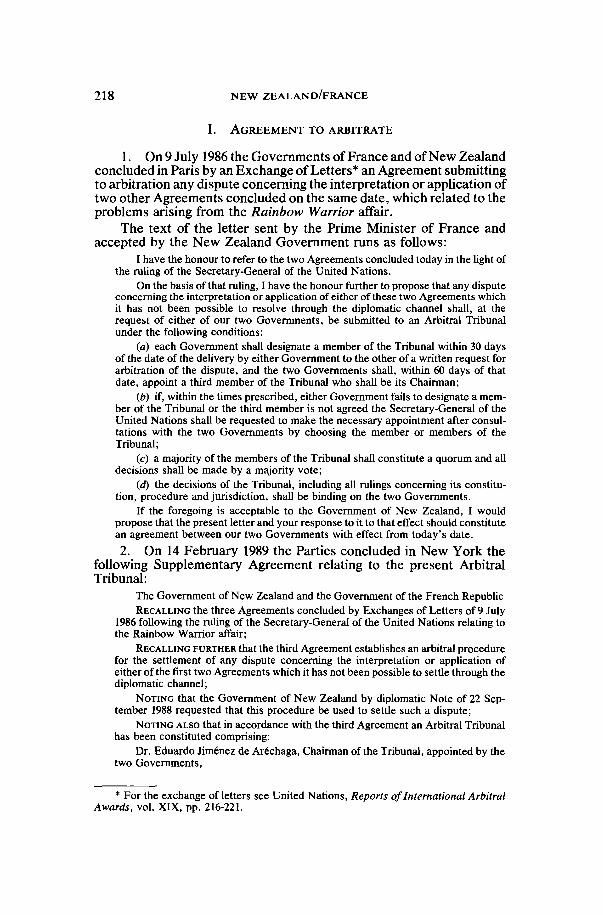
218 NEW ZEALAND/FRANCE
I. AGREEMENT TO ARBITRATE
1. On 9 July 1986 the Governments of France and of New Zealandconcluded in Paris by an Exchange of Letters* an Agreement submittingto arbitration any dispute concerning the interpretation or application oftwo other Agreements concluded on the same date, which related to theproblems arising from the Rainbow Warrior affair.
The text of the letter sent by the Prime Minister of France andaccepted by the New Zealand Government runs as follows:
I have the honour to refer to the two Agreements concluded today in the light ofthe ruling of the Secretary-General of the United Nations.
On the basis of that ruling, I have the honour further to propose that any disputeconcerning the interpretation or application of either of these two Agreements whichit has not been possible to resolve through the diplomatic channel shall, at therequest of either of our two Governments, be submitted to an Arbitral Tribunalunder the following conditions:
(a) each Government shall designate a member of the Tribunal within 30 daysof the date of the delivery by either Government to the other of a written request forarbitration of the dispute, and the two Governments shall, within 60 days of thatdate, appoint a third member of the Tribunal who shall be its Chairman;
(b) if, within the times prescribed, either Government fails to designate a mem-ber of the Tribunal or the third member is not agreed the Secretary-General of theUnited Nations shall be requested to make the necessary appointment after consul-tations with the two Governments by choosing the member or members of theTribunal;
(c) a majority of the members of the Tribunal shall constitute a quorum and alldecisions shall be made by a majority vote;
(d) the decisions of the Tribunal, including all rulings concerning its constitu-tion, procedure and jurisdiction, shall be binding on the two Governments.
If the foregoing is acceptable to the Government of New Zealand, I wouldpropose that the present letter and your response to it to that effect should constitutean agreement between our two Governments with effect from today's date.
2. On 14 February 1989 the Parties concluded in New York thefollowing Supplementary Agreement relating to the present ArbitralTribunal:
The Government of New Zealand and the Government of the French RepublicRECALLING the three Agreements concluded by Exchanges of Letters of 9 July
1986 following the ruling of the Secretary-General of the United Nations relating tothe Rainbow Warrior affair;
RECALLING FURTHER that the third Agreement establishes an arbitral procedurefor the settlement of any dispute concerning the interpretation or application ofeither of the first two Agreements which it has not been possible to settle through thediplomatic channel;
NOTING that the Government of New Zealand by diplomatic Note of 22 Sep-tember 1988 requested that this procedure be used to settle such a dispute;
NOTING ALSO that in accordance with the third Agreement an Arbitral Tribunalhas been constituted comprising:
Dr. Eduardo Jimenez de Aréchaga, Chairman of the Tribunal, appointed by thetwo Governments i
* For the exchange of letters see United Nations, Reports of International ArbitralAwards, vol. XIX, pp. 216-221.
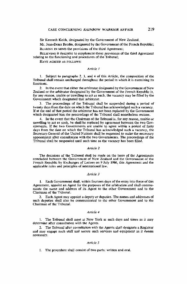
CASE CONCERNING RAINBOW WARRIOR AFFAIR 219
Sir Kenneth Keith, designated by the Government of New Zealand,Mr. Jean-Denis Bredin, designated by the Government of the French Republic;BEARING IN MIND the provisions of the third Agreement;BELIEVING it desirable to supplement those provisions of the third Agreement
relating to the functioning and procedures of the Tribunal;HAVE AGREED AS FOLLOWS:
Article 1
1. Subject to paragraphs 2, 3, and 4 of this Article, the composition of theTribunal shall remain unchanged throughout the period in which it is exercising itsfunctions.
2. In the event that either the arbitrator designated by the Government of NewZealand or the arbitrator designated by the Government of the French Republic is,for any reason, unable or unwilling to act as such, the vacancy may be filled by theGovernment which designated that arbitrator.
3. The proceedings of the Tribunal shall be suspended during a period oftwenty days from the date on which the Tribunal has acknowledged such a vacancy.If at the end of that period the arbitrator has not been replaced by the Governmentwhich designated him the proceedings of the Tribunal shall nonetheless resume.
4. In the event that the Chairman of the Tribunal is, for any reason, unable orunwilling to act as such, he shall be replaced by agreement between the two Gov-ernments. If the two Governments are unable to agree within a period of fortydays from the date on which the Tribunal has acknowledged such a vacancy, theSecretary-General of the United Nations shall be requested to make the necessaryappointment after consultation with the two Governments. The proceedings of theTribunal shall be suspended until such time as the vacancy has been filled.
Article 2
The decisions of the Tribunal shall be made on the basis of the Agreementsconcluded between the Government of New Zealand and the Government of theFrench Republic by Exchanges of Letters on 9 July 1986, this Agreement and theapplicable rules and principles of international law.
Article 3
1. Each Government shall, within fourteen days of the entry into force of thisAgreement, appoint an Agent for the purposes of the arbitration and shall commu-nicate the name and address of its Agent to the other Government and to theChairman of the Tribunal.
2. Each Agent may appoint a deputy or deputies. The names and addresses ofsuch deputies shall also be communicated to the other Government and to theChairman of the Tribunal.
Article 4
1. The Tribunal shall meet at New York at such days and times as it maydetermine after consultation with the Agents.
2. The Tribunal after consultation with the Agents shall designate a Registrarand may engage such staff and secure such services and equipment as it deemsnecessary.
Article 5
1. The procedure shall consist of two parts: written and oral.
220 NEW ZEALAND/FRANCE
2. The written pleadings shall consist of:(a) A Memorial, which shall be submitted by the Government of New
Zealand to the Registrar of the Tribunal and to the French Agent within eightweeks after entry into force of this Agreement;
(b) A Counter-Memorial, which shall be submitted by the Government ofthe French Republic to the Registrar of the Tribunal and the New ZealandAgent within eight weeks after the date of receipt by the French Agent of theNew Zealand Memorial;
(c) A Reply, which shall be submitted by the Government of New Zealandto the Registrar of the Tribunal and the French Agent within four weeks afterthe date of receipt by the New Zealand Agent of the French Counter-Memorial;
(d) A Rejoinder, which shall be submitted by the Government of theFrench Republic to the Registrar of the Tribunal and the New Zealand Agentwithin four weeks after the date of receipt by the French Agent of the NewZealand Reply;
(e) Such other written material as the Tribunal may determine to be neces-sary.3. The Registrar shall notify the two Agents of the address for deposit of
written pleadings and other written material.4. Each document shall be communicated in six copies.5. The Tribunal may extend the above time limits at the request of either
Government.6. The oral hearings shall follow the written proceedings after an interval of
not less than two weeks.7. Each Government shall be represented at the oral hearings by its Agent or
deputy Agent and such counsel and experts as it deems necessary for this purpose.
Article 6
Each Government shall present its written pleadings and oral submissions to theTribunal in English or in French. All decisions of the Tribunal shall be delivered inboth languages. Verbatim records of the oral proceedings shall be produced eachday in the language in which each statement was delivered. The Tribunal shallarrange for such translation and interpretation services as may be necessary andshall keep a verbatim record of all oral proceedings in English and French.
Article 7
1. On completion of the proceedings, the Tribunal shall render its Award assoon as possible and shall forward a copy of the Award, signed by the Chairman andthe Registrar of the Tribunal, to the two Agents.
2. The Award shall state in full the reasons for the conclusions reached.
Article 8
The identity of the Agents and counsel of the two Governments, as well as thewhole of the Tribunal's Award, may be made public. The Tribunal may also decide,after consultation with the two Agents and giving full weight to the views of each, tomake public the written pleadings and the records of the oral hearings.
Article 9
Any dispute between the two Governments as to the interpretation of theAward may, at the request of either Government, be referred to the Tribunal forclarification within three months after the date of receipt of the Award by its Agent.
CASE CONCERNING RAINBOW WARRIOR AFFAIR 221
Article 10
The present Agreement shall enter into force on the date of signature.
II. SUMMARY OF THE PROCEEDINGS
3. In accordance with Article 3 of the Supplementary Agreement,each Government communicated to the Chairman of the Tribunal thename and address of its Agent.
The Agent appointed by New Zealand is Mr. Christopher DavidBeeby, Deputy Secretary, Ministry of External Relations and Trade,New Zealand.
The Agent appointed by France is Mr. Jean-Pierre Puissochet,Counselor of State, Director of Legal Affairs, Ministry of ForeignAffairs, France.
4. On 8 May 1989, the Tribunal met in New York and appointedMichael F. Hoellering as Registrar, and Philippe P. Chalandon as As-sistant Registrar.
5. The two Governments filed their written pleadings within theagreed time limits.
On 5 April 1989 the Government of New Zealand submitted aMemorial with Annexes.
On I June 1989 the Government of France submitted a Counter-Memorial with Annexes.
On 30 June 1989 and on 27 July 1989 respectively, the partiessubmitted their Reply with further Annexes and a Rejoinder.
6. With the written stage of the proceedings concluded the Tri-bunal, following consultations with the Agents of both Parties, fixed thedate of the opening of oral proceedings for 31 October 1989. Oralproceedings were held in New York from 31 October to 3 November1989. The following persons attended:For New Zealand:
Rt. Hon. D. R. Lange, Attorney General, as Leader of the Del-egation,
Mr. C. D. Beeby, Deputy Secretary, Ministry of External Relationsand Trade, as Agent and Counsel,
Professor D. W. Bowett, Q.C., Whewell Professor of InternationalLaw, University of Cambridge, as Counsel,
Mr. C. R. Keating, Assistant Secretary, Ministry of External Rela-tions and Trade, as Counsel,
Mr. D. J. McKay, Counsellor, Ministry of External Relations andTrade, as Counsel,
Ms. J. A. Lake, Legal Consultant, Ministry of External Relationsand Trade, as Counsel;For France:
Mr. Jean-Pierre Puissochet, Counselor of State, Director of LegalAffairs, Ministry of Foreign Affairs, as Agent and Counsel,

222 NEW ZEALAND/FRANCE
Mr. Prosper Weil, Professor of the Paris University of Law, Eco-nomics and Social Sciences, as Counsel,
Mrs. Brigitte Stern, Professor of the University of Paris X at Nan-terre, as Counsel,
Mr. Vincent Coussirat-Coustère, Professor of the University ofLille II, as Counsel,
Mrs. Marie-Reine d'Haussy, Assistant Director, Legal Depart-ment, Ministry of Foreign Affairs, as Counsel,
Mr. François Alabrune, Secretary, Legal Department, Ministry ofForeign Affairs, as Counsel,
Mr. Jean-Paul Esquirol, Controller-General of the Army, asExpert,
Mr. Jean-Paul Algret, Lieutenant Colonel, as Expert,Professor Charles Laverdant, Member of the Academy of Medi-
cine, as Expert.The oral proceedings were recorded in conformity with Article 6 of theSupplementary Agreement.
III. FINAL SUBMISSIONS OF THE PARTIES
7. The final submissions of the parties are as follows:For New Zealand, in the Memorial:
144. In conclusion, New Zealand respectfully requests the Tribunal to grantthe following relief:
(a) A declaration that the French Republic:(i) breached its obligations to New Zealand by failing to seek in good faith
the consent of New Zealand to the removal of Major Mafart and Cap-tain Prieur from the island of Hao;
(ii) breached its obligations to New Zealand by the removal of MajorMafart and Captain Prieur from the island of Hao;
(iii) is in breach of its obligations to New Zealand by the continuous ab-sence of Major Mafart and Captain Prieur from the island of Hao;
(iv) is under an obligation to return Major Mafart and Captain Prieurpromptly to the island of Hao for the balance of their three year periodsin accordance with the conditions of the First Agreement;
(b) An order that the French Republic shall promptly return Major Mafart andCaptain Prieur to the island of Hao for the balance of their three yearperiods in accordance with the conditions of the First Agreement.
For France, in the Counter-Memorial:Conclusion
For all the reasons set out in the foregoing chapters, the Government of the FrenchRepublic respectfully requests that the Arbitral Tribunal reject the requests of NewZealand.
For New Zealand, in the Reply:Conclusion
In its Counter-Memorial France has failed to establish any reason, whether byreference to law or fact, why New Zealand should not be granted the relief it seeks.
CASE CONCERNING RAINBOW WARRIOR AFFAIR 223
Accordingly, New Zealand respectfully maintains its request for a declaration andan order for specific performance, as set out in paragraph 144 of its Memorial.
For France, in the Rejoinder:
Conclusion
For all the reasons set out in the foregoing chapters, the Government of the FrenchRepublic once again respectfully requests that the Arbitral Tribunal reject the re-quests of New Zealand.
Oral conclusions:For New Zealand:
Mr. President, I have made it clear that New Zealand sees no reason to make anymodification of its request to this Tribunal for a declaration and order as set out inparagraph 144 of the New Zealand Memorial.
For France:Its Agent reaffirmed its earlier " . . . conclusions whose main thrust is to encourageyou to reject the entire New Zealand request".
IV. THE FACTS
The 1986 Ruling and Agreements
8. On 10 July 1985, a civilian vessel, the Rainbow Warrior, notflying the New Zealand flag, was sunk at its moorings in AucklandHarbour, New Zealand, as a result of extensive damage caused by twohigh-explosive devices. One person, a Netherlands citizen, Mr. Fer-nando Pereira, was killed as a result of this action: he drowned when theship sank.
9. On 12 July 1985, two agents of the French Directorate Generalof External Security (D.G.S.E.) were interviewed by the New ZealandPolice and subsequently arrested and prosecuted. On 4 November 1985,they pleaded guilty in the District Court in Auckland, New Zealand, tocharges of manslaughter and wilful damage to a ship by means of anexplosive. On 22 November 1985, the two agents, Alain Mafart andDominique Prieur, were sentenced by the Chief Justice of New Zealandto a term of 10 years imprisonment.
10. On 22 September 1985, the Prime Minister of France issued acommuniqué confirming that the Rainbow Warrior had been sunk byagents of the D.G.S.E. under orders. On the same day, the FrenchMinister for External Affairs indicated to the Prime Minister of NewZealand that France was ready to undertake reparations for the con-sequences of that action.
11. Bilateral efforts to resolve the differences that had arisensubsequently between New Zealand and France were undertaken over aperiod of several months. In June 1986, following an appeal by PrimeMinister Lubbers of the Netherlands, the two Governments formallyapproached the Secretary-General of the United Nations and referred tohim all the problems between them arising from the Rainbow Warrioraffair for a binding Ruling.
224 NEW ZEALAND/FRANCE
12. On 6 July 1986, the Secretary-General of the United Nationsissued the following:
Ruling
The issues that I need to consider are limited in number. I set out below myruling on them, which takes account of all the information available to me. My rulingis as follows:
1. Apology
New Zealand seeks an apology. France is prepared to give one. My ruling isthat the Prime Minister of France should convey to the Prime Minister of NewZealand a formal and unqualified apology for the attack, contrary to internationallaw, on the "Rainbow Warrior" by French service agents which took place on10 July 1985.
2. Compensation
New Zealand seeks compensation for the wrong done to it, and France is readyto pay some compensation. The two sides, however, are some distance apart onquantum. New Zealand has said that the figure should not be less than US Dollars9 million, France that it should not be more than US Dollars 4 million. My ruling isthat the French Government should pay the sum of US Dollars 7 million to theGovernment of New Zealand as compensation for all the damage it has suffered.
3. The two French service agents
It is on this issue that the two Governments plainly had the greatest difficulty intheir attempts to negotiate a solution to the whole issue on a bilateral basis beforethey took the decision to refer the matter to me.
The French Government seeks the immediate return of the two officers. Itunderlines that their imprisonment in New Zealand is not justified, taking intoaccount in particular the fact that they acted under military orders and that France isready to give an apology and to pay compensation to New Zealand for the damagesuffered.
The New Zealand position is that the sinking of the "Rainbow Warrior" in-volved not only a breach of international law, but also the commission of a seriouscrime in New Zealand for which the two officers received a lengthy sentence from aNew Zealand court. The New Zealand side states that their release to freedomwould undermine the integrity of the New Zealand judicial system. In the course ofbilateral negotiations with France, New Zealand was ready to explore possibilitiesfor the prisoners serving their sentences outside New Zealand.
But it has been, and remains, essential to the New Zealand position that thereshould be no release to freedom, that any transfer should be to custody, and thatthere should be a means of verifying that.
The French response to that is that there is no basis either in international lawor in French law on which the two could serve out any portion of their New Zealandsentence in France, and that they could not be subjected to new criminal pro-ceedings after a transfer into French hands.
On this point, if I am to fulfil my mandate adequately, I must find a solution inrespect of the two officers which both respects and reconciles these conflictingpositions.
My ruling is as follows:(a) The Government of New Zealand should transfer Major Alain Mafart and
Captain Dominique Prieur to the French military authorities. Immediately there-after, Major Mafart and Captain Prieur should be transferred to a French militaryfacility on an isolated island outside of Europe for a period of three years.
(b) They should be prohibited from leaving the island for any reason, exceptwith the mutual consent of the two Governments. They should be isolated during
CASE CONCERNING RAINBOW WARRIOR AFFAIR 225
their assignment on the island from persons other than military or associated person-nel and immediate family and friends. They should be prohibited from any contactwith the press or other media whether in person or in writing or in any other manner.These conditions should be strictly complied with and appropriate action should betaken under the rules governing military discipline to enforce them.
(c) The French Government should every three months convey to the NewZealand Government and to the Secretary-General of the United Nations, throughdiplomatic channels, full reports on the situation of Major Mafart and Captain Prieurin terms of the two preceding paragraphs in order to allow the New Zealand Govern-ment to be sure that they are being implemented.
(d) If the New Zealand Government so requests, a visit to the French militaryfacility in question may be made, by mutual agreement between the two Govern-ments, by an agreed third party.
(e) I have sought information on French military facilities outside Europe. Onthe basis of that information, I believe that the transfer of Major Mafart and CaptainPrieur to the French military facility on the isolated island of Hao in French Poly-nesia would best facilitate the enforcement of the conditions which I have laid downin paragraphs (a) to (d) above. My ruling is that this should be their destinationimmediately after their transfer.
4. Trade issues
The New Zealand Government has taken the position that trade issues havebeen imported into the affair as a result of French action, either taken or in prospect.The French Government denies that, but it has indicated that it is willing to givesome undertakings relating to trade, as sought by the New Zealand Government.I therefore rule that France should:
(a) Not oppose continuing imports of New Zealand butter into the UnitedKingdom in 1987 and 1988 at levels proposed by the Commission of the EuropeanCommunities insofar as these do not exceed those mentioned in document COM (83)574 of 6 October 1983, that is to say, 77.000 tonnes in 1987 and 75.000 tonnes in 1988;and
(b) Not take measures that might impair the implementation of the Agreementbetween New Zealand and the European Economic Community on Trade in Mut-ton, Lamb and Goatmeat which entered into force on 20 October 1980 (as com-plemented by the Exchange of Letters of 12 July 1984).
5. Arbitration
The New Zealand Government has argued that a mechanism should exist toensure that any differences that may arise about the implementation of the agree-ments concluded as a result of my ruling can be referred for binding decision to anarbitral tribunal. The Government of France is not averse to that. My ruling is thatan agreement to that effect should be concluded and provide that any dispute con-cerning the interpretation or application of the other agreements, which it has notbeen possible to resolve through the diplomatic channel, shall, at the request ofeither of the two Governments, be submitted to an arbitral tribunal. (The ruling thenmade the specific proposals for arbitration which were later incorporated in theAgreement set out in para. 1 of this Award.)
6. The two Governments should conclude and bring into force as soon aspossible binding agreements incorporating all of the above rulings. These agree-ments should provide that the undertaking relating to an apology, the paymentof compensation and the transfer of Major Mafart and Captain Prieur should beimplemented at the latest on 25 July 1986.
7. On one matter I find no need to make a ruling. New Zealand, in its writtenstatement of position, has expressed concern regarding compensation for the familyof the individual whose life was lost in the incident and for Greenpeace. The Frenchstatement of position contains an account of the compensation arrangements that

226 NEW ZEALAND/FRANCE
have been made; I understand that those assurances constitute the response thatNew Zealand was seeking".
13. In accordance with paragraph 6 of the Ruling, the French andNew Zealand Governments concluded in Paris, on 9 July 1986, byExchanges of Letters, three Agreements which incorporated the provi-sions of the Ruling. The first of these Agreements, which relates to thesituation of the two French officers, runs as follows:
On 19 June 1986, wishing to maintain the close and friendly relations whichhave traditionally existed between New Zealand and France, our two Governmentsagreed to refer all of the problems between them arising from the Rainbow Warrioraffair to the Secretary-General of the United Nations for a binding Ruling. In thelight of that Ruling, made available on 7 July 1986,1 have the honour to propose thefollowing:
The Prime Minister of France will convey to the Prime Minister of New Zealanda formal and unqualified apology for the attack, contrary to international law, on theRainbow Warrior by French service agents which took place in Auckland on 10 July1985. Furthermore, the French Government will pay the sum of US$ 7 million to theGovernment of New Zealand as compensation for all the damage which it hassuffered.
The Government of New Zealand will transfer Major Alain Mafart and CaptainDominique Prieur to the French military authorities. Immediately thereafter, MajorMafart and Captain Prieur will be transferred to a French military facility on theisland of Hao for a period of not less than three years.
They will be prohibited from leaving the island for any reason, except with themutual consent of the two Governments. They will be isolated, during their assign-ment in Hao, from persons other than military or associated personnel and im-mediate family and friends. They will be prohibited from any contact with the pressor other media, whether in person, in writing or in any other manner. These condi-tions will be strictly complied with and appropriate action will be taken under therules governing military discipline to enforce them.
The French Government will every three months convey to the New ZealandGovernment and to the Secretary-General of the United Nations, through diplo-matic channels, full reports on the situation of Major Mafart and Captain Prieur interms of the two preceding paragraphs in order to allow the New Zealand Govern-ment to be sure that these paragraphs are being implemented as agreed.
If the New Zealand Government so requests, a visit to the facility on Hao maybe made, by mutual agreement between the two Governments, by an agreed thirdparty.
The undertakings relating to an apology, the payment of compensation and thetransfer of Major Mafart and Captain Prieur will be implemented not later than25 July 1986.
14. In accordance with the Ruling and the First Agreement, offi-cers Mafart and Prieur were transferred from New Zealand to a Frenchmilitary facility on the island of Hao on 23 July 1986, and the otherobligations undertaken in para. 2 of the Agreement were implemented.
The Case of Major Mafart
15. On 7 December 1987 the French Ministry of Defence wasadvised by the commander of the Hao military base that the condition

CASE CONCERNING RAINBOW WARRIOR AFFAIR 227
of Major Mafart's health required examinations and immediate care,which could not be carried out locally. The Minister of Defence thendecided to send a medical team to the site. This team was led by aprincipal Army doctor, Dr. Maurel, from the Val-de-Grace Hospital inParis.
16. On 10 December 1987 (Hao date), Dr. Maurel sent the Minis-try of Defence a message, received in Paris on Friday 11 December,stating that Major Mafart "poses the etiological and therapeutic prob-lem of stabbing abdominal pains in a patient with a history of similar, andstill unlabeled, problems. The results of today's examination indicatethe need for explorations in a highly specialized environment. Hiscondition justifies an emergency return to a hospital in mainland France.Absent any formal notice from you to the contrary, I propose that thisevacuation take place by the Sunday 13 December 1987 aircraft".
17. On 11 December 1987, a Friday, the Minister of Defenceconveyed Dr. Maurel's message to the Minister of Foreign Affairs,adding that he planned to proceed with officer Mafart's health-relatedrepatriation. He also asked the Minister of Foreign Affairs to "contactthe New Zealand Government through the procedures stipulated in theagreement signed with that Government".
18. On 11 December 1987, at 6.59 p.m. (Paris time; it was6.59 a.m. on Saturday 12 December in Wellington) the Minister ofForeign Affairs sent the French Ambassador in Wellington a telegramasking him to immediately give the New Zealand authorities a verbalnote containing all the information that the French Government had justreceived (Dr. Maurel's medical opinion was attached to this note). TheFrench Government, referring to the 1986 Agreement, asked "the NewZealand Government to consent to Major Mafart's urgent health-relatedtransfer to a hospital in mainland France".
The French Ambassador was instructed to stress the fact that theonly means of transport immediately available between Hao and Pariswas the military aircraft leaving Hao Sunday morning. The Ambassadorwas asked to add that "the state of Major Mafart's health absolutelyrequired that he be examined without delay in a highly specializedmedical facility which exists neither in Hao nor in Papeete".
19. On 12 December 1987, between 10 a.m. and 11 a.m. (Welling-ton time) the French Ambassador contacted a senior official of the NewZealand Ministry of Foreign Affairs, communicating the above mes-sage.
20. About 4 hours later, between 2.00 and 3.00 on the afternoon ofSaturday, 12 December 1987, the New Zealand Government answeredthe preceding communication by note verbale which stated that "inorder to enable the request to be examined with the care it deserves, theNew Zealand Government will require a New Zealand assessment tobe made of Major Mafart's medical condition. Accordingly, urgentarrangements are now being made for a suitably qualified New Zealandmilitary doctor to fly on a New Zealand military aircraft to Hao for thispurpose". The note added that "the Ministry seeks urgent confirmationthat the French authorities will give the necessary clearance for a
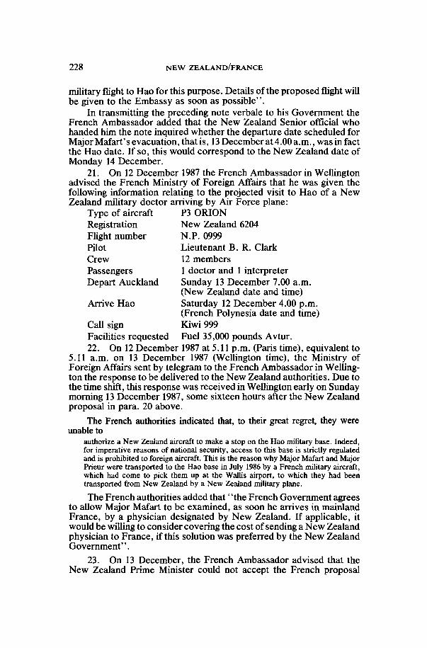
228 NEW ZEALAND/FRANCE
military flight to Hao for this purpose. Details of the proposed flight willbe given to the Embassy as soon as possible".
In transmitting the preceding note verbale to his Government theFrench Ambassador added that the New Zealand Senior official whohanded him the note inquired whether the departure date scheduled forMajor Mafart's evacuation, that is, 13 December at 4.00 a.m., was in factthe Hao date. If so, this would correspond to the New Zealand date ofMonday 14 December.
21. On 12 December 1987 the French Ambassador in Wellingtonadvised the French Ministry of Foreign Affairs that he was given thefollowing information relating to the projected visit to Hao of a NewZealand military doctor arriving by Air Force plane:
Type of aircraft P3 ORIONRegistration New Zealand 6204Flight number N.P. 0999Pilot Lieutenant B. R. ClarkCrew 12 membersPassengers 1 doctor and 1 interpreterDepart Auckland Sunday 13 December 7.00 a.m.
(New Zealand date and time)Arrive Hao Saturday 12 December 4.00 p.m.
(French Polynesia date and time)Call sign Kiwi 999Facilities requested Fuel 35,000 pounds Avtur.22. On 12 December 1987 at 5.11 p.m. (Paris time), equivalent to
5.11 a.m. on 13 December 1987 (Wellington time), the Ministry ofForeign Affairs sent by telegram to the French Ambassador in Welling-ton the response to be delivered to the New Zealand authorities. Due tothe time shift, this response was received in Wellington early on Sundaymorning 13 December 1987, some sixteen hours after the New Zealandproposal in para. 20 above.
The French authorities indicated that, to their great regret, they wereunable to
authorize a New Zealand aircraft to make a stop on the Hao military base. Indeed,for imperative reasons of national security, access to this base is strictly regulatedand is prohibited to foreign aircraft. This is the reason why Major Mafart and MajorPrieur were transported to the Hao base in July 1986 by a French military aircraft,which had come to pick them up at the Wallis airport, to which they had beentransported from New Zealand by a New Zealand military plane.
The French authorities added that ' 'the French Government agreesto allow Major Mafart to be examined, as soon he arrives in mainlandFrance, by a physician designated by New Zealand. If applicable, itwould be willing to consider covering the cost of sending a New Zealandphysician to France, if this solution was preferred by the New ZealandGovernment".
23. On 13 December, the French Ambassador advised that theNew Zealand Prime Minister could not accept the French proposal

CASE CONCERNING RAINBOW WARRIOR AFFAIR 229
but advanced new proposals, taking into account the impossibility oflanding at Hao. According to the New Zealand Memorial, the NewZealand Government put forward two alternatives: that a New Zealandmedical doctor be flown to Papeete, Tahiti, by a New Zealand militaryaircraft, and then onward to Hao by French military aircraft; or, ifFrance preferred, that the New Zealand medical doctor be flown toPapeete by a commercial flight and then onward to Hao by Frenchmilitary aircraft.
The French Ambassador in Wellington advised his Governmentsomewhat differently: "Mr. Lange proposes the following: New Zea-land dispatches a military doctor to Papeete as soon as possible bycommercial airline. The French party undertakes to transport him toHao so that he can perform his medical assignment there. After beingbrought back to Papeete, he returns to New Zealand to submit hisconclusions to the New Zealand authorities".
24. On 14 December (Wellington time), the French Ambassadorsent the following note to the New Zealand Ministry of Foreign Affairs:
A—The New Zealand request to have Major Mafart examined by a New Zea-land physician who would go to Hao, via Papeete, then return to Auckland to reportto his Government, who would then make their decision known, would delay theFrench officer's health-related transfer to mainland France by an excessive periodof time that could be as long as several days, given the available transport opportu-nities. The French authorities feel that this additional delay is absolutely incompati-ble with the urgency, stressed by the doctor who examined Major Mafart, of trans-porting the Major to a highly specialized medical facility in mainland France.
B—In carrying out their duty to protect the health of their agents, the Frenchauthorities, in this case of force majeure, are forced to proceed, without any furtherdelay, with the French officer's health-related repatriation. Major Mafart will leaveHao on Sunday 13 December at 2.00 (local time) on board a military plane that willarrive in Paris on Monday 14 December at about 10.00 (local time) after a technicalstop in Pointe-à-Pitre.
C—The French authorities reiterate that they are willing to allow Major Mafartto be examined by a physician chosen by New Zealand, as soon as he arrives inParis, and that they are even willing to cover the cost of sending a physician fromNew Zealand for this purpose, if this solution is preferred by the New ZealandGovernment.
D—All measures have been taken to insure the confidentiality of the entireoperation and to see to it that it remains secret, in any event until Major Mafart canbe examined in mainland France by the physician designated by the New Zealandauthorities".
25. On 14 December 1987 at 9.30 (Paris time), Officer Mafartarrived in Paris. He was taken to the Val-de-Grace Hospital where hewas examined and treated by Professor Daly, head of the Val-de-Gracemedical clinic, a professor of medicine and a specialist in gastroen-terology.
26. A note delivered on 14 December 1987 from the New ZealandEmbassy to the French Ministry of Foreign Affairs stated:
New Zealand views with considerable concern, and wishes to record its seriousobjection to the unilateral action taken, in the absence of New Zealand consent, totransfer Major Alain Mafart to France on Sunday 13 December 1987.
230 NEW ZEALAND/FRANCE
New Zealand regards this action as a serious breach of both the letter and thespirit of the obligations undertaken pursuant to the Ruling of 6 July 1986 by theSecretary-General of the United Nations.
The first approach to the New Zealand Government about a possible medicalevacuation of Mafart was made by the Ambassador of France in New Zealand atapproximately 10.00 a.m. New Zealand time on Saturday 12 December. From thatmoment the New Zealand side has acted with great sensitivity to the humanitarianconsiderations involved and has worked hard, in a sympathetic and pragmatic way,to ensure that both medical requirements and requirements of principle were left inbalance.
Within four hours of the receipt of the French request a proposal had beenapproved by the New Zealand Prime Minister and conveyed to the Ambassador ofFrance which would have enabled examination in Hao of Mafart by a New Zealanddoctor the following afternoon.
That proposal was rejected by the French side after 16 hours delay on the basisthat it was undesirable that a New Zealand aircraft should land at Hao. New Zealandthen immediately offered to transport its doctor to Tahiti, with France providingonward transportation to Hao. That proposal could also have been accomplished ina similar time frame had it not been for the delay on the part of the French author-ities.
New Zealand reserves its right to submit the question of Mafart's transfer fromHao to arbitration in accordance with the agreed procedures set out in the Exchangeof Letters of 9 July 1986. Nevertheless the New Zealand Government is willing towork constructively with the French Government to reach a resolution of the matterand, to this end, New Zealand awaits the French response to the proposals madetoday in a separate communication to the Prime Minister of France from the PrimeMinister of New Zealand.
27. The letter from the Prime Minister of New Zealand to thePrime Minister of France, dated 14 December 1987, read as follows:
I have been advised that, without the consent of the New Zealand Government,Major Mafart was taken some hours ago by French military aircraft from Hao formedical examination in metropolitan France.
My purpose in writing to you is not to deal with the legality of the action whichhas been taken—that is clear and will be the subject of a note from the New ZealandEmbassy to the Quai d'Orsay—but to explore with you the best means of dealingwith the situation which this unilateral action has created.
Your authorities have advised us that a New Zealand doctor may examineMafart on his arrival in Paris; and arrangements are now being made to enable this tobe done. I would of course expect that our doctor's examination of Major Mafartwill confirm a medical condition requiring urgent specialist examination. Should ourdoctor's examination of Major Mafart confirm the need for urgent specialist atten-tion then I suggest that we might proceed on the basis of an agreement as follows:
(a) compliance with the Exchange of Letters of 9 July 1986, by the return ofMajor Mafart to Hao, will be restored as soon as his medical condition permits andhe will be so returned even if further maintenance treatment is required which couldbe continued on Hao;
(b) the conditions contained in the Exchange of Letters of July 1986 relating toMajor Mafart's isolation, including the prohibition of any contact with the press orother media whether in person, in writing or in any other manner will continue toapply during such time as Major Mafart is in metropolitan France;
(c) the French authorities will transmit regularly to the New Zealand Govern-ment medical reports on Major Mafart's condition and, if requested, will undertakeconsultations with a designated New Zealand doctor and permit subsequent exam-inations;

CASE CONCERNING RAINBOW WARRIOR AFFAIR 231
(d) in the event of disagreement between our two Governments that MajorMafart's medical condition is such as to permit his return to Hao, the issue will bereferred to the Secretary-General of the United Nations for his decision;
In the event that our doctor's examination does not confirm a medical conditionrequiring urgent specialist attention then he shall be returned forthwith to Hao and inthe event that there is disagreement as to that then the provisions of (d) shall apply.
I should be grateful for your urgent confirmation that this proposal is acceptableto you.
I think I should add that when Major Mafart is returned to Hao I intend,pursuant to the Exchange of Letters of 9 July 1986, to request the agreement of yourGovernment to a visit to Hao by a representative of the Secretary-General of theUnited Nations. I should also note, in this regard, that in view of the essential roleplayed by the Secretary-General in this matter, I have thought it proper to advisehim of these developments.
I hope that Major Mafart's health will improve.
28. On 14 December 1987 New Zealand sent a doctor to examineAlain Mafart. At 4.00 p.m. (Paris time) officer Mafart was examinedby Dr. R. S. Croxson, a national of New Zealand, residing in London.Dr. Croxson, with the cooperation of French authorities and medicaldoctors, was able to conduct a substantial physical examination ofofficer Mafart, becoming acquainted with all his health records, inconsultation with the French doctors.
Dr. Croxson's report to the New Zealand authorities of 14 Decem-ber 1987 concerning his examination of Major Mafart read as follows:
Questions Dr. Croxson was asked to address:
(a) whether Mafart has a condition which, in your opinion, required specialistinvestigation not likely to be available in the presumably limited military facilities onHao;
(b) whether in your opinion the symptoms and conditions were such as tojustify an emergency evacuation;
(c) an account of the nature of the specialist investigations to be undertaken,including the likely length of time for the investigation;
(d) your opinion, if any, on whether or when he would be fit to be returned toHao;
(e) whether in your opinion the patient may be simply a malingerer.
Conclusions from Dr. Croxson's report on Major Mafart, 14 December 1987:
(a) I believe Mafart needed detailed investigations which were not available onHao;
(b) Although Dr. Maurel appeared impressed by the severity of his pain andsymptoms, when I asked if he thought Mafart might need an emergency operation hehesitated and I had the feeling he did not really feel at this stage that immediatesurgery was going to be required but was more impressed by the recurring nature ofthe symptoms. I think it is therefore highly arguable whether an emergency evacua-tion as opposed to a planned urgent evacuation was necessary;
(c) 2-3 weeks;
(d) when investigations and observations are completed (possibly 3-4 weeks),as the doctors may wish to keep him under observation to witness a further attackshould their investigations not disclose any other significant abnormalities;
{e) all the medical facts are very consistent and I do not think he is a malin-gerer.

232 NEW ZEALAND/FRANCE
29. On 18 December 1987 Dr. Croxson submitted a second report,which read as follows:
OpinionThe further sequencing and investigations would sound appropriate for some-
body with such a longstanding story of recurrent abdominal pain and distension fromprobable adhesions. The investigations would normally take a further one to twoweeks. I do not think that they are being excessively slow on their investigations,but are pursuing them in a fairly logical manner. Perhaps the investigations could becompressed over five or six days rather than the planned two weeks, although I didnot take this point up with Professor Daly. Professor Daly offered to discuss bytelephone with me the further results on Monday 4 January at the same time.
I did not tape record my conversation with Professor Daly, and I think I was alittle limited in not having French interpretation. Nonetheless the results of theinvestigations and the planned sequencing really do sound quite appropriate. Giventhe long history, I suspect most clinicians would like to witness an episode of severepain and abdominal distension. I did not raise the question again of exploratorysurgery, nor did Professor Daly indicate to me that there was any question of this atthe present time.
Professor Daly indicated that he had read my full medical report and agreed thatit was a totally accurate picture of his (Professor Daly's) medical facts as outlined tome. We did not discuss the acute management of Mafart as it appeared to Dr. Maurelwhen he arrived at Hao on 10 December.
30. On 19 December 1987 the Ministry of Foreign Affairs of theFrench Republic addressed a formal note to the New Zealand Embassy,answering the 14 December formal note in the following terms:
The French Government thinks that Major MAFART's transfer to Paris on De-cember 13 to undergo emergency medical examinations and the care necessitated byhis condition cannot be analyzed as a failure to meet the obligations under theagreement resulting from the Exchanges of Letters on 9 July 1986 between Franceand New Zealand, following the intervention of the Secretary-General of the UnitedNations.
On 11 December, when it appeared imperative to have Major MAFART undergomedical examinations as soon as possible in a highly specialized environment, theNew Zealand Ministry of Foreign Affairs was contacted in order to secure the NewZealand authorities' consent to the French officer's transfer to Paris by militaryflight departing Hao on 14 December. The New Zealand authorities then made theirconsent contingent upon a doctor's examination of Major MAFART on Hao and, forthis purpose, proposed that the required physician be transported to the Frenchmilitary base by a New Zealand military plane. But, as the New Zealand authoritieswere moreover aware, given the nature of the Hao base, foreign aircraft wereexcluded from landing there. In this connection, the French Ministry of ForeignAffairs recalls that, when Major MAFART and Captain PRIEUR were transportedfrom New Zealand to Hao, this impossibility was made known and resulted in theirbeing forced to change planes at the Wallis airport.
The solution of having a New Zealand physician come to the Papeete airportand be transferred from that city to Hao by a French plane was also examined. But itwas immediately ascertained that, given the technical possibilities and the fact thatthe doctor would have to return via the same arrangements, so that he could reportto his Government, the result of this procedure would have been that no decisioncould be made for several days.
Under these conditions, the only solution, in the spirit of the Agreement of9 July 1986 and of the conversations that led up to it, was to evacuate Major MAFARTand permit the physician designated by New Zealand to ascertain his state of healthas soon as he arrived in Paris. The French Government is happy to point out, in this
CASE CONCERNING RAINBOW WARRIOR AFFAIR 233
regard, that the New Zealand authorities accepted this solution and dispatchedDr. CROXSON to Paris for this purpose.
It noted with satisfaction the very positive appraisal that the New ZealandGovernment gave of the frankness, candor and full cooperation that Dr. CROXSONenjoyed while carrying out his assignment.
It observes that the conclusions of the report written by this doctor, which wereconveyed to it on 16 December by the New Zealand Embassy in Paris, concur withthose of the French physicians and show that there were perfect grounds for thedecision to transport Major MAFART to a highly specialized facility existing only inmainland France.
The French Government shares the desire expressed by the New ZealandGovernment, in its note, to participate constructively in the examination of thismatter, about which the Prime Minister will send a message to the Prime Minister ofNew Zealand under separate cover.
31. On 23 December 1987 the Prime Minister of France addressedthe following letter to the Prime Minister of New Zealand:
The emergency conditions under which Major MAFART had to be returned toFrance to undergo medical examinations, which you asked about in your letter of14 December, must, as you yourself indicate, be examined between us in order toanalyze the main elements of the situation.
It is certainly not necessary to recall the details of the circumstances of thistransfer, which, I am sure, you are perfectly familiar with. It was following thedispatch of a French military doctor, alerted by the Ministry of Defence, that thenecessity became apparent on 11 December of having Major MAFART examined assoon as possible in a highly specialized environment, which could not be found onFrench territory except in Paris. Through our Ministries of Foreign Affairs, contactswere immediately made for the purpose of obtaining your country's consent, inaccordance with the Agreement concluded on 9 July 1986 by the Exchanges ofLetters following the intervention of the Secretary-General of the United Nations,which themselves resulted from secret conversations between our two Govern-ments. Your representatives then indicated their desire to be permitted to haveMajor MAFART examined by a New Zealand physician. However, it was quicklyascertained that this was not possible by direct landing of a New Zealand airplane onthe island of Hao, which is a military base closed to foreign aircraft. You will alsorecall that the transfer of Major MAFART and Captain PRIEUR from New Zealand toHao had required a change of planes in Wallis, for the same reason.
It also became clear that the solution that your representatives immediatelyproposed, which consisted of flying a doctor from New Zealand to Papeete, thenfrom Papeete to Hao, by French military plane, and returning this doctor via thesame route so that he could report to his Government, would have required a delayof several days, which seemed contrary to the imperative interests of Major MA-FART'S health.
Under these conditions, the only remaining solution was to defer, until hisarrival in Paris, Major MAFART's examination by a doctor of your choosing, whichwas done. In this regard, I noted the very positive appraisal that you and your staffgave to the quality of the cooperation that Dr. CROXSON enjoyed from the Frenchdoctors. The reception given to your compatriot, his access to all the necessarydocuments, and the in-depth examination of Major MAFART, which he was able todo, showed the spirit of openness that we bring to this matter.
Moreover, as you undoubtedly recall, the eventuality of illness, and, in the caseof Captain PRIEUR, of pregnancy, were precisely the conditions that led to thestipulation, in the July 1986 Agreement, of the possibility of leaving the island. Thisemerges from the secret negotiations of our two Governments, conducted, on re-spective sides, by Mr. BEEBY and Mr. GUILLAUME, which prepared the way for theintervention of the United Nations Secretary-General, and of which we have kept avery accurate transcript. Dr. CROXSON, at your request, drew up a medical report,

234 NEW ZEALAND/FRANCE
the conclusions of which, not being covered by medical confidentiality, were con-veyed to the Ministry of Foreign Affairs by your Embassy in Paris. This reportshows that Major MAFART was in need of substantial medical examinations whichcould not be done in Hao and which were to last several weeks. In response to aquestion that you asked him, Dr. CROXSON added that Major MAFART was by nomeans a malingerer and that he was indeed ill.
Thus, all the circumstances of this affair confirm my feeling that we have actedwith moderation and discretion and that we should now await the results of theexaminations underway in order to be able to appraise the state of Major MAFART'Shealth with better knowledge of the facts.
Such are the indisputable facts, verified by individuals that you designated. Youwill understand that, under these conditions, I was surprised by the public accusa-tions that you immediately made against this officer and against the French author-ities, whereas I had proposed that this operation be kept confidential and that thefact themselves showed the correctness of the decision that I made.
However, I have just learned that you feel, after a new examination of all of theelements of this affair, that there was no longer any point to the intervention of theSecretary-General of the United Nations, to which you alluded to in your letter. Thisway of seeing things corresponds to the attitude that I personally adopted by re-fusing to engage in a polemic. Indeed, I am convinced that our two countries todayshould endeavor to turn the page and resume a constructive relationship, in keepingwith the long tradition of friendship between our two nations.
32. On 23 December 1987 the Embassy of New Zealand answeredthe two communications in paragraphs 30 and 31 above by the followingnote:
The New Zealand Embassy presents its compliments to the Ministry of ForeignAffairs and has the honour to convey, on instruction, the following response tocertain of the assertions contained in the Ministry's Note of 19 December 1987 andthe letter to the Prime Minister of New Zealand from the Prime Minister of Francedelivered in Wellington on 23 December.
New Zealand rejects the view advanced by the French side that the transfer ofMajor Mafart from Hao was in accordance with the ruling of the United NationsSecretary-General and the Exchanges of Letters of 9 July 1986 between New Zea-land and France.
On a point of fact, the sequence of dates set out in the Ministry's Note isinaccurate. New Zealand was advised of Mafart's condition late in the morning of12 December (New Zealand time). About midnight on 13 December (New Zealandtime)—about 39 hours later—advice was given by the French Ambassador in Wel-lington (and also by the Quai d'Orsay to the New Zealand Embassy) that he hadalready been removed from Hao.
The request for consent was presented as a humanitarian emergency. NewZealand responded promptly and sympathetically offering to send a New Zealanddoctor for an on the spot examination so that, if the medical condition of Mafartjustified it, consent could be given within the time frame requested by the Frenchauthorities. The quickest option involved a flight direct to Hao. It was a matter forthe French authorities to judge whether their position about clearances for foreignaircraft at Hao was of greater importance to them than what was said to be a seriousmedical emergency. The long delay in responding and the terms of that responsecalled in question the veracity of the so-called emergency.
It is manifestly incorrect to state that the New Zealand side, when confrontedwith this response from France, suggested an option that would have prevented adecision for several days. The French Ambassador in Wellington was told that thedoctor could be transported immediately to Papeete by New Zealand military air-craft (or alternatively, if the French side preferred, civilian aircraft options could beexplored) for onward transport to Hao by French military aircraft.

CASE CONCERNING RAINBOW WARRIOR AFFAIR 235
There is no basis in fact for the extraordinary statement that the New Zealanddoctor would have had to return to New Zealand to make a report before a decisioncould be made.
New Zealand formally disputes the suggestion that the decision to evacuateMajor Mafart was in accord with the spirit of the Agreement or the Secretary-Gen-eral's Ruling or any preliminary discussions. It was, on its face, a clear breach ofboth the letter and the spirit of the Ruling and the Exchanges of Letters—a breachwhich called in question the credibility of France's commitment to honor under-takings in this matter. There is not and was never at any stage of the discussionsbetween France and New Zealand, an agreement or understanding that New Zea-land would automatically agree to a request for medical evacuation. The relevantclause in the Agreement means precisely what it says.
New Zealand also rejects the suggestion that its decision to accept the offer tosend a New Zealand doctor to Paris to examine Major Mafart can or could beconstrued as acceptance by the New Zealand authorities of the evacuation of Mafartwithout New Zealand consent. That suggestion has no basis in fact and is wholly atvariance with the terms of the Embassy's Note 1987/103 of 14 December 1987 whichrecorded New Zealand's serious objection to the unilateral action taken by France.
New Zealand reiterates that its proposals put forward on 12 and 13 Decemberwere made in good faith. New Zealand was not refusing consent but seeking clarifi-cation. That could have been accommodated in a number of ways and very quickly.The objective evidence now available confirms that there was in fact no emergencyand no justification for the French authorities setting a deadline of the kind that theydid. Furthermore, New Zealand could have been advised of the situation consider-ably earlier. It is also clear beyond any doubt that had there in fact been a genuineemergency, New Zealand's requests for clarification (which were entirely reason-able and appropriate) could have been met within the time frame proposed hadFrance been willing to work positively and constructively to that end. Responsibilityfor the delay in obtaining New Zealand consent lies at France's door.
33. On the same day, 23 December 1987, the Prime Minister ofNew Zealand answered the Prime Minister of France in the followingterms:
Thank you for your letter which I have received today. I appreciate the sen-timents you have expressed about the need to restore and maintain the cordialrelations between New Zealand and France. I must say, however, that the fact thatyou have not in your response addressed the substantive issues that were containedin my letter of 14 December, is a matter of grave concern to me and my Government.
If we are to turn a page as you suggest, then what we need is a satisfactoryassurance that as soon as the medical investigations of Major Mafart have beencompleted and he has undergone any treatment which can only be given in Paris, hewill be returned to Hao.
Our medical advice is that these investigations will be completed shortly. I mustsay to you that, in the absence of a satisfactory response by 30 December to theproposals set out in my earlier letter, we will have no choice but to conclude thatFrance is unwilling to comply with its legal obligations. In that event we will feelcompelled to invoke the arbitration provisions of the Secretary-General's Ruling andthe Agreement of 9 July 1986.
Let me also say that at no stage have we indicated that there was no role for theUnited Nations Secretary-General in seeking to resolve this matter. To the contrary,I specifically mentioned this role in my letter and in various public statements.I have discussed the situation with him and we have kept him fully informed and willcontinue to do so. He has also, as you know, taken various initiatives of his own.
Finally, there are a number of points in your letter (which are also mentioned inrecent discussion between our officials) which I do not accept. I have asked the NewZealand Embassy in Paris to convey our views on these matters to the Quai d'Orsay.
236 NEW ZEALAND/FRANCE
I have also asked our Embassy to set in motion a request for a visit to Hao by a thirdparty in accordance with the Ruling and the Agreement of 9 July 1986.
34. On 30 December 1987 the French Ministry of Foreign Affairssent a note to the New Zealand Embassy answering the New Zealandcommunications in paras. 32 and 33 above, in the following terms:
The Ministry of Foreign Affairs was surprised by the sharp tone of the refer-enced documents and therefore feels it is a good idea to respond so as to enable abetter understanding of the French Government's point of view.
The Ministry of Foreign Affairs recalls that Major Mafart is currently stillundergoing medical examinations, the necessity of which has been acknowledged byboth the French doctors and Dr. Croxson. These examinations will not be com-pleted until early January; Dr. Croxson has also indicated that he was on vacationuntil 4 January. So, today, no one can say what the doctors' conclusions will be.
The Ministry of Foreign Affairs is surprised that, under these conditions of fact,the New Zealand authorities could have doubted the French intentions in connec-tion with respecting the July 1986 Agreement; it goes without saying that MajorMafart will return to Hao when the state of his health permits.
It emphasizes that, on the second and third points brought up in Mr. Lange'sletter of 14 December (isolation of Major Mafart, specifically from the press and themedia, plus disclosure of medical reports, as well as examinations by a New Zealanddoctor), New Zealand has received from the beginning, and will continue to receive,full satisfaction.
A discussion of possible recourse to the Secretary-General of the United Na-tions in the event of a disagreement between the two Governments over the pos-sibility of returning Major Mafart to Hao, given the state of his health, seemspointless, for the reasons indicated above. However, if the question did arise, theFrench Government would have the greatest apprehensions about appealing to theSecretary-General of the UN to resolve any dispute over the evaluation of theofficer's health. Firstly, this is not the procedure stipulated in the Agreement of9 July 1986, which in this case expressly provides for settlement by arbitration;secondly, just as the intervention of the high authority represented by the Secretary-General was necessary to solve all the problems born of the Rainbow Warriorincident, so it may seem out of proportion with the limited issue here involved,should it arise.
As for the conditions under which the decision to return Major Mafart to Francewas made because of the state of his health, the Ministry of Foreign Affairs rejectsthe New Zealand assertion that the refusal to let a New Zealand airplane land onHao in itself gives rise to doubt as to the emergency nature of Major Mafart'sevacuation. As it has already had occasion to point out, the impossibility of allowinga foreign aircraft to land on Hao is absolute and was well known to New Zealand.
The Ministry of Foreign Affairs notes that New Zealand maintains that there isno factual basis for the statement that the New Zealand doctor who would have beentaken to Hao on a French means of transportation after a connection in Papeetewould have had to return by the same route to New Zealand in order to report to hisGovernment before a decision could be made. However, it points out that thisinformation was conveyed to it from Wellington by the French Ambassador imme-diately following the telephone conversation which took place on Sunday 13 Decem-ber at about 1.00 p.m. between the Ambassador and Mr. Beeby.
It does not share the opinion expressed in note No. 1987/107 as to the spirit ofthe Agreement resulting from the Exchange of Letters on 9 July 1986. Althoughleaving the island requires the consent of both Governments, and although thisconsent should, insofar as circumstances permit, be prior, it remains that the provi-sion in question here was inserted with precisely the possibility of an illness in mindand that, in this case, approval could not be reasonably refused.

CASE CONCERNING RAINBOW WARRIOR AFFAIR 237
The Ministry of Foreign Affairs does not see any need to quibble, at this stage,over the meaning of New Zealand's agreement to send a doctor to Paris and, on thispoint, refers purely and simply to this doctor's findings, which, in its eyes, cor-roborate the French doctors' appraisals of the nature of the ailments that MajorMafart is suffering from.
The New Zealand Government has requested the application of the provision ofthe Agreement of 9 July 1986 which stipulates that "If the New Zealand Governmentso requests, a visit to the Hao military installation may, by common agreementbetween the two Governments, be made by an approved third party." Referring tothe remarks made by the New Zealand Charge d'Affaires when the note of 24 De-cember was submitted, it is the understanding of the Ministry of Foreign Affairs thatthe purpose of the request would be to verify the presence of Captain Prieur on Hao.In this regard, it gives the Government of New Zealand the most formal assurance.However, if the New Zealand Government intends to persist in its request, theFrench Government will agree to it in principle in order to avoid any erroneousinterpretation. However, the Ministry of Foreign Affairs does feel that, in this case,there would be no grounds for asking the Secretary-General of the United Nations todesignate a representative to make this visit. Indeed, it points out that, as is con-firmed by the secret conversations that led up to it, the Exchange of Letters of 9 July1986 provides that the visit must be made by a third party approved by commonagreement between the two Governments. If a visit must take place, France pro-poses that it be entrusted to Dr. T. Maoate, Vice Prime Minister and Minister ofHealth of the Cook Islands, given the geographical proximity and the historical tiesbetween the Cook Islands and New Zealand. Dr. Maoate could be transported by aFrench military airplane either from Papeete or directly from the Cook Islands. Inthe absence of specific clauses in the Agreement of 9 July 1986, the cost of thismission should be paid by the requesting Government.
35. On 4 January 1988 a third report from Dr. Croxson transcribedwhat Professor Daly, the doctor in charge of Mafart, proposed to do asfollows:
1. To supervise Major Mafart closely and in particular to witness if possible amajor crisis at which time he would have a surgical consultation available.
2. To this end Major Mafart must remain close to his department near thehospital. Professor Daly would wish to review him should any new crisis appear andwould be seeing him regularly at least once weekly for the next three to four weeks,and in his opinion Mafart should not return to Hao until the diagnosis and plan oftreatment is more certain.
3. He feels that Mafart is very tired after the many investigations and explora-tions and is anxious in view of the diagnosis still not being settled, and he feels thatsome degree of "convalescence" for about three to four weeks is necessary.
4. He feels that perhaps exploratory surgery might be necessary, but againemphasized that he is not keen on blind laparotomy in view of the danger of newadhesions. I understand that he is proposing to discharge Mafart later this week andto review him once weekly.
Professor Daly and I agreed that this was a difficult clinical problem. ProfessorDaly also indicated that he would contact me in the event of any major crisisappearing in the next few days, and unless something further developed I wouldcommunicate with him next Monday, 11 January.
Professor Croxson concluded:Professor Daly's point about observing him for a longer period, particularly to
try and witness a major episode when one would have a surgical opinion, is a veryorthodox and appropriate clinical management.
238 NEW ZEALAND/FRANCE
36. On 5 January 1988 the Embassy of New Zealand conveyed tothe French Ministry of Foreign Affairs the following response to theMinistry's note of 30 December 1987:
Without addressing all of the points contained in the Ministry's note and whilereserving New Zealand's legal position and, in particular, its right to commencearbitration proceedings, the explicit assurance that Major Mafart will return to Haowhen his health permits is very welcome. Furthermore the assurance given withrespect to Captain Prieur is also welcomed, and it is hoped that these two assuran-ces, together with the ongoing cooperation at the medical level, will provide a basisfor resolving the remaining issues between France and New Zealand.
37. On 11 January 1988 a fourth report from Dr. Croxson wasproduced. In this report, Dr. Croxson advised that "no clear abnor-mality has been demonstrated on the previous investigations", addingthat "the plan is to examine him again in one week's time or earliershould crisis develop".
38. On 18 January 1988 Dr. Croxson advised that in a telephoneconversation with Professor Daly the French Professor told him that"the situation had not altered clinically since last week", that "he hasno final firm diagnosis" and that the final report would be available on27 January 1988.
39. On 21 January 1988 the New Zealand Embassy, being advisedthat Professor Daly would be preparing a final report on 27 January,expressed the wish to have Major Mafart re-examined by their medicaladvisor, Dr. Croxson, assisted by a specialist, Dr. Christopher Mallin-son, a gastroenterologist practicing in the United Kingdom. This requestwas agreed to by the French authorities and their examination tookplace on 25 January 1988.
40. On 28 January 1988 Professor Daly advised that:Major Alain MAFART was hospitalized on 14 December 1987 at the VAL-de-
GRACE hospital where he underwent in-depth radiological, biological and clinicaltests. Given the need for close, specialized medical observation and on the basis ofthe standards of fitness governing military personnel, he must be considered as unfitto serve overseas for an indefinite period.Prospects—Medical Decision:
1. Given the current uncertainties of the diagnosis, it does not seem warrantedto propose an exploratory laparotomy right away for this abdominal ailment.
2. Depending on the subsequent clinical development, various additional testscan be considered:—barium enema—Wirsungography and pancreas function—Mesenteric arteriography
These points have been discussed with Professor MALLINSON andDr. CROXSON.
3. So, close observation is called for in order to forestall a more acute crisis,which is liable to entail a surgical procedure, or to schedule the aforementionedexplorations.
4. So, Major MAFART must be kept in mainland France insofar as this obser-vation can be done only in a modern, well-equipped hospital center.
Because of these exigencies, and pursuant to the standards of fitness governingFrench military personnel, he is declared unfit to serve overseas for an indefiniteperiod.

CASE CONCERNING RAINBOW WARRIOR AFFAIR 239
41. On 5 February 1988 the Ministry of Foreign Affairs conveyedProfessor Daly's report to the New Zealand Embassy, adding that theMinistry "feels that, given the medical conclusions that it has beengiven, it is not possible at present for Major Mafart to return to the islandof Hao. Hence, it is planned that Major Mafart will receive a militaryassignment in mainland France in which he will continue to be subject tothe clauses resulting from the Exchange of Letters of 6 July 1986,specifically as regards contact with the press and other communicationmedia".
42. On 12 February 1988 Dr. Croxson submitted his fifth report,stating, inter alia, that:
Dr. Mallinson, consultant gastroenterologist, and myself examined Major Ma-fart in the Val-de-Grace hospital on Monday 25 January in the presence of and withthe assistance of Professor Daly and Dr. Laverdant . . . we reviewed all the inves-tigations, x-rays, laboratory studies which had been carried out . . .
Major Mafart has remained well, since his last report on 18 January, with nomajor episodes of pain or abdominal distension. He has been eating a light andvaried diet and living in a house within the hospital confines . . . He did not appeardepressed; his pulse, blood pressure and temperature were normal . . .
The report concluded as follows:I believe the investigations have proceeded at a very slow pace and could well
have been compressed within one to two weeks. There was no evidence produced toshow that Major Mafart had an impending obstruction at the time he was evacuatedfrom Hao and certainly if he had, he should have been airlifted to the nearest generalsurgical center, which we believe exists in Tahiti. It would have been dangerous tohave flown him to Paris.
We do not believe that he needs to remain in the confines of a major hospitalcenter for the indefinite future but that he could be returned to Hao now, continuelife as normal, rest during minor attacks and obtain treatment from the militarymedical facilities in Hao if the attacks were of a more severe nature comparable tothe satisfactory management of the two previous attacks in July and Decemberwhich were carried out at Hao.
In the unlikely event that a major crisis with acute irreversible obstruction didoccur, and we emphasize that none have appeared in the last 22 years, surgicaltreatment in Tahiti would be the logical appropriate and safest management. We donot feel that mesenteric angiography nor an ERCP are essential investigations in hismanagement; if they were they could have been carried out by now.
43. On 18 February 1988, the New Zealand Embassy addressed anote to the French Ministry of Foreign Affairs recalling the position ofthe New Zealand Government:
the unilateral removal of Major Mafart from Hao without the consent of the NewZealand Government constituted a violation of France's obligations to New Zealandunder the Ruling of July 1986 by the United Nations Secretary-General and theAgreement of 9 July 1986 between New Zealand and France.
The note added:The medical reports available to both parties fully support the New Zealand
position, which is corroborated by other evidence. There was no medical situationrequiring emergency evacuation and the alternative proposals suggested by NewZealand for medical examination prior to giving consent to his departure werereasonable.
Despite the existence of this dispute regarding France's application of theRuling and the Agreement, and while fully reserving its legal position at every

240 NEW ZEALAND/FRANCE
step, New Zealand has, because of the humanitarian characteristics of the situa-tion, cooperated fully with the French programme of medical examination of Ma-jor Mafart.
However, the extended nature of these medical examinations has been a matterof concern to the New Zealand Government and, according to the medical reports,also to Major Mafart himself. Dr. Croxson's reports indicate that they have beenunnecessarily extended . . . Dr. Croxson's advice, supported by Dr. Mallinson, isthat there is no medical reason for Major Mafart's return to Hao to be any furtherdelayed. The position of the Ministry . . . that Major Mafart is unfit for militaryservice overseas is noted. But in New Zealand's view that is not relevant to thequestion of compliance with France's obligations to New Zealand under the Agree-ment. The issue is whether compliance should now be restored. Dr. Croxson'sadvice is unequivocal. Major Mafart is medically fit to return to Hao. The nature ofthe assignment, if any, given to him in that place is not an issue.44. On 21 July 1988 Dr. Croxson presented a final report on Ma-
jor Mafart that states:No change in Major Mafart's condition since last examination, 25 January 1988.
No major episodes of severe abdominal pain, abdominal distension and none re-quiring hospitalization or special investigation. My conclusions of my report of12 February 1988 remain and indeed are strengthened by this further period of fivemonths of observations.
45. According to the French Counter-Memorial Alain Mafart,who was evacuated in December 1987 for health reasons, was declared"repatriated for health reasons" on 11 March 1988. After a temporaryassignment at the Head Office of the Nuclear Experimentation Center,he was assigned on 1 September 1988 to the War College in Paris, afterpassing the entrance examination, for which he had taken the writtenpart in Hao and the oral part in Paris. On 1 October 1988, he waspromoted to the rank of Lieutenant Colonel.
Mr. Bos' Visit to Hao
46. On 28 March 1988 an agreed third party, a Netherlands offi-cial, designated by the two Governments for the purpose, visited Hao.Mr. Adriaan Bos submitted on 5 April 1988 a report indicating that hehad had an interview with Captain Dominique Prieur, and that hermilitary function on Hao is that of officier conseil and officier adjoint. Inthe former capacity she performs certain social functions, while in thelatter she deputizes for the Commander of the base in carrying outcertain duties. A few months after arrival on Hao, on 22 July 1986, shewas joined by her husband, who is also an officer.
Mr. Bos advised that "there are approximately 17 officers on Hao.Tours of duty on Hao are normally limited to one year". Mr. Bos addedthat "Dominique Prieur and her husband have access to the normalrecreational facilities at the base. As regards contact with her family,Dominique Prieur said that her mother had visited her twice and herparents-in-law once".
The Case of Captain Prieur
47. The French Counter-Memorial states that on 3 May 1988, theFrench Ministry of Foreign Affairs received a medical report indicating

CASE CONCERNING RAINBOW WARRIOR AFFAIR 241
that Dominique Prieur was 6 weeks pregnant. The report stated thatthis pregnancy should be treated with special care for several reasons:Mrs. Prieur was almost 39 years old; her gynecological history; the factthat this would be her first child. It also indicated that the medicalfacilities existing on Hao were unable to provide the necessary medicalexaminations and the care required by Mrs. Prieur's condition.
48. On the same day, 3 May 1988, the New Zealand Ambassadorin Paris was advised of the above information and answered that shewould inform her Government. The New Zealand Ambassador notedthat she "agrees that the medical facilities existing on Hao are clearlyinappropriate, but it was her understanding that Papeete did have all therelevant necessary equipment".
49. The next day, 4 May 1988, the New Zealand Governmentanswered the French Ministry of Foreign Affairs, stating:
While New Zealand's consent is required in terms of the 1986 Agreement, this isnot a case where, if the medical situation justifies it, consent would be unreasonablywithheld.
The New Zealand Government would like, on the basis of medical consultation,to determine the nature of any special treatment that Captain Prieur might need andthe place where the necessary tests and on-going treatment could be carried out ifthe facilities at Hao are not adequate.
As a first step to coming to an agreement on this basis, the New Zealandauthorities are making arrangements for a New Zealand military doctor with therequisite qualifications to fly on the first available flight to Papeete for onward flightto Hao.The answer added that Dr. Brenner, a civilian consultant to the
Royal New Zealand Navy, qualified in obstetrics and gynecology, wasstanding by to travel to Papeete on that day, 4 May.
50. The French Ministry of Foreign Affairs, on the same day,4 May, "agreed to the dispatching of Dr. Bernard Brenner to Hao assoon as possible", adding that "this solution was suitable to us and thatall the arrangements would be made for the New Zealand doctor's trip toPapeete and his transfer to Hao, definitely on the morning of 5 May".
51. On 5 May 1988, the New Zealand Ministry of Foreign Affairsinformed the French Ambassador to New Zealand "that, due to thecontinuing UTA strike, Dr. Brenner and his interpreter are forced todelay their arrival in Papeete, which they will reach by Air New Zea-land. Leaving Auckland on Friday, 6 May at 8.40 p.m., they will arrivein Papeete the same day at 3.25 a.m. (Papeete time). If extreme urgencyso requires, a connection to Papeete by military plane could be envis-aged".
52. On 5 May 1988 at 11.00 a.m. (French time), the New ZealandAmbassador in Paris was told that the French Government had beeninformed of a "new development", namely, that Dominique Prieur'sfather, hospitalized for treatment of a cancer, was dying. The FrenchGovernment informed the Ambassador that "for obvious humanitarianreasons" Dominique Prieur had to see her father before his death. Itwas proposed "bearing in mind the previous conversations regardingMrs. Prieur's pregnancy" that either Dr. Brenner, the New Zealanddoctor, leave Auckland within three or four hours on a special flight

242 NEW ZEALAND/FRANCE
for Papeete, whence a military aircraft would take him to Hao, or thatMrs. Prieur leave Hao immediately for Paris, where she would beexamined by the New Zealand doctor.
In response to questions communicated via telephone by the NewZealand Ambassador, it was then stated that the Minister of Defencewas ready to agree that Dr. Brenner be transported directly from Auck-land to Hao by a New Zealand aircraft.
53. According to Annex 47 of the French Counter-Memorial, theNew Zealand Ambassador replied on 5 May 1988 that the New ZealandPrime Minister could not be reached but that "while waiting for thePrime Minister's decision, the solution of sending a New Zealand mili-tary aircraft to Hao was under study. It was, however, clear thatthe aircraft could not leave Auckland within the 3 or 4 hour timelimit requested by the French Government. A departure would have tobe planned instead for Friday morning (New Zealand time)". Frenchauthorities then noted that "inasmuch as the New Zealand aircraftwould head directly for Hao, its departure from Auckland could bedelayed until Friday morning at 7.30 a.m. (New Zealand time). This wasthe latest possible deadline beyond which Dominique Prieur would runthe risk of arriving in Paris too late to see her father alive".
54. On 5 May 1988 at 9.30 p.m. (Paris time), the New ZealandAmbassador in France informed the French Minister of Foreign Affairsof the following:
A. It was not possible to ready a New Zealand military aircraft to leave forHao "within the time limit set by France".
B. Mr. Lange was not willing to agree to the departure of Mrs. Prieur fromHao for the reason invoked the same morning by the French Government (the stateof health of the interested party's father).
C. The response and offer that New Zealand had made regardingMrs. Prieur's pregnancy were still valid.
D. New Zealand would not give any guarantee of confidentiality regarding thestate of health of Mrs. Prieur's father.
E. New Zealand agreed to send a doctor on Friday morning to verify the stateof health of Mrs. Prieur's father.
55. On 5 May 1988 at 10.30 p.m. (French time), the followingresponse was given to the New Zealand Ambassador:
A. The French Government considers it impossible, for obvious humanitarianreasons, to keep Mrs. Prieur on Hao while her father is dying in Paris. The Frenchofficer will therefore depart immediately for Paris.
B. We agree that a New Zealand doctor may contact the doctors treatingDominique Prieur's father and, if those doctors agree to it, may examine the patient.
C. Our offer of a medical examination of Mrs. Prieur, upon her return tometropolitan France, by a doctor chosen by New Zealand, remains valid.
56. On 6 May 1988 a telegram sent by the French Minister ofForeign Affairs to the French Ambassador at Wellington confirmed thatMrs. Prieur had left on board the special flight on Thursday, 5 May at11.30 p.m. (Paris time), and that she was expected in Paris on 6 May inthe evening.

CASE CONCERNING RAINBOW WARRIOR AFFAIR 243
57. On 10 May 1988 the New Zealand Embassy presented thefollowing note to the French Ministry of Foreign Affairs referring to thediscussions which took place on 3, 4 and 5 May 1988 between theCabinet of the Minister of Foreign Affairs and the Embassy concerningCaptain Dominique Prieur:
The Government of New Zealand feels obliged to place on record at this timeits concern about the actions of the former French Government with respect toFrance's obligations to New Zealand under international law in connection with theAgreement following from the Ruling of 6 July 1986 by the Secretary-General ofthe United Nations and incorporated in the Exchange of Letters between Franceand New Zealand of 9 July 1986. New Zealand must protest these actions in thestrongest possible terms.
In this connection New Zealand must also recall the previous violations of thosesolemn undertakings when Major Mafart was removed from Hao in December 1987without New Zealand's consent and when, contrary to the clear medical indicationsof adequate fitness, French authorities refused to restore compliance. New Zealandhas sought to retain a cooperative relationship with France, including the activationof a medical team to visit Hao last week to examine Captain Prieur. Last week'sunilateral acts by the former French Government constitute a further serious viola-tion of legal obligations under the Agreement concluded under the auspices of theUnited Nations Secretary-General and give rise to a further legal dispute betweenFrance and New Zealand.
Prior to the events of last week New Zealand had publicly committed itself toseeking to resolve these problems through the diplomatic channel. It remains NewZealand's very strong wish to restore a climate of mutual confidence in its relationswith France, and, accordingly, New Zealand continues to be willing to seek asettlement under which France would voluntarily return Major Mafart and CaptainPrieur to Hao. An agreement whereby both officers could undergo specialist medicaltreatment in Tahiti, if that became necessary, and subject to appropriate conditions,could be envisaged.
The alternative approach is that the actions of the former French Governmentin this matter should be subject to independent review in accordance with thearbitration agreement between France and New Zealand. New Zealand awaits theresponse of the new French administration.58. On 16 May 1988 the father of Captain Prieur died.59. On 21 July 1988 Dr. Croxson examined both Major Mafart and
Captain Prieur and advised as to the latter as follows:The investigations and examinations by the French medical attendants and my
clinical examination would all be consistent with an approximately 18-week preg-nancy which is proceeding uneventfully. Results of the amniocentesis to excludeimportant chromosome abnormalities are awaited. No special arrangements for laterpregnancy or delivery are planned, and I formed the opinion that management wouldbe conducted on usual clinical criteria for a 39-year-old, fit, healthy woman in herfirst pregnancy.
60. According to the French Counter-Memorial, DominiquePrieur was assigned to the Head Office of the Nuclear ExperimentationCenter in Villacoublay. She was on leave until 7 November 1988, corre-sponding to military furlough that she had not taken previously. Shethen received twenty-two weeks maternity leave, pursuant to Frenchlabor law. She gave birth to her child on 15 December 1988.
61. On 22 September 1988 the New Zealand Government pre-sented a note to the French Ministry of Foreign Affairs and referring toits notes of 18 February and 10 May 1988 (paras. 43 and 57) stated:

244 NEW ZEALAND/FRANCE
Extensive efforts have been made in the intervening months to resolve thisdispute through the diplomatic channel. The Government of New Zealand greatlyregrets the fact that constructive proposals to this end which it advanced on10 August 1988 met no satisfactory response from the French Government. TheNew Zealand Government is therefore forced to the conclusion that all reasonableefforts to resolve this dispute have been exhausted. The Embassy is therefore in-structed to advise that the Government of New Zealand hereby requests, in accord-ance with the Ruling of the Secretary-General of the United Nations and theAgreement of 9 July 1986 between New Zealand and France, that the dispute be sub-mitted to an arbitral tribunal.
V. DISCUSSION
The Contentions of the Parties
62. New Zealand contends that France has committed six sepa-rate breaches of the international obligations it assumed under Clauses3 to 7 of the First Agreement of 9 July 1986, three in respect of eachagent. New Zealand submits that, taken chronologically, these breachesof obligations were: first, France's failure to seek in good faith itsconsent to the removal of the two agents from Hao; second, the removalof the two agents without New Zealand's consent; and, third, the con-tinued failure to return the two agents to Hao.
63. With respect to the first breach, New Zealand maintains thatthe mutual consent provision carried with it three subsidiary obligationsto act in good faith, namely, to give full information in a timely mannerabout circumstances in which consent was to be sought; not to impedeNew Zealand's efforts to verify this information; and, finally, to give itsGovernment a reasonable opportunity to reach an informed decision.
New Zealand alleges that when Major Mafart was hospitalized inHao in July 1987 its Government was not informed that a medicalproblem had arisen, nor was it advised in December that a medicaldoctor had been sent from France. The information furnished had nodetailed description of the medical history and no explanation of thenecessity for an air journey in excess of 20 hours to Paris, as against aflight of a little more than an hour to the excellent facilities in Papeete.
New Zealand further states that its proposal for an immediatemedical examination in Hao by a New Zealand doctor encountereddifficulties and obstructions such as the invoked absolute impossibilityfor a foreign military aircraft to land at Hao. It lays stress on the fact thatthe alleged impossibility was not absolute, as shown by the fact that aUnited States military aircraft had landed there previously, and, sixmonths later, in the case of Captain Prieur, permission for landing inHao was granted.
New Zealand also submits that in the case of Major Mafart reason-able time was not given, in fact less than 48 hours, to reach an informeddecision and in the case of Captain Prieur France failed to seek NewZealand's consent in good faith, for consent was never, in fact, soughton either the grounds of her pregnancy or on the grounds of her father'sillness. It states that while it was preparing to examine the alleged needfor special treatment of the pregnancy and where it might be carried out,

CASE CONCERNING RAINBOW WARRIOR AFFAIR 245
just three days before Presidential elections in France, the New ZealandGovernment was told that the terminal illness of Captain Prieur's fatherrequired her immediate removal.
64. The second set of breaches which New Zealand asserts is theremoval of the two agents from Hao without New Zealand consent. NewZealand points out that France has acknowledged in these proceedingsthat it removed the two agents without New Zealand's consent; thus, theFrench Republic has admitted a. prima facie breach and the only ques-tion is whether it can legally justify that breach.
New Zealand contends that the mutual consent provision allows thedeparture from Hao when and only when both Governments wereagreed that circumstances justified that departure. It also considers thatin making such decisions both Governments are obliged to act in goodfaith. The provision reads that the two agents "will be prohibited fromleaving the island for any reason, except with the mutual consent ofthe two Governments". The words "for any reason" and the words"except with mutual consent", in New Zealand's view, cannot bedismissed as superfluous but have a function and a meaning, expresslyexcluding any unilateral right to remove either agent. Any removal, forany reason, it argues, required the consent of New Zealand; moreover,the word "prohibited" emphasized the strictness of the regime estab-lished and the complete unacceptability of any exceptions to it.
65. The third set of breaches, according to New Zealand, consistsin France's failure to return the agents: in the case of Major Mafart,France invokes, inter alia, French military law to excuse the continuousbreach of the obligation to return him to Hao, alleging that he is not fit formilitary service overseas. However, New Zealand observes that MajorMafart is fit enough to attend the War College, and points out that it isnot asking that he go overseas in active service or fight a war: a cer-tificate by a French medical doctor that in terms of French military lawMajor Mafart is unfit for service overseas has no bearing on the questionwhether he should be in Hao. Anyway, it adds, Major Mafart can beplaced under any necessary medical supervision in Hao and good medi-cal support facilities exist nearby in Tahiti.
Recalling Article 27 of the Vienna Convention on the Law ofTreaties, New Zealand asserts that it is not open to France nor to anyother State to invoke the provisions of its own internal law as a justifica-tion for non-performance of its treaty obligations.
As to Captain Prieur, removed from Hao because of the illness ofher father, France has stated that after his death, she was placed onmaternity leave pursuant to the French military code and thereforecould not be sent back to Hao as long as her pregnancy continued;subsequent to the birth, France has asserted that she can not be sentback with a baby.
New Zealand finds that these reasons fail to justify the continuousbreach resulting from the fact that Captain Prieur has not been sent backto Hao.
It points out that whether Captain Prieur wishes to take the child toHao is irrelevant; there are many children on the island, which has a
246 NEW ZEALAND/FRANCE
civilian population of some 1,100 people. Just as the First Agreementallowed Captain Prieur's husband to live with her in Hao, it will allowher husband and child to accompany her or not, as she chooses.
New Zealand adds that there are countless examples in the SouthPacific involving teachers, missionaries, administrators and others,where European families with small children have lived in small atollcommunities less civilized than those on Hao.
66. For its part, the French Republic maintains that the clauseprohibiting the two agents from leaving the island except with theconsent of the two Governments is intended for one of the two followingpossibilities: either a special situation, particularly illness, or, as in thecase of Captain Prieur, pregnancy, which would render their remainingon the island inconceivable, or a joint desire by the two Governments toshorten the total length of their stay. It stresses that, both in December1987, for Major Mafart, and in May 1988, for Captain Prieur, the firstpossibility was involved.
France acknowledges that it did not obtain New Zealand's priorconsent, but it nevertheless seems to France that, bearing in mind thereason that made the transfer to Paris necessary, and the very specialcircumstances under which that transfer was made, its action bore nostain of illegality under the 1986 Agreement and the rules and principlesof international law.
It believes, moreover, that legitimate reasons have prevented thereturn of the officers in question to their island, and that in any case, theobligation to return can have no existence after 22 July 1989, the expira-tion date of the 1986 Agreement.
67. In the case of Major Mafart, the French Republic recalls thaton 7 December 1987, the Ministry of Defence received from the com-mander of the base at Hao a message indicating that Major Mafart's stateof health required immediate examinations and care that could not beprovided on the atoll.
A principal Army physician, Dr. Maurel, was dispatched to the siteand his report indicated that Major Mafart's condition necessitated"explorations in a highly specialized environment" and therefore"emergency repatriation to a hospital in mainland France' '. The FrenchRepublic adds that its authorities made every possible effort, during thatweekend, bearing in mind the difficulties in communication between thetwo capitals, to obtain New Zealand's consent within the time availableto the repatriation of Major Mafart for health reasons; to that end,the note verbale presented by the French Ambassador in Wellingtonon Saturday morning contained all the information that Paris had, andDr. Maurel's message was attached.
As for the denial of access to the base of a New Zealand aircraft, theFrench Republic asserts that New Zealand knew about the prohibitionbecause the transfer of officers in July 1986 was organized according tothis rule; moreover, the description of the flight in question, with a crewof 12 members, seemed like a provocation. But at the same time, in orderto respond to New Zealand's concerns, it was proposed that a doctor

CASE CONCERNING RAINBOW WARRIOR AFFAIR 247
designated by the latter should examine Major Mafart upon his arrival inParis. In addition, there was a misunderstanding regarding the placefrom which the doctor sent by New Zealand to Hao should make hisreport: the information that French authorities had was that this doctorwas to return to New Zealand to present his conclusions. This wouldhave had the effect of delaying Major Mafart's departure by severaldays. Under these conditions, the French Republic adds, the Frenchauthorities made the decision for an immediate repatriation for reasonsof health, notwithstanding the terms of the Agreement.
68. As for Major Mafart's stay in mainland France, he arrived inParis on 14 December and was immediately hospitalized. He remainedin the hospital until 6 January 1988, being subject to medical supervisionwithin the hospital "confines.
The French Republic stresses that the New Zealand doctor sent toverify the agent's state of health, Dr. Croxson, examined him on the dayof his arrival in Paris and submitted a report in the form of responses to aseries of questions, concluding that the condition of the party in questionnecessitated specialized examinations which could not be carried out inHao and that the officer was not a malingerer. As for the emergencyevacuation, Dr. Croxson's response reflects doubt about the degree ofemergency and not about the existence of an emergency.
The French Republic also points out that Dr. Croxson was keptregularly informed about the officer's state of health, and that he exa-mined him again on several occasions, being accompanied, on 25 Jan-uary, by a British gastroenterologist, Dr. Mallinson. On 27 January,Professor Daly issued his final report on Major Mafart, in which, inaccordance with the rules of fitness governing French military person-nel, "Major Mafart was declared unfit to serve overseas for an indeter-minate period".
Dr. Croxson's report of 16 February, written with Dr. Mallinson'sassistance, reaches a contrary conclusion, asserting that Major Mafartcould return to Hap. But in the face of this difference of opinion, Francemaintains that the military status of the two officers, with all the con-sequences that entails, particularly as regards the exclusive competenceof the French military physicians and the conclusiveness of their opin-ion, is one of the essential elements of the 1986 Agreement. Francestates that the French authorities consequently were not in a position toreturn Mafart to Hao.
69. As for Captain Prieur, France explains that on 3 May 1988 theMinistry of Foreign Affairs received a report indicating that Mrs. Prieurwas six weeks pregnant, that it was a risky pregnancy, and that thefacilities on Hao would not permit the carrying out of the necessaryexaminations and care. The New Zealand response said that this was nota case in which, if the medical situation justified it, the consent ofNew Zealand would be unreasonably refused and proposed that a NewZealand doctor take the first available flight to Papeete and be trans-ported from there by a French aircraft, making his report from Hao.But since the airline was on strike Dr. Brenner's voyage would bedelayed 30 hours. Then, on 5 May, it was learned in Paris, the French

248 NEW ZEALAND/FRANCE
Republic adds, that Mrs. Prieur's father was dying, which gave thesituation a dramatic urgency because it was necessary, for obvioushumanitarian reasons, that Mrs. Prieur see her father again before hedied. To bring about this last meeting, the French authorities proposedcertain solutions, one of which was that Dr. Brenner be transporteddirectly to Hao by a New Zealand military aircraft. But information wasreceived from New Zealand to the effect that a New Zealand militaryaircraft could not take off until the morning of 6 May. The Frenchauthorities replied that, inasmuch as this aircraft would go directly toHao, its departure from Auckland could be delayed until Thursdaymorning at 7.30, Wellington time. After that deadline, Dominique Prieurwould risk arriving too late to see her father alive. The New Zealandauthorities then indicated that it was impossible to get a New Zealandmilitary aircraft ready within the stated time.
On 5 May, one hour after the response from the New ZealandGovernment was received, the French Government informed New Zea-land that it considered it impossible to keep Mrs. Prieur on Hao whileher father was dying in Paris and that she was departing immediately forFrance.
70. As regards Captain Prieur's stay in mainland France, theFrench Republic maintains that, having returned to France to be presentfor her father's last moments, she was obliged to remain there through-out her pregnancy, and after the birth of her child on 15 December 1988,obvious humanitarian considerations prevented her being returnedeither with or without her child.
71. In summary, it results from the foregoing that New Zealandcontends that the removal of the two agents from the island of Haowithout its consent, the circumstances of those removals and the con-tinued failure of France to return them to Hao are breaches of theinternational obligations contained in the First Agreement.
The French Government, on its part, does not contest the fact thatthe provisions of the Agreement have not been literally honored, sincethe two officers' return to mainland France was not preceded by NewZealand's formal agreement, and they did not remain on the island ofHao for the three-year period that had been agreed. It believes neverthe-less that because circumstances of extreme urgency were involved, itsactions do not constitute internationally wrongful acts.
The Applicable Law
72. The first question that the Tribunal must determine is the lawapplicable to the conduct of the Parties.
According to Article 2 of the Supplementary Agreement of 14 Feb-ruary 1989:
The decisions of the Tribunal shall be taken on the basis of the Agreementsconcluded between the Government of New Zealand and the Government of theFrench Republic by Exchange of Letters of 9 July 1986, this Agreement and theapplicable rules and principles of international law.

CASE CONCERNING RAINBOW WARRIOR AFFAIR 249
This provision refers to two sources of international law: the con-ventional source, represented by certain bilateral agreements concludedbetween the Parties, and the customary source, constituted by the"applicable rules and principles of international law".
The customary source, in turn, comprises two important branchesof general international law: the Law of Treaties, codified in the 1969Vienna Convention, and the Law of State Responsibility, in process ofcodification by the International Law Commission.
The Parties disagree on the question of which of these two branchesshould be given primacy or emphasis in the determination of the primaryobligations of France.
While New Zealand emphasizes the terms of the 1986 Agreementand related aspects of the Law of Treaties, France relies much more onthe Law of State Responsibility. So far as remedies are concerned bothare in broad agreement that the main law applicable is the Law of StateResponsibility.
73. In this respect, New Zealand contests three French legalpropositions which it describes as bad law. The first one is that theTreaty of 9 July 1986 must be read subject to the customary Law of StateResponsibility; thus France is trying to shift the question at issue out ofthe Law of Treaties, as codified in the Vienna Convention of 1969.
New Zealand contends that the question at issue must be decided inaccordance with the Law of Treaties, because the treaty governs and thereference to customary international law may be made only if there werea need (1) to clarify some ambiguity in the treaty, (2) to fill an evidentgap, or (3) to invalidate a treaty provision by reference to a rule of juscogens in customary international law. But, it adds, there is otherwiseno basis upon which a clear treaty obligation can be altered by referenceto customary international law.
A second French proposition contested by New Zealand is thatArticle 2 of the Supplementary Agreement of 14 February 1989 refers tothe rules and principles of international law and thus, France argues,requires the Tribunal to refer to the Law of International Responsibility.New Zealand contends that Article 2 makes clear that the Tribunal is todecide in accordance with the Agreements, so the Treaty of 9 July 1986governs and, consequently, customary international law applies only tothe extent it is applicable as a source supplementary to the Treaty; not tochange the treaty obligation but only to resolve an ambiguity in thetreaty language or to fill some gap, which does not exist since the text iscrystal clear. Thus, New Zealand takes the position that the Law ofTreaties is the law relevant to this case.
Finally, New Zealand contests a third French proposition by whichFrance relies upon the general concept of circumstances excludingillegality, as derived from the work of the International Law Commis-sion on State Responsibility, contending that those circumstances arisein this case because there were determining factors beyond France'scontrol, such as humanitarian reasons of extreme urgency making theaction necessary. New Zealand asserts that a State party to a treaty, and
250 NEW ZEALAND/FRANCE
seeking to excuse its own non-performance, is not entitled to set asidethe specific grounds for termination or suspension of a treaty, enu-merated in the 1969 Vienna Convention, and rely instead on groundsrelevant to general State responsibility. New Zealand adduces that it isnot a credible proposition to admit that the Vienna Convention identifiesand defines a number of lawful excuses for non-performance—such assupervening impossibility of performance; a fundamental change ofcircumstances; the emergence of a new rule of jus cogens—and yetcontend that there may be other excuses, such as force majeure ordistress, derived from the customary Law of State Responsibility. Con-sequently, New Zealand asserts that the excuse of force majeure, in-voked by France, does not conform to the grounds for termination orsuspension recognized by the Law of Treaties in Article 61 of the ViennaConvention, which requires absolute impossibility of performing thetreaty as the grounds for terminating or withdrawing from it.
74. France, for its part, points out that New Zealand's requestcalls into question France's international responsibility towards NewZealand and that everything in this request is characteristic of a suit forresponsibility; therefore, it is entirely natural to apply the Law of Re-sponsibility. The French Republic maintains that the Law of Treatiesdoes not govern the breach of treaty obligations and that the rulesconcerning the consequences of a "breach of treaty" should be soughtnot in the Law of Treaties, but exclusively in the Law of Responsibility.France further states that within the Law of International Respon-sibility, "breach of treaty" does not enjoy any special status and that thebreach of a treaty obligation falls under exactly the same legal regime asthe violation of any other international obligation. In this connection,France points out that the Vienna Convention on the Law of Treaties isconstantly at pains to exclude or reserve questions of responsibility, andthat the sole provision concerning the consequences of the breach of atreaty is that of Article 60, entitled "Termination of a treaty or suspen-sion of its application as a result of breach", but the provisions of thisArticle are not applicable in this instance. But even in this case, theFrench Republic adds, the State that is the victim of the breach is notdeprived of its right to claim reparation under the general Law ofResponsibility. France points out, furthermore, that the origin of anobligation in breach has no impact either on the international wrongful-ness of an act nor on the regime of international responsibility applicableto such an act; this approach is explained in Article 17 of the draft of theInternational Law Commission on State Responsibility.
In particular, the French Republic adds, citing the report of theInternational Law Commission, the reasons which may be invoked tojustify the non-execution of a treaty are a part of the general subjectmatter of the international responsibility of States.
The French Republic does admit, in this connection, that it is theLaw of Treaties that makes it possible to determine the content andscope of the obligations assumed by France, but, even supposing thatFrance had breached certain of these obligations, this breach would notentail any repercussion stemming from the Law of Treaties. On the

CASE CONCERNING RAINBOW WARRIOR AFFAIR 251
contrary, it is exclusively within the framework of the Law on Inter-national Responsibility that the effects of a possible breach by France ofits treaty obligations must be determined and it is within the context ofthe Law of Responsibility that the reasons and justificatory facts ad-duced by France must be assessed. Consequently, the French Republicfurther states, it is up to the Tribunal to decide whether the circum-stances under which France was led to take the contested decisions are ofsuch a nature as to exonerate it of responsibility, and this assessmentmust be made within the context of the Law of Responsibility and notsolely in the light of Article 61 of the 1969 Vienna Convention.
75. The answer to the issue discussed in the two preceding para-graphs is that, for the decision of the present case, both the customaryLaw of Treaties and the customary Law of State Responsibility arerelevant and applicable.
The customary Law of Treaties, as codified in the Vienna Conven-tion, proclaimed in Article 26, under the title "Pacta sunt servandà"that
Every treaty in force is binding upon the parties to it and must be performed bythem in good faith.
This fundamental provision is applicable to the determinationwhether there have been violations of that principle, and in particular,whether material breaches of treaty obligations have been committed.
Moreover, certain specific provisions of customary law in theVienna Convention are relevant in this case, such as Article 60, whichgives a precise definition of the concept of a material breach of a treaty,and Article 70, which deals with the legal consequences of the expiry of atreaty.
On the other hand, the legal consequences of a breach of a treaty,including the determination of the circumstances that may excludewrongfulness (and render the breach only apparent) and the appropriateremedies for breach, are subjects that belong to the customary Law ofState Responsibility.
The reason is that the general principles of International Law con-cerning State responsibility are equally applicable in the case of breachof treaty obligation, since in the international law field there is nodistinction between contractual and tortious responsibility, so that anyviolation by a State of any obligation, of whatever origin, gives rise toState responsibility and consequently, to the duty of reparation. Theparticular treaty itself might of course limit or extend the general Law ofState Responsibility, for instance by establishing a system of remediesfor it.
The Permanent Court proclaimed this fundamental principle in theChorzow Factory (Jurisdiction) case, stating:
It is a principle of international law that the breach of an engagement involvesan obligation to make reparation in an adequate form. Reparation, therefore, is theindispensable complement of a failure to apply a convention (P.C.I.J., Series A,Nos. 9, 21 (1927)).

252 NEW ZEALAND/FRANCE
And the present Court has said:It is clear that refusal to fulfill a treaty obligation involves international respon-
sibility (Peace Treaties (second phase) 1950, ICJ Reports, 221, 228).
The conclusion to be reached on this issue is that, without prejudiceto the terms of the agreement which the Parties signed and the appli-cability of certain important provisions of the Vienna Convention on theLaw of Treaties, the existence in this case of circumstances excludingwrongfulness as well as the questions of appropriate remedies, shouldbe answered in the context and in the light of the customary Law of StateResponsibility.
Circumstances Precluding Wrongfulness
76. Under the title "Circumstances Precluding Wrongfulness"the International Law Commission proposed in Articles 29 to 35 a set ofrules which include three provisions, on force majeure and fortuitousevent (Article 31), distress (Article 32), and state of necessity (Arti-cle 33), which may be relevant to the decision on this case.
As to force majeure, it was invoked in the French note of 14 De-cember 1987, where, referring to the removal of Major Mafart, theFrench authorities stated that "m this case of force majeure'" (emphasisadded), they "are compelled to proceed without further delay with therepatriation of the French officer for health reasons".
In the oral proceedings, counsel for France declared that France"did not invoke force majeure as far as the Law of Responsibility isconcerned". However, the Agent for France was not so categorical inexcluding force majeure, because he stated: "It is substantively in-correct to claim that France has invoked/orce majeure exclusively. Ourwritten submissions indisputably show that we have referred to thewhole theory of special circumstances that exclude or 'attenuate' ille-gality".
Consequently, the invocation of "force majeure" has not beentotally excluded. It is therefore necessary to consider whether it isapplicable to the present case.
77. Article 31 (1) of the ILC draft reads:The wrongfulness of an act of a State not in conformity with an international
obligation of that State is precluded if the act was due to an irresistible force or to anunforeseen external event beyond its control which made it materially impossible forthe State to act in conformity with that obligation or to know that its Conduct was notin conformity with that obligation.
In the light of this provision, there are several reasons for excluding theapplicability of the excuse of force majeure in this case. As pointed outin the report of the International Law Commission, Article 31 refers to"a situation facing the subject taking the action, which leads it, as itwere, despite itself, to act in a manner not in conformity with therequirements of an international obligation incumbent on it" (YbkJLC,1979, vol. II, para. 2, p. 122, emphasis in the original). Force majeure is"generally invoked to justify involuntary, or at least unintentional con-duct", it refers "to an irresistible force or an unforeseen external event
CASE CONCERNING RAINBOW WARRIOR AFFAIR 253
against which it has no remedy and which makes it 'materially impossi-ble' for it to act in conformity with the obligation", since "no person isrequired to do the impossible" (Ibid., p. 123, para. 4).
The report of the International Law Commission insists on the strictmeaning of Article 31, in the following terms:
the wording of paragraph 1 emphasizes, by the use of the adjective "irresistible"qualifying the word "force", that there must, in the case in point, be a constraintwhich the State was unable to avoid or to oppose by its own means . . . The eventmust be an act which occurs and produces its effect without the State being able todo anything which might rectify the event or might avert its consequences. Theadverb "materially" preceding the word "impossible" is intended to show that, forthe purposes of the article, it would not suffice for the "irresistible force" or the"unforeseen external event" to have made it very difficult for the State to act inconformity with the obligation . . . the Commission has sought to emphasize that theState must not have had any option in that regard (Ybk. cit., p. 133, para. 40,emphasis in the original).
In conclusion, New Zealand is right in asserting that the excuse offorce majeure is not of relevance in this case because the test of itsapplicability is of absolute and material impossibility, and because acircumstance rendering performance more difficult or burdensome doesnot constitute a case offorce majeure. Consequently, this excuse is ofno relevance in the present case.
78. Article 32 of the Articles drafted by the International LawCommission deals with another circumstance which may precludewrongfulness in international law, namely, that of the "distress" of theauthor of the conduct which constitutes the act of State whose wrongful-ness is in question.
Article 32 (1) reads as follows:The wrongfulness of an act of a State not in conformity with an international
obligation of that State is precluded if the author of the conduct which constitutesthe act of that State had no other means, in a situation of extreme distress, of savinghis life or that of persons entrusted to his care.
The commentary of the International Law Commission explainsthat ' ' 'distress' means a situation of extreme peril in which the organ ofthe State which adopts that conduct has, at that particular moment, nomeans of saving himself or persons entrusted to his care other than to actin a manner not in conformity with the requirements of the obligation inquestion" (Ybk. cit., 1979, p. 133, para. 1).
The report adds that in international practice distress, as a circum-stance capable of precluding the wrongfulness of an otherwise wrongfulact of the State, "has been invoked and recognized primarily in casesinvolving the violation of a frontier of another State, particularly itsairspace and its sea—for example, when the captain of a State vessel indistress seeks refuge from storm in a foreign port without authorization,or when the pilot of a State aircraft lands without authorization onforeign soil to avoid an otherwise inevitable disaster" (Ibid., p. 134,para. 4). Yet the Commission found that "the ratio of the actual principlesuggests that it is applicable, if only by analogy, to other comparablecases" (Ibid., p. 135, para. 8).

254 NEW ZEALAND/FRANCE
The report points out the difference between this ground for pre-cluding wrongfulness and that of force majeure: "in these circum-stances, the State organ admittedly has a choice, even if it is only betweenconduct not in conformity with an international obligation and conductwhich is in conformity with the obligation but involves a sacrifice that itis unreasonable to demand" (Ybk. cit., p. 122, para. 3). But "this choiceis not a 'real choice' or 'free choice' as to the decision to be taken, sincethe person acting on behalf of the State knows that if he adopts theconduct required by the international obligation, he, and the personsentrusted to his care, will almost inevitably perish. In such circumstan-ces, the 'possibility' of acting in conformity with the internationalobligation is therefore only apparent. In practice it is nullified by thesituation of extreme peril which, as we have just said, characterizessituations of distress" (Ybk. cit., p. 133, para. 2).
The report adds that the situation of distress "may at most include asituation of serious danger, but not necessarily one that jeopardizes thevery existence of the person concerned. The protection of somethingother than life, particularly where the physical integrity of a person isstill involved, may admittedly represent an interest that is capable ofseverely restricting an individual's freedom of decision and induce himto act in a manner that is justifiable, although not in conformity with aninternational obligation of the State" {Ibid., p. 135, para. 10). Thus, thiscircumstance may also apply to safeguard other essential rights ofhuman beings such as the physical integrity of a person.
The report also distinguishes with precision the ground of justifica-tion of Article 32 from the controversial doctrine of the state of necessitydealt with in Article 33. Under Article 32, on distress, what is "involvedis situations of necessity" with respect to the actual person of the Stateorgans or of persons entrusted to his care, "and not any real 'necessity'of the State".
On the other hand, Article 33, which allegedly authorizes a State totake unlawful action invoking a state of necessity, refers to situations ofgrave and imminent danger to the State as such and to its vital interests.
This distinction between the two grounds justifies the general ac-ceptance of Article 32 and at the same time the controversial characterof the proposal in Article 33 on state of necessity.
It has been stated in this connection that there isno general principle allowing the defence of necessity. There are particular rules ofinternational law making allowance for varying degrees of necessity, but these caseshave a meaning and a scope entirely outside the traditional doctrine of state ofnecessity. Thus, for instance, vessels in distress are allowed to seek refuge in aforeign port, even if it is closed . . . ; in the case of famine in a country, a foreign shipproceeding to another port may be detained and its cargo expropriated . . . In thesecases—in which adequate compensation must be paid—it is not the doctrine of thestate of necessity which provides the foundation of the particular rules, but human-itarian considerations, which do not apply to the State as a body politic but aredesigned to protect essential rights of human beings in a situation of distress. {Man-ual of Public International Law, ed. Soerensen, p. 543.)
The question therefore is to determine whether the circumstancesof distress in a case of extreme urgency involving elementary human-

CASE CONCERNING RAINBOW WARRIOR AFFAIR 255
itarian considerations affecting the acting organs of the State mayexclude wrongfulness in this case.
79. In accordance with the previous legal considerations, threeconditions would be required to justify the conduct followed by Francein respect to Major Mafart and Captain Prieur:
1) The existence of very exceptional circumstances of extremeurgency involving medical or other considerations of an elementarynature, provided always that a prompt recognition of the existence ofthose exceptional circumstances is subsequently obtained from theother interested party or is clearly demonstrated.
2) The reestablishment of the original situation of compliancewith the assignment in Hao as soon as the reasons of emergency invokedto justify the repatriation had disappeared.
3) The existence of a good faith effort to try to obtain the consentof New Zealand in terms of the 1986 Agreement.
The Case of Major Mafart
80. The New Zealand reaction to the French initiative for theremoval of Major Mafart appears to have been conducted in conformitywith the above considerations.
The decision to send urgently a medical doctor to Hao in order toverify the existence of the invoked ground of serious risk to life clearlyimplied that if the alleged conditions were confirmed, then the requestedconsent would be forthcoming.
Unfortunately, it proved impossible to proceed with that verifica-tion while Major Mafart was still on the island. The rule forbiddingforeign aircraft from landing in Hao prevented the prompt arrival ofa New Zealand medical doctor in a military airplane and accompaniedby a large crew. In these circumstances, the maintenance of the pre-existing interdiction of foreign landing cannot be considered asunfounded nor as deliberately designed to impede the New Zealandauthorities from verifying the facts or frustrate their efforts to that end.Likewise, difficulties of communication and interpretation of state-ments made in different languages may explain the misunderstanding asto how and from where the New Zealand doctor would report hisconclusions. The parties blame each other for the failure to carry out theverification in Hao, but there were many factors, not the fault of anyparty, nor questioning their good faith, which prevented the carrying outof that verification in the short time available. The problem arose duringa weekend; communications had to be exchanged between Paris andWellington, with half a day "time difference" between the two cities;various departments were involved, etc. Consequently, the conclusionmust be reached that none of the parties is to blame for the failure incarrying out the very difficult task of verifying in situ Major Mafart'shealth during that weekend.
81. The sending of Dr. Croxson to examine Major Mafart thesame day of the arrival of the latter in Paris had the same implicationindicated above, namely, that if the alleged conditions of urgency jus-

256 NEW ZEALAND/FRANCE
tifying the evacuation were verified, consent would very likely havebeen given to what was until then a unilateral removal. The reservationmade by New Zealand in the formal diplomatic note of 23 December1987 rejecting the suggestion that its decision to accept the offer to senda New Zealand doctor to Paris to examine Major Mafart could beconstrued as acceptance of the evacuation only applied to any implica-tion resulting from the sending of Dr. Croxson; it is obvious that theacceptance of that French offer, by itself, could not imply consent to theremoval.
But, on the other hand, having accepted the offer to verify whetherMajor Mafart had required an urgent sanitary evacuation, subsequentconsent to that measure would necessarily be implied, unless there wasan immediate and formal denial by New Zealand of the existence of themedical conditions which had determined Major Mafart's urgent re-moval, accompanied by a formal request by New Zealand authorities forhis immediate return to Hao, or at least to Papeete. And this did notoccur.
On the contrary, Dr. Croxson's first report, of 14 December 1987,accepts that Major Mafart needed "detailed investigations which werenot available in Hao" and his answer to the crucial question of whetherthere was justification for the emergency evacuation is equivocal. Heapparently assumes that the only reason for the repatriation was theneed for immediate surgery, which was not the case, and he introduces adistinction between emergency evacuation and planned urgent evacua-tion, but in both alternatives justifying the sanitary evacuation whichhad been accomplished.
82. It was not until 12 February 1988 when Dr. Croxson, thenaccompanied by Professor Mallinson, stated: "there was no evidenceproduced to show that Major Mafart had an impending obstruction at thetime he was evacuated from Hao and certainly, if he had, he should havebeen airlifted to the nearest surgical center which we believe exists inTahiti. It would have been dangerous to have flown him to Paris". Butthis was post-facto wisdom: too late to counteract the implications of hisprevious reports, and the tolerance of the continuation of the treatmentfor almost two months.
83. This sixth report, dated 12 February 1988, on the other hand,evidences that there was by that time a clear obligation of the Frenchauthorities to return Major Mafart to Hao, by reason of the disap-pearance of the urgent medical emergency which had determined hisevacuation. This report, together with the absence of other medicalreports showing the recurrence of the symptoms which determined theevacuation, demonstrates that Major Mafart should have been returnedto Hao at least on 12 February 1988, and that failure to do so constituteda breach by the French Government of its obligations under the FirstAgreement. This breach is not justified by the decision of the Frenchauthorities to retain Major Mafart in metropolitan France on the groundthat he was "unfit to serve overseas".
84. This decision was based on a medical report by ProfessorDaly. Taking into account the reliance that both parties give to medical
CASE CONCERNING RAINBOW WARRIOR AFFAIR 257
reports concerning the state of health of Major Mafart, both in respect ofhis removal from Hao and his permanence in France, it becomes neces-sary to analyze the points of agreement and disagreement of the variousmedical reports filed in the proceedings and pronounce on the differ-ences which exist between them.
The various medical reports by Dr. Croxson and Professor Dalycoincide in finding that after several weeks of investigation and explora-tion no firm diagnosis had been reached and no clear abnormalities hadbeen demonstrated. It is also stated in Dr. Croxson's fifth report that inJanuary 1988 Major Mafart had been discharged from the hospital andwas living in a house within the hospital confines, being subject toweekly supervision by Professor Daly. Dr. Croxson also states in thatsame report that during his visit with Professor Mallinson on 25 January1988 he verified that "Mafart has remained well since his last report of18 January, with no major episodes of pain or abdominal distension".A final report by Dr. Croxson on 21 July 1988, after a 5-month period ofobservation, indicates "no change in Major Mafart's clinical conditionsince last examination. No major episodes of severe abdominal pain,abdominal distension and none requiring hospitalization or special in-vestigations".
There are no medical reports of French origin questioning or con-tradicting these assertions of fact; this final report of Dr. Croxson,communicated to the French authorities, has also been presented as anAnnex to the French Counter-Memorial.
85. It is against this background that Professor Daly's reportdeclaring Major Mafart "unfit for overseas service" must be examined.In support of his conclusion Professor Daly states that in the case ofMajor Mafart "close supervision is necessary" and consequently "hemust remain in mainland France inasmuch as this follow up can becarried out only in a modern and well-equipped Hospital Center".Professor Daly invokes two grounds in support of his assertion that"close supervision is necessary": this must be done, according to him,with the object of 1) ''intercepting an even more acute crisis, which mayrequire surgery" or 2) "planning the above-mentioned explorations".
86. The first ground, the need for surgery, had been discarded byall medical experts as an inappropriate answer to the two crises exper-ienced by Major Mafart, both in Hao, in July 1987 and again in Decem-ber 1987. Dr. Croxson and Professor Mallinson concurred in the viewthat the only indication for "surgery would be an acute and irreversibleobstruction' ', adding that "there have been no signs to suggest completeobstruction".
This assertion was not questioned or contradicted by other medicalreports.
Since such an intervention may be performed in any normallyequipped surgical center, there is no medical justification to retain MajorMafart in metropolitan France for the remote and unlikely event that hewould suffer, for the first time in his life, an acute and irreversibleobstruction.

258 NEW ZEALAND/FRANCE
87. The second medical reason invoked in Professor Daly's reportwas the need to "plan the above-mentioned explorations". This sen-tence refers to the fact that he indicates in his final report that ' 'a numberof additional investigations could be contemplated", adding that "thesepoints have been discussed with Professor Mallinson and Dr. Croxson' '.But the latter pointed out in their report that while they agreed with a"barium-enema X-ray" (which obviously may be performed in anyhospital), they had observed that "we do not feel that mesentericangiography nor an ERCP are essential investigations in (Mafart's)management; if they were they could have been carried out by now".This observation, not contested in any other medical report, is theconclusive answer to the second ground invoked by Professor Daly.
In consequence, there was no medical justification to retain Ma-jor Mafart in metropolitan France instead of returning him to Hao incompliance with the First Agreement.
88. The other ground leading Professor Daly to declare MajorMafart "unfit to serve overseas for an undetermined period" was of alegal and not of a medical character: the need to apply the "rules offitness governing French military personnel".
There is no reason to doubt that Professor Daly in his report and theFrench authorities in refusing on this ground the return of Major Mafartto Hao were applying the French norms on the subject of physicalaptitude for service overseas and in general the French military regula-tions and statutes.
But compliance with the First Agreement was not dependent on thefact that Major Mafart should have been able to render active service inthe military base at the island of Hao. Under the special obligationswhich the First Agreement imposed on him he was not required torender any military service at all. All that was required from him was tobe re-transferred to Hao and remain there until the expiration of the termestablished in the First Agreement, without any contact with the pressand other media. His transfer to Hao was not of a regular militarycharacter; it was not an assignment subject to the normal conditions orrequirements of a French military posting. Lack of aptitude to serveactively in military service beyond the confines of metropolitan Francedoes not imply lack of aptitude to be re-transferred to Hao and remainthere for the required term. It has not been contended, nor even sug-gested, that the climate or the environment in Hao could affect adver-sely Major Mafart's health nor that the food available in the island couldbe the cause of the troubles to his health.
Both parties recognized that the return of Major Mafart to Haodepended mainly on his state of health. Thus, the French Ministry ofForeign Affairs in its note of 30 December 1987 to the New ZealandEmbassy referring to France's respect for the 1986 Agreement had saidthat Major Mafart will return to Hao when his state of health allowed.
Consequently, there was no valid ground for Major Mafart con-tinuing to remain in metropolitan France and the conclusion is unavoid-able that this omission constitutes a material breach by the FrenchGovernment of the First Agreement.

CASE CONCERNING RAINBOW WARRIOR AFFAIR 259
For the foregoing reasons the Tribunal:— by a majority declares that the French Republic did not breach its
obligations to New Zealand by removing Major Mafart from theisland of Hao on 13 December 1987;
— declares that the French Republic committed a material and con-tinuing breach of its obligation to New Zealand by failing to order thereturn of Major Mafart to the island of Hao as from 12 February 1988.
The Case of Captain Prieur
89. As to the situation of Captain Prieur, the French authoritiesadvised the New Zealand Government, on 3 May 1988, that she waspregnant, adding that a medical report indicated that "this pregnancyshould be treated with special care . . . " The advice added that "themedical facilities on Hao are not equipped to carry out the necessarymedical examinations and to give Mrs. Prieur the care required by hercondition".
90. The New Zealand authorities answered this communicationon 4 May 1988, stating that "while New Zealand's consent is required interms of the 1986 Agreement, this is not a case where, if the medicalsituation justifies it, consent would be unreasonably withheld". Thiscommunication added that the New Zealand Government "would like,on the basis of medical consultation, to determine the nature of anyspecial treatment that Captain Prieur might need and the place where thenecessary tests and ongoing treatment could be carried out if the facil-ities at Hao are not adequate". For this purpose "as a first step tocoming to an agreement on this basis", the New Zealand authoritiesadvised that they were "making arrangements for a New Zealand doctorwith the requisite qualifications to fly on the first available flight toPapeete for onward flight to Hao by French military transport". Thenominated doctor was Dr. Bernard Brenner, qualified in obstetrics andgynecology.
91. On 4 May 1988 the French authorities gave their "agreementfor sending to Hao, as soon as possible, Doctor Bernard Brenner. Thelatter would first be taken to Papeete by airliner or by a New Zealandmilitary aircraft, and from there he would be transported to Hao by aFrench military aircraft" (see para. 50).
However, industrial action by French airline pilots caused thepostponement of these plans by one day, until 6 May 1988.
In the interim, on 5 May 1988, the New Zealand Ambassador inParis was informed "by the Office of the Minister of Foreign Affairs" ofa "new element", namely, that "Dominique Prieur's father, who is atthe Begin Hospital for treatment of a cancer, is dying", and "his condi-tion is considered critical by the doctors ' '. The French authorities addedthat: "we believed that, for obvious reasons of a humanitarian nature, itwas essential that Dominique Prieur be able to see her father before hisdeath". They advised of several solutions that were conceivable (seepara. 52).

260 NEW ZEALAND/FRANCE
92. It has been stated in paras. 53 to 56 above that:The New Zealand Ambassador responded on 5 May that while
awaiting the Prime Minister's decision, the solution of sending a NewZealand military aircraft was being studied;
The French authorities had indicated that the departure from Auck-land could not be delayed beyond 7.30 a.m. Friday (New Zealand time),"the final deadline" after which France would be running the risk thatDominique Prieur would arrive in Paris too late to see her father alive;
The New Zealand authorities informed the French Government on5 May 1988 at 9.30 p.m. that they were not ready to give their consent forthe reason invoked but that the offer made because of Mrs. Prieur'spregnancy remained valid;
In their response on 5 May at 10.30 p.m., the French authoritiesstated that the French Government considered it impossible "for ob-vious humanitarian reasons" to keep Mrs. Prieur on Hao, and that theofficer was therefore leaving immediately for Paris;
The French authorities confirmed on 6 May that Mrs. Prieur had leftHao by a special flight on Thursday at 11.30 p.m. (Paris time) and wasexpected in Paris at the end of the evening on that day (6 May).
93. The facts above, which are not disputed, show that NewZealand would not oppose Captain Prieur's departure, if that becamenecessary because of special care which might be required by herpregnancy. They also indicate that France and New Zealand agreed thatCaptain Prieur would be examined by Dr. Brenner, a New Zealandphysician, before returning to Paris. Only because of the strike bythe U.T.A. airline, the examination that was to take place in Haoon Thursday 5 May had to be postponed until Friday 6 May, sinceDr. Brenner would be arriving in Papeete at 3.25 p.m. local time, via AirNew Zealand. As the French Republic acknowledges in its Counter-Memorial, "It seemed that we were moving towards a satisfactorysolution; New Zealand's approval of Mrs. Prieur's departure seemedprobable". Reconciliation of respect for the Agreement of 9 July 1986and the humanitarian concerns due to the particular circumstances ofMrs. Prieur's pregnancy thus seemed to have been achieved.
94. On the other hand, it appears that during the day of 5 May theFrench Government suddenly decided to present the New ZealandGovernment with the fait accompli of Captain Prieur's hasty return for anew reason, the health of Mrs. Prieur's father, who was seriously ill,hospitalized for cancer. Indisputably the health of Mrs. Prieur's father,who unfortunately would die on 16 May, and the concern for allowingMrs. Prieur to visit her dying father constitute humanitarian reasonsworthy of consideration by both Governments under the 1986 Agree-ment. But the events of 5 May (French date) prove that the FrenchRepublic did not make efforts in good faith to obtain New Zealand'sconsent. First of all, it must be remembered that France and NewZealand agreed that Captain Prieur would be examined in Hao on 6 May,which would allow her to return to France immediately. For France, inthis case, it was only a question of gaining 24 or 36 hours. Of course, the

CASE CONCERNING RAINBOW WARRIOR AFFAIR 261
health of Mrs Prieur's father, who had been hospitalized for severalmonths, could serve as grounds for such acute and sudden urgency; but,in this case, New Zealand would have had to be informed very preciselyand completely, and not be presented with a decision that had alreadybeen made.
However, when the French Republic notified the Ambassador ofNew Zealand on 5 May at 11.00 a.m. (French time), the latter wasmerely told that Mrs. Dominique Prieur's father, hospitalized for cancertreatment, was dying. Of course, it was explained that the New ZealandGovernment could verify "the validity of this information" using aphysician of its choice, but the telegram the French Minister of ForeignAffairs sent to the Embassy of France in Wellington on 5 May 1988clearly stated that the decision to repatriate was final. And this singularannouncement was addressed to New Zealand: ' 'After all, New Zealandshould understand that it would be incomprehensible for both Frenchand New Zealand opinion for the New Zealand Government to stand inthe way of allowing Mrs. Prieur to see her father on his death bed . . . "Thus, New Zealand was really not asked for its approval, as compliancewith France's obligations required, even under extremely urgent cir-cumstances; it was indeed demanded so firmly that it was bound toprovoke a strong reaction from New Zealand.
95. The events that followed confirm that the French Govern-ment's decision had already been made and that it produced a fore-seeable reaction. Indeed, at 9.30 p.m. (French time) on 5 May, theAmbassador of New Zealand in Paris announced that the New ZealandGovernment was not prepared to approve Mrs. Prieur's departure fromHao, for the reason given that very morning by the French Government.But the New Zealand Government explained that the "response andNew Zealand's offer concerning the consequences of Mrs. Prieur'spregnancy were still valid". France, therefore, could have expected theprocedure agreed upon by reason of Mrs. Prieur's pregnancy to berespected. Quite on the contrary, the French Government informed theNew Zealand Ambassador at 10.30 p.m. that "the French officer is thusleaving immediately for Paris", and Mrs. Prieur actually left Hao onboard a special flight at 11.30 p.m. (Paris time). It would be very unlikelythat the special flight leaving Hao at 11.30 p.m. had not been planned andorganized before 10.30 p.m., when the French decision was intimated,and even before 9.30 p.m., the time of New Zealand's response. Indeed,the totality of facts prove that, as of the morning of Thursday, 5 May,France had decided that Captain Prieur would leave Hao during the day,with or without New Zealand's approval.
96. Pondering the reasons for the haste of France, New Zealandcontended that Captain Prieur's "removal took place against the back-drop of French presidential elections in which the Prime Minister was acandidate" and New Zealand pointed out that Captain Prieur's depar-ture and arrival in Paris had been widely publicized in France. Duringthe oral proceedings, New Zealand produced the text of an interviewgiven on 27 September 1989 by the Prime Minister at the relevant time,explaining the following on the subject of the ' 'Turenge couple" : "I take

262 NEW ZEALAND/FRANCE
responsibility for the decision that was made, and could not imagine howthese two officers could be abandoned after having obeyed the highestauthorities of the State. Because it was the last days of my Government,I decided to bring Mrs. Prieur, who was pregnant, back from the Pacificatoll where she was stationed. Had I failed to do so, she would surelystill be there today". New Zealand alleges that the French Governmentacted in this way for reasons quite different from the motive or pretextinvoked. The Tribunal need not search for the French Government'smotives, nor examine the hypotheses alleged by New Zealand. It onlyobserves that, during the day of 5 May 1988, France did not seek NewZealand's approval in good faith for Captain Prieur's sudden departure;and accordingly, that the return of Captain Prieur, who left Hao onThursday, 5 May at 11.30 p.m. (French time) and arrived in Paris onFriday, 6 May, thus constituted a violation of the obligations under the1986 Agreement.
This violation seems even more regrettable because, as of 12 Feb-ruary 1988, France had been in a state of continuing violation of itsobligations concerning Major Mafart, as stated above, which normallyshould have resulted in special care concerning compliance with theAgreement in Captain Prieur's case.
97. Moreover, France continued to fall short of its obligationsby keeping Captain Prieur in Paris after the unfortunate death of herfather on 16 May 1988. No medical report supports or demonstrates theoriginal claim by French authorities to the effect that Captain Prieur'spregnancy required ' 'particular care" and demonstrating that ' 'the med-ical facilities on Hao are not equipped to carry out the necessary medicalexaminations and to give Mrs. Prieur the care required by her condi-tion". There is no evidence either which demonstrates that the facilitiesin Papeete, originally suggested by the New Zealand Ambassador inParis, were also inadequate: on the contrary, positive evidence has beenpresented by New Zealand as to their adequacy and sophistication.
The only medical report in the files concerning Captain Prieur'shealth is one from Dr. Croxson, dated 21 July 1988, which appears todiscard the necessity of "particular care" for a pregnancy which is"proceeding uneventfully". This medical report adds that "no specialarrangements for later pregnancy or delivery are planned, and I formedthe opinion that management would be conducted on usual clinicalcriteria for a 39-year-old, fit, healthy woman in her first pregnancy".
So, the record provides no justification for the failure to returnCaptain Prieur to Hao some time after the death of her father.
98. The fact that ' 'pregnancy in itself normally constitutes a con-tra-indication for overseas appointment" is not a valid explanation,because the return to Hao was not an assignment to service, or "anassignment" or military posting, for the reasons already indicated in thecase of Major Mafart.
Likewise, the fact that Captain Prieur benefited, under Frenchregulations, from "military leave which she had not taken previously",as well as ' 'the maternity and nursing leaves established by French law' 'may be measures provided by French military laws or regulations.
CASE CONCERNING RAINBOW WARRIOR AFFAIR 263
But in this case, as in that of Major Mafart, French military laws orregulations do not constitute the limit of the obligations of France or ofthe consequential rights deriving for New Zealand from those obliga-tions. The French rules "governing military discipline" are referred toin the fourth paragraph of the First Agreement not as the limit of NewZealand rights, but as the means of enforcing the stipulated conditionsand ensuring that they "will be strictly complied with". Moreover,French military laws or regulations can never be invoked to justify thebreach of a treaty. As the French Counter-Memorial properly stated:"the principle according to which the existence of a domestic regulationcan never be an excuse for not complying with an international obliga-tion is well established, and France subscribes to it completely".
99. In summary, the circumstances of distress, of extreme ur-gency and the humanitarian considerations invoked by France may havebeen circumstances excluding responsibility for the unilateral removalof Major Mafart without obtaining New Zealand's consent, but clearlythese circumstances entirely fail to justify France's responsibility forthe removal of Captain Prieur and from the breach of its obligationsresulting from the failure to return the two officers to Hao (in the case ofMajor Mafart once the reasons for their removal had disappeared).There was here a clear breach of its obligations and a breach of a materialcharacter.
100. According to Articles 60 (3) (b) of the Vienna Convention onthe Law of Treaties, a material breach of a treaty consists in "theviolation of a provision essential to the accomplishment of the object orpurpose of the treaty".
The main object or purpose of the obligations assumed by France inClauses 3 to 7 of the First Agreement was to ensure that the two agents,Major Mafart and Captain Prieur, were transferred to the island of Haoand remained there for a period of not less than three years, beingsubject to the special regime stipulated in the Exchange of Letters.
To achieve this object or purpose, the third and fourth paragraphsof the First Agreement provide that New Zealand will transfer the twoagents to the French military authorities and these authorities willimmediately transfer them to a French military facility in Hao. Theprohibition "from leaving the island for any reason without the mutualconsent of the two Governments" was the means to guarantee thefulfilment of the fundamental obligation assumed by France: to keep theagents in Hao and submit them to the special regime of isolation andrestriction of contacts described in the fourth paragraph of the Exchangeof Letters.
The facts show that the essential object or purpose of the FirstAgreement was not fulfilled, since the two agents left the island beforethe expiry of the three-year period.
This leads the Tribunal to conclude that there have been materialbreaches by France of its international obligations.
101. In its codification of the Law of State Responsibility, theInternational Law Commission has made another classification of thedifferent types of breaches, taking into account the time factor as an

264 NEW ZEALAND/FRANCE
ingredient of the obligation. It is based on the determination of what isdescribed as tempus commissi delictu, that is to say, the duration orcontinuation in time of the breach. Thus the Commission distinguishesthe breach which does not extend in time, or instantaneous breach,defined in Article 24 of the draft, from the breach having a continuingcharacter or extending in time. In the latter case, according to para-graph 1 of Article 25, "the time of commission of the breach extendsover the entire period during which the act continues and remains not inconformity with the international obligation".
Applying this classification to the present case, it is clear that thebreach consisting in the failure of returning to Hao the two agents hasbeen not only a material but also a continuous breach.
And this classification is not purely theoretical, but, on the con-trary, it has practical consequences, since the seriousness of the breachand its prolongation in time cannot fail to have considerable bearing onthe establishment of the reparation which is adequate for a violationpresenting these two features.
For the foregoing reasons the Tribunal:— declares that the French Republic committed a material breach of its
obligations to New Zealand by not endeavouring in good faith toobtain on 5 May 1988 New Zealand's consent to Captain Prieur'sleaving the island of Hao;
— declares that as a consequence the French Republic committed amaterial breach of its obligations by removing Captain Prieur fromthe island of Hao on 5 and 6 May 1988;
— declares that the French Republic.committed a material and con-tinuing breach of its obligations to New Zealand by failing to orderthe return of Captain Prieur to the island of Hao.
Duration of the Obligations
102. The Parties in this case are in complete disagreement withrespect to the duration of the obligations assumed by France in para-graphs 3 to 7 of the First Agreement.
New Zealand contends that the obligation in the Exchange of Let-ters envisaged that in the normal course of events both agents wouldremain on Hao for a continuous period of three years. It points out thatthe First Agreement does not set an expiry date for the three-year termbut rather describes the term as being for ' 'a period of not less than threeyears". According to the New Zealand Government, this is clearly not afixed period ending on a predetermined date. ' 'The three-year period, inits context, clearly means the period of time to be spent by Major Mafartand Captain Prieur on Hao rather than a continuous or fixed time span.In the event of an interruption to the three-year period, the obligationassumed by France to ensure that either or both agents serve the balanceof the three years would remain". Consequently, concludes the Govern-ment of New Zealand, "France is under an ongoing obligation to returnMajor Mafart and Captain Prieur to Hao to serve out the balance of theirthree-year confinement".
CASE CONCERNING RAINBOW WARRIOR AFFAIR 265
103. For its part, the French Government answers: "it is true thatthe 1986 Agreement does not fix the exact date of expiry of the specificregime that it sets up for the two agents. But neither does it fix the exactdate that this regime will take effect". The reason, adds the FrenchGovernment, is that in paragraph 7 of the First Agreement, it is providedthat the undertakings relating to "the transfer of Major Mafart andCaptain Prieur will be implemented not later than 25 July 1986". Con-sequently, adduces the French Government, "it is quite obviously theeffective date of transfer to Hao which should constitute the dies a quoand thus determine the dies ad quern . . . The obligation assumed byFrance to post the two officers to Hao and to subject them there to aregime that restricts some of their freedoms was planned by the partiesto last for three years beginning on the day the transfer to Hao becameeffective; this transfer having taken place on 22 July 1986, the three-yearperiod allotted for the obligatory stay on Hao and its attendant obliga-tions" expired three years after, that is to say, on 22 July 1989.
The French Government adds in the Reply that "a period is quiteprecisely a continuous and fixed interval of time" and "even if no exactexpiry date was expressly stated in advance, this date necessarily fol-lows from the determination of both a time period and the dies a quo"".The French Government remarks, moreover, that there is no rule ofinternational law extending the length of an obligation by reason of itsbreach.
104. It results from paragraph 7 of the Agreement of 9 July 1986that both parties agreed that "the undertakings relating to an apology,the payment of compensation and the transfer of Major Mafart andCaptain Prieur" should be implemented as soon as possible. For thatpurpose, they fixed a completion date of not later than 25 July 1986. Inrespect of the two agents, the date of their delivery to French militaryauthorities was 22 July 1986, thus bringing to an end their prison term inNew Zealand. In order to avoid any gap or interval, paragraph 3 of theAgreement required that the two agents should be transferred to aFrench military base "immediately thereafter" their delivery. There isno question therefore that the special regimen stipulated and the under-takings assumed by the French Government began to operate unin-terruptedly on 22 July 1986. It follows that such a special regime,intended to last for a minimum period of three years, expired on 22 July1989. It would be contrary to the principles concerning treaty interpreta-tion to reach a more extensive construction of the provisions which thusestablished a limited duration to the special undertakings assumed byFrance.
105. The characterization of the breach as one extending or con-tinuing in time, in accordance with Article 25 of the draft on StateResponsibility (see para. 101), confirms the previous conclusion con-cerning the duration of the relevant obligations by France under theFirst Agreement.
According to Article 25, "the time of commission of the breach"extends over the entire period during which the unlawful act continuesto take place. France committed a continuous breach of its obligations,

266 NEW ZEALAND/FRANCE
without any interruption or suspension, during the whole period whenthe two agents remained in Paris in breach of the Agreement.
If the breach was a continuous one, as established in paragraph 101above, that means that the violated obligation also had to be runningcontinuously and without interruption. The "time of commission of thebreach" constituted an uninterrupted period, which was not and couldnot be intermittent, divided into fractions or subject to intervals. Since ithad begun on 22 July 1986, it had to end on 22 July 1989, at the expiry ofthe three years stipulated.
Thus, while France continues to be liable for the breaches whichoccurred before 22 July 1989, it cannot be said today that France is nowin breach of its international obligations.
106. This does not mean that the French Government is exemptfrom responsibility on account of the previous breaches of its obliga-tions, committed while these obligations were in force.
Article 70 (1) of the Vienna Convention on the Law of Treatiesprovides that:
the termination of a treaty under its provisions . . .(b) does not affect any right, obligation or legal situation of the parties created
through the execution of the treaty prior to its determination.Referring to claims based on the previous infringement of a treaty
which had since expired, Lord McNair stated:such claims acquire an existence independent of the treaty whose breach gave rise tothem (ICJ Reports, 1952, p. 63).In this case it is undisputed that the breaches of obligation incurred
by the French Government discussed in paragraphs 88 and 101 of theAward—the failure to return Major Mafart and the removal of andfailure to return Captain Prieur—were committed at a time when theobligations assumed in the First Agreement were still in force.
Consequently, the claims advanced by New Zealand have an exist-ence independent of the expiration of the First Agreement and entitleNew Zealand to obtain adequate relief for these breaches.
For the foregoing reasons the Tribunal:— by a majority declares that the obligations of the French Republic
requiring the stay of Major Mafart and Captain Prieur on the island ofHao ended on 22 July 1989.
Existence of Damage
107. Before examining the question of adequate relief for theaggrieved State, it is necessary to deal with a fundamental objectionwhich has been raised by the French Government. The French Govern-ment opposes the New Zealand claim for relief on the ground that such aclaim "completely ignores a central element, the damage", since it doesnot indicate that "the slightest damage has been suffered, even moraldamage".
And, the French Republic adds, in the theory of internationalresponsibility, damage is necessary to provide a basis for liability tomake reparation.
CASE CONCERNING RAINBOW WARRIOR AFFAIR 267
108. New Zealand gives a two-fold answer to the French objec-tion: first, it contends that it has been confirmed by the InternationalLaw Commission draft on State Responsibility that damage is not aprecondition of liability or responsibility and second, that in any event,New Zealand has suffered in this case legal and moral damage. NewZealand asserts that it is not claiming material damage in the sense ofphysical or direct injury to persons or property resulting in an identifi-able economic loss, but it is claiming legal damage by reason of havingbeen victim of a violation of its treaty rights, even if there is no questionof a material or pecuniary loss. Moreover, New Zealand claims moraldamage since in this case there is not a purely technical breach of atreaty, but a breach causing deep offence to the honour, dignity andprestige of the State. New Zealand points out that the affront it sufferedby the premature release of the two agents in breach of the treaty revivedall the feelings of outrage which had resulted from the Rainbow Warriorincident.
109. In the oral proceedings, France made it clear that it had neversaid, as New Zealand had once maintained, that only material or eco-nomic damage is taken into consideration by international law. It addedthat there exist other damages, including moral and even legal damage.In light of this statement, New Zealand remarked in the hearings thatFrance recognized in principle that there can be legal or moral dam-age, and that material loss is not the only form of damage in thiscase. Consequently, the doctrinal controversy between the parties overwhether damage is or is not a precondition to responsibility becamemoot, so long as there was legal or moral damage in this case. Accord-ingly, both parties agree that
in inter-State relations, the concept of damage does not possess an exclusive mate-rial or patrimonial character. Unlawful action against non-material interests, such asacts affecting the honor, dignity or prestige of a State, entitle the victim State toreceive adequate reparation, even if those acts have not resulted in a pecuniary ormaterial loss for the claimant State (cf. Soerensen, Manual cit., p. 534).
110. In the present case the Tribunal must find that the infringe-ment of the special regime designed by the Secretary-General toreconcile the conflicting views of the Parties has provoked indignationand public outrage in New Zealand and caused a new, additional non-material damage. This damage is of a moral, political and legal nature,resulting from the affront to the dignity and prestige not only of NewZealand as such, but of its highest judicial and executive authorities aswell.
The Appropriate Remedies
On the Request for an "Order" to the French Republic to Return itsAgents to Hao111. It follows from the foregoing findings that New Zealand is
entitled to appropriate remedies. It claims certain declarations, to theeffect that France has breached the First Agreement.

268 NEW ZEALAND/FRANCE
But New Zealand seeks as well an order for the return of the agents.It asserts in its Memorial, under the title "Restitutio in integrunC that"in the circumstances currently before the Tribunal, such a declarationis not, in itself, a true remedy. And the same is true for any order, ordeclaration of 'cessation' of the breach. For what is required to restorethe position of full compliance with the First Agreement is positiveaction by France, i.e., positive steps to return Major Mafart and Cap-tain Prieur to Hao and to keep them for the minimum of three yearsrequired by the First Agreement".
New Zealand therefore claims what it calls restitutio, in the form ofan order for specific performance. In its formal request in its Memorial itseeks an order "that the French Republic shall promptly return MajorMafart and Captain Prieur to the island of Hao for the balance of theirthree-year periods in accordance with the conditions of the First Agree-ment". It does not at that stage use the label or title of restitutio orspecific performance.
New Zealand points out that any other remedy would be inap-propriate in this case. While France suggests that the appropriate rem-edy for non-material damage is satisfaction in the form of a declaration,New Zealand states that a mere declaration that France was in breachwould be simply a statement of the obvious, and would not be satisfac-tory at all for New Zealand. A declaration of the respective rights andduties of the parties, contends New Zealand, would be an appropriateremedy in those cases where it is clear that once the judicial declarationis made, the Parties will conform their conduct to it, but it is not anappropriate remedy in this case because it is clear that France will notreturn the two agents to Hao unless specifically ordered to do so.
As to cessation, New Zealand contends that an order to that effectwill suffice in those cases where the breach consists not of activeconduct which is unlawful but of failing to act in a lawful manner; if onewants a party to desist from certain action cessation would be ap-propriate, but not if one wants a party to act positively.
Finally, as to reparation in the form of an indemnity, New Zealandcontends that, at least in cases of treaty breach, what a claimant Stateseeks is not pecuniary compensation but actual, specific compliance orperformance of the treaty, adding that if the party in breach were notexpected to comply with the treaty, but need only pay monetary com-pensation for the breach, States would in effect be able to buy theprivilege of breaching a treaty and the norm pacta sunt servanda wouldcease to have any real meaning. It is for this reason, concludes NewZealand, that where responsibility arises from a fundamental breach oftreaty, the remedy of restitution, in the sense of an order for specificperformance, is the most appropriate remedy.
112. For its part, the French Republic maintains that adequatereparation for moral or legal damage can only take the form of satisfac-tion, generally considered as the remedy par excellence in cases of non-material damage. Invoking the decisions of the International Court ofJustice, France maintains that whenever the damage suffered amounts
CASE CONCERNING RAINBOW WARRIOR AFFAIR 269
to no more than a breach of the law, a declaration by the judge of thisbreach constitutes appropriate satisfaction.
France points out, moreover, that, rather than restitutio, what NewZealand is demanding is the cessation of the denounced behavior, i.e.,"a remedy aimed at stopping the illegal behavior and consisting of ademand for execution of the obligation which has still not been car-ried out", according to the definition of the Special Rapporteur forthe International Law Commission on State Responsibility, ProfessorArangio-Ruiz.
But, France adds, only illegal behavior that continues up to the daywhen the problem is posed can be subject to cessation. For cessation totake place, there must be illegal behavior of a continuous nature whichpersists up to the day when the remedy is applied. Consequently, Franceadds, this form of reparation presupposes that France's obligation tomaintain the agents on Hao is in effect on the day the Tribunal rules. AState cannot be condemned to carry out an obligation by which it is nolonger bound: if the obligation is no longer in effect on the day the judgerules, this judge can state that, in the past, when the obligation was ineffect, an illegal act was committed. But the judge cannot give a ruling ofrestitutio in integrum or of specific performance of the obligation be-cause once the obligation is no longer in effect, the judge does not havethe power to revive it.
The French Republic concludes that it would be impossible to forceFrance to put a stop to a situation that has already ceased to exist; theorder for execution in kind cannot be granted since there is no longeranything that can be executed in the future.
113. Recent studies on State responsibility undertaken by theSpecial Rapporteurs of the International Law Commission have led toan analysis in depth of the distinction between an order for the cessationof the unlawful act and restitutio in integrum. Professor Riphagen ob-served that in numerous cases "stopping the breach was involved,rather than reparation or restitutio in integrum stricto sensu" (Ybk.I.L.C. 1981, vol. II, Part I, doc. A/CN.4/342, and Add. 1-4, para. 76).
The present Special Rapporteur, Professor Arangio-Ruiz, has pro-posed a distinction between the two remedies (ILC Report to the Gen-eral Assembly for 1988, para. 538).
In the field of doctrine, Professor Dominicé has rightly observedthat "the obligation to bring an illegal situation to an end is not repara-tion, but a return to the initial obligation", adding that "if one speaks,regarding this type of circumstance, of an obligation to give (in thegeneral sense) restitutio in integrum, it does not actually mean repara-tion. What is required is a return, to the situation demanded by law, thecessation of illegal behavior. The victim State is not claiming a newright, created by the illegal act. It is demanding respect for its rights, asthey were before the illegal act, and as they remain" (Observations onthe rights of a State that is the victim of an internationally wrongful act.Droit international 2, Institut des Hautes Etudes Internationales, Paris,1982, p. 1,27).
270 NEW ZEALAND/FRANCE
The International Law Commission has accepted the insertion ofan article separate from the provisions on reparation and dealing withthe subject of cessation, thus endorsing the view of the Special Rappor-teur Arangio-Ruiz that cessation has inherent properties of its ownwhich distinguish it from reparation (ILC Report to the General Assem-bly for 1989, para. 259).
Special Rapporteur Arangio-Ruiz has also pointed out that theprovision on cessation comprises all unlawful acts extending in time,regardless of whether the conduct of a State is an action or an omission(ILC Report to the General Assembly for 1988, para. 537).
This is right, since there may be cessation consisting in abstainingfrom certain actions—such as supporting the "contras"—or consistingin positive conduct, such as releasing the U.S. hostages in Teheran.
There is no room, therefore, for the distinction made by NewZealand on this point (see para. 111).
Undoubtedly the order requested by the New Zealand Governmentfor the return of the two agents would really be an order for the cessationof the wrongful omission rather than a restitutio in integrum. Thischaracterization of the New Zealand request is relevant to the Tribu-nal's decision, since in those cases where material restitution of anobject is possible, the expiry of a treaty obligation may not be, by itself,an obstacle for ordering restitution.
114. The question which arises is whether an order for the cessa-tion or discontinuance of the wrongful omission may be issued in thepresent circumstances.
The authority to issue an order for the cessation or discontinuanceof a wrongful act or omission results from the inherent powers of acompetent tribunal which is confronted with the continuous breach of aninternational obligation which is in force and continues to be in force.The delivery of such an order requires, therefore, two essential condi-tions intimately linked, namely that the wrongful act has a continuingcharacter and that the violated rule is still in force at the time in which theorder is issued.
Obviously, a breach ceases to have a continuing character as soonas the violated rule ceases to be in force.
The recent jurisprudence of the International Court of Justice con-firms that an order for the cessation or discontinuance of wrongful actsor omissions is only justified in case of continuing breaches of inter-national obligations which are still in force at the time the judicial orderis issued. (The United States Diplomatic and Consular Staff in TeheranCase, Î.C.J. Reports, 1979, p. 21, para. 38 to 41, and 1980, para. 95,No. 1 ; The Case Concerning Military and Paramilitary Activities in andAgainst Nicaragua, I.C.J. Reports, 1984, p. 187, and 1986, para. 292,p. 149.)
If, on the contrary, the violated primary obligation is no longer inforce, naturally an order for the cessation or discontinuance of thewrongful conduct would serve no useful purpose and cannot be issued.

CASE CONCERNING RAINBOW WARRIOR AFFAIR 271
It would be not only unjustified, but above all illogical to issue theorder requested by New Zealand, which is really an order for thecessation or discontinuance of a certain French conduct, rather than arestitutio. The reason is that this conduct, namely to keep the two agentsin Paris, is no longer unlawful, since the international obligation expiredon 22 July 1989. Today, France is no longer obliged to return the twoagents to Hao and submit them to the special regime.
For the foregoing reasons the Tribunal:— declares that it cannot accept the request of New Zealand for a
declaration and an order that Major Mafart and Captain Prieur returnto the island of Hao.
115. On the other hand, the French contention that satisfaction isthe only appropriate remedy for non-material damage is also not jus-tified in the circumstances of the present case.
The granting of a form of reparation other than satisfaction has beenrecognized and admitted in the relations between the parties by theRuling of the Secretary-General of 9 July 1986, which has been acceptedand implemented by both Parties to this case.
In the Memorandum presented to the Secretary-General, the NewZealand Government requested compensation for non-material dam-age, stating that it was "entitled to compensation for the violation ofsovereignty and the affront and insult that that involved".
The French Government opposed this claim, contending that thecompensation "could concern only the material damage suffered byNew Zealand, the moral damage being compensated by the offer ofapologies".
But the Secretary-General did not make any distinction, rulinginstead that the French Government "should pay the sum of US dollars7 million to the Government of New Zealand as compensation for all thedamage it has suffered" {Ibid., p. 32, emphasis added).
In the Rejoinder in this case, the French Government has admittedthat ' 'the Secretary-General granted New Zealand double reparation formoral wrong, i.e., both satisfaction, in the form of an official apologyfrom France, and reparations in the form of damages and interest in theamount of 7 million dollars".
In compliance with the Ruling, both parties agreed in the secondparagraph of the First Agreement that ' 'the French Government will paythe sum of US 7 million to the Government of New Zealand as compen-sation for all the damage which it has suffered" (emphasis added).
It clearly results from these terms, as well as from the amountallowed, that the compensation constituted a reparation not just formaterial damage—such as the cost of the police investigation—but fornon-material damage as well, regardless of material injury and indepen-dent therefrom. Both parties thus accepted the legitimacy of monetarycompensation for non-material damages.
272 NEW ZEALAND/FRANCE
On Monetary Compensation
116. The Tribunal has found that France has committed seriousbreaches of its obligations to New Zealand. But it has also concludedthat no order can be made to give effect to these obligations requiring theagents to return to the island of Hao, because these obligations havealready expired. The Tribunal has accordingly considered whether itshould add to the declarations it will be making an order for the paymentby France of damages.
117. The Tribunal considers that it has power to make an award ofmonetary compensation for breach of the 1986 Agreement under itsjurisdiction to decide "any dispute concerning the interpretation or theapplication" of the provisions of that Agreement (Chorzow FactoryCase (Jurisdiction) PCD Pubs. Ser A. No. 9, p. 21).
118. The Tribunal next considers that an order for the payment ofmonetary compensation can be made in respect of the breach of inter-national obligations involving, as here, serious moral and legal damage,even though there is no material damage. As already indicated, thebreaches are serious ones, involving major departures from solemntreaty obligations entered into in accordance with a binding ruling of theUnited Nations Secretary-General. It is true that such orders are un-usual but one explanation of that is that these requests are relativelyrare, for instance by France in the Carthage and Manouba cases (1913)(11 UNRIAA 449, 463), and by New Zealand in the 1986 process beforethe Secretary-General, accepted by France in the First Agreement.Moreover, such orders have been made, for instance in the last case.
119. New Zealand has not however requested the award of mon-etary compensation—even as a last resort should the Tribunal not makethe declarations and orders for the return of the agents. The Tribunal canunderstand that position in terms of an assessment made by a State of itsdignity and its sovereign rights. The fact that New Zealand has notsought an order for compensation also means that France has notaddressed this quite distinct remedy in its written pleadings and oralarguments, or even had the opportunity to do so. Further, the Tribunalitself has not had the advantage of the argument of the two Parties on theissues mentioned in paragraphs 117 and 118, or on other relevant mat-ters, such as the amount of damages.
120. For these reasons, and because of the issue mentioned inparagraphs 124 to 126 following, the Tribunal has decided not to make anorder for monetary compensation.
On Declarations of Unlawfulness as Satisfaction
121. The Tribunal considers in turn satisfaction by way of declara-tions of breach. Furthermore, in light of the foregoing considerations, itwill make a recommendation to the two Governments.
122. There is a long established practice of States and interna-tional Courts and Tribunals of using satisfaction as a remedy or form ofreparation (in the wide sense) for the breach of an international obliga-
CASE CONCERNING RAINBOW WARRIOR AFFAIR 273
tion. This practice relates particularly to the case of moral or legaldamage done directly to the State, especially as opposed to the case ofdamage to persons involving international responsibilities. The wholematter is valuably and extensively discussed by Professor Arangio-Ruizin his second report (1989) for the International Law Commission onState Responsibility (A/CN.4/425, paras. 7-19, and Ch. 3, paras. 106-145; see also Ch. 4, paras. 146-161, "Guarantees of Non-Repetition inthe Wrongful Act"). He demonstrates wide support in the writing aswell as in judicial and State practice of satisfaction as "the specialremedy for injury to the State's dignity, honour and prestige" (para.106).
Satisfaction in this sense can take and has taken various forms.Arangio-Ruiz mentions regrets, punishment of the responsible indivi-duals, safeguards against repetition, the payment of symbolic or nom-inal damages or of compensation on a broader basis, and a decision of aninternational tribunal declaring the unlawfulness of the State's conduct(para. 107; see also his draft article 10, A/CN.4/425/Add.l, p. 25).
123. It is to the last of these forms of satisfaction for an inter-national wrong that the Tribunal now turns. The Parties in the presentcase are agreed that in principle such a declaration of breach could bemade—although France denied that it was in breach of its obligationsand New Zealand sought as well a declaration and order of return. Thereis no doubt both that this power exists and that it is seen as a significantsanction. In two related cases brought by France against Italy forunlawful interference with French ships, the Permanent Court of Ar-bitration, having made an order for the payment of compensation formaterial loss, stated that:
in the case in which a Power has failed to meet its obligations . . . to another Power,the statement of that fact, especially in an arbitral award, constitutes in itself aserious sanction (Carthage and Manouba cases (1913) 11 UNRIAA 449, 463).
Most notable is the judgment of the International Court of Justice inthe Corfu Channel (Merits) Case (1949 ICJ Reports 4). The Court,having found that the British Navy had acted unlawfully, in the oper-ative part of its decision:
gives judgment that . . . the United Kingdom Government violated the sovereigntyof the People's Republic of Albania, and that this declaration of the Court con-stitutes in itself appropriate satisfaction.
The Tribunal accordingly decides to make four declarations ofmaterial breach of its obligations by France and further decides incompliance with Article 8 of the Agreement of 14 February 1989 to makepublic the text of its Award.
For the foregoing reasons the Tribunal:
— declares that the condemnation of the French Republic for itsbreaches of its treaty obligations to New Zealand, made public by thedecision of the Tribunal, constitutes in the circumstances appro-priate satisfaction for the legal and moral damage caused to NewZealand.

274 NEW ZEALAND/FRANCE
Recommendation
124. New Zealand and France have had close and continuingrelations since the early days of European exploration of the SouthPacific. The relationship has grown more intense and friendly sincethe beginning of constitutional government in New Zealand exactly150 years ago. It includes the friendship of many of the citizens of thetwo countries forged in peace and war, particularly in the two worldwars; and, notwithstanding difficulties of great distance, it extends tothe full range of cultural, social, economic and political matters.
125. From the time of the acknowledgement by the French Re-public of its responsibility for the unlawful attack on the RainbowWarrior, senior members of the Governments of both countries havestressed their wish to re-establish and strengthen those good relations. Acritical element in that process is a fair and final settlement of the issuesarising from that incident and the later events with which this Award isconcerned. So the 1986 Agreements, giving effect to the Secretary-General's Ruling, stress the wish of the two Governments to maintainthe close and friendly relations traditionally existing between them.In the hearing before the Tribunal, the Agents of the two Govern-ments emphasized the warming of the relationship, referring for in-stance to a relevant statement made by Mr. Rocard, the French PrimeMinister, during his visit in August 1989 to the South Pacific. Moreover,Mr. Lange, now Attorney-General of New Zealand and from July 1984to August 1989 Prime Minister, spoke before the Tribunal of thedynamic of reconciliation now operating between the two countries.
126. That important relationship, the nature of the decisions madeby the Tribunal, and the earlier discussion of monetary compensationlead the Tribunal to make a recommendation. The recommendation,addressed to the two Governments, is intended to assist them in puttingan end to the present unhappy affair.
127. Consequently, the Tribunal recommends to the Governmentof France and the Government of New Zealand that they set up a fund topromote close and friendly relations between the citizens of the twocountries and recommends that the Government of France make aninitial contribution equivalent to US Dollars 2 million to that fund.
128. The power of an arbitral tribunal to address recommenda-tions to the parties to a dispute, in addition to the formal finding andobligatory decisions contained in the award, has been recognized inprevious arbitral decisions. During the hearings, the New Zealand At-torney-General proposed that the Tribunal make some recommenda-tions. The Agent for France has not challenged in any way the power ofthe Tribunal to make such recommendations in aid of the resolution ofthe dispute.
For the foregoing reasons the Tribunal:— in light of the above decisions, recommends that the Governments of
the French Republic and of New Zealand set up a fund to promoteclose and friendly relations between the citizens of the two countries,

CASE CONCERNING RAINBOW WARRIOR AFFAIR 275
and that the Government of the French Republic make an initialcontribution equivalent to US Dollars 2 million to that fund.
VI. DECISION
For these reasons,
THE ARBITRAL TRIBUNAL
1) by a majority declares that the French Republic did not breachits obligation to New Zealand by removing Major Mafart from the islandof Hao on 13 December 1987;
2) declares that the French Republic committed a material andcontinuing breach of its obligations to New Zealand by failing to orderthe return of Major Mafart to the island of Hao as from 12 February 1988 ;
3) declares that the French Republic committed a material breachof its obligations to New Zealand by not endeavouring in good faith toobtain on 5 May 1988 New Zealand's consent to Captain Prieur's leavingthe island of Hao;
4) declares that as a consequence the French Republic committeda material breach of its obligations to New Zealand by removing CaptainPrieur from the island of Hao on 5 and 6 May 1988;
5) declares that the French Republic committed a material andcontinuing breach of its obligations to New Zealand by failing to orderthe return of Captain Prieur to the island of Hao;
6) by a majority declares that the obligations of the French Re-public requiring the stay of Major Mafart and Captain Prieur on theisland of Hao ended on 22 July 1989;
7) as a consequence declares that it cannot accept the requests ofNew Zealand for a declaration and an order that Major Mafart andCaptain Prieur return to the island of Hao;
8) declares that the condemnation of the French Republic for itsbreaches of its treaty obligations to New Zealand, made public by thedecision of the Tribunal, constitutes in the circumstances appropriatesatisfaction for the legal and moral damage caused to New Zealand;
9) in the light of the above decisions, recommends that the Gov-ernments of the French Republic and of New Zealand set up a fund topromote close and friendly relations between the citizens of the twocountries, and that the Government of the French Republic make aninitial contribution equivalent to $US 2 million to that fund.
DONE in English and in French in New York, on the 30 April, 1990.
Eduardo JIMENEZ DE ARÉCHAGAPresident
Michael F. HOELLERINGRegistrar
Arbitrator Sir Kenneth Keith appends a separate opinion to theDecision of the Arbitral Tribunal.

276 NEW ZEALAND/FRANCE
Separate opinion of Sir Kenneth Keith
1. As appears from paras. 2 to 5 and 7 to 9 of the Decision of theTribunal, I agree with major parts of the Award. In particular I agree— that France committed several serious breaches of the agreement it
had entered into in 1986 in accordance with the binding ruling of theUnited Nations Secretary-General,
— that the Tribunal should declare its condemnation of those breachesin its Award which it also decides to make public, and
— that the parties should be recommended to establish a Fund, Francemaking the first contribution equivalent to $US 2 million, to promoteclose and friendly relations between the citizens of the 2 countries.
2. To my regret and with great respect to my colleagues, I dohowever disagree with them on two matters—— the lawfulness of the removal of Major Mafart from the island of Hao
(paras. 80-88 of the Award), and— the duration of the period the two agents were to stay on the island
(paras. 102-106).I have accordingly prepared this separate opinion giving my rea-
sons for that disagreement.
The removal of Major Mafart3. The Tribunal holds that France did not act in breach of its
obligations in removing Major Mafart from Hao on 14 December 1987.Its reason in essence is that a serious risk to life justified the removal ofMajor Mafart although New Zealand had not consented. The argumentis not based on the obligations established by the agreement itself. NewZealand has not breached its obligations under the agreement to con-sider in good faith the French request for consent. Indeed in para. 80 themajority say that neither government is to blame for the failure in respectof the verification of Major Mafart's health on Hao in the weekend inquestion. Rather the argument is founded on the law of state respon-sibility and in particular on distress as a reason precluding the apparentunlawfulness of the departure of Major Mafart without New Zealand'sconsent.
4. In the words of the test stated by the International Law Com-mission, the question is whether the relevant French authorities ' 'had noother means, in a situation of extreme distress, of saving [Major Ma-fart's] life". The commentary to the draft article suggests that the test,while still very stringent, may be a more relaxed one: so it asks will thoseat risk "almost inevitably perish" unless the impugned action is taken?And it suggests the widening of the situation of distress beyond theprotection of life to the protection of ' 'the physical integrity of a person"(see para. 78 of the Award).
5. On my understanding, such an argument is available in lawnotwithstanding the apparently absolute language of the 1986 agreementon the basis that that agreement has not excluded the operation of theprinciple. So the apparently absolute rule found in treaty and customary

CASE CONCERNING RAINBOW WARRIOR AFFAIR 277
international law affirming sovereignty over national airspace is notseen as being breached by the entry of foreign aircraft in distress.Similarly I would agree with counsel for France on the lawfulness of theurgent removal of an agent to Papeete for necessary life-saving surgerythere following a shark attack at Hao and allowing no time to get NewZealand's prior consent. All legal systems recognize such exceptions tothe strict letter of the law.
6. The principle is established and broadly understood. How doesit apply to the facts in this case? There are 2 elements—first the threat tothe life or the physical integrity of Major Mafart, and second the actiontaken to deal with that threat. My disagreement with the majority relatesto the second matter and specifically to the timing of that action. I agreethat the state of Major Mafart's health as known to the French author-ities (including Dr. Maurel) on 14 December 1987 required detailedmedical investigations not available on Hao. This was confirmed on thevery day of Major Mafart's return to Paris by Dr. Croxson, the physiciannominated by the New Zealand Government. Indeed the indications arethat had the relevant information been provided to the New Zealandauthorities in a timely and adequate manner in advance of the departurethey would very likely have consented to medical investigations outsideHao. Such consent would almost certainly have been accompanied byconditions, for instance about the course of the investigations andrequiring return to Hao when the investigations were satisfactorilycompleted.
7. I need not however pursue those matters. As indicated, myparticular concern is not with the medical situation and the need formedical tests, but with the timing of the French action taken in apparentbreach of the 1986 agreement. The particular medical condition had itsorigins in surgery 22 years earlier. In July of 1987 Major Mafart was inhospital on Hao. On 7 December 1987 the commander of the base thereadvised the Minister of Defence in Paris that Major Mafart required testsand treatment which could not be provided there. On 9 December 1987the Minister dispatched a medical team to Hao. The French authoritiesdid not advise the New Zealand authorities of any of these eventsoccurring in 1987—although each of course could have led in due time toa request for consent to Major Mafart's departure. The three-monthlyreports provided by France to New Zealand and the United Nations asrequired by the agreement also gave no hint of the July hospitalization.Those of 21 July and 21 October 1987 simply said that the earliersituation, involving among other things the officers being in their mili-tary positions, continued without change.
8. On Thursday 10 December 1987, Dr. Maurel, the senior Armydoctor sent from Paris, reported to the Minister of Defence that hisexamination indicated the need to examine Major Mafart in a highlyspecialized environment; his state of health required urgent repatriationto a metropolitan hospital. In the absence of formal advice to thecontrary from the Minister, he proposed that the evacuation should bemade by the aircraft leaving on Sunday 13 December. On Friday 11 De-cember the Minister of Defence advised his colleague the Minister of

278 NEW ZEALAND/FRANCE
Foreign Affairs of these events and the planned removal and asked thatthe latter "prendre l'attache" of the New Zealand Government withinthe framework of the procedure included in the 1986 agreement. It wasonly at this very late stage, at about 7 p.m. on that Friday (Paris time),that steps were taken to seek New Zealand's consent to the removal. Bythe time the request was presented to the New Zealand authorities inWellington between 10 and 11 a.m. on the Saturday morning (Wellingtontime) a further 3 or 4 hours had passed and the aircraft was due to departfrom Hao less than 2 days later.
9. Only 4 hours after receiving the French request, that is between2 and 3 p.m. on the afternoon of Saturday 12 December, the NewZealand Government responded. It stated that a New Zealand medicalassessment had to be made and it proposed that a New Zealand militarydoctor fly on a New Zealand military aircraft to Hao for that purpose.Later on the Saturday it sought clearances for that flight and it providedthe relevant flight information. After the 8-hour flight from Auckland theplane would have been in Hao less than 30 hours after the initial requestand fully 12 hours before the proposed departure of the flight from Hao.
10. It was about 16 hours later, on the Sunday morning (Welling-ton time), that France rejected New Zealand's proposal—at about thetime that the New Zealand aircraft would have left. New Zealand madefurther proposals in the course of that day, the exact content of whichis disputed. Whatever their precise detail, the French authorities atno stage sought clarification (for instance of their surprising under-standing of one proposal that the doctor would have to return to NewZealand to make his report). Nor did they make any counter-proposalsto enable a timely medical assessment to be made by New Zealand as abasis for the decision whether to consent or not to the departure. Indeed,France's first written communication since its request made on theSaturday morning was the note delivered in Wellington on the Mondayannouncing that "in this case of force majeure'1'' the French authoritieswere forced to act without delay, and that Major Mafart "will leaveHao" on Sunday at 2 a.m. (Hao time). The aircraft had presumablyalready left when the note was delivered.
11. The long delay of about 7 days between the initial request fromHao and the arrival in Paris and the long arduous flight from Hao to Parisof about 20 hours both indicate that this was not a situation of extremedistress. France did not face an immediate medical emergency. It wasnot a case comparable to the hypothetical shark attack requiring urgentaction and treatment (para. 5 above).
12. New Zealand was obliged to consider in good faith any requestfor consent made by France. It could not however perform that dutywithout adequate information and time. No one questions the proprietyof its request to undertake a medical assessment—and indeed that wasfacilitated by the French authorities so far as an assessment in Paris wasconcerned. But the French authorities did not provide to New Zealandan appropriate opportunity to perform the duty and to make a decisionbefore the proposed departure. So there is no indication in the record of
CASE CONCERNING RAINBOW WARRIOR AFFAIR 279
— why France failed to propose alternative arrangements for a NewZealand medical assessment in Hao or Papeete
— why France could not have delayed the flight from Hao for a shorttime to facilitate the visit
— why France could not have provided fuller medical informationearlier—on a basis of confidence, of course.
13. France, in my view, has not established the need to act inapparent breach of its treaty obligations in the way and especially in thetime that it allowed. There was no sufficient urgency. The case was notone of extreme distress threatening Major Mafart's physical integrity.France was in a position to facilitate a proper medical assessment byNew Zealand in the performance by New Zealand of its good faithobligations under the agreement. It did not meet its obligations in thatrespect.
14. In the result, this difference within the Tribunal is of limitedconsequence since we all agree that France was as from 12 February1988 in breach of its obligation to order the return of Major Mafart toHao. Moreover, as indicated, I think it highly likely that a properlysupported and presented request for consent would have been accededto—on terms, of course.
Duration of the obligations15. As the Award says, the parties are in sharp disagreement
about the duration of the obligations, undertaken by France, in respectof the stay by the two agents on the island of Hao. In France's view, theobligations came to an end on 22 July 1989, the third anniversary of thetransfer of the two agents to the island. That is so even if their removalfrom the island and their remaining in metropolitan France were unlaw-ful. According to New Zealand, the agents were to spend a total periodof 3 years (at least) on the island—whether the period was continuous or,exceptionally, aggregated from shorter, separate stays.
16. The majority of the Tribunal agrees with the French position.The consequence of the expiry of the obligations in July 1989 is thatthere can now be no order for the return of the agents to the island.I agree that that is the consequence of that date of expiry. As theTribunal indicates in para. 114 of the Award, that is a sufficient andcompelling reason for refusing to make the order for the return of theagents. Accordingly, I do not find it necessary to come to a conclusionon the issues discussed in para. 113—the characterization of the requesteither as restitutio or as cessation, and the differences between them.Could I simply say that I am not sure, for instance, about the validity ofthe distinction in theory or in practice. It is notable that the InternationalCourt in deciding that the respondent States must take positive steps orrefrain from unlawful actions in the Teheran and Nicaraguan cases didnot attach such labels (nor did the applicant states in their formalrequests). I now turn to my disagreement with the majority's interpreta-tion of the duration of the obligations.

280 NEW ZEALAND/FRANCE
17. We must of course begin with the 1986 agreement. Under itsterms the agents
will be transferred to a French military facility on the island of Hao/or a period ofnot less than three years.seront transférés sur une installation militaire française de l'île de Hao, pour unepériode minimale de 3 ans. (emphasis added)
The agents were prohibited from leaving the island for any reason,except with the mutual consent of the two Governments.
18. The Vienna Convention on the Law of Treaties, the partiesagree, provides an authoritative statement of the principles of inter-pretation of treaties. Article 31(1) reads
A treaty shall be interpreted in good faith in accordance with the ordinarymeaning to be given to the terms of the treaty in their context and in the light of itsobject and purpose.
What is the ordinary meaning of the relevant terms? What does thecontext indicate? And the object and purpose of the agreement? Thosequestions involve, in the words of Max Huber, a process of encer-clement progressif.
19. I begin with the terms of the agreement. The transfer to theisland and the prohibition on departure involve of course an obligation tostay on the island. During that assignment on the island various addi-tional obligations were imposed to ensure the agents' isolation. Toreturn to the critical phrase, these various obligations relating to the stayon the island were for, pour a period of not less than 3 years. Theagreement does not say that the agents were to be on the island onlyduring a 3-year period, and as a result for a shorter period in total than3 years. Counsel for France put the matter very clearly: one of France'sobligations under paragraph 3 of the agreement was to transfer and tomaintain the two officers on Hao for 3 years ("l'obligation de transféreret de maintenir pendant trois ans les deux officiers sur l'île de Hao").
20. While the words "at least" "minimale" may not make anydifference to the ordinary meaning, they certainly give that meaninggreater emphasis. That emphasis underlines the importance of thiselement of the ruling and of the settlement. Moreover, those words,included in the agreement, are an addition to the ruling of the Secretary-General. They are indeed the only such change from the ruling. That onechange must have at least that emphatic significance.
21. The immediate context provided by other parts of the agree-ment supports that ordinary meaning of its terms. The agreement placesa specific terminal time limit on the obligations imposed on France ofapology, and payment, and on the two Governments of transfer. But bycontrast it gives no express date for the completion of the obligationsrelating to being on the island. It is, of course, a date which can be easilycalculated since the relevant facts are readily known—either a contin-uous period of 3 years from the date of transfer, had the two stayed onHao continuously, or an aggregated period of 3 years if, exceptionally,there was a break in the stay.
22. The wider context of the agreement includes, as well, thecharacter of the regime imposed by it. That character is seen in part in its
CASE CONCERNING RAINBOW WARRIOR AFFAIR 281
origins as found in the ruling of the Secretary-General. He was obliged tomake a ruling which was equitable and principled (il sera équitable etconforme aux principes pertinents applicables). The parties made fre-quent references to that ruling in support of their understanding of themeaning of the agreement.
23. At the time of the ruling, agreement, and transfer, the twoagents had served less than a year of a 10-year prison term imposed bythe Chief Justice of New Zealand following due process of law and pleasof guilty to very serious crimes known to all legal systems. They did notappeal against the sentences, as they were entitled to. They were noteligible to be released on parole until they had served at least 5 years.The French position was that the agents should be immediately released(la libération immédiate); that was, said France, implied by an equitableand principled approach; the agents had acted under orders; and Francewas willing to apologize and pay compensation to New Zealand (as wellas to the private individuals who had suffered from the attack). It wasessential to the New Zealand position that there should be no release tofreedom, that any transfer should be to custody, and that there should bea means of verifying that. New Zealand could not countenance therelease to freedom after a token sentence of persons convicted of seriouscrimes.
24. As the Governments agree, and the ruling and later agreementindicate, the Secretary-General could not and did not fully adopt theposition of either of them—either in respect of the character or theperiod of the stay on the isolated island.
25. The character of the regime was special. It was neither theNew Zealand penal system nor French military service. Rather it was anassignment to an isolated military installation, subject to significantlimits on the freedom of the two agents, and especially on their freedomof movement from the island. It is indeed the substantial restrictions onmovement which France invokes for its view that it would be impossibleor excessively onerous for an order for return to be made, even if it wasotherwise appropriate to make it. The weight of the restrictions is brieflyreflected in the only comment made by either of the agents about theregime and available to the Tribunal. Captain Prieur told Mr. AdriaanBos during his inspection visit to Hao on 28 March 1988 that she feltisolated (très isolée) on Hao and was not looking forward (elle appréhen-dait) to the remainder of her stay which was then due to continue untilJuly 1989. This was so notwithstanding that her husband was living withher on the base and that, as she recalled, she had had visits from hermother and parents-in-law.
26. The period of that regime—the stay on the isolated island wasto be lengthy, shorter than both the 10 years imposed by the High Courtand the 5 year minimum parole period. The period of real constraint onfreedom was still going to be significant—a 3-year period in addition tothe year that had already been spent in custody in New Zealand beforeand after conviction. It was not going to be a release to freedom. And yetthat is what in real terms the French interpretation of the period couldinvolve since, following a short stay on Hao and an unlawful departure,
282 NEW ZEALAND/FRANCE
the process of attempting with diligence to reach a settlement throughdiplomatic channels and then, if that attempt were to fail, the setting upand operating of the arbitral process could exhaust all or most of a periodexpiring in July 1989. That indeed is what has happened in the event.Such an interpretation is not consistent with the object of placing asubstantial limit on the liberty of the two agents.
27. The terms of the agreement, its context and its object all leadme to the view that the agreement required the agents to be on the islandfor the full period, whether continuous or aggregated, of 3 years. (It isperhaps unnecessary to make the point that that conclusion is subject tolimits which could lawfully and properly be placed on that obligation inaccordance with the law of treaties or the law of state responsibility asdiscussed in paras. 72-79 of the Award.)
28. There are several arguments to the contrary which requireconsideration. The first is that the extension of obligations beyond theinitial 3-year period would result in heavier obligations being placed onthe agents. They would be subject not only to isolation on the island for3 years but also to the obligations relating to limited personal contactsand media silence for the additional period they have been in France.Those obligations would thereby extend to 4 1/2 and 5 years for the twoagents.
29. There are two effective answers (at least) to that argument.The first is that, by their terms, the obligations of limited contactand media silence relate only to the time on the island. If France hasundertaken or the two parties have agreed that those conditions alsoapplies cy^the island that would be a new obligation, separate from theagreement.
30. This is clear from the references to the island in the relevantparagraphs. The third paragraph requires transfer to the island for3 years. The fourth paragraph
(1) prohibits departure from the island without consent;(2) requires isolation during their assignment in Hao from per-
sons other than military or associated personnel and immediate familyand friends; and
(3) prohibits contact with the press or other media.It is true that the last prohibition is not expressly limited in a geographicway. But that limit clearly arises from the context.
31. And the limit appears as well from the ruling of the UnitedNations Secretary-General. That ruling can be used to confirm themeaning gathered from the ordinary meaning of the agreement in con-text and in the light of its purpose. The Secretary-General set outconditions relating to the two agents in 4 paragraphs—those whichappear in paras. 3-6 of the agreement. The second paragraph set out theprohibition on departure, and on personal and media contact, and thefirst made only a general reference to transfer "to a French militaryfacility on an isolated island outside of Europe". The Secretary-Generalcontinued:
CASE CONCERNING RAINBOW WARRIOR AFFAIR 283
I have sought information on French military facilities outside Europe. On thebasis of that information I believe that the transfer of Major Mafart and CaptainPrieur to the French military facility on the isolated island ofHao in French Poly-nesia would best facilitate the enforcement of the conditions which I have laid downin [the four] paragraphs . . . (emphasis added).
In the Secretary-General's mind, the obligations were integrally tied tothe isolated island. The conditions were to be met there. That alsoappears from the provision for a visit by an agreed third party to theisland—to determine of course whether the agreement is being compliedwith there.
32. It is true that France, in response to New Zealand's proposal,undertook to apply the conditions relating to the isolation of MajorMafart when he was in Paris. But that undertaking was a special one todeal only with the period during which Major Mafart was in Paris—France in giving it stated that Major Mafart would return to Hao whenhis health allowed. And it included the conditions which expresslyapplied only on the island. That it was a special additional undertakingpeculiar to the circumstances appears as well from the lack of any sucharrangement between the two governments for Captain Prieur.
33. The second reason for rejecting the argument based on the"heaviness" of the obligations proceeds on the basis—which I reject—that the isolation obligations are capable of directly applying in metro-politan France. The reason for rejection is that those obligations ofisolation which are additional to those arising from geography are in factslight and are much lighter than the obligations of being on the island—obligations which at relevant times were being unlawfully evadedaccording to the ruling of the Tribunal. The slightness of the obligations,especially those concerning the press, is evidenced by a valuable note,Les règles de la discipline militaire, provided to the Tribunal by theAgent of France. The 1972 law on the statut général des militaires placesrestrictions on the members of the armed forces compared with othercitizens. The exceptions concern—the expression of philosophical, religious and political beliefs in the
context of the service;—the obligation of discretion (réserve) in all circumstances;—the requirements of military secrets.
34. It was of course by reference to such law that the obligationsunder the 1986 agreement were to be enforced. In the light of thoseobligations and of the general position of senior military officers, thestatement by the French Agent that Colonel Mafart since July 1989 ' 'stillleads a life of total discretion" comes as no surprise at all. The Frenchargument gives quite disproportionate weight to the obligations addi-tional to those arising directly from being on Hao (assuming, that is, thatthe obligations were capable of direct application off the island) as wellas from the officers' military status.
35. France also argues that the New Zealand position produces aresult which is "manifestly absurd or unreasonable" (using the words ofarticle 32 of the Vienna Convention on the Law of Treaties—that provi-sion of course not being directly applicable here since France does not

284 NEW ZEALAND/FRANCE
use it to invoke supplementary interpretative material which assists itsview). That absurdity or unreasonableness, for France, consists of theprolongation of the obligation of being on Hao beyond 3 years. But in thenormal case the obligation would not so extend; if it did so extend, itwould be for special reasons based on the consent of the two Govern-ments or on force majeure or distress. It would be exceptional, and theprolongation would in any event accord with the ordinary meaning of theprovisions in context and in the light of their purpose of imposing a realand not merely a token restraint on the liberty of the two officers.
36. France next argues that a tempus continuum is inherent in acontractual obligation of a given time period and that the same holds truefor an international treaty obligation. The one case which it cites, AlsingTrading Company Ltd v. Greece (1954) 23 Int. L. Reps 633, it is true,involved a contract for a period of 28 years, but the contract expresslystated both its beginning and its expiry dates; accordingly it is of nogeneral assistance in the present case. Moreover, general words have tobe given meaning in their particular contexts and by reference to theirpurpose. And the law, including treaty practice, knows many periods ofresidence which can each be made up of shorter periods where appro-priate to the context and purpose—consider treaties and legislationrelating to taxation, benefits, citizenship, and electoral rights.
37. The Tribunal perhaps suggests a further argument for the viewthat the obligations ended in July 1989 in its statement that "the princi-ples of treaty interpretation" are opposed to a more extensive construc-tion of special undertakings (para. 104). I have of course invoked "thegeneral rule of interpretation" stated in the Vienna Convention. TheInternational Law Commission in elaborating that general rule did notincorporate any "principles". So it thought that it was not necessary toinclude in the general rule a separate statement of the principle ofeffective interpretation. It recalled that the International Court hadinsisted that there are definite limits to the use which may be made ofthat principle. Rather the Commission, like the Court, emphasized theordinary meaning of the words in their context and in the light of theagreement's purpose (para. 6 of the commentary to draft articles 27and 28, ILC Yearbook 1966, Vol. II, p. 219).
38. I have already indicated that those matters lead me to theconclusion that the agreement placed on France an obligation to ensurethat the two agents spend three years on Hao.
Kenneth KEITH

INDEX
Aegean Sea case 172-173Agents
Designation of 125Agreement of 1 October 1906 between the Turkish Sultanate and the
Egyptian Khediviate concerning the fixing of a separating adminis-trative line between the Vilayet of Hejaz and Governorate ofJerusalem on the Sinai peninsula ("1906 Agreement") 25, 30, 33,44, 45, 49, 69, 71, 75, 78, 79, 80, 81-82, 87, 91, 92-93, 99, 102-103,104, 106Art. 1 19, 20, 36, 37, 39, 41, 42, 55, 57, 60, 64, 66, 82, 114-115
(text)Differing translations of, by Egypt and Israel 19
Art. 2 19, 20, 72, 115 (text)Art. 3 20, 40, 48, 53, 56, 58, 64, 84, 115 (text)Art. 4 72, 115 (text)Art. 5 20,72, 115 (text)Art. 6 20, 60, 98, 115 (text)Art. 7 20, 72, 98, 115 (text)Art. 8 72, 116 (text)Boundary pillars in 20, 73 (see Art. 3)
BPs 85, 86, 87 101-105BP 88 105-106
Contradictions between locations of pillars and 56-57Description of boundary line in 19, 52, 44 (see Art. 1)Final pillar and 66Great Britain's recognition of boundary line under 39Intervisibility of pillars under 85 (see Art. 3)Joint Commission on 30Linguistic problems of 18, 19Maps attached to, loss of 19-20Translations of 19, 20Text of 114-116Turkish text of 66
Agreement of 26 April 1960 concerning the maritime boundary be-tween France and Portugal 122-124, 126Disagreement between the Parties on applicability to the dispute
129-130Duration of 146Invalidity of 127Non-conformity with contemporary law of maritime delimita-
tion 127Non-registration of 148-149
285
286 INDEX
Agreement of 26 April 1960 concerning the maritime boundary be-tween France and Portugal (cont.)Nullity of 127, 129, 140-142Principle of jus cogens and 127, 129, 140-142Non-opposability of 143-144, 146, 147, 149, 159, 180Non-publication of the Agreement 146-148
Agreement of 25 April 1982 between Egypt and Israel 7-8, 11-12,44, 106
Agreement of 12 March 1985 on submission to arbitration (compromisd'arbitrage) between Senegal and Guinea-Bissau 122-124
Alsing Trading Company, Ltd. v. Greece 284Amery, L. S., British Secretary of State for the Colonies 74Aqaba 14, 16, 21, 23, 28, 31, 91, 98, 100, 103
Map of, and Parker pillar 31Aqaba, Gulf of 8, 14, 15, 16, 17, 31, 36, 41, 45, 58, 65, 66, 67, 72, 82,
83, 84, 87, 89, 92, 94, 99, 106Arangio-Ruiz, Professor
On declaration of unlawfulness 273On restitution 269, 270
Arbitral AwardsFinal and binding character of 124
ArbitrationProcedure for, in Case of Difference between New Zealand and
France 219-220Arbitration agreement (compromis arbitral) between Guinea and
Guinea-Bissau 145-146Arbitration Agreements between New Zealand and the Republic of
FranceAgreement of 9 July 1986 (First Agreement) 218, 226, 258, 260,
264, 265, 267, 267-271, 272, 280, 282Breach of 267Consent requirement of 244-245Law of State Responsibility and 249New Zealand allegations of breach of 244-246Remedies for breach of 267-21 \Requirements of compliance with 258
Agreement of 14 February 1989 (Supplementary Agreement)218-221 (text), 248-249Applicable law 248-249And Law of International Responsibility 249
Arbitration cases (see under individual case name)Arbitration Compromis of 11 September 1986 between Egypt and
Israel 10, 18, 44, 47, 100, 101, 103, 106, 107-114 (text)Annex to 12, 38, 39, 46, 58, 82, 113-114 (text)
Art. 5 71Description of BP 91 in 45, 83, 114
Art. I 107-108 (text)

INDEX 287
Arbitration Compromis of 11 September 1986 between Egypt andIsrael (cont.)Art. II 11, 39,43,71Art. Ill 108 (text)Art. IV 108 (text)Art. V 9, 108-109 (text)Art. VI 109 (text)Art. VII 109 (text)Art. VIII 8-9, 11, 109-111 (text)Art. IX 111 (text)Art. X 112 (text)Art. XI 9-10, 11, 112 (text)Art. XII 12-13,67, 112 (text)Art. XIII 13, 112-113 (text)Art. XIV 13, 67, 113 (text)Description of BP 91 in 83, 114Establishment of Multinational Force Observers (MFOs) under
9, 11Principal provisions of 8-13Task of tribunal in 43
Arbitrator, designation of 122Armistice (see General Armistice Agreement between Egypt and
Israel)Armistice declaration line between Egypt and Israel 27-28Azimuth lines 127, 131, 186-188, 199, 202, 207
Ball, Dr., of the Survey of Egypt 32, 35, 50, 62Beadnell, H. J. Llewellyn, Survey of Egypt 24, 41, 32, 35, 61, 63, 88Beazley, Commander P. B. 86Beeley, British Foreign Secretary's Advisor for Palestine Affairs 74Beersheba 22Bir Maghara 51BirTaba 41,58,60,82
As Alternative location for BP 91 98Boundaries
De jure 79Demarcation of 72, 75-77Demarcation versus delimitation of 77Making of, S. B. Jones on 76, 84Stability of (see Quieta non movere, principle of)
Boundaries, maritime, delimitation of 130, 192 (see also Continentalshelf)Azimuth lines and location of 187Distinction with rules governing the continental shelf 192Various methods of determining 200-204Ex novo 130Exercise of sovereignty during 127
288 INDEX
Boundaries, maritime, delimitation of (cont.)"Isodistance" in 203-204And establishment of different legal regimes 145Uti possidetis and 163,168State succession and treaties and 146"Median curve" procedure 201-202Absence of need for precise definition of zone for 131Principle of "relevant" coasts and 194Thalweg and 129
Boundary line between Egypt and Israel (see also Case concerninglocation of boundary markers in Taba between Egypt and Israel)Agreement of 1 October 1906 and 18-20Armistice declaration line between Egypt and Israel 27-28Delimitation and demarcation of 16-22Description of, in 1906 Agreement 19, 20-22, 44, 52Documents relating to 74-75During the period of the British Mandate for Palestine (1923-
1948) 24-27, 71-82During the post-Mandate period (1948-1982) 27-31During the pre-Mandate period (1907-1923) 22-24Egypt-Palestine border 25Installation of pillars on 20-21Joint Egyptian-Israeli Commission agreement on sources for 30Lapidorth dissent on 71-82Maps of (see Maps of boundary between Egypt and Israel)Meaning of the phrase "the recognized international boundary
between Egypt and the former mandated territory of Pales-tine" 44
Negotiations and survey 16-18Parker pillar and (see Parker pillar)Photographs of 56, 62Rafah-Aqaba line 14, 15, 16Rafah-Suez line 14, 15Rafah-Taba line 19, 20-22, 44, 52Taba Crisis of 1906 and 14-16Use of telegraph poles for 20-21, 86
Boundary markers (see also Boundary pillars, Case concerninglocation of boundary markers in Taba between Egypt and Israel)A 3 35BBBLLLL
838590113172174191
353535
36505036
Station B 85 36Trig List 144 26, 35, 36, 37, 62
INDEX 289
Boundary pillars (see also Boundary markers, Case concerninglocationParker i
i of boundary markers in Taba between Egypt and Israel,pillar) 8, 12
Agreement of 1906 and 20, 72BPBPBPBPBPBPBPBPBPBPBPBPBPBPBPBPBPBPBPBPBPBPBPBPBPBPBPBPBPBPBPBPBPBPBPBPBPBPBPBPBPBPBPBPBPBP
3 497 :7E71
M, AI, 4937,49
42,498 42111414E1411515E151161717E1711819262727E2714243444646E4614748495151E5115252E52153555656E56157588384
4237, 47, 48, 49, 50
37, 5050
37, 47, 5037
42, 5037, 4237, 47, 50
37, 5042
37374646, 47, 48, 49, 50
37, 5042
42424237, 47, 51
37,5142, 51
37, 51374237, 47, 51
37,5142
47, 5137,51
42,5137, 42, 514237, 47, 51-52
37, 42, 5252
52523046
290 INDEX
Boundary pillars (see also Boundary markers, Case concerninglocation of boundary markers in Taba between Egypt and Israel,Parker pillar) (cont.)BP 85 32, 36, 42, 46, 52-57, 101-105BP 85E 36, 52, 53, 57BP 851 53, 106BP 86 32, 36, 42, 52-57, 101-105BP 86E 52, 53, 57BP 861 106BP 87 32, 36, 52-57, 101-105BP 87E 52, 53, 57, 105BP 871 106BP 88 30, 37, 42, 57-58, 103, 105-106BP 88E 37, 58, 105, 106BP 89 30, 32, 37, 42, 57, 105BP 90 24, 30, 31, 41, 39, 42, 60, 63, 82, 88
Intervisibility of, with BP 91 64-65, 85-87, 94-99Intervisibility of, with BP 91E 90Intervisibility of, with BP 911 94-99Intervisibility of, with granite knob 91, 94-99Location of, in Egyptian memorial 33
BP 91 31, 39, 41, 45, 46, 58-67, 78, 79, 106Conditions for location of 82-87Egypt's locations for 61-67, 87-90Intervisibility with BP 90 64-65, 85-87, 94-99Israel's location for 58-61, 90-99Location of, in Egyptian memorial 33Problem of non-licet and 99-101
BP 91E 32, 34, 35, 59, 61, 62, 63, 64, 65, 66, 75, 83, 84, 87, 89, 90,93, 94, 97, 99, 100, 106Admissibility of Egypt's claim for 46-47As final pillar 65-67As mistaken trig point 63-64Intervisibility of, with BP 90 64-65Relation to BP 91 46-47
BP91I 40,83,91,100,106Intervisibility of, with BP 90 94-99
BP 91I(e) 58, 59, 65, 66BP 91I(w) 58, 65, 66Construction of, in 1906 20-22Contradictions between locations of and 1906 Agreement 56-57Description of, in Egyptian memorial 32Description of, in Israeli counter memorial 38Destruction of, in WWI 79During British Mandate of Palestine 81-82
Final pillar, defined 66Intervisibility of
In 1906 Agreement 85Of BP 90 and BP 91 64-65, 85-87, 94-99Of BP91EandBP90 90

INDEX 291
Boundary pillars (see also Boundary markers, Case concerninglocation of boundary markers in Taba between Egypt and Israel,Parker pillar) (cont.)Intervisibility of (cont.)
Of BP 911 and BP 90 94-99Of granite knob and BP 90
Location of 47-67Masonry, as demarcation of boundary 72, 75-76, 77Moving of 2Northernmost 47-52 (see also BPs 7, 14, 15, 17, 27, 46, 51, 52, 56)On heights of Wadi Taba 23Original form, as telegraph poles 72Rebuilding of 22, 56, 72, 75-76Repairs to 22State of, in 1933 25-26Telegraph poles as initial sites for 20-21, 86UNEF surveys and 29
Bramley, Lieutenant W. E. J. 14, 15Breach (see Treaty obligations, breach of)Brenner, Dr. Bernard 241, 247, 259, 260Bos, Adriaan 240, 281British Mandate for Palestine (see Palestine, British Mandate for)Burden of proof 133Burkina Faso/Mali Frontier Dispute case 75, 79
Camp David Accords 44Cape Roxo 127, 129, 131, 150, 186, 201, 202, 207, 212Carthage Case 272, 273Case Concerning the Difference Between New Zealand and France
Concerning the Interpretation or Application of Two Agreements,Concluded on 9 July 1986 Between the Two States and WhichRelated to Problems Arising from the Rainbow Warrior Affair215-2841986 ruling and agreements 223-226Adriaan Bos's visit to Hao Island 240Agreement to arbitrate 218-221Allegations of breach of treaty obligations in 244-246Applicable law 248-252Appropriate remedies 267-271Arbitration procedures in 219-220Case of Major Mafart 226-240, 255-259, 276-284 (dissent)Case of Captain Prieur 240-244, 259-264, 276-279 (dissent)Conditions justifying conduct of France in 255Contentions of the parties in 244-248Consent, failure to obtain 244-245Counter memorial of France 222Decision of tribunal 275

292 INDEX
Case Concerning the Difference Between New Zealand and FranceConcerning the Interpretation or Application of Two Agreements,Concluded on 9 July 1986 Between the Two States and WhichRelated to Problems Arising from the Rainbow Warrior Affair(cont.)Declaration of unlawfulness as satisfaction 272-273Discussion 244-275Duration of the obligations 264-266, 279-284 (dissent)Existence of damage 266-267Facts 223-244Final submissions of the parties 222-223Force majeure in 253Memorial of New Zealand 222Monetary compensation 272Oral conclusions 223Recommendations of tribunal 274-275Rejoinder of France 223Reply of New Zealand 222-223Separate opinion of Sir Kenneth Keith 276-284Summary of proceedings 221-222
Case concerning the delimitation of the maritime boundary betweenGuinea-Bissau and Senegal 119-213Adoption of supplementary decisions by tribunal 125Competence of tribunal in 123Composition of tribunal in 121-122, 124Conclusions of the tribunal in 149-153Constitution of the Tribunal 122-123Constitutional texts, difference of 140Costs 123-124Counter-Memorials 123, 125, 126Declaration attached to the award 154Definition of expression "a straight line oriented at 240°" 151,
152-153, 169-170Designation of arbitrator in 122Designation of experts in 121-122, 124Dissenting opinion in 154-213Extension of procedural time-limits 125Irrelevance in arguments of the Tribunal 179-180"Limit" defined 163Oral procedure in 126Partial Award in 123Partial competence of tribunal in 154Preparation of maps in 124Procedure in 123-124, 125Subject of dispute 128,131,132Submission of additional information requested by the Tribunal
125Uti possidetis juris, interpretation of 127, 161-162, 165-166Written procedure in 126

INDEX 293
Case Concerning the Location of Boundary Markers in Taba betweenEgypt and Israel 1-118Admissibility of Egypt's claim for BP 91 46Arbitral proceedings 7-43Boundary pillar locations 47-67
The nine northernmost pillarsBPs 85, 86, 87, and 88BP91
Contentions of the parties 32-43Egypt's 32-38Israel's 38-43
Dispositif 68-69Dissenting opinion of Prof. Ruth Lapidoth 69-106Execution of the award 67-68Factual background of 13-32Meaning of the phrase "the recognized international boundary
between Egypt and the former mandated territory of Pales-tine" 44
Memorials of the parties in 9Oral arguments 10Powers of tribunal in 71Preliminary issues 43-47Reasons for the award 43-106Representatives of Egypt 5-6Representatives of Israel 6-7Restrictions imposed upon the tribunal concerning the locations
advanced by the parties 45Tasks of the tribunal in 43-46Tribunal members 7
Case Concerning Military and Paramilitary Activities In and AgainstNicaragua 270, 279
Cessation of breach of treaty obligations, as remedy 279Chamberlain, Sir Austen, British Secretary for Foreign Affairs 74Chamizal arbitration 71Chorzow Factory Case 251, 272Compensation, monetary, as satisfaction 272Compromis (see Arbitration compromis)Cessation of breach of treaty obligations, as remedy 279"Contiguous zone", defined 152Continental shelf 189
Cases relating to 191, 190-191, 194, 195, 198-199, 208Defined 152Delimitation of 126, 150As "natural prolongation" 199Legal title of a state to 192Rules applicable to, distinguished from rules applicable to delim-
itation of maritime boundary 192
294 INDEX
Continental Shelf case (Libya/Malta) 195, 208Continental Shelf case (Tunisia/Libya) 190-191, 198-199, 208Convention of 24 June 1901 between Great Britain and Denmark
concerning the delimitation of fisheries 174Convention of 12 May 1886 between France and Portugal 129Convention of 10 December 1982 on the Law of the Sea 126, 199
Requirement of voluntary acceptance by parties to a dispute 185Convention between Great Britain and Turkey on Great Britain's
Special Status in Egyptian Affairs 13Consent, good faith obligation to obtain from treaty partner 244, 255,
256, 259, 260, 262, 264, 276-278Corfu Channel Case (Merits) 273Cromer, Lord (Sir Evelyn Baring), British Agent and Consul General
in Egypt 13-14, 16, 42, 99, 102Croxson, Dr. R. S.
Examinations of Major Mafart by 231, 255-258, 277Reports on Major Mafart
Report of 14 December 1987 (First Report) 231, 256Report of 18 December 1987 (Second Report) 232Report of 4 January 1988 (Third Report) 237Report of 11 January 1988 (Fourth Report) 238Report of 12 February 1988 (Fifth Report) 238, 256, 257Report of 16 February 1988 (Sixth Report) 247Report of 21 July 1988 (Final Report) 240, 243, 257
Report on Captain Prieur of 21 July 1988 262Daly, Professor, examination of Major Mafart by 229, 232, 237, 239,
247, 256, 257, 258Report of 28 January 1988 (text) 238
DamageExistence of, as prerequisite for relief 266-267Legal 273Moral 273Nature of, in inter-state relations 267Non-material, reparations for 266-267, 271
Declaration of unlawfulnessAs satisfaction in breach of treaty obligations 272-273
DistressAs factor precluding wrongfulness of breach of treaty obligation
252, 254-255, 276Distinguished from force majeure 254Distinguished from necessity 254International Law Commission on 252
Dominicé, Professor, on restitution 269
INDEX 295
Egypt 29Border with Palestine (see Boundary line between Egypt and
Israel)Contentions of, in boundary dispute with Israel case 32-38Counter memorial of 33, 47Khediviate of 13, 14, 16, 18, 71Memorial of 32-33, 46, 47, 58, 65Parket Pillar and 32Recognition of Palestine Mandate by 73Survey of (see Survey of Egypt)
El Arish 14, 15, 94El Auja 28Estoppel
Conditions for 171
Fahmi Bey, Turkish Commissioner 16, 21Fathi Pasha, Ibrahim 16Findlay, M. De C , Acting British Agent and Consul General in
Egypt 99Fitzmaurice, Sir Gerald, on problem of non-licet 101Force majeure
As factor precluding wrongfulness of breach of treaty obligation250, 252-254
French claim of, in Case Concerning Difference Between NewZealand and France 229, 252, 278
International Law Commission on 252And Law of State Responsibility 252-255Under Vienna Convention on Law of Treaties 252-255
France, Republic ofAmbassador to New Zealand 228Case of Difference with New Zealand 215-284
Communications with New Zealand concerning 228, 229,232-233, 233-234, 236-237, 242, 259-261
Contentions of France 246-248Counter Memorial of France 222Duration of France's obligation to New Zealand 264-266Moral and legal damage done by 273Rejoinder of France 223Oral conclusion of France 223
Government of 259, 261Minister for Foreign Affairs of 228, 232-233, 236-237, 242Military law of 283Nuclear Experimentation Center of 240, 243Primer Minister of 223, 233-234, 261-262
Frontier dispute between Burkina Faso and the Republic of Malicase 157
296 INDEX
Gaza Strip 28Gebel Samami 51General Armistice Agreement between Egypt and Israel of 24 Feb-
ruary 1949 12, 27-28, 36Good faith (see also Consent, Pacta sunt servanda, Treaty obligations)
Obligation to act in 141, 251And performance of treaty obligations 251, 255, 262, 264
Governorate of Jerusalem 71Granite knob 17, 36, 39, 58, 59, 61, 79, 82, 90, 91, 92, 93, 94, 99,
100, 106Intervisibility with BP 90 94-99British Naval Intelligence photograph of 41
Great Britain 13, 14, 24, 39, 44, 72, 73, 95, 99 (see also Palestine,British Mandate for)Convention between Great Britain and Turkey on Great Britain's
Special Status in Egyptian Affairs 13Department of Intelligence (Khartoum) 22, 40, 60, 98Foreign Office 41Naval Intelligence photograph of granite knob 41, 96Occupation of Egypt 23-24On boundary of Palestine 26-27Treatment of Parker pillar by 64War with Turkey 23-24War Office 14, 22
Grey, Sir Edward, British Foreign Secretary 98, 99Guinea-Bissau (see also Case concerning maritime boundary between
Guinea-Bissau and Senegal)Act of 17 May 1985 and definition of baselines 205
Guidebooks to Sinai and Palestine 40, 60, 74, 97Gulf of Aqaba (see Aqaba, Gulf of)Gulf of Fonseca case 173-174Gyani, Lt. General P. S. Commander of UNEF 35Hamdy, Egyptian General 36Henderson, N. British Minister to Egypt 74Hilmi, Abbas, Khedive of Egypt 13, 14Hilmy, Major General Amin, II of UNEF 35, 36, 37, 50
IndemnityNew Zealand claim for, as remedy 268
Internal LawAs justification for breach of treaty obligations 248-252Failure to fulfil an obligation of not considered a breach of inter-
national law 148Violation of 139-143, 147, 148, 180"Manifest" character of 139
INDEX 297
International Court of Justice 270, 273And principle of stability of boundaries 64, 79And principle of uti possidetis 75
International LawAbsence of rule regarding the equitable character of maritime
delimitation treaty 149, 192, 200, 208Applicability to treaties 248-252And Law of International Responsibility 248-252Concept of equality between States 211Equitable principles in 191Principle of jus cog ens (see Jus cog ens)Jus tractatus, restriction of 135Principle of self-determination of peoples 136, 138Principle of equality of rights of peoples 135United Nations Charter Art. 1 135United Nations resolutions 151 (XV) and 2625 (XXV) 135Uti possidetis (see Uti possidetis)
Interpretation of international agreementsTo be done in light of the law in effect at the time of its conclu-
sion 151International Law Commission 252, 253
On interpretation of treaty language 284Report to General Assembly, 1988 269, 270Report to General Assembly, 1989 270On State responsibility 249
International Law Commission Draft of the International Law of StateResponsibility 279, 280, 284On cessation 269, 270Cessation and restitutio, difference between 269On circumstances precluding wrongfulness 252-255Codification of International Law of State Responsibility 249On damage 267On distress 253Force majeure under 252-253Force majeure and distress, distinction between 254On interpretation of treaty language 284On state of necessity 254
Intervisibility of boundary pillars (see Boundary pillars, intervisibil-ity of)
Island of Palmas case 71, 183Israel
Armistice Agreement with Egypt 27Armistice Agreement with Lebanon, Jordan and Syria 28Alternative locations proposed for BP 91 58-61 (see also Bound-ary pillars)Border of with Egypt (see Boundary between Egypt and Israel)Contentions of, in boundary dispute with Egypt case 38-43Counter memorial of 38Delegation to Joint Commission 30

298 INDEX
Israel (cont.)Independence of 27Memorial of 38Parker pillar and 32Removal of cliffs by 58Survey of (see Survey of Israel)Withdrawal from Sinai 36
Jebel Fathi Pasha 41, 42, 52, 53, 54, 55, 101, 102, 103, 104Jebel Fort 17, 19, 21, 37, 41, 42, 52, 53, 54, 55, 57, 64, 91, 101, 102,
103, 104, 105 and Parker pillar 32Jebel Rasendi 103Jerusalem 22
Joint Commission formed pursuant to the Treaty of Peace of26 March 1979 between Egypt and Israel 30, 31Agreement on sources for border 30Assumption of functions by liaison system 31Dissolution of 31Erection of new pillar by at location of BP 88E 37, 52Formation of 30Israeli delegation 30
Joint Commission formed pursuant to the Agreement of 1 October 1906between Egypt and Turkey (Turko-Egyptian Commission) 62,72, 76, 77Erection of boundary pillars and 78, 115Fixing of point for BP 91 by 67Fixing of telegraph poles by 76
Jones, Stephen B., on boundary making 76, 84Jus cogens
And invalidation of treaty provisions 249, 250Incompatibility of with international rules 133-139Violation of principles of 127,136
Keeling, B. F. E., Survey Department of the Egyptian Ministry ofFinance 16, 17
Keith, Sir Kenneth, Separate Opinion of, in Case Concerning theDifference between New Zealand and France 276-284Concurrence 276Dissent 276-284On duration of obligations 279-284On Major Mafart 276-284On Captain Prieur 276-279
Khediviate of Egypt (see Egypt, Khediviate of)Kuntilla 14, 29
Lapidoth, Professor Ruth, dissenting opinion of, in Case Concerningthe Location of Boundary Markers in Taba between Egypt andIsrael 69-106

INDEX 299
Lauterpacht, E. 91, 92Law of the Sea
"Exclusive economic zone" defined 189As part of general international law 151Fixed limit of territorial waters 151And concept of "fundamental norm" 190-191"Right" to a maritime space versus "exercise" of that right 155
Law of International ResponsibilityApplicability to 1986 Agreement between New Zealand and
France 249, 250-251, 252Breach of treaty obligations under 251Customary international law and 248-252
Law of State ResponsibilityApplicability of, versus Law of Treaties 248-252Effect on 1986 Agreement between New Zealand and France 249Circumstances precluding wrongfulness of state acts under 249,
252-255Continuation of breach (Tempus commissi delictu) under 264Distress under 253Force majeure under 252-255
Law of Treaties (see Treaties, Law of)Lawrence, T. E. 23League of Nations, and British Mandate for Palestine 24LeRay, H. G., Survey of Palestine 74Littoral Boundary
Configuration of 192-197Lloyd Lord, British High Commissioner in Egypt 73, 74Low, W., British Air Ministry 26Lubbers, Prime Minister of the Netherlands 223Lyons, H. G., Director-General of the Survey of Egypt 77
Introduction of, to Wade Report 76On erection of masonry pillars 76
McNair, Lord 266McNeill, British Prime Minister 24-25, 74Mafart, Major Alain
Agreement between New Zealand and France concerning 226Arrest for the sinking of the Rainbow Warrior 223Assignment of, to French War College 245Case of 226-240 (facts), 255-259 (discussion), 276-284 (dissent)Correspondence between New Zealand and France concerning
228-240, 243Decision of tribunal concerning 259Duration of French obligation to New Zealand with respect to
264-266Examination of by Dr. Croxson 230-232, 237, 239, 240, 255-256Examination of, by Professor Daly 238
300 INDEX
Mafart, Major Alain (cont.)Examination of by Dr. Mallinson 247Examination of, by Dr. Maurel 227, 246, 277Final submissions of New Zealand and France concerning 222-
223French military law and 258Illness of 227, 246, 255Negotiations concerning the transfer to France of 227-229Reaction of New Zealand to transfer of 228-230Reports of Dr. Croxson on 256-257Secretary-General of the United Nations' ruling on 224-225Stay in France of 247Transfer to France of 229, 247
Mallinson, Professor, examination of Major Mafart by 246, 257, 258Manouba Case 272, 273Maps of boundary between Egypt and Israel 22, 59, 88, 96
1906 Survey of Cairo map 59, 971907 British War Office map 54, 59, 88, 97, 1021908-09 Rushdi map 54, 55, 59, 881909 Turkish military map 54, 79, 88, 96, 1031911 Survey of Cairo map 54, 55, 59, 88, 97, 1031915 British map 25, 26, 29, 32, 34, 36, 44, 52, 56, 61, 63, 75,
88,901916 Turkish-German map 40, 59, 79, 88, 96, 971917 Survey of Egypt map 31, 621926 Egyptian map 441933 Mitchell map 31, 34, 55, 61, 621935-38 Egyptian map 26, 37, 44, 48, 52, 56, 621943 British ground survey map 31, 621964 Survey of Israel map 29, 31, 611967 Arabic version of 1915 British map 29, 611967 Arabic version of 1964 Survey of Israel 31During Pre-Mandate period 22Owen rough map 55, 59, 88, 102Wade sketch map 42, 54, 55, 59, 88, 103
Marashas (Eilat) 14, 17Maritime Boundary (see Boundary)Maurel, Dr., examination of Major Mafart by 227, 246, 277Mitchell, R. H. 25
1933 map by 31, 34,55,61,62Mofrak 28, 41Mohammed Ali, Pashalik of Egypt 13Multinational Force Observers (MFOs) 9,11Munch, Prof. F.
On demarcation versus delimitation of boundaries 77On role of maps in determining boundaries 88
Muzaffer Bey, Turkish Commissioner 16, 21

INDEX 301
Naqb el Aqaba 14, 17, 261933 map of 25
Naqb el Arabi 15National Liberation Movements
United Nations resolution concerning 137-138Nekhl 14, 21Newcombe, Captain S. F. 23, 26New Zealand
and Case of Difference with France 215-284Claim for compensation of New Zealand 271Claim for restitution of New Zealand 268-269Communications with France concerning 229-230, 230-231,
234-235, 235-236, 238, 239-240, 240, 242, 243, 243-244Contentions of New Zealand 244-246Memorial of New Zealand 222, 268Duration of obligation of France to New Zealand 264-266Moral and legal damage done to New Zealand 273Reply of New Zealand 222-223Request for relocation, by New Zealand 222Oral conclusion of New Zealand 223
Embassy of, in Paris 229-230, 234-235, 238, 239-240, 243Foreign Minister of 242Government of 241, 243-244Prime Minister of 223, 230-231, 235-236
Non-licet 65-67BP 91 and problem of 99-101Definition of 65
Non-performance, circumstances precluding wrongfulness of 250,251, 252-255
Northeastern Boundary of the United States case 71North Sea Continental Shelf case 181, 194, 199Nufenpass case 80-81Nullity 127, 129, 140-142
Grounds for 133Nurock, M. 74
O'Conor, Sir N. 98Organization of African Unity
Charter of 161,164Resolution of 21 July 1964 regarding respect for boundaries 143
Ottoman Empire (see Turkey)Owen, Captain R. C. R. 14, 16, 18, 20, 36, 40, 42, 76, 82, 84, 86, 91,
92, 100, 103, 105, 106Map by 55, 59, 88, 102Report of 48, 56, 58, 59, 91, 60, 77, 78, 85, 89, 92, 93, 96, 97,
98, 102
302 INDEX
Pacta sunt servanda 251, 268Palestine, British Mandate for 7, 33, 39, 44, 45, 52, 53, 70, 71, 73, 75,
80, 99, 100Approval by League of Nations 24Borders of 25, 39BP 91 (Parker pillar) during 63-64, 84Expiration of 33Recognition of pillars as boundary during 63-64, 81-82Survey of (see Survey of Palestine)
Palestine Exploration Fund 11Palestine Grid System 35Parker, Captain A. C. 15, 17, 21, 22, 23, 31, 62, 76, 77, 78Parker pillar 22, 46, 47, 58, 60, 61, 66, 72-73, 77, 79, 83, 87, 99 (see
also Boundary pillars, Case concerning location of boundarymarkers in Taba between Egypt and Israel)1915 British map and 32Disappearance of 31During British Mandate 63-64, 84Egypt's claim for location of 32Evidence for 31Intervisibility of with BP 90 64-65Israel's claim for location of 32Location of 31, 32, 62-63, 84, 89New Pillar at site of 32Photographs of 31
Pereira, Fernando 223Pharaoh Island 15Plowden, J. M. C.
"Once in Sinai" (1940) 36, 94Plumer, Lord, British High Commissioner for Palestine 74Portugal
Constitution of 141-142Decree of 26 November 1958 regarding concession contract
with 129Decree of 22 November 1963 177Decree of 27 June 1977 and the straight baselines of Guinea-
Bissau 177Prieur, Captain Dominique
Agreement between New Zealand and France concerning 226Arrest for the sinking of The Rainbow Warrior 223Assignment of, to French War College 245Bos, Adriaan, visit of to 240Case of 240-244 (facts), 259-264 (discussion), 281, 283 (dissent)Correspondence between New Zealand and France concerning
241-244Decision of tribunal concerning 264Duration of French obligation to New Zealand with respect to
264-266

INDEX 303
Prieur, Captain Dominique icont.)Final submissions of New Zealand and France concerning 222-
223French military law and 258, 262-263Illness and death of father of 241, 242, 243, 245, 259, 260, 261,
262Justification of return to France of 255Medical reports on 240-241Negotiations concerning the transfer to France of 227-229Pregnancy of 241, 243, 245, 246, 247, 248, 259-260, 261, 262Reaction of New Zealand to transfer of 228-230Reports of Dr. Croxson on 256-257Secretary-General of the United Nations' ruling on 224-225Stay in France of 248Transfer to France of 229, 247
Quieta non movere, principle of 57, 64, 79
Rafah 8, 13, 20, 22, 26, 41, 48, 72, 94, 106Rainbow Warrior 218, 223, 224, 267Rann of Kutch case 95Ras, definition of 83, 93Ras el-Masri 94, 97, 98Ras Mohammed 15, 83Ras el-Naqb 23, 25, 29, 30, 36, 37, 41, 42, 52, 79, 106 (see also
Boundary pillars)Boundary pillars at 101-105UNEF battery at 37
Ras Taba 8, 19, 21, 30, 34, 40, 45, 54, 58, 60, 64, 65, 66, 67, 72, 82, 83,84, 87, 89, 90, 91, 92, 94, 98, 100, 101BP 90 and 39BP 91 and 33Parker pillar and 32
Remedies, for breach of treaty obligations 267-271 (see also Satis-faction)Declaration of unlawfulness as 272-273Monetary compensation as 272Satisfaction as 268, 271, 272-274Specific performance as 269-271 (see also Restitution)
Reparations (see Remedies)Responsibility, International, Law of (see Law of International
Responsibility)Responsibility, State, Law of (see Law of State Responsibility)Ress, Prof. G.
On demarcation versus delimitation of boundaries 77

304 INDEX
Restitution (Restitutio in integrum), as remedy for breach of treatyobligation 268-269, 279For continuing breach 270Distinguished from reparation 269-270
Richards, Mr., Survey of Egypt 74Riches, D. M. H., British Foreign Office 26Rifaat, Saad Bey, Egyptian Commandant at Aqaba 15Riley, General, United Nations Truce Supervision Organization 28Riphagen, Professor, on restitution 269Rocard, Prime Minister of France 274Rousseau, Prof. Charles
On demarcation of boundaries 76Rushdi Pasha
"The Question of Aqaba" (1910-11) 94, 96, 100Rushworth, D. 85n., 86, 87, 88-91, 92, 96, 97, 100
Sadek Pasha, General of the Egyptian Army 28Sarwat Pasha, Ahmed Khaled, Minister for Foreign Affairs of Egypt
74Satisfaction, declaration of unlawfulness as 272-273Sea of Iroise Case 185Secretary-General of the United Nations
Request for ruling by, in Case Concerning Difference betweenNew Zealand and France 223
Ruling in Case Concerning Difference between New Zealand andFrance 224-226 (text), 276Apology 224Arbitration 225-226Compensation 224On relocation of French agents to island of Hao 282-283On the Two French Service Agents 224, 282-283Trade issues 225
Senegal (see Case concerning the delimitation of maritime boundarybetween Guinea-Bissau and Senegal)
Sharm ash-Sheikh 81Shoucair, Naum 21, 76, 90
"Hill of Sinai" (1916) 67, 93, 99Simon, Yigal 36, 61Sinai 7, 13, 14, 15, 22, 29Sinai War of 1956 28Sovereignty
To maritime areas by virtue of littoral rights 210Inapplicability to maritime areas 167Over natural resources 134, 135And United Nations General Assembly resolutions 1803 (XVII)
and 2158 (XXI) 134

INDEX 305
Specific performance (see Restitution)Stability of boundaries (see Quieta non move re, principle of)State of necessity
As precluding wrongfulness of breach of treaty obligation 254-255
Distinguished from distress 254International Law Commission on 252
Statistical Yearbook of Egypt for 1909 40, 59, 74, 94-95, 96, 99Succession of States 133
Divergent views on rules governing succession between States132, 143
Applicability to maritime boundaries 144Tabula rasa principle and 158-160, 176, 178-179Under Vienna Convention on Succession of States in respect of
Treaties (see Conventions)Suez 14, 16, 21Suez Canal 13, 15, 24Sultan of Turkey 16, 18Survey of Egypt 22, 34, 36, 43, 85
Map of 1926 52Map of 1935-38 26, 37, 44, 48, 52, 56, 62Publication of 1915 British map 25
Survey of Israel 29, 30, 36, 48, 501967 map 31Parker pillar and 31
Survey of Palestine 85Taba 9, 11, 15, 16, 17, 20, 22, 24, 26, 28, 29, 30, 36, 58, 60, 75, 81, 106
Area of, and location of BP 91 82-99Taba crisis of 1906 14-16Tabula Rasa (see Succession of States)Temple of Preah Vihear case 57, 79-81Tempus commissi delictu 264Tigrane Pasha, Egyptian Minister for Foreign Affairs 14Trade issues between New Zealand and France 225Territorial Sea
Defined 152Delimitation of 126, 127, 130Undivided 174
Treaties (see also Vienna Convention on the Law of Treaties)Interpretation of 248-252, 284
Treaty obligationsBreach of 251-252, 263, 264
Consent requirement for 255, 262, 264Continuing 264, 270Continuing, cessation of 270

306 INDEX
Treaty obligations (cont.)Breach of (cont.)
Circumstances precluding wrongfulness of 250, 252-255Declaration of unlawfulness and satisfaction for 272-273Existence of damage as prerequisite for relief for 266-267
(see also Damage)Law applicable to 248-252Law of State Responsibility on 252Monetary compensation for 272Remedies for 267-271
Customary international law and 249Duration of, generally 266
In Case between New Zealand and France 264-266, 279-284Force majeure and 250Good faith performance of 251, 255, 262, 264Interpretation of 248-252, 284Jus cogens and 250Law applicable to, generally 248-252Law applicable to breach of 250Law of international responsibility and 249, 251Law of State responsibility and 249, 251-252Non-performance of 249-250
Circumstances precluding wrongfulness of 250, 251, 252-255Under Vienna Convention 250, 251-252, 266
Treaty of Lausanne 24Treaty of Peace of 26 March 1979 between Egypt and Israel 7, 8, 9,
11, 12, 13, 29, 44, 68, 71, 72, 81, 106Dissolution of Joint Commission under 31Egyptian forces and 29Formation of Joint commission pursuant to 30Framework of 29Liaison system and 67Maps attached to 29-30Tasks of tribunal under 29, 33, 39, 43UNEF force and 29
Treaty of Sevres 24Treaty partner
Breach of treaty obligation by (see Treaty obligations, breach of)Consent of, to deviation from treaty 244, 255, 256, 259, 260, 262,
264, 276-278Requirement to provide information to 244Requirement to allow time for verification 244, 255, 261, 276, 278Requirement to allow time for informed decision 244, 256, 278
TribunalIn Case concerning the location of boundary markers in Taba
between Egypt and Israel (see also Arbitration Compromis of11 September 1986 between Egypt and Israel)1982 Agreement between Egypt and Israel and 44Constitution of 107-108

INDEX 307
Tribunal (cont.)In Case concerning the location of boundary markers in Taba
between Egypt and Israel (cont.)Description of in Art. II of the Arbitration Compromis of
11 September 1986 43Israel on tasks of 39Powers of 71Tasks of 29, 33, 39, 43-46, 108Treaty of Peace between Egypt and Israel and 43, 44
In Case of Difference between New Zealand and FranceConstitution of 218-219Decision of 275Recommendations of 274-275
Obligation to rule in conformity with the rules of internationallaw 122, 150
Trig List 144 26, 35, 36, 37, 62Turkey 13, 61, 62, 63, 78, 97, 99-100
Grand Vizier of 14, 15, 22Presence at Wadi Taba 40, 59-60, 64, 98Rebuilding of pillars by 63Sultan of 16, 18Sultanate of (Ottoman Empire) 13, 41, 71War with Great Britain 23-24
Two Guineas case 183
Umrashrash 28, 36United Nations
GA resolution 181 of 29 November 1947 27G A resolution of 2 November 1956 28GA Special Committee on Palestine 27Secretary-General of (see Secretary-General of the United
Nations)UN Charter 278UN Command for an Emergency International Force (UNEF)
Activities during 1956 Sinai War 28-29, 35, 37, 42, 48UN Truce Supervision Organization 28
United States Diplomatic and Consular Staff in Teheran Case 270,279
Uti possidetis, principle ofInapplicability of 164Principle of African 132,143,Uti possideti facti 79Uti possidetis iuris 75,79
Vienna Convention on the Law of Treaties (see also Treaties) 245,250, 251, 263, 266, 280, 283, 284Art. 26 (pacta sunt servanda) 251Art. 27 (Invocation of internal law) 245Art. 31 (Principles of interpretation) 280, 284

308 INDEX
Vienna Convention on the Law of Treaties (see also Treaties) (cont.)Art. 32 (Unreasonable result) 283Art. 60 (Termination of a treaty as a result of breach) 250,
251, 263Art. 61 (Grounds for termination or suspension) 250Art. 70 (Expiration, termination) 251, 266Force majeure under 250Grounds for non-performance under 250
Vienna Convention of 23 August 1978 on the Succession of States inrespect of Treaties 126,127,159Applicability to maritime boundaries 146
Vilayet of Hedjaz 13, 14, 71Wade, E. B. H. Survey Department of the Egyptian Ministry of
Finance 16, 17, 18, 20, 36, 40, 53, 76, 82, 84, 86, 91, 100, 105, 106Map of 42, 54, 55, 59, 88, 102, 103Report of 16-18, 22, 42, 48, 51, 53, 55, 59, 60, 64-65, 76, 77, 86,
89, 93, 96, 97, 98, 103Intervisibility and 86
Wadi el Arabi 14Wadi Haneikiya 42, 56, 102Wadi Gasairiyi 42, 56, 102, 103Wadi Khadra 60, 88, 92, 93Wadi el Masri 26Wadi Taba 17, 23, 26, 29, 34, 36, 40, 41, 42, 47, 52, 53, 55, 56, 57, 60,
61, 64, 67, 86, 89, 90, 91, 92, 98, 99, 101, 102, 103, 104, 105, 106
Ziwer Pasha, Ahmed, Egyptian Prime Minister and Minister forForeign Affairs 25, 73, 74

INDEX
Accord de compromis d'arbitrage entre le Sénégal et la Guinée-Bissaudu 12 mars 1985 122-124
Accord du 1er octobre 1906 entre le Sultanat turc et le Khediviatd'Egypte concernant le tracé d'une ligne administrative de sépa-ration entre le Vilayet de Hejaz et le Gouvernorat de Jérusalem surla péninsule du Sinaï ("Accord de 1906") 25, 30, 33, 44, 45, 49,69, 71, 75, 78, 79, 80, 81-82, 87, 91, 92-93, 99, 102-103, 104, 106Art. 1 19, 20, 36, 37, 39, 41, 42, 55, 57, 60, 64, 66, 82, 114-115
(texte)Traductions divergentes, Egypte et Israël 19
Art. 2 19,20,72, 115 (texte)Art. 3 20, 40, 48, 53, 56, 58, 64, 84, 115 (texte)Art. 4 72, 115 (texte)Art. 5 20,72, 115 (texte)Art. 6 20,60,98, 115 (texte)Art. 7 20, 72, 98, 115 (texte)Art. 8 72, 116 (texte)Borne finale 66Bornes frontière 20, 73 (voir Art. 3)
Bornes frontière 85, 86, 87 101-105Borne frontière 88 105-106
Cartes jointes, perte 19-20Commission mixte 30Défauts de concordance entre les emplacements des bornes 56-
57Description de la ligne frontière 19, 52, 44 (voir Art. 1)Intervisibilité des bornes 85 (voir Art. 3)Problèmes d'ordre linguistique 18, 19Reconnaissance de la ligne frontière par la Grande-Bretagne 39Texte turc 66Texte 114-116Traductions 19-20
Accord du 26 avril 1960 concernant la frontière maritime entre laFrance et le Portugal 122-124, 126Défaut de conformité avec le droit contemporain de la délimitation
des frontières maritimes 127Défaut d'enregistrement 148-149Défaut de publication 146-148Désaccord entre les parties quant à son applicabilité au dif-
férend 129-130Durée 146Inopposabilité 143-144, 146, 147, 149, 159, 180Invalidité 127
309

310 INDEX
Accord du 26 avril 1960 concernant la frontière maritime entre laFrance et le Portugal (suite)Nullité 127, 129, 140-142Principe du jus cogens 127, 129, 140-142
Accord du 25 avril 1982 entre l'Egypte et Israël 7-8, 11-12, 44, 106Affaire concernant l'emplacement des balises frontalières à Taba,
entre l'Egypte et Israël 1-118Arguments des parties 32-43
Arguments de l'Egypte 32-38Arguments d'Israël 38-43
Conclusions orales 10Dispositif 68-69Emplacements dés bornes frontière 47-67
Borne frontière 91Bornes frontière 85, 86, 87 et 88Les neuf bornes situées à l'extrémité nord
Exécution de la sentence 67-68Faits 13-32Fonctions du tribunal 43-46Membres du tribunal 7Mémoires des parties 9Motifs de la sentence 43-106Opinion dissidente du professeur Ruth Lapidoth 69-106Pouvoirs du tribunal 71Procédure arbitrale 7-43Questions préliminaires 43-47Recevabilité de la prétention égyptienne concernant la borne
frontière 91 46Représentants de l'Egypte 5-6Représentants d'Israël 6-7Restrictions imposées au tribunal concernant les emplacements
proposés par les parties 45Sens du membre de phrase "la frontière internationale reconnue
entre l'Egypte et l'ancien territoire sous mandat de la Pales-tine" 44
Affaire concernant les activités militaires et paramilitaires au Nica-ragua et dirigées contre cet Etat 270, 279
Affaire concernant les problèmes nés entre la Nouvelle-Zélande et laFrance relatifs à l'interprétation ou à l'application de deux accordsconclus le 9 juillet 1986 lesquels concernaient les problèmes dé-coulant de l'affaire du Rainbow Warrior 215-284Accord d'arbitrage 218-221Allégations de violation d'obligations conventionnelles 244-246Arguments des parties 244-248Circonstances justifiant le comportement de la France 255Compensation monétaire 272Conclusions finales des parties 222-223Conclusions orales 223Consentement, défaut de 244-245

INDEX 311
Affaire concernant les problèmes nés entre la Nouvelle-Zélande et laFrance relatifs à l'interprétation ou à l'application de deux accordsconclus le 9 juillet 1986 lesquels concernaient les problèmes dé-coulant de l'affaire du Rainbow Warrior (suite)Contre-mémoire de la France 222Décision du tribunal 275Déclaration d'illicéité comme forme de réparation 272-273Discussion 244-275Droit applicable 248-252Duplique de la France 223Durée des obligations 264-266, 279-284 (opinion dissidente)Existence du dommage 266-267Faits 223-244Force majeure 253Le cas du capitaine Prieur 240-244, 259-264, 276-279 (opinion
dissidente)Le cas du commandant Mafart 226-240, 255-259, 276-284 (opi-
nion dissidente)Mémoire de la Nouvelle-Zélande 222Opinion individuelle de sir Kenneth Keith 276-284Procédures d'arbitrage 219-220Recommandation du tribunal 274-275Règlement et Accords de 1986 223-226Réparations appropriées 267-271Réplique de la Nouvelle-Zélande 222-223Résumé de la procédure 221-223Visite de Adriaan Bos à l'île Hao 240
Affaire de la délimitation de la frontière maritime entre la Guinée-Bissau et le Sénégal 119-213Adoption de décisions complémentaires par le tribunal 125Compétence du tribunal 123Compétence partielle du tribunal 154Composition du tribunal 121-122, 124Conclusions du tribunal 149-153Constitution du tribunal 122-123Contre-mémoires 123, 125, 126Déclaration jointe à la sentence 154Défaut de pertinence des arguments du tribunal 179-180Définition de l'expression "ligne droite, orientée à 240°" 151, 152-
153, 169-170Désignation d'arbitre 122Désignation d'experts 121-122, 124Frais et dépenses 123-124"Limite", définition 163Objet du différend 128, 131, 132Opinion dissidente 154-213Préparation de cartes 124Procédure 123-124, 125Procédure écrite 126Procédure orale 126

312 INDEX
Affaire de la délimitation de la frontière maritime entre la Guinée-Bissau et le Sénégal (suite)Prolongation des délais de procédure 125Sentence partielle 123Soumission de compléments d'information requis par le tribunal
125Textes constitutionnels, interprétations différentes 140Uti possidetis juris, interprétation 127, 161, 162, 165-166
Agents, désignation 125Alsing Trading Company, Ltd., c. Grèce 284Amery, L. S., Secrétaire d'Etat britannique aux colonies 74Aqaba 14, 16, 21, 23, 28, 31, 91, 98, 100, 103
Carte d' et borne Parker 31Aqaba, golfe d' 8, 14, 15, 16, 17, 31, 36, 41, 45, 58, 65, 66, 67, 72, 82,
83, 84, 87, 89, 92, 94, 99, 106Arrangio-Ruiz, professeur
Sur la déclaration d'illicéité 273Sur la restitution 269, 270
ArbitrageProcédure, en l'affaire du différend entre la Nouvelle-Zélande et la
France 219-220Arbitrage (compromis arbitral) entre la Guinée et la Guinée-Bissau
(145-146)Arbitrage, accords d', entre la Nouvelle-Zélande et la République
françaiseAccord du 9 juillet 1986 (Premier Accord) 218, 226, 258, 260,
264, 265, 267, 267-271, 272, 280, 282Allégations de violation faites par la Nouvelle-Zélande 244-
246Clause du consentement 244-245Clauses de respect 258Droit de la responsabilité des Etats 249Réparations en cas de violation 267-271Violation 267
Accord du 14 février 1989 (Accord complémentaire) 218-221(texte), 248, 249Droit applicable 248-249Droit de la responsabilité internationale 249
Arbitrage affaires (voir appellation de chaque affaire)Arbitrage, compromis arbitral du 11 septembre 1986, entre l'Egypte et
Israël 10, 18, 44, 47, 100, 101, 103, 106, 107-114 (texte)Annexe 12, 38, 39, 46, 58, 82, 113-114 (texte)
Art. 5 71Description de la borne frontière 91 45, 83, 114
Art. I 107-108 (texte)Art. II 11,39,43,71Art. III 108 (texte)Art. IV 108 (texte)

INDEX 313
Arbitrage, compromis arbitral du 11 septembre 1986, entre l'Egypte etIsraël (suite)Art. V 9, 108-109 (texte)Art. VI 109 (texte)Art. VII 108 (texte)Art. VIII 8-9, 11, 109-111 (texte)Art. IX 111 (texte)Art. X 112 (texte)Art. XI 9-10, 11, 112 (texte)Art. XII 12-13, 67, 112 (texte)Art. XIII 14, 112-113 (texte)Art. XIV 13, 67, 113 (texte)Arbitre, désignation d' 122Armistice (voir Convention d'armistice général entre l'Egypte et
Israël)Armistice, ligne de déclaration... entre l'Egypte et Israël 27-28Azimuths, lignes d' 127, 131, 186-188, 199, 202, 207Bail, docteur, chargé de levés pour l'Egypte 32, 35, 50, 62Beadnell, H. J. Llewellyn, Service des levés d'Egypte 24, 41, 32,
35,61, 63, 88Beazley, commandant P.B. 86Création de la Force multinationale d'observation 9,11Description de la borne frontière 91 83, 114Fonction du tribunal 43Principales dispositions 8-13
Beeley, Conseiller du Secrétaire britannique aux affaires étrangèrespour les affaires de Palestine 74
Beersheba 22Bir Maghara f 51BirTaba 41,58,60,82
Autre emplacement possible de la borne frontière 91 98Bonne foi (voir également Consentement, Pacta sunt servanda,
obligations conventionnelles)Et exécution d'obligations conventionnelles 251, 255, 262, 264Obligation d'agir 141, 251
Bos, Adriaan 240, 281Bramley, lieutenant, W. E. J. 14, 15Brenner, docteur Bernard 241, 247, 259, 260Burkina Faso/Mali, affaire du différend frontalier 75, 79Camp David, Accords de 44Cap Roxo 127, 129, 131, 150, 186, 201, 202, 207, 212Cartes de la frontière entre l'Egypte et Israël 22, 59, 88, 96
Canevas d'Owen 55, 59, 88, 102Carte britannique de 1915 25, 26, 29, 32, 34, 36,44, 52, 56, 61, 63,
75, 88, 90Carte de levés terrestres britannique de 1943 31, 62

314 INDEX
Cartes de la frontière entre l'Egypte et Israël (suite)Carte de 1907 du War Office britannique 54, 59, 88, 97, 102Carte de 1906 établie par le Département des levés topographiques
du Caire 59, 97Carte de Mitchell de 1933 31, 34, 55, 61, 62Carte de Rushdi de 1908-1909 54, 55, 59, 88Carte du Département des levés topographiques d'Egypte de
1917 31, 62Carte du Département des levés topographiques d'Israël de 1964
31Carte du Département des levés topographiques du Caire de
1911 54, 55, 59, 88,97, 103Carte égyptienne de 1926 44Carte égyptienne de 1935-1938 26, 37, 44, 48, 52, 56, 62Carte militaire turque de 1909 54, 79, 88, 96, 103Carte turco-allemande de 1916 40, 59, 79, 88, 96, 97Croquis de Wade 42, 54, 55, 59, 88, 103De la période antérieure au mandat 22Version arabe de 1967 de la carte britannique de 1915 29, 61Version arabe de 1967 de la carte du Département des levés topo-
graphiques d'Israël de 1964 31Carthage, affaire 272, 273Cessation de la violation d'une obligation conventionnelle comme
forme de réparation 279Chamberlain, sir Austen, Secrétaire britannique aux affaires étran-
gères 79Chamizal, arbitrage 71Charge de la preuve 133
Chorzow, affaire usine de 251, 272Commerce, questions commerciales entre la Nouvelle-Zélande et la
France 225Commission mixte créée conformément à l'Accord entre l'Egypte et
la Turquie en date du 1er octobre 1906 (Commission turco-égyptienne) 62, 72, 76, 77Etablissement d'un point pour la borne frontière 91 67Etablissement de poteaux télégraphiques 76Installation de bornes frontière 78, 115
Commission mixte créée conformément au Traité de paix entrel'Egypte et Israël en date du 26 mars 1979 30, 31Accord relatif aux sources de la frontière 30Création 30Délégation israélienne 30Dissolution 31Entrée en vigueur du système de liaison 31Installation d'une nouvelle borne à l'emplacement de la borne
frontière 88E 37, 52Commission du droit international 252, 253
Rapport à l'Assemblée générale, 1988 269, 270

INDEX 315
Commission du droit international (suite)Rapport à l'Assemblée générale, 1989 270Sur la responsabilité des Etats 249Sur l'interprétation des dispositions conventionnelles 284
Commission du droit international, projet relatif au droit internationalde la responsabilité des Etats 279, 280, 284Codification du droit international de la responsabilité des Etats
249Force majeure 252-253Force majeure et détresse, distinction 254Sur la cessation 269, 270Sur la détresse 253Sur la différence entre cessation et restitutio 269Sur les circonstances excluant l'illiciéité 252-255Sur les dommages 267Sur l'état de nécessité 254Sur l'interprétation des dispositions conventionnelles 284
Compensation, monétaire, comme forme de satisfaction 272Compromis (voir Arbitrage, compromis arbitral)Consentement, obligation de bonne foi d'obtenir le... du cocontrac-
tant 244, 255, 256, 259, 260, 262, 264, 276-278Convention d'armistice générale entre l'Egypte et Israël du 24 février
1949 12, 27-28, 36Convention du 12 mai 1886 entre la France et le Portugal 129Convention du 24 juin 1901 entre la Grande-Bretagne et le Danemark
concernant la délimitation des pêcheries 174Convention entre la Grande-Bretagne et la Turquie relative au statut
spécial de la Grande-Bretagne dans les affaires égyptiennes 13Convention sur le droit de la mer du 10 décembre 1982 126, 199
Clause de l'acceptation volontaire des parties au différend 185Corfu, affaire Canal de (Fond) 173Cour internationale de Justice 270, 273
Principe de la stabilité des frontières 64, 79Principe de Yuti possidetis 75
Cromer, lord (sir Evelyn Baring), agent et Consul général de la Grande-Bretagne en Egypte 13-14, 16, 42, 99, 102
Croxson, docteur R. S.Examens du commandant Mafart 241, 255-258, 277Rapports sur le commandant Mafart
Rapport du 14 décembre 1987 (premier rapport) 231, 256Rapport du 18 décembre 1987 (deuxième rapport) 232Rapport du 4 janvier 1988 (troisième rapport) 237Rapport du 11 janvier 1988 (quatrième rapport) 238Rapport du 12 février 1988 (cinquième rapport) 238, 256, 257Rapport du 16 février 1988 (sixième rapport) 247Rapport du 21 juillet 1988 (rapport final) 240, 243, 257
Rapport sur le capitaine Prieur en date du 21 juillet 1988 262
316 INDEX
Daly, professeur, examen du commandant Mafart 229, 232, 237, 239,247, 256, 257, 258Rapport du 28 janvier 1988 (texte) 238
Déclaration d'illicéitéComme forme de réparation en cas de violation d'une obligation
conventionnelle 272-273Département des levés topographiques d'Egypte 22, 34, 36, 43, 85
Carte de 1926 52Carte de 1935-1938 26, 37, 44, 48, 52, 56, 62Publication de la carte britannique de 1915 25
Département des levés topographiques de Palestine 85Département des levés topographiques d'Israël 29, 30, 36, 48, 50
Borne frontière Parker 31Carte de 1967 31
DétresseCirconstances excluant l'illicéité de la violation d'une obligation
conventionnelle 252, 254-255, 276Et la force majeure, distinction 254Et la nécessité, distinction 254Commission du droit international 252
Dominicé, professeur, sur la restitution 269Dommage
Existence, comme condition sine qua non de la réparation 266-267
Légal 273Moral 273Nature, dans les relations entre Etats 267Réparations de dommages immatériels 266-267, 271
Droit de la mer"Droit" à un espace maritime par opposition à "l'exercice" de ce
droit 155En tant que partie du droit international général 151Et notion de "norme fondamentale" 190-191Limite fixe des eaux territoriales 151"Zone économique exclusive", définition 189
Droit de la responsabilité des EtatsApplicabilité, par opposition au droit des traités 248-252Effet sur l'Accord de 1986 entre la Nouvelle-Zélande et la
France 249Circonstances excluant l'illicéité de faits du Prince 249, 252-255Poursuite de la violation (Tempus commissi delictu) 264Détresse 253Force majeure 252-255
Droit de la responsabilité internationaleApplicabilité à l'Accord de 1986 entre la Nouvelle-Zélande et la
France 249,250-251,252Droit international coutumier 248-252Violation d'obligations conventionnelles 251

INDEX 317
Droit des traités (voir Traités, droit des)Droit international
Absence de règle permettant de vérifier le caractère équitable dutraité de délimitation de la frontière maritime 149, 192, 200,208
Applicabilité aux traités 248-252Article premier de la Charte des Nations Unies 135Et droit de la responsabilité internationale 248-252Jus tractatus, restriction 135Notion de l'égalité entre les Etats 211Principe de l'autodétermination des peuples 136, 138Principe de l'égalité des droits des peuples 135Principe du jus cogens (voir Jus cogens)Principes équitables in 191Résolutions 1514 (XV) et 2625 (XXV) de l'Assemblée générale des
Nations Unies 135Uti possidetis (voir Uti possidetis)
Droit interneCaractère "manifeste" 139Comme justification de la violation d'obligations conventionnelles
248-252Manquement à une obligation de droit interne non considéré
comme un manquement au droit international 148Violation 139-143, 147, 148, 180
Egypte 29Arguments, dans l'affaire du différend frontalier avec Israël 32-
38Borne Parker 32Contre-mémoire 33-47Frontière avec la Palestine (voir Frontière ligne frontière entre
l'Egypte et Israël)Khédiviat 13, 14, 16, 18, 71Mémoire 32-33, 46, 47, 58, 65Reconnaissance du mandat sur la Palestine 73Service des levés topographiques
El Arish 14, 15, 94El Auja 28Estoppel
Conditions 171Etat de nécessité
Comme excluant l'illicéité de la violation d'une obligation conven-tionnelle 254-255
Commission du droit international 252Distinction avec la détresse 256
Etats-Unis, affaire de la frontière nord-est 71Etats-Unis, affaire du personnel diplomatique et consulaire à Téhéran
270, 279

318 INDEX
Fahmi Bey, Commissaire turc 16, 21Fathi Pasha, Ibrahim 16Findlay, M. De C , agent britannique par intérim et Consul général en
Egypte 99Fitzmaurice, sir Gerald, sur problème du non-licet 101Fonseca (baie de), affaire 173-174Force majeure
Comme facteur excluant l'illicéité de la violation d'une obligationconventionnelle 250, 252-254
Commission du droit international 252Dans la Convention de Vienne sur le droit des traités 252-255Droit de la responsabilité des Etats 252-255Moyen invoqué par la France, dans l'affaire du différend entre la
Nouvelle-Zélande et la France 229, 252, 278France, République de
Affaire du différend avec la Nouvelle-Zélande 215-284Arguments de la France 246-248Conclusion orale de la France 223Contre-mémoire de la France 222Durée de l'obligation de la France à l'égard de la Nouvelle-
Zélande 264-266Dommages moraux et légaux causés par la France 273Duplique de la France 223Echange de communications avec la Nouvelle-Zélande 228,
229, 232-233, 233-234, 236-237, 242, 259-261Ambassadeur en Nouvelle-Zélande 228Direction des centres d'expérimentation nucléaire 240, 243Gouvernement 259, 261Loi relative au statut général des militaires 283Ministre des affaires étrangères 228, 232-233, 236-237, 242Premier Ministre 223, 233-234, 261-262
FrontièresDe jure 79Démarcation 72, 75-77Démarcation et délimitation, distinction 77Etablissement, S. B. Jones 76, 84Stabilité (voir Quieta non movere, principe)
Frontière, affaire du différend frontalier entre le Burkina Faso et laRépublique du Mali 157
Frontières, balises frontalières (voir Bornes frontière, affaire concer-nant l'emplacement des balises frontalières entre l'Egypte et Israëlà Taba)A3 35B83 35B85 35B90 35L113 36L 172 50

INDEX 319
Frontières, balises frontalières (voir Bornes frontière, affaire concer-nant l'emplacement des balises frontalières entre l'Egypte et Israëlà Taba) [suite]L 174 50L 191 36Station B 85 36Liste de données trigonométriques 144 26, 35, 36, 37, 62
Frontière, bornes frontières (voir également Frontière, balises fron-talières, affaire concernant l'emplacement des balises frontalièresentre l'Egypte et Israël à Taba, borne Parker) 8, 12Accord de 1906 20, 72Borne frontière 3 49Borne frontière 7 37, 47, 49Borne frontière 7E 37, 49Borne frontière 71 42, 49Borne frontière 8 42Borne frontière 11 42Borne frontière 14 37, 47, 48, 49, 50Borne frontière 14E 37, 50Borne frontière 141 50Borne frontière 15 37, 47, 50Borne frontière 15E 37Borne frontière 151 42, 50Borne frontière 16 37, 42Borne frontière 17 37, 47, 50Borne frontière 17E 37, 50Borne frontière 171 42Borne frontière 18 37Borne frontière 19 37Borne frontière 26 46Borne frontière 27 46, 47, 48, 49, 50Borne frontière 27E 37, 50Borne frontière 271 42Borne frontière 42 42Borne frontière 43 42Borne frontière 44 42Borne frontière 46 37, 47, 51Borne frontière 46E 37, 51Borne frontière 461 42, 51Borne frontière 47 37, 51Borne frontière 48 37Borne frontière 49 42Borne frontière 51 37, 47, 51Borne frontière 51E 37, 51Borne frontière 511 42Borne frontière 52 47, 51Borne frontière 52E 37, 51Borne frontière 521 42, 51Borne frontière 53 37, 42, 51Borne frontière 55 42
320 INDEX
Frontière, bornes frontières (voir également Frontière, balises fron-talières, affaire concernant l'emplacement des balises frontalièresentre l'Egypte et Israël à Taba, borne Parker) [suite]Borne frontière 56 37, 47, 51-52Borne frontière 56E 37, 42, 52Borne frontière 561 52Borne frontière 57 52Borne frontière 58 52Borne frontière 83 30Borne frontière 84 46Borne frontière 85 32, 36, 42, 46, 52-57, 101-105Borne frontière 85E 36, 52, 53, 57Borne frontière 851 53, 106Borne frontière 86 32, 36, 42, 52-57, 101-105Borne frontière 86E 52, 53, 57Borne frontière 861 106Borne frontière 87 32, 36, 52-57, 101-105Borne frontière 87E 52, 53, 57, 105Borne frontière 871 106Borne frontière 88 30, 37, 42, 57-58, 103, 105-106Borne frontière 88E 37, 58, 105, 106Borne frontière 89 30, 32, 37, 42, 57, 105Borne frontière 90 24, 30, 31, 41, 39, 42, 60, 63, 82, 88
Emplacement, dans mémoire de l'Egypte 33Intervisibilité avec la borne frontière 91 64-65, 85-87, 94-99Intervisibilité avec la borne frontière 91E 90Intervisibilité avec la borne frontière 911 94-99Intervisibilité avec la bosse de granite 91, 94-99
Borne frontière 91 31, 39, 41, 45, 46, 58-67, 78, 79, 106Conditions d'emplacement 82-87Emplacement, dans mémoire de l'Egypte 31Emplacement proposé par Israël 58-61, 90-99Emplacements proposés par l'Egypte 61-67, 87-90Intervisibilité avec la borne frontière 90 64-65, 85-87, 94-99Problème du non-licet 99-101
Borne frontière 91E 32, 34, 35, 59, 61, 62, 63, 64, 65, 66, 75, 83,84, 87, 89, 90, 93, 94, 97, 99, 100, 106Comme dernière borne frontière 65-67Comme point trigonométrique erroné 63-64Intervisibilité avec la borne frontière 90 64-65Recevabilité de la thèse égyptienne 46-47Relation avec la borne frontière 91 46-47
Borne frontière 911 40, 83, 91, 100, 106Intervisibilité avec la borne frontière 90 94-99
Borne frontière 911 (e) 58, 59, 65, 66Borne frontière 911 (w) 58, 65, 66Construction, en 1906 20-22Contradictions entre emplacements et Accord de 1906 56-57Déplacement de 2 bornes frontièreDescription dans le contre-mémoire d'Israël 38

INDEX 321
Frontière, bornes frontières (voir également Frontière, balises fron-talières, affaire concernant l'emplacement des balises frontalièresentre l'Egypte et Israël à Taba, borne Parker) [suite]Description dans le mémoire de l'Egypte 32Destruction, pendant la première guerre mondiale 79Emplacement 47-67Etat de, en 1933 25-26Extrémité nord 47-52 (voir également Bornes frontière 7, 14,
15, 17,27,46,51, 52,56)Forme originale, comme poteaux télégraphiques 72Intervisibilité
Accord de 1906 85Borne frontière 90 avec borne frontière 91 64-65, 85-87, 94-
99Borne frontière 91E et borne frontière 90 90Borne frontière 911 et borne frontière 90 94-99Bosse de granite et de la borne frontière 90
Levés topographiques effectués par la Force d'urgence desNations Unies 29
Ouvrage de maçonnerie, comme forme de démarcation defrontière 72, 75-76, 77
Poteaux télégraphiques comme sites initiaux 20-21, 86Reconstruction 22, 56, 72, 75-76Réparations 22Sous le mandat britannique sur la Palestine 81-82
Dernière borne frontière, définition 66Sur les hauteurs de Wadi Taba 23
Frontière, ligne entre l'Egypte et Israël (voir également Affaireconcernant l'emplacement des balises frontalières entre l'Egypteet Israël) à TabaAbornement 20-21Accord de la Commission mixte égypto-israélienne sur les
sources 30Accord du 1er octobre 1906 18-20Borne Parker (voir Parker, borne)Cartes (voir Cartes de la ligne frontière entre l'Egypte et Israël)Crise de Taba de 1906 14-16Délimitation et démarcation 16-22Description, dans l'Accord de 1906 19, 20-22, 44, 52Documents relatifs à 74-75Frontière entre l'Egypte et la Palestine 25Ligne de déclaration de l'armistice entre l'Egypte et Israël 27-28Ligne Rafah-Aqaba 14, 15, 16Ligne Rafah-Suez 14, 15Ligne Rafah-Taba 19, 20-22, 44, 52Négociations et levés topographiques 16-18Opinion dissidente de Lapidorth 71-82Pendant la période antérieure au mandat (1907-1923) 22-24Pendant la période du mandat britannique sur la Palestine (1923-
1948) 24-27, 71-82

322 INDEX
Frontière, ligne entre l'Egypte et Israël (voir également Affaireconcernant l'emplacement des balises frontalières entre l'Egypteet Israël) à Taba (suite)Pendant la période postérieure au mandat (1948-1982) 27-31Photographies 56, 62Sens de l'expression "la frontière internationale reconnue entre
l'Egypte et l'ancien territoire sous mandat de la Palestine"44
Utilisation de poteaux télégraphiques 20-21, 86Frontières maritimes, délimitation 130, 192 (voir également Plateau
continental)Distinction par rapport aux règles régissant le plateau conti-
nental 192Et établissement de différents régimes juridiques 145Exercice de souveraineté pendant la délimitation 127Ex novo 130Inutilité d'une définition précise de la zone de délimitation 131"Isodistance" 203-204Lignes d'azimuths et emplacement 187Méthode de la "courbe médiane" 201-202Méthodes diverses de délimitation 200-204Notion de côtes "pertinentes" 194Succession d'Etats en matière de traités 146Thalweg 129Uti possidetis 163, 168
Gaza, bande de 28Golfe d'Aqaba (voir Aqaba, golfe d')Gouvernorat de Jérusalem 71Grande-Bretagne 13, 14, 24, 39, 44, 72, 73, 95, 99 (voir également
Palestine, mandat britannique sur la)Convention entre la Grande-Bretagne et la Turquie relative au
statut spécial de la Grande-Bretagne dans les affaires égyp-tiennes 13
Département des renseignements généraux (Khartoum) 22, 40,60, 98
Foreign Office 41Guerre avec la Turquie 23, 24Occupation de l'Egypte 23, 24Photographie de la bosse de granite prise par la Naval Intel-
ligence 41, 96Sur la frontière de Palestine 26, 27Traitement de la borne frontière Parker 64War Office 14, 22
Granite, bosse 17, 36, 39,58, 59,61,79, 82, 91, 92,93,94,99,100,106Intervisibilité avec la borne frontière 90 94-99Photographie prise par la Naval Intelligence britannique 41
Grey, sir Edward, Secrétaire britannique aux affaires étrangères 98,99

INDEX 323
Guides sur le Sinaï et la Palestine 40, 60, 74, 97Guinée, affaire des deux Guinée 183Guinée-Bissau (voir également Affaire de la délimitation de la frontière
maritime entre la Guinée-Bissau et le Sénégal)Loi du 17 mai 1985 et définition des lignes de base 205
Gyani, P. S., général de corps d'armée, commandant de la FUNU 35
Hamdy, général égyptien 36Henderson, N., Ministre britannique chargé de l'Egypte 74Hilmi, Abbas, Khedive d'Egypte 13, 14Hilmy, Amin, général de division de la FUNU 35, 36, 37, 50
Ile de Palmas, affaire 71, 183Indemnisation
Demande d'indemnisation faite par la Nouvelle-Zélande, à titre deréparation 268
Interprétation d'accords internationauxA la lumière du droit en vigueur à la date de la conclusion de
l'accord considéré 151Intervisibilité des bornes frontière (voir Frontière, Bornes frontière,
Intervisibilité)Iroise (mer d') affaire 185Israël
Convention d'armistice avec l'Egypte 27Accord d'armistice avec le Liban, la Jordanie et la Syrie 28Autres emplacements proposés par la borne frontière 91 58-61
(voir également Frontières, Bornes frontière)Frontière avec l'Egypte (voir Frontière entre l'Egypte et Israël)Arguments, dans l'affaire du différend frontalier avec l'Egypte
38-43Contre-mémoire 38Délégation à la Commission mixte 30Indépendance 27Mémoire 38Borne Parker 32Terrassement de collines 58Levés topographiques (voir Service des levés topographiques
d'Israël)Retrait du Sinaï 36
Jebel Fathi Pasha 41, 42, 52, 53, 54, 55, 101, 102, 103, 104Jebel, fort 17, 19, 21, 37, 41, 42, 52, 53, 54, 55, 57, 64, 91, 101, 102,
103, 104, 105Et borne Parker 32
Jebel Rasendi 103Jérusalem 22Jones, Stephen B., sur l'établissement de frontières 76, 84

324 INDEX
Jus cogensEt invalidation d'obligations conventionnelles 249, 250Incompatibilité avec les règles internationales 133-139Violation de principes du jus cogens 127, 136
Keeling, B. F. E., Département des levés topographiques du Ministèreégyptien des finances 16, 17
Keith, sir Kenneth, opinion individuelle dans l'affaire du différendentre la Nouvelle-Zélande et la France 276-284Accord avec l'opinion majoritaire 276Opinion dissidente 276-284Sur la durée des obligations 279-284Sur le capitaine Prieur 276-279Sur le commandant Mafart 276-284
Khediviat d'Egypte (voir Egypte, Khediviat)Kuntilla 14, 29
Lapidoth, professeur Ruth, opinion dissidente dans l'affaire concer-nant l'emplacement des balises frontalières entre l'Egypte et IsraëlàTaba 69-106
Lauterpacht, E. 91, 92Lawrence, T. E. 23LeRay, H. G., levés topographiques de la Palestine 74Littoral, aux fins de la détermination de la frontière en mer
Configuration 192-197Lloyd, lord, Haut Commissaire de la Grande-Bretagne en Egypte 73,
74Low, W., Ministère britannique des forces armées aériennes 26Lubbers, Premier Ministre des Pays-Bas 223Lyons, H. G., Directeur général du Département des levés topogra-
phiques d'Egypte 77Introduction au rapport Wade 76Sur la construction de bornes sous forme d'ouvrages de maçon-
nerie 76
McNair, lord 226McNeill, Premier Ministre de la Grande-Bretagne 24-25, 74Mafart, commandant Alain
Accord entre la Nouvelle-Zélande et la France 226Affectation au Collège français de la guerre 245Arrestation pour le naufrage du Rainbow Warrior 223Cas 226-240 (faits), 255-259 (discussion), 276-284 (opinion dis-
sidente)Conclusions finales de la Nouvelle-Zélande et de la France 222-
223Décision du Secrétaire général de l'ONU 224-225Décision du tribunal 259

INDEX 325
Mafart, commandant Alain (suite)Durée de l'obligation de la France à l'égard de la Nouvelle-
Zélande 264-266Echange de correspondances entre la Nouvelle-Zélande et la
France 228-240, 243Examen par le docteur Croxson 230-232, 237, 239, 240, 255-256Examen par le docteur Mallinson 247Examen par le docteur Maurel 227, 246, 277Examen par le professeur Daly 238Maladie 227, 246, 255Négociations concernant l'évacuation vers la France 227-229Rapports du docteur Croxson 256-257Réaction de la Nouvelle-Zélande à l'évacuation 228-230Règlements et status militaires français 258Séjour en France 247Transfert en France 229, 249
Mallinson, professeur, examen du commandant Mafart 246, 257, 258Manouba, affaire 272, 273Marashas (Eilat) 14, 17Maritime, frontière (voir Frontières)Maurel, docteur, examen du commandant Mafart 227, 246, 277Mer du Nord, affaire du plateau continental 181, 194, 199Mitchell, R. H. 25
Carte de 1933 31,34,55,61,62Mofrak 28, 41Mohammed Ali, Pashalik d'Egypte 13Mouvements de libération nationale
Résolution de l'ONU 137-138Multinationales, observateurs de la Force multinationale 9, 11Mûnch, professeur F.
Sur la démarcation par opposition à la délimitation des fron-tières 77
Sur le rôle des cartes dans la détermination des frontières 88Muzaffer Bey, Commissaire turc 16, 21Naqb el Aqaba 14, 17, 26
Carte de 1933 25Naqb el Arabi 15Nations Unies
Charte des Nations Unies 278Comité spécial pour la Palestine de l'Assemblée générale 27Commandement des Nations Unies pour une Force internationale
d'urgence (FUNU)Activités pendant la guerre du Sinai de 1956 28-29, 35, 37,
42,48Organisme des Nations Unies chargé de la supervision de la
trêve 28

326 INDEX
Nations Unies (suite)Résolution 181 de l'Assemblée générale du 29 novembre 1947 27Résolution de l'Assemblée générale du 2 novembre 1956 28Secrétaire général (voir Secrétaire général de l'Organisation des
Nations Unies)Nekhl 14, 21Newcombe, capitaine S. F. 23, 26Non-licet 65-67
Borne frontière 91 et problème du non-licet 99-101Définition 65
Nouvelle-ZélandeAffaire du différend avec la France 215-284
Arguments de la Nouvelle-Zélande 244-246Conclusion orale de la Nouvelle-Zélande 223Demande de réaffectation 222Demande de restitution de la Nouvelle-Zélande 268-269Demande d'indemnisation de la Nouvelle-Zélande 271Dommages moraux et légaux causés à la Nouvelle-Zélande
273Durée de l'obligation de la France à l'égard de la Nouvelle-
Zélande 264-266Echange de communications avec la France 229-230, 230-
231, 234-235, 235-236, 238, 239-240, 242, 243, 243-244Mémoire de la Nouvelle-Zélande 222, 268République de la Nouvelle-Zélande 222-223
Ambassade à Paris 229-230, 234-235, 238, 239-240, 243Gouvernement néo-zélandais 241, 243-244Ministre des affaires étrangères 242Premier Ministre 223, 230-231, 235-236
Nufenpass, affaire 80-81Nullité 127, 129, 140-142
Causes 133Nurock, M. 74
O'Conor, sir N. 98Organisation de l'unité africaine
Charte 161, 164Résolution du 21 juillet 1964 concernant le respect des frontières
143Ottoman, Empire (voir Turquie)Owen, capitaine R. C. R. 14, 16, 18, 20, 36, 40, 42, 76, 82, 84, 86, 91,
92, 100, 103, 105, 106Carte 55, 59, 88, 102Rapport 48, 56, 58, 59, 91, 60, 77, 78, 85, 89, 92, 93, 96, 97,
98, 102

INDEX 327
Pacta sunt servanda 251, 268Palestine, Fond d'exploration 11Palestine, mandat britannique 7, 33, 39, 44, 45, 52, 53, 70, 71, 73, 75,
80, 99, 100Approbation par la Société des Nations 24Borne frontière 91 (Borne Parker) pendant 63-64, 84Expiration 33Frontières 25, 39Levés topographiques (voir Service des levés topographiques de
la Palestine)Reconnaissance des bornes comme frontière pendant 63-64,
81-82Palestine, système de réseau électrique 35Parker, capitaine A. C. 15, 17, 21, 22, 23, 31, 62, 76, 77, 78Parker, bornes frontière 22, 46, 47, 58, 60, 61, 66, 72-73, 77, 79, 83,
87, 99 (voir également Frontières, bornes frontière, affaire con-cernant l'emplacement des balises frontalières entre l'Egypte etIsraël à Taba)Carte britannique de 1915 32Disparition 31Eléments de preuve 31Emplacement 31, 32, 62-63, 84, 89Intervisibilité avec la borne frontière 90 64-65Mandat britannique 63-64, 84Nouvelle borne au site 32Photographies 31Prétention de l'Egypte concernant l'emplacement 32Prétention d'Israël concernant l'emplacement 32
Pereira, Fernando 223Pharaoh, île 15Plateau continental 189
Affaires 191, 190-191, 194, 195, 198-199, 208Comme "prolongement naturel" 199Définition 152Délimitation 126, 150Distinctes des normes applicables à la délimitation de la frontière
maritime 192Règles valables... 192Titre juridique d'un Etat 192
Plateau continental (affaire Lybie/Malte) 195, 208Plateau continental (affaire Tunisie/Libye) 190-191, 198-199, 208Plowden, J. M. C.
"Once in Sinai" (1940) 36, 94Plumer, lord, Haut Commissaire de Grande-Bretagne pour la Pales-
tine 74Portugal
Constitution 141-142

328 INDEX
Portugal (suite)Décret du 26 novembre 1958 relatif au contrat de concession 192Décret du 22 novembre 1963 177Décret du 27 juin 1977 et les lignes de base droites de la Guinée-
Bissau 177Prieur, capitaine Dominique
Accord entre la Nouvelle-Zélande et la France 226Affaire 240-244 (faits), 259-264 (discussion), 281, 283 (opinion
dissidente)Affectation à l'Ecole de guerre de la France 245Arrestation pour le naufrage du Rainbow Warrior 223Conclusions finales de la Nouvelle-Zélande et de la France 222-
223Décision du Secrétaire général de l'ONU 224-225Décision du tribunal 264Durée de l'obligation de la France à l'égard de la Nouvelle-
Zélande 264-266Echange de correspondances entre la Nouvelle-Zélande et la
France 241-244Grossesse 241, 243, 245, 246, 247, 248, 259-260, 261, 262Maladie et décès du père 241, 242, 243, 245, 259, 260, 261, 262Motif du retour en France 255Négociations concernant le transfert en France 227-229Rapports du docteur Croxson 256-257Rapports médicaux 240-241Réaction de la Nouvelle-Zélande face au transfert 228-230Règlements et statuts militaires français 258, 262-263Séjour en France 248Transfert en France 229, 247Visite de Bos, Adrian à 240
Quieta non movere, principe 57, 64, 79
Rafah 8, 13, 20, 22, 26, 41, 48, 72, 94, 106Rainbow Warrior 218, 223, 224, 267Rann de Kutch, affaire 95Ras, définition 83, 93Ras-el-Masri 94, 97, 98Ras Mohammed 15, 83Ras el-Naqb 23, 25, 29, 30, 36, 37, 41, 42, 52, 79, 106 (voir également
Frontières, bornes frontière)Batterie de la FUNU 37Bornes frontière 101-105
Ras Taba 8, 19, 21, 30, 34, 40, 45, 54, 58, 60, 64, 65, 66, 67, 72, 82, 83,84, 87, 89, 90, 91, 92, 94, 98, 100, 101Borne frontière 90 et 39Borne frontière 91 et 33Borne frontière 32

INDEX 329
Réparations, pour violation d'obligations conventionnelles 267-271(voir également Satisfaction)Compensation monétaire 272Déclaration d'illicéité comme forme de réparation 272-273Exécution spécifique 269-271 (voir également Restitution)Satisfaction 268,271,272-274
Responsabilité, droit de la... des Etats (voir Droit de la responsabilitédes Etats)
Responsabilité, droit international de la (voir Droit de la responsabilitéinternationale)
Ress, professeur G.Sur la démarcation par opposition à la délimitation des fron-
tières 77Restitution {Restitutio in integrum) comme réparation de la violation
d'une obligation conventionnelle 268-269, 279Distinction avec la réparation 269-270Violation continue 270
Richards, M., Département des levés topographiques d'Egypte 74Riches, D. M. H., Foreign Office de Grande-Bretagne 26Rifaat, Saad Rey, commandant égyptien à Aqaba 15Riley, général, Organisme des Nations Unies chargé de la surveillance
de la trêve 28Riphagen, professeur, sur la restitution 269Rocard, Premier Ministre français 274Rousseau, professeur Charles
Sur la démarcation des frontières 76Rushdi Pasha
"La question d'Agaba" (1910-1911) 94, 96, 100Rushworth, D. 85n, 86, 87, 88-91, 92, 96, 97, 100Sadek Pasha, général de l'armée égyptienne 28Sarwat Pash, Ahmed Khaled, Ministre égyptien des affaires étran-
gères 74Satisfaction, déclaration d'illicéité comme forme de satisfaction 272-
273Secrétaire général de l'Organisation des Nations Unies
Décision dans l'affaire concernant le différend entre la Nouvelle-Zélande et la France 224-226 (texte), 276Arbitrage 225-226Excuse 224Indemnisation 224Questions commerciales 225Sur la réaffectation des agents français à l'île de Hao 282-
283Sur les deux agents des services de renseignements français
224, 282-283

330 INDEX
Secrétaire général de l'Organisation des Nations Unies (suite)Décision demandée au Secrétaire général, dans l'affaire concer-
nant le différend entre la Nouvelle-Zélande et la France 223Sénégal (voir Affaire de la délimitation de la frontière maritime entre la
Guinée-Bissau et le Sénégal) 121-213Sentences arbitrales
Caractère définitif et obligatoire 124Sharm ash-Sheikh 81Shoucair, Naum 21, 76, 90
"Hill of Sinai" (1916) 67, 93, 99Simon, Yigal 36, 61Sinaï 7, 13, 14, 15, 22, 29Sinaï, guerre de 1956 28Société des Nations, mandat britannique sur la Palestine 24Souveraineté
Et résolutions 1803 (XVII) et 2158 (XXI) de l'Assemblée généraledes Nations Unies 134
Inapplicabilité aux espaces maritimes 167Sur les espaces maritimes en vertu des droits côtiers 210Sur les resssources naturelles 134, 135
Specific performance (voir Restitution)Stabilité des frontières (voir Quieta non movere, principe)Statistical Yearbook of Egypt (Annuaire statistique de l'Egypte)
1909 40, 59, 74, 94-95, 96, 99Succession d'Etats 133
Applicabilité aux frontières maritimes 144Dans la Convention de Vienne sur la succession d'Etats en
matière de traités (voir Vienne, Conventions)Opinions divergentes sur les règles régissant la succession
d'Etats 132, 143Principe de la tabula rasa 158-160, 176, 178-179
Suez 14, 16, 21Suez, canal 13, 15, 24Sultan de Turquie 16, 18Taba 9, 11, 15, 16, 17, 20, 22, 24, 26, 28, 29, 30, 36, 58, 60, 75, 81, 106
Région, et emplacement de la borne frontière 91 82-99Taba, crise de 1906 14-16Tabula rasa (voir Succession d'Etats)Temple de Praeh Vihear, affaire 57, 79-81Tempus commissi delictu 264Tigrane Pasha, Ministre égyptien des affaires étrangères 14Traités (voir également Vienne, Convention de, sur le droit des traités)
Interprétation 248-252, 284

INDEX 331
Traités, cocontractantConsentement... à toute déviation par rapport au traité 244, 255,
256, 259, 260, 262, 264, 276-278Obligation de fournir des informations 244Obligation de ménager le temps nécessaire aux fins de vérifica-
tion 244, 255, 261, 276, 278Obligation de ménager un délai raisonnable aux fins de l'adoption
d'une décision en connaissance de cause 244, 256, 278Violation d'une obligation conventionnelle par (voir Traité, viola-
tion, obligations conventionnelles)Traité de Lausanne 24Traité de paix entre l'Egypte et Israël du 26 mars 1979 7, 8, 9, 11, 12,
13, 29, 44, 68,71, 72, 81, 106Cadre 29Cartes jointes 29-30Dissolution de la Commission mixte 31Fonctions du tribunal 29, 33, 39, 43Forces égyptiennes 29Formation de la Commission mixte 30FUNU 29Mécanisme de liaison 67
Traité de Sèvres 24Traités, obligations nées des obligations conventionnelles
Circonstances excluant l'illicéité 250, 251, 252-255Dans la Convention de Vienne 250, 251-252, 266Droit applicable à la violation 250Droit applicable, règle générale 248-252Droit de la responsabilité des Etats 249, 251-252Droit de la responsabilité internationale 249, 251Droit international coutumier 249Durée, règle générale 266
Dans l'affaire entre la Nouvelle-Zélande et la France 264-266, 279-284
Exécution de bonne foi 251, 255, 262, 264Force majeure 250Interprétation 248-252, 284Jus cogens 250Manquement 249-250Violation 251-252, 263, 264
Cessation de la violation continue 270Circonstances excluant l'illicéité de la violation 250, 252-255Clause du consentement 255, 262, 264Compensation monétaire 272Déclaration d'illicéité et réparation en cas de violation 272-
273Droit applicable 248-252Droit de la responsabilité des Etats 252Existence du dommage comme condition sine qua non de la
réparation 266-267 (voir également Dommages)
332 INDEX
Traités, obligations nées des obligations conventionnelles (suite)Violation (suite)
Réparations 267-271Violation continue 264, 270
TribunalDans l'affaire concernant l'emplacement des balises frontalières
entre l'Egypte et Israël à Taba (voir également Compromisarbitral du 11 septembre 1986 entre l'Egypte et Israël)Accord de 1982 entre l'Egypte et Israël 44Constitution 107-108Description dans l'article II du Compromis arbitral du
11 septembre 1986 43Fonctions du tribunal 29, 33, 39, 43-46, 108Israël sur les fonctions du tribunal 39Pouvoirs du tribunal 71Traité de paix entre l'Egypte et Israël 43, 44
Dans l'affaire du différend entre la Nouvelle-Zélande et la FranceConstitution 218-219Décision 275Recommandations 274-275
Obligation de statuer conformément aux règles du droit inter-national 122, 150
Trigonométrie, liste des données trigonométriques 144 26, 35, 36,37,62
Turquie 13,61,62,63,78,97,99-100Grand Vizir 14, 15, 22Guerre avec la Grande-Bretagne 23-24Présence à Wadi Taba 40, 59-60, 64, 98Reconstruction des bornes frontière 63Sultan 16, 18Sultanat (Empire ottoman) 13, 41, 71
Umrashrash 28, 36Uti possidetis, principe
Inapplicabilité 164Principe africain 132,143Uti possidetis facti 79Uti possidetis juris 75, 79
Vienne, Convention... sur le droit des traités (voir égalementTraités) 245, 250, 251, 263, 266, 280, 283, 284Art. 26 (Pacta sunt servanda) 251Art. 27 (Invocation du droit interne) 245Art. 31 (Principes d'interprétation) 280, 284Art. 32 (Résultat déraisonnable) 283Art. 60 (Extinction d'un traité comme conséquence de sa viola-
tion) 250, 251, 263Art. 61 (Motifs de résiliation ou de suspension) 250Article 70 (Expiration, résiliation) 251, 266
INDEX 333
Vienne, Convention... sur le droit des traités (voir également Traités)[suite]Force majeure 250Motifs de non-exécution 250
Vienne, Convention... sur la succession d'Etats en matière de traités,du 23 août 1978 126, 127, 159Applicabilité aux frontières maritimes 146
Vilayet de Hedjaz 13, 14, 71Violation (voir Traité, Violation d'obligations conventionnelles)
Wade, E. B. H., Département des levés topographiques du Ministèredes finances d'Egypte 16, 17, 18, 20, 36, 40, 53, 76, 82, 86, 91,100, 105, 106Carte 42, 54, 55, 59, 88, 102, 103Rapport 16-18, 22, 42, 48, 51, 53, 55, 59, 60, 64-65, 76, 77, 86, 89,
93, 96, 97, 98, 103Intervisibilité 86
Wadi el Arabi 14Wadi el Masri 26Wadi Gasairiyi 42, 56, 102, 103Wadi Haneikiya 42, 56, 102Wadi Khadra 60, 88, 92, 93Wadi Taba 17, 23, 26, 29, 34, 36, 40, 41, 42, 47, 52, 53, 55, 56, 57, 60,
61, 64, 67, 86, 89, 90, 91, 92, 98, 99, 101, 102, 103, 104, 105, 106
Ziwer Pasha, Ahmed, Premier Ministre et Ministre des affairesétrangères d'Egypte 25, 73, 74
Zone contiguë, définition 152

i . ,JUI .LPJ ^ j pjjji j ^ oLiUl ijL*dl r^l «Ijj-i- > J -Al
HOW TO OBTAIN UNITED NATIONS PUBLICATIONS
United Nations publications may be obtained from bookstores and distributors throughout theworld. Consult your bookstore or write to: United Nations. Sales Section. New York or Geneva.
COMMENT SE PROCURER LES PUBLICATIONS DES NATIONS UNIES
Les publications des Nations Unies sont en vente dans les librairies et les agences dépositairesdu monde entier. Informez-vous auprès de votre libraire ou adressez-vous à : Nations Unies.Section des ventes. New York ou Genève.
KAK nOJiyWHTb H3AAHHfl OPFAHH3ALIMH OET>E£HHEHHblX HALJHfï
H3naHH5i OpramnauHH OôieaimeHHbix HauHfl MOWHO KynitTb B KHHWHUX Mara3HHaxH areHTCTBax BO Bcex paflOHax Mupa. HaBonuTe cnpafiKH 06 H3aaHHJix B BauieM KHH>KHOMMara3HHe HJTH nHUiHre no aapecy: OpraHH3auHii O6teziHHeHHbix HauHfl, Cexudx no
H3aaHHfl, Hbto-MopK un H
COMO CONSEGUIR PUBLICACIONES DE LAS NACIONES UN1DAS
Las publicaciones de las Naciones Unidas estân en venta en librerîas y casas distribuidoras entodas partes del mundo. Consulte a su librero o dirîjase a: Naciones Unidas. Secciôn de Ventas.Nueva York 0 Ginebra.
Printed in U.S.A. ISBN 92-1 -033069-2 United Nations publication92-93355—November 1994—2,575 Sales No. E/F.93.V3