Volume 35, Number 3, 2013 - Kansas Historical Society
20
Kansas Preservation REAL PLACES. REAL STORIES. Volume 35, Number 3 • 2013 Historical Society
Transcript of Volume 35, Number 3, 2013 - Kansas Historical Society
Kansas PreservationR E A L P L A C E S . R E A L S T O R I E S .Volume 35, Number 3 • 2013
Historical Society

Kansas PreservationPublished quarterly by the Kansas Historical
Society, 6425 SW 6th Avenue, Topeka KS 66615-1099.
Please send change of address information to the above address or email [email protected].
Third class postage paid at Topeka, Kansas.
Governor Sam Brownback Jennie Chinn, State Historic Preservation Officer
Patrick Zollner, Deputy SHPO, Editor Linda Kunkle Park, Graphic Designer
Partial funding for this publication is provided by the National Park Service, Department of the Interior. The contents and opinions do not necessarily reflect the views or policies of the Department of the Interior, nor does the mention of trade names or commercial products constitute an endorsement or recommendation by the Department of Interior.
This program receives federal funds from the National Park Service. Regulations of the U.S. Department of the Interior strictly prohibit unlawful discrimination in departmental federally assisted programs on the basis of race, color, national origin, age, or handicap. Any person who believes he or she has been discriminated against in any program activity or facility operated by a recipient of federal assistance should write to: Office of Equal Opportunity, National Park Service, 1849 C Street NW, Washington DC 20240.
©2013
Newsletter of the Cultural Resources Division
Kansas Historical Society
volume 35 number 3Contents
1 National and State Register Nominations
6 Accommodating the Americans with
Disabilities Act at the Kansas State Capitol
10 Hutchinson’s Downtown Gap Area Survey
12 KATP Excavations at Whisky Ranch
16
Archaeology and the Classroom Workshop
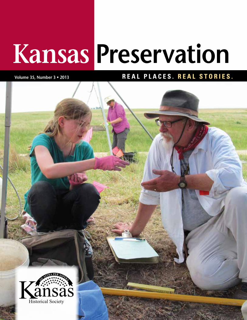
on the cover, Iris Hyde, a student at Bishop Seabury Academy in Lawrence, consults her crew chief, Bill Olson from Lindsborg, about artifacts found while screening soil from her excavation unit. Photo by Byron Strom of Des Moines, Iowa.
Tax Credit Before and after421 Commercial Street was initially deemed a non-contributing structure within Emporia’s Downtown Historic District. Historic Rehabilitation Tax Credits encouraged the owners to uncover the original architecture, repair the historic masonry and rebuild a historic storefront. The building is now a proud contributor to the district.
CorrectionThe image of a ceramic vessel on the 2013 Flint Hills Archaeological Conference logo illustrated on page 14 of the last Kansas Preservation (volume 35, number 2) was misidentified. This pot is from a Central Plains tradition lodge at the Witt site in Geary County, excavated by Kansas State University in 1973 under the direction of Patricia J. O’Brien. This vessel is currently on loan from Kansas State University to the Flint Hills Discovery Center in Manhattan, where it is on exhibit.
BeFore
aFter
V O l U M E 3 5 | 3 | 2 0 1 3 1
At its regular quarterly meeting held at the Kansas Historical Society in Topeka on Saturday, August 10, 2013, the Historic Sites Board of Review voted to forward 11 nominations to the Office of the Keeper of the National Register of Historic Places in Washington, D.C., to be evaluated by its professional staff. If staff members concur with the board’s findings, the properties will be included in the National Register. In other action, the board voted to list one property in the Register of Historic Kansas Places.
national and state Register nominations
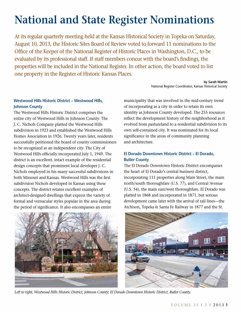
Westwood Hills Historic District – Westwood Hills, Johnson CountyThe Westwood Hills Historic District comprises the entire city of Westwood Hills in Johnson County. The J. C. Nichols Company platted the Westwood Hills subdivision in 1923 and established the Westwood Hills Homes Association in 1926. Twenty years later, residents successfully petitioned the board of county commissioners to be recognized as an independent city. The City of Westwood Hills officially incorporated July 1, 1949. The district is an excellent, intact example of the residential design concepts that prominent local developer J. C. Nichols employed in his many successful subdivisions in both Missouri and Kansas. Westwood Hills was the first subdivision Nichols developed in Kansas using these concepts. The district retains excellent examples of architect-designed dwellings that express the variety of formal and vernacular styles popular in the area during the period of significance. It also encompasses an entire
municipality that was involved in the mid-century trend of incorporating as a city in order to retain its own identity as Johnson County developed. The 255 resources reflect the development history of the neighborhood as it evolved from pastureland to a residential subdivision to its own self-contained city. It was nominated for its local significance in the areas of community planning and architecture.
el Dorado Downtown Historic District – el Dorado, Butler CountyThe El Dorado Downtown Historic District encompasses the heart of El Dorado’s central business district, incorporating 111 properties along Main Street, the main north/south thoroughfare (U.S. 77), and Central Avenue (U.S. 54), the main east/west thoroughfare. El Dorado was platted in 1868 and incorporated in 1871, but serious development came later with the arrival of rail lines—the Atchison, Topeka & Santa Fe Railway in 1877 and the St.
by sarah Martin National Register Coordinator, Kansas Historical Society
Left to right, Westwood Hills Historic District, Johnson County; El Dorado Downtown Historic District, Butler County.
2 K A N S A S P R E S E R v A T I O N
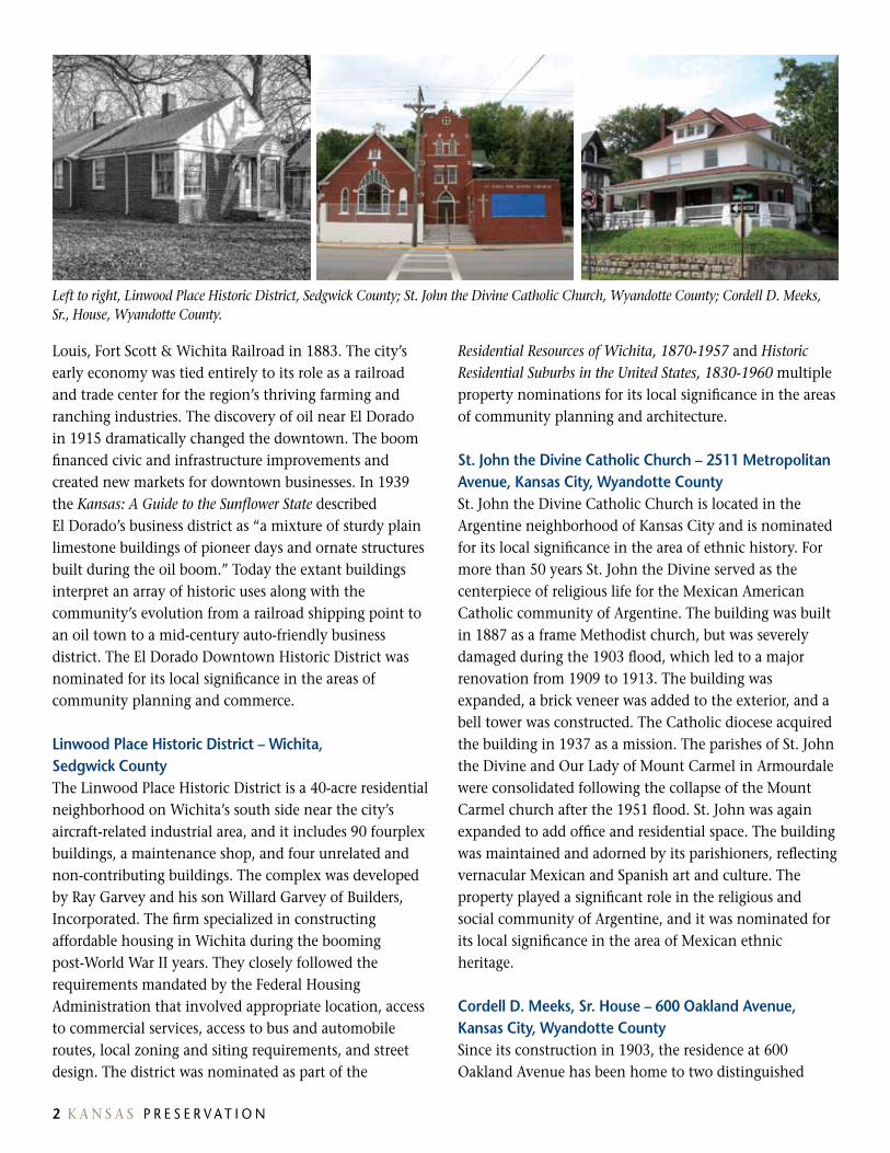
Left to right, Linwood Place Historic District, Sedgwick County; St. John the Divine Catholic Church, Wyandotte County; Cordell D. Meeks, Sr., House, Wyandotte County.
louis, Fort Scott & Wichita Railroad in 1883. The city’s early economy was tied entirely to its role as a railroad and trade center for the region’s thriving farming and ranching industries. The discovery of oil near El Dorado in 1915 dramatically changed the downtown. The boom financed civic and infrastructure improvements and created new markets for downtown businesses. In 1939 the Kansas: A Guide to the Sunflower State described El Dorado’s business district as “a mixture of sturdy plain limestone buildings of pioneer days and ornate structures built during the oil boom.” Today the extant buildings interpret an array of historic uses along with the community’s evolution from a railroad shipping point to an oil town to a mid-century auto-friendly business district. The El Dorado Downtown Historic District was nominated for its local significance in the areas of community planning and commerce.
Linwood Place Historic District – Wichita, sedgwick CountyThe linwood Place Historic District is a 40-acre residential neighborhood on Wichita’s south side near the city’s aircraft-related industrial area, and it includes 90 fourplex buildings, a maintenance shop, and four unrelated and non-contributing buildings. The complex was developed by Ray Garvey and his son Willard Garvey of Builders, Incorporated. The firm specialized in constructing affordable housing in Wichita during the booming post-World War II years. They closely followed the requirements mandated by the Federal Housing Administration that involved appropriate location, access to commercial services, access to bus and automobile routes, local zoning and siting requirements, and street design. The district was nominated as part of the
Residential Resources of Wichita, 1870-1957 and Historic Residential Suburbs in the United States, 1830-1960 multiple property nominations for its local significance in the areas of community planning and architecture.
St. John the Divine Catholic Church – 2511 Metropolitan avenue, Kansas City, Wyandotte CountySt. John the Divine Catholic Church is located in the Argentine neighborhood of Kansas City and is nominated for its local significance in the area of ethnic history. For more than 50 years St. John the Divine served as the centerpiece of religious life for the Mexican American Catholic community of Argentine. The building was built in 1887 as a frame Methodist church, but was severely damaged during the 1903 flood, which led to a major renovation from 1909 to 1913. The building was expanded, a brick veneer was added to the exterior, and a bell tower was constructed. The Catholic diocese acquired the building in 1937 as a mission. The parishes of St. John the Divine and Our lady of Mount Carmel in Armourdale were consolidated following the collapse of the Mount Carmel church after the 1951 flood. St. John was again expanded to add office and residential space. The building was maintained and adorned by its parishioners, reflecting vernacular Mexican and Spanish art and culture. The property played a significant role in the religious and social community of Argentine, and it was nominated for its local significance in the area of Mexican ethnic heritage.
Cordell D. Meeks, Sr. House – 600 Oakland Avenue, Kansas City, Wyandotte CountySince its construction in 1903, the residence at 600 Oakland Avenue has been home to two distinguished
2 K A N S A S P R E S E R v A T I O N V O l U M E 3 5 | 3 | 2 0 1 3 3
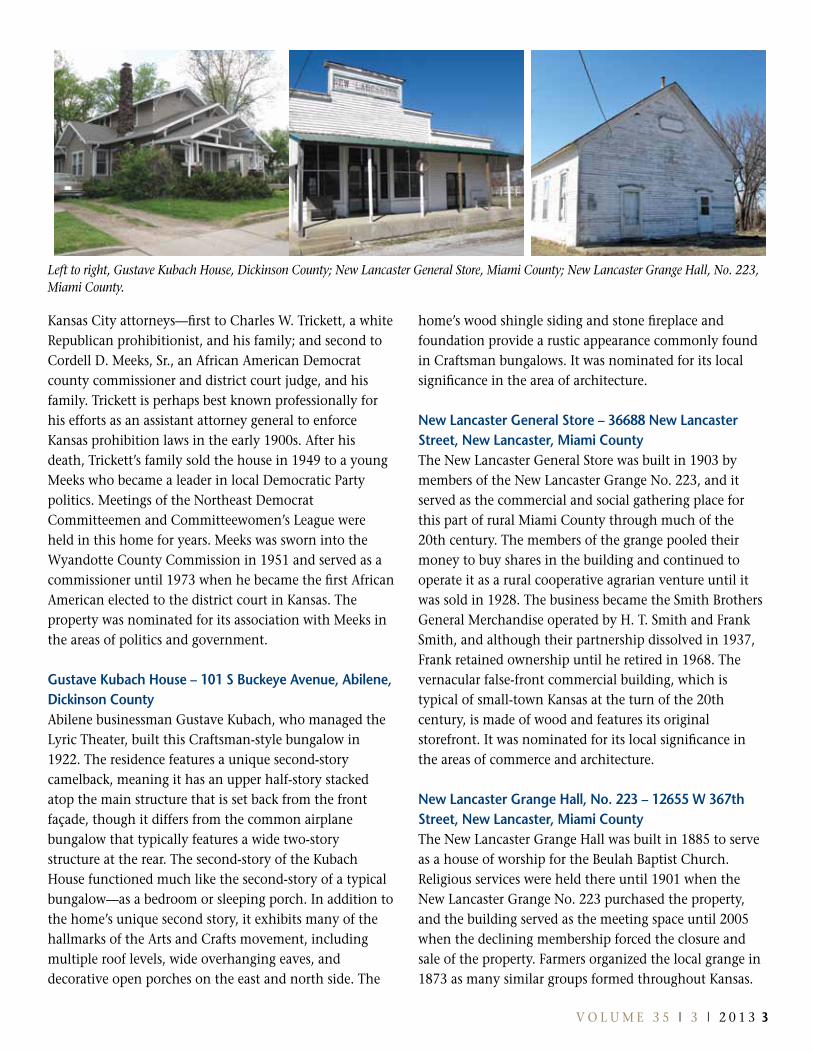
Left to right, Gustave Kubach House, Dickinson County; New Lancaster General Store, Miami County; New Lancaster Grange Hall, No. 223, Miami County.
Kansas City attorneys—first to Charles W. Trickett, a white Republican prohibitionist, and his family; and second to Cordell D. Meeks, Sr., an African American Democrat county commissioner and district court judge, and his family. Trickett is perhaps best known professionally for his efforts as an assistant attorney general to enforce Kansas prohibition laws in the early 1900s. After his death, Trickett’s family sold the house in 1949 to a young Meeks who became a leader in local Democratic Party politics. Meetings of the Northeast Democrat Committeemen and Committeewomen’s league were held in this home for years. Meeks was sworn into the Wyandotte County Commission in 1951 and served as a commissioner until 1973 when he became the first African American elected to the district court in Kansas. The property was nominated for its association with Meeks in the areas of politics and government.
Gustave Kubach House – 101 S Buckeye Avenue, Abilene, Dickinson CountyAbilene businessman Gustave Kubach, who managed the lyric Theater, built this Craftsman-style bungalow in 1922. The residence features a unique second-story camelback, meaning it has an upper half-story stacked atop the main structure that is set back from the front façade, though it differs from the common airplane bungalow that typically features a wide two-story structure at the rear. The second-story of the Kubach House functioned much like the second-story of a typical bungalow—as a bedroom or sleeping porch. In addition to the home’s unique second story, it exhibits many of the hallmarks of the Arts and Crafts movement, including multiple roof levels, wide overhanging eaves, and decorative open porches on the east and north side. The
home’s wood shingle siding and stone fireplace and foundation provide a rustic appearance commonly found in Craftsman bungalows. It was nominated for its local significance in the area of architecture.
new Lancaster General store – 36688 new Lancaster street, new Lancaster, Miami CountyThe New lancaster General Store was built in 1903 by members of the New lancaster Grange No. 223, and it served as the commercial and social gathering place for this part of rural Miami County through much of the 20th century. The members of the grange pooled their money to buy shares in the building and continued to operate it as a rural cooperative agrarian venture until it was sold in 1928. The business became the Smith Brothers General Merchandise operated by H. T. Smith and Frank Smith, and although their partnership dissolved in 1937, Frank retained ownership until he retired in 1968. The vernacular false-front commercial building, which is typical of small-town Kansas at the turn of the 20th century, is made of wood and features its original storefront. It was nominated for its local significance in the areas of commerce and architecture.
New Lancaster Grange Hall, No. 223 – 12655 W 367th street, new Lancaster, Miami CountyThe New lancaster Grange Hall was built in 1885 to serve as a house of worship for the Beulah Baptist Church. Religious services were held there until 1901 when the New lancaster Grange No. 223 purchased the property, and the building served as the meeting space until 2005 when the declining membership forced the closure and sale of the property. Farmers organized the local grange in 1873 as many similar groups formed throughout Kansas.
4 K A N S A S P R E S E R v A T I O N
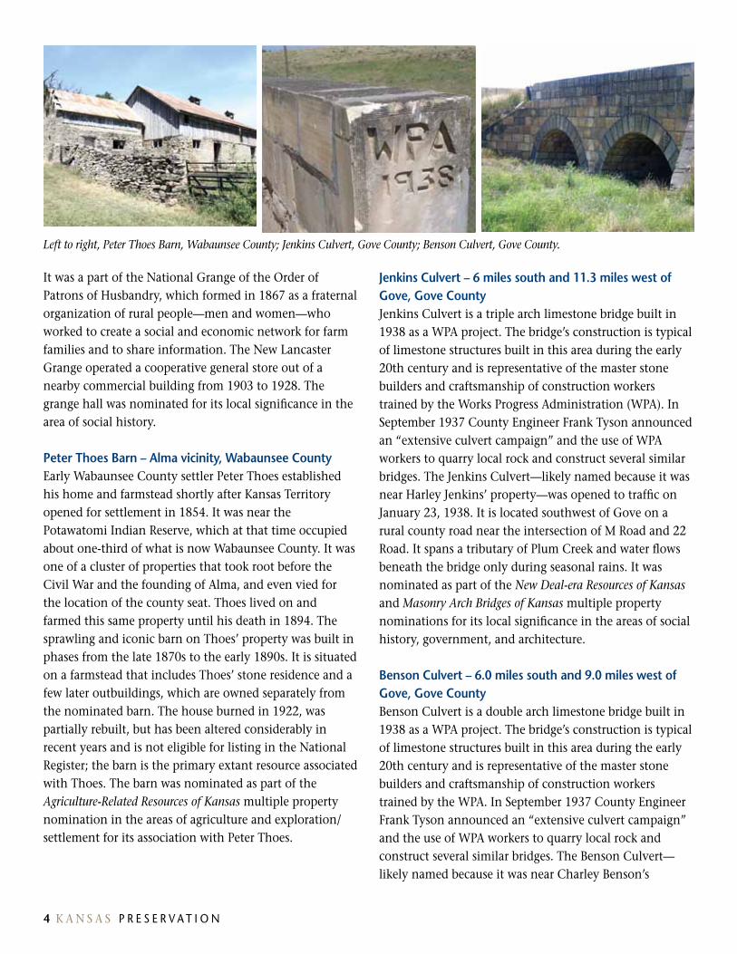
Left to right, Peter Thoes Barn, Wabaunsee County; Jenkins Culvert, Gove County; Benson Culvert, Gove County.
It was a part of the National Grange of the Order of Patrons of Husbandry, which formed in 1867 as a fraternal organization of rural people—men and women—who worked to create a social and economic network for farm families and to share information. The New lancaster Grange operated a cooperative general store out of a nearby commercial building from 1903 to 1928. The grange hall was nominated for its local significance in the area of social history.
Peter thoes Barn – alma vicinity, Wabaunsee CountyEarly Wabaunsee County settler Peter Thoes established his home and farmstead shortly after Kansas Territory opened for settlement in 1854. It was near the Potawatomi Indian Reserve, which at that time occupied about one-third of what is now Wabaunsee County. It was one of a cluster of properties that took root before the Civil War and the founding of Alma, and even vied for the location of the county seat. Thoes lived on and farmed this same property until his death in 1894. The sprawling and iconic barn on Thoes’ property was built in phases from the late 1870s to the early 1890s. It is situated on a farmstead that includes Thoes’ stone residence and a few later outbuildings, which are owned separately from the nominated barn. The house burned in 1922, was partially rebuilt, but has been altered considerably in recent years and is not eligible for listing in the National Register; the barn is the primary extant resource associated with Thoes. The barn was nominated as part of the Agriculture-Related Resources of Kansas multiple property nomination in the areas of agriculture and exploration/settlement for its association with Peter Thoes.
Jenkins Culvert – 6 miles south and 11.3 miles west of Gove, Gove CountyJenkins Culvert is a triple arch limestone bridge built in 1938 as a WPA project. The bridge’s construction is typical of limestone structures built in this area during the early 20th century and is representative of the master stone builders and craftsmanship of construction workers trained by the Works Progress Administration (WPA). In September 1937 County Engineer Frank Tyson announced an “extensive culvert campaign” and the use of WPA workers to quarry local rock and construct several similar bridges. The Jenkins Culvert—likely named because it was near Harley Jenkins’ property—was opened to traffic on January 23, 1938. It is located southwest of Gove on a rural county road near the intersection of M Road and 22 Road. It spans a tributary of Plum Creek and water flows beneath the bridge only during seasonal rains. It was nominated as part of the New Deal-era Resources of Kansas and Masonry Arch Bridges of Kansas multiple property nominations for its local significance in the areas of social history, government, and architecture.
Benson Culvert – 6.0 miles south and 9.0 miles west of Gove, Gove CountyBenson Culvert is a double arch limestone bridge built in 1938 as a WPA project. The bridge’s construction is typical of limestone structures built in this area during the early 20th century and is representative of the master stone builders and craftsmanship of construction workers trained by the WPA. In September 1937 County Engineer Frank Tyson announced an “extensive culvert campaign” and the use of WPA workers to quarry local rock and construct several similar bridges. The Benson Culvert—likely named because it was near Charley Benson’s
4 K A N S A S P R E S E R v A T I O N
property—was opened to traffic in June 1938. It is located southwest of Gove on a rural county road near the intersection of M Road and 28 Road. It spans a tributary of Plum Creek and water flows beneath the bridge only during seasonal rains. It was nominated as part of the New Deal-era Resources of Kansas and Masonry Arch Bridges of Kansas multiple property nominations for its local significance in the areas of social history, government, and architecture.
Register of Historic Kansas Places nomination
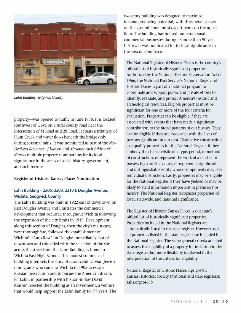
Lahn Building – 2206, 2208, 2210 E Douglas Avenue, Wichita, sedgwick CountyThe lahn Building was built in 1922 east of downtown on East Douglas Avenue and illustrates the commercial development that occurred throughout Wichita following the expansion of the city limits in 1919. Development along this section of Douglas, then the city’s main east/west thoroughfare, followed the establishment of Wichita’s “Auto-Row” on Douglas immediately east of downtown and coincided with the selection of the site across the street from the lahn Building as home to Wichita East High School. This modest commercial building interprets the story of resourceful latvian Jewish immigrants who came to Wichita in 1905 to escape Russian persecution and to pursue the American dream. Eli lahn, in partnership with his son-in-law David Krashin, erected the building as an investment, a venture that would help support the lahn family for 77 years. The
two-story building was designed to maximize income-producing potential, with three retail spaces on the ground floor and six apartments on the upper floor. The building has housed numerous small commercial businesses during its more than 90-year history. It was nominated for its local significance in the area of commerce.
Lahn Building, Sedgwick County.
The National Register of Historic Places is the country’s official list of historically significant properties. Authorized by the National Historic Preservation Act of 1966, the National Park Service’s National Register of Historic Places is part of a national program to coordinate and support public and private efforts to identify, evaluate, and protect America’s historic and archeological resources. Eligible properties must be significant for one or more of the four criteria for evaluation. Properties can be eligible if they are associated with events that have made a significant contribution to the broad patterns of our history. They can be eligible if they are associated with the lives of persons significant in our past. Distinctive construction can qualify properties for the National Register if they embody the characteristic of a type, period, or method of construction, or represent the work of a master, or possess high artistic values, or represent a significant and distinguishable entity whose components may lack individual distinction. lastly, properties may be eligible for the National Register if they have yielded or may be likely to yield information important in prehistory or history. The National Register recognizes properties of local, statewide, and national significance.
The Register of Historic Kansas Places is our state’s official list of historically significant properties. Properties included in the National Register are automatically listed in the state register. However, not all properties listed in the state register are included in the National Register. The same general criteria are used to assess the eligibility of a property for inclusion in the state register, but more flexibility is allowed in the interpretation of the criteria for eligibility.
National Register of Historic Places: nps.gov/nrKansas Historical Society (National and state registers): kshs.org/14638
V O l U M E 3 5 | 3 | 2 0 1 3 5
6 K A N S A S P R E S E R v A T I O N
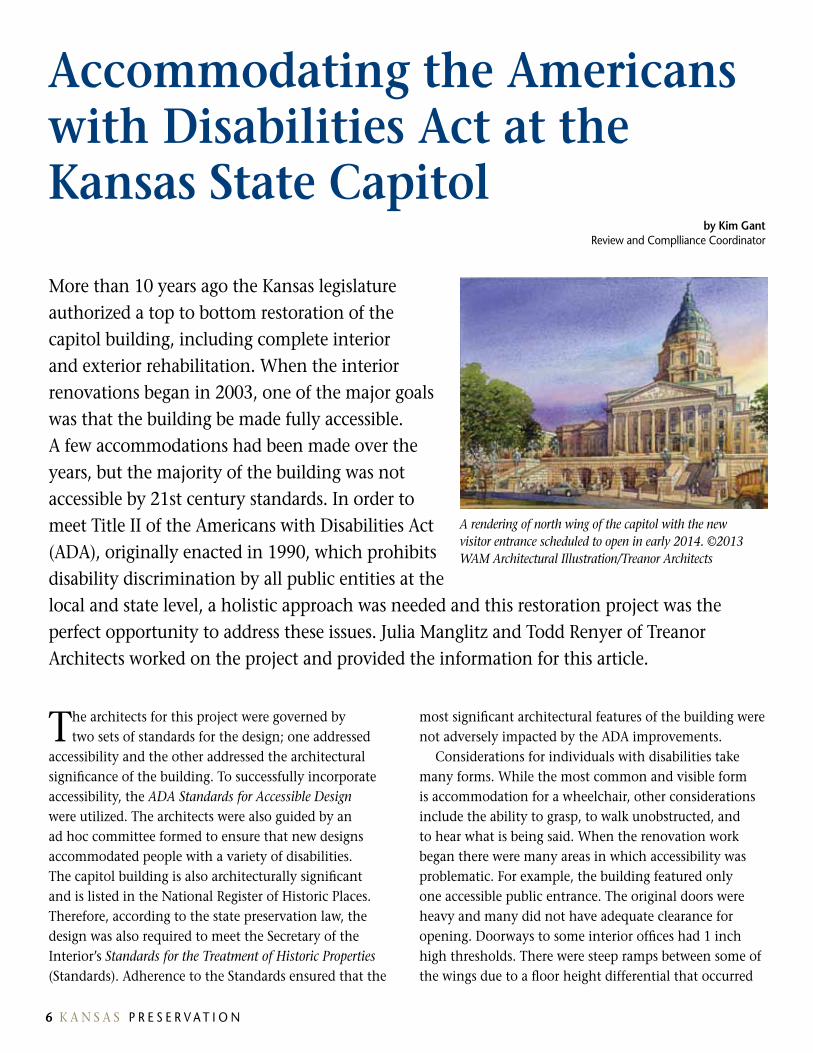
More than 10 years ago the Kansas legislature authorized a top to bottom restoration of the capitol building, including complete interior and exterior rehabilitation. When the interior renovations began in 2003, one of the major goals was that the building be made fully accessible. A few accommodations had been made over the years, but the majority of the building was not accessible by 21st century standards. In order to meet Title II of the Americans with Disabilities Act (ADA), originally enacted in 1990, which prohibits disability discrimination by all public entities at the local and state level, a holistic approach was needed and this restoration project was the perfect opportunity to address these issues. Julia Manglitz and Todd Renyer of Treanor Architects worked on the project and provided the information for this article.
accommodating the americans with Disabilities act at the Kansas state Capitol
The architects for this project were governed by two sets of standards for the design; one addressed
accessibility and the other addressed the architectural significance of the building. To successfully incorporate accessibility, the ADA Standards for Accessible Design were utilized. The architects were also guided by an ad hoc committee formed to ensure that new designs accommodated people with a variety of disabilities. The capitol building is also architecturally significant and is listed in the National Register of Historic Places. Therefore, according to the state preservation law, the design was also required to meet the Secretary of the Interior’s Standards for the Treatment of Historic Properties (Standards). Adherence to the Standards ensured that the
most significant architectural features of the building were not adversely impacted by the ADA improvements.
Considerations for individuals with disabilities take many forms. While the most common and visible form is accommodation for a wheelchair, other considerations include the ability to grasp, to walk unobstructed, and to hear what is being said. When the renovation work began there were many areas in which accessibility was problematic. For example, the building featured only one accessible public entrance. The original doors were heavy and many did not have adequate clearance for opening. Doorways to some interior offices had 1 inch high thresholds. There were steep ramps between some of the wings due to a floor height differential that occurred
by Kim Gant Review and Complliance Coordinator
A rendering of north wing of the capitol with the new visitor entrance scheduled to open in early 2014. ©2013 WAM Architectural Illustration/Treanor Architects
V O l U M E 3 5 | 3 | 2 0 1 3 76 K A N S A S P R E S E R v A T I O N
during the original construction. Most of the doors had knobs and many of the restrooms were not accessible. The house hall featured a raised floor that was several feet in height and only accessible by stairs.
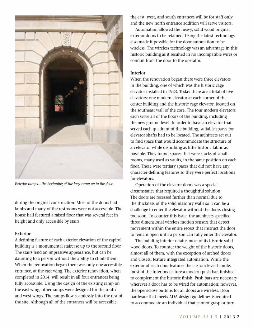
Exterior A defining feature of each exterior elevation of the capitol building is a monumental staircase up to the second floor. The stairs lend an impressive appearance, but can be daunting to a person without the ability to climb them. When the renovation began there was only one accessible entrance, at the east wing. The exterior renovation, when completed in 2014, will result in all four entrances being fully accessible. Using the design of the existing ramp on the east wing, other ramps were designed for the south and west wings. The ramps flow seamlessly into the rest of the site. Although all of the entrances will be accessible,
the east, west, and south entrances will be for staff only and the new north entrance addition will serve visitors.
Automation allowed the heavy, solid wood original exterior doors to be retained. Using the latest technology also made it possible for the door automation to be wireless. The wireless technology was an advantage in this historic building as it resulted in no incompatible wires or conduit from the door to the operator.
InteriorWhen the renovation began there were three elevators in the building, one of which was the historic cage elevator installed in 1923. Today there are a total of five elevators; one modern elevator at each corner of the center building and the historic cage elevator, located on the southeast wall of the core. The four modern elevators each serve all of the floors of the building, including the new ground level. In order to have an elevator that served each quadrant of the building, suitable spaces for elevator shafts had to be located. The architects set out to find space that would accommodate the structure of an elevator while disturbing as little historic fabric as possible. They found spaces that were stacks of small rooms, many used as vaults, in the same position on each floor. These were tertiary spaces that did not have any character-defining features so they were perfect locations for elevators.
Operation of the elevator doors was a special circumstance that required a thoughtful solution. The doors are recessed further than normal due to the thickness of the solid masonry walls so it can be a challenge to enter the elevator without the doors closing too soon. To counter this issue, the architects specified three dimensional wireless motion sensors that detect movement within the entire recess that instruct the door to remain open until a person can fully enter the elevator.
The building interior retains most of its historic solid wood doors. To counter the weight of the historic doors, almost all of them, with the exception of arched doors and closets, feature integrated automation. While the exterior of each door features the custom lever handle, most of the interiors feature a modern push bar, finished to complement the historic finish. Push bars are necessary wherever a door has to be wired for automation; however, the open/close buttons for all doors are wireless. Door hardware that meets ADA design guidelines is required to accommodate an individual that cannot grasp or turn
Exterior ramps—the beginning of the long ramp up to the door.

8 K A N S A S P R E S E R v A T I O N
a knob and most of the doors in the capitol had knobs. Several areas even retained historic knobs, which were set on a decorative escutcheon plate. In order to meet ADA while retaining the historic integrity of the doors, the architects designed a new lever handle that was based on the historic knobs, many of which were then set on the original escutcheon plates.
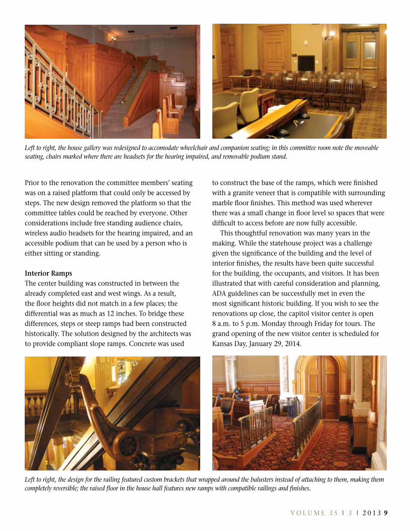
House Hall and GalleryHistorically, Representative Hall, a two story space encompassing the third and fourth floors in the west wing, had a single level floor. In 1955 a raised floor was installed. The renovation plans called for the floor to be returned to its historic level; however, just as the design was about to be implemented, the members voted to install a raised floor. The room is large, but it must accommodate 125 elected representatives and staff members while leaving room for accessible pathways. This proved to be a challenge, but the design was accomplished so that representatives and members of the public in wheelchairs can successfully access most of the hall, leaving the historic features of the room unaltered.
The house gallery was uniquely challenging because it was a narrow, multi-level balcony with little space for wheelchair seating. Ultimately, the risers were removed and the stairs were reconfigured to open up floor space for wheelchair and companion seating.
senate Chamber and GalleryThe Senate Chamber, a two-story space on the third and fourth floors in the east wing, had a single level floor and it remains level so ramps were not needed. There were few considerations that needed to be addressed in this space other than ensuring acceptable clearances and pathways. The major accommodation was the gallery, which was made accessible to wheelchairs by constructing a new platform, a particular feat given the very narrow space.
Grand staircasesThere are four grand open staircases, two in the north wing and two in the south wing. They are very significant and feature intricate finishes and decoration, but required upgrades to meet ADA guidelines for handrails. The only handrail was the banister and, at a width of more than six inches, it did not meet guidelines for a graspable rail. A smaller rail had to be added on the inside of the historic banister and also on the opposite wall. The architects worked to design a custom handrail and brackets that were based on historic details and materials and that could be attached in such a way that they would neither damage nor detract from the historic features.
Committee RoomsThe capitol building has 13 committee rooms where legislative committees meet and hear public testimony.
Left to right, the historic cage elevator, installed in the 1920s, was an early attempt at meeting the needs of those with disabilities; this lever door handle and escutcheon plate were adapted from the design of the original door hardware; door operators on the entrance to the state library allowed the heavy doors to be retained while providing assistance to those with disabilities.
V O l U M E 3 5 | 3 | 2 0 1 3 98 K A N S A S P R E S E R v A T I O N
Prior to the renovation the committee members’ seating was on a raised platform that could only be accessed by steps. The new design removed the platform so that the committee tables could be reached by everyone. Other considerations include free standing audience chairs, wireless audio headsets for the hearing impaired, and an accessible podium that can be used by a person who is either sitting or standing.
Interior RampsThe center building was constructed in between the already completed east and west wings. As a result, the floor heights did not match in a few places; the differential was as much as 12 inches. To bridge these differences, steps or steep ramps had been constructed historically. The solution designed by the architects was to provide compliant slope ramps. Concrete was used
to construct the base of the ramps, which were finished with a granite veneer that is compatible with surrounding marble floor finishes. This method was used wherever there was a small change in floor level so spaces that were difficult to access before are now fully accessible.
This thoughtful renovation was many years in the making. While the statehouse project was a challenge given the significance of the building and the level of interior finishes, the results have been quite successful for the building, the occupants, and visitors. It has been illustrated that with careful consideration and planning, ADA guidelines can be successfully met in even the most significant historic building. If you wish to see the renovations up close, the capitol visitor center is open 8 a.m. to 5 p.m. Monday through Friday for tours. The grand opening of the new visitor center is scheduled for Kansas Day, January 29, 2014.
Left to right, the house gallery was redesigned to accomodate wheelchair and companion seating; in this committee room note the moveable seating, chairs marked where there are headsets for the hearing impaired, and removable podium stand.
Left to right, the design for the railing featured custom brackets that wrapped around the balusters instead of attaching to them, making them completely reversible; the raised floor in the house hall features new ramps with compatible railings and finishes.

10 K A N S A S P R E S E R v A T I O N
In June 2012 the Kansas Historical Society awarded the City of Hutchinson a Historic Preservation Fund grant to conduct a survey of buildings located between the city’s two existing downtown historic districts. Aptly named the “Downtown Gap Area Survey,” the project included an evaluation of properties located between the Downtown Core North National Historic District and the Downtown Core South National Historic District. The survey area encompassed all or parts of 12 city blocks, totaling 51.5 acres, and included 80 properties.
Hutchinson’s DowntownGap area survey
Although many of the properties located within the gap area were surveyed during the 1990s, this area
was excluded from the nomination in 2004 when the City of Hutchinson’s two downtown historic districts were formed. At that time the determination was made that buildings in the area did not meet the requirements to be included in a historic district because of the age of the buildings (some were not old enough) and the presence of metal coverings on the old façades.
Interest in renovating properties in the downtown gap area was sparked by eight years of private investment in the two abutting downtown districts following their listing in the state and National Register. Several new property owners in the gap area expressed a desire to have their properties listed, as well. This prompted the Hutchinson Downtown Revitalization Partnership and the City of Hutchinson landmarks Commission to pursue a survey of the gap area properties.
by Jana McCarron, Planner, City of Hutchinson
Photos by Christy Davis, Davis Preservation
Left to right, Montgomery Ward store at 14 N Main; the 1965 Woolworth’s building at 2 N Main; the A. E. Kirk Building at100 W 2nd Avenue.
10 K A N S A S P R E S E R v A T I O N V O l U M E 3 5 | 3 | 2 0 1 3 1 1
The results of the survey showed both a variety of construction dates, as well as architectural styles present within the gap area. The majority of buildings were constructed either in or prior to 1890 or during the 1920s, though there was some construction that occurred in every decade up to 1990.
Most buildings in the survey area have simple designs with square window openings and few architectural details, representative of Commercial style architecture. The Montgomery Ward building, 14 N Main Street, has a Colonial Revival architectural style. Other styles noted include: Gothic Revival (First Presbyterian Church), Italianate, Neoclassical (Armory/Salt City Business College), Pueblo Revival, Second Empire (Wilcox House/Funeral Home), Spanish Eclectic, and Modern/Modern Movement.
The Downtown Gap Area Survey identified 42 properties that were either already listed in a national,
state, or local register or that had the potential to be considered contributing structures toward a historic district. An additional three properties appeared to be eligible for individual listing—the Truck Store building, the Salvation Army building, and the A.E. Kirk building.
The City of Hutchinson landmarks Commission will utilize the Downtown Gap Area Survey as a planning tool. The city is consulting with the Kansas State Historic Preservation Office (SHPO) to determine if there is sufficient historic integrity in the gap area to warrant nomination of the area as either a standalone historic district or as an amendment to one of the existing historic districts adjacent. Information in the survey will help city planners discuss options with local property owners. With property owner support, the city may apply for another Historic Preservation Fund grant in 2014 to nominate the gap area to the National Register of Historic Places.
Map of the “gap” area surveyed in downtown Hutchinson.
12 K A N S A S P R E S E R v A T I O N
KaTP Excavations at Whisky Ranch (14EL311) summary and Observations
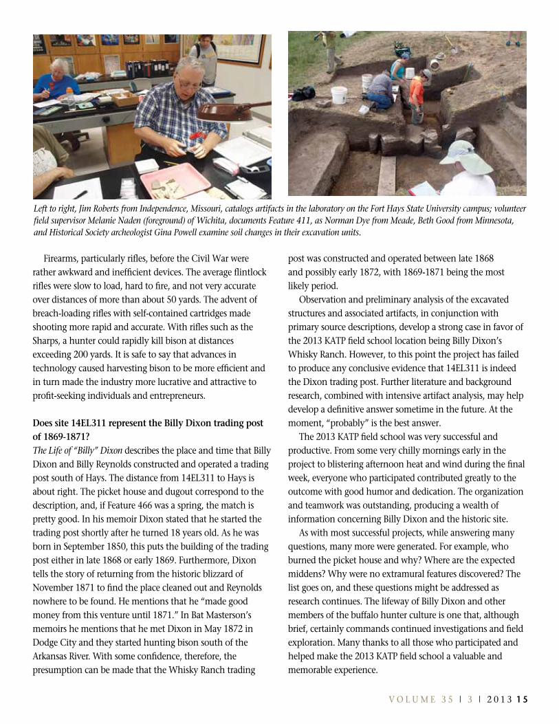
Historic site 14El311 had been periodically investigated by avocational archeologists and collectors for decades
but was not formally recorded until a site visit by Historical Society staff members in December 2012. Over the years metal detectors had been used to discover near-surface artifacts in and around the location. Collected artifacts, a review of available literature, and descriptions contained in Dixon’s memoirs indicated a high probability that the site is the Whisky Ranch location. Given that likelihood, a research design and an excavation plan were developed to address five research questions:
1. Does site 14El311 represent the Billy Dixon trading post of 1869-1871?
2. Based on material culture, what was life like?3. What was the general lifeway of the European-American
bison hunters?4. How do the dugouts at 14El311 compare to others in
the Central and Southern Plains?5. How did advances in technology influence the lifeway
and market?The immediate post-Civil War period, 1865 to 1880, was a
time of tremendous growth and transition on the Great Plains. Expanding industrial markets in the East created a demand for western resources, statehood and the Homestead Act opened up vast areas for settlement, and European immigration facilitated westward population expansion. New technologies, fueled by the Civil War—railroads, firearms, and communications—contributed to the rapid westward expansion. The extermination of the great bison herds and devastating impact upon the lifeway of Native Americans and early European explorers and hunters were the consequences.
On the Kansas plains the period of commercial bison hunting was brief, lasting only about six years from 1868 to 1874. The combination of commercial hunting, railroad expansion, agricultural development, and bovine disease diminished the once huge herds to near extinction. The Whisky Ranch site provided an opportunity to develop an understanding of that dynamic time and the people who transformed the Great Plains.
The Whisky Ranch site encompasses three structural components, associated with four extramural areas of interest. The structural components are relatively small, consisting of a picket house, a dugout, and a feature thought to be the location of the original fresh water spring described by Dixon. Associated with the structures are large activity areas containing a variety of period artifacts and materials. The primary site, including the three structural features, covers an area of about 190 square meters, while the extramural areas of interest encompass a 490-meter by 75-meter strip along and either side of the adjacent creek, covering more than 41,200 square meters.
During the field school, approximately half of structure one was excavated and recorded. This structure (Feature 461) is the remnants of a 10-meter by 6-meter picket house, constructed in an excavated portion of the creek bank, with limestone rock walls and an ash log supporting structure. Picket or pole construction, widely used in the 19th century and usually utilized locally available materials, followed techniques similar to stockades. The poles, obtained from trees 10 to 15 feet high, were installed vertically, side by side, to create a wall. Similar to modern-day wood privacy fences, picket walls were tied together with horizontal support poles,
The 2013 Kansas Archeology Training Program (KATP) field school was conducted near Hays at the presumed location of Billy Dixon’s Whisky Ranch trading post, providing volunteers and staff members an opportunity to investigate a mid-19th century buffalo hunters camp. The Kansas Historical Society and Kansas Anthropological Association-sponsored program was carried out in cooperation with the Fort Hays State University Departments of History and Geosciences and the Ellis County Historical Society.
By steven r. robertsPrincipal Investigator

12 K A N S A S P R E S E R v A T I O N V O l U M E 3 5 | 3 | 2 0 1 3 1 3
and in the case of Whisky Ranch, the walls were supported by parallel-running limestone supports. The walls were then tied together using a beam running the center length of the structure with stringer or support beams running laterally from the center to the outer walls. Additional pickets or poles were added to construct a roof. Cracks between the poles were generally filled with mud, clay, sod, adobe, or any other material that was at hand or could be made with available materials. The structure shows evidence of burning. Who burned it, when, and why remain mysteries. No traces of upright wall members were discovered, indicating that the pickets may have been removed or, considering the relatively fragile materials, decayed before the structure was destroyed.
Structure two (Feature 411) is a 5-meter by 3-meter dugout, also excavated into the creek bank. Both structures one and two face east, and their west walls are almost flush with the previously existing ground surface. Structure three (Feature 466) is a small feature about 3 meters north of the east end of the picket house with what appears to be a connecting path between the two. Auger tests, approximately 1 meter in depth, in the feature produced a soil matrix consistent with spring deposits.
The extramural areas of interest were investigated using metal detectors on a controlled grid. Apparently these areas were used for activities associated with ranch and trading post operations. Artifacts were discovered near the surface, between 3 and 15 centimeters deep, and included metal scrap, tin cans, cartridge casings, horseshoes, picket pins, nails, and horse tack.
Over the 16-day period, 140 volunteers (57 participating in the KATP for the first time) donated more than 6,100 hours of time to field operations and to lab work and classes at
facilities provided by Fort Hays State University. Participants in the field excavations removed and screened approximately 75 cubic meters of sometimes very hard-to-dig soil. More than 900 artifacts were collected, cataloged, analyzed, and sent to the Kansas Historical Society lab in Topeka.
While the number and variety of artifacts observed and collected and the physical size of the 14El311 is initially impressive, there is no conclusive evidence that the site was used either before 1869 or after about 1872. Considering the relatively light artifact density, there may have been only periodic or seasonal activity. Preliminary analysis suggests that the initial research questions can be answered or at least addressed.
How do the dugout and picket house compare to others in the Central and southern Plains?During the mid- to late-19th century dugouts and picket houses were common on the Great Plains. While there are some similarities in construction techniques across the region, a general comparison is difficult at best. Dugouts are dwellings of convenience and usually were constructed as temporary shelters.
Feature 461 (the picket house) appears to have been constructed using cross-beams with upright load-bearing support techniques commonly used by the military and early settlers. Apparently there were two equally spaced rows of upright poles (pickets), supporting lateral and horizontal beams, to develop a roof structure.
Feature 411 (the dugout) follows traditional building techniques of the region, being dug into an east-facing bank with its rear wall either flush with or slightly below the existing natural surface. A small stone wall appears to divide
Left to right, survey coordinator Nancy Arendt of Colby (left, foreground) led a team of metal detectionists and recorders, who recovered hundreds of period artifacts; Jared Fisher (left) and grandfather John O’Toole (center) returning volunteers from Minnesota, start a new unit in Feature 461. State Archelogist Bob Hoard (center) assists with grass removal.

14 K A N S A S P R E S E R v A T I O N
the dugout into two sections, and a small sub-floor hole is present in the northern half of the structure. The purpose of the hole, or even if it was part of the initial construction, is unclear. Additionally, the dividing wall is not flush with the original floor, indicating that the dugout may have been altered after the original occupation.
What was the general lifeway of the Euro-american bison hunters?The term lifeway is defined as a way of life, a manner of living, or any of the customs and practices of a culture. For centuries, the indigenous people of the plains hunted bison and utilized them as any natural resource. In “Diary of a Dodge City Buffalo Hunter,” Henry Raymond made a number of references to Native Americans participating in the hunting activities. For centuries Native Americans had used buffalo products as trading currency among tribes; after European contact this practice continued between the Native Americans and Europeans. As the market for hides and meat developed in the eastern United States following the Civil War, many Native Americans participated as well. For example, between 1872 and 1874 the Comanche, the Arapaho, and the Cheyenne, among others, sent about 390,000 buffalo hides to market.
like the American Indians, early Euro-American pioneers took advantage of a readily available meat supply. However, when a high-demand market for leather products in the eastern United States developed after the Civil War, hunting bison became a profit-driven occupation. Billy Dixon, Henry Raymond, the Masterson brothers, and other small operators were the forerunners of much larger commercial hunting operations of the later 1870s and 1880s, which led to the extermination of the great herds of the plains.
To describe Dixon and others as buffalo “hunters” is a bit of a misnomer. In contemporary times, hunters are thought of as people walking the fields, carrying a shotgun, and looking for an occasional rabbit or pheasant. In reality, the hunters of the mid-19th century were harvesters—no different than Texas combining crews coming to Kansas in June to harvest wheat. Bison herds became a commercial natural resource.
Distinctive cultural attributes certainly were associated with the activities of the early buffalo hunters, such as Dixon, Raymond, and Masterson. Two primary sources, The Life of “Billy” Dixon and “Diary of a Dodge City Buffalo Hunter,” give an understanding of the lifeway. In general, the hunters were young. Dixon was only 18 when he started his trading
post near Hays; Raymond and the Masterson brothers were all in their early 20s. These were young men coping with harsh economic conditions and taking advantage of moneymaking opportunities wherever they could find them.
The average small operator hunting team consisted of four men, usually one shooter, two skinners, and one person to take care of the camp and supplies. Outfitted primarily from government surplus clothes, rifles, etc., the teams traveled with minimal supplies.
Based on material culture, what was life like?Initial analysis of site features and artifacts provides a fundamental and general understanding of a buffalo hunter’s life. The structures are of simple construction, suggesting anticipation of short duration use. No extramural structures, such as outbuildings, wells, or livestock corrals indicate an intention of more permanent occupation. There were few exotic materials used in the structures, and they appear to have been made with locally available resources. From the collected artifacts it appears that at least the picket house had a glass window in either the north or the east wall. Deposits of burned materials in the center of this structure indicate that there may have been a box or other type of stove.
The observed artifacts are consistent with the period and bison hunting activities. The presence of 50-70 .44 caliber and 56-50 caliber rifle cartridge casings point to large game hunting activities.
How did advances in technology influence the lifeway and market?The immediate post-Civil War period was a time of rapid technological advances. Railroads were expanding westward; travel time from east to west was greatly reduced. The application of telegraph technology made it possible to communicate with stock exchanges and commodity buyers in the East in a matter of hours instead of weeks. Facilitated by the Civil War, advancements in firearms made harvesting bison more efficient.
Before the advances of railroads and the establishing of railheads, bison products had to be hauled to markets via freight wagons over relatively great distances. Once a railhead was started at Hays, hunters could work an area close to the herds and transport the hides and meat only a short distance, usually less than 50 miles. Buyers located in Hays had the ability to communicate with commodity markets in Chicago, Kansas City, St. louis, and even New York on a daily basis to establish prices.
14 K A N S A S P R E S E R v A T I O N V O l U M E 3 5 | 3 | 2 0 1 3 1 5
Firearms, particularly rifles, before the Civil War were rather awkward and inefficient devices. The average flintlock rifles were slow to load, hard to fire, and not very accurate over distances of more than about 50 yards. The advent of breach-loading rifles with self-contained cartridges made shooting more rapid and accurate. With rifles such as the Sharps, a hunter could rapidly kill bison at distances exceeding 200 yards. It is safe to say that advances in technology caused harvesting bison to be more efficient and in turn made the industry more lucrative and attractive to profit-seeking individuals and entrepreneurs.
Does site 14EL311 represent the Billy Dixon trading post of 1869-1871?The Life of “Billy” Dixon describes the place and time that Billy Dixon and Billy Reynolds constructed and operated a trading post south of Hays. The distance from 14El311 to Hays is about right. The picket house and dugout correspond to the description, and, if Feature 466 was a spring, the match is pretty good. In his memoir Dixon stated that he started the trading post shortly after he turned 18 years old. As he was born in September 1850, this puts the building of the trading post either in late 1868 or early 1869. Furthermore, Dixon tells the story of returning from the historic blizzard of November 1871 to find the place cleaned out and Reynolds nowhere to be found. He mentions that he “made good money from this venture until 1871.” In Bat Masterson’s memoirs he mentions that he met Dixon in May 1872 in Dodge City and they started hunting bison south of the Arkansas River. With some confidence, therefore, the presumption can be made that the Whisky Ranch trading
post was constructed and operated between late 1868 and possibly early 1872, with 1869-1871 being the most likely period.
Observation and preliminary analysis of the excavated structures and associated artifacts, in conjunction with primary source descriptions, develop a strong case in favor of the 2013 KATP field school location being Billy Dixon’s Whisky Ranch. However, to this point the project has failed to produce any conclusive evidence that 14El311 is indeed the Dixon trading post. Further literature and background research, combined with intensive artifact analysis, may help develop a definitive answer sometime in the future. At the moment, “probably” is the best answer.
The 2013 KATP field school was very successful and productive. From some very chilly mornings early in the project to blistering afternoon heat and wind during the final week, everyone who participated contributed greatly to the outcome with good humor and dedication. The organization and teamwork was outstanding, producing a wealth of information concerning Billy Dixon and the historic site.
As with most successful projects, while answering many questions, many more were generated. For example, who burned the picket house and why? Where are the expected middens? Why were no extramural features discovered? The list goes on, and these questions might be addressed as research continues. The lifeway of Billy Dixon and other members of the buffalo hunter culture is one that, although brief, certainly commands continued investigations and field exploration. Many thanks to all those who participated and helped make the 2013 KATP field school a valuable and memorable experience.
Left to right, Jim Roberts from Independence, Missouri, catalogs artifacts in the laboratory on the Fort Hays State University campus; volunteer field supervisor Melanie Naden (foreground) of Wichita, documents Feature 411, as Norman Dye from Meade, Beth Good from Minnesota, and Historical Society archeologist Gina Powell examine soil changes in their excavation units.
16 K A N S A S P R E S E R v A T I O N
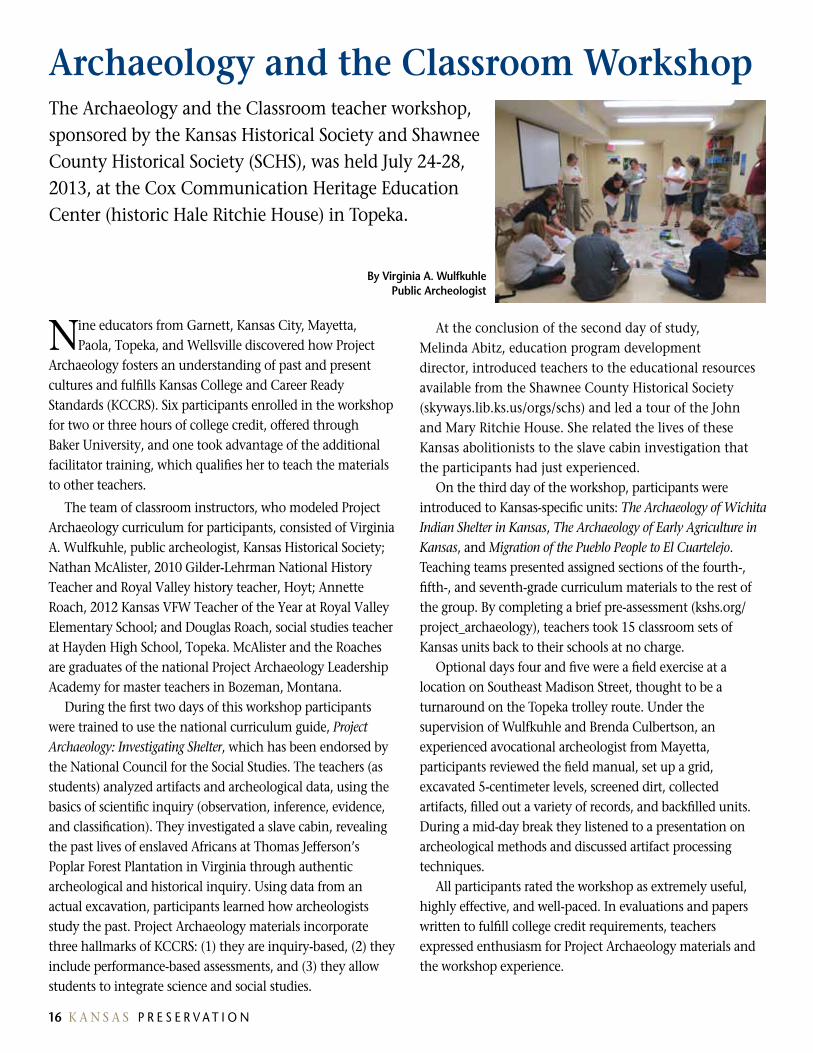
Nine educators from Garnett, Kansas City, Mayetta, Paola, Topeka, and Wellsville discovered how Project
Archaeology fosters an understanding of past and present cultures and fulfills Kansas College and Career Ready Standards (KCCRS). Six participants enrolled in the workshop for two or three hours of college credit, offered through Baker University, and one took advantage of the additional facilitator training, which qualifies her to teach the materials to other teachers.
The team of classroom instructors, who modeled Project Archaeology curriculum for participants, consisted of Virginia A. Wulfkuhle, public archeologist, Kansas Historical Society; Nathan McAlister, 2010 Gilder-lehrman National History Teacher and Royal Valley history teacher, Hoyt; Annette Roach, 2012 Kansas VFW Teacher of the Year at Royal Valley Elementary School; and Douglas Roach, social studies teacher at Hayden High School, Topeka. McAlister and the Roaches are graduates of the national Project Archaeology leadership Academy for master teachers in Bozeman, Montana.
During the first two days of this workshop participants were trained to use the national curriculum guide, Project Archaeology: Investigating Shelter, which has been endorsed by the National Council for the Social Studies. The teachers (as students) analyzed artifacts and archeological data, using the basics of scientific inquiry (observation, inference, evidence, and classification). They investigated a slave cabin, revealing the past lives of enslaved Africans at Thomas Jefferson’s Poplar Forest Plantation in Virginia through authentic archeological and historical inquiry. Using data from an actual excavation, participants learned how archeologists study the past. Project Archaeology materials incorporate three hallmarks of KCCRS: (1) they are inquiry-based, (2) they include performance-based assessments, and (3) they allow students to integrate science and social studies.
At the conclusion of the second day of study, Melinda Abitz, education program development director, introduced teachers to the educational resources available from the Shawnee County Historical Society (skyways.lib.ks.us/orgs/schs) and led a tour of the John and Mary Ritchie House. She related the lives of these Kansas abolitionists to the slave cabin investigation that the participants had just experienced.
On the third day of the workshop, participants were introduced to Kansas-specific units: The Archaeology of Wichita Indian Shelter in Kansas, The Archaeology of Early Agriculture in Kansas, and Migration of the Pueblo People to El Cuartelejo. Teaching teams presented assigned sections of the fourth-, fifth-, and seventh-grade curriculum materials to the rest of the group. By completing a brief pre-assessment (kshs.org/project_archaeology), teachers took 15 classroom sets of Kansas units back to their schools at no charge.
Optional days four and five were a field exercise at a location on Southeast Madison Street, thought to be a turnaround on the Topeka trolley route. Under the supervision of Wulfkuhle and Brenda Culbertson, an experienced avocational archeologist from Mayetta, participants reviewed the field manual, set up a grid, excavated 5-centimeter levels, screened dirt, collected artifacts, filled out a variety of records, and backfilled units. During a mid-day break they listened to a presentation on archeological methods and discussed artifact processing techniques.
All participants rated the workshop as extremely useful, highly effective, and well-paced. In evaluations and papers written to fulfill college credit requirements, teachers expressed enthusiasm for Project Archaeology materials and the workshop experience.
archaeology and the Classroom WorkshopThe Archaeology and the Classroom teacher workshop, sponsored by the Kansas Historical Society and Shawnee County Historical Society (SCHS), was held July 24-28, 2013, at the Cox Communication Heritage Education Center (historic Hale Ritchie House) in Topeka.
By Virginia A. WulfkuhlePublic archeologist

16 K A N S A S P R E S E R v A T I O N V O l U M E 3 5 | 3 | 2 0 1 3 1 7
CONTACT US
Jennie Chinn Preservation Officer (SHPO)785-272-8681, ext. 205 [email protected]
Rick anderson National Register Historian785-272-8681, ext. 228 [email protected]
Dorothy Booher Office Assistant785-272-8681, ext. 230 [email protected]
Kim norton Gant Review and Compliance Coordinator785-272-8681, ext. 225 [email protected]
Chris Garst laboratory Archeologist 785-272-8681, ext. 151 [email protected]
steven Keehner Administrative Assistant785-272-8681, ext. 235 [email protected]
Bob Hoard State Archeologist 785-272-8681, ext. 269 [email protected]
Matthew Holtkamp Tax Credit Reviewer 785-272-8681, ext. 227 [email protected]
Kristen JohnstonTax Credit Coordinator 785-272-8681, ext. 213 [email protected]
Marsha Longofono Tax Credit Clerk785-272-8681, ext. 240 [email protected]
amanda Loughlin Survey Coordinator 785-272-8681, ext. 226 [email protected] sarah Martin National Register Coordinator785-272-8681, ext. 216 [email protected] Ken Price Architect 785-272-8681, ext. 212 [email protected]
Katrina Ringler Grants Manager/ClG Coordinator785-272-8681, ext. 215 [email protected]
Gina s. PowellArcheologist 785-272-8681, ext. [email protected]
Tricia Waggoner Highway Archeologist 785-272-8681, ext. 267 [email protected]
Tim Weston SHPO Archeologist 785-272-8681, ext. 214 [email protected]
Virginia Wulfkuhle Public Archeologist 785-272-8681, ext. 266 [email protected]
Patrick Zollner Division Director & Deputy SHPO 785-272-8681, ext. 217 [email protected]
Cultural Resources Division state Historic Preservation Office (sHPO) and archeology staff
The Kansas Historic Sites Board of Review is a group of 11 professionals from various fields that meets quarterly to review and recommend nominations to the National Register of Historic Places and the Register of Historic Kansas Places, and award preservation planning and rehabilitation grants. As prescribed by the Kansas Historic Preservation Act of 1977 (K.S.A. 75-2719), the board is comprised of the following members: the governor or the governor’s designee, the state historic preservation officer or such officer’s designee, and nine members appointed by the governor for three-year terms. At least one member must be professionally qualified in each of the following disciplines: architecture, history, prehistoric archeology, historical archeology, and architectural history.
Jennie Chinn, State Historic Preservation Officer J. Eric Engstrom, Wichita, governor’s designee Toni (Brouhard) stewart, Topekasharron Hamilton, Salina John W. Hoopes, lawrence Joseph Johnson, Wichitasamuel Passer, Overland ParkBeka Romm, lawrenceDavid H. sachs, ManhattanGregory schneider, Topeka Margaret Wood, Topeka
Historic Sites Board of Review

Happenings in KansasThrough November 3, 2013 Americans by Choice: The Story of Immigration & Citizenship in Kansas exhibit • Kansas Historical Society, Topeka
Through January 5, 2014 Furnishing Kansas exhibit • Kansas Museum of History, Topeka
October 2 – 6 71st Plains Anthropological Conference • Loveland, Colorado
October 11 – 13 Kansas Anthropological Association Fall Fling • Pawnee Indian Museum State Historic Site, Republic
October 12 – 13 Fall Festival • Shawnee Indian Mission State Historic Site, Fairway
October 19 Ancestor Fair • Kansas Historical Society, Topeka
November 1 Application deadline • Heritage Trust Fund grand program
November 1 Kansas Historical Foundation annual meeting • Kansas State Capitol, Topeka
November 16 Historic Sites Board of Review meeting • Kansas Historical Society, Topeka
January 17 – August 31, 2014 Speaking of Quilts exhibit • Kansas Museum of History, Topeka
January 29, 2014 Kansas Day • Kansas Museum of History, Kansas State Capitol, Topeka, and other Historical Society sites
February 8, 2014 Historic Sites Board of Review • Kansas Historical Society, Topeka
online at kshs.org/events
Historical Society
6425 SW 6th Avenue Topeka KS 66615-1099
Join the Preserving Kansas listserv under Historic Preservation at kshs.org.
Pre-sorted standard
U.s. PostagePaid
toPeka ksPermit no 157