Virtual Reality as an Interface for 3D-GIS Rick Germs, Gert van Maren, Edward Verbree & Erik Jansen...
15
Virtual Reality as an Interface Virtual Reality as an Interface for 3D-GIS for 3D-GIS Rick Germs, Gert van Maren, Edward Verbree & Erik Jansen Department of Information Technology & Systems Department of Civil Engineering & Geosciences Delft University of Technology ASCI’99 Conference, June 15-17, Heijen, The Netherlands
-
date post
22-Dec-2015 -
Category
Documents
-
view
217 -
download
1
Transcript of Virtual Reality as an Interface for 3D-GIS Rick Germs, Gert van Maren, Edward Verbree & Erik Jansen...

Virtual Reality as an Interface for 3D-GISVirtual Reality as an Interface for 3D-GIS
Rick Germs, Gert van Maren, Edward Verbree & Erik Jansen
Department of Information Technology & Systems
Department of Civil Engineering & Geosciences
Delft University of Technology
ASCI’99 Conference, June 15-17, Heijen, The Netherlands

3D-GIS & Virtual Reality Project3D-GIS & Virtual Reality Project
• LWI-funded project
• developers:– Delft University of Technology
– CrossWorlds, TNO-FEL, SARA
• end-users:– Holland Railconsult
– Rijkswaterstaat

3D-GIS & Virtual Reality Project3D-GIS & Virtual Reality Project
• Goal: “To enable (infrastructure) designers to
interactively visualise, manipulate and analyse (changes in) the landscape and the urban environment with 3D GIS & VR.”

OverviewOverview
• Geographic Information Systems
• Virtual Reality
• Planning process
• Views
• Implementation
• Future Research
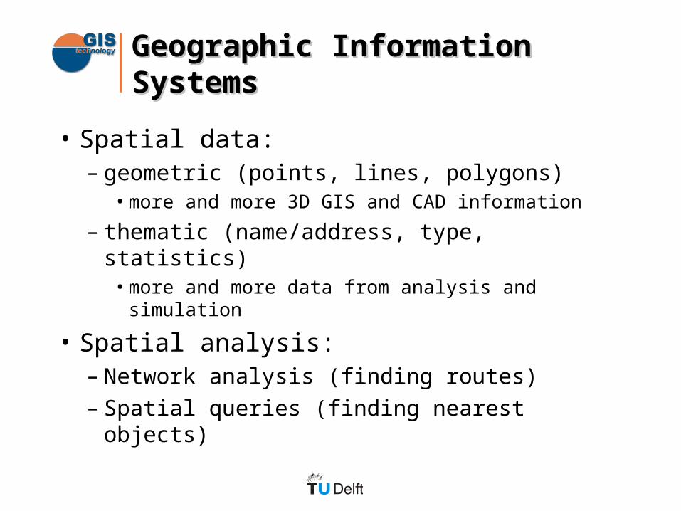
Geographic Information SystemsGeographic Information Systems
• Spatial data:– geometric (points, lines, polygons)
• more and more 3D GIS and CAD information
– thematic (name/address, type, statistics)• more and more data from analysis and simulation
• Spatial analysis:– Network analysis (finding routes)– Spatial queries (finding nearest objects)

Virtual RealityVirtual Reality
ResponsiveWorkbench
Desktop VR
CAVE
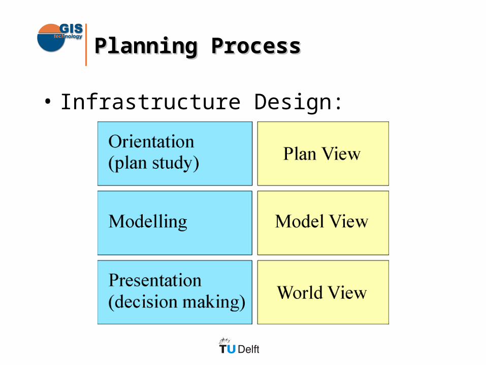
Planning ProcessPlanning Process
• Infrastructure Design:

Plan ViewPlan View
• 2D symbolic visualisation
• Simple GIS functions
• VR `map’ tool:– Orientation
– Navigation

Model ViewModel View
• 3D symbolic visualisation
• Modelling– arrangement of objects
– geographic constraints
• Virtual Workbench

World ViewWorld View
• 3D “realistic” visualisation
• Presentation– non-experts
• immersive VR:– CAVE
– ImmersaDesk

Implementation “Karma”Implementation “Karma”
• Components:– VR: WorldToolKit– GIS: Spatial Database Engine
• Platforms:– PC– SGI, CAVE, Responsive Workbench


Current StatusCurrent Status
• 2-way coupling VR and 3D GIS realized.
• Manipulation of GIS objects– rotate, translate, delete
• GIS analysis– query, spatial query, identify
• End-users will test the system in real-life applications

Future ResearchFuture Research
• Performance– dynamic loading– level of detail (GIS and 3D models)
• Modelling– geographic constraints– data enrichment
• Linking existing datasources– visualising analysis calculations

Delft in the year 1660...Delft in the year 1660...


![CV Gert Bakhuizen [GE]](https://static.fdocuments.us/doc/165x107/55baa47bbb61ebf5678b46c4/cv-gert-bakhuizen-ge.jpg)