Vermont Natural Resources Conservation Service Wildlife ...
30
Vermont Natural Resources Conservation Service Wildlife Habitat Incentives Program 2007 Plan i
Transcript of Vermont Natural Resources Conservation Service Wildlife ...
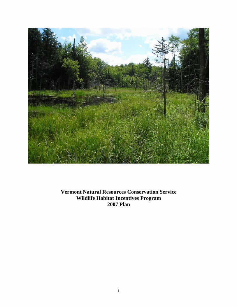
Vermont Natural Resources Conservation Service Wildlife Habitat Incentives Program
2007 Plan
i

Table of Contents
I. Introduction……………………………………………………………………………... 1
II. Background………………….…………………………………...……………............... 1
III. National and Regional Fish and Wildlife Priorities……………………………………2
IV. State Objectives - The Wildlife Action Plan and NRCS...………………………......... 3
V. Major Habitat Problems Facing Vermont Wildlife……….………………………….. 4
VI. State Fish and Wildlife Priorities……………………………………………………… 6
1. Aquatic and Riparian Habitat…………………………………………………. 6 1.1 Current Condition………………………..…………………………………......... 6 1.2 Desired Condition………………………………………………………………... 8 1.3 Vermont’s Wildlife Action Plan Strategies…………...………………………..... 9 1.4 Other Initiatives or Goals for Riparian Habitat………………………………….10 1.5 NRCS Actions to Improve Aquatic and Riparian SGCN Habitat…………….....10
2. Wetland Habitat………………………………………………………………...11 2.1 Current Condition………………………..…………………………………........11 2.2 Desired Condition……………………………………………………………..... 12 2.3 Vermont’s Wildlife Action Plan Strategies…………...………………………....13 2.4 Other Initiatives or Goals for Wetland Habitat…………………………………..13 2.5 NRCS Actions to Improve Aquatic and Riparian SGCN Habitat…………….....13
3. Grassland and Old Field Habitat……………………………………………...13 3.1 Current Condition………………………..…………………………………........14 3.2 Desired Condition………………………………………………………………..15 3.3 Vermont’s Wildlife Action Plan Strategies…………...………………………....16 3.4 Other Initiatives or Goals for Grassland Habitat………………………………...16 3.5 NRCS Actions to Improve Grassland and Old Field SGCN Habitat………….....16
4. Forest Habitat…………………………………………………………………...17 4.1 Current Condition………………………..………………………………........... 17
4.1a Shrubland SGCN……………………………………………………...…18 4.1b Diverse Forest SGCN…………………………………………………....19 4.1c Old Growth SGCN………………………………………………..……. 19 4.1d Forest Communities Important to SGCN………………………………. 19 4.1e Fragmentation……………………………………………………………20
4.2 Desired Condition………………………………………………………..……... 20 4.3 Vermont’s Wildlife Action Plan Strategies…………...………………………....21 4.4 Other Initiatives or Goals for Forest Habitat………………………..……….…..21 4.5 NRCS Actions to Improve Forest SGCN Habitat……………………………......21
i

VII. Partnership Involvement on the Wildlife and Forestry Subcommittee……………..22
VIII. Essential Habitat Designations………………………………………………………...23
IX. Applicant Ranking and Evaluation……………………………………………………24
X. Criteria for Measuring Success………………………………………………………..24
XI. References……………………………………………………………………………….25
ii

I. Introduction Vermont’s wildlife1 and habitats are as diverse as its land and water resources. Vermont’s landscape ranges from the warm Lake Champlain Valley with its abundant fertile farmland, high biodiversity and areas of dense population to the cool Northeast Highlands characterized by remote and extensive forest areas and significant conserved lands. The Green Mountains run the length of the state and are dominated by beech-birch-maple forests and spruce-fir at higher elevations. The waters of the state include the sixth largest lake in the United States, Lake Champlain and the largest river in New England, the Connecticut River, which drains 11,250 square miles. The wetlands of the state include small vernal pools, emergent marshes, and large forested swamps.
The forests, which make up the majority of Vermont’s land base, are home to wide ranging species such as the black bear, fisher and moose but also colorful wood warblers that winter in Central and South America and salamanders that breed in vernal pools. The large grassland areas are home to bobolink and savannah sparrows as well as various butterflies. Federally endangered Indiana bats use the Champlain Valley forests and open areas during the summer months as do the eastern rat and ribbon snakes. Our diverse wetlands support a variety of marsh birds and waterfowl as well as beaver, otter and mink and many species of turtles and frogs. Loons nest at the water’s edge on numerous rural forest ponds and lake sturgeon and landlocked Atlantic salmon may be found in Lake Champlain. Vermont’s headwater rivers support brook trout and spring salamanders and the Connecticut River is home to the federally endangered dwarf wedgemussel.
To maintain this level of diversity and improve conditions for the wildlife species in most need, the people of Vermont needed to come together with a plan. Thankfully, the conservationists of Vermont, with leadership from the Vermont Fish and Wildlife Department (VTFWD), have collaborated on just such a plan – Vermont’s Wildlife Action Plan. This Action Plan will serve as a Statewide, all-species conservation strategy that will guide and direct conservation efforts across the State.
II. Background The Vermont State Wildlife Habitat Incentives Program (WHIP) plan, while written to guide WHIP specifically, can serve as the framework to guide wildlife conservation priorities and targets for the Natural Resources Conservation Service (NRCS) in Vermont. The priorities outlined in this plan are well founded, being based upon recognized priority habitat concerns from the Action Plan, other science-based regional initiatives or plans, and current peer-reviewed literature.
Actions identified to improve habitat for targeted species could be accomplished through other farm bill programs such as Environmental Quality Incentives Program (EQIP), Agricultural Management Assistance Program (AMA), Wetland Reserve Program (WRP), Grassland Reserve Program (GRP), and Conservation Reserve Program (CRP). Both AMA and EQIP have national priorities to ‘promote at-risk species habitat conservation.’ NRCS will contribute, through financial or technical assistance, to the conservation of important wildlife species; the specific farm bill program used is not crucial.
1 The term ‘wildlife’ includes fish, wildlife and invertebrates.
1

The actions listed in this NRCS plan are not intended to address all identified environmental issues from the Action Plan; they are generally the actions that NRCS is best suited to address through our organization and Farm Bill programs. This plan will be adapted over time to address changing or evolving conservation issues as identified by NRCS and conservation partners.
III. National and Regional Fish and Wildlife Priorities The national WHIP priorities are established to provide direction to the State and local levels for implementing the program to achieve national objectives. NRCS has established the following national priorities:
• Promote the restoration of declining or important native wildlife habitats. • Protect, restore, develop or enhance wildlife habitat of at-risk species (candidate
species, and State and federally listed threatened and endangered species). • Reduce the impacts of invasive species on wildlife habitats. • Protect, restore, develop or enhance declining or important aquatic wildlife species’
habitats.
Projects that enhance habitat essential for the survival of federally protected species or those species that are candidates or proposed for listing under the Endangered Species Act have priority. The Endangered Species Act of 1973 (ESA), as amended, requires Federal agencies to use their programs to actively support the goals and objectives of the Act. NRCS National Policy states the Agency’s intent to ensure conservation of federally protected species through implementation of its programs. Conservation of federally protected species and species in decline is an objective of the EQIP, Grassland Reserve Program (GRP), WRP, and WHIP.
NRCS wishes to use its existing programs to contribute to National or Regional conservation initiatives. Initiatives that have well defined objectives and use a partnership approach to focus resources of state and federal agencies and national conservation organizations are emphasized. The North American Waterfowl Management Plan - Atlantic Coast Joint Venture, the North American Bird Conservation Initiative (NABCI) and Partners in Flight (PIF) have established regional management plans and identified strategies for Vermont and the region. The American Woodcock Conservation Initiative for the Atlantic Northern Forest region (Bird Conservation Region (BCR) 14) is a new initiative that offers opportunities for existing NRCS conservation programs to conserve early successional forest species. The Eastern Brook Trout Joint Venture is a pilot program of the newly established National Fish Habitat Initiative. Objectives of these initiatives are recognized and supported by numerous conservation agencies and organizations.
Projects involving multiple partners are usually cost effective and more technically sound. Therefore, projects which involve the technical and financial resources of NRCS and other partners and conservation organizations to deliver effective and focused conservation will be favored.
2

IV. State Objectives - The Wildlife Action Plan and NRCS The objective of the WHIP program in Vermont is to help participants protect, restore, develop, or enhance declining or important wildlife habitats.
Vermont’s Wildlife Action Plan (Action Plan) is and will continue to be an important tool to help Vermont NRCS identify fish and wildlife related conservation priorities. Used in conjunction with input from the Forestry and Wildlife Subcommittee of the State Technical Committee, habitat priorities will continue to focus upon degraded or declining habitats of high conservation value and upon habitats critical to at-risk species. The Action Plan, in turn, has recognized the importance of the WHIP program to habitat restoration and management and suggest to ‘maintain and expand incentives for private landowners such as the Wildlife Habitat Incentives Program (WHIP)’ under Statewide Habitat Themes for Action.
NRCS has the opportunity, through numerous partners and a diverse customer base, to improve many acres and miles of fish and wildlife habitat through our conservation planning process and farm bill programs, such as the Wildlife Habitat Incentives Program. NRCS will prioritize projects and contribute to the conservation of the Species of Greatest Conservation Need (SGCN), as identified in the Action Plan, through habitat restoration, protection and management.
Every State in the country, including Vermont, was required by congress to create a Wildlife Action Plan (formerly Comprehensive Wildlife Conservation Strategy) to remain eligible for State Wildlife Grants (SWG). The US Fish and Wildlife Service provide federal money to every state through State Wildlife Grants for cost-effective conservation aimed at preventing wildlife from becoming endangered. In Vermont, State Wildlife Grants is managed by the Fish & Wildlife Department (VTFWD), where it helps conserve, restore, and actively manage Vermont's wildlife and the places they live. State Wildlife Grants have funded more than 40 programs in Vermont including: conservation research and recovery planning for spruce grouse, lake sturgeon, turtles, bats and freshwater mussels; terrestrial and aquatic habitat assessments; bird and butterfly atlases (with Vermont Institute of Natural Science); a manual for town conservation planning; educational curriculum; and the purchasing of equipment for dealing with nuisance wildlife.
Creation of the Action plans, by every state and territory in the nation, was a historic effort. Combined, this was and is the largest wildlife conservation effort in the US—ever (Kart et al. 2005). Never before had Vermont undertaken such a comprehensive review of its wildlife. Wildlife biologists, ecologists, sportsmen and other conservationists, business leaders and state and federal agencies representing more than 60 entities have signed on as Conservation Partners to work with the Vermont Fish & Wildlife Department (VFWD) to create Vermont's Wildlife Action Plan. The Action Plan provides a science-based foundation to guide local, state and federal agencies, sportsmen’s and conservation organizations and the general public in a common conservation vision.
The Vermont Wildlife Action Plan provides detailed species assessment reports for 144 vertebrates and 191 invertebrates. These are the organisms identified as the Species of Greatest Conservation Need (SGCN). In Vermont, the SGCN include species with declining populations, species threatened or potentially threatened and species so little known in the state that experts cannot yet ascertain status. The Action Plan describes the habitats and landscapes used by these
3

species as well as the specific problems facing both the species and the landscapes and habitats upon which they depend. Conservation strategies are offered to address the various resource concerns and problems identified.
Vermont’s Action Plan identified twenty-two major categories of problems but the most common and serious problems identified include loss of habitat (conversion, degradation, fragmentation and lack of needed successional stages), impacts of roads, pollution and sedimentation, invasive species, climate change and data gaps and information needs. NRCS and farm bill programs, particularly the Wildlife Habitat Incentives Program, are identified frequently throughout the Action Plan as potential partners and funding sources to address recognized habitat issues and problems.
Vermont NRCS will strive to use its programs to assist in a coordinated effort to help implement Vermont’s Wildlife Action Plan. Specifically, the WHIP plan for 2006 has used the Action Plan as one of the principal guiding references to document habitat resource concerns and opportunities for restoration, protection and management. The WHIP program in Vermont will use the Action Plan within the context of NRCS national priorities, local priorities and program objectives and capabilities.
V. Major Habitat Problems Facing Vermont Wildlife The Action Plan process has identified twenty-two major habitat issues of which four may be addressed, in some way, through the NRCS planning process and Farm Bill programs. These include the loss of habitat (conversion, degradation, fragmentation and lack of needed successional stages), impacts of roads, pollution and sedimentation and invasive species. These four categories are not mutually exclusive and problems can often logically be placed into more than one category depending on the particular stress it causes for a species or habitat (Kart et al. 2005). These habitat problems will be frequently noted throughout this plan.
Loss of Habitat • Habitat Conversion: The complete transformation or loss of a habitat by human action
(examples include: filling a wetland to create a grassy field, converting a forest stand into a parking lot, or damming a stream to create a reservoir).
• Habitat Alteration/Degradation: A lessening of the quality of a habitat by human action stopping short of complete conversion (examples include: the reduction of mast (fruit and seed) production in a forest stand, stream channelization and riprapping, and significant land use changes adjacent to a habitat such as replacing a forest stand on the edge of a wetland with a housing development.
• Habitat Fragmentation: The breaking up of habitats into smaller, non-contiguous patches as a result of habitat conversion (e.g., housing, commercial development, roads, stream crossings, utility lines). Fragmentation can: 1) render important habitats inaccessible (such as isolating a den site from a feeding site, isolating spawning habitat, etc.), 2) isolating populations (for example grassland butterflies, spotted salamander, and tiger beetles); and, 3) degrade remaining habitat patches through edge effects that favor edge-tolerant species such as raccoons and crows, as well as invasive exotic species that can
4

out-compete native and rare species. The result of habitat fragmentation is often increased predation, increased mortality, reduced mobility and changes in habitat microclimates.
• Inadequate Distribution of Successional Stages: The lack of either late, mid or early successional habitat in appropriate patch size and/or juxtaposition can be a problem for some SGCN especially as fragmentation makes it harder for species to move between forest patches (examples include ruffed grouse and woodcock which prefer early successional forest stands, American marten which prefers late-successional stands and Canada lynx which depends on a mix of forest stages).
Impacts of Roads and Trails In the last quarter of the 20th century, Vermont expanded its road system by an average of 26 miles per year to a total of about 14,251 miles. The number of vehicle miles traveled by Vermont residents is growing at seven times the rate of population growth, according to information from the Vermont Agency of Transportation. Transportation systems, including some hiking and recreation trails, can cause numerous problems for SGCN including: vehicle-wildlife collisions; reducing animal and fish passage, thus limiting habitat availability and isolating populations; vehicle emissions of pollutants such as ozone and greenhouse gases; and facilitating the spread of an exotic, invasive species into otherwise healthy areas.
Pollution & Sedimentation The introduction of harmful and or excessive materials from point and non-point sources can significantly impact SGCN, particularly aquatic species. Pollutants & sediments include sands and silts, chemicals and toxins; excess nutrients from farm and municipal sewage plants; garbage and other solid waste; radioactive materials; road salt; excessive noise; thermal pollution (heightened temperatures); and light pollution that disturbs animals and disrupts migration patterns. Sediments can be a problem for SGCN through their physical presence alone. For example, soils can wash into a stream from a construction site and smother fish eggs and other aquatic species living in the spaces between rocks and gravel streambed.
Invasive Exotic Species Invasive exotic and pest species are one of the most frequently noted problems impacting Vermont's Species of Greatest Conservation Need (SGCN) and their habitats. This habitat issue merits special consideration because the world of invasive exotic control and eradication is a rapidly evolving one. The introduction and spread of nuisance exotic and native species (plants and animals) may lead to the elimination of native wildlife populations, threaten long-term stability of habitats and even lead to extirpation by out-competing a native species, displacing its food source or altering a key process or function of a habitat. Invasive exotic species in Vermont include Eurasian watermilfoil, purple loosestrife, common buckthorn, Japanese knotweed, Morrow’s honeysuckle, goutweed, black swallow-wort and zebra mussels.
5

VI. State Fish and Wildlife Priorities
1. Fluvial Aquatic and Riparian Habitat The Action Plan lists 66 species and invertebrate groups SGCN that are priority targets under both the fluvial and riparian condition. They include Bald eagle, wood turtle, river otter, mink, freshwater mussel and snail groups, Atlantic salmon and brook trout. For a full list of SGCN associated with Aquatic and Shoreline and Fluvial Habitat see Vermont’s Wildlife Action Plan.
1.1 Current Condition In general, fluvial and riparian ecosystems in Vermont are most affected by conversion, alteration, and fragmentation. Within stream and riparian ecosystems, the life cycle requirements of aquatic species have been affected in Vermont due to the significant modification of the following key ecological processes and components:
Stream, Riparian, and Floodplain Connectivity – the unimpeded movement of materials (water, sediment, and organic material) and organisms both longitudinally up and down the watershed and laterally between the stream channel and its riparian area and floodplain has been diminished from activities such as road crossings, dams, channel incision, encroachment and channelization.
Sediment Regime – the size, quantity, sorting, and distribution of sediments, which may differ between stream types due to their proximity to different sediment sources, and have become altered due to changes in hydrologic regime; stream, riparian and floodplain connectivity; and valley and stream morphology.
Hydrologic Regime – the timing, volume, and duration of flow events throughout the year and over time, which may be influenced by the climate, soils, geology, groundwater, and has become altered due to changes in watershed land cover; connectivity of the stream, riparian, and floodplain network; and valley and stream morphology.
Temperature Regime – the daily and seasonal in-stream water temperatures influenced by climate and aspect, and has become altered due to changes in riparian canopy, hydrologic regime (particularly groundwater components), and valley and stream morphology.
Large Wood and Organics Regime – the diversity, quantity, and physical retention of organic material available for biological uptake and physical refugia (moderating the expenditure of energy), which may be influenced by the primary productivity within the stream channel and has become altered due to changes in riparian cover and land use, watershed and floodplain connectivity, the hydrologic regime, and valley and stream morphology.
Some of our rivers, streams, lakes, and wetlands still have intact riparian areas, while many others no longer have functioning riparian areas due to more than 200 years of intensive human use of the land. Typically steeper mountainous streams at high elevations, less suited for human development, have well forested riparian areas with cold, clean water and relatively stable stream channels. The retention of sediment, nutrient, and organics in mountainous streams has been altered from the historic practice of snagging streams of any roughness elements that would impede the transport of wood to downstream mill sites. Recreational activities and their associated development, such as ski resorts, residential road development, and forestry are the land uses most common in these areas that may also affect stream habitats. Mid and low
6

elevation streams and rivers are more likely to be impacted by human land uses, including clearing of riparian vegetation, alteration of stream channels and floodplains, and direct inputs of toxins, excess nutrients, and sediments. These impacts are related primarily to roads, residences, commercial development, and agriculture, the latter being especially extensive in the lower valleys of the Lake Champlain and Connecticut River tributaries.
Lacustrine areas and their associated shorelines are particularly impacted by lakeshore development, such as seasonal and permanent residences, marinas and docks, and public and private beaches. In many instances these developments have altered natural lakeshore and littoral zones resulting in the direct loss of habitats for SGCN through the addition of fill materials (sand, bottom barriers) and the removal of native terrestrial and aquatic vegetation.
The fragmentation of riparian habitat in Vermont is due primarily to Vermont’s roadways paralleling the stream, rivers, and lakeshores and the use of floodplain areas for agriculture. Historic settlement and transportation patterns and ease of construction have resulted in roads paralleling the majority of Vermont’s major waterbodies and thousands of associated bridges and culverts. This results in removal of riparian vegetation and fragmentation, both longitudinally along the stream and laterally between the waterbody and adjacent upland communities.
Agriculture has lead to vegetation being removed from streambanks and associated riparian areas to permit cropping of the fertile floodplain soils. It is not uncommon to see fields cropped right to the top of bank. Poor grazing management techniques also create livestock concentrations near streams and rivers and in waterways and wetlands within the riparian corridor. Livestock may not be fenced out of streams and rivers since they are a convenient source of water. This near stream concentration of livestock produces a variety of environmental impacts including the degradation of vegetation, siltation, nutrient loading, increased water temperature and destabilization of streambanks.
The fragmentation of fluvial ecosystems is extensive in Vermont. A recent inventory of more than 200 culverts in the White River watershed showed more than half of the culverts inventoried were barriers to the upstream movement of all fish species present in the waterbody all of the time, and the other half of the culverts inventoried were barriers to some species and/or barriers some of the time (i.e. under certain stream flows when species movement is likely to occur) (Vermont Fish and Wildlife 2004). In addition, most of Vermont’s major rivers have large flood control and/or hydroelectric dams on them, with numerous smaller dams found throughout Vermont’s smaller streams. Such structures influence local habitat conditions, restrict movement of aquatic species, and alter downstream flood and sediment transport processes. The Vermont Agency of Transportation, Vermont Department of Fish and Wildlife, and Vermont Department of Environmental Conservation are currently working on several cooperative projects to identify the extent of impediments and to develop AOP design options for new stream crossings and retrofit applications.
Some aquatic habitat degradation is due to lasting effects of historic land uses. During the last two centuries land use in Vermont has been dominated by extensive land clearing for forestry and agriculture, aggressive stream clearing of boulders and coarse woody debris for stream log driving and flood control, and by dam construction and railroad and road building. Such activities have resulted in the relocation and straightening of stream and river channels throughout Vermont, resulting in an overall decrease in available fluvial habitat. For example, a
7

recent assessment of the upper White River watershed between Granville and Stockbridge shows that 93% (17.8 of 19.1 miles) of the length of the main stem White River has been channelized in the past, 13 miles of which are still in channelized form (Vermont Department of Environmental Conservation 2004). In addition, the extensive removal of natural substrates, such as boulders and coarse woody debris, has reduced overall stream habitat complexity throughout the Northeast (Verry 2000). The hard armoring of channels combined with the construction of flood control dams means that many of Vermont’s river channels have not regained their historic sinuosity. Furthermore, the slow re-growth of the Northeast’s forests means that large woody debris contribution to stream and river channels has yet to reach historic levels (Verry 2000).
1.2 Desired Condition Most of Vermont’s aquatic species rely on streams and rivers that provide clean water, a diversity of in-channel habitat, and unobstructed movement upstream and downstream between habitats. Whether in the mountain streams or large valley rivers, most aquatic SGCN require in-stream cover and/or substrates for protection and colonization. Most fish species seek cover for predator avoidance and to reduce metabolic (energy) demands. Mussels need firm substrates for colonization, as do most aquatic insect species. Substrates utilized may vary from rock to sand to in-stream aquatic vegetation, depending on the species, but all species can suffer from excessive fine sediments in the channel that can bury in-stream substrates. Loss of complexity and solid substrates for cover and colonization reduces overall habitat availability and quality.
In addition, many species use in-stream substrates for reproduction. For example, brook trout deposit eggs in gravels on the channel bottom, whereas many shiner species utilize aquatic vegetation to spawn. Embedding of substrates, destabilization of substrates due to chronic channel instability, and direct removal of substrates all impact aquatic habitats and species. The mammal and bird species associated with streams and rivers, such as bald eagle, osprey, mink, river otter, muskrat, and water shrew, are also impacted when aquatic species are affected, as these species rely on aquatic species as prey. In addition, muskrat, otter, mink, and particularly water shrew, utilize undercut streambanks and other stable bank areas for denning. Chronic channel instability that results in substantial streambank erosion may reduce potential denning areas for these species.
Some of the SGCN uniquely associated with streams and rivers have extensive movement requirements, such as the Atlantic salmon and American eel, migrating from freshwater streams and rivers to the Atlantic Ocean and back again. Other species move shorter distances, but still require habitat connectivity to be able to access spawning, rearing, and seasonal habitats. There are also species, such as wood turtle and river otter that move back and forth between the aquatic and nearby terrestrial habitats both daily and seasonally. Thus, it is important to maintain habitat connectivity both longitudinally along the river channel and adjacent riparian lands, as well as laterally between the aquatic habitat and the riparian habitat.
Ideally, Vermont’s rivers and streams would provide an interconnected network of habitats in which species can move upstream and downstream as needed to fulfill seasonal and diurnal habitat needs. In-stream structure would provide an abundance and diversity of habitat niches and be naturally maintained by physical stream processes over time (e.g., flooding, balanced sediment transport). Streams and rivers would be connected to the adjacent riparian habitats, which in turn function to protect and provide for fluvial habitat components, such as in-stream coarse woody debris and pollutant removal from surface runoff.
8

In summary, the desired condition of key ecological processes may be defined and evaluated using indicators of the following aquatic and riparian habitat components:
Bed Substrate Cover – stable, unembedded, and well-sorted sediments;
Woody Debris Cover – a greater density of large woody pieces and debris jams, and an abundance of course particulate organic matter;
Scour and Deposition Features – a high diversity of hydraulic units (depth/velocity combinations) and a frequency and distribution of stream bed features (e.g., riffles, steps, and pools) as expected within each stream-valley setting;
Channel Morphology – equilibrium dimensions, pattern and profile and floodplain relations appropriate to each stream type with minimal channelization, armoring, and dredging;
Hydrologic Characteristics – a high percentage of wetted useable area in the stream with minimal alteration of the natural flow characteristics from alterations of land use/land cover, ditches, and dam operations;
Connectivity – minimal obstruction of animal movement laterally or longitudinally within the stream and riparian network due to human practices or structures;
Stream banks – covered by native woody vegetation providing shade, bank stability, and cover habitats; and
Riparian Area – as a forested area buffering the stream from adjacent land uses and providing for the water quality, fish and wildlife habitat (aquatic/terrestrial), channel stability, and other functions associated with a river corridor.
Reach and watershed-scale stressors, such as channel straightening or increased sediment loading, may lead to changes in ecological processes and ultimately a degradation of aquatic and riparian habitat. These same indicators are important measuring tools for evaluating human stressors, those activities and practices that may result in negative effects on habitat processes and components.
1.3 Vermont’s Wildlife Action Plan Strategies The Action Plan strategies that include both NRCS technical assistance and farm bill program’s financial assistance as funding sources to achieve the goals: • Technical and financial assistance to private landowners to maintain and enhance SGCN
habitat in riparian areas; • Work with VTrans, towns, and private landowners to identify and maintain (or restore)
riparian habitat connectivity and improve aquatic organism passage; • Provide technical and financial incentives to private landowners for conservation and
protection of SGCN and their riparian and fluvial habitat; and
9
• Technical assistance to landowners and conservation groups on invasive exotic management and eradication.
1.4 Other Initiatives or Goals for Riparian Habitat • The Wildlife Management Institute’s (WMI)2 Regional Wildlife Habitat Needs
Assessment for the 2007 Farm Bill for the Northeast highlights loss of riparian habitats as one of the most dramatic examples of stressed habitats. The report list yearly habitat goals for the northeast, for aquatic and riparian species, of establishing 15,000 acres of new riparian buffers, 2,000 acres of new grassed waterways, 15,000 acres of new filter strips, and protect 500,000 feet of stream bank per year.
• The Vermont ANR, in cooperation with NRCS and other partners, is developing a project planning guide, titled: “River Corridor Protection and Restoration Planning: A Guide for Project Identification and Development.” This guide will provide technical guidance in the use of stream geomorphic and aquatic and riparian habitat data collected using the Vermont ANR 2006 Stream Geomorphic Assessment Protocols to identify and plan for restoration and protection projects being considered for WHIP and other State and Federal funding. This initiative also includes the development of new habitat assessment protocols which will be used in conjunction with fluvial geomorphic data to evaluated key ecological processes the watershed and reach-scale stressors which may be targeted during restoration and protection projects. Data will be made available through River Corridor Plans and through a web-based map server tailored for the WHIP program ranking process.
1.5 NRCS Actions to Improve Aquatic and Riparian SGCN Habitat NRCS will prioritize and focus efforts upon restoration and protection of river corridors which include both the aquatic and riparian systems. Due to the complexity of river corridor projects, partnerships (DEC, USFWS, VTFWD, watershed groups, etc.) are particularly important to implementing a successful restoration plan. Special attention will be made to plan and implement habitat projects that allow and provide for the river attaining its natural equilibrium, meander belt width and floodplain functions. Allowing rivers to reach a balanced condition will decrease erosion and sediment input to the aquatic systems while also allowing natural habitat features to form over time. Riparian forest buffers will be protected, established or managed through fencing, tree planting or natural regeneration, and control of invasive plants where success is likely. Other complementary buffer practices will be established as needed to improve water quality and habitat. Barriers on rivers and streams will be removed, modified or replaced to restore aquatic organism passage (AOP), aquatic habitat connectivity, and fluvial geomorphic functions in Vermont waters for SGCN. In-stream habitat improvements will be incorporated into comprehensive river restoration projects.
2 WMI is a professional conservation organization that works to improve the professional foundation of wildlife management. Toward the goal of improved management of wildlife resources, WMI is involved in a wide range of issue, policy, research and educational efforts.
10

2. Wetland Habitat Wetlands in Vermont range from small woodland seeps and vernal pools to cedar swamps to lakeside emergent marshes or swamps. There are many locally important wetlands throughout the state but the conservation value of wetlands of the Lake Champlain Valley, Connecticut River Valley and the Northeast Kingdom (Lake Memphremagog, Victory Basin, Nulhegan Basin, etc.) are elevated due to the high biodiversity and size.
Lake Champlain and its wetlands are particularly important in the state because of its high and number of SGCN of plants and animals. Lake Champlain was designated a resource of national significance in 1990 (Lake Champlain Special Designation Act) and was also included, together with the Adirondack Mountains, as a Biosphere Reserve in 1989 due to its diversity. Lake Champlain and its associated wetlands are part of the Atlantic Flyway which is an important migratory corridor for waterfowl and other wetland birds. Aerial censuses conducted annually in October by the Vermont Fish and Wildlife consistently reports between 20,000 and 40,000 individuals of 30 or more species (ACJV 2005). The more numerous species include American Black Duck, Mallard, Wood Duck, Green-winged Teal, Greater and Lesser Scaup, Common Goldeneye, Ring-necked Duck, and Common Merganser. The emergent and forested wetlands of the Missisquoi National Wildlife Refuge support the largest breeding colonies of Great Blue Heron and Black Tern in Vermont. Other high priority wetland dependent species breeding in the area include American Bittern, Least Bittern, Sora, Virginia Rail, Common Moorhen, and American Woodcock (ACJV 2005).
2.1 Current Condition Many wetlands in the state are protected and still maintain their functions and values as habitat for SGCN. However, approximately 35% of Vermont’s wetlands have been lost since European settlement (Opportunities for Action 2003). Certain wetland communities have been impacted to a greater extent than others. Problems facing wetland dependent species include habitat alteration and fragmentation, suppression of the natural disturbance regime, hydrologic alteration, and invasive exotic species. Many of the same problems identified in the Fluvial and Riparian (1.1) condition above are applicable to the current wetland condition and problems, particularly in floodplains.
Many floodplain wetlands and adjacent buffers in riparian corridors have been converted for use by agriculture due to higher fertility soils. In addition, palustrine wetlands (marsh, scrub-shrub, forested, etc.) and buffers have also been converted or modified for hay, pasture and cropland to meet demand. Many of the low and flat farm fields of Vermont were wetlands that have been cleared of vegetation and or ditched to improve the land for production. While working farms keep many of wetland habitats in good condition (particularly, protected from development), there are many areas where vegetation in wetlands or buffers are removed or managed in a manner not conducive to nesting, feeding or movement.
In general, increasing development causes problems for SGCN through direct conversion of wetlands and important adjacent terrestrial habitats (house or commercial buildings, roads, driveways) as well as fragmentation of habitats with infrastructure such as driveways and roads and introduction of invasive plants. Roads and railroads have fragmented wetland and associated upland habitats across the state. A prime example is the barrier a busy road may be for frogs, turtles or salamander that are moving to or from breeding and or feeding sites. These road mortalities can be significant and can have major impacts on migrating adults and dispersing
11

juveniles, especially when located between terrestrial and breeding habitat (Kart et al. 2005). Where beavers were once able to modify wetland habitats with dam building they are now considered pests and are removed. This alters the natural disturbance regimes of these wetlands and affects other SGCN as well (e.g. shrubland dependent species).
The negative impacts of invasive plant species is one of the most frequently listed problems facing SGCN habitat as it alters natural systems. This can lead to lower diversity of habitats required by SGCN while displacing natural food sources and habitats. Purple loosestrife is a common invasive plant of emergent wetlands across the state that is being addressed through a biological control effort by Vermont Department of Environmental Conservation (DEC). Water chestnut is displacing native wetland vegetation in important wetlands throughout the Champlain Valley and interior. There is a coordinated effort funded by various partners (VT State, NY State, USFWS, ACOE, DU, and TNC) to control chestnut in Lake Champlain. Vermont DEC has managed Chestnut on both sides of Lake Champlain for 23 years (Hunt and Marangelo 2005). The Nature Conservancy joined DEC and began management in 1995.
2.2 Desired Condition Desired conditions for wetland habitats include functional systems that accommodate aquatic habitat and water quality, natural hydrologic conditions, disturbance regimes and life histories of the SGCN. Conservation efforts should be focused upon large wetland complexes or adjacent to existing protected or natural areas. These areas are typically important to the greatest number of SGCN because they will encompass a large enough area to include various wetland and upland habitat types. However, the importance of small wetlands (vernal pools, seeps, etc.) for certain SGCN must be recognized.
Maintaining or restoring natural flooding regimes, hydrology and other natural processes, including beaver activity of shrub and forested wetlands, is important for wetland functions and values. Plugging ditches, busting drainage tile, and removing levees along floodplains are just some of the activities that will help establish natural hydrologic conditions that will promote native vegetation and habitat for SGCN.
Sufficient buffers for the life history of the SGCN will be established or protected along both riparian and wetland complexes. This may involve establishment of woody plants or altering management (fencing, mowing, timber harvest near vernal pools, etc.) to both allow movement (corridors) and provide food and cover. These buffer areas may be used by species such as the black duck for nesting or leopard frogs for foraging. Buffers will also protect water quality of the wetlands by filtering out sediment, nutrients and pollutants that may negatively affect aquatic species.
Many SGCN herpetofauna (amphibians and reptiles), including the Jefferson and spotted salamanders require sufficient upland habitats and wetland habitats in close proximity. Turtles move from the aquatic system to uplands to lay eggs while mole salamanders typically move from terrestrial systems to vernal pools to lay their eggs. Sufficient wetland and upland habitat will need to be protected or restored to accommodate these movements. In addition, where concentrated and historical movements corridors and crossings of SGCN are being disrupted by roads, crossings would be provided to allow these life cycles to safely progress.
12

Invasive species will have a minimal impact on natural communities and SGCN habitats. Natural ecological process, such as natural succession (as in beaver wetland), will proceed without disruption by invasive plant species. Where success is likely, invasive plants which are impacting important habitats will be controlled.
2.3 Vermont’s Wildlife Action Plan Strategies The Action Plan strategies that include both NRCS technical assistance and farm bill program’s financial assistance as funding sources to achieve the goals: • Financial and technical assistance to conserver, restore, maintain and enhance wetlands
for SGCN • Manage exotic species and provide technical assistance to landowners regarding control
2.4 Other Initiatives or Goals for Wetland Habitat The WMI report has a wetland species population goal to stabilize or increase declining wetland dependent species. To meet the habitat needs for this goal, WMI recommends doubling the number of acres of wetlands created and restored in the region to 15,000 acres per year. In addition, the goal of the Atlantic Coast Joint Venture3 is to protect 945,000 acres of wetlands and to restore or enhance 210,000 acres of wetlands.
2.5 NRCS Actions to Improve Wetland SGCN Habitat NRCS will prioritize and focus efforts upon restoration of degraded wetlands that have been altered from their natural condition. Due to the complexity of wetland restoration projects, partnerships (USFWS, VTFWD, DU, VTDEC, etc.) are particularly important to implementing a successful restoration plan. Wetlands and buffers will be managed, protected or restored in a manner that improves food and cover habitat and movement corridors through fencing and vegetation establishment. NRCS will seek to minimize the impacts of fragmentation that cannot be fully restored by contributing to wildlife crossing projects for SGCN. Invasive species that are degrading important SGCN habitat will be controlled where success is likely.
3. Grassland and Old Field Habitat While the WHIP plan has attempted to mirror the Wildlife Action Plan it has replaced “hedgerow” in the ‘Grassland and Hedgerow’ system with old field. Strip habitats such as hedgerows can be valuable habitat, particularly when large nest (includes snags) or mast trees are present (e.g. nesting for kestrels). However, early successional habitats (may be typical of hedgerows) configured in larger blocks are generally more valuable wildlife habitats. This provides much more available habitat and less edge per area. In addition, some shrub-dependent species require large blocks of habitat interspersed with other vegetation types.
3The Atlantic Coast Joint Venture (ACJV) is a partnership focused on the conservation of habitat for native birds in the Atlantic Flyway of the United States from Maine south to Puerto Rico. The joint venture is a partnership of the 18 states and commonwealths and key federal and regional habitat conservation agencies and organizations in the joint venture area. The joint venture was originally formed as a regional partnership focused on the conservation of waterfowl and wetlands under the North American Waterfowl Management Plan in 1988 and has since broadened its focus to the conservation of habitats for all birds consistent with major national and continental bird conservation plans and the North American Bird Conservation Initiative.
13

Since it can be confusing and difficult to distinguish between mature (as in high percent woody cover) old field habitat and early successional forest, this plan will group these habitats under the forest section below (4.) as the species using these habitats are the same or very similar. This section will focus upon grassland habitats with some mention of old field habitats that are still dominated by herbaceous growth.
Grassland bird species as a whole have declined steadily throughout their range. U.S. Fish and Wildlife Service Breeding Bird Survey show that declines of grassland birds have been consistently steeper and more widespread than any other assemblage of birds (Askins 1993, Sauer et al. 2001). Of Grassland bird species that occur in Vermont, the Northern harrier, short- eared owl, savannah sparrow, grasshopper sparrow, bobolink and Eastern meadowlark populations are experiencing significant decreases at the continental scale over the thirty year period between 1966-1999 (Sauer et al. 2000). National Watch List species which are species identified by the US Fish and Wildlife Service as being of conservation concern include the short-eared owl and bobolink. Partners In Flight (PIF) 4 lists the Bobolink and Upland Sandpiper as top tier priorities (high global priority) in the St. Lawrence Plain Physiographic Area 18 which includes the Champlain Valley (Rosenberg 2000).
In Vermont, Upland Sandpiper populations have declined and the species is listed as State endangered. Grasshopper Sparrows are listed as state threatened and both Sedge Wren and Henslow’s Sparrow populations have declined to where they may no longer be breeding in the state (both endangered). Other obligate grassland species, although relatively abundant (i.e., Bobolink and Eastern Meadowlark) have also show significant declines in recent years (LaBarr et al. 2005). In total, grassland and old field (hedgerow) systems provide habitat for over 40 SGCN (Kart et al. 2005). While 21 of the SGCN are birds, there are also reptiles (wood turtle, timber rattlesnake, and ribbon snake), invertebrates (grassland butterflies and moths), and mammals (New England cottontail, Eastern red bat and common gray fox) that depend on these important habitats.
3.1 Current Condition Most of Vermont’s large grasslands occur in the Champlain Valley and to a lesser extent the Connecticut River Valley and the area around Lake Memphremagog. There are also numerous grasslands of various types and sizes scattered across the rest of the state. Most grasslands are characterized as pasture, hayland and fallow fields and are usually associated with current or past agricultural practices although there a number that are maintained for specific purposes (airports, military reservations, landfills, industrial complexes, etc.). Most of Vermont’s grasslands are in
4 PIF is a cooperative effort involving partnerships among federal, state and local government agencies, philanthropic foundations, professional organizations, conservation groups, industry, the academic community and private individuals. PIF was originally launched in 1990 in order to focus upon conservation of birds not covered by existing conservation initiatives. The initial focus was upon neotropical migrants, species that breed in the Nearctic (North America) and winter in the Neotropics (Central and South America).
Partners in Flight (PIF) physiographic regions for Vermont include: • The St. Lawrence Plain (Area 18) which roughly covers the Champlain Valley • Northern New England (Area 27) which roughly covers the southern four biophysical regions of Vermont • The Eastern Spruce-Hardwood Forest (Area 28) which roughly covers the remaining North central and
eastern biophysical regions including the Northeast Kingdom
14

private ownership, although the state and federal governments own and manage some of these areas. The counties with the highest percentages of land in agriculture and open land are Addison (35.5%), Franklin (29.5%), Grand Isle (25%) and Orleans (22%, primarily in the area surrounding Lake Memphremagog) (USDA NRCS 1997).
Although agriculture practices create and maintain valuable grasslands, intensification of these practices has had negative impacts on their quality and availability. Small diversified farming operations which provided a range of suitable habitat types has given way to larger, more intensively managed farms as a result of improved agricultural techniques (Labarr et al 2005). The Vermont Wildlife Action Plan identifies widespread early hay harvest and heavy grazing rotations in pastures as the one of the highest ranking problems for species in this suite. Also, primarily for hedgerow species, removal of hedgerows and reclaiming of old fields for more intense management is identified as a high priority problem. Finally, the abandonment and forest succession of former agricultural land is also identified by the Action Plan as a high priority problem to be addressed.
Urban and suburban development has also resulted in a loss of grasslands. This loss comes in two forms, the direct loss of grasslands as structures and lawns replace fields, and fragmentation of large grassland areas into smaller parcels rendering them insufficient for use by some breeding grassland bird (e.g., Upland Sandpiper). In Vermont, the urban and suburban growth of Chittenden County is expanding into Franklin and Grand Isle counties to the north and Addison County to the south. As a result there is increasing pressure to develop agricultural lands important to grassland species (LaBarr et al. 2005).
Other factors contributing to loss of quality grasslands include incompatible management of grasslands in non-agricultural settings (i.e., airports). Although airport construction and management has provided suitable habitat for grassland species, mowing regimes, many of which are required by the Federal Aviation Administration (FAA) often disturb nesting activity. Also, a lack of airport expansion planning (new hangers, airplane parking, etc.) which takes into account grassland species has lead to the loss of important grassland habitat at these sites (LaBarr et al. 2005).
3.2 Desired Condition A variety of grasslands and old field habitats are needed, in the correct configuration and size to conserve the suite of species dependant on these habitat types. Grasslands will provide a mosaic of habitats including a mix of short, medium and tall grasses with some fields having a small shrub component. Disturbance, while a requirement to maintain this habitat, must be minimized during the breeding season. Invasive species will have a minimal impact on SGCN habitats if managed properly.
Creating or managing grasslands and old fields will provide habitats for the suite of grassland birds. Bobolinks utilize grassland or fallow hay fields and prefers a mosaic of grasses, sedges and scattered broad leaved forbs with less than 25% shrub cover (Jones and Vickery 1997). Northern Harrier habitat includes marshy meadows, wet, lightly grazed pastures, old fields, mesic grasslands, and drained marshlands. Densest populations are typically associated with large tracts of undisturbed habitats dominated by thick vegetation (MacWhirter and Bildstein1996). Upland Sandpipers prefer large grassland areas with a mosaic of grassland types as areas of short grass are used for feeding while areas of taller grass are used for nesting. All
15

three of these aforementioned species benefit from grasslands that are not subjected to early mowing. American Kestrels nest in cavities or nest boxes in most open areas (< 30% canopy cover).
While birds are typically the focus of this habitat type due to the extensive history of survey data (Breeding Bird Survey, Breeding Bird Atlas, etc.), there are many other SGCN that use these habitats. Gray Fox, New England Cottontail (considered for listing under the Endangered Species Act), Eastern Rat Snake, Smooth Green Snake and Brown Snake all utilize grasslands and shrubby areas for foraging, denning or nesting, and/or as movement corridors (Kart et. al. 2005). Many species of butterflies and other pollinators will only be found in these herbaceous openings although the area requirements are usually less than the larger vertebrates.
Many grassland birds are area sensitive and require large blocks of open and contiguous grassland habitat. Conservation efforts should focus attention in these large blocks and areas of high biodiversity (VTFWD Nongame and Natural Heritage Database).
3.2 Vermont’s Wildlife Action Plan Strategies The Action Plan strategies that include both NRCS technical assistance and farm bill program’s financial assistance as funding sources to achieve the goals: • Promote conservation easements or incentives to landowners managing
grasslands/hedgerows for SGCN. • Develop education and outreach program to provide information about
grassland/hedgerow dependant species and management options to enhance their populations in Vermont.
3.4 Other Initiatives or Goals for Grassland Habitat The WMI report for grassland species list population goals: • Maintain suitable habitat distributed across the landscape to support viable
metapopulation* structure for grassland birds identified in state Wildlife Action Plans • Continue efforts to develop grassland management protocol to maintain and enhance
nesting habitat for grassland nesting species. *multiple populations of an organism within an area in which interbreeding could occur
WMI list habitat needs for grassland species to include 2.4 million acres of grasslands in the Northeast to support the suite of grassland species identified in the Partners in Flight Physiographic Assessments which are frequently identified in Wildlife Action Plans as SGCN.
3.5 NRCS Actions to Improve Grassland and Old Field SGCN Habitat NRCS will prioritize and focus efforts upon management and restoration of grassland habitat for SGCN and to follow recommendations of the Vermont Grassland Bird Management and Recovery Plan (Labarr et al 2005). While grassy, herbaceous openings may provide habitat for a variety of wildlife, areas with large acreages (25 acres or more) of contiguous grassland will be prioritized as grassland birds are generally area sensitive. For instance, area requirements of bobolinks is 5-10 acres, Eastern meadowlark is 15-20 acres, grasshopper sparrow is 30 acres, savannah sparrow is 20-40 acres, and upland sandpiper is 120 acres (Jones and Vickery 1997). Smaller grasslands may be better managed for old field or shrubby habitat species such as field
16

sparrow (grass dominated with some shrub cover) or brown thrasher (later succession old field with high % shrub cover) that are much less area sensitive. Fields will be managed through mowing, seeding and other means where appropriate to maintain this habitat over time. Efforts will be made to increase available grassland bird habitat as well as improve the habitat diversity of these systems at the landscape as well as field level. Invasive species that are degrading important SGCN habitat will be controlled where success is likely.
4. Forest Habitat Vermont is about three quarters forested with higher percentages in Southern Vermont and much lower percentages in parts of the Champlain Valley. Vermont’s three primary landscape scale forests – Northern Hardwood, Spruce-Fir-Northern Hardwood, and Oak-Pine-Northern Hardwood – form the foundation of the state’s forested habitat that supports many of Vermont’s SGCN. At the landscape scale, the Action Plan for Wildlife identifies maintaining and managing large blocks of forested habitat and linkages for wide ranging species such as bear, marten and lynx. The Action Plan recommends conservation of 1,000+ acre blocks of Oak-Pine-Northern Hardwood forests and 1,000-20,000 acres for Northern Hardwood and Spruce-Fir Northern Hardwood forests. Each of the three landscape level forests hosts numerous SGCN that may require one or more of the natural community types associated and nested within that respective large forest. For instance, the conservation target clay plain forest natural community of the Champlain Valley is nested within the Oak-Pine-Northern Hardwood landscape level forest.
The Vermont Wildlife Action Plan and various regional plans and initiatives (NABCI, PIF, Woodcock Initiative, etc.) highlight well developed forest structure (understory and midstory) as well as sufficient early successional habitat as desired conditions for forest birds. In addition, some forest natural communities have been degraded or converted to non-forest uses by humans to a point where they are rare and are targeted for protection and or restoration (Valley Clay Plain and Sand Plain forests). Recent research describing summer range and habitat of the federally endangered Indiana bat in the Champlain Valley have made this species a high priority conservation target. In general, the Action Plan focuses attention on large blocks of forested habitat but in the Champlain Valley it is apparent that smaller blocks (<1,000 acres) of forest habitat are crucial to the survival of rare wildlife species such as the Indiana bat.
4.1 Current Condition Vermont’s landscape has experienced significant change over the past 250 years. The early 19th century saw the clearing of Vermont’s forest for agriculture and iron industry and exported to the south for lumber and a variety of other uses. By the 1850s nearly three quarters of Vermont was cleared, the streams were full of silt from the eroding land, and sheep grazed almost every hillside. When the fertile lands of the Midwest opened up, farmers left Vermont’s infertile hills for the tall grass prairies and their deep fertile soils. By 1880, dairy farming had replaced sheep. Over the years, hill farms slowly winked out and the land reverted to forest. Only the most productive agricultural lands remained, primarily in the river valleys and Champlain Valley and Memphremagog area. (Thompson and Sorenson 2000, David Skinas, NRCS Archeologist, personal communication 2005).
The change in land use altered the composition of wildlife species on the landscape. While mature forest wildlife populations (marten, goshawk, etc.) may have declined, species that depend on grasslands, old fields and young forests (grassland birds, cottontail, etc.) prospered in
17

the changed landscape. As these lands reverted back to forest, the species composition shifted again with mature forest wildlife populations increasing and early successional habitat dependent wildlife populations decreasing. Over the past two centuries the mix of successional stages available to Vermont's wildlife has changed dramatically in both distribution and abundance.
Natural disturbance is now limited in scale and frequency. Before European settlement, nature was allowed to take its course throughout New England. Habitats for all native wildlife species were continuously being created in a shifting mosaic as natural disturbances occurred and the forest re-grew (Degraff et al. 2005). The clearing of forest in eastern North America allowed a diversity of successional habitats to co-exist (Hunter et al. 2001). However, over the past century the forest has grown back. Much of the current mature forest is of similar age and has been sporadically cut, high graded, and neglected for most of the past century (Degraff et al. 2005). While much of Vermont’s forests have been cleared or logged at one time, current land management trends (smaller parcels, urbanization, etc.) will likely yield less early successional habitat in the future (Kart et al. 2005).
Nowhere are the effects of the large scale habitat changes (including lack of natural disturbance) on wildlife in the Northeast and Vermont more evident than in populations of breeding birds. This is due to the fact that birds have been extensively surveyed (Breeding Bird Survey, Singing Ground Surveys, etc.), are typically very habitat specific and also quickly respond to management compared with other wildlife groups.
4.1a Shrubland SGCN Breeding Bird Survey data suggest that populations of nearly one-quarter of the shrubland suite of birds in the Northeast Region (New England, New York, New Jersey, Pennsylvania, Delaware, Maryland, Virginia and West Virginia) have decreased by 50% or more since the mid 1960’s (Dettmers 2003). Shrubland birds are considered the suite of species that are primarily associated during the breeding season with naturally occurring shrublands and early successional forests created through disturbance (Dettmers 2003). Only grassland birds have a larger percentage of the species in their habitat suite experiencing significant declines. Ten of the 12 Partners In Flight (PIF) physiographic region plans for the Northeast Region highlight the shrubland/early successional habitats as either high or moderate conservation action (Dettmers 2003).
The golden-winged warbler, a Vermont SGCN, is placed in the highest priority group for PIF regions 18 and 27. Other species dependent upon disturbance of young forest patches that are showing a significant population decline include the black-billed cuckoo, whip-poor-will, chestnut-sided warbler, mourning warbler, common yellowthroat, Canada warbler, Eastern towhee, and indigo bunting (Hunter et al. 2001).
US Fish and Wildlife Service’s American Woodcock Singing Ground Surveys show that East Region and Continental populations of woodcock, listed as a Vermont SGCN, have declined at 1.9 % a year for the past thirty-eight years (Kelley and Rau 2006). While Vermont populations are experiencing a non significant decline, surrounding states populations are experiencing significant declines. In Vermont, the American woodcock was placed in the highest priority group for all three PIF physiographic regions (18, 27, and 28) that encompass the entire state.
18

While birds are highlighted for the aforementioned reasons, there are over 200 vertebrate species that occur in shrub/old field habitat and regenerating forest stands in New England (Degraff and Yamasaki 2001). Both the Eastern cottontail and the New England cottontail (SGCN) have both been identified as obligate users of early successional habitats (Litvaitis 2001) and the bobcat (SGCN) is a frequent visitor of these habitats in search of rabbits as prey. Vermont snake species that are SGCN (Eastern racer, rat snake, green snake, etc) also use these early successional habitats as do many butterflies. Other species use these habitats as only a part of their range and prefer a mix of successional stages in appropriate configurations (e.g., black bear, lynx) as these habitats are very productive (plants and soft mast).
In general, early successional forest is available on 10% of the Vermont’s forestland, ranging from 2.7% in the Taconic Mountains to over 19% in the Northern Vermont Piedmont (Frieswyk and Widmann 2000). Vermont's SGCN list contains relatively few species requiring mid-successional forests and more that thrive in early and late-successional representations.
4.1b Diverse Forest SGCN There are a number of SGCN and PIF priority forest bird species that require structurally diverse forest stands, with a well developed understory for nesting. While many are relatively abundant in the region (e.g. black-throated blue warblers) there are others that are declining. Many of these bird’s populations are centered in the Northeast and require long term planning to maintain or increase populations through land protection (large forest blocks) and forest management to maintain diverse size classes. These species that have a large percentage of their global population within our region are considered ‘responsibility birds’ by PIF and Audubon and warrant extra attention. Vermont listed SGCN that require a balance of forest age structures on the landscape include Canada warbler, veery, wood thrush, black-throated blue warbler, Bay-breasted Warbler and Blackpoll Warbler.
4.1c Old Growth SGCN While no species in New England need stands older than the silvicultural rotation age (Degraff et al. 2005), historic records and research in late-successional areas elsewhere indicate that the distribution and abundance of some wildlife species was much greater when late-successional forests were in greater abundance—even if these species can survive without them (Kart et al 2005). Given the lack of this condition on the landscape it is advisable to increase its availability to wildlife. The current availability of late successional stage habitat is nearly non-existent in the state, although trends lean toward an increasing availability of this habitat, particularly in the Southern Green Mountains (Kart et al. 2005).
4.1d Forest Communities Important to SGCN Of the three landscape level forests in Vermont, the Oak-Pine-Northern Hardwood Forest has been the most altered by human activities. The primary reason may be that this forest type is most closely associated with the Champlain and Connecticut River Valleys – Vermont’s most populated and agricultural regions (Kart et al. 2005). Clay plain forest, a community within the larger landscape forest, has declined by 87.9% since pre-European settlement (Lapin 2003). Clayplain forests, particularly large den trees and trees with exfoliating bark (shagbark hickory), are important summer foraging and roosting areas for the federally endangered Indiana Bat. This natural community has been a target for conservation in Vermont for the last 10 years and numerous projects are being implemented to restore these forests. The Clayplain and Floodplain Forest Restoration Plan (Lapin et al. 2004) specifically targets the Hubbarton River and Lower
19

Poultney River watershed in Vermont and New York. Another rare forest community that has been severely fragmented and converted to developed land is the sand plain forest in Chittenden County.
Although the dominant forest matrix in Vermont is Northern hardwood forest, there are areas where the other types prosper. The Oak-Pine is generally found in the lower, warmer parts of the state and the Spruce Fir type generally characterizes our coldest regions. The spruce-fir forests occur where growing seasons are short, summers are cool, and winters are harsh. The conifer-dominated forests blanket our highest peaks above 2,500 feet as well as occurring in cold lowland pockets (e.g. Nulhegan basin). A number of the SGCN associated with this type are at the southern end of their geographic range (spruce grouse and gray jay) and others, such as the Bicknell’s thrush, are ‘responsibility birds’ whose range is restricted to Northeastern montane forests.
Spruce-fir forests of the Northeast Highlands biophysical region, particularly lowland forests, have been degraded by over cutting which has removed the majority of spruce-fir over-story. This has lead to a dominance of hardwood pioneer tree species. While it is likely that these forests will eventually succeed to spruce-fir, restoration through management practices can speed up the process to benefit SGCN such as the spruce grouse, gray jay and black-backed woodpecker. In addition to the potential benefits to SGCN, these spruce fir forests provide important cover for deer during the severe winters that are typically of that part of the state.
4.1e Fragmentation Vermont’s forest land has become more widespread since the turn of the century but human population growth and economic development result in forestland conversion and fragmentation that yield smaller blocks of contiguous forest habitat. Fragmentation, through conversion to non-forest use or roads, can lead to a variety of habitat-related problems for the SGCN. Fragmentation may make important habitats inaccessible (breeding or feeding areas), isolate populations, and degrade habitat through edge effects (predation, parasitism, invasive species, etc.). It is critical to maintain large blocks of habitat and corridors, particularly for far ranging species but also to maintain habitat integrity for all SGCN.
4.2 Desired Condition The unifying message for all three landscape level forests listed in the Wildlife Action Plan, is maintaining or expanding large blocks (>1000 acres) of contiguous forestland to ensure the long term viability of the full suite of SGCN. This will include the various natural communities, accommodate wide ranging species, and provide enough variation on the landscape to capture important habitat elements to many other species of wildlife. While maintaining and expanding large blocks of forest is ideal, it must be recognized that conservation efforts should also focus efforts on smaller blocks of forest in the Champlain Valley which are critical to species such as the Indiana bat with limited range in Vermont.
Hard mast wildlife food (i.e., nuts and acorns) sources are important and will be available to many SGCN with stands of bear-scarred American beech being a classic example (Kart et al. 2005). Forest management will provide a variety of size classes and age structures across the landscape and within stands while maintaining some areas of old growth. Given that natural disturbance factors no longer function as they once did, more direct management intervention (e.g. forest management) may be justified from an ecological restoration point of view (Askins
20

2000). To optimize early successional species diversity, including many forest species, 10-20% of the forest landscape should be comprised of old fields, shrublands and young forest habitats (Degraff et al. 1992). Invasive species will have a minimal impact on SGCN habitats.
4.3 Vermont’s Wildlife Action Plan Strategies The Action Plan strategies and performance measures that include both NRCS technical assistance and farm bill program’s financial assistance as funding sources to achieve the goals: • Provide technical and financial assistance to private landowners, user groups and forest
managers to maintain, enhance or manage for SGCN including, SGCN associated with early successional and late successional habitat.
4.4 Other Initiatives or Goals for Forest Habitat The WMI report highlights that in the Northeast, in addition to grassland species, the species requiring large blocks of scrub and early successional forests have experienced the most significant population declines in the last several decades.
WMI’s population goal for forest species is to stabilize or increase declining populations of early successional and old-growth forest species. WMI habitat needs for forest species: • The draft Ruffed Grouse Conservation Plan calls for an increase of 587,000 acres of
young forest and shrubland, to return ruffed grouse populations to 1980 levels in the Northeast.
• The draft American Woodcock Conservation Plan calls for an increase of 9 million acres of young forest, shrubland and non-stocked habitats, to return woodcock populations to the 1970 levels.
• 17 million acres of mature coniferous, deciduous or mixed forestlands are needed to fulfill the requirements of the suite of forest-dependent species identified as the priority species in the physiographic assessments and frequently identified in Wildlife Action Plans as Species of Greatest Conservation Need.
• State Wildlife Action Plans prioritize conservation actions intended for both early and late-successional SGCN and should be used to focus Farm Bill programs that influence creation and management of these habitats.
Audubon Vermont's Forest Bird Initiative is integrating science, education and public policy to conserve forests within Vermont that are important to birds, by identifying, monitoring and stewarding a network of forest Important Bird Areas (IBA) that support a significant number of breeding forest birds to maintain viable populations of responsibility bird species.
4.5 NRCS Actions to Improve Forest SGCN Habitat NRCS will prioritize and focus efforts upon management and restoration of forested systems to provide and maintain habitat for the diverse SGCN. Blocks of forest habitat will be maintained and expanded, where appropriate, through natural regeneration or tree planting. Areas of old growth will be protected and maintained. Early successional habitat management will focus upon old field, shrubland and early successional woodland habitats in appropriate size and configuration to meet requirements of SGCN. Generally, early successional habitats are best managed contiguously (adjacent), in block sizes of 5 acres or greater to provide for the greatest
21

number of species. While many bird species have small territories (1-2 acres), they may not nest in patches of this size. For instance, golden-winged warblers generally will not use patches of young habitat that are less than 25 acres. Emphasis will be given to the Southern four biophysical regions where the seedling sapling size classes are 6% or less of the forest land. Diverse, well structured forests will be promoted through forest management, livestock exclusion or other means to improve food sources (mast) and nesting habitats for SGCN such as the wood thrush and Canada warbler. Indiana bat habitat will be protected, enhanced and restored based upon accepted methods of the VTFWD, the USFWS and NRCS. Forest communities important to SGCN (Clayplain, spruce-fir, etc.) may be protected or restored through fencing, tree establishment or other management practices. Invasive species that are degrading important SGCN habitat will be controlled where success is likely.
VII. Partnership Involvement on the Wildlife and Forestry Subcommittee
The individuals and organizations participating in the Wildlife and Forestry Subcommittee of the State Technical Committee bring a diversity and wide depth of knowledge to this subcommittee. Most of these individuals have been involved in the development of local and state-wide policies concerning wildlife management in the state. The Wildlife and Forestry subcommittee has met periodically since the inception of the program to provide suggestions to improve the program. The committee has identified wildlife habitat resource concerns and prioritized them for the state. The committee has also identified practices that could be used in the restoration of wildlife habitats in Vermont and opportunities for partnership in implementing the program.
• US Fish and Wildlife Service • VT Department of Fish and Wildlife • VT Department of Forests and Parks • VT Department of Environmental Conservation • VT Association of Conservation Districts • The University of Vermont • The Nature Conservancy • Audubon Vermont • Ruffed Grouse Society • Vermont Coverts • National Wild Turkey Federation • Vermont Woodlands Association • National Wildlife Federation • VT Agency of Agriculture • Private Landowners
NRCS will continue to work with a variety of conservation partners to effectively deliver Farm Bill Programs in a manner which benefit fish and wildlife resources and which focuses efforts to help solve priority national, regional, state and local fish and wildlife issues.
NRCS has a strong history of partnering on conservation projects in Vermont with USFWS Partners for Fish and Wildlife, the Vermont Department Fish and Wildlife, VT Department of Environmental Conservation, Vermont Department of Forests and Parks, The Nature
22

Conservancy, Ducks Unlimited, Conservation Districts, watershed groups and others. Wetland and riparian corridor restoration, Clayplain forest and other rare community restoration, fish passage, grassland and early successional woodland management, threatened and endangered species habitat improvement are all examples of past joint projects. The involvement of these and other partners in projects provides a technically sound and cost effective solution to the resource concern(s) identified through the planning process.
VIII. Essential Habitat Designations WHIP authorizes the use of up to 15% of funds made available annually to a state to be used for increased cost share payments to participants who restore and protect essential plant and animal habitat using a WHIP agreement with duration of at least 15 years. Plant and animal habitat can be considered essential if it is designated “critical habitat” by the Fish and Wildlife Service (FWS) or National Oceanic and Atmospheric Administration Fisheries Service (NOAAFS) as essential to the conservation of a Federally-listed species, similarly designated habitat by the State wildlife agency for State-designated species, known locations of listed or candidate species that can be improved with specific practices, or particularly rare and unique habitats that could support at-risk species.
The 2007 essential habitat designations for Vermont are based upon input from the Wildlife and Forestry Subcommittee of the State Technical Committee, National WHIP priorities, and priorities of the State WHIP Plan (and State Action Plan). For more information see ‘2007 WHIP Essential Habitats in Vermont’ on the WHIP program website.
Aquatic Habitats: River and stream habitats in Vermont have been degraded over the past 200 years in many ways (see 1. above). Vermont’s aquatic (and semi-aquatic) SGCN include a variety of species ranging from numerous mussels, including the federally endangered dwarf wedgemussel, to brook trout, wood turtles, and river otters. Watersheds eligible for this category are based on the Eastern Brook Trout Joint Venture maps of watersheds with greatly reduced populations (less than 50% of available habitat occupied) combined with the element occurrences (biotics) database of the Vermont Fish and Wildlife Departments Nongame and Natural Heritage Program. These watersheds were shown to have the highest numbers and proportions of uncommon and rare aquatic species. To support conservation of the dwarf wedge mussel, the Connecticut River and tributaries within ½ mile of the main stem are also eligible. Practices prescribed for each site must contribute to improved aquatic habitat conditions and natural stream processes.
Valley Clay Plain Forests: Clayplain forests dominated the clay soils of the Champlain Valley prior to conversion to agriculture. Today, this forest community is considered rare by the State of Vermont Nongame and Natural Heritage Program. Restoration of clayplain forests will provide valuable forested habitat to SGCN of the Champlain Valley in the form of corridors and buffers along streams that link fragmented habitat and improved ecological functions. Based upon recent research, it appears there is at least some relationship between Clayplain forests and summer habitat of the federally endangered Indiana bat. Investigations continue and guidelines for Indiana bat habitat management are under development. Once guidelines are established it is likely that there will be increased focus on this species.
Early Successional Woodlands: Early successional woodlands, seedling and sapling forest size class, represent a small percent of the forest land in Southern Vermont. This habitat is
23

particularly lacking in the Taconic Mountains and Southern Green Mountains biophysical regions. As this habitat type has declined in Vermont (forest maturing) there has been a decline in the wildlife that depend on the habitat. For detailed discussion see Forest section 4.1a above. The intent of this essential habitat restoration is to restore young woodland habitat such as the sapling size class (greater than 4.5 ft. tall and less than 4 inch dbh) in the 0-15 age class. Areas will only qualify for the essential habitats if they will be allowed to regenerate. This will allow the area to grow from the seedling and into the sapling and small pole size classes.
IX. Applicant Ranking and Evaluation Most NRCS programs require an evaluation process to prioritize proposed projects to maximize environmental benefits accrued from program delivery. As previously stated, national oversight and evaluation reviews for WHIP and EQIP have recommended screening and/or ranking processes that facilitate achievement of clearly defined national, regional, state and local priorities and cost-effective program delivery. The ranking process for WHIP, which is based on recommendations of this plan and national program rules, will be completed through the agency approved Application Evaluation and Ranking Tool (AERT) that is located with the Protracts online tool. NRCS will continue to work with national, regional, state and local entities to refine program ranking and evaluation processes for all natural resources, including fish and wildlife.
X. Criteria for Measuring Success NRCS employs periodic national program reviews, annual state program reviews, and annual conservation planning quality assurance reviews to ensure programs and conservation technical assistance are achieving their intended purpose. In addition, well designed program ranking tools can be used to track whether program outreach is effectively attracting high value conservation projects.
Although environmental monitoring of individual projects is desirable, NRCS has limited time and staffing to support such an effort. Therefore, NRCS must rely on established long term monitoring efforts (e.g., breeding bird surveys, waterfowl surveys, etc.) or on the efforts of partners and volunteers to document whether program implementation is benefiting intended targets. The University of Vermont has produced a Grassland Bird Survey form for landowners to document grassland birds and benefits of Farm Bill programs such as WHIP and GRP. The USFS Northeastern Research Station is proposing assessing the benefits of farm bill programs to populations of shrubland birds in New England. Shrubland birds, as discussed earlier, are a high conservation priority in the Northeast due to loss of habitat and declining populations. This project is intended to be carried out as an element of the wildlife component of the Conservation Effects Assessment Project (CEAP). It will take additional innovative and comprehensive efforts to truly assess conservation benefits of the Farm Bill programs on wildlife habitats and populations.
It is essential that selected projects, especially those involving state and/or federally listed species and restoration of natural communities, be monitored to evaluate success and to enable adaptive management. NRCS and its conservation partners will strive to develop specific monitoring protocols and to explore whether non-Farm Bill programs and/or Farm Bill program financial and technical assistance money can be used to selectively monitor priority projects.
24

XI. References
Askins, R.A. 2000. Restoring North America’s birds: lessons from landscape ecology. Yale University, New Haven, Connecticut, USA.
Atlantic Coast Joint Venture -Waterfowl Implementation Plan. Northeast Focus Areas. June 2005.
DeGraaf, R.M., M. Yamasaki, W.B. Leak, and J.W. Lanier. 1992. New England Wildlife: Management of Forested Habitats. General Technical Report NE-144. USDA Forest Service, Northeastern Forest Experiment Station, Radnor, PA, 271 pp.
DeGraff, R.M. and M. Yamasaki. 2001. New England Wildlife: Habitat, Natural History and Distribution. University Press of New England, Hanover, NH.
DeGraff, R.M., M. Yamasaki, W.B. Leak and A.M. Lester. 2005. Landowner’s Guide to Wildlife Habitat – Forest Management for the New England Region. University Press of New England, Hanover. 111 pp.
Dettmers, R. 2003. Status and conservation of shrubland birds in the northeastern US. Forest Ecology and Management. 185: 81-93.
Frieswyk, T. and R. Widmann. 2000. Forest Statistics for Vermont: 1983 and 1997. Resource Bulletin NE-00-145. USDA, Forest Service, Northeast Research Station. 130 pp.
Hodgman, T.P. and K.V. Rosenberg. 2000. Partners in Flight landbird conservation plan: physiographic area 27: northern new england. Partners in Flight Working Group and American Bird Conservancy, the Plains, VA. 46pp.
Hunt, T. and P. Marangelo. 2005. 2004 Water Chestnut Management Program: Lake Champlain and Inland Waters in Vermont. Final Report for the Lake Champlain Basin Program. 37pp.
Hunter, W.C., D.A. Buehler, R.A. Canterbury, J.L. Confer, and P.B. Hamel. 2001. Conservation of disturbance-dependent birds in eastern North America. Wildlife Society Bulletin. 29(2): 440-455.
Jones, A and P.D. Vickery. 1997. Conserving Grassland Birds: Managing Small Grasslands for Grassland Birds. Massachusetts Audubon Society, Lincoln, MA.
Online at http://massaudubon.org/Birds_and_Beyond/Grassland Birds
Kart, J., R. Regan, S.R. Darling, C. Alexander, K. Cox, M. Ferguson, S. Parren, K. Royar, B. Popp, editors. 2005. Vermont's Wildlife Action Plan. Vermont Fish & Wildlife Department. Waterbury, Vermont. www.vtfishandwildlife.com
Kelley, J.R., Jr., and R. D. Rau. 2006. American woodcock population status, 2006. U.S. Fish and Wildlife Service, Laurel, Maryland. 15pp.
25

LaBarr, M., S. Parren, J. Peterson, T. Allen, T. Donovan, A. Strong, E. Derleth, B. Crenshaw and R. Renfrew. 2005. Vermont grassland bird management and recovery plan. Vermont Fish and Wildlife Dept., Waterbury, Vermont, USA.
Lapin, M.F. 2003. Nature Conservation in an Agricultural Landscape: Forest Ecology, Fragmentation Analysis, and Systematic Site Prioritization, Southern Champlain Valley, Vermont, USA. PhD Dissertation, Cornell University. 225 pp.
Lapin, M.F., K. Doyle, J. Graves, M. Droege. 2004. Clayplain and Floodplain Forest Restoration Plan: Hubbarton River and Lower Poultney River Watershed Vermont and
New York. Southern Lake Champlain Valley Program of The Nature Conservancy. West Haven, VT. 53pp.
Litvaitis, J.A. 2001. Importance of early-successional habitats to mammals in eastern forests. Wildlife Society Bulletin. 29: 466-473.
Lorimer, Graig G., and Alan S. White. 2003. Scale and frequency of natural disturbances in the northeastern US: implications for early successional forest habitats and regional age distributions. Forest Ecology and Management. Volume 186: 41-64.
MacWhirter, R. B., and K. L. Bildstein. 1996. Northern Harrier (Circus cyaneus). In The birds of North America, No. 210 (A. Poole and F. Gill, eds.). The birds of North America, Inc., Philadelphia, Pennsylvania, USA.
Maine NRCS. 2006. NRCS Action Plan to Conserve: Identified Priority Fish and Wildlife Species and Habitat in Maine.
Opportunities for Action. 2003. Lake Champlain Basin Program.
Robbins, C.S., D.K. Dawson, and B.A. Dowell. 1989. Habitat area requirements of breeding forest birds of the Middle Atlantic States. Wildlife Monographs 103. The Wildlife
Society, Bethesda, MD.
Rosenberg, K.V. 2000. Partners in Flight landbird conservation plan: physiographic area 18: The St. Lawrence Plain. Partners in Flight Working Group and American Bird Conservancy, the Plains, VA. 41pp.
Rosenberg, K.V. and T. P. Hodgman. 2000. Partners in Flight landbird conservation plan: physiographic area 28: eastern spruce-hardwood forest. Partners in Flight Working Group and American Bird Conservancy, the Plains, VA. 46pp.
Sauer, J. R., J. E. Hines, L. Thomas, J. Fallon and G. Gough. 2000. The North American Breeding Bird Survey, Results and Analysis 1966 - 1999. Version 98.1.USGS Patuxent Wildlife Research Center, Laurel, MD.
Thompson, E. H., and E. R. Sorenson. 2000. Wetland, woodland, wildland - A guide to the natural communities of Vermont. University Press of New England, Hanover. 456 pp.
26

Vermont Department of Environmental Conservation. 2004. Stream geomorphic assessment data available from the DEC River Management Program, Water Quality Division, Waterbury,
VT.
Vermont Department of Fish and Wildlife. 2004. Evaluation of Bridge and Culverts for Aquatic Organism Passage and Fluvial Function in the White River Watershed. Waterbury, VT.
Vermont NRCS. 1998. Wildlife Habitat Incentive Program State Plan for Fiscal Year 1999. 15 pp.
Verry, E.S., J.W. Hornbeck, and C.A. Dolloff (eds). 2000. Riparian management in forests of the continental Eastern United States. Lewis Publishers, Boca Raton, FL.
Wildlife Management Institute. 2006. Regional Wildlife Habitat Needs Assessment for the 2007 Farm Bill – A summary of successes and needs of Farm Bill conservation
programs.
27