Using Submillimeter to measure cloud ice mass from earth viewing Satellites 11 October 2005 SIRICE...
30
Using Submillimeter to measure cloud ice mass from earth viewing Satellites 11 October 2005 SIRICE Steve Ackerman/U.Wisc David Starr/GSFC K. Frank Evans/CSU U.Wisconsin-GSFC- JPL
-
date post
21-Dec-2015 -
Category
Documents
-
view
215 -
download
1
Transcript of Using Submillimeter to measure cloud ice mass from earth viewing Satellites 11 October 2005 SIRICE...

Using Submillimeter to measure cloud ice mass from earth viewing Satellites
11 October 2005
SIRICE
Steve Ackerman/U.WiscDavid Starr/GSFC
K. Frank Evans/CSU
U.Wisconsin-GSFC-JPL
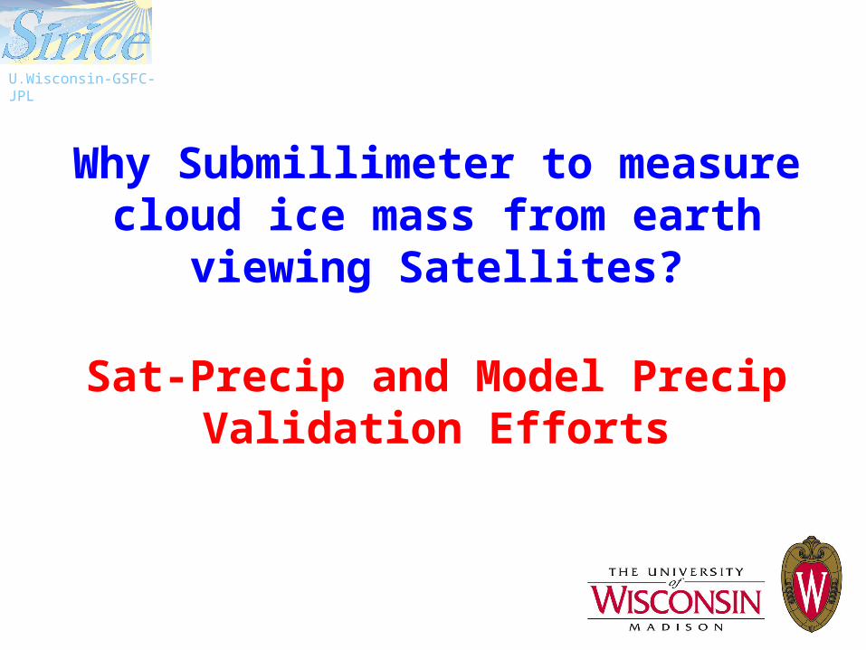
Why Submillimeter to measure cloud ice mass from earth viewing
Satellites?
Sat-Precip and Model Precip Validation Efforts
U.Wisconsin-GSFC-JPL

SIRICE Management Status Review September 27, 2005- Science
Slide 3
U.Wisconsin-GSFC-JPL
PIS. Ackerman (UW)
ALGORITHM APPLICATIONS VALIDATION
K.F. Evans (CU) D. O’C. Starr (GSFC) G. McFarquhar (UI)
T. L’Ecuyer (CSU) B. Soden (Miami)A. Heymsfield
(NCAR)
T. Greenwald (UW) A. del Genio (GISS) J. Mace (UU)
H. Revercomb (UW) A. Hou (GSFC) Z. Wang (WY)
P. Racette (GSFC) A. da Silva (GSFC) J. Wang (GSFC)
J. Spinhirne (GSFC) P. Norris (GSFC) S. Platnick (GSFC)
R. Lancaster (GSFC) B. Demoz (GSFC)
G. Skofronick-Jackson (GSFC)
R. Bennartz (UW)
Science Team
Science team is composed of internationally recognized leaders in ice cloud studies
SIRICE Management Status Review September 27, 2005- Science
Slide 4
U.Wisconsin-GSFC-JPL
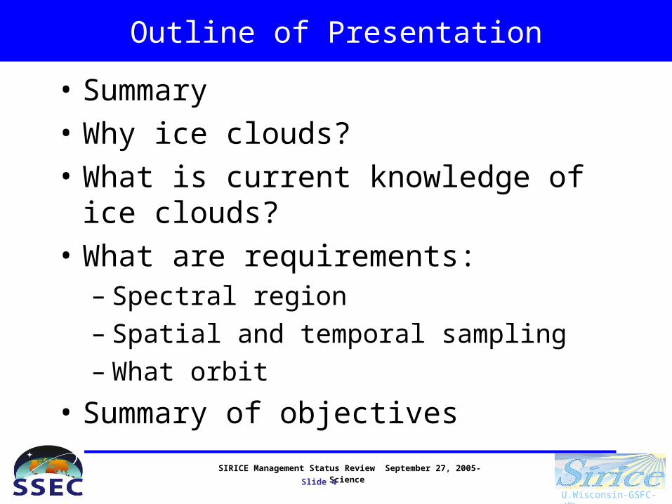
Outline of Presentation
• Summary
• Why ice clouds?
• What is current knowledge of ice clouds?
• What are requirements:– Spectral region– Spatial and temporal sampling– What orbit
• Summary of objectives

SIRICE Management Status Review September 27, 2005- Science
Slide 5
U.Wisconsin-GSFC-JPL
Provide the global distribution of cloud ice at cloud-system-resolving scales
Ice water path: IWP - vertically-integrated (column) mass of ice particles per unit area, => the Earth’s Radiation Budget and linkage to the Hydrologic Cycle.
IWC weighted mean equivalent particle diameter (Dme). Crystal size => cloud
radiative properties and ice crystal fall speed (vertical ice mass flux), a key model parameter.
Need measurements of IWP and Dme
• Daily Global coverage (1600-km swath from LEO) at• Cloud-system resolving (10-km resolution requirement) with• Useful accuracy (±25% requirement: Ohring et al, 2004; GCSS, 2000) over• Dynamic range (5-5000 g m-2 and 40 – 800 microns)
required to quantify coupling of the Global Water and Energy Cycles (Precipitation and Radiation Budget)
SIRICE Management Status Review September 27, 2005- Science
Slide 6
U.Wisconsin-GSFC-JPL
Why ice clouds?
Ice clouds are:
• Crucial to Earth’s Radiation Budget (Energy Cycle)(~large area coverage, highly variable properties)

SIRICE Management Status Review September 27, 2005- Science
Slide 7
U.Wisconsin-GSFC-JPL
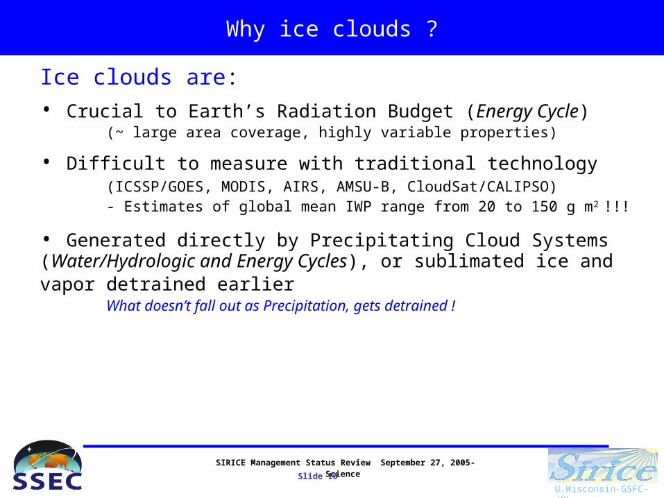
Why ice clouds ?
Ice clouds are:
• Crucial to Earth’s Radiation Budget (Energy Cycle)(~large area coverage, highly variable properties)
• Difficult to measure with traditional technology (ICSSP/GOES, MODIS, AIRS, AMSU-B, CloudSat/CALIPSO)- Estimates of global mean IWP range from 20 to 150 g m2 !!!

SIRICE Management Status Review September 27, 2005- Science
Slide 8
U.Wisconsin-GSFC-JPL
Why ice clouds?
Ice clouds are:
• Crucial to Earth’s Radiation Budget (Energy Cycle)(~ large area coverage, highly variable properties)
• Difficult to measure with traditional technology (ICSSP/GOES, MODIS, AIRS, AMSU-B, CloudSat/CALIPSO)- Estimates of global mean IWP range from 20 to 150 g m2 !!!
• Generated directly by Precipitating Cloud Systems (Water/Hydrologic and Energy Cycles), or sublimated ice and vapor detrained earlier
What doesn’t fall out as Precipitation, gets detrained !
SIRICE Management Status Review September 27, 2005- Science
Slide 9
U.Wisconsin-GSFC-JPL
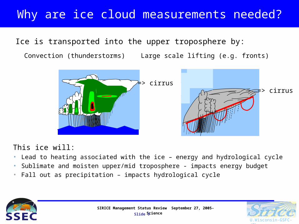
Why are ice cloud measurements needed?
Ice is transported into the upper troposphere by:
Convection (thunderstorms) Large scale lifting (e.g. fronts)
This ice will:• Lead to heating associated with the ice – energy and hydrological cycle• Sublimate and moisten upper/mid troposphere - impacts energy budget• Fall out as precipitation – impacts hydrological cycle
=> cirrus=> cirrus
SIRICE Management Status Review September 27, 2005- Science
Slide 10
U.Wisconsin-GSFC-JPL
Why ice clouds ?
Ice clouds are:
• Crucial to Earth’s Radiation Budget (Energy Cycle)(~ large area coverage, highly variable properties)
• Difficult to measure with traditional technology (ICSSP/GOES, MODIS, AIRS, AMSU-B, CloudSat/CALIPSO)- Estimates of global mean IWP range from 20 to 150 g m2 !!!
• Generated directly by Precipitating Cloud Systems (Water/Hydrologic and Energy Cycles), or sublimated ice and vapor detrained earlier
What doesn’t fall out as Precipitation, gets detrained !
SIRICE Management Status Review September 27, 2005- Science
Slide 11
U.Wisconsin-GSFC-JPL
Why ice clouds?
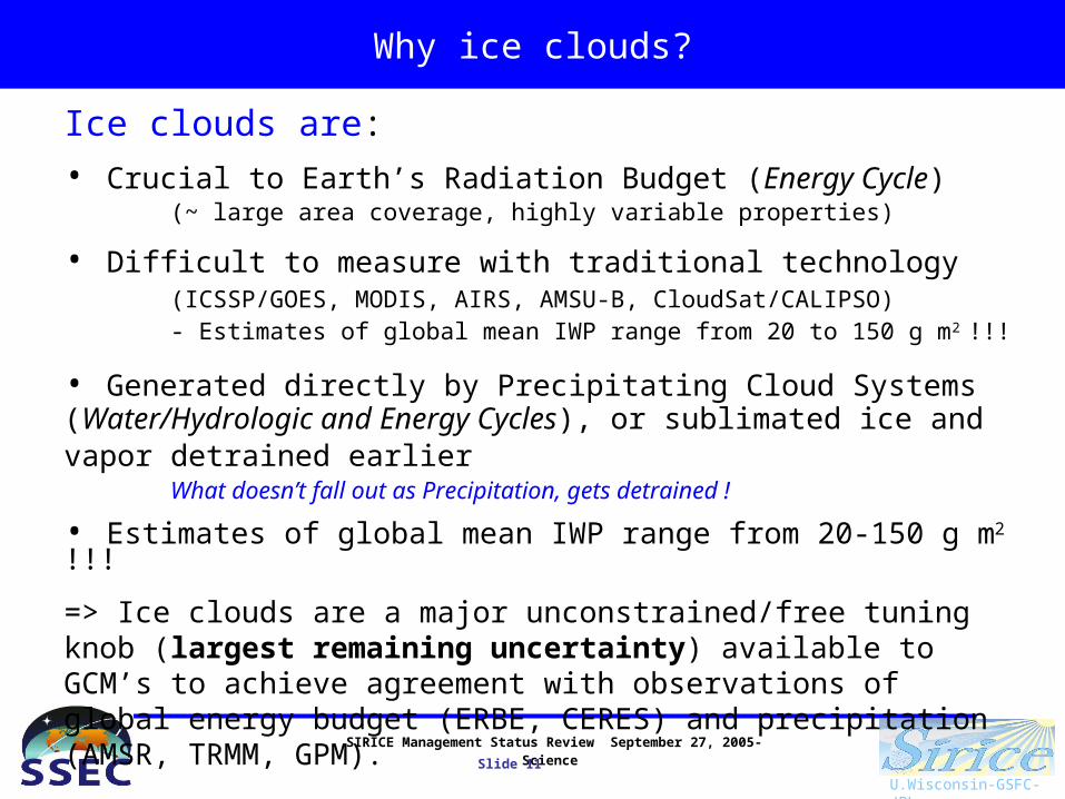
Ice clouds are:
• Crucial to Earth’s Radiation Budget (Energy Cycle)(~ large area coverage, highly variable properties)
• Difficult to measure with traditional technology (ICSSP/GOES, MODIS, AIRS, AMSU-B, CloudSat/CALIPSO)- Estimates of global mean IWP range from 20 to 150 g m2 !!!
• Generated directly by Precipitating Cloud Systems (Water/Hydrologic and Energy Cycles), or sublimated ice and vapor detrained earlier
What doesn’t fall out as Precipitation, gets detrained !
• Estimates of global mean IWP range from 20-150 g m2 !!!
=> Ice clouds are a major unconstrained/free tuning knob (largest remaining uncertainty) available to GCM’s to achieve agreement with observations of global energy budget (ERBE, CERES) and precipitation (AMSR, TRMM, GPM).

SIRICE Management Status Review September 27, 2005- Science
Slide 12
U.Wisconsin-GSFC-JPL
What is our current knowledge?
The large discrepancy in mean IWP between climate models is one demonstration of our poor knowledge of ice mass in the atmosphere.
The climatology of zonal, annual mean IWP from state-of-the-art global models.
Ohring et al (2004) note that for climate monitoring purposes, IWP must be measured to an accuracy of 25% and that no satellite missions meet this requirement. (NIST-NOAA-NASA workshop on Satellite Instrument Calibration for Measuring Global Climate Change)
SIRICE Management Status Review September 27, 2005- Science
Slide 13
U.Wisconsin-GSFC-JPL
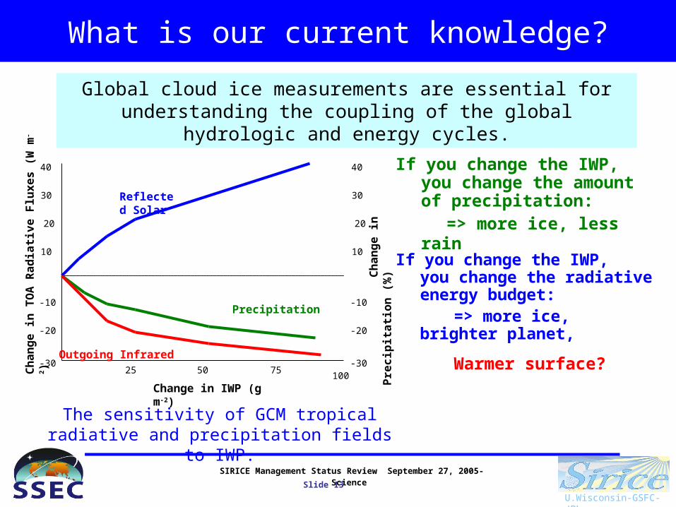
What is our current knowledge?
The sensitivity of GCM tropical radiative and precipitation fields to IWP.
Global cloud ice measurements are essential for understanding the coupling of the global hydrologic and energy cycles.
Change in IWP (g m-2)
25 50 75100C
ha
ng
e i
n T
OA
Ra
dia
tiv
e F
lux
es
(W
m-2)
-20
-10
10
20
30
-30
40
-20
-10
10
20
30
-30
40
Ch
an
ge
in
P
rec
ipit
ati
on
(%
)
Precipitation
If you change the IWP, you change the amount of precipitation:
=> more ice, less rain
Reflected Solar
If you change the IWP, you change the radiative energy budget:
=> more ice, brighter planet,
Outgoing InfraredWarmer surface?
SIRICE Management Status Review September 27, 2005- Science
Slide 14
U.Wisconsin-GSFC-JPL
What ranges do we need to measure?
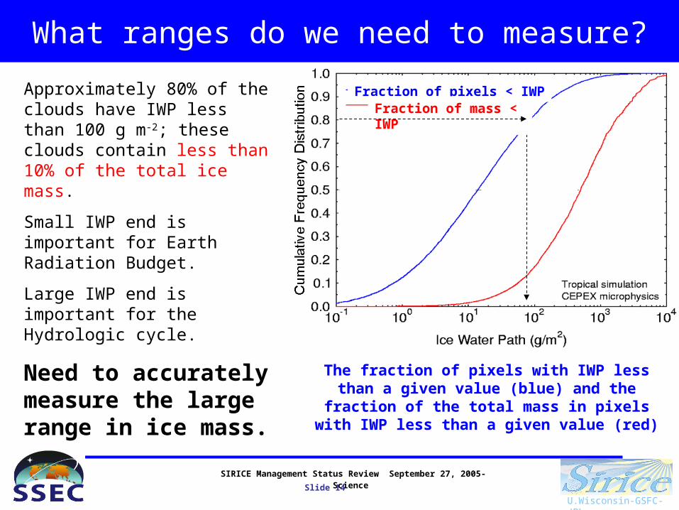
Approximately 80% of the clouds have IWP less than 100 g m-2; these clouds contain less than 10% of the total ice mass.
Small IWP end is important for Earth Radiation Budget.
Large IWP end is important for the Hydrologic cycle.
Need to accurately measure the large range in ice mass.
The fraction of pixels with IWP less than a given value (blue) and the fraction of the total mass in
pixels with IWP less than a given value (red)
Fraction of pixels < IWPFraction of mass < IWP
SIRICE Management Status Review September 27, 2005- Science
Slide 15
U.Wisconsin-GSFC-JPL
Science Requirement: Range
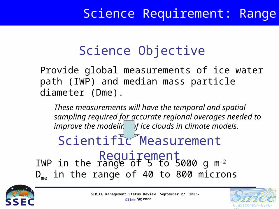
Provide global measurements of ice water path (IWP) and median mass particle diameter (Dme).
These measurements will have the temporal and spatial sampling required for accurate regional averages needed to improve the modeling of ice clouds in climate models.
Scientific Measurement RequirementIWP in the range of 5 to 5000 g m-2
Dme in the range of 40 to 800 microns
Science Objective

SIRICE Management Status Review September 27, 2005- Science
Slide 16
U.Wisconsin-GSFC-JPL
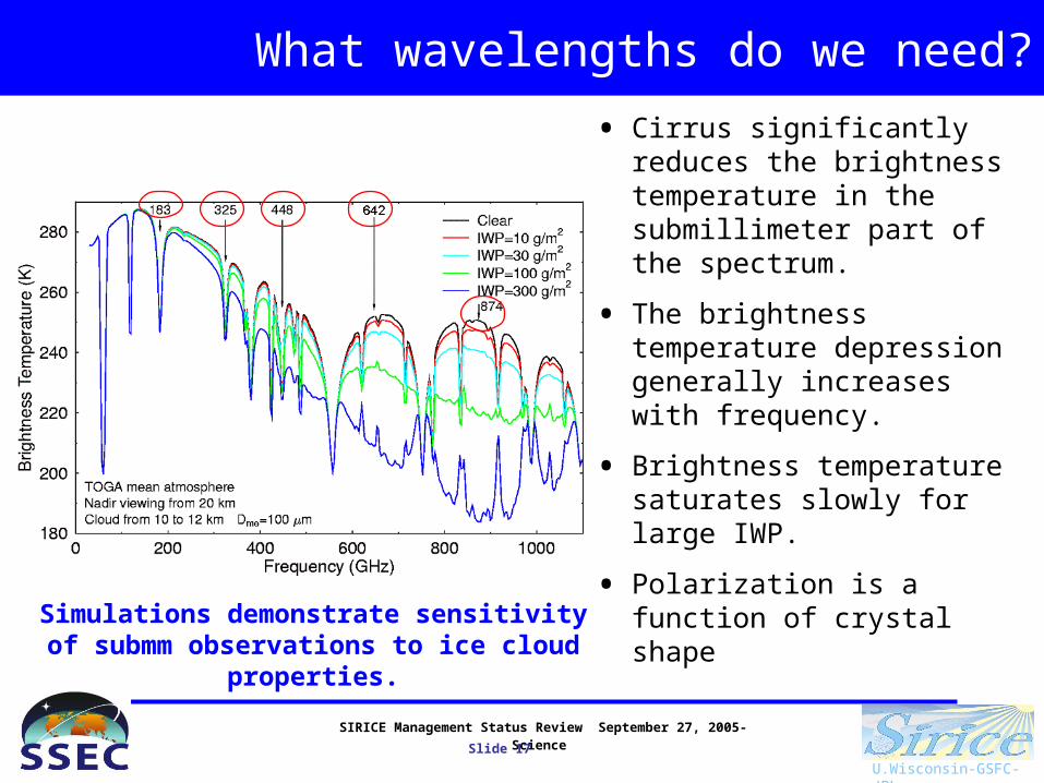
What wavelengths do we need?
• Below 1500 GHz radiation interacts with ice particles primarily by scattering.
• The change in the upwelling brightness temperature (Tb) compared to clear sky is a function of IWP and particle size.
• Submillimeter-wave radiation is emitted upwards by water vapor in the opaque lower troposphere.
The physics of the measurements is well known.
SIRICE Management Status Review September 27, 2005- Science
Slide 17
U.Wisconsin-GSFC-JPL
What wavelengths do we need?
• Cirrus significantly reduces the brightness temperature in the submillimeter part of the spectrum.
• The brightness temperature depression generally increases with frequency.
• Brightness temperature saturates slowly for large IWP.
• Polarization is a function of crystal shape
Simulations demonstrate sensitivity of submm observations to ice cloud properties.

SIRICE Management Status Review September 27, 2005- Science
Slide 18
U.Wisconsin-GSFC-JPL
What wavelengths do we need?
• A demonstration of the retrieval and its errors: IWP and median mass diameter (with error bars) are retrieved with a Bayesian algorithm (Evans et al., JGR, Feb 2002) (see top figure). Validation is accomplished through comparison with the vertically integrated radar reflectivity. (see bottom figure). The retrieval applied to CoSSIR measurements agrees very well with radar reflectivity
Channel selection based on detailed trade studies.

SIRICE Management Status Review September 27, 2005- Science
Slide 19
U.Wisconsin-GSFC-JPL
What wavelengths do we need?
• Retrieval errors in IWP as a function of IWP for combination of Submm, IR and Stereo.
• This is a result of detailed sensitivity studies to determine the optimum set of wavelengths and noise requirements for meeting retrieval requirements.
• One frequency with two linear polarization to determine particle shape.
• Knowledge of cloud altitude improves retrievals for less than 25 g m-2, more than 50% of the observed ice cloud frequency.
Channel selection based on detailed trade studies.

SIRICE Management Status Review September 27, 2005- Science
Slide 20
U.Wisconsin-GSFC-JPL
What is new and unique?
Submm is more then an evolution of existing observations – provides new spectral measurements of clouds at Submm wavelengths that compliment planned solar, infrared and microwave observations
When integrated with other coincident satellite measurements, Submm will uniquely provide the first complete description of the hydrometeor
content and structure of cloud systems.
MicrowaveCIMS
Solar, InfraredVIIRS
SIRICE
SIRICE Management Status Review September 27, 2005- Science
Slide 21
U.Wisconsin-GSFC-JPL
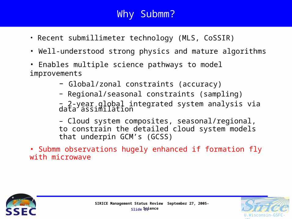
Why Submm?
• Recent submillimeter technology (MLS, CoSSIR)
• Well-understood strong physics and mature algorithms
• Enables multiple science pathways to model improvements– Global/zonal constraints (accuracy)– Regional/seasonal constraints (sampling)– 2-year global integrated system analysis via data assimilation
– Cloud system composites, seasonal/regional, to constrain the detailed cloud system models that underpin GCM’s (GCSS)
• Submm observations hugely enhanced if formation fly with microwave
SIRICE Management Status Review September 27, 2005- Science
Slide 22
U.Wisconsin-GSFC-JPL
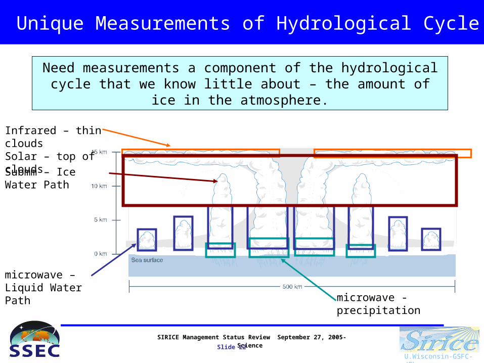
Unique Measurements of Hydrological Cycle
microwave - precipitation
microwave – Liquid Water Path
Infrared – thin cloudsSolar – top of clouds
Submm – Ice Water Path
Need measurements a component of the hydrological cycle that we know little about – the amount of ice in the atmosphere.

SIRICE Management Status Review September 27, 2005- Science
Slide 23
U.Wisconsin-GSFC-JPL
Science Requirement: Complete Range
Scientific Measurement Requirement
IWP in the range of 5 to 5000 g m-2
Dme in the range of 40 to 800 micron
Instrument Functional RequirementTwo instruments:
Infrared and submillimeter wavelengths
Rigorous and comprehensive trade studies show….

SIRICE Management Status Review September 27, 2005- Science
Slide 24
U.Wisconsin-GSFC-JPL
Science Pathway
It is not enough to observe the zonal mean variables. Need observations as a function of process.
Convective and synoptic systems transport ice into the upper troposphere. Need to resolve these processes to improve models.
Large scale lifting
Convection
Latitude
Cloud ice generation in mm/day by ECMWF, July

SIRICE Management Status Review September 27, 2005- Science
Slide 25
U.Wisconsin-GSFC-JPL
Science Pathway
Scientific Measurement RequirementDaily near-global coverageSample storm system spatial resolution – convective and synoptic
Robust regional/seasonal statistics and data assimilation for global description of complete cloud component of global hydrological cycle.
=> wide swath for global coverage
Process resolving analysis and cloud system modeling. => Resolution
SIRICE Management Status Review September 27, 2005- Science
Slide 26
U.Wisconsin-GSFC-JPL
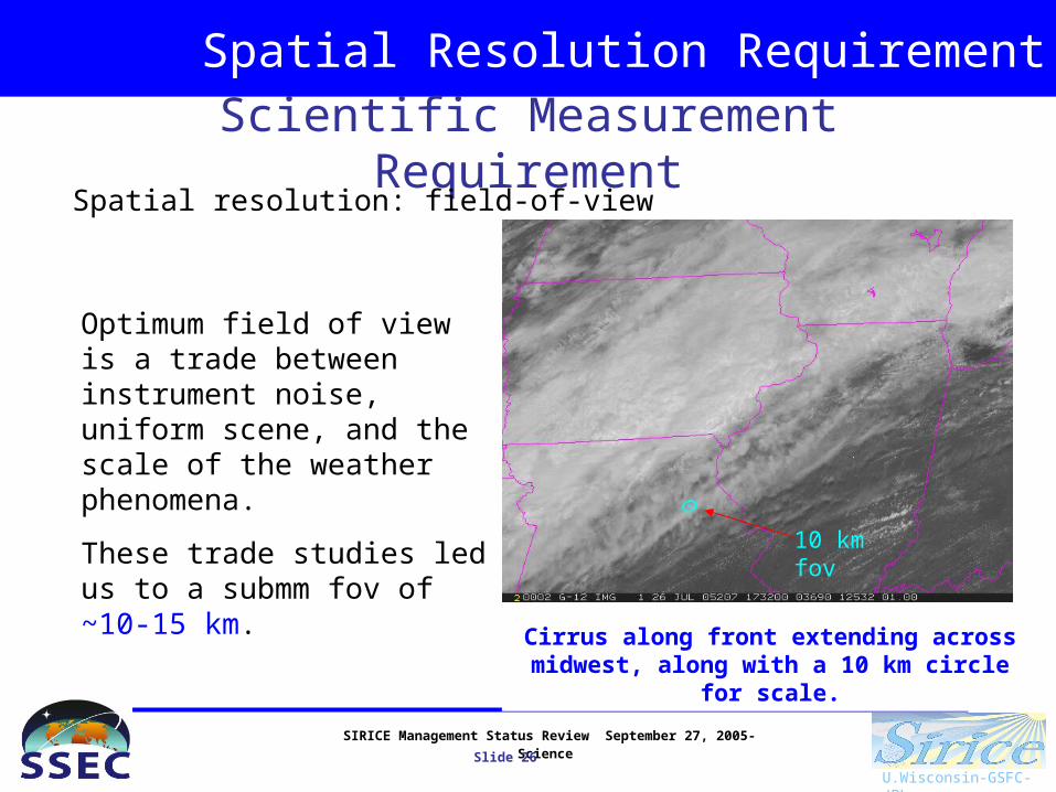
Spatial Resolution Requirement
Scientific Measurement RequirementSpatial resolution: field-of-view
Optimum field of view is a trade between instrument noise, uniform scene, and the scale of the weather phenomena.
These trade studies led us to a submm fov of ~10-15 km.
Cirrus along front extending across midwest, along with a 10 km circle for scale.
10 km fov
SIRICE Management Status Review September 27, 2005- Science
Slide 27
U.Wisconsin-GSFC-JPL
Spatial Coverage Requirement
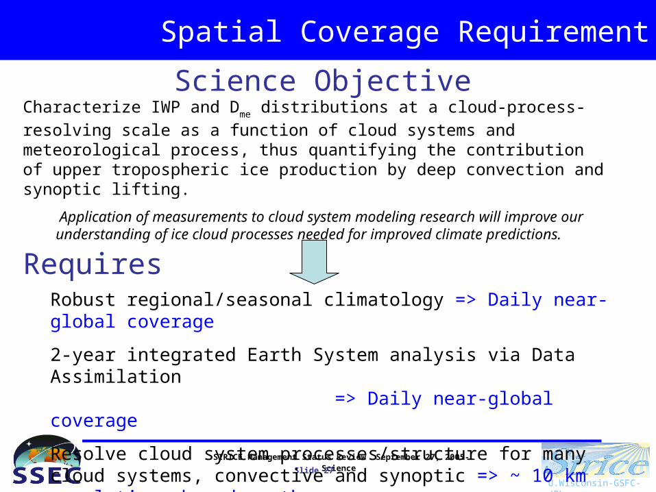
Characterize IWP and Dme distributions at a cloud-process-resolving scale as a
function of cloud systems and meteorological process, thus quantifying the contribution of upper tropospheric ice production by deep convection and synoptic lifting.
Application of measurements to cloud system modeling research will improve our understanding of ice cloud processes needed for improved climate predictions.
Requires
Science Objective
Robust regional/seasonal climatology => Daily near-global coverage
2-year integrated Earth System analysis via Data Assimilation => Daily near-global coverage
Resolve cloud system processes/structure for many cloud systems, convective and synoptic => ~ 10 km resolution, broad swath coverage
SIRICE Management Status Review September 27, 2005- Science
Slide 29
U.Wisconsin-GSFC-JPL
Spatial Coverage Requirement
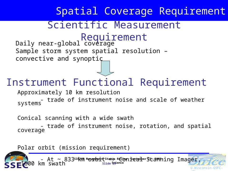
Scientific Measurement RequirementDaily near-global coverageSample storm system spatial resolution – convective and synoptic
Instrument Functional RequirementApproximately 10 km resolution
- trade of instrument noise and scale of weather systems
Conical scanning with a wide swath
- trade of instrument noise, rotation, and spatial coverage
Polar orbit (mission requirement)
- At ~ 833 km orbit => Conical Scanning Imager, ~1600 km swath

SIRICE Management Status Review September 27, 2005- Science
Slide 30
U.Wisconsin-GSFC-JPL
Orbit Selection
Scientific Measurement RequirementDaily near-global coverageApproximately 10 km resolution
Mission Functional RequirementSun-synchronous, morning/evening orbit
=> captures convection over tropical waters (morning, ice lags precip max) and continents (evening), fly with planned satellite that have visible, infrared and microwave measurements to allow complete cloud system characterization.
TRMM observations help with selecting equatorial crossing
SIRICE Management Status Review September 27, 2005- Science
Slide 31
U.Wisconsin-GSFC-JPL
Summary: Science Objectives
Provide global measurements of ice water path (IWP) and weighted median mass particle diameter (Dme).
These measurements will have the temporal and spatial sampling required for accurate regional averages needed to improve the modeling of ice clouds in climate models.
Characterize IWP and Dme distributions at a cloud-process-resolving scale as
a function of cloud systems and meteorological process, thus quantifying the contribution of upper tropospheric ice production by deep convection and synoptic lifting.
Application of measurements to cloud system modeling research will improve our understanding of ice cloud processes needed for improved climate predictions.