USACE Levee Risk Assessment Process – Lessons Learned€¦ · 92 56 62 102 130 102 56 48 130 120...
15
217 217 217 200 200 200 255 255 255 0 0 0 163 163 163 131 132 122 239 65 53 110 135 120 112 92 56 62 102 130 102 56 48 130 120 111 237 237 237 80 119 27 252 174 .59 Thomas Terry, PE, PG USACE-IWR RMC 14September 2017 USACE LEVEE RISK ASSESSMENT PROCESS – LESSONS LEARNED 1 Levee Risk Assessments Lessons Learned
-
Upload
truongtuong -
Category
Documents
-
view
219 -
download
0
Transcript of USACE Levee Risk Assessment Process – Lessons Learned€¦ · 92 56 62 102 130 102 56 48 130 120...
217217217
200200200
255255255
000
163163163
131132122
2396553
110135120
1129256
62102130
1025648
130120111
237237237
8011927
252174.59
Thomas Terry, PE, PG USACE-IWR RMC14September 2017
USACE LEVEE RISK ASSESSMENT PROCESS –LESSONS LEARNED
1
Levee Risk Assessments Lessons Learned
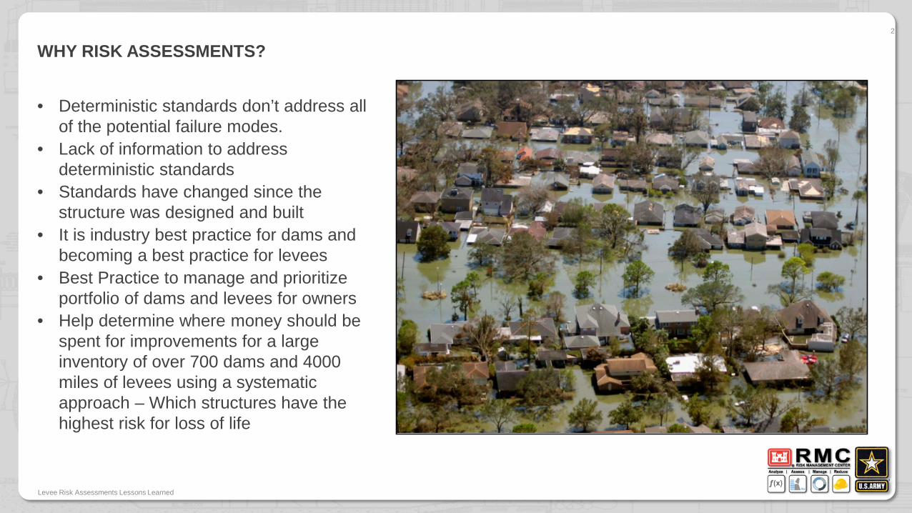
WHY RISK ASSESSMENTS?
• Deterministic standards don’t address all of the potential failure modes.
• Lack of information to address deterministic standards
• Standards have changed since the structure was designed and built
• It is industry best practice for dams and becoming a best practice for levees
• Best Practice to manage and prioritize portfolio of dams and levees for owners
• Help determine where money should be spent for improvements for a large inventory of over 700 dams and 4000 miles of levees using a systematic approach – Which structures have the highest risk for loss of life
Levee Risk Assessments Lessons Learned
2
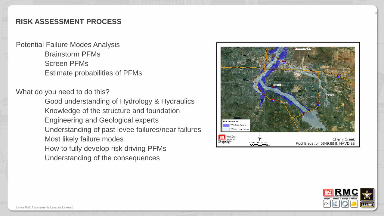
RISK ASSESSMENT PROCESS
Potential Failure Modes AnalysisBrainstorm PFMsScreen PFMsEstimate probabilities of PFMs
What do you need to do this?Good understanding of Hydrology & HydraulicsKnowledge of the structure and foundationEngineering and Geological expertsUnderstanding of past levee failures/near failures Most likely failure modesHow to fully develop risk driving PFMsUnderstanding of the consequences
Levee Risk Assessments Lessons Learned
3
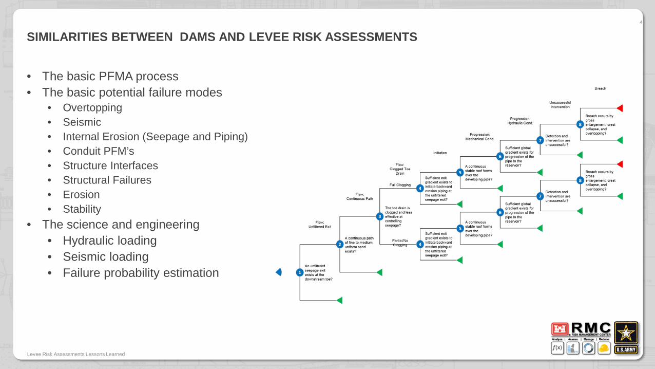
SIMILARITIES BETWEEN DAMS AND LEVEE RISK ASSESSMENTS
• The basic PFMA process• The basic potential failure modes
• Overtopping • Seismic• Internal Erosion (Seepage and Piping)• Conduit PFM’s• Structure Interfaces• Structural Failures• Erosion• Stability
• The science and engineering• Hydraulic loading• Seismic loading• Failure probability estimation
Levee Risk Assessments Lessons Learned
4
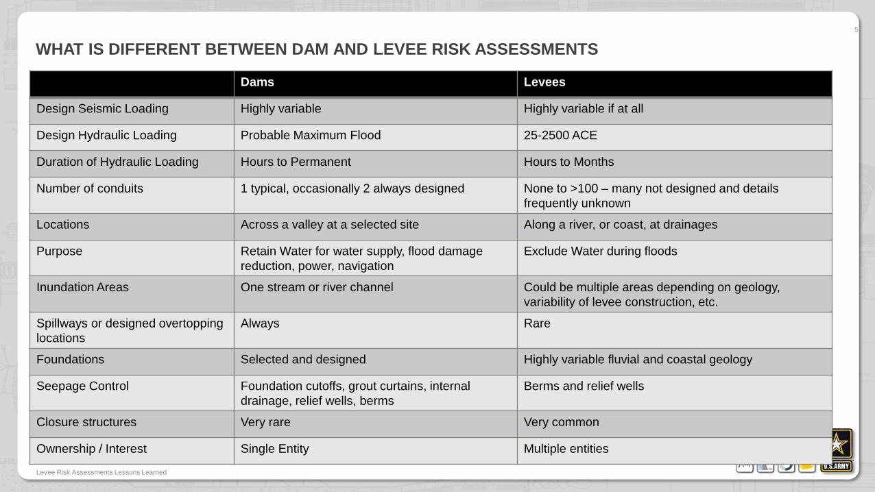
WHAT IS DIFFERENT BETWEEN DAM AND LEVEE RISK ASSESSMENTS
Dams Levees
Design Seismic Loading Highly variable Highly variable if at all
Design Hydraulic Loading Probable Maximum Flood 25-2500 ACE
Duration of Hydraulic Loading Hours to Permanent Hours to Months
Number of conduits 1 typical, occasionally 2 always designed None to >100 – many not designed and details frequently unknown
Locations Across a valley at a selected site Along a river, or coast, at drainages
Purpose Retain Water for water supply, flood damage reduction, power, navigation
Exclude Water during floods
Inundation Areas One stream or river channel Could be multiple areas depending on geology, variability of levee construction, etc.
Spillways or designed overtopping locations
Always Rare
Foundations Selected and designed Highly variable fluvial and coastal geology
Seepage Control Foundation cutoffs, grout curtains, internal drainage, relief wells, berms
Berms and relief wells
Closure structures Very rare Very common
Ownership / Interest Single Entity Multiple entities
Levee Risk Assessments Lessons Learned
5
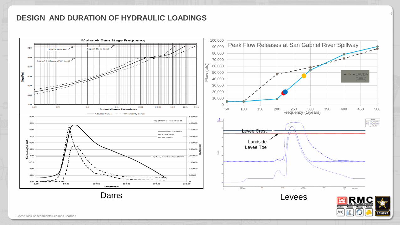
DESIGN AND DURATION OF HYDRAULIC LOADINGS6
Levee Risk Assessments Lessons Learned
0
10,000
20,000
30,000
40,000
50,000
60,000
70,000
80,000
90,000
100,000
50 100 150 200 250 300 350 400 450 500
Flow
(cfs
)
Frequency (1/years)
Peak Flow Releases at San Gabriel River Spillway
LACDA(1991)
Landside Levee Toe
Levee Crest
Dams Levees
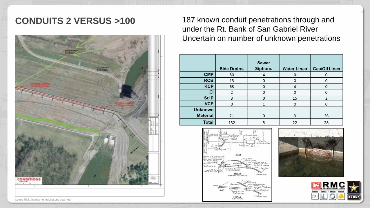
CONDUITS 2 VERSUS >1007
Levee Risk Assessments Lessons Learned
187 known conduit penetrations through and under the Rt. Bank of San Gabriel RiverUncertain on number of unknown penetrations
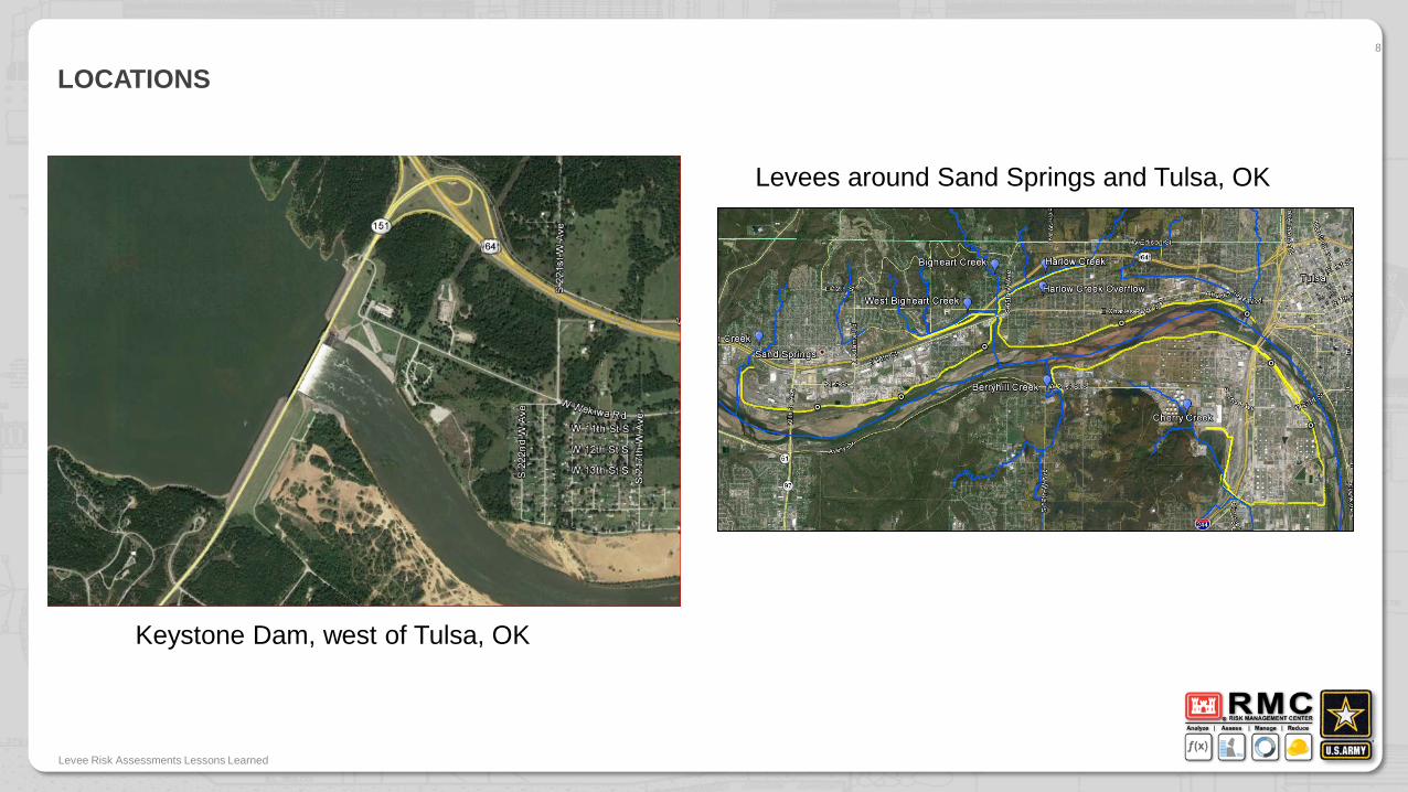
LOCATIONS8
Levee Risk Assessments Lessons Learned
Levees around Sand Springs and Tulsa, OK
Keystone Dam, west of Tulsa, OK
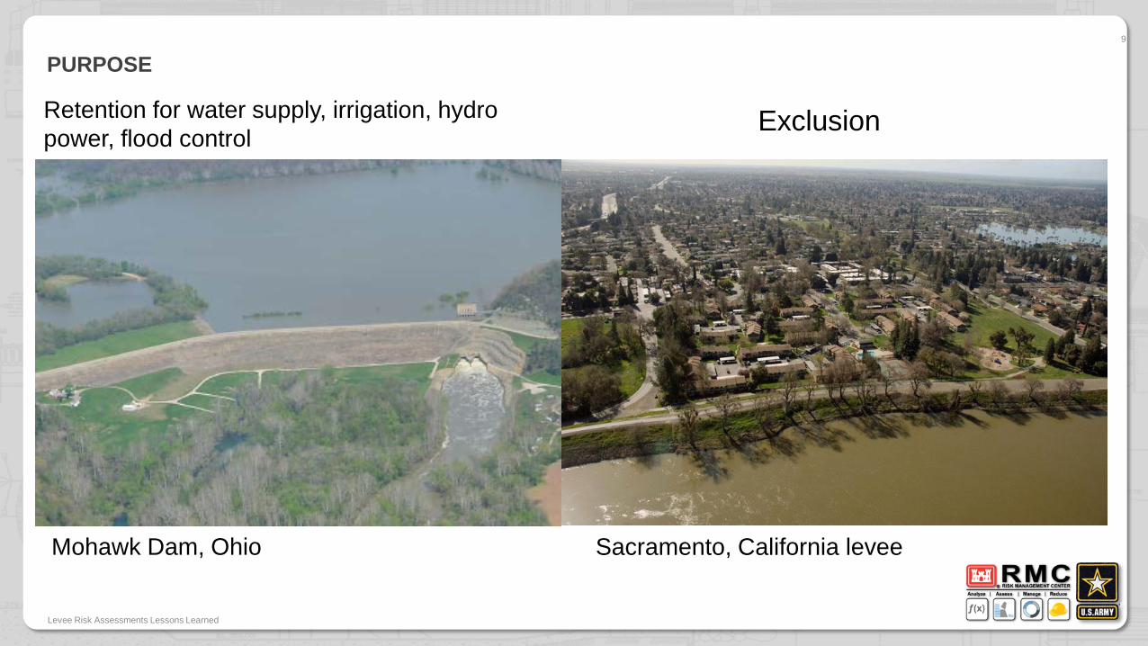
PURPOSE9
Levee Risk Assessments Lessons Learned
Mohawk Dam, Ohio Sacramento, California levee
Retention for water supply, irrigation, hydro power, flood control Exclusion
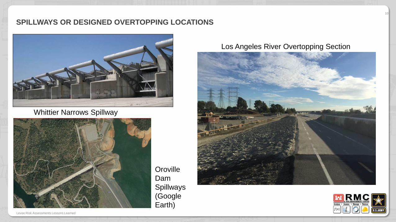
SPILLWAYS OR DESIGNED OVERTOPPING LOCATIONS10
Levee Risk Assessments Lessons Learned
Whittier Narrows Spillway
Los Angeles River Overtopping Section
Oroville Dam Spillways (Google Earth)
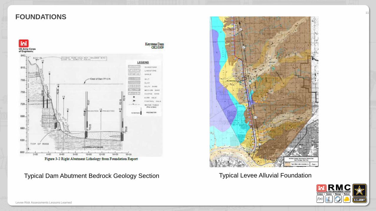
FOUNDATIONS11
Levee Risk Assessments Lessons Learned
Typical Dam Abutment Bedrock Geology Section Typical Levee Alluvial Foundation
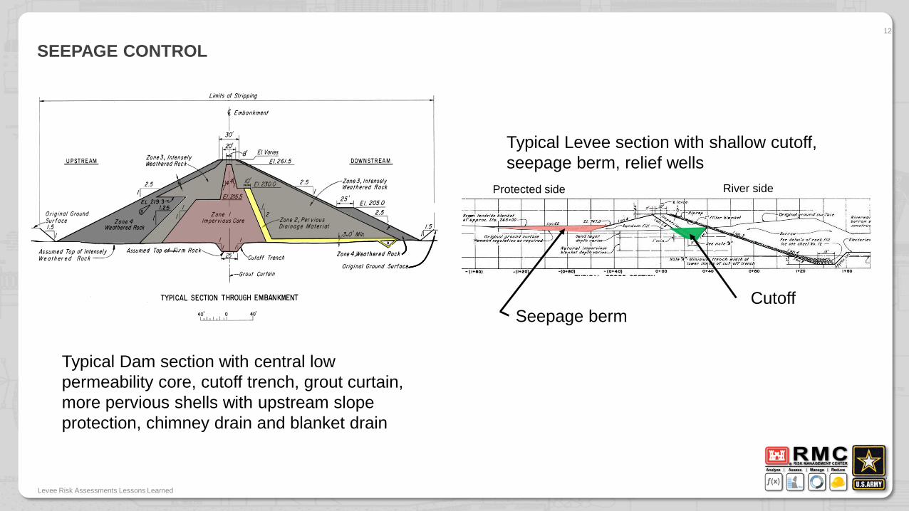
SEEPAGE CONTROL12
Levee Risk Assessments Lessons Learned
Typical Dam section with central low permeability core, cutoff trench, grout curtain, more pervious shells with upstream slope protection, chimney drain and blanket drain
Typical Levee section with shallow cutoff, seepage berm, relief wells
CutoffSeepage berm
Protected side River side
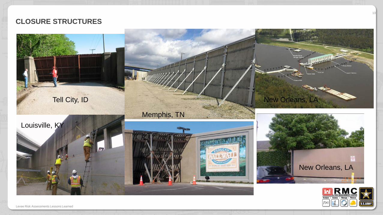
CLOSURE STRUCTURES13
Levee Risk Assessments Lessons Learned
Tell City, ID
Louisville, KYMemphis, TN
New Orleans, LA
New Orleans, LA

OWNERSHIP / INTERESTLocal Drainage and Flood Control District County GovernmentCity GovernmentState Government
• Any of the above can be a local sponsor for USACE flood control projects including levees for joint construction cost sharing – These levee projects are then turned over to the local sponsor for O&M. Some local sponsor have their own consultants, or engineering staff in addition to maintenance staffs.
• Federal Levee Systems – These vary from large ones that are part of the Mississippi River and Tributaries (MR&T) to pieces of local projects that for various reasons O&M remained with USACE. Some other federal agencies also have levee systems
• Locally built levees are eligible for repair and rehabilitation through PL84-99 once they are accepted into the system by USACE. These levee systems require annual inspections after initial acceptance.
Levee Risk Assessments Lessons Learned
14
Public Law (PL) 84-99 enables USACE to provide technical assistance for flood preparedness, response & recovery to include consequences reduction measures
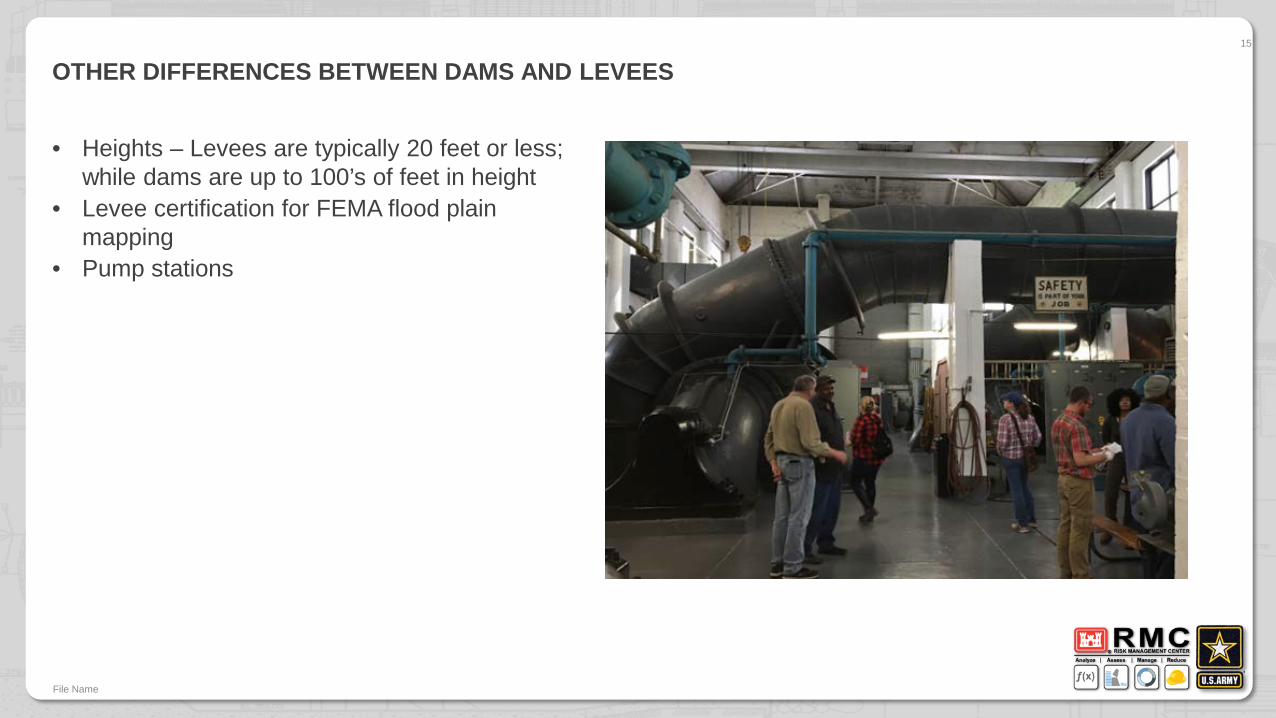
OTHER DIFFERENCES BETWEEN DAMS AND LEVEES
• Heights – Levees are typically 20 feet or less; while dams are up to 100’s of feet in height
• Levee certification for FEMA flood plain mapping
• Pump stations
File Name
15