Urbanization and Land Cover Change in Dakota County, Minnesota Kylee Berger and Julia Vang FR 3262...
17
Urbanization and Land Cover Change in Dakota County, Minnesota Kylee Berger and Julia Vang FR 3262 Remote Sensing Section 001/002
-
Upload
frank-dean -
Category
Documents
-
view
220 -
download
2
Transcript of Urbanization and Land Cover Change in Dakota County, Minnesota Kylee Berger and Julia Vang FR 3262...

Urbanization and Land Cover Change in Dakota County, MinnesotaKylee Berger and Julia VangFR 3262 Remote SensingSection 001/002
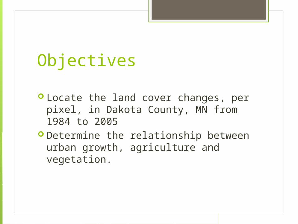
Objectives
Locate the land cover changes, per pixel, in Dakota County, MN from 1984 to 2005
Determine the relationship between urban growth, agriculture and vegetation.

Area of Study
Dakota County, Minnesota

Materials, Tools, and Data
Landsat TM images 1984 2005
MN Data Deli ArcGIS ERDAS Imagine 2011 Dakota County GIS

Methodology In ERDAS- changed Landsat imagery to UTM
zone 15 N In ERDAS- clipped Dakota county out of our
twin cities Landsat images Ran supervised classification on both 1984 and
2005 images Ran Thematic Change detection
“From-to” detection Imported to Arc GIS to display where the changes
between the years occurs using transparency Performed accuracy assessment of both
images

Classification Supervised classification
20 training points for all 6 Classes Urban Agriculture Water Wetland Herbaceous Forest

Dakota County 1984 Classified
URBAN
FOREST
AGRICULTURE
HERBACOUS
WETLAND
WATER

Dakota County 2005 Classified
URBAN
FOREST
AGRICULTURE
HERBACOUS
WETLAND
WATER

Thematic Change Detection Ran a Matrix Union to find all the
changed pixels Used “Summary Report of Matrix” to see
the percent of change and the number of acres that changed Focused on what classes changed to
urban and agriculture

Thematic Change Detection
URBAN
AGRICULTURE
HERBACOUS/FOREST
WATER/WETLAND
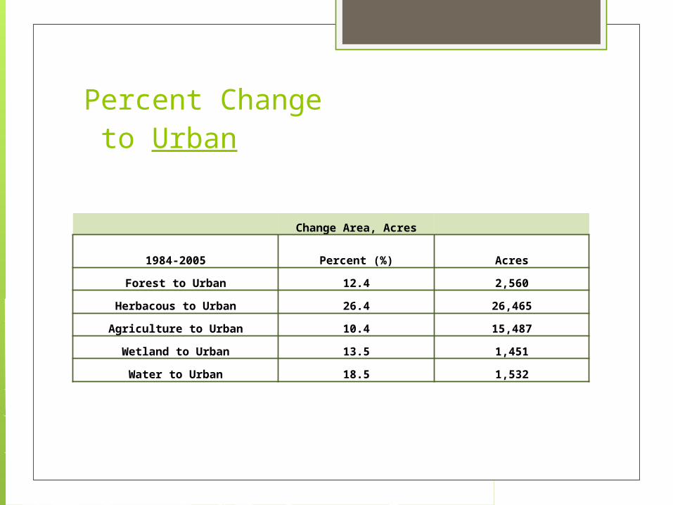
Percent Change to Urban
Change Area, Acres
1984-2005 Percent (%) Acres
Forest to Urban 12.4 2,560
Herbacous to Urban 26.4 26,465
Agriculture to Urban 10.4 15,487
Wetland to Urban 13.5 1,451
Water to Urban 18.5 1,532

Percent Change to Agriculture
Change Area, Acres
1984-2005 Percent (%) Acres
Forest to Agriculture 37.1 17,283
Herbaceous to Agriculture 31.2 31,242
Wetland to Agriculture 30.2 2,500
Water to Agriculture 9.9 1,068
Urban to Agriculture 20.5 12,488

Accuracy Assessment 1984 Classification Accuracy of 68.6%
Class Reference Classified Number Producers Users
Name Totals Totals Correct Accuracy Accuracy
FOREST 12 11 9 75.00% 81.82%
URBAN 12 12 9 75.00% 75.00%
AGRICULTURE 16 14 9 56.25% 64.29%
HERBACOUS 14 13 10 71.43% 76.92%
WETLAND 6 10 3 50.00% 30.00%
WATER 10 10 8 80.00% 80.00%
Totals 70 70 48

Accuracy Assessment 2005
Class Reference Classified Number Producers Users Name Totals Totals Correct Accuracy Accuracy Urban 10 12 8 80.00% 66.67%
Agriculture 20 14 11 55.00% 78.57% Herbaceous 9 13 5 55.56% 38.46%
Wetland 5 10 4 80.00% 40.00% Water 10 10 10 100.00% 100.00%
Forest 16 11 11 68.75% 100.00%Totals 70 70 49
Classification Accuracy Percent of 70.0%

Conclusions The land use/cover in Dakota County,
MN like almost everywhere is being developed into Urban areas and Agriculture fields.
Forests and Herbaceous lands are being developed to support the growing population

Future Studies Images with less or zero percent cloud
cover Images where dates/years all match up Better knowledge of programs, images,
and study area Create an error matrix

Questions?


![British Standards [C] 3262 Road Marking Materials](https://static.fdocuments.us/doc/165x107/577c83eb1a28abe054b6d056/british-standards-c-3262-road-marking-materials.jpg)