Unlocking New Insights into Riverscapes with Drone‐based ...
19
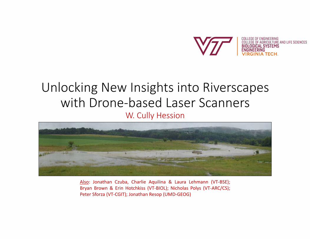
Unlocking New Insights into Riverscapes with Drone‐based Laser Scanners W. Cully Hession Also: Jonathan Czuba, Charlie Aquilina & Laura Lehmann (VT‐BSE); Bryan Brown & Erin Hotchkiss (VT‐BIOL); Nicholas Polys (VT‐ARC/CS); Peter Sforza (VT‐CGIT); Jonathan Resop (UMD‐GEOG)
Transcript of Unlocking New Insights into Riverscapes with Drone‐based ...
Unlocking New Insights into Riverscapes with Drone‐based Laser Scanners
W. Cully Hession
Also: Jonathan Czuba, Charlie Aquilina & Laura Lehmann (VT‐BSE);Bryan Brown & Erin Hotchkiss (VT‐BIOL); Nicholas Polys (VT‐ARC/CS);Peter Sforza (VT‐CGIT); Jonathan Resop (UMD‐GEOG)
Outline
• What is a riverscape?• Riverscapes and complexity• Study area• Lidar background• Drone‐based laser scanner (DLS)• Mapping riverscapes
2
https://www.sulisfineart.com/keith‐burtonshaw‐contemporary‐graphite‐drawing‐riverscape.html
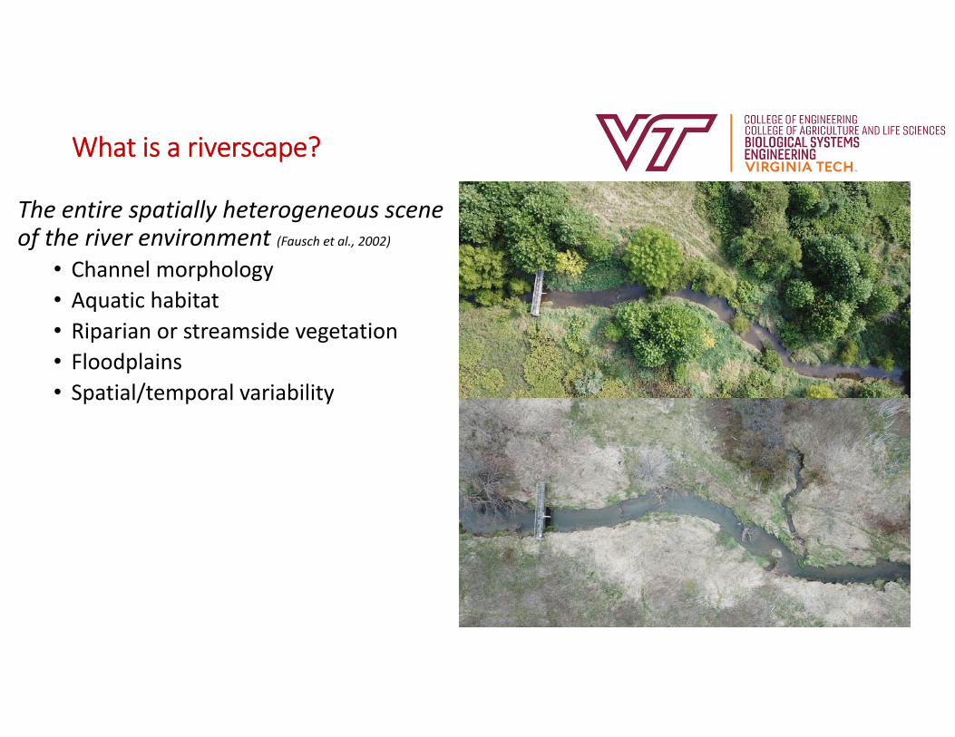
What is a riverscape?
The entire spatially heterogeneous scene of the river environment (Fausch et al., 2002)
• Channel morphology• Aquatic habitat• Riparian or streamside vegetation• Floodplains• Spatial/temporal variability
3
VT Campus
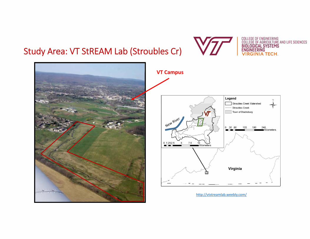
Study Area: VT StREAM Lab (Stroubles Cr)
http://vtstreamlab.weebly.com/

StREAM Lab Resto (temporal variability)
5
1952
2006
2009
2010
2018

Laser Scanning
• Light Detection and Ranging (lidar)• Emitting a laser pulse on a surface• Catching the reflected laser back to the lidar pulse source with sensors• Measuring the time laser travelled• Calculating distance from source [Distance = (Speed of light x Time elapsed)/2]
6https://www.yellowscan‐lidar.com
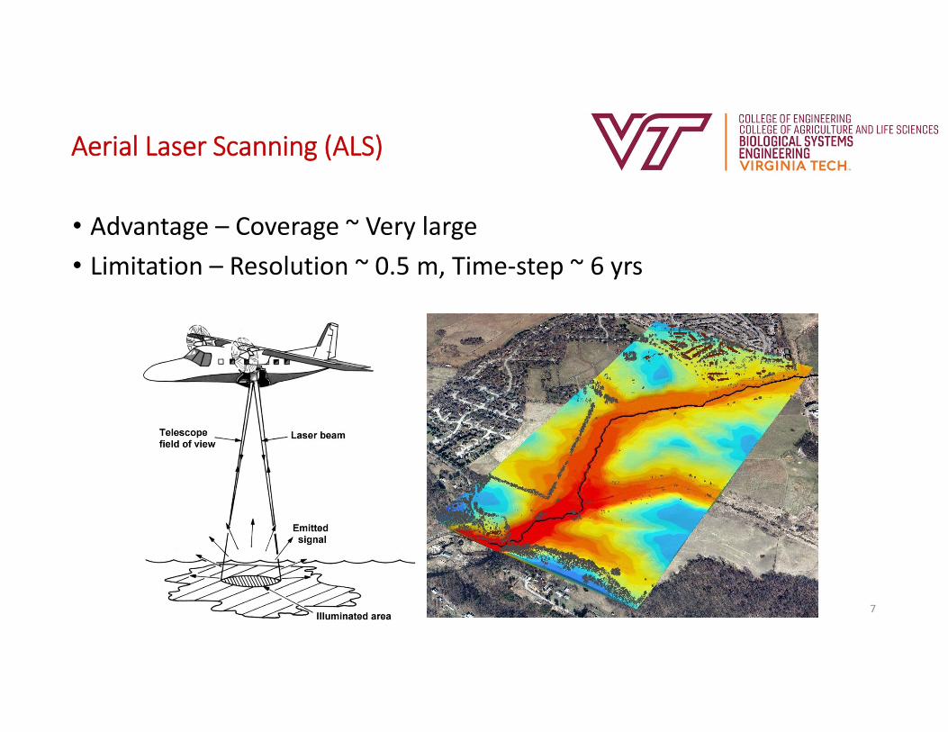
Aerial Laser Scanning (ALS)
• Advantage – Coverage ~ Very large• Limitation – Resolution ~ 0.5 m, Time‐step ~ 6 yrs
7
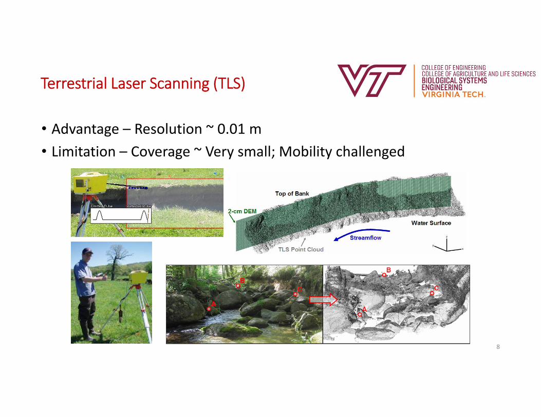
Terrestrial Laser Scanning (TLS)
• Advantage – Resolution ~ 0.01 m• Limitation – Coverage ~ Very small; Mobility challenged
8
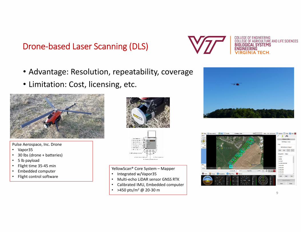
Drone‐based Laser Scanning (DLS)
• Advantage: Resolution, repeatability, coverage• Limitation: Cost, licensing, etc.
9
Pulse Aerospace, Inc. Drone• Vapor35• 30 lbs (drone + batteries)• 5 lb payload• Flight time 35‐45 min• Embedded computer• Flight control software
YellowScan® Core System – Mapper• Integrated w/Vapor35• Multi‐echo LiDAR sensor GNSS RTK• Calibrated IMU, Embedded computer• >450 pts/m2 @ 20‐30 m

ALS vs DLS
• Raw point clouds @ StREAM Lab
10
Data Collection ALS Dec 2016 DLS Mar 2017
Point Density (pts/m2) 4.2 455
Point Spacing (m) 0.5 0.05
Total Points ~850,000 ~90,500,000
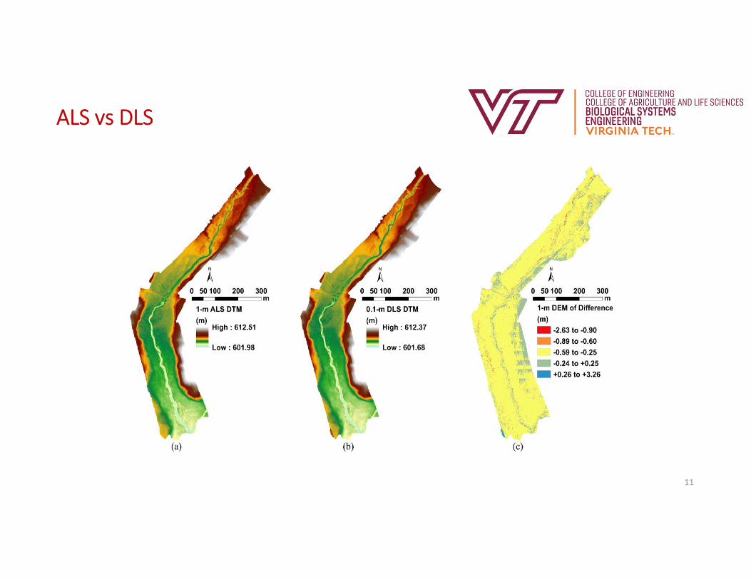
ALS vs DLS
11
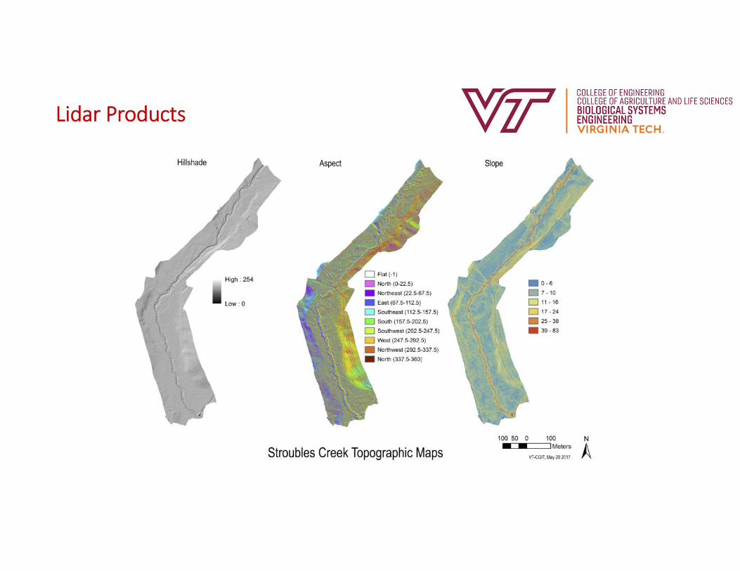
Lidar Products
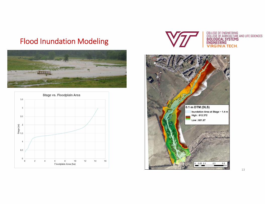
Flood Inundation Modeling
13

Improved Hydrodynamic Modeling
14High flowLow flow
Utilizing HEC‐RAS 2D in near future….

Roughness & Complexity
15
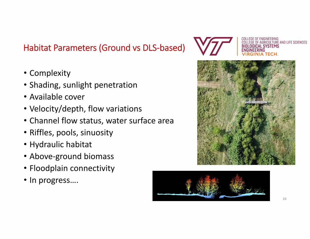
Habitat Parameters (Ground vs DLS‐based)
16
• Complexity• Shading, sunlight penetration• Available cover• Velocity/depth, flow variations• Channel flow status, water surface area• Riffles, pools, sinuosity• Hydraulic habitat• Above‐ground biomass• Floodplain connectivity• In progress….
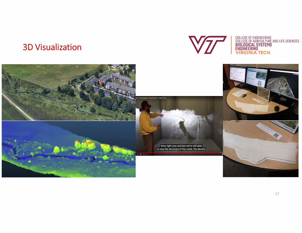
3D Visualization
17
Websites to look at
• Lidar data• http://www.projects2.cgit.vt.edu/streamlab/
• StREAM Lab YouTube site• https://www.youtube.com/channel/UC4liIdTHkvTnKWpGz7uA5pQ
• ARC Vimeo• https://vimeo.com/visionarium2018
• StREAM Lab• http://vtstreamlab.weebly.com/• https://www.bse.vt.edu/research/facilities/StREAM_Lab.html• http://streamlabvisual.weebly.com/
18
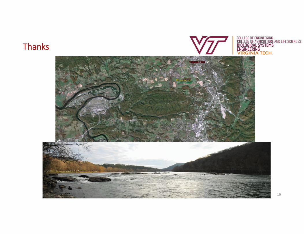
Thanks
19