UNITED STATES DEPARTMENT OF THE INTERIOR …Agnes Cr.) Koyukuk district Gold Wiseman (11.3, 8.7)...
22
UNITED STATES DEPARTMENT OF THE INTERIOR GEOLOGICAL SURVEY SUMMARIES OF DATA ON AND LISTS OF REFERENCES TO METALLIC AND SELECTED NONMETALLIC MINERAL OCCURRENCES IN THE WISEMAN QUADRANGLE, ALASKA, SUPPLEMENT TO OPEN-FILE REPORT 76-340 PART A SUMMARIES OF DATA TO JANUARY 1, 1981 By Edward H. Cobb Open-File Report 81-732A 1981 This report is preliminary and has not been reviewed for conformity with U.S. Geological Survey editorial standards and-stratigraphic nomenclature.
Transcript of UNITED STATES DEPARTMENT OF THE INTERIOR …Agnes Cr.) Koyukuk district Gold Wiseman (11.3, 8.7)...

UNITED STATES DEPARTMENT OF THE INTERIOR GEOLOGICAL SURVEY
SUMMARIES OF DATA ON AND LISTS OF REFERENCES TO
METALLIC AND SELECTED NONMETALLIC MINERAL OCCURRENCES
IN THE WISEMAN QUADRANGLE, ALASKA,
SUPPLEMENT TO OPEN-FILE REPORT 76-340
PART A SUMMARIES OF DATA TO JANUARY 1, 1981
ByEdward H. Cobb
Open-File Report 81-732A
1981
This report is preliminary and has not been reviewed for conformity with U.S. Geological Survey editorial standards and-stratigraphic nomenclature.

Introduction
This report was prepared as a supplement to a 1976 report which sum marized data on mineral occurrences in the Wiseman quadrangle, Alaska (Cobb, E. H., 1976, Summary of references to mineral occurrences (other than mineral fuels and construction materials) in the Chandalar and Wise man quadrangles, Alaska: U.S. Geological Survey Open-File Report 76-340, 205 p.). As a result of suggestions from users of the series of which the 1976 report is a part, this supplement is released in two parts: Part A, which presents summaries of data to January 1, 1981, and Part B, which consists of reference lists for each occurrence.
In Part A data from most reports released between the cut-off date (January 1, 1975) for the original report and January 1, 1981 have been incorporated in rewritten or new summaries where appropriate. For each occurrence described in Part A the name, U.S. Bureau of Mines mining dis trict, reference that has the occurrence plotted on a map on a scale of 1:250,000, list of mineral commodities, and location data are in the same format as in the 1976 report. Also included is a list of synonyms, owners, operators, and claim names.
In both parts citations are in standard bibliographic format with the exception that references to reports and maps in numbered publication series also show, in parentheses, an abbreviation for the report or map series and the number of the report or map. Abbreviations used are:
B U.S. Geological Survey BulletinBMB U.S. Bureau of Mines BulletinC U.S. Geological Survey CircularGC Alaska Division of Geological Survey Geochemical
Report1C U.S. Bureau of Mines Information CircularOF U.S. Geological Survey Open-File ReportMF U.S. Geological Survey Miscellaneous Field Studies
MapP U.S. Geological Survey Professional PaperRI U.S. Bureau of Mines Report of InvestigationsTDM Alaska Territorial Department of Mines PamphletUSBM OF U.S. Bureau of Mines Open-File Report
In Part B citations to the principal references used in preparing summaries in Part A are preceded by an asterisk. The form of citation used in the reference list for each occurrence is considered sufficient identification for each numbered report or map to be found easily in most libraries. Complete references to reports without identifying numbers are listed at the end of Part B.
The following two U.S. Bureau of Mines Open-File Reports were not used in preparing this supplement because descriptions of most occurrences are not sufficiently detailed to allow evaluation of deposits. In many descriptions it is not possible to determine if a potentially valuable mineral was identified or if the report is based solely on an analysis of a sample collected during a geochemical survey. Most specific data are also in other reports, such as Grybeck, 1977 (OF 77-166C).
Staff, Alaska Field Operations Center, 1978, Mineral appraisal of
Al

the proposed Gates of the Arctic Wilderness National Park, Alaska: A preliminary comment: U.S. Bureau of Mines Open- File Report 109-78, 29 p.
Staff, Alaska Field Operations Center, 1979, A mineral appraisal of the areas traversed by the Kobuk, Killik, Alatna and John Rivers and the North Fork of the Koyukuk River, Brooks Range, Alaska: A summary report: U.S. Bureau of Mines Open-File Re port 36-79, 23 p.
A2

(Acme Cr.) Gold
Koyukuk district MF-469, loc. 42
Wiseman (18.65, 8.85) 67°29'N, 150°13'W
A little fine, bright placer gold was recovered from a deep channel that joins the deep channel of Nolan Cr. at a depth reported to be 110 ft be low the surface. No gold in present creek channel.
(Agnes Cr.)
Koyukuk district
Gold
Wiseman (11.3, 8.7) approx. 67°29'N, 151°20'W approx.
Was prospecting and some placer gold mining in "early days" of district.
(Alien R.)
Koyukuk district MF-469, loc. 9
Copper
Wiseman (6.9, 6.75) 67°23'N, 151°59'W
Copper sulfides and malachite stains in Upper Devonian black phyllite and slate unit.
(Archibald Gulch) (Cr.)
Koyukuk district MF-469, loc. 42
Antimony, Gold
Wiseman (18.7-18.75, 8.85) 67°29'N, 150°12'-150°13'W
Short, steep tributary of Nolan Cr. cut in soft schist. Gravel is coarse, subangular, and frozen. In an old channel the depth to bedrock is as much as 25 ft, decreasing upstream; gold all coarse, some smooth and some rough. Some gold in creek gravels is fine and smooth and some is coarse and rough. In bench deposits gold is fine and smooth. A stibnite vein is reported to have been exposed by drift mining; another reported on spur between Archi bald and Smith Gulches. Placer mining before 1909, in 1927, 1933-39, and 1974 was reported. No data on amount of production.
(Big Four Cr.)
Koyukuk district
Gold(?)
Wiseman (15.5, 9.0) approx.(?) 67°30'N, 150°43'W approx.(?)
May have been some placer gold mining in early 1900's. Tributary of Con glomerate Cr.; location uncertain.
Gold
Wiseman (11.05-11.3, 8.0) 67°27'N, 151°19'-151°21'W
(Birch Cr.)
Koyukuk district MF-469, loc. 33
Placer gold discovered in 1904. Mined for about a mile near mouth of Rye Cr. in creek bed and in deposits about 20 ft below a low left-limit bench. In early 1900's production was about 950-1,450 oz of gold. Unknown amount produced more recently; last mining reported was in 1933.
(Blake Cr.) Gold
A3

Koyukuk district Wiseman(?)
Placer gold reported to have been mined in 1907. Location of creek not known; may be a lapsus for Slate Cr.; may be in Chandalar quad.
(Bourbon Cr.) Gold
Koyukuk district Wiseman (12.45, 5.1) MF-469, loc. 37 67°17'N, 151°10'W
Extensive placer gold mining in "early days" of district. Creek mined out
(Bryan Cr.) Gold(?)
Koyukuk district Wisemanquad.
Placer gold reported in 1900; pay streak said to be quite wide. Bryan Cr not shown on available maps; may be old name for Midas Cr. or Crevice Cr.
(Canyon Cr.) Gold
Koyukuk district Wiseman (19.2, 10.0)67°33'N, 150°08'W
Traces of placer gold in canyon in lower reaches of creek,
(Chapman Cr.) Gold
Koyukuk district Wiseman (17.25-17.7, 2.0) MF-469, Iocs. 56, 57 67°06'N, 150°25'-150°29'W
Holes sunk 9-14 ft near mouth discovered placer gold on false bedrock. Bench gravels 2 mi above mouth also contained some gold. Lack of water discouraged mining.
(Clara Gulch) (Cr.) Gold
Koyukuk district Wiseman (19.5, 5.3) MF-469, loc. 50 67°17'N, 150°08'W
Placer gold discovered in 1900 following the discoveries on Slate and Myrtle Creeks. In 1900 a nugget weighing 18 oz and worth about $300 was found. Mining was in 1900-01 and 1934. Amount of production uncertain; probably not much more than 175 oz.
(Colorado Cr.) Gold
Koyukuk district Wiseman (2.0, 6.6) >approx. MF-469, loc. 63 67°23'N, 152°43'W approx.
A prospector reported that fine gold with abundant magnetite and few gar nets was found in gravel on schist bedrock. Small-scale mining in 1937. Includes references to: (Mecklenberg Cr.), (Mettenpherg Cr.).
(Confederate Gulch) (Cr.) Gold
Koyukuk district Wiseman (19.65, 8.5)
A4

MF-469, loc. 45 - 67°28'N, 150°05'W
Coarse placer gold found, but not in paying quantities.
(Congolmerate Cr.) Gold
Koyukuk district Wiseman (15.75, 8.75) approx.67°29'N, 150°46'W approx.
Good prospects and some placer gold mining in "early days" of district. Many conglomerate boulders in creek hampered mining.
(Cow Cr.) Copper
Koyukuk district Wiseman (19.25, 7.4) MF-469, loc. 18 67°24'N, 150°09'W
Copper sulfides and malachite stains in schist and marble unit of Devonian(?) age.
(Crevice Cr.) Copper, Gold, Lead
Koyukuk district Wiseman (7.15-7.5, 6.25-6.45) MF-469, Iocs. 10. 26 67°21'-67°22'N, 151°53'-151°56'W
Small placer gold production. Stream said to run on bedrock and gold to be in crevices and pot holes in schist-marble unit. Upstream from placer mine galena and copper minerals occur in Devonian Ska jit Limestone about ^ mi from a small body of mafic rock.
(Eagle Cliff) (Bluff) Gold
Koyukuk district Wiseman (20.45, 1.35) MF-469, loc. 62 67°03'N, 150°01'W
Well-washed gravel on a rock-cut bench 10-12 ft above low-water stage of South Fork, Koyukuk R. contains rounded pieces of gold about the size of a grain of wheat. Through 1910 production was worth about $2,500 (about 120 oz).
(Eagle Gulch) Gold
Koyukuk district Wiseman (11.2, 7.25) approx. MF-469, loc. 33 67°24'N, 151°20'W approx.
A little placer gold was found near mouth of gulch; small tributary of Jay Cr.
(East Cr.) Gold
Koyukuk district Wiseman (12.6, 6.55) approx.67°22'N, 151°08'W approx.
Good placer gold prospects reported; bedrock is schist. Location on creek not given.
(Emma Cr.) Gold
A5

Koyukuk district MF-469, loc. 48
Wiseman (18.55-19.15, 6.05-6.15) 67°19 ! -67°20'N, 150°10 ! -150°15 ! W
Placer gold discovered in 1900. Near mouth a canyon has been cut in crys talline limestone and schist in bottom of an older, wider valley. Some gold in old gravels on top of canyon walls, but most is in stream gravel in and near canyon. Mining has been small scale; most recently reported in 1974, but most was probably before 1930. Total production was probably between $160,000 and $200,000 (7,700 to 9,700 oz.).
(Emma Dome)
Koyukuk district MF-469, loc. 17
Gold, Silver
Wiseman (17.5, 6.05) 67°19'N, 150°25'W
Gold and silver in a quartz vein. Only evidence for a bedrock source for gold in placers south of Wiseman.
(Fall Cr.)
Koyukuk district
Gold
Wiseman (12.25, 5.3) approx. 67°17'N, 151°11'W approx.
Good placer gold prospects reported to have been found in "early days" of district.
(Fay Gulch) (Cr.)
Koyukuk district MF-469, loc. 42
Gold
Wiseman (18.8-18.9, 9.0) 67°29'N, 150°11 ! -150°12 I W
Tributary of Nolan Cr. that drains a mineralized zone. By 1937 the present channel and a deep (20 ft) channel near Nolan Cr. were considered mined out. A high channel had been prospected and some mining was reported. Placer gold is rough and angular with quartz attached. Early (1901-09) production was worth $30,000 (about 1,450 oz). Some recent (probably post-World War II) mining reported. See also (Smith Creek Dome).
Ferguson
Koyukuk district MF-469, loc. 20
Antimony, Gold
Wiseman (19.15, 8.55) 67°28'N, 150°09'W
Pit between heads of Smith and Union Gulches exposed a 6-in-wide vein that contains kernels of coarsely crystalline stibnite in earthy matrix of yel low antimony oxides. Samples of quartz-stibnite veins contain detectable gold. Includes references to (Midnight Dome).
(Fool Cr.)
Koyukuk district
Gold
Wiseman (5.2, 5.35) approx.(?) 67°28'N, 152°14'W approx.(?)
Encouraging placer gold prospects were found in early 1900's. Mining in 1922 was reported. See also (Midas Cr.). Includes references to (Sixty- mile R.)
A6

(Frisbe Cr.) Gold(?)
Koyukuk district Wiseman (17.7, 0.5) approx.(?)67°00'N, 150°25'W approx.(?)
Prospecting and placer gold mining in "early days" of district reported. Location uncertain; right-limit tributary of South Fork, Koyukuk R.
(Fryingpan Bar) Gold
Koyukuk district Wiseman (17.2, 2.1)67°06'N, 150°29'W
Part of an old high channel of Middle Fork, Koyukuk R. was mined for placer gold in 1908.
(Galena Cr.) Lead
Koyukuk district Wiseman (10.7, 5.3) MF-469, loc. 36 67°18'N, 151°25 r W
Large piece of galena found in creek bed.
(Grubstake Bar) Gold
Koyukuk district Wiseman (17.7, 0.5) approx. MF-469, loc. 61 67°00'N, 150°25'W approx.
Low bench deposit or bar of present stream. A few thousand dollars worth of placer gold was sluiced in 1900-01.
(Hamil Bar) Gold
Koyukuk district Wiseman (16.5, 1.75) approx.67°05'N, 150°35'W approx.
Secondary placer gold concentration in fan of a small stream flowing into Middle Fork, Koyukuk R. was mined by hand methods in "early days" of district
(Hammond R.)(Cr.) Gold, Lead
Koyukuk district Wiseman (19.45-19.95, 8.9-9.45) MF-469, Iocs. 23, 41 67°29'-67°31'N, 150°02'-150°06'W
A major tributary of Middle Fork, Koyukuk R.; gold found only in lower 13 mi of its course; most mining within 3 mi of mouth. Most of gold came from a deep (as much as 115 ft) channel that extends into valley of Middle Fork, where it is truncated (as are similar channels of other tributaries), pro bably by a glacier that came down Middle Fork. Pay gravel also in an old channel 40-50 ft higher than the present stream. Gold from mouths of tri butaries such as Buckeye and Goldbottom Gulches and Steep Cr. was probably from bench gravels of Hammond R., though some also came from mineralized areas near heads of tributaries. Much of gold was very coarse (one 137-oz nugget reported). Gold was discovered in 1900 and mining continued with a few interruptions until World War II. Total placer gold production not known, but was substantial; one of major producing streams of district. A quartz vein near mouth of Swift Cr. contains galena. Includes references to: (Buckeye Gulch), (Goldbottom Gulch), (Steep Cr.). See also: (Swift Gulch), (Vermont Cr.).
A7

(Hanshaw Bar) Gold
Koyukuk district Wiseman (17.4, 0.4) MF-469, Loc. 60 67°00'N, 150°28 ! W
High-water bar on false bedrock in channel of South Fork of Koyukuk R. Was being rained in 1937; averaged about $2.50 (about 0.12 oz) per yd^ in fine, flaky gold.
(Hunt Fork) Lead
Koyukuk district Wiseman (2.55-2.75, 14.7-15.0) MF-469, Iocs. 2, 3 67°50'-67°51'N, 152°35'-152°37'W
Two occurrences of galena in vein quartz in Devonian black phyllite and shale unit.
(Jap Cr.) Gold
Koyukuk district Wiseman (19.0, 7.8) approx.67°25'N, 150°12 ! W approx.
Placer gold has been found, but not enough to encourage mining.
(J(ay) Cr.) Gold
Koyukuk district Wiseman (11.25-11.5, 7.2-7.35) MF-469, loc. 34 67°24'-67°25'N, 151°17 I -151°20'W
Placer gold discovered in 1904, but mining did not begin until 1912. Pro duction to 1935 was worth about $200,000 (a little less than 10,000 oz). Lower part of stream flows in canyon 25-50 ft wide cut in schist and with 3-12 ft of coarse angular gravel. Gold is coarse and unworn.
(John R.) Antimony, Copper, Gold
Koyukuk district Wiseman MF-469, loo-4 (in part) W \ quad.
Chalcopyrite and bornite in river gravels (location not reported). Stib- nite lode (42% Sb in a sample) reported to be near Hunt Fork. Rich placers reported in 1905. Placer gold mining actually was on tributaries. See also: (Crevice Cr.), (Fool Cr.), (Midas Cr.).
Jones & Boyle Antimony, Gold
Koyukuk district Wiseman (18.8, 8.8) MF-469, loc. 21 67°29'N, 150012'W
Quartz veins 3-4 in thick containing zones of stibnite 1.5-2 in thick and dectectable gold were exposed during placer gold mining. Five tons of stib nite (placer and lode) was recovered during ground sluicing and shipped during World War II. Includes references to stibnite on Smith Cr. unless specifically to Wannemaker & Wortman prospect.
(Julian Cr.) Gold
Koyukuk district Wiseman(?)
A8

Placer gold produced in 1907. Location uncertain; may be in Chandalar quad
(Kay Cr.) Gold
Koyukuk district Wiseman (12.3, 7.6) MF-469, loc. 35 67°25'N, 151°05'W
Extensive prospecting and some placer mining in "early days" of district.
(Kelly Gulch) Gold
Koyukuk district Wiseman (18.9, 5.56) MF-469, loc. 49 67°18'N, 150°12'W
About $500 worth of gold (less than 25 02) was mined in 1901. Work in 1937 probably was not successful. Includes references to: (Kelly's Gulch), (Kelly's Mistake Cr.).
(Koyukuk R., South Fork) Gold
Koyukuk district Wisemanquad.
Prospect drilling (1930) and mining (1935, 1936) reported. Operations probably were on Eagle Cliff, Grubstake Bar, or some other bar or small tributary.
(Lake Cr.) Antimony, Bismuth, Copper, Gold, Tungsten
Koyukuk district Wiseman (9.7-10.0, 8.4-8.6) MF-469, loc. 31 67°29'N, 151°31'-151°33'W
Bedrock is various kinds of schist cut by at least one greenstone dike; many quartz stringers near head of creek. Bedrock at head of delta into Wild Lake is 60-95 ft deep; gravel in stream bed above delta is only 3 ft thick. Placer concentrates contain gold, large pieces of stibnite, scheel- ite, native copper and bismuth, hematite, pyrite, and a little magnetite. A sample of vein quartz contained a little chalcopyrite and tourmaline. Gold, both coarse and very fine, was mined intermittently from 1904 until at least as recently as 1938. Recorded production as of 1937 was worth about $26,000, which is probably many thousand dollars too low.
(Lofty Cr.) Gold
Koyukuk district Wiseman (19.75, 9.0)67°29'N, 150°04'W
Placer gold was mined from channel near mouth in early 1900's. Creek is a small steep gully on right limit of Hanunond R.
(Lucky Cr.) Gold
Koyukuk district Wiseman (11.25, 7.2) approx.67°24'N, 151°20'W approx.
Small amounts of placer gold have been found. Location on creek not given; old name for upper part of Rye Cr.
A9

(Luke Cr.) Gold(?)
Koyukuk district Wiseraan (9.3, 8.25) approx.67°28'N, 151°38'W approx.
Some placer gold may be present.
(Lynx Cr.) . Gold(?)
Koyukuk district Wiseman (9.65, 8.75) approx. (?)67°30'N, 151°34'W approx. (?)
May be some placer gold near mouth. Drains west into Wild Lake; location uncertain.
(Mailbox Cr.) Gold
Koyukuk district Wiseman (17.2, 2.2) MF-469, loc. 55 67°06'N, 150°29'W
Small-scale placer mining in middle 1930's recovered fine, flaky gold distributed through stream gravel and rougher gold near bedrock, which is clay and fine conglomerate with some coal. Stream gravel derived from conglomerate.
(Mary's Cr.) Gold(?)
Koyukuk district Wiseman (9.3, 8.25) approx.67°28'N, 151°38'W approx.
Placer gold may be present; no mining reported.
(Mascot Cr.) Gold
Koyukuk district Wiseman (16.55-16.6, 8.8-9.0) MF-469, loc. 38 67°29 r -67°30'N, 150°32'W
Thin (3 ft or less) creek gravels carry up to $3.94 in placer gold per bedrock foot (0.2 or more oz per yd3). Old channel 30 ft above creek was also worked. Bedrock is mica schist with quartz stringers. Some nuggets worth $100 (about 5 fine oz). Gold discovered in 1902 and mined intermit tently until as recently as 1950's; production was well over $150,000 (7,250 oz). Includes reference to Koyukuk R., North Fork)*
(Mathews Dome) Copper
Koyukuk district Wiseman (10.2-10.25, 8.4-8.45)67°28'N, 151°29'W
Bornite and malachite in vein quartz and calcareous schist.
(McKinley Cr.) Gold(?)
Koyukuk district Wisemanquad
Placer gold mining reported in 1900. Location uncertain; mining may have been on Midas Cr. or Crevice Cr. rather than on creek shown as McKinley on modern maps.
A10
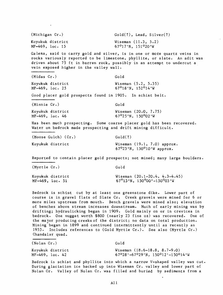
(Michigan Cr.) Gold(?), Lead, Silver(?)
Koyukuk district Wiseman (11.3, 5.2) MF-469, loc. 15 67°17'N, 151°20'W
Galena, said to carry gold and silver, is in one or more quartz veins in rocks variously reported to be limestone, phyllite, or slate. An adit was driven about 75 ft in barren rock, possibly in an attempt to undercut a vein exposed higher in the valley wall.
(Midas Cr.) Gold
Koyukuk district Wiseman (5.2, 5.35) MF-469, loc. 25 67°18'N, 152°14'W
Good placer gold prospects found in 1905. In schist belt.
(Minnie Cr.) Gold
Koyukuk district Wiseman (20.0, 7.75) MF-469, loc. 46 67°25'N, 150°02'W
Has been much prospecting. Some coarse placer gold has been recovered Water on bedrock made prospecting and drift mining difficult.
(Moose Gulch) (Cr.) Gold(?)
Koyukuk district Wiseman (19.1, 7.0) approx.67°23'N, 150°10'W approx.
Reported to contain placer gold prospects; not mined; many large boulders
(Myrtle Cr.) Gold
Koyukuk district Wiseman (20.1-20.4, 4.3-4.45) MF-469, loc. 51 67°13'N, 150°00'-150°03'W
Bedrock is schist cut by at least one greenstone dike. Lower part of course is in gravel flats of Slate Cr. Creek gravels were mined for 6 or more miles upstream from mouth. Bench gravels were mined also; elevation of benches above stream increases downstream. Much of early mining was by drifting; hydraulicking began in 1909. Gold mainly on or in crevices in bedrock. One nugget worth $800 (nearly 23 fine oz) was recovered. One of the major producing creeks of the district; no data on total production. Mining began in 1899 and continued intermittently until as recently as 1953. Includes references to (Gold Myrtle Cr.). See also (Myrtle Cr.) Chandalar quad.
(Nolan Cr.) Gold
Koyukuk district Wiseman (18.6-18.8, 8.7-9.0) MF-469, loc. 42 67°28'-67°29'N, 150°12 ! -150°14 ! W
Bedrock is schist and phyllite into which a narrow V-shaped valley was cut. During glaciation ice backed up into Wiseman Cr. valley and lower part of Nolan Cr. Valley of Nolan Cr. was filled and buried by sediments from a
All

stream graded to a higher temporary base level. Gold found from Fay Gulch to Wiseman Cr. flats. Creek gravels mined only at mouth of Fay Gulch; gold on false bedrock. Benches that merge with those of tributaries have been mined. Most production was from a buried deep channel (20 ft deep at Fay Gulch; more than 200 ft deep 3/4 mi below Smith Cr.). Mining in 1901 and most succeeding years until World War II; has been more recent mining also. No data on total production, but may have been worth several million dol lars. See also: (Archibald Gulch), (Fay Gulch), (Smith Cr.).
(Old Man Cr.) Gold(?)
Koyukuk district Wisemanquad
Gold placers reported, 1910. Location not known; said to be "a southerly tributary of the middle Koyukuk."
(Oregon Cr.) Gold
Koyukuk district Wiseman (10.65, 8.55) approx.MF-469, loc. 32 67°29'N, 151°25'W approx.
Good placer gold prospects, but no mining. Bedrock schist.
(Pasco Cr.) Gold(?)
Koyukuk district Wisemanquad. (?)
Placer gold reported. Location of creek uncertain.
(Porcupine Cr.) Gold
Koyukuk district Wiseman (18.35, 4.65-4.85) MF-469, loc. 52 67°15'N, 150°18'W
Bedrock is schist. Most of gold is in lower part of gravel rather than on bedrock. Placer deposits are 6 to 30 ft deep. Intermittent mining from 1900 to 1974. No data on total production.
(Quartz Cr.) Gold
Koyukuk district Wiseman (18.25-18.35, 4.8) MF-469, loc. 52 67°15'N, 150°18'-150°19 T W
Production of placer gold from stream gravels (by 1937) was worth about $2,500. Depth to bedrock about 3 ft.
(Rocky Point) Copper
Koyukuk district Wiseman (9.7, 9.25)67°31'N, 151°33'W
Malachite in vein quartz with dolomite.
(Rose Cr.) Gold
Koyukuk district Wiseman (19.15, 3.8)
A12

MF-469, loc. 53 67°11'N, 150°11'W
More than 100 ft to bedrock; many colors of gold on bedrock in a shaft about 3 mi about mouth. A few colors at surface about 2 mi above mouth.
(Rye Gr.) Copper, Gold, Lead, Monazite, Tungsten
Koyukuk district Wiseman (11.1-11.25, 7.2-7.3) MF-469, loc. 34 67°24'N, 151°20'-151°21 ? W
Creek flows on limestone and schist and along contact (probably a fault) between them. No gold in paying quantities above Jay Cr. Has been both drift and hand mining. Placers found in 1915. Production through 1937 was worth about $55,000. Concentrate samples contained ilmenite, andalus- ite, kyanite, pyrite, zircon, chalcopyrite, monazite, galena, sphalerite, scheelite, and gold.
(Sawyer Gulch) (Cr.) Gold
Koyukuk district Wiseman (18.95, 6.55) MF-469, loc. 47 67°21'N, 150°12'W
Coarse gravel with many large boulders. Some placer gold prospects reported, but no mining.
(Sirr Cr.) Gold
Koyukuk district Wiseman (9.25, 9.55) approx. MF-469, loc. 28 67°32'N, 151°37'W approx.
Was some placer gold mining before 1937. Mountain at head of creek is schist capped by limestone.
(Slate Cr.) Gold
Koyukuk district Wiseman (19.35-20.1, 4.3-4.9) MF-469, loc. 51 67°13'-67°15 ? N, 150°03'-150°09 ? W
Flows westward from a low gravel-covered divide to Middle Fork of Koyukuk R. Has cut down into phyllite and mica schist in lower two-thirds of its course. Bedrock cut by many quartz veins and altered dikes; gold probably was derived from small quartz veins; much came from Myrtle Cr. Bench gravels as well as stream gravels carry gold. Mining began in 1899 and was reported as recently as 1939. See also: (Myrtle Cr.), (Slate Cr.) Chandalar quad.
(Smally Cr.) Gold
Koyukuk district Wiseman (16.85, 0.6) MF-469, loc. 59 67°01'N, 150°33'W
Placer mining in "early days" of district and in 1937. Gold may have been derived from conglomerate (Cretaceous?) bedrock.
(Smith Cr.) (Gulch) Gold
Koyukuk district Wiseman (18.65-19.0, 8.6-8.75)
A13

MF-469, loc. 42 67°28'N, 150°11'-150O 14'W
A major gold-producing tributary of Nolan Cr.; heads agains Union Gulch. Bedrock micaceous schist. Creek gravels are 5-20 ft thick. Deep (135 ft at mouth) channel was mined out. Remnants of high channels have also been mined. Was intermittent production from 1903 to i960. For data on anti mony near creek see: Jones & Boyle, Wannemaker & Wortman.
(Smith Creek Dome) Antimony, Gold
Koyukuk district Wiseman (19.15, 9.0) MF-469, loc. 22 67°29'N, 150°09'W
A 6-in vein of stibnite and oxidation products was opened by a small pit. Samples contained as much as 9.2 ppm Au. Includes references to antimony at head of Fay Gulch.
(Spring Cr.) Gold
Koyukuk district Wiseman (9.85-10.15, 9.0-9.1) MF 469, loc. 30 67°30'-67°31'N, 151°29'-151°32'W
Bedrock is schist. Placer gold was discovered in 1903. Production through 1937 was about 2,785 fine oz worth about $59,500 and was from open cuts and drift mines. Mining in 1938 was reported and there probably has been some since World War II.
(Summit Cr.) Gold
Koyukuk district Wiseman (9.85-10.1, 9.2-9.3) MF-469, loc. 29 67°31'N, 151°30'-151°32'W
Stream flows through various kinds of schist from Mathews Dome to Wild Lake. Gravel coarse and angular. Gold (some coarse and some flour) on or near bedrock. Sporadic small-scale mining from 1904 until as recently as 1937. Includes reference to (Surprise Cr.).
(Swift Gulch) (Cr.) Gold
Koyukuk district Wiseman (19.45-19.5, 9.1) MF-469, loc. 41 67°29'N, 150°05'-150°06'W
A tributary of Hammond R.; heads in mineralized area east of Nolan Cr. An old high channel merged with that of Hammond R. Mining, all by hand methods, was between 1901 and 1912, in 1927, and possibly in other years when it was reported with that on Hammond R.
(Thompson Pup) Gold, Silver
Koyukuk district Wiseman (19.1, 9.05)MF-469, loc. 22 67°29'N, 150°09'W
Small amounts of gold and silver in quartz veins near head of creek.
(Timber Cr.) Gold(?)
Koyukuk district Wiseman (8.4, 3.5) approx. (?)67°11'N, 151°45'W approx. (?)
A14

Probably was placer mining from river bars in "early days" of district Location on stream not given.
(Tramway Bar) Gold
Koyukuk district Wiseman (17.1, 1.9) MF-469, loc. 58 67°05'N, 150°30'W
Gold-bearing gravel containing glacial erratics on bench cut on nonaurifer- ous conglomerate and sandstone 80-100 ft above Middle Fork of Koyukuk R. was mined sporadically on a small scale from 1900 or earlier until 1965 or later. Origin of gold is not known. Production 1900-09 was about 385 oz of gold; no data on later production.
(Twelvemile Cr.) Gold
Koyukuk district Wiseman (17.1-17.7, 3.7-3.8) MF-469, loc. 54 67°11 ! -67°12 ! N, 150°24'-150°30'W
Bedrock is schist. Some rich ground has been mined, but work was very difficult because of water in gravel. There are both creek and bench placers. Production 1900-09 was worth about $5,000 (about 240 oz); no data on more recent production. One hydraulic plant operated in 1937. Includes references to forks of Twelvemile Cr. and to (Potato Cr.).
(Twocent Cr.) Gold
Koyukuk district Wiseman (11.0, 9.0) approx.67°30'N, 151°21'W approx.
A little placer gold reported; two-cent pans of gravel.
(Union Gulch) (Cr.) Gold
Koyukuk district Wiseman (19.55, 8.4) MF-469, loc. 44 67°27'N, 150°06'W
Drains mineralized area east of Nolan Cr. Coarse gold (a nugget worth $660 (about 32 oz) was found in 1901) mined in early 1900 ? s. Production through 1909 was about $35,000 (about 1,700 oz). Mining in 1934 and 1937 was reported.
(VABM Alien) Copper
Koyukuk district Wiseman (6.4, 9.6) MF-469, loc. 6 67°33'N, 152°04'W
Minor amounts of chalcopyrite, bornite, and malachite in metamorphosed reef limestone of the Middle Devonian Skajit Limestone thrust over Upper Devonian shale, phyllite, and chloritic schist.
(Vermont Cr.) Gold
Koyukuk district Wiseman (19.15-19.45, 9.35-9.5) MF-469, loc. 40 67°31'N, 150°06 ? -150°09'W
Small tributary of Hammond R. that head against a fork of Nolan Cr. in a mineralized area. Bedrock is phyllite, some mineralized with pyrite; quartz
A15

veinlets, one of which contains free gold and sulfides. Shallow creek gravels and deep (30-90 ft) channel in valley of Hammond R. were mined from 1901 until as recently as 1969. Total production not known, but must have been worth many hundred thousand dollars; production 1901-09 was $172,000 (about 8,325 oz). Gold coarse; some nuggets about 10 oz.
(Vermont Dome) Copper, Zinc(?)
Koyukuk district Wiseman (18.6, 9.5) MF-469, loc. 24 67°31'N, 150°13'W
Copper sulfides and malachite stains and vein quartz float with traces of copper and zinc; no zinc mineral is mentioned, so Zn may have been only in anaylses of samples. Bedrock is Devonian phyllite and siltstone unit.
Wannemaker & Wortman Antimony
Koyukuk district Wiseman (18.65, 8.65) MF-469, loc. 21 67°28'N, 150°14'W
Stibnite vein in fissure whose walls are lined with terminated quartz crystals; fissure cuts across cleavage of phyllite. Sample of stibnite contained 58.370 Sb. See also Jones & Boyle.
(Washington Cr.) Gold
Koyukuk district Wiseman (18.0, 9.55) approx. MF-469, loc. 39 67°31'N, 150°20'W approx.
Gold was discovered in 1902 and $5,000 worth (less than 250 oz) mined by 1905, but all mining was small scale. None has been reported more recently. Results of prospecting high gravels are not known.
(Wild Lake) Copper
Koyukuk district Wiseman (9.65, 8.75) MF-469, loc. 13 67°30'N, 151°34'W
Copper sulfides and malachite stains; bedrock is Devonian calcareous schist
(Wild R.) (Cr.) Gold
Koyukuk district Wiseman (9.7-11.5, 7.2-9.3)67°24 ! -67°31'N, 151°17 ! -151°33 ! W
Mining or prospecting for placer gold reported in many years between 1904 and 1940 probably was on tributaries rather than on main stream. See also (Birch Cr.), (Jay Cr.), (Lake Cr.), (Rye Cr.), (Spring Cr.), (Summit Cr.).
(Wilson Cr.) Gold(?)
Koyukuk district Wisemanquad.
Placer prospects, but no paying quantities of gold, reported.
(Wiseman) Copper, Gypsum
A16

Koyukuk district Wiseraan (19.35, 7.7) MF-469, loc. 19 67°25'N, 150°08'W
Trace amounts of chalcopyrite and chrysocolla in samples of quartz and gypsum. Quartz and gypsum in narrow veins in Devonian(?) mica schist.
(Wiseman Cr.) Gold
Koyukuk .district Wiseman (18.6-19.0, 8.4-9.0) MF-469, loc. 43 67°27'-67°29 ? N, 150°10 ? -150°14 ? W
Small creek in a wide valley filled with 200-300 or more feet of gravel, sand, and silt. Prospect shafts and long cuts near vally wall found only small amounts of flour gold. Reports of mining on Wiseman Cr. are probably to unsuccessful prospecting or to mining on Nolan Cr., the major (and very productive) tributary of Wiseman Cr. See also (Nolan Cr.).
Unnamed occurrence Antimony, Lead
Koyukuk distric Wiseman (10.05, 8.8)67°30'N, 151°30'W
Tetrahedrite in vein quartz; limonite also present.
Unnamed occurrence Copper
Koyukuk dkstrict Wiseman (17.55, 6.1) MF-469, loc. 17 67°19'N, 150°25'W
Copper sulfides and malachite stains at contact between schist unit and schist and marble unit, both of Devonian(?) age.
Unnamed occurrences Copper
Koyukuk district Wiseman (8.85-8.9, 8.45-8.55)67°29'N, 151°41'W
Sulfides and malachite in vein quartz.
Unnamed occurrence Copper
Koyukuk district Wiseman (10.0, 8.85)67°30'N, 151°31'W
Malachite in vein quartz.
Unnamed occurrence Copper
Koyukuk district Wiseman (8.45, 9.0) MF-469, loc. 12 67°30'N, 151°45'W
Copper sulfides and malachite stains; bedrock is phyllite and siltstone unit of Devonian age.
Unnamed occurrence Copper
Koyukuk district Wiseman (7.6, 8.7)MF-469, loc. 11 67°30'N, 151°52'W
A17

Copper sulfides and malachite stain in Devonian conglomerate beneath a thrust plate of Devonian Skajit Limestone.
Unnamed occurrence Copper
Koyukuk district Wiseman (5.0, 9.25) MF-469, loc. 5 67°32'N, 152°16'W
Copper sulfides and malachite in faulted Devonian Skajit Limestone.
Unnamed occurrence Copper
Koyukuk district Wiseman (10.3, 9.65) MF-469, loc. 14 67°32'N, 151°27'W
Copper sulfides and malachite stains in Devonian calcareous schist.
Unnamed occurrences Copper
Koyukuk district Wiseman (10.15, 9.6)67°32'N, 151°30'W
Bornite and malachite in vein quartz.
Unnamed occurrence Copper
Koyukuk district Wiseman (6.8, 10.0) MF-469, loc. 7 67°34'N, 151°59'W
In a zone of probably stratabound deposits, individual ones of which are no more than 5 ft thick or extend more than a few tens of feet along strike. Malachite, azurite, and chalcopyrite in Upper Devonian quartzose chloritic schist and in fractures in small pods in the Middle Devonian Skajit Lime stone; deposits along a thrust fault separating the Skajit Limestone from the underlying rocks.
Unnamed occurrence Copper
Koyukuk district Wiseman (0.4, 11.8) MF-469, loc. 1 67°40'N, 152°57'W
Copper sulfide and malachite stain in Devonian slate and phyllite unit.
Unnamed occurrence Copper, Lead
Koyukuk district Wiseman (9.5, 9.4)67°32'N, 151°35'W
Malachite and galena in vein-quartz stockwork.
Unnamed occurrence Copper, Lead
Koyukuk district Wiseman (7.35, 10.4) MF-469, loc. 8 67°35'N, 151°54'W
Copper sulfides, galena, and malachite in quartz vein below thrust separat ing upper plate of Devonian Skajit Limestone from Devonian phyllite and siltstone unit.
A18

Unnamed occurrence Copper, Lead, Zinc
Koyukuk district Wiseman (4.7, 5.2) approx.67°18'N, 152°18'W approx.
Stratiform deposit on which 8 prospecting sites were staked in 1976. Pyrrhotite, galena, sphalerite, and chalcopyrite in interbedded schist, quartzite, and limestone.
Unnamed occurrence Copper, Zinc(?)
Koyukuk district Wiseman (19.15, 7.1)67°23'N, 150°10'W
Small bleb of bornite in quartz veinlet. Reported Zn was probably deter mined by spectrographic analysis only.
Unnamed occurrence Lead
Koyukuk district Wiseman (14.6, 10.35) MF-469, loc. 16 67°34'N, 150°39'W
Galena in quartz vein in Middle(?) Devonian slate, phyllite, and siltstone unit.
Synonyms, Owners, Operators, and Claim Names
American Koyukuk Gold Mining Co. see (Wiseman Cr.)Angelich & Kovich see (Twelvemile Cr.)Anglich see (Hammond R.)Bassi & Milian see (Minnie Cr.)Boyle see (Smith Cr.)Brady see (Hammond R.)Buchan see (Jay Cr.)(Buckeye Gulch) see (Hammond R.)Butrovich and others see (Lake Cr.)Calhoun see (Smith Cr.)Candle see (Washington Cr.)Chappell see (Nolan Cr.)Collins see (Hammond R.)Detroit Mining Co. see (Hammond R.)Dow (& Chappell) see (Archibald Gulch)Dow & Co. see (Archibald Gulch)Duffy see (Mascot Cr.)(Flat Cr.) see (Birch Cr.)Gamblin & Ferguson see (Smith Creek Dome)(Goldbottom Gulch) see (Hammond R.)Harvey see (Clara Gulch)Harvey & Co. see (Hammond R.)Haslem and associates see (Nolan Cr.)Holmgren see (Lake Cr.)Hope see (Spring Cr.)Hurley see (Smith Cr.)Ikovich see (Mascot Cr.)Irish see (Twelvemile Cr.)
A19

Johnson Bros. see (Colorado Cr.)Jones and associates see Jones & BoyleJones, White & O'Leary see (Smith Cr.)Kelley, Foley & Burke see (Hammond R.)Kelly & Davy see (Hammond R.)(Kelly's Gulch) see (Kelly Gulch)(Kelly's Mistake Cr.) see (Kelly Gulch)Kleffinz see (Twelvemile Cr.)Knorr see (Mascot Cr.)Kovick & Spinks see (Twelvemile Cr.)(Koyukuk R., North Fork) see (Mascot Cr.)Laane see (Emma Cr.)Larsen & Jensen see (Jay Cr.), (Lake Cr.)Lawson see (Minnie Cr.)Le Boyteau see (Nolan Cr.)Leichman see (Jay Cr.)Mangles see (Lake Cr.)Marsand and associates see (Porcupine Cr.)Marsand & Penny see (Spring Cr.)Mathews & Perry see (Spring Cr.)Matthews see (Jay Cr.)(Mecklenberg Cr.) see (Colorado Cr.)(Mettenberg Cr.) see (Colorado Cr.)(Mettenpherg Cr.) see (Colorado Cr.)(Midnight Dome) see FergusonMurphy see (Lake Cr.)Neck see (Porcupine Cr.)Ness & Marsand see (Hammond R.)O'Brien, Healy & Dennison see (Lake Cr.)O'Keefe see (Porcupine Cr.)Pendleton see (Porcupine Cr.)Pingel & Co. see (Nolan Cr.)(Potato Cr.) see (Twelvemile Cr.)Rooney see (Lake Cr.)(Rosie Cr.) see (Rose Cr.)Rowden see (Nolan Cr.)Rue see (Birch Cr.), (Jay Cr.)Silver King see (Michigan Cr.)Sirr see (Birch Cr.), (Spring Cr.)(Sixtymile R.) see (Fool Cr.)Spinks & Irish see (Hammond R.)Spinks & Marsan see (Twelvemile Cr.)Standish see (Nolan Cr.)Standish Bros. see (Porcupine Cr.)Stanich & Stanich see (Porcupine Cr.)Stanich & Ulen see (Nolan Cr.)(Steep Cr.) see (Hammond R.)Suckik see (Tramway Bar)(Surprise Cr.) see (Summit Cr.)(Surr Cr.) see (Sirr Cr.)Swift see (Jay Cr.)
A20

Swift & Smith see (Lake Cr.)Tobin see (Jay Cr.)Tobuck & Dow see (Nolan Cr.)Ulen see (Nolan Cr.)Wanamaker see (Nolan Cr.), (Smith Cr.)Wanamaker, Alien & Eaton see (Smith CrWanamaker & Hurley see (Smith Cr.)Watts see (Union Gulch)Watts, Harvey & Neck see (Hammond R.)Wilcox & Miller see (Sawyer Gulch)Williams see (Nolan Cr.)Wilson see (Emma Cr.)(Wiseman Cr. canyon) see (Wiseman)Wooll & Welch see (Nolan Cr.)Workman see (Nolan Cr.)
A21