Unit 1. Oklahoma covers nearly 70,000 square miles or 45 millions acres East/West border is 464...
16
Unit 1 Oklahoma History
-
Upload
ginger-walton -
Category
Documents
-
view
215 -
download
2
Transcript of Unit 1. Oklahoma covers nearly 70,000 square miles or 45 millions acres East/West border is 464...

Unit 1
Oklahoma History

Oklahoma covers nearly 70,000 square miles or 45 millions acres
East/West border is 464 miles long and North/South border is 320 miles.
18th in size in the USLarger than any state east of the
Mississippi River77 counties
About 1,160 miles in from LA and Washington DC

Ten Geographic Regions:High PlainsGypsum HillsWichita
MountainsRed Bed PlainsSandstone HillsArbuckle
MountainsRed River PlainsOuachita
MountainsPrairie PlainsOzark Plateau

• Unique vegetation zone that cuts across several of Oklahoma’s geographical regions.
• Consists of Post Oak and Blackjack Oak trees that grow so close together they form a natural barrier between western plains and eastern
prairies. • Comanche and other Plains Indians stayed West
of C.T. • Routes of even modern day interstates avoid C.T.
area• Generally unproductive area calling for many farmers and residents to live in poverty – many
socialists and radical political and religious ideas come from this area – think Woody Guthrie and
Oral Roberts
Cross Timbers

Forecasting HUGE in Oklahoma….
Storm watching a pastime of locals..
Average of 53 tornadoes annually
May 3, 1999 Twister
National Weather Service in Norman
Tornado Alley

State located where three climatic regions meet
As cool air meets warm air what happens?This happens frequently in Oklahoma
allowing for more annual tornadoes than most places!
Why Tornado Alley?

Some of the world’s most fertile soils is here in Oklahoma!!!!
Eastern OK – least productive Great soils, adequate rain and good growing
season allows for agricultural lifestyle in West
Fertile Soils
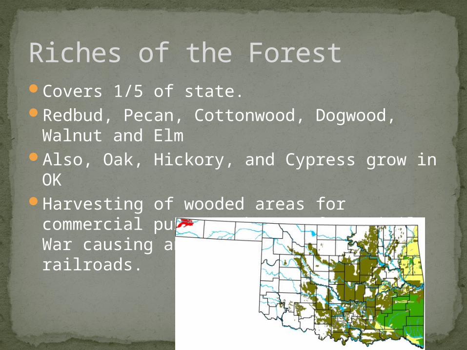
Covers 1/5 of state. Redbud, Pecan, Cottonwood, Dogwood,
Walnut and Elm Also, Oak, Hickory, and Cypress grow in OKHarvesting of wooded areas for commercial
purposes began after Civil War causing an increased need for railroads.
Riches of the Forest

Great Salt Plains – Alfalfa County (120 sq mi.)National Wildlife RefugeTallgrass Prairie “an immense extent of grassy,
undulating…country with here and there a clump of trees, dimly seen in the distance like a ship at sea.” Washington Irving
Osage County – managed by the Nature Conservancy
Salt Plains and Tallgrass Prairies
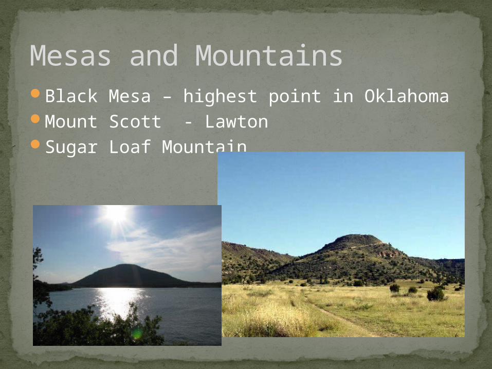
Black Mesa – highest point in OklahomaMount Scott - LawtonSugar Loaf Mountain
Mesas and Mountains

The number of native animal species to OK is probably larger than any equal area in US
Wildlife

Sulphur Springs in Chickasaw Indian Land
Springs and Waterfalls

Lakes – many lakes in Oklahoma all recreation lakes man made in Oklahoma
McClellan – Kerr Navigation System – Made so Oklahoma rivers could be navigated – Specifically the Arkansas River
Groundwater: aquifers provide more than half
of Oklahoma with fresh water. Ogallala most important aquifer to Oklahoma
for irrigation .
Major Water

As mountains push upward other parts of the earth form
depressions or basins. The Great Plains is one of these
Basins Energy deposits: Anadarko
Basin and Arkoma Basin.
Geological Basins, Energy Deposits

As ancient seas evaporated they left behind thick deposits of gypsum and salt.
Remains of huge dinosaurs found in the panhandle. These remains are from the Jurassic Period.
These are found in the Sam Noble Oklahoma Museum of Natural History.
Gypsum and Salt and Reptiles

Well, what if it never happened like this?All these things happened and have shaped
Oklahoma for the place it is now. great place for crops, huge reservoirs of water for its inhabitants, natural resources to help keep America from
being solely dependent on other places for energy
Why is this important?