
Unique & Powerful Geospatial Field Data Collection Solutions (Zach Edwards)
19
Summer 2015 GISCO Meeting Zach Edwards – Geospatial Solutions Representative, Colorado & Wyoming Territory
-
Upload
gis-colorado -
Category
Technology
-
view
537 -
download
4
Transcript of Unique & Powerful Geospatial Field Data Collection Solutions (Zach Edwards)

Summer 2
015
GISCO M
eeting
Zach Edwards – Geospatial Solutions Representative, Colorado & Wyoming Territory
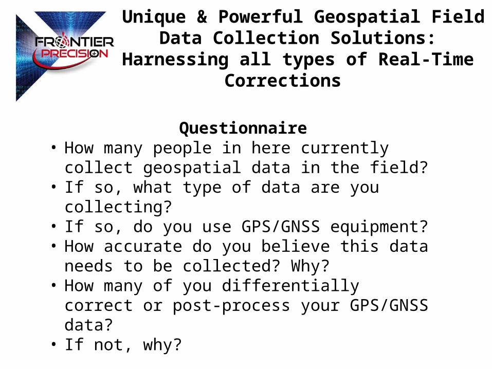
Unique & Powerful Geospatial Field Data Collection Solutions: Harnessing all types of Real-Time
Corrections
Questionnaire• How many people in here currently collect geospatial
data in the field?• If so, what type of data are you collecting?• If so, do you use GPS/GNSS equipment?• How accurate do you believe this data needs to be
collected? Why?• How many of you differentially correct or post-process
your GPS/GNSS data?• If not, why?
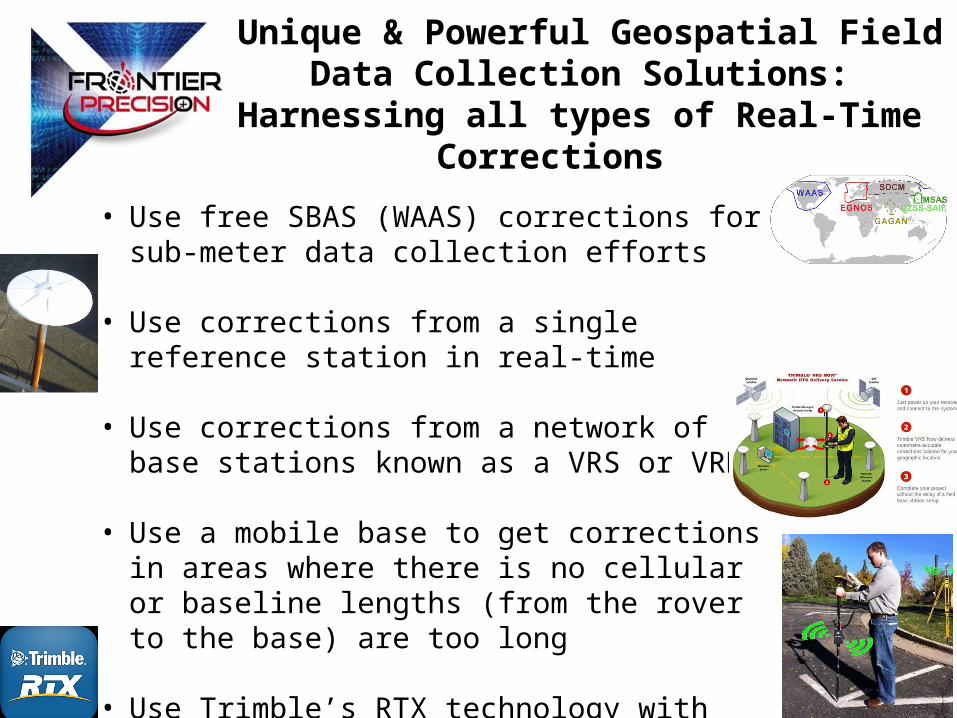
Unique & Powerful Geospatial Field Data Collection Solutions: Harnessing all types of Real-Time
Corrections
• Use free SBAS (WAAS) corrections for sub-meter data collection efforts
• Use corrections from a single reference station in real-time
• Use corrections from a network of base stations known as a VRS or VRN
• Use a mobile base to get corrections in areas where there is no cellular or baseline lengths (from the rover to the base) are too long
• Use Trimble’s RTX technology with RTX-Capable Devices
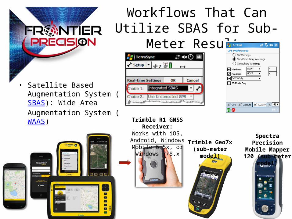
Workflows That Can Utilize SBAS for Sub-Meter Results
Trimble R1 GNSS Receiver:
Works with iOS, Android, Windows Mobile 6.5x, or
Windows 7/8.xTrimble Geo7x (sub-
meter model)
• Satellite Based Augmentation System (SBAS): Wide Area Augmentation System (WAAS)
Spectra Precision Mobile Mapper 120 (sub-meter model)
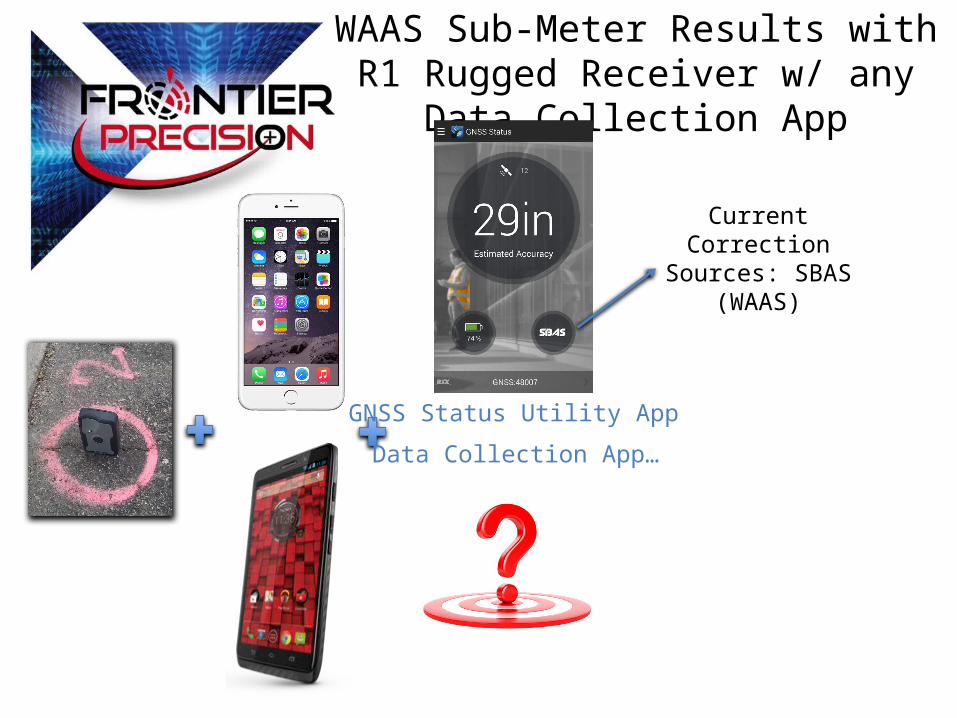
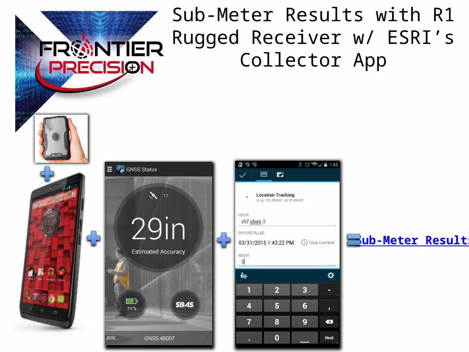
WAAS Sub-Meter Results with R1 Rugged Receiver w/ any Data Collection App
Data Collection App…
GNSS Status Utility App
Current Correction Sources: SBAS (WAAS)
Sub-Meter Results
Sub-Meter Results with R1 Rugged Receiver w/ ESRI’s Collector App
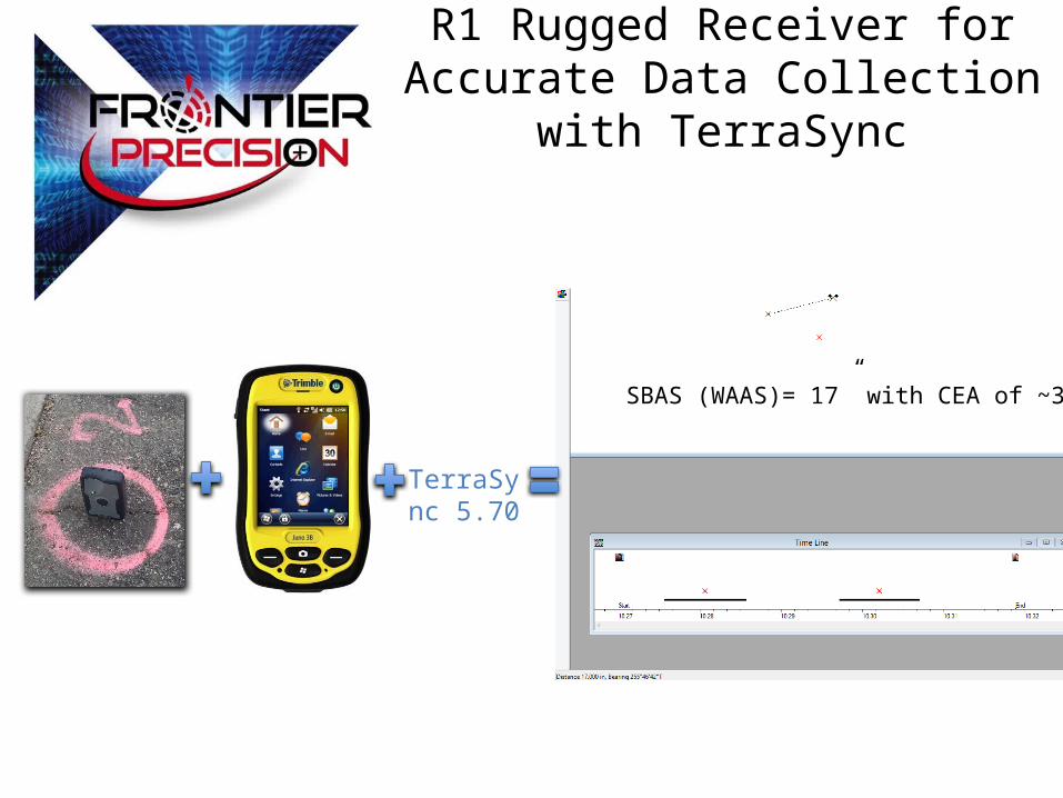
R1 Rugged Receiver for Accurate Data Collection with TerraSync
SBAS (WAAS)= 17” with CEA of ~30”
TerraSync 5.70
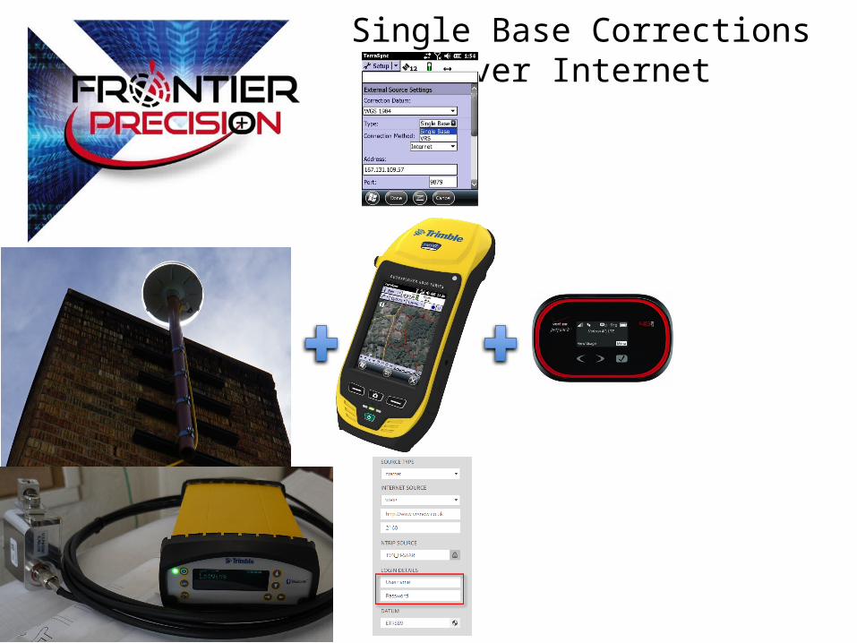
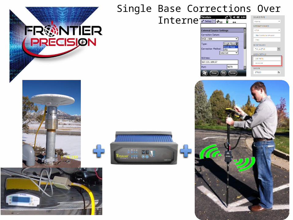
Single Base Corrections Over Internet
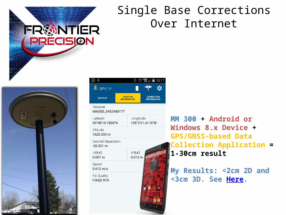
MM 300 + Android or Windows 8.x Device + GPS/GNSS-based Data Collection Application = 1-30cm result
My Results: <2cm 2D and <3cm 3D. See Here.
Single Base Corrections Over Internet
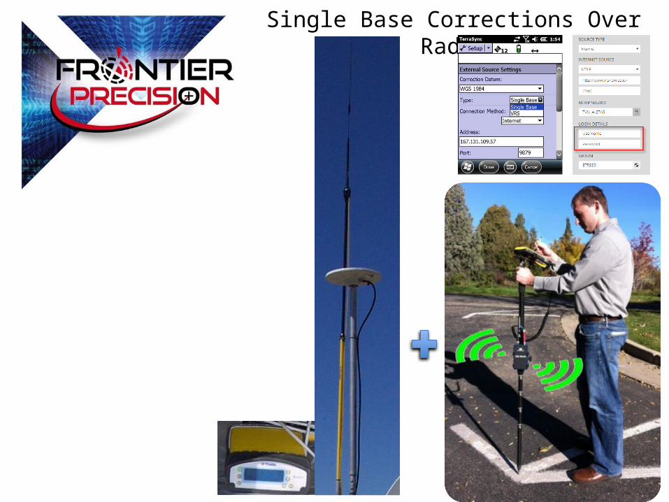
Single Base Corrections Over Radio
Single Base Corrections Over Internet/Radio
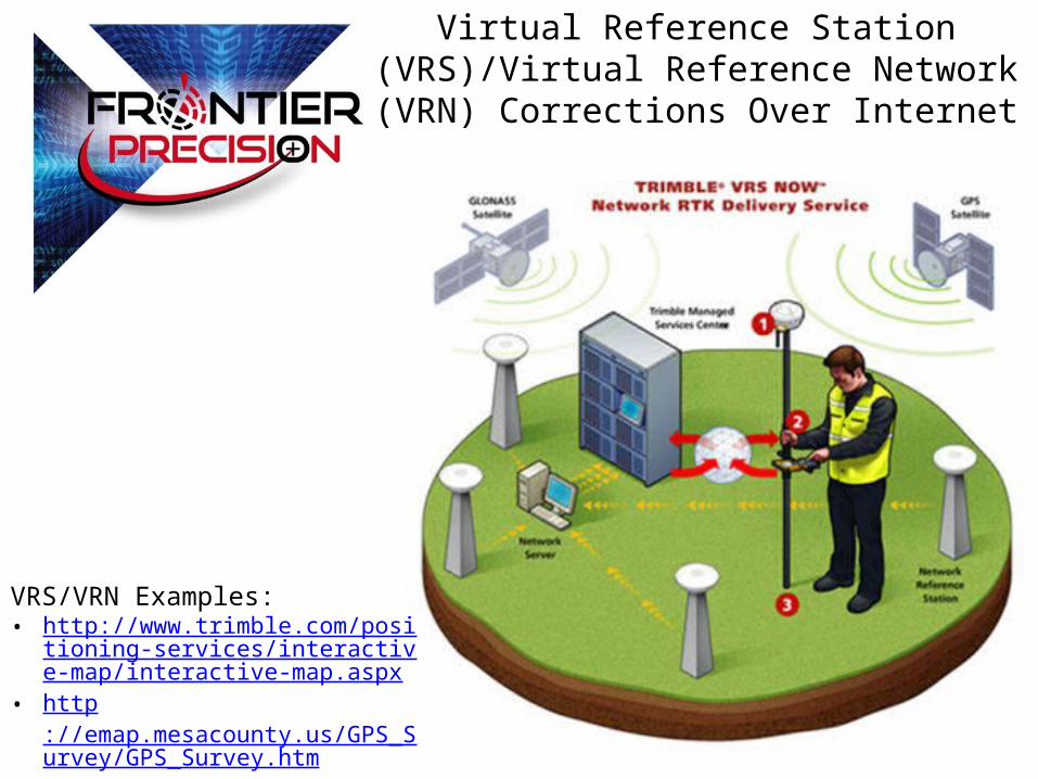
Virtual Reference Station (VRS)/Virtual Reference Network (VRN) Corrections Over Internet
VRS/VRN Examples: • http://www.trimble.com/positioning-ser
vices/interactive-map/interactive-map.aspx
• http://emap.mesacounty.us/GPS_Survey/GPS_Survey.htm
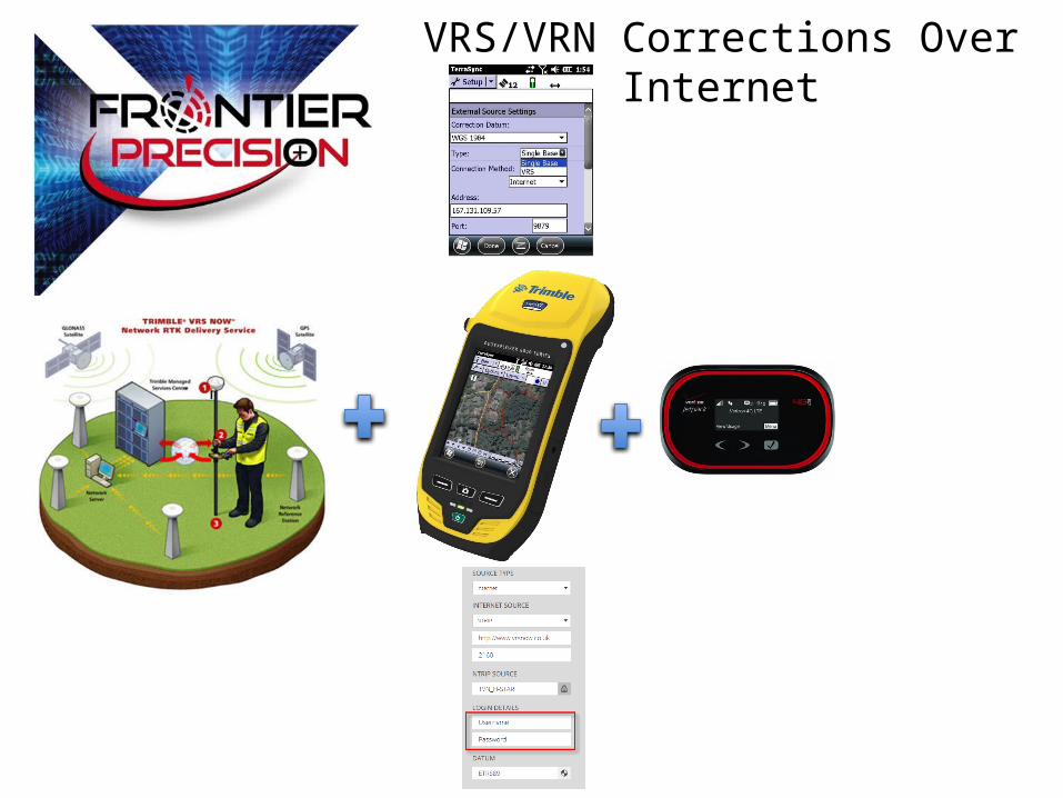
VRS/VRN Corrections Over Internet
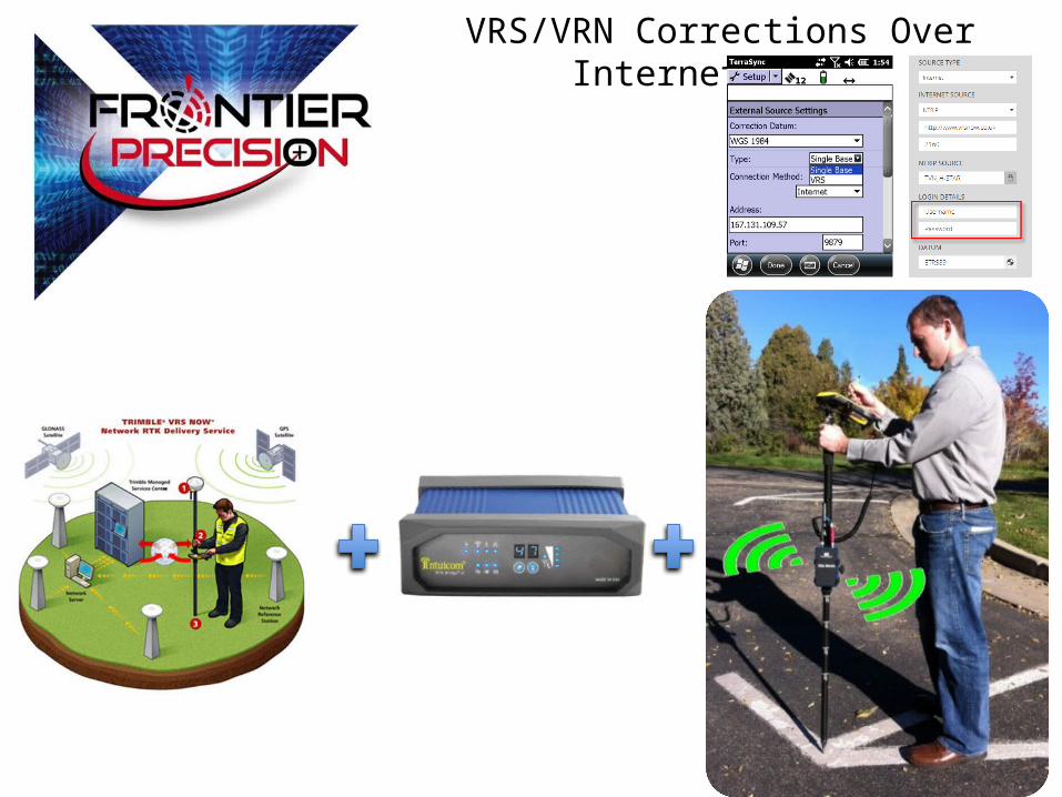
VRS/VRN Corrections Over Internet/Radio
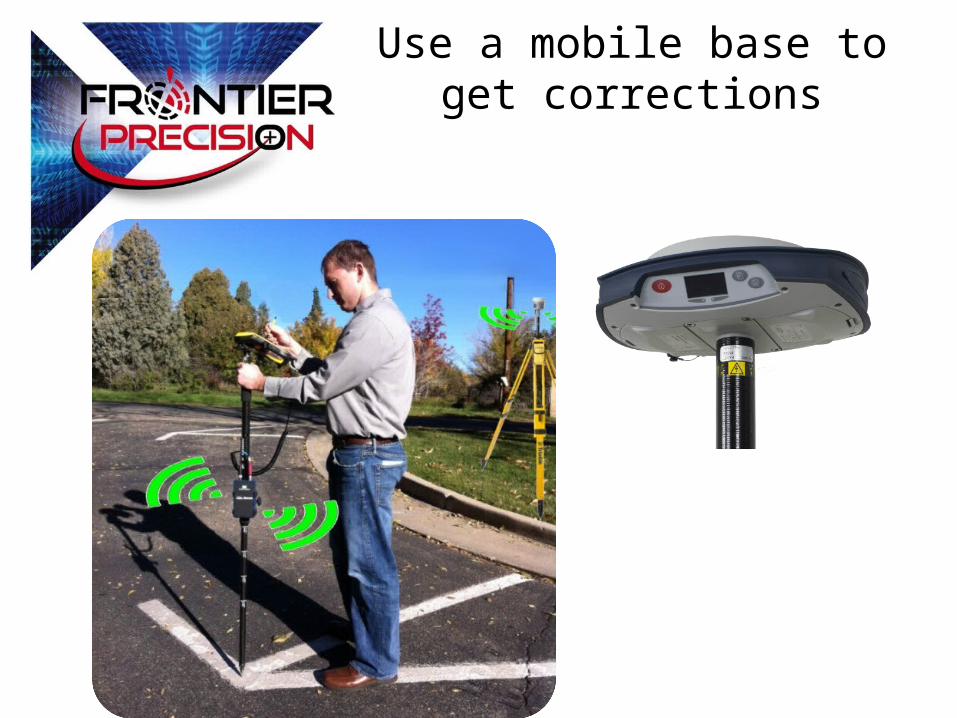
Use a mobile base to get corrections
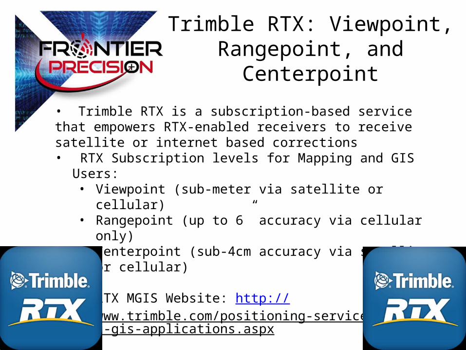
Trimble RTX: Viewpoint, Rangepoint, and Centerpoint
• Trimble RTX is a subscription-based service that empowers RTX-enabled receivers to receive satellite or internet based corrections• RTX Subscription levels for Mapping and GIS Users:
• Viewpoint (sub-meter via satellite or cellular)• Rangepoint (up to 6” accuracy via cellular only)• Centerpoint (sub-4cm accuracy via satellite or cellular)
• RTX MGIS Website: http://www.trimble.com/positioning-services/mapping-gis-applications.aspx
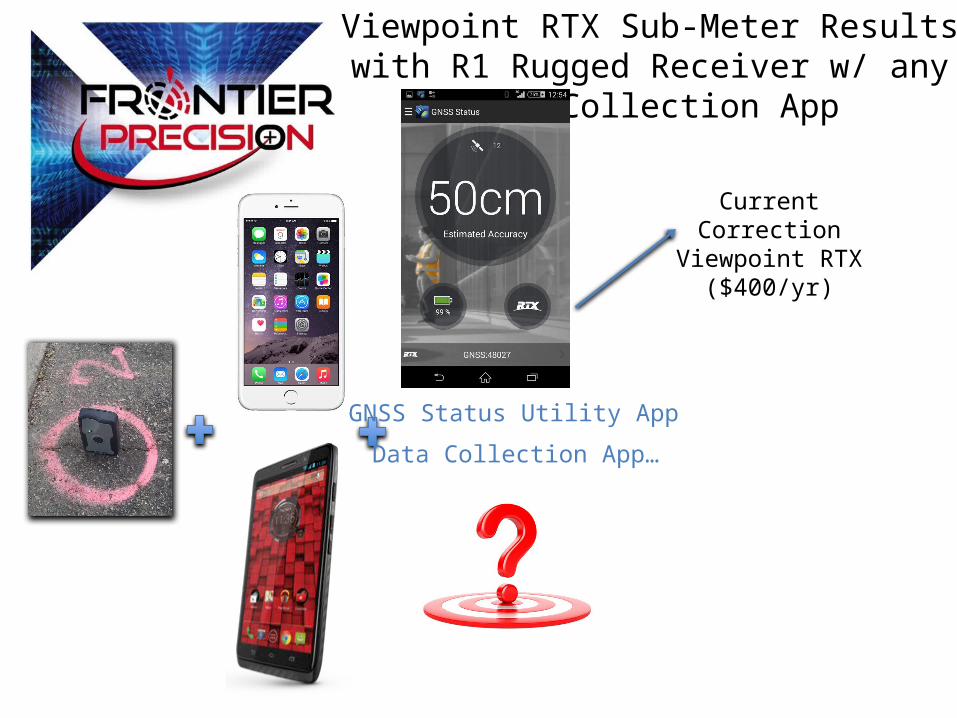
Viewpoint RTX Sub-Meter Results with R1 Rugged Receiver w/ any Data Collection App
Data Collection App…
GNSS Status Utility App
Current Correction Viewpoint RTX
($400/yr)

Questions?