UNESCO Global Geoparks · UNESCO Global Geoparks On November 17 2015, the 195 Member States of...
64
European Geoparks Magazine ●Issue 13 UNESCO Global Geoparks
Transcript of UNESCO Global Geoparks · UNESCO Global Geoparks On November 17 2015, the 195 Member States of...

European Geoparks Magazine●Issue 13
UNESCOGlobalGeoparks

EuropeanGeoparks Network
MagazineIssue No 13 / 2016
Published by:Natural History Museum of the Lesvos
Petrified Forest on behalf of the European Geoparks Network
Executive editor: Nickolas Zouros
Publication Editor: Tony Ramsay
Editorial board:Tony Ramsay, Jutta Weber, Nickolas Zouros
Contributors:Tony Ramsay, Vesa Krökki, Mikko Kiuttu, Barnabás
Korbély, Florian Dierickx, Irina Pavlova, Sarah Gaines, Staridas Spyros, C. Fassoulas, Melanie
Border, Annie-Marie Donslund, Ana Lima, Diamantino Pereira, Sílvia Marcos, Mojca Gorjup Kavčič, Bojan Režun, Nina Erjavec, Jaka Kenk, Sanja Marija Pellis, Eamon Doyle, Tiffany Sarre,
Sophie Justice, Mona Holte, Andreas Schüller, Julia Franzen, Luis Alcalá, Luis Mampel, Francisco Javier Verdú, Guiseppe Mogavero, Pasquale Li Puma, Abu Sharib, T. Blenkinsop, Alessandra Casini, Armando Costantini, Giancarlo Pagani, Maria Kamilari, Eleni
Koumoutsou, Gregoris Iatrou, Pietro Marescotti, Timo Kluttig, Ánchel Belmonte Ribas, Siegfried
Roth, Dana Pietsch, Hans-Jürgen Stede, Thomas Beisswenger, Mariana Vilas Boas, Ana Valente,
Carlos Neto de Carvalho, Joanna Rodrigues, Sara Gentilini, Pål Thjømøe, Heta Toivonen, Pierre
Prouillac, Erdal Gumus, N. Zouros, I. Valiakos, Chiara Grassi, Giuliana Pincelli, Roberto Zoanetti,
Vajolet Masè, Alessia Amorfini, Antonio Bartelletti, Guiseppe Ottria, António Duarte, Ricardo Neves, Vera
Magalhães, João Carlos Nunes, Eva Lima, Marisa Machado, Manuel Paulino Costa, Anna Knauer, J.-L.
Desbois, C. Lansigu, Jutta Weber, Cristina Rubio Segura, Irmgard Auer, Heinz Kollmann, Clemens
Eibner, Richard Watson, Edoardo Dellarole, Patakos Dimitris, Andrew Bratton, Nikki Maguire, Robina Barton, Asier Hilario, Leire Barriuso, Wessel van
Vliet, Eggert Sólberg Jónsson, Luise Bloise, Egidio Calabrese, Efthymios Tsiolakis
Editing: Tony Ramsay
Publication manager: Ch. Paraskevaidis
Print: Epikinonia Aigaiou S.A
Cover photo: Apuan Alps, English Riviera Geopark, Tuscan Mining Park, Natur-und Geopark Steirische
Eisenwurzen, Sobrarbe Geopark,Reykjanes Global Geopark, Arouca Geopark,
Parco Naturale Adamello Brenta, Bakony-Balaton Geopark, Marble Arch Caves Global Geopark.
Copyright: The magazine and all the contributions and il-lustrations contained therein are protected by copyright. No part of this magazine may be copied or reproduced without the written approval of the publishers. This also includes commercial reproduction as an electronic data base and copying on cd rom. © 2016
201620-30 June 2016International Intensive Course on GeoparksUNESCO Global GeoparksLesvos Island UNESCO Global Geopark – Greece. http://www.petrifiedforest.gr/geoparks2016/July 2016: Italian Geoparks ConferencePollino UNESCO Global Geopark - Italy27-28 July 2016: The Geoparks Niigata International Forum Itoigawa UNESCO Global Geopark, Niigata City, Japan.http://www.city.itoigawa.lg.jp/geopark-forum/en/index.html27 August - 4 September 2016:International Geological ConferenceCape Town, South Africa, http://www.35igc.org/1-10 September 2016: IUCN World Conservation CongressHawaii - USA. http://www.iucnworldconservationcongress.org/25th-26th September 2016:38th European Geoparks MeetingEnglish Riviera UNESCO Global Geopark - UK27th-30th September 2016: 7th International Conference on UNESCO Global GeoparksEnglish Riviera UNESCO Global Geopark - UK, http://ggn2016.com/November 2016International Intensive Course on Geoparks Management and Development Beijing China
2017March 2017: 39th European Geoparks MeetingBurren and Cliffs of Moher Geopark, Ireland20-30 June 2017: International Intensive Course on GeoparksLesvos Island, GreeceSeptember 2017:14th European Geoparks ConferenceSeptember 2017:5th Asian Pacific Geoparks Network Symposium
2018September 2018: 8th International Conference on UNESCO Global Geoparks
THE EUROPEAN GEOPARKS NETWORKwww.europeangeoparks.org
2
CALE
ND
AR

UNESCOGlobalGeoparks
Members of the European Geoparks Net-work celebrate becoming UNESCO Global
Geoparks within UNESCO’s new International Geoscience and Geoparks Programme (IGGP), which is the first initiative of its kind to be estab-lished by UNESCO for 40 years. We congratulate our EGN and UNESCO colleagues for their hard work and dedication in achieving this success-ful outcome.
The reports of activities and achievements of the European Geoparks Network (EGN) during 2015 include the 36th EGN Coordination Com-mittee Meeting and the 13th EGN Conference hosted by Rokua Geopark, and European Geopa-rks Week. In 2015 the EGN grew to 69 members with the inclusion of Reykjanes Geopark, Iceland, Pollino Geopark, Italy, Sitia Geopark, Greece and Troodos Geopark, Cyprus. The Magazine also in-forms that English Riviera Geopark will host the 7th International Conference on UNESCO Global Geoparks on the 27th – 30th September 2016.
In this issue, 43 articles explain how European Geoparks contribute to conservation, education and promoting sustainable development through geotourism. They demonstrate how sharing in-formation and working with communities, busi-nesses and educational establishments safe-guards sustainable development in geoparks. Adamello–Brenta, Apuan Alps, Arouca, Bauges, Kula, Marble Arch and Sobrarbe Geoparks high-light the importance of managing access to their territories by improving and/or developing new geotrails. The contribution of onsite guides and community participation is emphasized by Berg-strasse Odenwald Geopark. TERRA.vita Geopark shows how a conflict between professional and volunteer guides can be resolved.
All geoparks engage in formal and informal educational projects. Burren and Cliffs of Mo-her Geopark describes an exciting project that raises awareness in primary schools of ground-water issues. Chablais, Gea Norvegica Idrija, Odsherred, Terras de Cavaleiros use educational programmes to develop an appreciation of their geological and cultural heritage. Vulkaneifel Geopark highlights the importance of network-ing in integrating educational provision within a geopark. The sustainable development of geoparks is also dependent on research. Fforest Fawr Geopark describes a collaborative project with Cardiff University to create an educational
resource for use by schools and universities. Geoparks increase and improve their geo-
tourism activities either by extending their ter-ritory, e. g. Hondsrug and Naturtejo Geoparks, by adding new facilities or by developing their resources. Levos Geopark has a new attraction – the Nissiopi Marine Petrified Forest Park; the Madonie Astronomical Park is an exciting addi-tion to tourism provision in Madonie Geopark. Bakony Balaton Geopark introduces its geo-logical wonderland. Bronze Age mining tech-niques and a reconstructed Neolithic funeral monument are examples of the importance of prehistory and intangible heritage in Ore of the Alps and Luberon Geoparks respectively. Beigua and Tuscan Mining Geoparks present aspects of their mineralogy. Maestrazgo Geopark de-scribes the fascinating discovery of a dinosaur nursery. Swabian Albs Geopark emphasises the importance of developing partnerships with working quarries. Catalonia and Eisenwurzen Geoparks highlight the importance of gastrono-my in geoparks. Psiloritis, Troodos and Shetland Geoparks demonstrate the importance of col-laborating to promote their cultural and geologi-cal heritage. The Azores Geopark proposes a new networking initiative by exchanging memories between geoparks. Magma Geopark emphasizes the importance of developing business and fund raising strategies. Sesia val Grande Geopark shows that participating in events, e. g. the Mi-lan EXPO, raises a geoparks visibility. Psilortitis Geopark introduces an exciting new promotional tool – the UNESCO Global Geoparks Web Map.
The role of geoparks in conservation is de-scribed in articles by the Basque Coast and Chelmos Vouraikos Geoparks. Evaluating natu-ral hazards in UNESCO Global Geoparks, a new development, is described in an article by our UNESCO colleagues. The articles by Reykjanes, Pollino, and Troodos Geoparks shows the con-tributions that these new geoparks can make to the development of the EGN and UNESCO Global Geoparks.
Our grounds for celebration are, however, tinged with sadness by the the death of a dear colleague, Tomáš Řídkošil, Director of the Bo-hemian Paradise European and Global Geopark.
Tony RamsayMember of the Editorial Board
UNESCOGlobalGeoparks
GLO
BA
L G
EOPA
RK
S
3

02 Calendar
05 UNESCO Global Geoparks: A new milestone for the growing Geoparks Networks!
07 36th EGN Coordination Meeting: The Coordination Committee of the European Geoparks Network visiting Rokua Geopark, Finland
08 European Geoparks Conference September 3rd-6th 2015 Rokua Finland
10 Geoparks: Networking and Society 4th Asian Pacific Geoparks Network San’in Kaigan Symposium. Japan
12 The European Geoparks Week 2015: Take a walk on the geo-side…
GLOBAL GEOPARKS16 Natural Hazards in UNESCO Global Geoparks
18 The UNESCO Global Geoparks Network Web Map
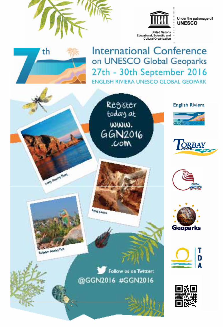
19 Welcome to GGN2016 in the English Riviera!GGN2016, will be hosted in the cosmopolitan seaside resort of Torquay, United Kingdom
GEO EDUCATION21 GEOKIDS: An Educational Programme in UNESCO
Global Geopark Odsherred, Denmark
22 Discovering a territory through Educational Programmes
23 Educational Programmes for elementary schools in Idrija UNESCO Global Geopark - increasing the geoheritage awareness among children and teachers
24 Transmitting Groundwater Awareness from Universities to Primary Schools: A Secondary School Project in the Burren, Ireland
25 Focus 2015: Action EducationChablais UNESCO Global Geopark, France
26 Students doing landscape analyses in Gea Norvegica UNESCO Global Geopark
27 The first “Parcours on Environmental Education” in Vulkaneifel UNESCO Global Geopark
RESEARCH28 A Dinosaur Nursery in the Maestrazgo UNESCO
Global Geopark (Teruel, Spain)
29 Madonie Astronomical ParkΙn an advanced stage of completion today, it will become a key site for astronomy with links to Earth science !
30 The Swansea Valley Disturbance Revisited: A collaborative project between Fforest Fawr UNESCO Global Geopark and Cardiff University to investigate the Nature and Origin of Anomalous Folds in the South Wales Coalfield
31 Great little treasures to know:Ores of the Tuscan Mining UNESCO Global Geopark – Italy
32 The European Geoparks Network today
34 Chelmos – Vouraikos UNESCO Global Geopark: “Monitoring and Evaluation of the conservation status of the European Priority Habitat Types and Species”
35 Garnets, hidden treasuresin Beigua UNESCO Global Geopark
GEO TOURISM36 Volunteer Tour guides vs. Professional Tour guides:
Problems and solutions in a Geopark´s visitor-mine TERRA.vita UNESCO Global Geopark, Germany
37 The geo-trails network of Sobrarbe UNESCO Global Geopark: 30 new ways to enjoy geology
38 Partnerships between geoparks and earth and stone industries – benefits in geo-education and geotope protection
39 Expanding Naturtejo UNESCO Global Geopark to include the natural lands of the Iberian Lynx
40 Possibilities for business in GeoparksThe Magma UNESCO Global Geopark Case
41 Rebuilding a Neolithic funeral monument:The dolmen of Ubac in the municipality of goult
42 Explore the Kula UNESCO Global Geopark
43 Nissiopi Marine Park in the Lesvos Petrified Forest: A new attraction with glass bottomed boat tours in Lesvos UNESCO Global Geopark
44 Footpaths for Everyone: Adamello Brenta UNESCO Global Geopark
45 Discovering the “Giants’ Potholes”: A new geotrail in the Apuan Alps UNESCO Global Geopark
46 The Suspended Walkway of Paiva RiverArouca UNESCO Global Geopark - Portugal”
47 “Exchanging memories”a networking initiative of the Azores UNESCO Global Geopark
48 How to be a geotourist in a geological wonderland? Bakony–Balaton UNESCO Global Geopark, Hungary
49 A free caving trail : An underground and pedagogical adventure
50 “Geopark-on-site-Guides” preservation of the intangible heritage and community participation at its best - Bergstrasse-Odenwald UNESCO Global Geopark, Germany
51 The First Gastronomic Fair of Central Catalonia UNESCO Global Geopark
52 Benefiting from a protected Biodiversity:Natur- und Geopark Styrian Eisenwurzen UNESCO Global Geopark
53 The Copper Ore from Mitterberg, a Hot Spot in the European Bronze Age
54 Marble Arch Caves UNESCO Global Geopark:Managing visitor pressures in a protected natural area
NETWORKING55 Raising awareness and visibility: crucial goals in
Sesia Val Grande UNESCO Global Geopark
56 GEOCREATING: an art exhibition in UNESCO Global Geoparks Troodos, Cyprus and Psiloritis, Greece
57 Drifting Apart – Working Together Shetland, Magma, Stonehammer, Marble Arch Caves, North West Highlands and Reykjanes UNESCO Global Geoparks
GEOCONSERVATION58 Working to reinforce the value of Geoparks as a
useful tool for Geoconservation. A major success in the Basque Coast UNESCO Global Geopark
PRESENTATION59 Hondsrug UNESCO Global Geopark goes urban:
The extension and completion of the first Dutch Geopark
60 Reykjianes UNESCO Global Geopark: Where Mysterious Landscapes and Icelandic Fishing Traditions Meet
61 Pollino UNESCO Global Geopark: Experience nature and cultural heritage in a Mediterranean Territory
62 Troodos UNESCO Global Geopark: a very promising geotouristic destination
GLO
BA
L G
EOPA
RK
S
4
UNESCOGlobalGeoparks
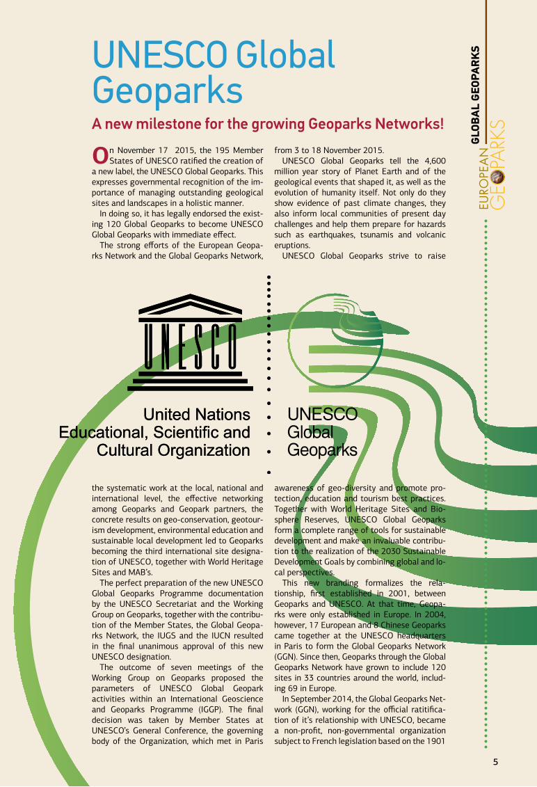
On November 17 2015, the 195 Member States of UNESCO ratified the creation of
a new label, the UNESCO Global Geoparks. This expresses governmental recognition of the im-portance of managing outstanding geological sites and landscapes in a holistic manner.
In doing so, it has legally endorsed the exist-ing 120 Global Geoparks to become UNESCO Global Geoparks with immediate effect.
The strong efforts of the European Geopa-rks Network and the Global Geoparks Network,
the systematic work at the local, national and international level, the effective networking among Geoparks and Geopark partners, the concrete results on geo-conservation, geotour-ism development, environmental education and sustainable local development led to Geoparks becoming the third international site designa-tion of UNESCO, together with World Heritage Sites and MAB’s.
The perfect preparation of the new UNESCO Global Geoparks Programme documentation by the UNESCO Secretariat and the Working Group on Geoparks, together with the contribu-tion of the Member States, the Global Geopa-rks Network, the IUGS and the IUCN resulted in the final unanimous approval of this new UNESCO designation.
The outcome of seven meetings of the Working Group on Geoparks proposed the parameters of UNESCO Global Geopark activities within an International Geoscience and Geoparks Programme (IGGP). The final decision was taken by Member States at UNESCO’s General Conference, the governing body of the Organization, which met in Paris
from 3 to 18 November 2015.UNESCO Global Geoparks tell the 4,600
million year story of Planet Earth and of the geological events that shaped it, as well as the evolution of humanity itself. Not only do they show evidence of past climate changes, they also inform local communities of present day challenges and help them prepare for hazards such as earthquakes, tsunamis and volcanic eruptions.
UNESCO Global Geoparks strive to raise
awareness of geo-diversity and promote pro-tection, education and tourism best practices. Together with World Heritage Sites and Bio-sphere Reserves, UNESCO Global Geoparks form a complete range of tools for sustainable development and make an invaluable contribu-tion to the realization of the 2030 Sustainable Development Goals by combining global and lo-cal perspectives.
This new branding formalizes the rela-tionship, first established in 2001, between Geoparks and UNESCO. At that time, Geopa-rks were only established in Europe. In 2004, however, 17 European and 8 Chinese Geoparks came together at the UNESCO headquarters in Paris to form the Global Geoparks Network (GGN). Since then, Geoparks through the Global Geoparks Network have grown to include 120 sites in 33 countries around the world, includ-ing 69 in Europe.
In September 2014, the Global Geoparks Net-work (GGN), working for the official ratitifica-tion of it’s relationship with UNESCO, became a non-profit, non-governmental organization subject to French legislation based on the 1901
UNESCO Global GeoparksA new milestone for the growing Geoparks Networks!
UNESCOGlobalGeoparks
GLO
BA
L G
EOPA
RK
S
5
UNESCOGlobalGeoparks
law on associations. Recognising the very
strong role networking has played in the suc-cess of the Geoparks movement, the GGN en-courages the strength-ening of Regional Geopa-rk Networks that include all the existing GGN members at a regional or continental level. Regional Geopark Networks serve for the coordination of GGN activities at a regional or continental level for the exchange of information and co-operation between Global Geoparks and Global Geopark professionals in the region.
At its 35th session 31 March – 1 April 2015, the European Geoparks Network Coordination Committee decided to become officially the GGN Regional Network in Europe and thus to become part of the official structure of the In-ternational Association.
Following the adoption of the new UNESCO Global Geoparks Programme, the main aim of the European Geoparks Network (EGN) is to concentrate on networking, on common pro-motional activities and cooperation projects and the exchange of best practice and expe-rience between Geoparks. In order to achieve this, the EGN should remain active and creative, searching for solutions to problems which may occur and organize conferences, meetings and capacity building activities for the develop-
ment of Geoparks in Europe and the world. The EGN should also produce com-mon Geopark activities, events, exhibitions, promo-tional tools, educational and geotourism activities and guarantee high quality experiences for Geopark visitors in Europe.
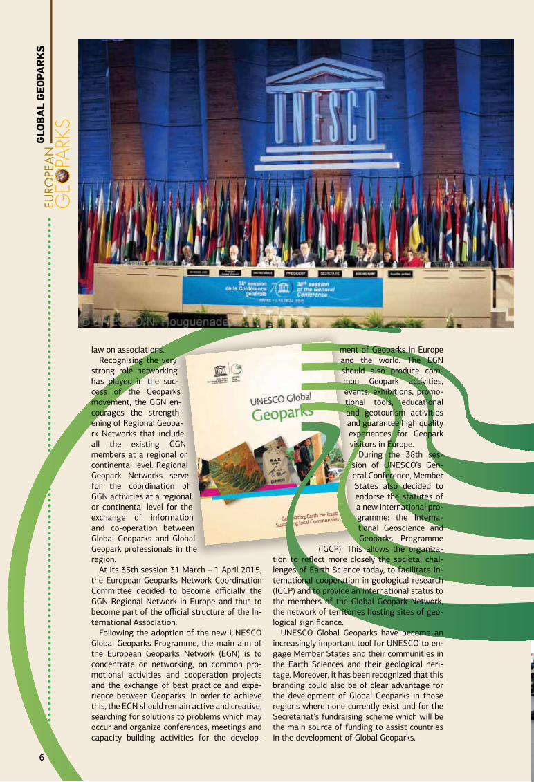
During the 38th ses-sion of UNESCO’s Gen-eral Conference, Member States also decided to endorse the statutes of a new international pro-gramme: the Interna-tional Geoscience and Geoparks Programme
(IGGP). This allows the organiza-tion to reflect more closely the societal chal-lenges of Earth Science today, to facilitate In-ternational cooperation in geological research (IGCP) and to provide an international status to the members of the Global Geopark Network, the network of territories hosting sites of geo-logical significance.
UNESCO Global Geoparks have become an increasingly important tool for UNESCO to en-gage Member States and their communities in the Earth Sciences and their geological heri-tage. Moreover, it has been recognized that this branding could also be of clear advantage for the development of Global Geoparks in those regions where none currently exist and for the Secretariat’s fundraising scheme which will be the main source of funding to assist countries in the development of Global Geoparks.
GLO
BA
L G
EOPA
RK
S
6
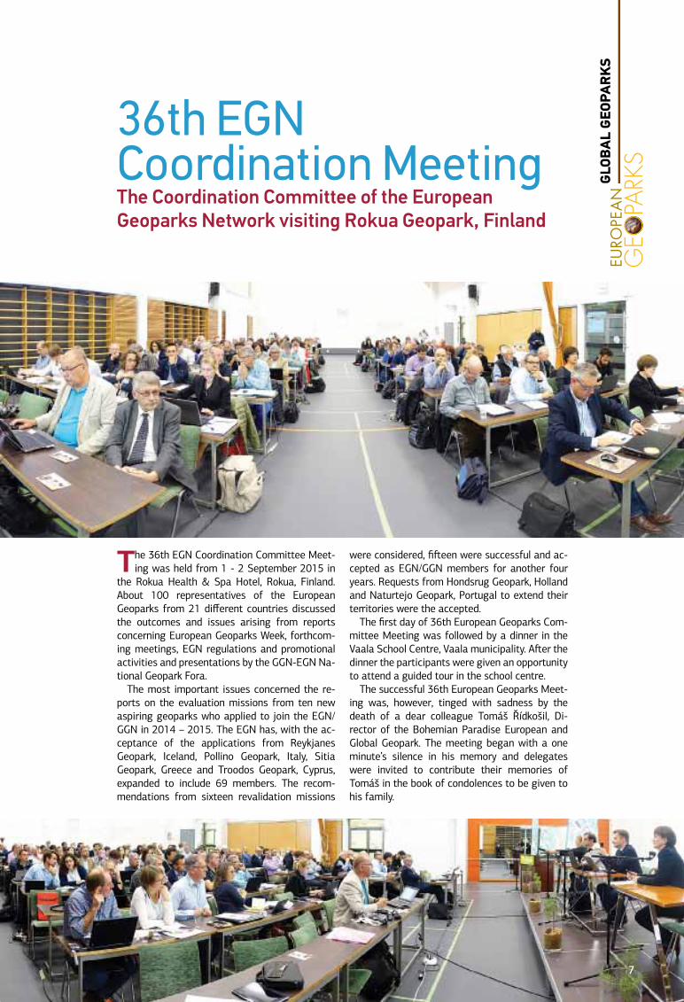
The 36th EGN Coordination Committee Meet-ing was held from 1 - 2 September 2015 in
the Rokua Health & Spa Hotel, Rokua, Finland. About 100 representatives of the European Geoparks from 21 different countries discussed the outcomes and issues arising from reports concerning European Geoparks Week, forthcom-ing meetings, EGN regulations and promotional activities and presentations by the GGN-EGN Na-tional Geopark Fora.
The most important issues concerned the re-ports on the evaluation missions from ten new aspiring geoparks who applied to join the EGN/GGN in 2014 – 2015. The EGN has, with the ac-ceptance of the applications from Reykjanes Geopark, Iceland, Pollino Geopark, Italy, Sitia Geopark, Greece and Troodos Geopark, Cyprus, expanded to include 69 members. The recom-mendations from sixteen revalidation missions
were considered, fifteen were successful and ac-cepted as EGN/GGN members for another four years. Requests from Hondsrug Geopark, Holland and Naturtejo Geopark, Portugal to extend their territories were the accepted.
The first day of 36th European Geoparks Com-mittee Meeting was followed by a dinner in the Vaala School Centre, Vaala municipality. After the dinner the participants were given an opportunity to attend a guided tour in the school centre.
The successful 36th European Geoparks Meet-ing was, however, tinged with sadness by the death of a dear colleague Tomáš Řídkošil, Di-rector of the Bohemian Paradise European and Global Geopark. The meeting began with a one minute’s silence in his memory and delegates were invited to contribute their memories of Tomáš in the book of condolences to be given to his family.
36th EGN Coordination Meeting The Coordination Committee of the European Geoparks Network visiting Rokua Geopark, Finland
GLO
BA
L G
EOPA
RK
S
7
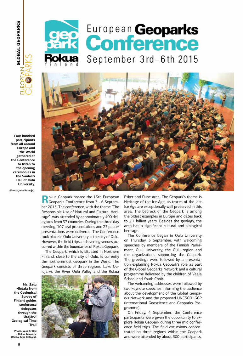
Rokua Geopark hosted the 13th European Geoparks Conference from 3 - 6 Septem-
ber 2015. The conference, with the theme “The Responsible Use of Natural and Cultural Heri-tage”, was attended by approximately 400 del-egates from 37 countries. During the three day meeting, 107 oral presentations and 27 poster presentations were delivered. The Conference took place in Oulu University in the city of Oulu. However, the field trips and evening venues oc-curred within the boundaries of Rokua Geopark.
The Geopark, which is situated in Northern Finland, close to the city of Oulu, is currently the northernmost Geopark in the World. The Geopark consists of three regions, Lake Ou-lujärvi, the River Oulu Valley and the Rokua
Esker and Dune area. The Geopark’s theme is Heritage of the Ice Age, as traces of the last Ice Age are exceptionally well preserved in this area. The bedrock of the Geopark is among the oldest examples in Europe and dates back to 2.7 billion years. Besides the geology, the area has a significant cultural and biological heritage.
The Conference began in Oulu University on Thursday, 3 September, with welcoming speeches by members of the Finnish Parlia-ment, Oulu University, the Oulu region and the organizations supporting the Geopark. The greetings were followed by a presenta-tion explaining Rokua Geopark’s role as part of the Global Geoparks Network and a cultural programme delivered by the children of Vaala School and Youth Choir.
The welcoming addresses were followed by two keynote speeches informing the audience about the development of the Global Geopa-rks Network and the proposed UNESCO IGGP (International Geoscience and Geoparks Pro-gramme).
On Friday, 4 September, the Conference participants were given the opportunity to ex-plore Rokua Geopark during three mid confer-ence field trips. The field excursions concen-trated on three regions within the Geopark and were attended by about 300 participants.
Four hundred participants
from all around Europe and
the World gathered at
the Conference to listen to
the opening ceremonies in
the Saalasti Hall of Oulu University.
(Photo: Juha Kalaoja).
Ms. Satu Hietala from
the Geological Survey of
Finland guides conference delegates
through the Utajärvi
Geological Time Trail
Photo: Vesa Krökki / Rokua Geopark.
(Photo: Juha Kalaoja).
GLO
BA
L G
EOPA
RK
S
8
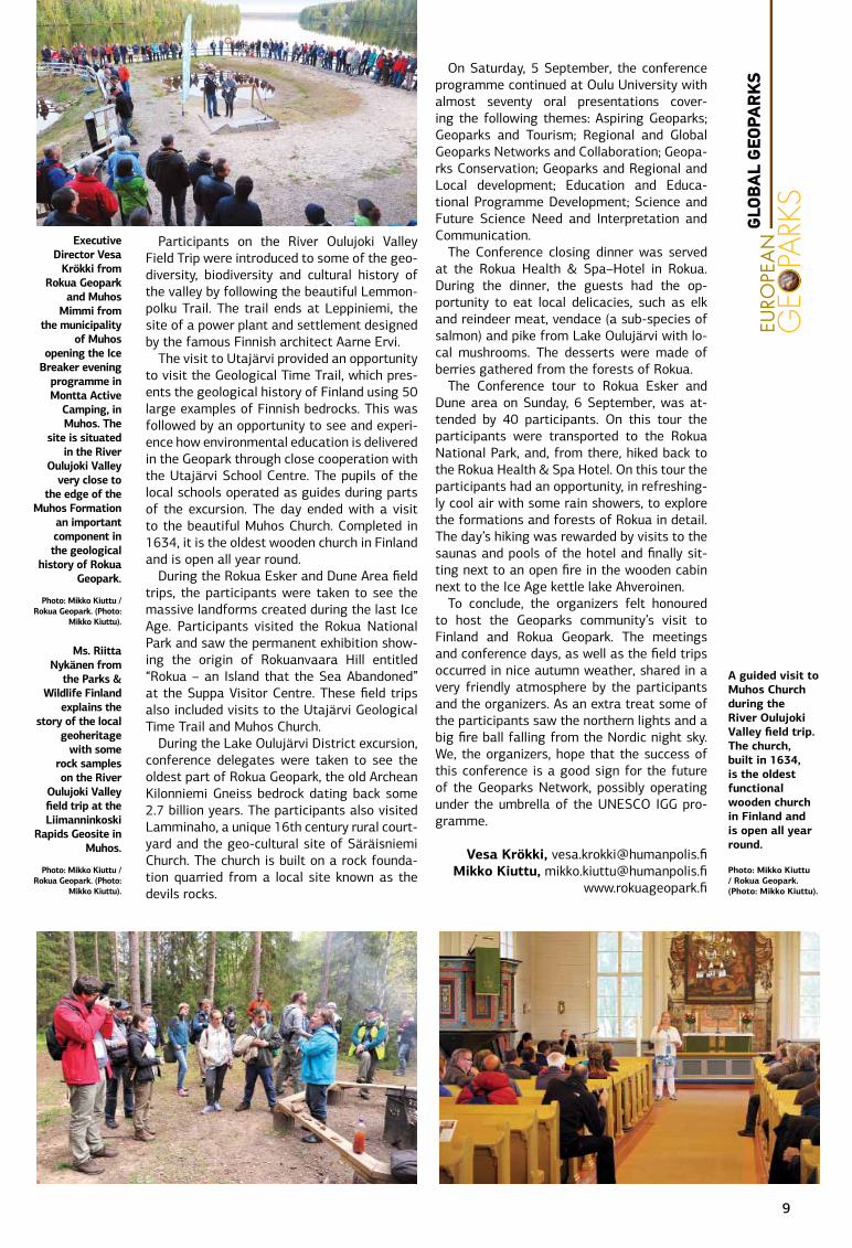
Participants on the River Oulujoki Valley Field Trip were introduced to some of the geo-diversity, biodiversity and cultural history of the valley by following the beautiful Lemmon-polku Trail. The trail ends at Leppiniemi, the site of a power plant and settlement designed by the famous Finnish architect Aarne Ervi.
The visit to Utajärvi provided an opportunity to visit the Geological Time Trail, which pres-ents the geological history of Finland using 50 large examples of Finnish bedrocks. This was followed by an opportunity to see and experi-ence how environmental education is delivered in the Geopark through close cooperation with the Utajärvi School Centre. The pupils of the local schools operated as guides during parts of the excursion. The day ended with a visit to the beautiful Muhos Church. Completed in 1634, it is the oldest wooden church in Finland and is open all year round.
During the Rokua Esker and Dune Area field trips, the participants were taken to see the massive landforms created during the last Ice Age. Participants visited the Rokua National Park and saw the permanent exhibition show-ing the origin of Rokuanvaara Hill entitled “Rokua – an Island that the Sea Abandoned” at the Suppa Visitor Centre. These field trips also included visits to the Utajärvi Geological Time Trail and Muhos Church.
During the Lake Oulujärvi District excursion, conference delegates were taken to see the oldest part of Rokua Geopark, the old Archean Kilonniemi Gneiss bedrock dating back some 2.7 billion years. The participants also visited Lamminaho, a unique 16th century rural court-yard and the geo-cultural site of Säräisniemi Church. The church is built on a rock founda-tion quarried from a local site known as the devils rocks.
On Saturday, 5 September, the conference programme continued at Oulu University with almost seventy oral presentations cover-ing the following themes: Aspiring Geoparks; Geoparks and Tourism; Regional and Global Geoparks Networks and Collaboration; Geopa-rks Conservation; Geoparks and Regional and Local development; Education and Educa-tional Programme Development; Science and Future Science Need and Interpretation and Communication.
The Conference closing dinner was served at the Rokua Health & Spa–Hotel in Rokua. During the dinner, the guests had the op-portunity to eat local delicacies, such as elk and reindeer meat, vendace (a sub-species of salmon) and pike from Lake Oulujärvi with lo-cal mushrooms. The desserts were made of berries gathered from the forests of Rokua.
The Conference tour to Rokua Esker and Dune area on Sunday, 6 September, was at-tended by 40 participants. On this tour the participants were transported to the Rokua National Park, and, from there, hiked back to the Rokua Health & Spa Hotel. On this tour the participants had an opportunity, in refreshing-ly cool air with some rain showers, to explore the formations and forests of Rokua in detail. The day’s hiking was rewarded by visits to the saunas and pools of the hotel and finally sit-ting next to an open fire in the wooden cabin next to the Ice Age kettle lake Ahveroinen.
To conclude, the organizers felt honoured to host the Geoparks community’s visit to Finland and Rokua Geopark. The meetings and conference days, as well as the field trips occurred in nice autumn weather, shared in a very friendly atmosphere by the participants and the organizers. As an extra treat some of the participants saw the northern lights and a big fire ball falling from the Nordic night sky. We, the organizers, hope that the success of this conference is a good sign for the future of the Geoparks Network, possibly operating under the umbrella of the UNESCO IGG pro-gramme.
Vesa Krökki, [email protected] Kiuttu, [email protected]
www.rokuageopark.fi
Executive Director Vesa
Krökki from Rokua Geopark
and Muhos Mimmi from
the municipality of Muhos
opening the Ice Breaker evening
programme in Montta Active
Camping, in Muhos. The
site is situated in the River
Oulujoki Valley very close to
the edge of the Muhos Formation
an important component in the geological
history of Rokua Geopark.
Photo: Mikko Kiuttu / Rokua Geopark. (Photo:
Mikko Kiuttu).
A guided visit to Muhos Church during the River Oulujoki Valley field trip. The church, built in 1634, is the oldest functional wooden church in Finland and is open all year round.
Photo: Mikko Kiuttu / Rokua Geopark. (Photo: Mikko Kiuttu).
Ms. Riitta Nykänen from
the Parks & Wildlife Finland
explains the story of the local
geoheritage with some
rock samples on the River
Oulujoki Valley field trip at the Liimanninkoski
Rapids Geosite in Muhos.
Photo: Mikko Kiuttu / Rokua Geopark. (Photo:
Mikko Kiuttu).
GLO
BA
L G
EOPA
RK
S
9
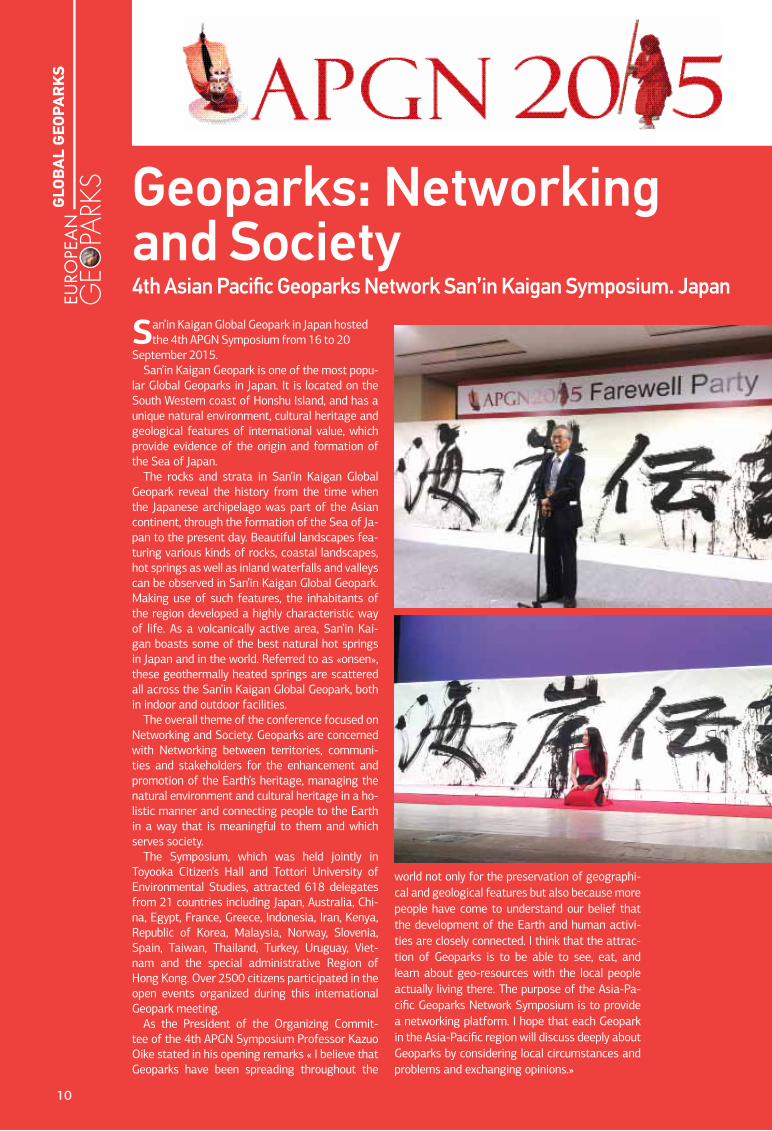
San’in Kaigan Global Geopark in Japan hosted the 4th APGN Symposium from 16 to 20
September 2015. San’in Kaigan Geopark is one of the most popu-
lar Global Geoparks in Japan. It is located on the South Western coast of Honshu Island, and has a unique natural environment, cultural heritage and geological features of international value, which provide evidence of the origin and formation of the Sea of Japan.
The rocks and strata in San’in Kaigan Global Geopark reveal the history from the time when the Japanese archipelago was part of the Asian continent, through the formation of the Sea of Ja-pan to the present day. Beautiful landscapes fea-turing various kinds of rocks, coastal landscapes, hot springs as well as inland waterfalls and valleys can be observed in San’in Kaigan Global Geopark. Making use of such features, the inhabitants of the region developed a highly characteristic way of life. As a volcanically active area, San’in Kai-gan boasts some of the best natural hot springs in Japan and in the world. Referred to as «onsen», these geothermally heated springs are scattered all across the San’in Kaigan Global Geopark, both in indoor and outdoor facilities.
The overall theme of the conference focused on Networking and Society. Geoparks are concerned with Networking between territories, communi-ties and stakeholders for the enhancement and promotion of the Earth’s heritage, managing the natural environment and cultural heritage in a ho-listic manner and connecting people to the Earth in a way that is meaningful to them and which serves society.
The Symposium, which was held jointly in Toyooka Citizen’s Hall and Tottori University of Environmental Studies, attracted 618 delegates from 21 countries including Japan, Australia, Chi-na, Egypt, France, Greece, Indonesia, Iran, Kenya, Republic of Korea, Malaysia, Norway, Slovenia, Spain, Taiwan, Thailand, Turkey, Uruguay, Viet-nam and the special administrative Region of Hong Kong. Over 2500 citizens participated in the open events organized during this international Geopark meeting.
As the President of the Organizing Commit-tee of the 4th APGN Symposium Professor Kazuo Oike stated in his opening remarks « I believe that Geoparks have been spreading throughout the
world not only for the preservation of geographi-cal and geological features but also because more people have come to understand our belief that the development of the Earth and human activi-ties are closely connected. I think that the attrac-tion of Geoparks is to be able to see, eat, and learn about geo-resources with the local people actually living there. The purpose of the Asia-Pa-cific Geoparks Network Symposium is to provide a networking platform. I hope that each Geopark in the Asia-Pacific region will discuss deeply about Geoparks by considering local circumstances and problems and exchanging opinions.»
Geoparks: Networking and Society 4th Asian Pacific Geoparks Network San’in Kaigan Symposium. Japan
10
GLO
BA
L G
EOPA
RK
S
Themes for oral presentations and poster submissions were as follows:
A. Geoparks Management and NetworkingB. Aspiring GeoparksC. Conservation and Interpretation of
NatureD. EducationE. Sustaining Local CommunitiesF. Improvement based on Assessment and
RecommendationG. GeotourismH. Cultural Heritage and Living Human
TreasuresI. Geo-hazard Risk Reduction, Prevention
and Mitigation
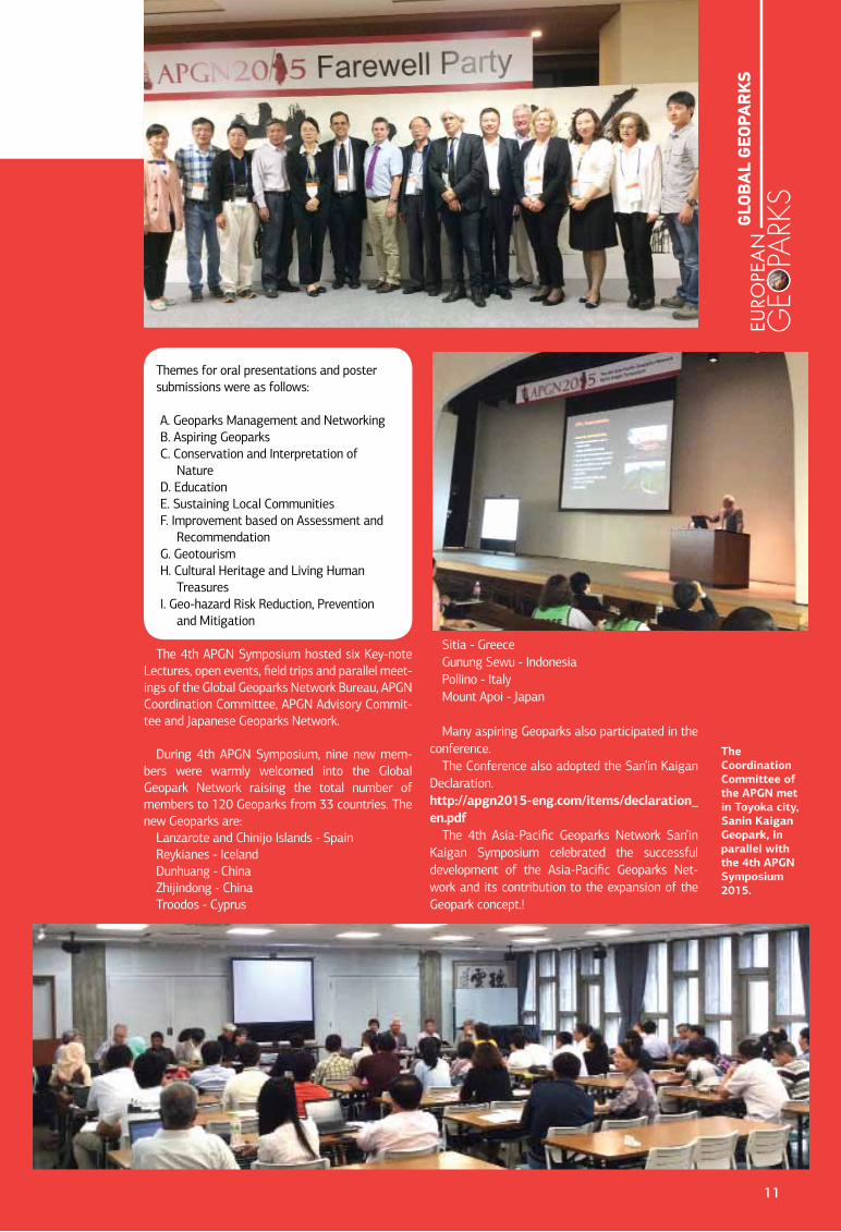
The 4th APGN Symposium hosted six Key-note Lectures, open events, field trips and parallel meet-ings of the Global Geoparks Network Bureau, APGN Coordination Committee, APGN Advisory Commit-tee and Japanese Geoparks Network.
During 4th APGN Symposium, nine new mem-bers were warmly welcomed into the Global Geopark Network raising the total number of members to 120 Geoparks from 33 countries. The new Geoparks are:
Lanzarote and Chinijo Islands - SpainReykianes - IcelandDunhuang - ChinaZhijindong - ChinaTroodos - Cyprus
Sitia - GreeceGunung Sewu - IndonesiaPollino - ItalyMount Apoi - Japan
Many aspiring Geoparks also participated in the conference.
The Conference also adopted the San’in Kaigan Declaration.http://apgn2015-eng.com/items/declaration_en.pdf
The 4th Asia-Pacific Geoparks Network San’in Kaigan Symposium celebrated the successful development of the Asia-Pacific Geoparks Net-work and its contribution to the expansion of the Geopark concept.!
The Coordination Committee of the APGN met in Toyoka city, Sanin Kaigan Geopark, in parallel with the 4th APGN Symposium 2015.
11
GLO
BA
L G
EOPA
RK
S
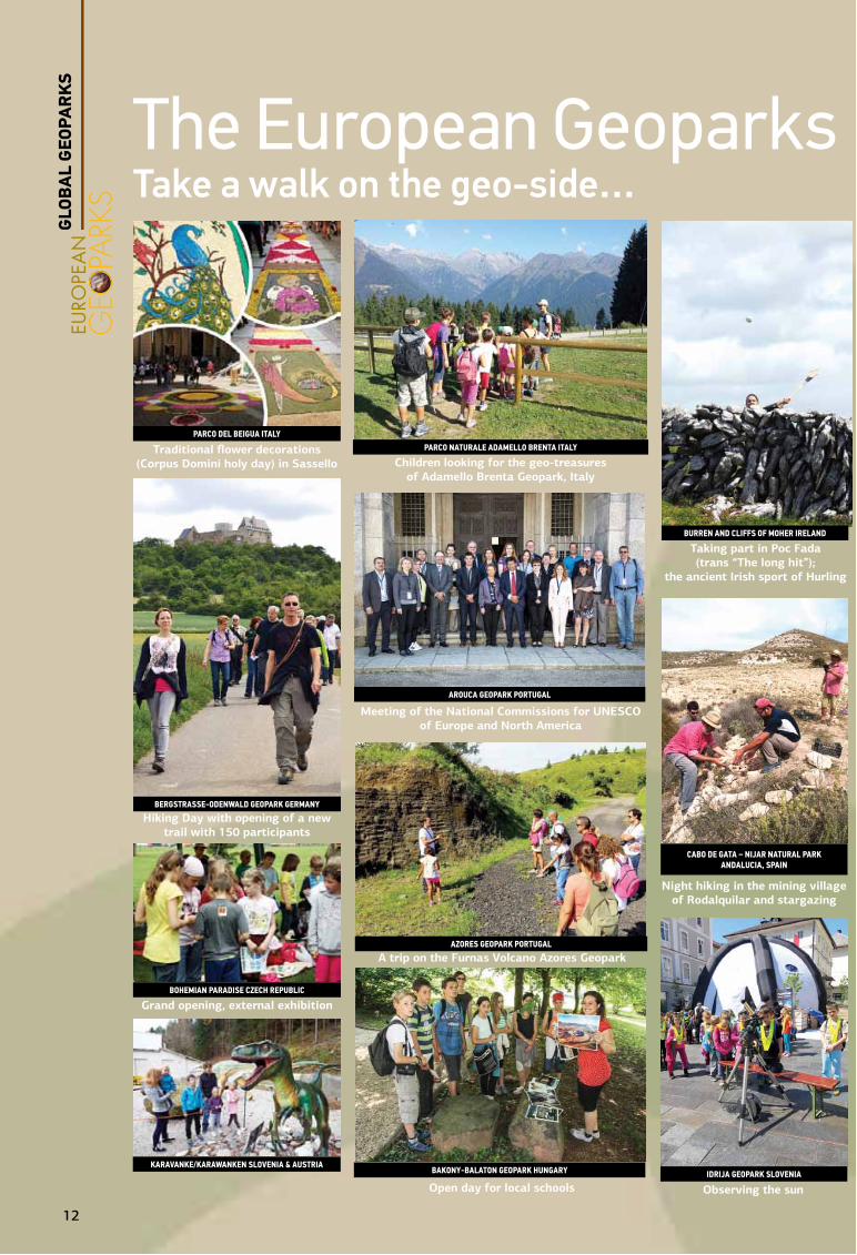
The European Geoparks Week 2015Take a walk on the geo-side…
Taking part in Poc Fada (trans “The long hit”);
the ancient Irish sport of Hurling
Observing the sun
Night hiking in the mining village of Rodalquilar and stargazing
Children looking for the geo-treasures of Adamello Brenta Geopark, Italy
Meeting of the National Commissions for UNESCO of Europe and North America
A trip on the Furnas Volcano Azores Geopark
Open day for local schools
Traditional flower decorations (Corpus Domini holy day) in Sassello
Hiking Day with opening of a new trail with 150 participants
Grand opening, external exhibition
Parco Del Beigua iTalYParco NaTurale aDamello BreNTa iTalY
BurreN aND cliffs of moher irelaND
Cabo de Gata – Nijar Natural Park aNDalucia, sPaiN
idrija GeoPark SloVeNia
arouCa GeoPark PortuGal
azoreS GeoPark PortuGal
bakoNy-balatoN GeoPark HuNGary
berGStraSSe-odeNwald GeoPark GerMaNy
BohemiaN ParaDise cZech rePuBlic
karaVaNke/karawaNkeN SloVeNia & auStria
GLO
BA
L G
EOPA
RK
S
12
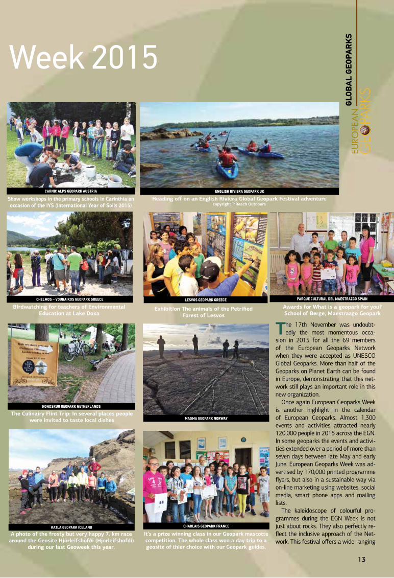
The 17th November was undoubt-edly the most momentous occa-
sion in 2015 for all the 69 members of the European Geoparks Network when they were accepted as UNESCO Global Geoparks. More than half of the Geoparks on Planet Earth can be found in Europe, demonstrating that this net-work still plays an important role in this new organization.
Once again European Geoparks Week is another highlight in the calendar of European Geoparks. Almost 1,300 events and activities attracted nearly 120,000 people in 2015 across the EGN. In some geoparks the events and activi-ties extended over a period of more than seven days between late May and early June. European Geoparks Week was ad-vertised by 170,000 printed programme flyers, but also in a sustainable way via on-line marketing using websites, social media, smart phone apps and mailing lists.
The kaleidoscope of colourful pro-grammes during the EGN Week is not just about rocks. They also perfectly re-flect the inclusive approach of the Net-work. This festival offers a wide-ranging
The European Geoparks Week 2015Take a walk on the geo-side…
It’s a prize winning class in our Geopark mascotte competition. The whole class won a day trip to a geosite of thier choice with our Geopark guides.
Heading off on an English Riviera Global Geopark Festival adventure copyright ™Reach Outdoors
Exhibition The animals of the Petrified Forest of Lesvos
Awards for What is a geopark for you?School of Berge, Maestrazgo Geopark
Birdwatching for teachers of Environmental Education at Lake Doxa
The Culinairy Flint Trip: In several places people were invited to taste local dishes
A photo of the frosty but very happy 7. km race around the Geosite Hjörleifshöfði (Hjorleifshofdi)
during our last Geoweek this year.
Show workshops in the primary schools in Carinthia on occasion of the IYS (International Year of Soils 2015)
CHablaiS GeoPark FraNCe
CarNiC alPS GeoPark auStria
MaGMa GeoPark Norway
Parque culTural Del maesTraZgo sPaiNleSVoS GeoPark GreeCe
eNGliSH riViera GeoPark uk
CHelMoS – VouraikoS GeoPark GreeCe
HoNdSruG GeoPark NetHerlaNdS
katla GeoPark iCelaNd
GLO
BA
L G
EOPA
RK
S
13
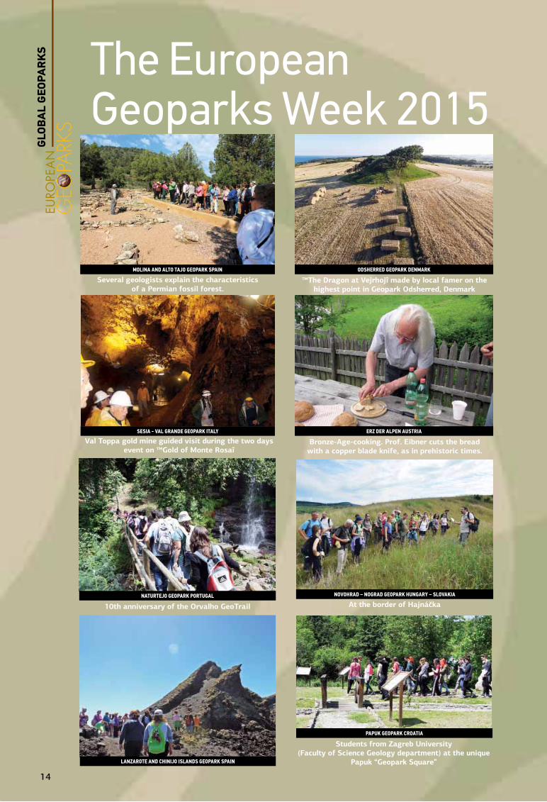
The European Geoparks Week 2015
Several geologists explain the characteristics of a Permian fossil forest.
™The Dragon at Vejrhojî made by local famer on the highest point in Geopark Odsherred, Denmark
Val Toppa gold mine guided visit during the two days event on ™Gold of Monte Rosaî
Bronze-Age-cooking. Prof. Eibner cuts the bread with a copper blade knife, as in prehistoric times.
Students from Zagreb University (Faculty of Science Geology department) at the unique
Papuk “Geopark Square”
10th anniversary of the Orvalho GeoTrail At the border of Hajnáčka
MoliNa aNd alto tajo GeoPark SPaiN odSHerred GeoPark deNMark
SeSia - Val GraNde GeoPark italy
laNzarote aNd CHiNijo iSlaNdS GeoPark SPaiN
erZ Der alPeN ausTria
NoVoHrad – NoGrad GeoPark HuNGary – SloVakiaNaturtejo GeoPark PortuGal
PaPuk GeoPark Croatia
GLO
BA
L G
EOPA
RK
S
14
Drakolimni on Mount Smolikas. A residue from the last glacial period. A permanent
“heart”, is a famous destination for climbers.
VikoS – aooS GeoPark GreeCe
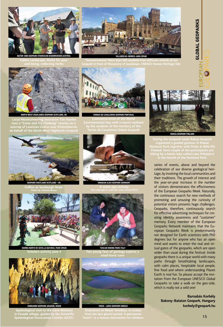
series of events, above and beyond the celebration of our diverse geological heri-tage, by involving the local communities and their traditions. The growth of interest and the year-on-year increase in the number of visitors demonstrates the effectiveness of the European Geoparks Week. Naturally, the continuous search for new methods of promoting and arousing the curiosity of potential vistors presents huge challenges. Geoparks, therefore, continuously search for effective advertising techniques for cre-ating identity awareness and “customer” memory. Every member of the European Geoparks Network maintains that the Eu-ropean Geoparks Week is predominantly not designed for Earth scientists with PhD degrees but for anyone who has an open mind and wants to enter the real and vir-tual gates of the geoparks, which are open wider than usual during the festival. Inside geoparks there is a unique world with many paths through breathtaking landscapes, with calm places, hospitable local people, fine food and where understanding Planet Earth is real fun. So please accept the invi-tation from the European UNESCO Global Geoparks to take a walk on the geo-side, which is really not a wild one!
Barnabás KorbélyBakony–Balaton Geopark, Hungary
Edible Landscape. Herbs for your well-being, collecting herbs
Commemoration of the World Environmental Day with a march realized
by the students of the territory of the Terras de Cavaleiros Global Geopark
“Geoconvivencia” More than 500 students from different schools of our Geopark in front of Monastery of Guadalupe, UNESCO Human Heritage Site
Two young fans of geology explore a small karst cave
Puffins at Sumburgh Head. Photo by Yolanda Bruce
Scholars activity June 4
Speleological visit to the Cave Moliniαs in Fosado village, guided by the Scientific Speleological Association Cotiella (ACEC).
During the Geopark week Rokua Geopark organized a guided geotour in Rokua
National Park together with Parks & Wild life Finland. Here couple of the participants are hiking by a kettle lake called Lake Pitkäjärvi
in the hearth of the National Park.
Local Mountaineering Instructor Tim Hamlet runs a “Come and Try Climbing” session on a
outcrop of Lewisian Gneiss near Kinlochbervie on behalf of the North West Highlands Geopark
A stone age activity. The copyright is with the urmu Urmu©2015
Natur-uNd GeoPark SteiriSCHe eiSeNwurzeN auStria VilluerCaS-iboreS-jara SPaiN
terraS de CaValeiroS GeoPark PortuGal
tuSCaN MiNiNG Park italy
SwabiaN albS GeoPark GerMaNyGeoPark SHetlaNd SCotlaNd – uk
Sierra Norte de SeVilla Natural Park SPaiN
Sobrarbe GeoPark araGoN, SPaiN
rokua GeoPark FiNlaNd
NortH weSt HiGHlaNdS GeoPark SCotlaNd, uk
GLO
BA
L G
EOPA
RK
S
15
The geoheritage celebrated at the core of UNESCO Global Geoparks can be a source of
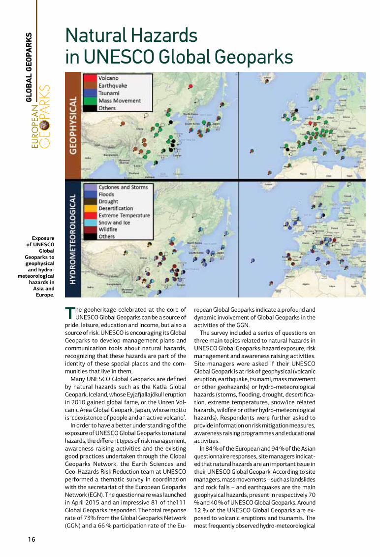
pride, leisure, education and income, but also a source of risk. UNESCO is encouraging its Global Geoparks to develop management plans and communication tools about natural hazards, recognizing that these hazards are part of the identity of these special places and the com-munities that live in them.
Many UNESCO Global Geoparks are defined by natural hazards such as the Katla Global Geopark, Iceland, whose Eyjafjallajökull eruption in 2010 gained global fame, or the Unzen Vol-canic Area Global Geopark, Japan, whose motto is ‘coexistence of people and an active volcano’.
In order to have a better understanding of the exposure of UNESCO Global Geoparks to natural hazards, the different types of risk management, awareness raising activities and the existing good practices undertaken through the Global Geoparks Network, the Earth Sciences and Geo-Hazards Risk Reduction team at UNESCO performed a thematic survey in coordination with the secretariat of the European Geoparks Network (EGN). The questionnaire was launched in April 2015 and an impressive 81 of the111 Global Geoparks responded. The total response rate of 73% from the Global Geoparks Network (GGN) and a 66 % participation rate of the Eu-
ropean Global Geoparks indicate a profound and dynamic involvement of Global Geoparks in the activities of the GGN.
The survey included a series of questions on three main topics related to natural hazards in UNESCO Global Geoparks: hazard exposure, risk management and awareness raising activities. Site managers were asked if their UNESCO Global Geopark is at risk of geophysical (volcanic eruption, earthquake, tsunami, mass movement or other geohazards) or hydro-meteorological hazards (storms, flooding, drought, desertifica-tion, extreme temperatures, snow/ice related hazards, wildfire or other hydro-meteorological hazards). Respondents were further asked to provide information on risk mitigation measures, awareness raising programmes and educational activities.
In 84 % of the European and 94 % of the Asian questionnaire responses, site managers indicat-ed that natural hazards are an important issue in their UNESCO Global Geopark. According to site managers, mass movements – such as landslides and rock falls – and earthquakes are the main geophysical hazards, present in respectively 70 % and 40 % of UNESCO Global Geoparks. Around 12 % of the UNESCO Global Geoparks are ex-posed to volcanic eruptions and tsunamis. The most frequently observed hydro-meteorological
Natural Hazards in UNESCO Global Geoparks
Exposure of UNESCO
Global Geoparks to geophysical and hydro-
meteorological hazards in
Asia and Europe.
GLO
BA
L G
EOPA
RK
S
16

hazards are floods (65 %) and wildfires (46 %), along with snow and ice related hazards (36 %).
Awareness raising activities related to natural hazards are carried out in many UNESCO Global Geoparks. The majority, 69%, conduct educa-tional activities, and 47% carry out prevention and mitigation awareness exercises. For ex-ample, the UNESCO Global Geoparks of Lesvos Island and Psiloritis in Greece contributed to the project “Raising earthquake awareness & coping with children’s emotions” which aims to reduce the emotional burden on children and help them to cope with disasters by raising awareness, improving knowledge of earthquakes and tsuna-mis and providing education on good practices and state of the art responses. UNESCO Global Geoparks are not only actively raising aware-ness about geophysical processes and risk, but they also cooperate in scientific research pro-grammes related to natural hazards.
Overall, 35 % of the managers responded that they have good practices and are interested to share them with other UNESCO Global Geopa-rks and UNESCO-designated sites. Of all the respondents, 72% were interested in training in prevention and mitigation of natural disasters.
An important issue for the future of UNESCO Global Geoparks is their cooperation with other UNESCO-designated sites – World Heritage Sites and Biosphere Reserves – especially where there is geographic overlap. At present, only 16 % of the UNESCO Global Geoparks cooperate with other UNESCO-designated sites. As coop-eration ensures the effective management of natural hazards, it is in the interest of UNESCO Global Geoparks and their communities to pri-oritize this in the future.
In conclusion, UNESCO Earth Sciences and Geo-Hazards Risk Reduction will continue to develop the initiative on risk assessment at UNESCO-designated sites. Future studies
should focus on evaluating the real situation in UNESCO Global Geoparks through more detailed spatial hazard assessment and more detailed questioning of identified focus groups. A se-ries of regional workshops with site managers should be organized on prevention, emergency preparedness and recovery, maintenance and monitoring at each concerned site. The elabo-rated methodology and associated tools should reinforce the capacity of UNESCO-designat-ed sites to deal with risk from disasters and, moreover, inform other institutions and the local community about natural hazards and how to mitigate risks threatening their communities and natural heritage assets.
UNESCO thanks all of its Global Geoparks who participated in the survey and looks forward to continued collaboration in this field.
Florian Dierickx, [email protected];
Irina Pavlova, [email protected];Sarah Gaines [email protected]
UNESCO Section on Earth Sciences and Geo-Hazards Risk Reduction, Natural Science Sector
Exposure of infrastructure to geophysical and hydro-meteorological hazards in Asian and European UNESCO Global Geoparks.
UNESCO Global Geoparks in Asia (A) and
Europe (B) interested in sharing good
practices.
GLO
BA
L G
EOPA
RK
S
17
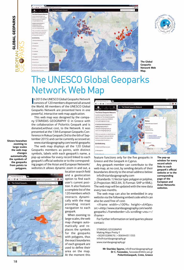
In 2015 the UNESCO Global Geoparks Network consists of 120 members dispersed all around
the World. All members of the UNESCO Global Geoparks Network are presented here in one powerful, interactive web map application.
This web map was designed by the compa-ny STARIDAS GEOGRAPHY © in Greece with the collaboration of Psiloritis Geopark and is donated,without cost, to the Network. It was presented at the 13th European Geoparks Con-ference in Rokua Geopark (3rd to the 6th of Sep-tember 2015) and can be currently accessed at:
www.staridasgeography.com/world-geoparksThe web map displays all the 120 Global
Geoparks members as points, with distinct symbols, labels with each geopark’s name, a pop-up window for every record linked to each geopark’s official website or to the correspond-ing pages of the Asian and European Networks’ websites.It allows dynamic zoom in and out, a
location search field and a geolocation option to find each user’s current posi-tion. It also features a complete list of the 120 members which interacts dynami-cally with the map providing instant navigation to each geopark.
When zooming to large scales, the web map changes auto-matically and re-places the symbols for the geoparks with polygons, thus the exact boundaries of each geopark are used to define their area on the map. At the moment this
feature functions only for the five geoparks in Greece and the Geopark in Cyprus.
Any geopark member can contribute to the web map, at no cost, by sending details of their boundaries directly to the email address below:
[email protected](Standards: 1) Vector type: polygon or polyline,
2) Projection: WGS 84, 3) Format: SHP or KML). The web map will be updated with the new data every two months.
The web map can also be embedded in any website via the following embed code which can also be used free of cost:
<iframe width=»100%» height=»640px» src=»http://www.staridasgeography.com/world-geoparks/» frameborder=»0» scrolling=»no»></iframe>
For further information or/and queries please contact:
STARIDAS GEOGRAPHYMaking Maps Pretty !!+302810289676 | [email protected]
Mr Staridas Spyros, [email protected] C. Fassoulas, [email protected]
PsiloritisGeopark, Crete, Greece
The Global Geoparks Network Web Map.
The pop-up window for every record which links to each geopark’s official website or to the corresponding page of the European and Asian Networks websites.
Shows howwhen zooming to
large scales the web map
changes automatically
the symbols of the geoparks
from points to polygons.
The UNESCO Global Geoparks Network Web Map
GLO
BA
L G
EOPA
RK
S
18
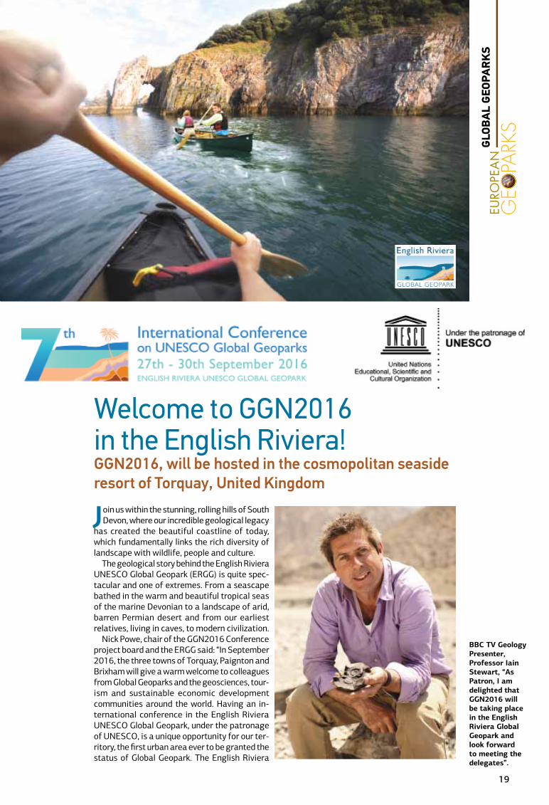
Join us within the stunning, rolling hills of South Devon, where our incredible geological legacy
has created the beautiful coastline of today, which fundamentally links the rich diversity of landscape with wildlife, people and culture.
The geological story behind the English Riviera UNESCO Global Geopark (ERGG) is quite spec-tacular and one of extremes. From a seascape bathed in the warm and beautiful tropical seas of the marine Devonian to a landscape of arid, barren Permian desert and from our earliest relatives, living in caves, to modern civilization.
Nick Powe, chair of the GGN2016 Conference project board and the ERGG said: “In September 2016, the three towns of Torquay, Paignton and Brixham will give a warm welcome to colleagues from Global Geoparks and the geosciences, tour-ism and sustainable economic development communities around the world. Having an in-ternational conference in the English Riviera UNESCO Global Geopark, under the patronage of UNESCO, is a unique opportunity for our ter-ritory, the first urban area ever to be granted the status of Global Geopark. The English Riviera
BBC TV Geology Presenter, Professor Iain Stewart, “As Patron, I am delighted that GGN2016 will be taking place in the English Riviera Global Geopark and look forward to meeting the delegates”.
Welcome to GGN2016 in the English Riviera!GGN2016, will be hosted in the cosmopolitan seaside resort of Torquay, United Kingdom
GLO
BA
L G
EOPA
RK
S
19

will shine a spotlight on the incredible work of the rapidly expanding Global Geoparks Network and we are very proud that this will be happening here in Devon,UK.”
Held for the first time in Great Britain, the confer-ence will welcome dele-gates concerned with the UNESCO Global Geoparks agenda from all over the world. UNESCO Global Geoparks work to develop sustainable economies, eco-tourism and engage-ment with their local com-munities, as well as being areas of significant geo-logical interest.
His Excellency Mr. Mat-thew Sudders, UK Ambas-sador to UNESCO said: “The Global Geoparks conference provides an international platform to support efforts to conserve Earth’s heritage while sustaining local communities and promot-ing science education. We are pleased to wel-come this high profile event to Great Britain for the first time. It is a recognition of the excellent
work of the UK in this field that we were chosen to host the Conference.”
Tim Williams, Chair of the UK National Commis-sion for UNESCO said, «The National Commis-sion is pleased to be as-sociated with this confer-ence. As well as being an opportunity to showcase the UK’s rich geological heritage to a global au-dience, the International Conference will be a valuable occasion for the UK’s Global Geoparks to both share best practice and bring new ways of working and learning to
the UK to more effectively promote eco-tourism and sustainable development.»
Register today for latest information and to be informed when official registration opens at www.GGN2016.com and follow latest news on twitter @GGN2016
Melanie Border, English Riviera Global Geopark Coordinator
Exploring Kents Cavern, the most important Palaeolithic cave system in
North-West Europe.
GLO
BA
L G
EOPA
RK
S
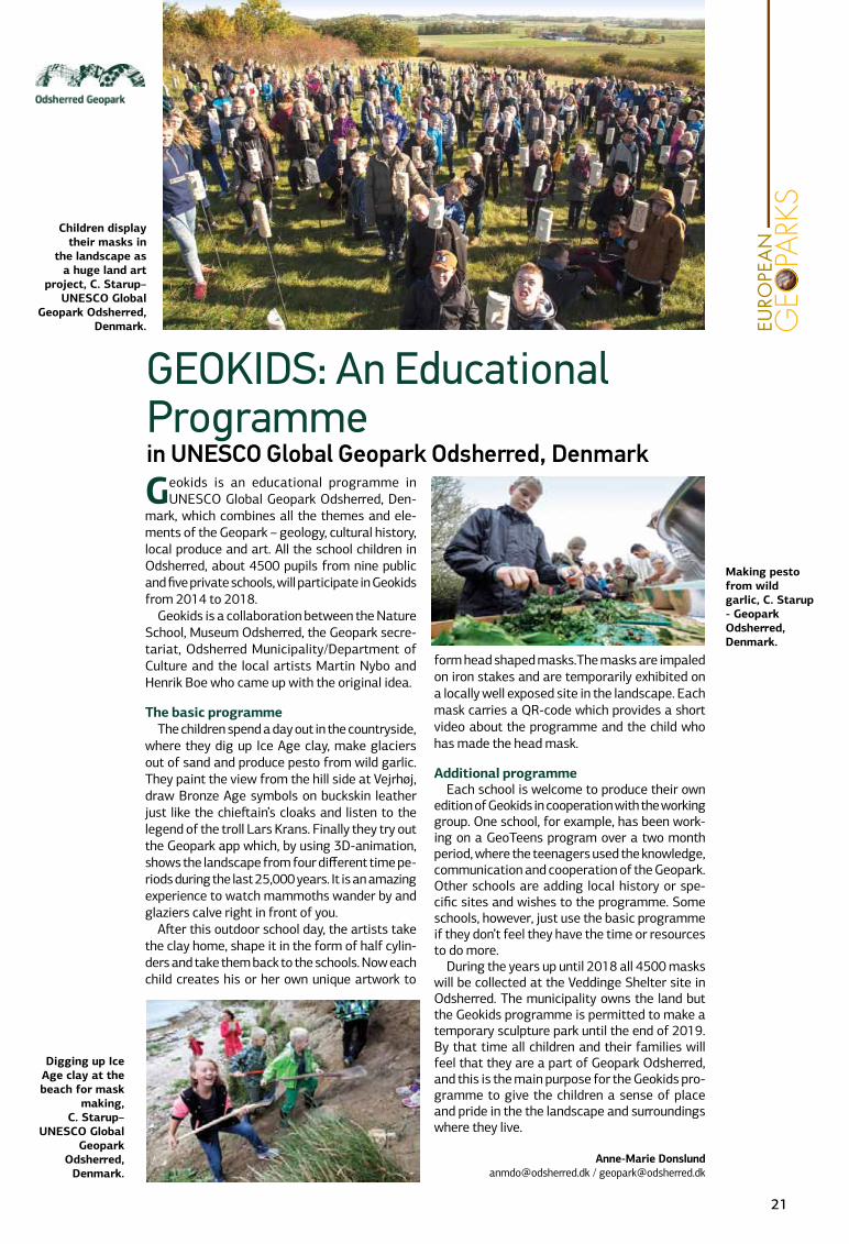
Geokids is an educational programme in UNESCO Global Geopark Odsherred, Den-
mark, which combines all the themes and ele-ments of the Geopark – geology, cultural history, local produce and art. All the school children in Odsherred, about 4500 pupils from nine public and five private schools, will participate in Geokids from 2014 to 2018.
Geokids is a collaboration between the Nature School, Museum Odsherred, the Geopark secre-tariat, Odsherred Municipality/Department of Culture and the local artists Martin Nybo and Henrik Boe who came up with the original idea.
The basic programmeThe children spend a day out in the countryside,
where they dig up Ice Age clay, make glaciers out of sand and produce pesto from wild garlic. They paint the view from the hill side at Vejrhøj, draw Bronze Age symbols on buckskin leather just like the chieftain’s cloaks and listen to the legend of the troll Lars Krans. Finally they try out the Geopark app which, by using 3D-animation, shows the landscape from four different time pe-riods during the last 25,000 years. It is an amazing experience to watch mammoths wander by and glaziers calve right in front of you.
After this outdoor school day, the artists take the clay home, shape it in the form of half cylin-ders and take them back to the schools. Now each child creates his or her own unique artwork to
form head shaped masks.The masks are impaled on iron stakes and are temporarily exhibited on a locally well exposed site in the landscape. Each mask carries a QR-code which provides a short video about the programme and the child who has made the head mask.
Additional programmeEach school is welcome to produce their own
edition of Geokids in cooperation with the working group. One school, for example, has been work-ing on a GeoTeens program over a two month period, where the teenagers used the knowledge, communication and cooperation of the Geopark. Other schools are adding local history or spe-cific sites and wishes to the programme. Some schools, however, just use the basic programme if they don’t feel they have the time or resources to do more.
During the years up until 2018 all 4500 masks will be collected at the Veddinge Shelter site in Odsherred. The municipality owns the land but the Geokids programme is permitted to make a temporary sculpture park until the end of 2019. By that time all children and their families will feel that they are a part of Geopark Odsherred, and this is the main purpose for the Geokids pro-gramme to give the children a sense of place and pride in the the landscape and surroundings where they live.
Anne-Marie [email protected] / [email protected]
GEOKIDS: An Educational Programme in UNESCO Global Geopark Odsherred, Denmark
Making pesto from wild garlic, C. Starup - Geopark Odsherred, Denmark.
Children display their masks in
the landscape as a huge land art
project, C. Starup–UNESCO Global
Geopark Odsherred, Denmark.
Digging up Ice Age clay at the beach for mask
making, C. Starup–
UNESCO Global Geopark
Odsherred, Denmark.
21
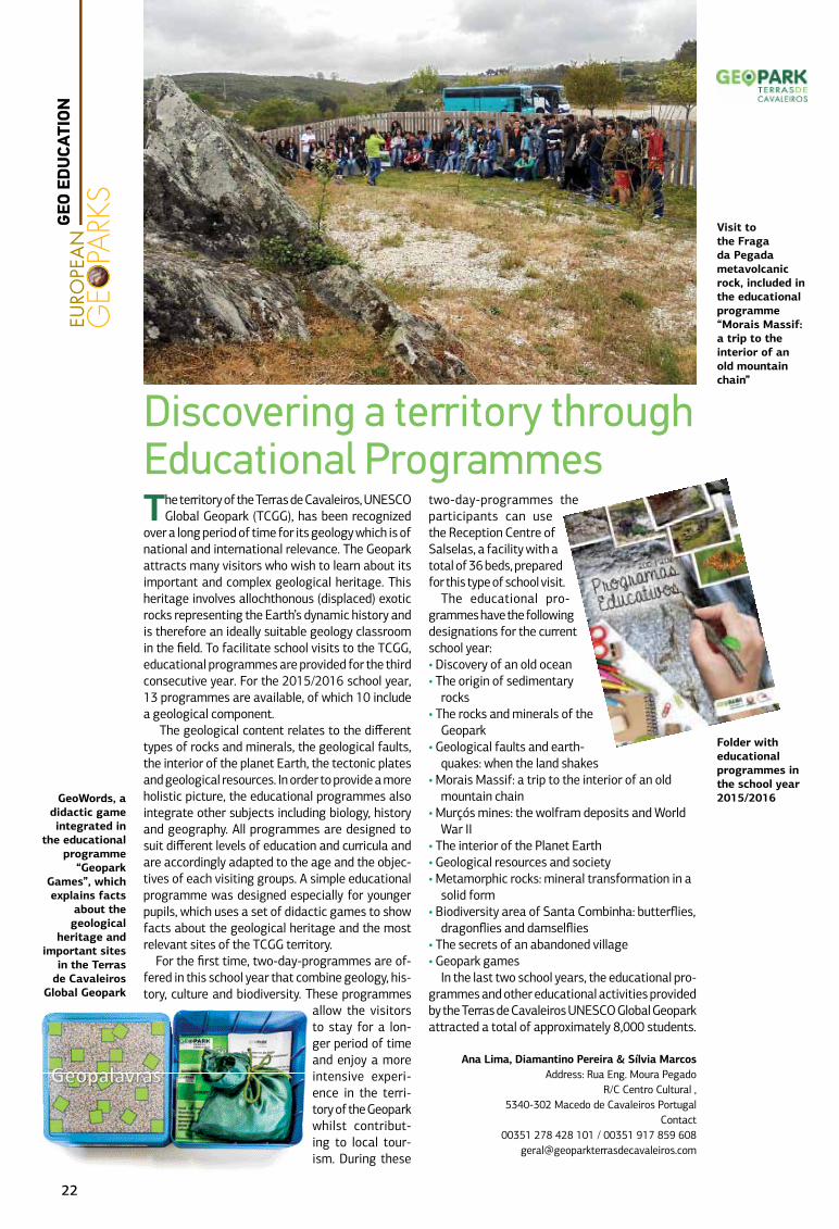
The territory of the Terras de Cavaleiros, UNESCO Global Geopark (TCGG), has been recognized
over a long period of time for its geology which is of national and international relevance. The Geopark attracts many visitors who wish to learn about its important and complex geological heritage. This heritage involves allochthonous (displaced) exotic rocks representing the Earth’s dynamic history and is therefore an ideally suitable geology classroom in the field. To facilitate school visits to the TCGG, educational programmes are provided for the third consecutive year. For the 2015/2016 school year, 13 programmes are available, of which 10 include a geological component.
The geological content relates to the different types of rocks and minerals, the geological faults, the interior of the planet Earth, the tectonic plates and geological resources. In order to provide a more holistic picture, the educational programmes also integrate other subjects including biology, history and geography. All programmes are designed to suit different levels of education and curricula and are accordingly adapted to the age and the objec-tives of each visiting groups. A simple educational programme was designed especially for younger pupils, which uses a set of didactic games to show facts about the geological heritage and the most relevant sites of the TCGG territory.
For the first time, two-day-programmes are of-fered in this school year that combine geology, his-tory, culture and biodiversity. These programmes
allow the visitors to stay for a lon-ger period of time and enjoy a more intensive experi-ence in the terri-tory of the Geopark whilst contribut-ing to local tour-ism. During these
two-day-programmes the participants can use the Reception Centre of Salselas, a facility with a total of 36 beds, prepared for this type of school visit.
The educational pro-grammes have the following designations for the current school year: • Discovery of an old ocean• The origin of sedimentary
rocks• The rocks and minerals of the
Geopark• Geological faults and earth-
quakes: when the land shakes • Morais Massif: a trip to the interior of an old
mountain chain • Murçós mines: the wolfram deposits and World
War II• The interior of the Planet Earth• Geological resources and society• Metamorphic rocks: mineral transformation in a
solid form• Biodiversity area of Santa Combinha: butterflies,
dragonflies and damselflies• The secrets of an abandoned village• Geopark games
In the last two school years, the educational pro-grammes and other educational activities provided by the Terras de Cavaleiros UNESCO Global Geopark attracted a total of approximately 8,000 students.
Ana Lima, Diamantino Pereira & Sílvia MarcosAddress: Rua Eng. Moura Pegado
R/C Centro Cultural , 5340-302 Macedo de Cavaleiros Portugal
Contact00351 278 428 101 / 00351 917 859 608
Discovering a territory through Educational Programmes
Folder with educational programmes in the school year 2015/2016GeoWords, a
didactic game integrated in
the educational programme
“Geopark Games”, which explains facts
about the geological
heritage and important sites
in the Terras de Cavaleiros
Global Geopark
Visit to the Fraga da Pegada metavolcanic rock, included in the educational programme “Morais Massif: a trip to the interior of an old mountain chain”
22
GEO
ED
UCA
TION
Idrija UNESCO Global Geopark, located in western Slovenia, is an area of unique natural and cultural
heritage, largely characterized by 500 years of mer-cury mining. The technical heritage of mercury min-ing in Idrija and Almadén has been recognized to be of outstanding universal value (OUV) and has been included in the UNESCO World Heritage List.
The Geopark places great emphasis on raising awareness among the younger generations of the importance of heritage in Idrija, both at the local and national levels. The main objectives of integrating heritage into the educational activities are: increas-ing heritage awareness among school age children, popularising the science content, promoting creative thinking and introducing new educational methods in teaching and interpreting the Geopark’s heritage.
We have formed the Idrija UNESCO Global Geopark School Network, where we actively take part in joint practical activities, devised to maintain and revive our local heritage in the town and in the rural areas. Members of the network include all four elementary schools in the area. Every year one of them takes over the organisation of a theme day and prepares the daily programme for about 150 seventh grad-ers divided into groups. The programme is delivered by the teaching staff as well as by Idrija Geopark’s partners, associations and individuals, and includes theoretical and practical activities based on the local natural and cultural heritage.
Additionally, during the summer holidays, work-shops for children in cooperation with partners are provided. We tend to make these workshops enter-taining as well as informative and educational. This
summer we delivered the following workshops: mak-ing your own stone bracelet; a tournament involving old social games at the interpretation site “Gravel is a Playground”; a creative workshop at the Idrijca River; the story of stones workshop and the visit to the Idrija bee house with the workshop of painting beehive panels.
Based on the the experience of previously imple-mented and tested programmes in recent years, we have prepared educational programmes for the cur-rent school year 2015/16 entitled “Geo-experiences for Big and Little Explorers” which were distributed to all elementary schools in Slovenia. These pro-grammes, which also include our partners, will be implemented as guided lectures at Idrija UNESCO Global Geopark interpretation sites, as tours along thematic teaching paths and as creative workshops.
One of our goals is to achieve the inclusion of these activities, based on the innovative interpretation of heritage and popularization of science, into the na-tional curricula and teacher training programmes at both local and national levels.
At Idrija UNESCO Global Geopark we hope for the success of the newly prepared programmes and for the educational activities for school children and their teachers to encourage a sense of preserving our ex-traordinary natural and cultural heritage.
Mojca Gorjup Kavčič, [email protected], Bojan Režun, [email protected], Nina Erjavec, [email protected], Jaka Kenk, [email protected], Sanja Marija Pellis, [email protected]
Idrija Heritage Centre (Idrija Geopark), Ulica IX. kor-pusa 17, SI - 5280 Idrija
The workshop “Make your own Erupting Volcano” as part of the programme “Restless Planet” for the final three grades of elementary school age
(Photo: Idrija Geopark)
A tournament at the
educational site “Gravel is a Playground”, where children
think about different types
of rocks in Idrija Geopark
for elementary school grades
three to five
(Photo: Idrija Geopark)
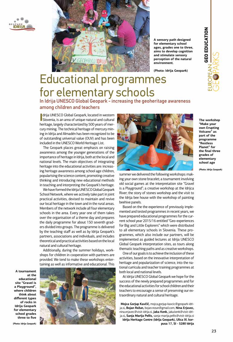
A sensory path designed for elementary school ages, grades one to three, aims to develop cognition and stimulate sensory perception of the natural environment.
(Photo: Idrija Geopark)
Educational programmes for elementary schools In Idrija UNESCO Global Geopark - increasing the geoheritage awareness among children and teachers
GEO
ED
UCA
TION
23
In May 2015, a groundwater awareness project in-volving secondary and primary schools took place
in the Burren. The project was initiated by the Burren and Cliffs of Moher UNESCO Global Geopark under the GeoparkLIFE project in collaboration with Lis-doonvarna Secondary School, Earth and Ocean Sci-ences (EOS) Department, NUI Galway and the Boghill Centre, Lisdoonvarna and the Geological Survey of Ireland.
The Burren is a glaciokarst limestone landscape on the west coast of Ireland. Groundwater in the Burren has been classified as ‘highly vulnerable’ by the Geo-logical Survey of Ireland. The Burren is a rural area with a low population density comprising isolated houses, farms, villages and small towns. Tourism (largely seasonal) and farming are the main economic activities in the area. Many of the houses and farms use groundwater as their primary source of drinking water. As well as being locally significant within the Geopark, the nature of the karst means that some of the groundwater flows beyond the Burren and ul-timately feeds into the source of drinking water for the town of Ennis (pop; 25,000) 10 km outside of the Geopark area.
The aim of the school project was to harness the hydrological re-search currently be-ing conducted in the Burren by the Earth and Ocean Science Department NUI Gal-way and to filter that information through secondary school children at Mary Im-
maculate Secondary School, Lisdoonvarna who would distil and then transmit their knowledge to local pri-mary school children. A publication (‘What to Do and what Not to Do in the Burren’) by local author and artist Sonja O’ Brien about environmental awareness in the Burren was used to supplement the hydrologi-cal information with information about littering and community responsibilities and provided a colourful and educational reward for the participating primary school children. The primary school children also sub-mitted paintings on the theme of ‘Water in the Burren’ to an EGN Week school art competition.
Dr. Tiernan Henry (EOS) presented the hydrologi-cal information in the format of a class lecture to eight Transition Year students. Additional informa-tion about littering was provided by Sonja O’Brien of the Boghill Centre, Lisdoonvarna through informal class lecture and video. This expert information was then used by the eight students to prepare a lesson plan for presentation to two local primary schools at Kilshanny and New Quay.
On completion of the project, the eight Transition Year students were presented with certificates of achievement which were presented at an end-of-year school awards cer-emony. The project will be submitted to the ECO- UNESCO Young Environmen-talist competition and will continue in 2016.
Dr. Eamon Doyle
Transmitting Groundwater Awareness from Universities to Primary SchoolsA Secondary School Project in the Burren, Ireland
Transition Year Secondary School children presenting a lesson to primary school children in the Burren.
The Burren and Cliffs of
Moher Geopark presented the
school children with a copy of
Sonja O’Brien’s illustrated
book about the Burren.
GEO
ED
UCA
TION
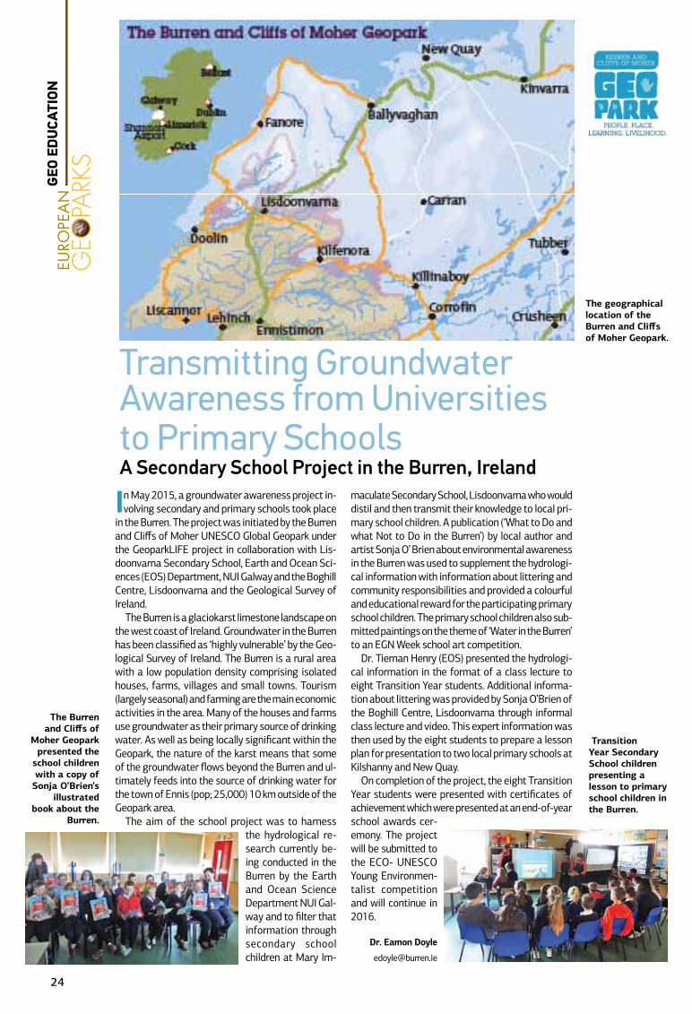
The geographical location of the Burren and Cliffs of Moher Geopark.
24
Chablais UNESCO Global Geopark devised a var-ied and dynamic programme in 2015 in order
to strengthen links with the 125 educational estab-lishments located in the Chablais. Working carefully within a modest budget, the Geopark Education Manager organized a range of events designed to extend the influence of the Geopark. Students ranging from four to eighteen years of age were introduced to the Geopark using formal and informal educational aids. These included for example the search for a mascot, which served as a platform to explain the Geopark and its aims through a dynamic presentation and story. Students then went on to reinforce their ideas of the Geopark through the art competition which drew on their understanding of Geopark activities and values. Similarly, a fun stall at the two day science festival in Evian offered many pupils a chance to participate in Geopark workshops. Whilst cooking with sweets and biscuits, the princi-pal differences between rock types were explored with the pupils. Finally, a brand new educational field trip catalogue was produced offering more than 30 outings, structured around the national cur-riculum and led by the trained Geopark guides. This
was circulated to all schools by the Education Authority, and has been uploaded on the Geopark website along with a wider revision of our educational provision.
The impetus for estab-lishing the Geopark in the Chablais was the desire of the population to safeguard its natural environment for future generations. In cele-brating the territory’s heritage, the local in-habitants assume an ever greater role as its ambassadors. This long term approach is reflected in the Geopark’s education strategy. An educational tool kit is being devised that will be supplied to the fifteen senior schools in the terri-tory in early 2016. The tool kit has been designed to offer class support for each year group, and was conceived by the education working group which is composed of both teachers and environmental mediators. Structured to propose multi-thematic activities, the story of the Geopark can be unlocked through science, history, design and technology or even music. Additional aids are being developed to encourage collaboration between schools in very different sectors of the territory, e.g. citizen science projects undertaken in the mountains compared with those organized by the lake shore. To ensure optimum uptake of the tool kit, training days are scheduled for the second semester of 2015 with teachers from the senior schools of the territory. We look forward to observing the roll out of this exciting new tool, and following its impact amongst the students of the Chablais.
Tiffany SARRE, Education Manager Geopark Chablais,
Sophie JUSTICE, Coordinator Geopark [email protected],
Focus 2015: Action EducationChablais UNESCO Global Geopark, France
Educational Catalogue : A choice of over twenty seven day trips and several overnight mountain stays are offered to the schools in the Chablais, in partnership with the Education Authority.
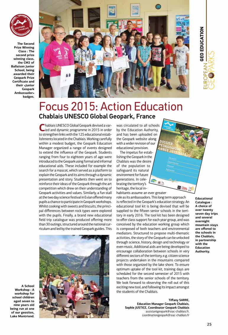
The Second Prize Winning
Class : The second prize
winning class, the CM2 of
Ballaison Junior School, being
awarded their Geopark Prize
Certificate and their «Junior
Geopark Ambassador»
badges.
A School Workshop : A workshop for
school children aged seven to nine years old
being run at one of our geosites,
Lake Montriond.
GEO
ED
UCA
TION
25
Annually the Norwegian University of Life Sci-ences delivers a course in Strategic Landscape
Planning, and courses for Masters students in Urban and Regional Planning, Land Management and Land-scape Architecture. This year’s project took place in the large geographic area of Gea Norvegica UNESCO Global Geopark . The reason for this choice was to in-clude, for the first time, the geological processes and phenomena and to study the connection between ge-ology, landscape and urbanization. The Geopark area represents a great diversity in physical geography varying from outer coastal areas with an archipelago of small skerries, inlets and low relief fjords to urban areas and densely populated cities with important industrial histories, productive rural areas and large forests with lakes and rivers.
The field work was delivered in close cooperation with the Geopark, and this collaboration with yet an-other University in Norway led to the possibility of interesting projects in the future. Students were in-troduced in greater depth to Gea Norvegica Geopark and the UNESCO Global Geopark concept.
The group of 39 students and their supervisors stayed in the Geopark for one week in September where they, besides getting to know the area and its geology, worked closely with the communities. This fieldwork constitutes the basis for their further work on the project, which will take place during the next months. The students were divided into eight groups, one for each community in the Geopark. In advance of the fieldwork, each group carried out desk
top research on the area and they arrived with the following expectations: what to see in the field re-garding the character of the landscape and its key qualities; resources of added value and local develop-ment; challenges in administering landscapes and nature- and cultural environments and the potential for developing places- and landscape based values. Many interesting issues!
During the last day of the fieldwork, each group gave a short presentation on their findings. Some of their expectations had to be adjusted and it was important to try to define which themes they will continue working on for their project reports. Pos-sible important outcomes of the projects, for example strategies to profile and communicate the qualities of the Geopark for local people and visitors, or strat-egies and initiatives to strengthen accessibility, use and experiences in the landscape through recreation and outdoor activities. These are actual everyday problems for the Geopark and it will be interesting to see the conclusions in the project reports. The final re-ports will also provide the Geopark and its communi-ties with useful information for developing new ideas and for continuing the areas of commitment within the Geopark. The Geopark staff have high expecta-tions for the outcome and future cooperation and we expect some critical but useful conclusions from young people, looking at Geoparks with new eyes!
Author: Mona Holte, [email protected]
Students doing landscape analyses in Gea Norvegica UNESCO Global Geopark
The students attending a presentation of their field data.
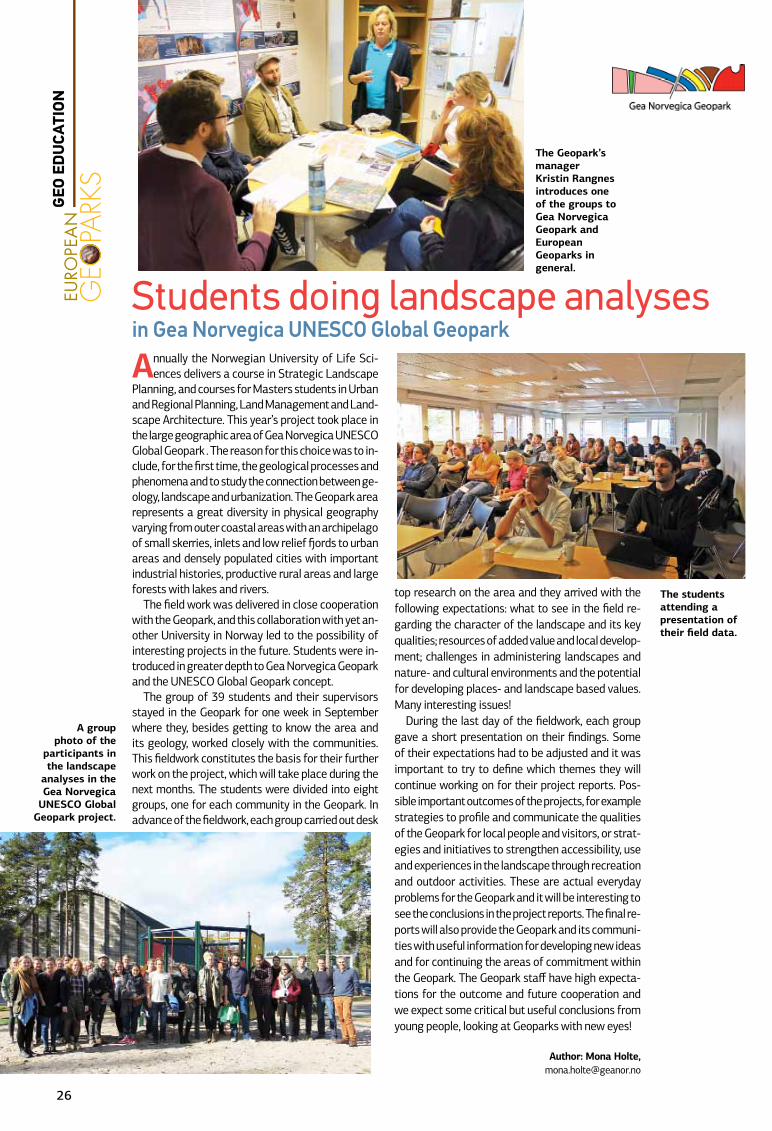
The Geopark’s manager Kristin Rangnes introduces one of the groups to Gea Norvegica Geopark and European Geoparks in general.
A group photo of the
participants in the landscape
analyses in the Gea Norvegica
UNESCO Global Geopark project.
26
GEO
ED
UCA
TION
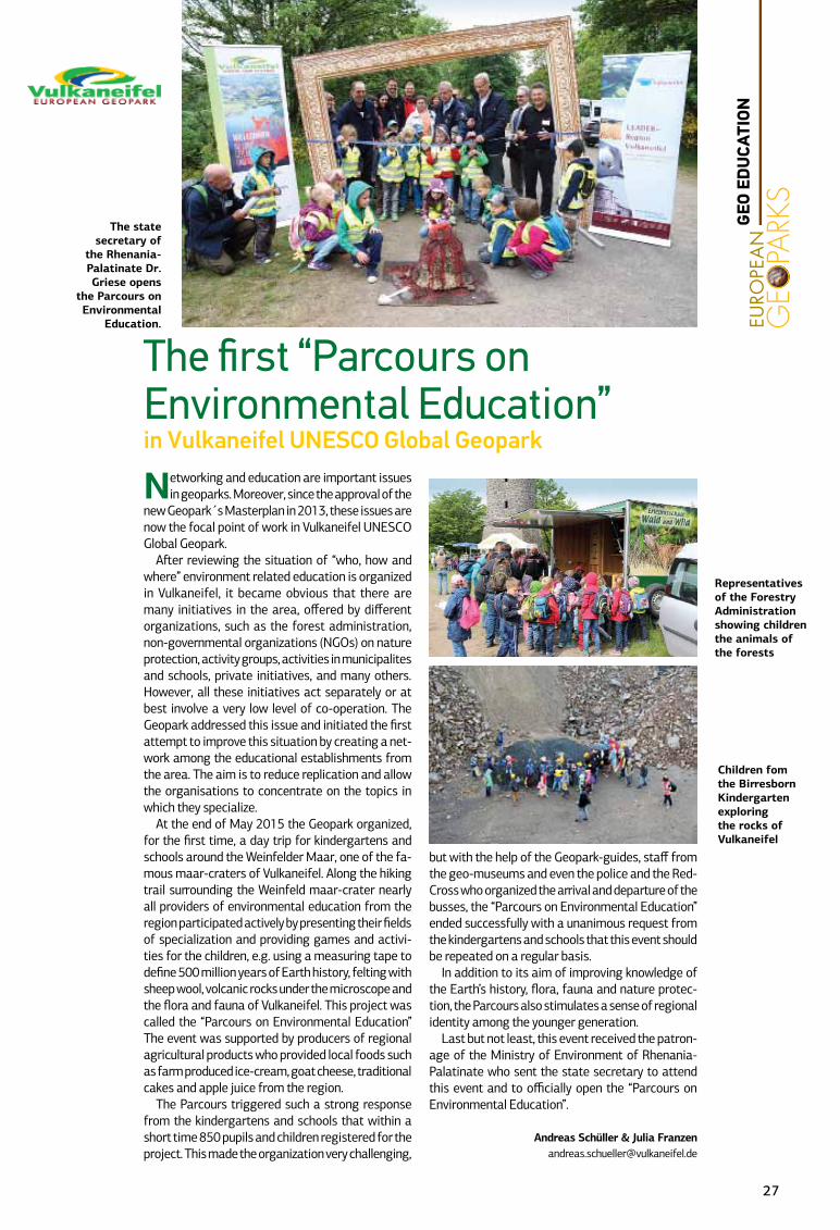
Networking and education are important issues in geoparks. Moreover, since the approval of the
new Geopark´s Masterplan in 2013, these issues are now the focal point of work in Vulkaneifel UNESCO Global Geopark.
After reviewing the situation of “who, how and where” environment related education is organized in Vulkaneifel, it became obvious that there are many initiatives in the area, offered by different organizations, such as the forest administration, non-governmental organizations (NGOs) on nature protection, activity groups, activities in municipalites and schools, private initiatives, and many others. However, all these initiatives act separately or at best involve a very low level of co-operation. The Geopark addressed this issue and initiated the first attempt to improve this situation by creating a net-work among the educational establishments from the area. The aim is to reduce replication and allow the organisations to concentrate on the topics in which they specialize.
At the end of May 2015 the Geopark organized, for the first time, a day trip for kindergartens and schools around the Weinfelder Maar, one of the fa-mous maar-craters of Vulkaneifel. Along the hiking trail surrounding the Weinfeld maar-crater nearly all providers of environmental education from the region participated actively by presenting their fields of specialization and providing games and activi-ties for the children, e.g. using a measuring tape to define 500 million years of Earth history, felting with sheep wool, volcanic rocks under the microscope and the flora and fauna of Vulkaneifel. This project was called the “Parcours on Environmental Education” The event was supported by producers of regional agricultural products who provided local foods such as farm produced ice-cream, goat cheese, traditional cakes and apple juice from the region.
The Parcours triggered such a strong response from the kindergartens and schools that within a short time 850 pupils and children registered for the project. This made the organization very challenging,
but with the help of the Geopark-guides, staff from the geo-museums and even the police and the Red-Cross who organized the arrival and departure of the busses, the “Parcours on Environmental Education” ended successfully with a unanimous request from the kindergartens and schools that this event should be repeated on a regular basis.
In addition to its aim of improving knowledge of the Earth’s history, flora, fauna and nature protec-tion, the Parcours also stimulates a sense of regional identity among the younger generation.
Last but not least, this event received the patron-age of the Ministry of Environment of Rhenania-Palatinate who sent the state secretary to attend this event and to officially open the “Parcours on Environmental Education”.
Andreas Schüller & Julia [email protected]
The first “Parcours on Environmental Education” in Vulkaneifel UNESCO Global Geopark
Children fom the Birresborn Kindergarten exploring the rocks of Vulkaneifel
The state secretary of
the Rhenania-Palatinate Dr. Griese opens
the Parcours on Environmental
Education.
Representatives of the Forestry Administration showing children the animals of the forests
GEO
ED
UCA
TION
27
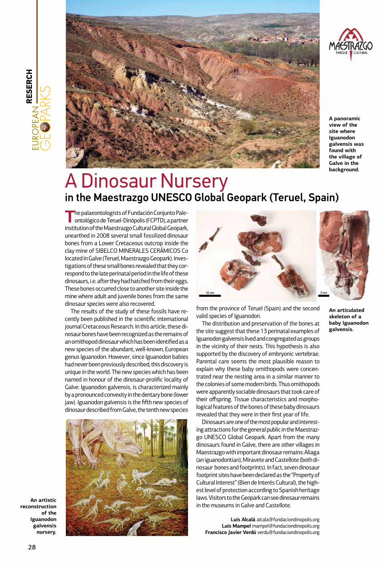
The palaeontologists of Fundación Conjunto Pale-ontológico de Teruel-Dinópolis (FCPTD), a partner
institution of the Maestrazgo Cultural Global Geopark, unearthed in 2008 several small fossilized dinosaur bones from a Lower Cretaceous outcrop inside the clay mine of SIBELCO MINERALES CERÁMICOS Co located in Galve (Teruel, Maestrazgo Geopark). Inves-tigations of these small bones revealed that they cor-respond to the late perinatal period in the life of these dinosaurs, i.e. after they had hatched from their eggs. These bones occurred close to another site inside the mine where adult and juvenile bones from the same dinosaur species were also recovered.
The results of the study of these fossils have re-cently been published in the scientific international journal Cretaceous Research. In this article, these di-nosaur bones have been recognized as the remains of an ornithopod dinosaur which has been identified as a new species of the abundant, well-known, European genus Iguanodon. However, since Iguanodon babies had never been previously described, this discovery is unique in the world. The new species which has been named in honour of the dinosaur-prolific locality of Galve: Iguanodon galvensis, is characterized mainly by a pronounced convexity in the dentary bone (lower jaw). Iguanodon galvensis is the fifth new species of dinosaur described from Galve, the tenth new species
from the province of Teruel (Spain) and the second valid species of Iguanodon.
The distribution and preservation of the bones at the site suggest that these 13 perinatal examples of Iguanodon galvensis lived and congregated as groups in the vicinity of their nests. This hypothesis is also supported by the discovery of embryonic vertebrae. Parental care seems the most plausible reason to explain why these baby ornithopods were concen-trated near the nesting area in a similar manner to the colonies of some modern birds. Thus ornithopods were apparently sociable dinosaurs that took care of their offspring. Tissue characteristics and morpho-logical features of the bones of these baby dinosaurs revealed that they were in their first year of life.
Dinosaurs are one of the most popular and interest-ing attractions for the general public in the Maestraz-go UNESCO Global Geopark. Apart from the many dinosaurs found in Galve, there are other villages in Maestrazgo with important dinosaur remains: Aliaga (an iguanodontian), Miravete and Castellote (both di-nosaur bones and footprints). In fact, seven dinosaur footprint sites have been declared as the “Property of Cultural Interest” (Bien de Interés Cultural), the high-est level of protection according to Spanish heritage laws. Visitors to the Geopark can see dinosaur remains in the museums in Galve and Castellote.
Luis Alcalá [email protected] Mampel [email protected]
Francisco Javier Verdú [email protected]
A Dinosaur Nursery in the Maestrazgo UNESCO Global Geopark (Teruel, Spain)
An artistic reconstruction
of the Iguanodon galvensis
nursery.
A panoramic view of the site where Iguanodon galvensis was found with the village of Galve in the background.
An articulated skeleton of a baby Iguanodon galvensis.
28
RES
ERCH
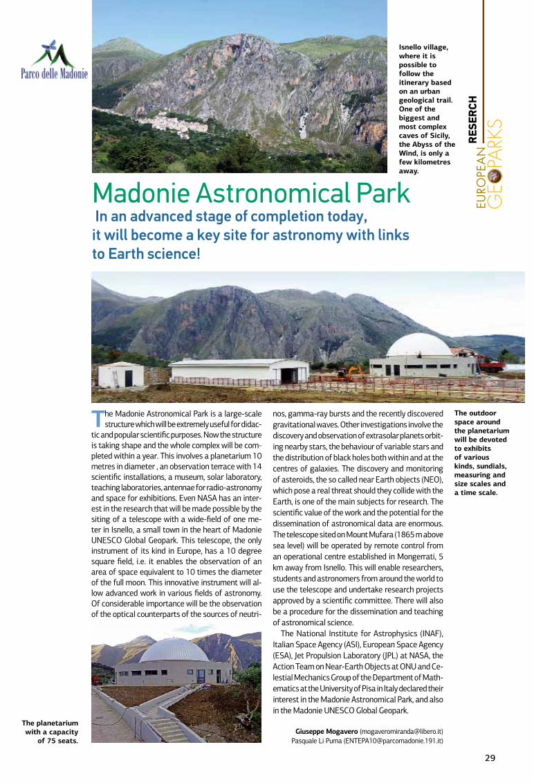
The Madonie Astronomical Park is a large-scale structure which will be extremely useful for didac-
tic and popular scientific purposes. Now the structure is taking shape and the whole complex will be com-pleted within a year. This involves a planetarium 10 metres in diameter , an observation terrace with 14 scientific installations, a museum, solar laboratory, teaching laboratories, antennae for radio-astronomy and space for exhibitions. Even NASA has an inter-est in the research that will be made possible by the siting of a telescope with a wide-field of one me-ter in Isnello, a small town in the heart of Madonie UNESCO Global Geopark. This telescope, the only instrument of its kind in Europe, has a 10 degree square field, i.e. it enables the observation of an area of space equivalent to 10 times the diameter of the full moon. This innovative instrument will al-low advanced work in various fields of astronomy. Of considerable importance will be the observation of the optical counterparts of the sources of neutri-
nos, gamma-ray bursts and the recently discovered gravitational waves. Other investigations involve the discovery and observation of extrasolar planets orbit-ing nearby stars, the behaviour of variable stars and the distribution of black holes both within and at the centres of galaxies. The discovery and monitoring of asteroids, the so called near Earth objects (NEO), which pose a real threat should they collide with the Earth, is one of the main subjects for research. The scientific value of the work and the potential for the dissemination of astronomical data are enormous. The telescope sited on Mount Mufara (1865 m above sea level) will be operated by remote control from an operational centre established in Mongerrati, 5 km away from Isnello. This will enable researchers, students and astronomers from around the world to use the telescope and undertake research projects approved by a scientific committee. There will also be a procedure for the dissemination and teaching of astronomical science.
The National Institute for Astrophysics (INAF), Italian Space Agency (ASI), European Space Agency (ESA), Jet Propulsion Laboratory (JPL) at NASA, the Action Team on Near-Earth Objects at ONU and Ce-lestial Mechanics Group of the Department of Math-ematics at the University of Pisa in Italy declared their interest in the Madonie Astronomical Park, and also in the Madonie UNESCO Global Geopark.
Giuseppe Mogavero ([email protected])Pasquale Li Puma ([email protected])
Madonie Astronomical Park Ιn an advanced stage of completion today, it will become a key site for astronomy with links to Earth science !
The planetarium with a capacity
of 75 seats.
The outdoor space around the planetarium will be devoted to exhibits of various kinds, sundials, measuring and size scales and a time scale.
Isnello village, where it is possible to follow the itinerary based on an urban geological trail. One of the biggest and most complex caves of Sicily, the Abyss of the Wind, is only a few kilometres away.
29
RES
ERCH
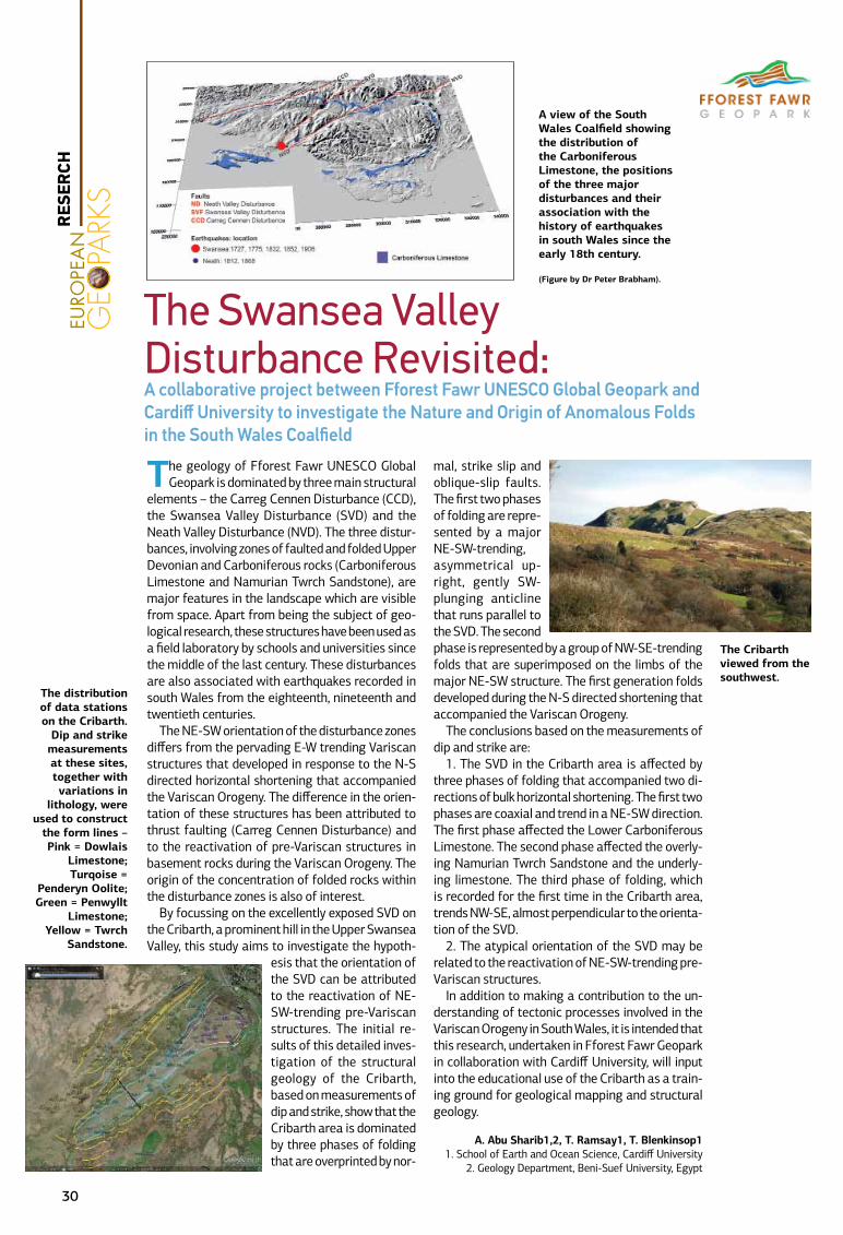
The geology of Fforest Fawr UNESCO Global Geopark is dominated by three main structural
elements – the Carreg Cennen Disturbance (CCD), the Swansea Valley Disturbance (SVD) and the Neath Valley Disturbance (NVD). The three distur-bances, involving zones of faulted and folded Upper Devonian and Carboniferous rocks (Carboniferous Limestone and Namurian Twrch Sandstone), are major features in the landscape which are visible from space. Apart from being the subject of geo-logical research, these structures have been used as a field laboratory by schools and universities since the middle of the last century. These disturbances are also associated with earthquakes recorded in south Wales from the eighteenth, nineteenth and twentieth centuries.
The NE-SW orientation of the disturbance zones differs from the pervading E-W trending Variscan structures that developed in response to the N-S directed horizontal shortening that accompanied the Variscan Orogeny. The difference in the orien-tation of these structures has been attributed to thrust faulting (Carreg Cennen Disturbance) and to the reactivation of pre-Variscan structures in basement rocks during the Variscan Orogeny. The origin of the concentration of folded rocks within the disturbance zones is also of interest.
By focussing on the excellently exposed SVD on the Cribarth, a prominent hill in the Upper Swansea Valley, this study aims to investigate the hypoth-
esis that the orientation of the SVD can be attributed to the reactivation of NE-SW-trending pre-Variscan structures. The initial re-sults of this detailed inves-tigation of the structural geology of the Cribarth, based on measurements of dip and strike, show that the Cribarth area is dominated by three phases of folding that are overprinted by nor-
mal, strike slip and oblique-slip faults. The first two phases of folding are repre-sented by a major NE-SW-trending, asymmetrical up-right, gently SW-plunging anticline that runs parallel to the SVD. The second phase is represented by a group of NW-SE-trending folds that are superimposed on the limbs of the major NE-SW structure. The first generation folds developed during the N-S directed shortening that accompanied the Variscan Orogeny.
The conclusions based on the measurements of dip and strike are:
1. The SVD in the Cribarth area is affected by three phases of folding that accompanied two di-rections of bulk horizontal shortening. The first two phases are coaxial and trend in a NE-SW direction. The first phase affected the Lower Carboniferous Limestone. The second phase affected the overly-ing Namurian Twrch Sandstone and the underly-ing limestone. The third phase of folding, which is recorded for the first time in the Cribarth area, trends NW-SE, almost perpendicular to the orienta-tion of the SVD.
2. The atypical orientation of the SVD may be related to the reactivation of NE-SW-trending pre-Variscan structures.
In addition to making a contribution to the un-derstanding of tectonic processes involved in the Variscan Orogeny in South Wales, it is intended that this research, undertaken in Fforest Fawr Geopark in collaboration with Cardiff University, will input into the educational use of the Cribarth as a train-ing ground for geological mapping and structural geology.
A. Abu Sharib1,2, T. Ramsay1, T. Blenkinsop11. School of Earth and Ocean Science, Cardiff University
2. Geology Department, Beni-Suef University, Egypt
The Swansea Valley Disturbance Revisited: A collaborative project between Fforest Fawr UNESCO Global Geopark and Cardiff University to investigate the Nature and Origin of Anomalous Folds in the South Wales Coalfield
The distribution of data stations on the Cribarth.
Dip and strike measurements at these sites, together with variations in
lithology, were used to construct
the form lines – Pink = Dowlais
Limestone; Turqoise =
Penderyn Oolite; Green = Penwyllt
Limestone; Yellow = Twrch
Sandstone.
The Cribarth viewed from the southwest.
A view of the South Wales Coalfield showing the distribution of the Carboniferous Limestone, the positions of the three major disturbances and their association with the history of earthquakes in south Wales since the early 18th century.
(Figure by Dr Peter Brabham).
30
RES
ERCH

As is now well known, the formation of a min-eral deposit is a very rare event in nature,
and is even more infrequent when it involves minerals containing elements that are rare in the Earth’s crust.
Since ores are frequently located at depth, given the potentially adverse conditions of air temperature and quality encountered in deep mines, and in the absence of advanced mining technologies, they are not always easy to ex-ploit. Thus the most advantageous location for exploiting a mineral deposit is either at or close to the surface where, in contrast to ore bodies at considerable depths, miners are not challenged by harsh environmental conditions.
Tuscan Mining Geopark’s territory is, from this point of view, a real exception, since, across just 180 square kilometres, numerous rich deposits of copper, iron, lead and zinc metallic ores are concentrated at relatively low depths in hydro-thermal accumulations of the mixed sulphides chalcopyrite, galena, sphalerite and iron pyrites. These ores have, in the course of 3,000 years, been intensively exploited by populations living in the area. Ore deposits especially those con-taining pyrite are associated with metasomatic processes linked with igneous granitic intru-sions. Metasomatism and associated dissolu-tion of Triassic carbonates generated voids that facilitated the movement of hydrothermal fluids.
The proximity to the surface of the flat lying isometric mineral stocks and their exposure to
atmospheric weathering frequently resulted in the removal of primary minerals and the forma-tion of numerous alteration minerals including hydroxides, oxides and especially sulphates.
The alteration products also resulted in the natural enrichment of minerals rich in silver con-sisting mainly of tetrahedrite and some silver galena. This phenomenon involving the creation of native silver - acanthite, proustite, pyrargyrite, chlorargyrite - boosted the development of local silver mines, especially during medieval times.
During the three-year period of mineralogical research conducted by the University of Siena in the Tuscan Mining UNESCO Global Geopark, we have identified more than 220 mining sites from mineralized outcrops, sites of mineral prospect-ing and mining from ancient and modern times. Two hundred and thirty six species of mineral ores were recorded by sampling these sites, a significant number and definitely among the highest recorded from the Italian mining sites. The pyrite mine of Niccioleta yielded no less than 73 species of minerals.
One of the most important duties of the Geopark is to protect this important mineralogi-cal heritage and create many means for its en-hancement and the dissemination of knowledge.
Alessandra [email protected]
Armando [email protected] Pagani
Great little treasures to know:Ores of the Tuscan Mining UNESCO Global Geopark – Italy
Anatase, titanium dioxide (0.6 mm) from the Geosite of Cugnano.
Photo by Matteo Chinellato.
Brochantite, copper basic sulphate (0.4
mm) from the geosite of
Serrabottini.
Photo by Matteo Chinellato.
Carbonatecyanotrichite, copper and aluminium, two basic sulphate carbonate hydrates (0.6 mm), from the Geosite of Serrabottini.
Photo by Matteo Chinellato.
RES
ERCH
31
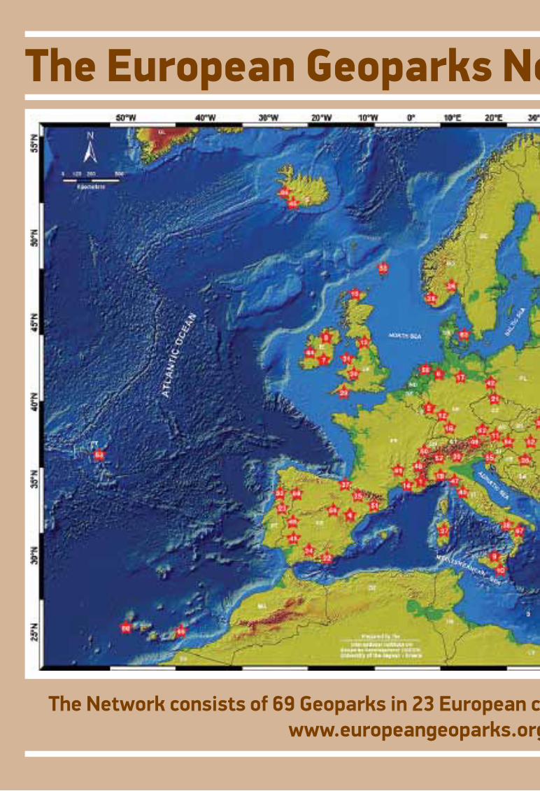
The European Geoparks Network today
The Network consists of 69 Geoparks in 23 European countries (September 2015)www.europeangeoparks.org
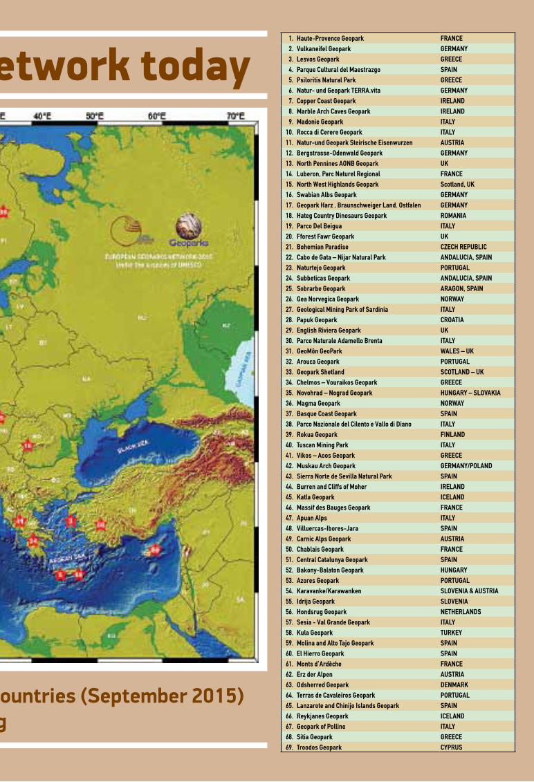
The European Geoparks Network today
The Network consists of 69 Geoparks in 23 European countries (September 2015)www.europeangeoparks.org
1. Haute-Provence Geopark FRANCE2. Vulkaneifel Geopark GERMANY3. Lesvos Geopark GREECE4. Parque Cultural del Maestrazgo SPAIN5. Psiloritis Natural Park GREECE6. Natur- und Geopark TERRA.vita GERMANY7. Copper Coast Geopark IRELAND8. Marble Arch Caves Geopark IRELAND9. Madonie Geopark ITALY
10. Rocca di Cerere Geopark ITALY11. Natur-und Geopark Steirische Eisenwurzen AUSTRIA12. Bergstrasse-Odenwald Geopark GERMANY13. North Pennines AONB Geopark UK14. Luberon, Parc Naturel Regional FRANCE15. North West Highlands Geopark Scotland, UK16. Swabian Albs Geopark GERMANY17. Geopark Harz . Braunschweiger Land. Ostfalen GERMANY18. Hateg Country Dinosaurs Geopark ROMANIA19. Parco Del Beigua ITALY20. Fforest Fawr Geopark UΚ21. Bohemian Paradise CZECH REPUBLIC22. Cabo de Gata – Nijar Natural Park ANDALUCIA, SPAIN23. Naturtejo Geopark PORTUGAL24. Subbeticas Geopark ANDALUCIA, SPAIN25. Sobrarbe Geopark ARAGON, SPAIN26. Gea Norvegica Geopark NORWAY27. Geological Mining Park of Sardinia ITALY28. Papuk Geopark CROATIA29. English Riviera Geopark UK30. Parco Naturale Adamello Brenta ITALY31. GeoMôn GeoPark WALES – UK32. Arouca Geopark PORTUGAL33. Geopark Shetland SCOTLAND – UK34. Chelmos – Vouraikos Geopark GREECE35. Novohrad – Nograd Geopark HUNGARY – SLOVAKIA36. Magma Geopark NORWAY37. Basque Coast Geopark SPAIN38. Parco Nazionale del Cilento e Vallo di Diano ITALY39. Rokua Geopark FINLAND40. Tuscan Mining Park ITALY41. Vikos – Aoos Geopark GREECE42. Muskau Arch Geopark GERMANY/POLAND43. Sierra Norte de Sevilla Natural Park SPAIN44. Burren and Cliffs of Moher IRELAND45. Katla Geopark ICELAND46. Massif des Bauges Geopark FRANCE47. Apuan Alps ITALY48. Villuercas-Ibores-Jara SPAIN49. Carnic Alps Geopark AUSTRIA50. Chablais Geopark FRANCE51. Central Catalunya Geopark SPAIN52. Bakony-Balaton Geopark HUNGARY53. Azores Geopark PORTUGAL54. Karavanke/Karawanken SLOVENIA & AUSTRIA55. Idrija Geopark SLOVENIA56. Hondsrug Geopark NETHERLANDS57. Sesia - Val Grande Geopark ITALY58. Kula Geopark TURKEY59. Molina and Alto Tajo Geopark SPAIN60. El Hierro Geopark SPAIN61. Monts d’Ardèche FRANCE62. Erz der Alpen AUSTRIA63. Odsherred Geopark DENMARK64. Terras de Cavaleiros Geopark PORTUGAL65. Lanzarote and Chinijo Islands Geopark SPAIN66. Reykjanes Geopark ICELAND67. Geopark of Pollino ITALY68. Sitia Geopark GREECE69. Troodos Geopark CYPRUS
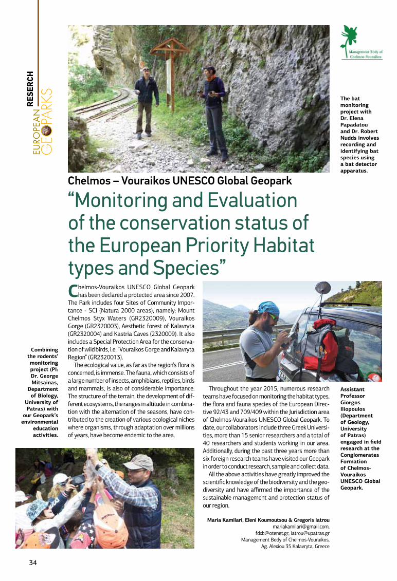
Chelmos-Vouraikos UNESCO Global Geopark has been declared a protected area since 2007.
The Park includes four Sites of Community Impor-tance - SCI (Natura 2000 areas), namely: Mount Chelmos Styx Waters (GR2320009), Vouraikos Gorge (GR2320003), Aesthetic forest of Kalavryta (GR2320004) and Kastria Caves (2320009). It also includes a Special Protection Area for the conserva-tion of wild birds, i.e. “Vouraikos Gorge and Kalavryta Region” (GR2320013).
The ecological value, as far as the region’s flora is concerned, is immense. The fauna, which consists of a large number of insects, amphibians, reptiles, birds and mammals, is also of considerable importance. The structure of the terrain, the development of dif-ferent ecosystems, the ranges in altitude in combina-tion with the alternation of the seasons, have con-tributed to the creation of various ecological niches where organisms, through adaptation over millions of years, have become endemic to the area.
Throughout the year 2015, numerous research teams have focused on monitoring the habitat types, the flora and fauna species of the European Direc-tive 92/43 and 709/409 within the Jurisdiction area of Chelmos-Vouraikos UNESCO Global Geopark. To date, our collaborators include three Greek Universi-ties, more than 15 senior researchers and a total of 40 researchers and students working in our area. Additionally, during the past three years more than six foreign research teams have visited our Geopark in order to conduct research, sample and collect data.
All the above activities have greatly improved the scientific knowledge of the biodiversity and the geo-diversity and have affirmed the importance of the sustainable management and protection status of our region.
Maria Kamilari, Eleni Koumoutsou & Gregoris [email protected],
[email protected], [email protected] Body of Chelmos-Vouraikos,
Ag. Alexiou 35 Kalavryta, Greece
Assistant Professor Giorgos Iliopoulos (Department of Geology, University of Patras) engaged in field research at the Conglomerates Formation of Chelmos-Vouraikos UNESCO Global Geopark.
Chelmos – Vouraikos UNESCO Global Geopark
“Monitoring and Evaluation of the conservation status of the European Priority Habitat types and Species”
The bat monitoring project with Dr. Elena Papadatou and Dr. Robert Nudds involves recording and identifying bat species using a bat detector apparatus.
Combining the rodents’ monitoring project (PI: Dr. George Mitsainas,
Department of Biology,
University of Patras) with
our Geopark’s environmental
education activities.
RES
ERCH
34
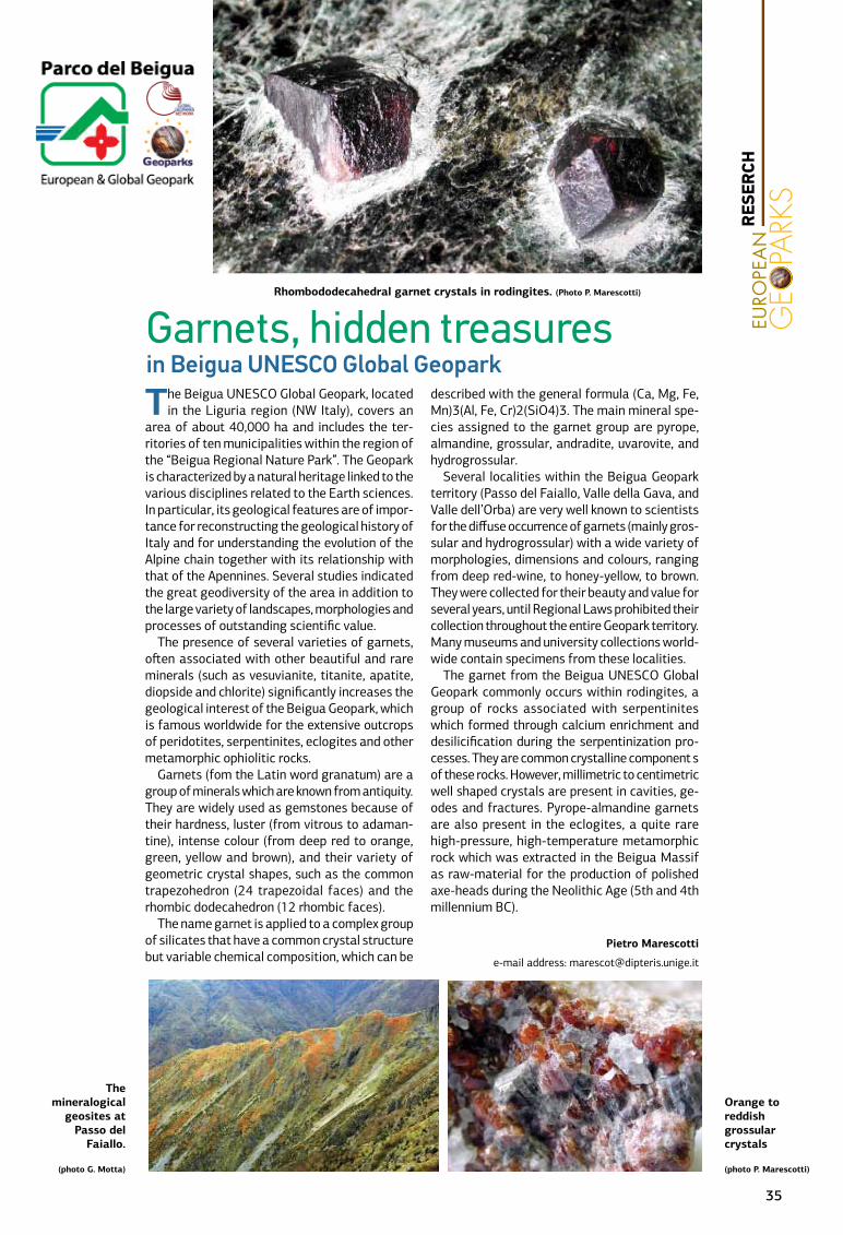
The Beigua UNESCO Global Geopark, located in the Liguria region (NW Italy), covers an
area of about 40,000 ha and includes the ter-ritories of ten municipalities within the region of the “Beigua Regional Nature Park”. The Geopark is characterized by a natural heritage linked to the various disciplines related to the Earth sciences. In particular, its geological features are of impor-tance for reconstructing the geological history of Italy and for understanding the evolution of the Alpine chain together with its relationship with that of the Apennines. Several studies indicated the great geodiversity of the area in addition to the large variety of landscapes, morphologies and processes of outstanding scientific value.
The presence of several varieties of garnets, often associated with other beautiful and rare minerals (such as vesuvianite, titanite, apatite, diopside and chlorite) significantly increases the geological interest of the Beigua Geopark, which is famous worldwide for the extensive outcrops of peridotites, serpentinites, eclogites and other metamorphic ophiolitic rocks.
Garnets (fom the Latin word granatum) are a group of minerals which are known from antiquity. They are widely used as gemstones because of their hardness, luster (from vitrous to adaman-tine), intense colour (from deep red to orange, green, yellow and brown), and their variety of geometric crystal shapes, such as the common trapezohedron (24 trapezoidal faces) and the rhombic dodecahedron (12 rhombic faces).
The name garnet is applied to a complex group of silicates that have a common crystal structure but variable chemical composition, which can be
described with the general formula (Ca, Mg, Fe, Mn)3(Al, Fe, Cr)2(SiO4)3. The main mineral spe-cies assigned to the garnet group are pyrope, almandine, grossular, andradite, uvarovite, and hydrogrossular.
Several localities within the Beigua Geopark territory (Passo del Faiallo, Valle della Gava, and Valle dell’Orba) are very well known to scientists for the diffuse occurrence of garnets (mainly gros-sular and hydrogrossular) with a wide variety of morphologies, dimensions and colours, ranging from deep red-wine, to honey-yellow, to brown. They were collected for their beauty and value for several years, until Regional Laws prohibited their collection throughout the entire Geopark territory. Many museums and university collections world-wide contain specimens from these localities.
The garnet from the Beigua UNESCO Global Geopark commonly occurs within rodingites, a group of rocks associated with serpentinites which formed through calcium enrichment and desilicification during the serpentinization pro-cesses. They are common crystalline component s of these rocks. However, millimetric to centimetric well shaped crystals are present in cavities, ge-odes and fractures. Pyrope-almandine garnets are also present in the eclogites, a quite rare high-pressure, high-temperature metamorphic rock which was extracted in the Beigua Massif as raw-material for the production of polished axe-heads during the Neolithic Age (5th and 4th millennium BC).
Pietro Marescotti
e-mail address: [email protected]
Orange to reddish grossular crystals
(photo P. Marescotti)
The mineralogical
geosites at Passo del
Faiallo.
(photo G. Motta)
Rhombododecahedral garnet crystals in rodingites. (Photo P. Marescotti)
Garnets, hidden treasuresin Beigua UNESCO Global Geopark
RES
ERCH
35
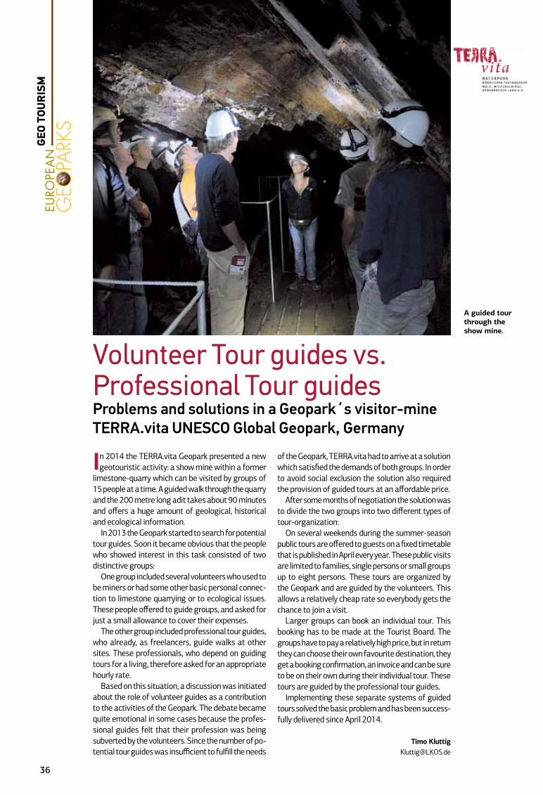
In 2014 the TERRA.vita Geopark presented a new geotouristic activity: a show mine within a former
limestone-quarry which can be visited by groups of 15 people at a time. A guided walk through the quarry and the 200 metre long adit takes about 90 minutes and offers a huge amount of geological, historical and ecological information.
In 2013 the Geopark started to search for potential tour guides. Soon it became obvious that the people who showed interest in this task consisted of two distinctive groups:
One group included several volunteers who used to be miners or had some other basic personal connec-tion to limestone quarrying or to ecological issues. These people offered to guide groups, and asked for just a small allowance to cover their expenses.
The other group included professional tour guides, who already, as freelancers, guide walks at other sites. These professionals, who depend on guiding tours for a living, therefore asked for an appropriate hourly rate.
Based on this situation, a discussion was initiated about the role of volunteer guides as a contribution to the activities of the Geopark. The debate became quite emotional in some cases because the profes-sional guides felt that their profession was being subverted by the volunteers. Since the number of po-tential tour guides was insufficient to fulfill the needs
of the Geopark, TERRA.vita had to arrive at a solution which satisfied the demands of both groups. In order to avoid social exclusion the solution also required the provision of guided tours at an affordable price.
After some months of negotiation the solution was to divide the two groups into two different types of tour-organization:
On several weekends during the summer-season public tours are offered to guests on a fixed timetable that is published in April every year. These public visits are limited to families, single persons or small groups up to eight persons. These tours are organized by the Geopark and are guided by the volunteers. This allows a relatively cheap rate so everybody gets the chance to join a visit.
Larger groups can book an individual tour. This booking has to be made at the Tourist Board. The groups have to pay a relatively high price, but in return they can choose their own favourite destination, they get a booking confirmation, an invoice and can be sure to be on their own during their individual tour. These tours are guided by the professional tour guides.
Implementing these separate systems of guided tours solved the basic problem and has been success-fully delivered since April 2014.
Timo [email protected]
Volunteer Tour guides vs. Professional Tour guidesProblems and solutions in a Geopark´s visitor-mine TERRA.vita UNESCO Global Geopark, Germany
A guided tour through the show mine.
36
GEO
TOU
RIS
M
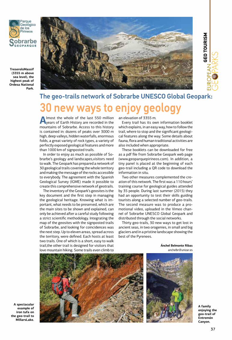
Almost the whole of the last 550 million years of Earth History are recorded in the
mountains of Sobrarbe. Access to this history is contained in: dozens of peaks over 3000 m high, deep valleys, hidden waterfalls, enormous folds, a great variety of rock types, a variety of perfectly exposed geological features and more than 1000 km of signposted trails.
In order to enjoy as much as possible of So-brarbe’s geology and landscapes,visitors need to walk. The Geopark has prepared a network of 30 geological trails covering the whole territory and making the message of the rocks accessible to everybody. The agreement with the Spanish Geological Survey (IGME) made it possible to create this comprehensive network of geotrails.
The inventory of the Geopark’s geosites is the key document and the first step in managing the geological heritage. Knowing what is im-portant, what needs to be preserved, which are the main sites to be shown and explained, can only be achieved after a careful study following a strict scientific methodology. Integrating the map of the geosites with the signposted trails of Sobrarbe, and looking for coincidences was the next step. Up to eleven areas, spread across the territory, were defined. Each hosts at least two trails. One of which is a short, easy to walk trail,the other trail is designed for visitors that love mountain hiking. Some trails even climb to
an elevation of 3355 m.Every trail has its own information booklet
which explains, in an easy way, how to follow the trail, where to stop and the significant geologi-cal features along the way. Some details about fauna, flora and human traditional activities are also included when appropriate.
These booklets can be downloaded for free as a pdf file from Sobrarbe Geopark web page (www.geoparquepirineos.com). In addition, a tiny panel is placed at the beginning of each geo-trail including a QR code to download the information in situ.
Two other measures complemented the cre-ation of this network. The first was a 110 hours’ training course for geological guides attended by 35 people. During last summer (2015) they had an opportunity to test their skills guiding tourists along a selected number of geo-trails. The second measure was to produce a pro-motional video, uploaded in the Vimeo chan-nel of Sobrarbe UNESCO Global Geopark and distributed through the social networks.
Thirty geo-trails, 30 new ways to get lost in ancient seas, in two orogenies, in small and big glaciers and in a pristine landscape showing the best of the Pyrenees.
Ánchel Belmonte [email protected]
The geo-trails network of Sobrarbe UNESCO Global Geopark:
30 new ways to enjoy geology
TreserolsMassif (3355 m above sea level), the
highest peak of Ordesa National
Park.
A family enjoying the geo-trail of Entremón Canyon.
A spectacular example of
iron tufa on the geo-trail to
MillarsLake.
37
GEO
TOU
RIS
M
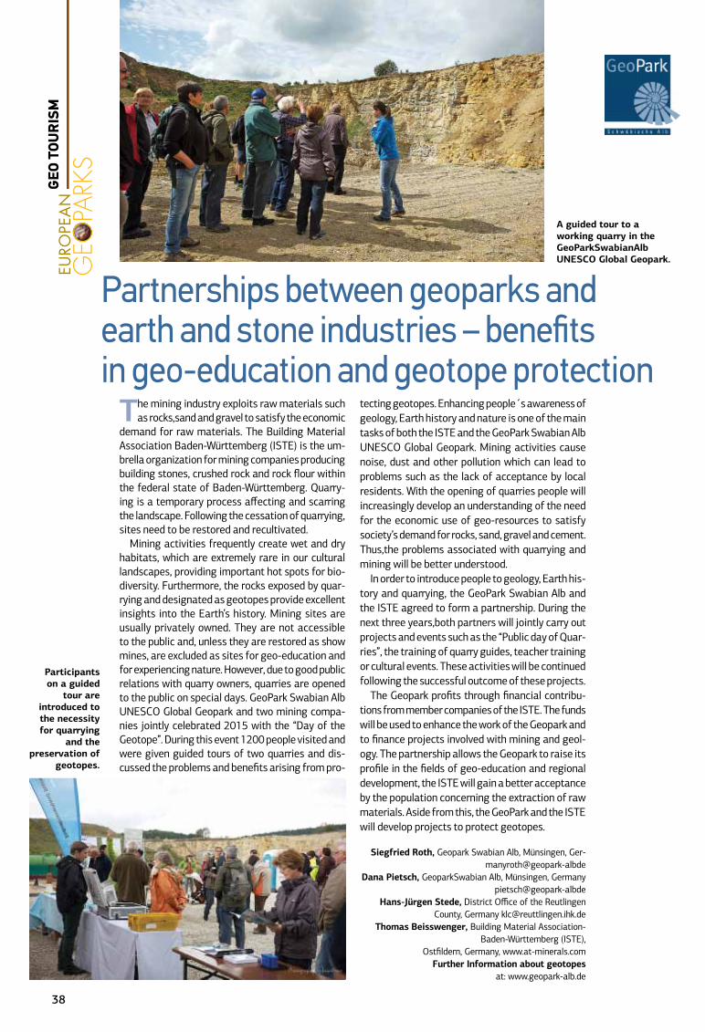
The mining industry exploits raw materials such as rocks,sand and gravel to satisfy the economic
demand for raw materials. The Building Material Association Baden-Württemberg (ISTE) is the um-brella organization for mining companies producing building stones, crushed rock and rock flour within the federal state of Baden-Württemberg. Quarry-ing is a temporary process affecting and scarring the landscape. Following the cessation of quarrying, sites need to be restored and recultivated.
Mining activities frequently create wet and dry habitats, which are extremely rare in our cultural landscapes, providing important hot spots for bio-diversity. Furthermore, the rocks exposed by quar-rying and designated as geotopes provide excellent insights into the Earth’s history. Mining sites are usually privately owned. They are not accessible to the public and, unless they are restored as show mines, are excluded as sites for geo-education and for experiencing nature. However, due to good public relations with quarry owners, quarries are opened to the public on special days. GeoPark Swabian Alb UNESCO Global Geopark and two mining compa-nies jointly celebrated 2015 with the “Day of the Geotope”. During this event 1200 people visited and were given guided tours of two quarries and dis-cussed the problems and benefits arising from pro-
tecting geotopes. Enhancing people´s awareness of geology, Earth history and nature is one of the main tasks of both the ISTE and the GeoPark Swabian Alb UNESCO Global Geopark. Mining activities cause noise, dust and other pollution which can lead to problems such as the lack of acceptance by local residents. With the opening of quarries people will increasingly develop an understanding of the need for the economic use of geo-resources to satisfy society’s demand for rocks, sand, gravel and cement. Thus,the problems associated with quarrying and mining will be better understood.
In order to introduce people to geology, Earth his-tory and quarrying, the GeoPark Swabian Alb and the ISTE agreed to form a partnership. During the next three years,both partners will jointly carry out projects and events such as the “Public day of Quar-ries”, the training of quarry guides, teacher training or cultural events. These activities will be continued following the successful outcome of these projects.
The Geopark profits through financial contribu-tions from member companies of the ISTE. The funds will be used to enhance the work of the Geopark and to finance projects involved with mining and geol-ogy. The partnership allows the Geopark to raise its profile in the fields of geo-education and regional development, the ISTE will gain a better acceptance by the population concerning the extraction of raw materials. Aside from this, the GeoPark and the ISTE will develop projects to protect geotopes.
Siegfried Roth, Geopark Swabian Alb, Münsingen, Ger-manyroth@geopark-albde
Dana Pietsch, GeoparkSwabian Alb, Münsingen, Germanypietsch@geopark-albde
Hans-Jürgen Stede, District Office of the Reutlingen County, Germany [email protected]
Thomas Beisswenger, Building Material Association-Baden-Württemberg (ISTE),
Ostfildern, Germany, www.at-minerals.comFurther Information about geotopes
at: www.geopark-alb.de
Partnerships between geoparks and earth and stone industries – benefits in geo-education and geotope protection
Participants on a guided
tour are introduced to the necessity for quarrying
and the preservation of
geotopes.
A guided tour to a working quarry in the GeoParkSwabianAlb UNESCO Global Geopark.
38
GEO
TOU
RIS
M
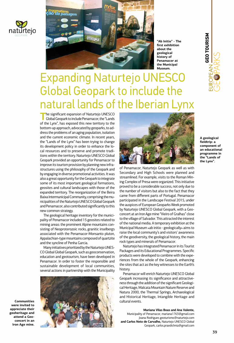
The significant expansion of Naturtejo UNESCO Global Geopark to include Penamacor, the “Lands
of the Lynx”, has exposed this new territory to the bottom-up approach, advocated by geoparks, to ad-dress the problems of an aging population, isolation and the current economic climate. In recent years, the “Lands of the Lynx” has been trying to change its development policy in order to enhance the lo-cal resources and to preserve and promote tradi-tions within the territory. Naturtejo UNESCO Global Geopark provided an opportunity for Penamacor to improve its tourism provision by planning new infra-structures using the philosophy of the Geopark and by engaging in diverse promotional activities. It was also a great opportunity for the Geopark to integrate some of its most important geological formations, geosites and cultural landscapes with those of the expanded territory. The reorganization of the Beira Baixa Intermunicipal Community, comprising the mu-nicipalities of the Naturtejo UNESCO Global Geopark and Penamacor, also contributed significantly to this new common strategy.
The geological heritage inventory for the munici-pality of Penamacor included 15 geosites related to mining areas: the prominent Alpine mountains con-sisting of Neoproterozoic rocks, granitic inselbergs associated with the Penamacor-Monsanto pluton, Appalachian-type mountains composed of quartzite and the syncline of Penha Garcia.
Many initiatives prioritized by the Naturtejo UNES-CO Global Global Geopark, such as geoconservation, education and geotourism, have been developed in Penamacor. In order to foster the responsible and sustainable development of local communities, several actions in partnership with the Municipality
of Penamacor, Naturtejo Geopark as well as with Secondary and High Schools were planned and streamlined. For example, visits to the Roman Min-ing Complex of Presa were organized. This initiative proved to be a considerable success, not only due to the number of visitors but also to the fact that they came from different parts of Portugal. Penamacor participated in the Landscape Festival 2015, under the auspices of European Geoparks Week promoted by Naturtejo UNESCO Global Geopark, with a Geo-concert at an Iron Age mine “Vieiro of Gralhas” close to the village of Salvador. This attracted the interest of the national media. A temporary exhibition at the Municipal Museum «ab initio - geologically» aims to raise the local community’s and visitors’ awareness of the geodiversity, the geological history, the main rock types and minerals of Penamacor.
Naturtejo has integrated Penamacor in its Tourist Packages and its Educational Programmes. Specific products were developed to combine with the expe-riences from the whole of the Geopark, enhancing the sites that act as the key witnesses to the Earth’s history.
Penamacor will enrich Naturtejo UNESCO Global Geopark increasing its significance and attractive-ness through the addition of the significant Geologi-cal Heritage, Malcata Mountain Nature Reserve and Natura 2000, the Thermal Springs, Archaeological and Historical Heritage, Intangible Heritage and cultural events.
Mariana Vilas Boas and Ana Valente, Municipality of Penamacor, [email protected]
Joana Rodrigues [email protected] Carlos Neto de Carvalho, Naturtejo UNESCO Global
Geopark, [email protected]
A geological fieldtrip: a component of an educational programme in the “Lands of the Lynx”.
“Ab Initio” - The first exhibition about the geological history of Penamacor at the Municipal Museum.
Expanding Naturtejo UNESCO Global Geopark to include the natural lands of the Iberian Lynx
Communities were invited to
appreciate their geoheritage and
attend a Geo-concert in an
Iron Age mine.
39
GEO
TOU
RIS
M
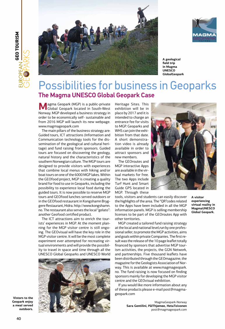
Magma Geopark (MGP) is a public-private Global Geopark located in South-West
Norway. MGP developed a business strategy in order to be economically self- sustainable and from 2016 MGP will launch its new webpage. www.magmageopark.com
The main pillars of the business strategy are: Guided tours, ICT attractions (Information and Communication technology tools for the dis-semination of the geological and cultural heri-tage) and fund raising from sponsors. Guided tours are focused on discovering the geology, natural history and the characteristics of the southern Norwegian culture. The MGP tours are designed to provide visitors with experiences that combine local menus with hiking and/or boat tours on one of the 6000 MGP lakes. Within the GEOfood project, MGP is creating a quality brand for food to use in Geoparks, including the possibility to experience local food during the guided tours. It is now possible to reserve MGP tours and GEOfood lunches served outdoors or in the GEOfood restaurant in Kongshamn Bryg-gere Restaurant, Hidra. http://www.kongshamn.no. The restaurant also serves the local “gelato”: another Geofood certified product.
The ICT attractions aim to enrich the tour-ists’ experiences in MGP. At the moment plan-ning for the MGP visitor centre is still ongo-ing. The GEOvisual will have the key role in the MGP visitor centre. It will be the most complete experiment ever attempted for recreating vir-tual environments and will provide the possibil-ity to travel in space and time through all the UNESCO Global Geoparks and UNESCO World
Heritage Sites. This exhibition will be in place by 2017 and it is intended to charge an entrance fee for visits to MGP. Geoparks and WHS can join the exhi-bition from that date. A short demonstra-tion video is already available in order to attract sponsors and new members.
The GEOroutes and MGP interactive Apps are available in the vir-tual markets for free. The two Apps include Turf Hunt and Smart Guide GPS located in MGP. Through these tools, visitors and students can easily discover the highlights of the area. The “QR”codes related to the Apps have been included in all the MGP information panels. MGP is selling membership licenses to be part of the GEOroutes App with other territories.
MGP created a tailored fund raising strategy at the local and national level,run by one profes-sional seller, to promote the MGP activities, aims and goals within private Companies. The first re-sult was the release of the 10 page leaflet totally financed by sponsors that advertise MGP tour-ism activities, the projects, the GGN Network, and partnerships. Five thousand leaflets have been distributed through the GEOmagazine, the magazine for the Geologists Association of Nor-way. This is available at www.magmageopark.no. The fund raising is now focused on finding sponsors mainly for developing the MGP visitor centre and the GEOvisual exhibition.
If you would like more information about any of these products please e-mail [email protected]
MagmaGeopark-NorwaySara Gentilini, PålThjømøe, HetaToivonen
Possibilities for business in GeoparksThe Magma UNESCO Global Geopark Case
Vistors to the Geopark enjoy a meal served
outdoors.
A geological field trip in Magma UNESCO GlobalGeopark
A visitor experiencing virtual reality in MagmaUNESCO Global Geopark.
40
GEO
TOU
RIS
M

The dolmen of Ubac was discovered in 1994 following flooding of the Calavon River. Since
its survival was threatened by recurrent floods, archaeologists, the Geopark architects and Goult Municipality decided to rebuild the structure 500 m upstream from the original site. The remarkable state of preservation provided an opportunity to study all aspects of the site during four excavation campaigns between 1997 and 2001.
The Dolmen was constructed during the early Neo-lithic Period, between 3300 and 2900 BC. During its use, which lasted more than 500 years, the burial chamber was gradually filled with sediment seeping in between the stone slabs. These deposits have fos-silized four different periods of occupation. The tomb contained fifty skeletons of all ages and gender. All were buried in a contracted, fetal position, the legs folded and brought close to the trunk. After its use by the Neolithic people, the site fell into obscurity.
The tomb consists of a mound or tumulus, contain-ing a dolmen with an elongated room and a corridor,
constructed from large stone slabs, hence the name Megalithic tomb.
The tumulus, a dome 14 metres in diameter, con-sists of earth and a surface covered by a «shell» of flat stones. It is structured at its base by two concentric large contiguous vertically arranged stone rings up to 1.30 m high and 0.60 m wide.
The three metres long and 1. 45m high burial cham-ber is constructed of three capstones, two lateral dry stone walls, a structure on the eastern side, consisting of a vertical slab of stone complemented by a dry stone wall and a narrow entrance on the western side formed by two vertical sidewalls. The corridor consists of dry stone walls. The structure was showered with stones after each burial.
The reconstruction and transportation of this ar-chaeological structure has preserved a rare heritage, reborn 500 meters from the place of its discovery, and respecting its orientation and proximity to the Calavon River.
The reconstruction of the Neolithic monument involved numbering and removing the stones and faithfully reassembling the structure stone by stone. The complete restoration required the addition of stones extracted close to the original site. The re-construction used the same local limestone, formed 20 million years ago under the sea, as that used by our Neolithic ancestors. With this reconstruction project, stones, once mere buried traces, now stand witness to the history of human activity at a site in the Geopark.
This experimental, original and symbolic project was initiated and progressed by the Municipality of Goult, the Ministry of Culture (DRC PACA) with the co-operation of the Archaeology Regional Department and designed by the Luberon Regional Nature Park – UNESCO Global Geopark. The work was carried out by craftsmen involved in professional restoration (Maison des Métiers du Patrimoine).
Pierre [email protected]
Rebuilding a Neolithic funeral monument:The dolmen of Ubac in the Municipality of Goult
The reconstructed
dolmen.
The reconstruction
of the entrance to the funeral
chamber.
41
GEO
TOU
RIS
M
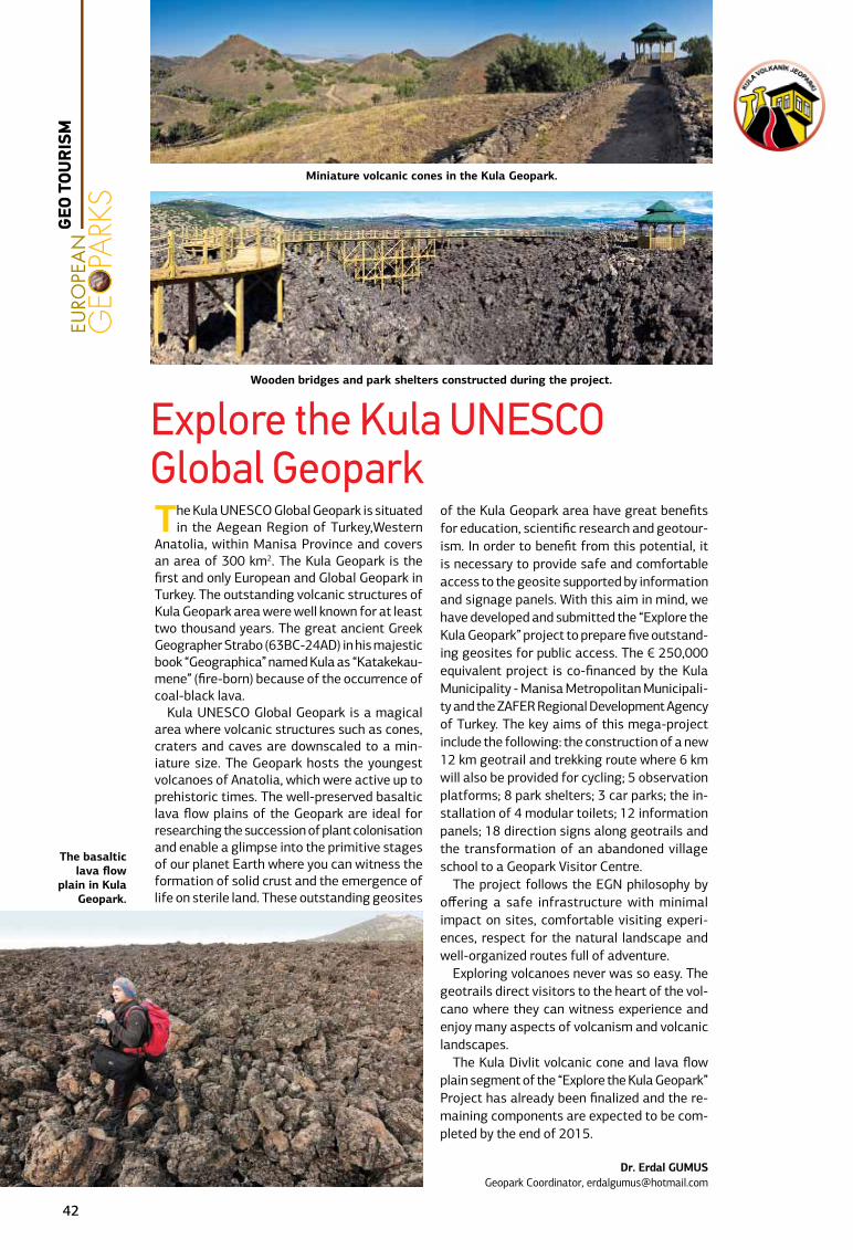
The Kula UNESCO Global Geopark is situated in the Aegean Region of Turkey,Western
Anatolia, within Manisa Province and covers an area of 300 km2. The Kula Geopark is the first and only European and Global Geopark in Turkey. The outstanding volcanic structures of Kula Geopark area were well known for at least two thousand years. The great ancient Greek Geographer Strabo (63BC-24AD) in his majestic book “Geographica” named Kula as “Katakekau-mene” (fire-born) because of the occurrence of coal-black lava.
Kula UNESCO Global Geopark is a magical area where volcanic structures such as cones, craters and caves are downscaled to a min-iature size. The Geopark hosts the youngest volcanoes of Anatolia, which were active up to prehistoric times. The well-preserved basaltic lava flow plains of the Geopark are ideal for researching the succession of plant colonisation and enable a glimpse into the primitive stages of our planet Earth where you can witness the formation of solid crust and the emergence of life on sterile land. These outstanding geosites
of the Kula Geopark area have great benefits for education, scientific research and geotour-ism. In order to benefit from this potential, it is necessary to provide safe and comfortable access to the geosite supported by information and signage panels. With this aim in mind, we have developed and submitted the “Explore the Kula Geopark” project to prepare five outstand-ing geosites for public access. The € 250,000 equivalent project is co-financed by the Kula Municipality - Manisa Metropolitan Municipali-ty and the ZAFER Regional Development Agency of Turkey. The key aims of this mega-project include the following: the construction of a new 12 km geotrail and trekking route where 6 km will also be provided for cycling; 5 observation platforms; 8 park shelters; 3 car parks; the in-stallation of 4 modular toilets; 12 information panels; 18 direction signs along geotrails and the transformation of an abandoned village school to a Geopark Visitor Centre.
The project follows the EGN philosophy by offering a safe infrastructure with minimal impact on sites, comfortable visiting experi-ences, respect for the natural landscape and well-organized routes full of adventure.
Exploring volcanoes never was so easy. The geotrails direct visitors to the heart of the vol-cano where they can witness experience and enjoy many aspects of volcanism and volcanic landscapes.
The Kula Divlit volcanic cone and lava flow plain segment of the “Explore the Kula Geopark” Project has already been finalized and the re-maining components are expected to be com-pleted by the end of 2015.
Dr. Erdal GUMUSGeopark Coordinator, [email protected]
The basaltic lava flow
plain in Kula Geopark.
Miniature volcanic cones in the Kula Geopark.
Wooden bridges and park shelters constructed during the project.
Explore the Kula UNESCO Global Geopark
42
GEO
TOU
RIS
M
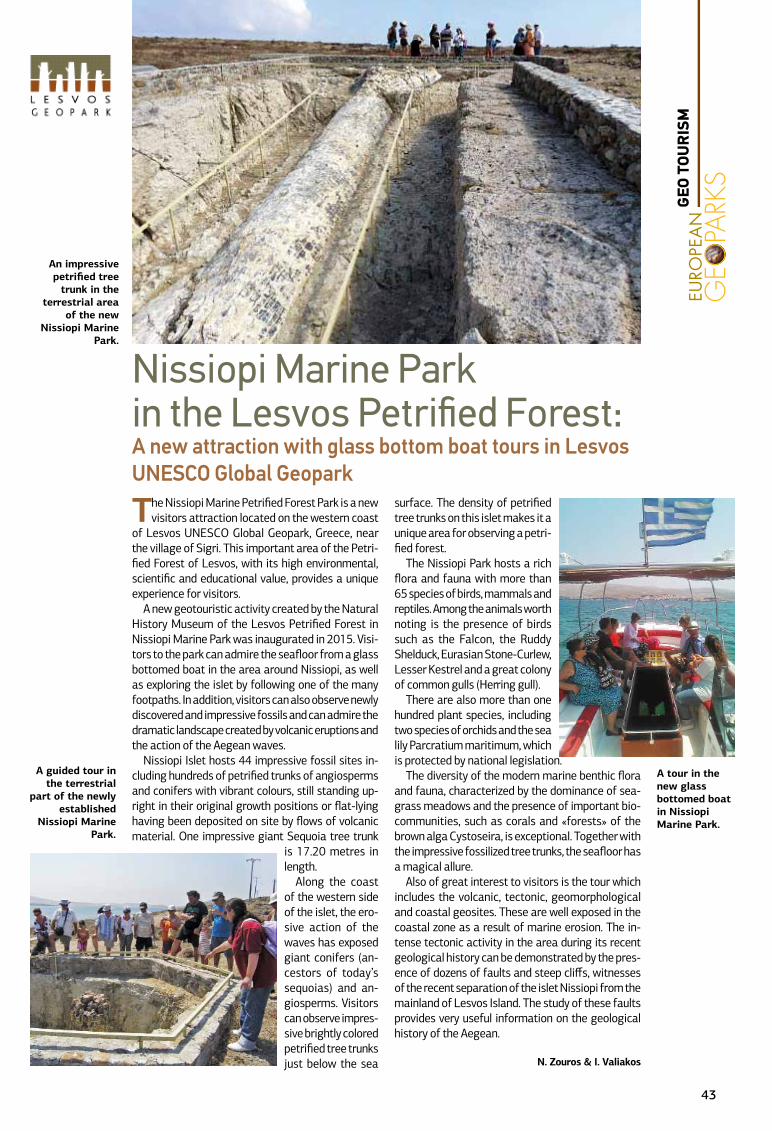
The Nissiopi Marine Petrified Forest Park is a new visitors attraction located on the western coast
of Lesvos UNESCO Global Geopark, Greece, near the village of Sigri. This important area of the Petri-fied Forest of Lesvos, with its high environmental, scientific and educational value, provides a unique experience for visitors.
A new geotouristic activity created by the Natural History Museum of the Lesvos Petrified Forest in Nissiopi Marine Park was inaugurated in 2015. Visi-tors to the park can admire the seafloor from a glass bottomed boat in the area around Nissiopi, as well as exploring the islet by following one of the many footpaths. In addition, visitors can also observe newly discovered and impressive fossils and can admire the dramatic landscape created by volcanic eruptions and the action of the Aegean waves.
Nissiopi Islet hosts 44 impressive fossil sites in-cluding hundreds of petrified trunks of angiosperms and conifers with vibrant colours, still standing up-right in their original growth positions or flat-lying having been deposited on site by flows of volcanic material. One impressive giant Sequoia tree trunk
is 17.20 metres in length.
Along the coast of the western side of the islet, the ero-sive action of the waves has exposed giant conifers (an-cestors of today’s sequoias) and an-giosperms. Visitors can observe impres-sive brightly colored petrified tree trunks just below the sea
surface. The density of petrified tree trunks on this islet makes it a unique area for observing a petri-fied forest.
The Nissiopi Park hosts a rich flora and fauna with more than 65 species of birds, mammals and reptiles. Among the animals worth noting is the presence of birds such as the Falcon, the Ruddy Shelduck, Eurasian Stone-Curlew, Lesser Kestrel and a great colony of common gulls (Herring gull).
There are also more than one hundred plant species, including two species of orchids and the sea lily Parcratium maritimum, which is protected by national legislation.
The diversity of the modern marine benthic flora and fauna, characterized by the dominance of sea-grass meadows and the presence of important bio-communities, such as corals and «forests» of the brown alga Cystoseira, is exceptional. Together with the impressive fossilized tree trunks, the seafloor has a magical allure.
Also of great interest to visitors is the tour which includes the volcanic, tectonic, geomorphological and coastal geosites. These are well exposed in the coastal zone as a result of marine erosion. The in-tense tectonic activity in the area during its recent geological history can be demonstrated by the pres-ence of dozens of faults and steep cliffs, witnesses of the recent separation of the islet Nissiopi from the mainland of Lesvos Island. The study of these faults provides very useful information on the geological history of the Aegean.
N. Zouros & I. Valiakos
A tour in the new glass bottomed boat in Nissiopi Marine Park.
An impressive petrified tree
trunk in the terrestrial area
of the new Nissiopi Marine
Park.
Nissiopi Marine Park in the Lesvos Petrified Forest:A new attraction with glass bottom boat tours in Lesvos UNESCO Global Geopark
A guided tour in the terrestrial
part of the newly established
Nissiopi Marine Park.
43
GEO
TOU
RIS
M
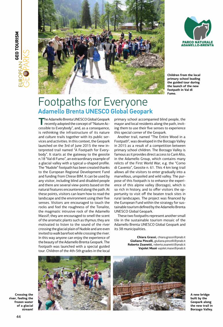
The Adamello Brenta UNESCO Global Geopark recently adopted the concept of “Nature Ac-
cessible to Everybody”, and, as a consequence, is rethinking the infrastructure of its nature and culture trails together with its public ser-vices and activities. In this context, the Geopark launched on the 3rd of June 2015 the new in-terpreted trail named “A Footpath for Every-body”. It starts at the gateway to the geosite n.18 “Val di Fumo”, an extraordinary example of a glacial valley with a typical u-shaped profile. The “Nudole” footpath has been created thanks to the European Regional Development Fund and funding from Chiese BIM. It can be used by any visitor, including blind and disabled people and there are several view-points based on the natural features encountered along the path. At these points, visitors can learn how to read the landscape and the environment using their five senses. Visitors are encouraged to touch the rocks and feel the roughness of the Tonalite, the magmatic intrusive rock of the Adamello Massif; they are encouraged to smell the scent of the aromatic plants such as thymus; they are motivated to listen to the sound of the river crossing the glacial plain of Nudole and are even invited to walk barefoot while crossing the river. In this way anyone can enjoy the experience of the beauty of the Adamello Brenta Geopark. The footpath was launched with a special guided tour. Children of the 4th-5th grades in the local
primary school accompanied blind people, the mayor and local residents along the path, invit-ing them to use their five senses to experience this special corner of the Geopark.
Another trail, named “The Entire Wood in a Footpath”, was developed in the Borzago Valley in 2015 as a result of a competition between primary school children. The Borzago Valley is famous as it provides direct access to Carè Alto, in the Adamello Group, which contains many relicts of the First World War, e.g. the “Corno di Cavento”, Geosite n. 61. This 4 km long trail allows all the visitors to enter gradually into a marvellous, unspoiled and wild valley. The pur-pose of this footpath is to enhance the experi-ence of this alpine valley (Borzago), which is so rich in history, and to offer visitors the op-portunity to visit off the beaten track sites in rural landscapes. The project was financed by the European Fund within the strategy for sus-tainable tourism defined by the Adamello Brenta UNESCO Global Geopark.
These two footpaths represent another small tile in the sustainable tourism mosaic of the Adamello Brenta UNESCO Global Geopark and its 38 municipalities.
Chiara Grassi, [email protected] Giuliana Pincelli, [email protected]
Roberto Zoanetti, [email protected] Vajolet Masè [email protected]
Footpaths for EveryoneAdamello Brenta UNESCO Global Geopark
Children from the local primary school leading the guided tour during the launch of the new footpath in Val di Fumo.
A new bridge built by the Geopark along the new trail in Borzago Valley.
Crossing the river, feeling the
frozen water of a glacial
stream!
44
GEO
TOU
RIS
M
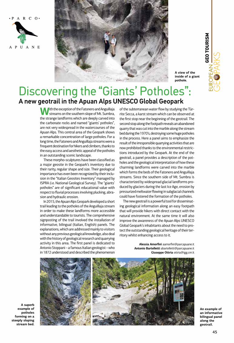
Discovering the “Giants’ Potholes”: A new geotrail in the Apuan Alps UNESCO Global Geopark
A superb example of
potholes forming on a
steeply sloping stream bed.
An example of an informative bilingual panel along the geotrail.
With the exception of the Fatonero and Anguillaja streams on the southern slope of Mt. Sumbra,
the strange landforms which are deeply carved into the carbonate rocks and named “giants’ potholes”, are not very widespread in the watercourses of the Apuan Alps. This central area of the Geopark shows a remarkable concentration of large potholes. For a long time, the Fatonero and Anguillaja streams were a frequent destination for hikers and climbers, thanks to the easy access and aesthetic appeal of the potholes in an outstanding scenic landscape.
These morpho-sculptures have been classified as a major geosite in the Geopark’s inventory due to their rarity, regular shape and size. Their geological importance has even been recognized by their inclu-sion in the “Italian Geosites Inventory” managed by ISPRA (i.e. National Geological Survey). The “giants’ potholes” are of significant educational value with respect to fluvial processes involving plucking, abra-sion and hydraulic erosion.
In 2015, the Apuan Alps Geopark developed a short trail leading to the potholes of the Anguillaja stream in order to make these landforms more accessible and understandable to tourists. The comprehensive signposting of the trail involved the installation of informative, bilingual (Italian, English) panels. The explanations, which are addressed mainly to visitors without any previous geological knowledge, also deal with the history of geological research and quarrying activity in this area. The first panel is dedicated to Antonio Stoppani – a famous Italian geologist – who in 1872 understood and described the phenomenon
of the subterranean water flow by studying the Tùr-rite Secca, a karst stream which can be observed at the first stop near the beginning of the geotrail. The second stop along the footpath reveals an abandoned quarry that was cut into the marble along the stream bed during the 1970’s, destroying some huge potholes in the process. Here a panel aims to emphasize the result of the irresponsible quarrying activities that are now prohibited thanks to the environmental restric-tions introduced by the Geopark. At the end of the geotrail, a panel provides a description of the pot-holes and the geological interpretation of how these charming landforms were carved into the marble which forms the beds of the Fatonero and Anguillaja streams. Since the southern side of Mt. Sumbra is characterized by widespread glacial landforms pro-duced by glaciers during the last Ice Age, erosion by pressurized meltwater flowing in subglacial channels could have fostered the formation of the potholes.
The new geotrail is a powerful tool for disseminat-ing geological information along an easy footpath that will provide hikers with direct contact with the natural environment. At the same time it will also improve the awareness of the Apuan Alps UNESCO Global Geopark’s inhabitants about the need to pro-tect the outstanding geological heritage of their ter-ritory whilst enhancing access to it.
Alessia Amorfini [email protected] Bartelletti [email protected]
Giuseppe Ottria [email protected]
A view of the inside of a giant pothole.
45
GEO
TOU
RIS
M
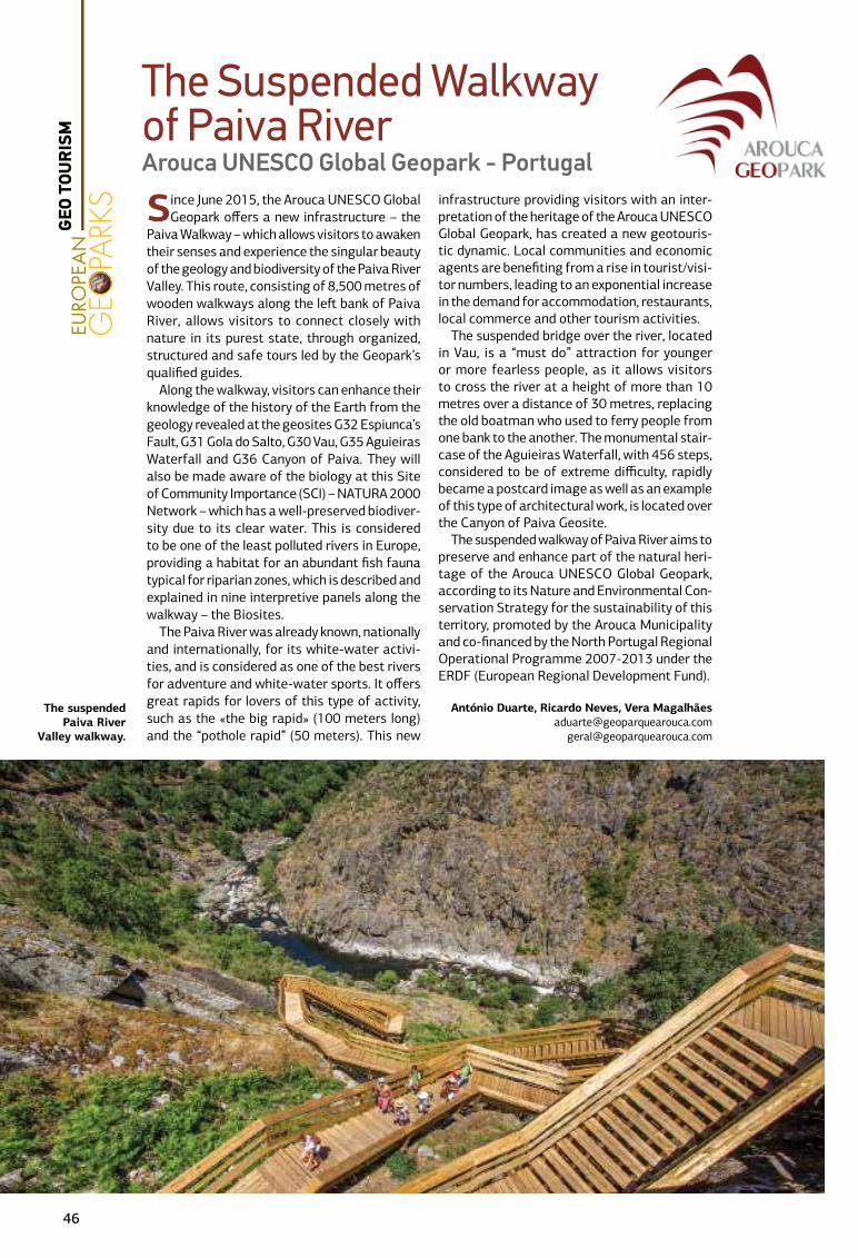
Since June 2015, the Arouca UNESCO Global Geopark offers a new infrastructure – the
Paiva Walkway – which allows visitors to awaken their senses and experience the singular beauty of the geology and biodiversity of the Paiva River Valley. This route, consisting of 8,500 metres of wooden walkways along the left bank of Paiva River, allows visitors to connect closely with nature in its purest state, through organized, structured and safe tours led by the Geopark’s qualified guides.
Along the walkway, visitors can enhance their knowledge of the history of the Earth from the geology revealed at the geosites G32 Espiunca’s Fault, G31 Gola do Salto, G30 Vau, G35 Aguieiras Waterfall and G36 Canyon of Paiva. They will also be made aware of the biology at this Site of Community Importance (SCI) – NATURA 2000 Network – which has a well-preserved biodiver-sity due to its clear water. This is considered to be one of the least polluted rivers in Europe, providing a habitat for an abundant fish fauna typical for riparian zones, which is described and explained in nine interpretive panels along the walkway – the Biosites.
The Paiva River was already known, nationally and internationally, for its white-water activi-ties, and is considered as one of the best rivers for adventure and white-water sports. It offers great rapids for lovers of this type of activity, such as the «the big rapid» (100 meters long) and the “pothole rapid” (50 meters). This new
infrastructure providing visitors with an inter-pretation of the heritage of the Arouca UNESCO Global Geopark, has created a new geotouris-tic dynamic. Local communities and economic agents are benefiting from a rise in tourist/visi-tor numbers, leading to an exponential increase in the demand for accommodation, restaurants, local commerce and other tourism activities.
The suspended bridge over the river, located in Vau, is a “must do” attraction for younger or more fearless people, as it allows visitors to cross the river at a height of more than 10 metres over a distance of 30 metres, replacing the old boatman who used to ferry people from one bank to the another. The monumental stair-case of the Aguieiras Waterfall, with 456 steps, considered to be of extreme difficulty, rapidly became a postcard image as well as an example of this type of architectural work, is located over the Canyon of Paiva Geosite.
The suspended walkway of Paiva River aims to preserve and enhance part of the natural heri-tage of the Arouca UNESCO Global Geopark, according to its Nature and Environmental Con-servation Strategy for the sustainability of this territory, promoted by the Arouca Municipality and co-financed by the North Portugal Regional Operational Programme 2007-2013 under the ERDF (European Regional Development Fund).
António Duarte, Ricardo Neves, Vera Magalhã[email protected]
The Suspended Walkway of Paiva RiverArouca UNESCO Global Geopark - Portugal
The suspended Paiva River
Valley walkway.
46
GEO
TOU
RIS
M
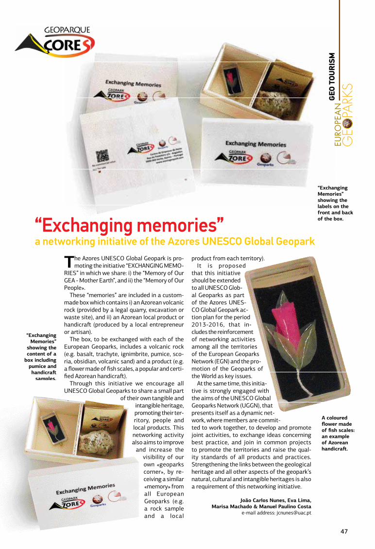
“Exchanging Memories” showing the labels on the front and back of the box.“Exchanging memories”
a networking initiative of the Azores UNESCO Global Geopark
A coloured flower made of fish scales: an example of Azorean handicraft.
“Exchanging Memories”
showing the content of a
box including pumice and handicraft
samples.
The Azores UNESCO Global Geopark is pro-moting the initiative “EXCHANGING MEMO-
RIES” in which we share: i) the “Memory of Our GEA - Mother Earth”, and ii) the “Memory of Our People».
These “memories” are included in a custom-made box which contains i) an Azorean volcanic rock (provided by a legal quarry, excavation or waste site), and ii) an Azorean local product or handicraft (produced by a local entrepreneur or artisan).
The box, to be exchanged with each of the European Geoparks, includes a volcanic rock (e.g. basalt, trachyte, ignimbrite, pumice, sco-ria, obsidian, volcanic sand) and a product (e.g. a flower made of fish scales, a popular and certi-fied Azorean handicraft).
Through this initiative we encourage all UNESCO Global Geoparks to share a small part
of their own tangible and intangible heritage, promoting their ter-ritory, people and local products. This networking activity also aims to improve
and increase the visibility of our own «geoparks corner», by re-ceiving a similar «memory» from all European Geoparks (e.g. a rock sample and a local
product from each territory).It is proposed
that this initiative should be extended to all UNESCO Glob-al Geoparks as part of the Azores UNES-CO Global Geopark ac-tion plan for the period 2013-2016, that in-cludes the reinforcement of networking activities among all the territories of the European Geoparks Network (EGN) and the pro-motion of the Geoparks of the World as key issues.
At the same time, this initia-tive is strongly engaged with the aims of the UNESCO Global Geoparks Network (UGGN), that presents itself as a dynamic net-work, where members are commit-ted to work together, to develop and promote joint activities, to exchange ideas concerning best practice, and join in common projects to promote the territories and raise the qual-ity standards of all products and practices. Strengthening the links between the geological heritage and all other aspects of the geopark’s natural, cultural and intangible heritages is also a requirement of this networking initiative.
João Carlos Nunes, Eva Lima, Marisa Machado & Manuel Paulino Costa
e-mail address: [email protected]
47
GEO
TOU
RIS
M
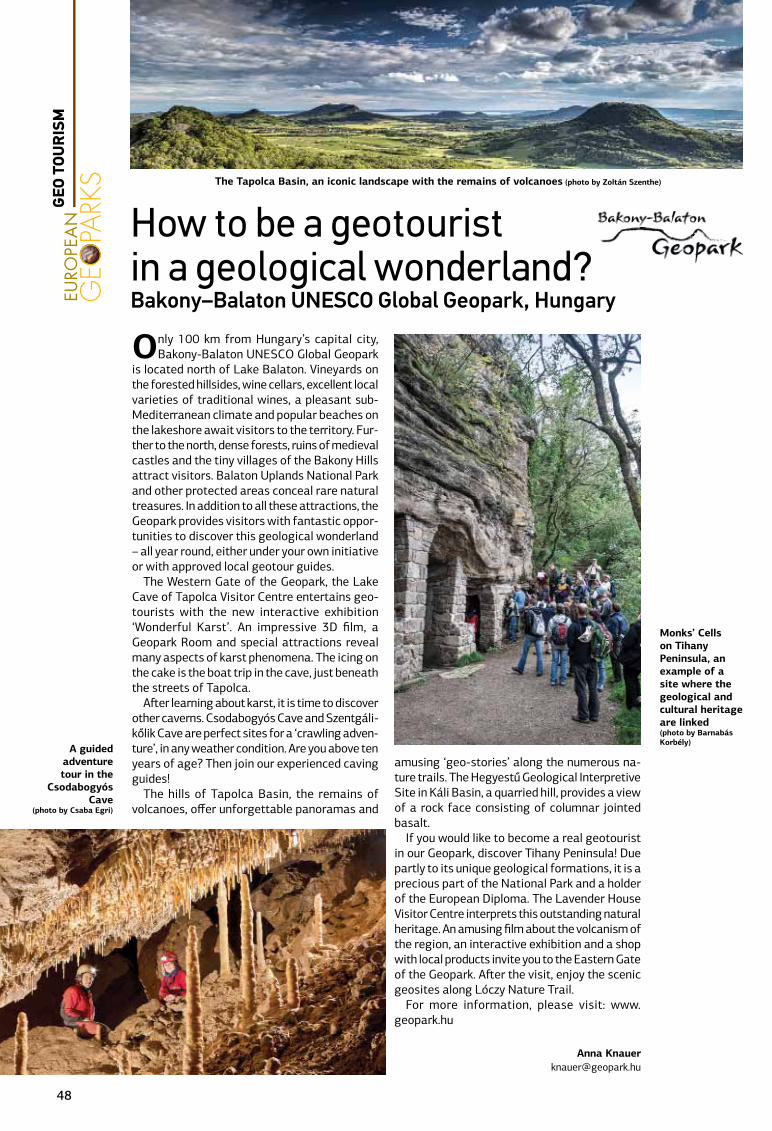
Only 100 km from Hungary’s capital city, Bakony-Balaton UNESCO Global Geopark
is located north of Lake Balaton. Vineyards on the forested hillsides, wine cellars, excellent local varieties of traditional wines, a pleasant sub-Mediterranean climate and popular beaches on the lakeshore await visitors to the territory. Fur-ther to the north, dense forests, ruins of medieval castles and the tiny villages of the Bakony Hills attract visitors. Balaton Uplands National Park and other protected areas conceal rare natural treasures. In addition to all these attractions, the Geopark provides visitors with fantastic oppor-tunities to discover this geological wonderland – all year round, either under your own initiative or with approved local geotour guides.
The Western Gate of the Geopark, the Lake Cave of Tapolca Visitor Centre entertains geo-tourists with the new interactive exhibition ‘Wonderful Karst’. An impressive 3D film, a Geopark Room and special attractions reveal many aspects of karst phenomena. The icing on the cake is the boat trip in the cave, just beneath the streets of Tapolca.
After learning about karst, it is time to discover other caverns. Csodabogyós Cave and Szentgáli-kőlik Cave are perfect sites for a ‘crawling adven-ture’, in any weather condition. Are you above ten years of age? Then join our experienced caving guides!
The hills of Tapolca Basin, the remains of volcanoes, offer unforgettable panoramas and
amusing ‘geo-stories’ along the numerous na-ture trails. The Hegyestű Geological Interpretive Site in Káli Basin, a quarried hill, provides a view of a rock face consisting of columnar jointed basalt.
If you would like to become a real geotourist in our Geopark, discover Tihany Peninsula! Due partly to its unique geological formations, it is a precious part of the National Park and a holder of the European Diploma. The Lavender House Visitor Centre interprets this outstanding natural heritage. An amusing film about the volcanism of the region, an interactive exhibition and a shop with local products invite you to the Eastern Gate of the Geopark. After the visit, enjoy the scenic geosites along Lóczy Nature Trail.
For more information, please visit: www.geopark.hu
Anna [email protected]
How to be a geotourist in a geological wonderland?Bakony–Balaton UNESCO Global Geopark, Hungary
The Tapolca Basin, an iconic landscape with the remains of volcanoes (photo by Zoltán Szenthe)
Monks’ Cells on Tihany Peninsula, an example of a site where the geological and cultural heritage are linked(photo by Barnabás Korbély)
A guided adventure tour in the
Csodabogyós Cave
(photo by Csaba Egri)
48
GEO
TOU
RIS
M

The calcareous Massif des Bauges UNESCO Global Geopark has highlighted its karstic
heritage since the creation of the Regional Nature Park. The first interpretative trail the “Ice Holes and Karst Geotrail” was established in 1996 and concentrated on the surface features of a karstic landscape. Although the trail is located on the deep-est and longest underground network of Savoie, the general public could not access it.
Following its designation in 2011 as a Euro-pean and Global Geopark, the Massif des Bauges Geopark began to explore a better way to provide access to the karstic network for the general public. In most cases, exploring the caves in the Bauges Massif requires specialized equipment rendering them unsuitable for the general public.
The “Tanne du Névé – Porte Cochère” cave sys-tem was the best candidate chosen to provide the public with the experience of cave exploration. The chasm, along the side of the surface trail, was al-ready one of the main attractions. However, access to the bottom of the chasm was impossible without the ropes, harnesses and blocks used by cavers. Equipping an alternative entry (The “Porte Co-chère”) with metal ladders and sealed handles now allows easy access to the cave system. Progressing through a succession of underground meanders, alternating with impressive vertical passages and narrow horizontal sections provides visitors with a real feeling of discovery, very different to that experienced in more traditional show caves.
The first free caving-trail in France is now open. Visitors can experience a one hour underground
adventure which only requires a helmet and a light. Footbridges and metal ladders assist visitors along the subterranean trail. As they progress inside a “true art gallery” they learn to understand the long process of erosion of the water on the surface and the inside of the Margériaz Mountain.
The passage under the Tannes du Névé chasm, where we can catch sight of the sky during the visit, is both impressive and reassuring. This cav-ing trail is accessible during high and mid-season, but its access is restricted during the winter, due to ice that can cover the soil and walls and render access to the cave, dangerous. This caving trail is a small part of a wider underground 18 kilometre long network with up to 800 metres differences in height between passages. A clear sign separates the general public trail from the technical part, only dedicated for exploration by experienced cavers.
Visitors can extend their trip along the surface trail to discover the surprising landforms: sinkholes, stone arches and dolines with the aid of a mobile application or an interpretative booklet.
Professional mountain leaders or caving guides offer some additional underground discoveries for the most adventurous visitors or for schools.
J-L. Desbois*1, C. Lansigu1,
* Corresponding author ([email protected])
The caving trail enjoyed by
children from the age of six
years.
Metal ladders allow progress through in the vertical sections of the meandering passage
A free caving trail An underground and pedagogical adventure
An art gallery consisting of small chambers and narrow meanders.
49
GEO
TOU
RIS
M
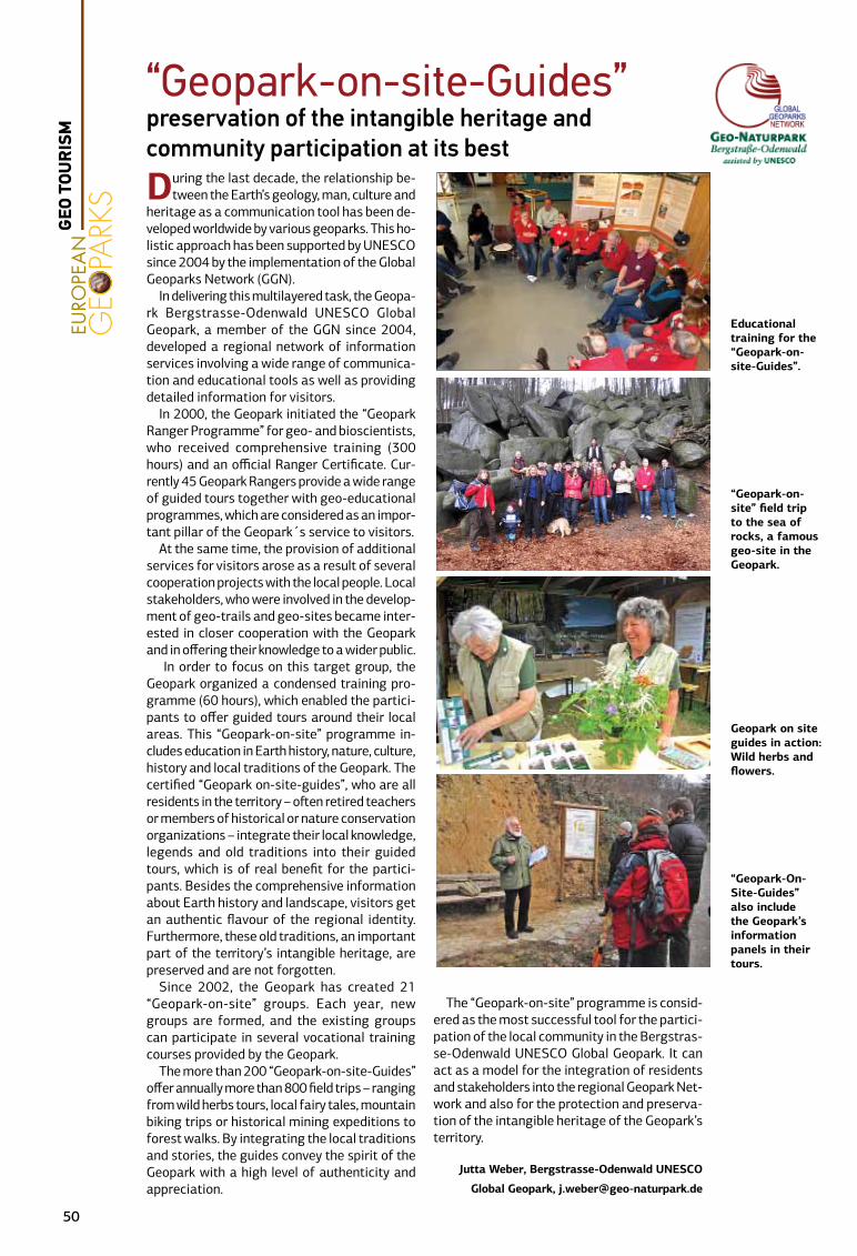
During the last decade, the relationship be-tween the Earth’s geology, man, culture and
heritage as a communication tool has been de-veloped worldwide by various geoparks. This ho-listic approach has been supported by UNESCO since 2004 by the implementation of the Global Geoparks Network (GGN).
In delivering this multilayered task, the Geopa-rk Bergstrasse-Odenwald UNESCO Global Geopark, a member of the GGN since 2004, developed a regional network of information services involving a wide range of communica-tion and educational tools as well as providing detailed information for visitors.
In 2000, the Geopark initiated the “Geopark Ranger Programme” for geo- and bioscientists, who received comprehensive training (300 hours) and an official Ranger Certificate. Cur-rently 45 Geopark Rangers provide a wide range of guided tours together with geo-educational programmes, which are considered as an impor-tant pillar of the Geopark´s service to visitors.
At the same time, the provision of additional services for visitors arose as a result of several cooperation projects with the local people. Local stakeholders, who were involved in the develop-ment of geo-trails and geo-sites became inter-ested in closer cooperation with the Geopark and in offering their knowledge to a wider public.
In order to focus on this target group, the Geopark organized a condensed training pro-gramme (60 hours), which enabled the partici-pants to offer guided tours around their local areas. This “Geopark-on-site” programme in-cludes education in Earth history, nature, culture, history and local traditions of the Geopark. The certified “Geopark on-site-guides”, who are all residents in the territory – often retired teachers or members of historical or nature conservation organizations – integrate their local knowledge, legends and old traditions into their guided tours, which is of real benefit for the partici-pants. Besides the comprehensive information about Earth history and landscape, visitors get an authentic flavour of the regional identity. Furthermore, these old traditions, an important part of the territory’s intangible heritage, are preserved and are not forgotten.
Since 2002, the Geopark has created 21 “Geopark-on-site” groups. Each year, new groups are formed, and the existing groups can participate in several vocational training courses provided by the Geopark.
The more than 200 “Geopark-on-site-Guides” offer annually more than 800 field trips – ranging from wild herbs tours, local fairy tales, mountain biking trips or historical mining expeditions to forest walks. By integrating the local traditions and stories, the guides convey the spirit of the Geopark with a high level of authenticity and appreciation.
The “Geopark-on-site” programme is consid-ered as the most successful tool for the partici-pation of the local community in the Bergstras-se-Odenwald UNESCO Global Geopark. It can act as a model for the integration of residents and stakeholders into the regional Geopark Net-work and also for the protection and preserva-tion of the intangible heritage of the Geopark’s territory.
Jutta Weber, Bergstrasse-Odenwald UNESCO
Global Geopark, [email protected]
Geopark on site guides in action: Wild herbs and flowers.
“Geopark-On-Site-Guides” also include the Geopark’s information panels in their tours.
“Geopark-on-site” field trip to the sea of rocks, a famous geo-site in the Geopark.
Educational training for the “Geopark-on-site-Guides”.
“Geopark-on-site-Guides” preservation of the intangible heritage and community participation at its best
50
GEO
TOU
RIS
M
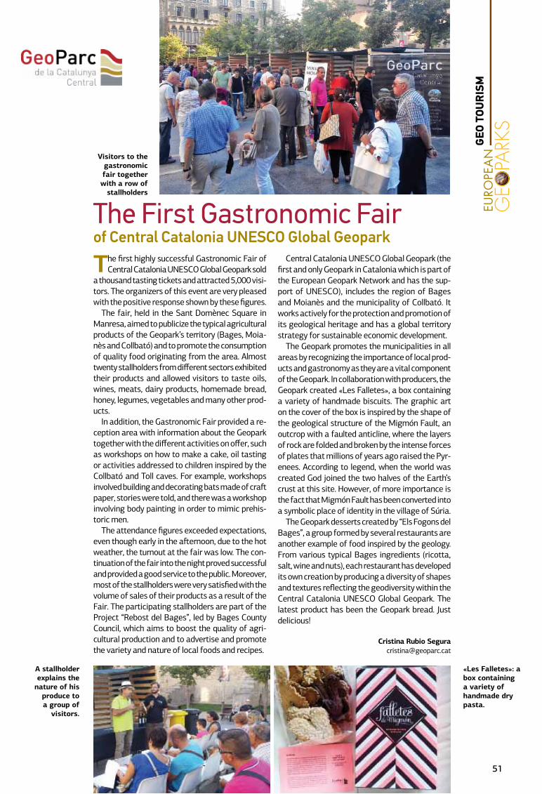
The first highly successful Gastronomic Fair of Central Catalonia UNESCO Global Geopark sold
a thousand tasting tickets and attracted 5,000 visi-tors. The organizers of this event are very pleased with the positive response shown by these figures.
The fair, held in the Sant Domènec Square in Manresa, aimed to publicize the typical agricultural products of the Geopark’s territory (Bages, Moia-nès and Collbató) and to promote the consumption of quality food originating from the area. Almost twenty stallholders from different sectors exhibited their products and allowed visitors to taste oils, wines, meats, dairy products, homemade bread, honey, legumes, vegetables and many other prod-ucts.
In addition, the Gastronomic Fair provided a re-ception area with information about the Geopark together with the different activities on offer, such as workshops on how to make a cake, oil tasting or activities addressed to children inspired by the Collbató and Toll caves. For example, workshops involved building and decorating bats made of craft paper, stories were told, and there was a workshop involving body painting in order to mimic prehis-toric men.
The attendance figures exceeded expectations, even though early in the afternoon, due to the hot weather, the turnout at the fair was low. The con-tinuation of the fair into the night proved successful and provided a good service to the public. Moreover, most of the stallholders were very satisfied with the volume of sales of their products as a result of the Fair. The participating stallholders are part of the Project “Rebost del Bages”, led by Bages County Council, which aims to boost the quality of agri-cultural production and to advertise and promote the variety and nature of local foods and recipes.
Central Catalonia UNESCO Global Geopark (the first and only Geopark in Catalonia which is part of the European Geopark Network and has the sup-port of UNESCO), includes the region of Bages and Moianès and the municipality of Collbató. It works actively for the protection and promotion of its geological heritage and has a global territory strategy for sustainable economic development.
The Geopark promotes the municipalities in all areas by recognizing the importance of local prod-ucts and gastronomy as they are a vital component of the Geopark. In collaboration with producers, the Geopark created «Les Falletes», a box containing a variety of handmade biscuits. The graphic art on the cover of the box is inspired by the shape of the geological structure of the Migmón Fault, an outcrop with a faulted anticline, where the layers of rock are folded and broken by the intense forces of plates that millions of years ago raised the Pyr-enees. According to legend, when the world was created God joined the two halves of the Earth’s crust at this site. However, of more importance is the fact that Migmón Fault has been converted into a symbolic place of identity in the village of Súria.
The Geopark desserts created by “Els Fogons del Bages”, a group formed by several restaurants are another example of food inspired by the geology. From various typical Bages ingredients (ricotta, salt, wine and nuts), each restaurant has developed its own creation by producing a diversity of shapes and textures reflecting the geodiversity within the Central Catalonia UNESCO Global Geopark. The latest product has been the Geopark bread. Just delicious!
Cristina Rubio [email protected]
The First Gastronomic Fair of Central Catalonia UNESCO Global Geopark
«Les Falletes»: a box containing a variety of handmade dry pasta.
A stallholder explains the
nature of his produce to a group of
visitors.
Visitors to the gastronomic fair together with a row of
stallholders
51
GEO
TOU
RIS
M
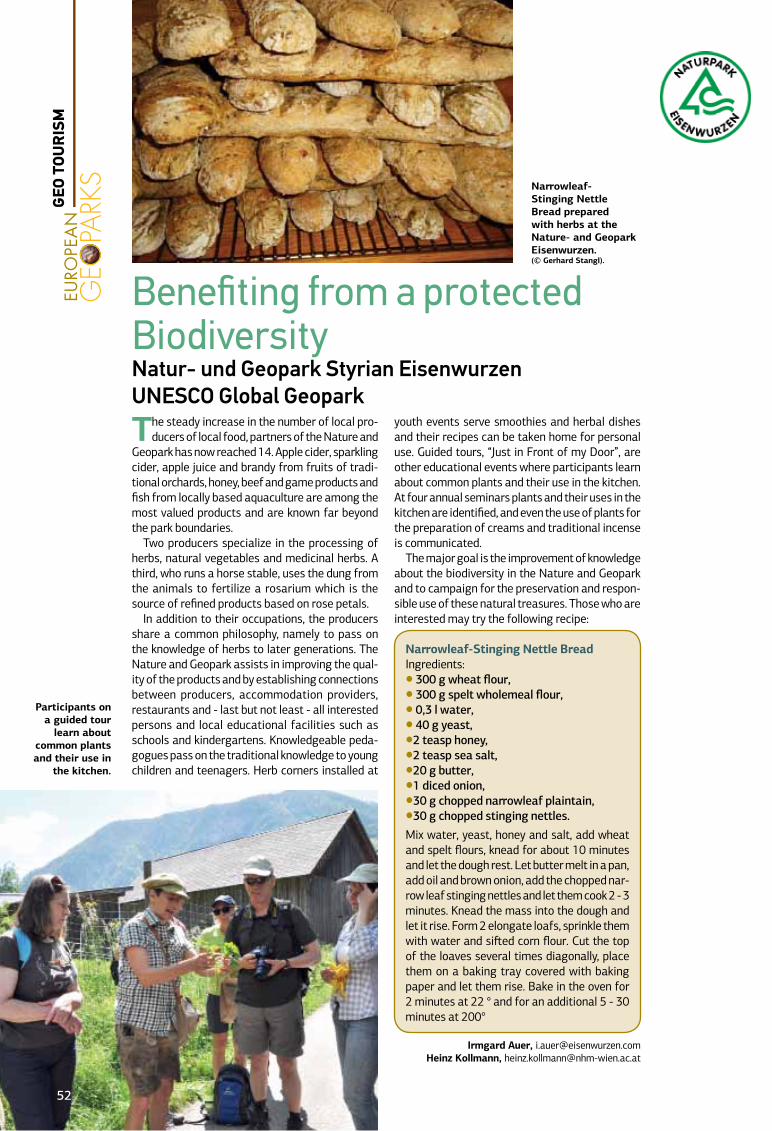
The steady increase in the number of local pro-ducers of local food, partners of the Nature and
Geopark has now reached 14. Apple cider, sparkling cider, apple juice and brandy from fruits of tradi-tional orchards, honey, beef and game products and fish from locally based aquaculture are among the most valued products and are known far beyond the park boundaries.
Two producers specialize in the processing of herbs, natural vegetables and medicinal herbs. A third, who runs a horse stable, uses the dung from the animals to fertilize a rosarium which is the source of refined products based on rose petals.
In addition to their occupations, the producers share a common philosophy, namely to pass on the knowledge of herbs to later generations. The Nature and Geopark assists in improving the qual-ity of the products and by establishing connections between producers, accommodation providers, restaurants and - last but not least - all interested persons and local educational facilities such as schools and kindergartens. Knowledgeable peda-gogues pass on the traditional knowledge to young children and teenagers. Herb corners installed at
youth events serve smoothies and herbal dishes and their recipes can be taken home for personal use. Guided tours, “Just in Front of my Door”, are other educational events where participants learn about common plants and their use in the kitchen. At four annual seminars plants and their uses in the kitchen are identified, and even the use of plants for the preparation of creams and traditional incense is communicated.
The major goal is the improvement of knowledge about the biodiversity in the Nature and Geopark and to campaign for the preservation and respon-sible use of these natural treasures. Those who are interested may try the following recipe:
Narrowleaf-Stinging Nettle BreadIngredients:● 300 g wheat flour, ● 300 g spelt wholemeal flour, ● 0,3 l water, ● 40 g yeast, ●2 teasp honey, ●2 teasp sea salt, ●20 g butter, ●1 diced onion, ●30 g chopped narrowleaf plaintain, ●30 g chopped stinging nettles.Mix water, yeast, honey and salt, add wheat and spelt flours, knead for about 10 minutes and let the dough rest. Let butter melt in a pan, add oil and brown onion, add the chopped nar-row leaf stinging nettles and let them cook 2 - 3 minutes. Knead the mass into the dough and let it rise. Form 2 elongate loafs, sprinkle them with water and sifted corn flour. Cut the top of the loaves several times diagonally, place them on a baking tray covered with baking paper and let them rise. Bake in the oven for 2 minutes at 22 ° and for an additional 5 - 30 minutes at 200°
Irmgard Auer, [email protected] Heinz Kollmann, [email protected]
Benefiting from a protected BiodiversityNatur- und Geopark Styrian Eisenwurzen UNESCO Global Geopark
Narrowleaf-Stinging Nettle Bread prepared with herbs at the Nature- and Geopark Eisenwurzen. (© Gerhard Stangl).
Participants on a guided tour
learn about common plants and their use in
the kitchen.
52
GEO
TOU
RIS
M
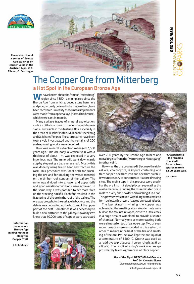
We have known about the famous “Mitterberg” region since 1850 - a mining area since the
Bronze Age from which grooved stone hammers and picks, wrongly believed to be made of iron, have been recovered. In reality these metal implements were made from copper alloys (normal tin bronze), which were cast in moulds.
Many surface traces of mineral exploitation, such as pitfalls – rows of funnel shaped depres-sions - are visible in the Austrian Alps, especially in the areas of Bischofshofen, Mühlbach/Hochkönig and St. Johann/Pongau. These structures have been extensively investigated and the remains of 200 m deep mining works were detected.
How was mineral extraction managed 3,500 years ago? The ore body, a vertical vein with a thickness of about 1 m, was exploited in a very ingenious way. The mine adit went downwards step by step using a transverse shaft. Mostly this was done by using fire to heat and fracture the rock. This procedure was ideal both for crush-ing the ore and for stacking the waste material on the timber roof support of the gallery. The mine was divided into a lower and upper drift and good aeration-conditions were achieved. In the same way it was possible to set more fires on the stacking backfill. Each fire resulted in the fracturing of the ore in the roof of the gallery. The ore was brought to the surface in buckets and the debris was deposited at the bottom of the upper part of the drift. Sometimes it was necessary to build a new entrance to the gallery. Nowadays we know that 10,000 tons of copper were extracted
over 700 years by the Bronze Age miners and metallurgists from the “Mitterberger Hauptgang” (mother vein).
How was the ore processed? Because the rich-est ore, chalcopyrite, is impure containing one third copper, one third iron and one third sulphur, it was necessary to concentrate it at ore dressing sites. The main steps in this process were crush-ing the ore into nut sized pieces, separating the waste material, grinding the disseminated ore in mills to a very fine powder and washing it in a pan. This powder was mixed with dung from cattle to form pellets, which were roasted on roasting beds.
The last stage in winning the copper was achieved at the smelting sites. Wooden huts were built on the mountain slopes, close to a little creek in a huge area of woodland, to provide a source of charcoal. Normally one or more roasting beds were situated on top of a slope-step. Two or even more furnaces were embedded in this system, in order to maintain the heat of the fire and smelt-ing of the ore. Pot-bellows kept the ore liquid at a temperature of 1300 °C. Quartz was used as an additive to produce an iron enriched slag (iron silicate). The result of a day’s work was an ap-proximately five kilogram cake of black copper.
Ore of the Alps UNESCO Global GeoparkProf. Dr. Clemens Eibner
Reconstruction of a series of Bronze
Age galleries on copper veins in the Austrian Alps. © C.
Eibner, G. Feitzinger
Information panel about Bronze Age
mining methods along the
Copper Trail.
© H. Ibetsberger
“Knappensteig” – the remains of a shaft furnace from approximately 3,500 years ago.
© C. Eibner
The Copper Ore from Mitterberga Hot Spot in the European Bronze Age
53
GEO
TOU
RIS
M
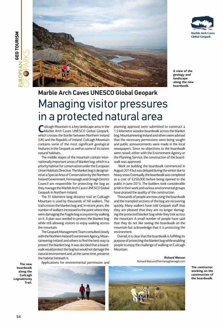
Cuilcagh Mountain is a key landscape area in the Marble Arch Caves UNESCO Global Geopark,
which crosses the border between Northern Ireland (UK) and the Republic of Ireland. Cuilcagh Mountain contains some of the most significant geological features in the Geopark as well as some of its rarest natural habitats.
The middle slopes of the mountain contain inter-nationally important areas of blanket bog, which is a priority habitat for conservation under the European Union Habitats Directive. The blanket bog is designat-ed as a Special Area of Conservation by the Northern Ireland Government. Fermanagh and Omagh District Council are responsible for protecting the bog as they manage the Marble Arch Caves UNESCO Global Geopark in Northern Ireland.
The 31 kilometre long distance trail on Cuilcagh Mountain is used by thousands of hill walkers. The trail crosses the blanket bog and, in recent years, the number of walkers increased to the point where they were damaging the fragile bog ecosystem by walking on it. A plan was needed to protect the blanket bog while still allowing visitors to enjoy walking across the mountain.
The Geopark Management Team consulted closely with the Northern Ireland Environment Agency, Moun-taineering Ireland and others to find the best way to protect the blanket bog. It was decided that a board-walk would protect the bog but would not damage the natural environment and, at the same time, preserve the habitat beneath it.
Applications for environmental permission and
planning approval were submitted to construct a 1.5 kilometre wooden boardwalk across the blanket bog. Mountaineering Ireland and others were advised that the necessary permissions were being sought and public announcements were made in the local newspapers. Since no objections to the boardwalk were raised, either with the Environment Agency or the Planning Service, the construction of the board-walk was approved.
Work on building the boardwalk commenced in August 2014 but was delayed during the winter due to heavy snow. Eventually, the boardwalk was completed at a cost of €250,000 before being opened to the public in June 2015. The builders took considerable pride in their work and various environmental groups have praised the quality of the construction.
Thousands of people are now using the boardwalk and the trampled sections of the bog are recovering quickly. Many walkers have told Geopark staff that they are pleased that they are no longer damag-ing the protected blanket bog while they trek across the mountain. A small number of people have said that they do not like seeing the boardwalk on the mountain but acknowledge that it is protecting the environment.
Overall, it is clear that the boardwalk is fulfilling its purpose of protecting the blanket bog while enabling people to enjoy the challenge of walking on Cuilcagh Mountain.
Richard [email protected]
Marble Arch Caves UNESCO Global Geopark
Managing visitor pressures in a protected natural area
The contractor working on the construction of the boardwalk.
A view of the geology and landscape along the new boardwalk.
The new boardwalk along the Cuilcagh
Legnabrocky Trail.
54
GEO
TOU
RIS
M
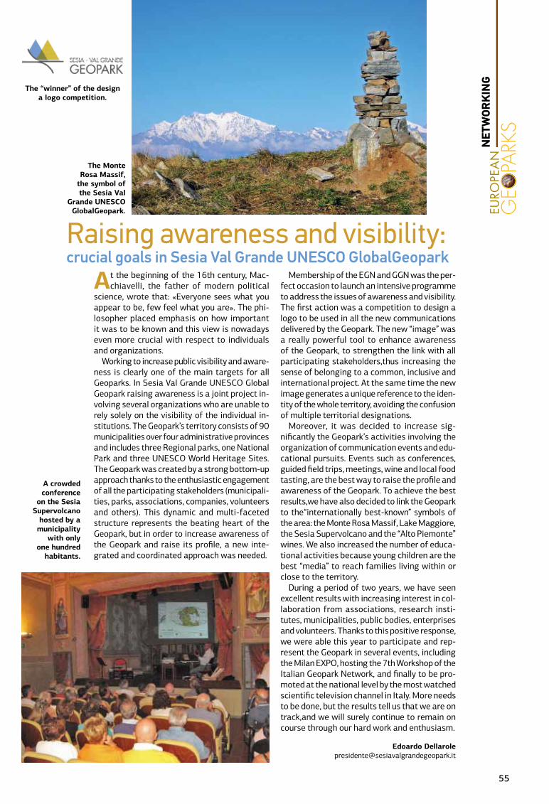
At the beginning of the 16th century, Mac-chiavelli, the father of modern political
science, wrote that: «Everyone sees what you appear to be, few feel what you are». The phi-losopher placed emphasis on how important it was to be known and this view is nowadays even more crucial with respect to individuals and organizations.
Working to increase public visibility and aware-ness is clearly one of the main targets for all Geoparks. In Sesia Val Grande UNESCO Global Geopark raising awareness is a joint project in-volving several organizations who are unable to rely solely on the visibility of the individual in-stitutions. The Geopark’s territory consists of 90 municipalities over four administrative provinces and includes three Regional parks, one National Park and three UNESCO World Heritage Sites. The Geopark was created by a strong bottom-up approach thanks to the enthusiastic engagement of all the participating stakeholders (municipali-ties, parks, associations, companies, volunteers and others). This dynamic and multi-faceted structure represents the beating heart of the Geopark, but in order to increase awareness of the Geopark and raise its profile, a new inte-grated and coordinated approach was needed.
Membership of the EGN and GGN was the per-fect occasion to launch an intensive programme to address the issues of awareness and visibility. The first action was a competition to design a logo to be used in all the new communications delivered by the Geopark. The new “image” was a really powerful tool to enhance awareness of the Geopark, to strengthen the link with all participating stakeholders,thus increasing the sense of belonging to a common, inclusive and international project. At the same time the new image generates a unique reference to the iden-tity of the whole territory, avoiding the confusion of multiple territorial designations.
Moreover, it was decided to increase sig-nificantly the Geopark’s activities involving the organization of communication events and edu-cational pursuits. Events such as conferences, guided field trips, meetings, wine and local food tasting, are the best way to raise the profile and awareness of the Geopark. To achieve the best results,we have also decided to link the Geopark to the“internationally best-known” symbols of the area: the Monte Rosa Massif, Lake Maggiore, the Sesia Supervolcano and the “Alto Piemonte” wines. We also increased the number of educa-tional activities because young children are the best “media” to reach families living within or close to the territory.
During a period of two years, we have seen excellent results with increasing interest in col-laboration from associations, research insti-tutes, municipalities, public bodies, enterprises and volunteers. Thanks to this positive response, we were able this year to participate and rep-resent the Geopark in several events, including the Milan EXPO, hosting the 7th Workshop of the Italian Geopark Network, and finally to be pro-moted at the national level by the most watched scientific television channel in Italy. More needs to be done, but the results tell us that we are on track,and we will surely continue to remain on course through our hard work and enthusiasm.
Edoardo Dellarole [email protected]
Raising awareness and visibility:crucial goals in Sesia Val Grande UNESCO GlobalGeopark
The Monte Rosa Massif,
the symbol of the Sesia Val
Grande UNESCO GlobalGeopark.
The “winner” of the design a logo competition.
A crowded conference
on the Sesia Supervolcano
hosted by a municipality
with only one hundred
habitants.
55
NET
WOR
KIN
G
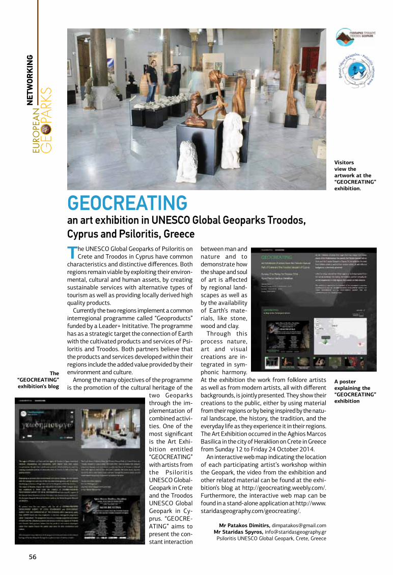
The UNESCO Global Geoparks of Psiloritis on Crete and Troodos in Cyprus have common
characteristics and distinctive differences. Both regions remain viable by exploiting their environ-mental, cultural and human assets, by creating sustainable services with alternative types of tourism as well as providing locally derived high quality products.
Currently the two regions implement a common interregional programme called “Geoproducts” funded by a Leader+ Inititative. The programme has as a strategic target the connection of Earth with the cultivated products and services of Psi-loritis and Troodos. Both partners believe that the products and services developed within their regions include the added value provided by their environment and culture.
Among the many objectives of the programme is the promotion of the cultural heritage of the
two Geoparks through the im-plementation of combined activi-ties. One of the most significant is the Art Exhi-bition entitled “GEOCREATING” with artists from the Psiloritis UNESCO Global-Geopark in Crete and the Troodos UNESCO Global Geopark in Cy-prus. “GEOCRE-ATING” aims to present the con-stant interaction
between man and nature and to demonstrate how the shape and soul of art is affected by regional land-scapes as well as by the availability of Earth’s mate-rials, like stone, wood and clay.
Through this process nature, art and visual creations are in-tegrated in sym-phonic harmony. At the exhibition the work from folklore artists as well as from modern artists, all with different backgrounds, is jointly presented. They show their creations to the public, either by using material from their regions or by being inspired by the natu-ral landscape, the history, the tradition, and the everyday life as they experience it in their regions.The Art Exhibition occurred in the Aghios Marcos Basilica in the city of Heraklion on Crete in Greece from Sunday 12 to Friday 24 October 2014.
An interactive web map indicating the location of each participating artist’s workshop within the Geopark, the video from the exhibition and other related material can be found at the exhi-bition’s blog at http://geocreating.weebly.com/. Furthermore, the interactive web map can be found in a stand-alone application at http://www.staridasgeography.com/geocreating/.
Mr Patakos Dimitirs, [email protected] Staridas Spyros, [email protected] UNESCO Global Geopark, Crete, Greece
GEOCREATING an art exhibition in UNESCO Global Geoparks Troodos, Cyprus and Psiloritis, Greece
The “GEOCREATING” exhibition’s blog
A poster explaining the “GEOCREATING” exhibition
Visitors view the artwork at the “GEOCREATING” exhibition.
56
NET
WOR
KIN
G
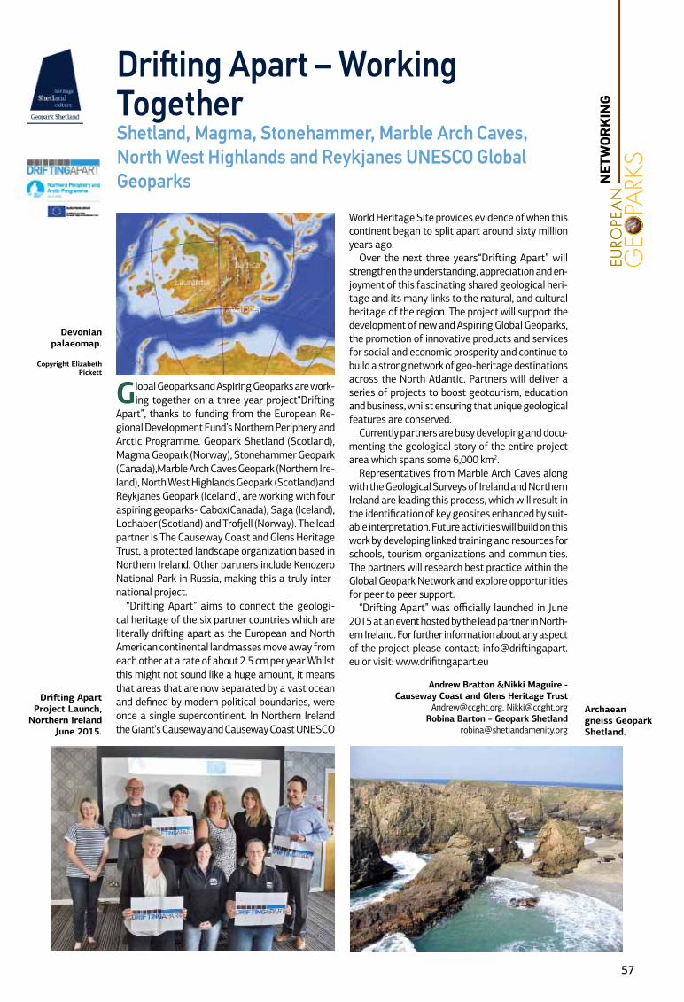
Global Geoparks and Aspiring Geoparks are work-ing together on a three year project“Drifting
Apart”, thanks to funding from the European Re-gional Development Fund’s Northern Periphery and Arctic Programme. Geopark Shetland (Scotland), Magma Geopark (Norway), Stonehammer Geopark (Canada),Marble Arch Caves Geopark (Northern Ire-land), North West Highlands Geopark (Scotland)and Reykjanes Geopark (Iceland), are working with four aspiring geoparks- Cabox(Canada), Saga (Iceland), Lochaber (Scotland) and Trofjell (Norway). The lead partner is The Causeway Coast and Glens Heritage Trust, a protected landscape organization based in Northern Ireland. Other partners include Kenozero National Park in Russia, making this a truly inter-national project.
“Drifting Apart” aims to connect the geologi-cal heritage of the six partner countries which are literally drifting apart as the European and North American continental landmasses move away from each other at a rate of about 2.5 cm per year.Whilst this might not sound like a huge amount, it means that areas that are now separated by a vast ocean and defined by modern political boundaries, were once a single supercontinent. In Northern Ireland the Giant’s Causeway and Causeway Coast UNESCO
World Heritage Site provides evidence of when this continent began to split apart around sixty million years ago.
Over the next three years“Drifting Apart” will strengthen the understanding, appreciation and en-joyment of this fascinating shared geological heri-tage and its many links to the natural, and cultural heritage of the region. The project will support the development of new and Aspiring Global Geoparks, the promotion of innovative products and services for social and economic prosperity and continue to build a strong network of geo-heritage destinations across the North Atlantic. Partners will deliver a series of projects to boost geotourism, education and business, whilst ensuring that unique geological features are conserved.
Currently partners are busy developing and docu-menting the geological story of the entire project area which spans some 6,000 km2.
Representatives from Marble Arch Caves along with the Geological Surveys of Ireland and Northern Ireland are leading this process, which will result in the identification of key geosites enhanced by suit-able interpretation. Future activities will build on this work by developing linked training and resources for schools, tourism organizations and communities. The partners will research best practice within the Global Geopark Network and explore opportunities for peer to peer support.
“Drifting Apart” was officially launched in June 2015 at an event hosted by the lead partner in North-ern Ireland. For further information about any aspect of the project please contact: [email protected] or visit: www.drifitngapart.eu
Andrew Bratton &Nikki Maguire - Causeway Coast and Glens Heritage Trust
[email protected], [email protected] Barton – Geopark Shetland
Drifting Apart – Working TogetherShetland, Magma, Stonehammer, Marble Arch Caves, North West Highlands and Reykjanes UNESCO Global Geoparks
Drifting Apart Project Launch,
Northern Ireland June 2015.
Archaean gneiss Geopark Shetland.
Devonian palaeomap.
Copyright Elizabeth Pickett
57
NET
WOR
KIN
G

The XI National Meeting of the Commission on Geological Heritage of the Geological Society
of Spain was held at the Basque Coast UNESCO Global Geopark from 9 -13 June 2015. The con-gress exceeded all expectations, with over 150 attendees and more than 90 communications submitted as oral and poster presentations to-gether with papers for publication. This represents an increase in the number of presentations by approximately 40% in comparison with previous published proceedings. We must also emphasize the attendance of a significant number of Latin American colleagues.
This is the first time that such a national scien-tific meeting was held in a Spanish Geopark. For this reason, the motto of the meeting, «Geological Heritage and Geoparks: forward along a trail for all» made it clear that one of the main objectives of the conference was to valorize geoparks as terri-tories for the management of geological heritage.
Prior to the official opening of the meeting, an intensive course on «Geoparks and Geologi-cal Heritage» was held, focusing on people either new to the subject or recently introduced to it. The young age of most participants is significant and clearly shows that there is a new generation that understands that geological heritage can be an
important niche for future employment.The conference began with «Dialogues on
Geoconservation and Geoparks», an interesting subject for discussion, where José Brihla (ProGeo president) and Luis Alcalá (EGN AC Committee member) talked openly about the challenges, dif-ficulties and achievements of geo-conservation in the past, present and for the future. It highlighted especially the need to standardize terminology and concepts, particularly in the light of the current state of expansion of geo-conservation, geotour-ism and geoparks
During the conference, attendees were able to enjoy a visit to the Basque Coast Geopark. They were active participants in the public use of the geological heritage in the Geopark, which is distin-guished by its scientific activity and a geotourism programme offering 500 guided tours throughout the year. Furthermore, the ideas and contributions of conference attendees regarding the manage-ment of several geosites in the Geopark were very useful for geopark managers, thus enhancing the positive outcome of collaboration between geoparks and the scientific, academic and geo-conservation communities.
Undoubtedly, this has been an excellent work-shop and training for the next EGN Coordination Committee Meeting, to be held in the Basque Coast UNESCO Global Geopark in March 2016. We are looking forward to hosting you here!!
Asier Hilario,. [email protected] Barriuso [email protected]
Working to reinforce the value of Geoparks as a useful tool for Geoconservation. A major success in the Basque Coast UNESCO Global Geopark
A discussion on “Geoconservation and Geoparks” between Jose Brilha ( ProGeo), Luis Alcala (AC-EGN) and Asier Hilario (Geoparkea)
A group photo of the participants
A boat trip along the spectacular Basque Coast Global Geopark
58
GEO
CON
SER
VATI
ON
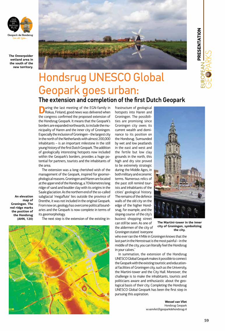
During the last meeting of the EGN-family in Rokua, Finland, good news was delivered when
the congress confirmed the proposed extension of the Hondsrug Geopark. It means that the Geopark’s borders are expanded northwards, to include the mu-nicipality of Haren and the inner city of Groningen. Especially the inclusion of Groningen – the largest city in the north of the Netherlands with almost 200,000 inhabitants – is an important milestone in the still young history of the first Dutch Geopark. The addition of geologically interesting hotspots now included within the Geopark’s borders, provides a huge po-tential for partners, tourists and the inhabitants of the area.
The extension was a long cherished wish of the management of the Geopark, inspired for geomor-phological reasons. Groningen and Haren are located at the upper end of the Hondsrug, a 70 kilometres long ridge of sand and boulder clay with its origins in the Saale glaciation. As the northern end of the so-called subglacial ‘megaflute’ lies outside the province of Drenthe, it was not included in the original Geopark. From now on, geology has overcome political bound-aries and the Geopark is now complete in terms of its geomorphology.
The next step is the extension of the existing in-
frastructure of geological hotspots into Haren and Groningen. The possibili-ties are promising since Groningen city owes its current wealth and domi-nance to its position on the Hondsrug. Surrounded by wet and low peatlands in the east and west and the fertile but low clay grounds in the north, this high and dry site proved to be extremely strategic during the Middle Ages, in both military and economic terms. Numerous relics of the past still remind tour-ists and inhabitants of the cities’ geological history. The remains of the defence walls of the old city on the edge of the higher Hond-srug, for example, and the sloping course of the city’s busiest shopping street can still be seen. As one of the aldermen of the city of Groningen stated: ‘everyone who ever ran the 4 Mile in Groningen knows that the last part in the Herestraat is the most painful – in the middle of the city, you can literally feel the Hondsrug in your calves.’
In summation, the extension of the Hondsrug UNESCO Global Geopark makes it possible to connect the Geopark with the existing touristic and education-al facilities of Groningen city, such as the University, the Martini-tower and the City Hall. Moreover, the challenge is to make the inhabitants, tourists and politicians aware and enthusiastic about the geo-logical basis of their city. Completing the Hondsrug UNESCO Global Geopark has been the first step in pursuing this aspiration.
Wessel van VlietHondsrug Geopark
Hondsrug UNESCO Global Geopark goes urban:The extension and completion of the first Dutch Geopark
An elevation map of
Groningen. The red ridge marks the position of the Hondsrug
(AHN, 120)The Martini-tower in the inner city of Groningen, symbolizing
the city.
The Onnerpolder wetland area in the south of the
new territory.
PRES
ENTA
TION
59
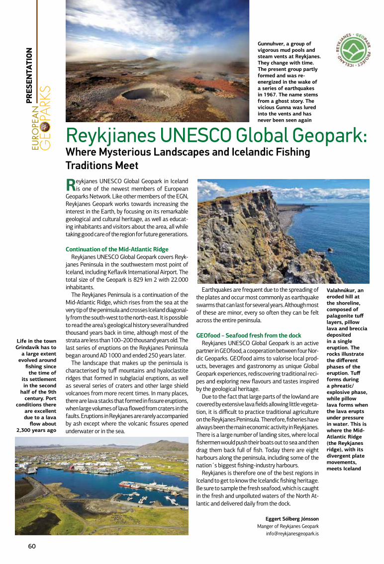
Reykjanes UNESCO Global Geopark in Iceland is one of the newest members of European
Geoparks Network. Like other members of the EGN, Reykjanes Geopark works towards increasing the interest in the Earth, by focusing on its remarkable geological and cultural heritage, as well as educat-ing inhabitants and visitors about the area, all while taking good care of the region for future generations.
Continuation of the Mid-Atlantic Ridge Reykjanes UNESCO Global Geopark covers Reyk-
janes Peninsula in the southwestern most point of Iceland, including Keflavik International Airport. The total size of the Geopark is 829 km 2 with 22.000 inhabitants.
The Reykjanes Peninsula is a continuation of the Mid-Atlantic Ridge, which rises from the sea at the very tip of the peninsula and crosses Iceland diagonal-ly from the south-west to the north-east. It is possible to read the area’s geological history several hundred thousand years back in time, although most of the strata are less than 100–200 thousand years old. The last series of eruptions on the Reykjanes Peninsula began around AD 1000 and ended 250 years later.
The landscape that makes up the peninsula is characterised by tuff mountains and hyaloclastite ridges that formed in subglacial eruptions, as well as several series of craters and other large shield volcanoes from more recent times. In many places, there are lava stacks that formed in fissure eruptions, when large volumes of lava flowed from craters in the faults. Eruptions in Reykjanes are rarely accompanied by ash except where the volcanic fissures opened underwater or in the sea.
Earthquakes are frequent due to the spreading of the plates and occur most commonly as earthquake swarms that can last for several years. Although most of these are minor, every so often they can be felt across the entire peninsula.
GEOfood – Seafood fresh from the dockReykjanes UNESCO Global Geopark is an active
partner in GEOfood, a cooperation between four Nor-dic Geoparks. GEOfood aims to valorise local prod-ucts, beverages and gastronomy as unique Global Geopark experiences, rediscovering traditional reci-pes and exploring new flavours and tastes inspired by the geological heritage.
Due to the fact that large parts of the lowland are covered by extensive lava fields allowing little vegeta-tion, it is difficult to practice traditional agriculture on the Reykjanes Peninsula. Therefore, fisheries have always been the main economic activity in Reykjanes. There is a large number of landing sites, where local fishermen would push their boats out to sea and then drag them back full of fish. Today there are eight harbours along the peninsula, including some of the nation´s biggest fishing-industry harbours.
Reykjanes is therefore one of the best regions in Iceland to get to know the Icelandic fishing heritage. Be sure to sample the fresh seafood, which is caught in the fresh and unpolluted waters of the North At-lantic and delivered daily from the dock.
Eggert Sólberg JónssonManger of Reykjanes Geopark
Reykjianes UNESCO Global Geopark:Where Mysterious Landscapes and Icelandic Fishing Traditions Meet
Gunnuhver, a group of vigorous mud pools and steam vents at Reykjanes. They change with time. The present group partly formed and was re-energized in the wake of a series of earthquakes in 1967. The name stems from a ghost story. The vicious Gunna was lured into the vents and has never been seen again
Valahnúkur, an eroded hill at the shoreline, composed of palagonite tuff layers, pillow lava and breccia deposited in a single eruption. The rocks illustrate the different phases of the eruption. Tuff forms during a phreatic/explosive phase, while pillow lava forms when the lava erupts under pressure in water. This is where the Mid-Atlantic Ridge (the Reykjanes ridge), with its divergent plate movements, meets Iceland
Life in the town Grindavík has to
a large extent evolved around
fishing since the time of
its settlement in the second
half of the 9th century. Port
conditions there are excellent due to a lava
flow about 2,300 years ago
60
PRES
ENTA
TION
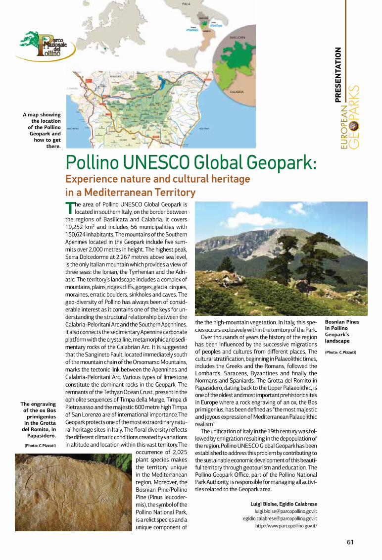
The area of Pollino UNESCO Global Geopark is located in southern Italy, on the border between
the regions of Basilicata and Calabria. It covers 19,252 km2 and includes 56 municipalities with 150,624 inhabitants. The mountains of the Southern Apenines located in the Geopark include five sum-mits over 2,000 metres in height. The highest peak, Serra Dolcedorme at 2,267 metres above sea level, is the only Italian mountain which provides a view of three seas: the Ionian, the Tyrrhenian and the Adri-atic. The territory’s landscape includes a complex of mountains, plains, ridges cliffs, gorges, glacial cirques, moraines, erratic boulders, sinkholes and caves. The geo-diversity of Pollino has always been of consid-erable interest as it contains one of the keys for un-derstanding the structural relationship between the Calabria-Peloritani Arc and the Southern Apennines. It also connects the sedimentary Apennine carbonate platform with the crystalline, metamorphic and sedi-mentary rocks of the Calabrian Arc. It is suggested that the Sangineto Fault, located immediately south of the mountain chain of the Orsomarso Mountains, marks the tectonic link between the Apennines and Calabria-Peloritani Arc. Various types of limestone constitute the dominant rocks in the Geopark. The remnants of the Tethyan Ocean Crust , present in the ophiolite sequences of Timpa della Murge, Timpa di Pietrasasso and the majestic 600 metre high Timpa of San Lorenzo are of international importance.The Geopark protects one of the most extraordinary natu-ral heritage sites in Italy. The floral diversity reflects the different climatic conditions created by variations in altitude and location within this vast territory.The
occurrence of 2,025 plant species makes the territory unique in the Mediterranean region. Moreover, the Bosnian Pine/Pollino Pine (Pinus leucoder-mis), the symbol of the Pollino National Park, is a relict species and a unique component of
the the high-mountain vegetation. In Italy, this spe-cies occurs exclusively within the territory of the Park.
Over thousands of years the history of the region has been influenced by the successive migrations of peoples and cultures from different places. The cultural stratification, beginning in Palaeolithic times, includes the Greeks and the Romans, followed the Lombards, Saracens, Byzantines and finally the Normans and Spaniards. The Grotta del Romito in Papasidero, dating back to the Upper Palaeolithic, is one of the oldest and most important prehistoric sites in Europe where a rock engraving of an ox, the Bos primigenius, has been defined as “the most majestic and joyous expression of Mediterranean Palaeolithic realism”
The unification of Italy in the 19th century was fol-lowed by emigration resulting in the depopulation of the region. Pollino UNESCO Global Geopark has been established to address this problem by contributing to the sustainable economic development of this beauti-ful territory through geotourism and education. The Pollino Geopark Office, part of the Pollino National Park Authority, is responsible for managing all activi-ties related to the Geopark area.
Luigi Bloise, Egidio [email protected]
[email protected]://www.parcopollino.gov.it/
Pollino UNESCO Global Geopark:Experience nature and cultural heritage in a Mediterranean Territory
The engraving of the ox Bos
primigenius in the Grotta
del Romito, in Papasidero.
(Photo: C.Pizzuti)
A map showing the location
of the Pollino Geopark and
how to get there.
Bosnian Pines in Pollino Geopark’s landscape
(Photo: C.Pizzuti)
61
PRES
ENTA
TION
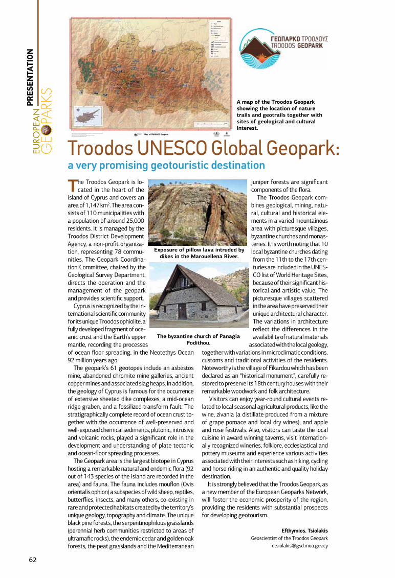
The Troodos Geopark is lo-cated in the heart of the
island of Cyprus and covers an area of 1,147 km2. The area con-sists of 110 municipalities with a population of around 25,000 residents. It is managed by the Troodos District Development Agency, a non-profit organiza-tion, representing 78 commu-nities. The Geopark Coordina-tion Committee, chaired by the Geological Survey Department, directs the operation and the management of the geopark and provides scientific support.
Cyprus is recognized by the in-ternational scientific community for its unique Troodos ophiolite, a fully developed fragment of oce-anic crust and the Earth’s upper mantle, recording the processes of ocean floor spreading, in the Neotethys Ocean 92 million years ago.
The geopark’s 61 geotopes include an asbestos mine, abandoned chromite mine galleries, ancient copper mines and associated slag heaps. In addition, the geology of Cyprus is famous for the occurrence of extensive sheeted dike complexes, a mid-ocean ridge graben, and a fossilized transform fault. The stratigraphically complete record of ocean crust to-gether with the occurrence of well-preserved and well-exposed chemical sediments, plutonic, intrusive and volcanic rocks, played a significant role in the development and understanding of plate tectonic and ocean-floor spreading processes.
The Geopark area is the largest biotope in Cyprus hosting a remarkable natural and endemic flora (92 out of 143 species of the island are recorded in the area) and fauna. The fauna includes mouflon (Ovis orientalis ophion) a subspecies of wild sheep, reptiles, butterflies, insects, and many others, co-existing in rare and protected habitats created by the territory’s unique geology, topography and climate. The unique black pine forests, the serpentinophilous grasslands (perennial herb communities restricted to areas of ultramafic rocks), the endemic cedar and golden oak forests, the peat grasslands and the Mediterranean
juniper forests are significant components of the flora.
The Troodos Geopark com-bines geological, mining, natu-ral, cultural and historical ele-ments in a varied mountainous area with picturesque villages, byzantine churches and monas-teries. It is worth noting that 10 local byzantine churches dating from the 11th to the 17th cen-turies are included in the UNES-CO list of World Heritage Sites, because of their significant his-torical and artistic value. The picturesque villages scattered in the area have preserved their unique architectural character. The variations in architecture reflect the differences in the availability of natural materials
associated with the local geology, together with variations in microclimatic conditions, customs and traditional activities of the residents. Noteworthy is the village of Fikardou which has been declared as an “historical monument”, carefully re-stored to preserve its 18th century houses with their remarkable woodwork and folk architecture.
Visitors can enjoy year-round cultural events re-lated to local seasonal agricultural products, like the wine, zivania (a distillate produced from a mixture of grape pomace and local dry wines), and apple and rose festivals. Also, visitors can taste the local cuisine in award winning taverns, visit internation-ally recognized wineries, folklore, ecclesiastical and pottery museums and experience various activities associated with their interests such as hiking, cycling and horse riding in an authentic and quality holiday destination.
It is strongly believed that the Troodos Geopark, as a new member of the European Geoparks Network, will foster the economic prosperity of the region, providing the residents with substantial prospects for developing geotourism.
Efthymios. TsiolakisGeoscientist of the Troodos Geopark
Troodos UNESCO Global Geopark: a very promising geotouristic destination
A map of the Troodos Geopark showing the location of nature trails and geotrails together with sites of geological and cultural interest.
The byzantine church of Panagia Podithou.
Exposure of pillow lava intruded by dikes in the Marouellena River.
62
PRES
ENTA
TION