
Understanding and Plotting Cell Phone ... - Wisconsin...
96
Understanding and Plotting Cell Phone Information Evan Weitz & Will Mattert
Transcript of Understanding and Plotting Cell Phone ... - Wisconsin...

Understanding and Plotting Cell Phone Information
Evan Weitz & Will Mattert

REASONS TO GATHER INFORMATION
What was said? - Content important (Drug cases, self-defense, conspiracy, etc..)

REASONS TO GATHER INFORMATION
Who talked to who? - Links between witnesses (Bias, timing of events, conspiracy)

REASONS TO GATHER INFORMATION
Location?

SOURCES OF INFORMATION

CELL PHONE
Information available:
Call History
Text Messages
Photos
Notes
E-mails
Social Messaging Applications

CELL PHONE
Visual Examination
Document with photographs
Forensic Analysis
Does not alter data
Deleted items can be recovered
Uses forensic software (Cellebrite, EnCase, etc..)
Different programs can retrieve different data

COMPUTER
Phones often backed up to Computer
Computer may have information the phone does not.
iTunes for iPhone
Android files copied to hard drive

COMPUTER
Cloud backups
Websites
Check-ins
Social Media Posts
Photos
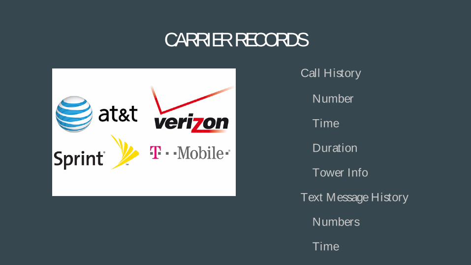
CARRIER RECORDS
Call History
Number
Time
Duration
Tower Info
Text Message History
Numbers
Time

CARRIER RECORDS Subscriber Info
Name
Billing Address
TracFones
Point of sale

CELLULAR TECHNOLOGY
Limited Number of Frequencies
Area Split into Cells


www.antennasearch.com

TOWER TYPES

TOWER ORIENTATION
Azimuth
Degrees from due north
Beam Width
Width of sector in degrees
Usually 120 for 3 sector towers
Amplitude
Power or Range of signal
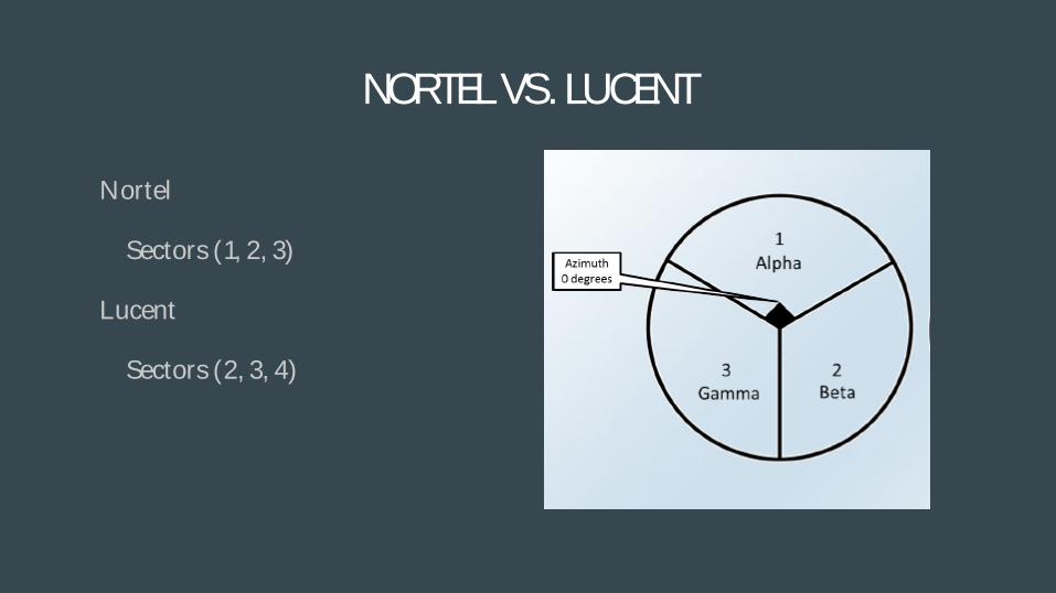
NORTEL VS. LUCENT
Nortel
Sectors (1, 2, 3)
Lucent
Sectors (2, 3, 4)

CONNECTING TO TOWER
Phone searches for strongest signal
Not always closest tower
Tower traffic
Environmental factors
Vegetation
Water
Buildings
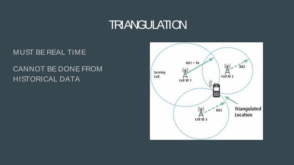
TRIANGULATION
MUST BE REAL TIME
CANNOT BE DONE FROM HISTORICAL DATA

INTERPRETING CALL DETAIL RECORDS
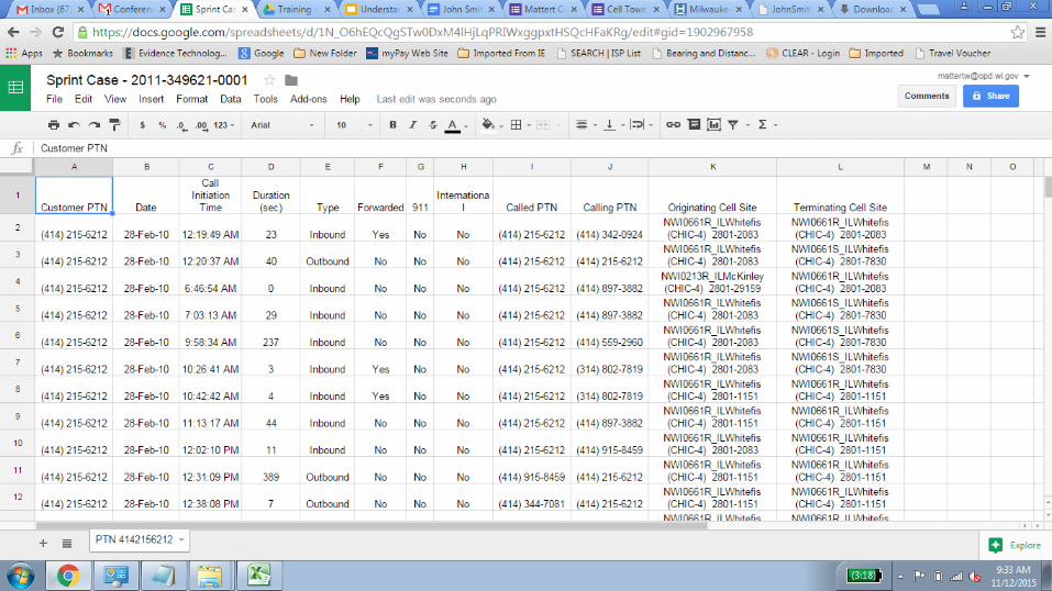
INSERT RECORDS
HOW TO PLOT CELL TOWER DATA
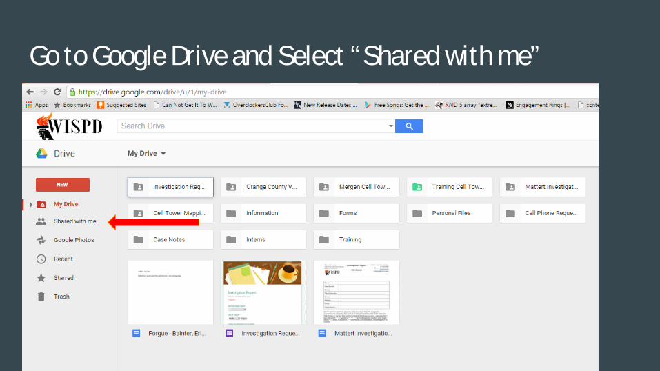
Go to Google Drive and Select “Shared with me”

You should have a shared folder for Cell Tower Mapping

Right Click the folder and select “Add to My Drive”

Select “Move”

Go back to My Drive and locate the folder you moved Open this Folder

You should see this, one folder and 3 files

Do NOT ever alter, or delete this file!

Double Click this file

You should see this

Do not make any changes to this file!
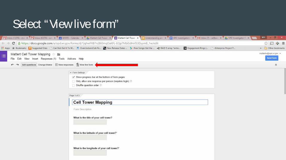
Select “View live form”

A new window should open that looks like this

Now we get into the meat and potatoes of things
There are two different ways that cell companies set up their towers
AT&T
They provide coverage for sector used for the call. They do not have standard cell sectors
Verizon/US Cellular/Sprint
They tend to use standard cell sector layout

Verizon/US Cellular/Sprint standard layout
It will either be sector 1 or Alpha. The center of the
sector is 0 degrees. Each sector is 120 degrees. You
must verify that the tower is a standard layout with
sector 1/Alpha to the north. This is the most common
and true 95% of the time.

AT&T Towers
Their towers very. The center of the sectors are different as are the width. We will practice with both using our mapping form.

This is our AT&T example

The crime happened at 11:30 A.M.

Pay attention to the Time Zone. AT&T use UTC

16:30 UTC is 11:30 AM for this time of the year.

AT&T provides the cell tower data in the record
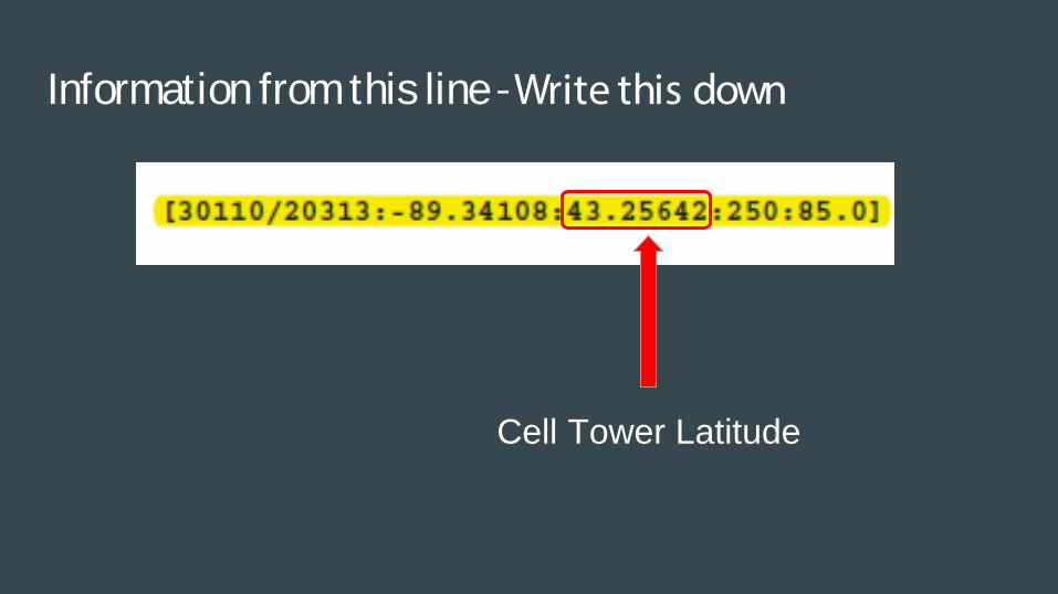
Information from this line - Write this down
Cell Tower Latitude

Information from this line - Write this down
Cell Tower Longitude

Information from this line - Write this down
Center of the cell tower sector

Information from this line - Write this down
Sector Beam Width

Information from this line - Write this down
Cell Tower Identifier

Figuring out the degrees of the sector
The sector center is 250 and it is 85 degrees wide, or 42.5 degrees on either side of 250. The edges of the sector are at 207.5 and 292.5
Does anyone not understand this?

Back to our Google Form

Input the title of the cell tower - the tower ID

Input the latitude of the cell tower
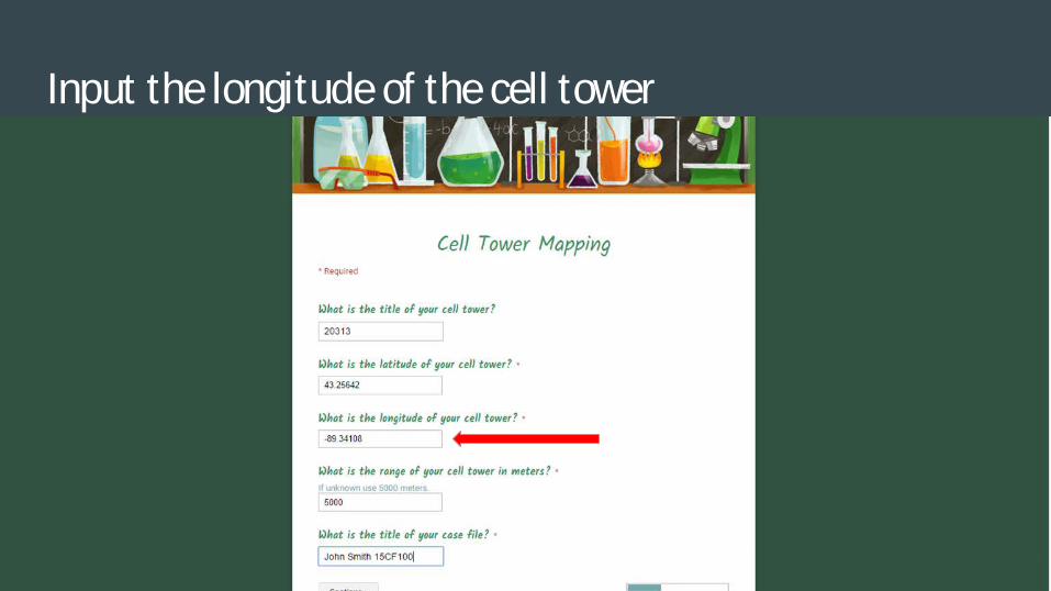
Input the longitude of the cell tower

Input the range of the cell tower

And the title of your case file

Then select continue

Plotting the ends - *For AT&T we only need points A&B
For point C, just enter the latitude and longitude for the cell tower location. Very important.
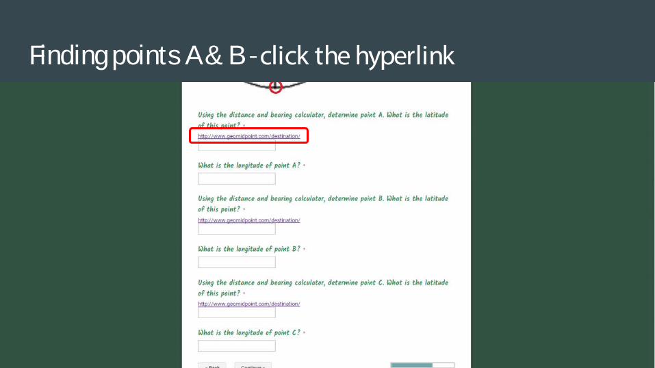
Finding points A & B - click the hyperlink

It opens up a new webpage
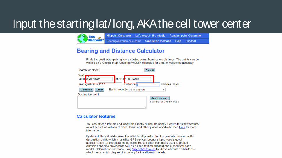
Input the starting lat/ long, AKA the cell tower center

Input the bearing (we determined this earlier) and range

Make sure you select kilometers!
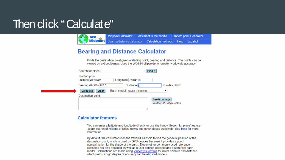
Then click “Calculate”

It will calculate “Point A” for you

Latitude - write this down

Longitude - write this down
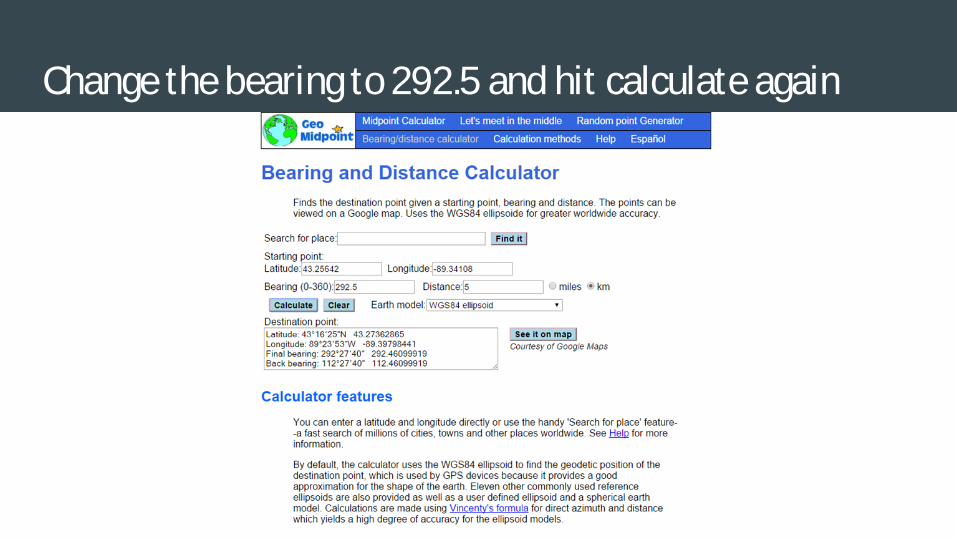
Change the bearing to 292.5 and hit calculate again
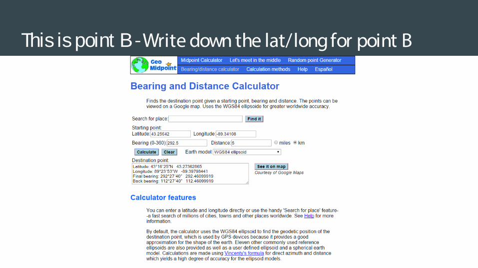
This is point B - Write down the lat/long for point B

Input the information into the Google Form
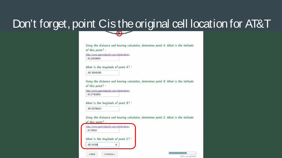
Don’t forget, point C is the original cell location for AT&T
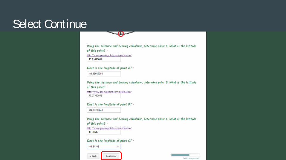
Select Continue

Determining Lat/Long of a specific location
Open up Google Maps in a new window

Right click the location you need the lat/ long for
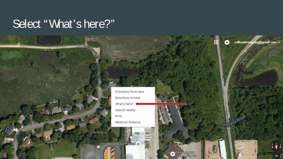
Select “What’s here?”

A box will open up at the bottom with your lat/ long

Write down these numbers for our examples home/alibi location

Do the same for the scene of the crime

Input all of this information in the Google Form

Select Submit

You will see this

You will get an email from Celltowermapping

Select “Open in Google Docs”

This will open in a new window

Select File - Download as - Plain Text (.txt)

In the lower left corner a file will be downloaded

Select the file by left clicking on it

A new window will open with Notepad that looks like

Select File - “Save As…”

Add .html to the end of the filename and select save

Right Click the saved file - Open with - Google Chrome

Magic - A new window should open with your map!

You can zoom in on the map and move it around
Turn on satellite
If you turn on “Satellite” and zoom all the way in you can see the actual cell tower

For Verizon, US Cellular and Sprint
Exact same process
When you get to plotting the cell tower, you put information for point A, B, & C
When using the bearing and distance calculator, the bearing will always be 60, 180 & 300
Again, you pick the distance for the strength of your cell towers range

LIMITATIONS
Actual cell coverage doesn’t follow a nice neat model.
Easier to exclude than to include

FUTURE CONSIDERATIONS
Stingrays
GPS Data
Google location history

Any Questions?