Tuesday, 27 AUG 2013 First, get a laptop and get logged in. Once this is done, just put it aside. We...
20
Tuesday, 27 AUG 2013 BELL-RINGER First, get a laptop and get logged in. Once this is done, just put it aside. We will use it shortly. Do the “Learning Style Inventory” on your own paper. The handout is a class set, so please do not write on it. When you are finished, you will add it to your Edmodo profile. Edmodo Tutorial
-
Upload
felicity-eaton -
Category
Documents
-
view
213 -
download
0
Transcript of Tuesday, 27 AUG 2013 First, get a laptop and get logged in. Once this is done, just put it aside. We...

Tuesday, 27 AUG 2013BELL-RINGER
First, get a laptop and get logged in. Once this is done, just put it aside. We will use it shortly.
Do the “Learning Style Inventory” on your own paper. The handout is a class set, so please do not write on it. When you are finished, you will add it to your Edmodo profile.
Edmodo Tutorial
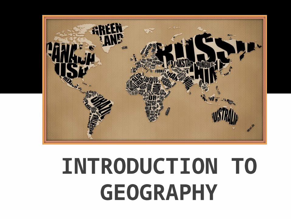
INTRODUCTION TO GEOGRAPHY

What does the Greek word geographia mean?
“to describe the earth”
How do geographers view the earth?
They look at the use of space on earth and interactions that take
place there

• Geography is the study of place and space.
• Study of human activity, the natural environment, and the relationship between the two
(human-environment interactions). • Geographers look at where things
are and why they are there.
WHAT IS GEOGRAPHY?
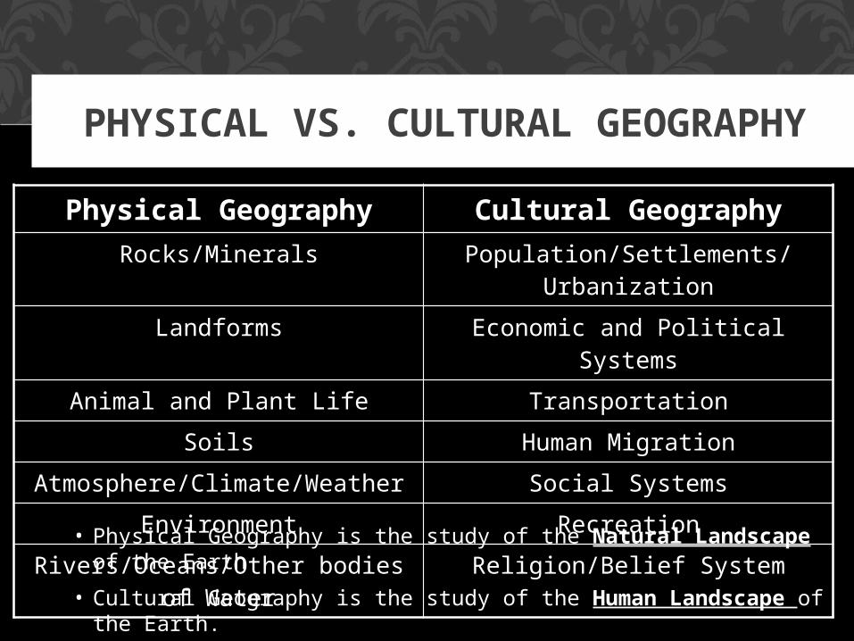
PHYSICAL VS. CULTURAL GEOGRAPHY
Physical Geography Cultural GeographyRocks/Minerals Population/Settlements/
Urbanization
Landforms Economic and Political Systems
Animal and Plant Life Transportation
Soils Human Migration
Atmosphere/Climate/Weather Social Systems
Environment Recreation
Rivers/Oceans/Other bodies of Water
Religion/Belief System
• Physical Geography is the study of the Natural Landscape of the Earth
• Cultural Geography is the study of the Human Landscape of the Earth.
WHAT TYPES OF TOOLS TO
GEOGRAPHERS USE?

MAPS AND GLOBES – WHAT’S THE DIFFERENCE?
Maps – “two dimensional” – usually only show parts
of the Earth’s surface.
Globes – “three dimensional” representation of the Earth, shows whole surface.

WHO MAKES MAPS?
Cartographers are people who make maps.

WHAT IS AN ATLAS?
An ATLAS is a book of maps.
You have an Atlas under your desk, Your textbook also has an Atlas Section
near the front.
Get to know them both, we will use them a lot this year!

BIG HISTORY
Everything you need to know to make sense of the last five hundred years… and
the next two semesters

WHY HISTORY IN GEOGRAPHY CLASS?
One big part of understanding the world of today is knowing how it
got that way. There are three BIG IDEAS that you need to know –
these three things explain a whole lot about the world.
1. IMPERIALISM (1500-1914)
2. WORLD WARS (1914-1945)
3. COLD WAR (1945-1991)

WHAT IS IMPERIALISM?
Started around 1500, went until the 1940’s. Related to “Colonialism”
Countries in Europe (Spain, France, England, Germany and others) took over almost the entire world, and divided it up.
These countries formed huge empires out of the different places and peoples that they ruled.

WHAT ARE THE WORLD WARS?
• World War 1 (1914-1918)• World War 2 (1939-1945)
These were two huge wars that started out as fights in Europe, but soon spread all over the world.
By the end, European countries lost their empires and colonies, and the USA and USSR were the strongest countries in the world.

WHAT WAS THE COLD WAR?
After WW2 (1945), the USA (America) and the USSR (Russia) were the strongest countries in the world. The USA was a Capitalist Democracy, and the USSR was a Communist Dictatorship. The two countries became enemies pretty quickly.
If the USA and USSR fought directly, a nuclear war would probably destroy the world. Instead, they fought indirectly using lots of smaller countries and small wars. The Korean War and the Vietnam War were both part of this struggle, as were many of the smaller wars around the world.
In the end the USA won, and the USSR collapsed in 1991; this helped to create the crazy world we have today.

THAT’S BIG HISTORY
1. IMPERIALISM (1500-1914)
2. WORLD WARS (1914-1945)
3. COLD WAR (1945-1991)
Remember this stuff, and the things you see in class will make a lot more sense!


SEVEN/FIVE PLUS QUIZ
Take out a sheet of paper, and number 1-20. You will have to match several physical features that you probably weren’t expecting on 13-20, in addition to the continents and oceans you should already know.
This way, we can see where you are in your knowledge of geography.

Identify #13- #20: Himalayas, Mediterranean Sea, Sahara Desert, Gulf of Mexico, Panama Canal, Red Sea, Persian Gulf, Greenland,
QUIZ: 7 Continents / 5 Oceans
18
1920


1. North America2. South America3. Africa4. Europe5. Asia6. Australia7. Antarctica8. Pacific Ocean9. Atlantic Ocean10.Indian Ocean
11.Arctic Ocean12.Southern Ocean13.Panama Canal14.Mediterranean Sea15.Gulf of Mexico16.Red Sea17.Persian Gulf18.Greenland19.Sahara Desert20.Himalayas
ANSWER KEY


![TCGetStartedMRPA.pptx [Read-Only] - Trusted Coaches · 2019. 3. 20. · get started trusted coaches services contactus news account creation & checkout if you are already logged in](https://static.fdocuments.us/doc/165x107/5fe26ae67a418221345cf5e4/read-only-trusted-coaches-2019-3-20-get-started-trusted-coaches-services.jpg)