Tropical Storm Regimes Influence the Structure of Tropical ...
15
BlOTROPlCA 35(2): 166-180 2003 Do Tropical Storm Regimes Influence the Structure of Tropical Lowland Rain Forests?' Roland C. de Gouvenain2 and John A. Silander Jr. Department of Ecology and Evolutionary Biology, 75 North Eagleville Road, University of Connecticut, Storrs, Connecticut 06269, U.S.A. ABSTRACT It has been suggested that the average canopy height of Madagascar's lowland rain forests is shorter and the average tree density is greater than in other tropical lowland rain forests of the world. The cause was hypothesized to be frequent cyclone disturbances. We compared the structure of the lowland rain forests in Madagascar to the structure described in published accounts of other tropical lowland rain forests. We found that the eastern coastal lowland forests of Madagascar have short canopy heights relative to that of many other lowland tropical rain forests, and that these Malagasy forests also have relatively high tree densities. On a worldwide basis, there is a significant correlation between short forest canopies and occurrence of tropical cyclones. The association between high tree density and occurrence of tropical cyclones is valid for Africa, but the pattern does not hold up globally. RESUME II a ttt conjecturt que la taille moyenne de la canopte des forets basses ombrophiles de Madagascar est moindre, et que la densitt des arbres est plus grande, que pour d'autres forets tropicales ombrophiles du monde. L'hypothtse a ttt avancte que les perturbations frtquentes des cyclones en sont la cause. Nous avons compart la structure des for& ombrophiles de basse altitude de Madagascar avec la structure d'autres fortts tropicales ombrophiles du monde. La hauteur de la canopte des forets de I'est de Madagascar est relativement plus courte que celles de beaucoup d'autres forets tropicales humides de basse altitudes, et la densitt des arbres est relativement tlevte. A I'tchelle globale, il y a une relation entre courte canopte et perturbations par les cyclones. La relation entre densitt des arbres et perturbations par les cyclones est validte par cette ttude seulement pour le continent Africain. Kq words: dpnsity; tropical storm; typhoon. basal area; canopy height; cyclone; firest smcture; hurricane; lowland tropical rain firest; Maahgascar; tree LOWLAND TROPICAL RAIN FORF~STS FXHIBIT A GREAT VARIETY of structural characteristicsworldwide (Ha- 116 et al. 1978, Richards 1996). While tree canopies can reach up to 50 m in the lowland dipterocarp forests of Malaysia and even 60 m or more in Bor- neo's lowland forests, canopies seldom reach 40 m in the lowland forests of equatorial Africa, Central America, or northern South America (Kira 1978; Whitmore 1984, 1995; Wyatt-Smith & Panton 1995; Richards 1996). Similarly, a wide range of tree densities and tree basal areas (cross-sectional surface area per hectare of all trees above a given diameter in a given forest type) has been reported for lowland tropical rain forests (Rollet 1979). Webb (1958) hypothesized that the short can- opies of certain lowland tropical forests in north ' Received 28 October 2002; revision accepted 8 April 2003. Current address: Dept. of Biological Sciences, Chapman University, One University Drive, Orange, California 92866, U.S.A. Queensland, Australia, were due to frequent dis- turbances by cyclones. Leigh (1988) conjectured that the average canopy height of Madagascar's lowland rain forests was shorter and the average tree density was greater than in other tropical low- land rain forests of the world, and he also hypoth- esized that frequent disturbances by tropical cy- clones were responsible for both of these structural characteristics. These two hypotheses could logi- cally be extended worldwide to make similar pre- dictions about the structure of all lowland rain for- ests that are subjected to tropical cyclone distur- bances (i.e., all such forests should have relatively short canopies and high tree densities). Webb (1958) supported his hypothesis by sug- gesting that whereas trees in lowland rain forests unaffected by cyclones or hurricanes can potentially grow to great heights with a moderate risk of wind- throw or breakage, trees in cyclone-affected rain forests are much more likely to be uprooted or bro- ken off before reaching similar heights (see also 166
Transcript of Tropical Storm Regimes Influence the Structure of Tropical ...

BlOTROPlCA 35(2): 166-180 2003
Do Tropical Storm Regimes Influence the Structure of Tropical Lowland Rain Forests?'
Roland C. de Gouvenain2 and John A. Silander Jr.
Department of Ecology and Evolutionary Biology, 75 North Eagleville Road, University of Connecticut, Storrs, Connecticut 06269, U.S.A.
ABSTRACT It has been suggested that the average canopy height of Madagascar's lowland rain forests is shorter and the average tree density is greater than in other tropical lowland rain forests of the world. The cause was hypothesized to be frequent cyclone disturbances. We compared the structure of the lowland rain forests in Madagascar to the structure described in published accounts of other tropical lowland rain forests. We found that the eastern coastal lowland forests of Madagascar have short canopy heights relative to that of many other lowland tropical rain forests, and that these Malagasy forests also have relatively high tree densities. On a worldwide basis, there is a significant correlation between short forest canopies and occurrence of tropical cyclones. The association between high tree density and occurrence of tropical cyclones is valid for Africa, but the pattern does not hold up globally.
RESUME II a ttt conjecturt que la taille moyenne de la canopte des forets basses ombrophiles de Madagascar est moindre, et que la densitt des arbres est plus grande, que pour d'autres forets tropicales ombrophiles du monde. L'hypothtse a ttt avancte que les perturbations frtquentes des cyclones en sont la cause. Nous avons compart la structure des for& ombrophiles de basse altitude de Madagascar avec la structure d'autres fortts tropicales ombrophiles du monde. La hauteur de la canopte des forets de I'est de Madagascar est relativement plus courte que celles de beaucoup d'autres forets tropicales humides de basse altitudes, et la densitt des arbres est relativement tlevte. A I'tchelle globale, il y a une relation entre courte canopte et perturbations par les cyclones. La relation entre densitt des arbres et perturbations par les cyclones est validte par cette ttude seulement pour le continent Africain.
K q words: dpnsity; tropical storm; typhoon.
basal area; canopy height; cyclone; firest smcture; hurricane; lowland tropical rain firest; Maahgascar; tree
LOWLAND TROPICAL RAIN FORF~STS FXHIBIT A GREAT
VARIETY of structural characteristics worldwide (Ha- 116 et al. 1978, Richards 1996). While tree canopies can reach up to 50 m in the lowland dipterocarp forests of Malaysia and even 60 m or more in Bor- neo's lowland forests, canopies seldom reach 40 m in the lowland forests of equatorial Africa, Central America, or northern South America (Kira 1978; Whitmore 1984, 1995; Wyatt-Smith & Panton 1995; Richards 1996). Similarly, a wide range of tree densities and tree basal areas (cross-sectional surface area per hectare of all trees above a given diameter in a given forest type) has been reported for lowland tropical rain forests (Rollet 1979).
Webb (1958) hypothesized that the short can- opies of certain lowland tropical forests in north
' Received 28 October 2002; revision accepted 8 April 2003.
Current address: Dept. of Biological Sciences, Chapman University, One University Drive, Orange, California 92866, U.S.A.
Queensland, Australia, were due to frequent dis- turbances by cyclones. Leigh (1 988) conjectured that the average canopy height of Madagascar's lowland rain forests was shorter and the average tree density was greater than in other tropical low- land rain forests of the world, and he also hypoth- esized that frequent disturbances by tropical cy- clones were responsible for both of these structural characteristics. These two hypotheses could logi- cally be extended worldwide to make similar pre- dictions about the structure of all lowland rain for- ests that are subjected to tropical cyclone distur- bances (i.e., all such forests should have relatively short canopies and high tree densities).
Webb (1958) supported his hypothesis by sug- gesting that whereas trees in lowland rain forests unaffected by cyclones or hurricanes can potentially grow to great heights with a moderate risk of wind- throw or breakage, trees in cyclone-affected rain forests are much more likely to be uprooted or bro- ken off before reaching similar heights (see also
166

Tropical Storm Regime and Forest Structure 167
Burslem et al. 2000). Uprooting of tall trees by strong winds is a possible mechanistic explanation for this association between low forest canopy and high cyclone frequency, since damage and/or wind- throw by severe storms predominantly affects tall trees (Webb 1958, Foster & Boose 1995, Weaver 1998). This is especially true in forests growing on shallow soils or in soils that promote shallow root- ing of the trees (Day 1950, Everham & Brokaw 1996). Thus, tropical storm regimes may maintain rain forests in a secondary stage of succession, with the associated high tree densities and short canopies typical of any secondary forest (N. Brokaw, pers. comm.).
The suggestion that hurricane- or cyclone-per- turbed forests have shorter canopies than other lowland forests has been documented for the north Queensland rain forests of Australia (Webb 1958) and the rain forests of Puerto Rico (Brokaw & Grear 1991). Similarly, the conjecture that hurri- cane- or cyclone-perturbed forests have greater tree densities has been supported by studies in Puerto Rico, where tree density increased for up to 20 years after hurricane disturbance and decreased slowly thereafter (Waide & Lug0 1992). Zimmer- man et al. (1995) found that Hurricane Hugo (September 1989) caused a significant increase in subsequent woody stem density in a Puerto Rican forest. Weaver (1998) reported a ten-year period of higher-than-average stem densities for the Luquillo Experimental Forest following the 1946 San Ci- priano Hurricane. Although Richards (1996), Ro- llet (1979), Whitmore (1984), and others have compared tropical forest attributes across geograph- ical areas, there has been little attempt at investi- gating the worldwide relationship of tropical rain forest structure to tropical storm regimes.
Global climate warming is predicted to increase the intensity of tropical cyclones and hurricanes, and thus amplify their destructive power by as much as 60 percent (Emanuel 1987). Since this predicted increase in tropical storm disturbance in- tensity is likely to have major consequences on the structure, composition, and dynamics of tropical forests (Overpeck et a/. 1990), we would expect the current pattern of association between forest struc- ture and tropical storm regime to change over the next century because tropical forests not located within tropical storm paths would be unaffected. It is thus important to document the present cor- relation between storm regime and forest structure so that future changes in this association, if they occur, can be detected.
The objectives of this study were to: (1) eval-
uate Leigh‘s (1 988) conjecture that Madagascar’s lowland rain forests have shorter canopies and higher tree densities than most other lowland trop- ical rain forests in the world; and (2) investigate Webb (1958) and Leigh‘s (1988) hypotheses that the short canopies and/or high tree densities of Queensland and Madagascar‘s lowland rain forests may be the result of frequent disturbance from tropical cyclones by extending our analysis to test if these hypotheses are valid worldwide.
STUDY SITES The lowland rain forest of eastern Madagascar once occupied much of the coastal fringe and associated foothills of eastern Madagascar. Centuries of de- forestation have resulted in the loss of most low- land rain forest in Madagascar (Sussman et al. 1994, Rabevohitra et al. 1998), which persists to- day only as fragments (Faramalala et al. 1995, Du Puy & Moat 1996, de Gouvenain & Silander in press). These lowland rain forest fragments are 1 of 12 tropical “hot spot” areas of biodiversity in the world (Meyers 1988) and have contributed to making Madagascar a “megadiversity” country identified by the World Wildlife Fund (Mitter- meier 1988).
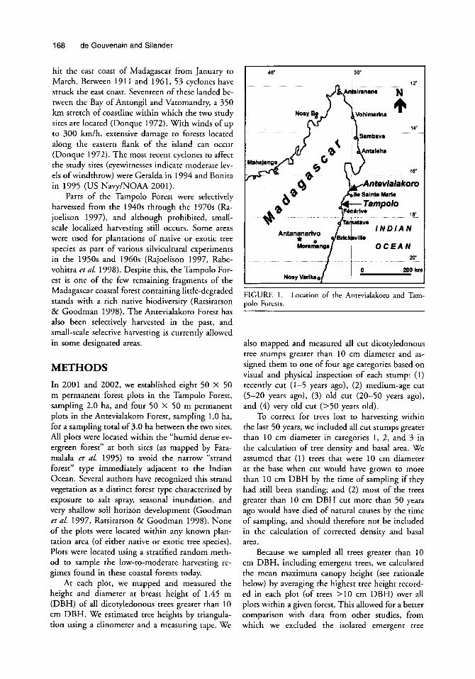
We conducted the field portion of this study in two coastal lowland rain forest fragments, the Tampolo Forest (17.3”S, 49.4“E) and the Antevia- lakoro Forest (16.8”S, 49.8”E) in 2001 and 2002 (Fig. 1). The Tampolo Forest (ca 800 ha) is a pro- tected forest located 110 km north of the large port city of Toamasina, on the east coast of Madagascar. It borders the Indian Ocean for 10 km and stretch- es inland 2-3 km. It is one of the best-preserved fragments of coastal rain forest in that region, and has been used as a research site over the past ten years by the University of Antananarivo (Rajoelison 1997, Ratsirarson & Goodman 1998). Elevation ranges from 5 to 20 m. The Antevialakoro Forest (ca 1000 ha) is located on the Pointe B Larrke pen- insula north of the town of Sonierana Ivongo, fac- ing the island of Sainte Marie. It grows on sandy soils similar to those of the Tampolo Forest. Ele- vation ranges from 5 to 15 m.
Climate at both sites is humid tropical, with a mean annual precipitation of 3600 mm and a mean annual temperature of 24°C. The rainy sea- son is concentrated in an eight-month period from December through July, but at least 100 mm of precipitation occurs on average every month (Don- que 1972, DMH 1998). Tropical cyclones affecting the southwestern Indian Ocean region frequently
168 de Gouvenain and Silander
hit the east coast of Madagascar from January to March. Between 19 1 1 and 196 1, 53 cyclones have struck the east coast. Seventeen of these landed be- tween the Bay of Antongil and Vatomandry, a 350 km stretch of coastline within which the two study sites are located (Donque 1972). With winds of up to 300 km/h, extensive damage to forests located along the eastern flank of the island can occur (Donque 1972). The most recent cyclones to affect the study sites (eyewitnesses indicate moderate lev- els of windthrow) were Geralda in 1994 and Bonita in 1995 (US Navy/NOAA 2001).
Parts of the Tampolo Forest were selectively harvested from the 1940s through the 1970s (Ra- joelison 1997), and although prohibited, small- scale localized harvesting still occurs. Some areas were used for plantations of native or exotic tree species as part of various silvicultural experiments in the 1950s and 1960s (Rajoelison 1997, Rabe- vohitra etal. 1998). Despite this, the Tampolo For- est is one of the few remaining fragments of the Madagascar coastal forest containing little-degraded stands with a rich native biodiversity (Ratsirarson & Goodman 1998). The Antevialakoro Forest has also been selectively harvested in the past, and small-scale selective harvesting is currently allowed in some designated areas.
METHODS In 2001 and 2002, we established eight 50 X 50 m permanent forest plots in the Tampolo Forest, sampling 2.0 ha, and four 50 x 50 m permanent plots in the Antevialakoro Forest, sampling 1.0 ha, for a sampling total of 3.0 ha between the two sites. All plots were located within the “humid dense ev- ergreen forest” at both sites (as mapped by Fara- malala et al. 1995) to avoid the narrow “strand forest” type immediately adjacent to the Indian Ocean. Several authors have recognized this strand vegetation as a distinct forest type characterized by exposure to salt spray, seasonal inundation, and very shallow soil horizon development (Goodman et af. 1997, Ratsirarson & Goodman 1998). None of the plots were located within any known plan- tation area (of either native or exotic tree species). Plots were located using a stratified random meth- od to sample the low-to-moderate harvesting re- gimes found in these coastal forests today.
At each plot, we mapped and measured the height and diameter at breast height of 1.45 m (DBH) of all dicotyledonous trees greater than 10 cm DBH. We estimated tree heights by triangula- tion using a clinometer and a measuring taue. We
46‘ 50‘
FIGURE 1. Location of the Antevialakoro and Tam- polo Forests.
also mapped and measured all cut dicotyledonous tree stumps greater than 10 cm diameter and as- signed them to one of four age categories based on visual and physical inspection of each stump: ( I ) recently cut (1-5 years ago), (2) medium-age cut (5-20 years ago), (3) old cut (20-50 years ago), and (4) very old cut (>50 years old).
To correct for trees lost to harvesting within the last 50 years, we included all cut stumps greater than 10 cm diameter in categories 1, 2, and 3 in the calculation of tree density and basal area. We assumed that (1) trees that were 10 cm diameter at the base when cut would have grown to more than 10 cm DBH by the time of sampling if they had still been standing; and (2) most of the trees greater than 10 cm DBH cut more than 50 years ago would have died of natural causes by the time of sampling, and should therefore not be included in the calculation of corrected density and basal area.
Because we sampled all trees greater than 10 cm DBH, including emergent trees, we calculated the mean maximum canopy height (see rationale below) by averaging the highest tree height record- ed in each plot (of trees > I 0 cm DBH) over all plots within a given forest. This allowed for a better comparison with data from other studies, from which we excluded the isolated emergent tree - “ L ”

Tropical Storm Regime and Forest Structure 169
heights sometimes reported. We calculated mean basal area and tree density based on the tree and stump data combined, assuming that the stump surface area would approximate the trunk cross- sectional surface area at breast height had a cut tree been left alive.
We reviewed 106 papers, book chapters, and monographs published from 1930 to 2001 that de- scribed lowland tropical rain forest structure. Our standard was to include data from all described for- ests located below 800 m elevation. Among the papers we reviewed, comparison of forest basal area and tree density data was restricted to studies using a sampling DBH minimum of 10 cm, the standard used by most studies that we also used. We, how- ever, included data from some studies using other DBH thresholds for comparison of canopy height data only. The data presented in most studies using a lower DBH threshold were insufficient to extract data for size classes greater than 10 cm DBH and were therefore not included in the results for tree density or basal area. We also included some data presented to us as personal communications.
Many published studies of forest structure did not contain the statistics necessary for comparison among studies using a quantitative, meta-analysis methodology. In other words, the mean, range, and standard deviation were usually not reported for the forest structure variables measured, and confi- dence intervals could not be calculated (Gurevitch & Hedges 2001). Therefore, we could not calculate average canopy height for comparison among most studies we reviewed. We decided to report the range in heights (when given) but use the highest canopy tree heights reported (excluding isolated emergent trees sometimes reported in the litera- ture) for comparison among studies.
This difficulty in comparing tropical rain forest attributes around the world has been noted by oth- ers (Bongers et a!. 1988). Everham and Brokaw (1996) remarked on the difficulty in comparing forest structure studies using different measurement standards. This underscores the need for authors to report the mean, range, and variance of forest at- tributes in order to make quantitative comparison possible.
We grouped studies as describing either Afri- can, American, or Indo-Malayan rain forests fol- lowing Whitmore’s (1998) classification. We com- pared the heights of Madagascar’s forests with that of other lowland tropical rain forests on the African continent using the nonparametric Wilcoxon rank- sum test.
If Madagascar’s lowland rain forest canopies are
indeed relatively short and tree densities are high, Leigh‘s ( 1988) hypothesis that frequent disturbanc- es by tropical cyclones were responsible for these structural characteristics should be corroborated by a relatively greater recorded frequency of tropical storms for Madagascar (and for other tropical for- ests with short canopies and high stem densities) than for geographical areas supporting tall forests with lower tree densities. To investigate this, we calculated how many tropical storms (hurricanes, cyclones, or typhoons) were recorded as crossing a meridian arc 10-20” latitude located in five of the world’s six main tropical cyclone storm paths (SW Indian Ocean, N Indian Ocean, SW Pacific Ocean, N W Pacific Ocean, and N Atlantic Ocean) over the period 1972-2000, as mapped by the US Navy/NOAA (2001). We classified the forest sites described in the literature that we reviewed as being either within or outside the path of these tropical storms for the period 1972-2000 (“presence/ab- sence” of storm disturbance, respectively).
We analyzed the relationship between canopy height, tree density, and basal area versus tropical storm disturbance for each geographical area data subset and for the complete (worldwide) data set in two ways. First, we modeled each of the response variables (canopy height, tree density, and basal area) for each study we reviewed as a linear func- tion of the number of hurricane-force winddyear (Table 2) using generalized least-square linear re- gression with S-plus (MathSoft 2000). In other words, number of hurricane-force windstorms/year was modeled as a continuous predictor of canopy height, tree density, or forest basal area. Second, we calculated the correlation of each of these three structural characteristics with presence/absence of tropical storms as a binary “predictor” variable (all forests within any of the five main tropical cyclone storm paths listed in Table 2 scored as 1; all others scored as 0 ) with Spearman’s rank correlation tests (Sokal & Rohlf 1995) using S-plus (Mathsoft 2000).
RESULTS The eight 50 X 50 m plots combined (2 ha total) for the Tampolo Forest sampled 580 trees greater than 10 cm DBH and 433 stumps greater than 10 cm diameter and less than 50 years old (Table 1). We estimated the total number of trees greater than 10 cm DBH that would be sampled by the eight 50 x 50 m plots had no harvesting occurred dur- ing the last 50 years at 580 + 433 = 1013, equiv- alent to a tree density of 507 trees greater than 10

Q
0 0 e C
(D
3
3
0, 3
P
F.
TABL
E 1.
Fo
rest
struc
ture
dat
a f.r
the
Tam
polo
and
Ant
evia
lako
ro F
ores
ts.
L!? 6
a
Tam
polo
For
est
Ant
evia
lako
ro F
ores
t 3
No.
stu
mps
N
o. s
tum
ps
2 M
ax. t
ree
No.
tre
es
>10
cm d
iarn
. M
ax.
tree
No.
tre
es
>10
cm d
iam
. he
ight
(m
) >
I0 c
m D
BH
<5
0 yr
he
ight
(m)
>10
cm D
BH
<5
0 yr
Plot
1
25
83
19
Plot
1
23
138
33
Plot
2
27
75
31
Plot
2
21
183
32
Plot
3
28
75
33
Plot
3
22
106
83
Plot
4
32
83
56
Plot
4
26
129
75
Plot
5
19
39
38
Plot
6
21
59
115
Plot
7
26
57
76
Plot
8
26
109
65
X
X
23
139
55.8
To
tal
580
433
25.5
72
.5
54.1
SD
4.
04
21.8
20
.83
SD
2.16
31
.12
27.0
5 To
tal s
urfa
ce a
rea
(cm
2)
277,
779
185,
200
Tota
l sur
face
area
(cm
2)
214,
392
96,9
71
Gra
nd t
otal
are
a (a
n2)
462.
979
Gra
nd t
otal
are
a (c
m2)
3
1 1,3
63
Equi
vale
nt B
A (m
2/ha
) 23
.2
Equi
vale
nt B
A (r
n2/h
a)
31.1
Eq
uiva
lent
den
sity
Eq
uiva
lent
den
sity
Tr
ees
>I0
cm
DB
H (no. t
rees
lha)
50
7 Tr
ees
>10
cm D
BH
(no
. tre
edha
) 77
9
Tota
l 55
6 22
3

Tropical Storm Regime and Forest Structure 171
cm DBH/ha. We estimated basal area (corrected for harvesting during the last 50 years) to be 23.2 m2/ha. Maximum tree height ranged from 19 to 32 m, with an average maximum height of 25.5 m, which we used as our best estimate of maximum canopy height at Tampolo (Table 1).
The four 50 x 50 m plots combined (1 ha total) for the Antevialakoro Forest sampled 556 trees greater than 10 cm DBH and 223 stumps greater than 10 cm diameter and less than 50 years old (Table 1). We estimated the total number of trees greater than 10 cm DBH that would be sam- pled by the four 50 x 50 m plots had no harvest- ing occurred during the last 50 years at 556 + 223 = 779, equivalent to a tree density of 779 trees greater than 10 cm DBH/ha. We estimated basal area (corrected for harvesting during the last 50 years) to be 31.1 m2/ha. Maximum tree height ranged from 21 to 26 m, with an average maxi- mum height of 23.0 m, which we used as our best estimate of maximum canopy height at Anteviala- koro (Table 1).
The average yearly frequencies of recorded tropical storms crossing a meridian arc 10-20" lat- itude located in five of the world's six main tropical cyclone storm paths (calculated for the period 1972-2000) are listed in Table 2. By far the great- est frequency of tropical storms, including those with hurricane-force winds, occurred in the north- west Pacific Ocean. Countries affected by these storms include the Philippines, Taiwan, and to a lesser extent, coastal Indochina and the east coast of Peninsular Malaysia. This northwest Pacific Ocean region experienced 834 tropical storms over the 1972-2000 period, of which 505 had hurri- cane status. Madagascar and La Rtunion (in the southwest Indian Ocean region) came in a distant second, in terms of tropical storms frequency, but ahead of the three other cyclone storm paths listed in Table 2.
Stem densities, basal areas, and ranges of can- opy height reported in other studies of tropical lowland rain forest structure are listed in Table 3 and illustrated in Figure 2, together with the results from this study. The maximum heights of the Tam- polo and Antevialakoro Forest canopies (25.5 and 23.0 m, respectively) were among the lowest of the studies we compared (Fig. 2a). The maximum can- opy heights reported in other studies of Madagas- car lowland forests (white arrows in Fig. 2) were also all in the lower range of maximum canopy heights reported. The low canopy of Malagasy for- ests is especially apparent if compared to that of other forests on the African continent (Wilcoxon
TABLE 2. Tropical storms over the period 1372-2000.
No. Total no No. hurricane- tropical hurricanes/ force
Location" stormdyear year windslyear
SW Indian Ocean X 2.24 SE 0.31 cv 0.75
N Indian Ocean x 1.66 SE 0.26 cv 0.84
SW Pacific Ocean X 1.59 SE 0.24 cv 1.68
NW Pacific Ocean X 8.97 SE 0.46 cv 0.28
N Atlantic Ocean X 1.69 SE 0.25 cv 0.79
1.31 0.23 0.96
0.62 0.16 1.39
0.83 0.13 0.5 1
6.31 0.35 0.30
1.07 0.19 0.97
0.59 0.18 1.6
0.28 0.10 1.92
0.31 0.10 0.29
2.35 0.28 0.64
0.45 0.13 1.53
Note: SE = standard error; CV = coefficient of variation. All above statistics are for storms per year crossing a me- ridian arc 10-20" latitude located in five of the world's sixa main tropical cyclone storm paths. Total tropicd storms are for all identified tropical storms over the period 1972-2000. Hurricanes are all tropical storms (hurri- canes, cyclones, or typhoons) that achieve hurricane force somewhere over their path in these years. Hurricane-force winds are those storms that are at hurricane force as they cross the designated arc in these years. Data are at least partly based on satellite information that was available from 1972 to the present. Data were scored from the following meridian arcs: SW Indian Ocean: off the east coast of Madagascar: 1O-2O0S, 50"E. N Indian Ocean: off the east coast of India (Bay of Bengal): 10-20°N, 85"E. SW Pacific Ocean: off the east coast of Australia: 10-20'" 150"E. NW Pacific: off the east coast of the Philippines: 10-20"N, 130"E. N Atlantic: off the east coast of the Caribbean Lesser Antilles: 10-20°N, 60"W. Source: U.S. Navy/NOAA (2001). a The sixth path is off the west coast of Mexico, and very few storms hit land. It is omitted in this table.
rank-sum test, P < 0.05; Fig. 3a). The lowest can- opy height reported of the studies listed in Table 3 was that of the Marelongue Forest on La Rkunion (Strasberg 1995) and the highest was that for the Pasoh Forest in Malaysia (Kira 1978).
Other low canopy heights were those reported by Tracey (1982) for the Mission Beach Road low- land forest of north Queensland (AUSZ), Chao (pers. comm.) for the Nanjenshan rain forest of

A
TABL
E 3.
St
em d
en&
ba
sal
area
and
can
opy
heig
ht of
som
e lo
wla
nd r
ain
fore
sts i
n th
e w
orld
(ar
rang
ed S
y ge
ogra
phic
al a
rea
follo
win
g W
hitm
orej
(19
98)
chsi
fcat
ion.
then
al
phab
etic
ally
Sy
auth
or).
C/H
/T co
lum
n =
ryc
lone
/hur
rica
ne/ty
phoo
n di
stur
banc
e occ
urre
nce
(Y =
yes,
N =
no)
; hei
ght of
emer
gent
tree
s in
par
enth
eses
; tre
e de
nsity
and
ba
sal a
rea
(BA)
dat
a re
porte
d on
ly fo
r stu
dies
win
g tre
e sa
mpl
ing
size
2 1
0 cm
DBH
.
2 P
m BA
GI
Elev
atio
n D
ensi
ty
(mZ
/ C
anop
y he
ight
0 P.
C
ount
rylS
ite
Cod
e R
efer
ence
(s)
(m)
ClH
lT
(no.
/ha)
ha
) (m
) 2 3
AFR
ICA
N R
AIN
FO
RES
TS
Mad
agas
carlT
ampo
lo
Mad
agas
cadA
ntev
iala
koro
M
adag
asca
dMan
onga
rivo
Mad
agas
cadE
ast.
Low
land
s Iv
ory
Coa
stlG
rabo
low
. fo
rest
G
hana
lWet
eve
rgre
en fo
rest
N
iger
ia/A
kure
G
abon
/Litt
oral
For
est
Cam
eroo
nlK
orup
Nat
l. Pa
rk
Nig
eria
/Om
o Fo
r. Re
s.
Mad
agas
carlT
ampo
lo
Mad
agas
carl
hdo h
ahel
a La
RC
unio
nlM
arel
ongu
e A
MER
ICA
N R
AIN
FO
RES
TS
Trin
idad
/Mor
a Fo
rest
M
exic
olLo
s Tux
tlas
Cub
a/R
io J
agua
ni
Guy
andM
orab
di C
reek
G
uyan
dMaz
arun
i Ri
ver
Col
ombi
alM
iddl
e C
aque
ta
Cos
ta R
ical
La S
elva
V
enez
uela
lAm
azon
Ter
ritor
y Eq
uado
rlYas
uni N
atl.
Park
C
osta
Ric
dLa
Selv
a
Puer
to R
icol
El V
erde
Nat
l. Fo
rest
Br
azill
Mar
C Fr
ench
Gui
andL
a Fu
mCe
Mtn
. B
razi
l/Bah
ia/A
tlanr
ic C
oast
V
enez
uela
lOrin
oco
Riv
er
Cos
ta R
icdB
arra
nca
Bra
zillM
arac
a Is
land
MA
D1
MA
D2
MA
D3
MA
D4
IVC
G
HA
N
lGl
GA
B C
AM
N
IG2
MA
D5
MA
D6
Rlk
J
TR
I M
EX
CU
B
GW
l G
UY
2 C
OL
co
s 1
VEN
1
cos2
PU
E BR
A1
GU
I BR
A2
VE
N2
CO
S3
BR
A3
EQU
This
stu
dy
This
stu
dy
D’A
mic
o &
Gau
tier
(199
9)
Dum
etz
(1 99
4)
Gui
llaum
et (
1967
) H
all &
Sw
aine
(198
1)
Jone
s (1
948)
cite
d in
Ola
-Ada
ms &
Hal
l (1
987)
Lo
uis
and
Font
& (
1996
) N
ewbe
ry &
Gar
tlan
(199
6)
Oka
li &
Ola
-Ada
ms
(198
7)
Ric
hard
s (1
939)
R
abev
ohitr
a et
al.
(199
8)
Rak
orom
alaz
a &
Mes
smer
(19
99)
Stra
sber
g (1
995)
Bear
d (1
946)
B
onge
rs e
t al.
(198
8)
Popm
a et
al.
(198
8)
Bor
hidi
(19
96)
Dav
is &
Ric
hard
s (1
933)
D
avis
cite
d in
Ric
hard
s (1
996)
D
uive
nvoo
rden
( 19
96)
Har
tsho
rn (
1983
) Jo
rdan
( 19
78)
Kor
ning
et a
l. (1
991)
Li
eber
man
& L
iebe
rman
(19
87)
Lieb
erm
an e
t al.
(199
5, 1
996)
Lu
g0 (
1992
) M
illik
en (
1998
) M
ori &
Boo
m (
1987
) M
ori &
Boo
m (
1983
) Ro
ller
(1 97
9)
Saw
yer &
Lin
dsay
(19
71)
Thom
Dso
n et
a/. (
1992
)
10
Y 10
Y
220
Y <5
00
Y (1
50
N
<150
N
<5
00
N
<I5
0 N
<3
00
N
15
N
10
Y 44
0 Y
(800
Y
60
N
150-
530
N
<800
Y
50
N
100-
300
N
250
N
<150
N
(1
00
N
250-
370
N
100
N
200
Y (1
00
N
2004
10
N
<500
N
25
0-50
0 N
<4
0 N
13
0 N
507
779
728 -
-
445
306
38 1
47 1
563
23.2
31
.1
22.4
-
-
25.5
31
27.8
29
.6
-
19-3
2, 2
= 2
6 21
-26,
.?
= 2
3 20
-25
(40)
1
62
8
10-3
0 (3
0-50
) 30
-35
(40)
2
04
0 (5
0)
-
-
37
46
678
-
-
739
34.1
15
-20
1079
81
.5
15
-
-
30
45
(58)
34
6 34
.9
30-3
5
-
30-3
5 -
-
-
23-3
3 (4
0)
-
25-3
2 -
600-
1140
15
-36
13-2
6 32
9 25
.3
-
817
27.6
27
73
4 22
.2
25-3
0 47
5 23
.5
28-3
8
-
-
24
635
31
25-3
5 (5
0)
619
53
20-3
5 (5
6)
436
23.1
-
498
35.3
35
891
46.3
28
-32
419
23.8
30
-35
(40)
2 5 P
v, 4 Q
..
.
.

TABL
E 3.
Continued.
BA
Elev
atio
n D
ensi
ty
(mZ
/ C
anop
y he
ight
C
ount
wlS
ite
Cod
e R
efer
ence
k)
(m)
C/H
/T
(no.
/ha)
ha
) (m
)
IND
O-M
ALA
YA
N R
AIN
FO
RES
TS
Aus
tralia
lNE
Que
ensl
and
(Plo
t 1
allu
vial
) Pa
pua
New
Gui
nea/
Mad
ang
Mal
aysi
alSa
raw
ak (l
owla
nd c
aten
a)
Mal
aysi
alSa
bahl
Gum
Gum
Taiwan(south.)/Nanjenshan
Mal
aysi
alPa
soh
Thai
land
M
alay
sial
Sara
wa W
Bako
Mal
aysi
alSa
raw
adC
unun
g M
ulu
(allu
vial
) M
alay
sial
Sara
waW
Gun
ung M
ulu
(dip
tero
carp
) Ph
ilipp
ines
lPal
awan
(gra
ywac
ke so
ils)
Phili
ppin
eslP
alaw
an (s
erpe
ntin
e so
ils)
Aus
traM
NE
Que
ensl
andl
Mis
sion
Bea
ch R
d.
Solo
mon
Isl
andl
Kol
omba
ngar
a B
rune
ilLow
. dip
tero
carp
M
alay
sial
Jara
k Is
land
In
done
sian
Bor
neol
Sebu
lu
AU
S 1
PNG
M
ALI
M
AL2
TA
I M
AL3
T
HA
M
AL4
MA
L5
MA
L6
PHI 1
PH
I2
AU
S2
SOL
BR
U
MA
L7
IND
Bea
dle
( 198
1)
Bow
man
et a
l. (1
990)
B
ruen
ig &
Dro
ste
(199
5)
Burg
ess
1961
cite
d in
Whi
tmor
e (1
984)
C
hao,
K.-J
. (p
ers.
com
m.)
K
ira (
1 978
) O
gaw
a et
af. (
1965
) cite
d in
Yak
amur
a et
af.
(198
6)
Prim
ack
& H
all
(199
2)
Prim
ack
(per
s. co
mm
.) Pr
octo
r et
af.
(198
3)
Proc
tor
et af. (
1983
) Pr
octo
r et
af. (
2000
) Pr
octo
r et
al.
(200
0)
Trac
ey (
1 982
) W
hitm
ore
(197
4)
Whi
tmor
e (1
984)
W
yatt-
Smith
(19
53)
Yak
amur
a et
al.
(198
6)
20
380 20
(800
(2
00
300
(800
(5
0
50
200-
250
(200
(2
00
<500
23
0-36
5 <8
00
(150
70
Y 46
2 Y N
N
Y
567
N
N
N
655
N
645
N
778
Y 93
0 Y
710
Y Y 43
7 N
N
64
8 N
55
0
-
-
-
-
-
-
-
43.2
-
-
-
37.9
39.9
35
28
57
52
19
-
-
-
-
-
32.8
21
41
45
60
50
20
50
-65
(>70
) 36
25
-30
-I a 2.
40-5
0 (5
5)
EL 5
18
s 10
-20
(25)
3
25-3
5 (4
0)
0
26
a
(D
45
48
30
-40
(50-
60)
'9.
15-3
0 (3
04
5)
2 30
-55
(70)
ol a

174 de Gouvenain and Silander
southern Taiwan (TAI), Lug0 (1992) for a mature secondary forest in the Luquillo Experimental For- est of Puerto Rico (PUE), Proctor et af. (2000) for a forest growing on serpentine soils in Palawan, Philippines (PHI2), and Duivenvoorden (1996) for the Middle Caqueta Forest of Colombia (COL; Ta- ble 3).
Not all cyclone- or hurricane-influenced low- land forests have short canopies. The Kolomban- gara Forest (SOL) in the Solomon Islands, studied by Whitmore (1974, has maximum canopy heights of 48 m, in the high end of our worldwide comparison (Table 3 and Fig. 2a). Conversely, not all the forests with short canopies listed above and in Table 3 are in areas subjected to tropical storms. The Middle Caqueta Forest of Colombia (Duiven- voorden 1996) and a forest in the Amazon Terri- tory of Venezuela (Jordan 1978; coded COL and VEN1, respectively, in Table 3 and Fig. 2a) are two such cases.
This may explain why the association of can- opy height and tropical storm disturbance for the worldwide data set was not significant if storm fre- quency (Table 2) was used as a continuous predic- tor variable of canopy height (P > 0.05); however, when we classified geographic regions using a pres- ence/absence of tropical storm classification, Spear- man’s rank correlation test (for the association be- tween storm occurrence and canopy height) was significantly negative for the worldwide data set listed in Table 3 (P = 0.001), the combined Afri- can and American data subsets (P = 0.001), or the African forest data subset (P = 0.01). In other words, short forest canopies were significantly as- sociated with occurrence of cyclones; however, Spearman’s rank correlation test was not significant for the American data subset alone (P = 0.4) and was only marginally significant for the Indo-Ma- layan data subset alone (P = 0.05).
The average tree density for the Tampolo For- est (507 treedha) was in the intermediate range of the studies listed in Table 3 and shown in Figure 2b, and that for the Antevialakoro Forest (779 treedha) was in the higher part of the range for those studies. Three other studies of the lowland forests of Madagascar, that of the Tampolo rain forest by Rabevohitra et af. (1998; MAD5 in Table 3 and Fig. 2b), the Manongarivo Forest by D’Amico and Gautier (1999; MAD3 in Table 3 and Fig. 2b), and the Andohahela Forest by Ra- kotomalaza and Messmer (1999; MAD6 in Table 3 and Fig. 2b), reported tree densities that were fairly similar to the densities we observed at An- tevialakoro (Fig. 2b). In this study, we did not use
one of the two 1 ha samples from Rabevohitra et al. (1 998) that included 27 percent of planted Au- coumea klaineana, an exotic, fast-growing and pro- lific pioneer tree species (Blaser et af. 1993, Rabe- vohitra et al. 1998). The lowest tree density re- ported in the studies listed in Table 3 was that of the Akure Forest in Nigeria (NIG1; Jones 1948 cited in Ola-Adams & Hall 1987) and highest was that of the Marelongue Forest on La Rkunion (Strasberg 1995).
When compared to other African forests only, four of the above Malagasy forests had tree densi- ties greater than for the forests of continental Africa (Fig. 3b). The tree density we observed at Tampolo (MAD1 in Fig. 3b), while lower than the densities observed in the Omo Forest Reserve of Nigeria, was higher than the densities of four other forests in continental Africa (Fig. 3b). For the worldwide data set or the African forests data subset, storm frequency was not a significant predictor of tree density, and Spearman’s rank correlation test was also not significant for the correlation of tree den- sity with occurrence of cyclones on a worldwide basis. Spearman’s rank correlation test, however, was significant for the correlation of tree density with occurrence of cyclones for the Africa data set (P = 0.01).
The average basal area we recorded for the Tampolo Forest (23.2 m2/ha) and that reported by D’Amico and Gautier (1999) for the Manongarivo Forest of Madagascar (22.4 m2/ha; MAD1 and MAD3 in Fig. 2c, respectively) were among the lowest of all reported tropical rain forest basal areas recorded in Table 3, while that of the Anteviala- koro (31.1 m2/ha) and Andohahela Forests (MAD2 and MAD6, respectively, in Fig. 2c) were intermediate. The lowest basal area reported in the studies listed in Table 3 was that of the Palawan Forest (on serpentine soils) in the Philippines (Proctor et af. 2000) and the highest was that of the Marelongue forest on La Rkunion (Strasberg 1995). For the worldwide data set or for any of the data subsets listed in Table 3, storm frequency was not a significant predictor of basal area, and there was no significant correlation between basal area and presence/absence of tropical storms.
DISCUSSION Our study and studies by D’Amico and Gautier (1999), Dumetz (1994), Rabevohitra et al. (1998), and Rakotomalaza and Messmer (1999) corrobo- rate Leigh‘s (1988) conjecture that the Madagascar lowland rain forests have a relatively short canopy

Tropical Storm Regime and Forest Structure 175
FIGURE 2. Comparison of (a) canopy heights, (b) tree densities, and (c) forest basal areas among studies listed in Table 3. Gray arrows indicate the Tarnpolo (MADI) and Antevialakoro ( W 2 ) data (this study). White arrows indicate data from other Madagascar studies (see text).

176 de Gouvenain and Silander
FIGURE 3. Comparison of (a) canopy heights and (b) tree densities among studies reporting data from Africa (including Madagascar and La Rtunion) listed in Table 3. Gray arrows indicate the Tampolo (MAD1) and Antevia- lakoro (MAD2) data (this study). White arrows indicate data from other Madagascar studies (see text).
compared to other lowland rain forests in the world and especially compared to other lowland rain for- ests in continental Africa. The very low canopy heights of the Malagasy rain forests are especially apparent if we compare them to the 50 m height estimated by Bourgeron (1983) or the 46-55 m height estimated by Richards ( 1 996) as averages for tropical forest canopy heights. Bourgeron ( 1 983) and Richards' ( 1 996) estimates are also greater than the mean or median (34.6 and 35.0 m, respective- ly) of the maximum canopy heights (excluding emergents) of the 42 studies listed in Table 3 that reported canopy heights, suggesting these authors may have overestimated the pantropical average canopy height.
Leigh's ( 1 988) hypothesis that the relatively
short canopies of the Madagascar lowland rain for- ests are the result of frequent disturbance by cy- clones is also supported by our study. The rain for- ests of continental Africa, which are rarely subject- ed to tropical storms, have canopies that are sig- nificantly taller than those of the Malagasy rain forests, which are located within the southwest In- dian Ocean cyclone path. For the worldwide data set we analyzed, even though not all cyclone- or hurricane-affected forests have short canopies, Webb (1 958) and Leigh's (1 988) hypotheses are supported by our analysis when we classify tropical lowland rain forests strictly on the basis of pres- ence/absence of tropical cyclone storm paths.
Storm frequency appears to have little bearing on the association between canopy height and trop-

Tropical Storm Regime and Forest Structure 177
ical storms. This lack of fit between canopy heights and storm frequency may be partly due to the dif- ficulty in assigning an accurate storm frequency to each of the forest sites listed in Table 3. Some for- ests are located in the heart of a cyclone belt where- as other forests, grouped in the same cyclone belt, are actually located on the edge and may receive many fewer storms per unit time.
Data from this study and all other studies of Madagascar lowland forests reported in this study support Leigh's (1 988) conjecture that Malagasy lowland forests have relatively high tree densities, especially when compared to the densities of other lowland forests of continental Africa. Correlation between tree density and cyclone presence/absence is significant for the Africa data subset and supports Leigh's (1988) hypothesis that this high density may be due to disturbance by cyclones; however, the extension of Leigh's (1988) hypothesis on tree density to a global scale is not supported by our study. Although forests affected by tropical cyclones on the African continent have significantly higher tree densities, there is no such correlation on a worldwide scale. Since tree density in a particular forest is likely to vary with time following its last disturbance from a tropical storm, it would be nec- essary to obtain storm historical data on all forests to investigate a tropical storm regime-tree density association more rigorously. Unfortunately, such data are rarely available.
Selective tree harvesting in itself could also be partly responsible for an increase in tree density (especially the density of smaller trees); however, the fact that all the Malagasy forests included in this study (which have not all been selectively har- vested) have relatively high tree density suggests that other, non-human induced dynamics are likely responsible for this pattern. In fact, the forest most affected by tree harvesting in our study, the Tam- polo Forest, has the lowest tree density of the five Malagasy forests included in Figure 3b. This would not be expected if selective harvesting had a dom- inant role in altering (e.g., increasing) tree density.
This study suggests that forest basal area is not associated with tropical storm disturbance regimes. We also note that the tree basal areas we calculated for the Tampolo and Antevialakoro Forests (23.2 and 31.1 m2/ha, respectively) are lower than the 36 m2/ha pantropical average basal area (for trees 2 3 0 cm DBH) calculated by Dawkins (1 963, cited in Whitmore 1984) for lowland rain forests. The mean basal area of the 30 studies reporting basal area data (34.1 trees/ha) is also lower, suggesting
that Dawkins may have overestimated pantropical average tree basal area for lowland rain forests.
We realize that many other environmental var- iables are likely to affect the relationship between forest structure and storm disturbance regimes. Soils can have an important influence on canopy height, basal area, and tree density. The Tampolo Forest, for example, grows on nutrient-poor, sandy Spodosol-like soils (Rajoelison 1997). These shal- low soils can promote the uprooting of tall trees and do not usually support high forest productivity in the tropics (Buol et al. 1997). An example of the influence of soil type on both canopy height and tree density is that described by Proctor et al. (2000) for a lowland forest of Palawan growing on two extremely different but contiguous soils. Trees growing on graywacke soils reach heights of 26 m and densities of 930 trees/ha while those growing on serpentine grow to only 18 m and attain a lower density of 710 treedha (Table 3).
The phylogenetic history of the various forests we considered in this analysis is another potentially confounding factor. For example, even though geo- graphically contiguous (and thus affected by the same climate), the forests described by Proctor et al. (2000) for Palawan have extremely different flo- ristic compositions depending on the underlying soil type (only one tree species was identified as common to both forests types). The potential as- sociation between floristic composition and tree height makes it difficult to compare lowland trop- ical forests based strictly on forest structure param- eters, especially across continents.
Finally, and perhaps more important than any other environmental factors, climate (especially the seasonal distribution of rainfall) is a dominant eco- logical force shaping forest structure and compo- sition (Beard 1955, Murphy & Lug0 1986). We restricted our comparative study to lowland tropi- cal rain forests, defined as tropical forests in which the mean annual temperature is at least 24°C and the mean annual precipitation is greater than 1500 mm/year (Hall6 etal. 1978, Richards 1996). With- in these forests, however, there is great variation in the amount and seasonality of rainfall, especially related to latitudinal location. Thus, part of the large variety in structural characteristics exhibited by these forests worldwide is undoubtedly due to climatic variability (Murphy & Lug0 1986).
One potential approach to minimize these problems would be to include only forests growing on a particular soil type, only forests experiencing similar climatic conditions, and/or only forests with floristically similar compositions (a phylogenetic

178 de Gouvenain and Slander
constraint) in the analysis. Satisfying such a com- bination of constraints, however, would greatly re- duce the sample size one could draw from the avail- able literature. In addition, the information needed to make such a classification is often lacking.
Despite these limitations, however, we found that Leigh's (1988) conjecture regarding the low canopies of Malagasy forests and his and Webb's (1958) hypotheses that short forest canopies may result from frequent disturbance by cyclones are well supported by data from the literature we sur- veyed. Leigh's (1988) conjecture that Malagasy for- ests are relatively denser than other lowland rain forests is supported for the African continent.
While not supported o n a global scale, Leigh's (1988) hypothesis that high tree density may result from high tropical cyclone frequency is supported if we restrict the analysis to African rain forests.
ACKNOWLEDGMENTS This study was supported by National Science Founda- tion IRFP Fellowship INT-0107353 and the MacArthur Foundation. We thank Professor Joelisoa Ratsirarson, M. Joma Fulgence, and M. Randrianasolo Mad (Department of ESSA-For&, University of Antananarivo) for their help and cooperation. We also thank Nick Brokaw, Robin Chazdon, Egbert Leigh J . , Richard Primack, and an anonymous reviewer for providing valuable comments on an early version of this manuscript.
LITERATURE CITED BEADLE, N. C. W. 1981. The vegetation of Australia. Springer-Verlag, Stuttgarr, Germany. BEARD, J. S. 1946. The Mora forests of Trinidad, British West Indies. J. Ecol. 33: 173-192.
. 1955. The classification of tropical American vegetation-types. Ecology 36: 89-100. BLASER, J., G. RAJOELISON, G. TSIZA, M. RAJEMISON, R. RABEVOHITRA, H. RANDRIANANJAFY, N. RAZAFINDRIANIIANA, G.
RAKOTOVAO, AND S. COMTET. 1993. Choix des essences pour la sylviculture A Madagascar. Akon'ny Ala (Bul- letin du DCpartement des Eaux et Forets de I.E.S.S.A.), Antananarivo, Madagascar.
BONGERS, F., J. POPMA, J. MEAVE DEL CASTILLO, AND J. CARABIAS. 1988. Structure and floristic composition of the lowland rain forest of Tuxtlas, Mexico. Vegetatio 74: 55-80.
BORHIDI, A. 1996. Phyrogeography and vegetation ecology of Cuba. AkadCmiai Kiad6, Budapest, Hungary. BOURGERON, I? S. 1983. Spatial aspects of vegetation structure. In F. B. Golley (Ed.). Ecosystems of the world 14A:
Tropical rain forest ecosystems. Structure and function, pp. 29-48. Elsevier, Amsterdam, The Netherlands. BOWMAN, D. M. J. S., J. C. Z. WOINARSKI, D. P. A. SANDS, A. WELLS, AND V. J. MCSHANE. 1990. Slash-and-burn
agriculture in the wet coastal lowlands of Papua New Guinea: response of birds, butterflies and reptiles. J. Biogeogr. 17: 227-239.
BROKAW, N. V. L., AND J. S. G-. 1991. Forest structure before and after Hurricane Hugo at three elevations in the Luquillo Mountains, Puerto Rico. Biotropica 23: 386-392.
BRUENIG, E. F., AND H. J. DROSTE. 1995. Structure, dynamics and management of rainforests on nutrient-deficient soils in Sarawak. In R. B. Primack and T. E. Lovejoy (Eds.). Ecology, conservation, and management of Southeast Asian rainforests, pp. 41-53. Yale University Press, New Haven, Connecticut.
BUOL, S. W., F. D. HOLE, R. J. MCCRACKEN, AND R J. SOUTHARD. 1997. Soil genesis and classification, 4th edition. Iowa State University Press, Ames, Iowa.
BURSLEM, D. F. R. I?, T. C. WHITMORE, AND C. BROWN. 2000. Short-term effects of cyclone impact and long-term recovery of tropical rain forest on Kolombangara, Solomon Islands. J. Ecol. 88: 1063-1078.
D'AMICO, C., AND L. GAUTIER. 1999. htude d'une parcelle de for& dense de base altitude dans la RCserve SpCciale de Manongarivo (Nord-Ouest de Madagascar). Document de Travail No. 7. Projet hcologie Politique et BiodiversitC, Antananarivo, Madagascar.
DAVIS, T. A. W., AND I? W. RICHARDS. 1933. The vegetation of Moraballi Creek, British Guiana: an ecological study of a limited area of tropical rain forest. Part I. J. Ecol. 21: 350-384.
DAY, W. R. 1950. Soil conditions which determine windthrow in forests. Forestry 23: 90-95. DE GOUVENAIN, R. C., AND J. A. SILANDER JR. Littoral forests. In S. M. Goodman and J. Benstead (Eds.). The natural
history of Madagascar, pp. 103-109. Field Museum of Natural History, Chicago, Illinois. In press. DMH (DIRECTION DE LA M~T~OROLOGIE ET DE L'HYDROLOGIE). 1998. Weather records. Antananarivo, Madagascar. DONQUE, G. 1972. The climatology of Madagascar. In R. Battistini and G. Richard-Vindard (Eds.). Biogeography
and ecology of Madagascar, pp. 87-144. Dr W. Junk, The Hague, The Netherlands. DUIVENVOORDEN, J. F. 1996. Patterns of tree species richness in rain forests of the Middle Caqueri area, Colombia,
NW Amazonia. Biotropica 28: 142-158. DUMETZ, N. 1994. Sur les traces d'une for& tropicale en voie d'extinction A Madagascar (I'ancienne for& i Humbertia
madagarcariensis). C.R. Acad. Sci. 318: 1009-1014. Du Pw, D. J.. AND J. MOAT. 1996. A refined classification of the primary vegetation of Madagascar based on the
underlying geology: using GIS to map its distribution and to assess its conservation status. In W. R. LourenGo (Ed.). BiogCographie de Madagascar, pp. 205-2 18. ORSTOM, Paris, France.
EMANUEL, K. A. 1987. The dependence of hurricane intensity on climate. Nature 326: 485-486. EVERHAM, E. D., 111, AND N. BROKAW. 1996. Forest damage and recovery from catastrophic wind. Bot. Rev. 62: 113-
185.

Tropical Storm Regime and Forest Structure 179
FARAMAMLA, M. H., M. VINCELETI-E, G. ~ Z A F I N D R A M B O A , A. WAXMAN, A. MITCHELL, L. I Y ~ R , AND s. OLIVILRI. 1995. Formations vCgCrales et domaine forestier national de Madagascar (1: 1 .OOO.OOO Map). Conservation Inter- nationaUDirection des Eaux et ForSts/CNRE/FTM, Antananarivo, Madagascar.
FOSTER, D. R., AND E. R. BOOSE. 1995. Hurricane disturbance regimes in temperate and tropical forest ecosystems. In M. P. Coutts and J. Grace (Eds.). Wind and trees, pp. 305-339. Cambridge University Press, Cambridge, England.
GOODMAN, S. M., M. PIDGEON, A. F. A. HAWKINS, AND T. S. SCHULENBLRG. 1997. The birds of southeastern Mada- gascar. Fieldiana: Zool. n.s., 87: 1-132.
GUILLAUMET, J.-L. 1967. Recherches sur la vtgktation et la flore de la rCgion du Bas-Cavally (CBte-d’Ivoire). ORSTOM, Paris, France.
GUREVITCH, J., AND L. V. HEDGES. 2001. Meta-analysis: combining the results of independent experiments. In S. M. Scheiner and J. Gurevitch (Eds.). Design and analysis of ecological experiments, pp. 347-369. Oxford Uni- versity Press, Oxford, England.
HALL, J. B., AND M. D. SWAINE. 1981. Distribution and ecology of vascular plants in a tropical rain forest: Forest vegetation in Ghana. Geobotany 1. Dr W. Junk, The Hague, The Netherlands.
HALL& F., R. A. A. OLDEMAN, AND I? B. TOMLINSON. 1978. Tropical trees and forests-An architectural analysis. Springer-Verlag, Berlin, Germany.
HARTSHORN, G. S. 1983. Plants (chap. 7). In D. H. Janzen (Ed.). Costan Rican natural history, pp. 118-350. University of Chicago Press, Chicago, Illinois.
JORDAN, C. F. 1978. Stem flow and nutrient transfer in a tropical rain forest. Oikos 31: 257-263. KIRA, T. 1978. Community architecture and organic matter dynamics in tropical lowland rain forests of Southeast
Asia with special reference to Pasoh Forest, West Malaysia. In P B.Tomlinsen and M. H. Zimmermann (Eds.). Tropical trees as living systems, pp. 560-590. Cambridge University Press, Cambridge, England.
KORNING, J., K. THOMSEN, AND B. (DLLCAARD. 1991. Composition and structure of a species rich Amazonian rain forest obtained by two different sample methods. Nord. J. Bot. 11: 103-1 10.
LEIGH, E. G. 1988. Importance de la faune et de la flore de Madagascar pour la thCorie de I’Cvolution. In L. Rakotovao, V. Barre, and J. Sayer (Eds.). L‘ tquilibre des Ccosysttmes forestiers A Madagascar: Actes d’un siminaire international, pp. 155-177. IUCN, Gland, Switzerland.
LIEBERMAN, D., AND M. LIEBERMAN. 1987. Forest tree growth and dynamics at La Selva, Costa Rica (1969-1982). J. Trop. Ecol. 3: 347-358.
LIEBERMAN, M., D. LIEBERMAN, R. PERALTA, AND G. S. HARTSHORN. 1995. Canopy closure and the distribution of tropical forest tree species at La Selva, Costa Rica. J. Trop. Ecol. 11: 161-178.
-___- , AND - . 1996. Tropical forest structure and composition on a large-scale altirudinal gradient in Costa Rica. J. Ecol. 84: 137-152.
LOUIS, A. M., AND J. FONT~S. 1996. Richesse florisrique et biodiversick des forets du Gabon, exemple de la for& littorale. In J.-L. Guillaumet, M. Belin, and H. Puig (Eds.). PhytogCographie Tropicale-RCalitCs et Perspec- tives, pp. 181-191. ORSTOM, Paris, France.
Luco, A. E. 1992. Comparison of tropical plantations with secondary forests of similar age. Ecol. Mongr. 62: 1-41. MATHSOFT. 2000. S-Plus 2000. Mathsoft, Inc., Cambridge, Massachusetts. MEYERS, N. 1988. Threatened biotas: “Hotpots” in tropical forests. Environmentalist 8: 1-20. MILLIKEN, W. 1998. Structure and composition of one hectare of Central Amazonian terrufinne forest. Biotropica 30:
530-537. MIITERMEIER, R. A. 1988. Primate diversity and the tropical forest. Case studies from Brazil and Madagascar and the
importance of the megadiversity countries. In E. 0. Wilson and F. M. Peter (Eds.). Biodiversity, pp. 145- 154. National Academy Press, Washington, D.C.
, AND - . 1987. The Lecythidaceae of a lowland Neotropicd forest: La FumCe Mountain, French Guiana. Chap. 11. The forest. Mem. N.Y. Bot. Gard. 44: 9-29.
MOM, S. A., AND B. M. BOOM. 1983. Southern Bahian moist forests. Bot. Rev. 49: 155-232.
MURPHY, P. G., AND A. E. Luco. 1986. Ecology of tropical dry forest. Annu. Rev. Ecol. Syst. 17: 67-88. NEWBERY, D. M., AND J. S. GARTLAN. 1996. A structural analysis of rain forest at Korup and Douda-Edea, Cameroon.
OKALI, D. U. U., AND B. A. OLA-ADAMS. 1987. Tree population changes in treated rain forest at Omo Forest Reserve,
01.4-ADAMS, B. A., AND J. B. HALL. 1987. Soil-plant relations in a natural forest inviolate plot at Akure Nigeria. J.
OVERPECK, J. T., D. RIND, AND R. GOLDBERG. 1990. Climate-induced changes in forest disturbance and vegetation.
PRIMACK, R., AND I? HALL. 1992. Biodiversity and forest change in Malaysian Borneo. BioScience 42: 829-837. PROCTOR, J., J. M. ANDERSON, P. CHAI, AND H. W. WALLACK. 1983. Ecological studies in four contrasting lowland
rain forests in Gunung Mulu National Park, Sarawak. J. Ecol. 71: 237-260. , A. J. M. BAKER, M. M. J. VAN BALGOOY, L. A. BRUIJNZEELS, S. H. JONES, AND D. A. MADULID. 2000. Mount Bloomfield, Palawan, Philippines: Forests on greywacke and serpentinized peridotite. Edinb. J. Bot. 57: 121- 139.
RABEVOHITM, R., L. W I L M ~ , P. P LOWRY 11, AND G. E. SCHATZ. 1998. La diversit6 floristique et I’importance de la conservation des forets littorales de la c6te Est. In J. Ratsirarson and S. M. Goodman (Eds.). Inventaire biologique de la forkt littorale de Tampolo (Fenoarivo Atsinanana), pp. 65-99. Recherches pour le dhelop-
Proc. R. SOC. Edinburgh 104B: 177-224.
south-western Nigeria. J. Trop. Ecol. 3: 291-313.
Trop. Ecol. 3: 57-74.
Nature 343: 51-53.
180 de Gouvenain and Slander
pement. Sirie Sciences Biologiques No. 14. Centre &Information er de Documentation Scientifique et Tech- nique, Antananarivo, Madagascar.
RAJOELISON, L. G. 1997. Etude sylvicole de la for& tropicale humide Malagasy. Exemple de la forst littorale exploitbe de Tampolo (Fenoarivo-Atsinanana)-CBte est de Madagascar. SCrie du DCpartemenr des Eaux et For& No. 4. UniversitC &Antananarivo, Ecole SupCrieure des Sciences Agronomiques, Antananarivo, Madagascar.
RAKOTOMAW, J., ANI) N. MESSMER. 1999. Structure and floristic composition of the vegetation in the RCserve Naturelle Intkgrale &Andohahela, Madagascar. In S. M. Goodman (Ed.). A floral and faunal inventory of the Reserve Naturelle Inttgrale &Andohahela, Madagascar: with reference to elevational variation, pp. 5 1-96. Field Museum of Natural History, Chicago, Illinois.
RATSIRARSON, J., AND S. M. GOODMN. 1998. Inventaire biologique de la forkt littorale de Tampolo (Fenoarivo Atsinanana). Recherches pour le dheloppement. Skrie Sciences Biologiques No. 14. Centre &Information et de Documentation Scientifique et Technique, Antananarivo, Madagascar.
RICHARDS, P. W. 1939. Ecological studies on the rain forest of southern Nigeria: I. The structure and floristic com- position of the primary forest. J. Ecol. 27: 1-61. . 1996. The tropical rain forest: An ecological study. Cambridge University Press, Cambridge, England.
Ro1.i.w. B. 1979. Organisation. In UNESCO-PNUE (Ed.). Ecosysthes forestiers tropicaux, pp. 118-1 52. UNESCO, Paris, France.
SAWYER, J. O., AND A. A. LINDSEY. 1971. Vegetation of the life zones in Costa Rica. Indiana Academy of Science Monograph No. 2, Indianapolis, Indiana.
SOKAL, R. R., AND F. J. ROHLP. 1995. Biometry: The principles and practice of statistics in biological research. W. H Freeman, New York, New York.
STRASBEKC;, D. 1995. Processus &invasion par les plantes introduites h La Rkunion et dynamique de la vCgktation sur les coultes volcaniques. kcologie 26: 169-180.
SUSSMAN, R. W., G. M. GREEN, AND L. K. SUSSMAN. 1994. Satellite imagery, human ecology, anthropology and deforestation in Madagascar. Hum. Ecol. 22: 333-354.
THOMPSON, J., J. PROCTOR, V. VIANA, W. MILLIKEN, J. A. RATTER, AND D. A. Scon-. 1992. Ecological studies on a lowland evergreen rain forest on Maraca Island, Roraima, Brazil: I. Physical environment, forest structure and leaf chemistry. J. Ecol. 80: 689-703.
TRACEY, J. G. 1982. The vegetation of the humid tropical region of north Queensland. CSIRO, Melbourne, Victoria, Australia.
US N A ~ N O A A . 200 1. Global tropical cyclone climatic atlas. http://navy.ncdc.noaa.gov/products/gtcca/gtccamain.html, Fleet Numerical Meteorology and Oceanography Detachment. Asheville, North Carolina.
WAIDE, R. B., AND A. E. LUGO. 1992. A research perspective on disturbance and recovery of a tropical montane forest. In J. G. Goldammer (Ed.). Tropical forests in transition: ecology of natural and anthropogenic disturbance processes, pp. 173-1 90. Birkhauser Verlag, Basel, Switzerland.
WEAVER, P. L. 1998. Hurricane effects and long-term recovery in a subtropical rain forest. In F. Dallmeier and J. A. Comiskey (Eds.). Forest biodiversity in North, Central and South America, and the Caribbean, pp. 249-270. MAB no. 21. UNESCO, Paris, and Parthenon Publishing, Carnforth, England.
WEBB, L. J. 1958. Cyclones as an ecological factor in tropical lowland rainforest, north Queensland. Aust. J. Bot. 6: 220-230.
WHITMORE, T. C. 1974. Change with time and the role of cyclones in tropical rain forest on Kolombangara, Solomon Islands. Institute paper no. 46. Commonwealth Forestry Institute, University of Oxford, Oxford, England. . 1984. Tropical rain forests of the Far East. Clarendon Press, Oxford, England. . 1995. Comparing Southeast Asian and other tropical rainforests. In R. B. Primack and T. E. Lovejoy (Eds.). Ecology, conservation, and management of Southeast Asian rainforests, pp. 5-1 5. Yale University Press, New Haven, Connecticut. . 1998. An introduction to tropical rain forests, 2nd edition. Oxford University Press, Oxford, England.
, AND W. P. PANTON. 1995. Manual of Malayan silviculture for inland forest-Parts 1-111. Malayan forest records no. 23, Kuala Lumpur, Malaysia.
YAKAMURA, T., A. HAGIHARA, S. SUKARDJO, AND H. OGAWA. 1986. Above ground biomass of tropical rain forest stands in Indonesian Borneo. Vegetatio 68: 71-81.
ZIMMERMAN, J. K., T. M. AIDE, M. ROSARIO, M. SERRANO, AND L. HERKERA. 1995. Effects of land management and a recent hurricane on forest structure and composition in the Luquillo Experimental Forest, Puerto Rico. For. Ecol. Manage. 77: 65-76.
WYATT-SMITH, J. 1953. The vegetation of Jarak Island, Straits of Malacca. J. Ecol. 41: 207-225.