
TRAVERTINE-MARL DEPOSITS OF THE VALLEY …...Vol. 31 February 1985 No. 1 TRAVERTINE-MARL DEPOSITS OF...
16
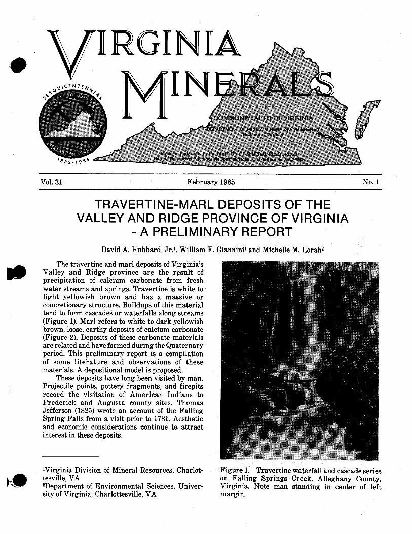
- Vol. 31 February 1985 No. 1 TRAVERTINE-MARL DEPOSITS OF THE VALLEY AND RIDGE PROVINCE OF VIRGINIA - A PRELIMINARY REPORT David A. Hubbard, Jr.1, William F. Gianninil and Michelle M. Lorah2 The travertine and marl deposits of Virginia's Valley and Ridge province are the result of precipitation of calcium carbonate from fresh water streams and springs. Travertine is white to light yellowish brown and has a massive or concretionary structure. Buildups of this material tend to form cascades or waterfalls along streams (Figure 1). Marl refers to white to dark yellowish brown, loose, earthy deposits of calcium carbonate (Figure 2). Deposits of these carbonate materials are related and have formed during the Quaternary period. This preliminary report is a compilation of some litei-ature and observations of these materials. A depositional model is proposed. These deposits have long been visited by man. Projectile points, pottery fragments, and firepits record the visitation of American Indians to Frederick and Augusta county sites. Thomas Jefferson (1825) wrote an account of the Falling Spring Falls from a visit prior to 1781. Aesthetic and economic considerations eontinue to attract interest in these deposits. 'Virginia Division of Mineral Resources, Charlot- Figure 1. Travertine waterfall and cascade series tesville, VA on Falling Springs Creek, Alleghany County, 2Department of Environmental Sciences, Univer- Virginia. Note man standing in center of left sity of Virginia, Charlottesville, VA margin.
Transcript of TRAVERTINE-MARL DEPOSITS OF THE VALLEY …...Vol. 31 February 1985 No. 1 TRAVERTINE-MARL DEPOSITS OF...
-
Vol. 31 February 1985 No. 1
TRAVERTINE-MARL DEPOSITS OF THE VALLEY AND RIDGE PROVINCE OF VIRGINIA
- A PRELIMINARY REPORT David A. Hubbard, Jr.1, William F. Gianninil and Michelle M. Lorah2
The travertine and marl deposits of Virginia's Valley and Ridge province are the result of precipitation of calcium carbonate from fresh water streams and springs. Travertine is white to light yellowish brown and has a massive or concretionary structure. Buildups of this material tend to form cascades or waterfalls along streams (Figure 1). Marl refers to white to dark yellowish brown, loose, earthy deposits of calcium carbonate (Figure 2). Deposits of these carbonate materials are related and have formed during the Quaternary period. This preliminary report is a compilation of some litei-ature and observations of these materials. A depositional model is proposed.
These deposits have long been visited by man. Projectile points, pottery fragments, and firepits record the visitation of American Indians to Frederick and Augusta county sites. Thomas Jefferson (1825) wrote an account of the Falling Spring Falls from a visit prior to 1781. Aesthetic and economic considerations eontinue to attract interest in these deposits.
'Virginia Division of Mineral Resources, Charlot- Figure 1. Travertine waterfall and cascade series tesville, VA on Falling Springs Creek, Alleghany County, 2Department of Environmental Sciences, Univer- Virginia. Note man standing in center of left sity of Virginia, Charlottesville, VA margin.

2 VIRGINIA DIVISION OF MINERAL RESOURCES Vol. 31
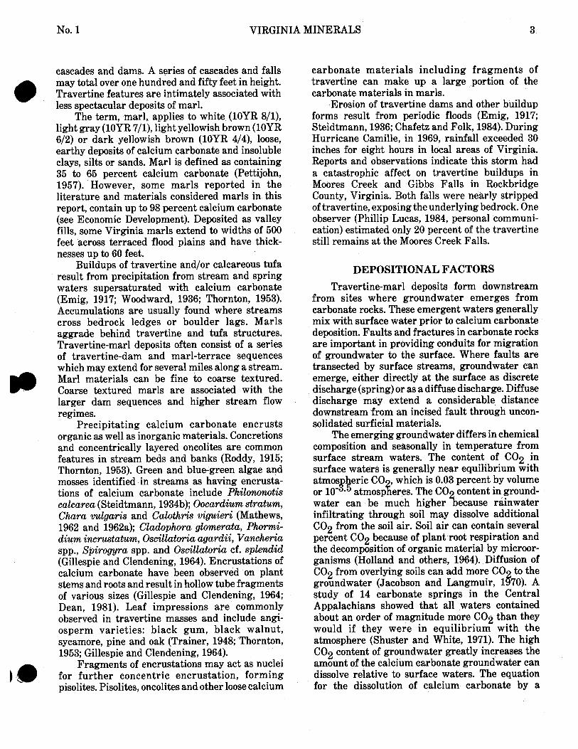
Figure 2. An extensive marl deposit located in Frederick County, Virginia. Stream, in fore- ground, has incised and drained the deposit. A soil profile, removed by producer, had developed on the marl. (Photograph by S. 0. Bird)
The authors have observed travertine and marl along streams and springs in seventeen counties of western Virginia. Calcium carbonate deposition assumes a variety of forms: rimstone dams (Figure 3), terrace cascades, drapery-like features, encrus- tation of organic materials, and oncolites. Encrust- ed materials and associated fossils include leaf impressions, twigs, seeds, stem and trunk casts, land and water snails and crustacean fragments.
Distinctive well-drained dark-colored soils (Mollisols) have developed over a number of travertine-marl deposits. These characteristic soils may be used with topogrqphic signatures to aid in identification of potentially economic deposits.
RANGE AND SCOPE OF DEPOSITS
Travertine and marl deposits were located along 57 streams and springs in the Valley and Ridge province of western Virginia (Figure 4). Further examination is expected to reveal addi- tional deposits.
Deposits are generally found downstream from faulted carbonate rocks (Thornton, 1953; Mathews, 1962 and 1962a; McFarland, 1981; McFarland and Sherwood, 1981). Over fifty percent of the sites examined are associated with mapped faults. The remaining sites are in highly fractured and folded rocks and are commonly associated with springs. Falling Springs, as well as other thermal springs on the Warm Springs anticline, is associated with lineaments observable on LANDSAT imagery (Gathright, 1981). Gathright (1981) suggested that
Figure 3. Rimstone dam form resulting from precipitation of calcium carbonate in Mill Creek, Page County, Virginia.
. TRAVERTINE-MARL DEPOSIT X COUNTY WlTH ABANDONED WORKINGS
COUNTY WITH ACTIVE WORKINGS
Figure 4. Travertine-marl deposits found in Alleghany, Augusta, Botetourt, Clarke, Craig, Frederick, Giles, Lee, Montgomery, Page, Roanoke, Rockbridge, Rockingham, Shenandoah, Smith, Warren and Washington counties.
the thermal springs are a result of deep ground- water circulation in vertical fracture zones that are expressed as lineaments.
The term, travertine, refers to a white (10YR 8/1), very pale brown (10YR 813) or light yellowish brown (10YR 6/4), massive or concretionary limestone with a radiating or concentric structure. Spongy or less compact varieties are commonly referred to as calcareous tufas. Julia (1983) notes the present trend is to term encrusting varieties of calcium carbonate, related to plants, as traver- tine, regardless of pore volume or density. Trav- ertine commonly forms rimstones, terraces, @
No. 1 VIRGINIA MINERALS
cascades and dams. A series of cascades and falls may total over one hundred and fifty feet in height. Travertine features are intimately associated with less spectacular deposits of marl.
The term, marl, applies to white (10YR 8/1), light gray (10YR 7/1), light yellowish brown (10YR 612) or dark yellowish brown (10YR 4/4), loose, earthy deposits of calcium carbonate and insoluble clays, silts or sands. Marl is defined as containing 35 to 65 percent calcium carbonate (Pettijohn, 1957). However, some marls reported in the literature and materials considered marls in this report, contain up to 98 percent calcium carbonate (see Economic Development). Deposited as valley fills, some Virginia marls extend to widths of 500 feet across terraced flood plains and have thick- nesses up to 60 feet.
Buildups of travertine and/or calcareous tufa result from precipitation from stream and spring waters supersaturated with calcium carbonate (Emig, 1917; Woodward, 1936; Thornton, 1953). Accumulations are usually found where streams cross bedrock ledges or boulder lags. Marls aggrade behind travertine and tufa structures. Travertine-marl deposits often consist of a series of travertine-dam and marl-terrace sequences which may extend for several miles along a stream. Marl materials can be fine to coarse textured. Coarse textured marls are associated with the larger dam sequences and higher stream flow regimes.
Precipitating calcium carbonate encrusts organic as well as inorganic materials. Concretions and concentrically layered oncolites are common features in stream beds and banks (Roddy, 1915; Thornton, 1953). Green and blue-green algae and mosses identified in streams as having encrusta- tions of calcium carbonate include Philononotis calcarea (Steidtmann, 1934b); Oocardium stratum, Chara vulgaris and Calothris viguieri (Mathews, 1962 and 1962a); Cladophora glomerata, Phormi- dium incrustatum, Oscillatoria agardii, Vancheria spp., Spirogyra spp. and Oscillatoria cf. splendid (Gillespie and Clendening, 1964). Encrustations of calcium carbonate have been observed on plant stems and roots and result in hollow tube fragments of various sizes (Gillespie and Clendening, 1964; Dean, 1981). Leaf impressions are commonly observed in travertine masses and include angi- osperm varieties: black gum, black walnut, sycamore, pine and oak (Trainer, 1948; Thornton, 1953; Gillespie and Clendening, 1964).
Fragments of encrustations may act as nuclei for further concentric encrustation, forming pisolites. Pisolites, oncolites and other loose calcium
carbonate materials including fragments of travertine can make up a large portion of the carbonate materials in marls.
Erosion of travertine dams and other buildup forms result from periodic floods (Emig, 1917; Steidtmann, 1936; Chafetz and Folk, 1984). During Hurricane Camille, in 1969, rainfall exceeded 30 inches for eight hours in local areas of Virginia. Reports and observations indicate this storm had a catastrophic affect on travertine buildups in Moores Creek and Gibbs Falls in Rockbridge County, Virginia. Both falls were nearly stripped of travertine, exposing the underlying bedrock. One observer (Phillip Lucas, 1984, personal communi- cation) estimated only 20 percent of the travertine still remains at the Moores Creek Falls.
DEPOSITIONAL FACTORS Travertine-marl deposits form downstream
from sites where groundwater emerges from carbonate rocks. These emergent waters generally mix with surface water prior to calcium carbonate deposition. Faults and fractures in carbonate rocks are important in providing conduits for migration of groundwater to the surface. Where faults are transected by surface streams, groundwater can emerge, either directly a t the surface as discrete discharge (spring) or as a diffuse discharge. Diffuse discharge may extend a considerable distance downstream from an incised fault through uncon- solidated surficial materials.
The emerging groundwater differs in chemical composition and seasonally in temperature from surface stream waters. The content of C02 in surface waters is generally near equilibrium with atmos heric CO which is 0.03 percent by volume P or loB5 atmosp eres. The CO content in ground- % water can be much higher ecause rainwater infiltrating through soil may dissolve additional C02 from the soil air. Soil air can contain several percent C02 because of plant root respiration and the decomposition of organic material by microor- ganisms (Holland and others, 1964). Diffusion of C02 from overlying soils can add more CO to the 8 groundwater (Jacobson and Langmuir, 1 70). A study of 14 carbonate springs in the Central Appalachians showed that all waters contained about an order of magnitude more C02 than they would if they were in equilibrium with the atmosphere (Shuster and White, 1971). The high C02 content of groundwater greatly increases the amount of the calcium carbonate groundwater can dissolve relative to surface waters. The equation for the dissolution of calcium carbonate by a

4 VIRGINIA DIVISION OF MINERAL RESOURCES Vol. 31
solution of water and C02 (carbonic acid) can be written:
The solubility of calcite depends on the amount of C02 available. Any process that increases the amount of C02 in the solution causes more calcium carbonate to dissolve, whereas processes that decrease the amount of C02 can cause calcium carbonate to precipitate.
Waters from springs in Virginia are usually at about the mean annual temperature of their respective areas. During summer and early fall, surface waters are warmer than spring waters. At this time atmospheric precipitation is also at a low for the year; thus, stream levels are down, and groundwater flow can be significant relative to surface flow. When groundwater joins a low-flow summer stream, dissolved calcium carbonate and C02 content of the stream can increase dramatically.
The main factor controlling deposition of calcite to form travertine-marl deposits appears to be the loss of COB from the mixed stream waters. As the CO enriched groundwater issues to the surface an cf' mixes with a stream, the water loses C02 as it approaches equilibrium with the atmosphere (Jacobson and Langmuir, 1970). The equilibrium solubility of calcite decreases substan- tially as C02 degasses, and the water becomes supersaturated with respect to calcite (Jacobson and Langmuir, 1970). The degree of calcite supersaturation increases downstream as the CO content of the water decreases (Jacobson an f Usdowski, 1975; Dandurand and others, 1982). When groundwater joins a warm summer stream, C02 degasses more readily from the water because COB is less soluble a t higher temperatures. Agitation of the stream water also results in more rapid outgassing of CO ; thus, calcite precipitation tends to be most rapi in turbulent zones of the stream.
3 Metabolic interaction of biologic agents such
as algae, fungi and bacteria can result in further loss of C02 and a corresponding increase in supersaturation with respect to calcite (Dean, 1981; Chafetz and Folk, 1984). Osmotic uptake of H20 could result in the exclusion and subsequent deposition of calcium carbonate on plants (Emig, 1917). A number of researchers have reported calcium carbonate encrustation on algae and
mosses (Emig, 1917; Steidtmann, 1934, 1934a, 1935, 1935a, 1936; Mathews, 1962 and 1962a; Gillespie and Clendening, 1964). In addition, osmotic uptake of H20 could result in the exclusion and subsequent deposition of calcium carbonate on these plants (Emig, 1917). Fungal influence on calcium carbonate deposition in streams is implied by Emig (1917) and Dennen and Diedchio (1984). Bacterially-constructed travertine is reported by Chafetz and Folk (1984), and evidence suggests that bacteria may be partly responsible for travertine deposition at Falling Spring Falls in Virginia (Dennen and Diecchio, 1984).
DEPOSITIONAL MODEL
Based on the depositional factors previously discussed, a depositional model for Virginia travertine-marl is proposed. Travertine-marl deposits form downstream from where a significant flow of carbonate-rich groundwater joins a surface stream (Figure 5, B and/or C) and are commonly associated with fractures or faults. The deposits form in summer or early fall during periods of the warmest water temperature and lowest surface flow. Precipitation of calcium carbonate proceeds downstream from the zone of mixing of the warm low calcium surface water and cool higher calcium groundwater (Figure 5, D). Deposition occurs only after the mixed waters reach supersaturation with respect to calcium carbonate, a result of C02 outgassing. C02 evolves from the stream by diffusion into the atmosphere which is inhanced by agitation. Buildups of travertine on ledges can cause pools to develop. Environmental warming of pooled waters, agitation of plunging and cascading waters, and the metabolic activity of biologic agents further increase the saturation index of calcium carbonate. Precipitation includes carbonate encrus- tation on plants, cobbles and bedrock exposures along the stream. As the travertine structures grow, loose calcium carbonate materials accumu- late behind them. The agrading stream migrates across the valley in such a way that the dams and fill deposits of traverine and marl may become extensive. Large dams can form in a few hundred years (Emig, 1917).
Clastic sediments derived from mass wasting may be locally interbedded in travertine-marl deposits. Burial of some travertine-marl deposits by aluviation and incision of travertine structures have increased as a result of agricultural practices over the last two hundred years. Many deposits have undergone enrichment of calcium carbonate along the banks of incising streams. At most deposits seasonal deposition is not keeping pace with erosion.
81

No. 1 VIRGINIA MINERALS
B Spring
C Diffuse groundwater flow from Dolomite permeable fault segment 40 r ft.
D Minor travertine build-up Mar l A A A
E Travertine build-up
F Mar l accumulation Travertine
G Fault
H Solution enlarged joints
4; 5-ei - . :.... . - . Stream Deposits _._ -. -. .
Figure 5. Generalized stream profile illustrating deposition of travertine-marl,
SOIL DEVELOPMENT
The continued incising and resulting drainage of travertine-marl deposits often results in a distinctive soil development. Mollisols are dark basic soils (Soil Conservation Service, 1975); at least two of these soil types have been identified in association with travertine-marl deposits in Virginia.
The Weaver soil is associated with marl deposits in Clarke County. This is a brown to dark brown soil which contains up to 10 percent lime concretions and effervesces with dilute hydroch- loric acid. The subsoil contains layers of marl (Edmonds, Circa 1970). A Weaver soil that contains two buried soil profiles is described in a recent soil survey of Clark County (Edmonds and Stiegler, 1982). Interlayered and basal marls can be recognized from this description. A second impor- tant Mollisol, the Massanetta Series, is found in Rockingham County. The Massanetta Series soils contain anomalously high percentages of solid calcium carbonate material (McFarland, 1981).
u 200 ft.
deposit in Augusta County. These materials were found at a depth of several feet, apparently in a terrace marl. The owner of the property noted that there were "several rings of fire discolored stones with charcoal in their midst" beneath the over- burden overlying a travertine bluff.
A number of projectile points and pottery fragments were found at a commercial marl deposit in Frederick County. These artifacts were found beneath the soil layer near the top of the marl, in association with a number of stones believed to have outlined a fire pit.
Artifacts from Frederick County are identified as having been made by late middle to early late Woodland Indians of about 750 AD to 1000 AD (W. Boyer, 1984, personal communication). These were horticultural indians and their campsites are frequently found associated with the range of flora and fauna found in the swampy depositional environment of an aggrading marl.
PALEONTOLOGICAL ASSOCIATIONS
In addition to the leaf impressions mentioned
ARCHAEOLOGICAL ASSOCIATIONS previously, a number of other fossils and sub-fossils have been found in association with travertine-marl d Fragments of indian pottery and charcoal were deposits. Downstream from Natural Bridge,
reported by Collins (1924) at a travertine-marl Rockbridge County, Helix alternata and Phgsa

6 VIRGINIA DIVISION OF MINERAL RESOURCES Vol. 31
mollusk shells were identified (Britton, 1886). Bythinella nickliniana Lea, Planorbis bicorinatus Say, Planorbis parvus Say and Pisidium sp. were identified by Dr. Paul Bartsch from an Augusta County deposit (Kindle, 1911). Molluscs collected from a second Augusta County deposit were identified by Dr. H. A. Pilsbry as: Circinaria concava (Say), Polygyra tridentata (Say), Polygyra frandulenta (Pilsbry), Gonyodiscus alternatus carinatus (Beck), Gastrodonta ligera (Say), Poly- gyra thyroidus (Say), Physa heterostropia (Say), Planorbis bicarinatus Say, (or P . antrosus of Conrad), Campeloma decisum (Say), Sphaerium sulvatum (Lamarck), and Unw s p (Collins, 1924). Five species of land snails and two of freshwater snails were found at the Falling Springs deposit (Trainer, 1948). Gillespie and Clendening (1964) reported gastropods and pelecypods in the stream traversing a West Virginia deposit.
A number of gastropods and two clams were found in 1983 associated with a marl deposit in Frederick County, Virginia. Specimens from this site on Red Bud Run were identified by J. J. Murray as: Triodopsis rugosa, T. fallax, T. albolabris, h m n a e a palustris (?), Heliosoma trivolvis (?), Gastrocopta cf G. armifera, Strobilops aenea, Physagyrina, Pisidium casertanum and Elliptio sp. Specimens of gastropods collected surficially from the Falling Springs deposit in 1984 were identified by S. 0. Bird as Triodopsis spp., Lymnaea sp. and Heliosoma cf H. aneeps.
ECONOMIC DEVELOPMENT
Marl from Valley and Ridge areas was marketed for many years. Rogers (1884) noted values for "carbonate of lime" (CaC03) ranging from 76 to 91 "grains in the 100'' for ten Virginia marl localities. Some Virginia marls were used as a flux in iron-making (Watson, 1907). He cited four analyses of "lime" ranging from 48 to 53 percent for Alleghany, Frederick and Rockbridge counties. Analyses of four Virginia freshwater marls were presented by Shubert (circa 1921):
1 - Botetourt 2) was worked with a two horse scraper (George L. Hayth, 1984, personal communication). Travertine-marl was put through a drier and then a crusher before being screened. Mr. Hayth reported his wages as a laborer in 1919 or 1920 as ninety cents a day, the scraper operator made two dollars and fifty cents a day. U. S. Bureau of Mines data indicates that agriculture lime from this deposit sold fgr about $3.00 a ton. Travertine or calcareous tufa material from Falling Spring Falls, Alleghany County was marketed as Barbers "Fallingsprings" Lime in the early to mid 1920's (Ohio C. Barber Fertilizer Company, circa 1926). In 1944 the Falling Springs Lime Company was quarrying travertine just west of the falls. Raw material was hauled two miles by narrow gauge - railroad to the town of Falling Springs where it was ground for agricultural use. A travertine sample from the locality contained 97.85 percent calcium carbonate, 0.90 percent magnesium carbonate, and 0.48 percent silica (Edmundson, 1958).
Marl was recovered commercially for over 20 years in Augusta County at Quicks Mill. Collins (1924) noted that this Falling Spring Run site was being worked when he visited the area (Table 1, Augusta 5a). Mrs. Avis La Port recalled that marl for agricultural use was produced from the site by J. S. Jordan from the early 1900's until the 1940's (personal communication, 22 July 1984).
Agricultural lime was produced for more than forty years from loose marl deposits in Clarke County. Producers included J. C. Digges and Sons, located west of Calmes Neck on the Shenandoah River (Edmundson, 1945; Edmundson and Nunan 1973).
Records from the U. S. Bureau of Mines reveal that travertine-marl production was carried out in eight Valley and Ridge Province counties (Figure 4) during the interval from 1913 to 1956 (Table 1). Thirty-two producers were responsible for a reported 1,297,239 tons of travertine marl during these forty-three years (Table 2). Additional U. S. Bureau of Mines data indicate 140,102 tons of travertine-marl production from 1957 thru 1969
Montgomery Rockbridge Rockingham for a total figure of 1,437,341 tons for the period County (in %) County (in %) County (in %) County (in %)
Calcium 1913 through 1969 for the Valley and Ridge carbonate 94.35 96.70 97.75 93.00 province of Virginia. Magnesium Travertine-marl deposits in a t least three other carbonate 4.20 1.39 0.73 1.34 counties mav have been utilized. Schubert (circa
A marl deposit northwest of Daleville, Botetourt 1921) reporis analyses from ~ o c k i n ~ h a m and County, was worked for fertilizer prior to 1920 Washington counties in a Norfolk and Western (Woodward, 1932). A deposit on Spreading Spring Railway brochure on Fresh Watw Marl in the Branch a t Springwood, (apparently mislabeled Virginias. A manufacturer along the railway is @ Springfield in production records repo-rted in Table listed as located in Abingdon (Washington County),
,

No. 1 VIRGINIA MINERALS
Table 1. Travertine-marl production for the Valley and Ridge province,
Deposit Total Location or Years of Tonnage Yield of
County Producer Name Productiona Solda Deposit
Alleghany la. Ohio C. ~ a r b e r Fert. Co. Barber, VA 1914-1926 b. Falling Springs Lime Co. Barber, VA 1927-1941 201570) 186,190 387,760
Augusta la. A.S. Bailey Mount Sidney, VA 1929 b. G.S. Bailey Mount Sidney, VA 1940 30 ) 42
12 2. James L. Coffey Staunton, VA 1941-1944 285 285 3. Farmers Marl Lime Co. 1921-1922 2,250 2,250 4. Bennett W. Huff Fort Defiance, VA. 1921-1929 865 865 5a. J.S. Jordan Staunton, VA. Verona 1921-1945 70,502 70,502
(excl. 1932, '33, '36, '42) b. leased to Carver F. Marshall 1942 13,394 13,394
6a. Arthur B. Kerr 1940-1941 b. Wilson & Taylor Staunton, VA. Kerr Pit 1942-1945 1,000 205) 1,205 c. leased to Verona Marl Co. Kerr Pit 1946-1947
7. Verona Marl Co. Inc. Alexandria, VA. Kerr Pit & 1945-1947 24,328 24,328 Verona Marl Pit
Botetourt la. Daleville Lime Marl Co. Roanoke, VA. Daleville b. Botetourt Lime Marl Co. Roanoke, VA. Daleville
2. Roanoke Lime Co. Roanoke, VA Springfield 3. Robinson Lime Marl Co. Fincastle, VA.
Clarke 1. Clarke Farmers Coop, Inc. Berryville, VA. Millwood
2a W. R. Thompson White Post, VA. Old Chapel Marl Pit
b. J. C. Digges 8 Sons White Post, VA. Old Chapel Marl Pit
3. Fincham Marl Plant Berryville, VA. Old Chapel Marl Pit
4. A. Golightly & Burkner Old Chapel Marl Pit
5. Elmer Kinney Berryville, VA. 6. Aimee Strother & Bro. Berryville, VA.
Frederick 1. Cornwall Lime Marl Winchester, VA. Giles 1. Blankenship
2. Gatewood & Talbott Co. Huntington, WV Narrows (sold to Langhorne & Langhorne-1948)
3. Rufus C. Hale Narrows, VA 4. Langhorne & Langhorne Huntington, WV Narrows 5a. Wolf Creek Marl Narrows, VA Narrows b. leased to Narrows Narrows, VA Narrows
Contracting Company
Montgomery la. J.N. Lantz Salem, VA
b. J. Gilbert Cox Ellison, VA
Rockbridge la. Calcium-Phosphate & Roanoke, VA Riverside Fertilizer Company Riverside
b. Farmers Marl Lime Co. (name change)
2. Dupont Chemical Wilmington, Del. Riverside 3. F.M. Hughson Roanoke, VA Riverside 4. Marlbrook Lime Co. Marlbrook, VA Marlbrook
5. United Chemical Products Company Buena Vista, VA
1919-1921 1922-1930
49170 ) 12,072 7,902
1919-1920 4,189 4,189 1947b No production reported 1940 -1950 137,497 137,497 (excl. 19 42)
1946 18,545 118,429
1947-1956 99,884 (excl. 1951-1955)
1923 1,942 1,942 1950 No production reported 1945-1948 84,242 84,242
1941-1947 2,650 2,650 1942-1947 141,056 141,056 1945-1946 1947-1950 429640 ) 84,571 41,931 (1952C)
1930-1938 911 911 (excl. 1932, '33 & '35-'37) 1948-1949 No production reported
1918-1923 16,540 1918-1923 29,121 1925-1930 12,581
1918 6,000 6,000 1922-1923 No production reported 1913-1931 109,205 109,205 (excl. 1916-1917) 1923-1931 24,951 24,951
a. U.S. Bureau of Mines Mineral Production Data , @ b. On file with the Virginia Division of Mineral Resources file data c. From U.S. Bureau of Mines "Minerals Yearbook"

8 VIRGINIA DIVISION OF MINERAL RESOURCES Vol. 31
Table 2. ^~ravertine-marl production by year for the Valley and Ridge province for 1913-1956".
Tonnage No. of Tonnage No. of Year Sold Producers Year Sold Producers 1913 3,750 1 1936 8,190 1 1914 10,400 2 1937 6,173 1 1915 22,500 2 1938 17,169 3 1916 25,000 1 1939 19,603 2 1917 12,500 1 l'940 37,500~ 5 1918 37,720 4 1941 32,735 6 1919 37,790 5 1942 13,541 5 1920 36,276 5 1943 61,659 6 1921 27,248 7 1944 68,617 6 1922 28,346 7 1945 88,831 8 1923 36,562 8 1946 137,122 7 1924 28,742 6 1947 98,932 8 1925 30,964 7 1948 53,477 5 1926 23,927 7 1949 62,428 4 1927 23,525 7 1950 52,131 4 1928 29,468 7 1951 nodata 4 1929 36,882 8 1952 nodata 1930 36,742 7 1953 no data 1931 17,442 5 1954 no data 1932 5,541 1 1955 mdata 1933 5,678 1 1956 10,500 2 1934 8,363 3 1935 3,265 1 Total 1,297,239 a. U.S. Bureau of Mines Mineral Production Data b. Includes production figure from correspondence not report- ed by U.S. Bureau of mines
Virginia. Bath and Rockingham counties are noted as having preparations underway in 1912 for utilization of marls for agricultural purposes (Watson, 1913).
One deposit continues to yield lime in Fred- erick County, Virginia. This working initially contained an estimated 100,000-ton reserve of marl containing in excess of 90 percent calcium carbonate.
REFERENCES NOT LISTED IN ANNOTATED BIBLIOGRAPHY
Chafetz, H. S. and Folk, R. L., 1984, Travertines: Depositional morphology and the bacterially constructed constituents: Jour. Sed. Petrology, vol. 54, no. 1, p. 289-316.
Dandurand, J. L., Gout, R., Hoefs, J., Menschel, G., Schott, J., and Usdowski, E., 1982, Kinet- ically controlled variations of major compo- nents and carbon isotopes in a calcite- precipitating spring: Chem. Geol., vol. 36, p. 299-315.
Dean, W. E., 1981, Carbonate mineral and organic matter in sediments of modern north temperate hard-water lakes: Soe. Econ. Paleon. and Mineralogists, Special Pub. No. 31, p. 213-231.
Dennen, K. 0. and Diecchio, R. J., 1984, The Falling Springs, Alleghany County, Virginia, in Rader, E. K. and Gathright, T. M., 11, Stratigraphy and structure in the thermal springs area of the western anticlines: Sixteenth Annual Virginia Geologic Field Conference, Oct. 13- 14, p. 17-19.
Edmonds, W. J., circa 1970, Soils of Clarke County: U. S. Department of Agriculture, Soil Conser- vation Survey, 375 p.
Emig, W. H., 1917, Travertine deposits of Okla- homa: Oklahoma Geol. Survey Bull. 29,76 p.
Gathright, T. M., 1981, Road log to the structures of the thermal springs area of western Virginia: Virginia Division of Mineral Resources, 13 p.
Gillespie, W. H. and Clendening, J. A., 1964, An interesting marl deposit in Hardy County, West Virginia: Reprinted from Proc. West Virginia Academy Sci., vol. 36, p. 147-151.
Holland, H. D., Kirsipu, T. V., Huebner, J. S., and Oxburgh, U. M., 1964, On some aspects of the chemical evolution of cave waters: Jour. Geol., vol. 72, p. 36-67.
Jacobson, R. L., and Langmuir, D., 1970, The chemical history of some spring waters in carbonate rocks: Groundwater, vol. 8, no. 3, p.
B 5-9.
Jacobson, R. L., and Usdowski, E., 1975, Geochem- ical controls on a calcite precipitating spring: Contrib. Mineral. Petrol., vol. 51, p. 65-74.
Jefferson, Thomas, 1825, Notes on the State of Virginia: H. C. Carey and I. Lea, Philadelphia, 344 p.
Julia, Ramon, 1983, Travertines, in Scholle, P. A., Bebout, D. G., and Moore, C. H., eds., Carbonate depositional environments: American Assoc. Petroleum Geologists Memoir 33, p. 64-72.
Pettijohn, F. J., 1957, Sedimentary rocks: Harper and Brothers, New York, 718 p.
Roddy, H. J., 1915, Concretions in streams formed by the agency of blue green algae and related plants: American Philos. Soc. Proc., vol. 54, p. 246-258.
Shuster, E. T. and White, W. B., 1971, Seasonal fluctuations in the chemistry of limestone springs: A possible means for characterizing carbonate aquifers: Jour. Hydrology, vol. 14, p. 93-128.
Soil Conservation Service, 1975, Soil taxonomy: U. S. Department of Agriculture, Agriculture @ Handbook No. 436,754 p.

No. 1 VIRGINIA MINERALS
ANNOTATED BIBLIOGRAPHY OF THE VALLEY AND RIDGE TRAVERTINE-MARL DEPOSITS OF VIRGINIA
David A. Hubbard, Jr.
ALLEN, R. M., JR., 1967, ~eology and mineral resources of Page County: Virginia Division of Mineral Resources Bull. 81,78 p. Quaternary (Recent) tufa terraces or dams have been
observed in several Shenandoah Valley streams. Tufa or travertine is chemically deposited from streams having high concentrations of calcium carbonate. Preci~itation results from the loss of carbon dioxide a t riffles and shall waterfalls. The tufas observed were brown to buff, porous, and punky. The greatest accumulations were observed downstream from Hamburg on Mill Creek. BARTLETT, C. S., JR. and Webb, H. W., 1971, Geology of the
Bristol and Wallace quadrangles, Virginia: Virginia Division of Mineral Resources Rept. Inv. 25,93 p. Travertine is found in some parts of the stream beds in
and near Bristol. One deposit occurs along Beaver Creek in Monroe Park northwest of the intersection of Valley Drive and Old Abingdon Place. BASSLER, R. S., 1905, Portland cement resources of Virginia:
U.S. Geol. Survey Bull 243, p 312-323, Map. Calcareous tufa, if favorably located in sufficient quantities,
would be of value in cement manufacture. Calcareous fresh water marls are of more importance, but surface indications are so meager that no estimate can be made of their auantity. Deposits 10to 12 feet thick were located in Staunton a by M;. Catlett. II) BASSLER. R. S.. 1909. Cement resources of Virginia: Virdnia - -
Geol. Survey Bull. 2-A, 309 p. Numerous springs in western Virginia are depositing
quantities of calcareous tufa or travertine. Analysis of a Staunton deposit containing "a calcareous marl or travertine 10 or 12 feet deep" yielded 90.4 percent CaC03. Ellett and Eskridge, and Roger's works were acknowledged. BRENT, W. B., 1960, Geology and mineral resources of
Rockingham County: Virginia Division of Mineral Resources Bull. 76,174 p. "Travertine" is found in old and present stream beds in
Rockingham County. Travertine is defined as a precipitation product from hot springs. Therefore, most of the deposits of calcium carbonate in stream beds of the county would not commercially be classed as travertine. They are classed commercially with the marbles. BRITTON, N. L., 1886, Geological notes on western Virginia,
North Carolina, and Tennessee: New York Acad. Sci., Trans., vol. 5, p. 215-223. Quantities of calcareous tufa occur along the banks of a
small stream entering Cedar Creek below Natural Bridge. Mollusk shells of Helix alternata and Physa and twigs of Arbor Vitae are found in the deposit. Deposition is recent and may still be occurring. COLLINS, R. E. L., 1924, Travertine deposits in Virginia: Pan-
American Geol., vol. 41, p. 103-106. Travertine and marl occur along Falling Springs Run, near
Staunton, Virginia. The run is fed by springs in the upper valley. Three distinct terraces with small water-falls a t their abrupt lower slopes extend over 40 acres. The deposits occur in two distinct forms, one a massive hardened variety forming the retaining walls of the terraces, the second type a fine, unconsolidated, sandy granular calcium carbonate of cream color, commonly known as marl. The second type is often used @ by farmers for liming the soil. The third terrace has been worked and fragments of Indian pottery and rings of fire blackened
stones and charcoal were found. Tree limb and trunk casts, leaf impressions, fragments of bone and teeth, and molluscan shells were found. Molluscs identified include:
Circinaria concava (Say) Polygyra tridentata (Say) Polygyra frandulenta (Pilsbry) Gonyodiscus alternatus carinatus (Beck) Gastrodonta ligera (Say) Polygy-a thyroidus (Say) Physa heterostropha (Say) P l a w b i s bicarinatus Say, (or P. antrosus of Conrad) Campeloma decisum (Say) S p M u m sulvatum (Lamarck) Unio sp? fragments
Leaf impressions were of common chestnut oak and sycamore. The deposit may be of late Pleistocene age, but in all probability is recent. DENNEN, K. 0. and Diecchio, R. J., 1984, The Falling Springs,
Alleghany County, Virginia, in Rader, E. K. and Gathright, T. M., 11, Stratigraphy and structure in the thermal springs area of the western anticlines: Sixteenth Annual Virginia Geologic Field Conference, Oct. 13-14, p. 17-19. Precipitation of calcium carbonate occurs along Falling
Springs Creek, below the falls, in late summer and fall. Deposition is the result of degassing of CO , evaporation and biologic factors including: algae, fungi, an%bacteria. Ancient travertine a t an elevation higher than the spring indicates that the travertine started to form when the valley floor was higher than it is today. DENNEN, K. 0. and Diecchio, R. J., 1984, Chemical
observations of Falling Spring, Alleghany County, Virginia (abs): Virginia Jour. Sci., vol. 35, no. 2, p. 119. Travertine precipitates downstream from Falling Spring
Creek waterfall. Seasonal changes in surface runoff and the activity of algae and bacteria are important to the formation of travertine. Ancient travertine consisting of waterfall/cascade deposits formed under conditions similar to those today, but at higher elevations. EDMONDS, W. J. and Stiegler, J., 1982, Soil Survey of Clarke
County, Virginia: U. S. Department of Agriculture, Soil Conservation Service, 211 p. Weaver series soils form on calcareous alluvial sediments
and massive deposits of travertine. A soil section is recorded from approximately 660 feet west-northwest of where Virginia Highway 621 crosses Spout Run. Carbonate concretions, mollusk* shells, and soft marly material make up 5 to 10 percent of the A and B horizons noted. The C horizons contain 40 to 50 percent calcareous materials. This soil profile contains two buried A and B horizon sequences. The deepest C horizon contains lime concretions with leaf imprints.
* refers to gastropod and pelecypod (misidentifield as brachiopod by Edmonds and Stiegler)
EDMUNDSON, R. S., 1945, Industrial limestonesand dolomites in Virginia: Northern and central parts of Shenandoah Valley: Virginia Geol. Survey Bull. 65, 195 p. A calcareous marl deposit at Calmes Neck, about two miles
east of Millwood in Clarke County, is being operated for agricultural lime. EDMUNDSON, R. S., 1958, Industrial limestones and dolomites
in Virginia: James River district west of the Blue Ridge: Virginia Division of Mineral Resources. Bull. 73, 137 p. The travertine deposit on Falling Springs Creek was

VIRGINIA DIVISION OF MINERAL RESOURCES Vol. 31
actively quarried when visited in 1944, but is not now. Analysis of a sample shows 97.85 percent calcium carbonate, 0.90 percent magnesium carbonate, and 0.48 percent silica. EDMUNDSON, R. S. and Nunan, W. E., 1973, Geology of the
Berryville, Stephenson, and Boyce quadrangles, Virginia: Virginia Division of Mineral Resources Rept. Inv. 34, 112 P. Marls occupying the flood plains of Clarke County streams
are intermixed with variable amounts of sand and clay. Calcium carbonate content ranges from 65 to 94 percent with a magnesium carbonate content of less than one percent. Where free from other sediments, marls contain more than 97 percent CaC03. Commercial operations for agricultural lime were conducted along Dry Marsh Creek, Calmes Neck and are active along Chapel Run. Massive travertine, coated pebbles and mollusk shells were observed in many streams. Some floodplains mapped as alluvium may contain marl deposits of commercial importance. ELLETT, W. B. and Eskridge, A. T., 1897, Virginia marls:
Virginia Agric. Exp. Station Bull. 78, vol. 6, no. 7, p. 65- 70. Marl is a earthy material of variable composition with a
considerable percent of carbonate of lime. Analyses of. five Valley and Ridge marls are listed with twenty or more percent lime: Allegheny Co. - 50.58 percent, Frederick Co. - 52.19 percent and 52.62 percent and Rockbridge Co. - 47.87 percent and 88.79 percent. GATHRIGHT, T. M., 11, 1974, Geology of the Ashby Gap
quadrangle, Virginia: Virginia Division of Mineral Resources Rept. Inv. 36,55 p. Tufa deposits are common along spring-fed streams incised
in flood- lain alluvium. These impure deposits contain organic debris a id fine grained siliceous iedime&. GATHRIGHT, T. M., 11, 1976, Roadlog to several thermal
springs of western Virginia in Near-normal geothermal gradient workshop: ERDA, Los Alamos Scientific Labor- atory, University of California, ERDA 76-11, CONF- 750366, ~265-292. Calcareous tufa extends along Falling Springs Creek from
the 60- to 70-foot falls upstream to the spring. The tufa forms a broad floodplain and was deposited by the thermal waters from the spring. HELZ, G. R. and Sinex, S. A., 1974, Chemical equilibria in
the thermal spring waters of Virginia: Geochim. Cosmo- chim. Acta., vol. 38, p.1807-1820. Massive travertine deposits were found downstream from
Falling Spring. The deposit was extensively quarried during the 1940's. Travertine has been found 60 feet higher than the present s t r e y level. The spring system is estimated to be at least 3 x 10 years old based on average rates of erosion in the region. HINKLE, J. H., 1934, Chemical studies of travertine and
travertine- depositing waters (abs): Proc. Virginia Acad. Sci., p. 57 (abs.): Travertine and travertine de~ositinn waters along Marl
creek in Rockbridge County were dbservea. Summer travertine layers have only half as much quartz, feldspar and clay as winter layers. Calcium content of the winter stream was two times saturation. KINDLE, E. M., 1911, The collapse of recent beds at Staunton,
Va.: Proc. Washington Acad. Sci., vol. 13, No. 2, p. 35- 49. Marl occurs along a minor tributary of Lewis Creek.
Accumulations of clay and marl range from twenty to sixty feet. Great numbers of fresh water shells in the marls afford indisputable evidence of pond conditions of accumulation. A well at the ice plant reportedly passed through 12 feet of marl. Shells collected from marl beds represented:
Bythinella nickliniana Lea Pla1uwbis bicorinatw Say Planorbis parvus Say Pisidium sp.?
These species indicate a post-Pleistocene age of the beds.
MATHEWS, H. L., 1962, Marl deposition by the algae Oocardium stratum and Chara vulgaris in Montgomery County, Virginia (abs): Proc. Virginia Acad. Sci., p. 250
Calcium carbonate dissolved from highly fractured and faulted carbonates was found to be precipitated by the algae Oocardium stratum in swift streams, and in smaller amounts by Chara vulgaris in still and eddy waters. Calothris wiguieri was observed, but thought to play a very minor role in the deposits. MATHEWS, H. L., 1962, The formation of calcareous tufa
deposits in Montgomery County, Virginia (abs): Proc. Virginia Acad. Sci., p. 283. Groundwater rising from highly fractured and faulted
dolomitic limestone is responsible for precipitation of CaC03 in Montgomery County. The presence of Oocardium stratum is of major importance to the deposition of CaC03 downstream from these springs. Inorganic factors affecting deposition include increasing temperature and loss of C02 to the atmosphere. Chara vulgaris and Calothris wiauieri are other algae influencing deposition. MCDONALD, J. V., 1984, The Saltville, Virginia, locality: A
summary of research and field t r i ~ mide: Symposium on the ~ u a & r n a r ~ of Virginia, ~harioGesville,-vGginia, 45 P. A tufaltravertine fan lies just beneath the surface between
the parking lot and Palmer Spring. MCFARLAND, E. R., 1981, Geochemistry of an unusual
carbonate-rich soil in Rockingham County, Virginia: Unpublished Senior Thesis, James Madison University 25 P. Massanetta Series soils contain a large percentage of solid
carbonate material. This soil type typically occurs along small streams downstream from the point at which a fault or fault zone in carbonate rock crosses the stream. Carbonate layers and deposits in the soil are attributed to soil forming processes. Travertine was observed to be forming in the stream channel. MCFARLAND, E. R. and Sherwood, W. C., 1981, Geochemistry
of an unusual carbonate-rich soil in Rockingham County, Virginia (abs): Virginia Jour. Sci., vol. 32, no. 3, p. 128. Massanetta Series soils were mapped along streams
draining faulted carbonate rocks. Carbonate content in these soils increased with depth to 65 percent in the C horizon. The deposition of calcite in these soils is attributed to surface evaporation. MCGUIRE, 0. S., 1976, Geology of the Daleville quadrangle,
Virginia: Virginia Division of Mineral Resources, Rept. Inv. 42,43 p. The commercial marl deposit 0.5 mile northwest of Daleville
is cited from Woodward (1932). No commercial operation involving marl deposits is known to have occurrred since the 1930's. OHIO C. BARBER FERTILIZER COMPANY, circa 1926,
Facts concerning Barbers "Fallingsprings" lime: Barber, Virginia, 16 p. An analysis of precipitated lime: 97.84 percent CaCO 0.13
percent MgCO, and a table of comparison values of cacd; and "Percentage Soluble in Rain Water or Soil Moisture for "Precipitate lime", Murate (sic), Helderburg, Shenandoah and Lewiston Limestones are presented. A number of letters from satisfied customers indicate production has been carried out since the early 1920's. RADER, E. K., 1967, Geology of the Staunton, Churchville,
Greenville, and Stuarts Draft quadrangles, Virginia: Virginia Division of Mineral Resources Rept. Inv. 12, 43 P. Travertine along Folly Mills Creek may be greater than
fifteen feet thick. Plant fragments and leaves are a common feature in this travertine. REEVES, Frank, 1932, Thermal springs of Virginia: Virginia
Geol. Survey Bull. 36,56 p. Some warm springs are currently forming marl, and some
are cutting away earlier deposits. Other springs have not formed t
No. 1 VIRGINIA MINERALS
such deposits. Deposits are a few feet wide and possibly several hundred feet long in the valleys fed by warm springs. Deposits are not limited to warm springs, marls occur below cold springs, as along Falling Springs Creek. ROGERS, W. B., 1884, A reprint of the geology of the Virginias:
D. Appleton and Company, New York, 832 p. Analyses of "carbonate of limes" are given for eleven
Virginia marl locations, ten of which are within the current state boundaries. Analyses ranged from 76 to 91 "grains in the 100". SCHUBERT, F. A., circa 1921, Fresh water marl in the
Virginias: Norfolk and Western Railway, 6 p. Fresh water marls are found throughout the Shenandoah
Valley and southwest Virginia from the Potomac River to the Tennessee line. Spring waters highly charged with acids act on limestones. As the stream comes in contact with waters of a different chemical composition or the waters of the streams become supersaturated with lime, precipitation takes place down the stream to where it empties into another stream, where the precipitation is the most active.
Analyses of Virginia samples include: Montgomery County - 94.35 percent calcium carbonate and 4.20 percent magnesium carbonate, Rockbridge County - 96.70 percent calcium carbonate and 1.39 Dercent mamesium carbonate: Rockinaham County - 97.75 calcium carbonate and' 0.73 percent magnesium carbonate; and Washington County - 93.00 percent calcium carbonate and 1.34 percent magnesium carbonate.
The principal use for fresh water marl is for agricultural purposes. Fresh water marl deposits collectively contain "a number of" million tons. Fresh water marls can be transported to any rail station in Virginia at a price ranging from $2.00 to $3.00 a ton depending on distance. Virginia manufactures along the Norfolk and Western Railway include: R. C. Copenhaver, Abingdon, Va.; Daleville Marl Company, Clover- dale, Va.: Marlbrook Lime Company, Roanoke, Va.; and F. M. - - Hughson, Roanoke, Va. SPENCER, E. W., 1968, Geology of the Natural Bridge,
Sugarloaf Mountain, Buchanan, and Arnold Valley quidrangles, Virginia: Virginia Division of ~ i n e r a l Resources Rept. Inv. 13,55 p. Massive porous deposits of tufa or travertine have formed
along a number of streams draining areas underlain by carbonate rocks. These materials are formed generally at waterfalls, rapids, or cascades where agitation has resulted in a loss of carbon-dioxide and promoted precipitation of calcium carbonate. STEIDTMANN, Edward, 1934, Travertine deposits near
Lexinnton, Virginia (abs): Proc. Virninia Acad. Sci., D. 56. ~ o s s e i and algae furnished a framework for travertine
deposition on rapids and falls near Lexington, Virginia. Travertine was classified into cascade, pool and fan deposits. Winter layers were thin compact and relatively clastic compared to summer layers. The present destructive erosion of the deposits is a consequence of land cultivation. Increases in water tem~eratures result in the de~osition of travertine. STEIDTMANN, Edward, i934, Travertine deposits near
Lexington, Virginia: Science, vol. 80, no. 2068, p. 162-163. The moss Philonotis calcarea is the most important
travertine builder. Calcite gathers on the dead tissues of these mosses. Decay is believed to be a factor in deposition. Travertine may have imprints of leaves, tree trunks and other plant structures, all species are living today. Travertine deposits are found only associated with rapids and falls. Falls grow vertically as well as downstream. Some falls were raised 25 feet and extended 100 feet downstream. The amount of insoluble materials in winter layers averages two times that found in summer layers. Increased temperatures of stream waters are the cause of inorganic ~reci~itat ion. Summer streams are warmer than thesprings &ich feed them. The present muddiness of streams after rains is the reason mosses have been greatly reduced and erosion is outstripping retention. STEIDTMANN, Edward, 1935, Travertine near Lexington,
Virginia (abs): American Min., vol. 20, no. 3, p. 206. &ol.
Soc. America Proc. (for 1934, 1935) p. 49 (Title), p. 111- 112.
Cascade deposits are tough and mossy or algal, and plainly show summer and winter layers. Travertine is forming on mosses and algae on cascades and as encrustations in pools. Muddy waters are now causing erosion to exceed retention. Waters downstream from the feeder spring show progressive loss of CaCO but are still supersaturated. STEIDTMA~N, Edward, 1935, Travertine depositing waters
near Lexington (abs): Proc. Virginia Acad. Sci., p. 70. Monthly testing of Wilson Creek in Rockbridge County
revealed CaC03 content of two or three times saturation. CaCO content decreased downstream from the feeder spring excep? during the coldest months, a period of maximum stream flow, when a weaker uniform content was found along the profile. Physical factors of deposition were ascribed to a rise in temperature, aeration, and close contact with calcite. STEIDTMANN, Edward, 1936, Travertine-depositing waters
near Lexington, Virginia: Jour. Geol., vol. 44, no. 2, p. 193- 200. A feeder spring was more supersaturated with CaC03 than
Wilson Creek. When the stream was cold (below 8OC) sampling showed that little or no CaCO was deposited. At higher temperatures, the stream shower? a progressive loss of CaCO downstream. The supersaturation of the spring with respec3 to both C02 and CaC03 results from the high CO content of soil gas, reported as ranging from 1 to 8 percent5y volume. Cultivation has resulted in a decline in the CaCOs content of the springs, as a result of reduced levels of C02 in the soils. Floods have resulted in the entrenchment of travertine deposits to depths of 25 feet. Where deposition occurs on cascades, calcite is deposited at the base of Ph iho t i s calcarea. Concentrations of these plants result in a framework for the calcite deposit. THORNTON, C. P., 1953, The geology of the Mount Jackson
quadrangle, Virginia: Unpublished Ph.D. Thesis, Yale University, 211 p. Tufa deposits were found in three locations along Smith
Creek, Holman Creek, and a tributary of Passage Creek. The deposits were of two types: 1) dams, and 2) concretionary masses and pellets. A number of dams were observed to be partially buried under alluvium. Some of these dams were growing where exposed by the stream. "In all three areas of tufa deposition the material is deposited from a stream at points downstream from where the stream crosses a fault ... The calcium carbonate is brought to the surface by underground water circulating in the fault plane or fault zone; the crushed condition of the limestone makes its solution easy!' A reduction in the solubility of calcium carbonate in streams is the result of outgassing of carbon dioxide by agitation and solar heating. The presence of algae is noted but their responsibility for deposition of CaC03 is uncertain. Dams were formed under drier conditions, perhaps during the Post-Glacial Thermal Maximum from 6000 t.a 4000 years ago. TRAINER, F. W., 1948, Notes on the flora and fauna of the
Falling Springs travertine, Alleghany County, Virginia (abs): Proc. Virginia Acad. Sci., p. 117-118. Organic and inorganic agencies-appear to be responsible
for deposition of travertine. Fossils found in the de~osit include leave impressions from elm, black walnut, sycamoie, and black gum trees and freshwater as well as land snails. Part of the deposit may be of Pleistocene age. VAN HORN, F. B., 1910, A cave-in caused by an underground
stream at Staunton, Va.: Engineering News, vol. 64, p.238- 239. An old stream valley has been filled to some depth with
marl and alluvial wash. Springs are numerous along the valley borders. VIA, E. K., 1962, Geology of the Wolf Creek-Piney Ridge area:
Unpublished M. S. thesis, Virginia Polytech. Inst., 89 p. Quaternary calcareous tufa is locally associated with
limestones and dolomites. Deposits are small and occur surficially or as fillings in parts of a fault zone. Thickest accumulation occurs on Cambrian carbonates near Wolf Creek

12 VIRGINIA,DIVISION OF MINERAL RESOURCES Vol. 31
in the vicinity of Shumate. WATSON, T. L., 1907, Mineral resources of Virginia: J. P. Bell
Company, Lynchburg, Virginia, 618 p. Analyses from Ellett and Eskridge are quoted. Uses of marl
as a fertilizer and limited use as a fluxing material in some iron furnaces are cited. WATSON, T. L., 1909, Annual report on the mineral production
of Virginia during the calendar year 1908: Virginia Geol. Survey Bull. 1-A, 141 p. Calcareous marls are found in the Valley region west of
the Blue Ridge. Their only development in Virginia has been for local use. WATSON, T. L., 1913, Biennial report on the mineral
production of Virginia during the calendar years 1911 and 1912: Virginia Geol. Survey Bull. 8,76 p. Fresh water calcareous marls of excellent grade and in
quantity are found in several counties of the Valley region west of the Blue Ridge. Preparations were under way in 1912 in Bath and Rockingham counties to utilize these marls for agricultural purposes. WOODWARD, H. P., 1932, Geology and mineral resources of
the Roanoke area, Virginia: Virginia Geol. Survey Bull. 34, 172 p. The largest of several small scattered marl deposits occurs
about half a mile northwest of Daleville in Botetourt County. The marl was irregularly deposited on the floor of an old lake less than one acre in extent and had a maximum thickness of twenty feet. Abundant fossil leaves, stems of plants and gastropod shells were found in the deposit. Owned by Messrs. Ikenber~v and Thomas. this occurrence was worked until 1920. A small crusher was ised to process the material for use as fertilizer. Other marl beds are located west of Blue Ridge Springs near the Lynchburg or Grubb iron mines and along Catawba Creek on the old McCormick farm approximately 6 mileg southwest of Catawba Sanatorium. WOODWARD, H. P., 1936, Geology and mineral resources of
the Natural Bridge region, Virginia: Virginia Division of Mineral Resources Open File Rept. 12, 350 p. Calcareous fluvial deposits of travertine are precipitated
from solution by ground and surface waters. Cellular or frothy, in structure, these deposits are common in stream channels at, or near, small waterfalls, where they tend to increase the size of the falls. Deposits were observed along Lipsley Run, Cascade Creek and in the area south and southwest of Springwood. The deposits are extremely local and of no economic value. An analysis is reported for Rockbridge County.
SINKHOLE STUDY The Virginia Division of Mineral Resources is
collecting current and historic reports of sinkhole collapse. Newspaper accounts (including name of newspaper and date) or other written reports are being sought. Reports should include date of formation of the sinkhole, location - including road directions from nearest town, shape and dimen- sions, extent of property damage, name and address of landowner, and any information related to possible cause of the sinkhole (eg. new well tested 100 feet away, water main leaking, or heavy equipment had been working over the site, etc.).
Please report sinkhole collapses to: D. A. Hubbard Virginia Division of Mineral Resources P.O. Box 3667 Charlottesville, Virginia 22903 -
JERRYGIBBSITE DISCOVERED A violet-pink mineral discovered in Franklin,
New Jersey has been named jerrygibbsite in honor of G. V. Gibbs, professor of mineralogy a t Virginia Polytechnic Institute and s ta te - universi ty , Blacksburg.
The mineral was discovered by a group of scientists doing a survey of the chemical compo- sition of specimens of leucophoenicite, a non- commercial humite mineral. They found a second, closely related, mineral and named it for Gibbs "in recognition of his outstanding contributions to the science of mineralogy and the society of mineralogists."
Jerrygibbsite is made up of the same elements as leucophoenicite but put together differently and is probably a member of the leucophoenicite group. Both minerals have a Mohs hardness of approx- imately 5.5, but jerrygibbsite is denser a t 4.0 than leucophoenicite a t 3.8. Jerrygibbsite is more brown and violet colored than most leucophoenicite but is not easily recognized without X-ray or chemical data, according to the scientists who discovered it (Pete J. Dunn, Donald R. Peacor, William B. Simmons and Eric J. Essene, in American Min- eralogist, 1984). Gibbs is the second Virginia Tech professor with a mineral named after him; in 1981, wonesite, a mica mineral, was named for David R. Wones.
(I
MINERAL RESOURCE NEWS Texasgulf Chemicals Company is presently
renovating the old Greer Lime Company high- calcium lime plant in Saltville, Smyth County. There will also be some new phases of construction on the site. The company plans the ship phosphate rock from its active operation on Lee's Creek, North Carolina by railroad to Saltville. In Saltville, the raw material will be defluorinated by heating the material in coal-fired rotary kilns. The product will be marketed as an animal and poultry feed supplement. I t will be shipped in bulk by truck. Plant and kiln renovation and new construction work should be complete by late summer, 1985.
United Fiberglass, Inc. is operating a home insulation plant in northern Virginia, in Prince William County a t Woodbridge. The company utilizes a ground dolomite from Virginia and feldspar and glass-grade sand from out-of-state sources. A borate mineral is also imported from out of state, prepared in Virginia, and utilized in their batch process. The ingredients are heated in an electric furnace to produce a mineral wool for home insulation.

VIRGINIA MINERALS
REFRACTORY GRADE DOLOMITE IN VIRGINIA Palmer C. Sweet and William F. Giannini
Dolomite is a rock-forming mineral (CaMg (C03)2!; the term is also applied to rocks that approximate the mineral in composition. The rock is composed of calcium-magnesium carbonate with varying amounts of silica, iron, and other impur- ities. A variety of applications include crushed stone for use as polishing roadstone, concrete aggregate, agriculture stone, asphalt stone, filler, and extender and for refractory uses.
Refractory-grade dolomite is used in open- hearth steel furnaces to cover and increase the life of the refractory brick and maintain the hearths. The lime (CaO) component helps to resist the erosive effect of high-acid slag. Presently, seawater periclase (stable form of MgO), which is expensive, and imported chromite are more widely used for various refractory processes in the United States. In 1982, the U. S. Bureau of Mines reported refractory dolomite production of just over 450,000 short tons. The Bureau is conducting studies on potential refractory dolomite resources in order to decrease domestic dependence on imported chrom- ite and the more expensive seawater-derived periclase.
In early 1983, the Virginia Division of Mineral Resources, during the course of its long-term
carbonate evaluation project, sampled several dolomites units between Clarke County in the northeastern part of the Valley and Ridge province and Lee County in the extreme southwestern part of the State. Samples were taken at six different locations (Figure) from three different rock units, and tests were made as a preliminary reconnais- sance study of materials potentially suitable for refractory grade dolomite. Differential Thermal Analysis (DTA) (Table 1) was run on six samples by heating the material at a definite rate to produce a particular curve or pattern to identify the mineral under examination. Chemical analyses (Table 2) and physical tests (Table 3) were also performed on the six samples.
Table 1. Differential Thermal Analysis (DTA). Sample Formation CaC03 MgC03 A1203 Fe203 Si203
31-C Mayn. 53.44 42.31 0.40 0.32 4.07 53-D Shady 53.94 43.70 0.27 0.27 1.52 87-C Honaker 53.19 43.01 0.61 0.42 2.01
135-C Shady 54.94 45.09 0.02 0.23 0.09 135-D Shady 54.94 44.05 0.05 0.33 0.28 216-B Shady 54.44 44.05 0.10 0.27 1.97
U.S. Bureau of Mines, Albany Research Center, Albany, Oregon.
No. County Unit 216-B Clarke Co. Shady Dol. 135-D Rockbridge Co. Shady Dol. 135-C Botetourt Co. Shady Dol. 87-C Russell Co. Honaker Dol. 53-D Wythe Co. 31-C Lee Co.
Figure. Dolomite sample locations.

14 VIRGINIA DIVISION OF MINERAL RESOURCES Vol. 31
Table 2: Chemical Analyses (percent).
Sample
31-C 53-D 87-C
135-C 135-D 216-B Standard (1st) Standard (2nd)
Formation Endothermic peak temperatures, "C
Maynardsville 809 977 Shady 805 984 Honaker 826 988 Shady 808 973 Shady 797 982 Shady 796 980
812 957 815 955
U.S. Bureau of Mines, Albany Research Center, Albany, Oregon.
Table 3. Physical tests performed a t Dept. of Geophysical Sciences laboratory, Old Dominion University, Norfolk, Virginia.
Sample Bulk Volume Porosity Grain Density 31-C 2.32 0.04 2.56 53-D 2.08 0.02 2.76 8 7 0 2.32 0.04 3.07
1354 2.21 0.03 2.64 135-D 2.03 0.04 2.65 216-B 2.08 0.04 2.65
*Although the grain density of this sample appears anomalously high, an X-ray analysis indicated only dohmite, calcite, and quartz. No barite or celesite was noted. Visible pyrite appears in the sample and may account for the difference in weight. noth her sample from the same formation in the vicinity was also evaluated; density of sample No. 2 was 2.91.
ROCK UNIT LlTHOLOGlES
Honaker Dolomite -- thin to medium-bedded, light gray to medium-dark gray, micro- to fine- grained dolomite. Thickness of the unit ranges up to 2000 feet.
Maynardville Formation -- medium to dark gray micrograined limestone with dolomitic lamina- tions (ribbon-banding), and fine-to-medium grained, very light to light gray dolomite intervals (Chances Branch Member). Thickness of the unit is approximately 100 feet.
Shady Dolomite -- massive, white to pinkish gray and light to dark gray, fine-to medium-grained high-magnesium dolomite. In Clarke County, thickness of this unit is estimated a t 1000-1500 feet.
SAMPLE LOCATIONS
31-C, Lee County, Coleman Gap 7.5-minute quadrangle (N4,053,450 E287,380, Zone 17) Maynardville Formation (Chances Branch
Member), 10-foot section, west side of State Road 683 and 2700 feet north of Virginia- Tennessee line.
53-D, Wythe County, Sylvatus 7.5-minute quad- rangle (N4,078,350 E512,770, Zone 17) Shady Dolomite, grab sample from quarry of H. D. Crowder and Sons.
87-C, Russell County, Honaker 7.5-minute quad- rangle (N4,097,730 E417,450, Zone 17) Honak- er Dolomite, 4-foot section from southwest quarry wall of E. Dillon and Co.
135-C, Botetourt County, Buchanan 7.5-minute quadrangle (N4,153,620 E617,900, Zone 17) Shady Dolomite, 8-foot section from south- southeast quarry wall of James River Lime- stone Co., Inc.
135-D, Rockbridge County, Arnold Valley 7.5- minute quadrangle (N4,164,480 E631,450, Zone 17) Shady Dolomite, 10-foot section in roadcut on the northwest side of State Road 708, 0.25 mile by road southwest of its inter- section with Virginia Highway 130 a t Natural Bridge Station.
216-B, Clarke County, Berryville 7.5-minute quadrangle (N4,334,580 E247,940, Zone 18) Shady Dolomite, 8-foot section from north quarry wall of Stuart M. Perry, Inc.
CONCLUSIONS
Each sample gave DTA curves typical of dolomite, showing a deep endothermic peak a t about 800°C representing decomposition of the MgC03 component and another deep endothermic peak a t about 980°C representing decomposition of the CaC03 component. Chemical analyses indicate that two of the samples (135-C, 135-D) fall within the generally accepted range of refractory dolomite specifications of a maximum of 0.75% Si02, 0.4% Fe203 and 0.3% A120 3 in the raw material.
Besides chemical composition requirements, physical properties of dolomite such as porosity and density values are also important in determining suitability. Bulk volume, porosity and density values were determined for this study.
These data can be used with data for refractory properties of actual calcined grain prepared in the kiln to determine which materials may be suitable for producing refractory-grade dolomite. Raw materials with variances in hydration, microstruc- ture and thermal behavior may have different grain densities when calcined, some of which may @ not be suitable for lining steel furnaces.

No. 1 VIRGINIA MINERALS
ABINGDON OFFICE
The Virginia Division of Mineral Resources has opened a Southwest Regional Office in Abingdon, Virginia. I t is located in Room No. 100, Johnson Center, 468 East Main Street (Phone 703-628- 3940). Geologists in the office are conducting field investigations in the Appalachian Plateau, Valley and Ridge, and Blue Ridge provinces of southwest Virginia. In addition, the staff will provide information to individuals, companies and govern- mental agencies. A complete set of Virginia Division of Mineral Resources publications and selected U.S. Geological Survey publications are available for use in the office. Because of the field duties of the personnel, an appointment should be made before visiting to ensure the office is open.
MINERAL UPDATE Wm. F. Gianninil and Richard S. Mitchell2
Anglesite (lead sulfate), sphalerite (zinc, iron sulfide), and brochantite (hydrous copper sulfate) were recently discovered in the Albemarle-Nelson county soapstone belt (W.F. Giannini). X-ray analyses were used to confirm the identification of the three specimens (R.S. Mitchell). All minerals were found in a dump adjacent to an abandoned soapstone quarry (Figure). This is the first known occurrence of these minerals from the soapstone belt.
Anglesite occurs as gray, prismatic, tabular crystals associated with sphalerite, brochantite, chalcopyrite, and millerite. All five minerals were found in cavities occurring in a ferroan dolomite vein cutting soapstone. The sphalerite exhibits a tetrahedral crystal form and is amber colored, whereas the brochantite occurs as a dark green crust on chalcopyrite.
Anglesite is an ore of lead, sphalerite a zinc ore, and brochantite an ore of copper. The scarcity of these minerals in the soapstone near the surface renders them of interest only to mineralogists and collectors, however, this occurrence may be a reflection of larger deposits elsewhere.
'Virginia Division of Mineral Resources, Charlot- tesville, VA. 2Department of Environmental Science, University of Virginia, Charlottesville, VA.
Figure. Location (X) of three newly discovered minerals from the Albemarle-Nelson county soap- stone belt.
OIL AND GAS NEWS
Thirty-nine thousand acres in seven eastern states including more than 1400 acres in Virginia National forests may contain oil and natural gas potential according to the Bureau of Land Man- agement. In Virginia the lands are 729 acres in George Washington National Forest in Highland County and 693 acres in Jefferson National Forest in Dickenson County.
The revised version of State Minerals Manage- ment Plan of Virginia is available from Virginia Division of Mineral Resources and the Department of General Services, Division of Engineering and Buildings. This Plan outlines the regulations regarding mineral surveys, exploration, leasing, and extraction of State-owned lands.
Over 20 million acres off the coasts of New Jersey, Maryland, Delaware, Virginia, North Carol- ina, New York, and Rhode Island are tentatively scheduled for competitive oil and gas leasing in 1985 by the Department of Interior. Blocks offered for leasing are located from 50 miles (25 miles off North Carolina) to 140 miles offshore. The water depths are between 132 feet and 10,560 feet.
ANR Production Company expects 20 million dollars in sales this year from 63 gas wells in Wise County. ANR expects to drill 35 wells in 1985.
Postmaster: Send address corrections to - Virginia Division of Mineral Resources Box 3667 Charlottesville, VA 22903
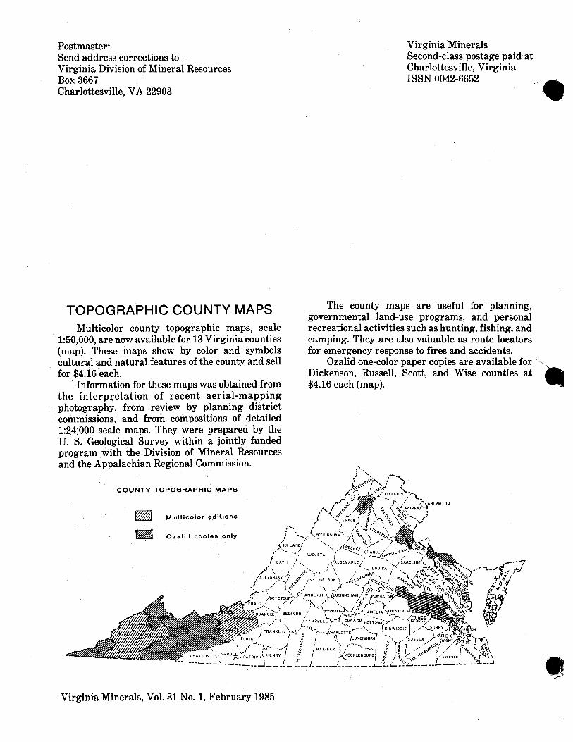
TOPOGRAPHIC COUNTY MAPS
Virginia Minerals Second-class postage paid at charlottesville, ~ i r n i n i a - ISSN 0042-6652
The county maps are useful for planning, governmental land-use programs, and personal
Multicolor county topographic maps, scale recreational activities such as hunting, fishing, and 1:50,000, are now available for 13 Virginia counties camping. They are also valuable as route locators (map). These maps show by color and symbols for emergency response to fires and accidents. cultural and natural features of the county and sell Ozalid one-color paper copies are available for - for $4.16 each. Dickenson, Russell, Scott, and Wise counties at
Information for these maps was obtained from $4.16 each (map). the interpretation of recent aerial-mapping photography, from review by planning district commissions, and from compositions of detailed 1:24,000 scale maps. They were prepared by the U. S. Geological Survey within a jointly funded program with the Division of Mineral Resources and the Appalachian Regional Commission.
C O U N T Y TOPOGRAPHIC MAPS
M ulticolor editions
Ozal id copies only
Virginia Minerals, Vol. 31 No. 1, February 1985


