Town of Lyndon, Vermont Zoning District Maplyndonvt.org/zoningdistrictmap.pdf · QR1 4 QR1 2 2 01 5...
1
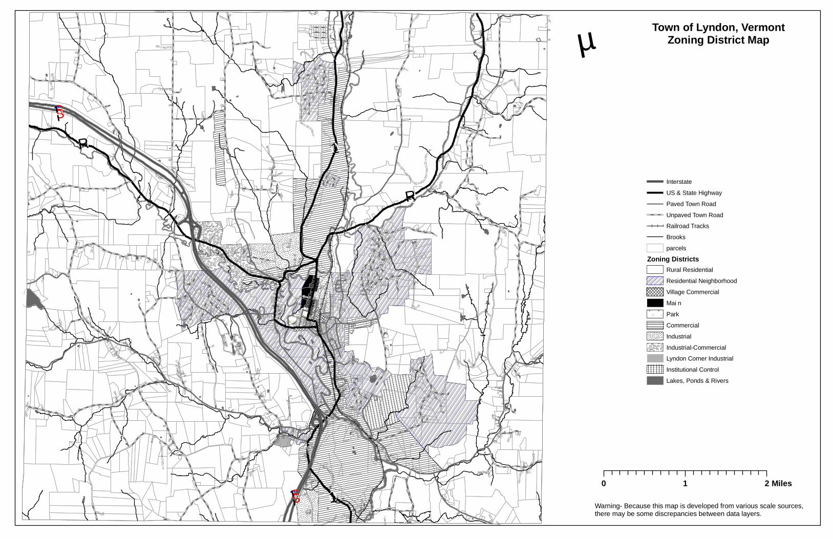
Q R 114 Q R 122 0 1 5 0 1 5 § ¨ ¦ 91 § ¨ ¦ 91 Town of Lyndon, Vermont Zoning District Map μ Interstate US & State Highway Paved Town Road Unpaved Town Road Railroad Tracks Brooks parcels Zoning Districts Rural Residential Residential Neighborhood Village Commercial Mai n Park Commercial Industrial Industrial-Commercial Lyndon Corner Industrial Institutional Control Lakes, Ponds & Rivers 0 1 2 Miles Warning- Because this map is developed from various scale sources, there may be some discrepancies between data layers.
Transcript of Town of Lyndon, Vermont Zoning District Maplyndonvt.org/zoningdistrictmap.pdf · QR1 4 QR1 2 2 01 5...
QR114
QR122015
015
§̈¦91
§̈¦91
Town of Lyndon, VermontZoning District Mapµ
InterstateUS & State HighwayPaved Town RoadUnpaved Town RoadRailroad TracksBrooksparcels
Zoning DistrictsRural ResidentialResidential NeighborhoodVillage CommercialMai nParkCommercialIndustrialIndustrial-CommercialLyndon Corner IndustrialInstitutional ControlLakes, Ponds & Rivers
0 1 2 Miles
Warning- Because this map is developed from various scale sources,there may be some discrepancies between data layers.