Towards A Drought Monitoring System for El Salvador
9
By David Eliseo Martínez Castellanos Software Developer Towards A Drought Monitoring System for El Salvador tion of Soil Moisture Estimation using Open Source Tools, Development of Web Mapping Appli Android Mobile Application for The Salvadoran Ministry of Environment (MARN)
-
Upload
david-eliseo-martinez-castellanos -
Category
Software
-
view
180 -
download
4
Transcript of Towards A Drought Monitoring System for El Salvador

By
David Eliseo Martínez Castellanos
Software Developer
Towards A Drought Monitoring System for El Salvador
Automation of Soil Moisture Estimation using Open Source Tools, Development of Web Mapping Application andAndroid Mobile Application for The Salvadoran Ministry of Environment (MARN)
Background
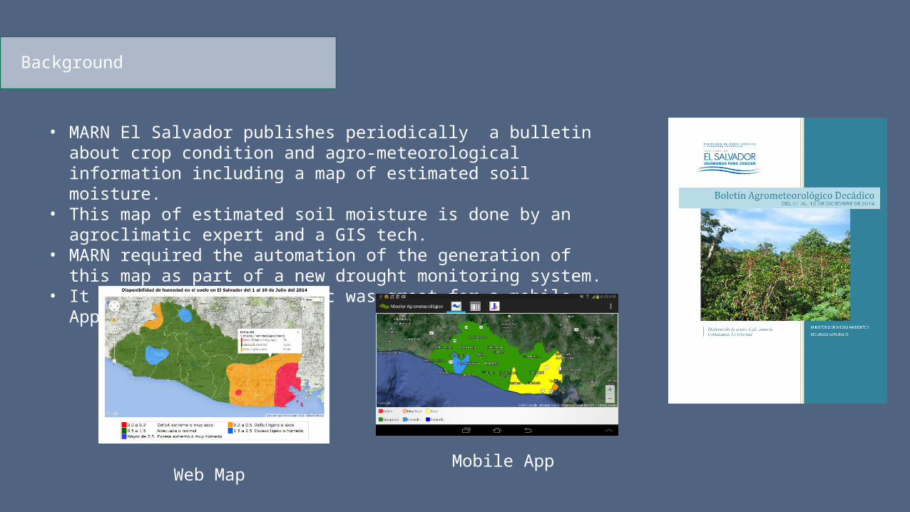
• MARN El Salvador publishes periodically a bulletin about crop condition and agro-meteorological information including a map of estimated soil moisture.
• This map of estimated soil moisture is done by an agroclimatic expert and a GIS tech.
• MARN required the automation of the generation of this map as part of a new drought monitoring system.
• It seemed to me this topic was great for a mobile App
Web MapMobile App

Solution Architecture
PosgreSQL + PostGIS
Tabular and Spatial DataApache
Web Server
MapServer(for WMS)
Processing Server (Windows 2008 Server)
R for Statistical ComputingMARN User
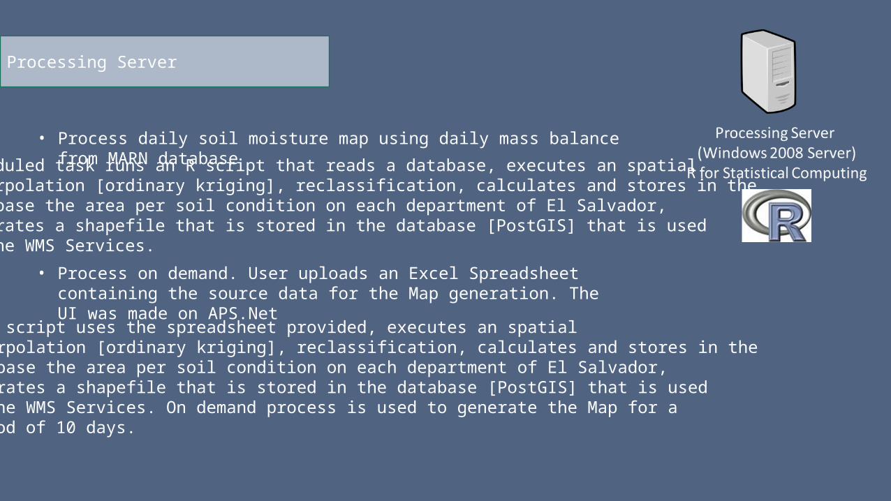
Processing Server
• Process daily soil moisture map using daily mass balance from MARN database
Scheduled task runs an R script that reads a database, executes an spatialInterpolation [ordinary kriging], reclassification, calculates and stores in theDatabase the area per soil condition on each department of El Salvador, Generates a shapefile that is stored in the database [PostGIS] that is usedIn the WMS Services.
• Process on demand. User uploads an Excel Spreadsheet containing the source data for the Map generation. The UI was made on APS.Net
An R script uses the spreadsheet provided, executes an spatialInterpolation [ordinary kriging], reclassification, calculates and stores in theDatabase the area per soil condition on each department of El Salvador, Generates a shapefile that is stored in the database [PostGIS] that is usedIn the WMS Services. On demand process is used to generate the Map for aperiod of 10 days.
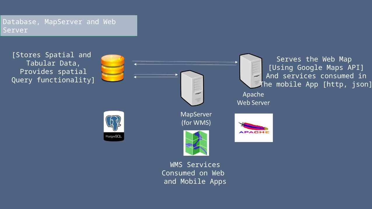
Database, MapServer and Web Server
[Stores Spatial and Tabular Data,
Provides spatialQuery functionality]
WMS ServicesConsumed on Web
and Mobile Apps
Serves the Web Map [Using Google Maps API]
And services consumed inThe mobile App [http, json]

Results: Web Map [10 days period]
Developed used PHP, JavaScript + jQuery, Google Maps API for JavaScriptAllows to query the percent of area per soil Condition for each deparment of El Salvador.
http://www.snet.gob.sv/googlemaps/humedad/mapIH.php
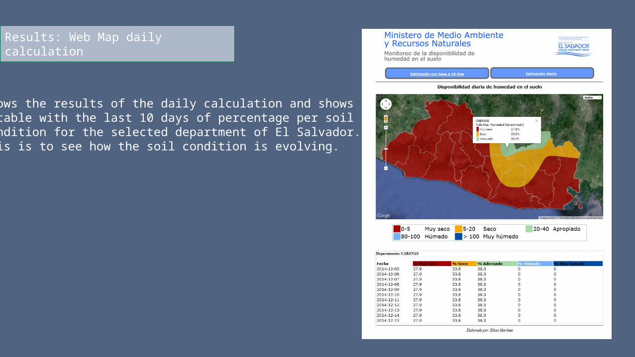
Results: Web Map daily calculation
Shows the results of the daily calculation and showsA table with the last 10 days of percentage per soilCondition for the selected department of El Salvador.This is to see how the soil condition is evolving.
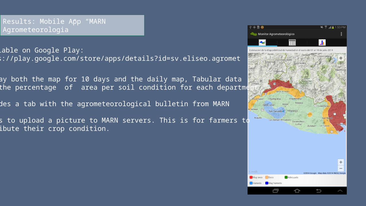
Results: Mobile App “MARN Agrometeorologia”
Available on Google Play:https://play.google.com/store/apps/details?id=sv.eliseo.agromet
Display both the map for 10 days and the daily map, Tabular dataWith the percentage of area per soil condition for each department.
Includes a tab with the agrometeorological bulletin from MARN
Allows to upload a picture to MARN servers. This is for farmers toContribute their crop condition.

What is next?
• Mobile App UI and functionality improvement [Allow to take picture offline, upload when on wifi]• Create a Map with a Time Line of user uploads and combine it with the estimated soil condition and
satellite imagery• Research on agrometeorological models [ + Research in general]• Get feedback
THANKS!David Eliseo Martínez Castellanos
[email protected]@marn.gob.sv
Linked-in: sv.linkedin.com/pub/david-eliseo-martinez-castellanos/35/71b/7b5/