TOOLKIT ( I ): PRE-PLANNING, VISIONING AND OBJECTIVE …
62
TOOLKIT ( I ): PRE-PLANNING, VISIONING AND OBJECTIVE SETTING REPUBLIC OF KENYA
Transcript of TOOLKIT ( I ): PRE-PLANNING, VISIONING AND OBJECTIVE …

National Land Commission Directorate of Land Use Planningi
TOOLKIT ( I ): PRE-PLANNING, VISIONING AND OBJECTIVE SETTING
REPUBLIC OF KENYA


National Land Commission Directorate of Land Use Planningii
Contact Us
NATIONAL LAND COMMISSION
ACK Bishops Garden Annex, 1st Ngong Avenue
Off Ngong Road, 7th Floor
P.O Box 44417-00100
Tel: + 254-2-2718050,
NAIROBI, Kenya
Email: [email protected] , website: www.landcommission.go.ke
© NLC 2019


National Land Commission Directorate of Land Use Planningiii

National Land Commission Directorate of Land Use Planningiv
National Land Commission Directorate of Land Use Planningv
List of Figures ....................................................................................................... vii
List of Tables ......................................................................................................... vii
Abbreviations & Acronyms ................................................................................. viii
Foreword ...............................................................................................................1
Acknowledgement ..............................................................................................3
PREAMBLE ...........................................................................................................5
About this Toolkit .................................................................................................5
Who are the targeted users of the Toolkit ........................................................5
How to use the Toolkit .........................................................................................6
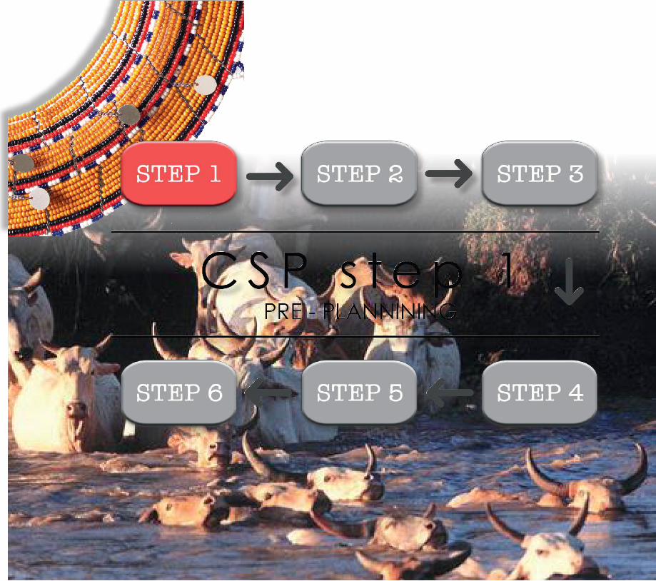
CSP STEP 1 - PRE-PLANNING ..................................................................................7
1.1 What is Pre-Planning? ...................................................................................9
1.1 Why Pre-Planning? ........................................................................................9
1.3 Who are involved in Pre-Planning? .............................................................10
TOOL 1.1-A: DEVELOP TECHNICAL CAPACITY AND INFRASTRUCTURE ........15
TOOL 1.2-B: RECONNAISSANCE SURVEY.............................................................17
TABLE OF CONTENTS
National Land Commission Directorate of Land Use Planningvi
1.2.1 Desktop Study ............................................................................................17
1.2.2 Acquisition of Preliminary Maps and Plans ............................................17
1.2.3 Planning the Field work Itinerary .............................................................17
1.2.4 Field visits ...................................................................................................18
1.2.5 Preliminary Data Analysis ..........................................................................18
1.2.6 Determine the Planning Issues ................................................................18
TOOL 1.2-C DELINEATING THE COUNTY INTO GEOGRAPHIC PLANNING ..
AREAS ...............................................................................................................21
Participants in this activity: ..................................................................................21
Steps for Identifying Planning Areas: ................................................................21
TOOL 1.3-A: SAMPLE WORK PLAN CHECKLIST ..................................................25
TOOL 1.3-B: PROCUREMENT OF CONSULTANCY SERVICES ............................31
TOOL 1.3-C: STAKEHOLDER MAPPING ................................................................33
TOOL 1.3 -D: PREPARATORY MEETINGS WITH TRADITIONAL AND ...............
COMMUNITY LEADERS .....................................................................................35
CSP STEP 2 VISIONING AND OBJECTIVE SETTING .............................................39
2.1 What is a Vision? ........................................................................................39

National Land Commission Directorate of Land Use Planningvii
TOOL 2.1-A: THE VISIONING PROCESS ................................................................43
TOOL 2.1-B: SETTING OBJECTIVES FOR THE CSP ..............................................45
LIST OF FIGURES
Figure 1: summary of the tasks during the reconnaissance survey ......................19
Figure 2: Vision............................................................................................................39
Figure 3: Objective setting .......................................................................................45
LIST OF TABLES
Table 1.1 Work Plan ....................................................................................................25
National Land Commission Directorate of Land Use Planningviii
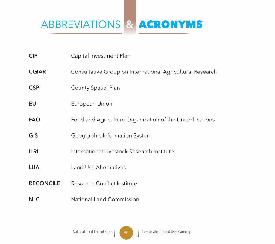
ABBREVIATIONS & ACRONYMS
CIP Capital Investment Plan
CGIAR Consultative Group on International Agricultural Research
CSP County Spatial Plan
EU European Union
FAO Food and Agriculture Organization of the United Nations
GIS Geographic Information System
ILRI International Livestock Research Institute
LUA Land Use Alternatives
RECONCILE ResourceConflictInstitute
NLC National Land Commission
National Land Commission Directorate of Land Use Planning1
The National Land Commission recognizes the unique characteristics of PastoralAreasandthesignificanceofrangelandsinnationalandcountydevelopment.Further,the Commission acknowledges the central role of County Spatial Planning in realizing effective and sustainable management and development of rangelands and pastoralism. An effective andefficientCountySpatialPlanningprocesscanbeacornerstonetoachievingCountySpatialPlans that resonate with the aspirations of the citizens.
The resulting County Spatial Plan (CSP) is much more than “just a plan”. It can be a key part of a county’s rangeland management system and guide a county’s strategy for sustainable development,notonly for the livestocksectorbutalso for theeconomyasawhole. It isaninvestment in a county’s future.
Section 110 of the County Governments Act 2012 requires County Governments to prepare County Spatial Plans to give effect to principles and objects of County Planning. The County Spatial Planning process is undertaken in a series of nine steps. This Toolkit elaborates steps one and two that relate to preparation for the planning process and agreeing on an overarching vision and objectives for the plan.
PursuanttoArticle67(2)(h)oftheConstitutionofKenya2010,“to monitor and have oversight responsibilities over land use planning throughout the country” the Commission recommends this toolkit as a necessary reference and guide in the process of preparing County Spatial Plans in Pastoral areas.
Kabale Tache AreroAg. Secretary/CEO, NATIONAL LAND COMMISSION
FOREWORD

National Land Commission Directorate of Land Use Planning2

National Land Commission Directorate of Land Use Planning3
THIS TOOLKIT has been prepared through consultative jointeffortbringingonboardseveraldevelopmentpartners,
professionals and Government agencies.
The Commission thanks the following agencies for the support in preparing the document: European Union (EU) through the Food and Agriculture Organization of the United Nations- Land Governance Programme (FAO - Kenya); International Livestock Research Institute (ILRI); the CGIAR Research Program on Livestock; and the Feed the Future Kenya Accelerated Value Chain Development program and ResourceConflictInstitute(RECONCILE).
The Commission commends the valuable direction and leadership of the Land Use Planning Directorate in preparing the Toolkits. Specifically, we appreciatethe following authors: Dr. Herbert Musoga, PhD (Director Land Use Planning-Team Leader); Mrs. Rose Kitur (Deputy Director of Land Use Planning); Dr. Lance Robinson (Senior Scientist and researcher specializing in environmental governance and social-ecological resilience in pastoralist systems - ILRI); Mr. Elijah Letangule (Deputy Director Advocacy-NLC); Husna Mbarak (FAO-Kenya); Mr. Peter Ken Otieno: Technical Coordinator- Rangelands Initiative Africa Programme of ILC Coordinated by RECONCILE; Mr. Daniel Mmbai ( Principal Land Use Planner); Mr. Christopher Kitonga (Principal Land Use Planner); Ms. Alice Kaumba (Chief Land Use Planner); Mr. Adelbert Moriango ( Senior Land Use Planning Assistant); Mr. Ebole Syumbu; Mr. Kelvin Mutwiri and Mr. Kepher Gallus.
Special appreciation to Mrs. Caroline Otieno for the secretarial work and formatting
ACKNOWLEDGEMENT

National Land Commission Directorate of Land Use Planning4
the reports and documents and Franklin Ongeti Osango (Graphics and document Designer).
We acknowledge valuable contribution and comments from the following categories of stakeholders: Hon Kulamo Bullo – Chairperson Land Sector Frontier Counties Development Council; Mr. Achiba Gargule – Government & Policy Advisor FCDC; Mr. Buoga Jared Omondi – Delivery Director Presidential Delivery Unit.
National Land Commission Coordinators: Rebecca Maritim – Baringo; Josphat Wasua – Laikipia; Eric Ndeda – West Pokot; James Longole – Turkana; Molu Halakhe – Marsabit; Abdullahi Jillo – Tana River; Mathew Muli - Isiolo and John Lolkitekui – Samburu.
Chief Officers in charge of Lands & Physical Planning: Rashid Arale ( Isiolo),MuktarI.Gucha(Marsabit),TimothyLomulen(WestPokot),MarkEwoi(Turkana),Catherine Changwony (Baringo).
PhysicalPlanners:FranklineKiche–Baringo,JoshuaOndari–WestPokot,StephenNjoroge – Turkana, Kamiri Elvis – Lamu,Mwenda Riungu – Tana River, PeterG.Nteere–Isiolo,J.KinyuaMiriti–Samburu,DansonKolia–Lamu,KimutaiCheruiyot–Isiolo,OsmanM.Galgallo–Isiolo.
Dr. Herbert Musoga (PhD)Director Land Use Planning,NATIONAL LAND COMMISSION

National Land Commission Directorate of Land Use Planning5
ABOUT THIS TOOLKIT This Toolkit elaborates on specific activities at the pre-planning, visioning andobjective setting stagesintheCountySpatialPlanningprocess.Itseekstoclarify,simplify and consolidate the requirements for the different steps in the process. Thesefirsttwostepsaredocumentedinpg.17oftheCountySpatialPlanning:Monitoring and Oversight Guidelines. They are further contextualized within the Annex as they apply to preparing County Spatial Plans in Pastoral Areas.
The Toolkit is divided into two main parts consisting of several tools that identify and describe key activities and tasks be carried out. The tools include:
Developing Technical Capacity and Infrastructure Reconnaissance Survey Delineating the County into Geographic Planning Areas Sample Work Plan Checklist Procurement of Consultancy Services Stakeholder Mapping The Visioning Process Setting Objectives for CSP Visioning and Objective Setting Steps Meeting between the Consultant and Technical Team
WHO ARE THE TARGETED USERS OF THE TOOLKIT The primary users of this toolkit are the County Government Land Use Planners responsible for preparing County Spatial Plans as well as Consultants who may be contracted to prepare CSP’s by County Governments. It is also an essential reference for:ChiefOfficers,CountyExecutiveCommitteeMembers,Members
PREAMBLE

National Land Commission Directorate of Land Use Planning6
of County Assemblies, Development Partners, Civil Society Organizations andDevelopment Agencies in the Pastoral Areas.The Toolkit may also be a reference for students of planning at the universities. Agencies charged with monitoring and overseeing development activities in countiesmayfindthetoolkituseful.
HOW TO USE THE TOOLKITThe Toolkit is a resource to draw upon rather than a prescription that must be followed precisely. Planning teams therefore may need to adapt the activities to their own context and work out the details of how to carry out the activities.
ThisToolkitshouldbeusedalongsideToolkit(II)(Research,MappingandSituationAnalysis) and Toolkit (III) (Developing Scenarios and Formulating Plan Proposals).
The Toolkit should also be used in conjunction with other Advisories issued by the National Land Commission. These advisories include: the County Spatial Planning: Monitoring and Oversight Guidelines; the Exemplar Format of a County Spatial Plan and the annex to the guidelines on County Spatial Planning in Pastoral Areas.
National Land Commission Directorate of Land Use Planning7

National Land Commission Directorate of Land Use Planning8

National Land Commission Directorate of Land Use Planning9
1.1 WHAT IS PRE-PLANNING?
Pre-planning is preparing or getting set for the planning process. It is an essential step that determines whether the County Government will proceed with the process of preparing a County Spatial Plan or not. It involves:
An assessment of the capacity and preparedness of the County to undertake the process of preparing the CSP;
Designing the process;Quantifyingandensuringtheavailabilityof therequisitehumanresources,finances, infrastructure, facilities and the competence to coordinate theinstitutions that will be involved in the process.
1.2 WHY PRE-PLANNING?
Preparation of a CSP is a multi-sectoral and multi-disciplinary undertaking involving several varied actors and institutions. These require to be properly identifiedandcoordinatedforeffectiveparticipationandmeaningfulcontribution.Further,financialresourcesneedtobemobilizedandmadeavailableinatimelymanner.It is therefore essential that these aspects are clearly assessed and provided for to enable successful design and actualization of the CSP process in the pastoral areas. Aswell, awell-structuredanddesignedprocesswill havea very strongbearing on subsequent effective implementation of the CSP. The pre-planning stage is the ideal juncture to ensure that the unique aspects of the pastoral areas are integrated into the CSP process.
PRE-PLANNING
5.05.0
National Land Commission Directorate of Land Use Planning10
1.3 WHO ARE INVOLVED IN PRE-PLANNING?
The County Director of Land Use Planning should take the lead in initiating,coordinating and steering the pre-planning stage. This should be within the protocol of the County Government structure.
1.4 WHAT ARE THE ESSENTIAL STEPS IN PRE-PLANNING?
To lay a firm foundation for the planning process, some preliminary steps arecrucial. These include:
1. Determining the planning readiness of the Department responsible for CSP. This entails:
Gathering all the necessary information needed; Constituting a planning team;Decidingonthechampionoftheplanningprocess, Establishing an implementation schedule for the team to follow.
It is important to consider what it will take to make the County successfully complete the planning process and what needs to be avoided and or mitigated.
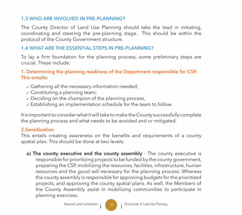
2.SensitizationThis entails creating awareness on the benefits and requirements of a countyspatial plan. This should be done at two levels:
a) The county executive and the county assembly - The county executive is responsibleforprioritizingprojectstobefundedbythecountygovernment,preparingtheCSP,mobilizingtheresources,facilities,infrastructure,humanresources and the good will necessary for the planning process. Whereas the county assembly is responsible for approving budgets for the prioritized projects,andapprovingthecountyspatialplans.Aswell,theMembersofthe County Assembly assist in mobilizing communities to participate in planning exercises.
National Land Commission Directorate of Land Use Planning11
b) The communities - The communities are sensitized to enable them to meaningfully participate in the planning activities such as sharing indigenousand localknowledge,volunteering informationnecessary fortheplanning,sharingtheiraspirations,needsandconcerns,participatinginformulating the vision. They need to understand the plan and adhere to the plan once complete and approved as well as assisting in policing the plan implementation.
Thecountygovernment,therefore,shouldfacilitatetheprocessbytakingtheleadthrough the Planning unit with varied support from partners to undertake a pre-CSP awareness and sensitization exercise. Subsequent steps are as itemized in Table 1.2 and elaborated in the tools.

National Land Commission Directorate of Land Use Planning12
Table 1.2: The Essential Steps in Pre-planning Stage
Activities Tasks Output
1.1 Sensitization Awareness creation• To the county executive• To the county assembly• To the community
1.2 Develop Technical Capacity and Infrastructure
1.2.1 Hire planners1.2.2Acquisitionofofficespace1.2.3Officestationary,equipment,
computers,GISsoftware,projectvehicle,
1.2.4 Appointment of team members
1.2.5 Formulation of T.O.R. for consultants
Planning team
1.3 Reconnaissance Survey
1.3.1 Desktop study1.3.2 Acquisition of preliminary
maps1.3.3 Plan itinerary1.3.4Undertakefieldvisits1.3.5 Preliminary data analysis1.3.6 Determine the planning needs
Scoping report

National Land Commission Directorate of Land Use Planning13
Activities Tasks Output
1.4 Develop Work Plan
1.4.1 Determine the activities1.4.2 Resource requirements1.4.3 Identify Actors1.4.4 Indicate Time frame
Planning needs assessment
1.5 Consultative meeting with the Chief Officer and CECM
1.5.1 Set meeting dates Work plan and budget approved
1.5 Issuing Notices of intention to plan
1.5.1 Preparation of gazette notice1.5.2 Publication of gazette notice
Gazette notice
1.6 Procurement of Consultancy Service
1.6.1 Preparation of EOI1.6.2 Advertisement for EOI1.6.3 Receiving and opening of the
EOI1.6.4 Formation of committee to
open and evaluate1.6.5Notificationofsuccessful
bidder
Successful bidder

National Land Commission Directorate of Land Use Planning14
Activities Tasks Output
1.7 Stakeholder Mapping
1.7.1 Stakeholder analysis and develop a strategy for stakeholder engagement
1.7.2 Preparatory meetings with traditional and community leaders
Checklist

National Land Commission Directorate of Land Use Planning15
TOOL 1.1-A: DEVELOP TECHNICAL CAPACITY AND INFRASTRUCTURE
Thisentailsdefiningandassemblingofthecompetenthumanresources,allocationand reallocation of the staff, mobilizing of necessary resources, e.g. sufficientofficespacetoserveallthetechnicalstaffandequipmentandestablishmentofaplanningteaminthecounty.Specifictaskswillinclude:
1.1.1 HIRE PLANNERS• Hirequalifiedplannersamongthemaregisteredplanner(whowillsupervise
the planning exercise) or
• Reassignaqualifiedcountytechnicalstaff
1.1.2 ACQUISITION OF OFFICE SPACE• Office stationery, equipment, computers, GIS software, provide sufficient
space to serve all the technical staff and all equipment.
1.1.3 PROVIDE EQUIPMENT, SOFTWARE, PROJECT VEHICLE• Provideasuitableprojectvehicletobeusedforfieldwork
1.1.4 ESTABLISH COUNTY SPATIAL PLANNING TEAM• The planning team should be multidisciplinary, multi-sectoral andrepresentative (Landuseplanners, surveyors,environmentalist, economist,GISExpert,sociologist,rangelandspecialistetc.)Thisshouldbedonethroughappointment letters.
• TheCountySpatialplanningteamwillbecoordinatedbytheCountyDirector,Land Use Planning.
National Land Commission Directorate of Land Use Planning16
1.1.5 FORMULATION OF T.O.R. FOR CONSULTANTSThe County Director of Land Use Planning will need to determine what tasks and activities will be undertaken by the consultants.
The crafting of the terms of reference must be very explicit regarding expectations and deliverables.
Terms of reference (T.O.R.) refers to an outline of activities and tasks for the consultantsincludingtimeline,scopeofworkanddeliverables.Thedevelopmentof the T.O.R. should provide a context and need for planning rangelands and the kind of stakeholders to be engaged.

National Land Commission Directorate of Land Use Planning17
TOOL 1.2-B: RECONNAISSANCE SURVEY
This is a preliminary survey used at the initiation of any project work through gathering preliminary data both spatial and non-spatial and suggesting possible alternative paths and routes. The process of carrying out a reconnaissance survey include:
1.2.1 DESKTOP STUDYIt occasions collection of baseline information from existing secondary sources about the pastoral Counties. Sources of this data include Open GIS sources,existing reports, KNBS, Survey of Kenya, County Information DocumentationCenters,regionaldevelopmentauthoritiese.g.ENNDAandpreviousCIDPsetc.
1.2.2 ACQUISITION OF PRELIMINARY MAPS AND PLANS Thisinvolvesacquiringexistingmapsandplans,whichprovideageneralspatialoverview of the planning area. This include topographical maps, regionaldevelopment plans, previous county spatial plans, urban land use plans,infrastructure maps and reports.
SourcesofthisdataincludeSurveyofKenya,MinistryofLandsandPhysicalPlanning,Countyrecords,Roads,publicworksandregionalauthoritiese.g.ENNDA.
1.2.3 PLANNING THE FIELD WORK ITINERARYThis refers to developing a program for undertaking reconnaissance survey. It includes the following activities:
Delineate the county into Planning AreasDecideontheteam,equipment,timeframe,andnumberofvehicles, Identify the route Identify contact persons on the ground e.g. Clan Elders, Community Leaders, Chiefs of the areas – because of the institutional memory

National Land Commission Directorate of Land Use Planning18
1.2.4 FIELD VISITS Thisisaprocessthatinvolvescarryingouttransectsurveys,observing,collecting,recording,anddocumentingbothattributeandspatialdatabytheplanningteam.
1.2.5 PRELIMINARY DATA ANALYSISThisinvolvesprocessingspatialandnon-spatialdatagatheredfromthefieldvisitand desktop survey
1.2.6 DETERMINE THE PLANNING ISSUES Having undertaken the preceding steps the planning team is able to determine the issuestobeaddressedintheplanningprocess,magnitudeofthework,gapsandareasoffocusinreferencetothevarioussectorse.g.water,infrastructure,humansettlements,mineralresources,wildlifeandtourism,agriculture,rangelandsandlivestock production.

National Land Commission Directorate of Land Use Planning19
Figure 1: summary of the tasks during the reconnaissance survey

National Land Commission Directorate of Land Use Planning20

National Land Commission Directorate of Land Use Planning21
TOOL 1.2-C DELINEATING THE COUNTY INTO GEOGRAPHIC PLANNING AREAS
One of the outputs from a reconnaissance survey is a recommendation of how to delineate the county into spatial planning areas. This should help structure public participation in the spatial planning process.
In some cases, a county may simply chooseto use its sub-counties as the Planning Areas. However, sub-county or other administrativeboundaries are not always very relevant for how rangelands are used and managed.
PARTICIPANTS IN THIS ACTIVITY: The planning team coordinated by the county director of land use planning. administration County Lands Department staff; Representatives of umbrella organizations or networks of community organizations at county-level (e.g., county pastoralists association, countynaturalresourcemanagementforum,associationofconservancies,etc.);
Representatives of NGOs engaged in natural resource management and land issues in the county.
STEPS FOR IDENTIFYING PLANNING AREAS:
Assemble maps and/or GIS layers of information relevant to the identification of Planning Areas.
Assemble maps and/or layers of customary territories, resources such asdrought reserve pastures that are shared by more than one community,
Not every task will be completed at the same time for every part of the county; instead, sometasks will proceed in a step-wise fashion in different Planning Areas,eventuallytobebroughttogether at county level.

National Land Commission Directorate of Land Use Planning22
resourcesharingagreements,knownlarge-landscapescalelandandNaturalResourceManagement (NRM)plansandplanningactivities,andumbrella/clusters networks of community NRM organizations that do joint planning. Wheresuchinformationisnotalreadyavailable inmapsorGIS layers, thismight be done by knowledgeable participants in a workshop setting.
Deliberate on possible demarcation of Planning Areas. This is to be in conjunction with stakeholders (see Participants identified earlier
in this tool Activity), deliberate on the pros and cons of different demarcations. This would normally be done in a workshop in which other tasks that are part of CSP Pre-Planning phase are also addressed. However,itmayalsoinvolveone-on-one discussions with knowledgeable stakeholders.
Decide on and map the Planning Areas. Decide on best delineation of the county in to Planning Areas and produce aGISshapefilelayeroftheunits.Thismaybedonefirstonapapermapandthen digitized or may be done directly in GIS software.

National Land Commission Directorate of Land Use Planning23
QUESTIONS TO CONSIDER IN DECIDING ON PLANNING AREAS
Are there customary rangeland demarcations that are relevant for rangelands management?
What resources are regularly shared among communities (e.g., drought reserve pastures) who and where are the communities which share those resources?
Which communities have a high level of interaction with each other, with their respective herds often using pasture and water resources that are regularly shared?
What inter-community and larger scale NRM plans and land use plans and resource sharing agreements already exist?
How relevant are administrative boundaries (especially. sub-county, constituency, wards, sub locations) for how communities use and manage rangelands?
For any suggested Planning Area, how easy will it be to organize participation and representation from all communities within the area? (Don’t make the Planning Areas too large.)

National Land Commission Directorate of Land Use Planning24
National Land Commission Directorate of Land Use Planning25
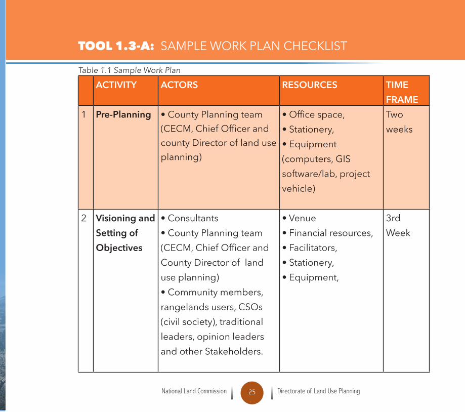
TOOL 1.3-A: SAMPLE WORK PLAN CHECKLIST
Table 1.1 Sample Work Plan
ACTIVITY ACTORS RESOURCES TIME FRAME
1 Pre-Planning • County Planning team (CECM,ChiefOfficerandcounty Director of land use planning)
•Officespace,•Stationery,• Equipment (computers,GISsoftware/lab,projectvehicle)
Two weeks
2 Visioning and Setting of Objectives
• Consultants• County Planning team (CECM,ChiefOfficerandCounty Director of land use planning)•Communitymembers,rangelandsusers,CSOs(civilsociety),traditionalleaders,opinionleadersand other Stakeholders.
• Venue•Financialresources,•Facilitators,•Stationery,•Equipment,
3rd Week

National Land Commission Directorate of Land Use Planning26
ACTIVITY ACTORS RESOURCES TIME FRAME
3 Establishing of GIS Lab, Data Collection & Mapping
• The County Government (CECM,ChiefOfficerLands,countyplanners,etc.)• County Planning Team(Manager,GISexperts,Economists,Environmentalists,Surveyors,consultants,etc.)• Community elders/leaders
• GIS station •Humanandfinancialresource• Equipment •Tools(GPS,Tablet,Fieldsquestionnaires,cameras,etc.)
Start 4th Week – End 20th Week
4 Situational Analysis
• The County Government (CECM,ChiefOfficerLands,countyplanners,etc.)• County Planning Team(Manager,GISexperts,Economists,Environmentalists,Surveyors,consultants,etc.)Community elders/leaders
• Venue•Financialresource,•Facilitators,•Stationery,•Equipment,
21st Week – 25th Week

National Land Commission Directorate of Land Use Planning27
ACTIVITY ACTORS RESOURCES TIME FRAME
5 Developing Scenarios (Modeling)
• The County Government (CECM,ChiefOfficerLands,countyplanners,etc.)• County Planning Team(Manager,GISexperts,Economists,Environmentalists,Surveyors,consultants,etc.)• Community members • Opinion leaders
• GIS station •Humanandfinancialresource• Equipment •Tools(GPS,tablets,fieldquestionnaires,cameras,etc.)
26th Week - 28th Week
6 Formulating Plan Proposals
• County Planning Team(Manager,GISexperts,Economists,Environmentalists,Surveyors,consultants,etc.)• Community members • Opinion leaders
• Financial and human resources
29th Week – 37th Week

National Land Commission Directorate of Land Use Planning28
ACTIVITY ACTORS RESOURCES TIME FRAME
7 Presenting & Publishing CSP
• The County Government (CECM,ChiefOfficerLands,countyplanners,etc.)• County Planning Team(Manager,GISexperts,Economists,Environmentalists,Surveyors,consultants,etc.)• Community members • Opinion leaders • Development partners• National government actors • Investors
• Financial resources • Facilitators • Venue
38th Week - 50th Week
8 Approval of the County Spatial Plan
• County Government (County Director Land usePlanning,CECM,Governor)• County Assembly • Governor
• Financial resources 51st Week – 52nd Week
National Land Commission Directorate of Land Use Planning29
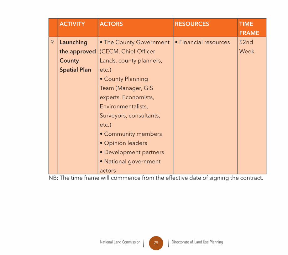
ACTIVITY ACTORS RESOURCES TIME FRAME
9 Launching the approved County Spatial Plan
• The County Government (CECM,ChiefOfficerLands,countyplanners,etc.)• County Planning Team(Manager,GISexperts,Economists,Environmentalists,Surveyors,consultants,etc.)• Community members • Opinion leaders • Development partners• National government actors
• Financial resources 52nd Week
NB: The time frame will commence from the effective date of signing the contract.

National Land Commission Directorate of Land Use Planning30
National Land Commission Directorate of Land Use Planning31
TOOL 1.3-B: PROCUREMENT OF CONSULTANCY SERVICES
Most counties in the pastoral areas lack capacity to undertake county spatial planning. The need to hire a consortium headed by a registered and practicing physical planner to lead the Planning process in the rangelands shall be critical.
ACountygovernmentshallselectafirmamongthoseinvitedtosubmitaproposal,in accordance with the method of selection detailed in the County Spatial Planning Monitoring and Oversight Guidelines (Pgs. 69-70).
• The method of selection shall be as indicated by the procuring county in the guidelines and consistent with procurement laws of Kenya.
• The consultants shall be invited to submit a Technical Proposal and a Financial Proposal. The proposal will be the basis for Contract negotiations and ultimatelyforasignedContractwiththeselectedfirm.
• The consultants must familiarize themselves with county conditions and take them into account in preparing their proposals.
• To obtain firsthand information on the assignment and on the localconditions,consultantsareencouragedtoliaisewiththeCountyregardingany information that they may be required attend a pre-proposal conference where applicable.
The above process shall be done in compliance with Public Procurement and Asset Disposal Act No 33 of 2015 and in adherence to the direction provided in the County spatial planning: monitoring and oversight guidelines. Pages 71 to 80

National Land Commission Directorate of Land Use Planning32
National Land Commission Directorate of Land Use Planning33
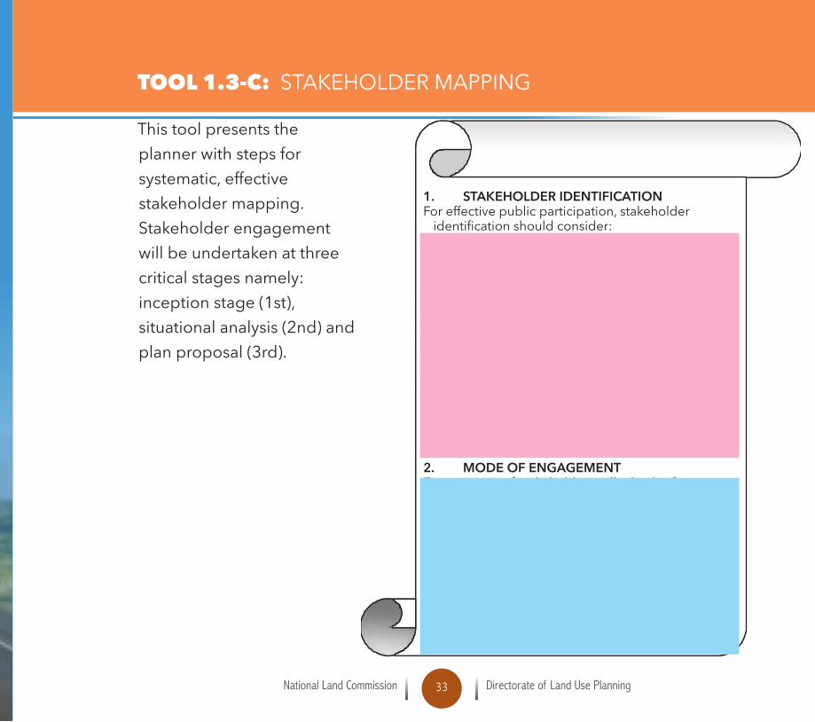
This tool presents the planner with steps for systematic,effectivestakeholder mapping. Stakeholder engagement will be undertaken at three critical stages namely: inceptionstage(1st),situational analysis (2nd) and plan proposal (3rd).
1. STAKEHOLDER IDENTIFICATIONForeffectivepublicparticipation,stakeholderidentificationshouldconsider: The immediate targeted users of the CSP; The people who have a key stake in CSP’s; People and institutions that need to be brought on board to support the CSP process; Inclusivity and prior information sharing Collaborations,cooperationandnetworking Opinion leaders; Community leaders People with indigenous knowledge on the local situation; People who have executive authority in the geographical/ subject area Spatial distribution (stakeholders mapping) of the stakeholders Women,youthandpersonswithdisability.
2. MODE OF ENGAGEMENTEngagement of stakeholders will take this form: Focusedgroupdiscussions, Stakeholderforums(workshops), Publichearings, Consultativeforums,(Resourcebase,Catchmentand community levels) Letters, Socialmedia, Advertisements, Pressconferences,Talkshows,Newsletters,Displaysandexhibitions,Brochures, Public fora.
TOOL 1.3-C: STAKEHOLDER MAPPING

National Land Commission Directorate of Land Use Planning34
National Land Commission Directorate of Land Use Planning35
The purpose of preparatory meetings with the community leaders is to ensure that there is a proper understanding of the objective of the planning process and the role of the traditional leaders and other leaders.
• Begin your presentation by emphasizing the importance of teamwork. • Remind your participants that they are leaders • Inform the participants that spatial planning is not a new thing but something
they interact with every day. •That,mostactivitiesinparticipatoryprocessesarecollaborative.
1. Nominate roles (moderator, visualiser, time-keeper, etc) Remember participatory planning is by everyone present since they are going to define resources that they interact with frequently. Encouragingparticipantstoalternateallrolesforeachexercise,inordertoexperienceasmany roles as possible.
2. Clarify the task Define the task to be achieved and read it aloud. Discuss with the team
whether the task is clear to everybody and come to a common understanding. 3. Decide upon working steps Discuss jointly which working steps are necessary in order to achieve the task andwriteoutthestepsonflipchart.
TOOL 1.3 -D: PREPARATORY MEETINGS WITH TRADITIONAL AND COMMUNITY LEADERS

National Land Commission Directorate of Land Use Planning36
4. Decide upon a division of labour Look at the working steps together and decide whether some of the steps could be done in sub-groups simultaneously in order to save time; if so,decide together who wants to work on which step/sub-task. Present a preview of the task by examples.

National Land Commission Directorate of Land Use Planning37

National Land Commission Directorate of Land Use Planning38

National Land Commission Directorate of Land Use Planning39
2.1 WHAT IS A VISION?Vision describes and illustrates the desired future to make it more vivid, real, and compelling so asto serve as an impetus for the present actions. It is meant to make the stakeholders to have a glimpse of the desired future state of the county (an artist impression of the desired county to live work invest and play) in a visioning process citizens and stakeholders are brought together,thus visioning is a participatory tool to develop a shared vision of the future. It considers long term past as well as long term future.
Figure 2: Vision
VISIONING AND OBJECTIVE SETTING
POINTS TO NOTE:It may cover what the County will look like, what facilities will beneeded and what it will be like to live and work thereIt should be concise and locally distinctiveAspirational but grounded.

National Land Commission Directorate of Land Use Planning40
2.0
Table 2.1: Steps in Visioning and Objective Setting
ACTIVITIES TASKS OUTPUT2.1 Consultative
meeting between
the consultant and
technical team
Set venue and date
Develop Program and Assign
responsibility
Invitation
Program
2.2 Engage the
stakeholders
Welcome and introduction
Make presentations
Plenary discussions and feed back
Workshop report
2.3 Defining the
overall framework
for the plan
Identify existing legal and institutional
frame work
Planning
framework for
the ASAL2.4 Defining Key
values to drive the
spatial planning
process
To ensure Inclusivity
To ensure participatory approach
To ensure Transparency and
Accountability
To ensure Sustainability
To ensure Equity

National Land Commission Directorate of Land Use Planning41
ACTIVITIES TASKS OUTPUT2.6 Defining Key
principles which
will be applied
when making land
use decisions
Integration of national values -
Protection of environmentally sensitive
areas and natural resources
Integration of the rights and interest of
the pastoral communities – lifestyle
Sustainable use of resources within
pastoral areas
Promote equitable resource allocation
that meets the needs of pastoral
communities
Check list
2.7 Defining Key
spatial issues
which need to be
dealt with
Identify Settlement patterns
Identify Grassing patterns - Identify
Stock routes & wildlife corridors
IdentifyConflictareasandissues
Identify Livestock infrastructure
Identify wildlife areas
Check list
2.8 Setting Priorities Objectives

National Land Commission Directorate of Land Use Planning42

National Land Commission Directorate of Land Use Planning43
TOOL 2.1-A: THE VISIONING PROCESS
The process can be adapted to a range of contexts and output needs, fromengaging in a full stand-alone visioning process to using smaller components embedded in other ongoing planning or engagement processes. This critical and distinguishing components include:
Despite their long-term and normative nature, visions should be informed byreality.Theyshouldindicatehowthecountywithitsspecificneedsandresourcesshould look like in future.

National Land Commission Directorate of Land Use Planning44
GUIDING QUESTIONS IN VISIONING
• What challenges do you face in your county?
• How will you like these challenges to be addressed?
• What is unique about your County (potentials & opportunities)?
• How does your County look like now in terms of development and where can you realistically expect it to be in future?
The outcomes of a visioning process should include some pictures and illustrations that communicate in a powerful way the desired future. This method of using pictures and illustrations is very important in making a compelling and long lasting impression in the minds of the participants The process of developing the Vision should include the following steps:
Develop a Working Vision with the stakeholders.
Popularize the Vision through stakeholder meetings to inform an agreed vision.
Revise the Vision if necessary after the formulation of the Development Strategies
National Land Commission Directorate of Land Use Planning45
TOOL 2.1-B: SETTING OBJECTIVES FOR THE CSP
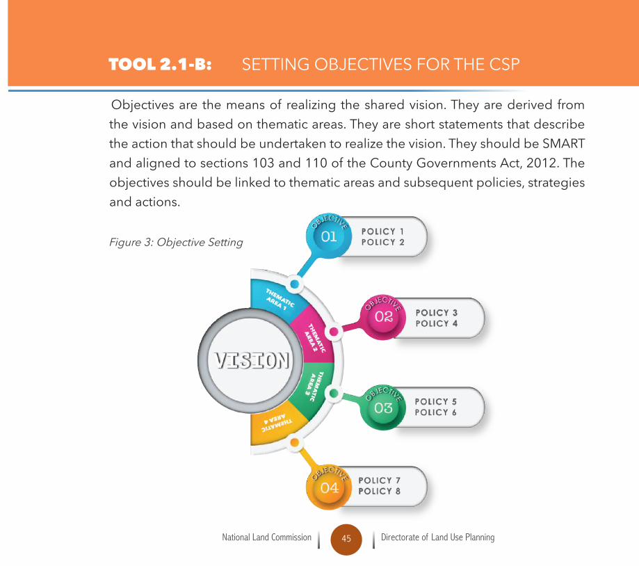
Objectives are the means of realizing the shared vision. They are derived from the vision and based on thematic areas. They are short statements that describe the action that should be undertaken to realize the vision. They should be SMART andalignedtosections103and110oftheCountyGovernmentsAct,2012.Theobjectivesshouldbelinkedtothematicareasandsubsequentpolicies,strategiesand actions. Figure 3: Objective Setting

National Land Commission Directorate of Land Use Planning46

National Land Commission Directorate of Land Use Planning47
TOOL 2.2-A: THE FIRST STAKEHOLDERS MEETING(S)
Public participation from the earliest stages of the planning process is crucial. Stakeholders should be involved in conceptualizing the vision for the plan and feelthatthevision,theplanningprocess,andeventuallytheplanitselfbelongto them. In the County Spatial Planning Monitoring and Oversight Guidelines,stakeholder involvement in the vision and objective setting stage is described as the “First Stakeholders Meeting”. To ensure meaningful and broad public participation,thiswillusuallyrequireaseriesofforumsorworkshops.Theremay,forexample,beastakeholdermeetingineachofthePlanningAreasandthen one high level stakeholder’s forum for the entire county.
Objectives of first stakeholder meeting To develop a shared vision or direction that they can agree to and buy into; To formulate creative solutions through dialogue and group processes;Toresolveconflictthroughnegotiationandmediation; To communicate the wishes, interests and aspirations of the people they
represent. To facilitate the process of proper planning and achievement of sustainable
development of the County.
The outputs of the first stakeholders meeting(s) include: Agreeable vision and objectivesOpportunities,challengesandinherentandtrendsinarea Way forward on further engagements Consensus on planning.
National Land Commission Directorate of Land Use Planning48
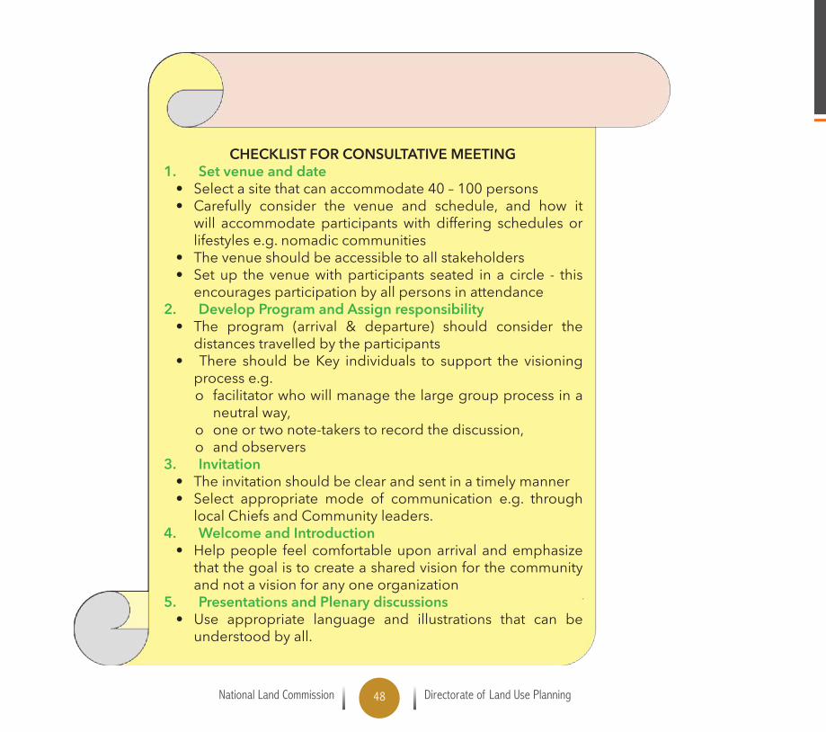
CHECKLIST FOR CONSULTATIVE MEETING1. Set venue and date
• Select a site that can accommodate 40 – 100 persons• Carefully consider the venue and schedule, and how it
will accommodate participants with differing schedules or lifestyles e.g. nomadic communities
• The venue should be accessible to all stakeholders• Set up the venue with participants seated in a circle - this
encourages participation by all persons in attendance2. Develop Program and Assign responsibility
• The program (arrival & departure) should consider the distances travelled by the participants
• There should be Key individuals to support the visioning process e.g. o facilitator who will manage the large group process in a neutralway,
o oneortwonote-takerstorecordthediscussion,o and observers
3. Invitation• The invitation should be clear and sent in a timely manner• Select appropriate mode of communication e.g. through
local Chiefs and Community leaders. 4. Welcome and Introduction
• Help people feel comfortable upon arrival and emphasize that the goal is to create a shared vision for the community and not a vision for any one organization
5. Presentations and Plenary discussions• Use appropriate language and illustrations that can be
understood by all.

National Land Commission Directorate of Land Use Planning49
1.NationalLandCommission,DirectorateofLandUsePlanning(2015), County Spatial Planning:
Monitoring and Oversight Guidelines; Nairobi.
2.RepublicofKenya,The Constitution of Kenya, 2010.
3.RepublicofKenya,The County Governments Act, 2012.
4.MinistryofLands,Sessional Paper No.3 of 2009 on National Land Policy.
5.Sanginga,P.andChitsike,C.,(2005).The power of visioning. A handbook for facilitating the
development of community action plan. Enabling Rural Innovation Guide 1. International
CentreforTopicalAgriculture:Kampala,Uganda
6. Steven Ames (2006) what is Community Visioning? American Planning Association.
7.StevenAmes(2006),Planning and Urban Design Standards,AmericanPlanningAssociation,
JR Wiley & Sons.
8. Susan Clark and Delia Clark ; Community Visioning: An Organizers Guide for Participatory
Planning: Quebec Labrador Foundation CS Mott Foundation Environmental Partnership for
Central Europe
REFERENCES

National Land Commission Directorate of Land Use Planning50
National Land Commission Directorate of Land Use Planning51
Front Cover Kenya pastoralist women child- northprovince-USAID
Page 6 Cattle crossing tana-river : courtesy Jeremiah Asaka
Page 8 GoatsinGalanaKilificountyCourtesyDailynation
Page 20 Floods Courtesy KBC
Page 24 GoatsinGalanaKilificountyCourtesyDailynation
Page 30 Maasai with cows
Page 34 Tourist camels
Page 38 Cattle in Kenya
Page 42 Tourist with camels
PHOTO CREDITS
National Land Commission Directorate of Land Use Planning52
Disclaimer;The views expressed in this publicaion do not necesssarily reflect the views of the
European Union Commission
NATIONAL LAND COMMISSIONACK Bishops Garden Annex, 1st Ngong Avenue,
Off Ngong Road, 7th FloorP.O. Box 44417 – 00100,
- Tel: +254-2-2718050, Nairobi, Kenya-Email: [email protected] , Website: www.landcommission.go.ke
Funded by the European Union