Tom Lupo, Chief Biogeographic Data Branch [email protected] · Biogeographic Data Branch Our mandate to...
27
Transcript of Tom Lupo, Chief Biogeographic Data Branch [email protected] · Biogeographic Data Branch Our mandate to...


Data Collection/Analysis Scenario
Cal DFG
USGS
US FWS
Cities Counties
Citizen Scientists
Biogeographic Data Branch
Our mandate to provide quality information, tools, and expertise to DFG and community, for making informed conservation decisions.
Programs include: • Biogeographic Info and Observation System
• California Natural Diversity Database
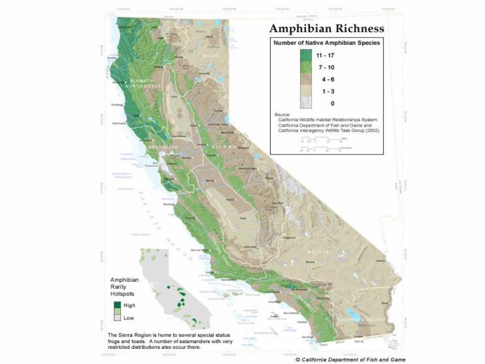
• California Wildlife Habitat Relationships System
• Vegetation Classification and Mapping Program
• Atlas of the Biodiversity of California

B I O S Biogeographic Information and
Observation System
Utilizes GIS, relational database management, and Internet map server technology to manage biological observations.
Provides secure password protected, layer specific read and download protection.
Increases transparency by liberating data from DFG and our partners.
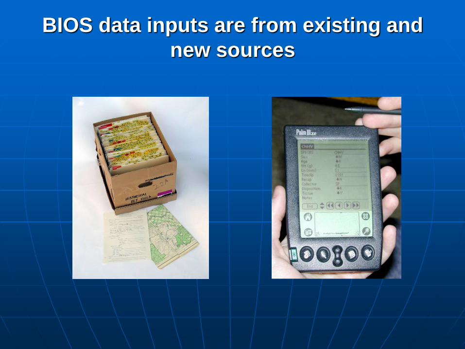
BIOS data inputs are from existing and
new sources
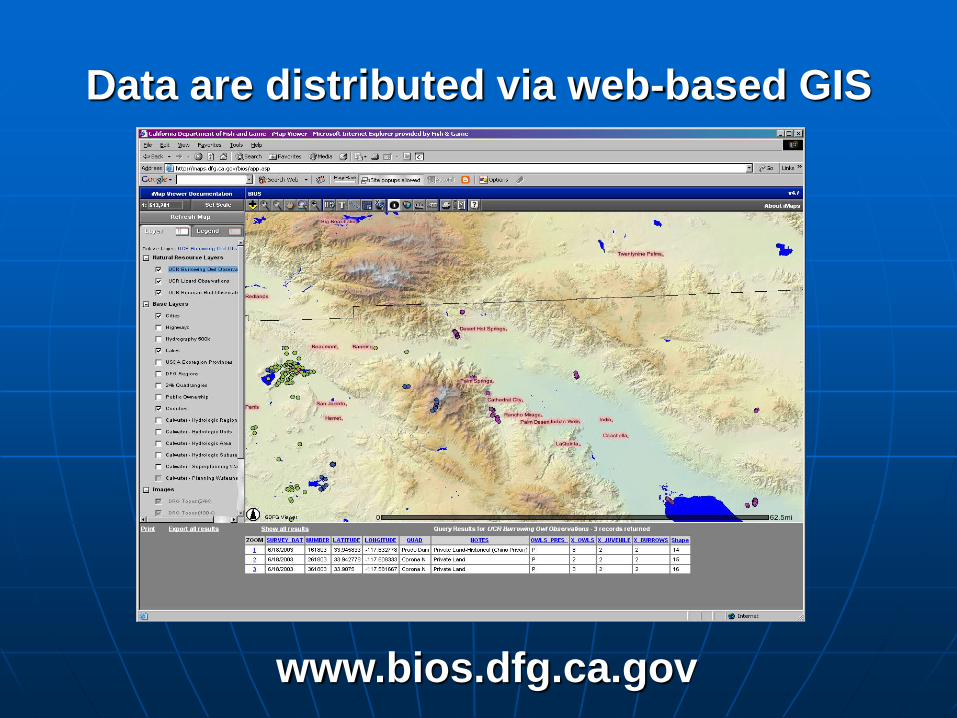
Data are distributed via web-based GIS
www.bios.dfg.ca.gov
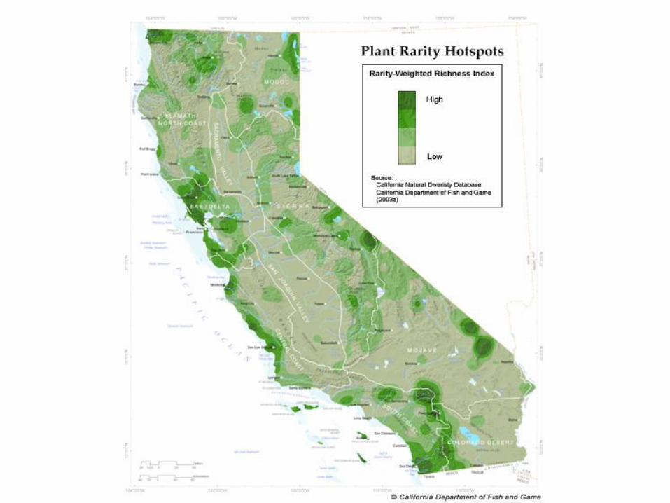
The California Natural
Diversity Database

What is the CNDDB?
It is a continually updated computerized inventory of location and status information on the rarest plants, animals, and natural communities in California.

What do we track in the CNDDB?
State and/or Federally listed species
State and/or Federal candidates for listing.
California Species of Special Concern – (Animals only)

Least Bell’s vireo occ 89 Las Flores Creek, (Las Pulgas Canyon). From just north of Basilone Rd extending SW to Just west of I-5, Camp Pendleton MCB 7 source documents from 1985 to 1999


The Need for
Statewide Vegetation
Mapping
California Department of Fish and Game
Vegetation Mapping and Classification Program

Vegetation is four of the top needs
identified by GIS users in CA 1. Street Addressing 2. Utilities 3. Public Land Conveyance Records 4. Buildings and Facilities 5. Flood Hazards 6. Vegetation 7. Biological Resources 8. Cultural and Demographic
Statistics 9. Soils 10. Wetlands 11. Earth Cover
Why vegetation was identified as
one of the top needs:
Allows informed conservation planning and resource management through: – improved regional conservation planning, – wildland fire/fuels modeling for improved preparedness, – identifying potential rare and endangered species
locations, – predicting the spread of invasive species, – early scoping for transportation projects to avoid rather
than mitigate impacts, – prioritizing land acquisitions for parks and ecological
reserves, – identifying important wildlife corridors, – setting a baseline for monitoring impacts of global climate
change.

Vegetation defined on the ground should be,
as much as possible, defined in the map

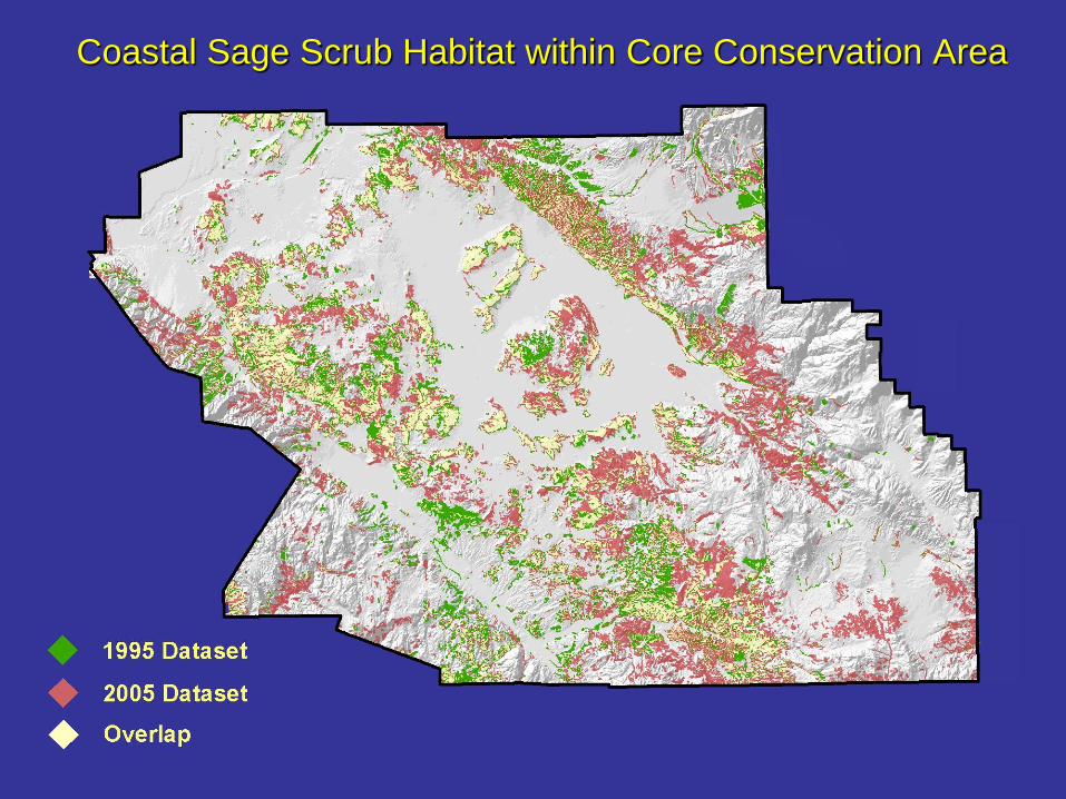
Coastal Sage Scrub Habitat within Core Conservation Area

Salt Marsh Harvest Mouse Habitat

Completed Large-
scale Mapping
Projects