
Thurston Canyon Ranch - kinglandwater.com · Thurston Canyon Ranch is located on the northside of...
10
Thurston Canyon Ranch 6035 +/- acres, Terrell County, Texas
Transcript of Thurston Canyon Ranch - kinglandwater.com · Thurston Canyon Ranch is located on the northside of...
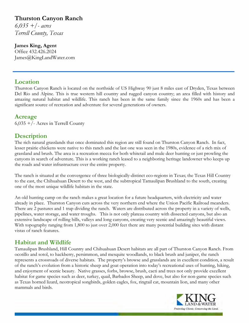
Thurston Canyon Ranch 6,035 +/- acres Terrell County, Texas James King, Agent Office 432.426.2024 [email protected]
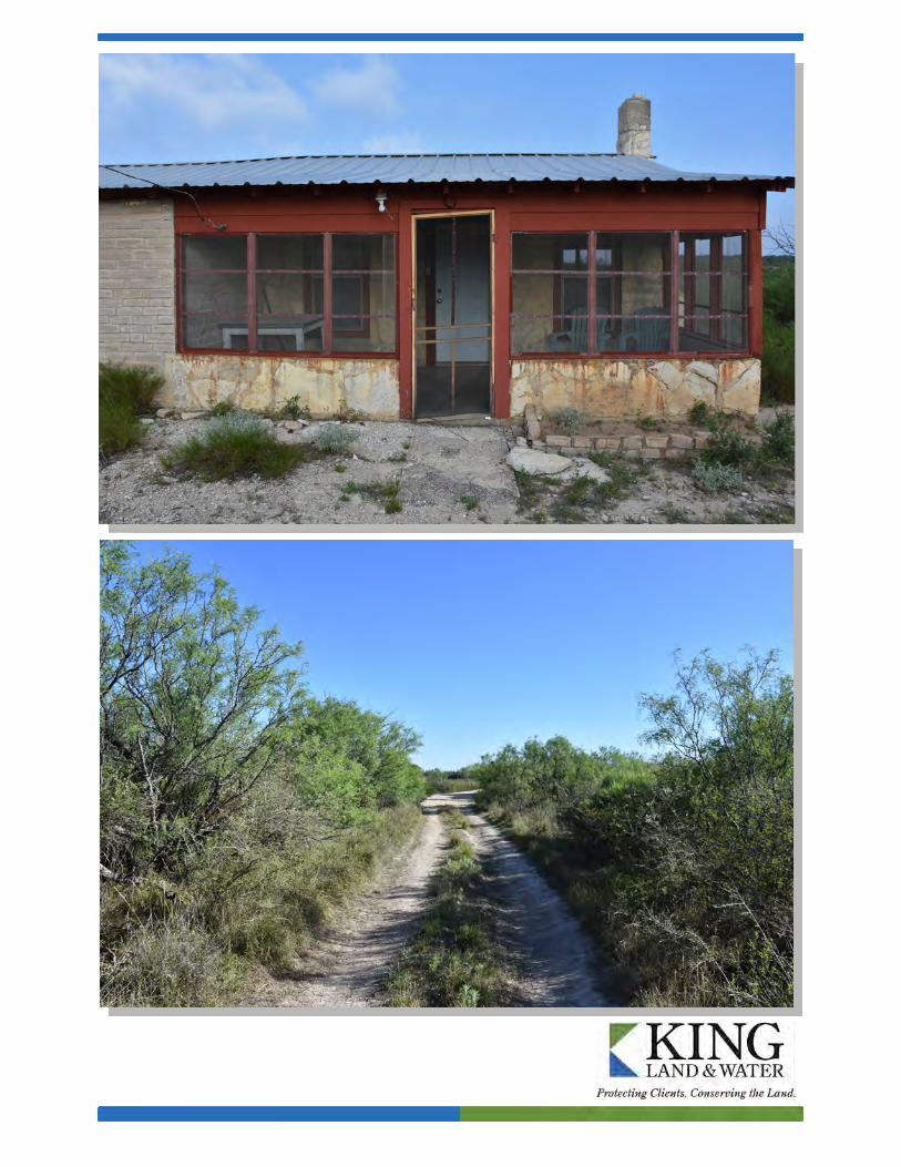
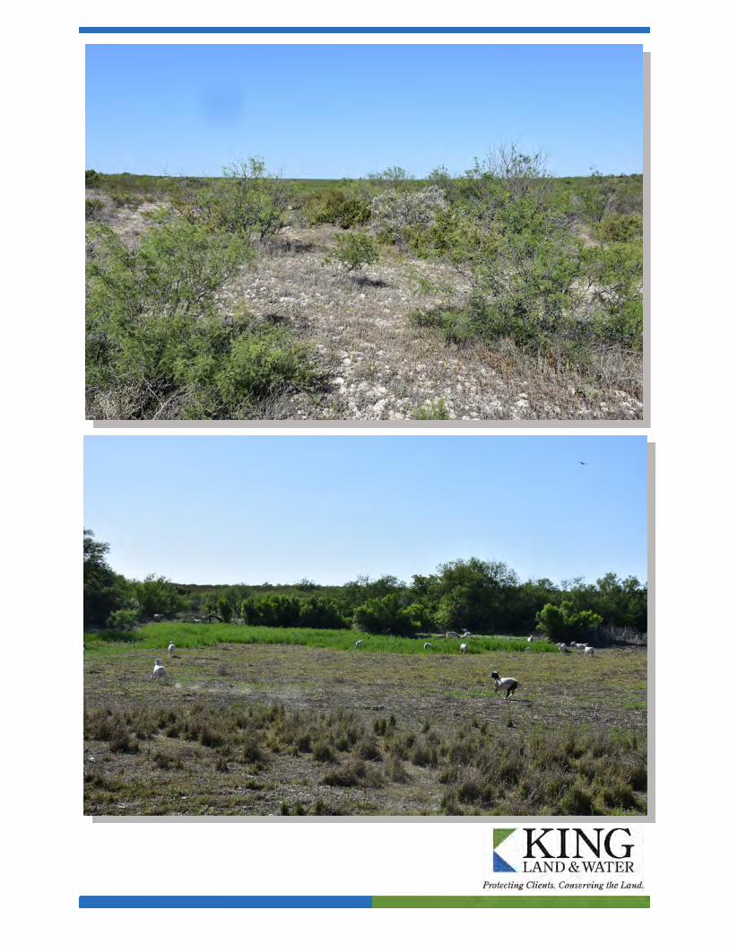
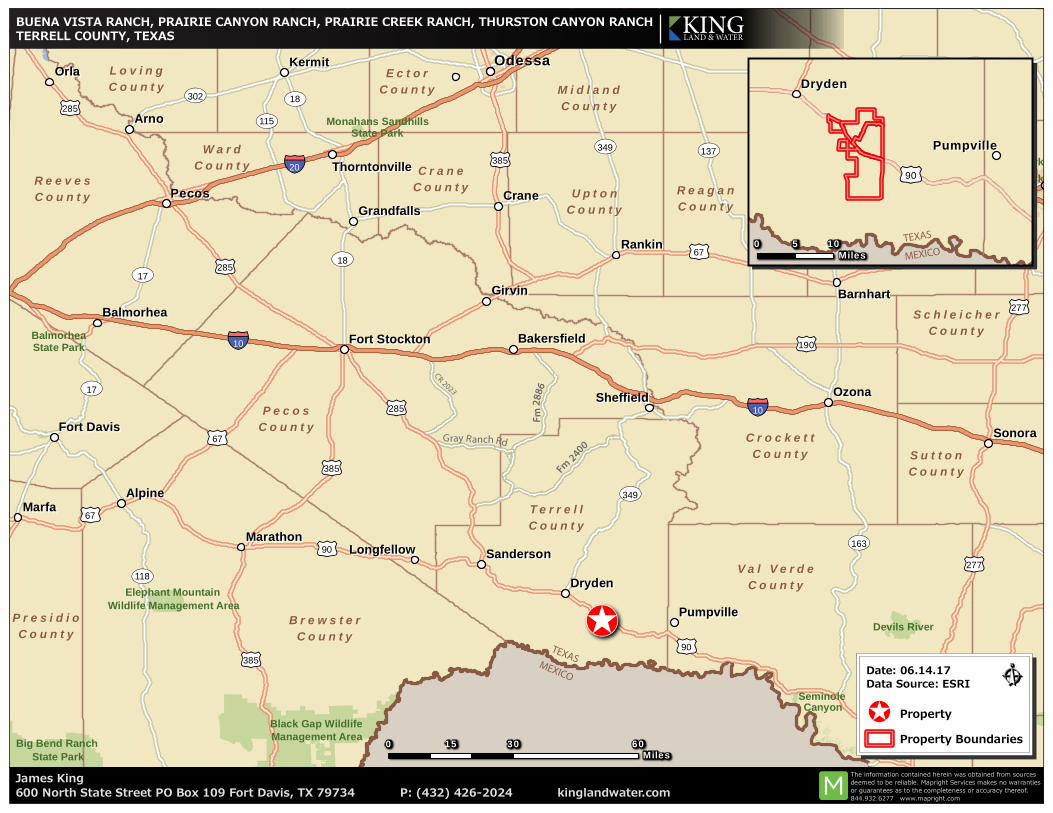
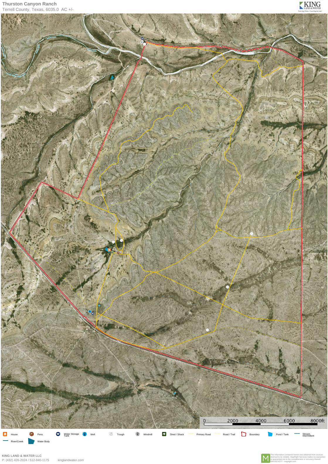
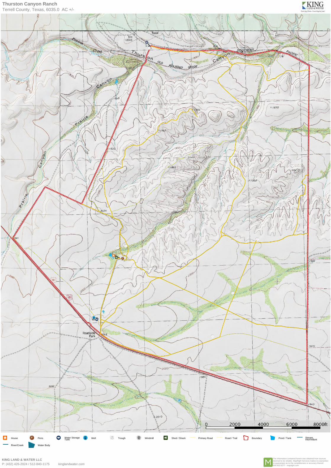
Location Thurston Canyon Ranch is located on the northside of US Highway 90 just 8 miles east of Dryden, Texas between Del Rio and Alpine. This is true western hill country and rugged canyon country; an area filled with history and amazing natural habitat and wildlife. This ranch has been in the same family since the 1960s and has been a significant source of recreation and adventure for several generations of owners. Acreage 6,035 +/- Acres in Terrell County Description The rich natural grasslands that once dominated this region are still found on Thurston Canyon Ranch. In fact, lesser prairie chickens were native to this ranch and the last one was seen in the 1980s, evidence of a rich mix of grassland and brush. The area is a recreation mecca for both whitetail and mule deer hunting or just prowling the canyons in search of adventure. This is a working ranch leased to a neighboring heritage landowner who keeps up the roads and water infrastructure over the entire property. The ranch is situated at the convergence of three biologically-distinct eco-regions in Texas; the Texas Hill Country to the east, the Chihuahuan Desert to the west, and the subtropical Tamaulipan Brushland to the south, creating one of the most unique wildlife habitats in the state. An old hunting camp on the ranch makes a great location for a future headquarters, with electricity and water already in place. Thurston Canyon cuts across the very northern end where the Union Pacific Railroad meanders. There are 2 pastures and 1 trap dividing the ranch. Waters are distributed across the property in a variety of wells, pipelines, water storage, and water troughs. This is not only plateau country with dissected canyons, but also an extensive landscape of rolling hills, valleys and long canyons, creating very scenic and amazingly beautiful views. With topography ranging from 1,800 to just over 2,000 feet there are many potential building sites with distant vistas of ranch features. Habitat and Wildlife
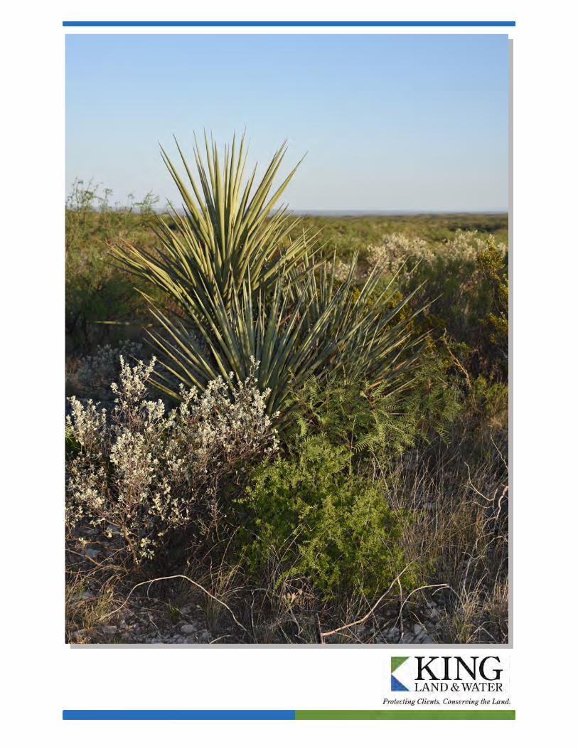
Tamaulipan Brushland, Hill Country and Chihuahuan Desert habitats are all part of Thurston Canyon Ranch. From ocotillo and sotol, to hackberry, persimmon, and mesquite woodlands, to black brush and juniper, the ranch represents a crossroads of diverse habitats. The property’s browse and grasslands are in excellent condition, a result of the ranch’s evolution from a historic sheep and goat operation into today’s recreational uses of hunting, hiking, and enjoyment of scenic beauty. Native grasses, forbs, browse, brush, cacti and trees not only provide excellent habitat for game species such as deer, turkey, quail, Barbados Sheep, and dove, but also for non-game species such as Texas horned lizard, neotropical songbirds, golden eagles, fox, ringtail cat, mountain lion, and many other mammals and birds.
Excellent Blue Quail hunting exist on the ranch, along with tremendous hunting potential for mule deer and
whitetail deer. Recent use and management has been focused on improving and growing both mule deer and whitetail deer populations.
Water The groundwater under Thurston Canyon Ranch is high quality and is accessed by one large electric well near the highway and a windmill on the adjoining property to the northwest. With the extensive water tanks and water pipeline and trough system, water is available across the ranch. Price $385/acre or $2,323,475 Owner financing available! Contact James King, Agent King Land & Water, LLC 432 426.2024 Office 432 386.2821 Cell [email protected] Disclaimer This ranch offering is subject to prior sale, change in price, or removal from the market without notice. While the information above was provided by sources deemed reliable, it is in no way guaranteed by the broker or agent.
!\
OrlaOrla
ArnoArno
OzonaOzona
MarfaMarfa
CraneCrane
RankinRankin
KermitKermit
GirvinGirvin
DrydenDryden
AlpineAlpine
MarathonMarathon
BarnhartBarnhart
SheffieldSheffield
SandersonSanderson
PumpvillePumpville
BalmorheaBalmorhea
LongfellowLongfellow
GrandfallsGrandfalls
Fort DavisFort Davis
BakersfieldBakersfield
ThorntonvilleThorntonville
Fort StocktonFort Stockton
Big Bend Ranch State Park
Black Gap Wildlife Management Area
Devils River
Elephant Mountain Wildlife Management Area
State Trust Land
San Angelo State Park
Monahans Sandhills State Park
State Trust Land
San Angelo State Park
State Trust LandState Trust Land
Balmorhea State Park
Seminole Canyon
SonoraSonora
OdessaOdessa
MidlandMidland
PecosPecos
§̈¦10
§̈¦20
§̈¦10
£¤67
£¤90
£¤277
£¤385
£¤190
£¤285
£¤377
£¤285
£¤277
£¤90
£¤67
£¤385
£¤385
£¤285
£¤67
ST163
ST137
ST118
ST349
ST18
ST17
ST115
ST17
ST18
ST349
ST302
P e c o sP e c o sC o u n t yC o u n t y
B r e w s t e rB r e w s t e rC o u n t yC o u n t y
R e e v e sR e e v e sC o u n t yC o u n t y
T e r r e l lT e r r e l lC o u n t yC o u n t y
C r o c k e t tC r o c k e t tC o u n t yC o u n t y
V a l V e r d eV a l V e r d eC o u n t yC o u n t y
U p t o nU p t o nC o u n t yC o u n t y
R e a g a nR e a g a nC o u n t yC o u n t y
E c t o rE c t o rC o u n t yC o u n t y
S u t t o nS u t t o nC o u n t yC o u n t y
P r e s i d i oP r e s i d i oC o u n t yC o u n t y
W a r dW a r dC o u n t yC o u n t y
M i d l a n dM i d l a n dC o u n t yC o u n t y
C r a n eC r a n eC o u n t yC o u n t y
L o v i n gL o v i n gC o u n t yC o u n t y
S c h l e i c h e rS c h l e i c h e rC o u n t yC o u n t y
0 30 6015Miles
James King600 North State Street PO Box 109 Fort Davis, TX 79734 P: (432) 426-2024 kinglandwater.com
The information contained herein was obtained from sourcesdeemed to be reliable. Mapright Services makes no warrantiesor guarantees as to the completeness or accuracy thereof.844.932.6277 www.mapright.com
DrydenDryden
PumpvillePumpville
£¤90
0 105Miles
Ê!\ Property
Property Boundaries
Date: 06.14.17Data Source: ESRI
BUENA VISTA RANCH, PRAIRIE CANYON RANCH, PRAIRIE CREEK RANCH, THURSTON CANYON RANCHTERRELL COUNTY, TEXAS KING
LAND & WATER
MEXICOTEXAS
MEXICO
TEXAS
Gray Ranch Rd
F m
288
6
F
m 240
0
CR 2023
Thurston Canyon RanchTerrell County, Texas, 6035.0 AC +/-
House Pens Water StorageTank
Well Trough Windmill Shed / Shack Primary Road Road / Trail Boundary Pond / Tank Stream,Intermittent
River/Creek Water Body
KING LAND & WATER LLCP: (432) 426-2024 / 512-840-1175 kinglandwater.com
The information contained herein was obtained from sourcesdeemed to be reliable. MapRight Services makes no warrantiesor guarantees as to the completeness or accuracy thereof.844.932.6277 - mapright.com