
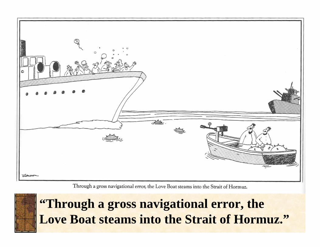
“Through a gross navigational error, the Love Boat … · “Through a gross navigational error,...
54
“Through a gross navigational error, the Love Boat steams into the Strait of Hormuz.”
Transcript of “Through a gross navigational error, the Love Boat … · “Through a gross navigational error,...
“Through a gross navigational error, the Love Boat steams into the Strait of Hormuz.”
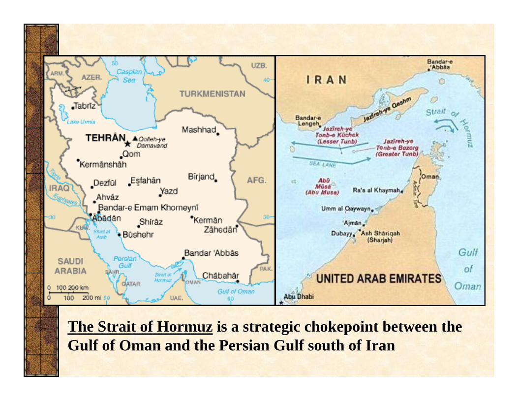
The Strait of Hormuz is a strategic chokepoint between the Gulf of Oman and the Persian Gulf south of Iran
Geography 12: Maps and Mapping
Lecture 9: Navigation III: Marine Navigation and Electronic Aids to Navigation

Extra credit availableucsb-geog.sona-systems.comLog on, create a user ID
This helps make sure you get credit for what you’re doing
Study: Invisible objectsOpenings 9-5, Friday through SundayTakes about 45 minutes.
Alternative: 5 Article Summary

Lecture OutlineFinish Dead Reckoning and GPSNautical Charts
TraditionalAeronautical ChartsElectronic Nautical ChartsIntro to Raster & Vector
Assisted NavigationWayfindingLocation Based ServicesPersonal Guidance SystemsAdvantages & Disadvantages

Getting to a Destination: Dead Reckoning
Dead Reckoning is keeping track of position while moving by knowing direction and distance traveled (or speed & time)Requires
Sure knowledge of starting positionCareful record of movement, time, direction
Accurate over short distances & easy to learnBut errors accumulate, so not good over long distances

Dead Reckoning Plot

Getting to a Destination:Terrain Association
Divide trip into segments called legs
Ease of recognitionEase of travel
Move from one recognizable feature to anotherCan Combine with Dead Reckoning

LORANLong-Range Navigation (LORAN)Uses pairs of radio stationsTransmit simultaneous pulsesDifferences in receipt time allow plotting of positionNot useful for measuring very short distances

Global Positioning Systems (GPS)
GPS is a satellite-based navigation system
24 Satellites form the GPS Constellation (~31 now operational)Operated by the Department of Defense
• Costs about $400 million per year• Free to use, just buy a receiver
Works in all types of weather, but doesn’t work well indoorsFirst launch 1972, Declared Operational in 1994

Other Global Positioning Systems
“GPS” is in common usage to describe the U.S. SystemFull U.S. Name is “NAVSTAR GPS”
NAVigational Time And RangingOther systems
GLONASS – RussiaGalileo – EUCOMPASS – ChinaIRNSS - India

Three Elements of GPS(1) Space
24 (~31 currently operating) orbiting satellites, plus more “parked” in spaceSatellites 20,200 km above ground (way out there)5-10 satellites visible from any pointAtomic clocks on boardTransmit precise time (later used to calculate distance between observer and satellite)

Three Elements of GPS(2) Control
Ground stations observe orbits, transmit corrections, synchronizing clocksMaster control station located at Schriever AFB in Colorado
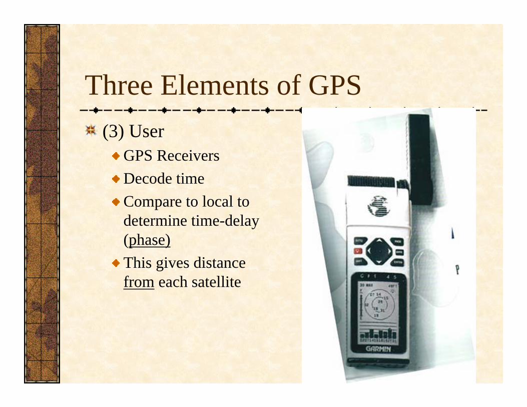
Three Elements of GPS(3) User
GPS ReceiversDecode time Compare to local to determine time-delay (phase)This gives distance from each satellite

Using TimeJust like Harrison’s Chronometer for determination of longitude, GPS uses time to calculate directionDelay x Speed of Light = DistanceSince Distance is used, the method is trilateration

Two satellites provide a planeThree satellites narrow it down to two pointsFour points give latitude, longitude, and elevationIf you know elevation, you can get by on three
Four Satellites Needed
Accuracy in GPSDepends on quality of signal, # of satellitesLikely error is calculated and presented
Area instead of pointGenerally better than 10 metersOn campus, 2-5m accuracy is common

Error in GPSThere are many reasons why more than four satellites are preferable
Remember triangle of error?Imprecise local clocks (no atomic clock in your $100 receiver)Slowing of signal in the ionosphereReflected (multipath) signals

Selective AvailabilitySelective Availability – Intentional error introduced in signal to degrade civilian signal for public safety
SA turned off in 2000Degraded accuracy to about 100m
Improving GPS AccuracyDifferential GPS
Was most effective during SAUsed ground stations at known locations that transmitted correctionsMore expensive, but improved accuracy from 100m to 10m (during SA)Dependant on nearby local differential transmissions
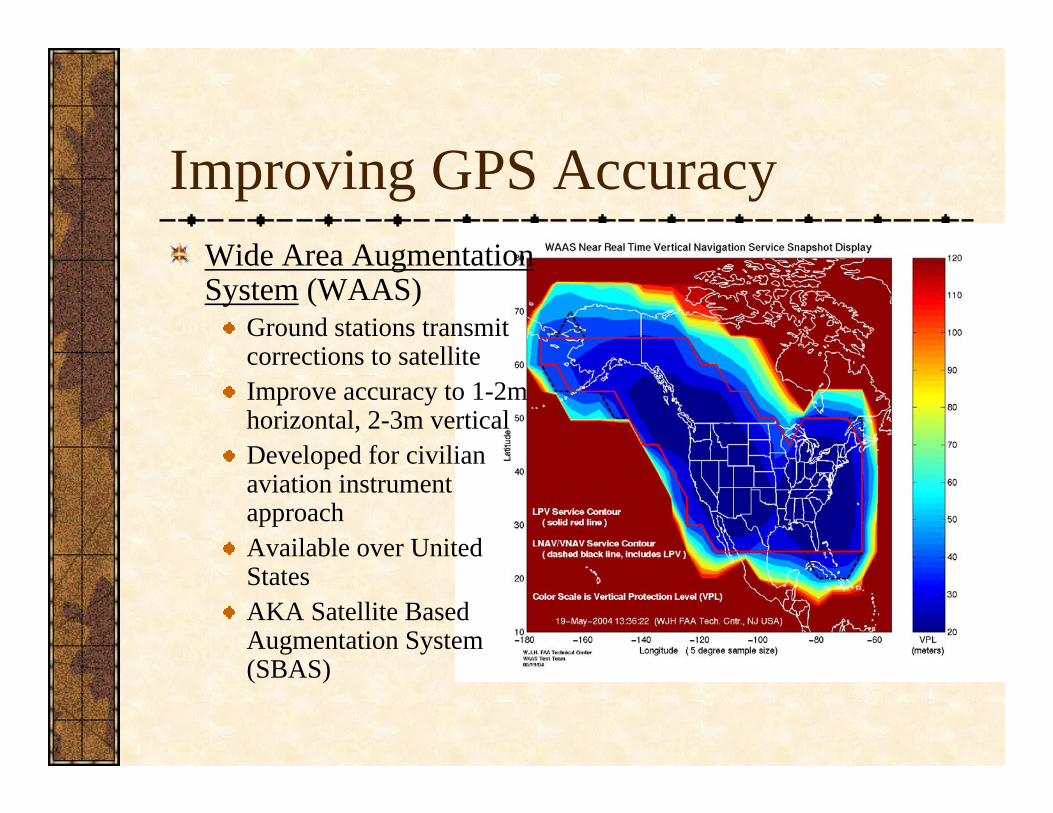
Improving GPS AccuracyWide Area Augmentation System (WAAS)
Ground stations transmit corrections to satelliteImprove accuracy to 1-2m horizontal, 2-3m verticalDeveloped for civilian aviation instrument approachAvailable over United StatesAKA Satellite Based Augmentation System (SBAS)

Visualizing GPS accuracy“Random Walks”

GPS comparison
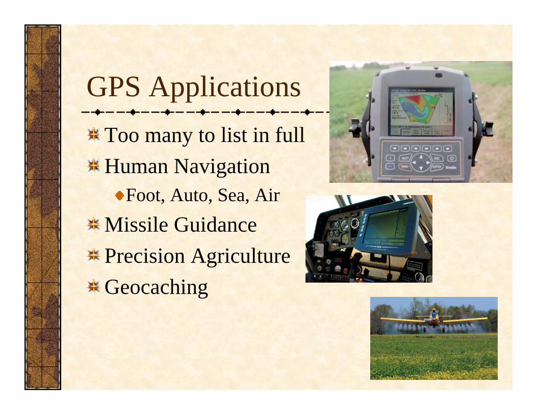
GPS ApplicationsToo many to list in fullHuman Navigation
Foot, Auto, Sea, AirMissile GuidancePrecision AgricultureGeocaching

Personal GPS UnitsMany different manufacturers (Garmin, Trimble, Magellan) quite commonCost >$100Applications for auto, boats, personal navigationInclude a small screen for map display
Many, many base maps availableInteract with computer with cable
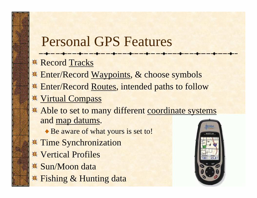
Personal GPS FeaturesRecord TracksEnter/Record Waypoints, & choose symbolsEnter/Record Routes, intended paths to followVirtual CompassAble to set to many different coordinate systemsand map datums.
Be aware of what yours is set to!Time SynchronizationVertical ProfilesSun/Moon dataFishing & Hunting data
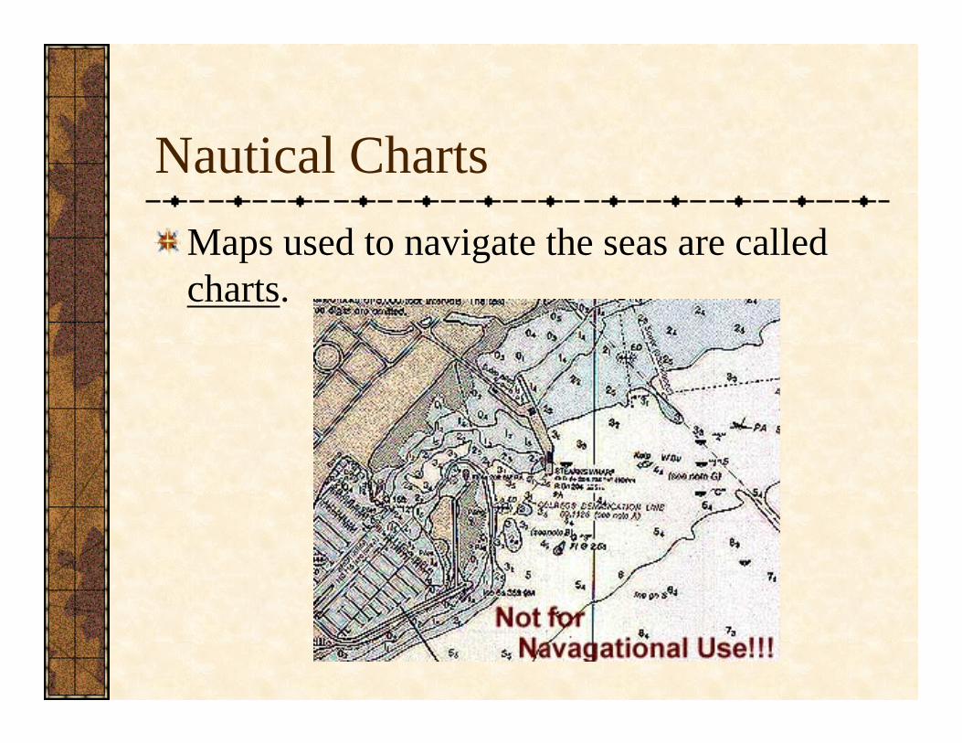
Nautical ChartsMaps used to navigate the seas are called charts.
Nautical ChartsUnlike the land, sea charts must be updated very frequently, as depths, shorelines, objects change.Almost always use Mercator Projectionbecause they allow for easier navigation by compass (Rhumb Lines or loxodromes)Most complete set of nautical charts in the world are the British Admiralty Charts.

Santa Barbara Harbor Area

SB Harbor Area
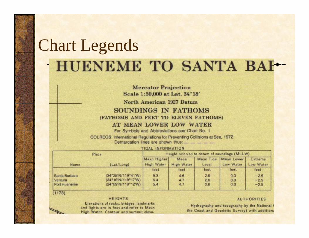
Chart Legends
Differences Between Charts and Maps
Usually nautical units instead of statute or metric1 Nautical Mile = 6076.12 feet = 1.151 miles = 1’ of latitudeDepths are usually in fathoms = 6 feet
Blue is only used for shallow waterDatum is usually mean lower low tideSoundings are point depths (spot heights), sometimes connected with isobaths, or lines of equal depthUnique symbology
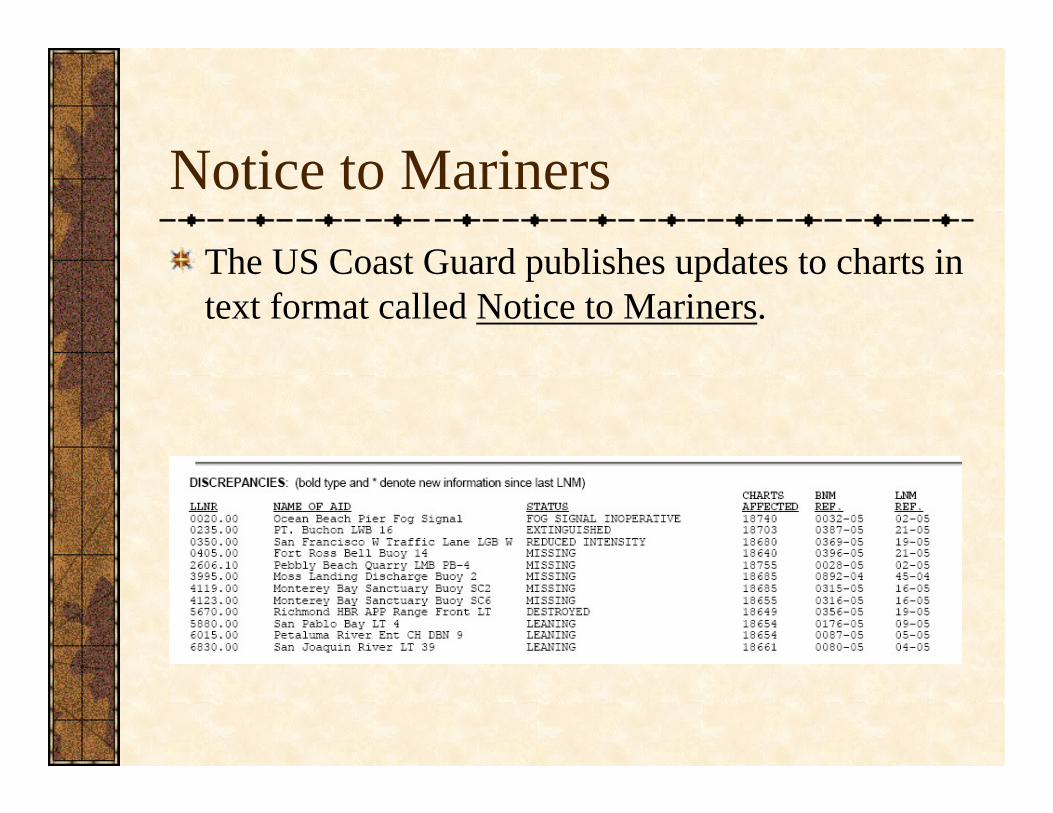
Notice to MarinersThe US Coast Guard publishes updates to charts in text format called Notice to Mariners.
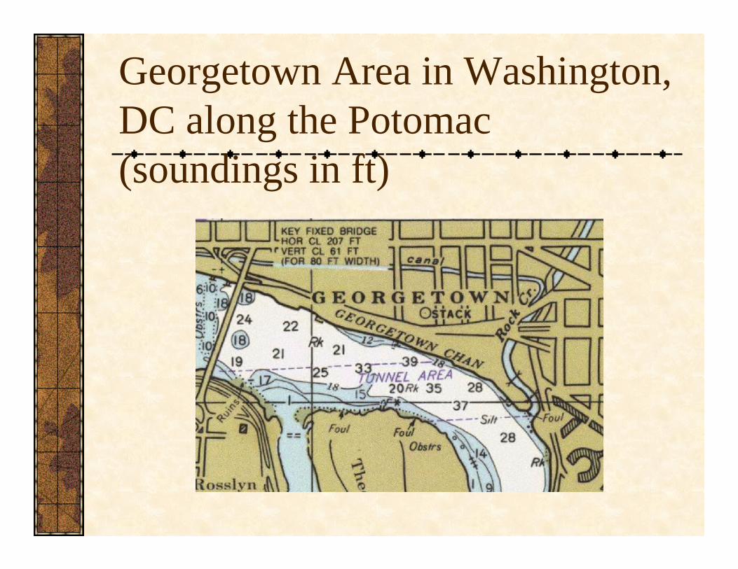
Georgetown Area in Washington, DC along the Potomac (soundings in ft)
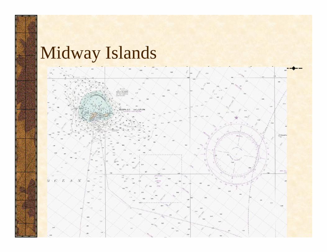
Midway Islands
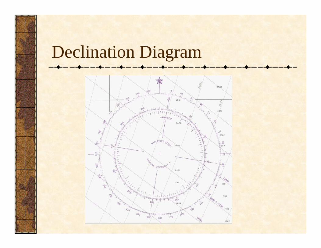
Declination Diagram

Chart SymbologyPublished in Chart No. 1
Extensive symbol developmentEase of translation variesNote use of hue, texture, shape
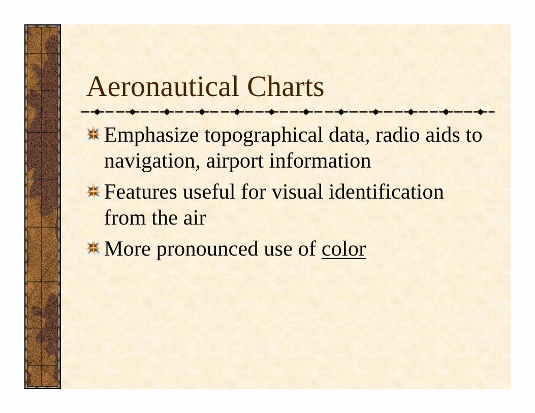
Aeronautical ChartsEmphasize topographical data, radio aids to navigation, airport informationFeatures useful for visual identification from the airMore pronounced use of color
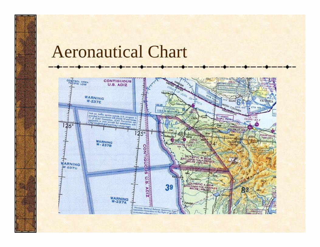
Aeronautical Chart
Electronic Nautical Charts (ENCs)
More vessels are switching to electronic charts as primary means of navigationStrengths
Easily updatedCheap to distribute (free to download!)Easy to change unitsAutomatic position and track plotting (with GPS)
WeaknessesScreen size limitationsCluttered symbols
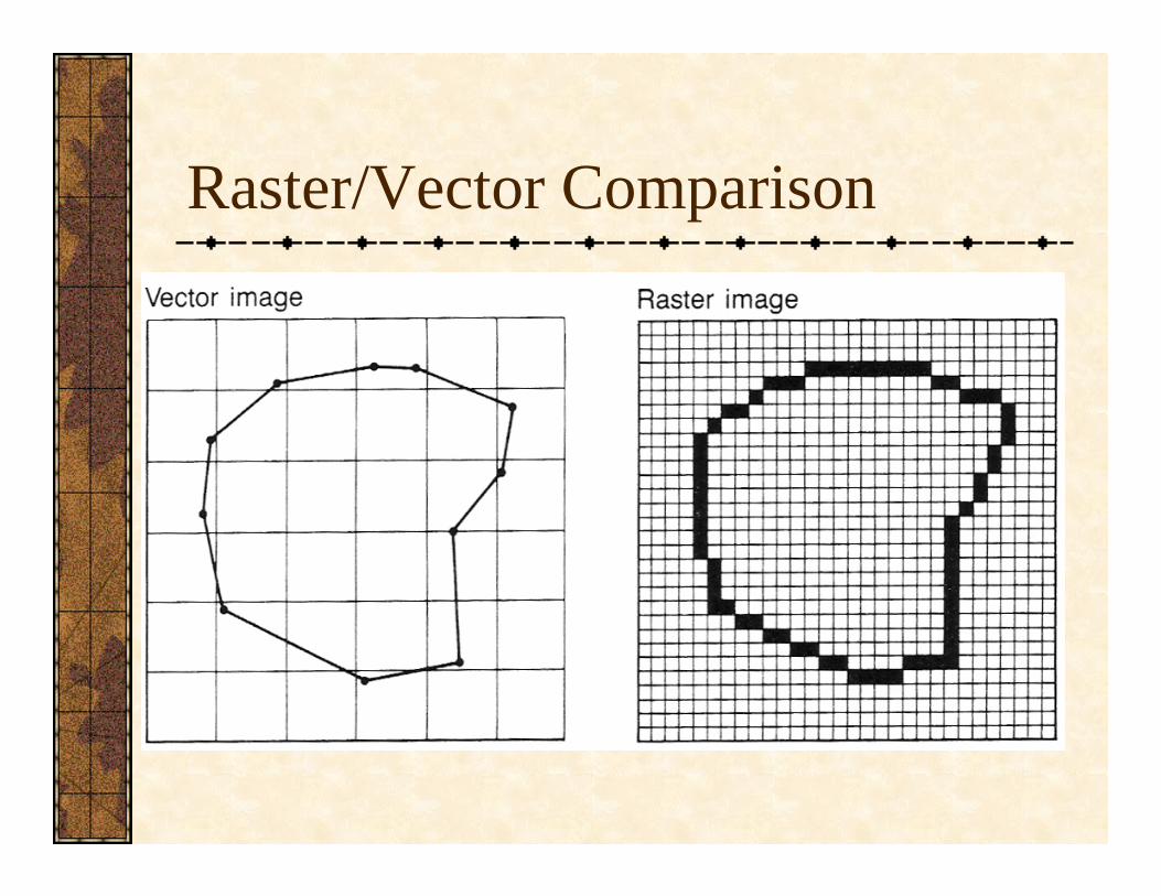
Raster/Vector Comparison
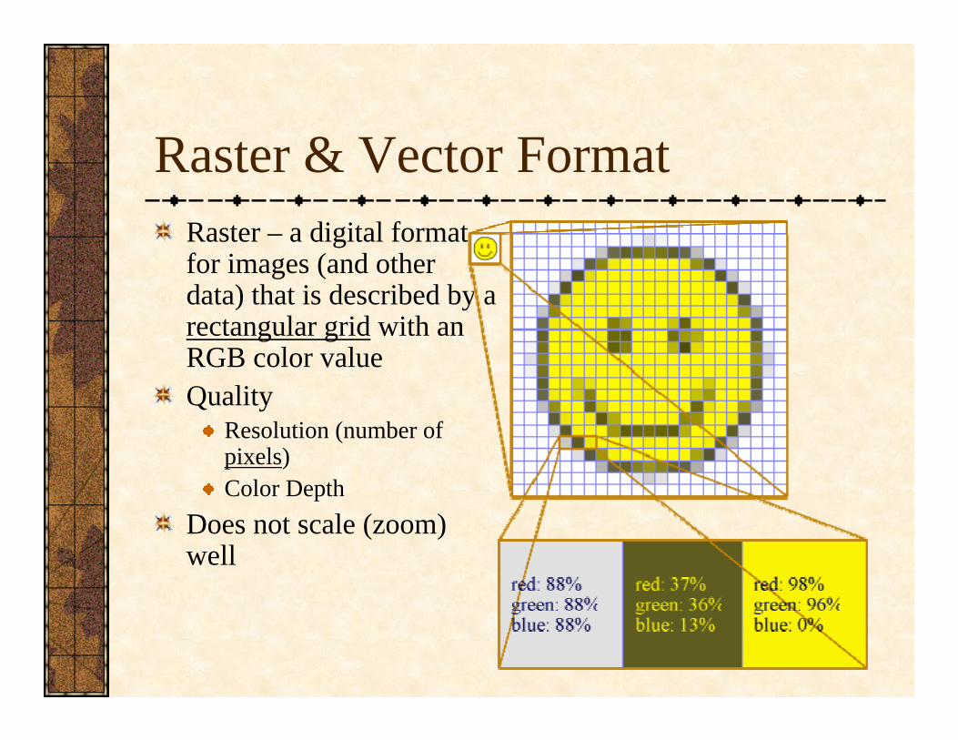
Raster & Vector FormatRaster – a digital format for images (and other data) that is described by a rectangular grid with an RGB color valueQuality
Resolution (number of pixels)Color Depth
Does not scale (zoom) well
Raster & Vector FormatVector – Uses geometric structures (points, lines, curves, polygons) to define an imageAllows for unlimited zooming/scaling (but doesn’t necessarily retain accuracy!)Rendered to raster image as a final stepYour GPS display is in vector format

Raster/Vector Comparison
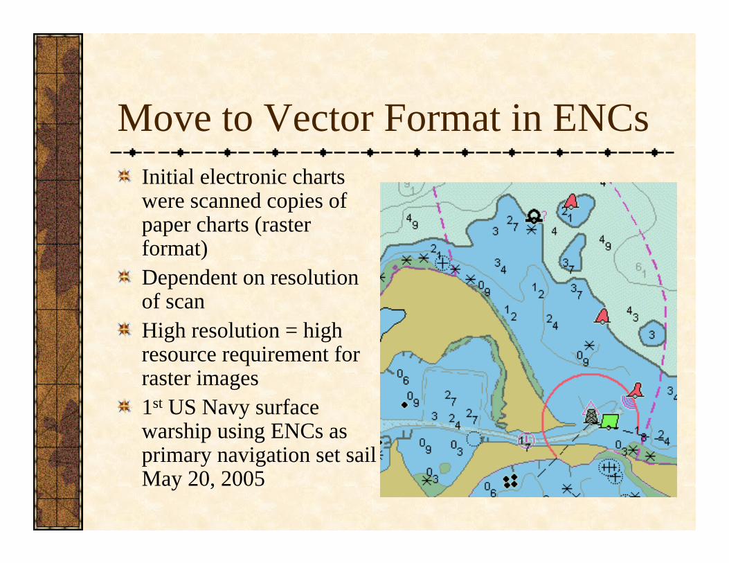
Move to Vector Format in ENCsInitial electronic charts were scanned copies of paper charts (raster format)Dependent on resolution of scanHigh resolution = high resource requirement for raster images1st US Navy surface warship using ENCs as primary navigation set sail May 20, 2005

Assisted NavigationDigital / Electronic Maps combined with GPSopen new frontiers in map useWayfinding
Choosing a path in the built environmentCan involve signage, non-traditional maps, graphic communicationWayfinding is a key element in development of spatial knowledge
Route Knowledge – Paths, nodes, landmarksSurvey Knowledge – More complete knowledge of an area
Assisted NavigationTwo broad types of navigation assistants to create dynamic mapsPersonal Guidance Systems
Designed to be used by individualsMay be handheld, wearableMay be visual-based or notControlled by keys, voice, gestures
Vehicular Navigation SystemsAircraft, Boats, AutomobilesSpecial issues of Situational Awareness & other important Attentional Demands

Location-based ServicesGPS enabled phones, PDAsFind locations
Your positionNearby restaurants, etc.
Get directionsLimitations with screen-sizeHead-Down Display

Wearable ComputersFull-power PC attached to the bodyHeads Up Display – A mounted eyepiece that lets you see geographic information while you move aroundMulti-modal interaction –many methods of interaction are possible
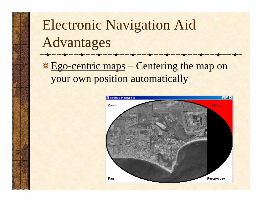
Electronic Navigation Aid Advantages
Ego-centric maps – Centering the map on your own position automatically
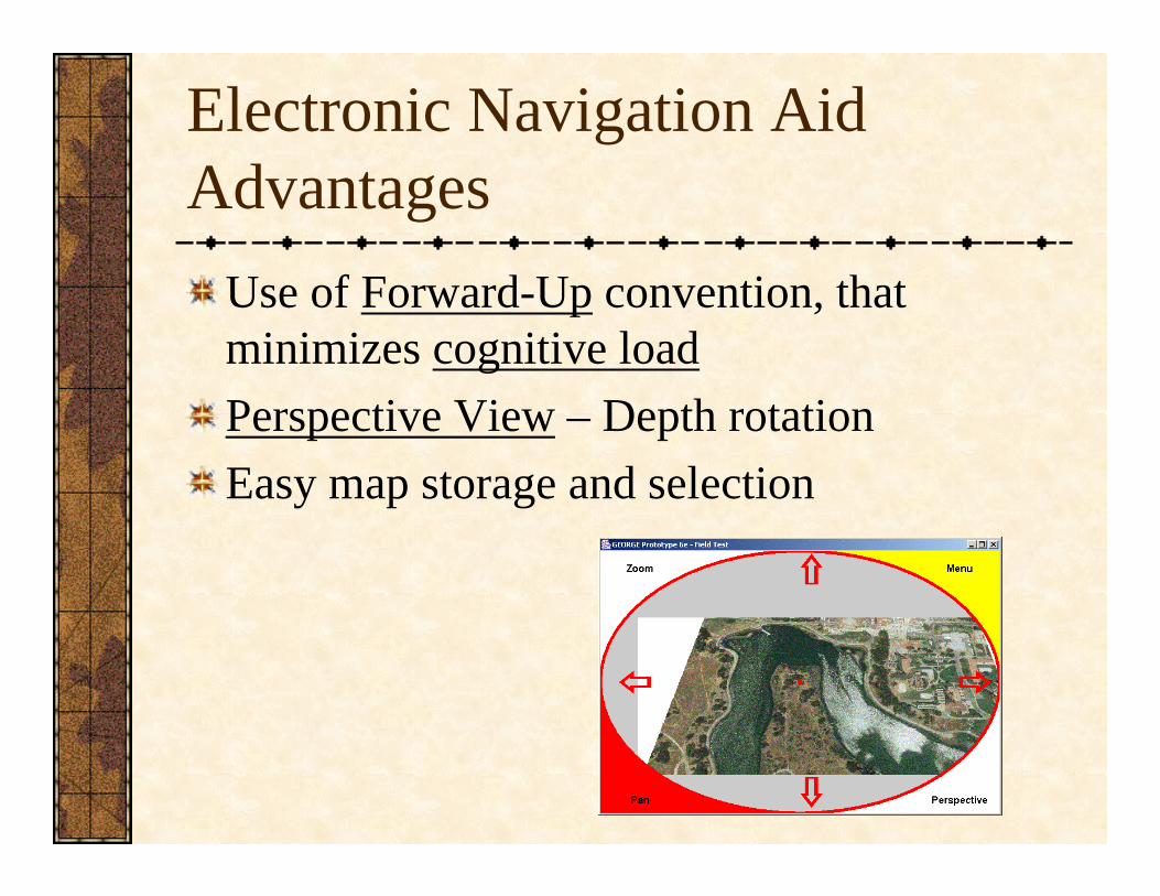
Electronic Navigation Aid Advantages
Use of Forward-Up convention, that minimizes cognitive loadPerspective View – Depth rotationEasy map storage and selection
Electronic Navigation Aid Advantages
Multi-modal interactionVoice, Keyboards, Mice, Eye-tracking, Gesture Recognition
Standard GPS-type capabilitiesWaypoint, track, route recordingAbility to match datums, change coordinate systems
Electronic Navigation Aid Problems
Many interface issues to iron outScreen size is smallVoice recognition still needs workWindows Icons Menus Pointers (WIMP) Interface doesn’t translate well to mobile devices
May prevent development of environmental spatial knowledge
Think of your knowledge when you drive vs. when you’re a passenger
Some people are far too trustinghttp://tubearoo.com/articles/91916/The_Office_Michael_Trusts_the_GPS_Too_Much.html?autoplay=true
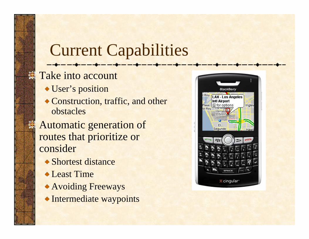
Current CapabilitiesTake into account
User’s positionConstruction, traffic, and other obstacles
Automatic generation of routes that prioritize or consider
Shortest distanceLeast TimeAvoiding FreewaysIntermediate waypoints