The Stables and Walled Gardens at Northcourt, … Stables and Walled Garden at North Court,...
102
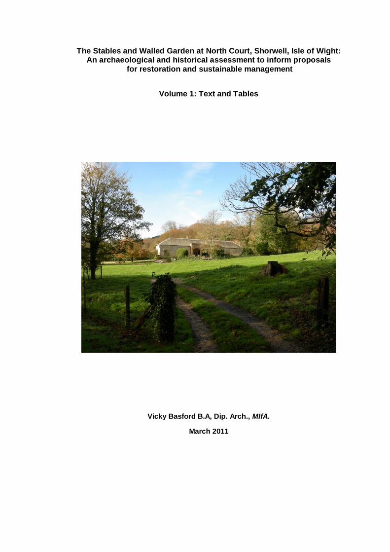
The Stables and Walled Garden at North Court, Shorwell, Isle of Wight: An archaeological and historical assessment to inform proposals for restoration and sustainable management Volume 1: Text and Tables Vicky Basford B.A, Dip. Arch., MIfA. March 2011
Transcript of The Stables and Walled Gardens at Northcourt, … Stables and Walled Garden at North Court,...
The Stables and Walled Garden at North Court, Shorwell, Isle of Wight: An archaeological and historical assessment to inform proposals
for restoration and sustainable management
Volume 1: Text and Tables
Vicky Basford B.A, Dip. Arch., MIfA.
March 2011
2
Volume 1 : List of Contents
1.
Executive Summary 7
2 Aims and Purpose of Assessment 10
3. Methods Statement 11
4. North Court: Location, Setting, Designations and Heritage Assets 13
5. The Stables and Walled Garden at North Court
5.1 Description
5.2 Condition Statement
16
16
6. Documentary and Cartographic Evidence for the Stables and Walled Garden
6.1 Historic Maps and Plans
6.2 Development of the Site from the 18th Century to the 20th Century
18
19
7. General Discussion of the Stable and Coach-House Block
25
8. Dating and Assessing the Site
8.1 The Stable and Coach House Block
8.2 The Service Area and Associated Buildings
8.3 The Walled Garden and its Buildings
8.3 The Walled Garden and its Buildings
31
34
35
9. Significance of Historic Assets
9.1Heritage Values
9.2 Assessing the Significance of the North Court Stables and Walled Garden
39
40
10 Conservation Principles for the Restoration and Re-use of the North Court Stables, Walled Garden and Service Area
45
11. Proposed North Court Garden Skills Centre and Visitor Centre: Aims, Objectives and Sustainability Appraisal
11.1 Aims
11.2 Objectives
11.3 Sustainability Appraisal
47
47
48
12. Works proposed by Client
12.1 Work to Stable Block
12.2 Work to Walled Garden
12.3 Work in Service Area
49
51
52
13. Recommendations of Archaeological Consultant
53
3
Volume 1 : List of Contents (Continued)
Appendix A: Survey of the Stable Block 56
Appendix B: Survey of the Walled Garden and Service Area 70
Appendix C: Historical Development of the North Court Estate 85
Appendix D: Documents Dealing with the Alterations of 1902-5 93
Appendix E :Relevant Planning Policies 96
References 100
Volume 1: Tables
No. Description
1. Heritage Assets within 500m of North Court Stables 15
2. Country House Stables and Coach Houses on the Isle of Wight
44
4
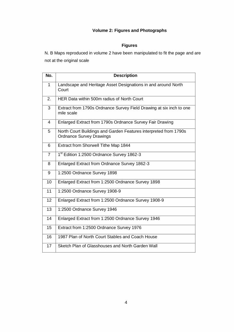
Volume 2: Figures and Photographs
Figures
N. B Maps reproduced in volume 2 have been manipulated to fit the page and are
not at the original scale
No. Description
1 Landscape and Heritage Asset Designations in and around North Court
2. HER Data within 500m radius of North Court
3 Extract from 1790s Ordnance Survey Field Drawing at six inch to one mile scale
4 Enlarged Extract from 1790s Ordnance Survey Fair Drawing
5 North Court Buildings and Garden Features interpreted from 1790s Ordnance Survey Drawings
6 Extract from Shorwell Tithe Map 1844
7 1st Edition 1:2500 Ordnance Survey 1862-3
8 Enlarged Extract from Ordnance Survey 1862-3
9 1:2500 Ordnance Survey 1898
10 Enlarged Extract from 1:2500 Ordnance Survey 1898
11 1:2500 Ordnance Survey 1908-9
12 Enlarged Extract from 1:2500 Ordnance Survey 1908-9
13 1:2500 Ordnance Survey 1946
14 Enlarged Extract from 1:2500 Ordnance Survey 1946
15 Extract from 1:2500 Ordnance Survey 1976
16 1987 Plan of North Court Stables and Coach House
17 Sketch Plan of Glasshouses and North Garden Wall

5
Photographs
No. Description
1 North Court Stables and Coach-House Block
2 Ferruginous Sandstone Arches at Front of Coach-House
3
North
North Stable Wing
4 South Stable Wing
5 Tack Room
6 Coachman’s Bedroom
7 Pump Room
8 Coach-House Pediment and Broken Finial
9 Stable roof and Wall Plate
10 Wedges between Roof and Wall Plate
11 Loft above North Stable
12 Loft above Coach-House
13 North Stable Wing: Adze-Cut Roof Timbers with Chamfer
14 Reused Roof Timbers in North Stable Roof
15 Carpenter’s Marks on Roof Timbers in North Stable Wing
16 South Stable Loft, showing Sawn and Reused Timbers in Roof
17 Catslide Roof in Western Extension
18 Late 19th Century Photograph showing Clock Tower and Western Extension
19 Gardener’s Cottage
20 Corbels and Beam Slots from Storage Building in Service Area
21 Walled Garden from Orchard, looking North
22 North End of Western Garden Wall
23 Site of Western Glasshouse
24 Site of Middle Glasshouse
25 Brick Arch at Front of Eastern Glasshouse
26 Detail of Brick Arch
27 Furnace outside North Garden Wall
28 Soil Accumulation within Boiler Room
29 Wall Flue in Boiler Room
30 Possible Wall Chimneys in North Garden Wall
31 Partly-Blocked Doorway in South Wall of Gardener’s Cottage
32 Wall between Coach-House Interior and Covered Entrance
33 Former Stable Clock on St Peter’s Church, Shorwell
34 Harness Pegs in Tack Room
35 ‘Air Flue’ inside Store
36 Blocked Doorway in End Wall of North Stable
37 Doorway and Loft Door in End Wall of South Stable Wing
38 Window from North Stable reused in Garden Building
39 Tie-Brace inside North Stable Loft
40 Stall 1: North Stable
41 Stall 2: North Stable
42 Loose Box: North Stable
43 Heel Posts with Legend ‘Musgraves Patent’
44 Front of Loose Box in North Stable
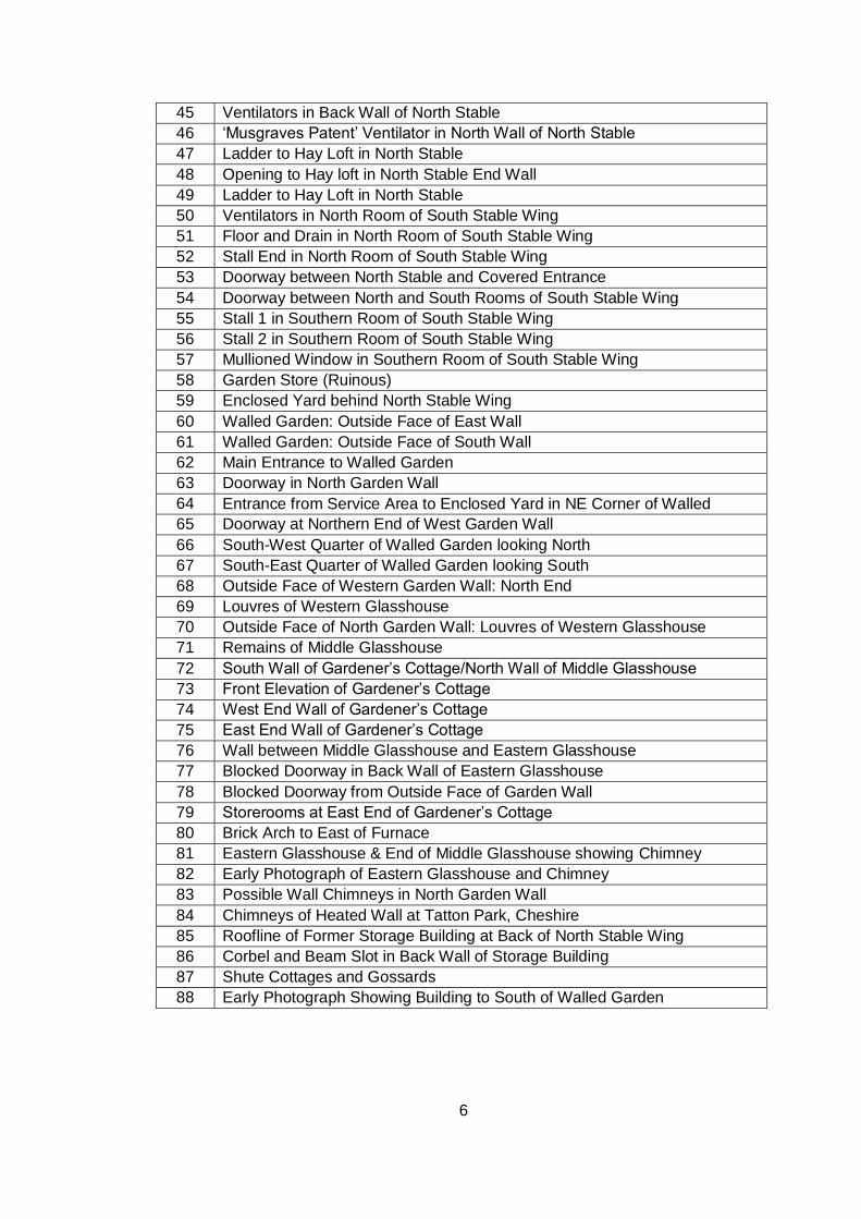
6
45 Ventilators in Back Wall of North Stable
46 ‘Musgraves Patent’ Ventilator in North Wall of North Stable
47 Ladder to Hay Loft in North Stable
48 Opening to Hay loft in North Stable End Wall
49 Ladder to Hay Loft in North Stable
50 Ventilators in North Room of South Stable Wing
51 Floor and Drain in North Room of South Stable Wing
52 Stall End in North Room of South Stable Wing
53 Doorway between North Stable and Covered Entrance
54 Doorway between North and South Rooms of South Stable Wing
55 Stall 1 in Southern Room of South Stable Wing
56 Stall 2 in Southern Room of South Stable Wing
57 Mullioned Window in Southern Room of South Stable Wing
58 Garden Store (Ruinous)
59 Enclosed Yard behind North Stable Wing
60 Walled Garden: Outside Face of East Wall
61 Walled Garden: Outside Face of South Wall
62 Main Entrance to Walled Garden
63 Doorway in North Garden Wall
64 Entrance from Service Area to Enclosed Yard in NE Corner of Walled
Garden 65 Doorway at Northern End of West Garden Wall
66 South-West Quarter of Walled Garden looking North
67 South-East Quarter of Walled Garden looking South
68 Outside Face of Western Garden Wall: North End
69 Louvres of Western Glasshouse
70 Outside Face of North Garden Wall: Louvres of Western Glasshouse
71 Remains of Middle Glasshouse
72 South Wall of Gardener’s Cottage/North Wall of Middle Glasshouse
73 Front Elevation of Gardener’s Cottage
74 West End Wall of Gardener’s Cottage
75 East End Wall of Gardener’s Cottage
76 Wall between Middle Glasshouse and Eastern Glasshouse
77 Blocked Doorway in Back Wall of Eastern Glasshouse
78 Blocked Doorway from Outside Face of Garden Wall
79 Storerooms at East End of Gardener’s Cottage
80 Brick Arch to East of Furnace
81 Eastern Glasshouse & End of Middle Glasshouse showing Chimney
82 Early Photograph of Eastern Glasshouse and Chimney
83 Possible Wall Chimneys in North Garden Wall
84 Chimneys of Heated Wall at Tatton Park, Cheshire
85 Roofline of Former Storage Building at Back of North Stable Wing
86 Corbel and Beam Slot in Back Wall of Storage Building
87 Shute Cottages and Gossards
88 Early Photograph Showing Building to South of Walled Garden
7
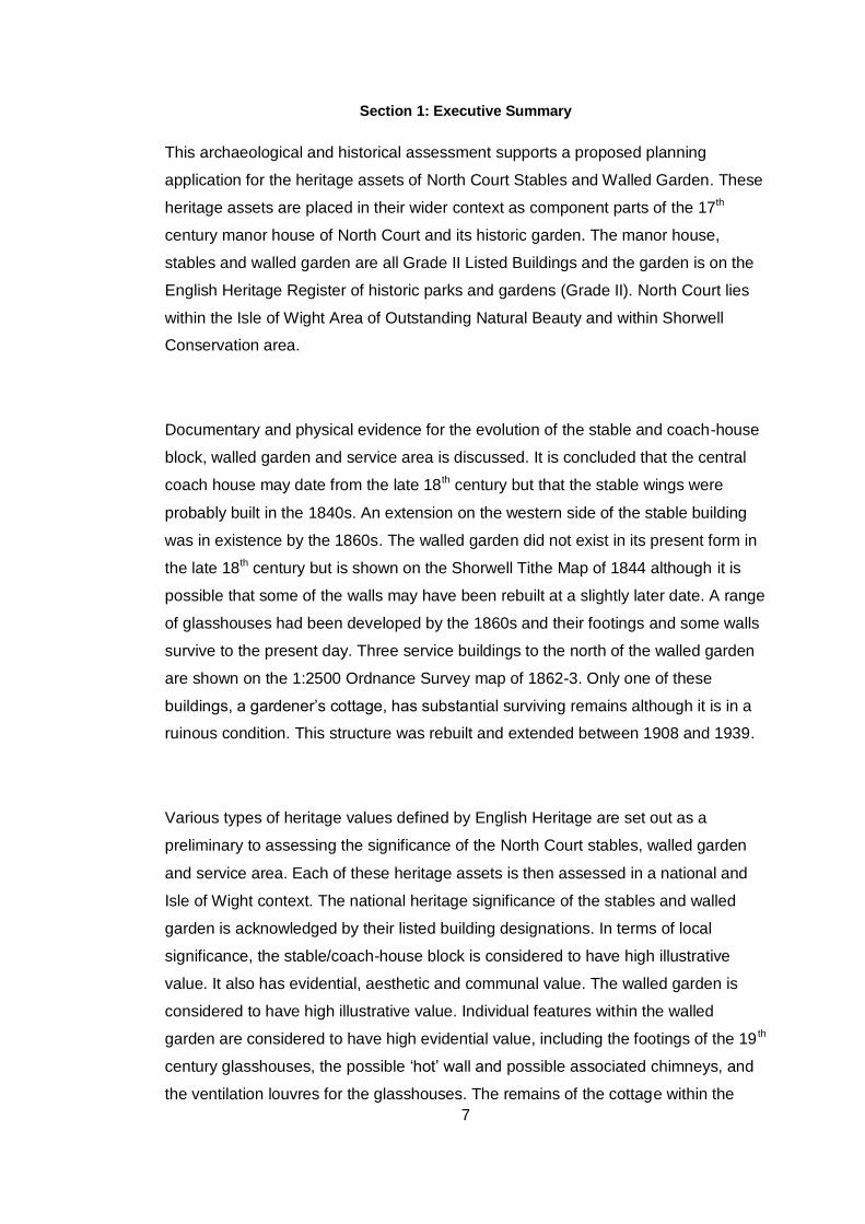
Section 1: Executive Summary
This archaeological and historical assessment supports a proposed planning
application for the heritage assets of North Court Stables and Walled Garden. These
heritage assets are placed in their wider context as component parts of the 17th
century manor house of North Court and its historic garden. The manor house,
stables and walled garden are all Grade II Listed Buildings and the garden is on the
English Heritage Register of historic parks and gardens (Grade II). North Court lies
within the Isle of Wight Area of Outstanding Natural Beauty and within Shorwell
Conservation area.
Documentary and physical evidence for the evolution of the stable and coach-house
block, walled garden and service area is discussed. It is concluded that the central
coach house may date from the late 18th century but that the stable wings were
probably built in the 1840s. An extension on the western side of the stable building
was in existence by the 1860s. The walled garden did not exist in its present form in
the late 18th century but is shown on the Shorwell Tithe Map of 1844 although it is
possible that some of the walls may have been rebuilt at a slightly later date. A range
of glasshouses had been developed by the 1860s and their footings and some walls
survive to the present day. Three service buildings to the north of the walled garden
are shown on the 1:2500 Ordnance Survey map of 1862-3. Only one of these
buildings, a gardener’s cottage, has substantial surviving remains although it is in a
ruinous condition. This structure was rebuilt and extended between 1908 and 1939.
Various types of heritage values defined by English Heritage are set out as a
preliminary to assessing the significance of the North Court stables, walled garden
and service area. Each of these heritage assets is then assessed in a national and
Isle of Wight context. The national heritage significance of the stables and walled
garden is acknowledged by their listed building designations. In terms of local
significance, the stable/coach-house block is considered to have high illustrative
value. It also has evidential, aesthetic and communal value. The walled garden is
considered to have high illustrative value. Individual features within the walled
garden are considered to have high evidential value, including the footings of the 19 th
century glasshouses, the possible ‘hot’ wall and possible associated chimneys, and
the ventilation louvres for the glasshouses. The remains of the cottage within the
8
service area to the north of the walled garden are considered to have some
evidential value but the illustrative value of this building is limited because of its
ruinous state.
Conservation principles for the restoration and re-use of the North Court stables,
walled garden and service area are set out, based on documentary evidence for the
development of the site, the detailed site survey and the assessment of heritage
value. The two overriding principles are that a unitary ownership is necessary in
order to secure a sustainable future for the stables and walled garden and that any
proposals for the future use of these features should seek to maximise their
illustrative, evidential, aesthetic and educational values. Specifically, any future
restoration of the stable block should seek to maintain its historic design significance
and internal evidential significance to the maximum extent consistent with ensuring a
sustainable use for the building. Proposals for rebuilding or modifying buildings and
structures in the walled garden and service area should seek to maintain the
evidential value of these buildings and structures or should ensure preservation by
record
A proposal for a Gardens Skills Centre and Visitor Centre to be developed within the
stable block and walled garden is set out. The aims of this scheme are stated to be
the provision of a purpose and a sustainable business solution for the redundant
stable block and walled garden, the creation of some rural employment, the creation
of opportunities for more people to appreciate the heritage and beauty of North Court
and the provision of educational opportunities. A brief appraisal of economic
sustainability is included in this section. Works proposed by the client within the
stable block, walled garden and service area are then listed.
This report concludes that the proposed Gardens Skills Centre and Visitor Centre is
the best way to ensure the sustainable future of the stables and walled garden.
Eleven recommendations are set out which aim to ensure that the proposed work
offers the maximum conservation benefit and that any required changes respect the
evidential, illustrative and aesthetic values of the site by retaining as many
architectural features and internal fittings as possible. Any restoration work within the
9
walled garden should use traditional materials and should conserve the historic walls
and path layout. Existing veteran fruit trees should be retained as long as possible
and replacements should consist of old varieties. Mitigation measures are proposed,
including making a full photographic record of the stables interior and western
extension, and carrying out more detailed recording of the glasshouses and north
garden wall. It is recommended that all possible steps should be taken to ensure the
minimum impact on the historic character of the paddock. It is concluded that no
archaeological sites or monuments recorded in the Historic Environment Record will
be affected by the proposed works to the North Court stable, walled garden and
service area other than these particular historic assets but that an archaeological
watching brief may be necessary if any changes are made to the present informal
track across the paddock.
The plan is presented in two volumes with the main text, tables and appendices in
Volume 1. Appendices A and B are site surveys of the stable block and walled
garden, from which many of the conclusions in the body of the report are drawn.
Appendix C describes the historical development of the wider North Court estate.
Appendix D lists the documents associated with the 1902-5 alterations to the stable
block. Appendix E deals with relevant planning policies. Figures and photographs
are presented in volume 2.
10
Section 2: Aims and Purpose of Assessment
This assessment is required to support a proposed planning application for North
Court Stables and Walled Garden. Its purpose is to provide information for the
Heritage Statement required by the local planning authority in support of all
applications relating to heritage assets.
The aims of the assessment are to understand the extent and character of buildings
and structures on the site and their relationship with the surrounding designed
landscape, to establish the evolution of the site over time and to date the various
buildings and structures.
This report also aims to assess the site’s heritage values and significances, both as
a whole and as they relate to component buildings and structures, to determine how
far these may be affected by the proposed future use of the site and to formulate
conservation principals for any future work.
Finally, the assessment aims to provide a complete record by documentary and
photographic means in order to mitigate the effects of any changes to the structure
of the heritage assets that will be necessary in order to ensure a sustainable future
for these assets. However, additional photographic recording may be necessary
once the site has been cleared, as set out in the report.
11
Section 3: Methods Statement
The assessment conforms to the IfA Standard and Guidance for the archaeological
investigation and recording of standing buildings.
The assessment is based on English Heritage’s ‘Conservation Principles, Policies
and Guidance for the Sustainable Management of the Historic Environment’ (2008)
which emphasises the prerequisites of effective conservation and management.
These are:
To understand the fabric of the heritage asset and how it has changed over
time.
To identify the significance of the heritage asset, based on a thorough
understanding of its fabric.
To identify appropriate ways of managing change to the heritage asset,
based on its evidential, historical, aesthetic and communal values.
This report follows the method set out by English Heritage. It describes the North
Court stables and walled garden at the present day, sets out their documentary
history, considers the physical evidence for the evolution of the site as a whole,
assesses significance and sets out conservation principles for future restoration and
re-use. Specific proposals for the site are then set out and recommendations are
made to ensure appropriate conservation and management of heritage assets.
The study is based on site visits and on a review of documentary sources, including
material in the University of Southampton Library. The detailed site surveys of the
stable/coach house block and of the walled garden and service area have been
placed at the back of the report as Appendix A and Appendix B because of their
length. However, it must be emphasised that conclusions in this report are all based
on the site surveys, including the assessment of significance in Section 9, the
conservation principles developed from that assessment in Section 10 and the
overall recommendations for the sustainable development of the stable/ coach house
block and the walled garden in Section 13.

12
Appendix C sets the North Court stables and walled garden in their full historical
context as components of the wider North Court estate. Appendix D lists the
documents associated with the 1902-5 alterations to the stable block.
Appendix E deals with relevant planning policies and government advice, including
PPS 5 Planning for the Historic Environment .
13
Section 4: North Court: Location, Setting, Designations and Heritage Assets
This report relates specifically to the stables and walled garden at North Court but it
is important that these assets should be seen in relation to the manor house of North
Court and its designed landscape, and also in relation to the wider landscape setting.
Landscape and heritage asset designations are shown in Figure 1.
North Court is situated to the north-west of Shorwell village in a rural, inland part of
the Isle of Wight. The B3399 which links Newport to the south-west coast road runs
alongside the eastern boundary of the property and through Shorwell village. North
Court and its historic garden lie on the Upper Greensand within a valley, to the
south of and below the central chalk ridge which cross the Island from west to east.
The property falls within the Isle of Wight Area of Outstanding Natural Beauty and
within Shorwell Conservation Area.
The manor house at North Court is a Grade II Listed Building. It was built c. 1615 by
Sir John Leigh and is the grandest 16th-17th century house on the Isle of Wight, built
of local greensand and set in landscaped grounds. The north front of the house was
extended to the west, partly by the local architect Percy Stone in 1905,1 to link with
an existing building that was named ‘Little North Court’ in the late 20 th Century. 2
The Stable Block to North Court is a Grade II Listed Building in its own right. The
Garden Wall around the Kitchen Garden is also a Grade II Listed Building.
The gardens at North Court are included in the English Heritage Register of Parks
and Gardens of Special Historic Interest (Grade II). The boundary of the Registered
Site reflects the historic extent of the designed landscape at North Court and
includes North Court Farm and other land that is not in the ownership of the Harrison
Family.
46 heritage assets are recorded in the Historic Environment Record within a 500
metre radius of the North Court Stable Block, comprising buildings, archaeological
sites and find spots. These assets are shown on Figure 2 and listed in Table 1.They
include North Court house and garden, the bath house in the garden and the stable
1 Lloyd and Pevsner 2006, 274-275
2 Listed Building Description

14
block. No archaeological sites or finds are recorded within the area of the proposed
planning application. Many of the assets recorded in the Table 1 are historic
buildings in Shorwell village.

15
Table 1
In digital version of document please open file in Volume 1 Folder.
16
Section 5: The Stables and Walled Garden at North Court
5.1 Description
The stables and walled garden lie to the north of North Court manor house. The
listed building description of the stable block is as follows:
‘Stables with central coach house. Early C19, probably built for General
Sir Willoughby Gordon. Central part of iron stone ashlar, rest stone
coursed rubble with hipped slate roof. Centre has 3 tall archways with 4
centred heads. Cupola no longer present. Stone coping and cornice to
parapet. Left wing has 1 3-light mullioned window with hood moulding,
blocked cambered doorcase and remains of top of 3-light mullioned
window, later extended into double doors. Right wing has 1 3-light
mullioned window with hood moulding and a blocked 4 centred arch
and hood moulding only remaining from another window which has
been extended to form a garage door. Plinth. Interior has C19 wooden
boarded stall partitions with iron columns at ends’.
The listed building description for the walled garden is as follows:
‘Garden Wall. Early C19. About 12 feet high. Front section is of stone
rubble but brick on the other side. The other 3 sides are of red brick in
English bond with buttresses and round headed arches’.
The historical and structural analyses of the stables and walled garden in Sections 6,
7 and 8, and in Appendices A and B are intended to amplify and (if necessary) to
modify the listed building description given above, to provide more detailed
information and to inform the restoration of the building.
5.2 Condition Statement
The stable block has not been used for its original purpose for many years and is
now effectively redundant. It is used at present mainly for storage purposes. Two
toilets and a shower have been installed in the south stable wing for use at outside
functions such as the Midsummer Fair. The building as a whole is in a poor state of
repair and requires a sustainable use to secure its long term future.
17
The walled garden is at present maintained as a functioning kitchen garden but at a
level that is well below its potential productive use due to economic and man-power
constraints.
At present, ownership of the stable block is spread into three legal units (created in
1963) with 7 related owners, and the walled kitchen garden into two legal estates,
attached to two parts of the divided house, with ownership split into 5 related owners.
This is a potential obstacle to ensuring a sustainable future for these features.
However if the proposed application proceeds then the owners agree to pass their
interests to North Court Estates Ltd or another company under family control.
18
Section 6: Documentary and Cartographic Evidence for the Stables and
Walled Garden
6.1 Historic Maps and Plans
Historic maps and plans are crucial to understanding the development of North
Court and its associated buildings and structures. The earliest reliable large-scale
maps that show North Court are the unpublished Ordnance Survey drawings of
the Isle of Wight at six inch to one mile scale dating from the 1790s. These
drawings exist in two versions. The first version comprises a set of field drawings
held at the National Archives3. An extract from one of these field drawings
showing the North Court area has been reproduced as Figure 3. The second
version comprises a set of eight ‘fair’ drawings derived from the field survey and
held in the British Library.4 Figure 4 is an extract from one of the British Library
drawings showing the North Court area.
Published sources suggest that the field survey of the Isle of Wight was
completed by 1792. In 1791 the Master General of the Ordnance ordained that
‘Mr William Gardener, the Chief Surveying Draftsman … proceed with the survey
of the Isle of Wight’. A year later the surveying party had moved to the Bagshot
area.5 Two of the field drawings give a date of 1791. Three of the eight ‘fair’
drawings in the British Library can be dated to 1793-4.6
In interpreting the building history of North Court, the extract from the British
Library drawing is in many ways easier to understand than the extract from the
field drawing since the fair drawing shows all buildings and structures of stone or
brick in red. However, at the original scale of six inches to one mile the buildings
are extremely small and when the drawing is enlarged detail starts to be lost. By
studying both the field drawing and the fair drawing it has been possible to
produce an interpretation at enlarged scale (Figure 5) which attempts to
reproduce details shown on the two drawings clearly and accurately.
3 NA WO 78/1648
4 BL OSD 67-74
5 Seymour 1980, 45
6 Hodson 1989
19
The next large scale map to show the North Court Estate accurately and at a
large scale is the Shorwell Tithe Map of 1844.7 A section of the map showing
North Court is reproduced here as Figure 6.
The large-scale 1:2500 1st Edition Ordnance Survey covering the North Court
area was surveyed from 1862-3 and is reproduced as Figure 7 Later editions of
the 1:2500 maps covering the North Court area were produced in 1898, 1908-9,
1946 and 1976. Extracts from these editions are shown in Figures 8-15.
Drawings from the architects firm of Stratton and Millgate dating from 1901 are
preserved in the Isle of Wight County Record Office.8
The existing outline of the coach-house and stable block is clearly shown on a
large-scale 1:50 plan of 1987 prepared by A G Biggs Partnership (Figure 16).
6.2 Development of the Site from the 18th Century to the 20th Century
The earliest clear description of the house, outbuildings and productive gardens at
North Court is provided by an indenture dated 1778.9 This was drawn up after the
death of Sir John Leigh in 1772 and named his five daughters as co-heirs, the
property being held in trust for them. The indenture itemises household and
garden equipment inside the house, within the outbuildings and in the garden.
Specific headings list all the rooms in the house plus the outbuildings and garden.
Headings relating to outbuildings and land include ‘Brewhouse’, ‘Bakehouse’,
‘Laundry’, ‘Wash-House’, ‘Cheese Room and Loft’, ‘Milk House and Dairy’,
‘Garden’, ‘Dog Kennell’, ‘Ale Cellar’, ‘Strong Beer Cellar’, ‘Stables’, ‘Coach Stable
and Coach House’ and ‘Coachmans Chamber’.
A document entitled ‘Particulars of the Estates of the Late John Leigh Esquire’,
dated October 179210 describes the ‘Offices disjoined from the House’ as follows:
‘an exceeding good Laundry, Wash-House, Brew-House, and Bake-House, all
adjoining; Two Chambers over the Laundry and Bake-House, Stables with
7 IWCRO/JER/T/310
8 IWCRO/Stratton Millgate/1185 & 2819
9 IWCRO/JER/DL/2
10 The title page of this document is reproduced in Lambert (1993)
20
Chambers and Granary over them, Double Coach-House, Barn, Cartlodge,
Wood-house, etc’ This description seems to tally well with that given by the
indenture of 1778. Both documents indicate that there were two separate
buildings accommodating the stables and coach house. Some of the domestic
offices mentioned in the two documents were probably located within ‘Little North
Court’ but the stables, coach-house, barn, cartlodge and wood-house were
probably separate free-standing buildings situated elsewhere in the grounds.
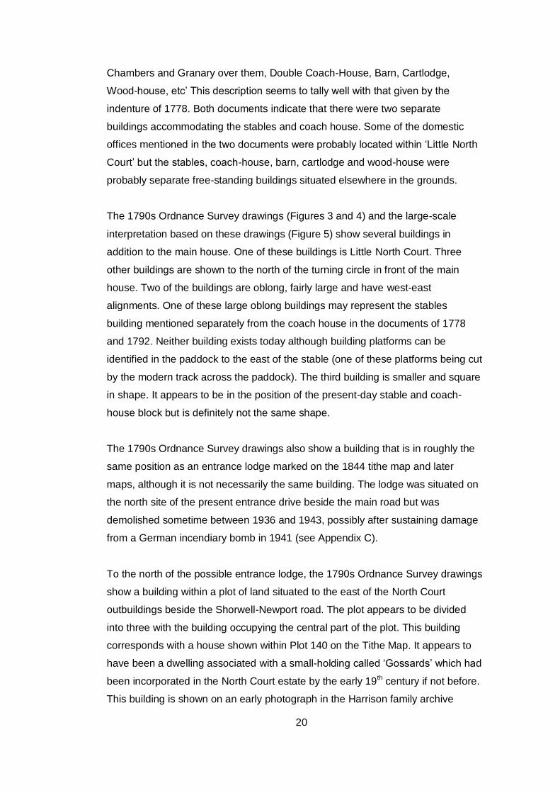
The 1790s Ordnance Survey drawings (Figures 3 and 4) and the large-scale
interpretation based on these drawings (Figure 5) show several buildings in
addition to the main house. One of these buildings is Little North Court. Three
other buildings are shown to the north of the turning circle in front of the main
house. Two of the buildings are oblong, fairly large and have west-east
alignments. One of these large oblong buildings may represent the stables
building mentioned separately from the coach house in the documents of 1778
and 1792. Neither building exists today although building platforms can be
identified in the paddock to the east of the stable (one of these platforms being cut
by the modern track across the paddock). The third building is smaller and square
in shape. It appears to be in the position of the present-day stable and coach-
house block but is definitely not the same shape.
The 1790s Ordnance Survey drawings also show a building that is in roughly the
same position as an entrance lodge marked on the 1844 tithe map and later
maps, although it is not necessarily the same building. The lodge was situated on
the north site of the present entrance drive beside the main road but was
demolished sometime between 1936 and 1943, possibly after sustaining damage
from a German incendiary bomb in 1941 (see Appendix C).
To the north of the possible entrance lodge, the 1790s Ordnance Survey drawings
show a building within a plot of land situated to the east of the North Court
outbuildings beside the Shorwell-Newport road. The plot appears to be divided
into three with the building occupying the central part of the plot. This building
corresponds with a house shown within Plot 140 on the Tithe Map. It appears to
have been a dwelling associated with a small-holding called ‘Gossards’ which had
been incorporated in the North Court estate by the early 19th century if not before.
This building is shown on an early photograph in the Harrison family archive
21
(Plate 87) but had been demolished by the end of the 19th century (see Appendix
C).
Walled enclosures, an orchard and outbuildings are shown on the 1790s
Ordnance Survey drawings to the north of the main house. The walled enclosures
do not occupy the same area as the existing walled garden although the area of
one of the enclosures seems to correspond roughly with what is now the eastern
half of the walled garden. An unenclosed orchard appears to be shown to the
west of this enclosure.
Sales Particulars for North Court produced in 1836 provide a valuable description
of the North Court mansion house, offices and grounds as well as the various
farms belonging to the estate.11 The particulars refer to ‘Stabling for Fourteen
Horse, Standing for Six Carriages’, ‘Gardens’ and ‘Pleasure Grounds’. The
‘Gardens’ are described as comprising ‘about an Acre and a Half, nearly Walled
round, stocked with Fruit Trees of the choicest sorts, and in full Bearing. Within
the ‘Gardens’, there were ‘Grapery and Succession Houses; Pump, and
Reservoir’. The dimensions of the walled gardens that existed in 1836 correspond
fairly well with those of the present walled garden which is about 1.25 acres.12 On
the other hand, the reference to ‘gardens’ in the plural may suggest that the layout
shown on the 1790s Ordnance Survey maps had not yet been altered to create
the present walled garden. The ‘grapery and succession houses’ mentioned in
the document could possibly be the same buildings that are shown on the 1862-3
Ordnance Survey map. These buildings went through various phases of
development, as described in Appendix B.
The reference in the 1836 Sales Particulars to stabling ‘for fourteen Horse’ does
not seem to tally very well with the accommodation in the existing stable wings. At
the present day, the north stable wing contains only two stalls and one loose box,
with possible space for another two stalls. In the south stable wings there are two
stalls in the south room and three tie-up rings in the north room (see Appendix A:
Sections A3 and A4). This suggests that the existing building could have
11
IWCRO/DL/355
12 Based on the figure of 0.505 hectares given by Rainey Petrie 2010, 5
22
accommodated a maximum of ten horses and, in fact, ten stalls are shown in
architects’ drawings dating from 1901 (see below).
As well as describing the buildings associated with the mansion house, the 1836
sales particulars also refer to a ‘Farm Yard, With Barn, Slaughter House, Sheds,
Granary, Stable, etc’. The evidence for the position of farm buildings at North
Court in the early 19th century is discussed further in Appendix C (The Historical
Development of the North Court Estate).
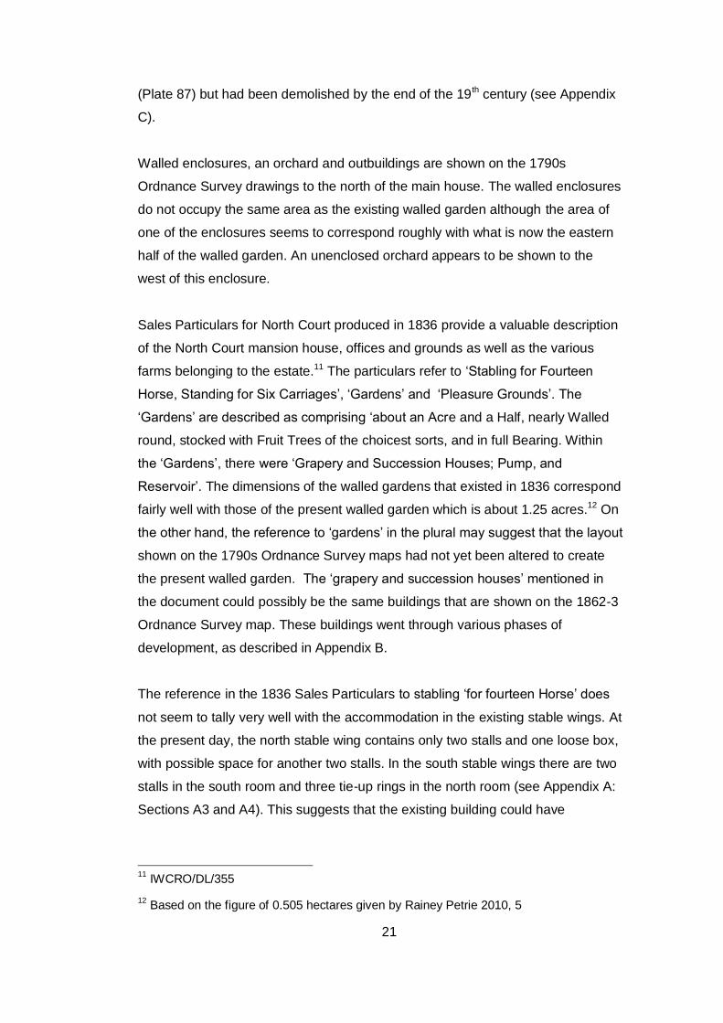
The 1844 Tithe Map (Figure 6) shows the stable and coach-house block in its
present position but the footprint of the building as shown on the tithe map is not
identical with the footprint of the building as it exists today. The north and south
wings appear to protrude beyond the central section although today it is the
central coach-house block that protrudes beyond the two side wings. This
apparent discrepancy may be due simply to the mapping conventions used on the
tithe map. The covered entrance to the central coach house is not a solid wall but
consists of three arches. These arches are represented by a dotted line on the
1898 and later editions of the 1:2500 Ordnance Survey map but this line may
have been missed off the tithe map. A more significant discrepancy is the fact that
the two wings shown on the tithe map are of unequal length whereas on the
existing building they are of the same length. There is no physical evidence in the
present building to show that either wing has been extended or reduced in size
although it is worth noting that the south stable wing consists of two separate
rooms whilst the north stable wing consists of only one room. The tithe map does
not show the western extension to the stable/coach-house block that exists today.
A service yard to the north of the stables is shown but none of the buildings in the
service area shown on later maps are marked.
The Tithe Map shows the walled garden in its present position, represented by
plot 142, but the alignment of the north, south and east walls is slightly different
from that shown on all later maps. The tithe map also fails to show a change in
alignment of the western wall at the north-west corner of the garden that is shown
on all later maps. Another puzzling detail is that the north wall of the walled
garden is shown as meeting the north-west corner of the stables exactly whereas
on all later maps the north garden wall meets the back wall of the north stable
block some 5m south of the corner.
23
The tithe map has been described in some detail as it is very important in dating
the stable/coach-house block and walled garden, However, It is impossible to be
certain whether all the discrepancies in the ground plans of the stables and walled
garden between the tithe map and later maps represent real differences that
existed on the ground or whether they can be attributed to inaccuracies and lack
of detail in the tithe map.
The 1st Edition 1:2500 Ordnance Survey map published in 1862-3 (Figure 7)
shows the outline of the stable and coach-house block as it exists today, including
the western extension facing onto the walled garden. It also appears to show a
small square structure at the southern end of the building within the walled
garden. This may be the ‘Garden Store’ marked on the A G Biggs Plan of 1987
(Figure 16). The boundary walls of the kitchen garden are shown in their present
position and a range of glasshouses is shown against the northern wall of the
garden. A service area is shown to the north of the walled garden containing two
small buildings within an enclosed yard at its western end and another long,
narrow building at its eastern end.
The only difference between the plan of the stable and coach-house block as
shown on the OS map of 1862-3 and as shown on the A G Biggs Plan of 1987 is
a room marked as ‘Store’ on the 1987 plan but not shown on the 1862-3 OS map.
This room is situated on the western side of the building, adjacent to the ‘Tack
Room’, and forms a continuation of the western extension under the same ‘cat-
slide’ roof. It appears to have been added on to the western extension when
internal alterations were carried out to the stable and coach house block in 1902-
1905 (see Appendix A.1 under ‘Washing Space’). However, this ‘store’ is not
shown on the 1:2500 Ordnance Survey maps of 1898, 1908-9 or 1946 although it
does appear on the 1:2500 Ordnance Survey of 1976.
The most detailed sources of documentary information for the coach-house and
stable block in the 20th century deal with alterations to the building between 1902
and 1905. There are written specifications and architects drawings in the Isle of
Wight County Record Office, dating from November 190113. In addition, a
tradesman’s final account of 1905 from T and E W Jenkins of Newport to Mrs
13
IWCRO/Stratton Millgate/ 1185 & 2819
24
Disney Leith has survived with other papers of the Gordon family preserved at the
Hartley Library, University of Southampton.14 The completed work included a new
entrance with sliding door to the coach house, internal rearrangement of the
coach house including the construction of internal brick walls, insertion of modern
doorways into the two stable wings and the creation of an enlarged coachman’s
bedroom in the coach house loft (see Section 7, Appendix A and Appendix D). It
also seems to have involved replacing three stalls in the north room of the south
stable wing with tie-up rings and replacing five stalls in the north stable wing with
two stalls and a loose box.
Comparison of the Ordnance Survey maps of 1908-9 and 1946 reveals that the
gardener’s cottage was enlarged after 1908-9. This probably took place during the
life time of Mrs Disney Leith who died in 1929. It had certainly been carried out by
1939. Sales Particulars of that date refer to ‘a gardener’s cottage, stone and tiled,
containing 6 rooms’. The Sales Particulars also refer to ‘stabling accommodation
for 5 horses’, a ‘garage for four cars’, and ‘various other useful buildings, glass
houses etc’. 15
14
Gordon MS 80 (A276) 15
15 Harrison Family Archive. 1939 Sales Particulars for North Court
25
Section 7: General Discussion of the Stable and Coach-House Block
This discussion is based on the detailed site survey contained in Appendix A
The stable and coach-house block comprises a central coach-house flanked by a
stable wing on either side with an extension on the western side of the building under
a separate cat-slide roof. (see Figure 16 and Plate1). As it exists today, the central
coach-house consists of a covered entrance with a tack room, carriage store and
pump room behind. Evidence within the two stable wings indicates that they provided
accommodation for a maximum of eight horses in the twentieth century, including
four stalls, one loose box and three tie-up rings.
The entrance façade to the coach house has three arches built of regular local
ferruginous sandstone ashlar blocks (Plate 2). In contrast, the front walls of the two
stable wings are built of pale green local sandstone from the Greensand Series cut
into dressed blocks, of irregular size but arranged in regular courses (Plates 3 and
4). The corners of these two wings have side-alternate quoins, mainly dressed
blocks of pale green sandstone but including some Bembridge Limestone blocks.
The two end walls of the stable wings and the main back wall of the building are
constructed of local greensand rubble arranged in regular courses. The western
extension is also constructed of local greensand rubble in regular courses and the
quoins are dressed blocks of local stone. Bembridge Limestone is employed in most
of the doorway arches throughout the buildings.
Both the coach-house and stable wings have been subject to alterations which can
be dated to the period 1902-1905 on the basis of the architects’ drawings and
specifications and the tradesman’s account referred to in Section 6 (Appendix D
contains a description of these documents). The main structural alterations can be
seen in the central coach-house. This had previously been a single space with a
harness room behind, to which entry was gained by three double doors. In 1902-5 it
was divided up by internal brick walls to form a central carriage store/garage with a
new harness room on one side (referred to as a tack room in the 1987 Biggs Plan)
and a narrow passageway on the other side (Plates 5 and 7). The three new rooms
are deeper than the original coach house as they extend backward into the area of
the western extension, most of which had previously been occupied by the old
harness room which had a long axis running north-south (i.e. at 90 degrees to the
long axis of the new rooms).
26
The new passageway created in 1902-5 contains a pump and is referred to as the
‘pump room’ in Appendix A and Volume 2 (Plates 7). Previously, water had been
obtained from a well in the walled garden just outside the coach house, as shown on
the Ordnance Survey 1898 map (Figure 10). Installation of a pump in the new
passageway meant that there was access to water within the coach-house. The new
passageway led into a manure yard behind the north stable wing which is first shown
on the Ordnance Survey map of 1908-9 (Figure 12).
The partition walls built in 1902-5 to divide the coach-house into three rooms are
constructed of red brick. A wall of yellow brick (technically referred to as ‘white kiln
brick’ in the 1901 specification) was also built at the front of the three rooms, dividing
the coach-house from the covered entrance (or loggia, as it is called in the architects’
drawings of 1901). The sliding doors at the front of the carriage store were also
inserted as part of the 1902-1905 alterations. They do not appear on the 1901
drawing of the proposed east elevation but are referred to in the written specification
for the alterations (see Appendix A and Appendix D). The entrance to the new tack
room or harness room has a stone door surround that is clearly of greater age than
the brick wall into which it has been inserted. It appears to have been reused from
elsewhere in the building (see below). A new window with stone surrounds was also
made for the front wall of the tack room (see Plate 32 and Appendix A).
Alterations can be seen in the east front of the north and south stable wings where
new doors were inserted between 1902 and 1905, cutting through the existing
windows (Plates 3 and 4).
Alterations to the coach house lofts in 1902-5 created a coachman’s bedroom above
the tack room (Plate 6). Previously, there had been a small loft at the southern end
of the coach-house and a larger loft space to the north which contained an enclosed
clock chamber. The alterations enlarged the smaller loft to form a coachman’s
bedroom by extending it under the eaves of the western extension. It would appear
that in order to do this the level of the cat-slide roof above the western extension was
raised (Plate 17). The new bedroom was lit by a roof skylight on the east side of the
room.
27
The stable and coach-house block as a whole is architecturally puzzling and does
not seem to form one integrated design. As an architectural statement, the entrance
façade to the coach house is fairly formal and imposing although the three four-
centred arches are gothic rather than classical in inspiration. In contrast, the two
stable wings are self-consciously vernacular in character. They seem to draw their
inspiration from the Island’s 17th century stone buildings, as do the North Court
estate cottages in Shorwell village. These cottages are all built of local greensand
and display plinths and mullioned stone windows with drip moulds. The stable wings
also have plinths and mullioned stone windows with drip moulds. Another point of
similarity between the stable wings and the estate cottages is the style of the
doorways. Originally, there were stone doorways with three-centred arches at each
end of both stable wings (one now blocked up) and there are also doorways of this
type between the two rooms of the south stable and between both stable wings and
the covered entrance. Doorways with similar three-centred arches can be seen in
the two estate cottages of ‘Heronfield’ and ‘Poplynge Mill’. However, there are
significant differences between the Shorwell estate cottages and the stable wings at
North Court. The estate cottages are constructed of stone rubble whereas the front
elevations of the stable wings employ dressed stone blocks. The cottages have
square-headed lights set within their mullioned windows whereas the mullioned
windows at the front of the stable wings contain round-headed lights. In addition, the
cottages all have steeply-sloping, tiled and gabled roofs with kneelers at the gable
ends. The hipped slate roof over the coach-house/stable block is very different in
character from the roofs of the estate cottages.
When first built, the two stable wings both appear to have had doorways in their end
walls. The doorway in the end wall of the north stable wing must have been blocked
up by 1901, since is not shown on the architects’ drawings of that date, but the
corresponding doorway in the end wall of the south stable wing is still open (Plates
36 and 37). The doorways between the stable wings and the covered entrance in
front of the coach house may also be original features.
On the east front of both wings there are low blocked doorways, originally positioned
between pairs of mullioned windows. Both doorways have been carefully in-filled
with dressed stone blocks and rubble, mainly of Bembridge Limestone but with some
greensand. The careful infilling and the low height of these features suggests the
possibility that they may have been picturesque embellishments rather than
28
functioning doorways and that they may always have been blocked. The position of
the existing ladders providing access to the north and south stable lofts certainly
indicates that the doorways could not have been open when the ladders were in use.
The architects’ plan of 1901 showing the stables ‘as at present’ (i.e. before
alterations) marks a stairway inside the north stable in a position that would have
prevented the use of the doorway on the east front although the stairway, as drawn,
has a different orientation from the present loft ladder (Appendix D: Stratton &
Millgate 1185, Item 5).
If the doorways in the east front of the two stable wings were blocked from the time
that the stables were built, then the original entrances to the two stable wings must
have been through the doorways in the end walls of each wing or the doorways
connecting with the covered entrance although this would not have been very
convenient. The architects’ drawings of 1901 do not show the blocked gothic
doorways at all but neither do they show the modern doorways cutting through two of
the mullioned windows in the north and south stable wings. The 1901 drawing
showing the stables ‘as at present’ (i.e. before the alterations of 1902-5) suggests
that entrance to the south stable wing was gained either from the doorway in the
south end wall of the wing or from the doorway connecting with the loggia or covered
entrance. The only entrance to the north stable wing shown on this drawing is
provided by the doorway connecting with the covered entrance. In the written
specification of 1901 there is an entry on page 5 ‘To cut opening for new doorway
between three stall and two stall stable’. Comparison of the ‘as present’ and ‘as
proposed’ architects’ drawings of 1901 show that a new doorway was inserted
between the south room and the north room of the south stable (Appendix D:
Stratton & Millgate 1185, Items 4 and 6). It is therefore rather puzzling that the
doorway between the two rooms (Plate 54) looks considerably older than the
doorway between the north room of the south stable and the covered entrance (Plate
53). The inner side of this doorway, within the south stable, does not have a stone
surround but consists of a plain, plastered recess with a flat wooden lintel. It is
possible that the doorcase on this side was moved to provide the new entrance to
the tack room or to the south room of the stable. The outer side of the doorway,
facing the covered entrance retains its stone surround with three-centred arch.
29
Structurally, the coach-house does not seem to be of one build with the adjoining
wings. The parapet of the coach-house is attached in an awkward fashion to the
main roof and the lead flashing at the junction between the parapet and the roof only
draws attention this awkward join (Plate 8). In addition, the floor of the loft above the
coach house has a floor that is 1.3m higher than the floor of the loft in the north
stable wing.
Another puzzling feature of the North Court Stable/ Coach-House block is its fairly
low-pitched hipped slate roof which sits oddly on the building beneath. The roof is
supported on wooden wall plates which rest on top of the walls (Plate 9) but the top
courses of the walls in the stable wings have an unfinished look. This may be just
because there are no gutters but one might expect to see a more substantial course
of dressed stone at the top of the walls. The rafters in both stable wings are exposed
at the eaves. On the outer edge of each rafter there is a wooden wedge which
creates a gap between the roof and the wall plate, possibly to allow ventilation (Plate
10). The choice of slate as a roofing material may be appropriate to a stable building
and matches the roof of the main house at North Court but slate would not have
been the original roofing material for the main house which is thought to have been
slated in around 1850 when a new roof was built and new chimneys added.
There are three separate open lofts over the central coach house and the two stable
wings. (Part of the loft within the coach house forms the coachman’s bedroom and
the roof beams are not exposed in this room.) In the lofts over the two stable wings,
the stone walls of the building continue upwards for just over a metre (Plate 11).
However, in the roof above the coach house the rafters meet the wall plate at floor
level, accounting for the difference in floor level between the coach-house loft and
the lofts over the stable wings (Plate 12). Many of the roof timbers that can be seen
in all three open lofts originally came from another building and have been re-used.
This has been achieved by sawing the original timbers longitudinally into four. Adze
marks can be observed on the outer faces of these timbers and saw marks on the
inner faces. There is a chamfer on one corner of each re-used timber (Plate 13). The
original timbers would have been of substantial size. Some timbers have slots cut
into them. These slots appear originally to have accommodated purlin beams at a
time when these timbers were in another building (Plate 14). Carpenters’ marks were
observed on some of the old timbers above all three lofts (Plate 15). In addition to
the old re-used timbers, there are sawn timbers of more recent date above all three
30
lofts but there appear to be more sawn timbers above the south stable loft (Plate 16).
In the section of roof above the coach house there are modern-looking sawn timbers
that were inserted when the clock tower was removed.
The construction of the section of roof over the coach-house is different from that of
the sections over the two stable wings. Over the coach-house, the purlins forming
part of the roof framework are located below the collar beam which runs across the
north end of the loft. There are also struts sloping down from the purlins to the floor
at an angle of about 70 degrees. Above the two stable wings, the purlins are at the
same level as the collar beams at the ends of the lofts and there are vertical struts
stretching from the rafters to the floor, supported variously by diagonal and/or
horizontal braces.16
A final puzzle concerning the coach house and stable block, which was not
satisfactorily resolved during the site survey, is the evidence for the whitewashing of
the stone work. Traces of whitewash occur on the east front of the south stable wing
below the mullioned window, on the stonework blocking the central doorway in the
north stable wing, and on two quoin blocks at the north-east corner of the building.
The walls of the stable wings within the covered entrance to the coach house are
entirely covered in whitewash. On the back (west) wall of the building there are
traces of whitewash between the north-west corner and the garden wall.
In summary, the North Court stable and coach-house block appears to be something
of an architectural enigma.
16
For information on roof timbers see Brunskill (2000) and Alcock et al. 1996
31
Section 8: Dating and Assessing the Site
This assessment is based on the documentary and cartographic evidence set out in
Section 6, on the discussion of the stable and coach-house block in Section 7 and on
the detailed site surveys (Appendix A and Appendix B)
8.1 The Stable and Coach-House Block
One possible explanation for the architectural inconsistencies within the
stable/coach-house block, discussed in Section 7, may be that the present building
represents work of several phases, carried out by different owners.
Between 1783 and 1805 North Court was in the occupation of Richard Bull. After
short periods in the ownership of his daughter Elizabeth (1805-1809), his step-son
Richard Bennet (1809-1814), and his step-grandson Richard Bennet Junior (1814-
1818), North Court was occupied by Mrs Bennet (the widow of Richard Bennet
Senior) from 1818 to 1837. Sir Henry Percy Gordon was the occupier of North Court
from c.1840 (see Appendix B). Of these various owners/occupiers, the two most
likely to have undertaken major building work are Richard Bull and Sir Henry
Gordon.
As mentioned in Section 7, there is strong evidence that the present stables and
coach-house may have been constructed in two phases. The parapet of the coach-
house is attached in an awkward fashion to the main roof and the floor of the loft
above the coach house has a floor that is 1.3m higher than the floor of the loft in the
north stable wing. In addition, the roof-timbers show signs of re-use and were
possibly taken from the long oblong buildings shown on the 1790s Ordnance Survey.
These details suggest that the stable wings were added on to an existing coach-
house block.
We know from the 1790s Ordnance Survey drawings that during the time when
Richard Bull lived at North Court there was a square building in the approximate
position of the present stable and coach house block and also two large oblong
buildings to the east. It is possible that the square building shown on the Ordnance
Survey drawings is the present coach-house block, if this is envisaged as having
been a free-standing building without any wings at that date. This building may
possibly have been constructed before Richard Bull leased North Court since an
inventory of 1778 lists separate coach-house and stable buildings (see Section 6.2).
32
Richard Bull leased North Court from 1783 (see Appendix C) but did not actually own
the property until January 1794. If Richard Bull was responsible for the construction
of the square building on the site of the present coach house he must have carried
out this work before he actually purchased North Court, since the Ordnance Survey
field drawing on which this building is first shown was probably completed by the end
of 1792 (see Section 6.1). On the other hand, if Richard Bull built the coach house
that we see today after he had purchased North Court, it follows that the OS
drawings must depict a building that has now vanished completely.
The 1836 Sales Particulars for North Court refer to ‘Stabling for Fourteen Horse,
Standing for Six Carriages’.17 This description probably does not refer to the present
stable wings since the 1901 architects’ drawing of the stables ‘as at present’ shows
accommodation for only ten horses, divided between a ‘2 Stall Stable’ and ‘3 Stall
Stable’ in the south wing and a ‘5 Stall Stable’ in the north wing (See Appendix A3,
Appendix A4 and Appendix D). Equally, however, the present coach-house block
could probably not have accommodated six carriages so it is possible that the coach-
house does not date from the time of Richard Bull but was built after 1836. An
alternative possibility would be that in 1836 at least some of the stabling and carriage
accommodation was still within the two large oblong buildings shown on the 1790s
Ordnance Survey drawings.
The most likely period for the construction of the stable wings at North Court is the
time between the death of Mrs Bennet in 1837 and the compilation of the Shorwell
Tithe Apportionment Book in 1842 (see Appendix C). Following the death of Mrs
Bennet, North Court came into the ownership of Sir James Willoughby Gordon
through his wife Isabella, who was the daughter of Mrs Bennet. However, the tithe
apportionment book shows the occupier as Henry Percy Gordon Esquire and it is
clear that he was, effectively, the new Squire of North Court, it would have been
logical for Henry Gordon to have made substantial changes, particularly after the
long occupancy of Mrs Bennet when few changes may have been made.
We know from the tithe map that by 1844 the two large oblong buildings shown on
the 1790s Ordnance Survey drawings had been demolished and that a building
existed on the site of the present stable and coach-house block. This building had a
17
IWCRO/DL/355
33
footprint similar to, but not identical, with that of the present-day structure. If the tithe
map is accurate, then the building shown on the map is not the same structure that
exists today. If we assume that the tithe map is slightly inaccurate and that it actually
depicts the stable/coach-house block as it exists at the present day, then this block
could have been built, or an existing building added to, at any time between 1793
and 1844.
In summary, it is suggested that structural evidence and the architectural mismatch
between the central coach house and stable wings indicate that these elements may
have been built at different times. The coach house with its imposing gothic
entrance arches would have fitted well with the ‘Picturesque’ improvements to the
North Court gardens carried out by the Bull family and it therefore seems quite
possible that Richard Bull may have been responsible for this part of the building. Sir
Henry Gordon may well have been responsible for the stable wings which are in an
architectural style quite similar to that of the estate cottages in Shorwell village.
These estate cottages appear to have been built by Sir Henry Gordon from 1864
(see Appendix C). The stable wings could quite possibly have been an earlier
experiment by Sir Henry in executing high quality building work in a vernacular style.
The present stable/coach-house block certainly existed by 1862-3 when it is shown
on the 1st Edition 25 inch Ordnance Survey map. This map also shows the western
extension to the central section of the stable/coach-house block, facing onto the
walled garden. The western extension may well have been added after 1844 as it is
not shown on the tithe map. However, it is also possible that the extension existed by
1844 but was simply not shown on the map, given the caveats mentioned above
about the accuracy of the tithe map.
As discussed in Section 7, it is somewhat puzzling why the roof line of the main
building was not simply continued when the western extension was built. The
architects’ drawings of 1901 show that the western extension housed a separate
harness room before the alterations of 1902-5 but that the extension was
incorporated within the area occupied by the main coach house and new tack room
during the alterations. The extension has two square-mullioned windows of three
lights. These are in a different style from the round-headed mullioned windows at the
front of the building although the south room of the south stable also has a square-
mullioned window (of two lights) in the back wall. The stonework of the extension is
34
different from the front elevation of the stable wings, being constructed in coursed
stone rubble rather than the dressed stone blocks used in the front elevation. The
end walls of the stable wings are also in coursed stone rubble, suggesting that this
technique was employed where the stonework was not so visible.
The roof of the extension must have been renewed when the store was built onto the
southern end of the western extension between 1902 and 1905 (see Figure 16)
since the present roof covers both the original part of the extension and the store
with no sign of any join. An extremely blurred photograph dating from the late 19 th
century shows the western extension before the store was built (Plate 18). This
photograph suggests that the roofline of the extension was different from the present
roofline, thus confirming that the roof of the extension was renewed when the store
was built. The photograph also indicates that the extension did not continue as far to
the north as is does today. The alterations carried out in 1902-1905 included building
the store (referred to as a ‘washing space’ in the 1901 specification) and lengthening
the back wall of the western extension to accommodate the newly created pump
room/passageway. There is a direction in the written specification of 1901 ‘to cover
the roof over Washing Space with slates … and do all necessary cutting to skylight
and make good’. However, it should be noted that there appears to be no change in
the length of the extension as shown on the 1898 and 1908-9 Ordnance Survey
maps.
Other alterations to the main stable block and coach-house were carried out
between 1902 and 1905 to adapt the building to 20th century needs. These
alterations included the division of the coach house into the tack room, carriage store
and pump room, the creation of the coachman’s bedroom, the insertion of new doors
in the north and south stable wings and the insertion of sliding doors in the front of
the carriage store.
During World War II the stables were used as army stores and some stencilled
markings and graffiti survive from this period.
8.2 The Service Area and its Buildings
The 1844 tithe map shows a service yard to the north of the walled garden and
west of the stables but no buildings are shown within this area. The 1862-3 OS
map shows a service area containing two small buildings within an enclosed yard
35
at its western end and another long, narrow building at its eastern end (Figure 8).
Surviving ruins within the decayed wall of the enclosed yard and the evidence of
Ordnance Survey maps indicate that the two buildings within the yard were
extended and rebuilt over time. The main building became a gardener’s cottage
(Plate 19). The rebuilding of this structure took place after 1908-9, since the
Ordnance Survey map of that date shows a smaller building than is shown on the
1946 Ordnance Survey map. The work was probably carried out before 1939 as
sales particulars of that date refer to a gardener’s cottage. It may have been
carried out for Mrs Disney Leith who died in 1929. The second building within the
enclosed yard lay at 90 degrees to the main building and abutted its eastern side.
This subsidiary building had been extended by 1898. After the main building had
become a gardener’s cottage the second building seems to have been used as a
store building for the cottage. Today, both these buildings are in a ruinous
condition.
The only surviving remains of the long narrow building at the eastern end of the
service area consist of a row of corbels protruding from the outside of the garden
wall and of brick-lined beam slots inserted into the wall (Plate 20). This building
seems to have been an open-fronted storage shed supported on posts at the
front, since there is no evidence of a front wall.
Further discussion of the buildings within the service area can be found in
Appendix B.
8.3 The Walled Garden and its Buildings (Plate 21)
The walled garden and its glasshouses are described in detail in Appendix B. This
section attempts to understand the historical development of the site. Section 6
established that the walled enclosures shown on the 1790s Ordnance Survey
map do not correspond with the present walled garden although they occupy part
of the same area. The Sales Particulars of 1836 record ‘extensive walled gardens’
in the plural and for that reason it is suggested that these particulars may not refer
to the present walled garden. However, the overall area recorded in 1836 was
similar to that of the present garden and a ‘Grapery and Succession Houses’ were
also recorded. It is nonetheless quite likely that Sir Henry Percy Gordon was
responsible for the construction of the walled garden as we see it today.
36
Certainly, the1844 tithe map seems to be the first map that shows boundary walls
enclosing the area of the present walled garden although there is a slight
difference between the orientation of the walled garden as shown on the tithe map
and as shown on later maps. On the tithe map, the garden has a distinct south-
west to north-east orientation. On the 1862-63 Ordnance Survey and later maps,
this orientation is much less pronounced, with the south and north walls running
more or less from west to east. However, the west wall has retained its south-
west to north-east alignment. Consequently, the angle between the west wall and
the south wall is less than 90 degrees. In the east garden wall, the 1862-63
Ordnance Survey and later maps show an south-west to north-east alignment that
is less pronounced than that shown on the tithe map.
There are other discrepancies between the tithe map and later maps. On the tithe
map, the north wall of the walled garden meets the north-west corner of the
stables exactly, whereas on the1862-3 Ordnance Survey and all later maps the
north garden wall meets the back wall of the north stable block 5m south of the
corner. In addition, the west garden wall is shown on the tithe map as having a
single alignment throughout its length whereas on the 1862-3 map a change of
alignment is shown at the northern end of the wall. Finally, it is noticeable that the
tithe map does not show any glasshouses within the walled garden. It is possible
that this is simply an omission since the purpose for which the tithe map was
prepared may not have required all subsidiary buildings to be shown.
The various discrepancies between the tithe map and the 1st Edition 25 inch
Ordnance Survey map may indicate that some rebuilding of the garden walls took
place between 1844 and 1862-3 when the Ordnance Survey map shows the
garden much as it exists today (Plate 21). The change of alignment at the north
end of the western garden wall can still be observed on the ground today (Plate
22). This short section of wall at the north-west corner of the garden seems to
incorporate the remains of a stone building, although the top courses of the wall
are in brick. The stone building appears to have been replaced by a glasshouse,
this being one of a range of three lean-to glasshouses along the north wall of the
garden. These glasshouses are shown for the first time on the 1862-3 OS map
although it is on the 1898 OS map that they are first marked with the hatched
convention used for glasshouses. The footprint of the glasshouses as shown on
the 1898 map is also slightly different from the footprint shown on the 1862-3
37
map. The earlier map indicates that the eastern part of the glasshouse range was
narrower than the western part, whereas on the 1898 map the entire range is
shown as being the same width.
The surviving remains of the glasshouses shown on the 1862-3 and 1898 maps
comprise brick footings and an end wall. Evidence on the ground indicates that there
were three separate glasshouses, each having the north wall of the walled garden as
its back wall. The western glasshouse and the middle glasshouse were ventilated by
openings with moveable wooden shutters set high into the north garden wall (Plates
23 and 24). These ventilation louvres still survive. The eastern glasshouse may have
been a grapery or vinery. Low brick arches within the surviving brick footings of the
vinery may have allowed vines to be planted outside the glasshouse, since the roots
required cool conditions, whilst the plants themselves grew up inside the glasshouse
(Plates 25 and 26). The glasshouses appear to have been heated and the remains
of a furnace can still be observed within the remains of a boiler room on the outside,
northern face of the garden wall (Plates 27 and 28). A curious heating flue is built
into the outside of the garden wall within the boiler room (Plate 29) It is also possible
that a section of the north garden wall to the east of the glasshouses was heated, the
evidence for this being the existence of two possible chimneys, one on either side of
the doorway in the centre of the north wall (Plate 30).
The relationship between the glasshouses and the gardener’s cottage in the service
area is difficult to understand. The gardener’s cottage abuts the middle glasshouse
and the two buildings share a back wall that is also part of the garden wall. Before
the cottage was rebuilt in the early twentieth century it may have functioned as a
work shed or bothy. At that time there was a doorway in the party wall, allowing
access to the middle glasshouse from this building. This doorway was partially
blocked at a later date to create a window, possibly at the time that the cottage was
rebuilt (Plate 31). It seems unlikely that the middle glasshouse was in use after the
gardener’s cottage was rebuilt, since at that time the height of the cottage was
increased so that it incorporated the shuttered openings in the back wall of the
middle glasshouse. In addition, the window in the back wall of the cottage would
have looked into the middle glasshouse, a curious arrangement if the glasshouse
had still been functioning.

38
The form, function and dating of the various structures on either side of the north
garden wall is still not fully understood, despite the survey work described in
Appendix B. It has been difficult to record some of the remains fully because of the
overgrown state of this part of the site. Further photography and analysis may be
necessary to ensure complete preservation by record.
39
Section 9: Significance of Historic Assets
9.1 Heritage Values
English Heritage defines four types of heritage values: Evidential Value, Historical
Value, Aesthetic Value and Communal Value.18
Evidential value derives from the potential of a place to yield evidence about past
human activity. In the absence of written records, the material record, particularly
archaeological deposits, provides the only source of evidence about the distant past.
Age is therefore a strong indicator of relative evidential value, but is not paramount,
since the material record is the primary source of evidence about poorly-documented
aspects of any period.
Historical value derives from the ways in which past people, events and aspects of
life can be connected through a place to the present. It tends to be illustrative or
associative. The idea of illustrating aspects of history or prehistory – the perception
of a place as a link between past and present people – is different from purely
evidential value. Illustration depends on visibility in a way that evidential value (for
example, of buried remains) does not. Places with illustrative value will normally also
have evidential value, but it may be of a different order of importance. An historic
building that is one of many similar examples may provide little unique evidence
about the past, although each illustrates the intentions of its creators equally well.
Association with a notable family, person, event, or movement gives historical value
a particular resonance.
Aesthetic value derives from the ways in which people draw sensory and
intellectual stimulation from a place. Design value relates primarily to the aesthetic
qualities generated by the conscious design of a building, structure or landscape as
a whole. Some aesthetic values are not substantially the product of formal design,
but develop more or less fortuitously over time, as the result of a succession of
responses within a particular cultural framework.
18
English Heritage 2008, 27-34
40
Communal value derives from the meanings of a place for the people who relate to
it, or for whom it figures in their collective experience or memory. Communal values
are closely bound up with historical (particularly associative) and aesthetic values,
but tend to have additional and specific aspects. Commemorative and symbolic
values reflect the meanings of a place for those who draw part of their identity from
it, or have emotional links to it. Social value is associated with places that people
perceive as a source of identity, distinctiveness, social interaction and coherence.
9.2 Assessing the Significance of the North Court Stables and Walled Garden
9.2.1 Heritage Significance within a National and Local Context
Placed in a national context, the heritage values of the North Court stables and
walled garden are of some significance. The walled garden forms part of North
Court’s historic garden which is on the English Heritage register of nationally
important historic parks and gardens (Grade II). It also lies within the curtilage of
North Court manor house, which is a Grade II Listed Building, and the garden walls
are listed Grade II in their own right. The stable block is also a Grade II Listed
Building. However, nationally there are considerable numbers of listed stables and
coach houses, and of walled gardens, on the English Heritage Register. It is
therefore more useful to examine the North Court site within the context of the Isle of
Wight.
The Historic Environment Record (HER) maintained by the County Historic
Environment and Archaeology Service contains entries for all buildings on the Isle of
Wight that were recorded on the tithe maps of the 1830s and 1840s, including
stables and coach houses. Buildings that post-date the 1840s will not necessarily be
recorded in the HER. There are 17 entries in the HER for ‘coach house’, of which
nine relate to country houses and five relate to other rural properties associated with
non-farming establishments. There are several hundred entries in the HER for
‘stable’ but the vast majority of these relate to farm stables. Altogether, there are 30
entries relating to stables and coach houses associated with country houses and
other non-farming establishments, or used for riding horses, of which 25 are listed
buildings (see Table 2). However, in many cases the stables are now in separate
ownership from the main house and/or have been converted to residential
accommodation, thereby losing all of their internal features. Only twelve of the stable
buildings have surviving internal structures or fittings (e.g. stalls, loose boxes, tie up
41
rings). Six sites having listed stables and/or coach houses are on the English
Heritage Register of Historic Parks and Gardens, including North Court, but North
Court is the only one of these sites to have both a functioning walled garden and a
stable/coach-house with surviving internal fittings.
9.2.2 Heritage Significance of the Stable/Coach House Block and Walled Garden as
Components of North Court’s Registered Garden
The stable/coach-house block and productive gardens, considered together,
have high illustrative value in a local context, since North Court provides the
only example on the Isle of Wight of a nationally important historic garden
which has both a functioning walled garden and a stable block with intact
internal features surviving within the boundary of the registered site. These
features enhance the heritage value of the garden as a whole.
The stable/coach-house block and productive gardens have evidential value
in providing information about the development of North Court during the 19th
century.
The stable/coach-house block and productive gardens have an aesthetic
value in the contribution they make to the landscape character and setting of
North Court.
The stable/coach-house block and productive gardens have communal value.
Despite the virtual demise of the country house life style, some older people
retain memories of the importance of the stables and productive gardens in
the life of country estates and many more have shared the memories of their
parents and grandparents relating to these buildings. Still more people have
read literature or memoirs that make reference to stables or kitchen gardens
(e.g. ‘Black Beauty’ by Anna Sewell) or have watched television programmes
such as ‘The Victorian Kitchen Garden’. 19
9.2.3 Heritage Significance of the Stable/Coach-House Exterior
The exterior of the building has design value in providing an example of high
quality mid-nineteenth century vernacular-style architecture, despite later
modifications to the building. The high quality construction of the building
includes such design features as plinths, mullioned stone windows and
chamfered stone door surrounds.
19
Davies 1987
42
The building has evidential value in forming part of a programme of
vernacular building on the Shorwell estate in the mid-nineteenth century, for
which virtually no documentary evidence appears to exist.
The building has aesthetic value in its use of the attractive local greensand
and ferruginous sandstone and its charming vernacular style.
9.2.4 Heritage Significance of the Stable/Coach-House Interior
The interior of the stable/coach-house block has evidential value in being one
of only twelve such buildings on the Isle of Wight to retain internal features
and fittings that demonstrate how the building functioned. The internal
features and fittings in the North Court building include evidence for stalls and
a loose box, surviving tie-up rings and ventilators, and the layout of the tack
room and coachman’s bedroom. The layouts of the tack room and
coachman’s bedroom probably date from the early 20th century. However,
this does not negate their value but provides evidential value for change in
the use of the building over time. The stencilled markings and graffiti
surviving from army use during World War II also have some evidential and
illustrative value.
9.2.5 Heritage Significance of the Walled Garden
The garden as a whole has a high illustrative value as a still-functioning
kitchen garden with historic fruit trees. Apart from North Court, it is estimated
that there are approximately thirty walled gardens still surviving on the Isle of
Wight (calculation based on records held by the Isle of Wight Gardens Trust).
Six of these are associated with gardens on the English Heritage Register,
twelve are associated with gardens on the Isle of Wight Council’s Local List
and twelve are associated with other gardens recorded by the Isle of Wight
Gardens Trust. However, the condition of these walled gardens is very
variable and it is estimated that the walls are in good condition at only
fourteen sites. Significantly, only about five of the walled gardens on the Isle
of Wight (including North Court) are still maintained as kitchen gardens with
one or two more maintained as ornamental gardens.
There is potential to increase the illustrative value of the North Court walled
kitchen garden still further by bringing the garden back into greater use.
Individual features within the walled garden have high evidential value. These
features include the footprint of the 19th century glasshouses, the possible
43
‘hot wall’ and associated chimneys, and the ventilation louvres for the
glasshouses set high into the garden wall.
9.2.6 Heritage Significance of the Building Remains in the Service Area
The remains of the gardener’s cottage have evidential value in contributing to
an understanding of the service area’s function and development during the
19th century and early 20th century. The illustrative value of this building is
very limited because of its ruinous state.
The function served by the long narrow building at the west end of the service
area is not understood but it has evidential potential in helping to understand
the history of the site and attempts should be made to identify the use of the
building. The illustrative value of this building is very limited because of its
ruinous state.

44
Table 2
In digital version of document please open file in Volume 1 Folder.
45
Section 10: Conservation Principles for the Restoration and Re-use of the
North Court Stables, Walled Garden and Service Area
1. At present ownership of the stable block and walled garden is fragmented,
which prevents any sensible long term conservation and management plan. It
is desirable that a unified ownership should be achieved so that the stable
and kitchen garden becomes one again and is capable of devolving as one
unit in the future, thus safeguarding its preservation.
2. Any proposals for the stable block and walled garden should recognise these
features as an important component of the historic property and garden at
North Court and should seek to ensure a sustainable future for them.
3. Proposals for the future use of the North Court stable block and walled
garden should seek to maximise its illustrative, aesthetic and educational
values by enabling more people to appreciate these qualities.
4. Any future restoration and use of the stable block should seek to maintain the
historic design significance and internal evidential significance to the greatest
extent consistent with ensuring a sustainable use for the building.
5. There are potential conflicts between aesthetic values, evidential values and
sustainable use in deciding what to retain. There is also a need to be aware
of different phases in the development of the building and of potential value
judgements to be made in deciding what to retain.
6. Proposals for the restoration, management and future use of the walled
garden should seek to maintain its historic walls, layout and function, and to
conserve historic plants.
7. Any proposals for building on the footprint of the 19th century glasshouses in
the walled garden, or for rebuilding the north garden wall, should seek to
conserve the evidential value of buildings and structures as far as possible,
including the ventilation louvres and evidence for the heating system, the
possible ‘hot wall’ and the chimneys in the wall. If preservation in situ is not
possible it may be necessary to undertake further photography and recording
to ensure full preservation by record.
46
8. The proposed rebuilding of the ‘gardener’s cottage’ in the service area will
restore its historic function. This building has been more compromised by
alterations and decay during the 20th century than other buildings and
features at North Court. Accordingly, it will probably not be possible or
necessary to retain all the surviving fabric and design features of the existing
remains but ideally the ventilation louvres for the middle glasshouse in the
walled garden should be retained. If this is not possible, it may be necessary
to undertake further photography. It would be desirable to preserve the
character of the west end wall if possible.
9. Any new buildings proposed for the east end of the service area should, if
possible, retain the corbels and beam slots in the garden wall, which relate to
a building of unknown function.
10. Where alterations to any buildings, building remains or structures on the site
(whether external or internal) are accepted as being necessary for
sustainable use of the site then the principle must be preservation by record.
This report and the accompanying photographic record largely fulfils the
principle of preservation by record for the stable and coach house block.
However, further photography of the building’s interior will be required once
the building has been completely cleared of stored material. Further study
and photography of the glasshouses and north garden wall may also be
required to provide a full understanding and record of these features. A copy
of this report and of any further survey work should be deposited in the
Historic Environment Record at the County Historic Environment and
Archaeology Centre in fulfilment of the ‘preservation by record’ principle.

47
Section 11: Proposed North Court Garden Skills Centre and Visitor Centre:
Aims, Objectives and Sustainability Appraisal developed by Client
11.1 Aims
1. To provide a purpose for the redundant stable block and walled garden.
2. To provide a sustainable long-term stand alone business solution.
3. To create some rural employment
4. To enable more of the public to appreciate the heritage and beauty of North Court.
5. To provide education opportunities for mostly mature persons but possible schools as well to understand a range of heritage and horticultural issues.
11.2 Objectives
1. To convey the titles to one entity of kitchen garden and stable block so that it
is sustainable whatever might happen to the three separate house titles, to
give right of way across field and to give rights of parking.
2. To provide an exhibition area for static and changing exhibitions – partly to
interpret North Court stables and garden, and partly for wider exhibitions to
provide education on garden history, the AONB, and other related heritage/
countryside issues.
3. To provide an education space for small classes of no more than 20 but
generally no more than 10.
4. To restore architectural and internal features of the building as far as is
compatible with its proposed new use.
5. To provide residential accommodation for residential students, upstairs.
6. To provide teaching for small groups on such subjects as growing
vegetables, sowing seeds, propagation, old varieties of fruit and vegetables,
traditional cooking with fruit and vegetables, growing herbs, cooking with
herbs and salad crops, garden history, Isle of Wight parks and gardens.
7. To provide a small visitors centre with toilet facilities, and a small tearoom
area, capable of taking groups of up to 24 at a time.
8. To propagate and sell plants to visitors as an income stream and attraction.
9. To encourage students to work practically in the kitchen garden/greenhouse
as volunteers and for work experience.
10. To provide some simple cooking facilities to demonstrate traditional cooking
methods.
48
11. To restore part of the greenhouses for propagation and overwintering tender
plants and starting early salad and vegetables.
12. To provide accommodation for a gardener/ part time teacher.
11.3 Sustainability Appraisal
1. It is aimed to open the walled garden/tea room and exhibition centre for
maybe 30-50 days a year, aiming for an average of 50 persons per day, and
subject to agreement with main garden owners of that part, also by
arrangement. Entrance fees would generate around £12000 p.a .
2. Sales of plants and teas would generate an additional profit of around £8000.
3. Residential courses will aim to run for around 24 weekends p.a. (subject to
demand) and will require outside teachers as on specialist subjects. A typical
residential course for a weekend would produce gross income of £250 per
delegate. This source of income would be vital to pay for the upkeep of the
walls and overheads of the main buildings, and contribute to staff costs.
4. It would be essential to have an onsite gardener to oversee vegetables on a
daily basis, and keep control of heating/ventilation of glasshouses/boilers.
Provision of accommodation for a gardener would reduce his salary by some
35%.
5. The building should be capable of being used for appropriate small functions,
thereby generating some additional income.
49
Section 12: Description of Works Proposed by Client: January 2011
(All proposed works are subject to consultation and final architectural
drawings)
12.1 Work to Stable Block
Exterior Facade
1. Investigate possibility of restoring the front of the two stable wings to their mid
nineteenth century appearance by reinstating original windows. It will also be
necessary to open up the blocked doorways to allow access.
Downstairs.
1. Creation of a tea room within the carriage store. This will involve expanding
the area to create sufficient space and light. Subject to consultation, it is
intended to do this by demolishing the existing western extension and
replacing it with a striking modern front (probably of glass and timber
construction) opening into the walled garden, and extending as far as the
path line.
2. Creation of a kitchen, possibly within the northern room of the south stable
wing.
3. Adaptation of present store to south of tack room in order to create a lobby
giving access from the kitchen to the tea room.
4. Retention of tack room, if possible, for use as reception and garden entrance
desk.
5. Possible enlargement of doorway between tack room and carriage store at
rear of building to allow circulation between proposed kitchen and café tea
room
6. Retention of square-headed stone mullioned windows from present back wall
of tack room and carriage store for re-use elsewhere (possibly in gardener’s
cottage).
7. Creation of one or more new stair wells in the corner of wings.
8. Restoration of panelling and horse boxes where possible and all other key
architectural features and internal fittings where practical. Relocation of any
key features and fittings that cannot be retained in their original positions
50
(e.g. because of the creation of new stairwells or, if inside the kitchen, for
food hygiene reasons).
9. Creation of inner walls for new stairwells to meet building/insulation
standards, but relocating any significant features to new inner walls.
10. Restoration of tack room saddle racks and cooking range.
11. Relocation of toilets to a new building to rear.
12. Retention of as much of old flooring as practical (in kitchen and tea room
areas this may not be practical for food hygiene reasons).
13. Treatment all wood retained for beetle.
14. Lowering of ceiling level in middle section to allow floor to be lowered to meet
level of adjoining loft space.
Upstairs
1. Stripping slate roof re-battening where appropriate and insulating to modern
building standards.
2. Retention of as many roof timbers as possible after treatment, particularly the
older re-used adze-cut timbers.
3. Insulating between roof timbers to modern building standards, leaving as
many exposed as possible.
4. Creation of bedroom space upstairs and ensuite bathrooms for
accommodating 8 persons, with the minimum of room divisions (e.g.
bathrooms may be integrated within bedroom – subject to building
regulations).
5. Adaption of former coachman’s bedroom to become a landing between
bedrooms.
6. Creation of new maximum conservation window lights at rear, providing
optimum views of garden and valley (double glazed).
7. Rebuilding the clock tower but with a modern battery operated clock.
8. Creation of as many new staircases as required for fire/building regulations.
9. Replacing most of floor joists (as rotten) with steel replacements, boxed in
with plaster work.
10. Treatment of all panels/remaining timbers for beetle (subject to any bat
considerations)
11. Provision of bat mitigation measures if required.
12. Relocation of owl box in a nearby tree .
13. Rainwater collection system with underground storage tank.

51
14. Solar panels for hot water on western roof (subject to viability).
15. Creation of inner walls to meet building standards, and divisions for privacy
for bathrooms.
16. Lowering floor of middle section-previously above carriage standing as
headroom no longer needed at ground-floor level.
17. Opening up accesses between the south, middle and north hay lofts so that
they interconnect, lowering floor levels so that they are as level as is practical.
Front of stable block
1. Planting a few standard bays/yews in planters near arches and consider
planting climbers (vines?) part way up arches to hide some of the blemishes.
2. Creation of a small plant sale area.
3. Moving back some of the bank to north to widen access for biomass material
delivery (if viable) and to increase parking for staff and disabled and sitting
out area.
Access
1. Creation of more car parking in field on green paving for up to 20 cars, using
Grasscrete, rubber crumb or similar. Location of parking spaces to be
discussed but preferably near road access, not distracting from view of stable
block and not impacting severely on character of paddock.
2. Planting a yew hedge to screen cars, or possibly a line of pleached limes.
3. Strengthening the surface of the alternative access with grasscrete or similar
material.
12.2 Work to Walled Garden
1. To commence a long term programme of wall repair and sympathetic re-
pointing with traditional materials where necessary (ongoing project).
2. To resurface the gravel paths and remove turf from old gravel paths
surrounding the inside edges of the walled garden
3. Edging paths with an appropriate wooden edging material.
4. Replanting box that is blighted with a suitable edging alternative after advice
(where blight killing off box).
5. Installing irrigation underground from rainwater collection from roofs.
52
6. Replanting gaps in the old espalier and cordon fruit trees with old varieties
(eg Howgate wonder and IW variety) but retaining all of the existing trees if
safe.
7. Stripping back old beds, where now grassed over to create strip planting of
vegetables and salad crops.
8. Creating an ornamental and culinary herb bed – designed as a knot or
parterre.
12.3 Work in Service Area
1. Rebuilding the lean-to buildings to the north of the walled garden to provide:
wall protection and support, wood storage, storage for garden implements,
wood biomass boiler, timber store, workshop, compost store, toilets.
2. Replacing the ruinous building at the western end of the service area, thought
to have been a bothy or gardener’s cottage, with a new gardener’s/manager’s
cottage on the same footprint, to include a living area within the walled
garden on the footprint of the middle glasshouse. This would take the form of
a traditional conservatory, with pitched roof utilising an existing blocked up
doorway.
3. Rebuilding the eastern glasshouse in a modern style for early crops but
retaining the existing footings and vine holes.
4. Consider using part of the service area to the north of the walled garden and
the north-west of the stable block as a biomass store or wood boiler room for
heating the greenhouse, gardener’s cottage and stable block, if access for
woodchip and continuity of supply is established.
53
Section 13: Recommendations of Archaeological Consultant in Relation to
Proposed Work
1. The façade of the stable wings should be restored to its mid-nineteenth
century appearance by the reconstruction of the original mullioned windows
which were destroyed by the creation of early-twentieth century doorways.
This restoration is included in the proposed works set out in Section 12.1
2. Some internal changes to the stable block are proposed in Section 12.1 in
order to ensure a sustainable future for the building. Such changes should
endeavour to respect the evidential and illustrative value of the building by
retaining as many internal features as possible, particularly where these
features provide evidence for the function of the building and for its changing
use over time. If at all possible, the stalls and loose box should be restored,
preferably in situ but relocated if necessary. It is also highly desirable that the
tack room (with internal fittings) and coachman’s bedroom should be retained
together with the original stairs between the two rooms, although it is
accepted that changes may be needed to conform with building regulations,
safety requirements and a sustainable use for the building.
3. After the stable and coach-house block has been cleared of all stored
material but prior to any work being carried out or alterations made to the
inside of the building, it is recommended that a complete photographic survey
of the interior is carried out by the Isle of Wight Gardens Trust. (It was not
possible to photograph the inside of the building adequately during this
survey because of the quantity of stored material.)
4. Section 12.1 proposes to demolish the existing western extension in order to
extend the proposed tea room into the walled garden. The western extension
existed by 1862-3. The loss of this part of the stable block is justifiable in
terms of creating a sustainable use for the building overall, subject to full
preservation by record. Further photography of the western extension may be
necessary once the building has been cleared of stored material, particularly
if any internal evidence of alterations is revealed. The square-headed stone
mullioned windows should be retained for re-use elsewhere.
54
5. Some of the roof timbers in the stables and coach house block are of
considerable age and show signs of re-use (see Sections 7 and 8.1). The
proposed work to the roof set out in Section 12.1 aims to retain as many roof
timbers as possible after treatment. Particular care should be taken to retain
the older, re-used and adze-cut timbers wherever possible. Some
photographs of the existing roof timbers have been taken as part of this
survey but a full photographic record should be made whilst the timbers are
still in situ, prior to any alterations.
6. Any restoration, management or other work within the walled garden should
utilise traditional materials, should maintain the historic walls and path layout,
should conserve existing old fruit trees as long as possible and should replant
with old varieties of fruit trees as appropriate.
7. Ideally, the footprints and surviving brickwork of the historic glasshouses
within the walled garden should be retained and conserved, including the
ventilation louvres, ‘hot wall’, chimneys and heating furnace . However, the
proposed reconstruction of the ruinous building at the western end of the
service area as a gardener’s cottage includes the creation of a living area
within the walled garden on the footprint of the middle glasshouse, reached
through an existing doorway, at present blocked. It is also proposed to rebuild
the eastern glasshouse in a modern style for early crops whilst retaining the
existing footings and vine holes. There will thus be very substantial new work
in this area and it is recommended that this should be preceded by a more
detailed survey of the area with the aim of improving understanding and
ensuring full preservation by record.
8. In the proposed rebuilding of the gardener’s cottage, the west gable wall
should be preserved if at all possible, thus retaining evidence of the
rebuilding of this structure in the early 20th century (see Appendix B:
Sections B4 and B5).
9. Care should be taken to conserve, as far as possible, the historic character of
the paddock or field which functioned as a small area of park-pasture in the
mid-nineteenth century, having previously contained buildings shown on the
55
1790s Ordnance Survey drawings. Building platforms are visible within the
paddock at the present day, one of which is cut by the access track,
although these earthworks are not recorded in the HER. The platforms
may relate to buildings shown on the 1790s drawings (see Section 6.2 and
Appendix C). Proposals for increased use of the existing track as an
alternative access to the stable block, strengthening the surface of the track,
and creating more car-parking in the paddock will affect the historic character
of the paddock to some extent. There is a need to balance this potential
damage against the overriding need to secure a sustainable future for the
stables and walled garden but care must be taken to minimise the impact on
the setting of North Court. The proposal to strengthen the track across the
paddock may affect the building platform cut by the track. There should be an
archaeological watching brief if work is carried out on the track, as this may
provide new information about the building platform.
10. On the basis of the data supplied by the Isle of Wight Historic Environment
and Archaeology Service (Table 1 and Figure 2), it has been concluded that
no archaeological sites or monuments recorded in the HER will be affected
by the proposed works to the North Court stables, walled garden and service
area other than these specific heritage assets. It has therefore been
concluded that no archaeological intervention will be necessary except for the
proposed archaeological watching brief in advance of any work to the track
across the paddock (Recommendation 9).
11. A copy of this report and of any photographic survey undertaken by the Isle
of Wight Gardens Trust should be deposited at the Isle of Wight Historic
Environment and Archaeology Centre to form part of the Historic Environment
Record.
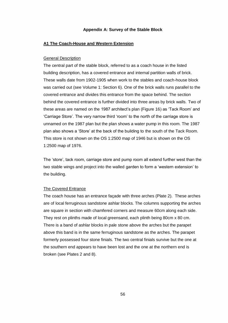
56
Appendix A: Survey of the Stable Block
A1 The Coach-House and Western Extension
General Description
The central part of the stable block, referred to as a coach house in the listed
building description, has a covered entrance and internal partition walls of brick.
These walls date from 1902-1905 when work to the stables and coach-house block
was carried out (see Volume 1: Section 6). One of the brick walls runs parallel to the
covered entrance and divides this entrance from the space behind. The section
behind the covered entrance is further divided into three areas by brick walls. Two of
these areas are named on the 1987 architect’s plan (Figure 16) as ‘Tack Room’ and
‘Carriage Store’. The very narrow third ‘room’ to the north of the carriage store is
unnamed on the 1987 plan but the plan shows a water pump in this room. The 1987
plan also shows a ‘Store’ at the back of the building to the south of the Tack Room.
This store is not shown on the OS 1:2500 map of 1946 but is shown on the OS
1:2500 map of 1976.
The ‘store’, tack room, carriage store and pump room all extend further west than the
two stable wings and project into the walled garden to form a ‘western extension’ to
the building.
The Covered Entrance
The coach house has an entrance façade with three arches (Plate 2). These arches
are of local ferruginous sandstone ashlar blocks. The columns supporting the arches
are square in section with chamfered corners and measure 60cm along each side.
They rest on plinths made of local greensand, each plinth being 80cm x 80 cm.
There is a band of ashlar blocks in pale stone above the arches but the parapet
above this band is in the same ferruginous sandstone as the arches. The parapet
formerly possessed four stone finials. The two central finials survive but the one at
the southern end appears to have been lost and the one at the northern end is
broken (see Plates 2 and 8).
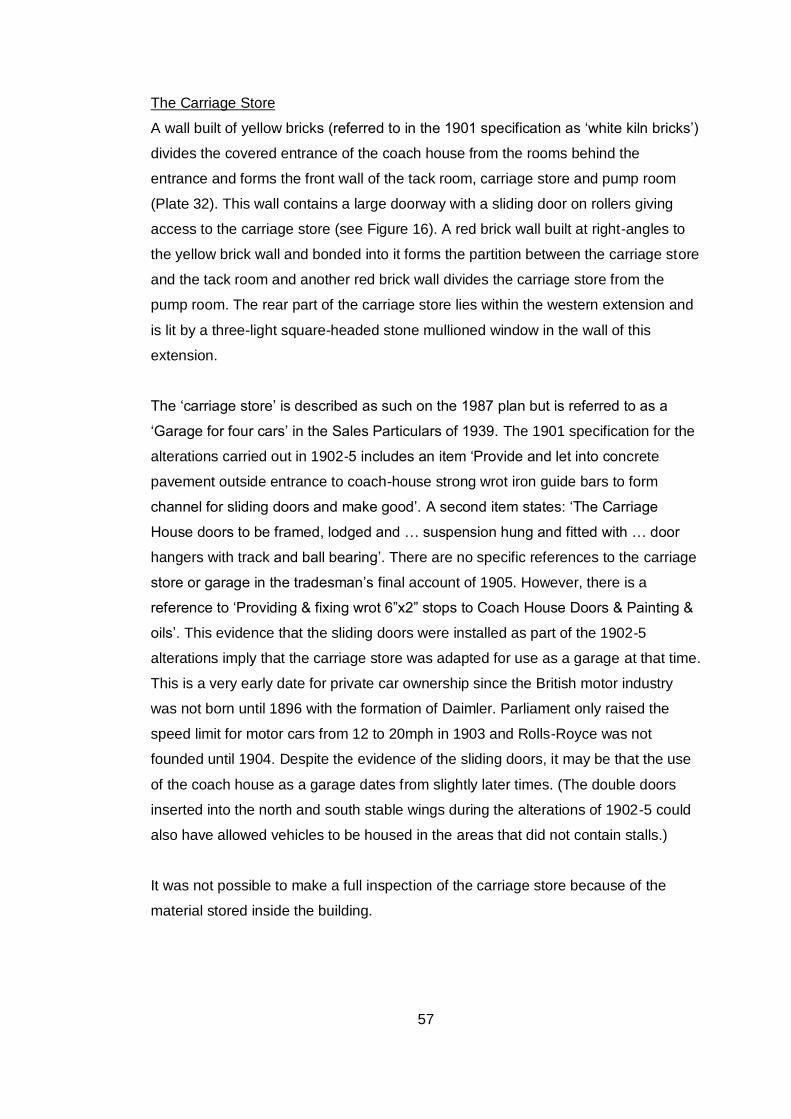
57
The Carriage Store
A wall built of yellow bricks (referred to in the 1901 specification as ‘white kiln bricks’)
divides the covered entrance of the coach house from the rooms behind the
entrance and forms the front wall of the tack room, carriage store and pump room
(Plate 32). This wall contains a large doorway with a sliding door on rollers giving
access to the carriage store (see Figure 16). A red brick wall built at right-angles to
the yellow brick wall and bonded into it forms the partition between the carriage store
and the tack room and another red brick wall divides the carriage store from the
pump room. The rear part of the carriage store lies within the western extension and
is lit by a three-light square-headed stone mullioned window in the wall of this
extension.
The ‘carriage store’ is described as such on the 1987 plan but is referred to as a
‘Garage for four cars’ in the Sales Particulars of 1939. The 1901 specification for the
alterations carried out in 1902-5 includes an item ‘Provide and let into concrete
pavement outside entrance to coach-house strong wrot iron guide bars to form
channel for sliding doors and make good’. A second item states: ‘The Carriage
House doors to be framed, lodged and … suspension hung and fitted with … door
hangers with track and ball bearing’. There are no specific references to the carriage
store or garage in the tradesman’s final account of 1905. However, there is a
reference to ‘Providing & fixing wrot 6”x2” stops to Coach House Doors & Painting &
oils’. This evidence that the sliding doors were installed as part of the 1902-5
alterations imply that the carriage store was adapted for use as a garage at that time.
This is a very early date for private car ownership since the British motor industry
was not born until 1896 with the formation of Daimler. Parliament only raised the
speed limit for motor cars from 12 to 20mph in 1903 and Rolls-Royce was not
founded until 1904. Despite the evidence of the sliding doors, it may be that the use
of the coach house as a garage dates from slightly later times. (The double doors
inserted into the north and south stable wings during the alterations of 1902-5 could
also have allowed vehicles to be housed in the areas that did not contain stalls.)
It was not possible to make a full inspection of the carriage store because of the
material stored inside the building.
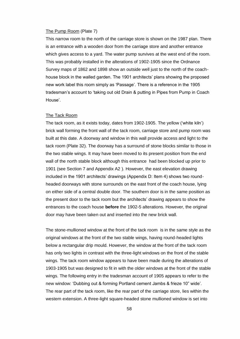
58
The Pump Room (Plate 7)
This narrow room to the north of the carriage store is shown on the 1987 plan. There
is an entrance with a wooden door from the carriage store and another entrance
which gives access to a yard. The water pump survives at the west end of the room.
This was probably installed in the alterations of 1902-1905 since the Ordnance
Survey maps of 1862 and 1898 show an outside well just to the north of the coach-
house block in the walled garden. The 1901 architects’ plans showing the proposed
new work label this room simply as ‘Passage’. There is a reference in the 1905
tradesman’s account to ‘taking out old Drain & putting in Pipes from Pump in Coach
House’.
The Tack Room
The tack room, as it exists today, dates from 1902-1905. The yellow (‘white kiln’)
brick wall forming the front wall of the tack room, carriage store and pump room was
built at this date. A doorway and window in this wall provide access and light to the
tack room (Plate 32). The doorway has a surround of stone blocks similar to those in
the two stable wings. It may have been moved to its present position from the end
wall of the north stable block although this entrance had been blocked up prior to
1901 (see Section 7 and Appendix A2 ). However, the east elevation drawing
included in the 1901 architects’ drawings (Appendix D: Item 4) shows two round-
headed doorways with stone surrounds on the east front of the coach house, lying
on either side of a central double door. The southern door is in the same position as
the present door to the tack room but the architects’ drawing appears to show the
entrances to the coach house before the 1902-5 alterations. However, the original
door may have been taken out and inserted into the new brick wall.
The stone-mullioned window at the front of the tack room is in the same style as the
original windows at the front of the two stable wings, having round-headed lights
below a rectangular drip mould. However, the window at the front of the tack room
has only two lights in contrast with the three-light windows on the front of the stable
wings. The tack room window appears to have been made during the alterations of
1903-1905 but was designed to fit in with the older windows at the front of the stable
wings. The following entry in the tradesman account of 1905 appears to refer to the
new window: ‘Dubbing out & forming Portland cement Jambs & frieze 10” wide’.
The rear part of the tack room, like the rear part of the carriage store, lies within the
western extension. A three-light square-headed stone mullioned window is set into
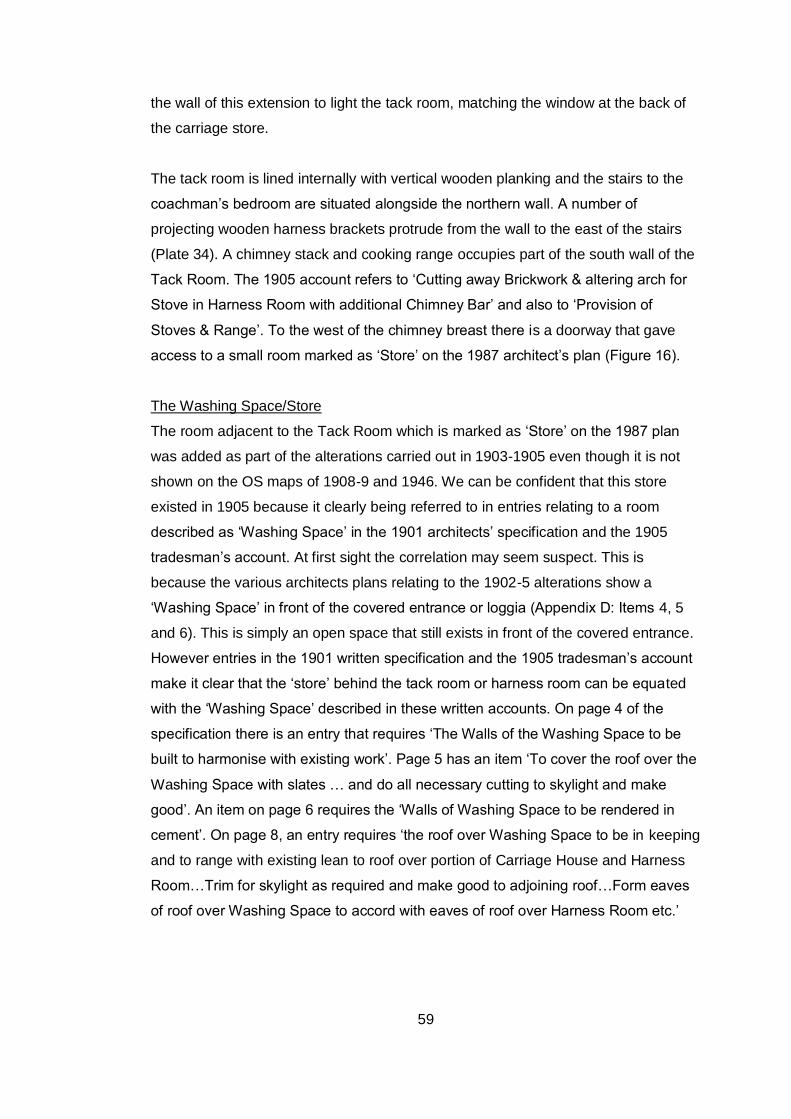
59
the wall of this extension to light the tack room, matching the window at the back of
the carriage store.
The tack room is lined internally with vertical wooden planking and the stairs to the
coachman’s bedroom are situated alongside the northern wall. A number of
projecting wooden harness brackets protrude from the wall to the east of the stairs
(Plate 34). A chimney stack and cooking range occupies part of the south wall of the
Tack Room. The 1905 account refers to ‘Cutting away Brickwork & altering arch for
Stove in Harness Room with additional Chimney Bar’ and also to ‘Provision of
Stoves & Range’. To the west of the chimney breast there is a doorway that gave
access to a small room marked as ‘Store’ on the 1987 architect’s plan (Figure 16).
The Washing Space/Store
The room adjacent to the Tack Room which is marked as ‘Store’ on the 1987 plan
was added as part of the alterations carried out in 1903-1905 even though it is not
shown on the OS maps of 1908-9 and 1946. We can be confident that this store
existed in 1905 because it clearly being referred to in entries relating to a room
described as ‘Washing Space’ in the 1901 architects’ specification and the 1905
tradesman’s account. At first sight the correlation may seem suspect. This is
because the various architects plans relating to the 1902-5 alterations show a
‘Washing Space’ in front of the covered entrance or loggia (Appendix D: Items 4, 5
and 6). This is simply an open space that still exists in front of the covered entrance.
However entries in the 1901 written specification and the 1905 tradesman’s account
make it clear that the ‘store’ behind the tack room or harness room can be equated
with the ‘Washing Space’ described in these written accounts. On page 4 of the
specification there is an entry that requires ‘The Walls of the Washing Space to be
built to harmonise with existing work’. Page 5 has an item ‘To cover the roof over the
Washing Space with slates … and do all necessary cutting to skylight and make
good’. An item on page 6 requires the ‘Walls of Washing Space to be rendered in
cement’. On page 8, an entry requires ‘the roof over Washing Space to be in keeping
and to range with existing lean to roof over portion of Carriage House and Harness
Room…Trim for skylight as required and make good to adjoining roof…Form eaves
of roof over Washing Space to accord with eaves of roof over Harness Room etc.’
60
In the tradesman’s account of 1905 there are various entries relating to the ‘washing
space’ as follows:
Extra labor & materials in arranging for air flue & fixing Iron Grating on
outside wall of Washing Space …’
‘extra labour & materials in putting level ceiling to Washing Space, forming
well to Skylight…’
‘Alteration in Washing Space building up Walls…’
‘To providing New Door & Frame to Washing Space’.
A wood-panelled internal ‘air flue’ can still be seen high up on the west wall of the
Store. This connects with the exterior ‘air flue’ which can still be seen in the roof of
the store (Plate 35). The roof skylight has also survived and can be seen from the
walled garden (Plate 17).
The evidence in the 1901 specifications and the 1905 tradesman’s account confirm
that the room marked as ‘Store’ on the 1987 plan is the ‘Washing Space’ described
in these documents. The room is marked on one of the architects’ drawings of 1901
showing proposed new work (Appendix D: Stratton & Millgate 1185, Item 4) but is
not named.
The Western Extension (Plates 17 and 18)
The coach house appears to have been extended to the west between 1844 and
1862. This extension has a separate slated cat-slide roof but is not divided internally
from the main eastern section of the coach house at the present day. In fact, the tack
room, carriage store and pump room all continue into the western extension and the
two windows in the western extension light the carriage store and the tack room.
However, these arrangements date only from the alterations of 1902-5. Most of the
western extension was formerly occupied by a harness room which is marked on the
1901 architects’ plan showing the stables ‘as at present’ i.e. before the alterations
were carried out (Appendix D: Stratton & Millgate 1185, Item 5). This original
harness room had a long axis running north-south but was removed to give the new
tack room and carriage store greater depth.
61
The west wall of the western extension has two square-mullioned windows of three
lights. These are in a different style from the round-headed mullioned windows at the
front of the building, The stonework of the extension is also different from the front
elevation of the stable wings, being constructed in coursed stone rubble rather than
the dressed stone blocks used in the front elevation.
The roof of the western extension was renewed and extended when the washing
space was built onto the southern end of the western extension between 1902 and
1905, as described in Section 8.1.
The Coachman’s Bedroom (Plate 6)
This room forms part of the roof-space of the central coach-house wing but in this
part of the roof-space the rafters have been boarded over with lath and plaster.
There is a roof light on the east side of the roof.
This area was altered in 1902-1905 to form a bedroom for the coachman. One of the
architects’ drawings from 1901 shows the original loft to the south of the clock
chamber (Appendix D: Stratton & Millgate 1185, Item 5). Two of the other architects
drawings show the proposed enlargement of this room which was to be
accomplished by extending it under the roof of the western extension (Appendix D:
Stratton & Millgate 1185, Items 4 and 6). On one of these plans, the enlarged room
is labelled as ‘Groom’s Bedroom’. The 1905 tradesman’s account includes two items
relating to this room:
‘To Board Enclosure to Stairs in Coachman’s Bed Room’
‘1” Match Board Enclosure with studs to Stairs’.
The bedroom still has a door at the top of the stairs leading from the tack room,
intended to prevent draughts. There is also a fireplace served by the same chimney
flue as the tack room.
Coach-House Roof and Loft
The roof above the coach-house formerly supported a clock tower. This is shown in
the elevation drawing of the east front included in the 1901 Stratton and Millgate
Plans (Appendix D: Item 4). The 1901 plan of the first floor ‘as at present’ (Appendix
D: Item 5) shows a fully enclosed ‘clock chamber’ with lofts on either side and the
clock chamber is also shown on the plans of the proposed new works (Appendix D:
62
Items 4 and 6). However, today there is only a single open loft to the north of the
coachman’s bedroom and the clock chamber no longer exists.
The clock tower is thought to have been removed during World War II. Bullet
damage to the weather vane suggests that it may have been used for shooting
practice when Northcourt was occupied by the army in 1941.There is certainly no
reference to the removal of the clock tower in the 1901 specifications or in the
tradesman’s bill of 1905. After the clock tower had been taken down the clock
mechanism was retained and is now in the possession of the Harrison family. The
clock face has been installed in the tower of St Peter’s Church, Shorwell (Plate 33).
The gap in the coach-house roof left by the removal of the clock tower has been
filled in with slates of a different colour from the rest of the roof. Some rafters have
also been removed and replaced by new sections of rafter.
The loft above the coach-house has a floor that is 1.3m higher than the floor of the
loft in the north stable wing.
A2 The Stable Wings: General Description and Discussion
Both wings are constructed of local greensand dressed blocks of a pale green hue
that contrast with the reddish-brown ferruginous sandstone of the coach-house. The
style of the stable wings is reminiscent of the Island’s vernacular architecture of the
16th-17th centuries. Both wings sit on stone plinths and originally both were lit by two
stone-mullioned windows. Each wing has a low blocked doorway at the centre of the
front elevation (Plates 3 and 4).
The blocked doorways in the front of the two stable wings have arches composed of
side-alternate Bembridge Limestone blocks. Both doorways been carefully in-filled
with dressed stone blocks and rubble, mainly of Bembridge Limestone but with some
greensand. The careful infilling and the low height of these features suggests the
possibility that they were picturesque embellishments rather than functioning
doorways and that they may always have been blocked. One argument against this
idea is the fact that the stone arches in the blocked doorways are strongly made and
that the keystones are of load-bearing strength. It must also be considered that if the
doorways were always blocked, the original entrance to the two stable wings must
have been through the doorways in the end walls of each wing or through the
63
doorways connecting with the covered entrance. Such an arrangement would have
been very inconvenient as it would not have allowed direct access into the stables
from the front of the building. Nevertheless, the evidence set out in Section 7 does
suggest that the blocked doorways in the east front of the stable wings were never
functional.
The doorway in the end wall of the north stable wing (Plate 36) was blocked before
1901 as stated in Section 7. However, the corresponding end wall of the south stable
wing still has a functioning doorway (Plate 37) despite an entry in the 1901
architects’ specifications which reads ‘the entrance nearest house to 2 stall stable to
be blocked up with stone’. It would appear that this proposal was not actually carried
out.
All the original doorways in the stable block have three-centred stone arches built
mainly of Bembridge Limestone (see Plates 32 and 37). Doorways with similar three-
centred arches can be seen in Shorwell village in the two estate cottages of
‘Heronfield’ and ‘Poplynge Mill’.
A3 The North Stable Block (Plate 3)
A double-doored entrance was cut through the northern mullioned window of the
north stable block during the alterations of 1902-1905, removing the window entirely
but leaving the drip mould in situ. This three-light window with round-headed arches
appears to have been reused in the 1960s in a small garden building situated beside
the knot garden at North Court (Plate 38). The other stone-mullioned window
survives intact to the south of the blocked doorway. This window has three round-
headed lights and a drip mould above.
The southern interior wall of the north stable is not visible at present because of
material stored in the room but the 1987 plan shows a doorway connecting with the
covered entrance to the central block. A doorway exists in a similar position in the
north wall of the south stable wing (see below).
Two tie-braces are visible on the east front of the north stable wing (Plate 3). The
lower brace may extend under the floorboards to the west side of the wing since a
64
tie-brace is visible in the rear elevation (Plate 59). However, the upper brace extends
only for about 2 metres into the loft space where it is secured to an upright timber
(Plate 39). This would appear to compromise the function of the tie-brace in keeping
the wall upright should it start bulging outwards.
The 1901 plans of the North Court Stables, both ‘as at present’ and ‘as proposed’
show five stalls in the north stable wing (Appendix D: Stratton & Millgate 1185, Items
4, 5 and 6). However, it was probably decided to reduce the number of stalls during
the actual alteration work since the 1939 Sales Particulars for North Court refer to
stabling for only five horses in total (i.e. in the north and south stable wings). This
equates with the accommodation surviving in the stables today, where there are two
stalls and a loose box in the north stable wing (Plates 40, 41 and 42) and two stalls
in the south room of the south stable.
The two stalls in the north stable wing are at the southern end of the building. They
are divided from each other by a sloping and curved wooden-planked partition
topped with iron beading. At the end of the partition there is a low iron heel post,
round in section, with tether rings and ball finial. This heel post is moulded with the
legend ‘Musgraves London & Belfast Patent’ (Plate 43).
Both the stalls and the loose box have tie-up rings, hay-racks with vertical iron bars
and cast iron water troughs. However, at the time of the survey, the trough in the
northern of the two stalls was lying on the floor in a dilapidated state. The two stalls
are also fitted with cast iron plates situated beneath the water troughs (see Plates 40
and 41) and similar cast iron plates survive in the north room of the south stable.
These plates seem to have been part of pulley mechanisms that are no longer in
place. The purpose of the pulley mechanisms is not known. A pulley wheel made of
lignum vitae (a very hard and dense wood) can be seen lying on the edge of the
water trough in Stall 1 (Plate 40).
This stable appears to have been used as a store during the World War II army
occupation of North Court. Various stencils and graffiti attest to this use. The wood
panelling on the southern side of Stall 1 bears the stencilled legend ‘BAY 1.
TENTAGE TOOLS FOR CLEANING AND SHARPENING’ . The wood panelling on
the north side of Stall 2 bears the stencilled legend ‘BAY 2 CHESTS TECH EQUIP’.
65
The centre of the stable is occupied by the loose box. A partition with wooden
panelling surmounted by cast iron bars (height 2.4 m) divides the loose box from the
front of the stable (Plate 44). The framework of the loose box is supported by round
cast iron posts with ball finials. There is a reference to this loose box in the 1905
tradesman’s account which refers to ‘cutting away for & fixing ironwork to additional
side of Loose Box, providing boarding etc’. Another reference in the 1905 account
refers to sizing, staining and twice varnishing of ‘woodwork to stalls and loose boxes’
but today there is evidence for only one loose box.
There is no stall or division on the northern side of the loose box but the north-west
corner of the building has a cast iron manger. There is also a rectangular stone or
rendered concrete plinth which contains an integral sunken trough.
Wooden planking in the end (north) wall extends to 2.3m and covers the blocked
doorway mentioned above. This wall also has iron tie-up rings and a wooden
cupboard at the eastern end.
Concern about stable hygiene and ventilation had become an obsession by the
middle of the 19th century and much was written on the subject.20 All the ventilators in
the two stable wings at North Court appear to have been installed during the 1902-
1905 alterations since there are many references to ventilators in the 1901 building
specifications and in the 1905 tradesman’s account. There are three ventilators set
high into the back (west) wall of the north stable (Plate 45) although there is not a
ventilator at the northern end of the wall, perhaps because this area did not contain a
stall. There are also two ventilators close to the ceiling in the end (north) wall of the
stable, one of which is shown as Plate 46. These ventilators bear the legend
‘MUSGRAVES PATENT BELFAST’. The firm of Musgrave & Co Ltd was founded in
Belfast in 1827. By the 1890’s a large home and export business had been built up,
principally for stable fittings and slow combustion stoves. The company had a show
room in Paris and agencies in most principal European countries. They were
responsible for fitting out and furnishing stables for the Empress Frederisk of
Germany, HM the King of Spain, as well as for very many members of the
20
Worsley 2004, 240-241, 269
66
aristocracy of the United Kingdom and Europe, also to the cattle barons of South
America.21
A ladder leads from the ground floor of the north stable to the hay loft via a trap door
(Plate 47). This corresponds with a similar ladder and trap door in the north room of
the south stable (Plate 49).
There is a square-shaped opening in the end wall of the hay loft at first-floor level
(Plate 48) and a corresponding opening in the end wall of the south stable hay loft
(Plate 37). The purpose of these openings was to allow hay and straw to be pitch-
forked up into the loft from a cart parked below. The hay or straw would then have
been stored in the loft and dropped down through the trap door as required. The
stone jambs surrounding both of these first-floor openings are of greensand, with
Bembridge Limestone blocks forming the sills. Curiously, neither opening has a
stone lintel. Instead, in both cases, the wooden wall plate bearing the roof forms the
top of the opening. Both openings have wooden doors.
A4 The South Stable Block (Plate 4)
The exterior of this block matches the northern stable block. Before the alterations of
1903-1905 the front wall possessed two mullioned windows, one on either side of the
central doorway. A double-doored entrance was installed during the alterations,
replacing the mullioned window on the north side of the blocked doorway. However,
the concrete lintel for this new doorway was inserted below the top of the window,
leaving the tops of the three round-headed lights in position as well as the drip mould
above.
Unlike the north stable wing, this block is divided into two rooms.
Northern Room
The modern entrance to the northern room is through the double door inserted into
one of the original window spaces. To the south of this entrance is a blocked
doorway. As with the matching blocked doorway in the north stable wing, this
doorway could not have been open at the same time as the present access to the
hay loft. This access is by means of a vertical ladder situated in front of the blocked
21
http://www.hevac-heritage.org/victorian_engineers/musgrave%27s/musgrave%27s.htm
67
doorway (Plate 49). Evidence of the blocked doorway on the inside of the building is
now concealed by a protruding brick dado 1.35m in height and by rendering above
the dado, possibly forming part of the 1903-1905 alterations.
There are three ventilators set high up in the back (west) wall. This wall also retains
two cast iron plates that appear to have been associated with pulley mechanisms.
Two similar plates are located in the north stable block (see A3 above).
No complete stalls survive in this room but three tie-up rings along the back wall
suggest that there were three stalls at one time (Plate 50). The 1901 plans for the
North Court Stables, both ‘at present’ and ‘as proposed’, mark the position of three
stalls in the northern room (Appendix D: Stratton & Millgate 1185, Items 4, 5 and 6).
It is assumed that these stalls were removed during the 1902-5 alterations. Two
squares of concrete have been inserted in the floor in the positions of former heel
posts situated at the end of stall partitions. There is also a drain running north-south
along the front of the former stalls. This drain has been in-filled with concrete (Plate
51). In the south-west corner there is a concrete plinth, possibly a manger base.
A wooden-planked stall-end abuts the north wall of this room (Plate 52). This ends in
a half-round heel post with ball finial. (All the heel posts abutting walls appear to
have been half-round in section whereas free-standing heel posts were round in
section.) Beyond the stall-end, a dado runs along the north wall, corresponding to
the dado on the east wall and possibly also forming part of the 1903-1905
alterations.
At the eastern end of the north wall there is a doorway connecting with the covered
entrance (Plate 53).This corresponds with a similar doorway connecting the north
stable wing with the covered entrance A stone-arched doorway in the south wall
connects with the southern room of the South Stable Wing (Plate 54). Section 7
discusses these two doorways in detail. The 1901 specification for alterations to the
stables indicates that the door between the northern and southern rooms of the
south stable was inserted as part of the alterations although it has the appearance of
being older.
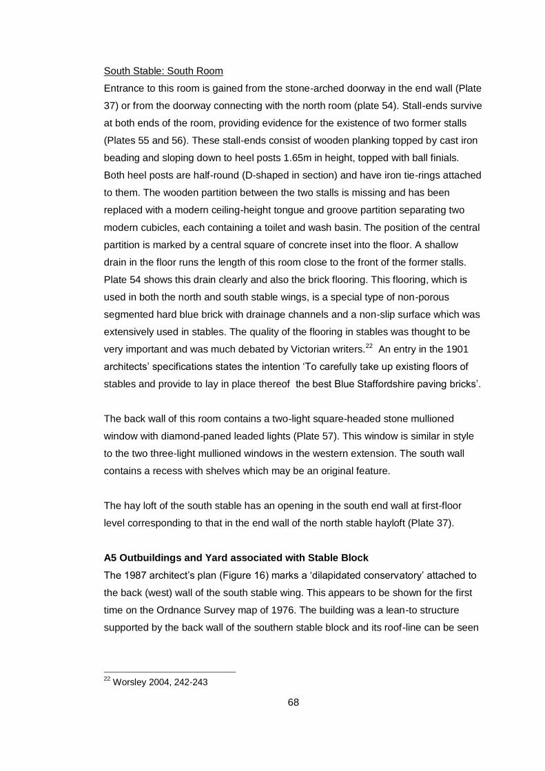
68
South Stable: South Room
Entrance to this room is gained from the stone-arched doorway in the end wall (Plate
37) or from the doorway connecting with the north room (plate 54). Stall-ends survive
at both ends of the room, providing evidence for the existence of two former stalls
(Plates 55 and 56). These stall-ends consist of wooden planking topped by cast iron
beading and sloping down to heel posts 1.65m in height, topped with ball finials.
Both heel posts are half-round (D-shaped in section) and have iron tie-rings attached
to them. The wooden partition between the two stalls is missing and has been
replaced with a modern ceiling-height tongue and groove partition separating two
modern cubicles, each containing a toilet and wash basin. The position of the central
partition is marked by a central square of concrete inset into the floor. A shallow
drain in the floor runs the length of this room close to the front of the former stalls.
Plate 54 shows this drain clearly and also the brick flooring. This flooring, which is
used in both the north and south stable wings, is a special type of non-porous
segmented hard blue brick with drainage channels and a non-slip surface which was
extensively used in stables. The quality of the flooring in stables was thought to be
very important and was much debated by Victorian writers.22 An entry in the 1901
architects’ specifications states the intention ‘To carefully take up existing floors of
stables and provide to lay in place thereof the best Blue Staffordshire paving bricks’.
The back wall of this room contains a two-light square-headed stone mullioned
window with diamond-paned leaded lights (Plate 57). This window is similar in style
to the two three-light mullioned windows in the western extension. The south wall
contains a recess with shelves which may be an original feature.
The hay loft of the south stable has an opening in the south end wall at first-floor
level corresponding to that in the end wall of the north stable hayloft (Plate 37).
A5 Outbuildings and Yard associated with Stable Block
The 1987 architect’s plan (Figure 16) marks a ‘dilapidated conservatory’ attached to
the back (west) wall of the south stable wing. This appears to be shown for the first
time on the Ordnance Survey map of 1976. The building was a lean-to structure
supported by the back wall of the southern stable block and its roof-line can be seen
22
Worsley 2004, 242-243
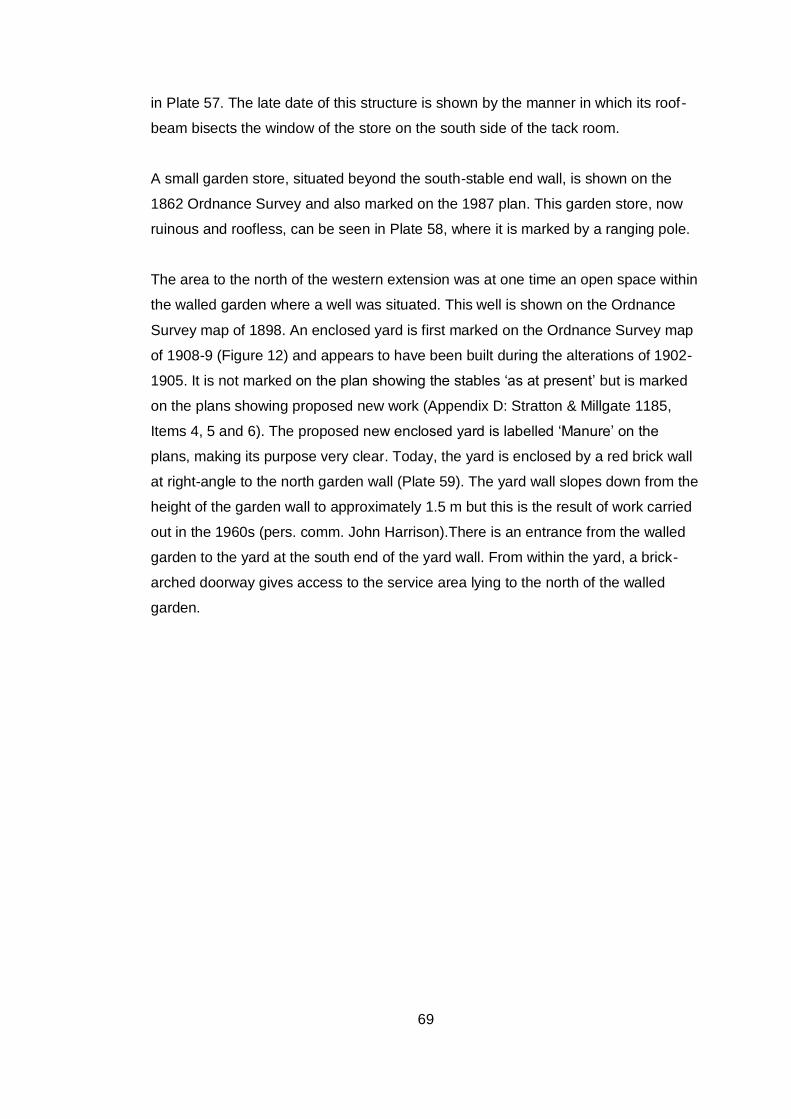
69
in Plate 57. The late date of this structure is shown by the manner in which its roof-
beam bisects the window of the store on the south side of the tack room.
A small garden store, situated beyond the south-stable end wall, is shown on the
1862 Ordnance Survey and also marked on the 1987 plan. This garden store, now
ruinous and roofless, can be seen in Plate 58, where it is marked by a ranging pole.
The area to the north of the western extension was at one time an open space within
the walled garden where a well was situated. This well is shown on the Ordnance
Survey map of 1898. An enclosed yard is first marked on the Ordnance Survey map
of 1908-9 (Figure 12) and appears to have been built during the alterations of 1902-
1905. It is not marked on the plan showing the stables ‘as at present’ but is marked
on the plans showing proposed new work (Appendix D: Stratton & Millgate 1185,
Items 4, 5 and 6). The proposed new enclosed yard is labelled ‘Manure’ on the
plans, making its purpose very clear. Today, the yard is enclosed by a red brick wall
at right-angle to the north garden wall (Plate 59). The yard wall slopes down from the
height of the garden wall to approximately 1.5 m but this is the result of work carried
out in the 1960s (pers. comm. John Harrison).There is an entrance from the walled
garden to the yard at the south end of the yard wall. From within the yard, a brick-
arched doorway gives access to the service area lying to the north of the walled
garden.
70
Appendix B: Survey of the Walled Garden and Service Area
B1. General Description of Walled Garden
The date of the present walled garden is discussed in Section 8.3. It has been shown
that by 1844 there were boundary walls enclosing the area of the present garden but
that there are subtle differences between the alignment of the walls as shown on the
1844 tithe map (Figure 6) and the walls as they exist today. The various
discrepancies between the tithe map and the 1st Edition 1:2500 Ordnance Survey
map may indicate that some rebuilding of the garden walls took place between 1844
and 1862-3 when the Ordnance Survey map shows the garden walls as at present
(Figure 8). On the other hand, the tithe map may be inaccurately representing the
existing garden walls. It is noticeable that both the field boundaries to the west of the
walled garden and the walled garden itself have a WNW-ESE alignment on the tithe
map whereas the field boundaries and the walled garden have a west-east alignment
on the 1862-3 OS map (compare Figures 6 and 7).
The shape of the garden is that of a trapezium rather than a rectangle. Only the
north and south walls are parallel and there is an acute angle between the south and
west walls. There is also a change in alignment at the north end of the west garden.
The materials used for the garden walls at North Court are typical in attempting to
balance fashion and economy. Like many other walled gardens of similar date,
fashionable brick was used for the front wall and cheaper stone for the side walls. At
North Court, stone was used for the exterior walls on the north, west and east sides
but brick was used for the exterior wall on the south side, where the main entrance to
the garden was situated. The exterior faces of the west and east walls are
constructed in coursed greensand stone rubble, each course being 36 cm in width.
The west and north exterior walls include ferruginous sandstone. There is also some
chalk in the west end of the north wall. The eastern exterior wall is shown in Plate
60. The brick wall on the exterior south front of the garden (Plate 61) is supported by
brick pilasters at regular intervals.
Although stone was an economical material for walled gardens it was considered
cold and damp, so the most important inward, south-facing walls were often lined
71
with brick.23 At North Court, all the interior walls of the garden are faced with brick.
There does not appear to be one distinctive brick bond. The interior walls are
supported by brick pilasters similar to those on the outside face of the south wall.
The western half of the south wall is of double thickness on the inside to a height of
1.5 metres and is 2.75 metres high.
There are four functioning doorways in the walled garden. The main entrance in the
centre of the south wall has a round-headed brick entrance arch from which hangs
an iron-barred gate (Plate 62). At the end of the central path there is a pointed brick-
arched doorway with a wooden door in the north wall of the garden, leading to the
service area (Plate 63). A second doorway with a round-headed brick arch lies at the
eastern end of the north wall within a small enclosed yard behind the stable (Plate 64
shows this doorway from the Service Area). There is a further pointed brick-arched
doorway with wooden door at the northern end of the west wall (Plate 65). This
doorway in the west wall formerly gave access to the dairy building marked on the
1844 tithe map (see Figure 6 and Appendix C). Between 1908 and 1946 the dairy
was demolished and replaced by two glasshouses which had been removed by 1976
(see Figures 12, 14 and 15).
The western wall of the garden extends for several metres beyond the south wall
and there is a doorway with a pointed brick arch in this section of wall outside the
actual walled garden.
Inside the garden, there are two main cultivation areas divided by a central path lined
with box hedging and running northward from the main entrance. This path is shown
on the 1862-3 Ordnance Survey map, as are paths along the sides of the garden,
following the line of the four garden walls. The central path is made of rammed chalk
and flint, as is the path on the northern side of the garden. The other paths have now
been grassed over. There are fruit trees on the west side of the central path and in
the south-west and south-east quarters of the garden (Plates 66 and 67). Many of
these trees are old espaliered specimens. The garden also has fruit bushes,
23
http://www.parksandgardens.ac.uk/274/explore-31/feature-articles-151/the-walled-
kitchen-garden-547.html
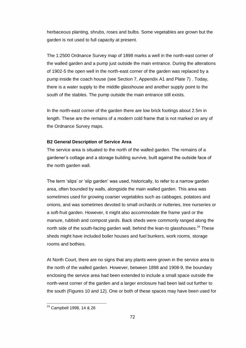
72
herbaceous planting, shrubs, roses and bulbs. Some vegetables are grown but the
garden is not used to full capacity at present.
The 1:2500 Ordnance Survey map of 1898 marks a well in the north-east corner of
the walled garden and a pump just outside the main entrance. During the alterations
of 1902-5 the open well in the north-east corner of the garden was replaced by a
pump inside the coach house (see Section 7, Appendix A1 and Plate 7) . Today,
there is a water supply to the middle glasshouse and another supply point to the
south of the stables. The pump outside the main entrance still exists.
In the north-east corner of the garden there are low brick footings about 2.5m in
length. These are the remains of a modern cold frame that is not marked on any of
the Ordnance Survey maps.
B2 General Description of Service Area
The service area is situated to the north of the walled garden. The remains of a
gardener’s cottage and a storage building survive, built against the outside face of
the north garden wall.
The term ‘slips’ or ‘slip garden’ was used, historically, to refer to a narrow garden
area, often bounded by walls, alongside the main walled garden. This area was
sometimes used for growing coarser vegetables such as cabbages, potatoes and
onions, and was sometimes devoted to small orchards or nutteries, tree nurseries or
a soft-fruit garden. However, it might also accommodate the frame yard or the
manure, rubbish and compost yards. Back sheds were commonly ranged along the
north side of the south-facing garden wall, behind the lean-to glasshouses.24 These
sheds might have included boiler houses and fuel bunkers, work rooms, storage
rooms and bothies.
At North Court, there are no signs that any plants were grown in the service area to
the north of the walled garden. However, between 1898 and 1908-9, the boundary
enclosing the service area had been extended to include a small space outside the
north-west corner of the garden and a larger enclosure had been laid out further to
the south (Figures 10 and 12). One or both of these spaces may have been used for
24
Campbell 1998, 14 & 26
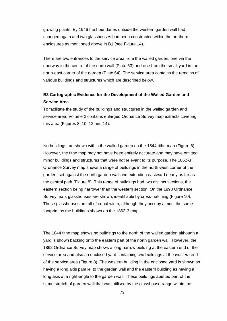
73
growing plants. By 1946 the boundaries outside the western garden wall had
changed again and two glasshouses had been constructed within the northern
enclosures as mentioned above in B1 (see Figure 14).
There are two entrances to the service area from the walled garden, one via the
doorway in the centre of the north wall (Plate 63) and one from the small yard in the
north-east corner of the garden (Plate 64). The service area contains the remains of
various buildings and structures which are described below.
B3 Cartographic Evidence for the Development of the Walled Garden and
Service Area
To facilitate the study of the buildings and structures in the walled garden and
service area, Volume 2 contains enlarged Ordnance Survey map extracts covering
this area (Figures 8, 10, 12 and 14).
No buildings are shown within the walled garden on the 1844 tithe map (Figure 6).
However, the tithe map may not have been entirely accurate and may have omitted
minor buildings and structures that were not relevant to its purpose. The 1862-3
Ordnance Survey map shows a range of buildings in the north-west corner of the
garden, set against the north garden wall and extending eastward nearly as far as
the central path (Figure 8). This range of buildings had two distinct sections, the
eastern section being narrower than the western section. On the 1898 Ordnance
Survey map, glasshouses are shown, identifiable by cross-hatching (Figure 10).
These glasshouses are all of equal width, although they occupy almost the same
footprint as the buildings shown on the 1862-3 map.
The 1844 tithe map shows no buildings to the north of the walled garden although a
yard is shown backing onto the eastern part of the north garden wall. However, the
1862 Ordnance Survey map shows a long narrow building at the eastern end of the
service area and also an enclosed yard containing two buildings at the western end
of the service area (Figure 8). The western building in the enclosed yard is shown as
having a long axis parallel to the garden wall and the eastern building as having a
long axis at a right-angle to the garden wall. These buildings abutted part of the
same stretch of garden wall that was utilised by the glasshouse range within the

74
walled garden. The western building appears to have been extended and rebuilt to
form a gardener’s cottage at some time between 1908-9 (date of 3rd Edition 1:2500
Ordnance Survey) and 1939, when a gardener’s cottage is described in the 1939
Sales Particulars for North Court.25 This work was probably carried out for Mrs
Disney Leith who died in 1929. The eastern building seems to have been extended
between 1862-3 (date of 1st edition 1:2500 Ordnance Survey) and 1898 (date of 2nd
edition 1:2500 Ordnance Survey). In the 20th century it seems to have been a store
building for the gardener’s cottage,
B4. Survey of Buildings, Structures and Walls at the North End of the Walled
Garden and within the Service Area
Introduction
This survey has been undertaken in an attempt to understand the complex building
phases in this part of the site and to record buildings and sections of wall that may
be demolished or altered by future work at North Court. Figure 17 is a rough sketch
plan of the survey area and should be referred to in connection with the text.
There is evidence for a range of three glasshouses along the inner face of the north
garden wall. These are described below as the ‘western’, ‘middle’ and ‘eastern’
glasshouses. All the glasshouses were lean-to buildings with the back walls of the
buildings also forming the north wall of the walled garden
Evidence for Early Building in North-West Corner of Garden and for Western
Glasshouse
The west garden wall has a curious dog-leg at its northern end. It meets the north
garden wall at an angle of 90 degrees but only a short 4 metre section maintains this
strict north-south alignment. To the south of this section, the west garden wall is
angled 5 degrees towards the west.
25
Harrison Family Archive
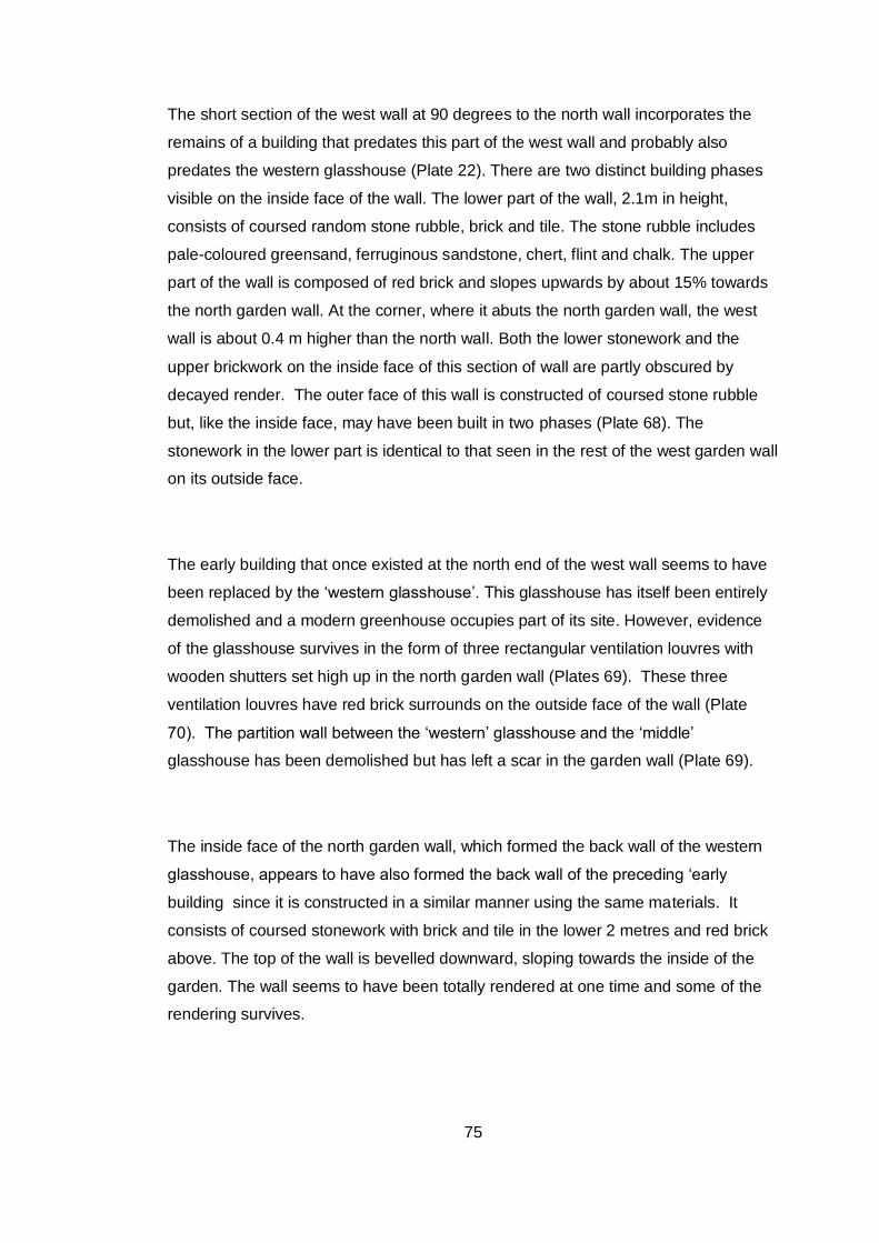
75
The short section of the west wall at 90 degrees to the north wall incorporates the
remains of a building that predates this part of the west wall and probably also
predates the western glasshouse (Plate 22). There are two distinct building phases
visible on the inside face of the wall. The lower part of the wall, 2.1m in height,
consists of coursed random stone rubble, brick and tile. The stone rubble includes
pale-coloured greensand, ferruginous sandstone, chert, flint and chalk. The upper
part of the wall is composed of red brick and slopes upwards by about 15% towards
the north garden wall. At the corner, where it abuts the north garden wall, the west
wall is about 0.4 m higher than the north wall. Both the lower stonework and the
upper brickwork on the inside face of this section of wall are partly obscured by
decayed render. The outer face of this wall is constructed of coursed stone rubble
but, like the inside face, may have been built in two phases (Plate 68). The
stonework in the lower part is identical to that seen in the rest of the west garden wall
on its outside face.
The early building that once existed at the north end of the west wall seems to have
been replaced by the ‘western glasshouse’. This glasshouse has itself been entirely
demolished and a modern greenhouse occupies part of its site. However, evidence
of the glasshouse survives in the form of three rectangular ventilation louvres with
wooden shutters set high up in the north garden wall (Plates 69). These three
ventilation louvres have red brick surrounds on the outside face of the wall (Plate
70). The partition wall between the ‘western’ glasshouse and the ‘middle’
glasshouse has been demolished but has left a scar in the garden wall (Plate 69).
The inside face of the north garden wall, which formed the back wall of the western
glasshouse, appears to have also formed the back wall of the preceding ‘early
building since it is constructed in a similar manner using the same materials. It
consists of coursed stonework with brick and tile in the lower 2 metres and red brick
above. The top of the wall is bevelled downward, sloping towards the inside of the
garden. The wall seems to have been totally rendered at one time and some of the
rendering survives.
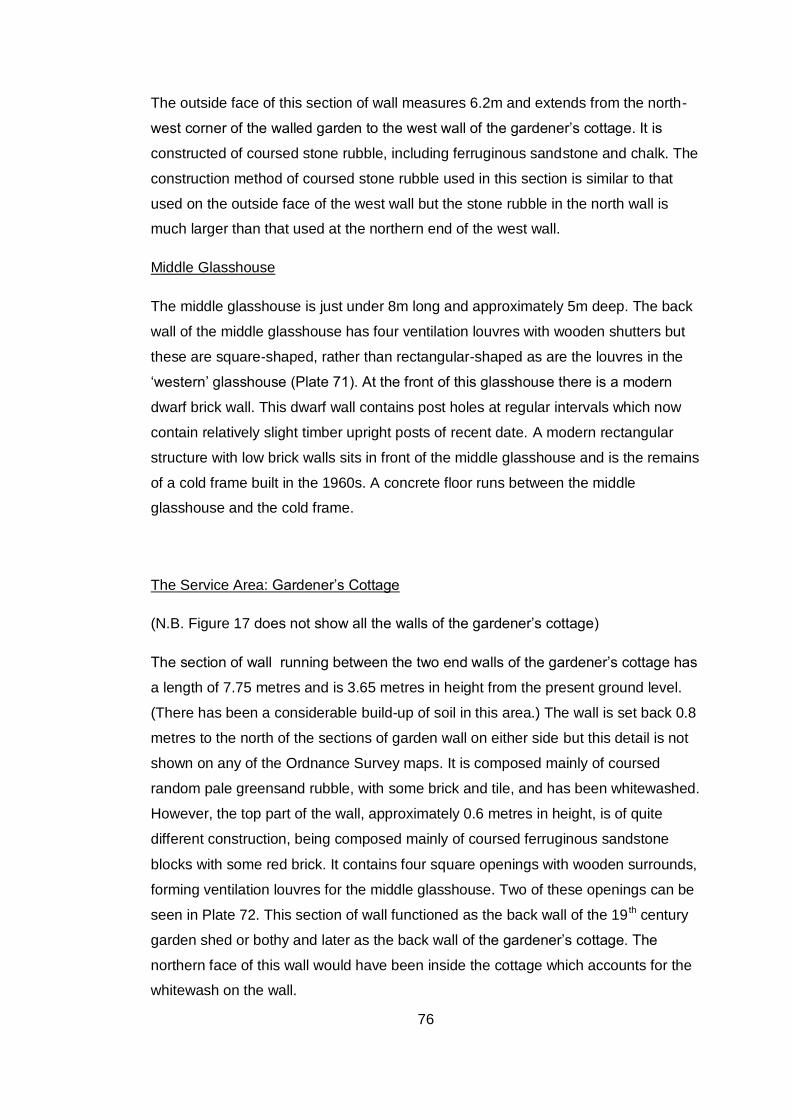
76
The outside face of this section of wall measures 6.2m and extends from the north-
west corner of the walled garden to the west wall of the gardener’s cottage. It is
constructed of coursed stone rubble, including ferruginous sandstone and chalk. The
construction method of coursed stone rubble used in this section is similar to that
used on the outside face of the west wall but the stone rubble in the north wall is
much larger than that used at the northern end of the west wall.
Middle Glasshouse
The middle glasshouse is just under 8m long and approximately 5m deep. The back
wall of the middle glasshouse has four ventilation louvres with wooden shutters but
these are square-shaped, rather than rectangular-shaped as are the louvres in the
‘western’ glasshouse (Plate 71). At the front of this glasshouse there is a modern
dwarf brick wall. This dwarf wall contains post holes at regular intervals which now
contain relatively slight timber upright posts of recent date. A modern rectangular
structure with low brick walls sits in front of the middle glasshouse and is the remains
of a cold frame built in the 1960s. A concrete floor runs between the middle
glasshouse and the cold frame.
The Service Area: Gardener’s Cottage
(N.B. Figure 17 does not show all the walls of the gardener’s cottage)
The section of wall running between the two end walls of the gardener’s cottage has
a length of 7.75 metres and is 3.65 metres in height from the present ground level.
(There has been a considerable build-up of soil in this area.) The wall is set back 0.8
metres to the north of the sections of garden wall on either side but this detail is not
shown on any of the Ordnance Survey maps. It is composed mainly of coursed
random pale greensand rubble, with some brick and tile, and has been whitewashed.
However, the top part of the wall, approximately 0.6 metres in height, is of quite
different construction, being composed mainly of coursed ferruginous sandstone
blocks with some red brick. It contains four square openings with wooden surrounds,
forming ventilation louvres for the middle glasshouse. Two of these openings can be
seen in Plate 72. This section of wall functioned as the back wall of the 19 th century
garden shed or bothy and later as the back wall of the gardener’s cottage. The
northern face of this wall would have been inside the cottage which accounts for the
whitewash on the wall.
77
Doorways survive in the west and east walls of the gardener’s cottage and there is
also a window in the west wall. There is also evidence for windows in the front
(north) wall of the cottage although this red brick wall survives to only about 1.5
metres (Plates 19 and 73). The building has a concrete floor which is consistent with
an early twentieth century rebuild.
Maps and documentary evidence show that the gardener’s cottage was formed by
amalgamating and extending the two existing buildings at the west end of the service
area between 1908 and 1939. The present ruinous building provides physical
evidence for changes over time. The red brick wall at the west end of the building
has been bonded into an older stub of wall protruding from the garden wall (Plate 74)
and the wall of whitewashed stone rubble at the east end of the original building
shows clear evidence that the roof line has been raised (Plate 75). Today, the roof
lines of both end walls in the gardener’s cottage protrude above the lower sections of
garden wall on either side of the building.
The present back wall of the cottage incorporates the ventilation louvres belonging to
the middle glasshouse in the walled garden. However, the stub of earlier wall bonded
into the west end wall of the cottage suggests that the roof line of the earlier work
shed or bothy may have met the garden wall beneath the line of the ventilation
louvres. The incorporation of the ventilation louvres into the back wall of the rebuilt
gardener’s cottage would suggest that the middle glasshouse had gone out of use by
the time that the gardener’s cottage was rebuilt or that the ventilation louvres were
no longer in use.
At one time, a doorway provided access between the middle glasshouse and the
building that preceded the gardener’s cottage. This has been partially infilled with
concrete blocks to create a window which looks out from the gardener’s cottage into
the middle glasshouse (Plate 31). The window was probably created when the
cottage was rebuilt in the early 20th century. The existence of this window, like the
incorporation of the ventilation louvres into the back wall of the cottage, may imply
that the middle glasshouse was not functional by the early twentieth century.
It is tentatively suggested that four phases of building work can be identified in this
area. The first building on the site may have been a work shed or bothy which was
free-standing and had a gabled roof. The footprint of this building may have been
78
partly outside and partly inside the area of the present walled garden. Evidence is
provided by the main east end wall of the gardener’s cottage. This end wall appears
to straddle the existing party wall between the gardener’s cottage and the walled
garden, suggesting that the party wall may be later in date than the end wall. After
the party wall had been inserted, part of the former east wall to the bothy or work
shed was reused as a partition wall between the middle glasshouse and the eastern
glasshouse. At a later date, the party wall was heightened to provide ventilation by
means of louvred openings. Finally, the gardener’s cottage was rebuilt at some time
between 1908 and 1939. An outbuilding was added at this time, outside the west end
wall of the cottage. This outbuilding has collapsed but part of the slate roof is lying on
the ground (Plate 70).
The Eastern Glasshouse
The partition wall between the ‘middle’ glasshouse and the ‘eastern’ glasshouse,
(possibly re-using part of the east gable wall of the 19th century work shed or bothy)
is constructed of red brick and has a doorway with a wooden door (Plate 76). The
section of garden wall that forms the back wall of the eastern glasshouse butts up
against this partition wall. This suggests that the garden wall/back wall of the
glasshouse is later in date than the partition wall/east gable wall of the bothy.
The surviving evidence for the eastern glasshouse includes a low brick wall forming
the front of the building (on the same line as the dwarf wall at the front of the middle
glasshouse) and another low brick wall forming the east end wall of the building.
These low brick walls are about 0.75m high. There are two arched openings set into
the front wall. Plates 25 and 26 show one of these arches, which may be openings
for grape vines planted outside the glasshouse.
The back wall contains a blocked doorway with flat wooden lintel which provided
access to and from the service area. Plate 77 shows this doorway on the inside of
the wall and Plate 78 shows it from the outside, within the service area. On the wall
to the west of the blocked doorway there is a curious patch of plastering surmounted
by wooden fixtures (Plate 76).
79
The Service Area: Eastern Store building, Furnace Area and Heating Arrangements
The store building attached to the east end of the gardener’s cottage was accessible
from the cottage through a door in the east end wall of the cottage (Plate 79). This
store building includes two 20th century storerooms built of concrete blocks, one of
which contained shelves. The 1898 Ordnance Survey map shows a glasshouse
attached to this building. Surviving low brick walls suggest that this glasshouse may
have been a cold frame.
The 1862-3 Ordnance Survey map shows that the two buildings at the western end
of the service area lay within an enclosed yard. Part of this yard wall was demolished
when the gardener’s cottage was extended to the north and no trace of the wall
survives to the west of the gardener’s cottage. However, part of the yard wall does
survive to the east of the store building as a low stone wall with brick quoins. This
terminates just to the west of the central gateway into the walled garden.
The boiler room lies to the east of the store building against the outside face of the
garden wall (Plate 28). This is first shown on the 1908-9 Ordnance Survey map. The
furnace lies in the south-west corner of this room against the garden wall. It has a
square-headed iron arch with rectangular iron vents above it and to either side. The
furnace was photographed by the Isle of Wight Gardens Trust in 2002 (Plate 27) but
since that time it has become very overgrown and only the top of the structure is now
visible, as can be seen in Plate 28. Behind the store building, to the east of the
furnace, there is a blocked brick arch that, when open, would have conducted hot
gasses to the middle glasshouse. There is also an adjacent square opening at the
base of the garden wall that would have conducted hot gases to the eastern
glasshouse (Plate 80).
An early photograph (Plate 81) shows that hot gases conducted from the furnace to
the middle glasshouse escaped through a chimney at the east end of the building.
This photograph also shows how the party wall between the middle glasshouse and
the bothy/gardener’s cottage was set back from the back wall of the other two
glasshouses.
To the east of the furnace there is a smoke-blackened and protruding section of wall
containing a diagonal internal flue (Plate 29). This lies behind the eastern
glasshouse and may be connected in some way with the patch of plastering on the
80
back wall of the eastern glasshouse. The wall-flue terminates in a brick buttress at its
eastern end. To the north of the buttress there is a low brick wall containing an
arched opening. This may have been the stoke hole for the furnace. (Plate 28). The
blocked doorway connecting with the eastern glasshouse lies immediately to the
east of this buttress.
It is clear that the eastern and middle glasshouses, at least, were heated, although
the eastern glasshouse does not have ventilation louvres in the back wall, unlike the
middle and western glasshouses. The existence of ventilation louvres in the western
glasshouse suggest that this building was also heated. Susan Campbell has
explained how the problem of ventilation was solved in the 19 th century by ‘admitting
air low down in the front of the house at a point where it would encounter some form
of heat from a flue, steam pipe or hot-water pipe’, By ‘opening more ventilators high
up at the back of the house, a current would be formed and the warmed air would
exit, taking stale air with it.26 The ventilation louvres in the western and middle
glasshouses would have been opened by pulling strings attached to the tops and
bottoms of the wooden shutters.
Possible Heated Wall
As well as having heated glasshouses, a part of the north garden wall may also have
been heated. ‘Hott walls’ or ‘fire walls’ were employed in walled gardens from the
18th century.27 These were heated by internal smoke flues. The necessary fireplaces
and fuel stacks were situated – often in pairs –at the back of the wall and the fires
were often sheltered by furnace sheds.28 In the North Court walled garden two
possible square brick chimneys are set into the north garden wall beyond the eastern
glasshouse, one on each side of the doorway in the centre of the garden. Both
structures are now capped with slate. They were repaired in the 1970s and were not
then examined for possible cavities. Plate 83 shows these two structures although
the western one is obscured by a fig tree. It is interesting that these possible
chimneys are not situated within any of the glasshouses. They may simply be
buttresses but a photograph of Tatton Park in Cheshire showing chimneys in a
heated wall, one on either side of a doorway,29 is strikingly similar to the arrangement
26
Campbell 2005, 188
27 Campbell 2005, 59-62
28 Campbell 1998, 17-18
29 Campbell 1998, 18
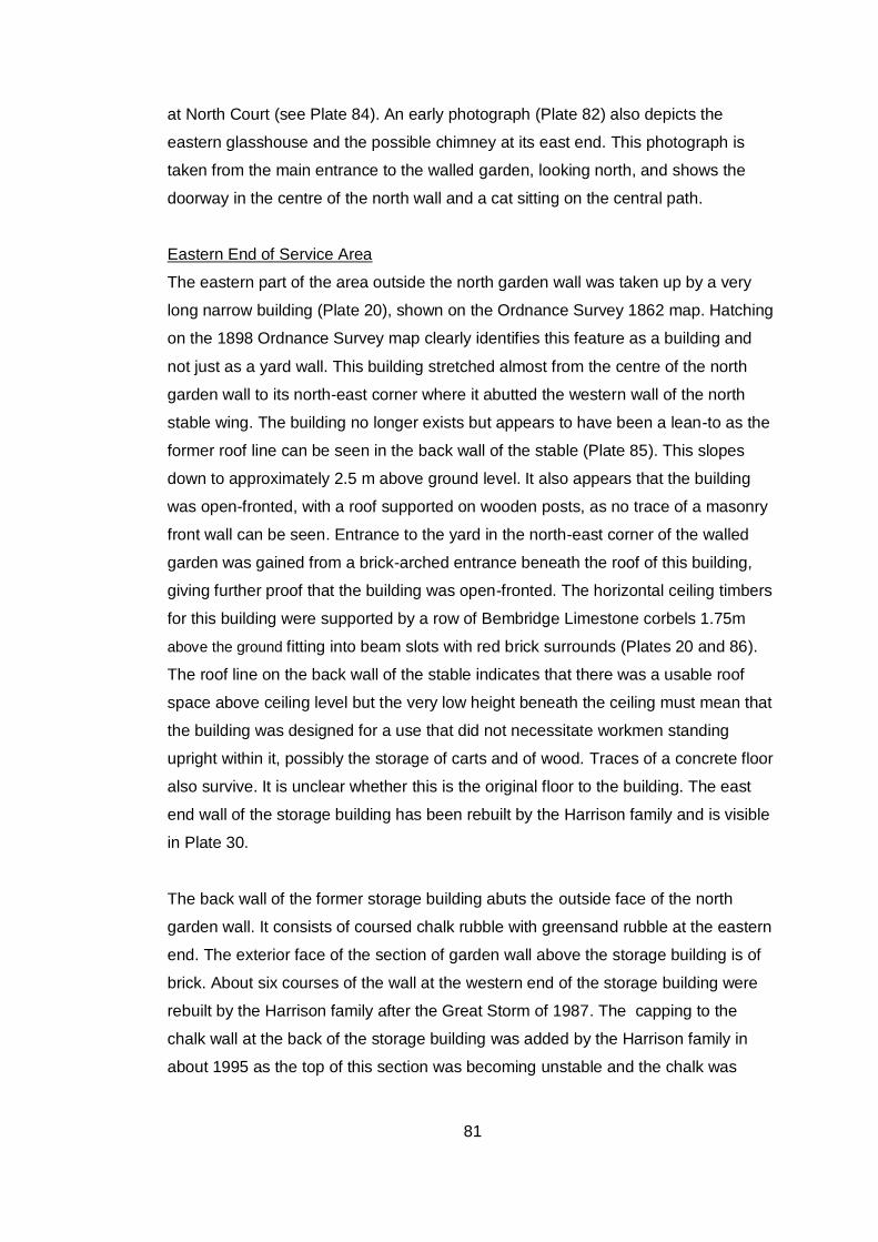
81
at North Court (see Plate 84). An early photograph (Plate 82) also depicts the
eastern glasshouse and the possible chimney at its east end. This photograph is
taken from the main entrance to the walled garden, looking north, and shows the
doorway in the centre of the north wall and a cat sitting on the central path.
Eastern End of Service Area
The eastern part of the area outside the north garden wall was taken up by a very
long narrow building (Plate 20), shown on the Ordnance Survey 1862 map. Hatching
on the 1898 Ordnance Survey map clearly identifies this feature as a building and
not just as a yard wall. This building stretched almost from the centre of the north
garden wall to its north-east corner where it abutted the western wall of the north
stable wing. The building no longer exists but appears to have been a lean-to as the
former roof line can be seen in the back wall of the stable (Plate 85). This slopes
down to approximately 2.5 m above ground level. It also appears that the building
was open-fronted, with a roof supported on wooden posts, as no trace of a masonry
front wall can be seen. Entrance to the yard in the north-east corner of the walled
garden was gained from a brick-arched entrance beneath the roof of this building,
giving further proof that the building was open-fronted. The horizontal ceiling timbers
for this building were supported by a row of Bembridge Limestone corbels 1.75m
above the ground fitting into beam slots with red brick surrounds (Plates 20 and 86).
The roof line on the back wall of the stable indicates that there was a usable roof
space above ceiling level but the very low height beneath the ceiling must mean that
the building was designed for a use that did not necessitate workmen standing
upright within it, possibly the storage of carts and of wood. Traces of a concrete floor
also survive. It is unclear whether this is the original floor to the building. The east
end wall of the storage building has been rebuilt by the Harrison family and is visible
in Plate 30.
The back wall of the former storage building abuts the outside face of the north
garden wall. It consists of coursed chalk rubble with greensand rubble at the eastern
end. The exterior face of the section of garden wall above the storage building is of
brick. About six courses of the wall at the western end of the storage building were
rebuilt by the Harrison family after the Great Storm of 1987. The capping to the
chalk wall at the back of the storage building was added by the Harrison family in
about 1995 as the top of this section was becoming unstable and the chalk was

82
getting badly affected by frost. The brick buttresses to the brick-built wall above were
added at the same time (see Plate 20).
83
B5. Building Phases relating to the North Garden Wall, Glasshouses and
Buildings in Service Area
The analysis below does not take account of the 1790s Ordnance Survey maps or
the 1844 Tithe Map since these maps probably do not provide accurate information
about the minor buildings described in this appendix. In other words, the absence of
individual buildings or structures from these maps cannot be taken as evidence that
particular buildings did not exist at the date of the maps.
It has not been possible to assign definite dates to the various buildings and
structures at the north end of the walled garden and in the service area. However, a
number of building phases can be identified.
Phase 1: Pre 1862-3 (probably pre 1844)
The building in the north-west corner of the walled garden predates the 1862-3 OS
map. It had been incorporated into the west garden wall by 1862-3.
The bothy that preceded the later gardener’s cottage appears to predate the 1862-3
map since its original footprint fell partly to the south of the back garden wall shown
on this map. The bothy can also be shown to predate the present middle and eastern
glasshouses, the evidence for this being the relationship between the east gable wall
of the bothy and the back walls of these glasshouses.
This early phase could date from the 18th or early 19th century, since Phase 2 is also
earlier than 1862-3.
Phase 2: Pre 1862-3 (possibly pre 1844)
By the time of the 1862-3 OS map, a range of buildings existed along the back wall
of the walled garden. These could be early 19th century since the Sales Particulars of
1836 refer to ‘walled gardens with grapery and succession houses’. The particulars
could be describing the walled gardens shown on the 1790s OS maps, which have a
different footprint from the present walled garden. However, the walled garden
shown on the 1844 tithe map has a very similar footprint to the present garden
although there are minor discrepancies.
It is unclear whether the range of buildings along the back wall of the walled garden
shown on the 1862-3 map can be equated with the glasshouses shown on the 1898
OS map. The range of buildings shown on the 1862-3 map had two distinct sections,
84
the eastern section being narrower than the western section, and is not identified as
a glasshouse range by cross-hatching. However, the glasshouses shown on the OS
1898 map, identifiable by cross-hatching, are all of equal width although they occupy
almost the same footprint as the buildings shown on the 1862 map.
By 1862-3, the bothy or work shed within the service area had been reduced in width
by the construction of the range of buildings along the back wall of the garden. An ‘L’
shaped storage building had been built to the east of the bothy and a very long
storage building had been constructed at the eastern end of the service area to the
east of the central gateway into the walled garden.
Phase 3
The back wall behind the middle glasshouse was heightened and ventilation louvres
were built into the new top section of this wall. This event cannot be dated from map
evidence.
Phase 4: 1862-1898
Alterations may have taken place to the range of buildings along the back garden
wall as the 1862-3 OS map shows that this range was wider at its western end
whereas by 1898 the OS map shows a range of glasshouses of equal width.
In the service area, the building to the east of the bothy was extended to the east
between 1862-3 and 1898, giving it a rectangular rather than an ‘L’ shaped footprint.
Phase 5: 1898-1908/9
The boiler room was built to the east of the store building in the service area (first
shown on 1908-9 OS map). Presumably, there must have been earlier arrangements
for heating the glasshouses. Perhaps the wall-flue and the possible wall chimneys
mentioned in B4 may be of earlier date.
Phase 6: Between 1908 and 1939
The bothy was rebuilt and extended to form a gardener’s cottage and an outhouse
was added to the west of the cottage. It is assumed that the middle glasshouse went
out of use when the gardener’s cottage was built.
85
Appendix C: The Development of the North Court Estate
The manor of North Shorwell or North Court was probably the estate held by the
king in Shorwell at the time of the Domesday Survey in 1086.30 In the 13th century
the manor was granted to the Nuns of Lacock by Amice, widow of Baldwin Earl of
Devon. After the Dissolution, North Court was granted to Thomas Temes in 1544
but his son sold it in 1586 to John and Barnabas Leigh. In 1603 John Leigh was
appointed Deputy Captain of the Island and c.1615 he built the present manor
house.31
North Court remained in the ownership of the Leigh family until January 1794
when The five daughters of John Leigh and their husbands sold the manor of
North Court, with the quit rents and North Court Farm, Furze Ground and Jordan
Coppice to Richard Bull, Esq. of Chipping Ongar, Essex, and Stratton Street,
Westminster.32
Richard Bull seems to have previously leased the manor house from about 1783.
Bull was a collector of prints and drawings. He and his wife Mary had two
daughters, Elizabeth and Catherine. There were also two children from Mary’s
first marriage, Richard Bennet and Levina Bennet. Elizabeth Bull had a great
enthusiasm for landscape gardening and North Court was embellished with
terraces, an ornamental dairy, a rustic bridge, a Temple of the Sun and a rustic
summerhouse floored with knucklebones.33
In the early 19th century the North Court Estate amounted to 1736 acres.34 This
included the ‘ancient mansion of North Court’ with its offices, outbuildings,
pleasure grounds and plantations, and also the farms of North Court, Cheverton,
30
Page ed. 1912, 279-280
31 Lloyd and Pevsner 2006, 274
32 IWCRO/DL/21. This document purports to be a lease for one year but has been interpreted
by Clifford Webster (former County Archivist) as transferring the ownership of North Court from John Leigh’s daughters and the daughters’ husbands to Richard Bull. This interpretation can be found in Clifford Webster’s transcription and annotation of the Royal Survey of the Isle of Wight 1559-60, held at the Isle of Wight Record Office.
33 Pinkerton 1978
34 1836 Sales Particulars IWCRO/DL/355
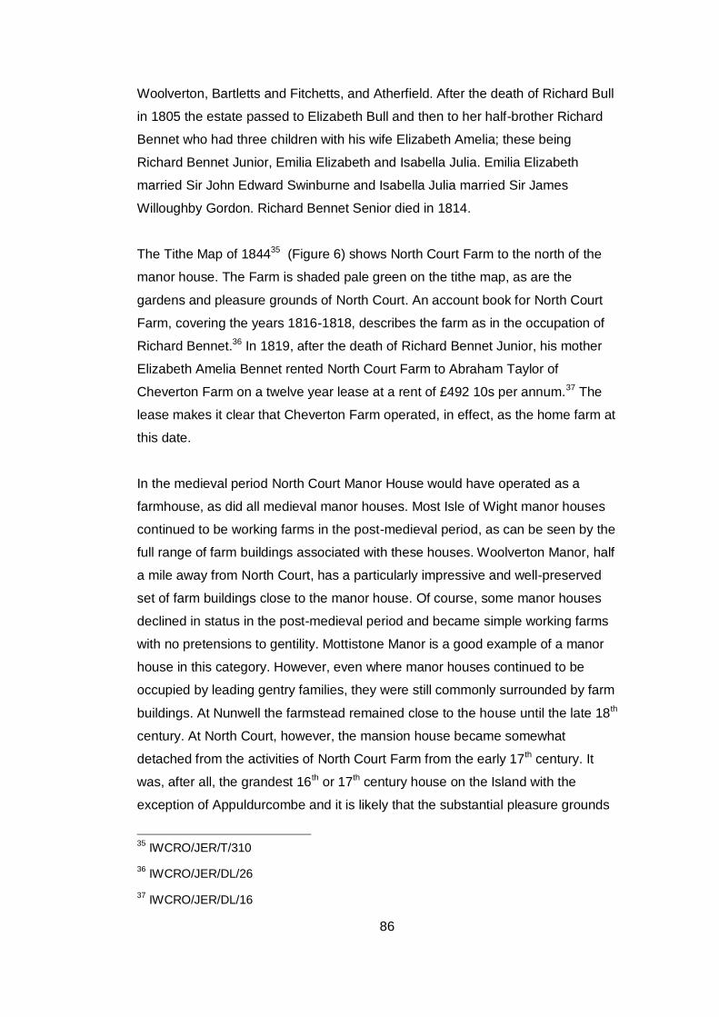
86
Woolverton, Bartletts and Fitchetts, and Atherfield. After the death of Richard Bull
in 1805 the estate passed to Elizabeth Bull and then to her half-brother Richard
Bennet who had three children with his wife Elizabeth Amelia; these being
Richard Bennet Junior, Emilia Elizabeth and Isabella Julia. Emilia Elizabeth
married Sir John Edward Swinburne and Isabella Julia married Sir James
Willoughby Gordon. Richard Bennet Senior died in 1814.
The Tithe Map of 184435 (Figure 6) shows North Court Farm to the north of the
manor house. The Farm is shaded pale green on the tithe map, as are the
gardens and pleasure grounds of North Court. An account book for North Court
Farm, covering the years 1816-1818, describes the farm as in the occupation of
Richard Bennet.36 In 1819, after the death of Richard Bennet Junior, his mother
Elizabeth Amelia Bennet rented North Court Farm to Abraham Taylor of
Cheverton Farm on a twelve year lease at a rent of £492 10s per annum.37 The
lease makes it clear that Cheverton Farm operated, in effect, as the home farm at
this date.
In the medieval period North Court Manor House would have operated as a
farmhouse, as did all medieval manor houses. Most Isle of Wight manor houses
continued to be working farms in the post-medieval period, as can be seen by the
full range of farm buildings associated with these houses. Woolverton Manor, half
a mile away from North Court, has a particularly impressive and well-preserved
set of farm buildings close to the manor house. Of course, some manor houses
declined in status in the post-medieval period and became simple working farms
with no pretensions to gentility. Mottistone Manor is a good example of a manor
house in this category. However, even where manor houses continued to be
occupied by leading gentry families, they were still commonly surrounded by farm
buildings. At Nunwell the farmstead remained close to the house until the late 18th
century. At North Court, however, the mansion house became somewhat
detached from the activities of North Court Farm from the early 17th century. It
was, after all, the grandest 16th or 17th century house on the Island with the
exception of Appuldurcombe and it is likely that the substantial pleasure grounds
35
IWCRO/JER/T/310
36 IWCRO/JER/DL/26
37 IWCRO/JER/DL/16
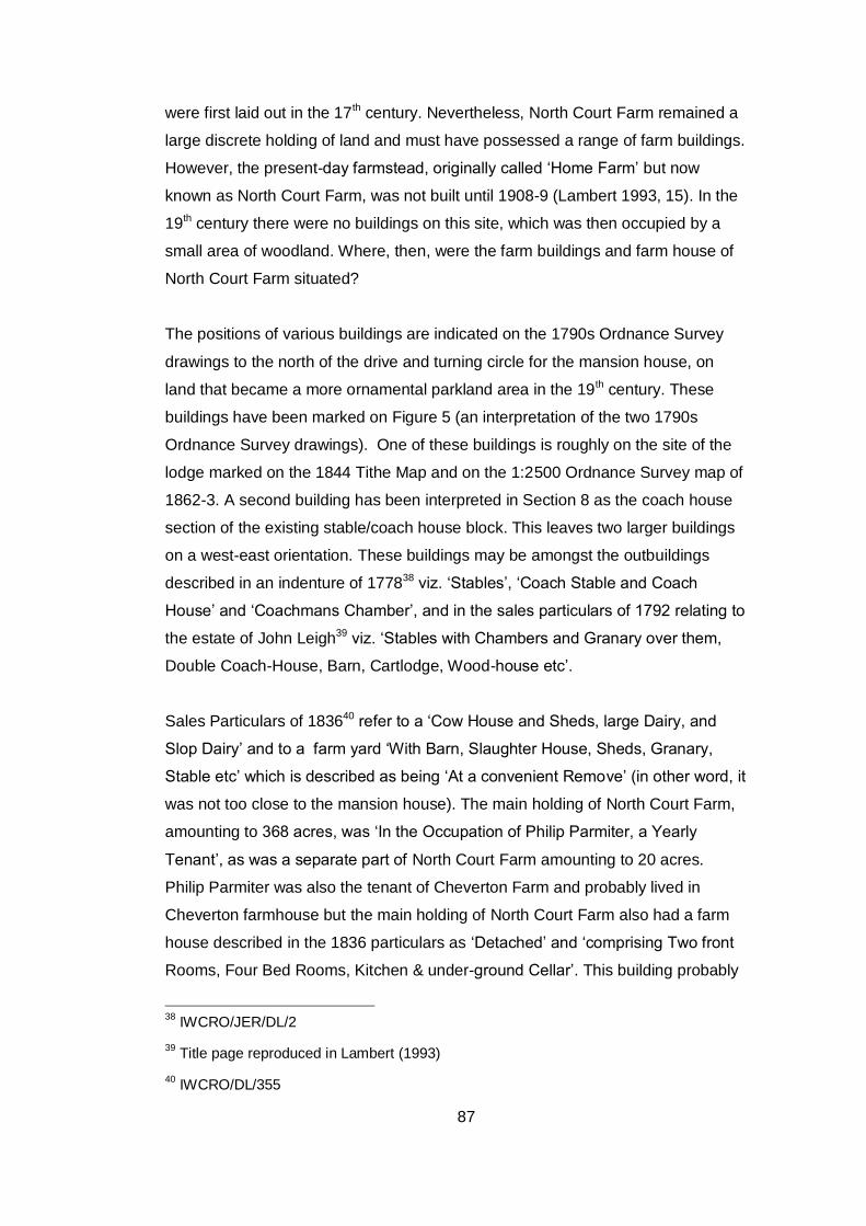
87
were first laid out in the 17th century. Nevertheless, North Court Farm remained a
large discrete holding of land and must have possessed a range of farm buildings.
However, the present-day farmstead, originally called ‘Home Farm’ but now
known as North Court Farm, was not built until 1908-9 (Lambert 1993, 15). In the
19th century there were no buildings on this site, which was then occupied by a
small area of woodland. Where, then, were the farm buildings and farm house of
North Court Farm situated?
The positions of various buildings are indicated on the 1790s Ordnance Survey
drawings to the north of the drive and turning circle for the mansion house, on
land that became a more ornamental parkland area in the 19th century. These
buildings have been marked on Figure 5 (an interpretation of the two 1790s
Ordnance Survey drawings). One of these buildings is roughly on the site of the
lodge marked on the 1844 Tithe Map and on the 1:2500 Ordnance Survey map of
1862-3. A second building has been interpreted in Section 8 as the coach house
section of the existing stable/coach house block. This leaves two larger buildings
on a west-east orientation. These buildings may be amongst the outbuildings
described in an indenture of 177838 viz. ‘Stables’, ‘Coach Stable and Coach
House’ and ‘Coachmans Chamber’, and in the sales particulars of 1792 relating to
the estate of John Leigh39 viz. ‘Stables with Chambers and Granary over them,
Double Coach-House, Barn, Cartlodge, Wood-house etc’.
Sales Particulars of 183640 refer to a ‘Cow House and Sheds, large Dairy, and
Slop Dairy’ and to a farm yard ‘With Barn, Slaughter House, Sheds, Granary,
Stable etc’ which is described as being ‘At a convenient Remove’ (in other word, it
was not too close to the mansion house). The main holding of North Court Farm,
amounting to 368 acres, was ‘In the Occupation of Philip Parmiter, a Yearly
Tenant’, as was a separate part of North Court Farm amounting to 20 acres.
Philip Parmiter was also the tenant of Cheverton Farm and probably lived in
Cheverton farmhouse but the main holding of North Court Farm also had a farm
house described in the 1836 particulars as ‘Detached’ and ‘comprising Two front
Rooms, Four Bed Rooms, Kitchen & under-ground Cellar’. This building probably
38
IWCRO/JER/DL/2
39 Title page reproduced in Lambert (1993)
40 IWCRO/DL/355

88
originated as the farmhouse for a smallholding called Gossard’s which was later
incorporated into Northcourt Farm. The area of this smallholding can be identified
by the fields called Lower Gossards and Gossards Pit, plots 94 and 139 on the
tithe map. 41 Plot 140 on the tithe map was probably the site of the house
originally associated with Gossards. The Tithe Apportionment of 184242 describes
this plot as ‘Tenements and Garden’. This suggests more than one dwelling and
the 1836 Sales Particulars do mention a house adjoining the farm house,
occupied partly by John Salter and partly by James Ballstone.
Plot 140, as shown on the Tithe Map, lies to the north of the manor house, on the
right side of the public highway from Newport to Shorwell. A property is shown in
this position on the 1790s Ordnance Survey and also on the 1st Edition 1:2500
Ordnance Survey of 1862-3 (Figure 7). However, it had vanished by 1898 and is
not shown on the 1:2500 Ordnance Survey map of that date. We can therefore be
sure that an early photograph showing both Gossards and Shute Cottages (Plate
87) 43 predates 1898.
In addition to the farm house listed for North Court Farm, the 1836 Sales Particulars
describe other farm buildings under two entries: ‘New Barn (Old), Two Leans, Two
Hovels, Ox Range (now a Stable), Yard and Rick Yard’ and ‘Four-Bay Cart House
and Stable adjoining, small Cottage & Garden’. (These outbuildings and stables
were quite distinct from the offices and stables attached to the mansion house, which
were listed in a separate part of the Sales Particulars.) Some of the farm buildings
described in 1836 can be tentatively identified using the Tithe Map and the
accompanying Tithe Apportionment of 1842.
In 1842, Plot 136 was described as ‘Barns and Yard’ in the occupation of John
Newberry. Two buildings are shown on the Tithe Map and there also appear to be
two buildings shown on the 1790s Ordnance Survey although one of these was in a
different position from the second building shown on the Tithe Map. The plot and its
41
This identification has been made by Mr Clifford Webster, former County Archivist, in his Transcription and Notes on the Royal Surveys of the Isle of Wight 1559 and 1560 (typescript in IWCRO).
42 IWCRO/JER/T/ 309
43 Harrison Family Archive
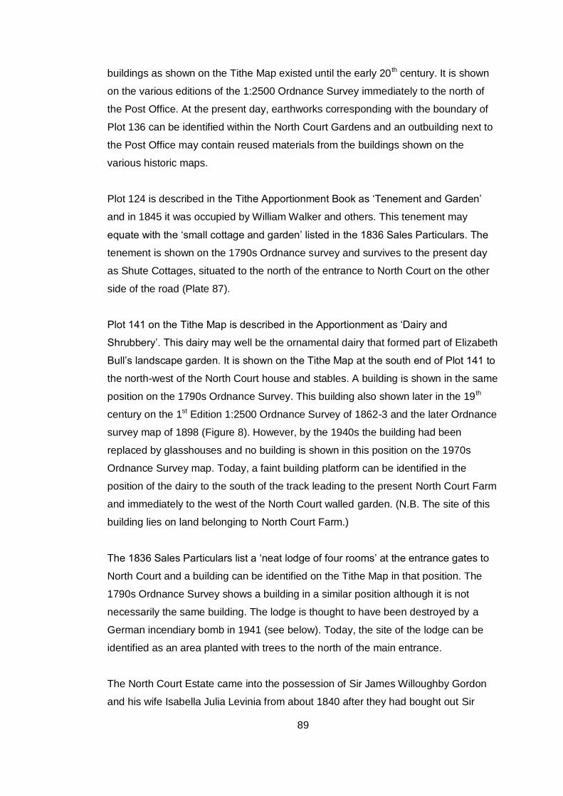
89
buildings as shown on the Tithe Map existed until the early 20 th century. It is shown
on the various editions of the 1:2500 Ordnance Survey immediately to the north of
the Post Office. At the present day, earthworks corresponding with the boundary of
Plot 136 can be identified within the North Court Gardens and an outbuilding next to
the Post Office may contain reused materials from the buildings shown on the
various historic maps.
Plot 124 is described in the Tithe Apportionment Book as ‘Tenement and Garden’
and in 1845 it was occupied by William Walker and others. This tenement may
equate with the ‘small cottage and garden’ listed in the 1836 Sales Particulars. The
tenement is shown on the 1790s Ordnance survey and survives to the present day
as Shute Cottages, situated to the north of the entrance to North Court on the other
side of the road (Plate 87).
Plot 141 on the Tithe Map is described in the Apportionment as ‘Dairy and
Shrubbery’. This dairy may well be the ornamental dairy that formed part of Elizabeth
Bull’s landscape garden. It is shown on the Tithe Map at the south end of Plot 141 to
the north-west of the North Court house and stables. A building is shown in the same
position on the 1790s Ordnance Survey. This building also shown later in the 19th
century on the 1st Edition 1:2500 Ordnance Survey of 1862-3 and the later Ordnance
survey map of 1898 (Figure 8). However, by the 1940s the building had been
replaced by glasshouses and no building is shown in this position on the 1970s
Ordnance Survey map. Today, a faint building platform can be identified in the
position of the dairy to the south of the track leading to the present North Court Farm
and immediately to the west of the North Court walled garden. (N.B. The site of this
building lies on land belonging to North Court Farm.)
The 1836 Sales Particulars list a ‘neat lodge of four rooms’ at the entrance gates to
North Court and a building can be identified on the Tithe Map in that position. The
1790s Ordnance Survey shows a building in a similar position although it is not
necessarily the same building. The lodge is thought to have been destroyed by a
German incendiary bomb in 1941 (see below). Today, the site of the lodge can be
identified as an area planted with trees to the north of the main entrance.
The North Court Estate came into the possession of Sir James Willoughby Gordon
and his wife Isabella Julia Levinia from about 1840 after they had bought out Sir
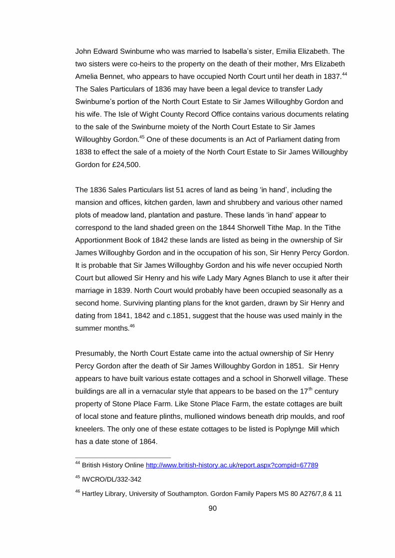
90
John Edward Swinburne who was married to Isabella’s sister, Emilia Elizabeth. The
two sisters were co-heirs to the property on the death of their mother, Mrs Elizabeth
Amelia Bennet, who appears to have occupied North Court until her death in 1837.44
The Sales Particulars of 1836 may have been a legal device to transfer Lady
Swinburne’s portion of the North Court Estate to Sir James Willoughby Gordon and
his wife. The Isle of Wight County Record Office contains various documents relating
to the sale of the Swinburne moiety of the North Court Estate to Sir James
Willoughby Gordon.45 One of these documents is an Act of Parliament dating from
1838 to effect the sale of a moiety of the North Court Estate to Sir James Willoughby
Gordon for £24,500.
The 1836 Sales Particulars list 51 acres of land as being ‘in hand’, including the
mansion and offices, kitchen garden, lawn and shrubbery and various other named
plots of meadow land, plantation and pasture. These lands ‘in hand’ appear to
correspond to the land shaded green on the 1844 Shorwell Tithe Map. In the Tithe
Apportionment Book of 1842 these lands are listed as being in the ownership of Sir
James Willoughby Gordon and in the occupation of his son, Sir Henry Percy Gordon.
It is probable that Sir James Willoughby Gordon and his wife never occupied North
Court but allowed Sir Henry and his wife Lady Mary Agnes Blanch to use it after their
marriage in 1839. North Court would probably have been occupied seasonally as a
second home. Surviving planting plans for the knot garden, drawn by Sir Henry and
dating from 1841, 1842 and c.1851, suggest that the house was used mainly in the
summer months.46
Presumably, the North Court Estate came into the actual ownership of Sir Henry
Percy Gordon after the death of Sir James Willoughby Gordon in 1851. Sir Henry
appears to have built various estate cottages and a school in Shorwell village. These
buildings are all in a vernacular style that appears to be based on the 17 th century
property of Stone Place Farm. Like Stone Place Farm, the estate cottages are built
of local stone and feature plinths, mullioned windows beneath drip moulds, and roof
kneelers. The only one of these estate cottages to be listed is Poplynge Mill which
has a date stone of 1864.
44
British History Online http://www.british-history.ac.uk/report.aspx?compid=67789
45 IWCRO/DL/332-342
46 Hartley Library, University of Southampton. Gordon Family Papers MS 80 A276/7,8 & 11
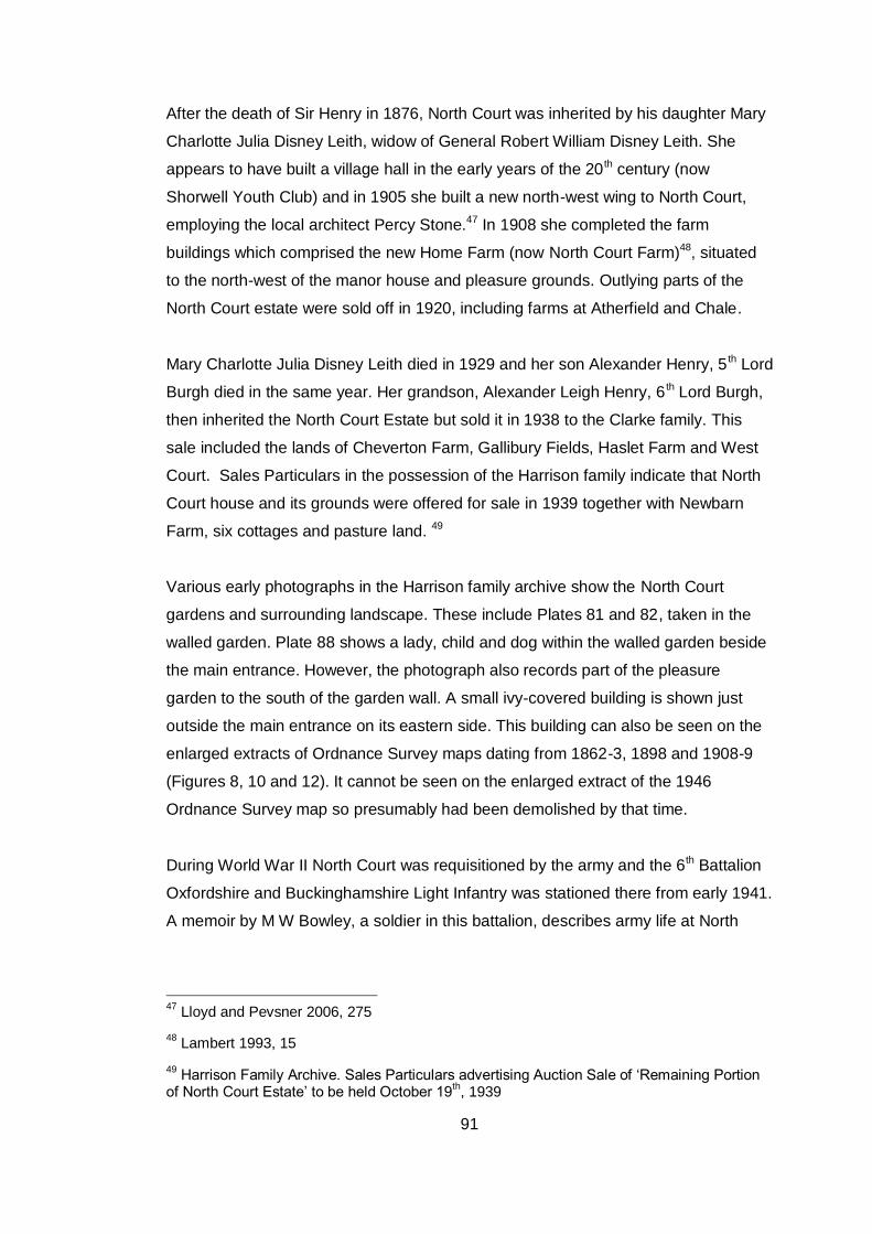
91
After the death of Sir Henry in 1876, North Court was inherited by his daughter Mary
Charlotte Julia Disney Leith, widow of General Robert William Disney Leith. She
appears to have built a village hall in the early years of the 20 th century (now
Shorwell Youth Club) and in 1905 she built a new north-west wing to North Court,
employing the local architect Percy Stone.47 In 1908 she completed the farm
buildings which comprised the new Home Farm (now North Court Farm)48, situated
to the north-west of the manor house and pleasure grounds. Outlying parts of the
North Court estate were sold off in 1920, including farms at Atherfield and Chale.
Mary Charlotte Julia Disney Leith died in 1929 and her son Alexander Henry, 5 th Lord
Burgh died in the same year. Her grandson, Alexander Leigh Henry, 6 th Lord Burgh,
then inherited the North Court Estate but sold it in 1938 to the Clarke family. This
sale included the lands of Cheverton Farm, Gallibury Fields, Haslet Farm and West
Court. Sales Particulars in the possession of the Harrison family indicate that North
Court house and its grounds were offered for sale in 1939 together with Newbarn
Farm, six cottages and pasture land. 49
Various early photographs in the Harrison family archive show the North Court
gardens and surrounding landscape. These include Plates 81 and 82, taken in the
walled garden. Plate 88 shows a lady, child and dog within the walled garden beside
the main entrance. However, the photograph also records part of the pleasure
garden to the south of the garden wall. A small ivy-covered building is shown just
outside the main entrance on its eastern side. This building can also be seen on the
enlarged extracts of Ordnance Survey maps dating from 1862-3, 1898 and 1908-9
(Figures 8, 10 and 12). It cannot be seen on the enlarged extract of the 1946
Ordnance Survey map so presumably had been demolished by that time.
During World War II North Court was requisitioned by the army and the 6th Battalion
Oxfordshire and Buckinghamshire Light Infantry was stationed there from early 1941.
A memoir by M W Bowley, a soldier in this battalion, describes army life at North
47
Lloyd and Pevsner 2006, 275
48 Lambert 1993, 15
49 Harrison Family Archive. Sales Particulars advertising Auction Sale of ‘Remaining Portion
of North Court Estate’ to be held October 19th, 1939
92
Court.50 The coach-house and stable block is not specifically mentioned although
stenciling and graffiti in the north stable wing show that the building was in use as a
store. Bowley records several air attacks in the area of North Court in May 1941.One
night many incendiary bombs were dropped. Some fell in the grounds of North Court
and one came through the roof of the main house. This was put out with sand. A
‘thatched cottage nearby’ was also hit and caught fire, soon spreading to two other
cottages. The soldiers fought the blaze unsuccessfully and Bowley records that the
cottages were destroyed. However, it is thought that the properties referred to in
Bowley’s account are Shute Cottages, which stand immediately to the north of North
Court’s main entrance on the other side of the road (Plate 87). This row of cottages
did, in fact, survive the 1941 air raid but evidence of severe damage and rebuilding
can be seen in the south gable end of the row. Bowley does not mention North
Court’s entrance lodge in his account but it is possible that this small building was a
casualty of the air raids although it could have been demolished before the start of
World War II. We know that the lodge still existed in 1936 because there is a
receipted bill of that date dealing with repairs to the roof.51 It is not mentioned in the
1939 Sales Particulars so it could have been demolished after the 1938 sale to the
Clarke family. It had definitely disappeared by 1946 as it is not shown on the
Ordnance Survey 1:2500 map of that date (Figure 13).
In 1945, Mary Levina Leith, Aunt of the 6th Lord Burgh, bought back the house and
immediate grounds. 52 After her death, North Court House and its 13 acres of
gardens were bought by Mr. Eric Harrison in 1962. Mr Harrison then fragmented it
into three separate units, dividing the house into three, the stables into three legal
and planning units, and the kitchen garden into two. Since 1982 Mr. John and Mrs
Christine Harrison have been buying back the various parts of the property from
relations.
50
Harrison Family Archive. The 6th Battalion Oxf. And Bucks Lt Infty and North court Shorwell
M W Bowley 1995
51 Harrison Family Archive. Receipted Bill for Repairs to Roof of North Court Lodge.
24.2.1936
52 Lambert 1993, 15-17
93
Appendix D
Documents Dealing with the Alterations of 1902-5
Isle of Wight County Record Office/Stratton Millgate/1185
Item 1
Written specification: ‘Northcourt Stabling, Isle of Wight. Proposed Alterations to
Specifications’. Nov 1901
Item 2
Written specification: ‘Proposed enlargement of Groom’s Bedroom’. Feb 1903
Item 3
‘Northcourt Stabling Isle of Wight. Proposed enlargement of Groom’s Bedroom. Bill
of Quantities’.
Item 4
Architect’s drawings on thick paper. ‘Northcourt Isle of Wight. Plan of Stabling etc’
showing proposed new layout. Elevations, sections and plans. N.B. Although certain
proposed alterations are shown in these drawings, it does not show all the
alterations that were actually carried out between 1903-5, for instance it does not
show the modern doors in the stable wing or the modern sliding door between the
coach house and the covered entrance (loggia).
The ground floor plan shows the proposed new layout with a harness room (tack
room), coach house and passage as shown on the 1987 Biggs Plan. It also shows a
‘Washing Space’ in front of the loggia and a yard at the back of the north stable
marked ‘manure’. The store to the south of the harness room is shown. Two stalls
are shown in the south room of the South Stable and three stalls in the north room of
the South Stable. Five stalls are shown in the North Stable.
The first floor plan shows the coachman’s bedroom as it is today - extended into
the loft above the former harness room (which lay within the ‘western extension’
under a separate cat-slide roof).
The east elevation (front of stables) shows the original windows in the stable wings.
It does not show either the modern doors or the blocked doors in the centre of each
wing. Matching doorways with three-centred arches are shown inside the loggia, one
94
on either side of a large double door for coaches and carts (N.B not the present
sliding door on rollers). This elevation drawing also shows the clock tower.
The west elevation shows the ‘western extension’ under its separate cat-slide roof
as being shorter than it is today i.e. it did not extend so far to the north. A curious
two-storey gabled wing with mullioned windows is shown to the south of the western
extension. This seems to be a proposal that never made it off the drawing board!
Item 5
Tracing. ‘Northcourt Isle of Wight Plan of Stabling etc’. Sept 1901. This drawing is
marked ‘Plans as at present’ i.e. it shows the layout as it existed in 1901 not the
proposed alterations.
Ground floor plan. This shows a total of ten stalls: two in the south room of the
South Stable, three in the north room of the South Stable and five in the North
Stable. The coach house is shown as one space with a long, narrow harness room
at the back occupying most of the ‘western extension’ under the cat-slide roof. The
covered entrance in front of the coach house is labelled ‘Loggia’. A ‘Washing Space’
is marked In front of the loggia. No entrances are shown on the eastern elevations of
the stable wings, neither the blocked gothic doorways between the mullioned
windows nor the modern doors that now exist. An entrance to the south room of the
south stable is marked in the south end wall of the building. An entrance from the
loggia to the north room of the South Stable is marked. No doorway is marked in the
end (north wall) of the North Stable/ The entrance to the North Stable is shown as
being from the loggia. The store to the south of the present tack room/harness room
is not shown.
First floor plan. This shows two separate lofts above the coach house with an
enclosed ‘clock chamber’ occupying part of the northern loft. The western loft is
similar in size to the present coachman’s bedroom but does not extend into the
‘western extension’. The roof of the western extension is shown and is marked as
‘Roof over Harness etc’. A loft is shown over each of the stable wings.
Item 6
Tracing labelled ‘Northcourt, Isle of Wight Plan of Stabling etc Sept 1901. The
ground floor and first floor pans correspond to those in Item 4 – proposed new layout
– but there are no sections or elevations.

95
Isle of Wight County Record Office/Stratton Millgate 2819
‘Northcourt Stabling. Proposed Alterations to Groom’s Bedrm’. January 1903
Drawings on disintegrating, yellowed tracing paper, folded and rolled.
First Floor Plan seems to be a proposed new layout that was never executed. It
shows a ‘Groom’s Bedroom’ to the north of the clock chamber in the coach house
loft.
Drawing of West Elevation. This appears to be the same as the west elevation
drawing shown in Item 4 of Stratton Millgate/1185. The drawing shows a proposed
new (or existing?) two storey gabled wing with mullioned windows and chimney to
the south of the ‘western extension’ under its cat-slide roof. If this wing was a
proposed alteration it was never built. The roof of the western extension (which
contained the harness room prior to the 1903-5 alterations) does not extend so far to
the north as it does today. A door is shown in the back wall of the north stable wing
immediately to the north of the western extension.
Hartley Library, University of Southampton
Tradesman’s Account of 1905
The itemised bill includes a single mention of one of the new entrances. This
refers to ‘forming Portland cement jambs and Frieze 10” wide’. Other informative
entries refer to boarding ‘Inclosure to Stairs in Coachman’s Bed Room’ and
‘Altering arch for stove in harness room’. Most of the entries deal with
improvements to the ventilation and drainage systems, lining the walls of the
stables with match board boarding and alterations to the ironwork of the loosebox.

96
Appendix E
Relevant Planning Policies
Planning Policy Statement 7 Sustainable Development in Rural Areas (ODPM
2004) sets out the government’s national policies for rural areas, including country
towns and villages and the wider undeveloped countryside up to the fringes of larger
urban areas.
Policy 1(vi) states that all development in rural areas should be well designed and
inclusive, in keeping and scale with its location, and sensitive to the character of the
countryside and local distinctiveness.
Policy 17 states that The Government’s policy is to support the re-use of
appropriately located and suitably constructed existing buildings in the
countryside where this would meet sustainable development objectives. Re-use
for economic development purposes will usually be preferable.
Policy 34 states that regional planning bodies and local planning authorities should
recognise through RSS and LDDs that tourism and leisure activities are vital to many
rural economies. They are encouraged to support through planning policies,
sustainable rural tourism and leisure developments that benefit rural businesses,
communities and visitors and which utilise and enrich, but do not harm, the character
of the countryside, its towns, villages, buildings and other features. Policy 34 also
recognizes that in areas statutorily designated for their landscape, nature
conservation or historic qualities, there will be scope for tourist and leisure related
developments, subject to appropriate control over their number, form and location to
ensure the particular qualities or features that justified the designation are
conserved.
Policy 35 encourages local planning authorities to allow appropriate facilities needed
to enhance visitors’ enjoyment, and/or improve the financial viability, of a particular
countryside feature or attraction, providing they will not detract from the
attractiveness or importance of the feature, or the surrounding countryside.
97
Policy 36 states that wherever possible, tourist and visitor facilities should be housed
in existing or replacement buildings, particularly where they are located outside
existing settlements.
Planning Policy Statement 5 Planning for the Historic Environment (TSO 2010)
sets out the national policies for heritage assets.
Policy HE1 states that local planning authorities should identify opportunities to
mitigate, and adapt to, the effects of climate change when devising policies and
making decisions relating to heritage assets by seeking the reuse and, where
appropriate, the modification of heritage assets so as to reduce carbon emissions
and secure sustainable development. Opportunities to adapt heritage assets include
enhancing energy efficiency, improving resilience to the effects of a changing
climate, allowing greater use of renewable energy and allowing for the sustainable
use of water. Keeping
heritage assets in use avoids the consumption of building materials and energy and
the generation of waste from the construction of replacement buildings.
Policy HE7 states that in decision-making local planning authorities should seek to
identify and assess the particular significance of any element of the historic
environment that may be affected by the relevant proposal (including by
development affecting the setting of a heritage asset).
Sub-section HE7.4 states that Local planning authorities should take into account: –
the desirability of sustaining and enhancing the significance of heritage assets, and
of utilising their positive role in place-shaping; and – the positive contribution that
conservation of heritage assets and the historic environment generally can make to
the establishment and maintenance of sustainable communities and economic
vitality by virtue of the factors set out in HE3.1
Sub-section HE7.5 states that local planning authorities should take into account the
desirability of new development making a positive contribution to the character and
local distinctiveness of the historic environment. The consideration of design should
include scale, height, massing, alignment, materials and use.

98
The Island Plan is the Isle of Wight’s Local Development Framework and will
replace the current Unitary Development Plan (UDP). At present (February 2011)
certain policies within the UDP have been ‘saved’ until replaced by relevant policies
in the Island Plan. Saved policies relevant to the North Court Stables Project are
Policy G4 General Local Criteria for Development, Policy, G5 Development
Outside Defined Settlements, Policy B7 Demolition on Non-Listed Buildings in
Conservation Areas, Policy B9 Protection of Archaeological Heritage and
Policy B10 Parks and Gardens and Landscapes of Historic Interest. Policy B10
covers historic parks and gardens on English Heritage’s National Register and also
those on the Isle of Wight Council’s Local List. North Court Garden (including the
Stables and Walled Garden) is on the National Register.
The Island Plan Core Strategy Proposed Submission went through a period of
public consultation from 29 October to 10 December 2010 . There will be a further
period of consultation in March 2011 on the Submission Document. The Core
Strategy will then be subject to public examination in July/August 2011. It is expected
that adoption and publication of the Core Strategy will take place in December 2011.
Once the Core Strategy has been adopted, the saved policies from the UDP will be
cancelled and the policies within the Core Strategy will guide all future development
proposals.
Development Management Policy 12 of the Core Strategy covers the historic and
built environment. At the present time, only the text of the Proposed Submission
Document is available. This reads as follows:
DM12 Historic and Built Environment The Council will support proposals that positively conserve and enhance the special character of the Island’s historic and built environment. Development proposals will be expected to: 1. Deliver economic led regeneration. 2. Relate to the continued use, maintenance, rescue/refurbishment, repair and reuse of heritage assets and historic places, especially where identified as being at risk, or likely to become at risk. 3. Relate to the conservation, enhancement and enjoyment of the Island’s heritage assets and public realm. 4. Consider and balance the relationship between the quality of place, economic, social and environmental characteristics. 5. Reflect the Council’s Conservation Area Appraisals and Local List Supplementary Planning Document. The partial or whole demolition of heritage assets, especially those listed nationally or locally, which make a positive contribution to the special character and/or local identity of
99
an area, will be resisted. Partial or whole demolition of heritage assets will only be permitted in wholly exceptional circumstances, once the consideration of viable alternatives to demolition has been demonstrated.
Supplementary Planning Guidance has been developed by the Isle of Wight
Council for a number of topics and is designed to be used with the current Unitary
Development Plan. The SPG document Conversion of Rural Buildings is relevant
to the North Court Stables Planning Application and can be found on the Council
website at http://www.iwight.com/living_here/planning/Planning_Policy/
as can the Proposed Submission Core Strategy and the Shorwell Parish Plan
(published 2005).
The North Court Planning Application lies within the Shorwell Conservation Area and
the Area of Outstanding Natural Beauty and the application will therefore be
assessed within the context of policies for these designations in the Unitary
Development Plan or (from December 2011) the Island Plan Core Strategy.
A further document that helps to place the North Court Stables Planning application
in its landscape context is the Shorwell Parish Landscape Character
Assessment. This was produced by local people in 2004 as part of the Shorwell
Parish Plan, under the guidance of the Isle of Wight AONB Partnership.
100
References
1. D Lloyd and N Pevsner The Isle of Wight. The Buildings of England Series.
Yale University Press. New Haven and London. 2006, 274-5
2. Listed Building Description for North Court. British Listed Buildings Online.
http://www.britishlistedbuildings.co.uk/
3. National Archives WO 78/1648. OS Field Drawings of the Isle of Wight
4. British Library OSD 67-74. OS Fair Drawings of the Isle of Wight
5. W H Seymour A History of the Ordnance Survey. Dawson. Folkstone.1980,
45
6. Y Hodson The Ordnance Surveyor’s Drawings 1789 – c.1840. Research
Publications. Reading.1989
7. Isle of Wight County Record Office JER/T/310. Shorwell Tithe Map. 1844
8. Isle of Wight County Record Office/Stratton Millgate/ 1185 & 2819
9. Isle of Wight County Record Office JER/DL/2. 1778. Counterpart of lease for
7 years of capital messuage or mansion house of North Court in p. Shorwell
etc
10. P Lambert The Landscaping of North Court.1993 (Report by Consultant in
support of Countryside Stewardship Scheme for North Court Farm)
11. Isle of Wight County Record Office DL/355. 1836 Sales Particulars for North
Court
12. Rainey Petrie Architecture Ltd The Stables, North Court Manor, Shorwell:
Feasibility Study Report. 2010
13. Isle of Wight County Record Office/Stratton Millgate/ 1185 & 2819
14. Hartley Library, University of Southampton. Gordon MS 80 (A276) 15.
Itemised bill of work carried out by T. and E.W. Jenkins for Mrs Disney Leith
at Northcourt 29 Mar 1905
15. Harrison Family Archive. Auction Sale, Thursday October 19th 1939 Isle of
Wight: The remaining portion of the North Court Estate
16. Two useful books on vernacular architecture (and roof timbers in particular)
are:
a. R W Brunskill Vernacular Architecture: An Illustrated Handbook.
Faber and Faber. 2000.
b. b) N W Alcock, M W Barley, P W Dixon and R A Meeson Recording
Timber-Framed Buildings. Council for British Archaeology.1996
17. Isle of Wight County Record Office DL/355. 1836 Sales Particulars for North
Court
101
18. English Heritage. Conservation Principles, Policies and Guidance. 2008
http://www.english-heritage.org.uk/professional/advice/conservation-
principles/ConservationPrinciples/
19. J Davies The Victorian Kitchen Garden. BBC Books. London. 1987
20. G Worsley The British Stable. Yale University Press. New Haven and
London. 2004, 240-241, 269
21. http://www.hevac-
heritage.org/victorian_engineers/musgrave%27s/musgrave%27s.htm
22. Worsley The British Stable 242-243
23. Parks and Gardens UK Website http://www.parksandgardens.ac.uk/274/explore-
31/feature-articles-151/the-walled-kitchen-garden-547.html
24. S Campbell Walled Kitchen Gardens. Shire Publications. Princes Risborough
1998, 14 & 26
25. Harrison Family Archive. Auction Sale, Thursday October 19th 1939 Isle of
Wight: The remaining portion of the North Court Estate
26. S Campbell A History of Kitchen Gardening. Frances Lincoln. London. 2005,
188
27. Campbell A History of Kitchen Gardening 59-62
28. Campbell Walled Kitchen Gardens 17-18
29. Campbell Walled Kitchen Gardens 18
30. W G Page ed. A History of Hampshire and the Isle of Wight. Volume 5: The
Isle of Wight. Victoria History of the Counties of England. Constable &
Company. 1912, 279-280
31. Lloyd and Pevsner The Isle of Wight, 274
32. Isle of Wight County Record Office/DL/21. Lease For a year. Manor of
Northcourt, Parish of Shorwell with the quit rents and North Court Farm,
Furze Ground and Jordan Coppice.
33. J M Pinkerton ‘Richard Bull of Ongar, Essex’ in The Book Collector. Spring
1978
34. Isle of Wight County Record Office/DL/3551836. Sales Particulars for North
Court
35. Isle of Wight County Record Office /JER/T/310. Shorwell Tithe Map 1844
36. Isle of Wight County Record Office /JER/DL/26. Accounts of North court
Farm, Shorwell when in occupation of owner R H A Bennet 1817-1818
37. Isle of Wight County Record Office /JER/DL/16. Counterpart of lease for 12
years of North Court Farm, p. Shorwell
102
38. Isle of Wight County Record Office JER/DL/2. 1778. Counterpart of lease for
7 years of capital messuage or mansion house of North Court in p. Shorwell
etc
39. October 1792. Particular of the Estates of the Late John Leigh Esquire, In the
Isle of Wight.
(Title page reproduced in Lambert,The Landscaping of North Court )
40. Isle of Wight County Record Office DL/355. 1836 Sales Particulars for North
Court
41. This identification has been made by Mr Clifford Webster, former County
Archivist, in his Transcription and Notes on the Royal Surveys of the Isle of
Wight 1559 and 1560 (typescript in IWCRO).
42. Isle of Wight County Record Office /JER/T/ 309. Tithe Apportionment for
North Court, 1842
43. Harrison Family Archive. Photograph of Gossards and Shute Cottages (pre
1898)
44. British History Online http://www.british-history.ac.uk/report.aspx?compid=67789I
45. Isle of Wight County Record Office /DL/332-342. Deeds relating to sale of the
Swinburne moiety of the North Court estate to Sir James Willoughby Gordon
46. Hartley Library, University of Southampton. Gordon Family Papers MS 80
A276/7,8 & 11
47. Lloyd and Pevsner The Isle of Wight, 275
48. Lambert The Landscaping of North Court, 15
49. Harrison Family Archive. Sales Particulars advertising Auction Sale of
‘Remaining Portion of North Court Estate’ to be held October 19th, 1939
50. Harrison Family Archive. The 6th Battalion Oxf. And Bucks Lt Infantry and
North court Shorwell. Unpublished memoir by M W Bowley 1995
51. Harrison Family Archive. Receipted Bill for Repairs to Roof of North Court
Lodge. 24.2.1936
52. Lambert The Landscaping of North Court, 15-17