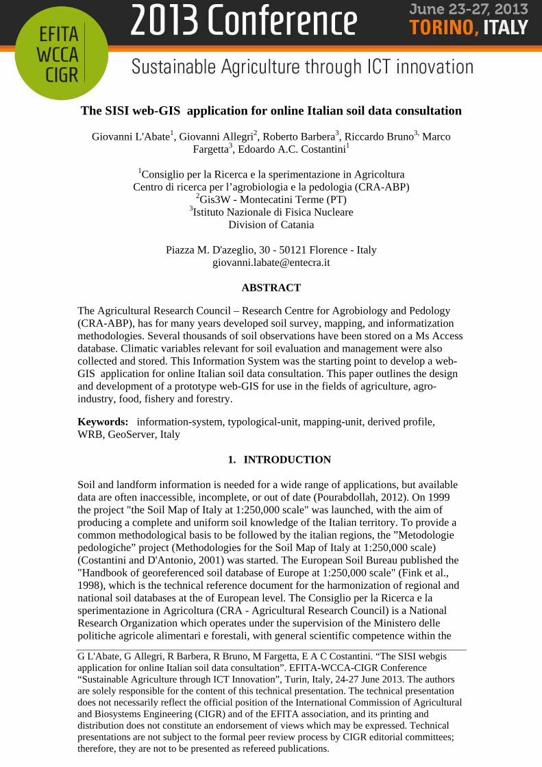
The SISI web-GIS application for online Italian soil data ...G L'Abate, G Allegri, R Barbera, R...
8
G L'Abate, G Allegri, R Barbera, R Bruno, M Fargetta, E A C Costantini. “The SISI webgis application for online Italian soil data consultation”. EFITA-WCCA-CIGR Conference “Sustainable Agriculture through ICT Innovation”, Turin, Italy, 24-27 June 2013. The authors are solely responsible for the content of this technical presentation. The technical presentation does not necessarily reflect the official position of the International Commission of Agricultural and Biosystems Engineering (CIGR) and of the EFITA association, and its printing and distribution does not constitute an endorsement of views which may be expressed. Technical presentations are not subject to the formal peer review process by CIGR editorial committees; therefore, they are not to be presented as refereed publications. The SISI web-GIS application for online Italian soil data consultation Giovanni L'Abate 1 , Giovanni Allegri 2 , Roberto Barbera 3 , Riccardo Bruno 3, Marco Fargetta 3 , Edoardo A.C. Costantini 1 1 Consiglio per la Ricerca e la sperimentazione in Agricoltura Centro di ricerca per l’agrobiologia e la pedologia (CRA-ABP) 2 Gis3W - Montecatini Terme (PT) 3 Istituto Nazionale di Fisica Nucleare Division of Catania Piazza M. D'azeglio, 30 - 50121 Florence - Italy [email protected] ABSTRACT The Agricultural Research Council – Research Centre for Agrobiology and Pedology (CRA-ABP), has for many years developed soil survey, mapping, and informatization methodologies. Several thousands of soil observations have been stored on a Ms Access database. Climatic variables relevant for soil evaluation and management were also collected and stored. This Information System was the starting point to develop a web- GIS application for online Italian soil data consultation. This paper outlines the design and development of a prototype web-GIS for use in the fields of agriculture, agro- industry, food, fishery and forestry. Keywords: information-system, typological-unit, mapping-unit, derived profile, WRB, GeoServer, Italy 1. INTRODUCTION Soil and landform information is needed for a wide range of applications, but available data are often inaccessible, incomplete, or out of date (Pourabdollah, 2012). On 1999 the project "the Soil Map of Italy at 1:250,000 scale" was launched, with the aim of producing a complete and uniform soil knowledge of the Italian territory. To provide a common methodological basis to be followed by the italian regions, the ”Metodologie pedologiche” project (Methodologies for the Soil Map of Italy at 1:250,000 scale) (Costantini and D'Antonio, 2001) was started. The European Soil Bureau published the "Handbook of georeferenced soil database of Europe at 1:250,000 scale" (Fink et al., 1998), which is the technical reference document for the harmonization of regional and national soil databases at the of European level. The Consiglio per la Ricerca e la sperimentazione in Agricoltura (CRA - Agricultural Research Council) is a National Research Organization which operates under the supervision of the Ministero delle politiche agricole alimentari e forestali, with general scientific competence within the
Transcript of The SISI web-GIS application for online Italian soil data ...G L'Abate, G Allegri, R Barbera, R...
G L'Abate, G Allegri, R Barbera, R Bruno, M Fargetta, E A C Costantini. “The SISI webgis application for online Italian soil data consultation”. EFITA-WCCA-CIGR Conference “Sustainable Agriculture through ICT Innovation”, Turin, Italy, 24-27 June 2013. The authors are solely responsible for the content of this technical presentation. The technical presentation does not necessarily reflect the official position of the International Commission of Agricultural and Biosystems Engineering (CIGR) and of the EFITA association, and its printing and distribution does not constitute an endorsement of views which may be expressed. Technical presentations are not subject to the formal peer review process by CIGR editorial committees; therefore, they are not to be presented as refereed publications.
The SISI web-GIS application for online Italian soil data consultation
Giovanni L'Abate1, Giovanni Allegri2, Roberto Barbera3, Riccardo Bruno3, Marco Fargetta3, Edoardo A.C. Costantini1
1Consiglio per la Ricerca e la sperimentazione in Agricoltura
Centro di ricerca per l’agrobiologia e la pedologia (CRA-ABP) 2Gis3W - Montecatini Terme (PT)
3Istituto Nazionale di Fisica Nucleare Division of Catania
Piazza M. D'azeglio, 30 - 50121 Florence - Italy
ABSTRACT
The Agricultural Research Council – Research Centre for Agrobiology and Pedology (CRA-ABP), has for many years developed soil survey, mapping, and informatization methodologies. Several thousands of soil observations have been stored on a Ms Access database. Climatic variables relevant for soil evaluation and management were also collected and stored. This Information System was the starting point to develop a web-GIS application for online Italian soil data consultation. This paper outlines the design and development of a prototype web-GIS for use in the fields of agriculture, agro-industry, food, fishery and forestry.
Keywords: information-system, typological-unit, mapping-unit, derived profile, WRB, GeoServer, Italy
1. INTRODUCTION Soil and landform information is needed for a wide range of applications, but available data are often inaccessible, incomplete, or out of date (Pourabdollah, 2012). On 1999 the project "the Soil Map of Italy at 1:250,000 scale" was launched, with the aim of producing a complete and uniform soil knowledge of the Italian territory. To provide a common methodological basis to be followed by the italian regions, the ”Metodologie pedologiche” project (Methodologies for the Soil Map of Italy at 1:250,000 scale) (Costantini and D'Antonio, 2001) was started. The European Soil Bureau published the "Handbook of georeferenced soil database of Europe at 1:250,000 scale" (Fink et al., 1998), which is the technical reference document for the harmonization of regional and national soil databases at the of European level. The Consiglio per la Ricerca e la sperimentazione in Agricoltura (CRA - Agricultural Research Council) is a National Research Organization which operates under the supervision of the Ministero delle politiche agricole alimentari e forestali, with general scientific competence within the

C0269 G L'Abate, G Allegri, R Barbera, R Bruno, M Fargetta, E A C Costantini. “The SISI webgis application for online Italian soil data consultation”. EFITA-WCCA-CIGR Conference “Sustainable Agriculture through ICT Innovation”, Turin, Italy, 24-27 June 2013.
fields of agriculture, agro-industry, food, fishery and forestry. The Agricultural Research Council – Research Centre for Agrobiology and Pedology (CRA-ABP), has for many years developed soil survey, mapping, and informatization methodologies. The center works at national scale to produce soil maps, it manages the national soil database, distributes an Access based software, develops soil and land evaluation models, stores and disseminates soil maps and metadata. Several thousands of soil observations have been stored on a Ms Access database. Climatic variables relevant for soil evaluation and management were also collected and stored. The soil database was the starting point to develop a web-GIS application for online Italian soil data consultation.
2. MATERIAL AND METHODS 2.1 Standards for web-based geotechnical information The Open Geospatial Consortium (OGC) published several open standards, which were adopted in the ISO and INSPIRE Specifications on Network Services (INSPIRE, 2010). The Web Map Services 1.3 (WMS) - ISO 19128:2005. The OpenGIS Web Map Service Interface Standard (WMS) provides a simple HTTP interface for requesting geo-registered map images from one or more distributed geospatial databases. A WMS request defines the geographic layer(s) and area of interest to be processed. The response is one or more geo-registered map images (returned as JPEG, PNG, etc) that can be displayed in a browser application. The interface also supports the ability to specify whether the returned images should be transparent, so that layers from multiple servers can be combined. Web Feature Service (WFS) - ISO 19142:2010. The OpenGIS Web Feature Service Interface Standard (WFS) defines an interface for specifying requests for retrieving geographic features across the Web using platform-independent calls. The WFS standard defines interfaces and operations for data access and manipulation on a set of geographic features. In particular, Get or Query features based on spatial and non-spatial constraints, Create a new feature instance; Get a description of the properties of features; Delete a feature instance; Update a feature instance; Lock a feature instance The specified feature encoding for input and output is the Geography Markup Language (GML) although other encodings may be used. Web Coverage Service (WCS) - ISO 19123:2005. The OpenGIS Web Coverage Service Interface Standard (WCS) defines a protocol-independent language for the extraction, processing, and analysis of multi-dimensional gridded coverages representing sensor, image, or statistics data. Services implementing this language provide access to original or derived sets of geospatial coverage information, in forms that are useful for client-side rendering, input into scientific models, and other client applications.
C0269 G L'Abate, G Allegri, R Barbera, R Bruno, M Fargetta, E A C Costantini. “The SISI webgis application for online Italian soil data consultation”. EFITA-WCCA-CIGR Conference “Sustainable Agriculture through ICT Innovation”, Turin, Italy, 24-27 June 2013.
Geography Markup Language (GML) – ISO 19136:2007. The OpenGIS Geography Markup Language Encoding Standard (GML) is an XML grammar for expressing geographical features. GML serves as a modelling language for geographic systems, as well as an open interchange format for geographic transactions on the Internet. 2.2 Standards for soil databases GEneral Multilingual Environmental Thesaurus (GEMET) is the official thesaurus for INSPIRE, although there are other already well defined soil specific vocabularies. Within GSSoil, for instance, existing vocabularies have been implemented, which developed the Multilingual Soilspecific Thesaurus (SoilThes). This thesaurus is intended to support finding and understanding soil and soil meta data related information (Schentz at al., 2005). The CRA-ABP published the ”Linee guida dei metodi di rilevamento e informatizzazione dei dati pedologici” (”Guidelines of the detection methods and computerization of soil data” Costantini, 2007) a volume with an attached CD-rom “CNCP 3.0, December 2007, Database for soil observations and pedological units storing, correlating and geoexploring” (L'Abate et. al., 2007). The software was developed according to the indication of the European Soil Bureau Handbook (Finke et al., 1999) and the ”Metodologie pedologiche” project (Costantini and D'Antonio, 2001). The CNCP 3.0 software was adopted as soil information system by several regional soil services. The volume can be considered as an Italian standard for soil database architecture.
3. RESULTS 3.1 Setting up the national soil database Several thousands of soil observations have been stored on a Ms Access database according to the CNCP 3.0 standard. The soil information systems of Italy is made up of a hierarchy of geographical layers, which includes soil regions, aimed at correlating the soils of Italy with the other European countries, soil systems, for the correlation of soil at the national level, and soil sub-systems, for the regional level. Soil regions are a regionally restricted part of the soil cover characterized by a typical climate and parent material association. Soil systems illustrate main Italian soilscapes and are composed of homogeneous areas as for physiography, lithology, river drainage network, and land cover. Each cartographic unit was described as combination of: i) a major landform, established according to main morphological process, slope, hypsometry, kind and degree of drainage, ii) two lithological types, iii) three land cover attributes. Maximum seven land components were recognized in each land system. A land component was a specific combination of morphology, lithology and land cover that was not delineated,

C0269 G L'Abate, G Allegri, R Barbera, R Bruno, M Fargetta, E A C Costantini. “The SISI webgis application for online Italian soil data consultation”. EFITA-WCCA-CIGR Conference “Sustainable Agriculture through ICT Innovation”, Turin, Italy, 24-27 June 2013.
but its incidence in the polygon quantified. The land component represented an elementary landform at the reference scale, which was linked to one or more soil-typological-units (STUs).
Figure 1. Database architecture The STUs were collected for the whole country from different sources, mainly with the collaboration of the Ministry of Agricultural, Food and Forestry Policies, the soil bureaus of the Italian Regional Administrations, as well by the soil chairs of some Universities. A main effort was spent to correlate soil profiles into STUs, find out the most representative benchmark profiles and obtain the derived profiles of each STU. Then a STU consists of a set of pedological observations described and analysed in one or more soilscapes, groups soil observations having similar classification and organization of functional horizons, and are joined to geography, like soil regions (1:5,000,000 reference scale), sub-regions (1:1,000,000), soil systems (1:500,000) or soil subsystems (1:250,000). A STU “derived profile” reports the modal, mean and standard deviation values of the characters and properties of its observations, and provides the soil information needed for practical evaluation. A benchmark “soil profile” is selected among the typical soil profiles of a STU, to represent an occurrence in the real world.
C0269 G L'Abate, G Allegri, R Barbera, R Bruno, M Fargetta, E A C Costantini. “The SISI webgis application for online Italian soil data consultation”. EFITA-WCCA-CIGR Conference “Sustainable Agriculture through ICT Innovation”, Turin, Italy, 24-27 June 2013.
3.2 Producing climatical elaborations Several climatic variables, relevant for soil evaluation and management, have been collected and stored. Climatical maps have been produced by spatialization of long term statistics related to meteorological stations. The map of precipitation (Annual Rainfall) was obtained by ordinary kriging of 1,613 stations completed of long term annual average values. Mean annual air temperature was obtained by ordinary kriging of 944 stations of long-term average annual air temperature. The humidity index was obtained with a simple calculation (Annual Rainfall/Mean Annual Air Temperature). Average temperature of the soil to 50 cm was calculated on the basis of the average air temperature of the long term and field capacity of the soil at the same depth, according to the equation: Tm = soil to 0.5 m tm air + (field capacity to 0.5 m - 20.7) / 7.9 (Constantini et al., 1999). The mean annual soil temperatures map was obtained by ordinary kriging of 6,660 data of average soil temperature at 50 cm. 3.3 Publishing the web-GIS application The SISI (Soil Information System of Italy) is the application designed to store soil data and related thematic informations. Online publication of the SISI application was possible with the support of the agINFRA e-infrastructure project. A Cloud infrastructure was chose to ensure higher performances, more fault-tolerant, and secure design. In order to allow online data consultation, the Ms Access database was converted to a PostgreSQL database according to INSPIRE soil standards (Schentz et al. 2012). The databases provide an inventory of Italian soilscapes at two reference scale, Soil region (1:5,000,000) and Soil systems (1:500,000). Relation between soil entities (typological-unit, derived profile, benchmark profile) and soil geography (mapping unit), was also stored. Access to geographical layers (administrative boundaries, region and province main towns, soil regions, and rasters of climatic variables) and correlation entities is moderated by GeoServer 2.1-beta3 (Figure 2). The application offers both soil and climatic information, related to 1:500,000 scale geography. Forms can be downloaded or printed both freely and by the AgINFRA Science Gateway community. Registered access allows consultation of soil profiles, different formats data download and several service capabilities. Two different access interfaces are possible: registered full access trough a Shibboleth protected proxy server, and free access to a reduced set of data. The system runs on dedicated virtual machine. The service offers two different operational modes: i) a reduced set of SISI services, freely accessible and ii) the full set of services, including the possibility to query the geodatabases to get information on the stored benchmark profiles. User authentication and authorization is required for different formats data download (AtomPub, GIF, GeoRSS, GML, JPEG, KML, OpenLayers, PDF, PNG, SVG, TIFF), and access to Service Capabilities (WCS, WFS, WMS - figure 2 and 3). The points of access for these resource are both the AgINFRA web portal (http://aginfra-sg.ct.infn.it) or the soilmaps.it web site (http://abp.entecra.it/soilmaps/index.html).

C0269 G L'Abate, G Allegri, R Barbera, R Bruno, M Fargetta, E A C Costantini. “The SISI webgis application for online Italian soil data consultation”. EFITA-WCCA-CIGR Conference “Sustainable Agriculture through ICT Innovation”, Turin, Italy, 24-27 June 2013.
Figure 2. Web-based system architecture
4. CONCLUSIONS An example of Web-based GIS applications has been developed for the dissemination and consultation of soil data on the Web. GIS application development adopting Internet technology was essential, because of the encreasing interest on soil information for different purposes. The prototype was successfully designed by using GeoServer and a PostgreSQL database on a Cloud infrastructure. The Cloud infrastructure was chose due to the higher performances, more fault-tolerant, and secure design. Further development of the web-GIS could include online data queries by means of R-statistical software and the implementation of other scale layers (1:1,000,000 and 1:250,000).

C0269 G L'Abate, G Allegri, R Barbera, R Bruno, M Fargetta, E A C Costantini. “The SISI webgis application for online Italian soil data consultation”. EFITA-WCCA-CIGR Conference “Sustainable Agriculture through ICT Innovation”, Turin, Italy, 24-27 June 2013.
Figure 3. Restricted access interface
1. ACKNOWLEDGEMENTS
The research leading to these results has received funding from the European Union Seventh Framework Programme (FP7/2007-2013) under grant agreement n° 283770. AgINFRA project (web portal). Retrieved 28 February 2013 http://www.aginfra.eu
2. REFERENCES
Costantini, E. A. C and A. D'Antonio. 2001. Attualità e prospettive dei progetti “metodologie pedologiche” e “carta dei suoli d’Italia a scala 1:250.000”. Boll. Soc. It. Sc. del Suolo L, 2: 205-218. Costantini, E.A.C. (Editor). 2007. Linee guida dei metodi di rilevamento e informatizzazione dei dati pedologici. CRA_ABP, Firenze, Italia, 296 pp.

C0269 G L'Abate, G Allegri, R Barbera, R Bruno, M Fargetta, E A C Costantini. “The SISI webgis application for online Italian soil data consultation”. EFITA-WCCA-CIGR Conference “Sustainable Agriculture through ICT Innovation”, Turin, Italy, 24-27 June 2013.
Finke, P., R. Hartwich, R. Dudal, J. Ibàñez, M. Jamagne, D. King, L. Montanarella, N. Yassoglou 1999. Database georeferenziato dei suoli europei. Manuale delle procedure. Versione 1.1. Versione italiana a cura di Edoardo A.C. Costantini. Commissione Europea. EUR 18092 pp. 176. Drafting Team Metadata and European Commission Joint Research Centre. 2010. INSPIRE Metadata Implementing Rules: Technical Guidelines based on EN ISO 19115 and EN ISO 19119. European Commission Joint Research Centre. ISO 19123:2005. Geographic information - Schema for coverage geometry and functions. Geneva, Switzerland: International Organization for Standardization. ISO 19128:2005. Geographic information – Web map service interface. Geneva, Switzerland: International Organization for Standardization. ISO 19136:2007 Geographic information -- Geography Markup Language (GML). Geneva, Switzerland: International Organization for Standardization. ISO 19142:2010. Geographic information - Web Feature Service. Geneva, Switzerland: International Organization for Standardization. L'Abate, G., R. Barbetti, E.A.C. Costantini. 2007. “CNCP 3.0, December 2007, Database for soil observations and pedological units storing, correlating and geoexploring”. CD-Rom attached to volume: E.A.C. Costantini (Ed.). 2007. “linee guida dei metodi di rilevamento e informatizzazione dei dati pedologici”. S.EL.CA. Srl, Firenze. Pourabdollah, A., D. G. Leibovici, D. M. Simms, P. Tempel, S. H. Hallett, M. J. Jackson. 2012 Towards a standard for soil and terrain data exchange: SoTerML, Computers & Geosciences, Volume 45, August 2012, Pages 270-283, ISSN 0098-3004, 10.1016/j.cageo.2011.11.026. (http://www.sciencedirect.com/science/article/pii/S0098300411004195) Schentz, H., and other members of GS Soil Work Package 3. 2012. D 3.5 Establishment of a multilingual soilspecific thesaurus. GS SOIL “Assessment and Strategic development of INSPIRE compliant Geodata-Services for European Soil Data” 31 May 2012. ECP-2008-GEO-318004