THE SIQUEIROS FRACTURE ZONE (SURVEY AREA PT-4)
6
3. GEOPHYSICAL MEASUREMENTS ACROSS THE EAST PACIFIC RISE IN THE VICINITY OF THE SIQUEIROS FRACTURE ZONE (SURVEY AREA PT-4) William J. Ludwig and Philip D. Rabinowitz, Lamont-Doherty Geological Observatory of Columbia University, Palisades, New York In early 1976, a 35-day cruise aboard R/V Robert D. Conrad of the Lamont-Doherty Geological Observatory was devoted to a geophysical survey of two sites in the Pacific Ocean (Survey Areas PT-4 and PT-5) for the In- ternational Phase of Ocean Drilling program (IPOD). PT-5 was surveyed between the Clarion and Molokai fracture zones near magnetic anomaly 13 on fast spread- ing Pacific crust near 21.5 C N and 126.5 °W. The geo- physical measurements and interpretation of the data for this area are given in Ludwig and Rabinowitz (in press). PT-4 is located near the East Pacific Rise axis be- tween the Siqueiros fracture zone at 8°15'N and the Clipperton fracture zone at 10°N. The evolution of ocean crust in this area has been extensively discussed (Batiza et al., 1977; Rosendahl, 1976; Rosendahl et al., 1976; Orcutt et al., 1975, 1976). The survey was desig- nated to obtain multichannel seismic measurements as well as additional underway geophysical measurements across the East Pacific Rise in the vicinity of proposed drill sites at PT-4. The navigational course of R/V Robert D. Conrad in the vicinity of PT-4 is given in Figure 1. Multichannel seismics and underway geophysical measurements were collected on three lines which traversed the strike of the East Pacific Rise (lines 17, 19 and 20) and on one line which was parallel to it (line 18). Bathymetric, gravity, and magnetic profiles are given in Figures 2, 3, and 4, respectively. These data are shown plotted as profiles along ship tracks on the bathymetric base map given by Rosendahl (this volume). The sonobuoy results are shown as crustal sections in Figure 5. Multichannel seismic measurements processed on line 19 are given in Figure 6 (after Herron et al., 1978; Stoffa et al., in press). ACKNOWLEDGMENTS The IPOD site survey management, under subcontract with the Deep Sea Drilling Project (UC-NSF-C-482-2), supported the data acquisiton. Additional support came from the Office of Naval Research, contract N00014-75-C-0210. REFERENCES Batiza, R., Rosendahl, B. R., and Fisher, R. L., 1977. Evolu- tion of ocean crust, Part III: Petrology and chemistry of basalts from the East Pacific Rise and Siqueiros Fracture Zone. /. Geophys. Res., v. 82, p. 265. Herron, T. J., Ludwig, W. J., Stoffa, P. L., Kan, T. K., and Buhl, P., 1978. Structure of the East Pacific Rise Crest from multi-channel seismic reflection data. Ibid., v. 83, p. 798-804. Ludwig, W. J. and Rabinowitz, P. D., in press. Geophysical characteristics of ocean crust: IPOD candidate site PT-5, Central Eastern Pacific Basin. Marine Geol. Orcutt, J. A., Kennett, B. L., Dorman, L. M., 1976. Structure of the East Pacific Rise from an ocean bottom seismometer survey. Geophys. J. Roy. Astron. Soc, v. 45, p. 305-320. Orcutt, J. A., Kennett, B. L., Dorman, L. M., and Prothero, W. A., 1975. Evidence for a low-velocity zone underlying a fast-spreading rise crest. Nature, v. 256, p. 475. Rosendahl, B. R., 1976. Evolution of oceanic crust, Part II: Constraints, implications and inferences. J. Geophys. Res., v. 81, p. 5305. Rosendahl, B. R., Raitt, R. W., Dorman, L. M., and Bibee, L. D., 1976. Evolution of oceanic crust, Part I: A physical model of the East Pacific Rise crest derived from seismic refraction data. Ibid., v. 81, p. 5294. Stoffa, P. L., Buhl, P., Herron, T. J., Kan, T. K., and Lud- wig, W. J., in press. Mantle reflections beneath the crestal zone of the East Pacific Rise from multi-channel seismic data. Marine Geol. 37
Transcript of THE SIQUEIROS FRACTURE ZONE (SURVEY AREA PT-4)

3. GEOPHYSICAL MEASUREMENTS ACROSS THE EAST PACIFIC RISE IN THE VICINITY OFTHE SIQUEIROS FRACTURE ZONE (SURVEY AREA PT-4)
William J. Ludwig and Philip D. Rabinowitz, Lamont-Doherty Geological Observatory of Columbia University,Palisades, New York
In early 1976, a 35-day cruise aboard R/V Robert D.Conrad of the Lamont-Doherty Geological Observatorywas devoted to a geophysical survey of two sites in thePacific Ocean (Survey Areas PT-4 and PT-5) for the In-ternational Phase of Ocean Drilling program (IPOD).
PT-5 was surveyed between the Clarion and Molokaifracture zones near magnetic anomaly 13 on fast spread-ing Pacific crust near 21.5CN and 126.5 °W. The geo-physical measurements and interpretation of the datafor this area are given in Ludwig and Rabinowitz (inpress).
PT-4 is located near the East Pacific Rise axis be-tween the Siqueiros fracture zone at 8°15'N and theClipperton fracture zone at 10°N. The evolution ofocean crust in this area has been extensively discussed(Batiza et al., 1977; Rosendahl, 1976; Rosendahl et al.,1976; Orcutt et al., 1975, 1976). The survey was desig-nated to obtain multichannel seismic measurements aswell as additional underway geophysical measurementsacross the East Pacific Rise in the vicinity of proposeddrill sites at PT-4.
The navigational course of R/V Robert D. Conrad inthe vicinity of PT-4 is given in Figure 1. Multichannelseismics and underway geophysical measurements werecollected on three lines which traversed the strike of theEast Pacific Rise (lines 17, 19 and 20) and on one linewhich was parallel to it (line 18).
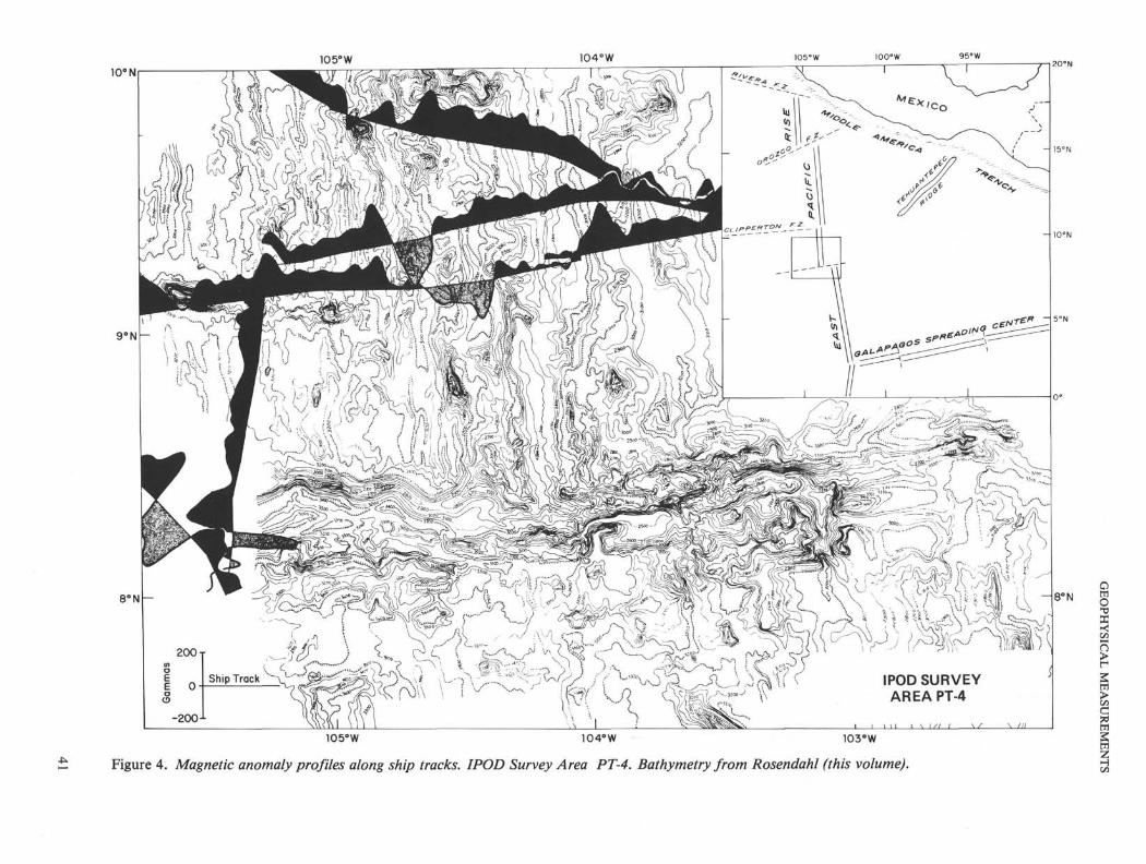
Bathymetric, gravity, and magnetic profiles are givenin Figures 2, 3, and 4, respectively. These data areshown plotted as profiles along ship tracks on thebathymetric base map given by Rosendahl (this volume).The sonobuoy results are shown as crustal sections inFigure 5. Multichannel seismic measurements processedon line 19 are given in Figure 6 (after Herron et al.,1978; Stoffa et al., in press).
ACKNOWLEDGMENTS
The IPOD site survey management, under subcontract withthe Deep Sea Drilling Project (UC-NSF-C-482-2), supportedthe data acquisiton. Additional support came from the Officeof Naval Research, contract N00014-75-C-0210.
REFERENCES
Batiza, R., Rosendahl, B. R., and Fisher, R. L., 1977. Evolu-tion of ocean crust, Part III: Petrology and chemistry ofbasalts from the East Pacific Rise and Siqueiros FractureZone. /. Geophys. Res., v. 82, p. 265.
Herron, T. J., Ludwig, W. J., Stoffa, P. L., Kan, T. K., andBuhl, P., 1978. Structure of the East Pacific Rise Crestfrom multi-channel seismic reflection data. Ibid., v. 83, p.798-804.
Ludwig, W. J. and Rabinowitz, P. D., in press. Geophysicalcharacteristics of ocean crust: IPOD candidate site PT-5,Central Eastern Pacific Basin. Marine Geol.
Orcutt, J. A., Kennett, B. L., Dorman, L. M., 1976. Structureof the East Pacific Rise from an ocean bottom seismometersurvey. Geophys. J. Roy. Astron. Soc, v. 45, p. 305-320.
Orcutt, J. A., Kennett, B. L., Dorman, L. M., and Prothero,W. A., 1975. Evidence for a low-velocity zone underlying afast-spreading rise crest. Nature, v. 256, p. 475.
Rosendahl, B. R., 1976. Evolution of oceanic crust, Part II:Constraints, implications and inferences. J. Geophys. Res.,v. 81, p. 5305.
Rosendahl, B. R., Raitt, R. W., Dorman, L. M., and Bibee,L. D., 1976. Evolution of oceanic crust, Part I: A physicalmodel of the East Pacific Rise crest derived from seismicrefraction data. Ibid., v. 81, p. 5294.
Stoffa, P. L., Buhl, P., Herron, T. J., Kan, T. K., and Lud-wig, W. J., in press. Mantle reflections beneath the crestalzone of the East Pacific Rise from multi-channel seismicdata. Marine Geol.
37

10°107° 106°
—r~
IPOD SURVEYAREA PT-4
105° 103°
OO Sonobuoy HF
Multi-Channel Seismic
Single-Channel Seismic
102°
8°N102° WIO7C
106° 105° 104° 103°
Figure 1. Navigational course of R/V Conrad while covering IPOD Survey Area PT-4. Annotations are dates and hours. Location of multichannelseismic profile given in Figure 6 is shown by the bold section of line 19.

10βN10 5° W 104°W 100-W
9°N
8°N
20°N
15°N
10°N
2700 -r
3000
3300-1-
IPOD SURVEYAREA PT-4
w \r~ \~n\105βW 104βW 103βW
Figure 2. Bathymetry profiles along ship tracks. Base level (ship track) = 3000 meters. Bathymetric contours from Rosendahl (this volume).

105°W 105°W 95°W
10° N
9°N
8βN
IPOD SURVEYAREA PT-4
20°N
8βN
-25 J
105°W 104°W 103°W
Figure 3. Free-air gravity anomaly profiles along ship tracks. IPOD Survey Area PT-4. Bathymetry contours from Rosendahl (this volume).
10 5° W 104°W10° N
IPOD SURVEYAREA PT-4
- 8 ° N
105°W 104βW 103°W
Figure 4. Magnetic anomaly profiles along ship tracks. IPOD Survey Area PT-4. Bathymetry from Rosendahl (this volume).

W. J. LUDWIG, P. D. RABINOWITZ
W
6 -
1 -
2 -
3 -
4 -
5 -
6 -
7 -
8-
9 -
0 -
53
3.5*
5.4
6.4
7.3
8.1
52
3.7*
5.4
6.3
8.1
54 55 51 49
3.7*
5.7
6.9
8.2
3.5*
5.6
7.1
4.4
6.2
7.4
IPOD SURVEYAREA PT-4
5 θ
Figure 5. Airgun, sonobuoy solutions. IPOD SurveyArea PT-4. Locations ofsonobuoys given in Figure 1.
RC 2002 MCS LINE 19
5 KM
CDP 1500 1700 1900 2100 2300
TIME10=30 hrs.
I
19=00 hrs.
Figure 6. Migrated, common depth point (CDP), stacked time section 19 across the East Pacific Rise (EPR), fromStoffa et al. (in press). Note the distinct layering of the oceanic crust to about 0.8 s below the sea floor and thestrong reflections from the top of mantle at about 6.0 s except in a 3-km wide zone just to the west of the rise crest.Reflections from the top of seismic Layer 3, a strong refractor beneath the EPR and adjacent ocean basin, are notobserved. The mantle reflections in this time section are conformable to the sea-floor topography, whereas in sec-tion 17, 10 km to the south, they are observed at a fairly constant depth (see Stoffa et al., in press). The multichan-nel seismic data indicate that the low-velocity zone of low Q under the EPR crest, postulated by Orcutt et al. (1975,1976) from OBS data, may be a local feature and that discrete crustal layering occurs nearly contemporaneouslywith generation of ocean crust (see Herron et al., 1978; Stoffa et al., in press).
42