
The Ottawa Hills Dam Decommissioning Project. Constructed: August 2008.
109
The Ottawa Hills Dam Decommissioning Project. Constructed: August 2008
-
Upload
alison-lynch -
Category
Documents
-
view
219 -
download
3
Transcript of The Ottawa Hills Dam Decommissioning Project. Constructed: August 2008.

The Ottawa Hills Dam Decommissioning Project. Constructed: August 2008

Existing riffle constructed by ODOT
Conceptual Design
Illustration of
Restoration Site by Matt Horvat of TMACOG
At the request of
the Village of Ottawa Hills we did not work in
this bend even
though the
vertical bank is 7 ft tall and the water over 7 ft deep!!
US
Pro
ject
Lim
it
DS
Pro
ject
Lim
it
This project will
encompass the bends
immediately upstream
and downstream of the former
dam site

The Ottawa Hills Dam Decommissioning Project
The dam was removed by Ohio-DOT in November 2007.
The project described in this PowerPoint is designed to reduce bank erosion and protect public
infrastructure (two roads), create aquatic & riparian habitat, improve streamside vegetation, assist with improving the riparian area, provide
benches & stepping stones for public stream enjoyment and access, and still have the existing
mowed floodplain recreation areas for public use!


OHIO DOT REMOVING THE
SECOR ROAD DAM NOV-DEC 2007

Looking from left bank at the Secor Road dam.
OTTAWA R-DAM REMOVAL @ OTTAWA HILLS-PIX BY MATT HORVAT-2007

Typical condition US of the Secor Road dam.
OTTAWA R-DAM REMOVAL @ OTTAWA HILLS-PIX BY MATT HORVAT-2007

Looking from left bank @ trackhoe removing the dam.
OTTAWA RIVER-DAM REMOVAL @ OTTAWA HILLS-PIX-LAWRENCE-2007
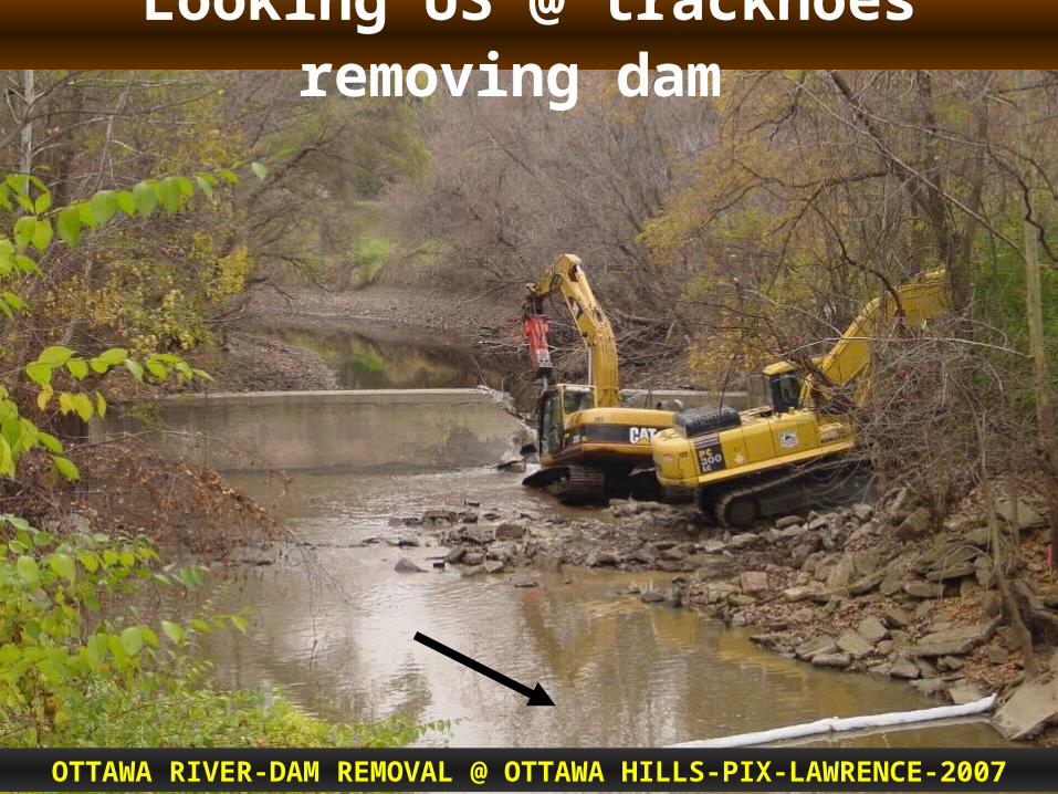
Looking US @ trackhoes removing dam
OTTAWA RIVER-DAM REMOVAL @ OTTAWA HILLS-PIX-LAWRENCE-2007

Looking US. Dam out, right bank sheetpile out, concrete riffle in. Left bank sheetpile will stay.
OTTAWA RIVER-DAM REMOVAL @ OTTAWA HILLS-PIX-HORVAT - 2007

PRE-PROJECT PHOTOS STARTING FROM
UPSTREAM TO DOWNSTREAMby Dave Derrick
AUGUST 20, 2008
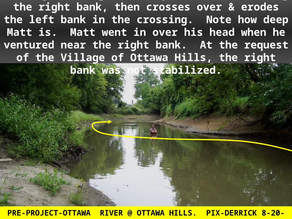
Looking DS. High velocity current is eroding the right bank, then crosses over & erodes the left bank in the crossing. Note
how deep Matt is. Matt went in over his head when he ventured near the right bank. At the request of the Village of
Ottawa Hills, the right bank was not stabilized.
PRE-PROJECT-OTTAWA RIVER @ OTTAWA HILLS. PIX-DERRICK 8-20-2008

Looking DS @ left eroded bank in the crossing & the upper portion of the US project bend.
PRE-PROJECT-OTTAWA RIVER @ OTTAWA HILLS. PIX-DERRICK 8-20-2008

Looking US @ the lower end of the US project bend
PRE-PROJECT-OTTAWA RIVER @ OTTAWA HILLS. PIX-DERRICK 8-20-2008

At the former dam site, looking US into the US bend
PRE-PROJECT-OTTAWA RIVER @ OTTAWA HILLS. PIX-DERRICK 8-20-2008

Looking DS @ the DS project bend. Hill Ditch tributary comes in just US of the bend.
PRE-PROJECT-OTTAWA RIVER @ OTTAWA HILLS. PIX-DERRICK 8-20-2008

Looking DS @ the DS project bend & the Secor Road bridge.
PRE-PROJECT-OTTAWA RIVER @ OTTAWA HILLS. PIX-DERRICK 8-20-2008

Looking DS. The protection will tie into the existing bridge abutment protection right here.
PRE-PROJECT-OTTAWA RIVER @ OTTAWA HILLS. PIX-DERRICK 8-20-2008

THE PLAN


Existing riffle constructed by ODOT
Conceptual Design
Illustration of
Restoration Site by Matt Horvat of TMACOG
At the request of
the Village of Ottawa Hills we did not work in
this bend even
though the
vertical bank is 7 ft tall and the water over 7 ft deep!!
US
Pro
ject
Lim
it
DS
Pro
ject
Lim
it
This project will
encompass the bends upstream
and downstrea
m of the former dam
site

EQUIPMENT

The Cat 330 tracked back hoe with a 4 ft wide bucket, 25 ft reach, weight about 70,000 pounds
CONSTRUCTION-OTTAWA RIVER @ OTTAWA HILLS. PIX-DERRICK 8-2008

STONE & STONE STAGING

SUITABLE STONE
Stone used for keys and LPSTP was a well-graded, self-adjusting, self-filtering Class A Stone with a size of 18” to 36” on the “B” axis. Stone for the Bendway Weirs &
Traffic Control Stones was a specially produced armor stone that varied from 2’ by 2’ by 3’ to
4’ by 4’ by 5’.

Dumping “A”stone-18 to 36 inch sized stone
CONSTRUCTION-OTTAWA RIVER @ OTTAWA HILLS. PIX-DERRICK 8-2008

Staged “A”-stone and armor stone
CONSTRUCTION-OTTAWA RIVER @ OTTAWA HILLS. PIX-DERRICK 8-2008

THE BEND IMMEDIATELY UPSTREAM OF THE FORMER
DAM LOCATION

Methodologies for the Upstream Bend
Traffic Control Stones with short Bendway Weirs
Vegetated keys
Transplanted clumps of shrubs
Hydraulic Cover Stones
Planned fall 2008: Container plantings of dogwoods, fast and slow growing shade trees, chokecherry, buttonbush, & other shrubs for food, pollinators, etc.

A KEY HAS ONE MAIN JOB, TO CONNECT THE
RIVER TRAINING STRUCTURE TO THE REST
OF THE WORLD (DON’T LET THE STREAM GET BEHIND {FLANK} RIVER TRAINING STRUCTURES)

CONSTRUCTION PHOTOS
by Dave Derrick & Matt Horvat
August 20-25, 2008

Detail for key
Cross-section for keywayFlow

Looking uphill at the dug key trench
CONSTRUCTION-OTTAWA RIVER @ OTTAWA HILLS. PIX-DERRICK 8-2008
Flow

Detail for key
Place some stone & soil in the trench
Flow

Placing some graded “A” stone and soil in the trench
CONSTRUCTION-OTTAWA RIVER @ OTTAWA HILLS. PIX-DERRICK 8-2008
Flow

Place Willow Poles against DS side of trench.
Detail for key
Flow
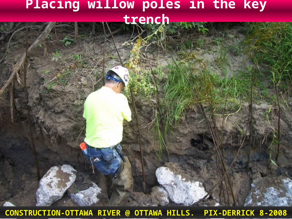
Placing willow poles in the key trench
CONSTRUCTION-OTTAWA RIVER @ OTTAWA HILLS. PIX-DERRICK 8-2008

Key will be extended uphill where the hoe is parked
CONSTRUCTION-OTTAWA RIVER @ OTTAWA HILLS. PIX-DERRICK 8-2008
Flow

Place the remainder of the stone in the trench
Detail for key
Flow
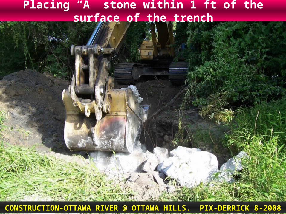
Placing “A” stone within 1 ft of the surface of the trench
CONSTRUCTION-OTTAWA RIVER @ OTTAWA HILLS. PIX-DERRICK 8-2008

Choke stone with soil & water in.
Detail for key
Flow

Backfill with native soils.
CONSTRUCTION-OTTAWA RIVER @ OTTAWA HILLS. PIX-DERRICK 8-2008
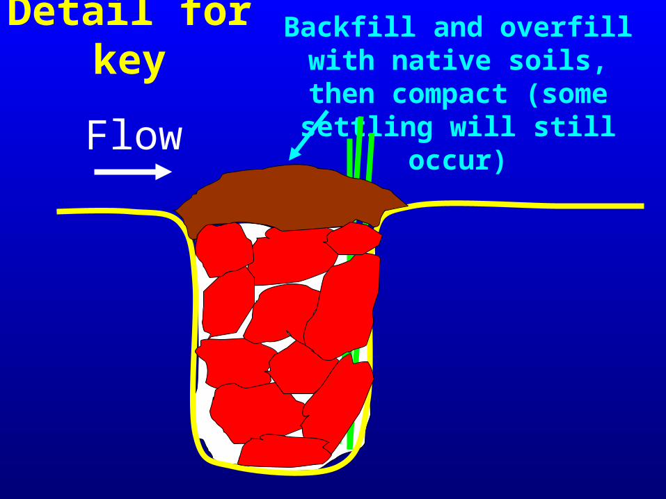
Backfill and overfill with native soils, then compact
(some settling will still occur)
Detail for key
Flow

Compacting soil over key. Note poles on DS side of key
CONSTRUCTION-OTTAWA RIVER @ OTTAWA HILLS. PIX-DERRICK 8-2008

TRAFFIC CONTRO
L STONES

WHAT IS THE LOWER LIMIT OF HARD
BANK PROTECTION?
AND MORE IMPORTANT, HOW
CAN WE REACH IT?
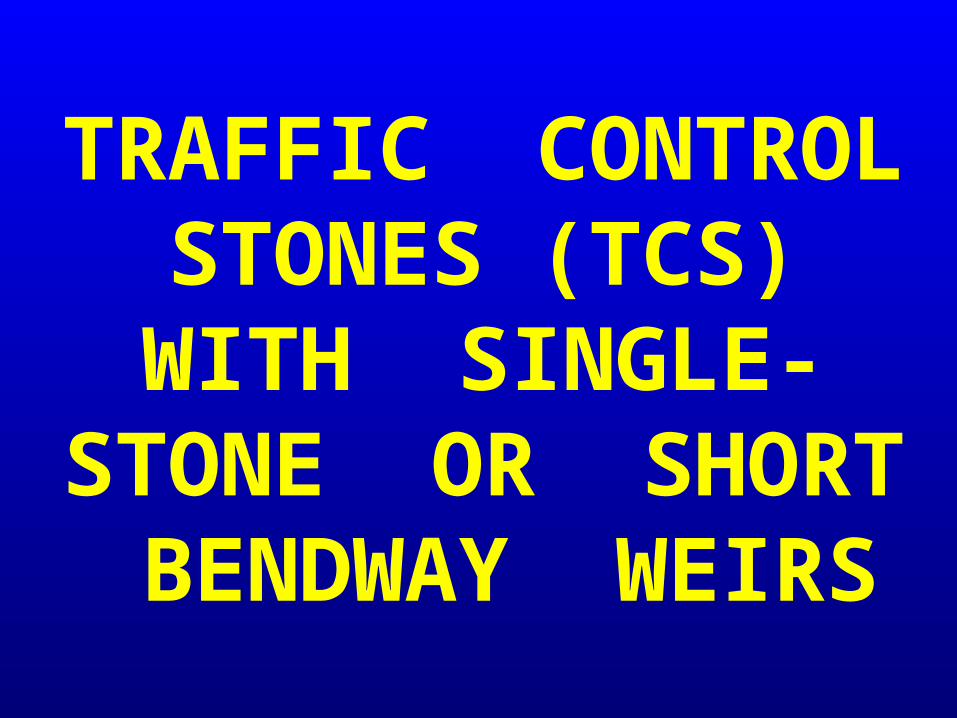
TRAFFIC CONTROL STONES
(TCS) WITH SINGLE-STONE OR SHORT BENDWAY
WEIRS

Drawn by Matt Horvat, TMACOG
Traffic Control
Stones for the US project
bend
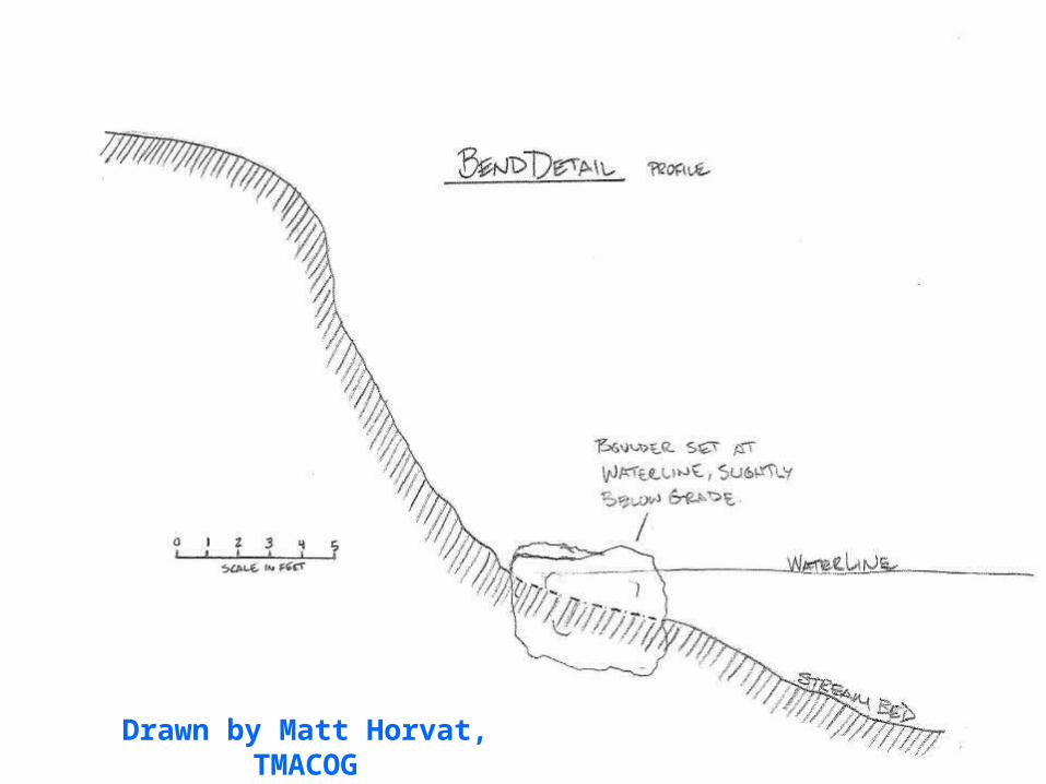
Drawn by Matt Horvat, TMACOG

Large stones (3 ft by 3 ft by 3 ft) designed to “kick” flow off the bank, must be keyed into the bed & bank, spaced 6 to 8 ft
apart, every 3rd one should be keyed into the bank. Every 3rd stone has a Single Stone or short Bendway Weir.
Traffic Control Stones with Single Stone Bendway Weirs
Key
Key
TCS
Key
TCS
SSBW
TCS
TCS
TCS
TCS
TCS
TCS
TCS
SSBW
SSBW

Willow, dogwood, & buttonbush Live Stakes & poles
were installed along with the TCS. Rooted stock plants will be installed this fall or spring
Traffic Control Stones with Single Stone Bendway Weirs
Key
Key
TCS
Key
TCS
SSBW
TCS
TCS
TCS
TCS
TCS
TCS
TCS
SSBW
SSBW

Track hoe digs a pit. Willow, dogwood, & buttonbush poles are placed around backside of pit
CONSTRUCTION-OTTAWA RIVER @ OTTAWA HILLS. PIX-DERRICK 8-2008

Looking DS @ Traffic Control Stone being placed in pit
CONSTRUCTION-OTTAWA RIVER @ OTTAWA HILLS. PIX-DERRICK 8-2008
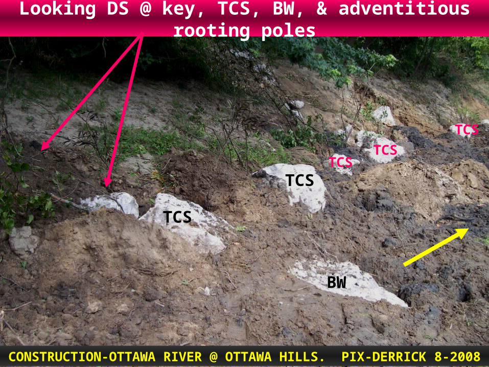
Looking DS @ key, TCS, BW, & adventitious rooting poles
CONSTRUCTION-OTTAWA RIVER @ OTTAWA HILLS. PIX-DERRICK 8-2008
BW
TCS
TCS
TCS
TCS
TCS


How Do Bendway Weirs Work? Water flowing over the weir is redirected at an angle
perpendicular to the longitudinal axis of the weir.
With weirs angled upstream the erosive flow (energy) is directed away from the outer bank and toward the inner part of the bend.
Strong secondary currents (helical flow) in bend are broken up.
A set of weirs are designed to act as a system to capture, control, and redirect current directions and velocities through the bend and into the downstream crossing.
Last weir in system can aim flow (and channel thalweg) where you need it.
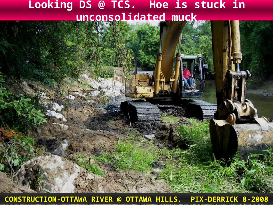
Looking DS @ TCS. Hoe is stuck in unconsolidated muck
CONSTRUCTION-OTTAWA RIVER @ OTTAWA HILLS. PIX-DERRICK 8-2008

Looking DS @ hoe filling tracks.
CONSTRUCTION-OTTAWA RIVER @ OTTAWA HILLS. PIX-DERRICK 8-2008
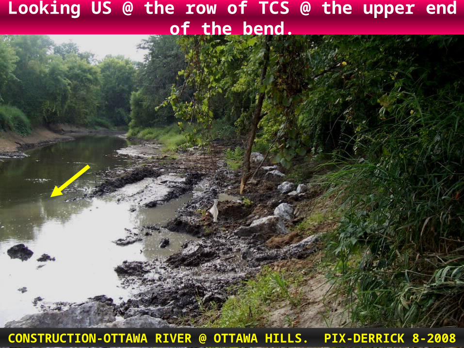
Looking US @ the row of TCS @ the upper end of the bend.
CONSTRUCTION-OTTAWA RIVER @ OTTAWA HILLS. PIX-DERRICK 8-2008
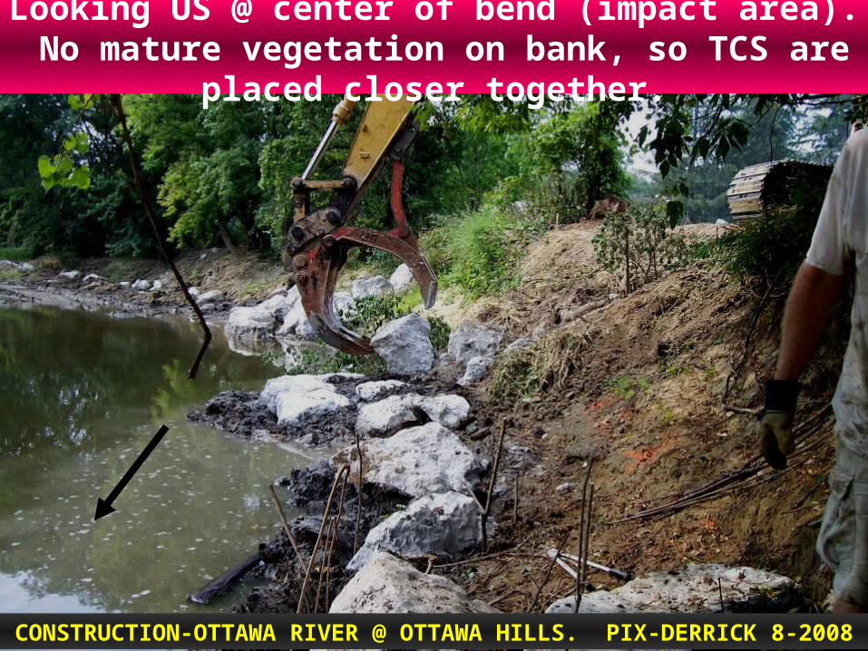
Looking US @ center of bend (impact area). No mature vegetation on bank, so TCS are placed closer together.
CONSTRUCTION-OTTAWA RIVER @ OTTAWA HILLS. PIX-DERRICK 8-2008

Looking DS toward the former dam location. Placing TCS
CONSTRUCTION-OTTAWA RIVER @ OTTAWA HILLS. PIX-DERRICK 8-2008

Looking US @ the TCS near the DS end of the bend.
CONSTRUCTION-OTTAWA RIVER @ OTTAWA HILLS. PIX-DERRICK 8-2008

Looking US. Dense brush & trees make TCS placement difficult
CONSTRUCTION-OTTAWA RIVER @ OTTAWA HILLS. PIX-DERRICK 8-2008

Resting rocks in the upper bend.
CONSTRUCTION-OTTAWA RIVER @ OTTAWA HILLS. PIX-HORVAT 8-2008

Raking, seeding, and spreading weed-free straw.
CONSTRUCTION-OTTAWA RIVER @ OTTAWA HILLS. PIX-HORVAT 8-2008

Spreading straw.
CONSTRUCTION-OTTAWA RIVER @ OTTAWA HILLS. PIX-HORVAT 8-2008

THE UPSTREAM BEND
CONSTRUCTION IS COMPLETE
(let’s look from upstream to downstream)

FROM THE OPPOSITE BANK
(inner bank), LOOKING AT THE
COMPLETED UPPER BEND
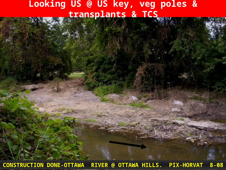
Looking US @ US key, veg poles & transplants & TCS
CONSTRUCTION DONE-OTTAWA RIVER @ OTTAWA HILLS. PIX-HORVAT 8-08
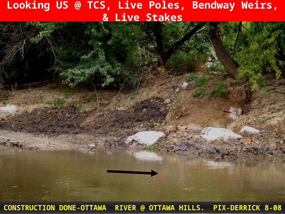
Looking US @ TCS, Live Poles, Bendway Weirs, & Live Stakes
CONSTRUCTION DONE-OTTAWA RIVER @ OTTAWA HILLS. PIX-DERRICK 8-08

Looking @ center of bend (impinging impact area)
CONSTRUCTION DONE-OTTAWA RIVER @ OTTAWA HILLS. PIX-DERRICK 8-08

Looking across @ outer bend just DS of the apex (center).
CONSTRUCTION DONE-OTTAWA RIVER @ OTTAWA HILLS. PIX-HORVAT 8-08
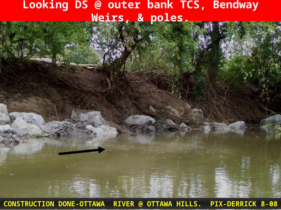
Looking DS @ outer bank TCS, Bendway Weirs, & poles.
CONSTRUCTION DONE-OTTAWA RIVER @ OTTAWA HILLS. PIX-DERRICK 8-08
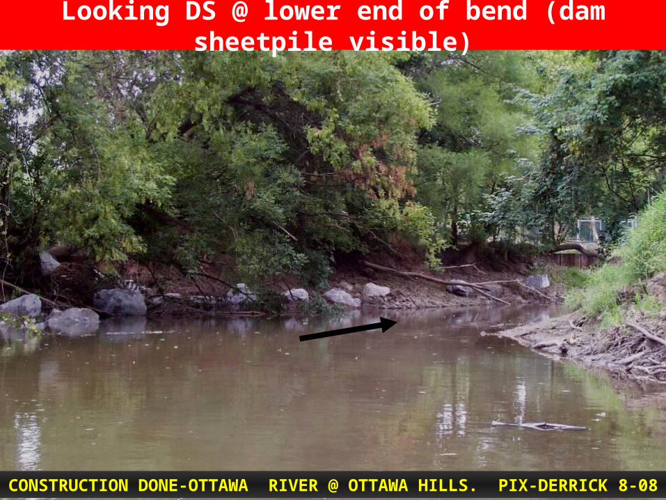
Looking DS @ lower end of bend (dam sheetpile visible)
CONSTRUCTION DONE-OTTAWA RIVER @ OTTAWA HILLS. PIX-DERRICK 8-08

CONSTRUCTION DONE-OTTAWA RIVER @ OTTAWA HILLS. PIX-DERRICK 8-08
Looking DS @ end of bend TCS, Poles, & Live Stakes.

From the US crossing, looking DS into the project bend
CONSTRUCTION DONE-OTTAWA RIVER @ OTTAWA HILLS. PIX-DERRICK 8-08

Looking DS into the impinging flow impact zone of the bend.
CONSTRUCTION DONE-OTTAWA RIVER @ OTTAWA HILLS. PIX-DERRICK 8-08

Ottawa River Dam Removal8-10-2009
UpdatePix & words by Matt Horvat, TMACOG

Increased public use
Pix & words by Matt Horvat, TMACOG
Pix by Matt Horvat, TMACOG

Left Bank in the spring
Bank protection stones and willow, dogwood, buttonbush stakes are visible
6-5-2009 photo, Horvat

SIGNIFICANT PLANTING EFFORT
500 PLANTS INSTALLED THE WEEK OF JULY 27,
2009 ON BANKS & RIPARIAN AREAS
Photos & words by Matt Horvat

Another view of the same area - Left Bank in the spring
Bank protection stones and willow, dogwood, buttonbush stakes are visible
Pix & words by Matt Horvat, TMACOG
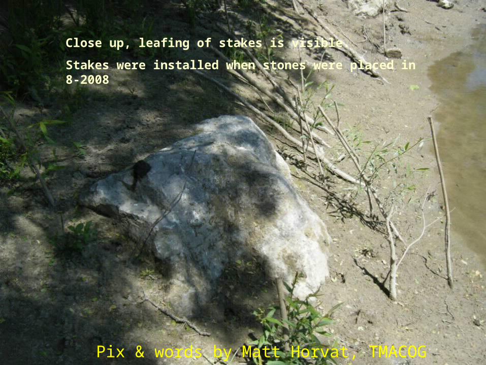
Close up, leafing of stakes is visible.
Stakes were installed when stones were placed in 8-2008
Pix & words by Matt Horvat, TMACOG

Materials to be used for restoration and stabilization
Photos taken week of 7-27-2009
Pix & words by Matt Horvat, TMACOG

Wetland and riparian species of shrubs will be placed to in-fill between the stabilization stones.
Nine-bark and buttonbush will be planted in the lowest areas.. They love having wet roots. Their roots will spread forming a dense network, holding the bank and soil during flood events.
Photos taken by Matt Horvat week of 7-27-2009

Some of the woody shrubs being staged for planting on a right bank. The shrubs will be staggered to maximize the benefit of their roots holding the soil.
Photos taken by Matt Horvat week of 7-27-2009

Floodplain area on the right bank being reforested.
The vegetated floodplain and riparian area will help to slow flood velocities and allow suspended soil to settle out as well as provide habitat and recreation opportunities.
Photos taken by Matt Horvat week of 7-27-2009
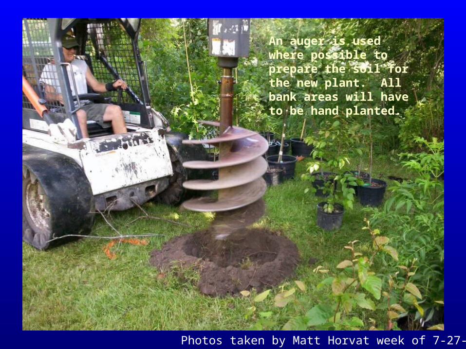
An auger is used where possible to prepare the soil for the new plant. All bank areas will have to be hand planted.
Photos taken by Matt Horvat week of 7-27-2009

Site prep done with the 24” auger
Photos taken by Matt Horvat week of 7-27-2009

One of the woody shrubs
Photos taken by Matt Horvat week of 7-27-2009
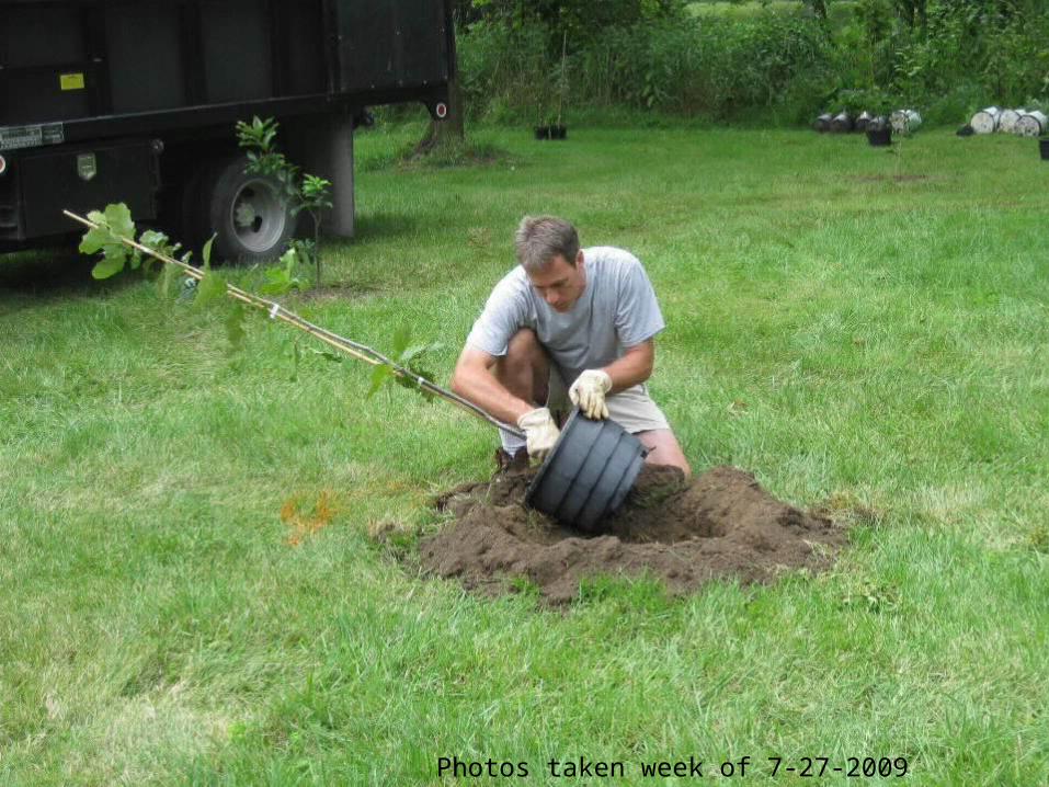
Photos taken week of 7-27-2009

Planting top of bank floodplain areas
Photos taken by Matt Horvat week of 7-27-2009

Looking downstream
Photos taken by Matt Horvat week of 7-27-2009

LDB, just downstream of first key, new plantings of buttonbush, ninebark and elderberry visible at the bamboo stakes
Photos taken by Matt Horvat week of 7-27-2009
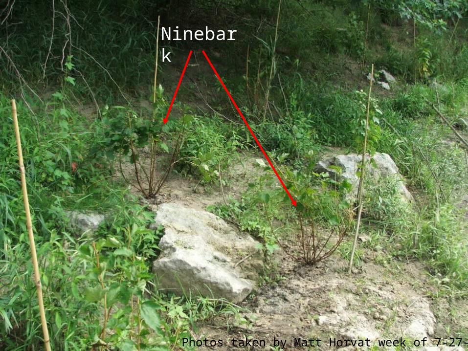
Ninebark
Photos taken by Matt Horvat week of 7-27-2009

Newly planted maple severely browsed, planting was only one day old
Photos taken by Matt Horvat week of 7-27-2009
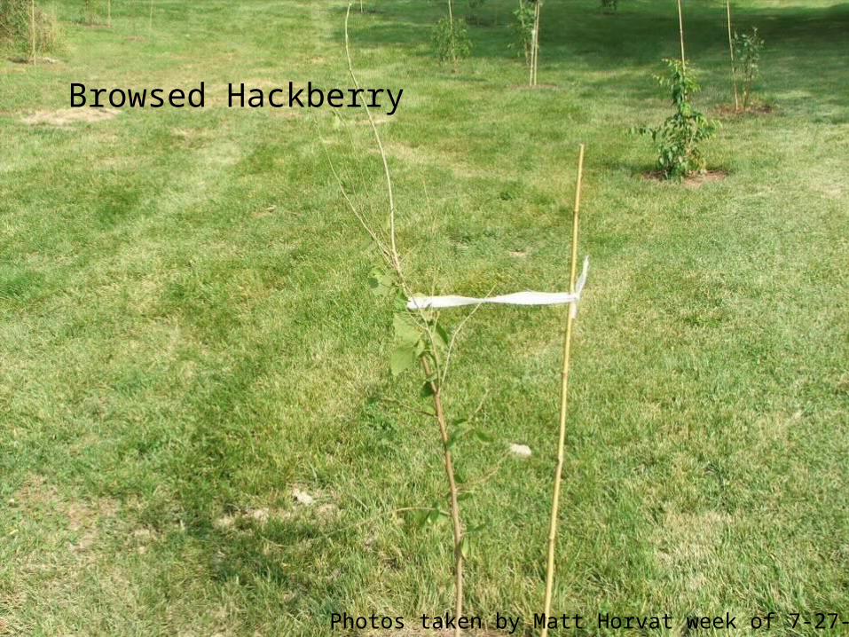
Browsed Hackberry
Photos taken by Matt Horvat week of 7-27-2009

One of the suspects
What deer like:•Opportunity•Maple•Hackberry•Everything else
Photos taken by Matt Horvat week of 7-27-2009

Smells bad enough, lets hope it works!
Photos taken by Matt Horvat week of 7-27-2009

RDB, just upstream on the old dam on the inside bank. Note the buttonbush planted low along the bank
Photos taken by Matt Horvat week of 7-27-2009

LDB, looking upstream toward key
Photos taken by Matt Horvat week of 7-27-2009

LDB, looking upstream toward key
Stakes mark each plant location
Photos taken by Matt Horvat week of 7-27-2009

RDB, upstream of dam and undercut high bank visible just beyond the sign at the locust tree.
Planted approx 750lf from dam upstream = 0.8 acre
Photos taken by Matt Horvat week of 7-27-2009

RDB, nearest old dam
Photos taken by Matt Horvat week of 7-27-2009

LDB, West of Secor Ave.
800 lf from dam upstream = 1 acre
Photos taken by Matt Horvat week of 7-27-2009
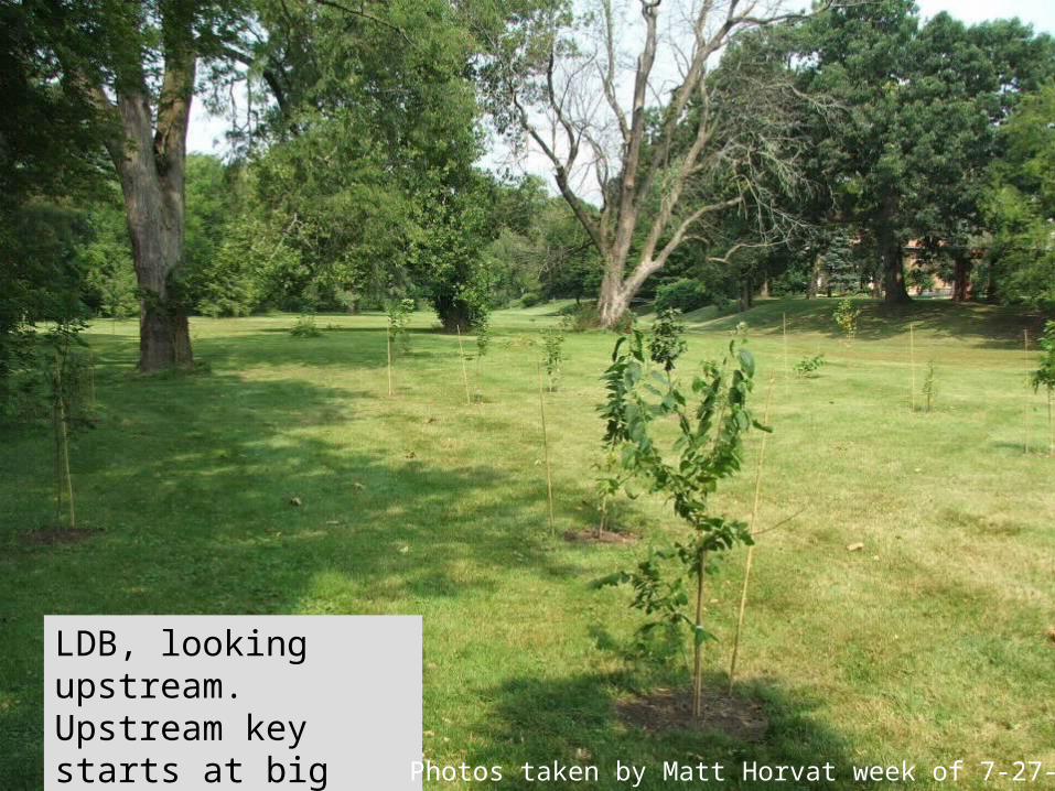
LDB, looking upstream. Upstream key starts at big locust
Photos taken by Matt Horvat week of 7-27-2009

Documented watershed scale fish distribution changes due to dam mitigation/removal (first fish passage connectivity in 80+ years) !! Fish community above both Secor Dam (removed) and Highland Dam (mitigated) have significantly changed for the better. Least Darter are now distributed throughout the lower Ottawa River, presumably following the new conveyance of sand. I think I forwarded the picture of the juvenile Rainbow Trout we caught right? We caught the first juvenile Golden Redhorse I've found above the dam this fall. Furthermore, sunfish are abundant around Sylvania, which never happened before. The result of having sunfish and Redhorse has been a shift in dominance to less tolerant, lithophilic-spawning species.
I also talked to someone who lives by the Airport who has had white suckers in his ditch every spring since you put in the riffle at Highland. There have been other highlights, but you're probably all yawning with the fish talk by now :) Awesome part, most all this data was collected by undergraduates in our Ecology 3060 lab course (University of Toledo).Take home message: CONNECTIVITY = GOOD! From: Todd Crail

the Bassett as a mountain lion