The official newspaper Visitor Guide 2017 Park Service U.S. Department of the Interior Vol. 13, No....
12
National Park Service U.S. Department of the Interior Vol. 13, No. 1, 2017 Glen Canyon National Recreation Area Rainbow Bridge National Monument The official newspaper Glen Canyon Continues The Party Into The Next Century ONE HUNDRED AND ONE. THAT’ S HOW OLD THE NATIONAL Park Service will be turning in 2017. It doesn’t quite measure up to the excitement of turning 100, does it? In 2016, we rolled out the red carpet to celebrate 100 years since the creation of the National Park Service, the agency that takes care of places like Glen Canyon National Recreation Area. Now that it’s 2017, the party hats have been put away and the guests have all gone home. Or have they? The reality is, you don’t make it to be 100 years old if you’re not doing something right. And with over 300 million visitors every year it seems like the public would agree. The National Parks are truly the pride of our nation, where citizens and visitors alike can experience the best that this country has to offer. Glen Canyon National Recreation Area is no exception. Over 3 million visitors per year come here to recreate within this unique National Park Service site, where preservation and enjoyment are one and the same. Perhaps your visit will include taking a power boat out on Lake Powell or paddling a kayak down the Colorado River to get a taste for what Glen Canyon was like before the dam was built, creating Lake Powell. Maybe you would prefer to explore Glen Canyon by foot on one of several hiking trails, taking in the sights and sounds of the desert around you. Regardless of how you choose to experience Glen Canyon, you are sure to come in contact with the unique resources that make this place so special; stunning rock formations millions of years in the making, cliff dwellings left behind by ancient peoples, the footprints of a coyote hunting for its supper under some of the darkest skies on earth. The National Park Service continues to protect these things and more so that they will be here for the next 100 years, and that is certainly something worth celebrating year after year! Districts South....................... 6-7 Page, Wahweap, Antelope Canyon North........................8-9 Bullfrog, Halls Crossing Escalante....................10 Lees Ferry ....................11 Rainbow Bridge ..........12 Park Info Park Map ....................2 Fees ............................2 Weather ......................3 Ranger Programs .........3 Safety .........................4 Volunteer ....................4 Welcome to Glen Canyon National Recreation Area and Rainbow Bridge National Monument, home to Lake Powell and so much more! You may already know about the water-based activities like boating and fishing you can enjoy in your 1.25 million-acre national park, but that’s only a small part of our story. We have seemingly endless trails, routes, roads and canyons to explore by foot, bike or vehicle, which will impart a sense of discovery as you share in the rich history of this national treasure. Throughout the park, you’ll find evidence of our region’s past as a seabed, dinosaur habitat, sacred land of American Indian tribes, and home to Mormon pioneers. Our cultural, geological, paleontological and historical resources are only rivaled by our beautiful views. Take some time to speak with our rangers and plan a Glen Canyon trip you’ll remember forever! William Shott Superintendent Visitor Guide 2017 PHOTO: NPS Trash Trackers
Transcript of The official newspaper Visitor Guide 2017 Park Service U.S. Department of the Interior Vol. 13, No....

National Park Service U.S. Department of the Interior
Vol. 13, No. 1, 2017
Glen Canyon National Recreation AreaRainbow Bridge National MonumentThe official newspaper
Glen Canyon Continues The Party Into The Next CenturyOne hundred and One. ThaT’s hOw Old The naTiOnal Park Service will be turning in 2017. It doesn’t quite measure up to the excitement of turning 100, does it? In 2016, we rolled out the red carpet to celebrate 100 years since the creation of the National Park Service, the agency that takes care of places like Glen Canyon National Recreation Area. Now that it’s 2017, the party hats have been put away and the guests have all gone home.
Or have they?
The reality is, you don’t make it to be 100 years old if you’re not doing something right. And with over 300 million visitors every year it seems like the public would agree. The National Parks are truly the pride of our nation, where citizens and visitors alike can experience the best that this country has to offer.
Glen Canyon National Recreation Area is no exception. Over 3 million visitors per year come here to recreate within this unique National Park Service
site, where preservation and enjoyment are one and the same. Perhaps your visit will include taking a power boat out on Lake Powell or paddling a kayak down the Colorado River to get a taste for what Glen Canyon was like before the dam was built, creating Lake Powell. Maybe you would prefer to explore Glen Canyon by foot on one of several hiking trails, taking in the sights and sounds of the desert around you. Regardless of how you choose to experience Glen Canyon, you are sure to come in contact with the unique resources that make this place so special; stunning rock formations millions of years in the making, cliff dwellings left behind by ancient peoples, the footprints of a coyote hunting for its supper under some of the darkest skies on earth. The National Park Service continues to protect these things and more so that they will be here for the next 100 years, and that is certainly something worth celebrating year after year!
HighlightHorseshoe Bend..............5
DistrictsSouth....................... 6-7Page, Wahweap, Antelope Canyon
North........................8-9Bullfrog, Halls Crossing
Escalante....................10Lees Ferry....................11Rainbow Bridge ..........12
Park InfoPark Map ....................2Fees ............................2Weather ......................3Ranger Programs .........3Safety .........................4Volunteer ....................4
Welcome to Glen Canyon National Recreation Area and Rainbow Bridge National Monument, home to Lake Powell and so much more! You may already know about the water-based activities like boating and fishing you can enjoy in your 1.25 million-acre national park, but that’s only a small part of our story. We have seemingly endless trails, routes, roads and canyons to explore by foot, bike or vehicle, which will impart a sense of discovery as you share in the rich history of this national treasure. Throughout the park, you’ll find evidence of our region’s past as a seabed, dinosaur habitat, sacred land of American Indian tribes, and home to Mormon pioneers. Our cultural, geological, paleontological and historical resources are only rivaled by our beautiful views. Take some time to speak with our rangers and plan a Glen Canyon trip you’ll remember forever!
William ShottSuperintendent
Visitor Guide 2017
PHO
TO: N
PS T
rash
Tra
cker
s

Paved Road
Unpaved Road
RAINBOW BRIDGE NATIONAL MONUMENT
GRANDCANYONNATIONALPARK
LAKE
POWELL
SANJUAN
ARM
GLEN CANYON
NATIONALRECREATION
AREA
CANYONLANDSNATIONAL PARK
Bullfrog
Wahweap
Hite
Antelope Point
Lees FerryPage
Ferry
HallsCrossing
OrangeCliffs
LAKE
POWELL
Escalante
UtahArizona
CAPITOL REEFNATIONAL PARK
AlstromPoint
Hole-in-the-Rock
GRAND STAIRCASE-ESCALANTE NATIONAL MONUMENT
DanglingRopeMarina
NAVAJO NATION
Glen Canyon National Recreation Area and Rainbow Bridge National Monument
SuperintendentWilliam Shott
Park AddressP.O. Box 1507691 Scenic View RdPage AZ 86040
Website Informationnps.gov/glcanps.gov/rabrEmail: [email protected]/glencanyonnrayoutube.com/glencanyonnra
Park HeadquartersOpen weekdays 7am-4pm928-608-6200 928-608-6259 fax
The National Park Service cares for the special places saved by the American people so that all may experience our heritage.
National Park ServiceU.S. Department of the Interior
Travel time from Page (one-way)
To Travel Time Miles
Lees Ferry 45 minutes 43 by road
Wahweap 10 minutes 5 by road
Antelope Point 17 minutes 13 by road
Rainbow Bridge 2.5 hours by boat 50 by water
Bullfrog 5 hours by car4 hours by boat
286 by road100 by water
Halls Crossing 4 hours 230 by road
Escalante 3.5 hours 194 by road
Hite 4 hours 226 by road
Glen Canyon OverviewDuring Major John Wesley Powell’s famous 1869 expedition
on the Colorado River, he noted, “So we have a curious ensemble of wonderful features - carved walls, royal arches, glens, alcove gulches, mounds, and monuments. From which of these features shall we select a name? We decide to call it Glen Canyon.”
2
Entrance FeesEntrance fees are charged year-round. Passes may be purchased at any entrance station or Park Headquarters.
Glen Canyon Passes
1 – 7 days Annual Pass
Vehicle Entrance
$25 $50 per person
Individual Entrance
$12 on foot or bicycle
Boating $30 per vessel $50 per vessel
Glen Canyon’s 1.25 million aCres were set aside for the national Park Service by Congress in 1972. Its vast landscape is filled with rugged canyon lands, sandstone mesas, rivers, and a 186-mile-long reservoir called Lake Powell. Getting from the one end of the park to the other requires many hours by boat or by car. Most visitors find it impractical to visit more than one district in a single trip. For some people, it takes a lifetime to even begin to know all of the wonders Glen Canyon and Rainbow Bridge have to offer.

Plan Your Visit
3
Ranger Programs
If you are between the ages of 5 and 13, we want YOU to be a part of the National Park Service family!
Earn your Junior Ranger badge during your visit by participating in special Junior Ranger events, completing individual learning activities, or volunteering. Ask a Park Ranger how you can get involved!
Our Junior Ranger staff is ready to assist daily at Carl Hayden Visitor Center and Escalante Visitor Center. Days vary at Bullfrog Visitor Center.
Enrich your Glen Canyon experience by attending a ranger program. Current schedule is available at park visitor centers or go.nps.gov/GLCARanger
Reflection CanyonIf you’ve seen Lake Powell and the brightly colored cliffs surrounding the deep, clear waters of the man-made reservoir, the photo on this year’s America the Beautiful Pass may have been a recognizable sight. The winding cliffs of Reflection Canyon have become a particularly iconic scene in Glen Canyon.
This extremely remote site is challenging to reach and requires a long drive on rough (sometimes impassible) dirt roads, and miles of hiking over rugged, unmarked terrain. Some equally beautiful experiences can be found in more accessible areas of the park, including Horseshoe Bend on page 5.
January
Averages:42°F/6°C24°F/-4°C
Rain/Snow .47in/1.2cm
February
Averages:51°F/11°C30°F/-1°C
Rain/Snow .43in/1.1cm
March
Averages:58°F/14°C36°F/2°C
Rain/Snow .73in/1.9cm
April
Averages:68°F/20°C43°F/6°C
Rain/Snow .34in/.9cm
May
Averages:80°F/27°C53°F/12°CRain/Snow .43in/1.1cm
June
Averages:91°F/33°C62°F/17°CRain/Snow .20in/.5cm
July
Averages:97°F/36°C69°F/21°CRain/Snow .47in/1.2cm
August
Averages:94°F/34°C67°F/19°CRain/Snow .67in/1.7cm
September
Averages:85°F/29°C58°F/14°CRain/Snow .54in/1.4cm
October
Averages:71°F/22°C47°F/8°C
Rain/Snow .78in/2.0cm
November
Averages:55°F/13°C35°F/2°C
Rain/Snow .59in/1.5cm
December
Averages:46°F/8°C27°F/-3°C
Rain/Snow .51in/1.3cm
Weather & Average Temperatures
Horseshoe Bend
Leave No Trace Ranger Talk May - October • Sat & Sun• 8:30am MST
Park Ranger Program May - October • Weekdays • 8:30am MST
Wahweap Campground Amphitheater
Evening Ranger Program June - September • Fri & Sat • 8:00pm MST
Carl Hayden Visitor Center
Jr Ranger Programs June - September • Daily • 10am - 2pm MST
Hanging Garden
Guided Hike - 1 hour June - September • Mon - Thurs • 1/2 hour before sunset MST
Defiance House Archaeological Site
Guided Ranger Talk June - September • Times and Days TBD
Rainbow Bridge National Monument
Guided Ranger Talk June - September • Daily • Times TBD
Quagga Mussels Are Present In Lake PowellIt is your responsibility to help prevent them from spreading.You may be contacted by a mussel ranger.
anchor
live wells
bilge
rollersaxletrailer hullmotor
storage compartments
prop
dock lines
CLEAN. DRAIN. DRY. Everything... Every Time!
Junior Ranger Program
Park Events Enjoy special events in the park and interact with park rangers in the local community throughout the year! Visit our website at www.nps.gov/glca and click on the calendar icon.
Park Ranger at Rainbow Bridge

Ignoring Your Surroundings: Glen Canyon is a place of extremes, but no adventure is worth your life. Avoid canyons when rain is present in the forecast. Stay back from cliff edges. Let someone know your plans when traveling into wilderness areas. Know where you are at all times
Drinking and Boating: Boating under the influence is the same as driving a vehicle under the influence – it is dangerous and illegal. Consider the cost to you and your loved ones and save the cold ones for later.
Swimming in Marinas: Electrical faults from vessels can electrocute swimmers in the water while boat traffic and propeller strikes can maim and kill. Find a beach instead.
Cliff Jumping: Even in water, jumping from heights can create a painful impact, not to mention submerged rocks or structures. It is illegal to jump off rocks or man-made structures more than 15 feet high.
Carbon Monoxide Poisoning: Gas burning engines release carbon monoxide, an odorless gas that can be deadly when inhaled. Know where your boat vents exhaust and stay out of the danger zone. Install CO detectors on your boat or RV.
Know Before You GoYour visit to Glen Canyon should be a fun and enjoyable one that you can cherish for years to come. Yet every year visitors are injured or killed while recreating in Glen Canyon. More often than not, these negative outcomes could have been prevented with just a little bit of advance planning. Avoid disaster by knowing and following these safety tips:
Beat the Heat: Extreme temperatures and exposure to the sun can all contribute to heat exhaustion and stroke. Avoid outdoor activity during the hottest parts of the day. Wear sunscreen, light-colored clothing, and a hat for sun protection.
When Thunder Roars, Go Indoors: Afternoon thunderstorms are common during the summer months. During a thunderstorm, you are not safe anywhere outside. Seek shelter in a safe building or vehicle.
Wear Your Smartest Accessory: Lifejackets can save even the most experienced swimmers. It’s optional for adults and teens but required for anyone age 12 and under. All PWC passengers must wear a Coast Guard approved lifejacket at all times.
Drink Water: Poor judgment, nausea, dizziness, headaches, and even death can result from dehydration. Drink plenty of water (minimum 1 gallon per day) and replace electrolytes lost through sweat in this desert environment. Limit alcohol and caffeine intake.
The Edge Is Right There!
Volunteers are an elite team of Trash Trackers, GRIT members, school groups, scouts, and individual champions. The secret is anyone can join our team.
4
Disaster On The Water A Leap To Your Death Steer Clear Of Flash Floods
Why Should I Help?Glen Canyon National Recreation Area and Rainbow Bridge National Monument are magnificent places that preserve the wildly untamed beauty of the Colorado Plateau, the fascinating history of the American West, and thrilling opportunities for outdoor adventure. When you visit, consider volunteering to protect these experiences for yourself, and others. After all, these are YOUR parks!
Voluntourism is one of the best ways to visit your park and leave it better than you found it. Giving your holiday to Glen Canyon some lasting meaning plants unique memories from your visit that you would not be able to have any other way.
Do you feel a special connection to the places the National Park Service protects? Do you want to see these places preserved so your friends, children, and grandchildren can experience them the way you do today? When you volunteer in a National Park Service unit like Glen Canyon, you are actively taking a step to make that future a reality, and you will find that the happy feeling you get from being in the park is magnified when you give back and leave it better than you found it.
Protect Your Park
Protect Yourself
Volunteer while visiting us for an hour, several days, or even a whole season. • One hour: Join our Rangers at Horseshoe Bend for Leave No Trace awareness training and
a one hour volunteer project from Memorial Day to labor Day, 9 a.m. to 10 a.m. daily • Multi-day: overnight houseboat and camping trips, or sign up your group for a project of your choosing - visit
our website at go.nps.gov/glcaVIP to find out about our many opportunities. • For 30 days or more: check out our open positions at volunteer.gov. Whether you are a retiree, professional
looking to build a resume, or young adult looking to gain an edge on college applications, there may be a spot for you.
A student volunteer group helps out with the orchard at Lees Ferry.
How Can I Help?
10,013fireworks
23mattresses
1488golf balls
7042plastic bottles
WHAT ELSE?● 84 volunteers● 609 miles of shoreline● 1168 trash bags● 25 week-long trips
Trash Trackers 57,115 Pounds of Trash
10,842TOTAL HOURS WORKED
418TOTAL VOLUNTEERS
Featuring
Graffiti Removal & Intervention Team Scrubbed 3127 Sq Feet of Graffiti
2016 GLEN CANYON VOLUNTEERSBy The Numbers
Not All Heroes Wear Capes
5 Ways to Die in Glen CanyonPrepare For Your Adventure
Astronomy volunteers help you see the sun and other stars

5
Stand on the edge of the canyon at Horseshoe Bend. It can feel as if you are on the threshold of the world, and you can see more of it than you ever have at one time. In that moment you are part of the earth below your feet as well as the air around you and the space directly in front of you. If you are very quiet, you can hear the gentle rush of the river and the voices of fly fisherman and river guides recreating below your feet.
This stunning vista has inspired numerous artists to capture images of Horseshoe Bend on film and canvas. As these images become more popular, people from around the world are finding themselves inspired to visit this uniquely beautiful place. We are doing our best to keep up.
Park Highlights
Drones Are ProhibitedLaunching, landing, or operating an unmanned aircraft from or on lands and waters administered by the National Park Service within the boundaries of Glen Canyon NRA and Rainbow Bridge NM is prohibited, even if the operator is outside the boundary.
Join our Night Sky Rangers for Full Moon hikes at Hanging Garden trailhead and New Moon stargazing at Wahweap Amphitheater.
Weekly Solar Viewing and Junior Ranger “Night Explorer” activities at Carl Hayden Visitor Center.
Check times on our website for all Night Sky Ranger programs. go.nps.gov/glenskies
The brilliance of the starry night sky has been inspiring humans for generations, but today, many look up and see just a handful of stars as light pollution shrinks our visible universe from millions of light years to just a few miles. Light pollution - the inappropriate or excessive use of light - can have negative,
and even deadly, effects on the animals that rely on the dark for predation, reproduction and navigation. Even humans and plants rely on the cycle of light and darkness to help govern our innate circadian rhythms, which are disrupted by exposure to artificial light at night.
By making a commitment to preserve some of the darkest skies in the country, Glen Canyon National Recreation Area gives visitors the opportunity to experience the silver rainbow of light formed by the Milky Way and an inky night sky filled with thousands of stars. This nightscape is critical to the natural and cultural heritage of the park and special effort is being made to improve outdoor lighting and protect our fragile resources.
Of all pollution problems we face, light pollution may be the most easily remedied. You can help preserve our precious night sky by simply turning off the lights outside your home at night or shielding those lights to direct light downward. Lowering blinds on windows will also help keep artificial light inside your home and prevent it from impacting the natural environment.
Dark Skies Over Glen Canyon
Your Visit to Horseshoe Bend
2017 Moon Full New
April Apr 19 Apr 26
May May 18 May 25
June June 17 June 23
July July 16 July 23
August Aug 14 Aug 21
September Sept 13 Sept 20
October Oct 12 Oct 19
November Nov 10 Nov 18
December Dec 10 Dec 18
Sturdy shoes
Drone
Camera & tripod
Carving on the rocks
Pack out trash and pet waste
Wander off trail
Dogs kept on a leash
Sunscreen and a hat
Water
Get too close to the edge
Hiking Checklist A Popular Spot Horseshoe Bend is a “bucket list” destination for many visitors. There will be lots of people there at the same time as you and no railings at the edge. Please be courteous and let everyone enjoy the view.
Glen Canyon National Recreation Area and the City of Page are working now to reroute the hiking trail to the viewpoint to make it accessible for people of all ability groups, install shade shelters, and provide interpretation about the landscape and ecosystem surrounding Horseshoe Bend. In the future, there will be a station to fill water bottles and an area for Park Rangers to greet visitors and engage them in activities.
For now, we encourage you to ensure you are prepared for the hike to Horseshoe Bend. The short hike is more challenging than it looks and nobody wants to ruin their vacation with a trip to the hospital! Plan to visit early in the morning when the weather is cool, always bring water and wear shoes, and stay clear of the edge!

Adventure Begins HereWhether you have a few hours or a few days to spend here, there are no shortage of both land and water-based activities in this most visited district of the park.
Visitors should begin their adventure with a stop at the Carl Hayden Visitor Center at the Glen Canyon Dam. Films and exhibits tell the story of water in the west, from source to citizen, while tours of the dam are offered throughout the day. Once oriented, take a short hike to see the awe-inspiring view at Horseshoe Bend or a secluded desert oasis at the Hanging Garden. Hiking not your thing? Take a drive to the Wahweap Overlook for a panoramic view of the surrounding landscape.
Those with more time may consider exploring Lake Powell by powerboat, kayak, or paddleboard. Rentals and tours are offered from both the Wahweap and Antelope Point Marinas as well as local outfitters. Flat water rafting on the river below the dam is provided by Colorado River Discovery, located in Page, AZ. Catch a ranger-led talk, hike, or night-sky program to learn more about the environment and history of the area.
6
Page
Antelope Point Marina
Lone Rock
Wahweap Overlook
Carl Hayden Visitor Center
Glen Canyon DamHanging Garden Trail
Dam Overlook
NPS Headquarters
LeChee
Horseshoe BendOverlook
WahweapAZUT
Lees Ferry
Lake Powell
Colorado River
Lower Antelope CanyonNavajo Tribal Park
Upper Antelope CanyonNavajo Tribal Park
Lonely Dell Ranch
Haul Rd
Lake Powell Blvd Coppermine Rd
Castle Rock CutUplake
Lake Powell Resort
Lakeshore Drive
Wahweap South
WahweapNorth
Powell Museum
89
98
20
89
22B
$
$
$
$
NorthPark Boundary
Trailhead
Entrance/Fee Station$
Area Information
Lake Access
Point of Interest
Marina Services
Camping Primitive Camping
Paved Roads
Launch Ramp
Fuel Dock
Legend
Page Wahweap Antelope Point
Travel time from Carl Hayden Visitor Center
To Driving Time Miles (km)
Antelope Canyon 10 minutes 8.5 (13.7)
Antelope Point 17 minutes 13 (20.9)
Dam Overlook 5 minutes 1.5 (2.4)
Horseshoe Bend 10 minutes 5 (8)
Lone Rock Beach 15 minutes 8 (12.9)
Page 5 minutes 2 (3.2)
Wahweap Marina 10 minutes 5 (8)
Wahweap Overlook 10 minutes 3 (5)
The Carl Hayden Visitor Center is open daily 8am-5pm, with extended hours in the summer. Check the website for events.
Tours of Glen Canyon Dam every day, call 928-608-6072 for information about tours of the dam.
Call 928-608-6200 for general information.
The Carl Hayden Visitor Center has brand new exhibits exploring the history, culture, environment, and recreation at Glen Canyon Dam and Glen Canyon National Recreation Area.
Boat Tour Contacts
Tour Phone Website
Lake Powell Resort (Lake) 928-645-2433 lakepowell.com
Antelope Point Marina (Lake) 928-608-4477 antelopepointlakepowell.com
Colorado River Discovery (River) 888-522-6644 raftthecanyon.com

Trails are not maintained.
This is a desert. Protect yourself from the sun.
Always bring plenty of drinking water on your hike.
Cell phone coverage is spotty.
There are no restrooms on the trails.
Hike Distance (round-trip)
Average Time
Terrain About the trail
Easy
Dam Overlook
940 ft (286m) 30 minutes to 1 hour
Walk down stairs and over sandstone
From Carl Hayden Visitor Center drive south 1.5 miles (2.4km) on Hwy 89, turn right on Scenic View Road. Turn right on first road to parking area. Descend a flight of stone steps to the canyon rim for a wide angle view of the Glen Canyon Dam and the Colorado River.
Hanging Garden
1 mile (1.6km)
1 hour minimum
Rocky and sandy From Carl Hayden Visitor Center, turn south on Hwy 89 and proceed across Glen Canyon Bridge. Turn left one half mile (0.8km) east on Hwy 89. Trailhead is 500 yards down dirt road. Hike over sand and slick rock to a cool alcove seep spring. Open: sunrise to sunset.
Moderate
Horseshoe Bend
1.5 miles (2.4km)
1 hour minimum
Sandy hill, rocky, uneven ground. Caution: dangerous drop-off, no railings
From Carl Hayden Visitor Center turn south on Hwy 89. Approximately 5 miles (8km) on U.S. Hwy 89, just south of highway marker 545, turn right into the parking area. Glen Canyon Follow the trail to cliff edge for a remarkable view of the Colorado River. Hike during cooler times of day. Wear appropriate shoes for hiking.
Difficult
Wiregrass Canyon
6 miles (9.7km)
Half day Sandy wash, some rock scrambling required
From the Carl Hayden Visitor Center, drive north on Hwy 89 for 15.3 miles (24.6km). In Big Water, UT, turn right (opposite from the Grand Staircase Escalante National Monument visitor center) onto Ethan Allen Rd for 0.3 mile (0.5km) then right on NPS road 230.After about 4.7 miles (7.6 km), there will be a sign marking the trailhead. Proceed into the canyon, then hike as far as you can go, turn around, and come back. View excellent examples of erosional processes including a slot canyon, hoodoos, and two natural bridges. Hike during the cooler hours of the morning. Do not enter narrow canyons when thunderstorms are forecast.
RV Park Reservations: lakepowell.com, 1-800-528-6154
Fire grills, tables, restrooms, showers, laundry, store, dump station, potable water. Pets are allowed on leash. The beach, picnic area and amphitheater are nearby. Can accommodate RVs up to 70 feet long.
Wahweap 139 full hook-up sites6 group sites with shade shelters, no hook-ups
Campground No reservations, maximum two vehicles per site. Rates: lakepowell.com
Wahweap 112 tent sites - some sites are large enough for an RV up to 40 feet9 walk-in tent sites - must carry equipment from parking area
Primitive Camping No reservations, maximum two vehicles per site. $14 per vehicle/night
Outdoor showers, microflush, vault toilets, and RV dump (not available year round).
Lone Rock Beach Drive to the lake and camp on the beach. Be aware of soft sandy areas. It is easy to get a vehicle stuck in the sand. There is a designated off-road vehicle (ORV) play area.
Lodging Reservations: lakepowell.com, 1-800-528-6154
Wahweap Lake Powell Resort Lodge. Rooms of various sizes, restaurant, gift shop.
Nearby Multiple hotels in and around Page, AZ
Camping/Lodging
Lone Rock Beach
Kayakers on Lake Powell
7
89
Amphitheater
Boat tours
North
S
E
W
89
Mai
n La
unch
Ram
pLake PowellResort
Ranger StationFirehouse
Lake at Full Pool (3700’)
Lake Level at 3610’
Stat
elin
e La
unch
Ram
p
The Coves (closed)
Utah
Arizona
Lakeshore Drive
Boat Rentals
Campground
Fish Cleaning Station
Pumpout
Wahweap Beach
Wah
wea
p Bl
vd
Stateline Drive
To: Page, AZ
To: Kanab, UT
Wahweap SouthEntrance Station
Lakeshore Drive
Wahweap NorthEntrance Station
Not to Scale
Wahweap
Invasive MusselDecontamination Station
Picnic Area
Waheap Marina Parking
Fuel Dock
Pumpout
Fuel Dock
Hiking
There is more to the area than Glen Canyon! For more information on lodging, restaurants, and nearby attractions, including Antelope Canyon and Scenic Flights, please visit the Powell Museum at the corner of Lake Powell Boulevard and North Navajo. They can assist you with booking tours and finding hotel rooms, all while showcasing the history of Page, AZ, and the area. You can also contact them at 928-645-9496 or powellmuseum.org
Powell Museum

Away From It AllMiles away from any city, the Bullfrog and Halls Crossing districts of Glen Canyon NRA offer visitors a chance to slow down and prepare for their Lake Powell adventures “away from it all.” Begin your visit on the right foot by stopping by the Bullfrog Visitor Center or Halls Crossing Contact Station (Hours vary) to view exhibits and get updates on current conditions. Rangers at both locations are full of information to help you plan a safe and enjoyable visit to Lake Powell.
Imagine what life was like for early inhabitants of Glen Canyon at Defiance House archaeological site, a preserved Ancestral Puebloan cliff dwelling that is open to the public at the back of Forgotten Canyon. Wear good shoes as the unmaintained trail winds over sand and rock as it makes its way up to the dwelling site. Find solitude in a side canyon off the Escalante arm of Lake Powell, where sheer sandstone cliffs frame a winding waterway. Powerboats and kayaks can be rented from either marina.
Land-based adventure awaits along the Burr Trail, where drivers can view spectacular geologic evidence of uplift and erosion. The 67-mile long gravel road connects Bullfrog to Boulder, UT, passing through Glen Canyon NRA, Capital Reef National Park, and Grand Staircase-Escalante National Monument.
8
Bullfrog Halls Crossing
To Stanton Creek Primitive Camping Area
276
276
$
CampgroundRV Campground
Entrance Station
Halls Crossing
Ferry to Bullfrog
LAKEPOWELL
Ranger Station Halls Crossing Marina
Fuel docks
Launch Ramp
Uplake
LAKEPOWELL
Rainbow Bridge
Ferry to Halls Crossing
To WahweapCampground StoreShowers/Laundry
Post OfficeShowers/Laundry
Hob
ie C
at B
each
Alt
erna
te F
erry
Rou
te
Hobie Cat Beach
Bullfrog Slot Canyon Trail
276
531
276
$
Fuel Docks
Launch Ramp
Bullfrog Bay
Halls Creek Bay
Bullfrog MarinaBoat Rentals
Entrance Station
Campground
RV Campground
Loop Trail
Burr Trailto CapitolReef NationalPark
Ticaboo
Pedestal Alley
Bullfrog
Stanton Creek
Bullfrog Visitor CenterMedical Clinic
DefianceHouseLodge
Legend
Paved road
Unpaved road
North
Hiking trail
Trailhead
Primitive hike
Beach Access
Location of water-based facilities may change with fluctuating lake levels
Some facilities may be closed during winter.
Not to scale
Charles Hall FerryAt the Bullfrog Visitor Center, you can find exhibits relating to geology and history of Glen Canyon, Ancestral Puebloan and pioneer artifacts, and a life-size model of a slot canyon. Hours vary. Check the website or call 435-684-7423 for updated information.
Take the Charles Hall Ferry between Halls Crossing and Bullfrog: Vehicle passes start at $25 based on length. Call 435-684-3088 for schedule.
Ranger talk at Defiance House Archaeological Site
Ranger on the Ramp at Halls Crossing
Volunteers help clean up the beaches at Stanton Creek.
Pictographs at Defiance House.

9
Hike Distance (round trip)
Average Time
Terrain About the trail
Easy
BullfrogCampground Trail
1.5 miles (2km)
1 hour Sandy hike, some slickrock scrambling, follow rock cairns
Take a stroll down this easy trail, which starts from Bullfrog Campground Loop B, or park at the ferry lot and walk up to the trailhead.
Moderate
Pedestal Alley 3 miles (4.8km)
3-4 hours Sandy and rocky, must cross some washes. No shade.
From the Bullfrog Visitor Center drive 4.4 miles (7km) north on Hwy 276 to the marked junction with the Burr Trail. Turn left and drive 4.8 miles (7.7km) down the Burr Trail. The trailhead is across the road from the parking area. Follow the cairn-marked trail to curious pedestal rock formations. Spring and fall are the best times for this shadeless hike. Must cross a few washes along the way.
Bullfrog Slot Canyon Trail
1 mile (1.6km)
1 hour Sandy wash, must climb in and out of wash
Take this short slot canyon hike from the Bullfrog Visitor Center as far as conditions permit. Be prepared to climb in and out of this sandy wash, and even get muddy and wet. Do not hike when there is a potential for flash flooding. Conditions may vary.
Hiking
RV Park Reservations: lakepowell.com, 1-800-528-6154
Fire grills, tables, restrooms. Pets are allowed on leash. RV dump stations, potable water, showers at Bullfrog and Halls Crossing
Bullfrog 24 full hook-up sites, RV maximum 50 feet
Halls Crossing 32 full hook-up sites, RV maximum 60 feet
Campground No reservations, maximum two vehicles per site. Rates: lakepowell.com
Fire grills, tables, restrooms. Pets are allowed on leash. RV dump stations, potable water, showers at Bullfrog and Halls Crossing
Bullfrog 75 tent sites (Loop C closed until further notice)
Halls Crossing 45 tent sites
Primitive Camping No designated sites/no reservations.
Access to lake shore is limited or not possible due to low water. Roads may be impassable.
Bullfrog - Stanton Creek: Microflush toilets, no water. $12 per person/night
Lodging Reservations: lakepowell.com, 1-800-528-6154
Bullfrog Defiance House Lodge: Rooms, seasonal restaurant & gift shop; Family units.
Halls Crossing Family units: Trailers available to rent seasonally
Camping/Lodging
DrivingBurr Trail: Through Capitol Reef National Park
Distance: One-way Average Time
67 miles (108km) Half day to all day
About the Road: Easy to Difficult
• Paved and dirt roads – impassable when wet. Four-wheel drive sometimes required. No RVs. From the Bullfrog Visitor Center, drive north on Hwy 276 to the junction and turn left onto the Burr Trail. Continue to Boulder, UT.
• Call 435-826-5499 for road conditions.• Visit the website for detailed information:
go.nps.gov/burrtrail
Burr Trail
Trails are not maintained.
This is a desert. Protect yourself from the sun.
Always bring plenty of drinking water on your hike.
Cell phone coverage is spotty.
There are no restrooms on the trails.
Defiance House Archaeological Site
Please Visit With RespectDefiance House is nearly 800 years old and very fragile. The structures are made of local materials and mortar that can easily be damaged.
• Walk with care. Do not sit or stand on any walls. Enter buildings only through doorways or the ladder into the kiva.
• Rock art is easily damaged if touched. Do not leave graffiti on the walls or in the structures.
• Pets are not allowed. Urine and feces damage the site.
• Leave nothing behind but your footprints.
Defiance House Archaeological Site is three miles up the middle fork of Forgotten Canyon. It is only accessible by boat, then a hike through underbrush and climb up the side of the cliff.
Early native inhabitants migrated seasonally through this landscape, settling for a while in the sheltering canyons. Movement in and out of Glen Canyon may have been correlated with variations in climate; the availability of arable soil, animals to hunt, useful plants and water.
Gradually, they shifted from a hunter-gatherer lifestyle and began to use dry farming techniques to grow corn, beans, squash and cotton near the creek bed below. They domesticated animals such as turkeys and hunted larger game in the Henry Mountains to the north.
They eventually built permanent dwellings; pit houses, which were partially dug into the ground, or taller stick stone and mortar structures constructed in alcoves or high on ledges. Using only local materials these dwellings provided shelter and protection to an extended family of up to 20 people. In such dwellings, archaeologists found arrowheads,
grinding stones, remnants of baskets, yucca fiber sandals and potsherds.
Archaeologists theorize that climate change, prolonged drought or scarcity of food and water made them relocate to the south and east of Glen Canyon to Arizona, New Mexico, or all the way to the Rio Grande River.
This structure was first seen by archaeologists during a survey in 1959. University of Utah researchers followed traditional hand-and-toe hold trails up the sandstone to access this 13th century Puebloan site where most of the roofs were still in place and “two overturned Tsegi orange bowls still had food particles in them.” The archaeologists named the site “Defiance House” for the large ‘pictograph’ (rock painting) of three warriors brandishing clubs and shields.
Defiance House is protected under Federal Laws (36CFR, ARPA). Destruction of Archaeological sites is illegal. To report vandalism or damage please notify the National Park Service by phone: 1-800-227-7286 or 1-928-608-6300; at the Visitor Centers and NPS Ranger Stations; or Marine Radio Channel 16.
Defiance House Archaeological Site

12
12
GLEN CANYONNATIONAL
RECREATIONAREA
GRAND STAIRCASE - ESCALANTENATIONAL MONUMENT
(Bureau of Land Management)
Bullfrog
GRA
ND
GU
LCH
S T R AI G
H
T C L I F F F I F T Y MI L E M
O
UN
TAI N
K A I P A R OW
I T S P L AT
EA
U
WA
TERPO
CK
ET FO
LD
Escalante
River
Fif
tymile Cr
Hurricane W
ash
Bullfrog Creek
Halls C
reek
Twentyfive Mile Wash
Harris Wash
Sand Creek
Escalante River
Wide HollowReservoir
GARFIELDKANE
SAN JUAN
KANE
Hole-in-the-Rock
ThreeRoof
DevilsGarden
DanceHall
Rock
COTTONWOOD C
EXPLO
RER
CANYONFENCE CANYON
COW
CAN
YON
DAVI
S GULC
H
FiftymilePoint
BementArch
LaGorce
Arch
Broken BowArch
CliffArch
JacobHamblin
Arch
CoyoteNaturalBridge
WILL
OW GULCH
STEV
EN
S CANYON
FORTYMILE
RIDGE
SCORPION GULCH
DRY FORK
COYOTE GULCH
Hole - in - the - Rock Road
Mo
un
tain
Ro
ad
Smoky
EscalanteBLM, NPS, USFS
EscalanteState Park Calf
Creek
10
Escalante
Hole-in-the-Rock: From Escalante
Distance: One-way Average Time
62 miles (100km) All day
About the Road: Easy to Difficult
• High-clearance 2-wheel drive when dry. • Last five miles require 4-wheel drive. • The junction of the Hole-in-the Rock Road
and Highway 12 is just a few miles east of the town of Escalante.
• Call 435-826-5499 for road conditions. • Visit the website for detailed information:
go.nps.gov/HitR
Hike Distance (round trip)
Average Time
Terrain About the trail
Easy
Dance Hall Rock
0.2-0.5 mile (0.1-0.8 km)
0.5-1 hour Sandy and rocky On the Hole-in-the-Rock road 36.5 miles south from Highway 12. Turn east from at the BLM interpretive sign and continue to the parking area. Hike at your leisure and experience the natural red rock amphitheater used by pioneers during the Hole-in-the-Rock expedition.
Devil’s Garden
0.1-0.5 miles (0.1-0.8 km)
varies Sandy and rocky On the Hole-in-the-Rock road 13 miles south from Highway 12. Turn right at the sign for Devil’s Garden, then continue another 1.5 miles to the parking area. Hike at your leisure among the hoodoos and arches. Picnic tables, iron grills, and pit toilets are provided by the Bureau of Land Management. No overnight camping.
Difficult
Coyote Gulch milage varies
2-3 days Sandy washes and rocky canyons
There are multiple entries to this popular location from the Hole-in-the-Rock road. Seek more information from the Escalante Visitor Center about routes, driving conditions, and permit requirements. This hike scenic contains seeps, arches, a natural bridge, and multiple waterfalls. Backcountry permits required for overnight stays and waste containment systems required at all times. No pets permitted. More info at go.nps.gov/cgulch
Find Your Park in the Escalante Canyon Wilderness“There are no words that can tell the hidden spirit of the wilderness, that can
reveal its mystery, its melancholy, and its charm.” – Theodore Roosevelt
Away from man-made reservoirs and dusty desert highways, there are wild places where you can experience the landscape as it has been for thousands of years. The Escalante River and surrounding canyons offer some of the best backcountry experiences in the park for those who care to venture off the beaten path. Rough, ruggedly beautiful landscapes are contrasted with fragile perennial streams and delicate desert ecosystems. These canyons make up part of Glen Canyon’s 588,855 acres of proposed wilderness lands, which are managed to preserve their unique wilderness character. Tread lightly when you visit these places to protect them for the future.
Hole-in-the-Rock
Side Canyon On The Escalante River
At the Escalante Interagency Visitor Center staff from the Bureau of Land Management, U.S. Forest Service, and National Park Service can help you to plan your visit within nearby public lands. Backcountry permits, solid waste containment systems, and information are available here. Hours vary.
Driving
HikingTrails are not maintained.
This is a desert. Protect yourself from the sun.
Always bring plenty of drinking water on your hike.
Cell phone coverage is spotty.
There are no restrooms on the trails.
Escalante Region
11
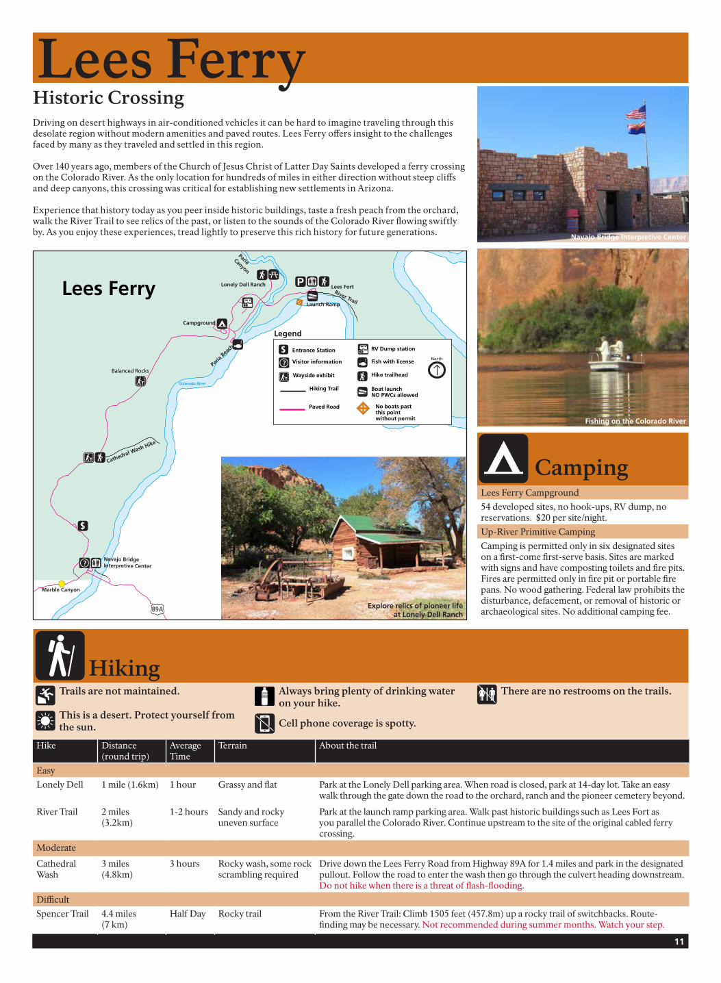
Historic CrossingDriving on desert highways in air-conditioned vehicles it can be hard to imagine traveling through this desolate region without modern amenities and paved routes. Lees Ferry offers insight to the challenges faced by many as they traveled and settled in this region.
Over 140 years ago, members of the Church of Jesus Christ of Latter Day Saints developed a ferry crossing on the Colorado River. As the only location for hundreds of miles in either direction without steep cliffs and deep canyons, this crossing was critical for establishing new settlements in Arizona.
Experience that history today as you peer inside historic buildings, taste a fresh peach from the orchard, walk the River Trail to see relics of the past, or listen to the sounds of the Colorado River flowing swiftly by. As you enjoy these experiences, tread lightly to preserve this rich history for future generations.
Hike Distance (round trip)
Average Time
Terrain About the trail
Easy
Lonely Dell 1 mile (1.6km) 1 hour Grassy and flat Park at the Lonely Dell parking area. When road is closed, park at 14-day lot. Take an easy walk through the gate down the road to the orchard, ranch and the pioneer cemetery beyond.
River Trail 2 miles (3.2km)
1-2 hours Sandy and rocky uneven surface
Park at the launch ramp parking area. Walk past historic buildings such as Lees Fort as you parallel the Colorado River. Continue upstream to the site of the original cabled ferry crossing.
Moderate
Cathedral Wash
3 miles (4.8km)
3 hours Rocky wash, some rock scrambling required
Drive down the Lees Ferry Road from Highway 89A for 1.4 miles and park in the designated pullout. Follow the road to enter the wash then go through the culvert heading downstream. Do not hike when there is a threat of flash-flooding.
Difficult
Spencer Trail 4.4 miles (7 km)
Half Day Rocky trail From the River Trail: Climb 1505 feet (457.8m) up a rocky trail of switchbacks. Route-finding may be necessary. Not recommended during summer months. Watch your step.
Fishing on the Colorado River
Lees Ferry Campground
54 developed sites, no hook-ups, RV dump, no reservations. $20 per site/night.
Up-River Primitive Camping
Camping is permitted only in six designated sites on a first-come first-serve basis. Sites are marked with signs and have composting toilets and fire pits. Fires are permitted only in fire pit or portable fire pans. No wood gathering. Federal law prohibits the disturbance, defacement, or removal of historic or archaeological sites. No additional camping fee.
Navajo Bridge Interpretive Center
Explore relics of pioneer life at Lonely Dell Ranch
89A
$
?
Cathedral Wash Hike
Navajo Bridge Interpretive Center
Marble Canyon
Campground
Paria
Bea
ch
Lonely Dell Ranch Lees FortRiver TrailLaunch Ramp
Paria Canyon
Colorado River
Paria River
Lees Ferry
Balanced Rocks
North
Boat launchNO PWCs allowed
Hike trailheadWayside exhibit
Visitor information
No boats pastthis point without permit
Hiking Trail
Legend
Paved Road
RV Dump station$ Entrance Station
Fish with license?
Camping
Hiking
Lees Ferry
Trails are not maintained.
This is a desert. Protect yourself from the sun.
Always bring plenty of drinking water on your hike.
Cell phone coverage is spotty.
There are no restrooms on the trails.

A Rainbow Turned to StoneThe soaring red rock cliffs and canyons that form the Glen Canyon region give evidence of the vast and varied geologic history of the area – a story millions of years in the making. In few places is this story as visible as it is at Rainbow Bridge National Monument, where a massive natural bridge has been carved right into the Navajo Sandstone. Like many of the geologic features present in the Glen Canyon region, Rainbow Bridge was shaped by the forces of water and wind, working at their leisure over a liberal allowance of time.
Standing approximately 290 feet tall and with a span of 275 feet wide, Rainbow Bridge is one of the largest and most scenic natural bridges in the world. Given its large size and whimsical appearance, it is no surprise that Rainbow Bridge has stood prominently in the stories of those who have come in contact with this natural feature. For thousands of years, native people have found power in this place and members of several Native American tribes continue to interact with Rainbow Bridge for spiritual purposes.
Today close to 100,000 people make the trip to Rainbow Bridge each year to marvel at the curious geologic feature – this rainbow turned to stone – and ponder it’s meaning to people both past and present. Although some effort is required to reach this remote location, those who have experienced the wonder of Rainbow Bridge National Monument would likely say it is well worth the trip.
12 Printed on recycled paper. Please recycle again.
Rainbow Bridge National Monument
Rainbow Bridge boat tour from Wahweap: Take a 6½ hour boat ride up to Rainbow Bridge National Monument. Tours begin in the lobby of the Lake Powell Resort at Wahweap. For reservations call 928-645-2433.
Boat tour from Antelope Point:
Boat tour to Rainbow Bridge by charter only. Call 928-608-4477.
Boat yourself to Rainbow Bridge:
Approximately 7 miles north of Dangling Rope Marina, turn east at buoy 49 into Forbidding Canyon, marked with a Rainbow Bridge National Monument sign. After traveling several miles through Forbidding Canyon, turn left and proceed with caution through the narrow mouth of Bridge Canyon, also marked with a sign. Leave your boat at the courtesy dock. Pets must remain in your boat.
From the boat dock, the hike to Rainbow Bridge is approximately 1 mile each direction on a dirt trail. There is little shade along the trail or at the bridge itself. Wear protective clothing including a hat, shoes, sunglasses, and sunscreen. Carry drinking water with you.
Hike around Navajo Mountain:
If you have 2-3 days, you can hike around Navajo Mountain to Rainbow Bridge. The 14-18 mile hike (depending on route) is through rugged terrain with no services provided. A permit from the Navajo Nation is required. Go to www.navajonationparks.org for more information about the hike and permit.
Walk only on designated trail and viewing area.
Pack it in, Pack it out - no trash receptacle on trail.
Pets must stay in the boat.
Visit with respect to all cultures and beliefs.
This is a desert. Protect yourself from the sun.
Always bring plenty of drinking water.
No cell phone coverage.
There are no restrooms on the trail.
Stay Safe at Rainbow Bridge - Be Aware
Protect Rainbow Bridge - Know the Rules
Services at Dangling Rope Marina: Restrooms, convenience store, snack bar, fuel, pumpout. Closed mid-November to March 1.
Getting There