THE MASTER PLAN STUDY ON FLOOD FORECASTING AND …
74
JAPAN INTERNATIONAL COOPERATION AGENCY KINGDOM OF MOROCCO MINISTRY OF COUNTRY PLANNING, WATER AND ENVIRONMENT DIRECTORATE GENERAL OF HYDRAULICS THE MASTER PLAN STUDY ON FLOOD FORECASTING AND WARNING SYSTEM FOR ATLAS REGION IN THE KINGDOM OF MOROCCO FINAL REPORT VOLUME 2 MAIN REPORT JANUARY 2004 CTI ENGINEERING INTERNATIONAL CO., LTD. YACHIYO ENGINEERING CO., LTD. SSS JR 03-164 No.
Transcript of THE MASTER PLAN STUDY ON FLOOD FORECASTING AND …

JAPAN INTERNATIONAL COOPERATION AGENCY
KINGDOM OF MOROCCO
MINISTRY OF COUNTRY PLANNING, WATER AND ENVIRONMENT DIRECTORATE GENERAL OF HYDRAULICS
THE MASTER PLAN STUDY ON FLOOD FORECASTING AND WARNING SYSTEM
FOR ATLAS REGION IN THE KINGDOM OF MOROCCO
FINAL REPORT
VOLUME 2 MAIN REPORT
JANUARY 2004
CTI ENGINEERING INTERNATIONAL CO., LTD. YACHIYO ENGINEERING CO., LTD. SSS
JR 03-164
No.

JAPAN INTERNATIONAL COOPERATION AGENCY
KINGDOM OF MOROCCO
MINISTRY OF COUNTRY PLANNING, WATER AND ENVIRONMENT DIRECTORATE GENERAL OF HYDRAULICS
THE MASTER PLAN STUDY ON FLOOD FORECASTING AND WARNING SYSTEM
FOR ATLAS REGION IN THE KINGDOM OF MOROCCO
FINAL REPORT
VOLUME 2 MAIN REPORT
JANUARY 2004
CTI ENGINEERING INTERNATIONAL CO., LTD. YACHIYO ENGINEERING CO., LTD.

The cost estimates in this Study are based on the prices levels
indicated below and expressed in Moroccan Dirham
according to the following exchange rates:
USD 1.00 = Dh 9.8638 = JPY 120.590
As of August 1, 2003

PREFACE
In response to a request from the Government of the Kingdom of Morocco, the Government of Japan decided to conduct The Master Plan Study on Flood Forecasting and Warning System for Atlas Region in the Kingdom of Morocco and entrusted the study to the Japan International Cooperation Agency (JICA). JICA selected and dispatched the study team headed by Mr. Yoshiharu Matsumoto of CTI Engineering International Co., Ltd. consisted of CTI Engineering International Co., Ltd. and Yachiyo Engineering Co., Ltd. to Morocco, 5 times between March 2000 and December 2003. In addition, JICA set up the advisory committee headed by Mr. Masayuki Watanabe, Senior Advisor of JICA . The team held discussions with the officials concerned of the Government of the Kingdom of Morocco, and conducted field surveys at the study area. Upon returning to Japan, the team conducted further studies and prepared this final report. I hope that this report will contribute to the promotion of this project and to the enhancement of friendly relationship between our two countries. Finally, I wish to express my sincere appreciation to the officials concerned of the Government of the Kingdom of Morocco for their close cooperation extended to the Team.
2004 January
Kazuhisa MATSUOKA Vice-President
Japan International Cooperation Agency

January 2004 Mr. Kazuhisa MATSUOKA Vice-President Japan International Cooperation Agency Tokyo, Japan Sir:
LETTER OF TRANSMITTAL
We are pleased to submit herewith the Final Report on the Master Plan Study on Flood Forecasting and Warning System for Atlas Region in the Kingdom of Morocco. The study was conducted by CTI Engineering International Co., Ltd. in association with Yachiyo Engineering Co., Ltd. under contracts with Japan International Cooperation Agency (JICA) during the period from March 2000 to January 2004. In conducting the study, we have paid much attention to formulate a realistic master plan of flood forecasting and warning system with due consideration to the present situation of Morocco. We wish to take this opportunity to express our sincere gratitude to the Government of Japan, particularly, JICA, the Ministry of Foreign Affairs, and other offices concerned. We also wish to express our deep appreciation to the Directorate General of Hydraulics, the Ministry of Country Planning, Water and Environment, and other organizations concerned of the Government of Morocco for their close cooperation and assistance extended to the JICA study team during the study. Finally, we hope that this report will contribute to the further promotion of the master plan. Very truly yours, Yoshiharu Matsumoto Leader, JICA Study Team CTI Engineering International Co., Ltd. Encl. : a/s
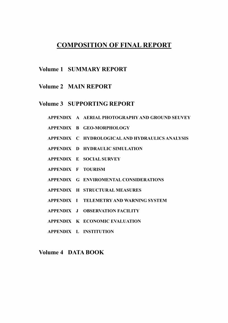
COMPOSITION OF FINAL REPORT
Volume 1 SUMMARY REPORT
Volume 2 MAIN REPORT
Volume 3 SUPPORTING REPORT
APPENDIX A AERIAL PHOTOGRAPHY AND GROUND SEUVEY
APPENDIX B GEO-MORPHOLOGY
APPENDIX C HYDROLOGICAL AND HYDRAULICS ANALYSIS
APPENDIX D HYDRAULIC SIMULATION
APPENDIX E SOCIAL SURVEY
APPENDIX F TOURISM
APPENDIX G ENVIROMENTAL CONSIDERATIONS
APPENDIX H STRUCTURAL MEASURES
APPENDIX I TELEMETRY AND WARNING SYSTEM
APPENDIX J OBSERVATION FACILITY
APPENDIX K ECONOMIC EVALUATION
APPENDIX L INSTITUTION
Volume 4 DATA BOOK

600m
1000m
1500m
2000m 2500m
3000m
Riv
er
Leg
end
Nat
iona
l Roa
d
Prov
inci
al R
oad
Stu
dy
Are
a M
ap
N
4167
3912
Ouarzazate
i
05
1015
20km
R'dat R.
Zat R.
Ourika R.
Rheraya R.
N'fis R.
Tensift R.
MARRAK
ECH
Tahannaout Ouka�meden
Asni
Wirgane
Setti Fadma
Amizmiz
Taroudante
Chichaoua
Mt.
Toubkal
ATLAS
Beni-Mellal
Casablanca
Safi
Tahannaout
Aghbalou
Lalla Takerkoust
Imin El Hmam
Iguir N'kouris
RANGE

Scale
AgounsAmenzal
Tourcht
Tazitount
Iraghf
Adrar Tazaïna
Aoulous
Al Haouz Province
100 15 Km5
N
ABHT
Tiourdiou
DPE
Ourika Caida
Al Haouz Province
MARRAKECH
FLOOD FORECASTING AND WARNING
SYSTEM OF THE OURIKA RIVER BASIN
(PILOT PROJECT)
DGH Monitoring Station
RABAT
Legend
ABHT Master Information Ccenter
Monitoring Station
Flood Watch Station (Rainfall)
Flood Watch Station
(Rainfall and Level Water)
Telemetry Relay Station
Warning System Radio Network
ABHT
Telemetry VHF Radio Network
Warning Post
Warning System Relay Station
Computer Network
DPE Al Haouz
Sidi Bou Othmane
Agouns Station
Centre informatique Principal de l'ABHT
Ourika Caida
Amenzal Station
Tourcht Station
Tazzitount Station
Warning Post and Loud Speaker at Iraghf
Aoulouss Relay Station
Adrar Tazaina Relay Station
Ultrasonic Water Level Gauge at
Tiourdiou Station
ii

iii
THE MASTER PLAN STUDY ON FLOOD FORECASTING AND WARNING SYSTEM
FOR ATLAS REGION IN THE KINGDOM OF MOROCCO
FINAL REPORT (MAIN REPORT)
TABLE OF CONTENTS
PREFACE LETTER OF TRANSMITTAL COMPOSITION OF FINAL REPORT STUDY AREA MAP ................................................................................................i FLOOD FORECASTING AND WARNING SYSTEM OF THE OURIKA RIVER BASIN........................................................................................................... ii TABLE OF CONTENTS ......................................................................................... iii LIST OF TABLES ................................................................................................. x LIST OF FIGURES ................................................................................................. xiii ABBREVIATIONS ................................................................................................. xviii
CHAPTER 1. INTRODUCTION 1.1 Background ............................................................................ 1-1 1.2 Objectives of the Study .......................................................... 1-1 1.3 Study Area .............................................................................. 1-1 1.4 Study Schedule ........................................................................ 1-1 1.5 Organizational Change during This Study .............................. 1-2
CHAPTER 2. GENERAL BACKGROUND OF THE STUDY AREA 2.1 Natural Conditions .................................................................. 2-1
2.1.1 Topography ................................................................ 2-1 2.1.2 Geology ..................................................................... 2-1 2.1.3 Climate ....................................................................... 2-2 2.1.4 Hydrology .................................................................. 2-3
2.2 Socio-Economy ...................................................................... 2-3 2.2.1 Administration ........................................................... 2-3 2.2.2 Demography .............................................................. 2-4 2.2.3 Economy .................................................................... 2-5 2.2.4 Education .................................................................... 2-6 2.2.5 Land Use..................................................................... 2-7
2.3 Agriculture, Stock Raising and Forestry ................................. 2-7 2.3.1 Agriculture ................................................................. 2-7 2.3.2 Stockbreeding ............................................................. 2-8 2.3.3 Forestry ..................................................................... 2-8
2.4 Infrastructure .......................................................................... 2-8
iv
2.4.1 Road Network ........................................................... 2-8 2.4.2 Telecommunications ................................................. 2-9 2.4.3 Electric Power Supply ............................................... 2-11 2.4.4 Drinking Water Supply .............................................. 2-12
2.5 Tourism................................................................................... 2-12 2.5.1 General ...................................................................... 2-12 2.5.2 Characteristics of Tourist Spots ................................ 2-12 2.5.3 Characteristics of Tourists ......................................... 2-14
2.6 River Condition ..................................................................... 2-15 2.6.1 River Basin ................................................................ 2-15 2.6.2 River Morphology ..................................................... 2-16
2.7 Past Flood and Debris Flow Disaster ..................................... 2-17 2.7.1 Past Major Disaster ................................................... 2-17 2.7.2 Features of Flood and Debris Damage....................... 2-18
2.8 Flood and Debris Flow Protection Measures ......................... 2-21 2.8.1 Nonstructural Measures ............................................ 2-21 2.8.2 Structural Measures .................................................. 2-26
2.9 Institutional Setup .................................................................. 2-29 2.9.1 Laws and Regulations ................................................ 2-29 2.9.2 Relevant Organizations .............................................. 2-32
2.10 Environment .......................................................................... 2-40 2.10.1 National Strategy ....................................................... 2-40 2.10.2 Existing Environmental Setting ................................. 2-40 2.10.3 Environmental Legislation......................................... 2-43
2.11 Related Projects and Studies................................................... 2-44 2.11.1 Projects and Studies on Telemeter System ................ 2-44 2.11.2 Improvement of Meteorological Observation
Network...................................................................... 2-46 2.11.3 Flood Protection......................................................... 2-46 2.11.4 Action plan 1999-2003 in Water Sector ................... 2-47
CHAPTER 3. BASIC ANALYSIS 3.1 Geo-morphological Analysis ................................................ 3-1
3.1.1 Preparation of Geo-morphological Land Classification Maps .................................................. 3-1
3.1.2 Preparation of Disaster Hazard Map............ ............ 3-1 3.2 Hydrological and Hydraulic Analysis ...................... ............ 3-4
3.2.1 Availability of Hydrological Data ........................... 3-4 3.2.2 Characteristics of Rainfall and Discharge................. 3-4 3.2.3 Establishment of Flood Simulation Model ............... 3-6 3.2.4 Preparation of Flood Map ......................................... 3-10

v
3.2.5 Other Hydraulic Studies by Using Calibrated Model......................................................................... 3-13
3.3 Social Analysis ...................................................................... 3-15 3.3.1 Methodology of Interview and Questionnaire
Surveys ..................................................................... 3-15 3.3.2 Result of Interview and Questionnaire
Survey ....................................................................... 3-17
CHAPTER 4. FLOOD FORECASTING AND WARNING SYSTEM BEFORE IMPREMENTATION OF PIROT PROJECT
4.1 Introduction ............................................................................ 4-1 4.2 Agencies Concerned for FFWS .............................................. 4-1
4.2.1 Components of FFWS ................................................ 4-1 4.2.2 Guideline for FFWS ................................................... 4-2
4.3 FFWS by Ministry of Equipment ............................................ 4-2 4.3.1 Hydrological Observation and Data Colloection........ 4-3 4.3.2 Data Analysis, Flood Forecasting,
Announcement of Flood Notices and Distribution of Flood Information/Flood Notices....... 4-12
4.3.3 Evacuation .................................................................. 4-14 4.4 FFWS by Ministry of Interior (Al Haouz Province) ............... 4-14
4.4.1 Observation and Data Collection................................ 4-15 4.4.2 Issuance of Warning ................................................... 4-15 4.4.3 Dissemination of Information/Warning...................... 4-16 4.4.4 Evacuation .................................................................. 4-16
4.5 Actual Practice in October 1999 Flood .................................. 4-16 4.5.1 October 1999 Flood .................................................... 4-17 4.5.2 Playing-back ............................................................... 4-17 4.5.3 Evaluation of Observation and Data
Reporting by DRHT ................................................... 4-20 4.6 Actual Practice in 12 August 2001 Flood................................ 4-21
4.6.1 Introduction ................................................................ 4-21 4.6.2 Hydrological Condition .............................................. 4-21 4.6.3 Activities of Organizations Concerned....................... 4-22 4.6.4 Reaction of Tourists and Inhabitants .......................... 4-23 4.6.5 Lessons from the Flood .............................................. 4-24
4.7 Problems of Existing FFWS ................................................... 4-26
CHAPTER 5. STRATEGY OF MASTER PLAN 5.1 Strategy of Master Plan Formulation ...................................... 5-1
5.1.1 Necessity and Limitation of Flood Forecasting and Warning System .................................................. 5-1
5.1.2 Basic Strategy for the Formulation of Master Plan ... 5-2 5.1.3 Basic Conditions of Master Plan Formulation ........... 5-3
5.2 Selection of Target Areas for FFWS ....................................... 5-3

vi
5.2.1 Disaster Characteristics ............................................. 5-4 5.2.2 Selection of High Risk Areas .................................... 5-6
5.3 Major Points of Master Improvement .................................... 5-6 5.3.1 Hydrological Observation and Data Collection ........ 5-6 5.3.2 Data Analysis and Forecasting .................................. 5-10 5.3.3 Flood Warning Issuance ........................................... 5-15 5.3.4 Flood Warning Dissemination .................................. 5-16 5.3.5 Evacuation ................................................................. 5-16 5.3.6 Institutional Plan ....................................................... 5-19
5.4 Conceivable Equipment Options ........................................... 5-23 5.4.1 Flood Warning Issuance ........................................... 5-23 5.4.2 Three Options for Data Analysis,
Forecasting and Data Distribution ............................ 5-25 5.4.3 Warning Dissemination ............................................. 5-27 5.4.4 Selection of Optimum Equipment Plan ..................... 5-28
5.5 General Description of Master Plan ....................................... 5-29 5.5.1 Objective of Proposed FFWS ................................... 5-29 5.5.2 Components of Atlas Region FFWS Plan.................. 5-30 5.5.3 Strengthening and Systemization of
Voluntary Prevention Activities ............................... 5-32
5.6 Operation and Maintenance Plan ........................................... 5-32 5.6.1 Organizations Involved in Atlas Region FFWS Plan 5-32 5.6.2 Proposed Operation and Maintenance Plan .............. 5-33
5.7 Implementation Plan and Cost Estimate ................................ 5-36 5.7.1 Implementation Plan ................................................. 5-36 5.7.2 Cast Estimate ............................................................ 5-37
5.8 Project Evaluation .................................................................. 5-38 5.8.1 Economic Evaluation and Financial Consideration ... 5-38 5.8.2 Consideration of Social Aspect ................................. 5-44 5.8.3 Initial Environmental Evaluation ............................... 5-45 5.8.4 Technical Acceptability ............................................ 5-48
5.9 Recommendation for Institutional Strengthening .................. 5-49 5.9.1 Responsibility Allocation and Cooperation
among Related Entities ............................................. 5-49 5.9.2 Organization Setup .................................................... 5-49 5.9.3 Required Human Resource Development ................. 5-51
CHAPTER 6. PLANNING AND DESIGN OF PILOT PROJECT 6.1 Planning of Pilot Project ......................................................... 6-1
6.1.1 Selection of Objective River Basin............................ 6-1 6.1.2 Determination of Development Level ...................... 6-1

vii
6.2 Description of Pilot Project ..................................................... 6-3 6.2.1 General of Pilot Project .............................................. 6-3 6.2.2 Description of Pilot Project by Subsystem ................ 6-5
6.3 Design of Pilot Project Phase - I ............................................. 6-7 6.3.1 Ambient Conditions.................................................... 6-7 6.3.2 Specifications and Configuration of Equipment......... 6-7 6.3.3 Specification of Flood Forecasting Software ............. 6-7
6.4 Design of Pilot Project Phase - II ............................................ 6-8 6.4.1 Design of Radio Circuit for Telemetry System .......... 6-8 6.4.2 Specifications and Configuration of Equipment......... 6-15
CHAPTER 7. IMPREMENTATION AND EXPERIMENTAL OPERATION OF PILOT PROJECT PHASE - I
7.1 Implementation Work ............................................................. 7-1 7.1.1 Construction Work .................................................... 7-2 7.1.2 Installation of Equipment and Software ..................... 7-2 7.1.3 Development of Flood Forecasting Program.............. 7-2
7.2 Preparation of Guideline.......................................................... 7-2 7.2.1 Principal Organizations and General Procedures ...... 7-3 7.2.2 Definition of Flood Notices, Flood Warnings
and Flood Phases ........................................................ 7-4 7.2.3 Action and Procedures to be Taken
by Principal Organizations ......................................... 7-11 7.2.4 Guideline of Evacuation Activities............................. 7-13
7.3 Technical Transfer Programs................................................... 7-16 7.3.1 Inauguration Events
(Site Visits and Workshop Seminar) .......................... 7-16 7.3.2 Communication Simulation Drill ............................... 7-17 7.3.3 Evacuation Drill.......................................................... 7-19
7.4 Global Simulation Drill .......................................................... 7-21 7.4.1 Introduction ................................................................ 7-21 7.4.2 Preparation Activities ................................................. 7-21 7.4.3 Results and Evaluation Global Simulation Drill......... 7-26 7.4.4 Evaluation and Recommendation ............................... 7-29
7.5 Maintenance of Equipment ..................................................... 7-32 7.6 Actual Operation During 14 June 2003 Flood ....................... 7-32
7.6.1 Introduction ................................................................ 7-32 7.6.2 Hydrological Condition .............................................. 7-33 7.6.3 Activities of Organization Concerned ........................ 7-33 7.6.4 Threats of Flood and Debris Flow from Tributary ..... 7-35 7.6.5 Lessons from the Flood .............................................. 7-35

viii
CHAPTER 8. IMPREMENTATION AND EXPERIMANTAL OPERATION OF PILOT PROJECT PHASE-II
8.1 Implementation Work ............................................................. 8-1 8.1.1 Construction Work..................................................... 8-1 8.1.2 Installation of Equipment and Software..................... 8-1 8.1.3 Radio Interference Problems...................................... 8-3
8.2 Technical Transfer Problems .................................................. 8-5 8.2.1 Global Simulation Drill.............................................. 8-6 8.2.2 Inauguration Ceremony ............................................. 8-10
8.3 Maintenance of Equipment ..................................................... 8-10 8.4 Actual Operation During 4 August 2003 Storm ..................... 8-10
8.4.1 Introduction................................................................ 8-10 8.4.2 Hydrological ............................................................. 8-10 8.4.3 Activities of Organizations Concerned ..................... 8-12
CHAPTER 9. EVALUATION OF PILOT PROJECT 9.1 Introduction............................................................................. 9-1 9.2 Criteria of Evaluation.............................................................. 9-1
9.2.1 Objective of Evaluation ............................................. 9-1 9.2.2 Criteria of Evaluation ................................................ 9-1
9.3 Evaluation ............................................................................... 9-2 9.3.1 Adequacy of Equipment ............................................ 9-2 9.3.2 Adequacy of Guideline .............................................. 9-5 9.3.3 Adequacy of Total System......................................... 9-7 9.3.4 Conclusion ................................................................. 9-8
CHAPTER 10. MODIFICATION OF MASTER PLAN 10.1 Introduction............................................................................. 10-1 10.2 Modification of Master Plan ................................................... 10-2
10.2.1 Target Completion Year of Master Plan ................... 10-2 10.2.2 Modification of Subsystem ....................................... 10-2 10.2.3 Modification of Operation and Maintenance Plan .... 10-4 10.2.4 Comprehensive Approach for Disaster Prevention ... 10-7
10.3 General Description of Master Plan........................................ 10-7 10.3.1 Objective of Proposed FFWS ................................... 10-7 10.3.2 Institutional Plan ....................................................... 10-7 10.3.3 Components of Atlas Region FFWS Plan ................. 10-10 10.3.4 Proposed Operation and Maintenance Plan .............. 10-12 10.3.5 Human Resource Development Plan ........................ 10-15
10.4 Implementation Plan and Cost Estimate ................................. 10-16 10.4.1 Implementation Plan ................................................. 10-16 10.4.2 Cost Estimate ............................................................ 10-16
10.5 Project Evaluation................................................................... 10-16

ix
10.5.1 Economic Evaluation and Financial Consideration.... 10-17 10.5.2 Consideration of Social Aspect ................................. 10-18 10.5.3 Initial Environmental Evaluation ............................... 10-19 10.5.4 Technical Acceptability ............................................. 10-19
CHAPTER 11. COMPREHENSIVE APPROACH TO DISASTERS IN ATLAS REGION
11.1 General .................................................................................... 11-1 11.2 Introduction of Structural Measures ........................................ 11-1
11.1.1 Current Provision of Structural Measurer against Flood Damage............................................................. 11-1
11.2.2 Applicable Structural Measures ................................. 11-1 11.2.3 Consideration on the Introduction of
Structural Measures ................................................... 11-2 11.3 Introduction of Non-structural Measure expect FFWS ........... 11-2
11.3.1 Publication of Hazard Maps ...................................... 11-2 11.3.2 Monitoring of Potential Debris Streams ..................... 11-3 11.3.3 Introduction of Traffic Control .................................. 11-3 11.3.4 Land Use Control and Guidance ................................ 11-4 11.3.5 Provision of Tourism Facilities ................................. 11-5
CHAPTER 12. CONCLUSIONS AND RECOMMENDATIONS 12.1 Conclusions ............................................................................. 12-1 12.2 Recommendations ................................................................... 12-2

x
LIST OF TABLES
Table 2.1.1 CLIMATE IN MARRAKECH ......................................................... T-2-1 Table 2.1.2 TEMPERATURE AT SIDI RAHAL STATION AND
LALLA TAKERKOUST STATION................................................ T-2-1 Table 2.1.3 ANNUAL MAXIMUM DISCHARGE ............................................ T-2-2 Table 2.1.4 PROBABILITY OF ANNUAL PEAK DISCHARGE
AT PRINCIPAL STATION.............................................................. T-2-3 Table 2.2.1 DEMOGRAPHIC DATA OF AL HAOUZ PROVINCE ................. T-2-4 Table 2.2.2 DEMOGRAPHIC DATA OF THE PREFECTURE
OF SIDI YOUSSEF BEN ALI ......................................................... T-2-5 Table 2.3.1 DOMINANT TREE AND FOREST AREA
IN AL HAOUZ PROVINCE ............................................................ T-2-6 Table 2.4.1 LIST OF TELEPHONE INSTALLATION AT AL HAOUZ
PROVINCE....................................................................................... T-2-7 Table 2.5.1 TOURISM SURVEY METHODOLOGY........................................ T-2-8 Table 2.5.2 SUMMARY RESULTS OF QUESTIONNAIRE TO
TOURISTS........................................................................................ T-2-9 Table 2.6.1 CATCHMENT AREAS OF SUB-BASIN........................................ T-2-10 Table 2.6.2 DIMENSION OF MAJOR RIVERS................................................. T-2-10 Table 2.7.1 FEATURE OF FLOOD AND SEDIMENT FLOW DAMAGE
IN 1995 FLOOD ............................................................................... T-2-11 Table 2.10.1 PROJECTS SUBJECT TO EIA........................................................ T-2-12 Table 3.1.1 CLASSIFICATION OF LAND FORM FOR 1/50,000 MAP .......... T-3-1 Table 3.1.2 CLASSIFICATION OF LAND FORM FOR 1/5,000 MAP ............ T-3-2 Table 3.2.1 RAINFALL GAUGING STATION FOR HYDROLOGICAL
STUDY ............................................................................................. T-3-3 Table 3.2.2 WATER LEVEL OBSERVATION.................................................. T-3-3 Table 3.2.3 INTENSITY-DURATION-FREQUENCY RELATIONSHIP
FOR AGHBALAU............................................................................ T-3-4 Table 3.2.4 MAXIMUM 10 FLOODS FOR EACH RIVER ............................... T-3-5 Table 3.2.5 DISTRIBUTION OF DISCHARGE................................................. T-3-6 Table 3.3.1 NUMBER OF DOUARS DAMAGED AND MENACED
BY FLOODS IN AL HAOUZ PROVINCE ................................................................. T-3-7
Table 3.3.2 LIST OF SELECTED DOUARS FOR SOCIAL STUDY AND PUBLIC AWARENESS OF NATURAL DISASTER..................... T-3-8
Table 3.3.3 SOCIAL ENVIRONMENT OF SELECTED DOUARS IN STUDY AREA ............................................................................ T-3-9
Table 3.3.4 SUMMARY OF ANSWERS TO QUESTIONNAIRE FOR THE SOCIAL STUDY AND PUBLIC AWARENESS OF NATURAL DISASTER (PART 1)............................................. T-3-12
Table 3.3.5 SUMMARY OF ANSWERS TO QUESTIONNAIRE FOR THE SOCIAL STUDY AND PUBLIC AWARENESS (PART 2) .. T-3-18

xi
Table 3.3.6 LIST OF DAMAGE IN SELECTED DOUARS BY THE 1995 DISASTER ........................................................................................ T-3-22
Table 3.3.7 LIST OF DAMAGE IN SELECTED DOUARS BY THE 1999 DISASTER ........................................................................................ T-3-24
Table 4.2.1 LIST OF FLOOD WATCH STATIONS IN STUDY AREA ........... T-4-1 Table 4.2.2 LIST OF EQUIPMENT AT FLOOD WATCH STATIONS ............ T-4-2 Table 4.2.3 ACTIONS TO BE TAKEN BY DPE/DRE ....................................... T-4-3 Table 4.2.4 DMN ALERT MESSAGES AND ACTUAL RAINFALL............... T-4-4 Table 5.2.1 SUMMARY OF DISASTER CHARACTERISTICS ....................... T-5-1 Table 5.3.1 PROPOSED NETWORK OF FLOOD WATCH STATIONS
IN THE STUDY AREA .................................................................... T-5-2 Table 5.3.2 LOCATIONS OF PROPOSED WARNING SPOTS ........................ T-5-3 Table 5.4.1 COMPARISON OF WATER LEVEL GAUGE ............................... T-5-4 Table 5.4.2 COMPARISON FOR COMMUNICATION METHOD
(SUMMARY) ................................................................................... T-5-5 Table 5.4.3 THREE ALTERNATIVES FOR MASTER PLAN .......................... T-5-6 Table 5.4.4 EQUIPMENT COSTS FOR THREE OPTIONS .............................. T-5-7 Table 5.4.5 ESTIMATION OF NECESSARY TIME FOR FFWS
OPERATION..................................................................................... T-5-8 Table 5.7.1 IMPLEMENTATION SCHEDULE OF ATLAS REGION
FFWS PLAN ..................................................................................... T-5-9 Table 5.8.1 ECONOMIC COST SUMMARY ..................................................... T-5-10 Table 5.8.2 SUMMARY OF REPORTED DAMAGE......................................... T-5-10 Table 5.8.3 ESTIMATED LOSSES ON ASSETS ............................................... T-5-11 Table 5.8.4 ANNUAL AVERAGE DAMAGE.................................................... T-5-11 Table 5.8.5 CASH FLOW .................................................................................... T-5-12 Table 5.8.6 ANNUAL AVERAGE DAMAGE
(INCLUDING HUMAN LIVES) ...................................................... T-5-13 Table 5.8.7 CASH FLOW(INCLUDING VALUE OF HUMAN LIVES)........... T-5-14 Table 5.8.8 HYDROLOGY-RELATED BUDGET OF DGH IN 2000/01
OF DGH............................................................................................. T-5-15 Table 5.8.9 HYDROLOGY-RELATED BUDGET OF DRHT............................ T-5-15 Table 5.8.10 O&M RESPONSIBILITY AND COST BURDEN
ON LOCAL AUTHORITIES............................................................ T-5-15 Table 5.8.11 SCREENING OF MASTER PLAN PROJECTS .............................. T-5-16 Table 5.8.12 CHECKLIST FOR SCOOPING........................................................ T-5-17 Table 5.8.13 POTENTIAL ENVIRONMENTAL IMPACTS................................ T-5-18 Table 6.1.1 GAP BETWEEN CONDITIONS BEFORE PILOT PROJECT
AND MASTER PLAN ...................................................................... T-6-1 Table 6.1.2 SUBSYSTEMS OF FOUR ALTERNATIVES ................................. T-6-2 Table 6.1.3 DEVELOPMENT LEVEL OF ALTERNATIVE 1-1 ....................... T-6-3 Table 6.1.4 DEVELOPMENT LEVEL OF ALTERNATIVE 1-2 ....................... T-6-4 Table 6.1.5 DEVELOPMENT LEVEL OF ALTERNATIVE 1-3 ....................... T-6-5 Table 6.1.6 DEVELOPMENT LEVEL OF ALTERNATIVE 2 .......................... T-6-6

xii
Table 6.1.7 ESTIMATED IMPLEMENTATION SCHEDULE OF PILOT PROJECT ....................................................................... T-6-7
Table 6.1.8 APPROXIMATE EQUIPMENT COSTS FOR FOUR ALTERNATIVES ........................................................ T-6-8
Table 6.2.1 IMPLEMENTATION SCHEDULE OF PROJECT ......................... T-6-9 Table 6.4.1 COMPARISON OF COMMUNICATION MEDIA
FOR TELEMETRY SYSTEM ......................................................... T-6-10 Table 6.4.2 LIST OF EQUIPMENT FOR RADIO PROPAGATION TEST ...... T-6-11 Table 6.4.3 RESULTS OF RADIO PROPAGATION TESTS............................ T-6-12 Table 7.1.1 INVENTORY OF EQUIPMENT INSTALLED IN 2001 ................ T-7-1 Table 7.2.1 NECESSARY ACTIONS TO BE TAKEN
IN EACH FLOOD PHASE............................................................... T-7-4 Table 7.4.1 ASSUMED HYDROLOGICAL DATA ON 25 JUNE 2002 ........... T-7-9 Table 7.4.2 MEETING AND EVENTS RELATED
TO GLOBAL SIMULATION DRILL.............................................. T-7-10 Table 7.4.3 CONSUMED TIME IN EACH PROCEDURE
IN THREE SIMULATION DRILLS ............................................... T-7-11 Table 8.1.1 INVENTORY OF EQUIPMENT INSTALLED IN 2003 ................ T-8-1 Table 8.1.2 RADIO PROPAGATION DATA..................................................... T-8-3 Table 8.1.3 TELEMETRY DATA OBTAINING RATE .................................... T-8-4 Table 9.3.1 PERFORMANCE OF PILOT PROJECT FFWS
DURING FLOODS........................................................................... T-9-1 Table 9.3.2 MAJOR TROUBLES OF EQUIPMENT
AND THEIRMEASURES DURING EXPERIMENTAL OPERATION.................................................................................... T-9-3
Table 9.3.3 FLOODS EXCEEDING PRE-ALERT AND ALERT LEVELS .................................................................... T-9-4
Table 10.4.1 IMPLEMENTATION SCHEDULE OF MASTER PLAN............... T-10-1 Table 10.4.2 EQUIPMENT COST OF MODIFIED MASTER PLAN
AFTERPILOT PROJECT................................................................. T-10-2 Table 10.4.3 EQUIPMENT COST OF MODIFIEDT MASTER PLAN
BY AGENCY ................................................................................... T-10-3 Table 10.5.1 FINANCIAL COST SUMMARY
(MODIFIED MASTER PLAN)........................................................ T-10-4 Table 10.5.2 ECONOMIC COST SUMMARY
(MODIFIED MASTER PLAN)........................................................ T-10-4 Table 10.5.3 CASH FLOW
(MODIFIED MASTER PLAN ALTERNATIVE-1) ........................ T-10-5 Table 10.5.4 CASH FLOW
(MODIFIED MASTER PLAN ALTERNATIVE-2) ........................ T-10-6 Table 10.5.5 CASH FLOW
(INCLUDING VALUE OF HUMAN LIVES MODIFIED MASTER PLAN ALTERNATIVE-1).............................................. T-10-7
Table 10.5.6 CASH FLOW (INCLUDING VALUE OF HUMAN LIVES MODIFIED MASTER PLAN ALTERNATIVE-2).............................................. T-10-8

xiii
Table 11.3.1 DEBRIS FLOW POTENTIAL STREAM MONITORING REPORT ................................................................. T-11-1
LIST OF FIGURES
Fig.2.1.1 SUMMIT LEVEL MAP .................................................................... F-2-1 Fig.2.1.2 GEOLOGIC MAP ............................................................................. F-2-2 Fig.2.1.3 AVERAGE MONTHLY OF RAINFALL AT REPRESENTATIVE
STATIONS........................................................................................ F-2-3 Fig.2.1.4 MONTHLY MEAN DISCHARGE AT PRINCIPAL GAUGING
STATIONS........................................................................................ F-2-4 Fig.2.2.1 ADMINISTRATIVE DIVISION OF THE STUDY AREA.............. F-2-5 Fig.2.2.2 LAND USE MAP .............................................................................. F-2-6 Fig.2.3.1 PROJECT AREA OF ORMVAH...................................................... F-2-7 Fig.2.4.1 ROAD NETWORK IN THE STUDY AREA ................................... F-2-8 Fig.2.5.1 LOCATION OF TOURISM SURVEY............................................. F-2-9 Fig.2.5.2 SUMMARY RESULTS OF TOURISM SURVEY (1/3-3/3) ........... F-2-10 Fig.2.6.1 DIVISION OF SUB-BASIN ............................................................. F-2-13 Fig.2.6.2 ELEVATION - AREA CURVES OF RIVER BASINS.................... F-2-14 Fig.2.6.3 PROFILE OF RIVERS...................................................................... F-2-15 Fig.2.6.4 BASIN GRADIENT OF MAIN TRIBUTARIES ............................. F-2-16 Fig.2.7.1 FLOOD MAP (1/3-3/3) ..................................................................... F-2-17 Fig.2.7.2 HYDROGRAPH OF REPRESENTATIVE STATION
(1995 FLOOD) ................................................................................. F-2-20 Fig.2.7.3 HYDROGRAPH OF REPRESENTATIVE STATION
(1999 FLOOD) ................................................................................. F-2-21 Fig.2.8.1 LOCATION OF METEOROLOGICAL AND HYDROLOGICAL
OBSERVATION STATIONS........................................................... F-2-22 Fig.2.8.2 COVERAGE OF FIVE RADARS..................................................... F-2-23 Fig.2.8.3 BROCHURE OF TOURISTS ........................................................... F-2-24 Fig.2.8.4 REFORESTATION PLAN................................................................ F-2-25 Fig.2.8.5 LOCATION OF STRUCTURAL MEASURES
IN OURIKA RIVER BASIN............................................................. F-2-26 Fig.2.8.6 LOCATION OF STRUCTURAL MEASURES
IN ISSYL RIVER .............................................................................. F-2-27 Fig.2.9.1 ORGANIZATION FOR FELIEF ACTIVITIES
IN THE ORSEC PLAN ..................................................................... F-2-28 Fig.2.11.1 LOCATION OF AUTOMATIC STATIONS
IN WIRGANE RIVER BASIN ......................................................... F-2-29 Fig.2.11.2 SYSTEM ARCHITECTURE OF INFORMATION NETWORK
IN DGH ............................................................................................. F-2-30 Fig.2.11.3 SCHEMATIC DIAGRAM OF NETWORK PROPOSED
BY DMN ........................................................................................... F-2-31 Fig.2.11.4 RADIO LINK FOR ROCADE CANAL AND N’FIS CANAL ........ F-2-32

xiv
Fig.3.1.1 GEOMORPHOLOGICAL LAND CLASSIFICATION MAP (1/ 50,000)........................................................................................ F-3-1
Fig.3.1.2 HAZARD MAP(OURIKA) .............................................................. F-3-2 Fig.3.2.1 HYDROLOGICAL STATIONS FOR HYDROLOGICAL
AND HYDRAULIC SURVEY......................................................... F-3-3 Fig.3.2.2 RELATION BETWEEN RAINFALL AND ALTITUDE
IN THE STUDY AREA.................................................................... F-3-4 Fig.3.2.3 ISOHYETAL MAP (ANNUAL AVERAGE) .................................. F-3-5 Fig.3.2.4 SEASONALLY AMOUNT O RAINFALL ..................................... F-3-6 Fig.3.2.5 TOPOGRAPHICAL, LITHOLOGICAL AND VEGETATION
MAP.................................................................................................. F-3-7 Fig.3.2.6 SUB-BASIN DIVISION FOR RUNOFF SIMULATION................ F-3-8 Fig.3.2.7 SCHEMATIC DIAGRAM OF HYDRODYNAMIC
SIMULATION MODEL................................................................... F-3-9 Fig.3.2.8 CALIBRATION RESULT................................................................ F-3-10 Fig.3.2.9 SCHEMATIC DIAGRAM OF SIMULATION MODEL
FOR ISSYL RIVER.......................................................................... F-3-11 Fig.3.2.10 SIMULATION RESULT FOR ISSYL RIVER
(PEAK DISCHARGE = 90M3/S) .................................................... F-3-12 Fig.3.2.11 TARGET AREA FOR FLOOD MAP .............................................. F-3-13 Fig.3.2.12 DESIGNED HYDROGRAPH FOR ISSYL RIVER ........................ F-3-14 Fig.3.2.13 BRIDGES IN ISSYL RIVER ........................................................... F-3-15 Fig.3.2.14 FLOOD MAP OF N’FIS RIVER...................................................... F-3-16 Fig.3.2.15 FLOOD MAP OF RHERAYA RIVER (100-YEAR FLOOD) ........ F-3-18 Fig.3.2.16 FLOOD MAP OF RHERAYA RIVER
(AROUND IMLIL, ASNI, AND MOULAY BRAHIM).................. F-3-19 Fig.3.2.17 FLOOD MAP OF OURIKA RIVER (100-YEAR FLOOD) ............ F-3-20 Fig.3.2.18 FLOOD MAP OF OURIKA RIVER (1/5-5/5) ................................. F-3-21 Fig.3.2.19 FLOOD MAP OF ZAT RIVER (100-YEAR FLOOD).................... F-3-26 Fig.3.2.20 FLOOD MAP OF R’DAT RIVER (100-YEAR FLOOD) ............... F-3-27 Fig.3.2.21 FLOOD MAP OF RHERAYA RIVER
(AROUND JUNCTION OF TAZILIDA TRIBUTARY) ................. F-3-28 Fig.3.2.22 FLOOD MAP OF ISSYL RIVER (100-YEAR FLOOD)................. F-3-29 Fig.3.2.23 COMPARISON OF SIMULATION RESULTS .............................. F-3-30 Fig.3.2.24 TRAVELING TIME OF FLOOD..................................................... F-3-31 Fig.3.2.25 FLOW CAPACITY OF RIVER ....................................................... F-3-32 Fig.3.3.1 LOCATION OF THE SOCIAL STUDY AND
PUBLIC AWARENESS ................................................................... F-3-34 Fig.4.3.1 LOCATION OF RADIO STATIONS UNDER DRHT.................... F-4-1 Fig.4.3.2 LOCATION OF FLOOD WATCH STATION
IN THE STUDY AREA.................................................................... F-4-2 Fig.4.3.3 LOCATION OF FLOOD WATCH STATION
IN OURIKA RIVER BASIN ............................................................ F-4-3 Fig.4.3.4 EXAMPLE OF SPECIAL METEOROLOGICAL
BULLETINS..................................................................................... F-4-4

xv
Fig.4.3.5 SCHEMATIC DIAGRAM FOR DIFFUSION OF ALERT MESSAGE......................................................................................... F-4-5
Fig.4.3.6 ROUTES OF INFORMATION/ WARNINGS DISSEMINATION . F-4-6 Fig.4.4.1 LOCATION OF RADIO STATIONS AND CLIMATIC POST
IN AL HAOUZ PROVINCE............................................................. F-4-7 Fig.4.5.1 PLAYBACK OF OCTOBER 1999 FLOOD..................................... F-4-8 Fig.4.5.2 OBSERVED RAINFALL DURING 1999 FLOOD.......................... F-4-9 Fig.4.5.3 WATER LEVEL HYDROGRAPH DURING 1999 FLOOD ........... F-4-10 Fig.4.6.1 PLAYBACK OF 12 AUGUST 2001 FLOOD .................................. F-4-12 Fig.4.6.2 DISTRIBUTION OF RAINFALL ON 12 AUGUST 2001............... F-4-13 Fig.5.3.1 DEPLOYMENT PLAN OF FLOOD WATCH STATIONS............. F-5-1 Fig.5.3.2 SAMPLE OF VISUALIZED INFORMATION (1/3-3/3)................. F-5-2 Fig.5.3.3 LOCATION OF PROPOSED WARNING POSTS .......................... F-5-5 Fig.5.4.1 CONNECTIONAL BLOCK DIAGRAM FOR DATA
COLLECTION SUB-SYSTEM ........................................................ F-5-6 Fig.5.4.2 SYSTEM BLOCK DIAGRAM FOR DATA COLLECTION .......... F-5-7 Fig.5.4.3 EQUIPMENT BLOCK DIAGRAM FOR DATA PROCESSING
AND MONITORING SYB-SYSTEM .............................................. F-5-8 Fig.5.4.4 CONNECTIONAL BLOCK DIAGRAM FOR WARNING
SUB-SYSTEM .................................................................................. F-5-9 Fig.5.4.5 SYSTEM BLOCK DIAGRAM FOR WARNING
SUB-SYSTEM (OPTION C)............................................................. F-5-10 Fig.5.4.6 VHF RADIO COMMUNICATION NETWORK TELEMETRY
AND ARNING SYSTEM ................................................................. F-5-11 Fig.5.5.1 COMMUNICATION NETWORK.................................................... F-5-12 Fig.6.1.1 OUTLINE OF PILOT PROJECT ..................................................... F-6-1 Fig.6.2.1 COMPARISON OF MASTER PLAN AND PILOT PROJECT
IN NUMBER OF STATIONS AND WARNING POSTS IN OURICA RIVER BASIN............................................................. F-6-2
Fig.6.3.1 CONCEPTUAL SYSTEM DIAGRAM OF PILOT PROJECT ........ F-6-3 Fig.6.3.2 BLOCK DIAGRAM FOR TELEMETRY SUPERVISORY &
CONTROL AND DATA PROCESSING EQUIPMENT ................. F-6-4 Fig.6.3.3 BLOCK DIAGRAM FOR FLOOD WATCH STATION:
AGOUNS AND TOURCHT (1/4-4/4) ............................................. F-6-5 Fig.6.3.4 BLOCK DIAGRAM FOR WARNING SYSTEM (1/3-3/3)............. F-6-9 Fig.6.4.1 PROPOSED RADIO NETWORK FOR TELEMETRY
SYSTEM FOR PILOT PROJECT PHASE II ................................... F-6-12 Fig.6.4.2 RESULTS OF RADIO PROPAGATION TEST............................... F-6-13 Fig.6.4.3 RESULTS OF RADIO CURCUIT CALCULATION....................... F-6-14 Fig.6.4.4 BLOCK DIAGRAM FOR REPEATER STATION
(AOULOUSS) (1/2-2/2) ................................................................... F-6-15 Fig.7.1.1 WATER LEVEL GAUGE SUPPORTING MAST........................... F-7-1 Fig.7.1.2 PANZERMAST INSTALLATION................................................... F-7-2 Fig.7.1.3 EXAMPLES OF GRAPHIC INFORMATION PROVIDED
BY DRHT (1/4-4/4)........................................................................... F-7-3

xvi
Fig.7.1.4 EXAMPLES OF SIMULATION RESULTS (COMPARISON) (1/2-2/2) ............................................................................................ F-7-7
Fig.7.2.1 FLOW CAPACITY OF OURIKA RIVER AT LEVEL OF ROAD P2017 .............................................................................. F-7-9
Fig.7.2.2 ESTIMATION OF PROBABLE DISCHARGE BY USING CREAGER’S CURVES.................................................................... F-7-10
Fig.7.2.3 RATING CURVES AND ALERT LEVELS AT 3 STATIONS ...... F-7-11 Fig.7.2.4 CROSS SECTION PROFILE AND ALERT WATER LEVELS
AT 3 STATIONS .............................................................................. F-7-12 Fig.7.2.5 RISING FLOOD HYDROGRAPHS OBSERVED
AT AGHBALOU STATION............................................................ F-7-13 Fig.7.2.6 FAX FORM OF FLOOD NOTICE (PRE RIVER FLOOD NOTICE)
(1/3-3/3) ............................................................................................ F-7-14 Fig.7.2.7 FAX FORM OF FLOOD WARNING (RIVER FLOOD CAUTION) F-7-17 Fig.7.2.8 PROPOSED EVACUATION PLACES IN IRAGHF ...................... F-7-18 Fig.7.4.1 GENERAL SCENARIO OF GLOBAL SIMULATION DRILL ..... F-7-21 Fig.7.4.2 DISSEMINATION ROUTE OF DMN MESSAGE
IN GROBAL SIMULATION DRILL............................................... F-7-22 Fig.7.4.3 DISSEMINATION ROUTE OF FLOOD NOTICES AND
FLOOD WARNING IN GROBAL SIMULATION DRILL ............ F-7-23 Fig.7.4.4 ALERT MESSAGE FAXED FROM DMN MARRAKECH........... F-7-24 Fig.7.4.5 FLOOD NOTICE MESSAGE FAXED FROM ABHT
(PRE FLOOD NOTICE)................................................................... F-7-25 Fig.7.4.6 FLOOD WARNING MESSAGE FAXED FROM PROVINCE
(FLOOD CAUTION)........................................................................ F-7-26 Fig.7.4.7 SIMPLIFIED MESSAGES FROM PROVINCE
TO WARNING POST ...................................................................... F-7-27 Fig.7.4.8 LEAFLET DISTRIBUTED TO TOURISTS.................................... F-7-28 Fig.7.4.10 ACTIONS MADE BY PRINCIPAL ORGANIZATIONS DURING
19 JUNE TEST SIMULATION........................................................ F-7-30 Fig.7.4.11 ACTIONS MADE BY PRINCIPAL ORGANIZATIONS DURING
21 JUNE TEST SIMULATION........................................................ F-7-31 Fig.7.4.12 ACTIONS MADE BY PRINCIPAL ORGANIZATIONS DURING
25 JUNE............................................................................................ F-7-32 Fig.7.6.1 PLAYBACK OF 14 JUNE 2003 FLOOD ........................................ F-7-33 Fig.7.6.2 DISTRIBUTION OF RAINFALL ON 14 JUNE 2003 .................... F-7-34 Fig.8.1.1 STORAGE HOUSE FOR REPEATER EQUIPMENT
(AOULOUSS, ADRAR, TAZAINA) ............................................... F-8-1 Fig.8.4.1 PLAYBACK OF 4 AUGUST 2003 FLOOD.................................... F-8-2 Fig.8.4.2 DISTRIBUTION OF RAINFALL ON 4 AUGUST 2003 ................ F-8-3 Fig.8.4.3 DEBRIS DISASTERS DURING 4 AUGUST 2003 RAINSTORM F-8-4 Fig.8.4.4 RAINFALL DATA DISPLAYED ON PC SCREEN....................... F-8-5 Fig.10.2.1 MODIFIED BLOCK DIAGRAM FOR DATA COLLECTION
SUBSYSTEM ................................................................................... F-10-1 Fig.10.2.2 MODIFIED BLOCK DIAGRAM FOR WARNING SUBSYSTEM F-10-2

xvii

xviii
ABBREVIATIONS
ABHT Agence du Bassin Hydraulique de Tensift, MATEE
Tensift Hydraulic Basin Agency
AEFCS Administration des Eaux et Forest et de la Conservation des Sols
Administration of Water and Forest and Soil Conservation
AEPI Alimentation en Eau Potable et Industrielle
Drinking and Industrial Water Supply
ANRT Agence Nationale de Réglementation de Transmission
National Agency of Transmission Regulation
CDCL Centre de Documentation des Collectivités Locales, MI
Documentation Center for Local Communities
CNP Centre National des Prévisions, DMN National Forecasting Center, DMN DEA Direction des Eaux et Assainissement,
MAMVA Directorate of Water and Drainage
DGCL Direction Générale des Collectivités Locales, MI
Directorate General of Local Communes
DGH Direction Générale de l'Hydraulique, MATEE
Directorate General of Hydraulics
DMN Direction de la Météorologie Nationale, MATEE
Directorate of National Meteorology
DPA Direction Provinciale de l'Agriculture, MAMVA
Provincial Directorate of Agriculture
DPE Direction Provinciale de l'Equipement, MET
Provincial Directorate of Equipment
DRC Direction Régionale Centre, DMN, MATEE
Central Regional Directorate, DMN
DRCR Direction des Routes et de la Circulation Routière, MET
Directorate of Roads and on Road Traffic
DRE Direction Régionale de l'Equipement, MET
Regional Directorate of Equipment
DREF Direction Régionale des Eaux et Forêts,
MCEF Regional Directorate of Water and Forests
DRH Direction de la Région Hydraulique, ME Directorate of the Hydraulic Region DRHT Direction de la Région Hydraulique de
Tensift, ME Directorate of the Hydraulic Region of Tensift
DRT Délégation Régionale du Tourisme, MT Regional Delegation of Tourism LPEE Laboratoire Public d'Essais et d'Etude Public Laboratory for Experiments and
Studies

xix
MAMVA Ministère de L’Agriculture et de la Mise en Valeur Agricole
Ministry of Agriculture and Agricultural Development
MATEE Ministère de l’Aménagement du Territoire, de l’Eau et de l’Environnement
Ministry of Country Planning, Water and Environment
MCEF Ministère Chargé des Eaux et Forêts Ministry in charge of Water and ForestsME Ministère de l’Equipement Ministry of Equipment MET Ministère de l’Equipement et du
Transport Ministry of Equipment and Transport
MI Ministère de l’Intérieur Ministry of Interior MT Ministère du Tourisme Ministry of Tourism ONCF Office National des Chemins de Fer Railway National Office ONE Office Nationale de l'Electricité National Office of Electricity ONEP Office Nationale de l'Eau Potable National Office of Drinking Water ORMVAH Office Régionale de la Mise en Valeur
Agricole d'Al Haouz Regional Office of Agricultural Development of Al Haouz
PAGER Programme d'Approvisionnement en Eau des Populations Rurales
Water Supply Program for Rural Population
PNUD Programme des Nations Unies pour le Développement
United Nations Development Programme (UNDP)
PC Post de Commande Command Post Plan ORSEC Plan d'Organisation des Secours Disaster Contingency Plan RTM Radio Télévision Marocaine Moroccan Radio & Television

Chapter 1
1-1
CHAPTER 1. INTRODUCTION
1.1 Background
The Kingdom of Morocco is located on the northwest of the African Continent. The area is 710,850 km2 with a population of 26.6 million. The kingdom still remains as one of the developing countries with a GDP per capita of US$1,161 according to the 2000 statistical data.
The Study Area is located in the northern slopes of the high mountain range called “Haut Atlas”, ranging from 500 m to 4,000 m in altitude. Its picturesque scenery, cool air and clean water attract a lot of visitors, but the area is on the other hand vulnerable to flood and debris flow disasters due to its geo-morphological and meteorological conditions.
The mountain areas are characterized by steep slopes and poor vegetation. A strong convection developed by high temperature in summer is likely to generate thunderstorms that cause localized, intensive heavy rainfall. Such heavy rainfall results in flash floods and debris flows in rivers and streams. In August 1995, a thunderstorm hit the high mountain areas of the Study Area and caused sudden flash floods and debris flows that swallowed hundreds of lives.
Since the 1995 disaster, the Government of the Kingdom of Morocco has made efforts to mitigate flood damage in the Study Area by implementing various structural and non-structural measures. As a non–structural measure, they installed seven hydrological stations equipped with a radiotelephone in and around the Ourika River basin which were most badly hit in the 1995 disaster. However, those previous efforts are still far from being satisfactory to assure safety of the Study Area.
Under these circumstances, the Moroccan Government requested the Government of Japan to conduct the Master Plan Study on Flood Forecasting and Warning System (FFWS) for Atlas Region. In response to the request, the Japan International Cooperation Agency (JICA) dispatched a study team heady by Mr. Yoshiharu Matsumoto to the Kingdom of Morocco at the end of March 2000.
1.2 Objectives of the Study
The objectives of the Study are:
(1) To formulate the master plan of flood forecasting and warning system for the Atlas Region; and
(2) To carry out technology transfer to counterpart personnel of the Moroccan Government in the course of the Study.
1.3 Study Area
The Study Area covers 3,500 km2 of the left bank of the Tensift River including river basins of six tributaries, the R’dat, Zat, Ourika, Issil, Rheraya and N’fis Rivers as shown in the Study Area Map.
1.4 Study Schedule
This Study started in March 2000. According to the original schedule proposed in the Inception Report, this Study was supposed to be completed by February 2002. Due to introduction of a telemetry system into as a Pilot Project and to additional study items such as simulation drills, it was decided that the study period would be extended nearly two years until around the beginning of 2004.
In the prolonged study period, a part of the draft master plan that was proposed in the Interim Report 2 in April 2001 was realized in the Ourika River Basin step-wisely between 2001 and 2003 as the Pilot Project. A semi-automatic FFWS that enables automatic observation was completed in 2001, and then

Chapter 1
1-2
upgraded into a full automatic telemetry system in July 2003 by adding an automatic data transmission system to the semi-automatic system.
Study Schedule
2000 2001 2002 2003 20043 6 9 12 3 6 9 12 3 6 9 12 3 6 9 12 3
1.5 Organizational Change during This Study
Two major organizational changes that are related to this Study took place during the Study Period between 2000 and 2003.
The first one is the transition of DRHT (Direction de la Région Hydraulique du Tensift) into ABHT (Agence du Bassin Hydraulique du Tensift). The hydraulic basin agency, creation of which had been officially published by the Prime Minister’s decree No. 2-00-79 dated November 14, 2000, was practically established with DRHT as a mother body in April 2002 upon the nomination of the director, together with another five hydraulic basin agencies for Sous Massa, Bouregreg, Sebou, Lokkous and Moulouya. In this report, the word, “DRHT” is used to represent the mother body before April 2002, and “ABHT” is used to represent the one after April 2002, although the division between DRHT and ABHT is unclear because the transition is still going on.
The other change is the transfer of DGH and ABHT from the Ministry of Equipment to the Ministry of Land Planning, Water and Environment in November 2002 as a part of the cabinet reshuffle accompanied by the creation of the new government. DGH now belongs to the Ministry of Land Planning, Water and Environment, especially to the State Secretary in charge of water, which was newly created in November 2002. The State Secretary is composed of DGH and DMN, and it controls ONEP and Basin Agencies, too.
Work in Morocco Work in Japan
*1: Inception Report, *2: Interim Report 1, *3: Interim Report 2 *4: Progress Report, *5: Progress Report 2, *6: Draft Final Report, *7: Final Report
1st Field Survey
*1
2nd Field Survey
Preparatory Work
1st Home Work
2nd Home Work 3rd Home Work
4th Field Survey
Implementation
*2 *6 *7*4*3
3rd Field Survey 5th Field Survey
Experimental Operation Pilot Project Phase I
Pilot Project Phase II Implementation
*5Experimental Operation

Chapter 2
2-1
CHAPTER 2. GENERAL BACKGROUND OF THE STUDY AREA
2.1 Natural Conditions
2.1.1 Topography
The Study Area is composed of six river basins forming northwestern slopes of the High Atlas that runs in the direction of southwest to northeast on the northwestern edge of the African Continent. There are many high mountains exceeding 3,000 m in elevation in the Study Area. Mt. Toubkal (4,167 m) is the highest and an origin of the Rheraya River. A summit level map is given in Fig. 2.1.1.
The Atlas Mountain Range that forms as a part of the Alpine Orogene was made originally as a result of the tectonic movement from the end of the Jurassic and repeated overturned folding and thrust faulting after the Miocene. It was after the Pliocene when the Atlas Mountain Range was raised as high as it is now.
Upheaval of the mountains brought about remarkable undermining. In the higher areas valleys are extremely deep and narrow. This topographic feature is classified into mountains of maturity. In Oukaimeden where red sandstone layers are distributed, Adrar and Yagour, are seen features of early maturity such as large gentle slopes and flat plains surrounded by clear kink lines and urgent cliffs. Steep gorges are seen at locations where rivers cross the prevailing geologic structures perpendicularly. Slope failures and creeps are also seen everywhere on long and steep slopes. Glacial valleys are seen in the high elevation areas over 3,000 m.
Landslide areas have been formed in the lower areas of each river basin (a corridor area connecting Wirgane, Aghbalau and Tighedouine), where base-rocks were shattered badly. So-called badlands are also existing in the corridor area, where gullies and rills have been developed on the unstable and unconsolidated soil and sediments. Furthermore, unconsolidated residual soil, colluvial deposits and ravine debris exist in quantity in steep slopes and steep tributaries as well. Therefore, a geographical disaster such as a landslide, slope failure, rock-falling, debris flow arises easily by a stimulus such as an earthquake, rain, thaw, freezing and fusion.
On the other hand, in the mid- and downstream areas of the Issyl River Basin, sediments supplied from the High Atlas form vast dissected fans and composite fans.
2.1.2 Geology
Sedimentary rocks from the Precambrian to the present and igneous rocks such as Dorerite and Granites are widely distributed over the Study Area as shown in Fig. 2.1.2. Metamorphic rocks are also seen partially.
Geologically the Study Area belongs to an area called “Atlas Belt” except for the flat area of the Issyl River Basin. The Atlas Belt has been under continental sedimentation since the Triassic, and has been formed by accumulation of non-marine Triassic system over the subsiding belt of graben. This is the red sandstone layer that can be widely seen in the Study Area. In the Jurassic marine sediments that are rich in limestone were accumulated, and then the sea retreated and the Atlas Belt entered the tectonic term. After the Miocene, overturned folding and trust faulting occurred repeatedly, and then the Atlas Belt became the present mountain range. Sedimentation layers after the Miocene that were brought from erosion of the High Atlas are distributed widely around the northern foot of the High Atlas.
There are igneous rocks such as Granite, Granodiorite, Dolerite and Andesite in the upper areas of the Rheraya, Ourika and Zat River Basins and the eastern and most-upstream parts of the N'fis River Basin. The Tertiary and the Quaternary formations are distributed around the northern foot of High Atlas, while the Paleozoic and Mesozoic formations are seen widely between the lower and midstream areas of the river basins. It is noted that the Mesozoic formation that was widely metamorphosed is dominant in the N’fis River Basin. Moreover, red sandstone layers are outstanding in the Ourika, Zat and R'Dat River Basins.

Chapter 2
2-2
Despite of existence of joints and bedding planes, base-rocks in the Study Area are generally solid except for the Tertiary and the Quaternary formations. However, the landslide areas in the lower areas are fragile due to remarkable shattering of rocks. Moreover, many long large slopes are subjected to creeping of base-rocks. Faults in the west-southwest to east-northeast direction are prevailing in the Study Area, and shattering and weathering are proceeding in some parts of the faults.
2.1.3 Climate
The Mediterranean Sea, the Atlantic Ocean and the Atlas Mountains influence the climate of the Study Area. Climate in the study area is of the arid continental type based on the Mediterranean climate, because the area is located comparatively inland.
The Study Area is characterized by the dry and rainy seasons that alternately occur. The rainy period is October-April and the dry period is May-September. The average annual rainfall at the High Atlas ranges from 600 to 800 mm. On the other hand, from the foot of the High Atlas to the Haouz Plain the range is between 300 and 400 mm. Approximately 80 to 90% occur during the rainy season. Thunderstorms often generate serious damage to the valleys in the Atlas Mountain between July and October. The variations of monthly mean rainfall at the principal stations are shown in Fig. 2.1.3.
The temperature generally gets hotter from the Atlas Mountain Region to the Haouz Plain. According to the data measured at the Marrakech Meteorological Station (DMN) from 1984 to 1991 as shown Table 2.1.1, monthly mean temperatures vary between 11.8°C and 29.2°C. The hottest months are generally July and August (Mean max: from 37.2°C to 37.7°C) and the coldest month is January (about Mean min: 5.3°C). The extreme maximum and minimum temperatures recorded are 1.4°C and 43.9°C. Records of temperature at the other stations are shown in Table 2.1.2.
The yearly average pan evaporation varies between 1,800 mm on the High Atlas and 2,600 mm in the Haouz Plain, according to the chief of the hydrology service of DRHT. Table 2.1.2 shows the monthly total of evaporation at the Lalla Takerkoust and Sidi Rahal Hydrological Observation Stations.
It snows somewhere in the medium-elevation areas from November to May. In the High Atlas, snow cover can be seen as long as between January and April at the areas of between 2,500 and 3,000 m in elevation, and it can snow all over the year above 3,000 m.
Regarding wind, the prevailing winds are from west-northwest and the average wind velocity in Marrakech is about 1.5 m/s, 2.5 m/s and 3.4 m/s representatively at 0600, 1200 and 1800 hours according to DRHT.
Sunshine hours in Marrakech are about 200 hours in February and 325 hours in June (See Table 2.1.1).
2.1.4 Hydrology
River discharge varies seasonally, corresponding to the seasonal change of rainfall. The variations of monthly mean discharge at the principal hydrological observation stations (Sidi Rahal, Taferiat, Aghbalau, Tahanaout, and Imin el Hamam) are shown in Fig. 2.1.4. River flow normally starts to increase in October, and peaks between March and May when intensive precipitation is caused by frontal rainfall or melting snow. Thunderstorm rainfall often results in a torrential flood in the valley in summer.
Annual maximum discharge data at the principal observation stations are shown in Table 2.1.3. According to the record at the Aghbalau Hydrological Station in the Ourika River, the maximum discharge was 1,060 m3/s in 1967, followed by that of 1,030 m3/s in 1995. According to the statistic analysis by DRHT, the return periods of the peak discharges in these floods are about 30 years at Aghbalau. As for the other stations, no discharge of over the 30-year return period has been recorded except at the Tahanaout Hydrological Observation Station in the Rheraya River, which recorded a maximum discharge of over the 100-year return period in August 1995. The probable discharges at the principal stations estimated by DRHT are shown in Table 2.1.4.
It is noted that the Issyl River that is located in the alluvial fan is a so-called Wadi. It is usually dry and river flow is observed only during a flood. The other rivers also become wadis in the alluvial fans after they pass the valleys. River water infiltrate into the riverbeds covered by sand and gravel.

Chapter 2
2-3
2.2 Socio-Economy
2.2.1 Administration
(1) National Government
Morocco is a country of constitutional monarchy. The current King, Mohammed VI acceded to the throne on the death of his father, the previous King, Hassan II on July 23rd 1999. The ruler has a dual role as temporal leader (king) and spiritual guide (amir al-muminin, or commander of the faith). According to the constitutional revision made in 1992, the king appoints the Prime Minister, who then chooses a government subject to royal approval. The king also has the power to dismiss both government and parliament, but in practice has been reluctant to wield this last resort. The King is expected to promote further political and economic modernization such as democratization, decentralization and privatization, which started with the previous King. The latest executive branch of the government, appointed by the King in November 2002, is composed of 33 ministers and 6 secretaries of the state.
(2) Local Administration
The constitution established regions, prefectures/provinces, and communes as local collectivities. Prefectures are established for urban areas, while provinces are located for rural areas.
Local administration in Morocco can be characterized as two dual concepts developed in its history.
(a) Traditional Communal System vs. Modern Local Administration:
Traditional communal system has tribal origin and geographical boundaries based on consanguinity links. Traditional rural councils were run in a democratic manner by a co-opted collegial group (Jemaa) and the executive powers (Amghar) were vested with general competencies for collective matters, such as internal order, water management, roads organization as well as judiciary practices. The traditional system seems to have some informal or mental validity, especially at grass-root level in rural areas.
Modern local administration was launched under the protectorate with establishment of central ministerial administration. The colonial administration gradually introduced modern municipal (city council) system based on the statute law. Since the independence, a modern and general system has been adopted. Communal council elections were established and the communal jurisdictions were defined in 1959 dahir (a royal decree). Communal Charter of 1976 widened attributions of the communal councils and enhanced the competence of the executive power of the commune substantially, retaining some supervision and intervention by the central administration. Prefectures/provinces have become local collectivities by 1962 first constitution. Although prefectures/provinces have each assembly, governors, who are appointed by and delegate the central administration, have executive power. Regional system was introduced by 1992 constitution to promote regional socio-economic development and to reduce regional disparity, corresponding to smaller divisions of communes and prefectures/ provinces to be closer to aspiration of the residents. Regions have each council, while each executive power is vested in a governor nominated among prefectural/provincial governors in the region.
(b) Delegation vs. Decentralization:
Administration in Morocco adopts both delegation and decentralization, as most of the countries in the world and decentralization would be developed further.
Decentralization is strongly applied at the level of commune, especially in urban communes. Each commune has its council whose members are directly elected by residents and its executive branch is headed by the president of the council with financial autonomy.

Chapter 2
2-4
As can be seen in the attributions of governors (dahir – Law No. 1-75-168), governors are representatives of the state administration in their jurisdiction on the one hand. On the other hand they have been entrusted to implement the decisions of the assemblies whose members are indirectly elected by the residents (Governors embody both delegation of the state authority and decentralization). In parallel to the administrative divisions for decentralization, administrative units of delegation concept are further divided as follows.
Central ministries have their branch offices in regions and in prefectures/provinces, as regional directorates and provincial directorates of ministries (delegation system).
Region
Delegation Units(State Organizations)
Governor(Wali)
Prefecture/Province
Cercle
Decentralization Units
Region
Prefecture/Province
Caidat
Chief of Cercleor Super Caid
Macherikha
Caid (rural) orPacha (urban)
Chaikh
DouarMacadam
Commune
Governor
President of theCouncil
Almost all of the Study Area belongs into the Region of Marrakech-Tensift-Al Haouz, while very small area of southern parts falls in the Region of Souss Massa-Drâa (Province of Ouarzazate). Most of the study area belongs to the Province of Al Haouz, while limited area of the Issyl River Basin is located in the Prefecture of Sidi Youssef Ben Ali. Al Haouz Province is further divided into the four cercles, namely cercles of i) Ait Ourir, ii) Amimiz, iii) Asni and iv) Tahannaout, and the study area extends to all of the four cercles. There are 39 communes, including one urban commune, and 1,690 douars (villages) in the province.
2.2.2 Demography
National census was conducted in 1994 in Morocco to update country’s population and its structural characteristics. Demographic data and information are properly arranged and documented as Données Monographiques, and thereby the number of households and population are available at Commune Rurale level and even at Douar level.
The 1994-based demographic data were assembled from different sources such as Al Haouz Province, Prefecture of Sidi Youssef Ben Ali and Direction of Statistics Marrakech, and these are closely checked and summarized in Tables 2.2.1 and 2.2.2. It is reported that the number of households and population of Al Haouz Province are 67,480 and 435,072 respectively. The annual average growth rate from 1982 to 1994 was estimated at 1.55 %. However, it is reduced to 0.36 % from 1995 to 1998 according to “Annual Statistics of Morocco 1999” published by the Direction of Statistics. Meanwhile, Prefecture of Sidi Youssef Ben Ali has a population of 239,899 with 40,003 of households. It should be noted that the population was increased by 2.3 % annually before the 1994 census and then became as high as 3.4 % from 1995 to 1998. This population increase can be seen only in District as a result of rapid urbanization.
Assuming that the same growth rate continues to date, current population can be projected for both areas and as a consequence it is estimated at 444,554 for Al Haouz Province and 276,662 for Prefecture
Local Administrative Units

Chapter 2
2-5
of Sidi Youssef Ben Ali. In this regard, population density will be higher accordingly. It indicates 71 persons/km2, a slight increase from 1994 level for the Province. On the other hand, it may reach 181 persons/km2 for the Prefecture, showing a sharp increase from 157 persons in 1994. Further details are given in the following tables:
Al Haouz Province 1994-Based Demographic Data Projection for 2000 Cercle Area (km2) Number of households
Population Density (person/km2)
Population Density (person/km2)
Ait Ourir 2,505 33,084 223,777 89 228,654 91 Tahanaout 1,315 15,847 99,540 76 101,709 77 Amizmiz 1,033 10,645 60,338 58 61,653 60 Asni 1,418 7,904 51,417 36 52,538 37 Total 6,271 67,480 435,072 69 444,554 71
Prefecture of Sidi Youssef Ben Ali
1994-Based Demographic Data Projection for 2000 Cercle Area (km2) Number of households
Population Density (person/km2)
Population Density (person/km2)
District Sidi Youssef Ben Ali
80 27,416 157,396 1,967 192,361 2,404
Bour 1,444 12,587 82,503 57 84,301 58 Total 1,524 40,003 239,899 157 276,662 181
Population in the Study Area can also be estimated from the available data. First of all, all Commune Rurales involved in each river basin need to be identified on the map and then from the1994-based demographic data, the population can be calculated in proportion to the land area of concerned Cummune extending in the basin. Thus, population distribution by the river basin is figured up and its result is summarized in the following table:
Population in Study Area River basin Number of
concerned C.R.Population
(1994) Population
(2000) R’dat River 3 30,845 31,517 Zat River 3 34,554 35,307 Ourika River 2 24,343 24,873 Rheraya River 1 16,235 16,589 N’fis River 6 35,182 35,949 Issyl River 5 190,711 226,402 Total 20 331,870 370,637
From the above consideration, it is understood that there may be about 370,000 people living in the whole river basin. The Issyl River basin has an extremely high population compared to other study basins. This is because of the involvement of the District Sidi Youssef Ben Ali located in the lower basin. Besides S.Y. Ben Ali, there are 19 Communes concerned in the river basins, which belong either to Cercle Ait Ouir, Tahanaout or to Asni in terms of administrative jurisdiction, and Cercle Amizmiz is considered to be out of the objective basin.
2.2.3 Economy
Agriculture and stock raising are the dominant industries in the Study Area. Although non-agricultural income including that from tourism is larger than agricultural income in some communes according to the social survey of the Study, it should be interpreted that farmers should work away from their home farm because their income from agriculture is not enough to live by. Since these agriculture and stock raising as well as tourism are explained in the rest of the sub-sections, here in this sub-section described are those economic activities in Al Haouz Province which are not explained there.

Chapter 2
2-6
(1) Industrial Sector
Its major products are agricultural foods. They are all related with agricultural productions in the Province. Industrial activities are characterized with the following figures in 1998:
Its total industrial production amounts to Dh 307 million, which is 5.9% of the total of million in the Region of Marrakech-Tensift-Al Haouz. Since the national total production is Dh 53,795 million, the provincial share is 0.57%.
• Its realized trunover attains Dh 317 million, which is 5.9% of the Regional total. • The value added in the industrial sector reaches at Dh 110 million, which is 6.4% of the
Region. • Investment in the sector amounts to Dh 18 million, which is 5.2% of the Region. • The number of permanent employees are counted at 666, which is 4.2% of the region.
The status of the Province in the industrial activities can be measured at 5-6% in the Regional scale. The employee number of 4.2% seems lower than this figure. Its reason may be the higher production share of chemical sector which employs more laborers; 33.9% in Al Haouz Province than that on the Regional average, 22.6%.
(2) Mining Sector
Major productions are zinc, lead, copper, barium and salt. The annual average productions in 1993-1996 of lead and copper are 15,121 tons and 6,694 tons respectively, or 22% and 18.% of the national production. According to the results of the 1994 census, the working population in the mining sector amounts to about 600, or 0.4 % of the total in the Province (0.2% in urban area and 0.5% in the rural area).
(3) Handicraft Sector
According to the census of 1994, 4.4% of the working population is craftsmen (19.3% in urban area and 3.4% in rural area). The number of handicraft cooperatives has been dwindling due to the weakness of craftsmen's adherence cooperatives. The rate of participation is less than 4%. In 1999, twenty-seven craftsmen of the Province obtain credit of Dh 309 thousands in total from the Government. The average credit given is about Dh 11 thousands. The total amount of credit has been increasing remarkably.
(4) Commercial Sector
According to the results of the 1994 census, the working population belonging to the sector is 5.8%, more than 7,100 (1,800 in urban and 5,300 in rural areas). Sales of basic foodstuff is not so much changed in 1991-1995. According to "Etude Monographique de la Province d'Al Haouz", which is reported in 1997 jointly by the Moroccan Government and UNDP, the number of wholesale establishments is 46 in 1996. 17% of them are concentrated in Ait Ourir, making the most important commercial center.
2.2.4 Education
Al Haouz Province is very much behind in education. As shown below, the illiteracy rate is over 80 %, much greater than the national average rate of 46 %. Especially, that for females in the rural communes is as much as 94 %.
This high illiteracy probably attributes to limited opportunities of education. According to a social survey conducted in the JICA Study, “Master Plan Study on Decentralized Rural Electrification of Haouz Region in Kingdom of Morocco” (hereinafter referred to as the JICA Electrification Study), the rate of the population with no education is about 70 % in the province. Although the government has given priority to improvement of the education rate especially for females, a satisfactory level has not been achieved yet.

Chapter 2
2-7
Illiteracy Rate of Ages of 10 years and over (%) Sex Urban Rural Total Male 34.0 72.0 68.9 Female 63.5 93.9 91.3 Total 49.0 83.0 80.2
Data Source: Monographie de la Province d‘Al Haouz, Oct., 1997
2.2.5 Land Use
A land use survey was conducted in 1994 under a JICA Study, “Etude pour la Planification Regionale des Reboisements a Objectif de Production de Bois de Feu au Royaume de Maroc, Decembre 1994”. The land use survey covers about 15,000 km2 over Marrakech Menara, Marrakech Medina and Sid Youssef Ben Ali Prefectures and Al Haouz and Chichaoua Provinces. A set of land use maps with a scale of 1/100,000 was prepared through a remote sensing analysis using the Landsat Data. In this Study the land use maps were further summarized into Fig. 2.2.2 and as follows:
Land Use Coverage in Study Area
Land Use N'Fis R. Rheraya R. Issyl R. Ourica R. Zat R. R' dat R. Total (km2) (%) (km2) (%) (km2) (%) (km2) (%) (km2) (%) (km2) (%) (km2) (%)Forest 642 51.1 98 44.3 110 26.1 260 52.5 316 59.8 204 38.3 1,630 47.2 Orchard 30 2.4 9 4.1 69 16.4 4 0.8 56 10.6 19 3.6 187 5.4 Agriculture 509 40.5 41 18.6 242 57.5 55 11.1 72 13.6 95 17.9 1014 29.4 Grass/bare area 2 0.2 11 5.0 0 0.0 8 1.6 12 2.3 180 33.8 213 6.2 Rocky 73 5.8 45 20.4 0 0.0 40 8.1 49 9.3 1 0.2 208 6.0 Unknown 0 0.0 15 6.8 0 0.0 128 25.9 23 4.4 34 6.4 200 5.8 Total 1,256 100.0 221 100.0 421 100.0 495 100.0 528 100.0 532 100.0 3,453 100.0
Forest dominates 47 % of the Study Area, followed by agriculture of 29 %. In the N’Fis, Issyl and Zat River Basins, the total area of forest, orchard and forest and agriculture exceeds 85 %. The other basins, Rheraya, Ourika and R’dat seem more devastated. Grass/bare area, rocky area and unknown area, where rocky area is probably dominant, cover more than 30 % in the three basins.
2.3 Agriculture, Stock Raising and Forestry
The agriculture of Al Haouz Province is characterized by its diversified production: cereals, olive trees, apricot trees, citrus fruits, rose trees, potatoes, fodder, livestock, milk, honey, etc. The total agricultural area is estimated at about 604,000 ha, of which 75.6 % is composed of uncultivated areas, forests, and roads. The forests alone occupy 45.6 %, and useful agricultural areas occupy 147,700 ha, 24.4 % of the total province area. Agriculture and stock raising are most important industries in the Study Area. According to the JICA Electrification Study, agriculture, stock raising and forestry account for 46 %, 32 % and 0.1 % of the total household income in the province.
Three administrative organizations are involved in the development of this sector. ORMVAH is responsible for the agricultural development of 663,000 ha including large-scale irrigation areas by the Bune El Ouidane, Moulay Hassan 1st, Moulay Youssef, and Lalla Takerkoust Dam Reservoirs as shown in Fig. 2.3.1. DPA is concerned about agricultural areas that ORMVAH does not cover. DREF is responsible for the development of the forest areas.
2.3.1 Agriculture
Major crops are cereals such as barley, wheat and maize, and tree crops such as olive, almond and apple. Cereals account for nearly 80 % of the total agriculture land in the province, and barley alone occupies 45 %.

Chapter 2
2-8
Area Occupation by Crop in Al Haouz Province
Agricultural Crops
Area (ha) Percentage(%)
Cereals 105,154 78.4 Fodder 4,310 3.2
Vegetables 2,535 1.9 Beans 470 0.4
Tree crops 21,597 16.1 Total 134,066 100.0
Data Source: Monographie de la d‘Al Haouz, Oct., 1997
Land holding in the province is very small in size. It is reported that about 90 % of agriculture households have less than 5 ha. In the mountain areas like the Study Area, the holding areas are smaller. The social survey conducted in this Study reveals that the average holding area of the answers is as small as 1.3 ha, as discussed in Subsection 3.3.2.
2.3.2 Stockbreeding
In addition to agriculture, stockbreeding is also very important in the province. In the mountainous areas, people depend on stockbreeding more than the flat areas.
675,000 heads of livestock are kept in the province. Sheep and goats are main livestock, and account for 51 % and 31 % in terms of number of heads, followed by cattle of 11 % and donkeys and mules of 7 %.
Number of Livestock in Al Haouz Province Livestock Number
(heads) Percentage(%)
Cattle 74,654 11.1 Sheep 342,969 50.8 Goats 208,976 31.0 Donkeys and Mules 48,321 7.1 Total 674,920 100.0 Data Source: Monographie de la d‘Al Haouz, Oct., 1997
2.3.3 Forestry
Dominant trees and forest area in Al Haouz Province is shown in Table 2.3.1. Based on the data from DREF Marrakech, forest dominates 43.7% of the province. Holm oak dominates 55.3% of total forest area, followed by Juniper, Thuya, and Alop pine. There is no Moroccan indigenous species in the table.
Asni cercle has the highest radio of forest of 53.5%, followed by Amizmiz, Tahanaout and Ait Ourir cercles, respectively. Although Ait Ourir cercle has the smallest ratio of 39.9%, it has the largest forest area of 990 km2.
It is reported that an area of 603 km2 or 22% of the forest area has been deforested due to human activities or natural activities such as landslide. According to as the JICA Electrification Study, the annual consumption of firewood is estimated at 2.7 t per household in mountain villages, of which 2.4t or 88 % is collected from the forest.
2.4 Infrastructure
2.4.1 Road Network
Roads are divided into two categories, namely classified roads and unclassified roads. The classified roads are under the responsibility of DRCR, Ministry of Equipment, and the unclassified roads are communal roads. The road network of the classified roads in and around the Study Area is presented in Fig. 2.4.1.

Chapter 2
2-9
(1) Classified Road
The total length of the classified roads in Al Haouz Province is 865 km, of which 107.5 km is principal, 213.4 km secondary and 535.3 km tertiary. 80 % of the principal roads is judged in good condition and 20 % acceptable. The secondary roads are 20 % in good condition, 20 % acceptable and 20 % in poor condition. The surfaced tertiary roads that account for 22.6 % of the total tertiary roads are 30 % in good condition, 40 % acceptable and 30 % in poor condition. According to “Etude Monographique de la Province d‘Al Haouz, October 1997”, the daily traffic in 1995 was 950 to 2,469 on the principal roads and 1,165 to 1,760 on the secondary roads, respectively.
Due to the mountainous topography, the roads in the Study Area are vulnerable to rock-fallings, slope failure, debris flow, flood inundation and snow-coverings. To assure the permanent circulation of the road traffic, three brigade stations for road maintenance have been provided near road-cut risk areas, namely at Taddart on N9, Ijoukak on R208 and Oukaimedan on P2030 as shown in Fig. 2.4.1.
(2) Unclassified Road
The unclassified roads include unpaved mountain roads and footpaths. The total length of the unclassified roads in Al Haouz Province is 998 km, accounting for 54 % of the total road length in the province. These unclassified roads are very important in the mountainous areas, and are maintained by Rural Commune.
2.4.2 Telecommunications
(1) Telephone
The MAROC TELECOM has been operated exclusively both the domestic telephone and the international long-distance telephone in the kingdom as a state-operated public corporation under the umbrella of Ministry of Post, Telephone and Telegraph. At the year of 2002, MAROC TELECOM has been privatized. The government will hold 51% of share and the remaining share will be held by private sectors after the privatization.
The MAROC TELECOM provides various kinds of telecommunication services to the public, such as normal telephone, mobile telephone, internet, pager as well as domestic satellite communication. The normal telephone networks are digitized nearly nation-widely, of which V90 protocol enables 56 Kbps of communication. To catch up with the international IT (Information Technology) boom, the MAROC TELECOM is expanding digital high-speed communication networks such as MARNIS that is the Moroccan branch of the world network ISDN (Integrated Service Digital Network). This digital network allows transmission of voice, image and data with a transmission speed of 2 x 64 Kbps.
According to the press release of MAROC TELECOM, the total number of telephone installation in Kingdom is 2,673,937 lines, among those, numbers of fixed telephone is 1,471,281 lines. The diffusion rate of the Kingdom is 9.2 lines/100 persons in total and 5.01 lines/100 persons for fixed telephone line. Mobile telephones will take over from fixed telephones. This is a common trend in the world.
The “Office de National PTT, Tahannaout” that is one of the branch offices under the MAROC TELECOM Marrakech covers Al Haouz Province. The Office de National PTT, Tahannaout provides 3,179 telephone lines (as of March 2000) in the province. The number of telephone lines corresponds to 0.73 lines/100 persons, or 47.1 lines/100 households, much less than 5.01 lines/100 persons of the national average. This low diffusion rate probably attributes to the severe mountainous topography that hinders development of the telephone networks. However, it is noted that the telephone lines are going deep into the Ourika Valley and has reached Setti Fadma already. These telephone lines could be utilized as a mean of flood warning dissemination. Table 2.4.1 shows station names and numbers of telephone lines in the Study Area.

Chapter 2
2-10
(2) Radio communication
ANRT that is under the direct control of the Prime Minister Office is responsible for management and control of the telecommunication in the kingdom. This organization conducts decision-making on the telecommunication policy, utilization for radio frequency spectrum, allocation and management of all radio frequencies including satellite communication. Inspection of radio equipment is also one of the most important roles of ANRT.
Radio frequency is to be granted to Moroccan people impartiality if available. Not a license but an official permission from ANRT is required to become a radio operator. ANRT collect bills from radio frequency users, depending on their grades, based on several grade of fee.
It is difficult to obtain the land mobile frequency bands, namely 150MHz(VHF) and 450MHz(UHF). These frequencies have been already granted to many users and heavy congestion is occurring over the VHF and UHF radiotelephone operation. ANRT suggests that 80MHZ band still has rather space for new users. The propagation characteristics of the low band VHF are suitable for radio communication in mountainous areas like the Study Area.
(3) Satellite communication
The Kingdom of Morocco has a plan to launch its own telecommunication satellite for domestic use. However, details of this plan have not been disclosed yet. The satellite communication in Morocco depends on those of foreign countries as follows.
(a) V-SAT
Two groups, the MAROC TELECOM and Meditel will soon obtain the operation license of the satellite communication service of V-SAT which uses the EUROSAT or ARABSAT’ transponder. This service will be applied for data and voice communication for banks, finance companies and other private companies. Involvement of government agencies is still obscure.
(b) Low Orbit Satellite
The service of data communication using ORBCOM is already operational but the number of users is limited.
(c) INMARSAT-C
ANRT has filed an authentic application for INMARSAT standard-C for a land mobile communication. This application has been made in response to a special request by DGH for the pilot project on Automation of Ouergha River Basin Network (refer to Section 2.11.1). ANRT considers that such an authorization is exceptional and should not be renewed for other projects.
(d) METEOSAT
DMN appointed the ELTA company (Toulouse – France) as a provisional winning bidder for the supply of 12 climatic stations, and is waiting for a final approval by the World Bank. These DCPs (Data Collection Platform) will observe meteorological parameters such as wind direction and speed, air pressure, temperature, humidity, rainfall and sun shine. The observed data are transmitted via a meteorological satellite, METEOSAT, and finally to CNP in Casablanca through the telephone network.
The installation of the 12 DCPs will be given priority over the telemetry project for the Oum Er Rbia River Basin (refer to Section 2.11.1). The final placement will be made through close collaboration between DMN and the DGH. It is noted that the DCP system is one of appropriate systems for meteorological and hydrological observation in an isolated place like a deep ravine.

Chapter 2
2-11
(4) Mobile Telephone Service
Two groups, MAROC TELECOM and Meditel, operate mobile telephone service in Morocco. MAROC TELECOM is the largest operator among those, selling more than 2,000,000 units of GSM (Global System of Mobile Communications) hand held terminals by the end of June 2003.
MAROC TELECOM is expanding its service area over the whole country. In major cities and along the national roads GSM was already in services. The base station installations are accelerated into semi urban area, and along second-class national roads as well as small towns. The number of the hand held terminals is expected to increase to 2,500,000 units by the end of 2004. In case of Ourika valley, many base stations are under installation. It will be in service within this year and the present empty areas in the Ourika valley such as Tazzitount, Trouchi and up stream of Setti Fadma can be connected via new base stations. In very near future, the mobile telephone service will expand into villages in the mountainous areas.
Meditel started services from April 1999. The number of hand held terminals is rapidly increasing. Now the company concentrates their services in urban areas but will expand nation-widely along with increasing customers’ demands. The company sold approximately 1,000,000 units of hand held terminals by the end of June 2003. The service area of Meditel is bit poor than MAROC TELECOM. Now Meditel follows MAROC TELECOM service area expansion to give the same service of MAROC TELECOM to the customers.
Effectiveness of the mobile telephone at an emergency like a disaster has been already proved by the communication quantity control technology. Utilization of the mobile telephone service as a communication tool during a flood disaster is to be considered in this Study.
2.4.3 Electric Power Supply
Electrification in rural areas is one of the most important policies. The Decentralized Energy National Program (PNED), which aims at electrification via renewable energy sources, was launched in 1993. Moreover, the Global Regional Electrification Program (PERG), which integrates efforts under the aforementioned PNED, was inaugurated in July 1995. PERG aims at electrification of 2,000 villages by the year 2000, and then it targets the ultimate completion of rural electrification in the whole nation by 2010. The JICA Electrification Study was a part of the PERG program.
In Al Haouz Province there are operational two forms of electrical energy, namely interconnected network and decentralized networks. The interconnected network began in1958 with electrification of principal centers of the province. Recently, the form is expanding increasing speed within the framework of an electrification program. The decentralized networks have been framed by the center of renewed energy development in Marrakech (CDER) since 1982.
According to “Monographie de la d‘Al Haouz, Oct., 1997”, the electrification rate of all the rural communes was estimated at 28%, while that was estimated at 31% in the whole province. It is noted that electrification in rural areas is accelerated under the PERG program. For example, in the Ourika Valley Amlouggui village has been electrified recently, and Trouchi village will be electrified by the end of 2003.
Eight flood watch stations are existing in the Study Area. Two of them have commercial power supply, but the remaining six stations do not. Equipment for flood management such as radio equipment should not relies on the commercial power supply, considering a high possibility of power failure during a flood and unstable voltage due to long low tension voltage power lines. Solar Cell power supply is recommended for the purpose of FFWS (flood forecasting and warning system).
2.4.4 Drinking Water Supply
Drinking water supply is under the responsibility of ONEP. According to “Etude Monographique de la Province d‘Al Haouz, October 1997”, the production of drinking water in the province was 988,000 m3 in 1996. However, the water supply facilities are concentrated to urban areas, and no public water supply system has been available in rural areas.

Chapter 2
2-12
Thus, inhabitants in such rural areas must prepare their drinking water by themselves. In the mountainous areas, they withdraw or fetch waters in a long distance from streams or springs, and wells are dug in the flat areas. This kind of water is generally poor in quality and quantity. Drinking water is still one of the things that inhabitants are requesting the administration to supply to them most strongly.
2.5 Tourism
2.5.1 General
Tourism is one of the most important industries in Morocco. Many tourists spend their holidays and travel all over the country. Most attractive to tourists is the city of Marrakech that is one of the most famous tourist sites of the kingdom, visited by 1,120,000 in 1999.
The Study Area is located at the immediate south of Marrakech. It includes the High Atlas represented by Mt. Toubkal culminating at an altitude of 4,165m above sea level. Nature and exceptional landscapes of the High Atlas are of equal attractiveness, which makes very important tourist sites that attracts many holidaymakers of both Morocco and foreign countries.
The main attractions are mountain climbing, trekking, skiing, playing in rivers and streams, in addition to its being considered as a summer resort escaping from the heat. Mt. Toubkal is known for mountain climbing, and Oukaimeden for trekking and skiing. Moulay Brahim is a very famous spot especially for Moroccan women, where there are many hotels and shops (Souk) that provide necessary facilities for tourists.
Moreover, there are four major tourist spots on the objective rivers of the Study. These are Iraghf(Oulmes) and Setti Fadma on the Ourika River, and Imlil and R’ha Moulay Brahim on the Rheraya River. Many tourists gather at these locations, especially in summer. On the other hand, the tourists spots are vulnerable to floods and debris flows, and it is unforgettable that the catastrophic disaster in 1995 killed hundreds of people there.
In this Study, a tourism survey was conducted in early August 2000 for the above four tourist spots as shown in Fig. 2.5.1, to collect information on the tourism that are hardly available in statistics and reports. The results of the survey are presented in Fig. 2.5.2 and discussed as follows:
2.5.2 Characteristics of Tourist Spots
(1) Ourika River
Tourist spots on the Ourika River are not limited to Iraghf (Oulmes) and Setti Fadma. In summer the whole stretch of the Ourika River from Aghbalou to Setti Fadma is crowded with tourists.
Peak Number of Tourists on Ourika River Date of Survey Iraghf Setti Fadma Others Total*
Thursday, August 3 1,170 868 422 2,193* Sunday, August 6 2,628 2,487 1,221 5,728*
* This total number for the whole stretch is less than the total of the three peak numbers because the peak-time is different from place to place.
The maximum 5,728 tourists and 1,185 vehicles were counted on the whole stretch at 3:00 p.m. on Sunday, August 6, 2000, about 5.5 times as many tourists and vehicles on Thursday, August 3, 2000.
(a) Setti Fadma
Setti Fadma is at the upstream end of the paved road along the river. Normal cars are obliged to give up going further. The nature is beautiful, namely clean water, water falls, green trees, fine landscapes, and huge rocks. Many tourist facilities such as accommodations, cafe-restaurants and shops are available.
Most of the tourists head towards this area in July and August to spend their summer

Chapter 2
2-13
vacations playing with river water. The road is exceedingly jammed up, especially on weekends because a lot of cars and buses are parked on the road. Sometimes it takes more than fifteen minutes for a car to go through the jam.
There were 2,478 tourists and 260 vehicles at the peak time, 1:00 p.m. on Sunday, August 6, 2000, about 2.7 times as many as that on Thursday, August 3, 2000.
(b) Iraghf (Oulmes)
Iraghf is widely famous as "Oulmes". This spot comprises a variety of tourist facilities including accommodations, cafe-restaurants and shops. Most of the tourists head for this spot in July and August to spend their summer vacations, same as Setti Fadma. All tourist facilities open during this period. The road is also exceedingly jammed up, especially on weekends. There is only one small parking lot in Iraghf (Oulmes). Thus, a 1 km long line of cars is formed on the road on weekends.
2,628 tourists and 182 vehicles were counted at the peak time between 3:00 and 5:00 p.m. on Sunday, August 6, 2000, about 2 times as many as that on Thursday, August 3, 2000. It is noted that the peak time is later and more visitors stay there late in the evening than those at Setti Fadma. It is probably because Iraghf is closer to their homes in Marrakech, Casablanca, etc.
(2) Rheraya River
It is difficult to find people on and around the Rheraya River except at R’ha Moulay Brahim and Asni. R’ha Moulay Brahim is the only place where tourists play with river water. Imlil is a base point for trekking and mountain skiing. There are many tourists seen at hotels, cafe-restaurants, and shops in Imlil but few of them enter the river. 4,556 tourists and 578 vehicles were counted at the peak time; 11:00 a.m. on Saturday, August 5, 2000 in the zone from R’ha Moulay Brahim to the Asni Market.
The Asni Market (Souk) that opens every Saturday is located just beside the Rheraya River. It is not a tourist spot but many local people go shopping there. 3,873 people were counted there at 11:00 a.m. on Saturday, August 5, 2000.
Traffic Jam in Setti Fadma on Sunday
Traffic Jam in Iraghf on Sunday

Chapter 2
2-14
Peak Number of Tourists on Rheraya River
Date of Survey R’ha Moulay Brahim Asni Market Others Total*
Wednesday, August 2 883 - 124 910* Saturday, August 5 1,360 3,873 155 4,556*
* This total number for the whole stretch is less than the total of the three peak numbers because the peak-time is different from place to place.
(a) Imlil
There are hotels, cafe-restaurants, shops and a mountain guide office in Imlil. Tourists stop there for taking a rest or preparation of activities in the mountains, and then go deep into the mountains or go home.
The peak season is summer for trekking, and the second peak is in March and April when mountain skiing is available. The majority of tourists are foreigners and they dare visit Imlil despite knowing the 1995 disaster through a popular guidebook: “Lonely Planet”.
(b) R‘ha Moulay Brahim
R‘ha Moulay Brahim is located just under Moulay Brahim, 10 minute drive or 30minute walk. A pool in the river has been made temporarily by stones for children to swim. There are seen several camels and mules waiting for customers to ride. The road was not congested because a parking space is secured at the opposite side of the restaurants even on Sunday.
1,360 tourists and 63 vehicles were counted at 4:00 p.m. on Saturday, 2000, about 1.5 times as many tourists and vehicles as those on Wednesday. More than 90 % of tourists that were interviewed there visited Moulay Brahim, too.
2.5.3 Characteristics of Tourists
(1) Nationality and Language
The majority of tourists are Moroccans except in Imlil where almost all tourists are foreigners. The purpose of their purpose is to play in and around the river (94%). Arabic is the most available language among the tourists, and 94 % can speak and listen to Arabic. French is also spoken and listened to by 71 %. However, the local language, Berber is far less understood among the tourists who gather from all over the kingdom.
Available Languages
Language Reading &Writing
Speaking & listening
French 68 % 71 % Arabic 88 % 94 % Berber 11 % 30 % English 27 % 24 %
R’ha Moulay Brahim on Sunday

Chapter 2
2-15
(2) Seasonal and Daily Pattern
According to the interviews to the owners of hotels or cafe-restaurants, the peak season is July and August. In summer, the places are the more crowded on Saturday and Sunday, followed by Friday.
The peak time for the traffic coming into the Ourika Valley was between 12:00 and 13:00 p.m., and for that going out from the Ourika Valley was 18:00 p.m.
65% of the tourists in Ourika come and return in one day, while the remaining 35% stay for several nights. On the other hand, one-day’s visitors are the minority in R’ha Moulay Brahim. 72% spend several nights at the adjoining tourist site, Moulay Brahim. As a means of transportation, 39 % use their private cars, 44 % taxis and 16 % buses.
(3) Awareness over Disaster
92 % of the interviewees know about the 1995 disaster and 61 % expressed their fear against a flood. Questioned about an evacuation place, 81 % answered that they would evacuate to higher places, 12 % to their cars, which corresponds to 24% of the interviewees who came by their own cars. Almost all the interviewees expressed the necessity of an alarm facility and a guide to help them evacuate in case of a flood.
Regarding the owners of hotels and cafe-restaurants, they have never taken any concrete measures against a flood, though they feel threaten by it. They are just keeping careful and prepared to evacuate as soon as they detect a flood.
An in-depth interview survey with five tourists and three restaurant owners was made in the Ourika Valley on 2 August 2000, in addition to the above survey. Asked which is more important, longer time for evacuation or accuracy of warning/information, all the interviewees preferred longer time for evacuation. The three restaurant owners showed their willingness to help tourists to evacuate during a flood and to have a training for it. It is also interesting that six of the nine interviewees expressed their support to an idea of so called “Park and Ride” under which private cars are controlled at the entrance of the valley and the car passengers are transported to the tourist spots by a shuttle bus.
2.6 River Condition
2.6.1 River Basin
The Study Area is composed of the High Atlas and the Haouz Plain. The High Atlas rises to more than 4,000 m, and embraces several torrential watercourses that are perpendicular to the general direction of the High Atlas (East-West). On the other hand, the Haouz Plain situated between 600 m and 1,500 m in altitude is an alluvial plain formed by fluvial detritus from the above watercourses in the Neocene and Quaternary Periods.
(1) Basin Division and Rivers
In this Study, the location of the hydrological observation stations and the basin boundaries were closely checked, and drainage areas of the objective rivers were measured as shown in Fig. 2.6.1 and Table 2.6.1. The Study Area is estimated at 3,453 km2.in total. That of each objective river is 532 km2 for the R’dat River, 528 km2 for the Zat River, 495 km2 for the Ourika River, 221 km2 for the Rheraya River, 1,256 km2 for the N’fis River and 421 km2 for the Issyl River.
(2) Hypsographical Matter
Fig. 2.6.2 shows the relation between the accumulated area and elevation for each river basin in the Study Area. This curve is called hypsographic curve. According these curves, the ratio of higher mountain areas (over the elevation of 2,500 m) to the whole river basin is about 20 % at the N’fis, Zat, and R’dat River Basin. On the other hand, the ratio is 30 % and 55 % in the Rheraya and Ourika River Basin. Therefore, N’fis, Zat, and R’dat River Basin have larger area

Chapter 2
2-16
with gently slopes in comparison with the Ourika and Rheraya River Basins. Especially the Ourika, Zat, and R’dat River Basins are almost equal in area, but the Ourika River Basin holds higher mountains than the Zat and R’dat River Basins. The curve of Issyl River Basin is separated into two parts at a bend point of about 900 m in elevation because the Issyl River has two different areas, which are mountain areas and flat alluvial plains.
(3) Water Resources
The N’fis, Rheraya, Ourika, Zat, and R’dat Rivers other than the Issyl River that are originated in the High Atlas generate the average water resources of 590 Mm3/year and have 50% of the surface water resources of the Tensift River Basin (7,854 km2). Additionally, the Rocade Canal from the Sidi Driss Barrage (at the Lakhdar River east of the Study Area) supplies 300 Mm3/year to the drinking water for Marrakech and irrigation water for the Haouz Plain. Hence, the potential in surface water reaches 890 Mm3/year on an average year in the Study Area.
Regarding groundwater, actually, 400 Mm3/year is extracted from groundwater at the foot of the High Atlas, and complement to irrigation water supply for 78,000 ha.
(4) Floods
The Study Area is characterized with floods in autumn, winter and spring, provoked by rain and melting snow. Flash floods also take place in summer, generating a sudden large discharge. Some villages along the rivers are exposed to floods of the rivers or debris disasters mainly from the tributaries.
2.6.2 River Morphology
The N’fis, Rheraya, Ourika, Zat and R’dat rivers are originated in the mountains of the High Atlas that have elevations of between 2,400 and 4,000 m. The Issyl River, normally dried up, originates in the mountain with approximately 2,000 m situated northeast of the Ourika River Basin. These rivers join the Tensift River through the alluvial plains after passing the valleys. The profile and dimensions of these rivers are given in Fig. 2.6.3 and Table 2.6.2. The followings are descriptions of the morphology of these rivers.
(1) R‘dat River
The R‘dat River drains an area of 532 km2 at the Sidi Rahal Hydrological Observation Station. This river presents the slope of 1/10-1/100 between the station and its origin with a distance of 57 km. Debris flow is not expected to occur in this river because of its gentle slope. The annual average discharge is of 2.5 m3/s at the Sidi Rahal Station. This river has five principal tributaries: Tichka, Iswal, Ifraden, Imzer, and Tissert Rivers. Based on the basin gradient of these tributaries of R’dat River shown in Fig. 2.6.4, it is recognized that basin gradient of the tributaries is relatively gentler than the others.
(2) Zat River
The Zat River drains an area of 528 km2 at the Taferiat Hydrological Observation Station. This river shows the slope of 1/5-1/70 between the station and its origin with a distance of 94 km. In the downstream of this river between the Taferiat Station and Tighedouine village, no debris flow is expected to happen. However, debris flow was generated from a tributary, Tighedouine River, and the debris flow brought damage to the Tighedouine village in the 1995 flood. The annual average discharge is of 3.9 m3/s at the Taferiat Station. This river has seven major tributaries: Ikiys, Yagoun, Tarat, Wasna, Tiqqui, Ansa, and Tighedouine Rivers.
(3) Ourika River
The Ourika River, originating in the mountain situated in the southwestern part of the Ourika River Basin, flows down 16 km in the northeast to Setti Fadma. Then the river changes its flow direction to the north and flow down 12km to the Aghbalau Hydrological Observation Station. This river has a catchment area of 495 km2 at the Aghbalau Station and presents the steepest slope of 1/5-1/32 among the six rivers. The annual average discharge is of 6.2 m3/s at

Chapter 2
2-17
the Aghbalau Station. This river has three major tributaries: Tifni, Noufra and Tarzara Rivers. The former two tributaries, originating at the altitude of 3,800 m, are confluent on the right side at 8km upstream, and 6.5km from Setti Fadma respectively. The last one (Assif Tarzara) joins at the upstream of the Aghbalau Station and is a sloppy river whose violent floods has caused considerable damage, for example, interruption of the road P2017 along the Ourika River.
(4) Rheraya River
The Tahanaout Hydrological Observation Station with a catchment area of 221 km2 controls the Rheraya River whose basin possesses the culminating point of Mt. Toubkal, 4,167 m. This river shows the slope of 1/5-1/45 between the station and its origin with a distance of 32 km. The annual average discharge is of 1.8m3/s at the Tahanaout Station. The Rheraya River consists of two major tributaries (Tachedirt and Imlil river) that are confluent at the upstream 3.5 km from Asni. According to the observer of the Aremd Hydrological Observation Station located upstream of the Imlil River, the cross-section near the station always varies and has not regularized.
(5) N’fis River
The N’fis River drains the river basin of 1,256 km2 at the Imin el Hammam Hydrological Observation Station. The river length between its origin and the station is of 100 km. Compared to the other rivers, this river has a gentler slope of 1/50-1/110. The annual average discharge is estimated at 6.5 m3/s at the station. This river has five major tributaries: Ourigane, Imigdal, and Ougrandis Rivers. In the 1995 flood, debris flow caused destruction of infrastructure, and road interruption happened at two tributaries, the Ourigane and Imigdal Rivers.
(6) Issyl River
The Issyl River flows down 48 km through the Haouz Plain from its origin to the Tensift River, crossing the Rocade Canal. The river has the gradient of between 1/20 and 1/160 with an average of 1/60. The 4 km lowest stretch runs on the east site of Marrakech. However, water flow occurs only after a heavy rainfall and lasts for only a few hours. A majority of the floodwater comes from the mountain areas that are active (effective) catchment with an area of 175 km2. In the 1997 flood, the discharge was estimated at 90 m3/s. The river crosses a bridge of Road 31 at Sidi Yossef Ben Ali that does not have enough capacity to evacuate floods. Near the city wall there is another old bridge causing the overflow of floods.
2.7 Past Flood and Debris Flow Disaster
2.7.1 Past Major Disaster
(1) High Atlas
DRHT in its report entitled “MEMORY” has stated that major floods occurred in 1925, 1949, 1967 and 1980. However, no detailed information on these floods is available. Two other big floods occurred in 1995 and 1999 in the High Atlas including the five river basins except the Issyl River Basin. The flood in 1995 was more serious in terms of flood damages. Over two hundred people were reported to be either dead or missing, and agricultural areas, houses and infrastructures were also damaged heavily. On the other hand, in the 1999 flood roads, irrigation channels and agricultural areas received much damage in the Ourika, Rheraya, and N‘fis Rivers, although no casualties were reported.
(2) Alluvial Plain (Issyl River Basin)
The overflow of floodwaters from the Issyl River and the Chaabas Channel has resulted in considerable damages to the neighborhood of Menara, Sidi Yossef Ben Ali and to the road along the city wall. According to the DRHT, human casualties and material losses during floods had occurred many times in the past. Except the 1997 flood, however, detailed information on the other floods is not available.

Chapter 2
2-18
Past Major Floods
River Basin Year/ Month Major Flooded Area Flood Damage
1956/- Sidi Youssef Ben Ali and along the river course (Most severe flood in the past)
Many lives were lost.
1963/12 Marrakech city area 2 people died and 97 houses were washed away.
1971/- No data Flood damage was less severe than the 1956 flood.
1982/- Sidi Youssef Ben Ali area Many houses were washed away. 1984/- Mainly Bab Rob area Not specified 1986/- Sidi Youssef Ben Ali 10 houses were washed away
1990/1 No data 4 people died, 20 people were injured, 530 ha of agricultural area were inundated.
1994/10 Sidi Youssef Ben Ali 8 houses were damaged 1995/4 No data 36 houses were damaged
Issyl
1997/3 23 villages and Sidi Youssef Ben Ali 40 houses were damaged
1949/- No data No data 1967/- - do - - do - 1980 - do - - do -
1995/8 Ourika and other areas (55 villages)More than 200 people were killed or missing and total damage amount was 70 mil. DH
Other Basins (R‘dat, Zat, Ourika, Rheraya and N’fiss)
1999/10 N‘fiss, Ourika and Rheraya Infrastructure and agricultural areas were damaged.
2.7.2 Features of Flood and Debris Damage
Among the floods mentioned above, those in 1995, 1997 and 1999 are described as follows. The flood map about these floods is shown in Fig.2.7.1. As a conclusion of this section, the flood features in each river basin is summarized in Table 2.7.1.
(1) 17 August 1995 Flood
(a) Hydrological Condition
In the 1995 flood event, local heavy rainfall caused by a thunderstorm occurred in a very limited area. The violent storm hit the high mountain area from about 5 p.m. to 8 p.m. on August 17. It peaked at between 6 and 7h20mn p.m. The rainfall intensity was presumed to be 100 mm/hr in the area of 228 km2 upstream of Setti Fadma in the Ourika River Basin and 200 mm/hr in the Imlil area of the Rheraya river basin. However, there was no rain or almost no rain at the areas downstream of Setti Fadma.
Fig. 2.7.2 shows hydrographs of the representative stations in the 1995 flood. Immediately after the heavy rainfall, flood emerged in the downstream. The flood travel time was very short and it was assumed to be between 30 minutes and 1 hour. The Aghbalau Station recorded 1000 m3/s, and the Tahanaout Station 680 m3/s. These peak discharges correspond to the annual maximum discharges with the return periods of 30 years and 100 years respectively.
The hydrographs at Aghbalau was especially very sharp. In the past hydrological analysis of the Ourika Basin by DRHT, rainfall of 130 mm in three hours is necessary to generate the same runoff volume as that of the 1995 flood (3.8Mm3/s). However, the peak discharge of 1,000 m3/s could be never reached by the 130 mm rainfall at all. This result means that the 1995 flood cannot be interpreted by the normal hydraulic condition.
The following is an interpretation of the flood phenomenon made in “Amenagements Hydrauliques pour la Protection de la Vallee de l’Ourika Contre les Crues, Mission I,

Chapter 2
2-19
Mars 1996 INGEMA”. The violent flood happened with sediment flow including pebbles, sand, silt, blocks, and tree trunks. Such materials formed a “natural dam”, behind which water accumulated until the dam collapsed. After the dam was breached, the flow including sediment made a sharp hydrograph downstream at Aghbalau. This phenomenon was repeated every time the topography and lithology permit it and occurred in particular in the two bridges that disturbed the flow and at the two villages of Anfli and Tiourdiou, where alluvial cones flow into the Ourika River. Inhabitants were aware of this phenomenon.
Besides the places mentioned above, the gravels generated from the riverbank of the Ourika River disturbed the river flow at Tazzitount, where the river is narrow and the debris from Tighazrit tributary caused the same phenomenon, according to a staff of DRHT.
(b) Flood Damage
In this flood, the area most severely damaged was the Ourika Valley where many tourists usually make a visit. In the valley, 210 were reported as lost or missing, and many houses, agricultural areas and roads were damaged. The total damage amount was 70 million DH. The following description is about the flood damage in each basin.
(i) Ourika River Basin
According to Royal Mounted Police (Gendarmerie Royale) and DPA, 210 human lives were lost or missing, 142 buildings were completely or partly destroyed, and 300 ha of agricultural land were inundated (62 ha were lost).
The following is additional information obtained through the field reconnaissance:
• A few hundred meters of the road P2017 upstream of the Aghbalau Station were damaged.
• Debris flow from the Tighazrit tributary in Iraghf destroyed bridges and roads.
• Most of causalities are Moroccan tourists who were killed in tourist places of Iraghf and Setti Fadma. Causalities of local Inhabitants were as few as 16.
(ii) Rheraya River Basin
A torrential flow caused the death of 5 persons in R‘ha Moulay Brahim and 7 others were injured (transferred to Tahanaout Hospital). According to the DPA, 983 ha of agricultural land were inundated. An interview survey shows that flood flow washed away 40 cars parked at Imlil and the weir near the town of Tahanaout was destroyed. Several houses were partly damaged in Asni town.
(iii) N‘fis River Basin
Debris flow happened in the two tributaries, the Imigdal and Ourigane Rivers. Although 20 mm of rain was recorded in Iguir N’kouris, no flood was noted at the station. According to the Royal Mounted Police and the DPA, the Ourigane Bridge was destroyed by debris flow, and a total 900 ha of agricultural land was inundated in the river basin.
(iv) Zat River Basin
Royal Mounted Police reported gave the number of human casualties as 11, the number of destroyed buildings as 22 and the number of dead livestock as 2,982. DPA reported the inundated agricultural area as 3,700 ha (148 ha were lost). According to the field reconnaissance, debris flow from the Tighedouine tributary washed out many houses and killed 11 inhabitants.

Chapter 2
2-20
(v) R‘dat River Basin
The damaged zone is located in the Zerkten commune rural that is crossed by the Tazlida tributary. The Royal Mounted Police reported the following losses caused by debris from the Tazilida River: the number of casualties was 3, buildings destroyed were 27, and dead livestock were 190 heads. The road at 2 Km near the Zerkten was washed out partly. In addition, DPA reported that agricultural land inundated was 1,350 ha.
(2) 1997 Flood (Issyl River Basin)
In the Issyl River basin, besides the inundation area devoid of any drainage system or those having ones but not operating correctly, floods essentially inundate and inflict damage on the urban perimeter and threaten the inhabitants’ safety. The overflow of floodwaters from the Issyl River results in a considerable damage to the neighborhood of Sidi Yossef Ben Ali and to the road along the city wall. Human casualties and material losses during floods had occurred many times in the past.
(a) Hydrological Condition
In the 1997 flood, heavy rainfall occurred several days in a wide part of the Study Area. The total monthly rainfall of March and April occupied more than 30% of the total annual rainfall and at the B. L. Takerkoust point in the N’fis river basin it was 238 mm, which corresponds to 90% of the total annual rainfall.
On April 6, 1997, the discharge from the Issyl River was estimated at 90 m3/s at the P 31-bridge level.
(b) Flood Damage
Intense streaming on March 27, 1997 and April 8, 1997 essentially caused the flood damage. All rural and urban communes of the Sidi Yossef Ben Ali Prefecture were generally flooded.
Flood damage was observed mainly in the Issyl river basin. In the basin, 358 houses in 26 villages were damaged and, at 16 points, the road was washed away. The damaged agricultural area was 113 ha in the M-Menara area.
(3) October 11-13, 1999 Flood
(a) Hydrological Condition
Abundant rain fell at high intensity from October 11 to 13, 1999 in the whole sub-basins of the Ourika, Rheraya and N‘fis Rivers. According to the rainfall recorded at the respective stations, this rainfall was interrupted on the 12th and started again on the 13th. At Tourcht Hydrological Station in the Ourika basin, the maximum daily rainfall was recorded at 62.4 mm/day on the 11th of October.
The peak discharge at the Aghbalau Station was 561 m3/s at 22h30mn on the 11th. This discharge exceeds the 10-year discharge, according to DRHT. On the other hand, the peak discharges at the other basins were not so large, less than the 5-year return period.
(b) Flood Damage
According to the DRHT, the provincial road P2017 along the Ourika River was damaged (erosion of the edges of the road).
(4) 28 October 1999 Flood
(a) Hydrological Condition
Around the noon of October 28th, heavy rainfall hit the High Atlas. At the Tourcht and Amenzal Hydrological Stations in the Ourika basin, heavy rainfall was recorded at 108.3 and 103.8 mm/day on October 28. On the same day, heavy rainfall was recorded at

Chapter 2
2-21
112.0 mm/day at the Aremd Observation Station in the Rheraya River, too.
Fig. 2.7.3 presents hydrographs at the Aghbalau Station. Compared to the flood on August 17, 1995, this flood had a gentler rise time and hydrographic base time.
Runoff discharge was also quite large in the Ourika river basin. The maximum flood discharge was estimated at 762 m3/s (17h30mn), corresponding to the 20-year return period, while those in the Rheraya and N‘fis river basins correspond to 50 years (476m3/s) and 25 years (970 m3/s), respectively.
(b) Flood Damage
In these floods, the direct flood damage to inhabitants has been minimal, but infrastructures such as roads and irrigation system, as well as agricultural areas, were severely damaged. The following description is about the flood damage in each basin.
(i) Ourika River Basin
According to the report by Royal Mounted Police, the flood caused the interruption of P 2017 (Marrakech-Setti Fadma Route) between KP 47 (Lgharmane) and KP 59+750 (Setti Fadma) with very significant damage. In addition to the electricity interruption in the center of Aghbalau and telephone disturbances in the whole Ourika valley, two secondary houses in the center of Aghbalau that were already damaged by the flood in 1995 were completely washed away by the flood. On the other hand, the agricultural area of 69 ha was inundated along the Ourika River.
(ii) Rheraya and N‘fis River Basin:
According to the report from Royal Mounted Police, the regional road R 203 along the N’fis and Rheraya Rivers was damaged at six points by flood and debris from the tributaries. P 2015 (Asni-Imlil) was also damaged. In addition, the agricultural area of 56 ha in the Rheraya river basin was lost. Furthermore, according to the census performed by the DPA, the agricultural area of 2,160 ha was damaged in the N‘fis river basin.
(iii) Zat River Basin
At Tighedouine, about one-third of the agricultural area in the river was washed away and flood damage amount was about one million DH.
2.8 Flood and Debris Flow Protection Measures
The Moroccan Government has been making efforts to mitigate flood damage in the Study Area by implementing various structural and non-structural measures in the Study Area.
2.8.1 Nonstructural Measures
Major non-structural measures which have been implemented recently especially since the 1995 disaster, are as follows:
• Improvement of Meteorological Observation and Weather Forecasting • Introduction of Flood Watch System and Flood Management • Enlightenment to Inhabitants and Visitors and Construction of Evacuation Facilities • Land use Control in River • Reforestation and Erosion Control
(1) Improvement of Meteorological Observation and Weather Forecasting
One of the most important roles of DMN is weather forecasting. DMN has been making efforts to enhance accuracy of the weather forecasting by improving of the meteorological

Chapter 2
2-22
observation networks and introducing high technologies such as physical models, precipitation radar stations and satellite pictures as follows:
(a) On-surface observation
On-surface observation is made by 41 synoptic stations and about 380 climatic posts in the kingdom, as follows:
(i) Synoptic Station
Precipitation, temperature, humidity, pressure, sunshine duration, evaporation, height of cloud layers, horizontal visibility are observed at the synoptic stations. Some of the synoptic stations are located at airports to support aeronautical navigation. Observation is made and reported every 30 minutes (aeronautical purpose only), an hour and three hours, and reported to DMN in Casablanca via the corresponding DRs through telephone line, exclusive telegraph lines, or METOSAT Satellite.
There are three synoptic stations in and around the Study Area. They are the Marrakech Station, the Oukaimeden Station located at an altitude of 2,680 m in the Ourika River Basin and the one at the Lalla Takerkoust Dam. The last two stations were established in 1996 after the 1995 flood to reinforce the meteorological observation over the High Atlas. The observation data are transmitted to the Marrakech Station by telephone, and then to Casablanca. In particular, the Oukaimeden Station is expected to supply precious meteorological information in high altitude areas for the weather forecasting and flood watch of the Study Area.
(ii) Climatic Post
To supplement the synoptic stations, 380 climatic posts are distributed all over the kingdom. At these posts, rainfall, temperature, humidity, evaporation and sunshine duration, etc. are manually observed depending on the categories of the posts. Administratively, these posts are field posts of DEF, ORMVAH, DPA, and caidat offices, etc., not belonging to DMN. Observation equipment and maintenance service are provided by DMN, and in return they supply observed data to DMN. In particular, DMN has a convention on the climatic observation with MCEF for the climatic observation.
In the Study Area, there are about 30 climatic posts in the Study Area as shown in Fig. 2.8.1. These posts are divided into those of the province and those of the other agencies. Those for Al Haouz Province are caidat offices. The province collects rainfall data from the caidat posts twice a day at 7:00 and 18:00 through telephone, and then transmits them by fax or telex to the Marrakech Station. The Marrakech Station transmits the data to DRC in Casablanca through the exclusive line twice a day. In a case of a flood, the Marrakech Station can contact the posts directly to collect information on rainfall and damages, and transmit a special bulletin on the flooding to DRC.
The other posts that have no link with the province prepare 3 copies of a monthly observation report. The first one is sent to DMN either directly or through the Marrakech Station, the second is to the corresponding agency, and the third remains at the posts.
(b) Precipitation Radars
Five precipitation radars became operational in 1996 after the disaster. The radar sites are Larache, Fez, Casablanca, Khouribga and Agadir. The five radar stations can cover most parts of the whole territory as shown in Fig. 2.8.2, but there are still existing some blind areas including the High Atlas. Installation of a precipitation radar is being discussed among officials concerned in DMN. Marrakech and Oujda (Northeast

Chapter 2
2-23
Morocco) are preferred as candidate sites of the new radar.
(c) Satellite Pictures Observation
CNP (Centre National des Previsions) in Casablanca receives data from Meteosat and Tiros (NOAA). These are pictures of the atmosphere for various radiation bands that lead to the estimation of the meteorological parameters such as content of water steam, temperature of cloud summits.
The satellite pictures allow the follow up of the turbulences on the Moroccan coasts and on the national territory as they supply useful additional information for the areas that are hardly covered by the rain radar stations. They also provide zoomed images of some areas that are of particular interest.
(d) Radio-sondage Observation
Radio-sondage is a system of measurement of vertical profile of temperature, humidity, pressure and wind up to 20 km of altitude in the sky. It supplies information on wind speed and its directional components as well as on the progress of the thermal and meteo-hydrological structure. There are 4 radio sondage stations ( Casablanca, Beni – Mellai, Agadir and Dakhla) in the kingdom.
(e) Forecasting Model
CNP has three simulation models for weather forecasting. They are Al Bachir, ARPEGE and CEP. Al Bachir that is the most detailed model among the three is used for 48 hour forecasting. The whole territory of the kingdom is divided into 16.5 km square meshes that are the minimum units of calculation. ARPEGE is a French model with 70 km square meshes over Morocco that gives 48 to 72 hour forecasting. CEP is an European model covering Morocco with 105 km square meshes that gives 5 day forecasting.
(2) Reinforcement of Flood Management by Introduction of Flood Watch System and Guideline
(a) Introduction of Flood Watch System
A flood watch system was introduced in the Study Area after the 1995 disaster. Five and one hydrological stations were newly established in the Ourika and Rheraya River Basins respectively, which were damaged worst in the disaster. These stations are equipped with a VHF/FM and/or a HF/SSB radiotelephone to report flood information to DRHT. Details of the flood watch system are discussed in Chapter 4.
New Flood Watch Stations Station River Basin Observation Item
Tazzitount Ourika R, WL Tourcht Ourika R, WL Amenzal Ourika R, WL Tiourdiou Ourika R, WL Agouns Ourika R Aremd Rheraya R, WL
The construction and installation works were very hard, particularly for three stations of Amenzal, Tiourdiou and Agouns which are far away from motor roads. Materials and equipment had to be transported to the stations by mules on mountain trails from Setti Fadma and Oukaimeden.
(b) Preparation of Guideline for Flood Management
In December, 1996 under the close cooperation of three organizations of DGH, DRCR and DMN, Ministry of Equipment elaborated a guideline for flood management entitled “GESTION DES PHENOMENES CATASTROPHIQUES NATURELS LIES AUX PLUIES

Chapter 2
2-24
ET AUX CRUES, GUIDE PRATIQUE (Management of Catastrophic Phenomena Related to Rains and Floods Practical Guide)”. This ME Guideline stipulates activities of organization concerned of the ministry at each level of evolution of a flood, covering permanent duties, weather forecasting, flood watching, information exchange, establishment of PC, intervention, post-flood restoration, etc.
The ME Guideline is a great achievement in terms of inter-organization cooperation. The three organizations including their regional and provincial representatives such as DRH, DPE, DRE and synoptic meteorological stations can take actions and exchange information each other in the common guideline.
(3) Public Relations and Construction of Evacuation Facilities
(a) Studies to Identify Flood Inundation Areas
After the 1995 disaster, DGH conducted topographic surveys and hydrological and hydraulic studies for the Ourika River to identify flood inundation areas. The topographic surveys included aerial photography, preparation of topographic maps and river cross section surveys. In the hydrological studies, hydrological characteristics were analyzed statistically and physically. In the hydraulic studies, hydraulic simulations using MIKE11 were carried out to create flood inundation maps.
(b) Installation of Warning Board
Based on the above studies, DPE Al Haouz installed several boards along the road P2017 from Aghbalau to Setti Fadma after the 1995 flood, noticing that the places are vulnerable to inundation. The flood inundation areas were identified through a hydraulic simulation and site reconnaissance. According to DPE, however, some of the warning boards were already removed by people concerned of the tourism industry. They were afraid that those boards might discourage the tourism in the area.
(c) Preparation of Brochure for Visitors
DPE Al Haouz prepared 10,000 copies of a brochure that calls for attention of visitors against a potential flood as shown in Fig. 2.8.3. The brochure includes a flood map showing potential inundation areas, parking areas, etc. along the Ourika River. The copies were to be passed to coming visitors at Aghbalau. However, they have not been passed to visitors yet for fear of an opposition from the tourism industry.
(d) Construction of Evacuation Facilities
After the 1995 disaster, DPE constructed 4 parking areas. In addition, a 7 km bypass road connecting P2017 with P2030 was also constructed on the mountain slopes. The bypass road is not paved but can be used as an evacuation road during a flood as it actually worked in the 1999 flood.
(4) Land Use Control in River
In the 1995 disaster, many houses in the flood prone areas were destroyed by flood water and debris flows. It is now well understood among officials concerned that land use control is one of the most effective measures to mitigate flood damages.
On the other hand, the “10-95 Law”, namely the so-called “Water Act” was enacted in August 1995. This law stipulates occupation of the public water domains, and is expected to be a legal background for execution of land use control. In the law it is forbidden:
• To put inside the public water domain any obstacles hindering navigation and free water flow,
• To make or withdraw any deposit, plantation or cultivation in the public water domain except for prior authorization,

Chapter 2
2-25
• To dig, deepen, enlarge, adjust, or regularize temporary or permanent water courses except for prior authorization,
• To make on public works, water courses and any other part of the Public Hydraulic Domain, small irrigation and water intakes except for prior authorization, and
• To make any excavations, mainly extraction of construction materials from water courses beds at a distance less than 10 meters from the Front Bank of water courses, or canal mouths, aqueducts and canals except for prior authorization. The authorization is not granted, should this excavations be likely to damage public works, embankments or aquatic fauna.
(5) Reforestation and Erosion Control
DREF has two interventions consisted of reforestation and construction of check dams against soil erosion and flood.
(a) Master Plan
A master plan of reforestation in Marrakech Region including the Study Area was formulated in 1996. The reforestation schedule in/around the Study Area is shown in the following table, and the locations are mapped in Fig. 2.8.4. In the Study Area, there are two river basins of planning reforestation, namely Ourika and R’dat. The reforestation are scheduled at Timenkar in the Ourika River Basin with 299 ha annually from 2000 to 2006 (totally 2,093 ha) and at Majdallah and Ourgouz in the R’dat River Basin with 618 ha annually from 2000 to 2006 (totally 3,389 ha).
Reforestation Schedule in the Study Area Unit: ha
River Basin Location 1997 1998 1999 2000 2001 2002 2003 2004 2005 2006 Total Production
R’dat Majdallah - - - - - 319 319 319 319 319 1,595 Ourgouz - - - - 299 299 299 299 299 299 1,794Ourika Timenkar - - - 299 299 299 299 299 299 299 2,093N’fis Ait Bourd - - 292 292 292 - - - - - 876 Ait Ouzerkri - - - 368 368 - - - - - 736 Azgherfile 272 272 272 272 272 272 272 - - - 1,904 Azgour - - 244 244 244 244 244 244 244 - 1,708
Sub-total : Production 272 272 808 1,475 1,774 1,433 1,433 1,161 1,161 917 10,706Protection
R’dat Ait Owrir 54 54 54 54 54 54 54 54 54 54 540N’fis Bouskikira - - 285 285 285 285 - - - - 1,140 Ouzguita 260 260 - - - - - - - - 520
Sub-total Protection 314 314 339 339 339 339 54 54 54 54 2,200Grand Total 586 586 1,147 1,814 2,113 1,772 1,487 1,215 1,215 971 12,906
Source : Plan Diretor de Reboisement, Programme D’Intervention de Reboisement, Wilaya de Marrakech, Ministere de L’Agriculture et de la Mise en Valeur Agricol (MAMVA), Administration des Eaux et Forest et de la Conservation des Sols (AEFCS)
The master plan of reforestation includes a plan of erosion control works, improvement of pastureland and social development support (seeds, hydropower generation, technical support for handicraft and agriculture). The erosion control works have been also implemented in the Study Area. The main erosion control works are small check dams and hillside works, which are constructed mainly with dry masonry and rarely with gabion or wet masonry. The erosion control works of some 18,000 m3 were implemented between July 1999 and August 2000 in Setti Fadma and Oukaimedan Rural Commune areas of the Ourika River Basin.

Chapter 2
2-26
(b) Development Project of the Ourika River Basin
This 100 million dirham project, financed by the Hassan II Fund for Economic and Social Development, is being implemented over 665 km2 of the Ourika River Basin years from 2001 to 2003. Objectives of the project is to protect the population, visitors and economic infrastructure, to secure and promote hydro-agricultural infrastructures, to promote investments of eco-tourism and to contribute to the improvement of basic infrastructures and the self help of local people. The project includes the following components:
Estimated Cost by Component
Item Quantity Cost in DH x 1000 Plant production 2,550,000 plants 3,970.00 Reforestation and improvement of the forest and grassland cover
3,800 ha 24,313.30
Regeneration of forests 3,000 ha 3,135.00 Mechanical treatment (check-dams) 113,000 m3 50,973.00 Opening and restoring tracks 130 km 11,511.00 Self help 20 douars 4,251.40 Forest development 38,000 ha 1,846.00
Total 100,000.00
2.8.2 Structural Measures
There are almost no works and programs on structural measures so far against flood in the R’dat, Zat, Rheraya and N’fis Rivers, except road protection works such as revetment works and its foot protection. Structural measures against flood have been implemented in the Ourika and Issyl Rivers. As the Ourika River has been important in terms of tourism as well as frequent and large flood damages, Ministry of Equipment has mainly concentrated on the river to mitigate occurrence of debris flow as well as to enlarge the flood carrying capacity. Since the Issyl River often attacked the city of Marrakech in the past, some structural measures against floods have been carried out.
(1) Ourika River
The following river works have been implemented in the Ourika River as a emergency countermeasures; 1) blasting of large boulders (10,000 m3), 2) riverbed excavation along 12 km to ensure discharge capacity for floodwater, 3) riverbank formation and protection with large gravel and 4) revetment works to protect damaged road.
The following structural measures were planned or are currently being constructed as a drastic flood control measures in the Ourika River:
• Setti Fadma Flood Control Dam (Canceled), • Check Dams in Thalwegs (Under construction), • Check Dams in the Main Rivers (Planning), and • Excavation and Flood Protection Wall along the River (Planning).
The above flood control measures in the Ourika River are summarized as follows (Refer to Fig. 2.8.5):
(a) Setti Fadma Flood Control Dam
A flood control dam was proposed in the immediate upstream of Setti Fadma. The dam reservoir capacity was 7.5 Mm3 with a dam height of 90 m. Mainly due to inappropriate geological conditions, inefficient topographic characteristics and poor economic feasibility, however, the dam plan was canceled.

Chapter 2
2-27
(b) Check Dams in Thalwegs
There are 27 small check dams constructed by DPE in the Ourika River basin as of April 2000 to prevent outbreak of debris flow in the eight tributaries, namely Ighir, Romanchou I and II, Taghzrit, Taghzoute, Oussen, Tazitount and Ouzrou rivers.
The Development Project of the Ourika River Basin includes construction of check dams as mechanical treatment as described in Subsection 2.8.1. A total of several thousands of small check dams are being constructed on the almost all tributaries.
(c) Check Dams in the Main Rivers
Check dams in the main river course serves reducing the flow speeds and bank erosion as well as sediment transportation. However sedimentation of the upstream of check dams might lead to a raise of water level and thus might cause more flooded land. The plan of one or more check dams in the main river course will be defined and included in the future program.
(d) Excavation and Flood Protection Wall along the River
Certain sections of the road P2017 linking Marrakech City to the Ourika Valley are exposed to inundation and erosion risks. Similarly, floods or debris flows from tributaries generally causes large damages to the road. Residential houses are also damaged in this vicinity. In fact, the road was severely damaged in two times, during the floods of August 1995 and April 1996.
The inundation map was analyzed to select the zones that are vulnerable to flooding and is necessary to be protected against flood. The four (4) reaches judged to be high risk zones were selected, namely Setti Fadma, Iraghf (Oulmes), Igrifoudeune and Aghbalou. Flood protection works proposed in these zones are summarized in the following table. Total construction cost is estimated Dhs. 30 millions.
Excavation and Flood Protection Wall along the Ourika River
Zone Flood Protection Measures Specification Setti Fadma Excavation of narrow pass and
small parapet wall 540 m in length
Iraghf (Oulmes) Flood Protection Wall 3-6 m in height, 743 m in length Igrifoudeune Flood Protection Wall 2-5 m in height, 730 m in length Upstream of Aghbalou Flood Protection Wall 3-6 m in height, 770 m in length Downstream of Aghbalou Flood Protection Wall 3-6 m in height, 768 m in length
(2) Issyl River
The areas damaged by floodwater of the Issyl River are divided into three (3) areas shown in the following table. Flood protection works in those areas could be characterized according to each topographical and social condition as described in the table. The existing and planning flood protection works in those areas are explained as follows (Refer to Fig. 2.8.6):
Division of Flood Protection Works
Area Place Main Flood Protection Works Upstream Area Upstream of Rocade Canal Protection works for agricultural land and forest
against erosion (reforestation and erosion controlTassoltante Area Downstream of Rocade Canal
to Sidi Youssef Ben Ali Drainage channel against inundation
Marrakech City Area
Sidi Youssef Ben Ali, Remparts Road and Ain Itti
Riverbed excavation and dykes against flooding
Note. Rocade canal was developed from the east to the west of the south of Marrakech City, with the length of 118.5 km. The maximum peak discharge at the head of main canal is 20 m3/sec.

Chapter 2
2-28
(a) Upstream Area
In the Issyl River Basin from the top of alluvial fan around Agadir-n-Tafent to the Rocade Canal, some parts of agricultural land are the main flood-damaged properties. Some emergency dykes to protect the road P2017 to Ourika are found along the main stream of the Issyl River. Physical and biological protection works on the river basin have been implemented from 1972 to 1984, such as small banks to protect trees, small check dams with dry masonry and protection works for reforestation.
The future program will be realized throughout a period of 5 years and includes the following actions:
(i) Actions in the River Basin
• In the upstream: 1) Reforestation, and 2) Erosion Control works on reforestation area, and
• In the downstream (private domain): 1) Fruit plantation, 2) Green curtain of plantation against wind erosion, 3) Plantation around houses and villages, and 4) Ridge and ditch for redistribution of rainwater in a small area and raising the infiltration.
(ii) Actions in the River Course
• Gully protection works such as dry masonry sills, spur dyke (groyne) and plantation of fast-growing species,
• A series of small dams for flood control and for water storage to be utilized, and
• Large infiltration sills.
(b) Tassoltante Area
Inundation rather than flooding is superior in this area, because rainwater and river water flow down through many small creeks, which have no enough capacity resulting in poor drainage. Then intercepting drainage channel has been planned and constructed by ORMVAH, namely Tassoltante Intercepting Drainage Channel, in order to protect a part of Marrakech City by gathering rainwater and floodwater and draining them to the Issyl River. However, due to the lack of drainage capacity, it is reported that this intercepting channel becomes the cause of floods in Harakat and Zemrane villages and other downstream localities.
The following recommendations on the Issyl River basin are submitted to protect Tassoltante Area:
• Enlarging the discharge capacity of the tributaries of Tassoltante and Akhachan, • Improvement of river-crossing works, • Arrangement of road crossing works located at Marrakech-Ourika road, • Removing and prohibiting obstacles (garbage, buildings and farming activities)
occupying watercourses, • Re-organization of hydrographic networks (tributaries and creaks), and • Improvement of the said intercepting drainage channel.
(c) Marrakech City Area
In the Marrakech City areas, flood damages are liable to occur at Sidi Youssef Ben Ali, the area along the ramparts road and the area of Ain Itti. The main course of the Issyl River was frequently flooded and has been damaging to the people and houses. Especially some bridges disturb flood flow, resulting in overflowing, while all the existing bridges have the discharge capacity only with return period of less than 15 years.

Chapter 2
2-29
(i) Existing Structural Measures
DPE Marrakech carried out the river improvement works of the Issyl River in this area on October 1995, to achieve ensuring discharge capacity with 10-20 year return period, spending Dhs. 6 millions for them. These works consist of:
• Widening of lower riverbed, • Eliminating obstacles (rubbles and rubbishes) in the river course, • Correcting the narrow pass due to the local presence of hard soils, • Dyke embankment, and • Protection of riverbanks
However, there are three historical bridges that disturb flowing flood discharge but could not be removed.
(ii) Future Plan of Structural Measures
The following recommendation were made for flood control measures:
Recommendations by DPE Marrakech Actions Recommendation
Actions to be carried out quickly • Prohibition of all the garbage and rubbish to the river
• Excavation and floodwall at some critical points
Actions to be planned • Improvement of discharge capacity at the bridges
• Continuous river course cleaning • Environmental improvement and creating
of green spaces
Besides, the following plans were made also for flood control measures:
• Excavation and river widening • Dyke embankment • Increase of river slope to strait meandering points • Improvement of discharge capacity at the bridges and new bridge
construction
2.9 Current Institutional Status for Flood Forecasting and Warning
2.9.1 Laws and Regulations
There could not be found laws specifically relevant to flood forecasting and warning. The primary law on water management, including flood control, is the Water Act (Law No. 10-95). There are two important directives on flood forecast and warning, namely “Gestion de Phénomènes Catastrophique Natureles Liés aux Pluies et aux Crues – Management of Natural Catastrophic Phenomena Related to Rain and Flood” prepared by Ministry of Equipment (ME Guideline) and “Plan d’Organization des Secour – Rescue Organization Plan” (ORSEC Plan).
(1) Water Act
The Water Act stipulates principles for water management, recognizing all water, including groundwater, as public goods, and watercourses, water sources, and works for public use, as public domain.
Although river areas, water courses, such as river beds, submergible lands, and zones within 2 m from water courses are defined as public domain, whether ownership of the lands falls under

Chapter 2
2-30
private property or not (Article 2), required procedures for the use of the lands near the watercourses, including flood prone areas, are not clearly stipulated in the act itself. Some decrees were promulgated providing required procedures mainly for use of water and for excavation of materials.
Provisions on fighting against floods are included in Section II of Chapter XI, mainly stipulating structural flood control measures. The section prohibits unauthorized construction of dykes, embankment and other works in submersible lands, except those for protection of inhabitants and private properties, in order not to hinder floodwater flow (Art. 94). The basin agency may order modification or removal of those works with compensation given by the Agency, when the agency deems those woks may hinder water flow or extend to flooded areas (Art.95). In case of necessity from public interest, the agency may impose on owners of properties beside the watercourse to construct dykes for protection of their properties (Art. 96). It is prohibited to perform plantation, construction or depositing on the land between a water course and protection dykes constructed closely to border of the watercourse (Art. 97).
There are no other provisions in the act on collective activities for flood control, whether on structural or non-structural measures, neither on duties assigned clearly to relevant entities nor coordination/ demarcation among the relevant entities.
(2) ME Guideline
The Guideline is prepared as a practical guide to reduce hesitation and ad-hoc measures in extraordinary hydrological conditions for internal diffusion within the Ministry of Equipment. The Guideline shall be up-dated regularly every year between May and June. The Guideline orders each Regional/Provincial Directorate of Equipment (Direction Régionale/ Provinciale de l’Equipement: DRE/DPE) to prepare many lists for effective and efficient activities in cases of food occurrence.
The Guideline is composed of the following two parts.
• An inventory of required data and tools which have to be permanently available and up-dated
• A description of actions to be launched or undertaken to correspond to catastrophic events
(a) Enhancement of Preparedness in Ordinary Situations
The Guideline instructs each DRE and/or DPE to establish and maintain permanently communication system and job assignment for preparedness of managers and technicians who should be equipped with necessary tools, especially communication and mobilization means, such as radio phones, telephones, vehicles with the drivers, staff and materials for the repairs.
Each DRE/DPE should keep and update monthly a file composed of lists and tables on duty assignment, on contact points and persons (address and phone number for days and nights), and maps on roads and hydraulic works, etc, for information collection. The Guideline indicates full utilization radio network of Directorate of Roads and Road Traffic (Direction des Routes et de la Circulation Routiére: DRCR) and close contacts with Directorate(s) of Hydraulic Region (Direction(s) Région(s) Hydraulique(s) DRH(s))– organized by a major river basin).
At ordinary times, every DRE/DPE should verify and assure i) operation of telecommunication tools, ii) availability of materials, equipment and vehicles with necessary supplies (fuel, battery, etc.), iii) warning and mobilization of staff of DRE/DPE (managers, engineers, technicians, drivers, gauging team, etc.), iv) contacts with local authorities and Civil Protection for preparedness for all probabilities.
(b) Pre-alert and Alert Conditions and Intervention against Flood
In a condition that intensive rainfall is predictable, Directorate of National Meteorology

Chapter 2
2-31
(Direction de la Météorologie Nationale: DMN) shall issue pre-alert message. On receipt of the pre-alert, relevant DRE/DPE should start vigilance of hydrological conditions with assistance of DRH (DRHT – Directorate of Hydraulic Region of Tensift, in case of the Study Area) and DMN. DRHT also receives meteorological forecasts directly from DMN and should analyze the forecast. DRHT starts careful and intensive monitoring of hydrological conditions, utilizing and controlling the hydro-climatological network it manages. According to the evolution of the situation, DRE/DPE should dispatch a patrol vehicle with communication tools for field reconnaissance and surveillance. Collected information should regularly be sent to pre-determined organizations, such as Ministry of Equipment, DGH, DRCR, DMN, DRE and local authorities. In case DRE/DPE deems necessary, it may establish headquarters (or – poste commendment: PC) and cells as shown below to combat against floods.
In case that highly intensive rainfall is imminent, DMN issues an alert message. Upon receipt of the alert message or in case of worsening conditions, DRE/DPE should establish a PC, if not yet established. DRHT, as a regional center, should analyze data and information and issue flood forecast, if deemed predictable, with identification of the location and prediction of seriousness of the flood as well as advisory messages, utilizing its data and information network and continuously contacting with DMN. DRHT should send the results of the analysis to DRE/DPE. According to the staff of DRHT, DRHT may send the message of flood forecast directly to a governor of the related province. DRE/DPE should dispatch first brigade with two heavy vehicles with a radio set, and signboards for traffic control, as well as send equipment to damaged sites from prefixed center (Urgent Intervention Center – CIU) according to the updated reassessment of flood prone areas and required material intervention.
Headquarters
Cell of Information,Coordination and Evaluation
(CICE)
Cell of Intervention Team(CEI)
Cell of Material and Supply(CMR)
* to collect information from actorsand partners
* to analyze information* to evaluate evolution of the
phenomenon and registereddamages
* to communicate information tosuperior authorities
* to ensure follow-up of the situationand coordination of other cells
* to define the needs and to assignline organizations
* to assure road traffic and securityof road users
* to assure conducting works
* to mobilize and to assure transferand coordination of material
* to watch over good functions ofmaterials
(Source) ME Guideline
Action Plan of DPE in Case of a Natural Disaster
(c) Reporting and Evaluation
In conducting follow-up intervention DRE/DPE should transmit information in prescribed formats to pre-defined organizations according to the evolution, regarding i) pluviometric data, ii) situation of water courses, iii) damages occurred, and iv) situation of road infrastructure. The information should be verified and shared by DRH.
After disastrous events, DRH and DRE/DPE should prepare detailed evaluation report in aspects of i) Hydro-pluviometric situation (physical characteristics of the basin, study on rainfall, study on flood, history of flood events, lessons learned and measures to be taken

Chapter 2
2-32
on hydrology of small or medium basins and on lay out of construction works and hydraulic works, ii) damage caused on human lives and assets, iii) financial evaluation, and iv) evaluation of the follow-up and intervention undertaken by DRE/DPE.
(3) ORSEC Plan
ORSEC is a plan for organizing rescue and aid activities in an emergency situation caused by a disaster, whether natural or artificial. The plan aims effective and efficient uses of human and material resources kept by governmental and non-governmental organization as well as by the private sector for relief activities without creation of a new permanent organization and without adding new stock of materials.
The directive for planning, organizing and implementing the ORSEC Plan prepared by Directorate of Civil Protection of the Ministry of Interior illustrated the standard organization for relief activities against disasters. The directive instructs manner of elaboration of each prefectural/provincial ORSEC Plan by respective governor with collaboration of responsible persons to be appointed as heads of the services of the organization illustrated in the directive. Each head of the service should prepare with supports by Civil Protection Committees a document containing the following elements. The documents should be carefully checked at lease twice a year in June and December.
• Inventory of available means and resources • List of personnel to be alerted and called upon (home and office address/ telephone
number, means of transportation, etc.) • Missions to be assigned and rules to be observed • List of communication means • Providing telephone services for days and nights at various administrative and technical
levels • Telephone directory, names and addresses, in order of the Services designated in the
directive, of official and executives who keep materials, equipment and foodstuff • List of personnel who constitute the Operational and Fixed Headquarters and means to
call upon them
The directive stipulates roles of i) witness (the person who finds the unusual phenomenon), ii) territorial units for intervention of relief and fire fighting services, iii) the police and Royal Gendarmerie. The directive also well provides procedure, rules, criteria and issues by step of relief intervention.
ORSEC Plan of the Al Haouz Province has been documented with revision made in 2000, according to the provisions of the directive.
In the field of flood forecast and warning, delegation system can be widely adopted in ME Guideline named “Management of Natural Catastrophic Phenomena Related to Rains and Floods” and “Rescue Organization Plan (ORSEC Plan)” because of the necessity of strong leadership and well-organized command line.
2.9.2 Relevant Organizations
Relevant ministry for flood forecasting is the Ministry in charge of Country Planning, Water Resources and Environment (Ministère de l’Aménagement du Territoire, de l’Eau et de l’Environment: MATEE), while that related to flood warning is the Ministry of Interior (Ministère de l’intérieur). Organizations for water resources management are in process of transition with two recent changes in formation in terms of the central ministries and regional administration. In the reshuffle of the cabinet, the functions previously attributed to the Ministry of Equipment (Ministère de l’Equipement: ME) have been divided into two ministries, to MATEE and Ministry of Equipment and Transport (Ministère de l'Equipement et du Transport). The water management as well as meteorological services is included in the portfolio of MATEE, while road construction and control of road traffic are discharged by the Ministry of Equipment and Transport.

Chapter 2
2-33
At regional Level, seven Basin Agencies, including that for the Tensift, have been established as provided in the Water Act (Law No. 10-95). Regional/Provincial extension or delegation of former ME, including that of Directorate of Hydraulics Development (Direction des Aménagements Hydrauliques: DAH) and Service (Section) of Water at regional/provincial level, will be allegedly reorganized by the end of 2003.
(1) Organizations under Ministry in Charge of Country Planning, Water Resources and Environment
In November 2002, the King appointed a new government proposed by the Prime Minister. The functions of the previous ME were divided into two ministries, namely MATEE and Ministry of Equipment and Transport. The relevant functions related to flood forecasting, including those for hydrological measurement and assessment, are attached to attributions of the former ministry. The organization structure of MATEE is as follows.
Ministry in charge of Country Planning, Water Resources and Environment
State Secretariat incharge of Environment
State Secretariat in charge ofWater Resources
Directorate ofCountry Planning
Directorate of NationalMeteorology
Directorate Generalof Hydraulics
Directorate of WaterResources
Development
National Office ofPotable Water
Directorate ofResearch and
Planning on Water
Directorates of Hy draulicRegions
(two remaining regions)
Serv ice of Water(in Pref ectural/Prov incial
Directorates of Equipment)Div ision of Studies
Div ision ofConstruction and
Maintenance
Div ision of Small andMedium Dams
Div ision of Methods
Div ision ofAdministration andHuman Resource
Dev elopment
Div ision of Programsand Financing
Div ision of WaterResources
Div ision of Planningand Management of
Water
Div ision of WaterQuality
Basin Agencies (sevenagencies have established)
(Source) DGH
Organization Structure of Ministry in charge of Country Planning, Water Resources and Environment
MATEE also provides meteorological services, including rainfall forecast, through Directorate of National Meteorology (Direction de Météorologie Nationale: DMN) with a centralized and sophisticated system. The headquarters of DNM is located in Casablanca and the directorate has four regional directorates, Center in Casablanca, Northeast in Fès, South in Agadir and North in Larache. DMN has a station in Marrakech, which functions as one of 41 synoptic stations and one of aeronautic stations. DMN Marrakech Station has three observation stations, namely i) Marrakech, ii) Oukaimedan, and iii) Lalla Takelkoust Dam. DMN Marrakech Station observes meteorological conditions with items of a) wind (direction and speed), b) visibility, c) clouds conditions, d) temperature, e) humidity, f) air pressure (at sea level) and g) prompt variation of weather conditions (storms, etc.) 24 hours a day. Observed data are sent to the national center every three hours. Marrakech Station makes its own 9-hours weather forecast in every three hours, i.e., eight times a day, starting 1:00 a.m. for the purpose of aviation safety for items of winds, visibility, clouds, rainfall and meteorological phenomena such as storm or strong winds. The Station is staffed with 24 persons, of whom 14 are civilian technicians and 10 of the technicians are at superior level.

Chapter 2
2-34
DGH has two directorates, besides administrative divisions, namely Directorate of Hydraulics Development (Direction des Aménagements Hydrauliques: DAH), and Directorate of Water Research and Planning (Direction de la Recherche et de la Planification de l’Eau: DRPE). DAH is in charge of design, construction, operation and maintenance of works for water use, mainly of dams, while DRPE conducts water resources management, in terms of quantity and quality, mainly through regulatory instruments as well as technical and financial supports. The organization composition of DGH as well as its duties had not been modified at the time of reshuffle of the ministries in 2002.
In the regional division for water management, river basins had been adopted as geographical units even before establishment of basin agencies. At the time of the commencement of this study, directorates of hydraulic regions had been established by basins discharged hydrological observation and analysis, including rainfall and flood measurement, analysis and flood forecasting. In case of the study area, Directorate of Hydraulic Region of Tensift (Direction de la Région Hydroulique du Tensift: DRHT) undertook the duty under the supervision of DGH.
Regional service extension of DAH spreads through the Water Services in DPEs under supervision and supports of DREs, while the extension services of DRPE were undertaken by DRHs.
A basin agency called Tensift Hydraulic Basin Agency (ABHT: Agence du Bassin Hydraulique du Tensift) is in the process of its establishment at present based on the provisions in the Water Act and Decree No. 2-00-79. Although formal establishment and staff allocation are subject to the approval of the ministry in charge of public finance, the establishment was actually advanced and activities have already started.
The Basin Agencies are to be in charge of the followings according to the Water Act:
1) to elaborate a master plan on integrated water resources development in its jurisdiction 2) to follow up the implementation of the master plan 3) to deliver authorizations and concessions for use of water of public domain according
to the master plan 4) to provide financial assistance and technical services to public or private persons upon
their requests for pollution control, development and use of water resources of public domain
5) to conduct hydrometric measurements, hydrological and hydrogeological studies for quantitative and qualitative planning and management of water
6) to conduct quality measurement and to apply provisions of this law and laws for protection and restoration of water quality in collaboration with governmental authorities in charge of environment
7) to propose and to execute adequate measures, particularly regulatory ones, to assure water supply in case that water shortage is declared in accordance with related provisions of the Water Act (Chapter X) or to prevent flood hazards
8) to manage and supervise the use of transferred water resources 9) to establish infrastructure necessary for flood prevention and control 10) to keep a register of recognized water rights and of granted concessions and
authorization as water debit
The Basin Agency is administrated by an administrative council chaired by the governmental authority in charge of water resources (Ministry of Equipment at present) and whose members may be neither under 24 nor over 48 and are composed of the following 32 members:
• a representative of the Minister in charge of the Interior (1) • a representative of the Minister in charge of Finances (2)

Chapter 2
2-35
• a representative of the Minister of Agriculture, Rural Development and the Water and Forests (3)
• a representative of the Minister of Equipment (4) • a representative of the Minister of Industry, Commerce, Energy ad Mines (5) • a representative of the Minister of Maritime Fishing (6) • a representative of the Minister of Public Health (7) • a representative of the Minister in charge of Economic Forecasting and Plan (8) • a representative of the Minister of Territory Development, Environment, Urbanism and
Habitat (9) • a representative of the Minister in charge of Crafts (10) • a representative of the Administration of National Defense (11) • a representative of the National Office of Drinking Water, nominated by the Minister of
Equipment (12) • two representatives of the National Office of Electricity, nominated by the Minister in
charge of Energy and Mines (13, 14) • a representative of the O.R.M.V.A. of Al Haouz, nominated by the Minister in charge
of Agriculture (15) • two representatives of the Autonomous State-Controlled Companies for Water and
Electricity Distribution of Marrakech, nominated by the Minister of the Interior (16, 17)
• three representatives of the Agricultural Chambers of Essaouira, Marrakech and Safi, elected by an electoral college composed from among the members of the bureaus of the said chambers (18, 19, 20)
• three representatives of the Chambers of Commerce, Industry and Services of Essaouira, Marrakech and Safi, elected by an electoral college composed from among the members of the bureaus of the said chambers (21, 22, 23)
• five representatives of Prefectural and Provincial Assemblies of Al Haouz, Chichaoua, Essaouira, Marrakech-Menara, Marrakech-Medina and Sidi Youssef Ben Ali, nominated by the Minister of the Interior (24, 25, 26, 27, 28)
• two representatives of the Ethnic Collectivities in the Agency's action area, nominated by the Minister of the Interior (29, 30)
• two representatives of agriculture water users' associations elected by and among the presidents of the associations in the action area of the Agency (31, 32)
The administrative council shall perform the followings. The administrative council may create all committees, when it deems useful to delegate certain power of the agency.
1) to examine the Master Plan on Integrated Water Resources Development before its approval
2) to study programs for water resources development and management as well as general activities of the agency planed for a year or more before its approval by the government authority in charge of water resources (DGH at present)
3) to fix the budget and accounts of the agency 4) to allocated charges collected from pollution to specific water cleanup activities 5) to propose to the government authority in charge of water resources (DGH) base rate of
the charge which constitute remuneration from the users for the services of the agency 6) to elaborate statute of personnel for the agency which is approved in conditions provided
by the legislation in force for the personnel of public establishment 7) to approve conventions and concession contracts passed by the agency

Chapter 2
2-36
The director is to be nominated inconformity with the rules in force (currently recommended by the Minister of Equipment for royal nomination), and the director shall;
1) execute the decisions by the administrative council and, if need be, those of a committee or committees created by the council,
2) manage the agency and act in the name of the agency, 3) accomplish or authorize acts and operation related to objects of the agency, 4) deliver authorizations of use of water of public domain, conclude conventions and
contracts, and notify to the concessionaires after the approval of the administrative council,
5) represent before the court, have position to act and to defend in the name if the agency, however he immediately have to notify to the administrative council
6) assure technical preparation and secure secretaryship for meetings of the administrative council
7) be an authorized person to receive and expend and, in such capacity, commit expenditure through acts, contracts or deals, keep accounting of committed expenses, and liquid and constant expenditure and revenue of the agency, and deliver corresponding orders of payment titles of receipt to the accounting agency
The budget of the agency includes the following:
1) Incomes a) revenue and operational profits of as well as those from their operations and their
properties b) revenue of charge remunerated from users of their services c) revenue of charge for utilization of water of public domain d) subsidies from the State e) donation, legacy or other revenue f) repayable advances loans from the State or public or private organizations as well
as borrowings authorized in accordance with regulations in force g) indirect taxation set for instituted to its profit h) all other receipts related to its activity
2) Expense a) operation and investment expenses of the agency b) repayment of advances, loans and borrowings c) all other expenditure related to its activity
Current organization of ABHT is shown below.

Chapter 2
2-37
(Source) ABHT
Organization Structure of ABHT
The Division of Water Resources Development (Division du Developpement des Ressourse en Eau) is in charge of hydrological measurement and flood forecasting, although names of the divisions and services as well as the job descriptions do not explicitly mention flood control activities. The staff allocation of ABHT as well as the Division is listed below:
Numbers of Employees of ABHT
Staff Level Total of ABHTDiv. of Water
Resources Management
Dams Hydrological Stations
Chief Engineer 7 2 0 0Engineer 10 3 0 0Administrative Staff 1 1 0 0Principal Technician 10 3 0 0Technician 22 7 3 0Agents 63 5 13 23Total 113 21 16 23(Source) ABHT
Currently major activities for ABHT have been concentrated in studies on i) modernization of administration, including human resource development, ii) water resources monitoring and evaluation (assessment), and iii) studies on public domain (water and watercourses). In the item of iii), delimitation of areas of public domain subject to water administration by ABHT is included. After the delimitation, dangerousness of tributaries, including those in the JICA Study Area will be assessed as jobs of ABHT, while slopes outside the limits of public hydraulic domain will be assessed of Water and Forest under the agricultural ministry.
(2) Organizations under Ministry of Interior
Ministry of Interior has a wide area of authorities, as well as responsibilities, for domestic administration, such as supervision of local collectivities, civil protection, etc. Directorate of Civil Protection (Direction de la Protection Civile) is closely related to the flood warning and evacuation as well as to rescue activities after floods damages occur. The mission of directorate includes the followings:
• to organize, to lead and to coordinate implementation of measures for protection and rescue of people and goods at the time of calamities and disasters
• to assure the protection and the safeguard of the population and the national heritage, and during the circumstances of the civil defense, foreign nationals
Administrative Council
Director
Accounting Agency
General Secretariat
Audit and Post-evaluation Unit
Div. of Water Resources Development
Sec. of Monitoring and Evaluation of Water Resources
Sec. of Planning of Water Resources
Sec. of Management and Preservation of Water Resources
Div. of Hydraulic Patrimony
Div. of Information System and Communication
Div. of Human Resources and Finance

Chapter 2
2-38
• to promote prevention of risks and to fight against all disasters, in particular fires • to organize and to assure administrative and technical management of emergency
services and struggle against the fire • to prepare and to undertake all actions for anti-locust struggle.
The Directorate has following divisions and sections (services).
• Division of Studies and Coordination (Division des Ètudes et de la Coordination)
• Section of Studies and Rescue Plans (Service des Ètudes et des Plans de Secours) • Section of Coordination on Rescue (Service de la Coordination des Secours) • Section of Health (Service de Santé) • Section of Information and Documentation (Service de l'Information et de la
Documentation)
• Division of Inspection of Rescue Services (Division de l'Inspection des Services de Secours)
• Section of Inspection (Service de l'Inspection) • Section of Prevention and Regulation (Service de la Prévention et de la
Réglementation) • Section of Logistics and Maintenance (Service de la Logistique et la
Maintenance) • Section of Social Actions (Service de l'Action Sociale)
• Division of Administrative Services (Division des Services Administratifs)
• Section of Strength (Service des Effectifs) • Section of Credit and Accounting (Service des Crédits et de la Comptabilité) • Section of Materials (Service du Matériel)
• National Center of Anti-locusts Struggle (Centre National de la Lutte Anti-acridienne)
• Section of Research and Interventions (Service de la Recherche et des Interventions)
• Section of Facilities and Stores (Service des Èquipements et des Approvisionnements)
• Section of Administrative Management (Service de la Gestion Administrative)
• School of Civil Protection (L'Ecole de la Protection Civile)
The Province of Al Haouz, having around 140 officials working there, is in charge of issuance and diffusion of flood warning to people after the message from DPE-Al Haouz. Preparation of the ORSEC Plan is conducted by the Division of Civil Protection. Radio communication tools, installed up to the Caïdat level and to the Warning Post, are managed by the Transmission Unit of the Cabinet of the Governor.

Chapter 2
2-39
Div. of Local Collectivities
Div. of Rural Affairs
Div. of Economy and Society
Div. of Civil Status
Div. of Finance and Personnel
Div. of Administration
Div. of Civil Protection
Sec. of Prevention
Sec. of Rescue
Sec. of Meteorology
Sec. of Documentation
Delegation of National Promotion
Div. of Technique
Div. of Town Planning
Governor
Secretary GeneralCommunication Unit
Cabinet
Division of General Affairs
Investment Unit
(Source: Province of Al Haouz)
Organization of The Province of Al Haouz
(3) Provincial Organization on Water
Prefectural/Provincial Water Commissions have been established based on the Water Act according to the Decree No. 2-97-488 of 1998. The commission is chaired by the Governor of the Prefecture/Province and its headquarters is located in the prefectural/provincial headquarters. The Commission is comprised of the following members:
• a representative of the government authority in charge of Equipment (1) • a representative of the government authority in charge of Agriculture (2) • a representative of the National Office of Drinking Water, nominated by the
government authority in charge of Equipment (3) • a representative of the National Office of Electricity, nominated by the government
authority in charge of Energy (4) • a representative of the Hydraulic Basin Agency, nominated by the government
authority in charge of Equipment (5) • a representative of the O.R.M.V.A., nominated by the government authority in charge
of Agriculture (6) • President of the prefectural/provincial assembly (7) • President of the chamber of agriculture (8) • President of the chamber of commerce, industry and services (9) • three representatives of communal councils nominated by the prefectural/provincial
assembly (10, 11, 12) • a representative of the ethnic collectivities nominated by the Minister of Interior (13)
The president may invite any competent person for assistance or consultation to the meeting of the Commission. The secretary of the Commission, assured by the Minister in charge of the Equipment, is in charge of preparation of the meeting and of following-up the execution of the recommendation. The commission meets once in three months or the time when necessity

Chapter 2
2-40
arises. The State Minister to Interior, Ministers of Agriculture, of Equipment, and of Environment, by each concern, are in charge of the execution of this decree.
A committee for risk management, placing emphasis on combating against floods in the Ourika Valley is in preparation for the establishment with the leadership of the Governor and secretaryship of ABHT. The members of the committee will be composed of representatives of following organizations:
• Al Haouz Province • ABHT • Protection Civil • Royal Mounted Police • Auxiliary Forces • DPE • Caïdat • Communes, and so on.
Directorate General of Town Planning, Architecture and Territorial Development (Direction Générale de l'Urbanisme, de l'Architecture et de l'Aménagement du Territoire) of Ministry of Interior is also concerned with flood control, or reduction of flood damage through land use regulation based on the Law No. 12-90. According to the law, every person who wants to build a house or any other building has to submit a plan to the commune of the location. Then, Commission of Instruction of Project Files (Commission d’Instruction des Dossiers) gives the permission for implementation when it deems the project as proper.
At present, the Urban Agency of Marrakech is formulating a land use plan along the Ourika Valley, from Setti Fatma to Tnine Ourika. The plan will include zoning and prohibition of establishment of buildings in zones prone to floods or debris flows. The agency is collecting the information for the zoning from ABHT.
2.10 Environment
2.10.1 National Strategy
In 1995 the Moroccan Ministry of the Environment published the “National Strategy for the Protection of the Environment and Sustainable Development Report”, based on a study implemented by the ministry, UNDP and UNESCO. The Strategy has identified serious environmental problems facing Morocco of soil erosion, desertification and water resource scarcity due to seasons of drought. These problems have been aggravated by the rapid growth in population and economic development during the period of 1980 to 1992.
In response to these problems the Strategy has identified four areas of priority where environmental action is required, as follows:
• Protect the water • Reduce waste and improve their treatment and disposal methods • Improve the quality of air • Protect the soil
The Strategy has also determined targets for water quality, air quality, waste management, the urban environment, soil and natural environment, and coastal areas.
2.10.2 Existing Environmental Setting
In order to determine any potential impacts on the environment that may be generated by the master plan to be proposed in this Study, it is necessary first to attain an understanding of the existing environmental setting in which the master plan shall be implemented. This understanding shall be

Chapter 2
2-41
achieved through site visits and the review of reports and reference materials relevant to the Study area. Both activities are still ongoing at the time of preparation of this report and therefore a preliminary description of the Study area shall be provided at this time. More detailed description shall be included in the Initial Environmental Examination to be submitted in a later report.
(1) History and Socioeconomic Conditions
The Study area is almost all located in Al Haouz Province. The word “Haouz” historically refers to the region covering the Atlas Mountains with Marrakech at its center. “Haouz” is believed to come from the Arabic word “hiyaza” which means possession. This name may have originated from the leading role Marrakech played with respect to its surrounding Atlas areas. In later times the Haouz region came to define the area south of Marrakech and stretching into the Atlas Mountains.
The inhabitants of the Study Area at present originate from six tribes, which all belong to the larger tribal group of “Masmouda” (reference: LE HAOUZ DE MARRAKECH, Paul Pascon, 1983). The Masmouda tribe was first referred to in writings of the year 1068.
It is interesting to note that each river basin was more or less inhabited by a specific tribe. Namely Glaoua tribe in the R’dat River, Mesfioua tribe in the Zat and Issyl River, Ourika tribe in the Ourika River, Rheraya tribe in the Rheraya River, Guedmioua and Goundafa tribes in the N’fis River Basin. These tribes are all of Berber origin and were largely native to the surrounding areas. They populated the Atlas region, which was easily defendable and supported agricultural activity.
The socioeconomic conditions of the Study area, in terms of population and economic activities have been described in Section 2.2.
(2) Natural Conditions
The water hydrology, soils, geology, topography and meteorology of the Study area have been detailed in Section 2.1, based on data collection, field visits and surveys. These conditions shall form the background when considering the impacts of the master plan on the environment.
(3) Land Use Patterns
The land use issue is very important because of the nature of the Study Area, being floodplains. The intervention of disorderly development in the floodplain is the guarantee to increase damages and causalities during floods. In that sense the danger from floods is multiplied in the Study area.
The Study area inhabitants are mainly engaged in agriculture and the tourist industries. Agricultural lands are mostly adjacent to the riverbanks. One significant feature of the Ourika and Rheraya river basins is the orchard cultivation inside the clearly identifiable river paths (which are dry most of the time). Also shepherds are bringing their sheep to the river areas, partly for feeding them waste illegally discharged there.
Facilities to support the tourist industry in the Study area such as restaurants, small shops, handicrafts and places for vehicles transporting tourists to stop and tourists to alight and spend time are built directly alongside the river path.
The Water Act (Law No. 10-95) contains clauses on construction of facilities near the rivers and also the requirement to prepare land use plans for river basins. However implementation of the stipulations of this law in the Study area river basins has not been observed.
(4) Environmental Pollution Conditions
(a) Water Quality
The Water Quality Monitoring Department of the DHRT takes samples of surface and ground waters in the Tensifit area at least twice annually and analyzes them at its laboratories in Marrakech and DGH laboratories in Casablanca.

Chapter 2
2-42
With the exception of the high concentration of ammonia in one of the two samples taken from R’dat river, the water quality of all the samples taken in February 1999 is quite good. One of the reasons for this good quality is the lack of municipal wastewater discharge to these rivers. Samples taken from Wadi Tensift west of Marrakech are very bad in quality because the municipal wastewater from the city is partly discharged in that river. However there is a plan to construct a wastewater treatment plant by the year 2003 to serve Marrakech.
The Study area depends for its drinking water on the rivers and groundwater. The area is served by the Haouz aquifer. The water quality is ranked as good by DGH.
(b) Waste Management
In the Study area only the 4 centers of Ait Ourir, Oukaimeden, My Brahim and Tahanout have some limited wastewater and solid waste collection service (refer to ETUDE MONOGRAPHIQUE DE LA PROVINCE D’AL HAOUZ, 1997). However the services provided in these centers are primitive.
Wastewater is mainly collected separately of storm water and is either discharged into the river path or to agricultural fields for use as organic fertilizer. There is no treatment of the collected wastewater.
Solid wastes are dumped at collection points from where they are collected at irregular frequencies. Some parts of the Issyl River path are being used as dumping grounds for waste generated in Marrakech. The situation is particularly serious in the Issyl River section just to the south of the Tensift River.
Finally reference should be made to the construction wastes left behind from the construction activities in the Study Area because of the access problems in many parts of the Study Area.
(5) Fauna, Flora and National Parks
The Study Area is located in a sub-humid climatic zone. This region supports mainly the stepes on high altitudes (Atlas) surrounded by forests. It is divided into the Sclerophyll Forests zone and the Atlas Steppes zone (refer to “FLORE ET ECOSYSTEMES DU MAROC, Abdelmalik Benabid, 2000).
The first zone is characterized by richness in forests spread over wide areas and remarkable biodiversity. The climate is hot and semi-arid with colder conditions on the higher lands. The major forests are Quercus rotundifolia, Q. suber, Q. coccifera, Olea europea, Tetraclinis articulata, Juniperus phoenicea, Pinus halpepensis, and P. pinaster Maghrebiana. The fauna species include macaque (in limited areas), American big horn, boar, jackal, fox, lynx, porcupine, gazelle, and stag.
The Study Area is mainly located in the Atlas steppes zone. This area is significant in the small number of trees, and the vast steppes. The climate is semi-arid and sub-humid reaching severe frost conditions. The major steppes species are Erinacea anthyliis, Astragalus boissieri, A. numidicus, Arenaria pungus, and Villa mairei. The fauna species located here include American big horn, small mammals, invertebrates, etc.
The Toubkal National Park is a preserved area, which lies in the Study Area, in the basins of Ourika, Rherya and N’Fis Rivers. This park was created in 1942 (based on the same reference as above) and occupies an area of 38,000 hectares. The highest mountain in Morocco, Jbel Toubkal is located here (outside the Study Area). The major forests include Quercus rotundifolia, Juniperus phoenicea, J. thurifera, Tetraclinis articulata and very local Q. faginea. In total there are about 400 – 500 species, some of which are endangered. The fauna inhabiting the park includes American big horn, porcupine, and lynx. There are also 95 different species of birds, some of which are very rare.

Chapter 2
2-43
2.10.3 Environmental Legislation
(1) General
In a study prepared in 1992 (“PROJET DE GESTION DE L’ENVIRONMENT, ANNEXE 5, ETUDE DETAILLEE DU CADRE LEGISLATIF ET REGELEMENTAIRE”), a detailed study of the existing environmental laws and regulations was summarized. According to that study there are over 360 laws, decrees and regulations pertaining to the environment, which were issued during the period of 1913 to 1985.
Recently The Water Act (Law No. 10-95) was promulgated. The law has established the water bodies as public hydraulic domains and made conditions for their protection. The Water Act states that any expropriations along the water bodies shall be made in accordance with the Dahir no. 1-81-254 issued in 1982. This Dahir sets out the juridical process for appropriating land for the public benefit and the estimation of the indemnification.
The Moroccan government, represented by the Ministry concerned with the environmental affairs has been trying to pass a global law for the protection of the environment. This law is still under discussion within the government at the time of preparation of this report.
(2) Environmental Impact Assessment Law
Although the draft environmental protection law described in the previous section contains a clause on environmental impact assessment, a separate draft law and regulations for environmental impact assessment has also been prepared and is reported to be under deliberation in the Moroccan parliament at this time. There is no indication when this law will be ratified by the parliament.
Main features of the draft EIA law and regulations are as follows:
• All activities, public works, structures and industrial concerns which may have an impact on the environment, whether private or public shall be subject to an EIA (those of military nature or by direct declaration of the regime are exempt)
• The EIA shall specifically evaluate the environmental impact on
• Humans, flora and fauna • Soil, water, air, climate and landscape • Properties and cultural assets • The interaction amongst these factors
• The EIA shall be prepared by the petitioner for the subject works based on the terms of reference prepared by the concerned governmental authority
• A public inquiry shall be held on the EIA • The National Committee for EIA (to be set up) shall examine the EIA from the
following aspects:
• Conformity with the EIA terms of reference • Reliability of the baseline data • Validity of the scientific methods adopted • Impacts of the project on the environment • Mitigation countermeasures proposed • Results of the public inquiry
• The draft regulations identifies projects which shall be subject to the EIA as given in Table 2.10.1.

Chapter 2
2-44
• The draft decree further exempts projects ordered by the government for the public good from the EIA process stipulated in the law (Article 2). However neither the definition of public good nor the process for determining such a nature for a project are clarified.
The schedule for execution of the EIA will differ by project however the draft law sets the following time schedule once the EIA documents are submitted to the National Committee for EIA and the government authority responsible for the environment.
Schedule for Execution of EIA
Item Period Contents EIA submission
3 months Acceptance of EIA by National Committee and government authority responsible for the environment
Public inquiry 1.5 months
Public inquiry commission shall include representatives from the related local authority, municipal council, governmental authority responsible for the environment and two members from the National Committee for EIA.
Project implementation
Within 5 years of acceptance
2.11 Related Projects and Studies
2.11.1 Projects and Studies on Telemeter System
DGH has been very eagerly promoting projects and studies for automation of hydrological observation by introducing a telemetry system. They are “Project on Automation of Ouergha River Basin Network”, “Project on Installation of Hydrological Telemetry System for Oum Er Rbia and N’fis River Basins” and “Sous/Massa Integrated Water Resources Management Project (SIWM)”.
A telemetry system near the Study Area is also noteworthy. This is the Dynamic Regulation System for Rocade and N’fis Canals by ORMVAH, which has been operational since 1990.
(1) Automation of Ouergha River Basin Network
The Ouergha River is a tributary of the Sebou River. The catchment area exceeds 10,000 km2, and contains the Al Wahda Dam Reservoir (3 billion m3) and the Grab Plain, the largest flood inundation area in the kingdom. This project financed by the French Development Bank aims to automate the existing hydrological observation and data transmission system for flood forecasting and management of the gigantic dam reservoir.
14 stations were equipped with an automatic sensor for rainfall and/or water level measurement in 1999. In May 2000, equipment for automatic and on-line data transmission was installed at selected eight stations and two monitoring centers, DRH Fes and DGH in Rabat
In this system, measured data are to be transmitted automatically to both DRH Fes and DGH through HF radio or INMARSAT C satellite. Three alert levels have been defined for both water level and rainfall intensity at each station. If rainfall or water level exceeds one of the alert levels, an alarm is sounded from the monitoring computer in DRH Fes and DGH. The time interval for data transmission is also automatically shortened, according to the rising water level or the growing rainfall intensity.
The system is operating well except the HF transmission system that malfunctions due to a problem of software as of May 2003.

Chapter 2
2-45
(2) Study and Technical Assistance for Installation of Hydrological Telemetry System for Oum Er Rbia and N’fis River Basins
The Oum Er Rbia River Basin is located in east of the Tensift River Basin. This River Basin has been developed for a long time as an important basin for water resources, and there are eight existing and two planned dams in the basin. In 2000 a World Bank study was completed, proposing a H.T.M. (Hydrological Telemetry) real time management system of water resources covering not only the Oum Er Rbia River Basin but also the N’fis River Basin that is included in the area of this Study. The system aims to insure safe and efficient operation of dams during floods and filling periods, and to manage water resources and discharges in rivers and accompanying groundwater layers for a refined command of dam releases and an optimal water allocation for users.
Following the study, DGH intended to implement the telemetry system project with a World Bank loan. Once the H.T.M. project is completed, hydrological and climatic data of 11 hydrological stations, 12 climatological stations and 12 dam units were supposed to be transmitted automatically on real-time basis to two regional central posts, Oum Er Rbia Hydraulic Basin Agency (ABHO) in Beni Merall and Tensift Hydraulic Basin Agency (ABHT) in Marrakech. The data were to be transferred to a national central post in DGH and DMN, too.
According to DGH, however, DGH gave up the H.T.M project in 2002 because of its high operation and maintenance costs. Instead DGH decided to implement two substitute projects under a World Bank loan. One is to establish a nation-wide hydrological observation network by installation of automatic hydrological observation equipment, and the other is to introduce 4 or 5 mobile units for hydrological measurement to the Oum Er Rbia and Tensift River Basins.
(3) SIWM Project
The US-AID SIWM Project (Project of Integrated Water Resources Management for Sous/Massa), in which Ministry of Equipment, Ministry of Agriculture, State Secretary of Environment and Wilaya of Agadir are concerned, is conceived to help the existing and new institutions develop and establish sustainable planning and integrated management of water resources practices. Establishment of a telemetry system will be also discussed in this 16 million USD project. The donation agreement was made in August 1999, and then the project was launched in January 2001 for a period of 6 years.
Introduction of a telemetry system is being implemented as a pilot project under the SIWM Project. VHF radio transmission system is proposed for the telemetry system consisting 18 rainfall stations, 6 rainfall and water level stations and 1 water level station. According to DGH, the installation of the telemetry equipment is being made between July and December 2003.
(4) MED-HYCOS Project (Mediterranean Hydrological Observation System Project)
The MED-HYCOS Project has just commenced to exchange hydrological information among the Mediterranean countries in July 2000. In Morocco, two telemeter stations have been installed. They are Dar El Caid (Moulouya Basin) and Oued Laou : Koudiat Kouriren (Mediterranean coast). Meteo-sat is used for data transmission.
(5) Dynamic Regulation on Rocade and N’fis Canals
The Rocad and N’fis Canals were main canals that convey potable water for Marrakech and irrigation water for three major irrigation areas as shown in Fig. 2.3.1. The Rocade Canal alone conveys 300 million m3 annually (260 million m3 for irrigation and 40 million m3 for Marrakech). The Dynamic Regulation System is a remote control system for gate structures integrated with a telemetry system, which was introduced for the Rocade and N’fis Canals in 1990 to more effectively operate the canals. According to an official of ORMVAH, this was the first telemetry system in Africa.

Chapter 2
2-46
There are eight RTUs (Remote Transmission Unit) at the Sidi Driss Dam and regulators of the Rocade Canal and three RTUs on the regulators of the N’fis Canal. At these RTUs, information on discharge, water level, gate openings and state of equipment is automatically measured and transmitted to the General Control Center (GCC) by the radio or cable links. GCC has computers equipped with the dynamic regulation software that enables data processing, forecasting, dispatching commands for remote control and checking of execution of the commands. This cycle of control operation is made every 15 minutes. The location of main structures and radio links are presented in Fig. 2.11.4.
To ensure continuous and normal operation of the system, ORMVAH organized a unit comprising two sections of operators and three maintenance technicians in GCC. The unit is given a workshop and storage of spare parts for preventive maintenance and small repairs. If necessary, specialists are also called from installers under maintenance contracts. Now, about 10 million DH is spent annually to keep the system in good condition, including wages for the staff. Within a year ORMVAH is going to replace by new computers and software the old computer system that is consuming high maintenance costs and becoming very obsolete.
2.11.2 Improvement of Meteorological Observation Network
(1) Precipitation Radar
Five precipitation radars became operational in 1996 after the disaster. The rader sites are Larache, Fez, Casablanca, Khouribga and Agadir. The five radar stations can cover most parts of the whole territory, but there are still existing some blind areas including the High Atlas. Installation of a precipitation radar has been discussed among officials concerned in DMN for a long time. Marrakech and Oujda (Northeast Morocco) are preferred as candidate sites of the new radar. According to an official of DMN, however, realization of the precipitation is facing financial constraints.
(2) Lightening Detection and Observation Network
DMN is going to implement this study on lightening. The purposes of the network are to forecast electric activities of clouds and help the forecasters to predict thunderstorms. The system is called lightening localizing system. This lightening detection project will be implemented very soon according to a DMN official.
2.11.3 Flood Protection
(1) National Plan of Protection against Floods
This nation-wide study financed by the World Bank commenced in July 2000 and completed in 2003. The purposes of the study are:
• Definition of flood types, • Elaboration of syntheses documents on areas that present potential risks of floods • Analysis of the actual situation of the institutional frame and propositions of the
improvement, and • Formulation of an action plan for combating floods.
The study targets all the principal river basins over the territory of the kingdom, namely Lukkos basin, Mediterranean coast and Tangier’s, Sebou Basins, Moulouya and Oued Kert Basins, Bou Regreg and Atlantic coast Basins, Oum Er Rbia Basins, Tensift Basin, Ksob-Lquezoullen Basins, Souss-Massa Basins. Southern Atlas Basins, Sahara Basins.
The study is composed of three missions. Mission 1 is further divided into 3 sub-missions, and Mission 3 into 2 sub-missions respectively, as follows:

Chapter 2
2-47
Contents of Mission Mission Sub-mission Contents
Characterization of problems resulting from floods and regulatory provisions for control of soil users in flood exposed areas
Sub-mission 1-1 Classification of floods. Sub-mission 1-2 Inventory study of flood prone areas and elaboration of hazard maps.
Mission 1
Sub-mission 1-3 Proposition of prevention measures and definition of priority order relating to protection works.
Mission 2 Analysis of institutional frame and identification of improvements and modifications to be added to the existing frame.
Mission 3 Preparation of Action Plan for selected areas. Sub-mission 3-1 Setting forth a implementation schedule, cost estimate and
elaboration of a financial plan.
Sub-mission 3-2 Proposition on flood alert system and water courses clearing
(2) Study on Protection of Road P2017
After the 1995 disaster, DRCR rehabilitated a lot of damaged portions of the road RP2017 connecting Setti Fadma with Marrakech along the Ourika River, spending more than 20 million DH. However, the road was cut again by the October 1999 flood at many locations, and DRCR had to rehabilitate the road again.
Under these circumstances, DRCR decided to conduct a study to determine essential solutions for the protection of P2017 under a state budget. The study is consisting of Mission I (field reconnaissance), Mission II (Identification of problems of existing protections and hydraulic studies) and Mission III (feasibility studies and presentation of study results).
LPEE is the contractor of the Study, and a French consultant firm, SOGREA is also engaged as a subcontractor. The study started in 2000, and in May 2001 a report of the Missions 1 and 2 were released. The Mission 3 was supposed to be completed in August 2002, but has been suspended due to lack of funds for an additional river profile survey.
In the Missions 1 and 2, data collection, field reconnaissance and hydrological and hydraulic analyses were made to identify existing problems. Discharges of several return periods were estimated and a set of 18 A3 sheet maps with a scale of 1/5,000 showing inundation areas was also prepared. Moreover, a diagnosis study on causes of destructions of the road structures was made to give a clue to establish a concept for proposing appropriate solutions that are to be proposed in the Mission 3.
2.11.4 Action Plan 1999-2003 in Water Sector
Ministry of Equipment established “Plan dé Développement Economique et Social 1999-2003”, where DGH released “Plan dé d’Action Plan 1999-2003 Secteur Hydraulique”. The five-year action plan includes various water resources development programs such as drinking water for the urban and rural, irrigation water, industrial water, hydro-electricity and flood control. Modernization of hydrological observation networks is one of the major targets of the five -year action plan.