The Marine Invasive Non Native Species Didemnum vexillum ...
44
The Marine Invasive Non-Native Species Didemnum vexillum: Loch Creran Surveys - October 2016 Scottish Marine and Freshwater Science Vol 9 No 10 L Brown, W R Turrell, J Graham, M Gubbins, G Hermann, J-P Lacaze, and I Matejusova
Transcript of The Marine Invasive Non Native Species Didemnum vexillum ...
The Marine Invasive Non-Native Species Didemnum
vexillum: Loch Creran Surveys - October 2016
Scottish Marine and Freshwater Science Vol 9 No 10
L Brown, W R Turrell, J Graham, M Gubbins, G Hermann, J-P Lacaze,
and I Matejusova
The Marine Invasive Non-Native Species Didemnum vexillum: Loch
Creran Surveys - October 2016
Scottish Marine and Freshwater Science Vol 9 No 10
L Brown, W R Turrell, J Graham, M Gubbins, G Hermann, J-P Lacaze,
and I Matejusova
Published by Marine Scotland Science
ISSN: 2043-7722
DOI: 10.7489/12126-1

Marine Scotland is the directorate of the Scottish Government responsible for the
integrated management of Scotland’s seas. Marine Scotland Science (formerly
Fisheries Research Services) provides expert scientific and technical advice on
marine and fisheries issues. Scottish Marine and Freshwater Science is a series of
reports that publish results of research and monitoring carried out by Marine
Scotland Science. It also publishes the results of marine and freshwater scientific
work that has been carried out for Marine Scotland under external commission.
These reports are not subject to formal external peer review.
This report presents the results of marine and freshwater scientific work carried out
by Marine Scotland Science.
© Crown copyright 2018
You may re-use this information (excluding logos and images) free of charge in any
format or medium, under the terms of the Open Government Licence. To view this
licence, visit: http://www.nationalarchives.gov.uk/doc/open-
governmentlicence/version/3/ or email: [email protected]
Where we have identified any third party copyright information you will need to obtain
permission from the copyright holders concerned.
1
The Marine Invasive Non-Native Species Didemnum vexillum: Loch
Creran Surveys - October 2016
L Brown, W R Turrell, J. Graham, M. Gubbins, G. Hermann, J-P Lacaze,
and I. Matejusova
Marine Scotland Science, Marine Laboratory
375 Victoria Road, Aberdeen, AB11 9DB
Content SECTION 1 - Sunday 16 October 2066 – South Shian Bay Summary of Samples for Genetic Analysis (South Shian Bay) SECTION 2 - Sunday 16 October 2016 – South Ardnalach Farm No Samples Taken SECTION 3 - Monday 17 October 2016 – Rubha Mor Farm Summary of Samples for Genetic Analysis (Rubha Mor) Minilogger Placement – Rubha Mor SECTION 4 - Tuesday 18 October 2016 – Creagan Farm and North Shian Shoreline Summary of Samples for Genetic Analysis (North Shian) SECTION 5 - Tuesday 18 October 2016 – Eriska Shoreline Summary of Samples for Genetic Analysis (Eriska) SECTION 6 - Wednesday 19 October 2016– Collection of Samples
Summary In September 2016 Marine Scotland Science performed a survey of the Rubha Mor Farm along with a detailed survey of the foreshore around Loch Creran. In this report we present the results of a further survy of the Rubha Mor Farm, surveys of all other oyster farms in Loch Creran, as well as further foreshore surveys. Staff involved in the surveys, and initials used in this report, are: Marine Scotland Science (MSS)
Lyndsay Brown LB
Guillame Hermann GH
Bill Turrell BT
Scottish Natural Heritage (SNH)
Jane Dodd JD
2
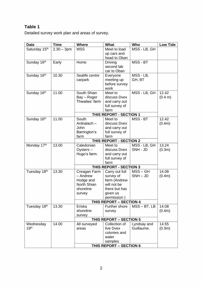
Table 1
Detailed survey work plan and areas of survey.
Date Time Where What Who Low Tide
Saturday 15th 2.30 – 3pm MSS Meet to load up cars and head to Oban
MSS - LB, GH
Sunday 16th Early Home Driving second lab car to Oban
MSS - BT
Sunday 16th 10.30 Sealife centre carpark
Everyone meeting up before survey work
MSS - LB, GH, BT
Sunday 16th 11.00 South Shian Bay – Roger Thwaites’ farm
Meet to discuss Dvex and carry out full survey of farm
MSS - LB, GH 12.42 (0.4 m)
THIS REPORT - SECTION 1
Sunday 16th 11.00 South Ardnalach – John Barrington’s farm
Meet to discuss Dvex and carry out full survey of farm
MSS - BT 12.42 (0.4m)
THIS REPORT - SECTION 2
Monday 17th 13.00 Caledonian Oysters – Hugo’s farm.
Meet to discuss Dvex and carry out full survey of farm
MSS - LB, GH SNH - JD
13.24 (0.3m)
THIS REPORT - SECTION 3
Tuesday 18th 13.30 Creagan Farm – Andrew Hodge and North Shian shoreline survey
Carry out full survey of farm (Andrew will not be there but has given us permission )
MSS – GH SNH – JD
14.08 (0.4m)
THIS REPORT – SECTION 4
Tuesday 18th 13.30 Eriska shoreline survey
Further shore survey
MSS – BT, LB 14.08 (0.4m)
THIS REPORT – SECTION 5
Wednesday 19th
14.00 All surveyed areas
Collection of live Dvex colonies and water samples
Lyndsay and Guillaume.
14.55 (0.3m)
THIS REPORT – SECTION 6
3
Section 1
Sunday 16 October 2016 – South Shian Bay
Narrative
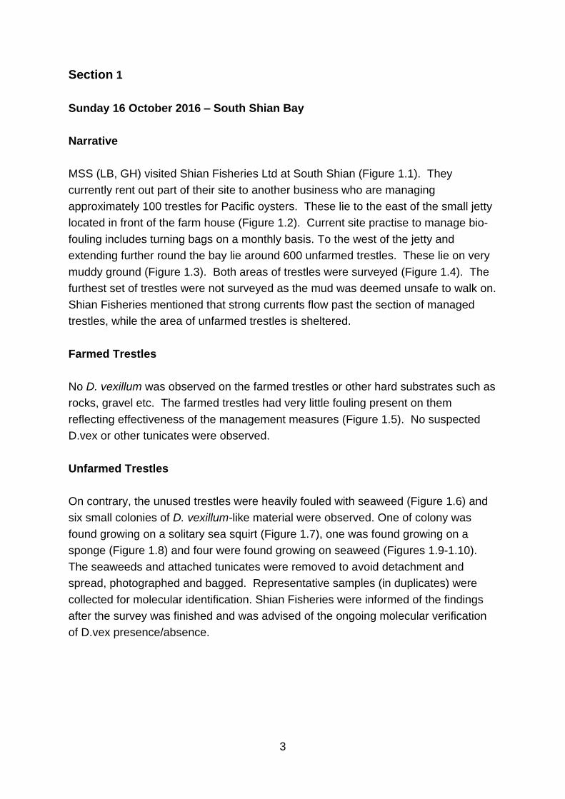
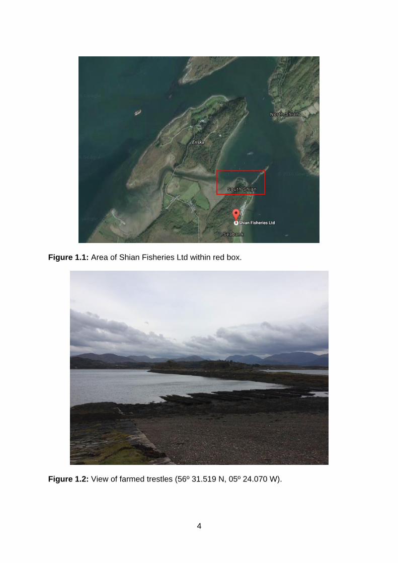
MSS (LB, GH) visited Shian Fisheries Ltd at South Shian (Figure 1.1). They
currently rent out part of their site to another business who are managing
approximately 100 trestles for Pacific oysters. These lie to the east of the small jetty
located in front of the farm house (Figure 1.2). Current site practise to manage bio-
fouling includes turning bags on a monthly basis. To the west of the jetty and
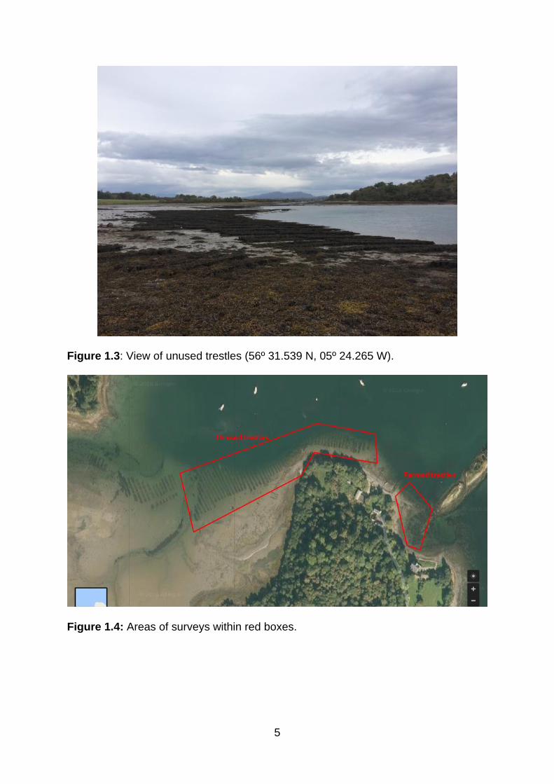
extending further round the bay lie around 600 unfarmed trestles. These lie on very
muddy ground (Figure 1.3). Both areas of trestles were surveyed (Figure 1.4). The
furthest set of trestles were not surveyed as the mud was deemed unsafe to walk on.
Shian Fisheries mentioned that strong currents flow past the section of managed
trestles, while the area of unfarmed trestles is sheltered.
Farmed Trestles
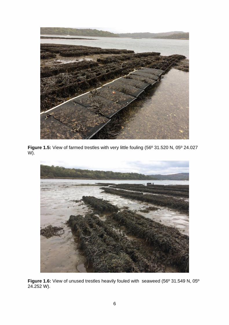
No D. vexillum was observed on the farmed trestles or other hard substrates such as
rocks, gravel etc. The farmed trestles had very little fouling present on them
reflecting effectiveness of the management measures (Figure 1.5). No suspected
D.vex or other tunicates were observed.
Unfarmed Trestles
On contrary, the unused trestles were heavily fouled with seaweed (Figure 1.6) and
six small colonies of D. vexillum-like material were observed. One of colony was
found growing on a solitary sea squirt (Figure 1.7), one was found growing on a
sponge (Figure 1.8) and four were found growing on seaweed (Figures 1.9-1.10).
The seaweeds and attached tunicates were removed to avoid detachment and
spread, photographed and bagged. Representative samples (in duplicates) were
collected for molecular identification. Shian Fisheries were informed of the findings
after the survey was finished and was advised of the ongoing molecular verification
of D.vex presence/absence.
4
Figure 1.1: Area of Shian Fisheries Ltd within red box.
Figure 1.2: View of farmed trestles (56º 31.519 N, 05º 24.070 W).
5
Figure 1.3: View of unused trestles (56º 31.539 N, 05º 24.265 W).
Figure 1.4: Areas of surveys within red boxes.
6
Figure 1.5: View of farmed trestles with very little fouling (56º 31.520 N, 05º 24.027 W).
Figure 1.6: View of unused trestles heavily fouled with seaweed (56º 31.549 N, 05º 24.252 W).
7
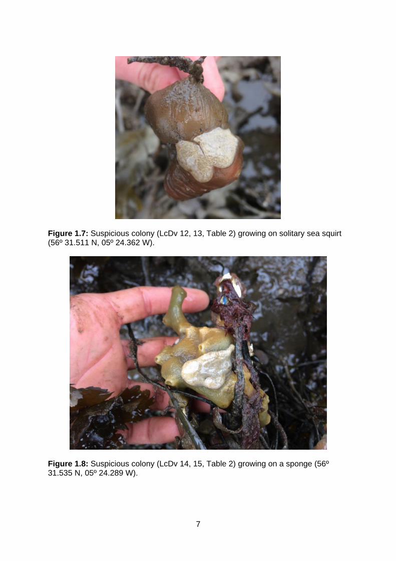
Figure 1.7: Suspicious colony (LcDv 12, 13, Table 2) growing on solitary sea squirt (56º 31.511 N, 05º 24.362 W).
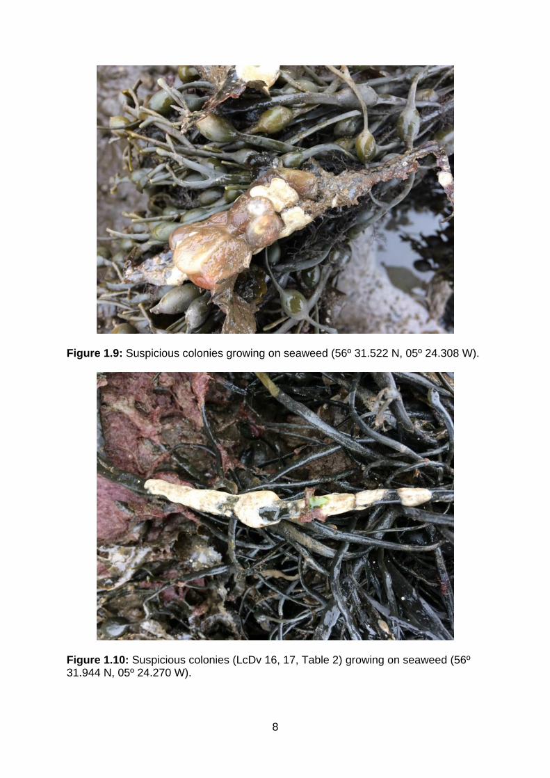
Figure 1.8: Suspicious colony (LcDv 14, 15, Table 2) growing on a sponge (56º 31.535 N, 05º 24.289 W).
8
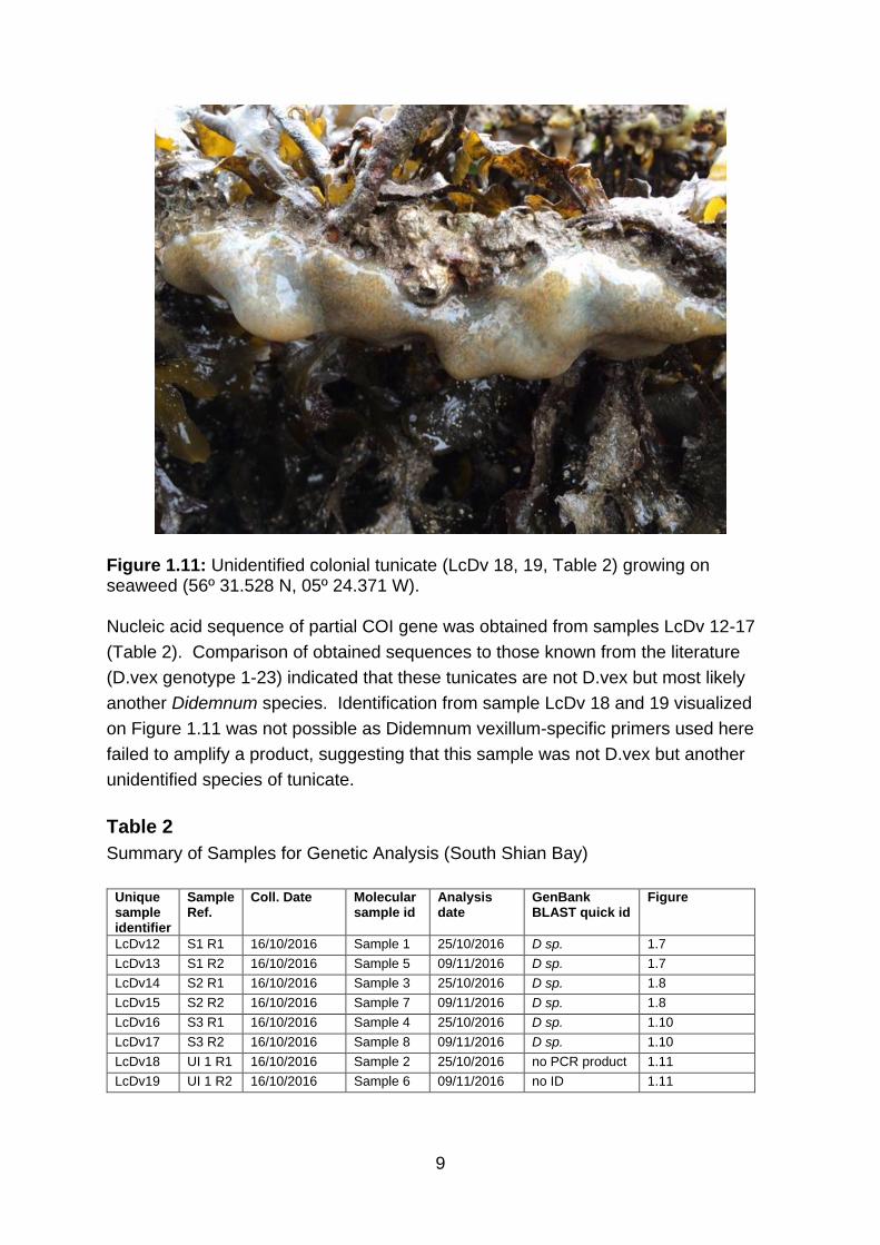
Figure 1.9: Suspicious colonies growing on seaweed (56º 31.522 N, 05º 24.308 W).
Figure 1.10: Suspicious colonies (LcDv 16, 17, Table 2) growing on seaweed (56º 31.944 N, 05º 24.270 W).
9
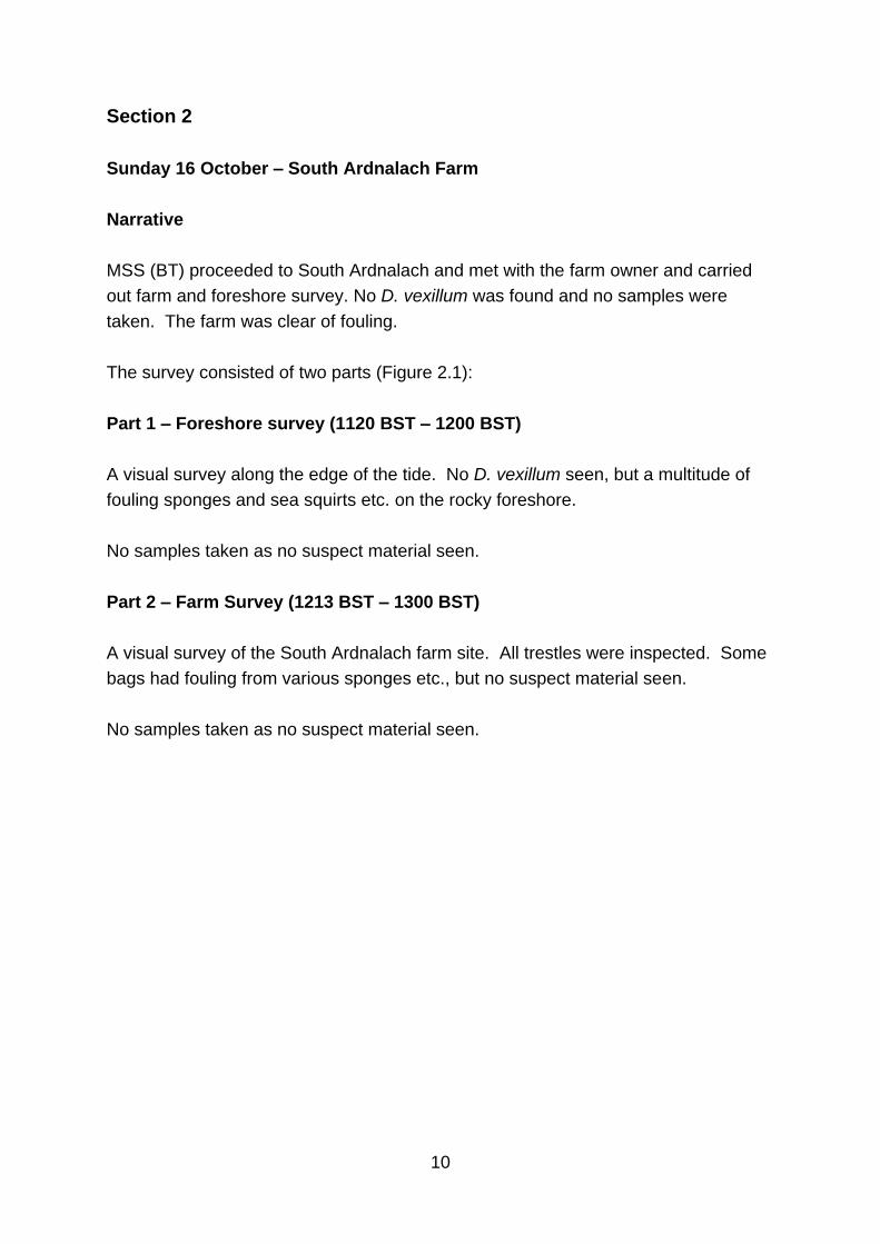
Figure 1.11: Unidentified colonial tunicate (LcDv 18, 19, Table 2) growing on seaweed (56º 31.528 N, 05º 24.371 W). Nucleic acid sequence of partial COI gene was obtained from samples LcDv 12-17
(Table 2). Comparison of obtained sequences to those known from the literature
(D.vex genotype 1-23) indicated that these tunicates are not D.vex but most likely
another Didemnum species. Identification from sample LcDv 18 and 19 visualized
on Figure 1.11 was not possible as Didemnum vexillum-specific primers used here
failed to amplify a product, suggesting that this sample was not D.vex but another
unidentified species of tunicate.
Table 2
Summary of Samples for Genetic Analysis (South Shian Bay)
Unique sample identifier
Sample Ref.
Coll. Date Molecular sample id
Analysis date
GenBank BLAST quick id
Figure
LcDv12 S1 R1 16/10/2016 Sample 1 25/10/2016 D sp. 1.7
LcDv13 S1 R2 16/10/2016 Sample 5 09/11/2016 D sp. 1.7
LcDv14 S2 R1 16/10/2016 Sample 3 25/10/2016 D sp. 1.8
LcDv15 S2 R2 16/10/2016 Sample 7 09/11/2016 D sp. 1.8
LcDv16 S3 R1 16/10/2016 Sample 4 25/10/2016 D sp. 1.10
LcDv17 S3 R2 16/10/2016 Sample 8 09/11/2016 D sp. 1.10
LcDv18 UI 1 R1 16/10/2016 Sample 2 25/10/2016 no PCR product 1.11
LcDv19 UI 1 R2 16/10/2016 Sample 6 09/11/2016 no ID 1.11
10
Section 2
Sunday 16 October – South Ardnalach Farm
Narrative
MSS (BT) proceeded to South Ardnalach and met with the farm owner and carried
out farm and foreshore survey. No D. vexillum was found and no samples were
taken. The farm was clear of fouling.
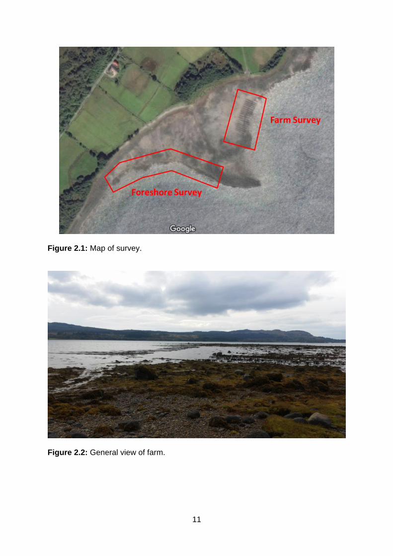
The survey consisted of two parts (Figure 2.1):
Part 1 – Foreshore survey (1120 BST – 1200 BST)
A visual survey along the edge of the tide. No D. vexillum seen, but a multitude of
fouling sponges and sea squirts etc. on the rocky foreshore.
No samples taken as no suspect material seen.
Part 2 – Farm Survey (1213 BST – 1300 BST)
A visual survey of the South Ardnalach farm site. All trestles were inspected. Some
bags had fouling from various sponges etc., but no suspect material seen.
No samples taken as no suspect material seen.
11
Figure 2.1: Map of survey.
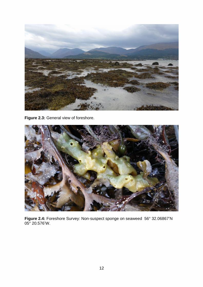
Figure 2.2: General view of farm.
12
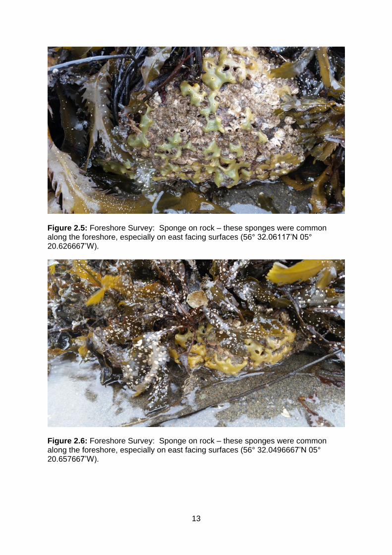
Figure 2.3: General view of foreshore.
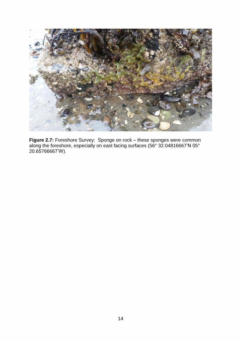
Figure 2.4: Foreshore Survey: Non-suspect sponge on seaweed 56° 32.06867’N 05° 20.576’W.
13
Figure 2.5: Foreshore Survey: Sponge on rock – these sponges were common along the foreshore, especially on east facing surfaces (56° 32.06117’N 05° 20.626667’W).
Figure 2.6: Foreshore Survey: Sponge on rock – these sponges were common along the foreshore, especially on east facing surfaces (56° 32.0496667’N 05° 20.657667’W).
14
Figure 2.7: Foreshore Survey: Sponge on rock – these sponges were common along the foreshore, especially on east facing surfaces (56° 32.04816667’N 05° 20.65766667’W).
15
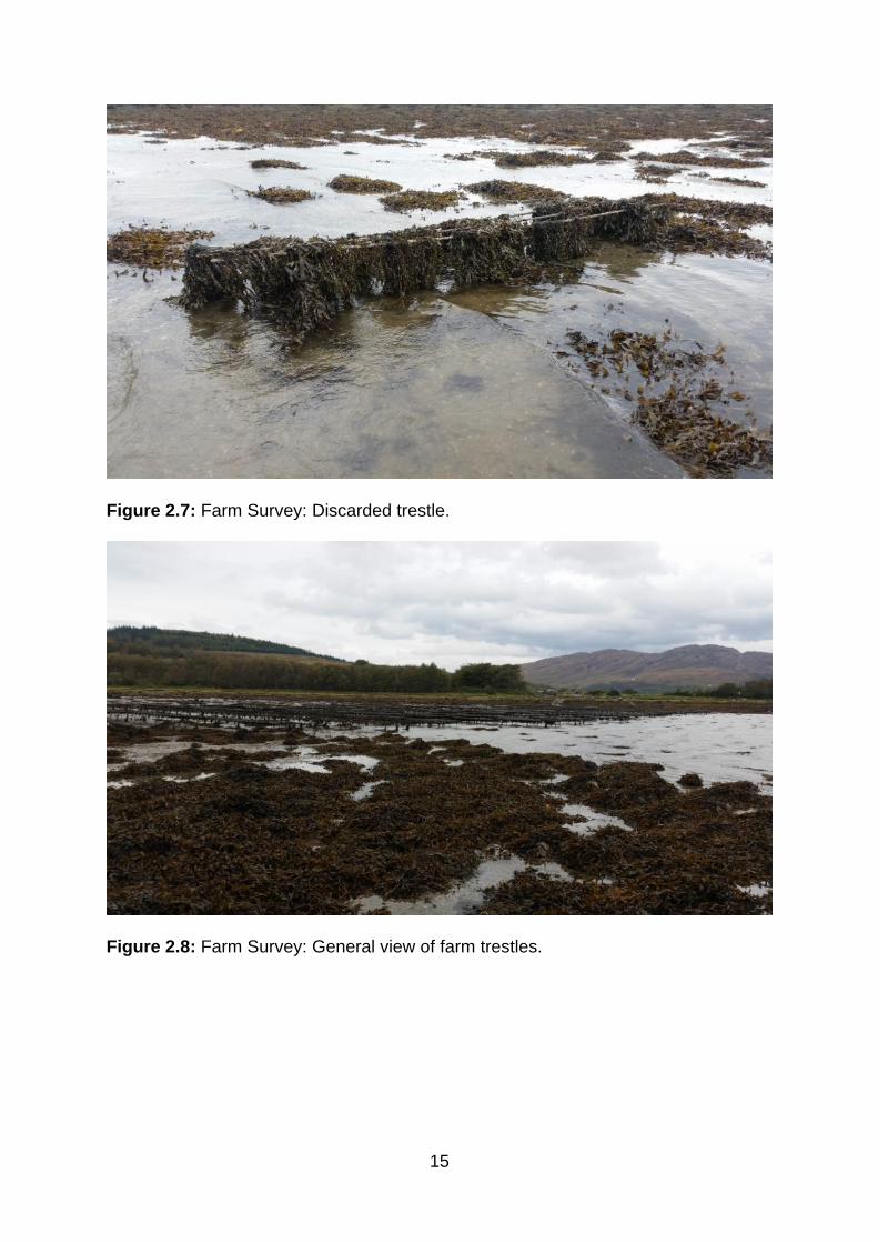
Figure 2.7: Farm Survey: Discarded trestle.
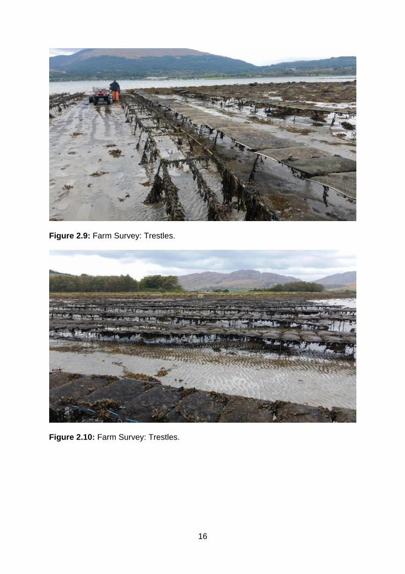
Figure 2.8: Farm Survey: General view of farm trestles.
16
Figure 2.9: Farm Survey: Trestles.
Figure 2.10: Farm Survey: Trestles.
17
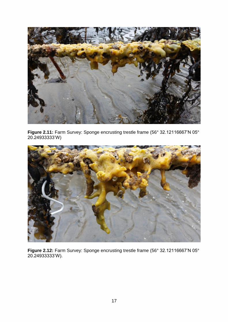
Figure 2.11: Farm Survey: Sponge encrusting trestle frame (56° 32.12116667’N 05° 20.24933333’W)
Figure 2.12: Farm Survey: Sponge encrusting trestle frame (56° 32.12116667’N 05° 20.24933333’W).
18
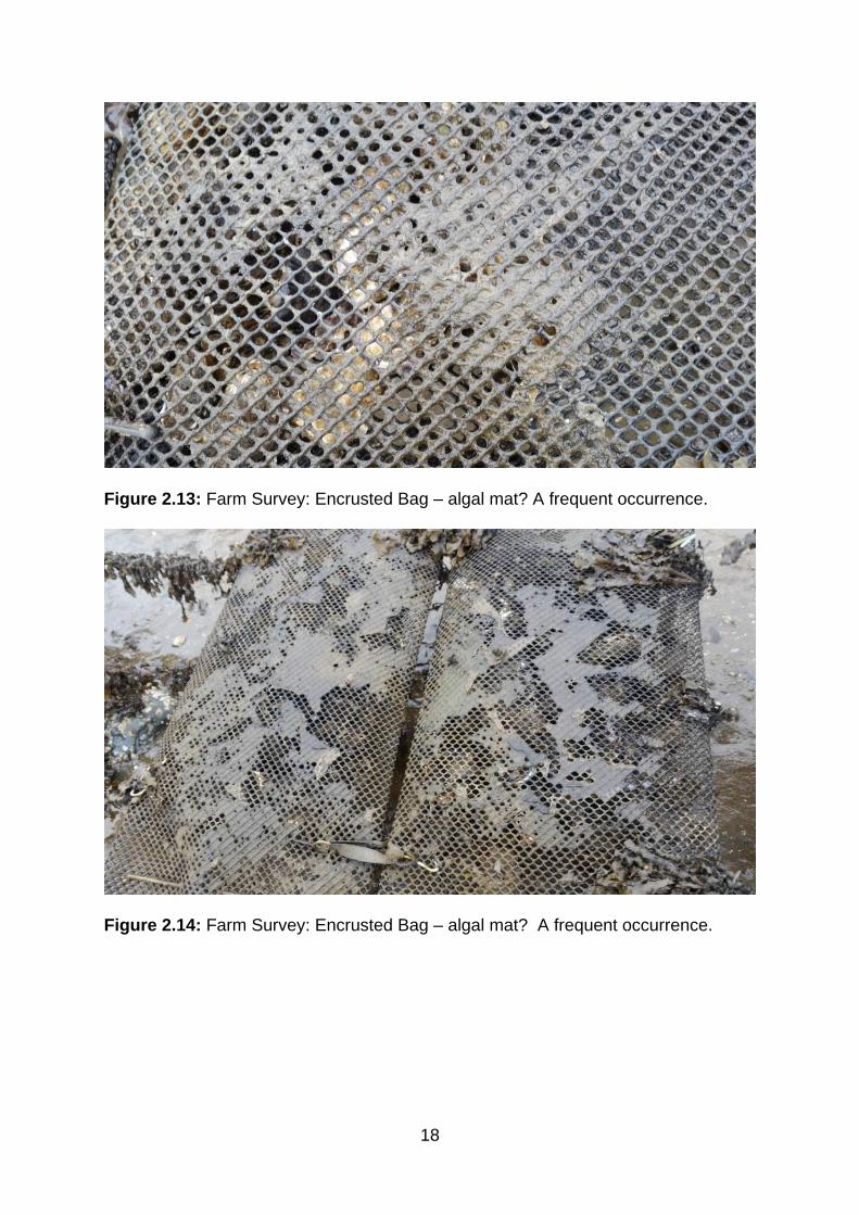
Figure 2.13: Farm Survey: Encrusted Bag – algal mat? A frequent occurrence.
Figure 2.14: Farm Survey: Encrusted Bag – algal mat? A frequent occurrence.
19
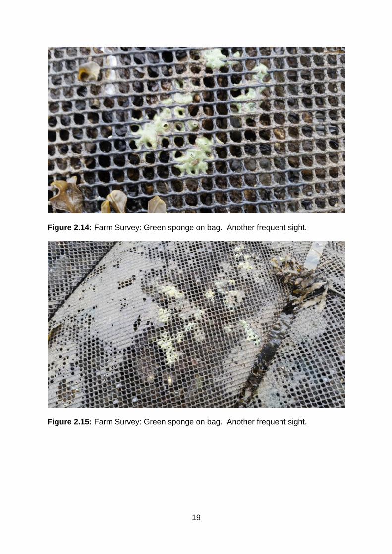
Figure 2.14: Farm Survey: Green sponge on bag. Another frequent sight.
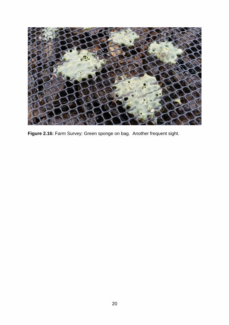
Figure 2.15: Farm Survey: Green sponge on bag. Another frequent sight.
20
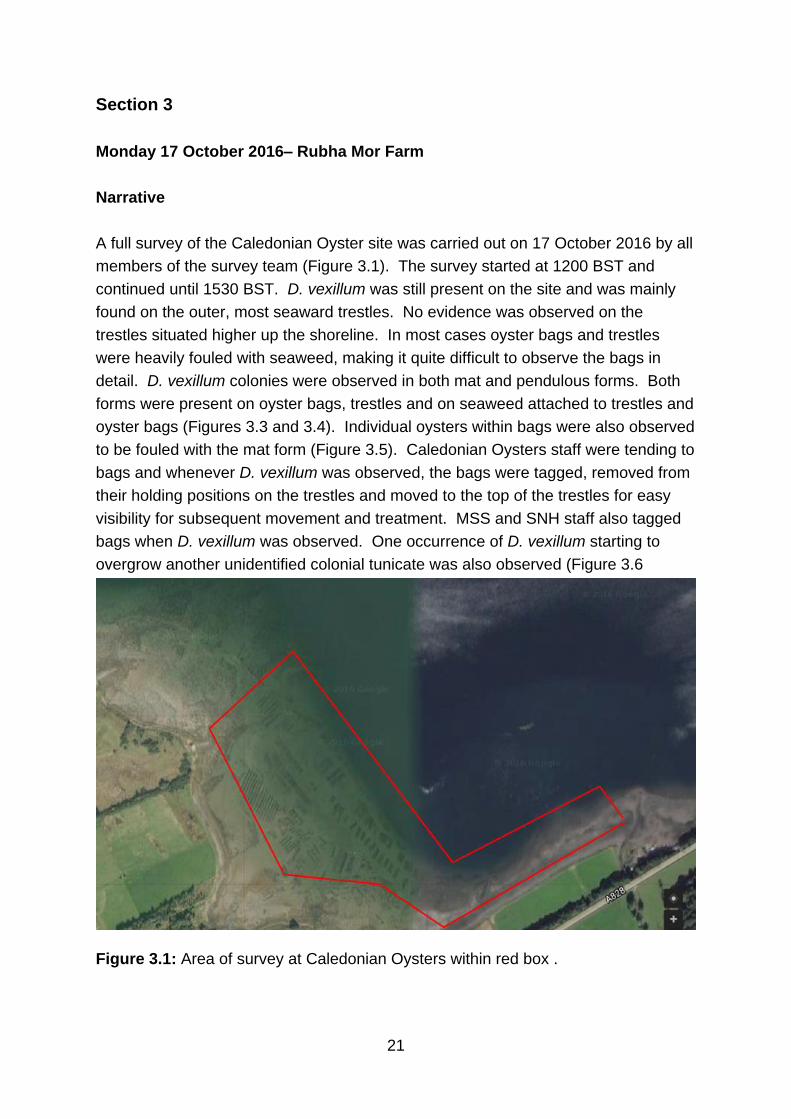
Figure 2.16: Farm Survey: Green sponge on bag. Another frequent sight.
21
Section 3
Monday 17 October 2016– Rubha Mor Farm
Narrative
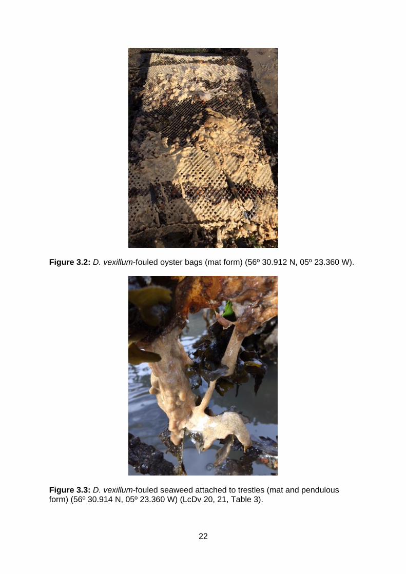
A full survey of the Caledonian Oyster site was carried out on 17 October 2016 by all
members of the survey team (Figure 3.1). The survey started at 1200 BST and
continued until 1530 BST. D. vexillum was still present on the site and was mainly
found on the outer, most seaward trestles. No evidence was observed on the
trestles situated higher up the shoreline. In most cases oyster bags and trestles
were heavily fouled with seaweed, making it quite difficult to observe the bags in
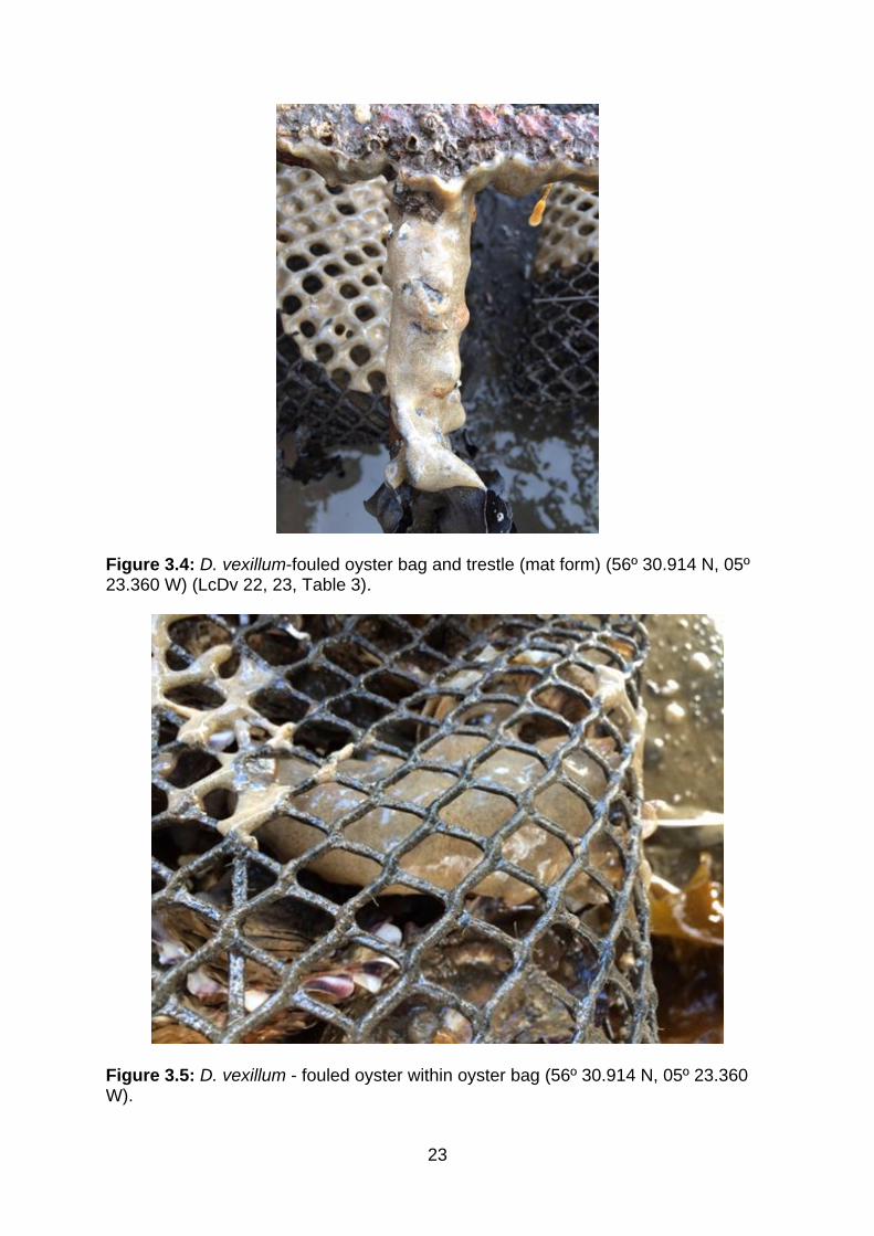
detail. D. vexillum colonies were observed in both mat and pendulous forms. Both
forms were present on oyster bags, trestles and on seaweed attached to trestles and
oyster bags (Figures 3.3 and 3.4). Individual oysters within bags were also observed
to be fouled with the mat form (Figure 3.5). Caledonian Oysters staff were tending to
bags and whenever D. vexillum was observed, the bags were tagged, removed from
their holding positions on the trestles and moved to the top of the trestles for easy
visibility for subsequent movement and treatment. MSS and SNH staff also tagged
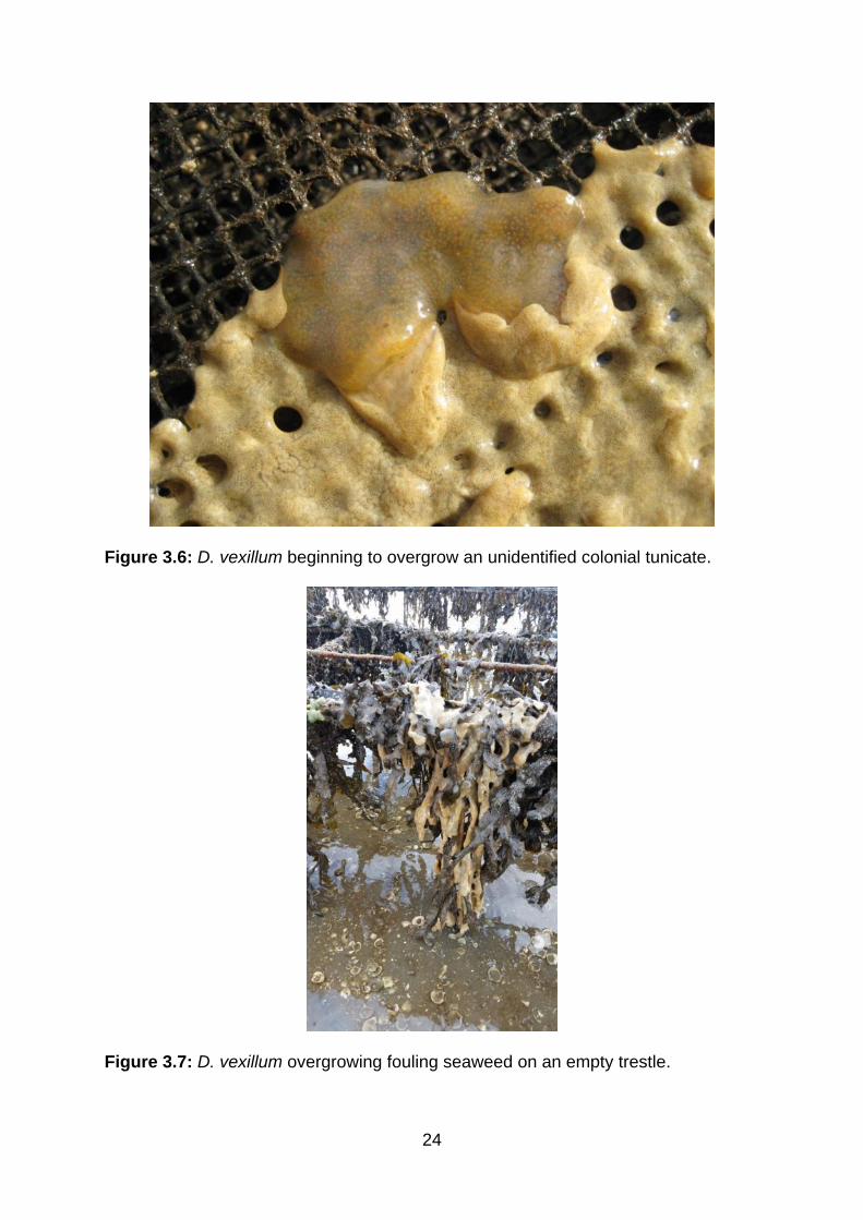
bags when D. vexillum was observed. One occurrence of D. vexillum starting to
overgrow another unidentified colonial tunicate was also observed (Figure 3.6
Figure 3.1: Area of survey at Caledonian Oysters within red box .
22
Figure 3.2: D. vexillum-fouled oyster bags (mat form) (56º 30.912 N, 05º 23.360 W).
Figure 3.3: D. vexillum-fouled seaweed attached to trestles (mat and pendulous form) (56º 30.914 N, 05º 23.360 W) (LcDv 20, 21, Table 3).
23
Figure 3.4: D. vexillum-fouled oyster bag and trestle (mat form) (56º 30.914 N, 05º 23.360 W) (LcDv 22, 23, Table 3).
Figure 3.5: D. vexillum - fouled oyster within oyster bag (56º 30.914 N, 05º 23.360 W).
24
Figure 3.6: D. vexillum beginning to overgrow an unidentified colonial tunicate.
Figure 3.7: D. vexillum overgrowing fouling seaweed on an empty trestle.
25
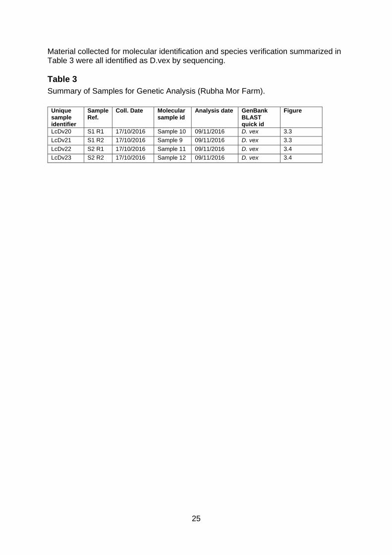
Material collected for molecular identification and species verification summarized in Table 3 were all identified as D.vex by sequencing.
Table 3
Summary of Samples for Genetic Analysis (Rubha Mor Farm).
Unique sample identifier
Sample Ref.
Coll. Date Molecular sample id
Analysis date GenBank BLAST quick id
Figure
LcDv20 S1 R1 17/10/2016 Sample 10 09/11/2016 D. vex 3.3
LcDv21 S1 R2 17/10/2016 Sample 9 09/11/2016 D. vex 3.3
LcDv22 S2 R1 17/10/2016 Sample 11 09/11/2016 D. vex 3.4
LcDv23 S2 R2 17/10/2016 Sample 12 09/11/2016 D. vex 3.4
26
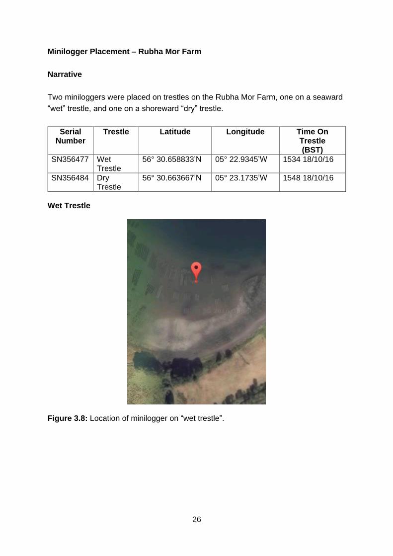
Minilogger Placement – Rubha Mor Farm
Narrative
Two miniloggers were placed on trestles on the Rubha Mor Farm, one on a seaward
“wet” trestle, and one on a shoreward “dry” trestle.
Serial Number
Trestle Latitude Longitude Time On Trestle (BST)
SN356477 Wet Trestle
56° 30.658833’N 05° 22.9345’W 1534 18/10/16
SN356484 Dry Trestle
56° 30.663667’N 05° 23.1735’W 1548 18/10/16
Wet Trestle
Figure 3.8: Location of minilogger on “wet trestle”.
27
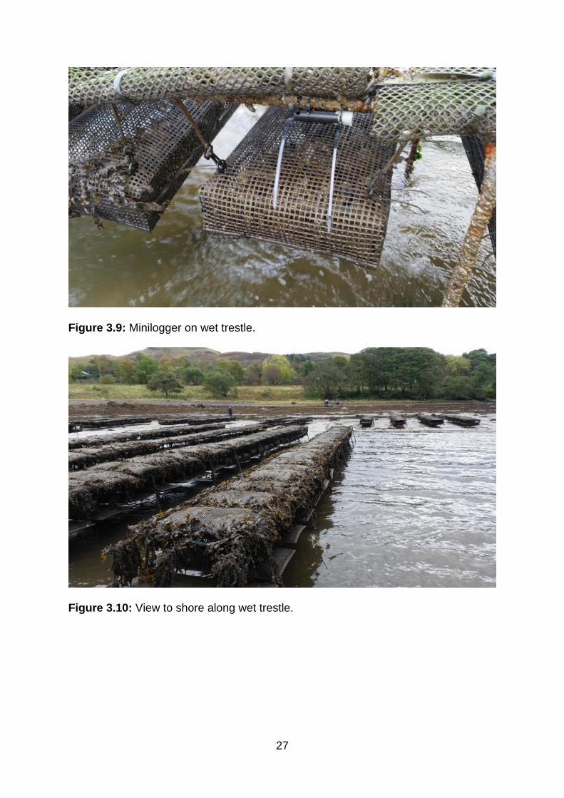
Figure 3.9: Minilogger on wet trestle.
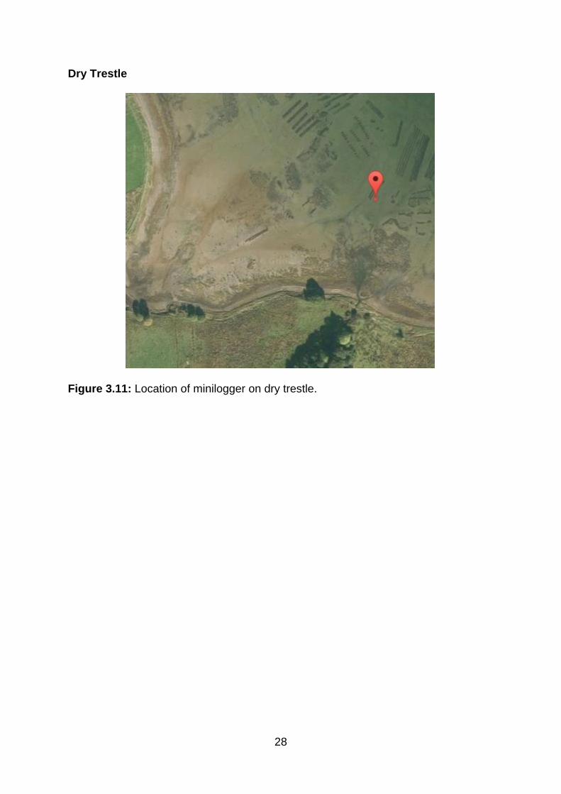
Figure 3.10: View to shore along wet trestle.
28
Dry Trestle
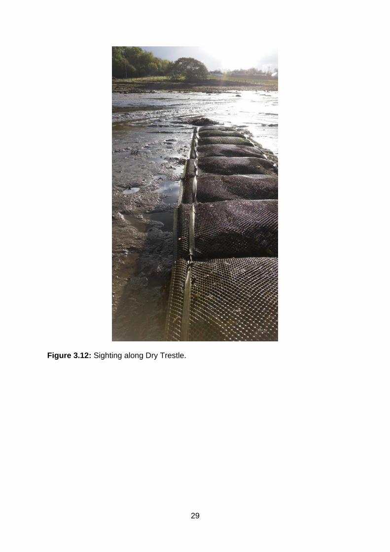
Figure 3.11: Location of minilogger on dry trestle.
29
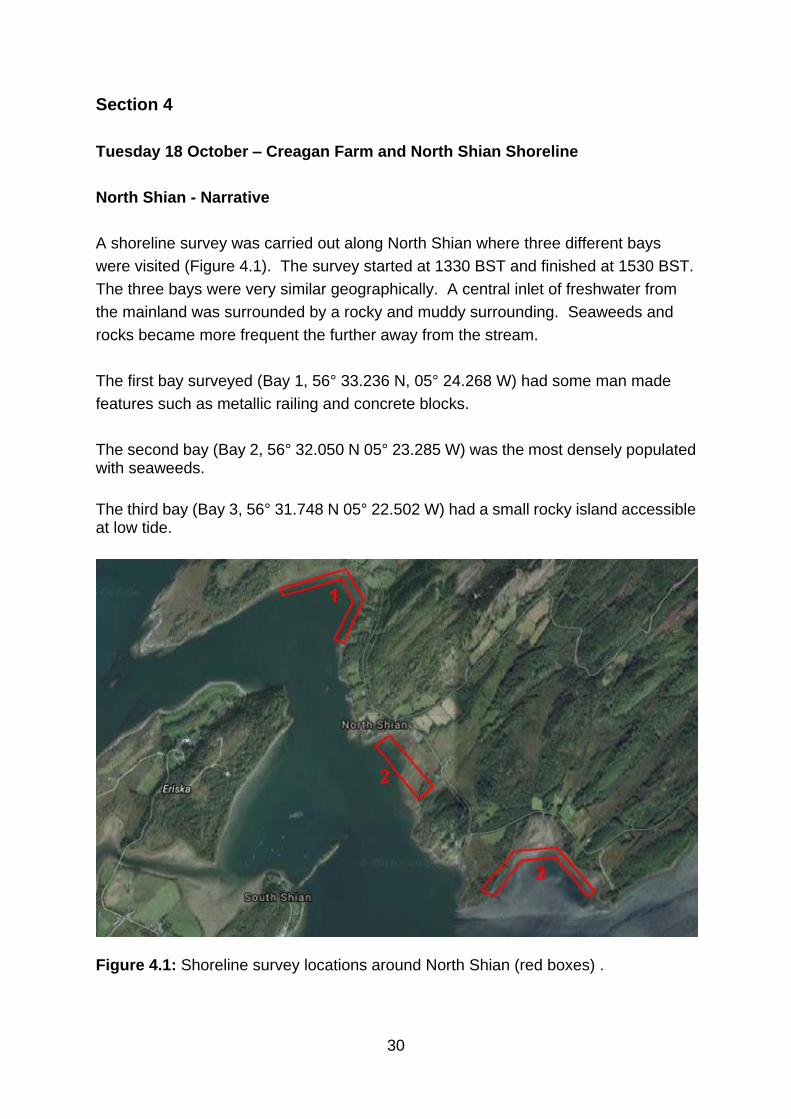
Figure 3.12: Sighting along Dry Trestle.
30
Section 4
Tuesday 18 October – Creagan Farm and North Shian Shoreline
North Shian - Narrative
A shoreline survey was carried out along North Shian where three different bays
were visited (Figure 4.1). The survey started at 1330 BST and finished at 1530 BST.
The three bays were very similar geographically. A central inlet of freshwater from
the mainland was surrounded by a rocky and muddy surrounding. Seaweeds and
rocks became more frequent the further away from the stream.
The first bay surveyed (Bay 1, 56° 33.236 N, 05° 24.268 W) had some man made
features such as metallic railing and concrete blocks.
The second bay (Bay 2, 56° 32.050 N 05° 23.285 W) was the most densely populated with seaweeds.
The third bay (Bay 3, 56° 31.748 N 05° 22.502 W) had a small rocky island accessible at low tide.
Figure 4.1: Shoreline survey locations around North Shian (red boxes) .
31
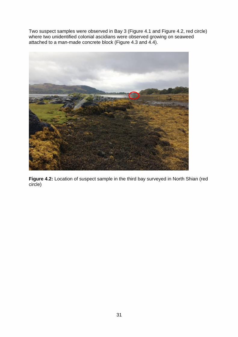
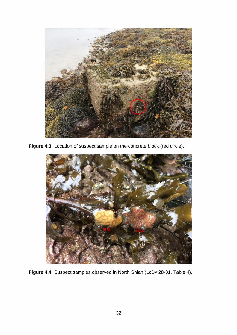
Two suspect samples were observed in Bay 3 (Figure 4.1 and Figure 4.2, red circle) where two unidentified colonial ascidians were observed growing on seaweed attached to a man-made concrete block (Figure 4.3 and 4.4).
Figure 4.2: Location of suspect sample in the third bay surveyed in North Shian (red circle)
32
Figure 4.3: Location of suspect sample on the concrete block (red circle).
Figure 4.4: Suspect samples observed in North Shian (LcDv 28-31, Table 4).
33
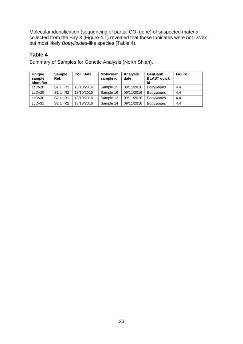
Molecular identification (sequencing of partial COI gene) of suspected material collected from the Bay 3 (Figure 4.1) revealed that these tunicates were not D.vex but most likely Botrylloides-like species (Table 4).
Table 4
Summary of Samples for Genetic Analysis (North Shian).
Unique sample identifier
Sample Ref.
Coll. Date Molecular sample id
Analysis date
GenBank BLAST quick id
Figure
LcDv28 S1 UI R1 18/10/2016 Sample 15 09/11/2016 Botrylloides 4.4
LcDv29 S1 UI R2 18/10/2016 Sample 16 09/11/2016 Botrylloides 4.4
LcDv30 S2 UI R1 18/10/2016 Sample 13 09/11/2016 Botrylloides 4.4
LcDv31 S2 UI R2 18/10/2016 Sample 14 09/11/2016 Botrylloides 4.4
34
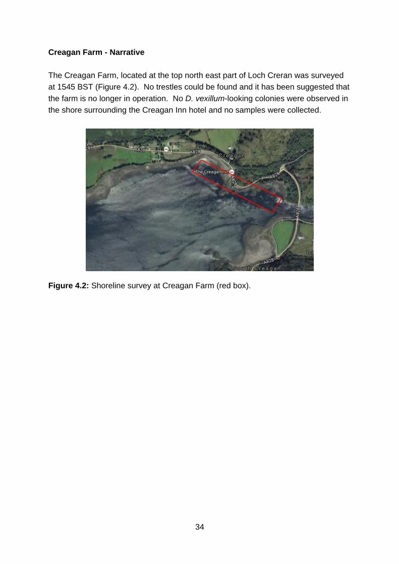
Creagan Farm - Narrative
The Creagan Farm, located at the top north east part of Loch Creran was surveyed
at 1545 BST (Figure 4.2). No trestles could be found and it has been suggested that
the farm is no longer in operation. No D. vexillum-looking colonies were observed in
the shore surrounding the Creagan Inn hotel and no samples were collected.
Figure 4.2: Shoreline survey at Creagan Farm (red box).
35
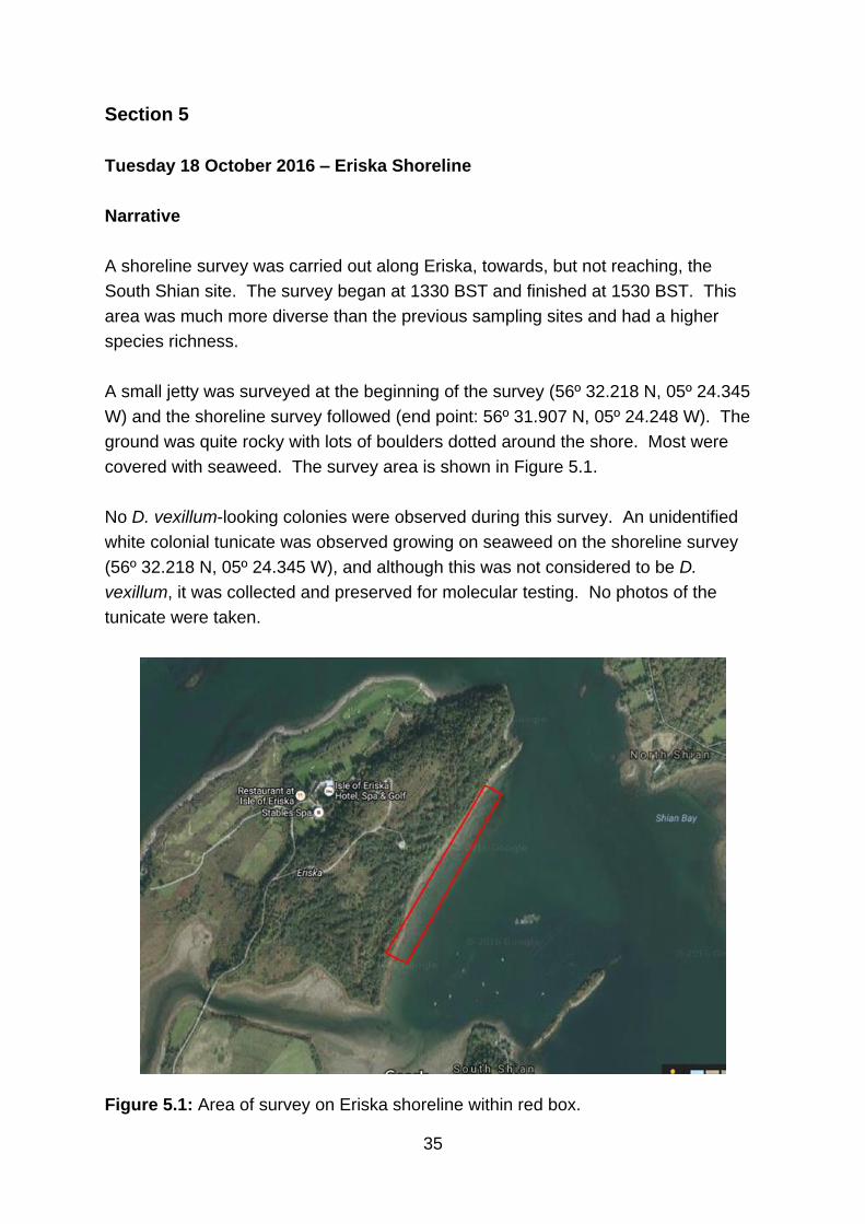
Section 5
Tuesday 18 October 2016 – Eriska Shoreline
Narrative
A shoreline survey was carried out along Eriska, towards, but not reaching, the
South Shian site. The survey began at 1330 BST and finished at 1530 BST. This
area was much more diverse than the previous sampling sites and had a higher
species richness.
A small jetty was surveyed at the beginning of the survey (56º 32.218 N, 05º 24.345
W) and the shoreline survey followed (end point: 56º 31.907 N, 05º 24.248 W). The
ground was quite rocky with lots of boulders dotted around the shore. Most were
covered with seaweed. The survey area is shown in Figure 5.1.
No D. vexillum-looking colonies were observed during this survey. An unidentified
white colonial tunicate was observed growing on seaweed on the shoreline survey
(56º 32.218 N, 05º 24.345 W), and although this was not considered to be D.
vexillum, it was collected and preserved for molecular testing. No photos of the
tunicate were taken.
Figure 5.1: Area of survey on Eriska shoreline within red box.
36
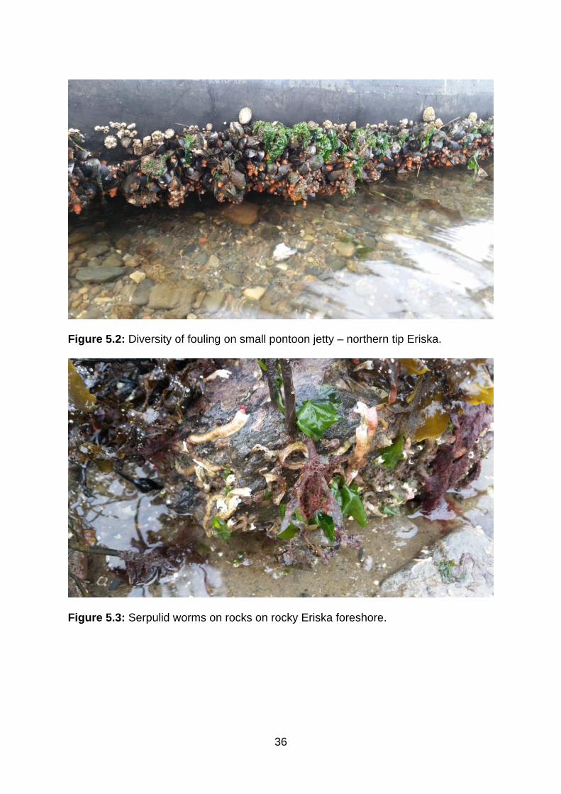
Figure 5.2: Diversity of fouling on small pontoon jetty – northern tip Eriska.
Figure 5.3: Serpulid worms on rocks on rocky Eriska foreshore.
37
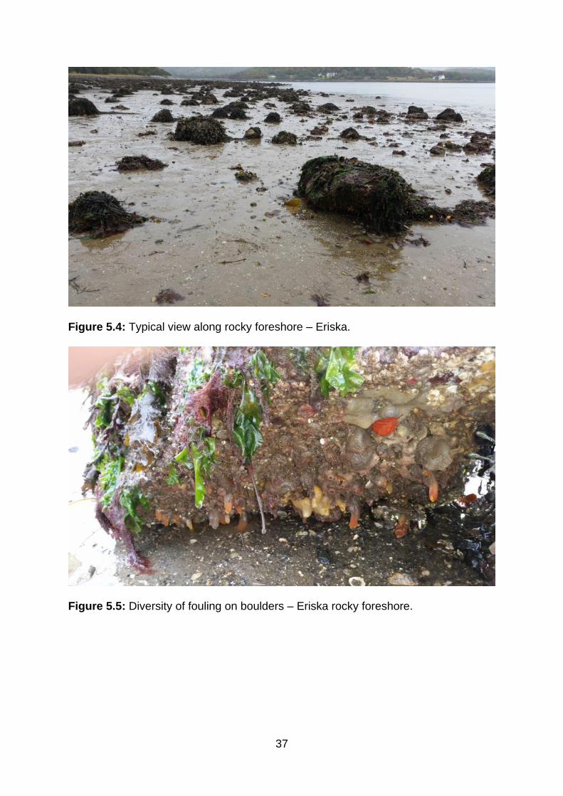
Figure 5.4: Typical view along rocky foreshore – Eriska.
Figure 5.5: Diversity of fouling on boulders – Eriska rocky foreshore.
38
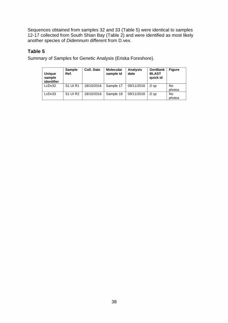
Sequences obtained from samples 32 and 33 (Table 5) were identical to samples 12-17 collected from South Shian Bay (Table 2) and were identified as most likely another species of Didemnum different from D.vex.
Table 5
Summary of Samples for Genetic Analysis (Eriska Foreshore).
Unique sample identifier
Sample Ref.
Coll. Date Molecular sample id
Analysis date
GenBank BLAST quick id
Figure
LcDv32 S1 UI R1 18/10/2016 Sample 17 09/11/2016 D sp No photos
LcDv33 S1 UI R2 18/10/2016 Sample 18 09/11/2016 D sp No photos
39
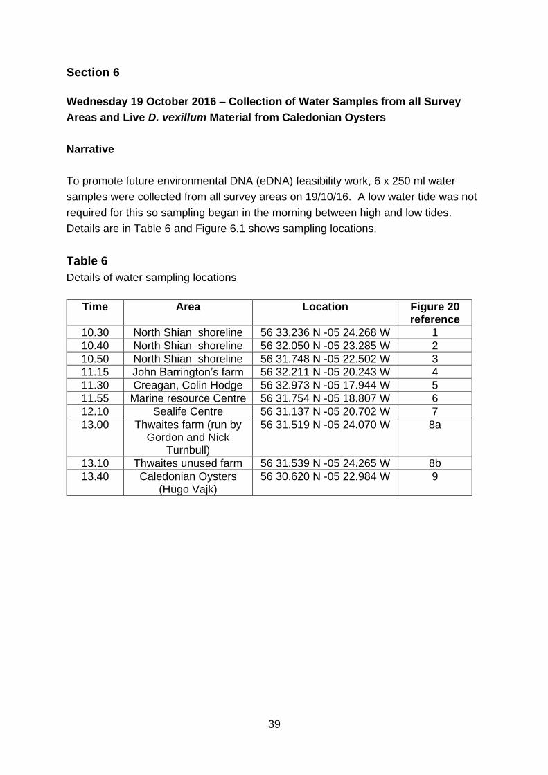
Section 6
Wednesday 19 October 2016 – Collection of Water Samples from all Survey
Areas and Live D. vexillum Material from Caledonian Oysters
Narrative
To promote future environmental DNA (eDNA) feasibility work, 6 x 250 ml water
samples were collected from all survey areas on 19/10/16. A low water tide was not
required for this so sampling began in the morning between high and low tides.
Details are in Table 6 and Figure 6.1 shows sampling locations.
Table 6
Details of water sampling locations
Time Area Location Figure 20 reference
10.30 North Shian shoreline 56 33.236 N -05 24.268 W 1
10.40 North Shian shoreline 56 32.050 N -05 23.285 W 2
10.50 North Shian shoreline 56 31.748 N -05 22.502 W 3
11.15 John Barrington’s farm 56 32.211 N -05 20.243 W 4
11.30 Creagan, Colin Hodge 56 32.973 N -05 17.944 W 5
11.55 Marine resource Centre 56 31.754 N -05 18.807 W 6
12.10 Sealife Centre 56 31.137 N -05 20.702 W 7
13.00 Thwaites farm (run by Gordon and Nick
Turnbull)
56 31.519 N -05 24.070 W 8a
13.10 Thwaites unused farm 56 31.539 N -05 24.265 W 8b
13.40 Caledonian Oysters (Hugo Vajk)
56 30.620 N -05 22.984 W 9
40
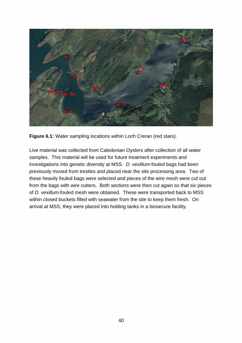
Figure 6.1: Water sampling locations within Loch Creran (red stars).
Live material was collected from Caledonian Oysters after collection of all water
samples. This material will be used for future treatment experiments and
investigations into genetic diversity at MSS. D. vexillum-fouled bags had been
previously moved from trestles and placed near the site processing area. Two of
these heavily fouled bags were selected and pieces of the wire mesh were cut out
from the bags with wire cutters. Both sections were then cut again so that six pieces
of D. vexillum-fouled mesh were obtained. These were transported back to MSS
within closed buckets filled with seawater from the site to keep them fresh. On
arrival at MSS, they were placed into holding tanks in a biosecure facility.

© Crown copyright 2018 Marine Scotland Science Marine Laboratory 375 Victoria Road Aberdeen AB11 9DB Copies of this report are available from the Marine Scotland website at www.gov.scot/marinescotland