The leading pioneer in GPS technology The StarFire Global Satellite Based Augmentation System Ron...
32
The leading pioneer in GPS technology The StarFire Global The StarFire Global Satellite Based Satellite Based Augmentation System Augmentation System Ron Hatch Ron Hatch NavCom Technology, Inc. NavCom Technology, Inc.
-
Upload
carol-bolen -
Category
Documents
-
view
222 -
download
0
Transcript of The leading pioneer in GPS technology The StarFire Global Satellite Based Augmentation System Ron...
The leading pioneer in GPS technology
The StarFire Global Satellite Based The StarFire Global Satellite Based Augmentation SystemAugmentation System
Ron HatchRon Hatch
NavCom Technology, Inc.NavCom Technology, Inc.
2
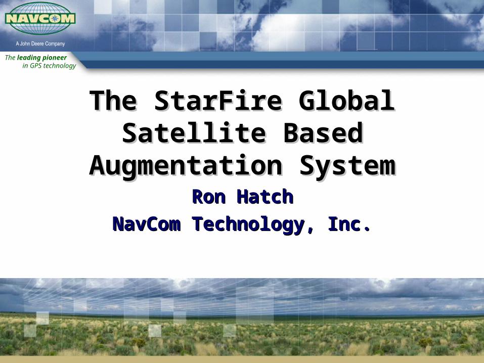
AgendaAgenda
Introduction
System Description
User Benefits/ Performance- StarFire Navigation- RTK Extend- System integrity
Summary

The leading pioneer in GPS technology
IntroductionIntroduction

4
Who is NavCom Technology, Inc?Who is NavCom Technology, Inc?
Located in Southern California Major Business Areas
- Proprietary Products for precise positioning & wireless communication
- Product Services (Global Differential GNSS Corrections)
- Contract Engineering Acquired by Deere & Co. November 1999
- Technology steward- NavCom remains “pathfinder brand”

The leading pioneer in GPS technology
StarFireStarFireSystem DescriptionSystem Description
6
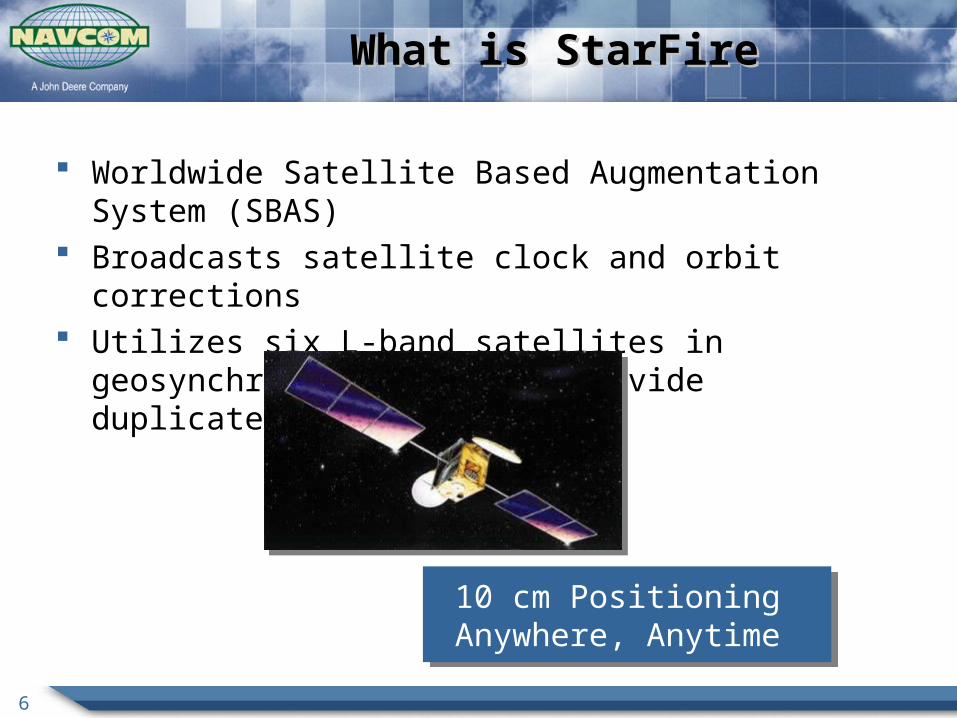
What is StarFireWhat is StarFire
Worldwide Satellite Based Augmentation System (SBAS) Broadcasts satellite clock and orbit corrections Utilizes six L-band satellites in geosynchronous orbits to provide
duplicate global coverage
10 cm Positioning Anywhere, Anytime 10 cm Positioning
Anywhere, Anytime

7
StarFire SystemStarFire System
User – Receivers and System
Control - Processing CenterSpace – Signal Distribution
Ground Tracking - Global Network

8
StarFire System - GroundStarFire System - Ground
Ground Tracking - Global Network
9
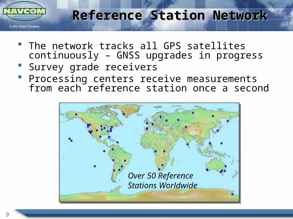
Reference Station NetworkReference Station Network
Over 50 Reference Stations Worldwide
The network tracks all GPS satellites continuously – GNSS upgrades in progress
Survey grade receivers Processing centers receive measurements from each reference station
once a second
10
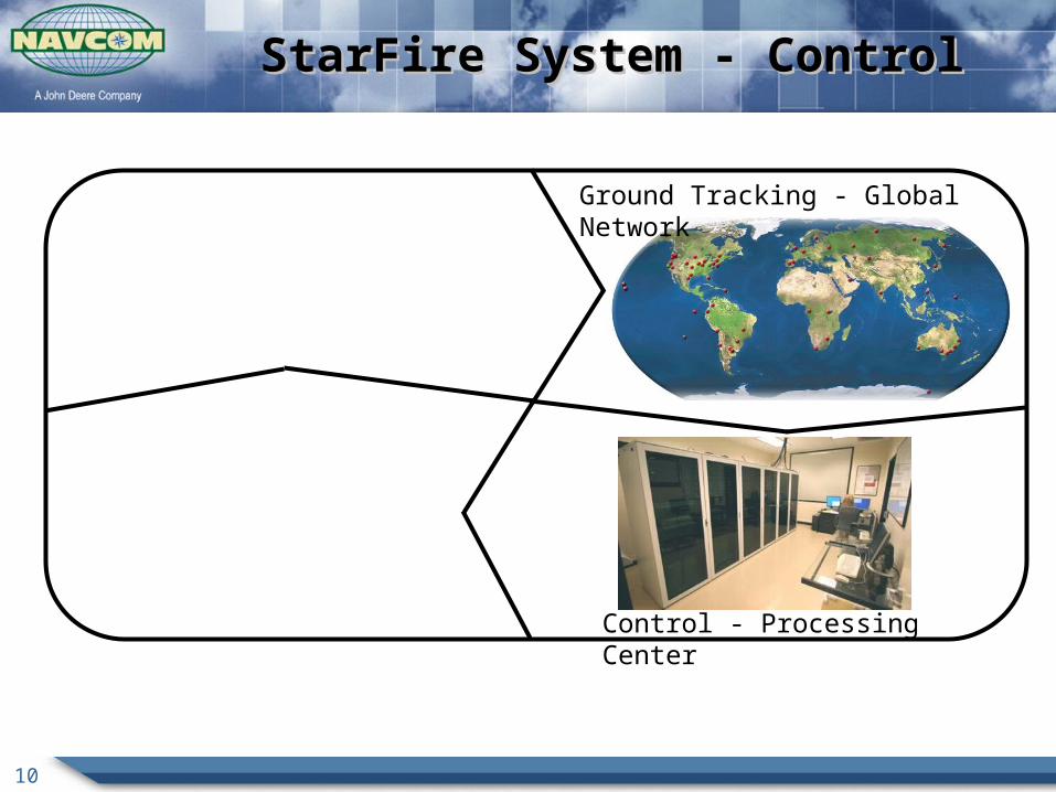
StarFire System - ControlStarFire System - Control
Control - Processing Center
Ground Tracking - Global Network

11
StarFire Processing CentersStarFire Processing Centers
Two Processing Centers- Torrance, California- Moline, Illinois
Both Processing Centers Compute a Correction Stream for Satellites- Orbit Corrections once a minute (∆xyz ECEF)- Clock Corrections once every two seconds
12
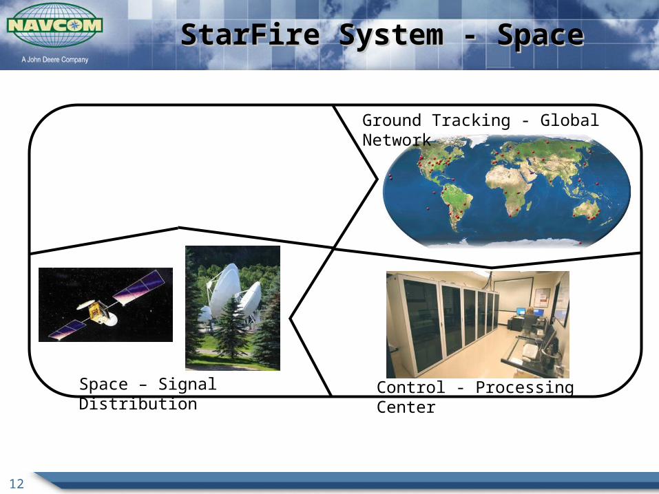
StarFire System - SpaceStarFire System - Space
Space – Signal Distribution Control - Processing Center
Ground Tracking - Global Network

13
StarFire Uplink and Space SegmentStarFire Uplink and Space Segment
StarFire channels on global beams of 6 different L-band communication satellites
All users see StarFire signals from two sources
- Americas –Laurentides, Canada- Americas – Santa Paula, CA- Europe – Burum, Netherlands- Europe – Southbury, CT- Asia – Perth, Australia - Asia - Auckland, New Zealand
Redundant Uplink Sites and Satellites Redundant Uplink
Sites and Satellites

14
StarFire System - UserStarFire System - User
User – Receivers and System
Control - Processing CenterSpace – Signal Distribution
Ground Tracking - Global Network

15
StarFire System PerformanceStarFire System Performance
Reliability achieved by ensuring no single point of failure and thorough monitoring- Redundancy throughout entire system
From reference sites to broadcast signals
- Extensive real-time monitoring internal checks real-time positioning results
- 99.999% availability Under 6 minutes of outage annually

16
StarFire StarFire Integrated ReceiversIntegrated Receivers
StarFire SF-3000- Multi-frequency GNSS receiver- MEMs inertial attitude determination
StarFire SF-3050 Series - Military, Offshore, Machine Control markets- Full GNSS capability- CORS and Heading Functionality
StarFire SF-2040- Survey markets
Worldwide decimeter accuracy in real-Worldwide decimeter accuracy in real-timetime
SF-2040GGIS SensorSF-2040G
GIS Sensor

17
ApplicationsApplications
Machine Guidance- Agriculture- Construction- Intermodal (port operations)
Offshore Survey Aerial Survey Autonomous Vehicles Land Survey

The leading pioneer in GPS technology
User BenefitsUser Benefits
19
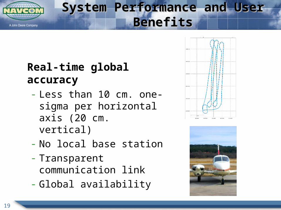
System Performance and User BenefitsSystem Performance and User Benefits
Real-time global accuracy- Less than 10 cm. one-sigma per
horizontal axis (20 cm. vertical) - No local base station - Transparent communication link- Global availability
20
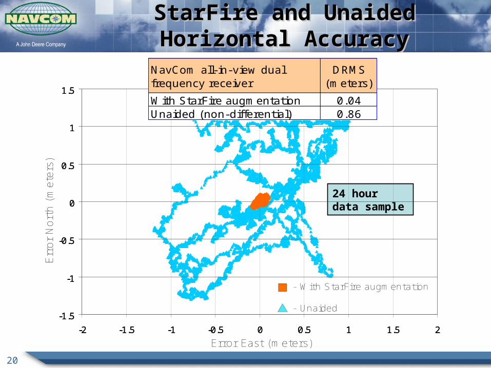
StarFire and Unaided Horizontal AccuracyStarFire and Unaided Horizontal Accuracy
24 hour data sample
-1.5
-1
-0.5
0
0.5
1
1.5
-2 -1.5 -1 -0.5 0 0.5 1 1.5 2
-1.5
-1
-0.5
0
0.5
1
1.5
-2 -1.5 -1 -0.5 0 0.5 1 1.5 2
Error East (meters)
Err
or
Nort
h (
met
ers)
- With StarFire augmentation
- Unaided
With StarFire augmentation 0.04Unaided (non-differential) 0.86

21
RTK Extend bridges the gaps in RTK coverage RTK and StarFire operations all in ONE receiver Patented innovation exclusive to NavCom
RTK ExtendRTK Extend
RTK corrections No blockage.No problems.
Blockage!Problems!!!
StarFire corrections
Sta
rFir
e co
rrec
tio
ns
Continuous cm-level positioning for up to 15 mins .

22
-1
-0.8
-0.6
-0.4
-0.2
0
0.2
0.4
0.6
0.8
1
0 10 20 30 40
Time (minutes)
Del
ta N
ort
hin
gs
an
d E
astin
gs
(met
ers)
5
10
15
20
25
dG
PS
Mo
de
err East err North dGPS Mode
RTK gap #217 minutesall dynamic
RTK gap #14 minutesstationary
RTK gap #35 minutesstationary
Gap #2 Statistics East North Up
Average (m.) -0.02 0.01 0.01Std. Dev. (m.) 0.01 0.01 0.03Min (m.) -0.04 -0.02 -0.07Max (m.) 0.01 0.04 0.08
RTK Extend Dynamic Test ResultsRTK Extend Dynamic Test Results
23
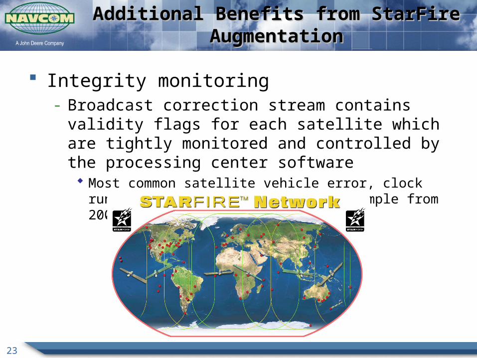
Additional Benefits from StarFire AugmentationAdditional Benefits from StarFire Augmentation
Integrity monitoring- Broadcast correction stream contains validity flags for each
satellite which are tightly monitored and controlled by the processing center software Most common satellite vehicle error, clock runoff, detected early – PRN 02
example from 2006

24
PRN 30 - 02 June 2006 (Indian Ocean)PRN 30 - 02 June 2006 (Indian Ocean)
StarFire
Provided corrections for 36 Seconds and then disabled the satellite
StarFire
Provided corrections for 36 Seconds and then disabled the satellite
GPS System
Invalid clock for 12 Minutes before setting the satellite unhealthy
GPS System
Invalid clock for 12 Minutes before setting the satellite unhealthy

25
PRN30 Effect on StarFire PositioningPRN30 Effect on StarFire Positioning
NCT-2100D Receiver
Johannesburg, S.Africa
No Effect on StarFire Positioningfrom PRN30 Clock Issue
No Effect on StarFire Positioningfrom PRN30 Clock Issue

The leading pioneer in GPS technology
SummarySummary
27
StarFire Key Features and DiscriminatorsStarFire Key Features and Discriminators
Only global SBAS owned and operated by a manufacturer of high precision GNSS receivers
Unique fusion of RTK with global SBAS RTK-extend
Reliable, global decimeter accuracy in one receiver
- Built-in StarFire capability
- Independence from local base

The leading pioneer in GPS technology
Questions?Questions?

The leading pioneer in GPS technology
Thank You!Thank You!
Please visitwww.navcomtech.com
30
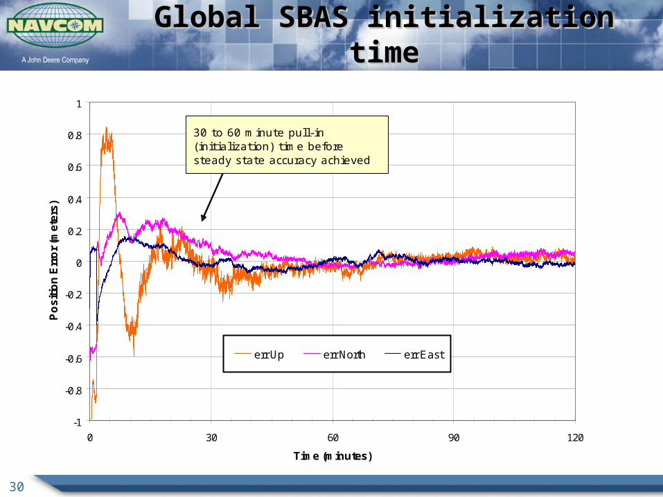
Global SBAS initialization timeGlobal SBAS initialization time
-1
-0.8
-0.6
-0.4
-0.2
0
0.2
0.4
0.6
0.8
1
0 30 60 90 120
Time (minutes)
Po
sit
ion
Err
or
(me
ters
)
err Up err North err East
30 to 60 minute pull-in (initialization) time before steady state accuracy achieved

31
Global SBAS initialization with QuickStartGlobal SBAS initialization with QuickStart
-1
-0.8
-0.6
-0.4
-0.2
0
0.2
0.4
0.6
0.8
1
0 30 60 90 120
Time (minutes)
Po
sit
ion
Err
or
(me
ters
)
err Up err North err East
QuickStart applied using known position.

32
RTK-X Augmenting RTK CoverageRTK-X Augmenting RTK Coverage
RTK-extend operational area
RTK Base Stations with range limits
Operational Area


![[Sky-Tel] RTK Extend. Navcom Starfire Satcom GNSS Augmentation Extends RTK When Lacks Coverage](https://static.fdocuments.us/doc/165x107/55720524497959fc0b8b66e4/sky-tel-rtk-extend-navcom-starfire-satcom-gnss-augmentation-extends-rtk-when-lacks-coverage.jpg)


