The importance of satellite data and products for RA1 in ... importance of satellite data and...
17
The importance of satellite data and products for RA1 in the WWRP strategy Estelle de Coning World Weather Research Division
Transcript of The importance of satellite data and products for RA1 in ... importance of satellite data and...
The importance of satellite data and products for RA1 in the WWRP strategy
Estelle de Coning World Weather Research Division

Kofi Annan former UN Secretary-General (21 July 2016)
• "The poor need alerts too." • In the areas that need to become climate-smart the fastest, such as
Africa and small island developing states, many health professionals are not yet using forecasts of droughts, floods or extreme temperatures – mainly because national weather services don’t have the funding, tools, training or institutional arrangements necessary to generate or share such forecasts.
• “We need to support weather and climate services in developing countries so that rather just collecting and providing data, they can become trusted suppliers of information and knowledge to the public.
• We need to place greater emphasis on providing people with the timely information they need to protect themselves from extreme weather.
• Early warnings of hazards can not only help communities respond and adapt.. but also raise awareness of the causes and effects of climate change — and hence build public support for policies that strengthen resilience and mitigate against the impact of climate change.”
https://public.wmo.int/en/media/news/poor-need-alerts-too-kofi-annan
2

Uses of satellite data
• Satellite data have multiple purposes: – Real time (1-15 min) images - trained forecasters interpret
the images (single channels or combinations of channels or RGBs), and
– Real time (1-15 min) products - to identify features (eg. Convective Initiation, Rapidly Developing Thunderstorms, gravity waves, Hurricane Intensity, Fog, Volcanic ash, Fires, Dust, Smoke etc.)
– Used as input for numerical weather prediction models (data assimilation, e.g., AMVs, Radiances) (10min-1hr)
– Use as a verification tool of NWP products (in real time or after an event, e.g., synthetic model radiances)
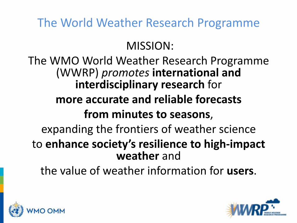
The World Weather Research Programme
MISSION: The WMO World Weather Research Programme
(WWRP) promotes international and interdisciplinary research for
more accurate and reliable forecasts from minutes to seasons,
expanding the frontiers of weather science to enhance society’s resilience to high-impact
weather and the value of weather information for users.

WWRP Implementation Plan
Based on outcome of the World Weather Open Science Conference (Montreal, 2014) and on the engagement of all the WWRP community WWRP webpage:
http://www.wmo.int/pages/prog/arep/wwrp/new/wwrp_new_en.html
http://library.wmo.int/opac/index.php?lvl=notice_display&id=17276#.VXmfdev3j5k

• Interdisciplinary research across spectrum - from process understanding to developing applications
• Engagement with policy makers, donors, private entities
• Effective links to key partners to define priorities and for efficient Research and Operations
WWRP key focuses

WWRP Structure WWRP Working Groups WWRP Core Projects
WWRP Regional Portfolio Research Development & Forecast Demonstration Projects • Convective Systems, Tropical Cyclones, Aviation, Olympic
Games, Nowcasting Systems, Sand & Dust Prediction etc • China, Argentina, US, Mediterranean, Hong Kong, South Africa,
Canada, Australia, South Korea ….

High Impact Weather project PROJECTS: • HIGHWAY : Aims to improve nowcasting and early warning systems in the
Lake Victoria region – Project started 1 Oct 2017. • NAWDEX: (Jet stream near North America, as well as their influence on
downstream propagation across the North Atlantic, and their consequences for high-impact weather in Europe)
• Waves to Weather (W2W): Improve insight into ensembles to identify the sources and evolution of uncertainty)
• HYMEX (Improve our understanding of the water cycle, with emphasis on extreme events in the Mediterranean),
• RELAMPAGO-CACTI (improve observation and understanding of convective storms in the lee of the Andes Mountains in central Argentina that are poorly represented by weather and climate models and produce high impact weather)
• ICE-POP 2018 (to advance seamless prediction from nowcasting to short-range forecast for winter weather over complex terrains based on intensive observation campaign, Korea winter Olympics),
• SURF (to promote cooperative international urban research in Beijing area to address urban convection and haze challenges )

HIGH impact Weather lAke sYstem HIGHWAY project (part of HIW)
• In 2010 the WMO Executive Council (EC) recommended that a project is considered for the Lake Victoria Watershed with the aim to improve early warning services to deal with disaster related to water spouts, waves, and wind gusts and their impacts on local communities (nowcasting to 5 days)
• WMO secured funding from Department For International Development (DFID) in the UK, through the Weather and Climate Information SERvices for Africa (WISER) programme. 30 month project, ending March 2020.
• Core project partners: WMO, UKMO and the East African NMHSs. • Satellite data, images and products will play a major role in this data sparse region
for nowcasting and early warning purposes
Approximately 30 million people live in the LV basin and it provides employment for 3-4 million people including 200,000 fishermen

Outputs of the project 1 Oct 2017-31 March 2020
Output 1: Established, effective institutional framework for the generation, uptake and use and sustainability of an Early Warning System for the East African Region Output 2: Improved access to all operational data sources to support the generation and maintenance of Early Warning Services for the East African Region Output 3: Strengthened integration between producers and users to develop and verify innovative, accurate tailor-made EWS products through co-production for the East African region Output 4 – Improved methods and strengthened capacity for communication and promoting understanding and use of EWS products with relevant producers, technicians, forecasters intermediaries and users in a in the East African region

Nowcasting Satellite Application Facility - Spain
• Amongst the list of products developed by the Nowcasting SAF are: – Rapidly Developing Thunderstorms product (RDT) – Convective Rainfall Rate (CRR)
• The RDT and CRR products can be extremely useful for convection and severe convection nowcasting in data sparse countries.
• These products need input from MSG and global or local NWP to the algorithms
• These two products are part of the plan for the HIGHWAY project
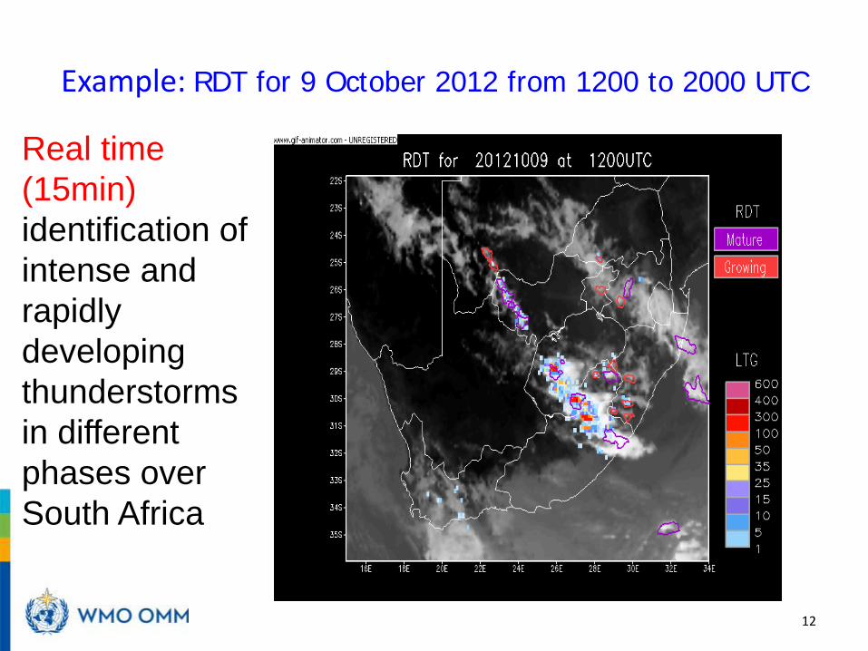
Example: RDT for 9 October 2012 from 1200 to 2000 UTC
12
Real time (15min) identification of intense and rapidly developing thunderstorms in different phases over South Africa

Validation of 25 cases over South Africa in summer season against 35 dBz radar reflectivity
13
Including lighting data in input
Gijben, M and De Coning, E. 2017. Using Satellite and Lightning Data to Track Rapidly Developing
Thunderstorms in Data Sparse Regions. Atmosphere, 8(4), 67; doi:10.3390/atmos8040067.

Example: Daily rainfall: CRR vs rain gauges for 23 Feb 2010
14
CRR using 3 MSG channels Rain gauges 0.001.002.003.004.005.006.007.008.009.00
10.0011.0012.0013.0014.0015.00
RMSE MAE BIAS 1 mm BIAS 10 mm BIAS 20 mm
Average of RMSE, MAE and BIAS
HE CRR
IPWG: http://rsmc.weathersa.co.za/IPWG/ipwgsa_qlooks.html

Satellite products: RDT for 3 March 2015 from 1000 to 2130 UTC Lake Victoria (East Africa)
Severe hail storm with lots of damage to infrastructure during evening, from 1900 - 2100 UTC, available every 15 minutes
Summary
• MSG data and products are crucial for research and operations, especially in data sparse regions (images, products, DA and verification)
• Nowcasting SAF products have been shown to validate well with reality over SA, should be useful in other African countries as well. This will be used during the HIGHWAY project.
• MTG – Lightning imager on board – can enhance observation of severe convection and NWC SAF products for entire African continent!
WMO Nowcasting Symposium 2016 16