the GIS ProfeSSIonal - URISA GIS... · new direction or makes ... a disruptive technology, ArcGIS...
32
the GIS PROFESSIONAL A publication of the Urban and Regional Information Systems Association Issue 247 • January/February 2012 IN THIS ISSUE 4 Line Printer Mapping— Still About the Analysis! 7 URISA Education Offerings 8 GIS in Kielce, Poland 15 President’s Column 18 ESIG Award 19 SPOC – Survey Plan On-line Checker 20 Welcome New URISA Members 23 Book Review 26 URISA Volunteer Satisfaction Survey 30 2012 Sponsor Directory continued on page 2 Dare to Be Disruptive Co-Authored By: Comfort Manyame, Keri Shearer, and Greg Babinski Introducing a series geared toward technologies that have or will shake up the Geospatial Community. Reminiscent of magma, hot new technologies explode on the scene, oozes on over to the rest of us, becomes steamy at the edges as it hits the main stream, and fortifies our foundation, be- coming institutionalized. If something is truly a disrup- tive technology nobody can hide from it forever in our line of business. As we look at the ever changing technology around us, it is important to pay close attention to the ones that are viral and let them stew to see if they become disruptive. Viral comes on fast and can fade fast, so sit back, observe and plan. Something disruptive might be a subtle change that pulls your whole program in a new direction or makes you sit on the sidelines and watch until it is affordable and politically safe to jump tracks. Keep in mind technology that is transforming can be slow to take hold initially because it is way too different for us to move to within large enterprises. Let us reflect on this past year’s disruptive technologies for our community and then make some predictions for 2012. We want to hear from you. Please, take our online survey. This will help us pull information from you into a matrix of results, to be shared at the next GIS-Pro Conference in Portland, September 30 - October 4 (http://www. urisa.org/gispro2012). Access our online survey by going to: http://goo.gl/ yRYK7 Or use your smart phone or tablet to scan this QR code to instantly access the survey. We would like to get your thought process started by sharing some examples of disruptive technologies from 2011. Entereth the “app” Take yourself on a quest, back to a day before we knew the term “There’s an app for that,” before your whole nuclear family was on Facebook (sending you a Poke or virtual farming), and you knew something called “Social Media” existed. Well it really is just the past few The thought of new technology may give you an array of feelings.
Transcript of the GIS ProfeSSIonal - URISA GIS... · new direction or makes ... a disruptive technology, ArcGIS...

theGIS ProfeSSIonalA publication of the Urban and Regional Information Systems Association Issue 247 • January/February 2012
IN THIS ISSUE4 Line Printer
Mapping—Still About the Analysis!
7 URISA Education Offerings
8 GIS in Kielce, Poland
15 President’s Column
18 ESIG Award
19 SPOC – Survey Plan On-line Checker
20 Welcome New URISA Members
23 Book Review
26 URISA Volunteer Satisfaction Survey
30 2012 Sponsor Directory
continued on page 2
Dare to Be DisruptiveCo-Authored By: Comfort Manyame, Keri Shearer, and Greg BabinskiIntroducing a series geared toward technologies that have or will shake up the Geospatial Community.
Reminiscent of magma, hot new technologies explode on the scene, oozes on over to the rest of us, becomes steamy at the edges as it hits the main stream, and fortifies our foundation, be-coming institutionalized. If something is truly a disrup-tive technology nobody can hide from it forever in our line of business.
As we look at the ever changing technology around us, it is important to pay close attention to the ones that are viral and let them stew to see if they become disruptive. Viral comes on fast and can fade fast, so sit back, observe and plan. Something disruptive might be a subtle change that pulls your whole program in a new direction or makes you sit on the sidelines and watch until it is affordable and politically
safe to jump tracks. Keep in mind technology that is transforming can be slow to take hold initially because it is way too different for us to move to within large enterprises. Let us reflect on this past year’s disruptive technologies for our community and then make some predictions for 2012. We want to hear from you. Please, take our online survey. This will help us pull information from you into a matrix of results, to be shared at the next GIS-Pro Conference in Portland, September 30 - October 4 (http://www.urisa.org/gispro2012).
Access our online survey by going to: http://goo.gl/yRYK7
Or use your smart phone or tablet to scan this
QR code to instantly access the survey.
We would like to get your thought process started by sharing some examples of disruptive technologies from 2011.
Entereth the “app”Take yourself on a quest, back to a day before we knew the term “There’s an app for that,” before your whole nuclear family was on Facebook (sending you a Poke or virtual farming), and you knew something called “Social Media” existed. Well it really is just the past few
The thought of new technology may give you an array of feelings.

years that the Apple iPAD embedded itself into our lives and just a little while before that the iPhone had reset the consumer’s stage of ex-pectation for entertainment, soon followed by the sea of Android devices and eRead-ers. Remember, the iPhone and iPAD became available on multiple cell phone service providers just early in 2011. Plus, Microsoft and Google came out with smart phones (I know, what?). The world might just be a much less convenient disconnected place without our “apps,” just like it would be without any maps. Therefore, the disrup-tive technology discussed in the next few lines highlights how applications became “apps” and how this benign sounding little word, that has been around awhile, has settled into our profession.
It is natural that the lives of our readers should be positively disrupted by the technologies that serve up “apps.” Today there are millions of “apps”, which work on various computers, smart phones, and tablets. Also, there are brands that exploded onto the scene and changed
the way that we as GIS Professionals approach creation of geospatial technology applications. Just think to the time, not so long ago, when we did not have to worry about whether our online maps would work on things called Android, Chrome, or Mozilla Firefox. We just had to worry about the main commercial platforms of Mac and Microsoft. For the most part we really just focused on what version of Internet Explorer was running. There are varying platforms that augment our reality by giving us real world “goggles”, and do everything from scan a code so we can buy coffee, augment reality, find satellites overhead, and then sling virtual fuming feathered friends to their heroic destiny to knock out a green ham village. But what about GIS? Has our profession truly been impacted? Of course it has. More municipalities and private sector businesses sponsor their own “apps.” And their consumers expect this. As the consumers adopt more and more technology to gain information (good information) to make decisions regarding their lives, interact with one another, and take care of business, so do government and business professionals. Let’s say for the sake of reasoning, consumers fall within three areas of impact for us GIS Pro’s.
Field/Plant Operations – How do we get information
from out there to in here in near real time? We want to collect, manage and maintain assets, crews, and work orders from the field using “apps” like Mobile 311, Cityworks Server, ArcGIS Mobile, ArcGIS Air api, and/or Freeance mobile.
Office Operations – How do we share updates, mandates, and project information? Make an “app” for that or use “Cisco AnyConnect” or remote connect “apps” to connect out to your desktop computer. Take your desktop to your meeting or just forget about printing documents you have them already on your smart phone or tablet ready when you are. Did you know you can remote to your computer and run ArcMap from your smart phone for instance?
Customer Operations – How do we share and interact with our customers. Outsiders are creating “apps” to help your customers, and it is tied to a map (examples: “See-Click-Fix”, “Bing Map Apps”, “Heads Up Navigator”, “Aure”, or “Gogles”). Create it or it will be created for you and not to your standards, so get ahead of the game while you can.
Just like “apps” transformed from applications and settled into our everyday lives. We expect there to be an “app” for most everything we wish to do and therefore it is positively disruptive.
ArcGIS Server Gave us Choices on SharingArcGIS server has been
around for several years now (formerly as ArcIMS) but it is only in the last year or so that most small to medium sized electric utilities have started to garner its full potential. The minimal use of ArcGIS Server for most small utilities is related to the high cost of the technology. Server tech-nology allows for creating, managing and distributing GIS services over the web. With server, GIS applications are put at the disposal of enterprise users without the need for expensive desktop GIS applications.
Utilities have embraced the concept of ‘Dashboard’ applications, which allow for the visualization of data from different sources, all in one place, and at the same time. Data sources like SCADA (Supervisory Control and Data Acquisition); OMS (Outage Management System), AMI (Advanced Metering Infrastructure) etc. can either feed into one repository or through the use of ODBC and other connections can be accessed and be viewed in a Dashboard. All this is made possible with ArcGIS Server technology.
An example application is for viewing ‘blink’ counts from the AMI system on a map. The number of blink counts recorded by a meter in a given time period can warn system operators of a larger problem with power delivery or power quality. When viewed in spatial space, trends and relationships can begin to emerge thus making it easy to troubleshoot or prevent potential problems before they occur. When these
Dare continued from page 2
This depiction of various “apps” in a world like con-figuration is a simple hint at the underlying geography of many “apps” available today.
The GIS Professional • JaNUary/fEbrUary 2012 • Page 2

The GIS Professional • JaNUary/fEbrUary 2012 • Page 3
blinks are viewed together with outage data coming from the OMS, a better story can be told. As individual pieces, these data offer benefits to the utility but when viewed together in space and time, the benefits increase exponentially.
With server technology or dashboards the web map can be also accessed on mobile devices so decision makers have information at their disposal all the time whenever they need it. As a disruptive technology, ArcGIS Server has managed to drastically reduce the desktop application footprint by utilizing the web.
School Days Aren’t What They Used To BeOngoing education and training is a key success fac-tor, both for individual careers and for organizations that use GIS – to ensure that their
staff can maximize the use of GIS technology. Cities, coun-ties, utilities, and businesses invest millions in developing GIS, but to get a good return on their investment it takes skilled professionals to oper-ate and maintain the GIS and well trained users to maxi-mize the business benefits from the system.
GIS users are dependent on a community of educational institutions and training suppliers to meet their ongoing GIS-related training needs. This is an area where disruptive technology and changing business drivers have combined to change the landscape for how we get our ongoing training needs met.
What are these changing business drivers? Certainly the implementation of new technology within our organizations means we need to keep up. Software
version upgrades, new OS versions, new third party end user software, open source options, virtual servers, cloud computing – all require us to master and keep up with new technology. But at the same time, what do we hear from our budget officer? Because of the recent recession, budgets are tight, so we need to keep down what we spend on training and travel. And tight budgets mean our boss is expecting us to do more and to do it better day after day, so we had better keep down our time away from the office for training. This means reduced budgets and time for traditional instructor-led, face-to-face GIS training.
The GIS training vendor community has responded to the impact of these disruptive business drivers by utilizing recent new technology developments to redefine how we can get our GIS training. What are these technologies that have disrupted the traditional way we receive our GIS training? They include cheap telephony, ubiquitous high speed broad band internet service, VOIP, specialized online presentation applications, video conferencing, web cams, etc. All these technologies combined in varying configurations enable distance learning, that in the past was very expensive, but that now has become very common.
The technology drives a business model that keeps down costs by allowing one instructor to reach many
more students at the same time while also keeping down travel costs and time away from other duties for both the instructor and the students. Distance learning may not be as effective as face-to-face instructor-led teaching, but it provides an attractive alternative at much lower costs. And it has been embraced across the GIS training industry. With distance learning technology, small one-person GIS consulting firms in rural locations can reach an international market with custom niche-market focused training. At the other spectrum of the industry, ESRI can complement its traditional instructor led ArcGIS courses with a variety of modularized on line courses at very attractive prices – or for free!
Even URISA is moving to leverage and supplement its traditional day long workshops (http://www.urisa.org/workshops) with a variety of URISA Connect Webinars (http://www.urisa.org/URISAConnect). Keep up your skills – keep down your costs – school days aren’t what they used to be!
Let’s Hear From You!Time will tell what technolo-gies in the near future will be magma for us and what is merely viral. Our URISA GIS community is becom-ing more agile and expects change. Keep an eye on the technology rumblings and head for cover, but then plan for the best path.
In the mean time, do not forget to take our online survey, so that we can keep this discussion going.
This screenshot from Esri’s website shows a sampling of ArcGIS Server sites. It is exciting to see the various industries already sharing information in this new manner (Source: www.esri.com/software/arcgis/arcgisserver/live-user-sites.html)

Line Printer Mapping—Sti l l About the Analysis !By F. Peirce Eichelberger, gDBMS, Inc.
As we get closer to URISA’s 50th anniversary this year in Portland, some of the Past Presidents have begun to document their thoughts and experiences. This docu-mentation should get mem-bers fired up for URISA’s 50th, for content at the con-ference or as newsletter fod-der throughout the year.
Some Background My first URISA conference was in Atlanta in 1976 (Don Luria was President; Barry Wellar was a Vice Presi-dent). One of my earliest URISA workshops was on ‘fire station location mod-eling’. Based on the one workshop we were able to implement the Rand Insti-tute’s Firehouse Site Loca-tion Model sponsored by HUD. The model was two large programs written in FORTRAN. We undertook an extensive master plan for the Miami Fire Department leading to a $10M bond is-sue to simultaneously build three new fire stations that were better located than three older stations they replaced. The 15 fire sta-tion department went from 15 fire stations to 12 with overall better response times Citywide. More equipment was in each new station so more manpower could ar-rive on the scene with the first dispatch. Part of this
work led to summarizing the travel times on hand drawn, isoline maps showing before and after travel times for the first due fire engines, first due ladders and second due engines, etc.
The maps were particularly important in briefing the City Council and the City Manager. I went with the Fire Chief early one morning to request permission to place the Fire Bond Issue on the next ballot. Later the Chief told me, “Peirce your “egg” maps really did the trick in explaining the before and after results of nearly a year of Fire Planning work! He thought that the City Manager might have been hungry, so that’s why the maps were so well received and why the meeting was much shorter than expected.
During grad school I became quite proficient with SPSS (Statistical Package for the Social Sciences). Thank you Dr. Wolf Roder for the exposure to SPSS in the methods class! As a geographer I always thought that computers would be in the forefront because with geographic data there always seemed to be a lot of it! In the 1970’s SPSS was the tool for
non-programmers to use computers. It was really the spreadsheet of the day.
After grad school during my first job at the City of Miami (FL) Planning Department, I was viewed as the computer go-to guy. I took many classes at the local Junior College. The first was FORTRAN which was the most SPSS-like because of the way you described input data (and output data if you were outputting raw data). Then I took RPG, the complete opposite of FORTAN, and then I went to the “middle” and took several COBOL classes.
Now for the MappingOne of my duties at the Planning Department was
maintaining the library. One day I came across a short (9 pages) memo on Census Bureau letterhead titled “Choropleth Mapping on Small Computers.” The memo described a small (about 50 statements) FOR-TRAN program that did line printer choropleth map. It was called C-Map. WOW what a find in the Planning Department library! This was in 1976 or 1977. The memo described the scan line (raster) encoding meth-od for geographic areas. The program was written by Dr. Morton W. Scripter then of the University of Idaho, Department of Ge-ography. The documenta-tion included an example from South Carolina by County. So we began to
Hand Drawn Isoline Map Showing Current Situation With 15 Miami Fire Stations
The GIS Professional • JaNUary/fEbrUary 2012 • Page 4

Line Printer Mapping—Sti l l About the Analysis !
The GIS Professional • JaNUary/fEbrUary 2012 • Page 5
do “computer maps.” Most of the available
city service data was collected by some type of management geography. This means we could only compare diverse data on a similar scale map with differing management geography. The Police Department used small reporting areas, the Fire Department used older Traffic Zones, our Planning Department land use and housing data was summarizeable by Census Tracts and Census Blocks, Block Groups, the latest Traffic Zones and Planning Areas. Other data was by Voting Precincts, Neighborhoods, etc.
C-Map did not allow any changes in map scale, yet we learned that if all the “scan lines” were generated from the same scale base map we could begin to compare data for relatively small areas for a point in time for the very first time. The effort was much trial and error. We decided on an 8.5x11 inch map format in a landscape layout. Actually this allowed for an easy reduction of regular computer printer paper, usually 11x17 inches. We learned how to ask for white
paper (on the Job Control Language (JCL) statements in the card deck) and not the ugly computer “green bar” default paper. We also figured out how to tighten up the printing to 10 lines per vertical inch, rather then the default 8 lines per inch. This was starting to give us more acceptable and user friendly maps.
About the same time I stumbled onto Display and
Analysis of Spatial Data by Davis and McCullagh (1975), see chapter by J.T. Coppock, “Maps by Line Printer.” That paper described how to have a more human friendly, line printer map using a transparent overlay that could show landmarks and even major streets. So with much more trial and error, we got the same overlay to work with any of the City’s management reporting geography. So with the denser printing, the white printer paper, the reduction to 8.5x11 inches and the transparent overlay (before copying) we were able to produce some fairly attractive maps for any digital data-set fairly quickly and very inexpensively. We even implemented a CBD blow-up (insert) for the
Traffic Zone maps (see the following example).
With all these enhancements, the map products were as acceptable as SYMAP output from the Harvard Laboratory for Computer Graphics and Spatial Analysis. Howard Fisher was the founder of the Harvard Laboratory, he had attended a computer mapping workshop put on by Edgar Horwood, founder of URISA, in 1963 at Northwestern University. The Harvard Laboratory also developed ODYSSEY which was a genesis of ARC/INFO. Ed Horwood and the URISA connection way back then, as important as ever.
By using C-Map we developed the very
Map 1.02 Population Density Per Net Residential Acre By Traffic Zone-1975
continued on page 6

popular Atlas of Miami that contained 32 computer maps covering such topics as land use, population, housing and City services in 1978. A real focus of the Atlas was to try to illustrate changes over time. Subsequent map products were Arson in Miami for the Miami Fire Department, Crime in Miami for the Miami Police Department and many map products supporting the full range of transportation planning activities.
My boss at the time, Joe McManus, used the atlases during a tough budget hearing (without my knowledge) and got the Planning Department’s budget approved with flying colors. The next day he said to me, “Peirce, I do not know what you are doing but please keep doing it!” Honest exact quotes. What a great first boss, I hope everyone’s first boss was like that.
Many C-Map spinoffs were developed, many available from the Geography Program Exchange of the University of Michigan. One took the FORTRAN program and rewrote it into COBOL (350+ lines of code), other versions allowed for multiple map production and other statistical data manipulation.
What It Means TodayData analysis is still the name of the game. Ana-lyzing trends is just as important today as ever. Understanding how things are changing is critical to today’s decision makers. The GIS map is the most important business graphic in a governmental sense. We still are not using GIS products and analysis on a daily basis at the Commis-sion/Council level. Why not?
SPSS is now part of IBM’s Business Intelligence (BI) software suite. They tried to change the name of it a few years back, but the users would have none of it. It now has neat Windows command interfaces but it still supports the command lines “underneath.” It runs on both Mac’s and PC’s. No question that the data analysis before the first map is as important today as ever.
Fire and Police agencies are now big consumers of GIS products. Even volunteer Fire Departments, as an NGO, can benefit from GIS analysis.
Working with computer code is easier nowadays. Everything you need is right at your fingertips. Templates are a common occurrence. Code is more sophisticated now. Programming forced obsolescence seems to be accelerating. Remember VB, Avenue, Viaduct, Pascal? The www provides for more connectivity
and system options now. You don’t need reference books to decipher Job Control Language (JCL) for IBM mainframes or the easier WFL for Burrough’s mainframes. You had to know something similar for NCR, UNIVAC, DEC VAX processors too.
Geocoding and comparing operational data across various departments is still challenging. Working with Police incident data and linking it to GIS is every bit a challenge today as it was back in the 1970’s. Working with unstandardized address data from various Police
Line Printer continued from page 5 record systems is still often the norm. Comparing operational data over time is also today no simple matter. Coded values are not consistent over time and key attribute data may not be archived on a regular basis for subsequent analysis either.
Oh how things have changed, or have they really? Happy 50th anniversary URISA, I am sure URISA will see a hundred!
Keep the comments coming…Peirce Eichelberger, [email protected]
Deadlines to Note!• Abstracts for 2012 URISA/NENA
Addressing Conference - Due february 13
• Abstract Submissions for GIS-Pro 2012- Due february 17
• GIS/CAMA Hotel Reservation Deadline- february 17
• Registration Discounts for URISA Leadership Academy - Expire on March 1
• Abstracts for 2012 Caribbean GIS Conference - Due april 2
• 2012 Exemplary Systems in Government Awards - Due May 7
The GIS Professional • JaNUary/fEbrUary 2012 • Page 6
URISA Education Offerings
The GIS Professional • JaNUary/fEbrUary 2012 • Page 7
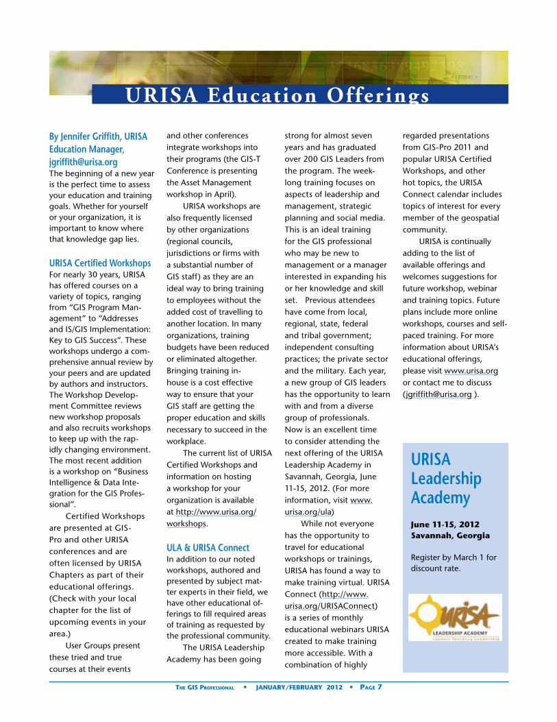
By Jennifer Griffith, URISA Education Manager, [email protected] beginning of a new year is the perfect time to assess your education and training goals. Whether for yourself or your organization, it is important to know where that knowledge gap lies.
URISA Certified WorkshopsFor nearly 30 years, URISA has offered courses on a variety of topics, ranging from “GIS Program Man-agement” to “Addresses and IS/GIS Implementation: Key to GIS Success”. These workshops undergo a com-prehensive annual review by your peers and are updated by authors and instructors. The Workshop Develop-ment Committee reviews new workshop proposals and also recruits workshops to keep up with the rap-idly changing environment. The most recent addition is a workshop on “Business Intelligence & Data Inte-gration for the GIS Profes-sional”.
Certified Workshops are presented at GIS-Pro and other URISA conferences and are often licensed by URISA Chapters as part of their educational offerings. (Check with your local chapter for the list of upcoming events in your area.)
User Groups present these tried and true courses at their events
and other conferences integrate workshops into their programs (the GIS-T Conference is presenting the Asset Management workshop in April).
URISA workshops are also frequently licensed by other organizations (regional councils, jurisdictions or firms with a substantial number of GIS staff) as they are an ideal way to bring training to employees without the added cost of travelling to another location. In many organizations, training budgets have been reduced or eliminated altogether. Bringing training in-house is a cost effective way to ensure that your GIS staff are getting the proper education and skills necessary to succeed in the workplace.
The current list of URISA Certified Workshops and information on hosting a workshop for your organization is available at http://www.urisa.org/workshops.
ULA & URISA ConnectIn addition to our noted workshops, authored and presented by subject mat-ter experts in their field, we have other educational of-ferings to fill required areas of training as requested by the professional community.
The URISA Leadership Academy has been going
strong for almost seven years and has graduated over 200 GIS Leaders from the program. The week-long training focuses on aspects of leadership and management, strategic planning and social media. This is an ideal training for the GIS professional who may be new to management or a manager interested in expanding his or her knowledge and skill set. Previous attendees have come from local, regional, state, federal and tribal government; independent consulting practices; the private sector and the military. Each year, a new group of GIS leaders has the opportunity to learn with and from a diverse group of professionals. Now is an excellent time to consider attending the next offering of the URISA Leadership Academy in Savannah, Georgia, June 11-15, 2012. (For more information, visit www.urisa.org/ula)
While not everyone has the opportunity to travel for educational workshops or trainings, URISA has found a way to make training virtual. URISA Connect (http://www.urisa.org/URISAConnect) is a series of monthly educational webinars URISA created to make training more accessible. With a combination of highly
regarded presentations from GIS-Pro 2011 and popular URISA Certified Workshops, and other hot topics, the URISA Connect calendar includes topics of interest for every member of the geospatial community.
URISA is continually adding to the list of available offerings and welcomes suggestions for future workshop, webinar and training topics. Future plans include more online workshops, courses and self-paced training. For more information about URISA’s educational offerings, please visit www.urisa.org or contact me to discuss ([email protected] ).
URISA Leadership AcademyJune 11-15, 2012Savannah, Georgia
Register by March 1 for discount rate.

Using a Geographical Information System as a Platform to Integrate Local Strategies in Kielce, Poland
Leipzig Charter Recommendations for Sustainable European CitiesThe Leipzig Charter, adopted in 2007 by the Ministers of the European Union responsible for urban de-velopment, states that the strengthening of European cities must include ‘regard to all dimensions of sustainable development i.e. economic prosperity, social balance and a healthy environment’ (Leipzig Charter, 2007) while also paying attention to cul-tural and health aspects. Sus-tainable development is the basis for integrated planning of urban development. The main recommendation of the Leipzig Charter is ‘putting on a large scale integrated approach to urban develop-ment policy.’ Such a policy includes coordinating the key sectors of urban policy (geographical planning, environment, economic de-velopment, social affairs and development of civil society). Achieving sustainable devel-opment can take place by moving away from sectoral planning and management to an integrated urban devel-opment policy.
Strategic Documents in Polish Cities - an Integrated System?Polish cities create different kinds of strategic develop-ment plans and programs - both by individual munici-
pal business sectors and on a quasi-coordinated basis when trying to define the desired city development. These include:• Strategic and cross-
sectoral documents: development strategies, local development plans, strategy development for sustainable transport revitalization program, etc.
• Environmental protection: environmental protection program, waste management program
• Economic development: long-term investment program
• social policy and building civil society: strategy for solving social problems, housing resource management program, a program of cooperation with NGOs
• Other: tourism development strategy, a program for care of monuments and a regional plan (Geographical policy), together with the local geographical development plans, which integrate the objectives contained in the above-mentioned studies on urban space. All these policies should
include regional and national policy objectives.
In practice it is very difficult to integrate individual municipal business sector policies in a realistic, comprehensive, and effective way. Economic policy contained in the development strategy of the municipality is generally uncoordinated with the land-use policy (the regional plan and legal tool in Geographical planning - local plans). All these documents are usually not in any way coordinated with the environmental program, which is nothing else than an environmental strategy for the municipality. What’s even more, local zoning plans implemented in the city are not integrated with each other, and thus comparable. The practical consequence is that it is impossible to determine the actual city investment rate or the state of development in areas designated for particular functions.
Why are key documents required for effective sustainable development of the city not managed on a comprehensive basis? As experience shows the main problems are:• Lack of access to
common, reliable and consistent information
• No or limited exchange of information between the municipal offices responsible for specific policies
• Lack of communication and collaboration tools
The development and implementation of urban policy (both by municipal business sector and on a municipality-wide strategic basis) is composed of four constantly recurring stages:• Planning (determination
of diagnosis, setting goals and tasks for implementation, and establishing monitoring indicators)
• Implementation (tasks)• Monitoring (to
determine the status of completed tasks)
• Improvement of system and procedures
Integrated urban development policy cannot be developed and implemented without current and reliable data about the city and the phenomena or activities that occur within its borders. Typically, the necessary data are interdisciplinary, describing in detail the various issues. Individual municipal offices often have adequate resources data, however, the drafters of the
By Szymon Ciupa, Katarzyna Dzwonkowska, Jerzy Kisiel; 24GIS s.c.
The GIS Professional • JaNUary/fEbrUary 2012 • Page 8

Using a Geographical Information System as a Platform to Integrate Local Strategies in Kielce, Poland
The GIS Professional • JaNUary/fEbrUary 2012 • Page 9
various sectoral policies and strategic are not aware of the existence of this data. Thus, it is necessary to implement an information platform that allows both the acquisition and ongoing data analysis and sharing of data information within the urban work units and also providing information to the public. The Leipzig Charter speaks of “the coordination of key areas of urban policy from the standpoint of space, and time course of action.” A key tool that meets the requirements listed above is an urban Geographical Information System (GIS).
Geographical Information Infrastructure - Support from the European UnionIn May 2007 the ‘Infrastruc-ture for Geographical Infor-mation in Europe’ (INSPIRE) came into force. This Euro-pean Commission directive establishes an infrastructure for Geographical information across Europe to promote the Community’s environ-mental policies and activities that may impact the environ-ment, and therefore also for Geographical and integrated planning. INSPIRE promotes the availability of Spatial data and increases awareness of Geographical information for use in local government.
INSPIRE is ‘a set of
appropriate technologies, and economic policy measures and institutional projects that facilitate access to and use of Spatial data’ (Kubik, 2009). The INSPIRE Directive is intended to build a Spatial data infrastructure within the European Union to enable the sharing of Spatial data by public sector organizations and facilitate public access to Geographical information in Europe.
INSPIRE is based on several common principles:• Data should be collected
only once and stored in the most efficient way
• Data from various European sources should be stored in a seamless and unified manner, enabling their use by different users using different applications
• Data collected at one level should be made available at many levels; specified for accurate research, generalized for the overall strategic objectives
• Geographic information needed for good management at all levels should be easily accessible and transparent
• Ease in locating Geographical information must be ensured, along with
information on how it can be used to meet the specific needs, and on what basis it can be purchased and used
One of the objectives of INSPIRE is to share and exchange environmental Spatial data between public institutions and provide better accessibility to Spatial data to serve the construction of the EU Joint Environmental Information System. In recent years, due to the INSPIRE directive requirements, there has been a significant increase in the availability of Spatial data for local government units.
The City of Kielce Geographical Information SystemKielce is a city in central Poland located midway be-tween Warsaw and Krakow. With over 200,000 inhabit-ants it is the capital city of the Swietokrzyskie Voivod-ship. The city is located in the middle of the Swietokrzyskie Mountains. (Holy Cross
Mountains), on the banks of Silnica River. Kielce is an important regional center of trade and commerce.
The primary objective for development of the City of Kielce Geographical Information System (Miejski System Informacji Przestrzennej Urzędu Miasta Kielce or UM Kielce MSIP) was to support comprehensive management of sustainable development. This objective provided an opportunity for an innovative approach to GIS, because most urban GIS in Poland is created to carry out specific tasks without citywide integration or a comprehensive approach to urban management. Intermediate objectives are:• Enable better
coordination of urban policy
• Provide access to full information about the city
• Improve the investment process
• Enable systematic
Fig. 1. construction of a spatial data infrastructure as a process of reduction and integration of databases by their repeated use. Source: 24GIS based on Gotlib, Iwaniak, Olszewski, 2009.
continued on page 10

monitoring of changes in the city
During the pre-implemen-tation analysis it was deter-mined that the system would operate primarily in three key areas: environment, land management and surveying. Within these three fields of activity the Kielce GIS also had to realize sectoral objec-tives.
Key Area: Environment• Support the city’s
environmental policy (the environment protection program)
• Inventory resources and environmental hazards (Fig. 2)
• Enable environmental monitoring of the city
• Support administrative decision making
Key Area: Land Management• Support Geographical
policy (by supporting development of the study of conditions and directions of Geographical and local development plans)
• Enable better location decisions
• Support decision making through access to data and Geographical analysis
• Enable comprehensive monitoring of investment activity (Fig. 3)
• Improve monitoring of Geographical development
Key Area: Surveying
• Create and share high-quality reference data
• Support decision making
“Support to the investment process” was chosen as the first stage of implementation due to the fact that this process integrates all three fields of activity within the city. An integrated system of software application was developed and implemented to support administrative procedures such as:• Creating regional and
local development plans• Issuing of the zoning
decisions• Issuing decisions
about public purpose investment locations
• Issuing environmental decisions
Two types of software were used:• Easy to use applications
that run through web browsers for access to spatial data and application support for administrative procedures (Fig. 4). This software is used by the vast majority of users.
• Specialized software packages to perform advanced geographical analysis, and data creation and editing.
The system provides a broad spectrum of spatial data needed in the process of planning projects and assessing their impact on the environment. It also provides tools for geographical analysis
and a tool supporting the formal and legal side of a land use decision. It also provides access to different types of decisions that affect a single investment.
Early in its development Kielce GIS launched Geoportal Kielce, a web map solution where
environmental, zoning and other spatial data about the city is available (Fig. 5). Geoportal Kielce is a “window on the world,” accessible to any internet user (http://gis.kielce.eu/geoportal_toolkit/).
As implementation of the system began, the
Fig. 2: 2008 detailed inventory of urban greenery using photo-grammetric methods. Source: UM MSIP Kielce
Fig. 3 Map of ongoing proceedings in the Architecture and Ur-ban Planning Department and the distribution of decisions is-sued in 2007-2009. Source: UM MSIP Kielce
Fig. 4 Sample application to support issuing building permits. Source: UM MSIP Kielce
Using a GIS as a Platform continued from page 9
The GIS Professional • JaNUary/fEbrUary 2012 • Page 10

The GIS Professional • JaNUary/fEbrUary 2012 • Page 11
acquisition of spatial data was launched. This included: protected areas, an inventory of vegetation, and existing local plans. Training for various groups of users (for the city presidents, directors, administrators, planners and officials) were conducted.
In subsequent development stages the system was extended to support applications of all procedures in the Department of Environmental Protection and also to support property taxes execution
control functions. At the moment we are working on the support system module for District Construction Supervision. GIS capabilities were also used to optimize the electoral wards (with a detailed map of population distribution).
At the moment, the system has 160 authorized users with access for their work to more than 1,600 layers of information.
Schematic operation of the Municipal Geographical Information System is shown in Fig. 6.
Application of GIS in Integrated Planning.Kielce GIS was originally designed to be used for inte-grated planning. Therefore, various geographical analysis tools have been developed to improve this process. Dur-ing the initial stage of imple-mentation a comprehensive GIS database of local city plans was developed. The database has been standard-ized, which means that a coherent geographical policy was created. Standard GIS policy for local development plan (Fig. 7) defines:• Unique identifiers of
land use and technical infrastructure
• Standard of urban
indicators• Rules for recording data
structures that make up the local plan
• Rules for creating GIS data
• Rules for recording the text of the resolution of the local plan
• Standard graphical presentation of GIS data constituting the drawing of the plan
• GIS data control rules
With data prepared and managed to comprehensive standards such as these, it becomes possible to quickly answer questions that cut across sectoral boundaries, such as: how much of the city land is undeveloped, or with multifamily housing, or with industry, or with new technology infrastructure? The system can analyze in relation to local plans, sectoral plans, and the city plans, minimizing the need to infer too much on a subjective basis.
Development of a coherent GIS database also allows the city to publish local plans in accessible form for residents and investors on Geoportal Kielce and to provide planning information for city office staff. During the pre implementation needs assessment, 24GIS
Fig. 5 Geoportal Kielce provides local plans and other spatial data in an accessible form. Source: www.GIS.KIELCE.eu
Fig. 6 Schema of the Municipal Information System in the UM Kielce. Source: 24GIS
Fig. 7 Access to data on the planning location before standard-ization (A) and after (B). On presented area 3 plans are valid. Source: 24GIS.
continued on page 12

determined that for city office staff, local plans are second in importance after the cadastral maps.
For drafting the regional plan, an ecophysiography survey was performed. While working on the document the reference data and thematic data from the Kielce GIS was used, but many new layers of information were also acquired and handed over for use by the city (on the analysis of the historical development of the city or town).
Kielce GIS provides access to all its work for staff in the Office of Planning, Environmental Protection Department, and Urban Planning and Architecture Department for use in decision-making processes.
One of the studies completed using the resource of Kielce GIS and the process of integrated
planning was ‘Analysis of the conditions of life in the city of Kielce’ performed in 2009. This study, inspired by the European Urban Audit program, was designed to provide objective and comparable indicators for isolated urban areas. The aim was to develop in-depth analysis of the phenomena of socio-economic and environmental conditions occurring throughout the city. Assumptions of analysis were also prepared based on the methodology of System Analysis Local Government Association of Polish Cities and sustainable development indicators developed by Prof. Tadeusz Borys. For this analysis the area of Kielce was divided into 87 unit areas (Fig. 9) and conditions calculated for over 180 indicators.
The indicators were divided into eight thematic groups:
• Demographics (Fig. 10)• Society• Economy (Figure 11)• Civil activity• Education• Environment• Land use and planning• Transport
The ‘Analysis of the conditions of life’ provides
information about the state of the city in the respective fields of study. But because of the reproducible analytical models, based on precisely defined methodology, and the use of data collected the computer systems of the City (not only GIS data but also Social Security data, unemployment data, etc) it is a tool for monitoring the activities carried out by the city.
This study is used to develop a regional plan, environmental protection program, and to build local policies on social welfare and preventing social exclusion. Data obtained in the framework of the development can also be used to conduct activities related to public safety and crisis management.
At the moment we are working on integrating the processes of preparing the program of environmental protection and regional plan. Task teams were established for the preparation of the
Using a GIS as a Platform continued from page 11
Fig. 8 Ecophysiography Map available in both traditional and GIS format. Source: UM Kielce
Fig. 9 Division of the city of Kielce into 87 units of in the ‘Analy-sis of the conditions of life.’ Source: City of Kielce
The GIS Professional • JaNUary/fEbrUary 2012 • Page 12

The GIS Professional • JaNUary/fEbrUary 2012 • Page 13
• Demographics (Fig. 10)• Society• Economy (Figure 11)• Civil activity• Education• Environment• Land use and planning• Transport
The ‘Analysis of the conditions of life’ provides
so-called. ‘Area Plans for the Conservation and Sustainable Development’ (eg water plan, a plan for sustainable transport, climate protection plan and the atmosphere). Representatives of the Office of Planning, Department of Environmental Protection, and other city entities responsible for specific areas are collaborating in this work.
For proper diagnosis and
evaluation of phenomena related to these areas it is necessary to have complete and current information about them, legible and appropriately structured, and accessible to all participants in the decision making process at all stages. A key tools for achieving these objectives is the Kielce Geographical Information System. Part of the GIS,
Geoportal Kielce, serves as the platform for the City’s ‘Agenda 21’. This provides the public with current data about the environment of the city, with publicly available documents containing information about the environment and its protection. Thanks to this application, the community will be better informed about projects affecting the environment.
Implementation of the Kielce Geographical Information System The geographical informa-tion system for each city is different. An efficient urban system is not created by just installing the software “out of the box” on several computers at the office. GIS is a system which is used in many tasks by many us-ers, and therefore must be tailored to their needs. GIS must be designed to support urban business function tasks, rather than
hinder them. The system must fulfill specific business objectives - implementation of GIS is not a goal in itself. Construction of an urban GIS should be treated as a process that is planned and implemented in accordance with the plan. Otherwise, it is a huge probability that organizational and financial effort will be wasted.
Stages of GIS (figure 13)The decision to start work on development of a geo-graphic information system must be a conscious decision of the city authorities. With-out the commitment and understanding of GIS imple-mentation on the part of top management it is extremely difficult. The development of urban GIS in Kielce started with the recommendations of the City Council in Sep-tember 2006. The document adopted by the council in-dicated that the city should implement an integrated management system and environmental sustainability using a Geographic Informa-tion System. The basis for all future work is the detailed analysis of the circumstances and needs of the city office in the use of GIS. This analy-sis must include:• An analysis of resources
of information resources (including data resources, information systems)
• An analysis of the human resources of the office
• Identification of tasks related to the use of Geographical information, human resources
Fig. 10 Examples of the Geographical presentation of indicators in the field of demography; A - population density, B the population in retirement age, C - emigration from the city. Source: City of Kielce
Fig. 11 Examples of the Geographical presentation of indicators in the field of economy; A - unem-ployment by age, B - the distribution companies. Source: Kielce City
Fig. 12 Availability of urban parks for the residents. Source: Kielce City
continued on page 14

• An analysis of needs in terms of access to spatial data and their processing capabilities and analysis.
Based on the results of the analysis the key areas for the implementation of GIS must be indicated, which is extremely important because the implementation of GIS should be staged. At the same time the City should prepare for the implementation of GIS from the organization side. In Kielce, control and implementation teams were
established. Moreover, an ordinance governing the operation of the system was issued by the Mayor of the City.
The next step was to develop a detailed specification of the tender for the system. For a system tailored to the needs and designed to implement specific objectives and tasks of this stage is crucial. The specification defines how much detail is desired to operate the system. After selection of the contractor, work began on development and implementation related to the “physical” software installation on servers and on the system. Throughout the period of implementation data was obtained, training conducted to educate users about the possibility and methods of using GIS.
After the initial implementation phase, system functionality verification was pursued and system performance evaluated. Subsequently, the system can be upgraded. For this reason, it should be ensured that the system has a modular design that allows for seamless expansion of the GIS to other departments and tasks.
ConclusionAfter several years of opera-tion of the Municipal Infor-mation System in the City of Kielce it can be concluded that the use of GIS allows for the termination or significant
reduction in problems asso-ciated with the implementa-tion of the idea of integrated planning of urban develop-ment such as:• Lack of access to
common, reliable and consistent information
• No or limited exchange of information between the cells responsible for specific policy
• Lack of communication and collaboration tools
• Lack of monitoring tools
The City of Kielce’s Geographical Information System has become a tool for integrating and analyzing data, and more importantly it has become a platform for cooperation between city departments and units. It should be emphasized that this implementation could not have been achieved without a high awareness of the value of integrated management in accordance with the principles of sustainable development among the executives and employees of the City Council involved in the construction of Kielce GIS.
24GIS24GIS is a consulting com-pany that specializes in the fields of GIS, spatial plan-ning, and local government. 24GIS provides and analyzes data as well as offering tech-nical solutions for public sec-tor and private organizations working in sectors such as environmental protection, natural science, and spatial planning. 24GIS is a URISA Business Sponsor. See: www.24GIS.com.
Bibliography:A key resource for English speakers about INSPIRE is: Masser, Ian, Building European Spatial Data Infrastructure, 2010: ESRI Press, Redlands, CA.1. Gaździcki, J. (2002).
Leksykon geomatyczny.
Warszawa: Wieś Jutra.
2. Gotlib D., Iwaniak A.,
Olszewski R. (2009). GIS.
Obszary zastosowań.
Warszawa: Wydawnictwo
Naukowe PWN
3. Harmon, J. E., & Anderson,
S. E. (2003). The Design
and Implementation of
Geographic Information
Systems. Hoboken: John
Wiley and sons.
4. Karta Lipska (2007), http://
www.mrr.gov.pl/rozwoj_
regionalny/poziom_
miedzynarodowy/
polityka_przestrzenna_
ue/rozwoj_miast/
Documents/Karta%20
Lipska_PL_tlumaczenie%20
Komitetu%20Regionow_1.
5. Kubik T. (2009). GIS .
Rozwiązania sieciowe.
Warszawa: Wydawnictwo
Naukowe PWN
6. Longley, P. A., Goodchild,
M. F., Maguire, D. J., &
Rhind, D. W. (2006). GIS.
Teria i praktyka. Warszawa:
Wydawnictwo Naukowe
PWN.
7. Markowski T. (2002).
System zarządzania
przestrzenią miasta jako
narzędzie w procesie
równoważenia jego
rozwoju. „System
zarządzania przestrzenią
miasta” pod red. P.
Lorensa (strony 15-23).
Gdańsk: Politechnika
Gdańska
Fig. 13 Steps of Geographical Information System imple-mentation. (Decision, Analysis of circumstances of specific local government, need as-sessment and concept of GIS, organizational preparation, public procurement, imple-mentation and installation, maintenance) Source: 24GIS (http://www.24gis.pl/baza-wiedzy.php)
Using a GIS as a Platform continued from page 13
The GIS Professional • JaNUary/fEbrUary 2012 • Page 14

The Future of URISA as an International Organizationbeing disruptive may mean going back to origi-nal intentions. Politicians in the U.S. sometimes try to upset what they perceive as the status-quo, by harking back to ‘original intentions of the founding fathers’ or to a strict interpretation of the Constitution. Organiza-tions change with the times. Sometimes reflecting on our origins may lead us to redis-cover a past potential that can now be realized.
I travelled to Taiwan in 2010 and met many GIS professionals eager to gain access to URISA’s ongoing body of knowledge (see The GIS Professional Issue 240). In 2011, I travelled to Poland and met with URISA Business sponsor 24GIS and GIS staff from the City of Kielce (see article in this issue of The GIS Professional). There is much to learn and much to share by striving for a more inclusive internationally focused organization.
URISA was established to be an international organization. Article II of the URISA Constitution states:
URISA is an international Association to stimulate, encourage and oth-erwise provide for the advancement of an in-terdisciplinary and multi-professional approach to planning, designing and operating urban informa-
tion systems. The Asso-ciation shall operate as an objective educational organization without po-litical, social, financial or national bias.
What is the record of URISA as an international organization and what should its future be? During its early years, in practice, URISA’s ability to develop as a true international organization was limited by a number of factors:• International travel and
communications was very limited by local government policy, budget, and practice.
• Technology of the time, including air travel, computers, and international telephony, was poorly developed at best and non-existent in key area, and the internet had yet to be invented.
• Economic development in more than half of the world was considered to be ‘Third World’ - not fertile ground for urban and regional information systems.
• Much of the world was divided into two broad political camps – the ‘West’ and the ‘Communist Block.’
In late 2001, URISA launched an International Task Force (ITF) to
recommend policy related to requests from chapters and to establish formal relations with associations outside the U.S. and Canada. Unfortunately ITF recommendations were never taken up.
The consequence of these limitations for URISA has been that its strongest international component has been in North America – primarily in Canada, with growing participation from the Caribbean region. A brief review of what URISA has accomplished internationally will demonstrate that the organization has never forgotten its international focus, but also indicates some deficiencies and a possible way forward.
URISA’s Ongoing International FocusInternational participation in URISA conferences:A sampling of non-U.S. subject matter and authors
indicates that there has been a steady growth in the international aspect of URISA conferences. The 1967 AC Proceedings in-cluded 25 papers, of which only one (4%) was by a non-American author. By the 1987 AC, Canadian au-thors and/or subject matter had increased to 12 of 84 papers (14%). The following year, 1988, 15 of 95 papers (16%) were ‘international’ – with 10 Canadian and five Australian papers.
During the highly successful 2006 AC in Vancouver, Canada, 50 (31%) of the 160 papers were authored by Canadians, and a further 10 (7%) were authored from outside North America.
Clearly, the URISA AC is a highly valued international event that provides a unique venue for intellectual discourse and exchange in the field of urban and regional information systems.
URISA specialty conferences also attract international participation. During the 2011 URISA GIS in Public Health Conference in Atlanta, of 175 attendees, 38 (22%) were from outside the U.S. Because many attendees came from former Soviet republics, selected sessions were translated live into Russian during the conference.
President’s Column
The GIS Professional • JaNUary/fEbrUary 2012 • Page 15
Greg Babinski, GISP
continued on page 16

International content and contributors to URISA JournalThe URISA Journal is the Association’s flagship pub-lication. Between 1989 and 2010, the URISA Journal published 372 articles. Of these, 21 articles (6%) had a Canadian orientation. A further 64 articles (17%) represented authors or con-tent outside the U.S. and Canada. The URISA Journal has been an effective means of achieving the Associa-tion’s international goals.
International board members & presidentsOf a total of 46 Presidents in URISA’s history, four have been from Canada: Barry S. Wellar, O.E. Dial, Laurel McKay, and Dianne Haley. In addition, URISA has had many non-U.S. Board mem-bers. During the past ten years, of 30 individual Board members, five (16%) have been non-U.S. The only known non-North American Board member was Mr. Bi-jan Azad, from Lebanon, in 1995-1998.
In 2011, the URISA Bylaws were revised to require that at least one international member always serves on the Board of Directors.
International chaptersURISA has developed a net-work of five international chapters: Alberta, British Co-lumbia, Caribbean, Ontario, and Quebec.
International conferencesThe URISA Policy Manual states that ‘the Annual Con-ference will be held in Can-
ada a minimum of every 9 years.’ Since 1974, URISA has met or exceeded its policy on conferences in Canada. URISA’s past international conferences include:• 1974 AC: Montreal,
Canada• 1980 AC: Toronto,
Canada• 1985 AC: Ottawa,
Canada• 1990 AC: Edmonton,
Canada• 1997 AC: Toronto,
Canada• 2001 Caribbean GIS
Conference: Montego Bay, Jamaica
• 2004 Caribbean GIS Conference: Barbados
• 2006 AC: Vancouver, Canada
• 2006 Caribbean GIS Conference: Bahamas
• 2008 Caribbean GIS Conference: Grand Cayman
• 2010 Caribbean Conference: Trinidad and Tobago
Australia & New Zealand - SSSIIn the early 1980’s interest in geospatial technology led a number of individuals from Australia to attend URISA conferences. In 1983 the Australasian Urban and Re-gional Information Systems Association (AURISA) was formed then merged two years ago with the surveying organizations in Australia and New Zealand to form SSSI - the Surveying and Spatial Sciences Institute.
SSSI and URISA have an annual exchange of presidents. A formal SSSI-URISA Five-year MOU
was signed in 2010 and SSSI licensed a URISA workshop for presentation across Australia and New Zealand. In 2011, SSSI and URISA initiated conference calls between Executive Committees and agreed to develop a small number of joint cooperative initiatives.
International award winnersURISA’s Exemplary Systems in Government Awards, inau-gurated in 1980, recognize extraordinary achievement by government agencies in the use of automated infor-mation systems. Since its inception, 202 ESIG awards or Distinguished System Awards have been made. Of these, a total of 24 (12%) have been awarded to Cana-dian agencies. A further 22 (11%) have been awarded to other non-U.S. agencies.
GISCorpsGISCorps was the idea of longtime URISA member Shoreh Elhami. She present-ed her idea to the URISA ITF in 2001. In 2003 the Board unanimously endorsed GIS-Corps as a URISA initiative. To date (2011), the Corps has deployed 250 volunteers to 80 missions in 39 coun-tries around the world.
International MembersIn October 2011, URISA had a total of 2,290 regular members. Of this total 2,067 (90.3%) were from the U.S., 139 (6.1%) from Canada, and 84 (3.6%) from other countries. The proportion of non-U.S. URISA members is lower than the proportion of non-U.S. URISA Confer-ence papers, Journal articles, and ESIG award winners.
This might suggest that the stature of URISA in the inter-national community is such that it attracts mostly the ‘best and the brightest’ out-side the U.S.
These membership numbers cause us to ask though, with the techno-logical advances of the past 25 years and the reduction in real communication and travel costs, why isn’t the proportion of URISA mem-bers outside the U.S. much higher? For a truly interna-tional organization, shouldn’t we expect that more than 50% of URISA’s members would be from outside North America?
Just as ‘all politics is local’ as the late U.S. Senator Tipp O’Neil said, so all GIS data and applications are local, or developed for some defined geographic limits. Very rarely are GIS systems developed to be truly international in scope. This does not this mean however, that URISA should not concern itself with examining its appropriate international mission.
The Future of URISA as an International OrganizationThe factors that hindered URISA’s ability in its early years to pursue its original vision as an international or-ganization have now largely been eliminated. International travel for local government administrators, although limited, is now more feasible. New technology – cheap international air travel, the Internet, and cheap tele-phony – now allows anyone anywhere with an interest in urban and regional informa-tion systems to come to-
President’s Column continued from page 15
The GIS Professional • JaNUary/fEbrUary 2012 • Page 16
gether as a true international community. The Cold War is now over and countries once enemies of the West are now allies in many cases, and most are active trading partners. ‘Third World’ is a descrip-tion applied to few countries today and rapidly developing economies are actively de-veloping urban and regional information systems.
There is almost no country anywhere where GIS development is not in progress. There is no region anywhere that can rival North America for the level of development of GIS. And there is no professional organization that can rival URISA for its potential to educate, promote, guide, and lead the effective development and management of GIS and regional information systems.
This represents a profound opportunity for URISA to return to its original goals and to effectively support the international urban and regional information community.
The following section outlines some possible initiatives, activities, and policies that are being considered by URISA to build upon our current programs and further advance our original international focus. Education:• A U.S.-centric focus
in URISA educational offerings should be addressed.
• More international authors should be solicited.
• URISA should proactively promote
educational offerings outside the U.S.
• Market the ULA and URISA Workshops outside North America.
• Market URISA-Connect webinars outside North America.
Publications:• Solicit volunteer content
editors for the URISA Journal and the GIS Professional from Canada, the Caribbean, and outside North America.
• Solicit article sharing agreements with BURISA, SSSI, and other allied organizations, to revive or nurture common focus with these organizations outside North America.
• Consider an annual ‘International Edition’ of the GIS Professional that would focus on GIS Practitioner articles outside North America.
• As URISA launches new publications in the future, authors should avoid U.S.-specific content and case studies, if these would minimize the publication’s value outside the U.S.
Conferences:• URISA should explore
a URISA Canada Geospatial Conference, to be held on alternate years from the Caribbean Conference.
• On a more long-term basis, URISA should look for opportunities to organize or co-sponsor conferences outside North America.
Policy• URISA should take an
interest in appropriate policy issues outside the U.S.
MOU’s and Liaison with Allied International Organizations• URISA’s MOU with
SSSI should be a high priority to ensure that we maximize the mutual benefits between the two organizations.
• We should try to reestablish our liaison with BURISA.
• We should develop a list of other potential international allied organizations with which we could develop liaison relationships.
Future International Chapters and Affiliations• In 2011 the URISA
board approved a petition to form a new Chapter in the United Arab Emirates.
• In 2011 individual URISA members have initiated discussions regarding potential new URISA chapters, affiliations, or cooperation with groups in Taiwan, Turkey, and Poland.
• URISA members who travel internationally or who have international connections should not hesitate to leverage professional contacts to explore affiliation with URISA.
Back to the FutureWhat did the founders of
URISA envision for our or-ganization in its early years? Did they even conceive that URISA would exist five decades on? Whatever their vision, if they were with us today they would very likely assume that the interna-tional participation in URISA would be much higher than what it is. North America represents 6% of the world’s population, but 99% of URISA’s membership.
Can URISA set a goal that within a decade, 50% of our members will be from outside of North America? At its January 5, 2012 meeting, the URISA Board approved pursuing this goal. This will result in a URISA that is much different from what it is today, but it will be a URISA that is much more dynamic and relevant as the organization progresses through the 21st Century.
However we got to where we are now, every URISA member, as geospatial professionals, will benefit from a broader and more inclusive international focus. This broader focus will also ensure that every geospatial professional and those with an interest in urban and regional information systems throughout the international community will find value in URISA, its programs, and the professional relationships that it can enable.
Looking to our past may be disruptive, but perhaps there we rediscover some of URISA’s future potential.
Contact Greg at: [email protected].
The GIS Professional • JaNUary/fEbrUary 2012 • Page 17

apply for a 2012 UrISa ESIG™ award!
“By participating in the ESIG process we are able to demonstrate how GIS technology benefits the whole organization in a very broad scope. Winning the award also greatly increased “GIS awareness” in the organization. The project eventually received an internal “City Manager Award”, boosting the importance of GIS in the organization’s technology environment.”
— Nianwei Liu, GISP, Senior System Analyst, City of Charlotte, NC - Virtual Charlotte,
ESIG Enterprise Systems Category Winner
“I believe the award has done two things for me professionally. The first relates to leadership. The award was a source of pride for my team and reinforced the team’s belief in my ability to pull all the pieces together to develop a product worthy of national recognition and their ability to be successful in their roles. The second relates to credibility. Many of the District’s senior leaders have little experience in GIS. However, many of these leaders are familiar with URISA. Receiving this award has reinforced their decision to entrust me with this large, complex project and has dem-onstrated that I can deliver despite the statistics related to failed and overly expensive IT projects.”
—Don Nehmer, Capital Program Business Manager, Milwaukee Metropolitan
Sewerage District, WI - SewerView, ESIG Enterprise Systems Category - Distinguished
System
“One of the most rewarding aspects of partici-pating in the ESIG Awards process was the rare opportunity to formally acknowledge the out-standing efforts of our staff and regional partner agencies for their collaborative work. Recognition of their achievements by URISA’s respected com-munity of GIS professionals and peers has pro-vided quite a charge.”
— Eric Brandt, GISP, GIS Program Manager, Lane Council of Governments,
OR - Regional Land Information Database (RLID), ESIG Enterprise Systems Category -
Distinguished System
The application deadline is: May 7, 2012
ESIG™ award Categories:• Enterprise Systems: Systems in this
category are outstanding and working examples of using information systems technology in a multi-department environment as part of an integrated process. These systems exemplify effective use of technology yielding widespread improvements in the process(es) and/or service(s) involved and/or cost savings to the organization.
• Single Process Systems: Systems in this category are outstanding and working examples of applying information system technology to automate a specific SINGLE process or operation involving one department or sub-unit of an agency. The system application results in extended and/or improved government services that are more efficient and/or save money.
Join the exclusive list of ESIG™ Award winners and learn more about the application require-ments online: http://www.urisa.org/esig.
If you’ve successfully improved the way in which government operates, through the use of geospatial information technology, you should apply for a 2012 URISA ESIG™ Award.
If you have any questions, contact URISA Head-quarters at (847) 824-6300 or [email protected]
Has your organization improved the delivery and quality of government services through the application of geospatial information technology? If so, that achievement should be recognized and shared with your peers. Nominate your organization for a prestigious URISA Exemplary Systems in Government (ESIG™) Award. Or convince a colleague to participate!
The GIS Professional • JaNUary/fEbrUary 2012 • Page 18

By Wendy Amy, Martin Newby Consulting, Calgary, Alberta, [email protected]
It has been over 13 years since digital CAD files were mandated to be submitted by Alberta Land Surveyors as part of Alberta’s Land Titles registration process. These files have been used as an integral part of the cadastral maintenance process and have assisted in the timely maintenance of a consistent and accurate Province-wide cadastral mapping base. In January 2010, the digital CAD submission specifica-tions were further enhanced
by the requirement for geo-referencing. This additional requirement in conjunction with limited resources avail-able at Alberta’s Land Titles office, has driven the devel-opment of a web-based plan checking system to ensure the quality of survey CAD files meet the registration specifications at the Land Titles office. This applica-tion is called SPOC – Survey
Plan On-line Checker.SPOC is a custom
geo-processing service that imports a CAD file and performs various business rule checks to validate its content and formatting. A layer content check provides the user (surveyor) with acknowledgment that the submitted CAD file conforms to the required layer and element structure. Secondly the user (surveyor) is provided with a geo-referencing quality check tool to ensure that the CAD file is properly geo-referenced and agrees with
legal land description, projection and datum parameters input in the metadata interface.
As a third check, the dimension checker tool checks the
dimensions in the CAD file against the CAD graphics. The dimension check ensures blunders are identified in the CAD file prior to registration.
When these initial checks are complete and the file has met the quality requirements, it is uploaded to a map interface. The user (surveyor) is able to
view their plan relative to the complete and current cadastral fabric for Alberta and confirm that the survey CAD file has been drawn in the correct spatial location. This visual map component assists the users to identify plan anomalies or conflicts prior to submission to Alberta Land Titles Registries.
SPOC is an Rich Internet Application (RIA) developed in Adobe Flex and integrates with ESRI’s ArcGIS Server v10. RIA is the new generation of web applications that offers functionality and a user experience closer to that of a desktop. SPOC business logic and data objects are supported by custom Java components. ESRI’s ArcGIS Server is the map engine for the integrated map view and the geo-processing tasks performing the layer, geo-referencing and dimension checks. An Oracle SDE Enterprise Geodatabase houses the supporting features.
Alberta Land surveyors and their staff have the ability to verify that each of the digital CAD file submissions meet Alberta Land Titles specifications. At Alberta Land Titles, SPOC has moved the quality assurance for digital CAD files from the Land Titles staff to the surveyors. This in turn streamlines
the approval process and improves the quality of the registration documents.
As the CAD quality continues to improve, this sets the stage for the on-line automation of plan integrations. In areas of very tight survey control, it will be possible to extract pertinent features from the CAD file and adjust and integrate registered survey plans directly into the cadastral fabric. A system of this nature will further improve the timeliness of cadastral base updates. By pushing the maintenance of the cadastral fabric closer to the source of change, efficiencies will be recognized in the compilation of the cadastral mapping base.
SPOC was released to the user community in the spring of 2010. Over 80% of Alberta surveyors are already utilizing the functionally to improve their survey plan CAD file quality. In January 2012, SPOC will become mandatory; all survey plan packages submitted to Alberta Land Titles for registration will be validated by SPOC.
“Alberta Land Titles finds that the SPOC System saves both time, effort and levels of ac-curacy related to processing of survey plans for registration.” Bill Elliott, Director from Business Support & Land Information Services, Alberta Land Titles
SPOC – Survey Plan On-l ine Checker
Figure 1: SPOC – Survey Plan On-line Checker Web Interface
The GIS Professional • JaNUary/fEbrUary 2012 • Page 19
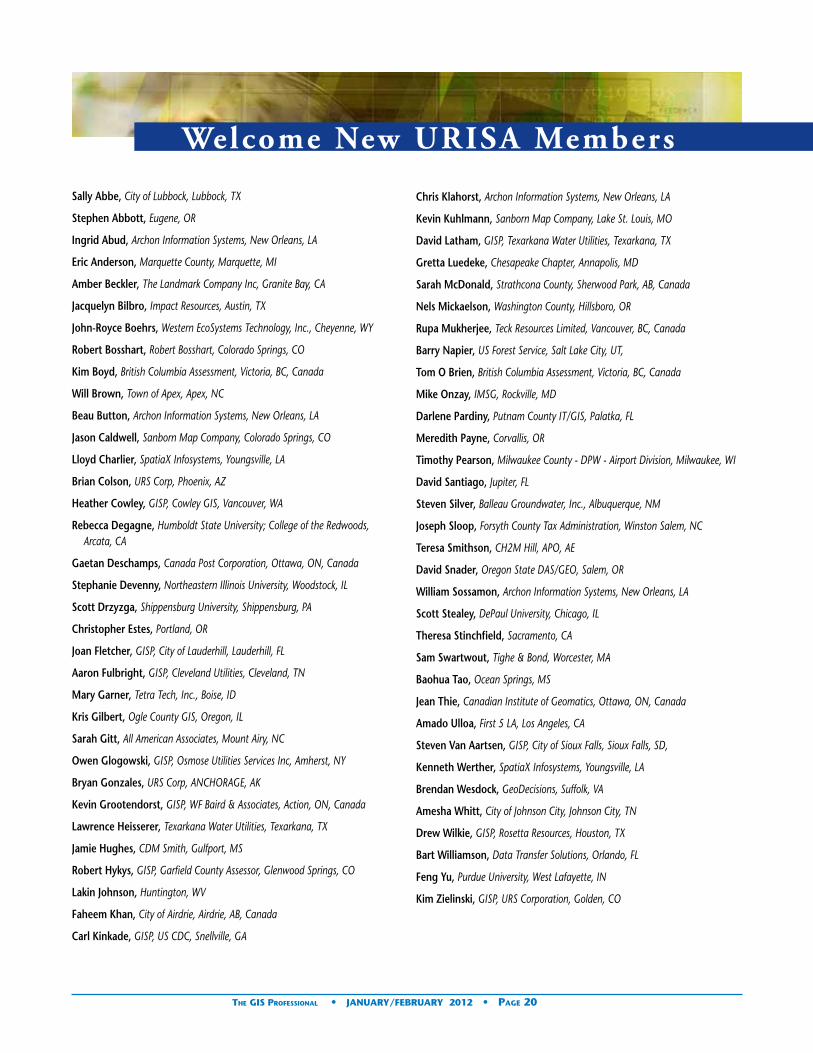
Welcome New URISA Members
Chris Klahorst, Archon Information Systems, New Orleans, LA
Kevin Kuhlmann, Sanborn Map Company, Lake St. Louis, MO
David Latham, GISP, Texarkana Water Utilities, Texarkana, TX
Gretta Luedeke, Chesapeake Chapter, Annapolis, MD
Sarah McDonald, Strathcona County, Sherwood Park, AB, Canada
Nels Mickaelson, Washington County, Hillsboro, OR
Rupa Mukherjee, Teck Resources Limited, Vancouver, BC, Canada
Barry Napier, US Forest Service, Salt Lake City, UT,
Tom O Brien, British Columbia Assessment, Victoria, BC, Canada
Mike Onzay, IMSG, Rockville, MD
Darlene Pardiny, Putnam County IT/GIS, Palatka, FL
Meredith Payne, Corvallis, OR
Timothy Pearson, Milwaukee County - DPW - Airport Division, Milwaukee, WI
David Santiago, Jupiter, FL
Steven Silver, Balleau Groundwater, Inc., Albuquerque, NM
Joseph Sloop, Forsyth County Tax Administration, Winston Salem, NC
Teresa Smithson, CH2M Hill, APO, AE
David Snader, Oregon State DAS/GEO, Salem, OR
William Sossamon, Archon Information Systems, New Orleans, LA
Scott Stealey, DePaul University, Chicago, IL
Theresa Stinchfield, Sacramento, CA
Sam Swartwout, Tighe & Bond, Worcester, MA
Baohua Tao, Ocean Springs, MS
Jean Thie, Canadian Institute of Geomatics, Ottawa, ON, Canada
Amado Ulloa, First 5 LA, Los Angeles, CA
Steven Van Aartsen, GISP, City of Sioux Falls, Sioux Falls, SD,
Kenneth Werther, SpatiaX Infosystems, Youngsville, LA
Brendan Wesdock, GeoDecisions, Suffolk, VA
Amesha Whitt, City of Johnson City, Johnson City, TN
Drew Wilkie, GISP, Rosetta Resources, Houston, TX
Bart Williamson, Data Transfer Solutions, Orlando, FL
Feng Yu, Purdue University, West Lafayette, IN
Kim Zielinski, GISP, URS Corporation, Golden, CO
Sally Abbe, City of Lubbock, Lubbock, TX
Stephen Abbott, Eugene, OR
Ingrid Abud, Archon Information Systems, New Orleans, LA
Eric Anderson, Marquette County, Marquette, MI
Amber Beckler, The Landmark Company Inc, Granite Bay, CA
Jacquelyn Bilbro, Impact Resources, Austin, TX
John-Royce Boehrs, Western EcoSystems Technology, Inc., Cheyenne, WY
Robert Bosshart, Robert Bosshart, Colorado Springs, CO
Kim Boyd, British Columbia Assessment, Victoria, BC, Canada
Will Brown, Town of Apex, Apex, NC
Beau Button, Archon Information Systems, New Orleans, LA
Jason Caldwell, Sanborn Map Company, Colorado Springs, CO
Lloyd Charlier, SpatiaX Infosystems, Youngsville, LA
Brian Colson, URS Corp, Phoenix, AZ
Heather Cowley, GISP, Cowley GIS, Vancouver, WA
Rebecca Degagne, Humboldt State University; College of the Redwoods, Arcata, CA
Gaetan Deschamps, Canada Post Corporation, Ottawa, ON, Canada
Stephanie Devenny, Northeastern Illinois University, Woodstock, IL
Scott Drzyzga, Shippensburg University, Shippensburg, PA
Christopher Estes, Portland, OR
Joan Fletcher, GISP, City of Lauderhill, Lauderhill, FL
Aaron Fulbright, GISP, Cleveland Utilities, Cleveland, TN
Mary Garner, Tetra Tech, Inc., Boise, ID
Kris Gilbert, Ogle County GIS, Oregon, IL
Sarah Gitt, All American Associates, Mount Airy, NC
Owen Glogowski, GISP, Osmose Utilities Services Inc, Amherst, NY
Bryan Gonzales, URS Corp, ANCHORAGE, AK
Kevin Grootendorst, GISP, WF Baird & Associates, Action, ON, Canada
Lawrence Heisserer, Texarkana Water Utilities, Texarkana, TX
Jamie Hughes, CDM Smith, Gulfport, MS
Robert Hykys, GISP, Garfield County Assessor, Glenwood Springs, CO
Lakin Johnson, Huntington, WV
Faheem Khan, City of Airdrie, Airdrie, AB, Canada
Carl Kinkade, GISP, US CDC, Snellville, GA
The GIS Professional • JaNUary/fEbrUary 2012 • Page 20

Welcome New Bronze URISA Sponsor
archon The New Orleans Exchange Centre 935 Gravier Street, Suite 1700 New Orleans, Louisiana 70112(504) 267-0065 [email protected] http://archoninfosys.comPrimary Contact: Ingrid AbudWe provide all levels of government and governmental agencies with comprehensive, progressive tax related and treasury management solutions.
Our company’s philosophy is to provide clients with the highest quality products, services, and counsel, on a timely and responsive basis, while upholding the highest ethical standards.
Technology is fast becoming the world’s equalizer in today’s society – in every aspect, from commerce and trade to free press and artistic expression. At Archon, we believe that the next logical step is for technology to take its place in government as the next milestone in American democracy. At any level, local, state or federal; technology employed in the right way can be an empowering tool for constituents and a vital means of communications for government leaders. That is why Archon is committed to providing clients with complete end-to-end solutions in technology, legal and collection services.
Our company’s philosophy is unique among competitors in that we believe in product-driven, flexible solutions, not disparate temporary ‘patches’ of technology to produce a one-time quick fix. Archon provides systems that are complex, yet versatile and adaptable to changing needs and can evolve with the clients that utilize them.
Let Archon bring your state, city or municipality to the forefront of the intersection of government and technology.
Welcome New Business Members
3564 Avalon Park Blvd E. Suite 1, #243 Orlando, FL 32828Phone: (407) [email protected] Martin Roche
Spatially Enabling Improved DecisionsGeoPlanning Services, LLC of Orlando, FL was founded in early 2009 is a full service provider of geospatial tools and analysis to support urban planning, logistics, real estate and economic development organizations.
We bring a unique multi-disciplinary approach to spatial problems with a focus on fusing data from multiple sources to provide the tools and information necessary to support improved decision making. A primary corporate focus is on data quality and integration with a particular emphasis on addressing systems as a critical unifying element in many data sets.
GeoPlanning Services has extensive experience with Strategic and Business Planning including facilitation of outreach efforts and the development of implementation and marketing plans. Our approach to strategic planning is based on consensus building, and understanding of specific user requirements, and maximizing return on investment.
The GIS Professional • JaNUary/fEbrUary 2012 • Page 21
PlaTINUM CorPoraTE SPoNSor: Esri
GolD CorPoraTE SPoNSor: CDM Smith
SIlvEr CorPoraTE SPoNSorS: DTS
Pictometry International
fEDEral aGENCy SPoNSor: U.S. Census Bureau
broNzE CorPoraTE SPoNSorS: Archon Information Systems
Manatron Merrick & Company
Milsoft Utility Solutions Inc. Sanborn
Valtus Imagery Services
bUSINESS MEMbErS: 24GIS
geographic Data Base Management Systems, Inc. GeoPlanning Services LLC
GeoTechVision Enterprises Ltd. GIS Innovations LTD.
GPC GIS H Davis Cole and Associates LLC
Highland Mapping Inc. Kessler GIS
North River Geographic Systems, Inc. Spatial Focus Inc.
SpatiaX Infosystems Wellar Consulting
continued on page 22

Kessler GIS20414 W Baker Rd. Cheney, WA 99004509-235-5500Contact Bruce Kessler, MS, GISP, CTT+, CTPVisit the Company Website
Bruce Kessler founded Kessler GIS in the spring of 2001. He emphasizes education, consulting and map production in ArcGIS, Workstation ArcInfo, and ArcView 3.x and uses his broad-based GIS experience starting in 1985 to help clients understand the basics and work through complex GIS pro-cedures. His business goals are:• Focus on client educational and consulting needs and
build client self-sufficiency for long-term solutions• Keep clients fully informed• Finish projects in a timely and cost-effective manner• Develop GIS curricula for innovative educational
solutions• Teach ESRI Authorized Training Program (ATP) classes
Mr. Kessler’s consulting projects concentrate on simple, easily implemented solutions for his clients. He can help with system and database upgrades, needs assessments, database design, data conversion and maintenance, application design, contract monitoring, and programming. Additionally, he enjoys creating and teaching how to create nice looking and efficient maps, repeatable GeoProcessing analyses, and well organized data management procedures. He has worked within all supported data models: coverage, shapefile, and GeoDatabases including SDE, file and personal.
Mr. Kessler teaches a variety of classes using materials he developed either meeting client’s specialized needs or meeting his own more generic education program curricula needs. Some of the clients requesting specialized classes include the USDA Forest Service, the Bureau of Land Management (BLM), Idaho Department of Water Resources, Idaho Department of Lands, Weyerhaeuser Corporation, HDR Inc., and Washington Closure Hanford. Mr. Kessler teaches his classes at colleges, universities, regional/national/international conferences, at client sites or by using his own mobile training lab. Through the ESRI Authorized Training Program (ATP), he teaches ArcGIS Desktop II & III (9.x).
Mr. Kessler also presents special seminars to diverse groups on GIS-related topics such as Managing a GIS, What is GIS?, Communicating What You Want in the GIS Techno World, etc. Many of the special topics are geared towards organized growth. He can adapt and present a variety of topics fitting client specific needs. These seminars have been presented to clients at their facilities or at conferences attended by thousands.
Correction
In the November/December 2011 issue of THE GIS PROFESSIONAL, a glaring omission was made in the listing of award recipients at GIS-Pro 2011 in Indianapolis.
Martha McCart Wells, GISP was the 2011 recipient of the Horwood Distinguished Service Award.
The Horwood Distinguished Service Award was introduced in 1975 and is named after founding member and first URISA President, Edgar Horwood. Horwood was an early pioneer in the field of information systems for local government and admired by all for his intellectual and organizational contributions to URISA. Horwood was the Chair of the constitutional drafting committee, giving URISA the “open membership” model that has led to our interdisciplinary organization.
The Horwood Distinguished Service Award is an occasional award given for long-term service to URISA and the profession. This award is URISA’s ultimate award for service and leadership to URISA and the geospatial industry. Martha joins a brief and distinguished list of individuals who have previously been honored with this recognition.
Over the last thirty years, Martha’s contributions to URISA International are almost too numerous to list. Highlights include URISA President, member of the Board of Directors, URISA Treasurer, chairperson of numerous conferences, chairperson and member of numerous committees, participant in numerous conferences, URISA Workshop developer and instructor, and charter member of the Alabama Chapter.
Martha is also the leader of the URISA Address Standards Working Group. The work that Martha and her fellow committee members performed over a five year period resulted in the FGDC endorsement of the United States Thoroughfare, Landmark, and Postal Address Standard in 2011.
Martha is also an experienced GIS Manager and founder of Spatial Focus, Inc. Her expertise in local government planning and zoning issues, organizational issues, budgeting, project management, real estate development, and addressing issues is well known to her customers and professional peers throughout the world.
Ultimately, Martha embodies the URISA spirit: generous with her experiences, a mentor to countless GIS professionals, and a leader in her field. Congratulations Martha!
Please accept our sincerest apologies for this omission, Martha.
New Members continued from page 21
Martha and Cy Smith, 2010-11 URISA President
The GIS Professional • JaNUary/fEbrUary 2012 • Page 22

Steve Jobs by Walter Isaa-csonReviewed by F. Peirce Eichel-berger
The Sunday before GIS-Pro 2011 in Indianapolis, I picked up a copy of Isaacson’s latest work. I thoroughly enjoyed his biography of Benjamin Franklin, An American Life. I always have to have a good book with me when I travel, especially with all of the waiting involved with flying. Having the opportunity to read is the only thing that makes flying at all worth-while.
I have been a Macintosh user pretty much from day one and thought I knew most of the Steve Jobs and Apple stories but I was in for a surprise after reading Steve Jobs. He was adopted; he had a full sister also adopted that he did not know about for many years. He never did get a college degree. He was a pretty heavy drug user (LSD), but was a devout vegetarian. One of his inspirations was a calligraphy class at Reed College (Portland, OR—
URISA’s 50th Anniversary conference site) after he dropped out. He hung around and “took” some classes that interested him. The class taught him about fonts and what looked good on a piece of paper. He was one of the first people to have their DNA completely sequenced (he could afford it) in hopes of a more sophisticated battle with his pancreatic cancer. He did have a liver transplant in Tennessee after his cancer started to spread. He has three daughters (one a love child) and a son. Many of the PIXAR stories I did not know, yet movies were just one industry that Jobs changed forever.
But what an interesting fellow. Everyone knows the stories about him and Steve Wozniack and the garage founding of Apple Computer. They also know about him bringing in John Sculley from Pepsi. The Macintosh really did commercialize so many things about today’s computers that we take for granted. Mice, multilayered windows, pixels, icons, objects, GUI’s, etc. Remember when Apple introduced the first digital camera (circa 1992) and the first successful, mass market laser printers? “Do you want to spend the rest of your life selling sugared water, or do you
want a chance to change the world?” The Jobs clincher after a four-month dance to bring Sculley to Apple. Everyone knows of Sculley’s subsequent push to rid Apple of Jobs (spring of 1985) and Apple’s rock bottom. The behind the scenes stories of the Apple Super Bowl ads and others is a great read. Everyone knows of Jobs’ idea for NEXT, no floppy disks but DVD’s to come, UNIX based OS. Jobs set foot on Apple’s Cupertino campus for the first time (December, 1996) since his ouster eleven years before. With Jobs return as iCEO almost everything he touched turned to gold. The colorful iMACs and the resurgence of incredibly designed products all designed without focus groups and market research.
Steve was largely responsible for the Apple retail stores, the latest just opened in Grand Central Terminal in New York City in early December. The Apple stores are the most successful retail stores in
terms of sales per square foot in retailing history. The stores also gross more in total receipts per store then any other retailer in history. Today there are some 325+ Apple stores around the world.
In 2001 the original iPod was introduced, iTunes shortly thereafter, music was never to be the same again. The stories about Bob Dylan, the music executives, Bono, Yo-Yo Ma (he played at Steve’s funeral) and the Beatles were great to read. In 2007 came the iPhone, in 2009 a new liver, the iPad in 2010, then the iPad2 and now the iCloud.
Steve Jobs died October 5, 2011.
He changed computers, movies and animation, the music business, retailing, mobile telephones and how we keep in touch on the go. He left the world’s most valuable company--Apple—who would have guessed?
A personal footnote here if I may. Steven Kinzy introduced the Macs (512 K) to HDR Systems in Omaha, NE in 1984. We traveled with them under the airplane seats; we used a weekender suitcase with Styrofoam padding to carry our dot matrix printer to client sites. We set up an AppleTalk network in every hotel room we visited and amazed our clients
Book Review
The GIS Professional • JaNUary/fEbrUary 2012 • Page 23
continued on page 25

Thinking About GIS: Geographic Information System Planning for Man-agers, 4th edBy Roger Tomlinson. ESRI Press: Redlands, California. 2011.Reviewed by: Dr. John G. Van Hoesen, Associate Professor of Geology, Green Mountain Col-lege, Poultney, VT
After 40+ years thinking about, working with, and managing geographic data and users of geospatial data, Roger Tomlinson has certainly earned the oft-used title “father of GIS.” The 4th edition of his semi-nal book about planning and implementing a GIS has evolved since the original publication in 2003, partic-ularly in the areas of recent advances in geospatial and network technologies, addi-tional appendices and new case studies. Tomlinson’s approach requires an initial investment of time and resources that he assures the reader will result in a better GIS that incorporates the immediate needs of the organization but provides room for future expansion and fosters a more sustain-able infrastructure.
Tomlinson presents his a nine-step formulaic approach for planning and developing a GIS in 11 chapters, six appendices and a new DVD containing exercises and templates to work through, and an eight-hour recording of a “Planning and Managing a GIS” seminar given by Dave Peters at the 2010 ESRI International User conference. Some of the chapter names have been revised since the original 2003 seminal version and include:• GIS: The whole picture• Overview of the
method• Consider the strategic
purpose• Build the foundation• Conduct a technology
seminar• Describe the
information products• Consider the data
design• Choose a logical
database model• Determine system
requirements• Consider benefit-cost,
migration, and risk analysis
• Plan the implementation
His narrative is easy to read with frequent sidebars of interest (Focus sections) and tips about supplemental resources available on the DVD or online. The book
is structured so that users can read a chapter, explore case studies, take quizzes to evaluate their understanding of the content and utilize templates and standardized forms before moving on to the next chapter.
Chapters 3-5 are relatively short but perhaps the most important since they really help identify the purpose, direction, and needs of an organization. Chapter 6 describes how to develop individualized standards, quality assurance and metadata guidelines for GIS products. These chapters are less about the hardware and technology, computing power, software, etc. and focus more on developing a cohesive vision for why an organization wants to utilize a GIS, how it will serve the mission and goals, develop buy-in from employees and gather input from potential users of the GIS.
Chapters 7-9 focus more on the GIS itself; the underlying database design, database model type, and the necessary hardware and network infrastructure necessary to support the types of analyses, queries and data products identified in the earlier planning stages. These three chapters are incredibly detailed and provide simple visuals and easy-to-understand examples
of how an organization or manager might approach these daunting tasks. The Rome case-study in Chapter 9 is particularly helpful and will leave few organizations wanting for a clearer explanation of how to develop a multi-year analysis of organizational system requirements.
Chapters 10-11 illustrate how to take the information collected through the previous 9 steps and develop a cost-benefit analysis of migration and potential risks to then solidify an implementation plan. The guidelines for developing this plan are also highly detailed with a laundry list of recommendations and suggestions for building out a comprehensive description and assessment of the entire planning process.
The updated appendices are helpful additions for managers working their way through the process and are titled:
• GIS staff, job descriptions, and training
• Benchmark testing• Network design
planning factors• Request for proposal
(RFP) outline• The preliminary design
document• Custom workflows
Book Review
The GIS Professional • JaNUary/fEbrUary 2012 • Page 24

with such speedy turn around of superb workflow graphics, screen layouts and database schemas. In Orlando we had 150 Macs and a like number of PC’s networked with a GIS sponsored fiber-optic network that connected City Hall with the all the Orange County Departments. The AppleTalk worked atop DECNet using the OSI model. I gave an early Mac to my daughter for college and like her first car she returned both to me in excellent condition, both still working.
Six years ago I hooked a Mac Mini, with a wireless keyboard and wireless mouse, to a 53” LG plasma 1080p HDTV using HDMI. The wireless peripherals allow me to work across the room with my feet up. An early digital hub. Today that Mini is hooked to a network with three other Macs, some PC’s and a Mac Mini server all still running strong. I am sure that Steve was thinking about the next revolution—TV.
The addition of more appendices, Focus sections, tips, new case studies, templates, and 8 hours of video provide a wealth of resources for organizations interested in building out a GIS. However, few changes were made to the core methodology – Tomlinson’s field-tested approach to planning and implementing a GIS. He updated and
re-wrote numerous chapters to include the latest technologies and current best practices in the field, but his primary message remains unchanged.
This is merely an aesthetic issue but a many of the figures and tables seem outdated; in a number of chapters there is an odd juxtaposition of well-designed, simple
We help you putGIS to work!
206-263-5220www.kingcounty.gov/gis/training
Professional GIS training in our Seattle facility or at your site.Professional GIS training in our Seattle facility or at your site.
GIS TRAININGEXPRESS ™
✔ URISA’s Pacific Northwest Education Center
✔ ESRI®-Authorized Classes
✔ Custom Classes Created and taught by working GIS professionals
✔ GIS Academy“Beyond the Basics”
✔ GIS Certification Institute Qualified Earn GISCI points
✔ Veterans’ GI Bill BenefitsSelected programs of study at the King County GIS Center are approved for those eligible to receive benefits under Title 38 and Title 10, USC.
tables with color heavy, blocky looking tables that are slightly pixilated. I also think the chapter on data design could have incorporated more in-depth discussions about open-source options, cloud-based tools (e.g. – Google Fusion Tables, CloudGIS, etc), and a better explanation of Neography and the benefits and challenges of managing volunteered geographic information for project managers and analysts.
Overall I think 4th edition and its updates will be a useful resource
and desk reference for managers and analysts alike. Tomlinson’s writing style, attention to detail and unique perspective and experience is something you won’t find in most books. However, other than new case-studies and the DVD, there isn’t anything dramatically unique about this edition. Since the core methodology hasn’t changed, it is likely that an older edition could serve an organization interested in planning and developing a GIS just as well.
The GIS Professional • JaNUary/fEbrUary 2012 • Page 25
Steve Jobs continued from page 23

URISA Volunteer Sat is fact ion SurveyBy Tom Conry, Fairfax County (and current URISA Secretary), [email protected]
Volunteers are individuals who choose to give freely of their time, energy, and talents to help other people, causes, or organizations, without expectation of compensation, financial or otherwise. The main reasons why people vol-unteer are to help others, to promote causes they believe in, network with others, and/or to accomplish what they consider to be worthwhile goals. Volunteers also benefit through learning new skills and resume building, which enhance their personal and professional growth.
In August and September 2011, the Board of Directors conducted a survey to gain insight into the satisfaction of the many URISA volunteers. The quality of our volunteers’ experience is crucial to URISA’s success and the Board wants to ensure that volunteers have a meaningful and rewarding experience. The importance is highlighted by having this activity on its Balanced Score Card (BSC) measures under the Develop volunteers and Staff perspective section. While Develop Volunteers and Staff remains a key BSC perspective, the survey wraps up this measure. The results will better inform future Board Actions and
several activities being planned will build on these findings.
Survey SummaryTo personify the 42 respon-dents to the survey as a sin-gle volunteer – we will call him Dan Sig* (two-thirds of the responders were male):
Dan is a chapter and URISA International (UI) member who strongly values face-to-face connection with other members, uses social media (mostly Facebook) daily – just not much with other URISA members. He puts in around 6 hours per month on URISA activities knowing that the work is important to URISA as well as the GIS profession, and drives more than 15 miles to URISA meetings to get the face-to-face time. Two thirds of his time is spent on UI activities and about a third on chapter work. During those interactions he strongly feels that others respect his contributions and share their experience, leading to a strong sense of community that goes beyond work to socializing. He agrees that meetings and communications are worthwhile but identified areas for improvement. Dan joined URISA in his thirties
and has been a member for about 10 years. (He watched a lot of MTV, still listens to U2’s “With or Without You”, enjoys Springsteen, particularly “Born in the USA” and may queue up “Time After Time” on GrooveShark). Involvement can be seen in his other activities over the
past five years: attending an annual conference and workshop, local chapter meetings and conference calls. And most importantly, Dan absolutely will take on another activity after the current one wraps up – perhaps in the hope to meet Pam one of these days.
*Dan is not related to Pam. However they both share the same country of origin – Mapland where Sig is as common a surname as Johansson in Sweden.
For the nuances and details of the responses – read on!
Survey ResultsThe survey was sent in early August 2011 to approxi-mately 200 known URISA
volunteers, 42 of whom re-sponded. The last response was entered September 13.
Most of those who responded were involved in URISA International committees (68.4%); 34.2% were involved in Chapter committees and 10.5% UI Board Members (multiple answers were allowed – 38
individuals answered the question and there were a total of 62 responses, so more than half (24) could be wearing multiple hats). On a later question, 31 of 42 respondents said they were members of a local chapter. Respondents represented 21 different local chapters. One of the respondents was not a UI member.
Respondent’s age ranges ran from 31-40 years, to past 70. The preponderance of ages fell in the 41-60 range: 12 of 42 (45.3%). Outside of that, 8 were in the 31-40 range, 7 in the 61-70 bracket, and 3 greater than 70. None were under 31 years in age… a crucial and missing
Most non-profit professional associations and societies were
founded and organized by volunteer leaders who sought to
create a forum for shared values and intellectual growth.
The GIS Professional • JaNUary/fEbrUary 2012 • Page 26

URISA Volunteer Sat is fact ion Survey
The GIS Professional • JaNUary/fEbrUary 2012 • Page 27
demographic.One surprise in the
survey was that two-thirds of the respondents were men. Across UI, the ratio of men to women is about: 3-to-2 (numbers for all of the chapters aren’t available).
The respondents are a dedicated group. Combined, the 42 respondents have over an estimated 600 years of membership (took midpoint years except only used 30 years). Nearly half (47%) have been members for six to twenty years. Volunteers have spent much of their professional lives furthering the profession and URISA.
While the survey didn’t ask at what age members joined UI, an estimate would be around 38 (median age is around 50, median membership length average is probably around 12 years). While that seems high, it still reinforces the missing younger demographic, and hints that it is nothing new. It may hint about when in a member’s career, URISA became an important organization.
These folks spend a lot of time on UI activities: 23 of 41 (56.1%) drive more than 15 miles to attend meetings (the question did
not distinguish one way vs. two way mileage – thus the total miles driven to a meeting could be over 30 miles). One participant spends over 30 hours per month on URISA activities, though the majority of the time contributed was between 3-10 hours per month (22 of 42 – 52.4%).
The driving force behind the involvement of these folks is connection. A free form response asking “What is the ONE thing that URISA does that is most important to you?”, was answered by 32 respondents. Twenty-one of those responses related to connection/networking/contacts. Other factors mentioned included education; advocacy/policy discussion; vendor neutrality; return (“loves me back” & “gives back”); professional growth; volunteer opportunities; and idea exchange. Some responders gave multiple reasons.
Connection also informs and provides insight into another interesting finding in two questions: over 75% of respondents use social media – usually on at least a daily basis, yet nearly all (92.7%) listed face-to-face interaction as
their the preferred mode of interaction with other URISA members, with 28 indicating it was their Most Preferred method. About 40% indicated that social media was their Least Preferred mode. Thus while most are using social media to connect, it is the face-to-face interaction with members that is most important. These results also track with another question which asked generally “How do you interact with other URISA members in your URISA activities?” Participants listed phone almost as high as email (38 vs. 39), followed by face-to-face (33). Social media interaction with other members was low (only 12 respondents). Thus while most members use social media (>75%), that is not their primary or preferred mode of interaction with URISA members. It is not clear to what extent these preferences correlate with the different age ranges of the respondents, but it hints at some (but by no means definitive) generational differences.
One question directly probed the quality of interactions with URISA members. The majority of responses were all in the Strongly Agree category – with the assertions about the interactions. It further reinforces the earlier findings about the importance of face-to-face interactions and provides some insight into the qualities of those interactions.
• Forty (97.6%) Agreed or Strongly Agreed that members are willing to share their knowledge and experience
• Thirty-eight (92.6%) believe URISA members respect their contribution to URISA.
• Forty (97.5%) enjoy interacting with fellow URISA members.
• Thirty-nine (95.1%) have a sense of community with other URISA members, while one disagreed.
• Thirty-seven (90%) enjoy socializing with other URISA members in addition to working with them.
Volunteers’ sense of relevance and the value of the work they do for URISA was also covered. There were no disagreements with four assertions, and all but the first one had the majority of responses in the Strongly Agree category. They feel the work not only helps URISA but the GIS profession overall. The work is personally rewarding.
The survey also delved into areas that could be improved, or at least be of great importance to our volunteers.
A free-form question asked “What is the one thing that URISA does not do (or does not provide) that would be of great importance to you? “ Seventeen respondents answered. Thirty-five percent (6/17) were training related (web, open-source, advanced), with half of those desiring
continued on page 28

GIS-Pro 2012 Free Registration Winners
We’ve had a few promotions related to GIS-Pro and membership recruitment lately. The lucky winners of complimentary GIS-Pro 2012 registrations are:• Survey Winner - Christopher Haak, AgIntegrated,
Inc., State College, PA
• Membership recruitment Winner – Keri Brennan, GISP, The Schneider Corporation, Indianapolis, IN
• GIS-Pro 2011 attendee who stayed at the JW Marriott Indianapolis Winner - Tony Thompson, Davis County Planning Department, Farmington, UT
web-based training. Organizational/structural issues accounted for 41.1 % of respondents desires (use more technology, better forum for chapters and individuals to connect, one membership for UI and chapters, clear roles and responsibilities for chapter board members across all chapters and international, transparency with elections and appointments). Another wanted URISA to take the lead on elevating GIS Management, while one wanted more work on policy issues. “Sex, drugs, rock ‘n roll, whirled peas” didn’t fit well into any category.
Another free-form question asked about the URISA volunteer experience. Thirteen entered thoughts. Seven (53.8%) noted their experience was good/rewarding. One suggested annual prioritization of activities to accomplish in a coordinated way at UI and chapters. Another thought that the local chapters are more beneficial and better run than UI yet it does little to support them. One response noted the professional quality of the volunteers (and UI staff) and that they should not berate themselves when a deadline is missed. One bemoaned that their employer saw little value in URISA involvement.
Participants were asked to “Please rate the structure/organization of URISA activities in which you participate“ across eight line items. This question elicited the largest range
of responses. All seven categories from Strongly Agree to Strongly Disagree were selected – and show areas for improvement in operation and communication between the UI Board and chapters. • Eighty-six percent
(16/42) thought meetings and conference calls were well structured. This is the only one with no disagreement.
• Only 61% thought there is clear communication with the committee chair or URISA Board; two disagreed and 10 were neutral.
• Six responses (14.3%) disagreed that agendas and meeting minutes are consistently provided; five were neutral and twenty nine (69%) agreed or strongly agreed.
• Thirty-three (78.6%) noted meetings and calls start and end promptly, while five were neutral and one disagreed.
• Three (7.1%) disagreed that they have a clear understanding of their work tasks/role; thirty-one (73.8%) agreed or strongly agreed; eight were neutral
• Seven (16.7%) disagreed that their committee receives worthwhile feedback from the local chapter or URISA Board; eleven were neutral and 24 (57.1%) agreed or strongly agreed.
• Five (11.9%) thought they didn’t have a
clear understanding of how their work relates to URISA’s goals and objective; twenty-six (61.9%) agreed or strongly agreed; eleven were neutral.
• The last item had the majority of check offs in disagree (“we meet too frequently”; seventy-one percent agreed or strongly disagreed).
Over half of the respondents did not belong to any of the organizations listed in in the survey. Of those that did, GITA was the predominant organization, with 6 responses.
The vitality, commitment and volunteer experience clearly came through in the question asking if the responder would volunteer again: 38/42 (90.5%) would volunteer for another URISA activity after this one finishes!!
Based on these results, we would like to get further feedback from readers about insights the results provide as well as any ideas for action. For instance, in view of the demographics and URISA’s historic ties to education, would starting student chapters at community colleges, colleges and universities help URISA’s age profile? Do you think something like that would work? How can we achieve parity in the number of men and women members? What educational/training opportunities would you like to see URISA offer?
We will set up a discussion (Volunteer Satisfaction Survey) on URISA’s LinkedIn page to enable readers to comment and respond. If you want to extend the discussion, add your insight, raise questions, or share ideas - join our LinkedIn discussion.
Volunteer Survey continued from page 28
The GIS Professional • JaNUary/fEbrUary 2012 • Page 28

2012 Sponsor Directory
Platinum CorporateSponsor
Esri
380 New York St, Redlands, CA 92373 Phone: (909) 793-2853 [email protected]
Since 1969, Esri® has been helping or-ganizations map and model our world. Esri’s GIS software tools and meth-odologies enable them to effectively analyze and manage their geographic information and make better decisions. They are supported by our experienced and knowledgeable staff and extensive network of business partners and international distributors.
A full-service GIS company, Esri sup-ports the implementation of GIS tech-nology on the desktop, servers, online services, and mobile devices. These GIS solutions are flexible, customizable, and easy to use.
Esri software is used by hundreds of thousands of organizations who apply GIS to solve problems and make our world a better place to live. We pay close attention to our users to ensure they have the best tools possible to accomplish their missions. A com-prehensive suite of training options offered worldwide helps our users fully leverage their GIS. Esri is a socially conscious business, actively supporting organizations involved in education, conservation, sustainable develop-ment, and humanitarian affairs.
Gold Corporate Sponsor
CDM Smith
50 Hampshire Street, One Cambridge Place Cambridge, MA 02139 Phone: (617) 452-6000 [email protected]
What began in February 2011 with joining of two industry forces has cul-minated in a fully integrated provider of comprehensive water, environment, transportation, energy and facilities services united under the new brand CDM Smith.
One promise: doing what is right for our clients and communities
One partner: providing integrat-ed water, environment, transportation, energy and facilities solutions
One passion: creating a better future, together
At CDM Smith, we are committed to building strong and lasting relation-ships with our clients and each other. Together, we are solving the world’s water, environment, transportation, energy and facilities challenges with smart, integrated solutions. As your trusted partner, we are shaping tomor-row while delivering the services you need today. Proving every day—in every way—we’re better together.
Silver Corporate Sponsors
Data Transfer Solutions
3680 Avalon Park Blvd East, Suite 200, Orlando, FL 32828 Phone: (407) 382-5222 [email protected]
Headquartered in Orlando, DTS is a leader in asset management, geo-graphic information systems, and transportation planning. We specialize in creating solutions to help clients automate their worlds, reduce their workload and organize their data through customized technology.
DTS is comprised of seven divisions, each with its own scope of services. Often however, a single project spans several divisions before completion because we uniquely offer all the necessary cutting-edge services, inte-grated within one company.
Pictometry International
100 Town Centre Dr, Suite A, Rochester, NY 14623 Phone: (585) 739-1854 [email protected]
Pictometry International Corp. is a leading provider of geo-referenced, aerial image libraries and related soft-ware. Pictometry has captured nearly 130 million digital aerial images which represent more than 80 percent of the United States population and all major U.S. markets.
Using its proprietary imaging process, Pictometry captures geo-referenced, high-resolution orthogonal (straight down view) and oblique (captured at an angle) imagery within which structures and land features can be measured. Pictometry customizes and markets these technologies for govern-ment and commercial applications. Pictometry’s standard oblique imagery includes second order visualization tools that do not produce authoritative or definitive information (surveying).
Bronze Corporate Sponsors
Archon Information Systems
935 Gravier Street, Suite 1700, New Orleans, LA 70112 Phone: (504) 267-0065 [email protected]
We provide all levels of government and governmental agencies with com-prehensive, progressive tax related and treasury management solutions. Let Archon bring your state, city or munici-pality to the forefront of the intersec-tion of government and technology.
The GIS Professional • JaNUary/fEbrUary 2012 • Page 29
continued on page 30

Manatron Inc.
510 East Milham Ave., Portage, MI 49002 Phone: (800) 666-5300 [email protected]
Manatron, a Thomson Reuters busi-ness, is a global leader in providing integrated property tax and land ad-ministration software for governments worldwide. With unparalleled experi-ence and history in property recording, land registry, GIS tax assessment, billing and collection,
Manatron has been at the forefront of innovative product and service development since 1969. Manatron currently provides 1600+ customers with the power to manage over 45 mil-lion parcels.
Property Assessment Land Records Cadastral Mapping Tax Billing and Collection eGovernment
Merrick & Company
2450 South Peoria Street, Aurora, CO 80014 Phone: (303) 751-0741 [email protected]
Merrick & Company provides com-prehensive, client-focused land information services, including image acquisition (aerial and satellite), GPS Surveying, digital photogrammetry, Light Detection and Ranging (LIDAR), digital imaging, digital orthophotog-raphy processing, LiDAR software tools (MARS®), GIS database design and application programming. Merrick’s primary markets include city/county, federal government, electric utilities, engineering design firms and pipeline operators.
Milsoft Utility Solutions Inc
4400 Buffalo Gap Rd Ste 5150, Abilene, TX 79606 Phone: (800) 344-5647 [email protected]
Get the most out of your GIS by fully integrating the best electrical grid analysis into your Esri GIS environment.
Sanborn
1935 Jamboree Drive, Suite 100, Colo-rado Springs, CO 80920 Phone: (719) 593-0093 Toll-Free: 1.866.SANBORN (1.866.726-2676) [email protected]
With a rich tradition of mapping dating back to 1866, Sanborn is a compre-hensive geospatial solutions company. Sanborn provides geographic and location-based information from data capture through design and develop-ment of custom applications including; systems integration, spatial analysis, and modeling.
Valtus Imagery Services
212, 5438-11th St NE, Calgary, AB T2E 7E9 Canada Phone: (403) 295-0694 Toll Free: (800) 661-6782 [email protected]
Valtus Imagery Services provides best in class solutions for the storage, man-agement and delivery of geospatial information in the form of ortho-imagery and elevation data through web delivery systems.
Business Sponsors
24 GIS
Office in Kielce: Ul. w. St. Leonarda 1/6, 25-311 Kielce Poland TEL: (41) 307-38-07 Office in Warsaw: Ul. Kępna 2B/9, 03-730 Warszawa Poland TEL: (22) 662-11-17
E-MAIL: [email protected] or [email protected] The company’s mission is to provide reliable 24GIS services related to con-sulting, analytics and data acquisition in the creation and use of spatial infor-mation systems for public institutions, business and academics.
geographic Data Base Management Systems, Inc.
41 E. 4th Avenue, Collegeville, PA 19426-2341 (610) 489-0353 [email protected]
gDBMS Services include: Technical reviews and ongoing evalua-tions of existing GIS programs. Making sure GIS is all that it can be in your jurisdiction.
GeoPlanning Services, LLC
3564 Avalon Park Blvd E., Suite 1, #243, Orlando, FL 32828 Phone: (407) 608-4186 [email protected]
GeoPlanning Services, LLC of Orlando, FL was founded in early 2009 is a full service provider of geospatial tools and analysis to support urban planning, logistics, real estate and economic development organizations.
GeoTechVision Enterprises Limited
Unit #8A Seymour Park, 2 Seymour Park Avenue Kingston 6, Jamaica, W.I. Phone: (876) 620-4513 [email protected]
Based in Jamaica, GeoTechVision En-terprises Limited is a team of qualified professionals who specialize in innova-tive spatial technology and provide clients with high-end geospatial prod-ucts and services, practical advice and solutions. GeoTechVision Enterprise specializes in, among other services, GIS Consultancy, GIS Training, Personal and Vehicle Tracking and Mapping Solutions.
GIS Innovations Ltd.
8108 Elliott St, Vancouver, BC, V5S 2P2 Canada Phone: (604) 261-1017 Toll Free 1-888-262-1017 [email protected]
GIS Innovations Ltd. was incorporated in July of 1993 with a mission state-ment: to help customers succeed with GIS technology. GIS Innovations has wealth of skill and expertise at inte-grating and validating GIS data, espe-cially address and street related data. GIS Innovations also works with a col-lection of local consultants in projects related to land and/or environmental planning studies.
2012 Sponsor Directory (continued)
The GIS Professional • JaNUary/fEbrUary 2012 • Page 30

For information about URISA Sponsorship, please visit: http://www.urisa.org/sponsorship or contact Wendy Nelson at URISA Headquarters.
GPC Global Information Solutions LLC
P O Box 129060, Abu Dhabi, United Arab Emirates Tel: + 971 2 666 6574 [email protected]
Based in Abu Dhabi, UAE, GPC Global Information Solutions LLC (GPC-GIS), was launched in 2008 by the Geo-graphic Planning Collaborative, Inc. (GPC) to specialize in the delivery of geospatial information services to the MENA Region. By harnessing more than 25 years experience of GPC partners, we provide consulting services in Geospatial Information Technology and Services (GITS), Spatial Data Infrastructure (SDI), Geospatial Education, Location Based Services and Information Management for a wide variety of organizations and projects in the region.
H Davis Cole and Associates LLC
2321 North Hullen Street, Suite B, Me-tairie, LA 70001 Phone: (504) 836-2020 [email protected]
H. Davis Cole & Associates, LLC (HDCA) was founded in 2006 on the principle of providing exceptional client service through performance, quality and teamwork. HDCA is a full-service civil and environmental engineering consulting firm providing a wide array of services to both public and private sector clients. In addition, HDCA of-fers project and community planning through the gulf coast region.
Through project and community plan-ning, HDCA provides GIS consulting services including data collection, data conversion, mapping, spatial analysis, cartographic development, and photo-grammetric services.
Highland Mapping Inc.
PO Box 2124, Banner Elk, NC 28604 Phone: (828) 898-7720 [email protected]
Highland Mapping, Inc., is a GIS con-sulting firm primarily serving county and municipal governments through-out North Carolina and surrounding states. We specialize in working with land records and tax assessor offices. Our core competencies include data conversion, geodatabase design and development, custom applications, and enterprise GIS. As an ESRI autho-rized business partner and reseller, Highland Mapping works with the world’s premier GIS technology com-pany to offer a plethora of software and consulting solutions.
Kessler GIS
20414 W Baker Rd., Cheney, WA 99004 509-235-5500 [email protected]
Bruce Kessler founded Kessler GIS in the spring of 2001. He emphasizes edu-cation, consulting and map production in ArcGIS, Workstation ArcInfo, and ArcView 3.x and uses his broad-based GIS experience starting in 1985 to help clients understand the basics and work through complex GIS procedures.
North River Geographic Systems, Inc.
215 Jarnigan Ave, Chattanooga, TN 37405 Phone: (423) 653-3611 [email protected]
North River Geographic Systems, Inc. is a Geographic Information Systems and Services Company located in southeast Tennessee. Although in business for just over two years, we bring over 15 years experience in the GIS/Mapping industry. NRGS has provided an array of services such as GIS consulting, spatial analysis, and cartography to an array of public and private organizations. Be-ing a small company and Esri business partner gives us the ability to keep costs low and solutions innovative. Please give us a call/email if you have any questions.
Spatial Focus, Inc.
6813 40th Ave, University Park, MD 20782 Phone: (301) 277-6212 [email protected]
Spatial Focus, Inc. is an independent consulting firm, specializing in plan-ning, design, implementation and technical services in the field of geo-graphic information systems.
Spatial Focus, Inc. was formed to offer a new standard for vendor-indepen-dent technical and consulting services in geographic information of all kinds. Organized in 1998, Spatial Focus, Inc. specializes in integrating geographic information throughout public and private enterprises, giving them spatial focus.
Wellar Consulting
Ottawa, ON Canada Phone: (613) 728-3483 [email protected]
Wellar Consulting services include design and evaluation of education and training courses and currricula for GISystems and GIScience programs; advice and workshops on the develop-ment of quantitative measures to assess information system and trans-portation system performance; critical reviews of IS and GIS RFPs; seminars on the safety and security aspects of interdependent infrastructures; pro-fessional opinion on land use planning and zoning issues; and, expert opinion on liability for safety-related incidents involving pedestrians, cyclists, and motor vehicle operators.
Federal Agency Sponsor
U.S. Census Bureau 4600 Silver Hill Road, Washington, DC 20233
The Census Bureau serves as the lead-ing source of quality data about the nation’s people and economy. We honor privacy, protect confidentiality, share our expertise globally, and con-duct our work openly. We are guided on this mission by our strong and capable workforce, our readiness to innovate, and our abiding commitment to our customers.
Thank you to all of URISA’s sponsors
The GIS Professional • JaNUary/fEbrUary 2012 • Page 31

Mark Your Calendar!
March 12-15, 2012GIS/CAMA Technologies ConferenceSan Antonio, Texas
april 11-13, 20122012 CalGIS ConferenceSacramento, California
august 6-9, 2012 URISA/NENA Addressing ConferenceMemphis, Tennessee
october 1-4, 2012GIS-Pro 2012: URISA’s 50th Annual Conference for GIS ProfessionalsPortland, Oregon
November 12-16, 2012URISA’s Caribbean GIS ConferenceMontego Bay, Jamaica
PRESIDENTGreg Babinski, GISP – King County GIS [email protected]
PRESIDENT-ELECTAl Butler, GISP, AICP – City of Ocoee (FL)[email protected]
IMMEDIATE PAST-PRESIDENTCy Smith, GISP – State of [email protected]
SECRETARYTom Conry – Fairfax County (VA)[email protected]
TREASURERCarl Anderson, GISP – Spatial Focus, Inc. (FL)[email protected]
Tripp Corbin, GISP – eGIS Associates (GA)[email protected]
David DiBiase, GISP – Esri (CA)[email protected]
Twyla McDermott, GISP – City of Charlotte (NC)[email protected]
Cindy Post – University of Alberta [email protected]
Nancy Obermeyer, GISP – Indiana State [email protected]
Christopher Thomas – Esri (CA)[email protected]
Teresa Townsend – Planning Communities LLC (NC)[email protected]
THE GIS PROFESSIONALA publication of URISA – The Association for GIS Professionals.URISA is a non-profit professional and educational association that promotes the effective and ethical use of spatial information and information technologies for the understanding and management of urban and regional systems. It is a multidisciplinary association where professionals from all parts of the spatial data community can come together and share concerns and ideas.
URISA Headquarters701 Lee Street, Suite 680Des Plaines, IL 60016Phone (847) 824-6300Fax (847) 824-6363 [email protected]
SubmissionsManaging Editor – Wendy Nelson, Executive Director, [email protected] Editor – Comfort Manyame, GISP, [email protected] Editor – Keri Shearer, GISP, [email protected]
RFP Distribution
URISA members, remember that URISA will distribute your RFP/RFQ announcements to our corporate and business members at no charge. Simply email your announcement to [email protected] (Subject: RFP Service) and we’ll send it right out for you!