The Future is Now - riversedgewest.org · Bring your coupon (located in your registration name...
46
The Future is Now: FORWARD-THINKING RESTORATION, PLANNING, AND ADAPTATION Photo by Tom Till Photography, Inc. LEARN CONNECT BE INSPIRED 15th ANNUAL TAMARISK COALITION CONFERENCE FEBRUARY 7-9, 2017 FORT COLLINS, CO
Transcript of The Future is Now - riversedgewest.org · Bring your coupon (located in your registration name...

T h e F u t u r e i s N o w :FORWARD-THINKING RESTORATION, PLANNING, AND ADAPTATION
Photo by Tom Till Photography, Inc.
LEARN
CONNECT
BE INSPIRED
15th ANNUAL
TAMARISK COALITION CONFERENCE
FEBRUARY 7-9, 2017 FORT COLLINS, CO

TAMARISK COAL I T ION │ 2017 ANNUAL C O NFE R E NC E
F O R W AR D - T H I N K I N G R E S T O R A T I O N , P L AN N I N G , AN D A D A P T A T I O N
TABLE OF CONTENTS
Overview……………..…………….……………….….………….…….……………Page 1-2 Featured Events…………………….……………….…..……..……………..……..Page 3 Field Trip Descriptions…………………….….….………….……..……..…...Page 4-5 Full Agenda…………………………………………....………….….…….....…..Page 6-11February 7th Abstracts & Speaker Information….…..……........Page 12-22February 8th Abstracts & Speaker Information……….….…......Page 23-37Poster Session Abstracts…………….…….………….……..…..……..…Page 38-42 Sponsor Logos………………………………………………………….….…...Back Cover
Light breakfast & lunch
Registration area, Dropbox computers
AM and PM plenary
sessions and breakout room
Breakout room
e are thrilled to have you join us at our 15th Annual Conference and participate in the growing
movement to restore rivers! Over the next two and a half days, we hope you become even more empowered to succeed with your river restoration activities, share with and learn from your peers, and help increase dialog among those involved in riparian research and land management.
Map of the Hil ton’s Conference Center
W
Snacks during morning &
afternoon breaks, posters,
exhibitors, happy hour on Feb 7th
ATRIUM
SALON III, IV, VI SALON I, II, V
LEGENDS
ROOM

2017 TAMARISK COALITION CONFERENCE
P a g e | 1
FORT COLLINS, COLORADO – FEBRUARY 7-9, 2017
15TH Annual Tamarisk Coalition Conference
THE FUTURE IS NOW:
FORWARD-THINKING RESTORATION, PLANNING, AND ADAPTATION
OVERVIEW
REGISTRATION The Registration Table, which is located in front of the Salons in the Hilton, will open at 8:00 am before the start of the day’s sessions on February 7th and open at 7:30 am on February 8th. Check the Registration Table for updated information regarding presentations, workshops, field trips, lost and found, etc.
PARKING The $5 parking fee at the Hilton has been waived for conference attendees.
SPEAKER PRESENTATIONS Presenters will be speaking from 9:00 am – 5:00 pm on Tuesday, February 7th and from 8:30 am – 4:50 pm on Wednesday, February 8th in the conference rooms at the Hilton. Abstracts are included in this program.
VENDORS IN THE ATRIUM Be sure to visit our exhibitors in the Atrium from 8:00 am – 5:00 pm both days!
POSTER AND EXHIBITOR SET-UP Posters will be displayed in the Atrium during both days of the conference. Poster presenters may set up on Tuesday, February 7th between 8:00 am – 3:00 pm. Posters may be left up to display until 5:00 pm on Wednesday, February 8th.
PRESENTATION DROP-OFF
Presentations will be uploaded via the designated Dropbox computers located at the Registration Table.
NOTE TO PRESENTERS: Presentations must be uploaded no later than one full session prior to the session that contains your presentation.
FOOD AND DRINKS A light breakfast and a full lunch will be served on February 7th and 8th in Salon III, IV, VI. Morning and afternoon snacks will be provided in the Atrium on February 7th and 8th. See below for more details:
Tuesday, February 7th Light breakfast, morning/afternoon snacks, and buffet lunch will be provided. Hors d'oeuvres will also be served at the Poster

FORWARD-THINKING RESTORATION, PLANNING, AND ADAPTATION
P a g e | 2
Session/Happy Hour along with one complimentary beer from 5:00 pm – 7:15 pm in the Atrium. A cash/credit bar will also be available.
Wednesday, February 8th Light breakfast, morning/afternoon snacks, buffet lunch provided.
Thursday, February 9th Meals are not provided for the half day field trips. Light snacks (e.g. granola bars, apples) will be provided for those participating in the Campbell Valley restoration site visit.
WIRELESS INTERNET Access to Wireless Internet is available in the Hilton. You will need a passcode, which will be provided at the Registration Table.
CONTINUING EDUCATION UNITS (CEUs) Continuing Education Units are available for the following categories listed below. PLEASE NOTE:
Attendance at specific sessions is required for credit. For more information on required sessions and to complete the required certification forms, please visit the Registration Desk.
Colorado qualified supervisors, certified operators, and private applicators are eligible to receivethree CEUs from the Colorado Department of Agriculture. One credit may be received fromattending any one of the following sessions:
1. Wild Weeds of the West (Day One, 1:45-3:00)2. Beetle-Mania (Day Two, 10:40-12:20)3. Move Over Tamarisk, Make Some Room for Russian Olive (Day Two, 1:20-3:00)
NAME BADGES Please wear your name badge when you are on site as an introduction to new colleagues, a reminder for those you have met before, and as your ticket to the field trip for which you have registered. Please return your name badge to the Registration Table after the conclusion of the conference.
PROCEEDINGS Unless otherwise noted by the presenter, all presentations and posters will be posted on our YouTube page (www.youtube.com/user/TamariskCoalition) and on our website (www.tamariskcoalition.org) in the months following the conference.
EVALUATION Help us make next year even better! We encourage you to fill out a survey regarding your conference experience. Please take a few minutes to respond; your feedback will provide critical input as we plan future events that serve your needs as river restoration professionals. You can also fill out an evaluation online at: www.surveymonkey.com/r/TC2017Conference.

2017 TAMARISK COALITION CONFERENCE
P a g e | 3
FEATURED EVENTS
MONDAY, FEBRUARY 6TH
PRE-CONFERENCE CHECK-IN Join us in the Atrium from 5:30 pm - 7:30 pm to check-in, pick up conference materials, and make some
new connections! NOTE TO PRESENTERS : We will have computers available so you can upload your presentation to Dropbox with us ahead of time.
TUESDAY, FEBRUARY 7TH
SILENT ART AUCTION Stop by the silent art auction featuring one-of-a-kind pieces made from invasive plants and art inspired by rivers that you can bid on and take home. All proceeds generated from the auction are in honor of Rita Beard and will be donated to support the Tamarisk Coalition. The auction will close at 3:25 pm on February 8th.
POSTER SESSION & HAPPY HOUR - Sponsored by Chevron This is a great opportunity to meet new people and catch up with old friends! The evening’s reception on February 7th, from 5:00 pm – 7:15 pm, will include hors d'oeuvres, a free beer, and the opportunity to interact with poster presenters as well as vendors. Abstracts for poster presentations are included in this program. Bring your coupon (located in your registration name badge) for a complimentary beer. A cash/credit bar is also available. Thanks to Many Rivers Brewing Company and Avery Brewing Company for donating the beer.
WEDNESDAY, FEBRUARY 8TH
FIRST PRESIDENT’S AWARD CEREMONY Join us at lunch on February 8th for our First President's Award Ceremony! The First President's Award is given in memory of Pete Larson, Tamarisk Coalition’s first board president, to honor his dedication to restoring natural resources through education, science, and volunteerism. The winner of this award will receive a $500 cash prize to be applied to their restoration efforts.
PLEASE NOTE : Nomination forms are available at the Registration Table and are due by the afternoon break (3:15 pm - 3:40 pm) on February 7th. The individual or organizational representative you nominate must be present at the conference to be qualified for the award.
SOCIAL HOUR AT THE BLACK BOTTLE BREWERY Wind down from two full conference days at the Black Bottle Brewery, located within walking distance of the conference at 116 College Ave. They have a full food menu and 40 beers on tap; you are on your own for meals and drinks.

FORWARD-THINKING RESTORATION, PLANNING, AND ADAPTATION
P a g e | 4
THURSDAY, FEBRUARY 9TH - FIELD TRIPS
COLORADO STATE FOREST SERVICE NURSERY TOUR:
9:00 am ~ 12:00 pm
Cost: Free
Transportation is not provided; attendees will need to meet at 3843 W Laporte Ave, Bldg. 1060,Fort Collins, CO 80521 at 9:00 am. The nursery is approximately 10 minutes by car from theHilton.
The Colorado State Forest Service Nursery (CSFS Nursery) tour will provide information about the exclusive production of riparian species in deepots, ecotypic riparian seed and cutting production, and native seed collection and stratification.
Attendees will be able to experience first-hand the forefront of Colorado’s native, riparian restoration production at the CSFS Nursery. This will include both walking indoors and outdoors to visit the tree processing facility, shop/storage and greenhouse space (all indoors, but can be chilly at times), and the shade houses (outdoors).
The CSFS Nursery has had the opportunity to work with many local and regional restoration agencies, such as the Tamarisk Coalition, Wildlands Restoration Volunteers, and Powell Restoration, and has provided plant material for the Lower Fish Creek Restoration project occurring along the Big Thompson. Through their partnerships with seed collection agencies, they have been able to grow out several different deciduous species specifically for riparian restoration.
CAMPBELL VALLEY RESTORATION SITE: Novel Approaches to Erosion Control and Native Plant Reestabl ishment in one of Northern Colorado’s Most Catastrophically Degraded Watersheds
8:45 am – 12:00 pm
Cost: $10, transportation and light snacks will be provided
Shuttles will depart from the lobby of the Hilton at 8:45 am. Attendees will arrive at theCampbell Valley site around 9:30 am and depart at 11:20 am, arriving back to the hotel around12:00 pm.
In the late 1800s 4.8 million cubic yards of soil and an entire riparian ecosystem were washed out of the Campbell Valley by an intentional breach in a newly constructed irrigation canal. Over 100 years later, decades of overgrazing, piles of old tires and ever increasing canal leakage continued to hinder the recovery of this tragically beautiful landscape. Wilderness Restoration Volunteers and its partners have been restoring this seemingly hopeless watershed on a shoestring budget with donated materials and volunteer labor. After 6 years and many lessons learned, using a variety of innovative and low impact treatments, the signs of tenuous recovery are beginning to show. Project managers from the Natural Resources Conservation Service, Colorado Parks and Wildlife (CPW), and US Fish & Wildlife Service will provide an overview of the site and discuss how current restoration plans will help CPW better achieve its goal of providing superior wildlife habitat.

2017 TAMARISK COALITION CONFERENCE
P a g e | 5
FUNDRAISING WORKSHOP: Finding ‘Em and Keeping ‘Em: Building Your Organization’s Donor Support
8:00 am – 11:00 am, at the Hilton in Salon I
Cost: Free
Transportation and snacks are not provided
This Tamarisk Coalition and Cross-Watershed Network-led fundraising training will outline practical methods and tools for implementing the five steps of the Resource Development Cycle (planning, donor identification, cultivation, asking, thanking, and donor involvement). This will be an interactive session that draws on the fundraising successes of the workshop attendees and provides opportunities for participants to identify concrete actions to be taken to help grow their own private fundraising programs.

5:30-7:30 pm
8:00-9:00 am
Time
9:20-9:45
9:45-10:10
10:10-10:35
10:35-11:00
11:00-11:25
11:25-11:50Matthew McEttrick, Northern Arizona University
11:50-12:15Bruce Orr, Stillwater Sciences
12:15-12:40
Andrew Rayburn, Jefferson County Open Space Division
Clint Evans, State Conservationist, USDA Natural Resources Conservation Service
Keynote Presentation
Adapting to Change - Salon I, II, V
Anna Schrenk, Friends of Verde River Greenway & Russ Dickerson, AZ Conservation Corps
Watershed Health and the Colorado Water Plan
Environmental Water Transactions to Support Riparian Restoration
Multi-species Assisted Migration to Increase Growth Rate In Transplanted Communities
Adapting to Change and Restoring Resilient Riparian Ecosystems in the Southwest
Invasive Species Mapping and Prioritization to Support Climate-smart Management, Restoration, and Long-Term Recovery of Biological Resources on Lower Cache Creek
FORWARD-THINKING RESTORATION, PLANNING, AND ADAPTATIONP a g e | 6
Developing Restoration Scenarios and Outcomes to Inform Binational Water Policy in the Colorado River Delta
Engaging Coloradans in Caring Through Active Stewardship
Mike Wight, Conservation Legacy
Ancestral Lands Conservation Corps; Partnerships, Restoration, and Opportunity on Sovereign Lands
TAMARISK COALITION’S 15th ANNUAL
AGENDA
MONDAY, FEBRUARY 6, 2017
TUESDAY, FEBRUARY 7, 2017
Water Planning Innovations - Salon I, II, V
Concurrent Session
BREAK - 25 minutes - Atrium - Supported by Colorado State Forest Service
9:00-9:20 Opening Remarks from Tamarisk Coalition
Presentation TitleSpeaker
Registration (Atrium) and Light Breakfast (Salon III, IV, VI)
Optional Social Hour and Pre-Conference Check-In, Atrium of the Hilton
The Future is Now: Forward-Thinking Restoration, Planning, and Adaptation
Check-in, pick up conference materials, and say hello! A note to our presenters: We will have computers available to upload your presentation with us ahead of time.
Chris Sturm, Colorado Water Conservation Board
Plenary Session
Welcome - Salon I, II, V
Stacy Beaugh, Executive Director
Karen Schlatter, Sonoran Institute
Research and Management Conference
February 7-9, 2017 - The Hilton in Fort Collins, CO
Partnerships in Action: Verde Watershed Restoration Coalition and Arizona Conservation Corps
Season Martin and Aaron Citron, The Nature Conservancy
We're All in it Together! - Legends Room
Anna Zawisza, Volunteers for Outdoor Colorado
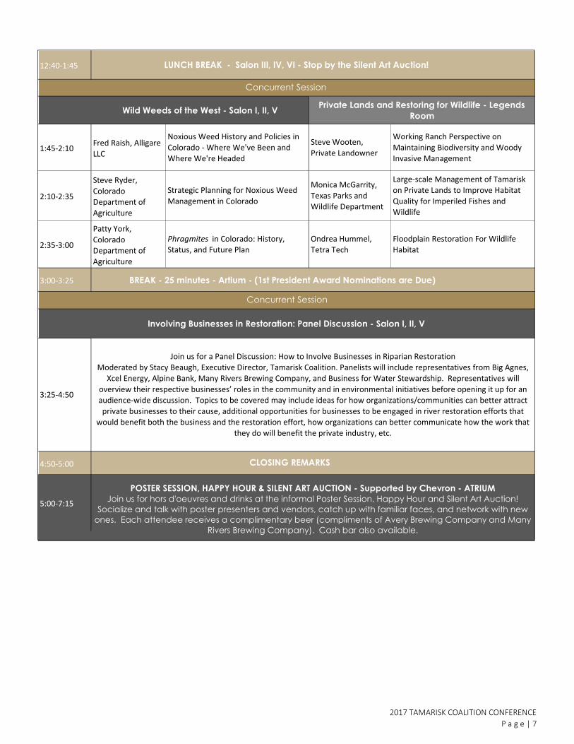
12:40-1:45
1:45-2:10Fred Raish, Alligare LLC
2:10-2:35
Steve Ryder, Colorado Department of Agriculture
2:35-3:00
Patty York, Colorado Department of Agriculture
3:00-3:25 BREAK - 25 minutes - Artium - (1st President Award Nominations are Due)
4:50-5:00
5:00-7:15
3:25-4:50
Monica McGarrity, Texas Parks and Wildlife Department
Large-scale Management of Tamarisk on Private Lands to Improve Habitat Quality for Imperiled Fishes and Wildlife
Steve Wooten, Private Landowner
2017 TAMARISK COALITION CONFERENCE
P a g e | 7
LUNCH BREAK - Salon III, IV, VI - Stop by the Silent Art Auction!
Strategic Planning for Noxious Weed Management in Colorado
Phragmites in Colorado: History, Status, and Future Plan
Floodplain Restoration For Wildlife Habitat
Wild Weeds of the West - Salon I, II, V
Involving Businesses in Restoration: Panel Discussion - Salon I, II, V
Concurrent Session
POSTER SESSION, HAPPY HOUR & SILENT ART AUCTION - Supported by Chevron - ATRIUM
Join us for hors d'oeuvres and drinks at the informal Poster Session, Happy Hour and Silent Art Auction!
Socialize and talk with poster presenters and vendors, catch up with familiar faces, and network with new
ones. Each attendee receives a complimentary beer (compliments of Avery Brewing Company and Many
Rivers Brewing Company). Cash bar also available.
Private Lands and Restoring for Wildlife - Legends
Room
Concurrent Session
Working Ranch Perspective on Maintaining Biodiversity and Woody Invasive Management
CLOSING REMARKS
Join us for a Panel Discussion: How to Involve Businesses in Riparian RestorationModerated by Stacy Beaugh, Executive Director, Tamarisk Coalition. Panelists will include representatives from Big Agnes,
Xcel Energy, Alpine Bank, Many Rivers Brewing Company, and Business for Water Stewardship. Representatives will overview their respective businesses’ roles in the community and in environmental initiatives before opening it up for an audience-wide discussion. Topics to be covered may include ideas for how organizations/communities can better attract private businesses to their cause, additional opportunities for businesses to be engaged in river restoration efforts that
would benefit both the business and the restoration effort, how organizations can better communicate how the work that they do will benefit the private industry, etc.
Ondrea Hummel, Tetra Tech
Noxious Weed History and Policies in Colorado - Where We've Been and Where We're Headed

7:30-8:30
Time
8:30-8:35
9:00-9:25
9:25-9:50
9:50-10:15
10:15-10:40
10:40-11:05Patrick Shafroth, US
Geological Survey
11:05-11:30
Gabrielle Katz,
Metropolitan State
University of
Denver
11:30-11:55
Andrew Norton,
Colorado State
University
11:55-12:20Steven Lee, U.S.
Geological Survey
Claire Reardon and
Caitlyn Willis, Bosque
Ecosystem
Monitoring Program
Interactions and Trajectories: a Look at
Post Flood Response of Riparian Plant
Communities to Diorhabda Invasions
Along the Virgin River
Funding and Restoration Approaches to Benefit Riverside Communities - Salon I, II, V
Welcome and Opening Remarks - Salon I, II, V
Weed Invasions Along the South Platte
River
The Future is Now: Forward-Thinking Restoration, Planning, and Adaptation
Fátima Luna, Sonoran InstituteValuing the Socioeconomic Benefits of Environmental Flows and Restoration in
the Colorado River Delta
Kristen Jespersen, Tamarisk Coalition
Speaker
AGENDA
Tamarisk Leaf Beetle Monitoring Along
the Middle Rio Grande Riparian
Corridor
Current Status and Future Trajectories
for the Riparian Forest Along the South
Platte River in Colorado
Temperature, Day Length and
Geographic Distribution Data Allows
for Prediction of Tamarix spp.
Defoliation by Diorhabda carinulata
And the River Runs Through It - Salon I, II, V
FORWARD-THINKING RESTORATION, PLANNING, AND ADAPTATION
P a g e | 8
WEDNESDAY, FEBRUARY 8, 2017
Registration & Light Breakfast - Salon III, IV, VI
Restore Our Rivers: A Case Study in Tackling Private Fundraising for Riparian
Restoration
Presentation Title
8:35-9:00
Concurrent Session
Jeremy Sokulsky, Environmental
Incentives
A Conservation Funding Framework to Support Large-Scale Restoration and
Long-Term Stewardship
Annie Henry,
University of Denver
Spatial Patterns of Beetle-Induced
Defoliation of Invasive Tamarisk
at the Landscape Level
Reciprocal Interactions between Fluvial
Processes and Riparian Vegetation at
Multiple Scales
Pam Nagler, U.S.
Geological Survey
Saltcedar Beetle and Saltcedar
Interactions in the Colorado River
Basin: Potential for Water Salvage, and
Dispersal of Beetles from the Upper to
the Lower River Basin
Levi Jamison,
Colorado Plateau
Research
Station/Northern
Arizona University
Beetle-mania - Legends Room
BREAK - 25 minutes - Atrium
TAMARISK COALITION’S 15th ANNUAL
Plenary Session
Research and Management Conference
February 7-9, 2017 - The Hilton in Fort Collins, CO
From Farm to Foundation – An Entrepreneurial Approach to River Conservation
Chip Norton, Sinagua Malting Company;
Kim Schonek, The Nature Conservancy;
Tim Carlson, Many Rivers Brewing PBC
and Forever our Rivers Foundation

12:20-1:20
1:20-1:45
Curt Deuser,
National Park
Service
2:10-2:35
Graham Tuttle,
Colorado State
University
2:35-3:00
Michael Scott,
Emeritus, U. S.
Geological Survey
3:00-3:25
3:25-3:50
3:50-4:15
4:15-4:40
4:40-4:50
5:30-7:30
LUNCH BREAK - 1st President's Award Presentation - Salon III, IV, VI
2016 Tamarisk Beetle Distribution in North America and Expectations for 2017Ben Bloodworth, Tamarisk Coalition
Plenary Session
Lisa Clark, University of Denver
Phoebe McNeally,
University of Utah
Wenjie Ji, The State
University of New
York at Buffalo
Detection of the Spatiotemporal
Patterns of Beetle-Induced Tamarisk
(Tamarix spp.) Defoliation Along
Lower Rio Grande Using Landsat TM
Images
Bill Eubanks, Meyer Glitzenstein &
Eubanks LLP
When Law and Science Collide: The Application of the Endangered Species Act
to the Federal Government’s Beetle Permitting Program
BREAK - 25 minutes - Artium (close of Silent Art Auction)
CLOSING REMARKS
Social Hour at the Black Bottle Brewery (116 College Ave)
1:45-2:10
Steve Chignell,
Colorado State
University
Application and Comparison of Satellite
Remote Sensing and Species
Distribution Models for Mapping
Tamarisk
Re-establishing Ecological Function
After Russian Olive Removal: Passive
Versus Active Restoration
Natalie West,
USDA-ARS Northern
Plains Agriculture
Research
Laboratory
Move Over Tamarisk, Make Some Room for Russian Olive -
Salon I, II, VSatellites and GIS Tools - Legends Room
Human Ecology of Tamarix Invasion Control in Riparian Southwest U.S
The Role of Invasive Russian Olive and
Native Cottonwood In Vegetation
Expansion And Channel Narrowing On
A Dryland River
Ahmed Eldeiry,
Colorado State
University
Designing a Watershed Scale GIS
Database for Riparian Restoration: A
Case Study in the Colorado River Basin
Russian Olive Control Methods
Russian Olive Effects Persist Three
Years After Removal
Concurrent Session
Plants, People, Bugs... Why Should I Care? - Salon I, II, V
2017 TAMARISK COALITION CONFERENCE
P a g e | 9
Tree Species Classification of South
Platte Phreatophytes

Time Logistics and
Cost Speaker
FORWARD-THINKING RESTORATION, PLANNING, AND ADAPTATION
P a g e | 10
FIELD TRIP AGENDA
THURSDAY, FEBRUARY 9, 2017
Cost: Free Workshop will be Located in Salon I at the Hilton. Limited to 50 attendees.
8:00 am ~
11:00 am
In the late 1800s 4.8 million cubic yards of soil and an entire riparian ecosystem
were washed out of the Campbell Valley by an intentional breach in a newly
constructed irrigation canal. Over 100 years later, decades of overgrazing, piles
of old tires and ever increasing canal leakage continued to hinder the recovery
of this tragically beautiful landscape. WRV and its partners have been restoring
this seemingly hopeless watershed on a shoestring budget with donated
materials and volunteer labor. After 6 years and many lessons learned, using a
variety of innovative and low impact treatments, the signs of tenuous recovery
are beginning to show. Logistics: Transportation provided. Shuttles will depart
from the lobby of the Hilton at 8:45 am. Attendees will arrive to the Campbell
Valley site around 9:30 and depart at 11:20, arriving back to the hotel around
12:00 pm. If you need to drive your own vehicle, you'll need a high clearance
vehicle to get to the project site.
Nate Boschmann,
Stewardship
Coordinator,
Wildlands
Restoration
Volunteers
Cost: $10 to cover
transportation and
snacks. Attendees
will meet in the
lobby of the Hilton
at 8:30 am to check
in.
8:45 am -
12:00 pm
Attendees will be able to experience first-hand the forefront of Colorado’s
native, riparian restoration production at the Colorado State Forest Service
Nursery. This will include both walking indoors and outdoors to visit the tree
processing facility, shop/storage and greenhouse space (all indoors, but can be
chilly at times), and the shade houses (outdoors). Through their partnerships
with seed collection agencies, the CSFS Nursery has been able to grow out
several different deciduous species specifically for riparian restoration.
This tour will provide more information about the nursery’s:
• Exclusive production of riparian species in deepots
• Ecotypic, riparian seed and cutting production
• Native seed collection and stratification
Option 3: Interactive Fundraising Workshop - Salon I: Finding ‘Em and Keeping ‘Em: Building Your Organization’s
Donor Support
Kristen Jespersen,
Tamarisk Coalition,
Lindsay Murdoch,
Cross-Watershed
Network
This Tamarisk Coalition and Cross-Watershed Network-led fundraising training
will outline practical methods and tools for implementing the five steps of the
Resource Development Cycle (planning, donor identification, cultivation, asking,
thanking, and donor involvement). This will be an interactive session that draws
on the fundraising successes of the workshop attendees and provides
opportunities for participants to identify concrete actions to be taken to help
grow their own private fundraising programs.
Option 1: Colorado State Forest Service Nursery Tour
Nursery manager,
Josh Stolz, and
Greenhouse
Manager, Zach Clark-
Lee, and many more
Cost: Free. This will
be an indoor and
outdoor trip.
Transportation is
not provided.
Attendees will need
to meet at 3843 W
Laporte Ave, Bldg
1060, Fort Collins,
CO 80521 at 9:00
am.
9:00 am-
12:00 pm
Option 2: Tour of the Campbell Valley Restoration Site: Novel Approaches to Erosion Control and Native Plant
Reestablishment in one of Northern Colorado’s Most Catastrophically Degraded Watersheds
Description
TAMARISK COALITION’S 15th Annual Research and Management Conference

2017 TAMARISK COALITION CONFERENCE
P a g e | 11
POSTER PRESENTERS - ATRIUM
Join us for the Poster Session at 5:00 on February 7th! Socialize and talk with poster presenters and vendors, catch up with familiar faces, and network with new ones.
Natalie Pyrooz and Mike Wight, Southwest Conservation
Corps
Anna V. Schrenk, Emily Garding, Sara Van Marel, Friends
of Verde River Greenway
VWRC: A Collaborative Approach to Improving Riparian Areas in the Verde
Watershed
Stephanie Minnaert, Escalante River Watershed
Partnership
2012-2016 Tamarisk Leaf Beetle Distribution and Defoliation Rates Along the
Rio Grande River, NM Watershed
Lindsay Murdoch, Cross-Watershed NetworkCross-Watershed Network: Get the Scoop on the Peer-to-peer Knowledge
Sharing Network
Mattew Johnson, Colorado Plateau Research
Station/Northern Arizona University
Weeds Mapping and Treatment on the Navajo Nation and Beyond:
Conservation Corps Engaging Native Youth to Connect with and Improve their
Lands
Tim Carlson, Many Rivers Brewing PBC, Chip Norton,
Sinagua Malting Company; Kim Schonek, The Nature
Conservancy; and Forever our Rivers Foundation
From Farm to Foundation – An Entrepreneurial Approach to River Conservation
Ben Bloodworth, Tamarisk Coalition 2016 Tamarisk Beetle Distribution Map
Tim Graham, University of Utah
Diorhabda carinulata in Grand County Utah, 2004-2016: Summary of
Abundance and Distribution, Impact on Tamarisk (canopy mortality), and
Ecosystem Response (Plant Recruitment Under Defoliated Tamarisk)
The Essence of the Escalante River and Escalante River Watershed Partnership

FORWARD-THINKING RESTORATION, PLANNING, AND ADAPTATION
P a g e | 12
PRESENTATION ABSTRACTS
Abstracts are l isted chronologically. Present ing authors are denoted by an aster isk.
Tuesday, February 7 th
KEYNOTE SPEAKER Salon I , I I , V
9:20-9:45
Clint Evans, State Conservationist USDA - Natural Resources Conservation Service
Denver, CO
Clint graduated from Kansas State University with a Bachelor’s of Science degree in Agriculture. He started his career with the USDA-NRCS as a Soil Conservation Technician in southeast Kansas. Clint has worked 16 years for the USDA-NRCS and has served at all levels of management within field offices and
state offices in Kansas, Idaho and Colorado. He has worked as a District Conservationist, State Level Conservation Program Specialist, and Assistant State Conservationist for Programs and Assistant State
Conservationist for Operations in Kansas and Idaho. In addition he has served in detail capacities as the acting Assistant State Conservationist for Programs in Ohio, as the acting National Wetlands Reserve
Program Specialist and in the National Easement Programs Division – as the Easement Assessment and Remediation Team Coordinator in Wyoming. Clint is currently serving as the State Conservationist in
Colorado.
WATER PLANNING INNOVATIONS Salon I , I I , V
9:45-10:55
Watershed Health and the Colorado Water Plan
Chris Sturm1
1 Colorado Water Conservation Board; [email protected]
Colorado’s Water Plan leveraged and integrated the work accomplished by Colorado’s nine Basin Roundtables, the Interbasin Compact Committee, the Colorado Water Conservation Board (CWCB), and partners and stakeholders statewide since 2005 to determine how to implement water supply planning solutions that meet Colorado’s future water needs while supporting healthy watersheds and the environment; robust recreation and tourism economies; vibrant and sustainable cities; and viable and productive agriculture.

2017 TAMARISK COALITION CONFERENCE
P a g e | 13
Watershed health and recreation are too critical to Colorado’s brand not to have robust objectives. CWCB grant programs are strategic elements of implementation success. The CWCB Colorado Watershed Restoration Program (CWRP) will be the lead grant program in this arena.
CWRP is designed to provide planning and project implementation funding for watershed and stream restoration and protection efforts. The program supports applicants committed to collaborative approaches to restoring and protecting the ecological processes that connect land and water. The CWRP guidance document and application was approved by the CWCB in September of 2008. The CWCB approved revisions to the program in May 2012 and July 2015. The latest revision added Stream Management Plans as a specific grant type. Other grant types include Watershed/Stream Restoration, Flood Mitigation, and Monitoring grants.
Since 2008, the program has funded 59 projects with over $2.3 million. Every CWCB dollar contributed to the program has leveraged $4 from other local, state, and federal sources. The CWRP guidance has also served as a template for several other grant programs developed since the September 2013 floods. This includes the special release of the CWCB Colorado Watershed Restoration Program ($1,925,000) for 2013 flood recovery planning, the CWCB Senate Bill 14-179 River Restoration Program ($2,500,000), the Department of Local Affairs Community Development Block Grant – Disaster Recovery, Watershed Resilience Program ($25,000,000), and the NRCS – CWCB Emergency Watershed Protection Program (>$60,000,000).
Environmental Water Transactions to Support Riparian Restoration
Season Martin1*, Aaron Citron1*
1 The Nature Conservancy, Boulder, CO; [email protected]; [email protected]
Water markets are lauded as an integral management strategy for western water management in the face of increasing demand and decreasing supply for our water resources. Flow restoration and protection advocates utilize a variety of tools to maintain water in river systems to support ecological and human needs. Increasingly environmental water transactions, buying water and dedicating it to an instream flow or environmental use, are becoming essential. This session will provide a brief overview of where environmental water transactions are successfully being used to restore and protect flows across the Colorado River Basin, and discuss how restoration practitioners can engage in flow protection to better inform restoration design. Additionally, we’ll discuss how flow and riparian restoration can be integrated as the Colorado Water Plan is implemented.

FORWARD-THINKING RESTORATION, PLANNING, AND ADAPTATION
P a g e | 14
Developing Restoration Scenarios and Outcomes to Inform Binational Water Policy in the Colorado River Delta
Karen J. Schlatter1*, Matthew R. Grabau1, Jennifer Pitt2, Osvel Hinojosa-Huerta3, Eloise Kendy4, Eliana Rodríguez5, Jorge Ramírez5, Francisco Zamora-Arroyo1, Yamilett Carrillo6, Karl W. Flessa7, and Lianne
Daugherty8
1
Sonoran Institute, 100 N. Stone Ave., Ste. 400, Tucson AZ 85701, Phone: (520) 290-0828; [email protected]; [email protected]; [email protected] 2
National Audubon Society, Boulder CO 80302, Phone: (720) 841-5366; [email protected] 3
Pronatura Noroeste, Calle Décima No. 60, esquina Ryerson, Zona Centro, Ensenada 22800, B.C. Mexico, Phone: +52 646-175-3461; [email protected] 4
The Nature Conservancy, 415 Monroe Ave., Helena MT 59601, Phone: (406) 495-9910; [email protected] 5
Autonomous University of Baja California, Av. de la Normal s/n Col. Insurgentes Este, Mexicali 21280, B.C. Mexico, Phone: +52 686-566-4150; [email protected]; [email protected] 6
Restauremos el Rio Colorado, San Luis Rio Colorado, Sonora Mexico; [email protected] 7
University of Arizona, Tucson AZ 85721, Phone: (520) 621-7336; [email protected] 8
Hydros Consulting, Inc., 1628 Walnut Street, Boulder CO 80302, Phone: (303) 284-1841; [email protected]
In 2012, the U.S. and Mexico signed Minute 319, which provides new guidelines for Colorado River binational water management. Among the broad set of terms decreed in Minute 319 were provisions to dedicate environmental flows to the Colorado River Delta and assess the hydrological and biological impacts of water deliveries to the region. With Minute 319 due to expire in 2017, negotiations are currently underway to renew and extend these terms under a new Minute. As part of the current binational negotiation process, the negotiation team defined four different scenarios for environmental water volume availability and tasked an Environmental Work Group (EWG), composed of representatives from U.S. and Mexican federal and state agencies, water users, and non-governmental conservation organizations, with assessing restoration opportunities associated with each scenario. A sub-team of scientists, who were already collaborating on Minute 319 monitoring efforts, was formed to accomplish the task. The process of scenario assessment included the following components: 1) determine restoration priorities; 2) estimate water needs for restoration site irrigation and maintenance and recreational flows; 3) consider water balance by river reach and estimated outflows from water deliveries; and 4) consider inter-annual variability of flows, lessons learned from the 2014 Minute 319 pulse flow, and operational limitations. Once a suite of restoration scenarios was developed, the team predicted potential social and ecological benefits of each scenario. To estimate restoration benefits, the team utilized hydrological models, fine-scale vegetation classification maps derived from LiDAR, and estimates of infiltration, plant water use, and salinity reductions under different flow volumes. In addition, the team estimated restoration costs for each scenario and drafted a monitoring program and budget. The EWG presented results to the primary negotiation team, who may agree upon language for a new Minute, including commitments to water and funding for Delta restoration, by December 2016.

2017 TAMARISK COALITION CONFERENCE
P a g e | 15
ADAPTING TO CHANGE Salon I, II, V
11:25-12:40
Multi-species Assisted Migration to Increase Growth Rate in Transplanted Communities
Matthew P. McEttrick1*, Kevin C. Grady1
1 School of Forestry and the Merriam-Powell Center for Environmental Research, Northern Arizona University,
Flagstaff, AZ; [email protected]
The pace of future climate change is predicted to exceed the rate at which species can adapt. Intra-range assisted migration may potentially increase the adaptive capacity of plants to respond to climate change. However, because ecological communities consist of webs of complex interactions, the impact of such interactions on the outcome of assisted migration efforts should be considered. This study refines revegetation strategies using assisted migration by leveraging possible facilitative effects of ecological associates. We examined assisted migration in the foundation tree species, Populus fremontii, at sites undergoing climate change, planted with and without a common riparian neighbor, Salix exigua. We are unaware of any other studies including multiple interacting plant species in assisted migration. We evaluated two hypotheses: 1) Growth of P. fremontii and S. exigua is related to temperature transfer distance, i.e. the difference in mean annual maximum temperature between our common garden site and the source site for a given genotype, and 2) S. exigua facilitates growth of P. fremontii with growth rates of P. fremontii related to the transfer distance of S. exigua. We also evaluated herbivory as a potential consequence of altered P. fremontii growth, and the role of root extracts of common riparian associates of P. fremontii as a possible mechanism. We found that facilitation of P. fremontii by locally derived S. exigua, increased P. fremontii growth by as much as 44%, while S. exigua from transfer distances larger than 2 °C did not increase P. fremontii growth. We also found that root extract from S. exigua resulted in significantly higher growth in P. fremontii, compared to root extract from P. fremontii. These results show facilitative interactions can be used to improve assisted migration effectiveness in restoration, and that the specific genotypes of the plants involved are important.
Adapting to Change and Restoring Resilient Riparian Ecosystems in the Southwest
Bruce K. Orr1*, Gail M. Drus2, Tom L. Dudley3, Glen T. Leverich1, Zooey E. Diggory1, Matthew J. Johnson4, James R. Hatten5, Adam Lambert6, Kevin R. Hultine7, Dan Bean8, and Devyn A. Orr9
1Stillwater Sciences, Berkeley, CA; [email protected]; [email protected]; [email protected]
2Saint Francis University, Loretto, PN; [email protected]
3Marine Science Institute, UC Santa Barbara, Santa Barbara, CA; [email protected],
4Northern Arizona University, Flagstaff, AZ; [email protected]
5Columbia River Research Laboratory, U.S. Geological Survey, Cook, WA; [email protected]
6Marine Science Institute, UC Santa Barbara, Santa Barbara, CA; [email protected]
7Desert Botanical Garden, Phoenix, AZ; [email protected]
8Colorado Dept. of Agriculture – Palisade Insectary, Palisade, CO; [email protected]
9UC Santa Barbara, Santa Barbara, CA; [email protected]

FORWARD-THINKING RESTORATION, PLANNING, AND ADAPTATION
P a g e | 16
Many riparian systems across the Southwestern United States have been highly altered by human land and water management actions coupled with extensive invasion by non-native tamarisk (Tamarix spp.), creating novel ecosystems associated with varying changes in composition and abundance of native plants and animals, fire regimes, hydrology, fluvial geomorphic processes, soil chemistry, and other biophysical factors. There have been a large number of efforts to remove tamarisk by mechanical or chemical means, with widely variable levels of success and failure. More recently, a new agent of change has been added to these systems through the introduction of a biological control agent, the tamarisk beetle (Diorhabda spp.), which is now spreading throughout the Southwest. We are studying the effects of the tamarisk beetle on the expected trajectories of these novel riparian ecosystems, and working with restoration practitioners to develop and implement restoration strategies to help direct these systems towards a more desirable state that will be relatively self-sustaining and resilient to future stressors. Using research and restoration case studies from various rivers in the Southwest, we will discuss how the various sources of data were synthesized to produce restoration plans that highlight both those areas best suited for active restoration (including horticultural revegetation) and those in which passive, process-based restoration and natural revegetation are expected to create new riparian systems that provide the ecosystem conditions and services desired by local stakeholders. Implementation of these restoration plans is underway. Long-term monitoring and adaptive management approaches will be critical given the uncertainties posed by changing climate and by potential co-evolution of the beetle, tamarisk, and other species in these systems.
Invasive Species Mapping and Prioritization to Support Climate-smart Management, Restoration, and Long-Term Recovery of Biological Resources on Lower Cache Creek
Andrew Rayburn1
1 Jefferson County Open Space Division, Golden, CO, Phone: (530) 723-3233; [email protected]
Cache Creek is an 87-mile (140 km) stream in Lake, Colusa, and Yolo counties in north-central California. The stream originates in the coastal foothills, flowing to the Sacramento River through a mosaic of canyons, riparian forests, oak woodlands, willow scrub, and gravel washes. Once mined extensively for gravel and highly degraded as a result, lower Cache Creek and the associated riparian ecosystem are now adaptively managed as an integrated system, with an emphasis on balancing biological resources, water resources, floodway and channel stability, open space and recreation, agriculture, aggregate mining, and the cultural landscape. Invasive species became widespread along the creek over the past 100 years, including tamarisk, arundo, ravennagrass, perennial pepperweed, Himalayan blackberry, and over 20 additional nonnative and invasive species. Over the past decade, invasive species control and riparian restoration projects have been increasingly implemented to improve habitat for over 200 species of birds, mammals, reptiles, amphibians, fish, and invertebrates, including numerous special-status species. In 2016, two large-scale invasive species mapping and prioritization projects were implemented to comprehensively assess the distribution and status of a suite of species along a 20-mi stretch of lower Cache Creek. Specific objectives were to (1) map the extent and distribution of existing priority invasive species (arundo, ravennagrass, and tamarisk) to assess effectiveness of past control efforts; (2) map extent and distribution of new priority invasive species that have established in the region; (3) produce a spatially-explicit baseline to inform and prioritize adaptive management; and (4) identify and prioritize potential restoration opportunities. Thousands of individual plants and hundreds of patches of 25 nonnative and invasive species were mapped across the project area using mobile-mapping and GPS equipment in the field. Results of these projects are already generating conservation

2017 TAMARISK COALITION CONFERENCE
P a g e | 17
funding, stimulating landowner engagement, supporting restoration planning, and informing long-term conservation planning in the region.
WE’RE ALL IN IT TOGETHER! Legends Room
11:25-12:40
Engaging Coloradans in Caring Through Active Stewardship
Anna Zawisza1*, Dean Winstanley1
1 Volunteers for Outdoor Colorado, Denver, CO; [email protected]; [email protected]
While efforts are increasing across the state to connect more people to our outdoors, we collectively lack a means of caring for these places. Without a caring public, we face the very real possibility that we will degrade the parks, open spaces, and outdoor recreation amenities we have established.
Volunteers for Outdoor Colorado (VOC) is a leading statewide nonprofit dedicated to motivating and enabling people to become active stewards of Colorado’s natural resources. Each year, VOC engages thousands of diverse volunteers through our outdoor stewardship projects, which range in duration from one to five days and occur anywhere from urban parks and open spaces, to rural riparian corridors, to high-altitude peaks. Since our founding in 1984, VOC has inspired and engaged more than 105,000 people to care for Colorado – a total donated labor value of nearly $21 million.
While we continue to use our community-based, large scale projects as the primary vehicle for volunteer engagement, VOC is also at work developing innovative strategies that encourage enthusiastic individual acts of stewardship, engage the uninitiated and diversify our constituents. Committed to expanding statewide capacity for stewardship, VOC’s Outdoor Stewardship Institute has also been the top source of volunteer leadership training programs since 1986, annually equipping hundreds of people, in local communities, other volunteer organizations and within land management agencies, with the skills necessary to be effective and technically skilled leaders.
VOC would like to share examples and successes we have in place fostering a lasting culture of stewardship that benefits our natural places and communities all across the state over the long term. In this session, we will share effective engagement strategies including public, youth and corporate projects; leadership and skills trainings; community tool kits and technical assistance; DIY stewardship and digital badges through mobile apps; and technology such as social media.

FORWARD-THINKING RESTORATION, PLANNING, AND ADAPTATION
P a g e | 18
Ancestral Lands Conservation Corps; Partnerships, Restoration and Opportunity on Sovereign Lands
Mike Wight1
1 Ancestral Lands Regional Director, Southwest Conservation Corps; [email protected]
Since 2008 Conservation Legacy's Southwest Conservation Corps has been partnering with Native Communities to develop job training and employment opportunities through conservation-service work. Operating programs with Navajo Nation, Acoma Pueblo, and Zuni Pueblo has created relationships that continue to provide much-needed job opportunities and initiate new restoration efforts on Sovereign lands. Attend this presentation to learn about how community connections, coupled with the systems Conservation Legacy provides, has led to innovative partnerships that engage hundreds of young adults and Native staff each year to restore,improve and manage natural resources on tribal lands and beyond.
Successful Partnerships in Action: VWRC, AZCC, and Vets4Hire
Anna V. Schrenk1*, Russ Dickerson2*, Sara Van Marel1
1 Friends of Verde River Greenway, P.O. Box 2535, Cottonwood, AZ 86326; [email protected];
Arizona Conservation Corps, 2500 N. Rose St, Suite 101, Flagstaff, AZ 86001; [email protected]
The Verde Watershed Restoration Coalition (VWRC) is a multi-stakeholder group of representatives from federal and state agencies, private landowners, corporations and non-profit organizations working on a watershed scale initiative to manage invasive plants in the Verde Watershed in central Arizona. Since 2012, VWRC has been working with Arizona Conservation Corps (AZCC) and Vets4Hire to implement the ecological, social, economic and management goals outlined in the Verde River Cooperative Invasive Plant Management Plan. AZCC operates conservation service programs across Arizona that empower individuals to positively impact their lives, their communities and the environment. Vets4Hire is a locally based veteran service organization that provides job skill training, employment opportunities and housing for veterans experiencing homelessness.
Over the past five years, VWRC has developed cooperative partnerships with both organizations that provide VWRC with locally based crews that work for our full season while providing individuals with a well-rounded experience that includes six-months of hand-on job experience, skills training and education that both enables individuals to find career pathways and develops our next generation of conservationists.
Since its inception, these partnerships have put more than 80 young people and veterans to work either as AmeriCorps service or paid staff. These “boots on the ground” crews have been an integral part of VWRC’s success, so far they’ve removed target invasive plants affecting over 5,000 acres from private and public lands. More than $800,000 in wages and $60,000 in AmeriCorps Education Award have been distributed to young adults in Arizona and local veterans. During the 2016/2017 field season, four AZCC crew and one Vets4Hire crew, over thirty young adults and veterans will be implementing projects in the Verde Valley under this successful model.

2017 TAMARISK COALITION CONFERENCE
P a g e | 19
WILD WEEDS OF THE WEST Salon I, II, V
1:45-3:00
Noxious Weed History and Policies in Colorado - Where We've Been and Where We're Headed
Fred Raish1
1 Alligare LLC, 617 Custer Ave, Akron, CO 80720; [email protected]
This presentation will outline the steps Colorado has taken since 1989 to establish the Colorado Noxious Weed Act. We will discuss the evolution of the Colorado Noxious Weed Act, the Colorado Noxious Weed Trust Fund, and how Colorado’s noxious weed management has influenced land management policies at a federal level. The presentation will also look at the future of noxious weed policy, education, and funding in Colorado.
Strategic Planning for Noxious Weed Management in Colorado
Steve Ryder1
1 Colorado Department of Agriculture, Broomfield, CO 80021; [email protected]
Strategic planning has become a common-place term, rote activity, even cliché. So it’s instructive to review not only its concepts and processes, but also what it tells us about our efforts to control noxious weeds over a large landscape with myriad ownership types and multiple levels of government oversight and/or responsibility.
Generally, strategic planning has been used in corporate environments since the 1960s, where it more recently migrated to non-profit organizations and is now common in government as well. Its aim is to determine an organization’s direction, identify its long-term goals and provide a pathway to reaching those goals. The tools and approaches are fairly common and two of these tools will be used to demonstrate the application of strategic planning to small organizations such as NGOs and local-to-state government programs, particularly those that address invasive plant management.
SWOT analysis is the first tool discussed, and it is probably the most common of all the tools. It involves analyzing the internal structure and functioning of the organization to describe its “strengths” and “weaknesses”; and also focuses on external factors that impact the organization, which include “opportunities” and “threats.” From this point, an organization has a much clearer idea of how to achieve its goals.
A second tool is what’s called a PEST analysis (or, more broadly PESTLE analysis). This tool examines the more remote external environment. Both are useful for our lines of work. The use and usefulness of these tools will be presented, with possible applications shown for many of the organizations present.

FORWARD-THINKING RESTORATION, PLANNING, AND ADAPTATION
P a g e | 20
Phragmites in Colorado: History, Status, and Future Plan
Patty York1
1 Colorado Department of Agriculture's Noxious Weed Program; [email protected]
Phragmites australis is a tall, perennial grass found worldwide, mainly in aquatic and riparian environments. Three lineages are present in North America, two native, and one introduced. Phragmites australis subspecies australis is Eurasian in origin and has proven problematic to native habitats, especially in the eastern United States. This subspecies was added to the Colorado Noxious Weed Watch List in 2012, in order to gather more information about its statewide distribution and behavior. An in-depth survey was administered in 2016, and results showed that weed managers are still mostly unclear as to whether their populations are native or introduced. The Colorado Department of Agriculture plans to help establish a statewide distribution map of native vs. introduced Phragmites in 2016, in order to better determine whether this introduced invasive qualifies as a noxious weed in Colorado.
PRIVATE LANDS AND RESTORING FOR WILDLIFE Legends Room
1:45-3:00
Working Ranch Perspective on Maintaining Biodiversity and Woody Invasive Management
Steve Wooten1
Abstract not available.
Large-scale Management of Tamarisk on Private Lands to Improve Habitat Quality for Imperiled Fishes and Wildlife
Monica E. McGarrity1*, Kevin Mayes2, Duane Lucia3, Todd Caldwell4, Brad Wolaver4, Aaron Urbanczyk5, and Gene R. Wilde5
1 Texas Parks and Wildlife Department, Austin, TX; [email protected]
2 Texas Parks and Wildlife Department, San Marcos, TX; [email protected]
3 US Fish and Wildlife Service, Lubbock, TX; [email protected]
4 University of Texas – Bureau of Economic Geology, Austin, TX; [email protected];
[email protected] 5 Texas Tech University, Lubbock, TX; [email protected]; [email protected]
Habitat degradation resulting from tamarisk (Tamarix spp.) infestation has been implicated in fish species imperilment in Texas, yet managing upwards of half a million infested acres presents a unique challenge in a state with greater than 95% private land ownership. Tamarisk impacts in Texas are most pronounced in semiarid regions of the Great Plains and Trans-Pecos, where tamarisk thickets along rivers reduce habitat quality for terrestrial wildlife and armor banks, dramatically impacting hydrology and river channel morphology. In the upper Brazos River Basin, tamarisk

2017 TAMARISK COALITION CONFERENCE
P a g e | 21
infestation was implicated in severe degradation of habitat resulting in a recent decision to list two fishes—Smalleye Shiner (Notropis buccula) and Sharpnose Shiner (N. oxyrhynchus) as federally endangered. With 623 river miles designated as critical habitat for these two species, effective management of tamarisk to improve habitat quality will require prioritization, long-term planning, and partnerships. State and federal resource agencies are partnering with private landowners to initiate treatment of tamarisk in the highest priority areas and collaborating with Texas universities to conduct ecological monitoring. Monitoring efforts include water quality and plant and aquatic community structure and dynamics but will focus primarily on monitoring changes in physical habitat and hydrology. Paired cross-sections are used to monitor channel morphology over time and collocated hydrological monitoring stations were installed to estimate soil (bank) and groundwater storage and evaluate post-treatment changes to salinity balance. Although tamarisk management may not directly translate to instream water gains, increased bank and groundwater storage could result in more sustained baseflows. Changes in channel morphology are expected to increase habitat diversity and improve habitat quality for imperiled fishes over time. We will highlight the current status of management and research efforts in the Upper Brazos, as well as challenges and rewards of implementing large-scale management on privately-owned lands.
Floodplain Restoration for Wildlife Habitat
Ondrea Hummel1
1 Tetra Tech, Albuquerque, NM; [email protected]
Loss of riverine floodplain connected habitat and the resulting loss of habitat for wildlife has been an ongoing challenge for restoration specialists, especially in the arid Southwest. This presentation will discuss efforts to connect floodplain habitat for wildlife use and the evaluation of that habitat use through monitoring.
As a previous staff member of the U.S. Army Corps of Engineers, Ms. Hummel was the lead ecologist for restoration efforts in the Albuquerque Reach of the Rio Grande for the past 13 years. The overarching goal of these projects was to increase ecosystem functionality and sustainability. Restoration projects focused on increasing diversity and quality of wildlife habitat, reducing fire hazard, and reconnecting the river and adjacent floodplain. Various restoration techniques were implemented toward these goals. Tetra Tech has completed restoration projects of similar nature and objectives which will also be discussed.
Fire hazard reduction has focused on reducing dead material on the ground as well as dense thickets of non-native vegetation such as salt cedar (Tamarix ramosissima), Russian olive (Elaeagnus angustifolia), tree of heaven (Ailanthus altissima), and Siberian elm (Ulmus pumila).
Projects implemented are being monitored for restoration success by evaluating vegetation response and potential habitat, and wildlife use and response. All floodplain connected sites are being monitored for use by the federally listed Rio Grande silvery minnow (Hybognathus amarus), Southwestern Willow Flycatcher (Empidonax traillii extimus), and Western Yellow Billed Cuckoo (Coccyzus americanus). Transects monitoring avian populations in the project area were also established prior to construction and continue to be monitored. This monitoring has provided important information in regards to

FORWARD-THINKING RESTORATION, PLANNING, AND ADAPTATION
P a g e | 22
planning future restoration efforts that meet all project objectives. Monitoring has also pointed out where improvement is needed and adaptive management can be implemented.
Restoration features implemented, habitat and species monitoring, and results and recommendations will be discussed.
INVOLVING BUSINESSES IN RESTORATION:
PANEL DISCUSSION Salon I , I I , V
3:25-4:50
How to Involve Businesses in Riparian Restoration
Matt Teeters1, Kynnie Martin2, Katie Hughes3, Craig Mackey4, Tim Carlson5
1 Alpine Bank, Grand Junction, CO; [email protected]
2 Xcel Energy, Grand Junction, CO; [email protected]
3 Big Agnes; [email protected]
4 Business for Water Stewardship; [email protected]
5 Many Rivers Brewing Company; [email protected]
Moderated by Stacy Beaugh, Executive Director, Tamarisk Coalition.
Panelists will overview their respective businesses’ roles in the community and in environmental initiatives before opening it up for an audience-wide discussion. Topics to be covered may include ideas for how organizations/communities can better attract private businesses to their cause, additional opportunities for businesses to be engaged in river restoration efforts that would benefit both the business and the restoration effort, how organizations can better communicate how the work that they do will benefit the private industry, etc.

2017 TAMARISK COALITION CONFERENCE
P a g e | 23
February 8th
FUNDING AND RESTORATION APPROACHES TO BENEFIT
RIVERSIDE COMMUNITIES Salon I, II, V
8:35-10:15
Valuing the Socioeconomic Benefits of Environmental Flows and Restoration In the Colorado River Delta
Fátima Luna1
1 Sonoran Institute, 100 N. Stone Ave., Suite 400, Tucson, AZ, Phone: (520) 290-0828 Ext. 1115;
Although the Colorado River Delta in northwest Mexico has been severely degraded due to lack of river flows caused by upstream dams and diversions, the Delta remains a vital and remarkably resilient ecological and economic resource. Restoration efforts of Sonoran Institute and partners over the last decade have shown that active restoration coupled with environmental flow deliveries can successfully restore patches of riparian and marsh habitat along the river corridor. Diverse, functioning Delta habitats, in turn, significantly benefit local communities by providing an array of recreational and economic opportunities.
This study analyzed the existing and potential economic benefits of restored Delta ecosystems, providing an economic argument for augmenting Delta environmental flows. The study also evaluated potential market mechanisms to fund restoration and water acquisition. Based on over 2,000 surveys and interviews with water users in the region, results indicated that hunters and local recreationists visiting the Delta are willing to support restoration/conservation efforts by donating up to $235,000 dollars per year. Enhanced eco-tourism opportunities and donations from camp and vacation homeowners can provide sustainable revenue sources for restoration. Furthermore, the study determined that establishing a non-profit Conservation Fund managed by an NGO would be the most effective long-term approach for administering funds for water acquisition and restoration project implementation. Such projects can support recreation and eco-tourism opportunities, with the ultimate goal of a sustainable restoration and maintenance funding cycle.
Resulting from this study, a Delta Conservation Fund is currently in the process of becoming formally established. A technical committee—composed of key representatives from the hunting industry, camp and vacation homeowners, Cucapah tribal members, fishermen, and government agencies—was assembled to oversee and decide the type of restoration projects to be implemented. The Conservation Fund has raised $13,000 to date, and hopes to implement its first restoration project in 2017.

FORWARD-THINKING RESTORATION, PLANNING, AND ADAPTATION
P a g e | 24
A Conservation Funding Framework to Support Large-Scale Restoration and Long-Term Stewardship
Jeremy Sokulsky1*, Osvel Hinojosa Huerta2, Kristen Boysen1
1 Environmental Incentives, South Lake Tahoe, CA, Phone: (530) 541-2980; [email protected];
Pronatura Noroeste, A.C., Ensenada, B.C., MX; [email protected]
Over the last decade, the nongovernmental organizations in the Colorado River Delta have made significant policy and ecological strides in the Colorado River Delta region. The success of the Minute 319 agreement and the 2014 pulse flow together have made the Delta increasingly attractive to conservation donors interested in restoring habitat. Funding has been secured for multiple project sites and for the acquisition of water rights to sustain restoration. Future challenges include securing funding for the long-term stewardship of existing restoration and increasing the amount of funding available for additional restoration. The estimated costs for water delivery and stewardship of restoration sites over a 25-year period can be similar to the costs of active restoration depending on site requirements and constraints.
Here we propose a Conservation Funding Framework to attract and diversify the sources of funding for restoration and stewardship in the Delta by: Offering Conservation Certificates that enable donors to invest in a product which supports the long-term performance of restoration projects. Conservation certificates can be itemized to create a menu of defined fundraising products and options to attract a variety of donors – both large and small. Linking Conservation to Ecological Success and linking project-scale outcomes to regional restoration goals. Ecological success criteria provide a consistent definition of habitat quality for different habitat types in the Delta. Ensuring Financial Sustainability by securing dedicated funds to pay for site maintenance, water delivery, monitoring, and reporting over a period of decades within a structured context. This will ensure Performance Reports for donors and interested stakeholders, as well as support ongoing adaptive management decisions at the restoration site.
This is a transferable framework that can form the basis for conservation finance investments in areas where regulations or long-term funding initiatives create demand for verified and durable conservation outcomes.
Restore Our Rivers: A Case Study in Tackling Private Fundraising for Riparian Restoration
Kristen Jespersen1
1 Tamarisk Coalition; [email protected]
Many practitioners face common challenges with carrying out private fundraising for riparian restoration work. This presentation will walk through some of those challenges, the importance of private fundraising to organizational sustainability, and the lessons that the Tamarisk Coalition has learned in private fundraising since launching its $2.42M Restore Our Rivers initiative.

2017 TAMARISK COALITION CONFERENCE
P a g e | 25
From Farm to Foundation – An Entrepreneurial Approach to River Conservation
Tim Carlson1*, Chip Norton2*, Kim Schonek3*
1 Many Rivers Brewing PBC and Forever our Rivers Foundation; [email protected]
2 Sinagua Malting Company
3 The Nature Conservancy
Traditional means of funding river conservation projects such as invasive control, river trails, launch areas, in-stream flows, etc. have always been focused on seeking funding from donors, foundations, and/or other grant making sources. If asked an initial question “How do these sources get their money”? The simple answer is that these people and organizations acquired their funding at some point in time from an entrepreneurial enterprise. So, the second question begs “Why can’t we mimic this approach to setup a corporate structure that generates profits that eventually aid river conservation”? The presenters have done exactly this and will discuss the unique ways beer plays into keeping more water in rivers and funding additional river conservation as well.
AND THE RIVER RUNS THROUGH IT Salon I , I I , V
10:40-11:05
Reciprocal Interactions between Fluvial Processes and Riparian Vegetation at Multiple Scales
Patrick Shafroth1*, Li Kui2,3, John C. Stella2, Andrew C. Wilcox4, Anne Lightbody5, Rebecca Diehl4, and Sharon Bywater-Reyes4
1 Fort Collins Science Center, US Geological Survey, Fort Collins, CO; [email protected]
2 State University of New York College of Environmental Science and Forestry, Syracuse, NY; [email protected]
3 Marine Science Institute, University of California, Santa Barbara, CA; [email protected]
4 University of Montana, Missoula, MT; [email protected]
5 University of New Hampshire, Durham, NH; [email protected]
Fluvial forces interact with woody riparian plants in complex ways to influence the coevolution of river morphology and floodplain plant communities. Here, we report on an integrated suite of multi-disciplinary studies that contrasted the responses of tamarisk (Tamarix spp.) and cottonwood (Populus fremontii) plants in terms of (1) differences in vulnerability to scour and burial during floods; (2) interactions and feedbacks between plants and river morphodynamics; and (3) long-term coevolution of river floodplains and riparian communities following flow regulation from dams. The focus of these studies was sand-bed rivers in arid-land regions where invasion by tamarisk has strongly influenced riverine plant communities and geomorphic processes. We analyzed long-term vegetation and geomorphic changes along the dammed Bill Williams River (AZ, USA) using time-series aerial photographs, and complemented this with two novel laboratory experiments using live seedlings in field-scale flumes to quantify the initial stages of plant-river interactions.
The strength of vegetation-fluvial interactions depended on plant characteristics, river hydraulics and sediment conditions, and these were relatively coherent across the wide range of scales. At a corridor

FORWARD-THINKING RESTORATION, PLANNING, AND ADAPTATION
P a g e | 26
scale, we observed a pattern of plant encroachment during five decades of flow regulation, in which channel narrowing and simplification to single-thread form was more associated with tamarisk-dominated reaches compared with native woodlands. For smaller plants in individual and patch configurations, tamarisk’s greater biomass, lower crown position, and stiffer stems induced greater sedimentation during experimental floods compared to cottonwood. This resulted in tamarisk’s greater mortality from burial as small seedlings under sediment equilibrium conditions but higher survival under sediment deficit scenarios. As plants grew larger and at higher density, their flood vulnerability diminished due to greater root anchoring and canopy effects on hydraulics. Together, these multi-scale plant-river dynamics help explain the persistence of tamarisk along regulated rivers where catastrophic floods have been reduced and also highlight the limitations of using flow releases for invasive species management.
Current Status and Future Trajectories for the Riparian Forest along the South Platte River in Colorado
Gabrielle Katz1*, Andrew Norton2, Ahmed Eldiery2, and Reagan Waskom3
1Department of Earth and Atmospheric Sciences, Metropolitan State University of Denver, Denver, CO;
[email protected] 2Department of Bioagricultural Sciences and Pest Management and Graduate Degree Program in Ecology, Colorado
State University, Fort Collins CO; [email protected]; [email protected] 3Colorado Water Institute, Colorado State University, Fort Collins CO; [email protected]
The hydrologic regime of the South Platte River in eastern Colorado has experienced significant anthropogenic change since the mid-19th century. Streamflow has been progressively stabilized and augmented by dams, trans-basin diversions and sub-surface irrigation return flows, though inter-annual variation in flow still occurs due to climate conditions. Reductions in hydrologic variability in other systems have resulted in a shift from native pioneer cottonwood-willow (Populus-Salix) forests to non-pioneer communities dominated by species such as green ash (Fraxinus pennsylvanica), Siberian elm (Ulmus pumila) and Russian olive (Elaeangus angustifolia). Because the South Platte River still retains substantial variation in flow, it is unclear what will be the future trajectory of its expansive riparian forest.
In 2015 we undertook a survey of the riparian forest along the South Platte River from Fort Lupton CO to Julesburg CO, just west of the Nebraska border. Our survey quantified seedling, sapling and tree densities at 15 sites along the river. The riparian forest is dominated by plains cottonwood (Populus deltoides), followed by peachleaf willow (Salix amygdaloides). Combined, these two native species make up more than 90% of the forest basal area and almost 70% of the individual trees throughout the survey area. Russian olive, green ash, Siberian elm and boxelder (Acer negundo) were the next most common species. Cottonwood and willow comprise approximately 60% of the sapling numbers in the system, a smaller share of the forest than is seen for mature trees. However, high flows in 2013, 2014 and 2015 created large areas of newly exposed ground suitable for cottonwood germination. We encountered more than 100,000 seedlings over 175 hectare surveyed; more than 90% were cottonwood.
From our survey there is some evidence to suggest that the long-term trajectory of the forest is a replacement of cottonwood-willow with non-pioneer species. However, the recent pulse in cottonwood seedlings suggests that cottonwood-willow forests may still be capable of widespread reproduction.

2017 TAMARISK COALITION CONFERENCE
P a g e | 27
Future work will focus in describing the age structure of the current riparian forest, and assessing survival of seedling cohorts established after recent floods.
Weed Invasions along the South Platte River
Andrew Norton1*, Gabrielle Katz2, Ahmed Eldiery3, and Reagan Waskom4
1 Department of Bioagricultural Sciences and Pest Management and Graduate Degree Program in Ecology,
Colorado State University, Fort Collins CO; [email protected] 2
Department of Earth and Atmospheric Sciences, Metropolitan State University of Denver, Denver, CO; [email protected] 3
Department of Bioagricultural Sciences and Pest Management, Colorado State University, Fort Collins, CO; [email protected] 4
Colorado Water Institute, Colorado State University, Fort Collins, CO; [email protected]
In the summer of 2015 we undertook a survey of noxious weed presence and abundance throughout the flood plain of the South Platte River and its tributaries, from approximately Fort Lupton to Julesburg, CO near the Nebraska boarder. At each of 15 study sites we estimated the presence and abundance of State of Colorado Listed noxious weeds along transects running perpendicular to the river and covering the site’s existing flood plain. At each survey point we also collected data on riparian forest structure, distance to and elevation above the river channel and presence of bare ground, litter or other vegetation. These variables were used in regression models to determine which environmental factor(s) could explain weed presence and abundance.
State of Colorado listed noxious weeds were common at all sites. For example, nearly 30% of 10 x 10 m plots surveyed contained hoary cress (Cardaria draba), and almost 35% of plots contained downy brome (Bromus tectorum). When all weed species are considered together, 90% of plots sampled contained one or more weed species. Percent cover for each weed species presents a similar picture. Over all plots and all sites, listed weeds make up more than 20% of plant cover. Downy brome (10.42%) and hoary cress (4.35%) are the most abundant weed species we found.
Interactions and Trajectories: A Look at Post Flood Response of Riparian Plant Communities to Diorhabda Invasions along the Virgin River
Steven Lee¹*, Patrick Shafroth², Rebecca Sherry³, Steven Ostoja1, and Mathew Brooks1
¹ US Geological Survey, Yosemite Field Station, Oakhurst, CA; [email protected]; [email protected]; [email protected] ² US Geological Survey, Fort Collins Science Center, Fort Collins, CO; [email protected] ³ Cherokee Nation Technologies (CNT), Contracted To: US Geological Survey, Fort Collins, CO; [email protected]
In 2009 we started monitoring the vegetation composition and cover, soils, and topography along a ~40 mile stretch of the Virgin River in Nevada and Arizona in anticipation of invasion by Diorhabda beetles being used as biological control on Tamarix. In December 2010 a large flood event occurred along the river, drastically altering the local topography and vegetation cover. This event occurred at the front of the invasion by Diorahbda, which continue to defoliate extant stands of Tamarix along this section of

FORWARD-THINKING RESTORATION, PLANNING, AND ADAPTATION
P a g e | 28
the river. By spring 2015, major defoliation had occurred throughout our study area resulting in shifts in the plant communities. We describe changes to riparian plant communities over a six year period between Fall 2009 and Spring 2015. We also expand on previously reported work by discussing the interaction of flooding with Tamarix defoliation, possible trajectories of the riparian communities and our ongoing plans for monitoring along the Virgin River.
Flood disturbance resulted in different species compositions dependent on local erosion or deposition. In general, flooding had a positive influence on recruitment of native woody species (e.g., Pluchea sericea, Salix sp.) in once Tamarix dominated areas. Tamarix mortality from defoliation was heaviest in areas that had the highest Tamarix cover, suggesting a density dependent relationship between Diorhabda beetles and Tamarix. The interaction between flooding and beetle defoliation showed larger changes to the plant communities in flooded areas than those not impacted by the flood event. Major flood events, like the one in 2010 can offer a window of opportunities for native plant species to re-colonize riparian habitats. Flooding on the Virgin River is episodic and an important part of the dynamics that shape the riparian communities. With the establishment of Diorhabda to the region, we have reason to expect more persistent mixed stands of riparian vegetation than in the past.
BEETLE-MANIA Legends Room
10:40-12:20
Tamarisk Leaf Beetle Monitoring Along the Middle Rio Grande Riparian Corridor
Claire Reardon1*, Caitlyn Willis1*
1 Bosque Ecosystem Monitoring Program, Albuquerque, NM, Bernalillo; [email protected];
Since the release of the tamarisk leaf beetle (Diorhabda spp.) as a biological control for tamarisk (Tamarix spp.) throughout several western states in 2001, the beetles have made their way into central New Mexico. The Bosque Ecosystem Monitoring Program (BEMP) has monitored tamarisk leaf beetles annually since 2013 along the Rio Grande, from Santo Domingo Pueblo to Las Cruces, NM. This 2016 field season included monitoring 135 trees at 27 sites once per month for four months. Each site had five trees selected for collection that were sampled with a sweep net five times per sampling period. All arthropods collected were then stored in a freezer to be sorted later under a microscope. In the lab, all arthropods were identified and counted with the focus primarily on tamarisk defoliators (Diorhabda spp., Coniatus splendidulus, Opsius spp.). Individual tree defoliation was estimated during each sampling period and documented visually with photographs from a set point for each tree.
This research focuses on the abundance and diversity of the tamarisk defoliators (primarily Diorhabda spp.) throughout various life stages since 2013. Analysis of the spatial and temporal distribution of the tamarisk leaf beetle can provide insight into the impact of these exotic species on the health of the tamarisk throughout the Middle Rio Grande Valley. The study has found that an increase in Diorhabda generally coincides with a decrease in other species of defoliators. The Diorhabda beetle has been present at all BEMP monitoring sites within the Middle Rio Grande Valley except for three sites: one in Los Lunas, Las Cruces, and one site in Albuquerque. Tree mortality in our study sites was very low (one in

2017 TAMARISK COALITION CONFERENCE
P a g e | 29
135 trees). The ongoing monitoring of these species is essential to understand the impacts it may have on the future of southwestern riparian ecosystems.
Spatial Patterns of Beetle-Induced Defoliation of Invasive Tamarisk at the Landscape Level
Annie Henry1*, Eduardo González1, Wright Robinson2, Bérenger Bourgeois3, and Anna Sher1
1 University of Denver, Dept. of Biological Sciences, Denver, CO; [email protected]; [email protected];
Grand County Weed Dept., Moab, UT; [email protected] 3
Département de Phytologie, Faculté des Sciences de l’Agriculture et de l’Alimentation, Université Laval, Québec & Québec Centre for Biodiversity Science, Department of Biology, McGill University, Montréal, Canada; [email protected]
Diorhabda spp. was introduced as a bio-control agent beginning in 2001 and has since become an inseparable part of tamarisk-dominated river systems in the Southwest. We cannot yet accurately predict either patterns or drivers of defoliation in response to beetle release. Most ecological phenomenon display some kind of spatial organization; identifying and describing these can help fill such gaps in understanding. This study applied Moran’s eigenvector maps to tamarisk defoliation to show how spatial models can be used to expand traditional statistical methods in ecology to understand ecological phenomena. Between 2013 and 2016 tamarisk dieback was assessed at 79 sites across Grand County, UT. Using a traditional general linear model, we found that readily and commonly measured environmental factors could explain only 26% of the variation in tamarisk live canopy each year. Combining both traditional and novel spatial statistical methods we increased that percentage to 43-63%, depending on year. The portion of live canopy explained through environmental factors and spatial structure had little overlap. This means that while we have gained an understanding of distinct spatial patterns that account for variation in live canopy, the ecological processes underlying this spatial structure remain unknown. However, we found three types of spatial patterns – a linear East-West gradient (4-12%), a bi-directional pattern relating to rivers (26-37%) and a third related overland, as-the-crow-flies distances (25-58%). Interestingly, the overland proximity-based spatial structure in live canopy remained consistent, while the river-way patterns changed substantially from year to year, suggesting that both temporally stable (e.g., tamarisk population genetic structure) and unstable (e.g., the flow regime) aspects of the system are influencing the defoliation of tamarisk canopy. This study will help us to design future studies to understand the factors controlling tamarisk beetle defoliation and ultimately optimize their use as an effective management tool.
Temperature, Day Length, and Geographic Distribution Data Allows for Prediction of Tamarix spp. Defoliation by Diorhabda carinulata
Levi Jamison1*, Charles Van Riper2, and Matthew Johnson1
1 Colorado Plateau Research Station/Northern Arizona University, Flagstaff, AZ; [email protected];
USGS, Tucson, AZ; [email protected]

FORWARD-THINKING RESTORATION, PLANNING, AND ADAPTATION
P a g e | 30
We examined the spatial dynamics and timing of defoliation of tamarisk (Tamarix spp.) by the biological control agent Diorhabda carinulata at three sites within the Colorado River Basin. We found that the location and timing of defoliation was predictable based on; 1) abiotic cues for D. carinulata activity, 2) spatial distributions and abundances of D. carinulata across a site, and 3) movement of D. carinulata as a result of available tamarisk foliage. We found that averaged air temperatures above 15ºC during the spring related to how soon D. carinulata began reproducing and defoliation rate at a site, and that this led to variations in voltinism rates in D. carinulata. We found the critical day length for inducing diapause in D. carinulata at our sites to be 33-47 min shorter than that of populations first released in North America in 2001, suggesting adaptation in response to abiotic cues. We also found a positive correlation between the spatial distributions of D. carinulata populations during the fall compared to that of the 1st generation of larvae during the following spring, suggesting that locations of defoliation as a result of abundant larval populations could be predicted in advance. There was also a significant decrease in the numbers of D. carinulata in sites that were 50% defoliated compared to those that were 100% defoliated, demonstrating that D. carinulata will abandon areas once defoliation levels become high. We will present how these results will better enable conservationists to understand the timing of defoliation events across a landscape and provide a rationale to forecasting tamarisk defoliation in areas colonized by D. carinulata.
Saltcedar beetle (Diorhabda carinulata) and Saltcedar (Tamarix spp.) Interactions in the Colorado River Basin: Potential for Water Salvage, and Dispersal of Beetles from the Upper to
the Lower River Basin
Pamela L. Nagler1*, Uyen Nguyen2, Heather Bateman3, Christopher J. Jarchow1, Edward P. Glenn2, Jody W. Waugh4, Charles van Riper III1,5
1 U.S. Geological Survey, Southwest Biological Science Center, 520 North Park Avenue, Tucson, AZ 85719;
Department of Soil, Water and Environmental Science, The University of Arizona, 1177 E. 4th Street, Tucson, AZ 85721-0038 3
Arizona State University, College of Integrative Science and Arts, 6073 S Backus Mall, Mesa, AZ 85212 4
Navarro Engineering, 2597 Legacy Way, Grand Junction, CO81503-1789 5
School of Natural Resources and the Environment, University of Arizona, 520 North Park Avenue, Tucson, AZ 85719
Saltcedar biocontrol beetles (Diorhabda carinulata) were released in the Upper Colorado River Basin in the U.S. in 2004-2007 to defoliate introduced saltcedar shrubs (Tamarix spp.) in the region’s riparian zones. The primary purpose was to control the invasive shrub and reduce evapotranspiration (ET) by saltcedar in an attempt to increase streamflows. We evaluated beetle-saltcedar interactions with MODIS and Landsat satellite imagery on 13 river systems, with vegetation indices used as indicators of the extent of defoliation and ET. Beetles are now widespread throughout the region. They exhibit a pattern of colonize-defoliate-emigrate, so that riparian zones contain a mosaic of completely defoliated, partially defoliated, and re-foliated saltcedar stands. Based on satellite data and ET algorithms, mean ET before beetle release (2000-2006) was 416 mm yr-1 (SE = 49) compared to post-release (2007-2015) ET of 356 mm yr-1 (SE = 41) (P < 0.05) for a net reduction of 60 mm yr-1. This is lower than initial literature projections that ET would be reduced by 300-460 mm yr-1. Reasons for the lower-than-expected ET reductions are because baseline ET rates are lower than initially projected and percentage ET reduction is low because saltcedar stands tend to regrow new leaves after defoliation and other plants help

2017 TAMARISK COALITION CONFERENCE
P a g e | 31
maintain canopy cover. Defoliation is now proceeding from the Upper Basin into the Lower Basin at a rate of 40 km yr-1, much faster than initially projected. Defoliation now occurs within Southeastern Willow Flycatcher (Empidonax traillii extimus) habitat, an endangered bird that nests in saltcedar stands.
MOVE OVER TAMARISK, MAKE SOME ROOM FOR
RUSSIAN OLIVE Salon I , I I , V
1:20-3:00
Russian Olive Control Methods
Curtis Deuser1
1 Deuser, Curtis, National Park Service, 601 NV Way, Boulder City, NV 89005, Phone: (702) 293-8979;
Information included in this presentation is based on a compilation of 27 years of practical experience involving tamarisk and Russian olive control at multiple sites in several western states. Some information is based on experimental studies and then applied broadly across numerous implementation project sites over two decades forming a large spatial and temporal sample size. Various woody perennial tree control methods and slash management options are described including pros and cons based on various factors. Tamarisk control methods appear to be more well established and standardized with better results compared to Russian olive. Some plot work and experience has found that frill cut (or hack and squirt) method using high concentrations of glyphosate produces very good results on Russian olive, and is less labor intensive compared to cut stump method with potentially less herbicide impacts.
Re-establishing Ecological Function after Russian Olive Removal: Passive Versus Active Restoration
Erin K. Espeland1, Natalie M. West1*, David H. Branson1, Jennifer M. Muscha2, Merilynn Schantz3,
Robert W. Kilian3, Joseph D. Scianna3, and Mark K. Petersen2
1 USDA-ARS Northern Plains Agriculture Research Laboratory, Sidney, MT; [email protected];
[email protected]; [email protected] 2
USDA-ARS Fort Keogh Livestock and Range Research Laboratory, Miles City MT; [email protected]; [email protected] 3
Red Rock Resources LLC, Miles City, MT; [email protected] 4
USDA-NRCS Plant Materials Center, Bridger, MT; [email protected]; [email protected]
How does Russian olive invasion alter ecological function, and how much active management (removal, restoration) is required to return functionality to landscapes? Dense Russian olive stands reduce the agricultural and ecological value of rivers, streams and drainage ditches across Montana. Our Russian olive control method of using a tree shear with immediate cut stump herbicide application resulted in a
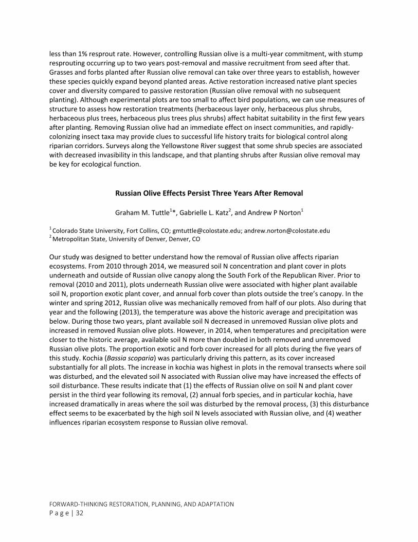
FORWARD-THINKING RESTORATION, PLANNING, AND ADAPTATION
P a g e | 32
less than 1% resprout rate. However, controlling Russian olive is a multi-year commitment, with stump resprouting occurring up to two years post-removal and massive recruitment from seed after that. Grasses and forbs planted after Russian olive removal can take over three years to establish, however these species quickly expand beyond planted areas. Active restoration increased native plant species cover and diversity compared to passive restoration (Russian olive removal with no subsequent planting). Although experimental plots are too small to affect bird populations, we can use measures of structure to assess how restoration treatments (herbaceous layer only, herbaceous plus shrubs, herbaceous plus trees, herbaceous plus trees plus shrubs) affect habitat suitability in the first few years after planting. Removing Russian olive had an immediate effect on insect communities, and rapidly-colonizing insect taxa may provide clues to successful life history traits for biological control along riparian corridors. Surveys along the Yellowstone River suggest that some shrub species are associated with decreased invasibility in this landscape, and that planting shrubs after Russian olive removal may be key for ecological function.
Russian Olive Effects Persist Three Years After Removal
Graham M. Tuttle1*, Gabrielle L. Katz2, and Andrew P Norton1
1 Colorado State University, Fort Collins, CO; [email protected]; [email protected]
2 Metropolitan State, University of Denver, Denver, CO
Our study was designed to better understand how the removal of Russian olive affects riparian ecosystems. From 2010 through 2014, we measured soil N concentration and plant cover in plots underneath and outside of Russian olive canopy along the South Fork of the Republican River. Prior to removal (2010 and 2011), plots underneath Russian olive were associated with higher plant available soil N, proportion exotic plant cover, and annual forb cover than plots outside the tree’s canopy. In the winter and spring 2012, Russian olive was mechanically removed from half of our plots. Also during that year and the following (2013), the temperature was above the historic average and precipitation was below. During those two years, plant available soil N decreased in unremoved Russian olive plots and increased in removed Russian olive plots. However, in 2014, when temperatures and precipitation were closer to the historic average, available soil N more than doubled in both removed and unremoved Russian olive plots. The proportion exotic and forb cover increased for all plots during the five years of this study. Kochia (Bassia scoparia) was particularly driving this pattern, as its cover increased substantially for all plots. The increase in kochia was highest in plots in the removal transects where soil was disturbed, and the elevated soil N associated with Russian olive may have increased the effects of soil disturbance. These results indicate that (1) the effects of Russian olive on soil N and plant cover persist in the third year following its removal, (2) annual forb species, and in particular kochia, have increased dramatically in areas where the soil was disturbed by the removal process, (3) this disturbance effect seems to be exacerbated by the high soil N levels associated with Russian olive, and (4) weather influences riparian ecosystem response to Russian olive removal.
2017 TAMARISK COALITION CONFERENCE
P a g e | 33
The Role of Invasive Russian Olive and Native Cottonwood In Vegetation Expansion And Channel Narrowing On A Dryland River
Michael L. Scott1*, Lindsay V. Reynolds2,3 and Patrick B. Shafroth3
1 Emeritus, U. S. Geological Survey, Fort Collins Science Center, 2150 Centre Ave., Bldg. C, Fort Collins, CO, 80526;
[email protected] 2 Department of Biology, Colorado State University, Fort Collins, CO, 80523; [email protected]
3 U. S. Geological Survey, Fort Collins Science Center, 2150 Centre Ave., Bldg. C, Fort Collins, CO, 80526;
Throughout the southwestern US, channel narrowing resulting from both climatic drought and flow regulation, has featured the extensive establishment and spread of the non-native riparian shrub tamarisk (Tamarix ramosissima, and hybrids) and more recently Russian olive (Eleaegnus angustifolia). Russian olive, a non-native riparian tree, established along streams in the region and is now the fourth most common riparian tree in the western US. Like many regional streams, the Escalante River in southern Utah has a channel that has narrowed dramatically and been invaded by dense stands of Russian olive during the late-twentieth century. Increases in Russian olive and changes in channel form prompted a broad-scale effort to remove Russian olive from the Escalante River bottomland. We used this removal effort to document the details of Russian olive invasion along the Escalante River. Our objectives were to: 1) use tree-ring analysis and historical aerial photos to quantify the timing and extent of vegetation expansion; 2) analyze hydroclimate data and model Russian olive establishment with hydroclimate variables; and 3) develop a conceptual model describing the Russian olive invasion and its role in channel narrowing. Results show the Escalante River channel narrowed significantly between the 1950s and 1980; primarily as a result of cottonwood establishment. Although present in the watershed in the early 1950s, dense stands of Russian olive established along the river after 1980, narrowing the channel even further. Russian olive, clustered along the channel banks, appear to have: 1) created levees; 2) simplified channel form and 3) limited channel and floodplain dynamism. We found that Russian olive establishment is tied, in part, to wet years in the 1980s and 90s. Russian olive removal along the Escalante River, appears to restore some erosional and depositional processes. Strategic use of slash may enhance localized channel dynamics. Monitoring is suggested to evaluate the effectiveness of removal efforts.
SATELLITES AND GIS TOOLS Legends Room
1:20-3:00
Tree Species Classification of South Platte Phreatophytes
Ahmed Eldeiry1*, Andrew Norton1, Gabrielle Katz2, Reagan Waskom3
1
Ahmed Eldeiry, Ph.D. Bioagricultural Sciences & Pest Management, College of Agricultural Sciences, Colorado State University, 80523; [email protected]; [email protected] 2
Gabrielle Katz, Ph.D. Department of Earth and Atmospheric Sciences, Metropolitan State University of Denver, Denver, CO 802173; [email protected] 3
Reagan Waskom, Ph.D. Colorado Water Institute, Colorado State University, 80523; [email protected]

FORWARD-THINKING RESTORATION, PLANNING, AND ADAPTATION
P a g e | 34
A knowledge based expert system was used in this study to identify different tree species in the flood plain of the South Platte River and its tributaries in Colorado. High density airborne light detection and ranging (LiDAR) data were acquired from the Federal Emergency Management Agency (FEMA) that covered the whole study area. High resolution aerial images were acquired from the National Agricultural Imagery Program (NAIP). Height, DBH, canopy condition and species identity were determined for trees in 435 20 x 20 m plots from 15 sites within the study area. A matrix was constructed from the collected samples of tree species and the corresponding values of independent variables from LiDAR and aerial images. Variables included image bands, indices, and heights. A decision tree algorithm was used to classify the collected samples based on the independent variables. A set of rules was established to classify different tree species based on the decision tree classifications. An Object Based Image Analysis (OBIA) approach was used to segment and classify the image. Image segmentation was used to divide the image into meaningful structure, where pixels in close proximity and having similar spectral characteristics are grouped together into an object. Then, segmented objects were grouped into classes, where each class represents a specific tree species. The preliminary results show that this technique successfully categorized five different species in the study area: Acer negundo (box elder), Elaeagnus angustifolia (Russian olive), Populus deltoides (plains cottonwood), Salix amygdaloides (peach leaf willow) and Salix exigua (coyote willow).
Application and Comparison of Satellite Remote Sensing and Species Distribution Models for
Mapping Tamarisk
Amanda West1, Nicholas Young1, Ryan Anderson1, Stephen Chignell2*, Paul Evangelista1, Catherine Jarnevich3, Thomas Stohlgren1, Colin Talbert4, Marian Talbert4, Jeffrey Morisette4
1
Natural Resource Ecology Laboratory, Colorado State University Fort Collins, CO 80523-1499; [email protected]; [email protected]; [email protected]; [email protected]; [email protected] 2
Department of Ecosystem Science and Sustainability, Colorado State University Fort Collins, CO 80523-1499; [email protected] 3U.S. Geological Survey, Fort Collins Science Center 2150 Centre Ave. Building C. Fort Collins, CO 80526-8118;
[email protected] 4U.S. Geological Survey, U.S. Department of the Interior North Central Climate Science Center
Fort Collins, CO 80526; [email protected]; [email protected]; [email protected]
Detecting and monitoring invasive plant species is vital for the management of natural resources and protection of ecosystem processes. The use of satellite remote sensing for mapping the distribution of invasive plants is becoming more common; however best practices for using these images in species distribution models (SDMs) are still being developed. In these studies, we test and evaluate the use of five SDMs fit with satellite remote sensing data to map invasive tamarisk (Tamarix spp.) along the Arkansas River in southeastern Colorado. In addition, we compare the use of freely available moderate resolution Landsat satellite imagery to commercial high-spatial resolution WorldView-2 imagery for mapping tamarisk in Havasu National Wildlife Refuge, Arizona. The SDMs tested included boosted regression trees, Random Forest, multivariate adaptive regression splines, generalized linear model, and Maxent. These analyses were conducted using the Software for Assisted Habitat Modeling (SAHM). Field data were collected in each respective study area to train and test the models. Individual bands, Normalized Difference Vegetation Index, Soil-Adjusted Vegetation Index, Normalized Difference

2017 TAMARISK COALITION CONFERENCE
P a g e | 35
Wetness Index and tasseled cap transformations were used as predictor variables. Remote sensing imagery used captured multiple seasons to distinguish tamarisk from native riparian vegetation. All SDMs identified current tamarisk distribution successfully based on threshold independent and threshold dependent test evaluation metrics. To account for model specific differences, we produced an ensemble of all five models highlighting areas of agreement and areas of uncertainty. Cost, historical availability, data processing, spatial and spectral resolution and revisit time were compared between Landsat and WorldView-2 imagery. Our results demonstrate the usefulness of SDMs in analyzing remotely sensed data and the utility of ensemble mapping, showcase the capability of SAHM in pre-processing and executing multiple models, and emphasize the utility of freely-available Landsat satellite imagery for mapping tamarisk distribution.
Designing a Watershed Scale GIS Database for Riparian Restoration: A Case Study in the Colorado River Basin
Phoebe B. McNeally, Ph.D.1* and Michael J. Campbell2
1
DIGIT Lab, University of Utah, Salt Lake City, UT; [email protected] 2 Geography Department, University of Utah, Salt Lake City, UT; [email protected]
Tracking riparian restoration work is a challenging and often daunting task faced by many watersheds. Cross-walking the data across multiple watersheds increases the complexity of the task due to varying methods of collecting and reporting data and non-standardized terminology and definitions. Geographic information systems (GIS) provide an efficient and effective way to manage and track spatial data and associated attributes. Using GIS allows data to be collected in a consistent and standardized manner across watersheds and easily calculates reporting metrics. Working with the Walton Family Foundation (WFF) and associated Colorado River Basin watersheds, the DIGIT Lab at the University of Utah developed a standardized GIS framework to capture pertinent data associated with an individual watershed’s restoration work with the overall goal to allow WFF to track and roll up progress and success data across multiple watersheds. Data includes physical watershed characteristics, invasive treatments and restoration, monitoring, and administrative reporting needs. The framework is designed to be portable and adaptable for use by any watershed working with the treatment of invasive species. This presentation will discuss the project background, cross-walk challenges, GIS framework components, and implementation strategies.
Detection of the Spatiotemporal Patterns of Beetle-Induced Tamarisk (Tamarix spp.) Defoliation along Lower Rio Grande using Landsat TM Images
Wenjie Ji 1*, Le Wang1, Allen E. Knutson2
1
Department of Geography, The State University of New York at Buffalo, Buffalo, NY 14261, Phone: (716) 645 0474; [email protected]; [email protected] 2 Department of Entomology, Texas A&M AgriLife Research and Extension Center, Dallas, TX 75252;

FORWARD-THINKING RESTORATION, PLANNING, AND ADAPTATION
P a g e | 36
Tamarisk (Tamarix spp.) has long been targeted for removal by land managers in the western U.S. due to its negative impacts on the quality of riparian habitats. Tamarisk leaf beetle (Diorhabda spp.) was first released in the U.S. in 2001 as a biocontrol agent for this non-native plant. Since then, the beetle quickly established and substantial tamarisk defoliation was subsequently observed along river corridors in the western states. However, interactions between beetle herbivory and tamarisk defoliation is not well understood due to the lack of effective methods for monitoring and tracking the spatiotemporal patterns of beetle-induced defoliation. In the present study, using a classification-based method, we successfully mapped tamarisk defoliation caused by the subtropical tamarisk beetle (D. sublineata) in Landsat TM images from 2009 to 2014 along Lower Rio Grande in West Texas. The match between our results and ground observation suggest remote sensing, especially Landsat TM images, is an effective and valuable tool for monitoring and tracking tamarisk defoliation/beetle dispersal at large spatial scales. Our results also show that the beetle populations dispersed a distance of 108 km in the first year after release. The availability and the connectivity of tamarisk stands appeared to control the movement of beetles at a coarser and a finer scale, respectively. Temperature and precipitation were not correlated with tamarisk defoliation.
PLANTS, PEOPLE, BUGS…WHY SHOULD I CARE? Salon I , I I , V
3:25-4:40
Human Ecology of Tamarix Invasion Control in Riparian Southwest U.S.
Lisa B. Clark1*, Eduardo González1, Rebecca Lave2, Nathan Sayre3, and Anna Sher1
1 University of Denver, Dept. of Biological Sciences, Denver, CO; [email protected]; [email protected];
[email protected] 2 Indiana University, Dept. of Geography, Bloomington, IN; [email protected]
3 University of California, Dept. of Geography, Berkeley, CA; [email protected]
Ecological restoration and rehabilitation projects vary widely in their success at meeting project goals. Researchers have investigated the role of the environment and weed-removal methods to explain this variability, but the human component has rarely been explored. A new, NSF-sponsored project is using efforts to control Tamarix as a case study to explore human-environment interactions through the following questions: (1) How has plant community structure changed as a consequence of human intervention? (2) What aspects of a manager’s background best explain variability in attitudes toward nature and science? (3) Do managers’ attitudes follow any geographic patterns? (4) Do managers’ attitudes correlate with restoration outcomes? We have vegetation and environmental data from over 400 sites in the southwestern US where Tamarix removal or other restoration activities have taken place; we are presently surveying and interviewing the managers responsible for these projects to explore their perceptions of science and nature, collaborations, informational resources, and their intervention goals and methods. Research to address question 1 has found dramatic and striking patterns. Multivariate analyses will be used to explore both intra-system interactions (question 2) as well as interactions between human and ecological systems (questions 3 and 4). Of particular interest is testing the assumption that land managers who utilize scientifically-sound resources and practices and collaborate more frequently will have better project outcomes (as defined both by managers and scientists) because they draw on more than just personal experience. We also anticipate that a

2017 TAMARISK COALITION CONFERENCE
P a g e | 37
disconnect between managers and scientists will be detrimental to intervention outcomes because technical decisions and goals will not be informed by synergies between scientific knowledge and managers expertise. Through this project, we will be able to give insight into how best to improve future human intervention on ecosystems, particularly control of invasive species.
When Law and Science Collide: The Application of the Endangered Species Act to the Federal
Government’s Beetle Permitting Program
Bill Eubanks1
1
Meyer Glitzenstein & Eubanks LLP, 3206 Norwood Court, Fort Collins, CO 80525, Phone: (970) 703-6060; www.meyerglitz.com
The U.S. Department of Agriculture (“USDA”) and various USDA sub-agencies have been authorizing and coordinating the release of tamarisk leaf-eating beetles for approximately two decades. Because USDA’s actions have caused adverse effects to federally protected species—such as the highly endangered Southwestern willow flycatcher—and the critical habitat utilized by these species for survival and recovery purposes, USDA is obligated to carry out certain duties under the Endangered Species Act (“ESA”). In 2013, several conservation organizations filed a lawsuit in the U.S. District Court for the District of Nevada challenging USDA’s alleged failure to comply with procedural and substantive safeguards under the ESA that are designed to ensure that imperiled species do not go extinct from human-caused activities. This presentation will provide an overview of the litigation, a summary of the relevant factual background, the parties’ legal positions in the case, and the status of the lawsuit at this time.
2016 Tamarisk Beetle Distribution in North America and Expectations for 2017
Ben Bloodworth1
1 Tamarisk Coalition, Grand Junction, CO; [email protected]
The tamarisk beetle (Diorhabda spp.) was studied and released as a biocontrol agent to combat tamarisk (salt cedar) across the southwest. More than a decade has passed since the initial large-scale releases of the beetle along the Colorado River near Moab, Utah. There are now hundreds of square miles in western North America occupied by tamarisk beetle populations. This presentation will discuss notable movements and absences of the beetle in 2016, point out newly occupied areas where impacts to the endangered southwestern willow flycatcher (Empidonax traillii extimus) will likely be seen in 2017, and discuss likely routes and time frames for beetle dispersal into yet-to-be-occupied areas of southern Arizona. This talk will also touch on impacts to tamarisk plants observed after beetle-induced defoliation, and discuss the need for continued, if not even more highly prioritized, riparian restoration in light of beetle occupation.

FORWARD-THINKING RESTORATION, PLANNING, AND ADAPTATION
P a g e | 38
POSTER ABSTRACTS
P o s t e r s a r e l i s t e d a l p h a b e t i c a l l y b y p r e s e n t i n g a u t h o r ’ s f i r s t n a m e .
VWRC: A Collaborative Approach to Improving Riparian Areas in the Verde Watershed
Anna V. Schrenk1*, Emily Garding1*, Sara Van Marel1*
1
Friends of Verde River Greenway, P.O. Box 2535, Cottonwood, AZ 86326; [email protected]; [email protected]; [email protected]
The Verde Watershed Restoration Coalition (VWRC) is a multi-stakeholder group made up of federal and state agencies, private landowners, corporations, and non-profit organizations working together on a watershed-scale initiative to manage invasive plants. The Verde River Cooperative Invasive Plant Management Plan, a five-year plan, was competed by VWRC in 2010. The plan includes not only ecological goals but also equally important social, economic and management goals. In 2011 the plan came to life through a collaborative effort between VWRC partners led by Friends of Verde River Greenway. We hired support staff, engaged private landowners, completed mapping on three demonstration projects, formed a Steering Committee, and held an invasive plant mapping workshop. In 2012, we formed partnerships with the Coconino Rural Environment Corps (CREC) and The Vetraplex. We started implementation in earnest, putting young adults and veterans to work removing invasive non-native plants from riparian areas within the Verde Watershed. Field crews focus on treating four primary woody invasive species: saltcedar (Tamarix spp.), giant reed (Arundo donax), tree of heaven (Ailanthus altissima), and Russian olive (Elaeagnus angustifolia), as well as secondary weed infestations. Since the inception of the project, field crews and VWRC partners have removed over 7,000 acres of invasive plants on over 40 miles of streamside habitat on both public and private lands. VWRC is using “lessons learned” from past seasons to inform our adaptive management process. Come visit our poster to learn more about our accomplishments and lessons learned.
2016 Tamarisk Beetle Distribution Map
Ben Bloodworth1
1 Tamarisk Coalition, Grand Junction, CO; [email protected]
Monitoring is proving to be more and more important as the tamarisk beetle has not been present in the system for long and the dynamics of population movement and stability are not yet understood. In 2016, the beetle distribution continues to ebb and flow across North America. The beetles expanded along the Middle Rio Grande, bringing southern and northern populations together as they moved through Elephant Buttes Reservoir and into Bosque del Apache NWR. They now

2017 TAMARISK COALITION CONFERENCE
P a g e | 39
occupy all of the Middle Rio Grande and caused massive late-season defoliation in major Southwester Willow Flycatcher territories. Tamarisk beetles are also moving west from the Rio Grande towards the Gila River watershed near Silver City, NM as well as along the I-10 corridor to Lordsburg, NM. In Arizona, the beetles made a large push southward down the Lower Colorado River from Davis Dam, through the Lake Havasu area, as far south as Parker, AZ and into the Bill Williams River. In Grand County Utah, near Moab, the beetles were in the largest numbers since 2013 and suggest the typical predator-prey cycle is a likely future pattern for beetle populations. Populations in west Texas, the Pecos River drainage in New Mexico, and Arkansas River in Colorado continued to have relatively low numbers of beetles present, while populations across plains in north Texas, Oklahoma, and Kansas seem to have virtually disappeared. Populations along the Rio Grande and Big Bend area of Texas rebounded this year with large numbers and heavy defoliation. TC would like to thank more than 40 partners directly involved in providing data for 2016, and more than 70 partners that have provided data during the span of TC's involvement in tracking beetle locations across the west.
Cross-Watershed Network: Get the Scoop on the Peer-to-peer Knowledge Sharing Network
Lindsay Murdoch1*, Daniel Oppenheimer2*, Dave Bastian3*
1 Cross-Watershed Network Coordinator; [email protected]
2 Tamarisk Coalition, XWN Steering Committee; [email protected]
3 Utah State University, Utah Conservation Corps, XWN Participant; [email protected]
XWN is a facilitated peer-to-peer, knowledge-sharing network that connects practitioners across watershed boundaries around a variety of shared watershed management challenges. Through innovative programs, such as practitioner-driven workshops, field-centered cross-visits, virtual sharing venues, and an online Practitioner Directory of resource experts, XWN makes it easy to build a network of peers that span various geographies in the arid West. Come stop by the poster and learn how you can get connected with XWN and broaden the scope of your professional network!
2012-2016 Tamarisk Leaf Beetle Distribution and Defoliation Rates along the Rio Grande River, NM Watershed
Matthew Johnson1*, Levi Jamison1*
1Colorado Plateau Research Station/Northern Arizona University, Flagstaff, AZ, USA; [email protected];
During 2012 - 2016, tamarisk leaf beetles (Diorhabda spp.) monitoring has been conducted throughout the upper, middle and lower Rio Grande River, NM Watershed, (Santo Domingo - La Mesa, NM). In 2015, an increase in abundance of tamarisk leaf beetles was detected, particularly at sites along the middle section between Los Lunas and the Rio Puerco/Rio Grande River Confluence as well as lower sites between Hatch and Leasburg Dam State Park. In 2016, beetle advancement was significant where

FORWARD-THINKING RESTORATION, PLANNING, AND ADAPTATION
P a g e | 40
we detected beetles at all study sites across all sections of the river corridor. This advancement has been contributed to the northwestern movement of the possible hybridized species of Diorhabda originated from the three Diorhabda species (D. sublineata, D. carinata, and D. elongata) released in west Texas and the northern tamarisk leaf beetle (Diorhabda carinulata) released in Utah which advancing southward. Current hybrid identification is based on adult morphology, and previous patterns of colonization. In order to verify tamarisk leaf beetle hybridization we are also examining tamarisk leaf beetle species at the genetic level, which will examine the four species of Diorhabda populating the regions surrounding the Rio Grande Watershed. The beetle species originating from west Texas are also known to exhibit additional generations (4-5 generation), leading to an increase in distribution and defoliation rates as population growth expands throughout the Rio Grande River Watershed. We will present tamarisk leaf beetle distributions over the four years of monitoring, defoliation and mortality rates, preliminary genetic results, and provide management recommendations that may be used to mitigate the effects of defoliation and mortality by the beetle.
Weeds Mapping and Treatment on the Navajo Nation and Beyond: Conservation Corps Engaging Native Youth to Connect with and Improve their Lands
Natalie Pyrooz1* and Mike Wight1
1 Southwest Conservation Corps, Durango, CO; [email protected]; [email protected]
Conservation corps have long been an integral player in assisting land management agencies to achieve conservation-related goals. Partnerships with agencies managing Native American land and nearby surrounding public land are increasing in number, geographic areas of focus, and scopes of work. As the Bureau of Indian Affairs adds an Integrated Weed Management Plan to guide their vision in maintaining rangeland health, the Southwest Conservation Corps has partnered with them both in systematically conducting invasive species mapping and in the accompanying treatment of problem noxious weeds. Offering multi-faceted training and employment opportunities to the Native youth that are participants of these AmeriCorps-supported programs not only provides participants with a greater breadth of technical knowledge, but allows them to engage more fully in their understanding of the land and how it is actively being managed. This poster highlights work that the Southwest Conservation Corps has done to map and treat targeted invasive species as well as describe some of the indirect effects that are a powerful result in connecting Native youth and their land.
The Essence of the Escalante River and Escalante River Watershed Partnership
Stephanie Minnaert1 and the Coordinating Committee of the Escalante River Watershed Partnership
1 Public Lands Program Coordinator, Escalante River Watershed Partnership; [email protected]
In 2009, a group of diverse partners came together as a result of growing concerns about the future health of the Escalante River watershed in the Escalante canyons of southern Utah. Together these partners (federal agencies, state agencies, non-profit organizations, private landowners and researchers) developed a shared vision for restoring the Escalante River watershed and determined that working together, integrating skills, resources, and funding was key to achieving that vision. The collaborative

2017 TAMARISK COALITION CONFERENCE
P a g e | 41
effort that grew from this shared vision is what is now known as the Escalante River Watershed Partnership (ERWP). Dense, thorny, fast-growing Russian olive trees choked hundreds of miles of river corridor in the Escalante canyons since the early 2000s. Russian olive removal was already underway in the lower Escalante canyons within Glen Canyon National Recreation Area, but only a watershed-wide effort could bring about long-term change. That imperative motivated an unprecedented partnership of watershed stakeholders. Invasive, non-native species, like Russian olive, pose one of the biggest threats to the Escalante River ecosystem. To date, ERWP has removed Russian olive from 79 river miles encompassing land on Grand Staircase Escalante National Monument (GSENM), Glen Canyon National Recreation Area, Dixie National Forest, and private lands in the Escalante and Boulder communities. There are 11 miles left to be treated. Russian olive removal must continue on these last acres to ensure the benefits of the restoration activities are realized by both the wildlife and human communities of the Escalante River. Some of the key aspects to be discussed during the poster session include: Escalante River facts, partnership history, and lessons learned.
From Farm to Foundation – An Entrepreneurial Approach to River Conservation
Tim Carlson1*, Chip Norton2*, Kim Schonek3*
1 Many Rivers Brewing PBC and Forever our Rivers Foundation; [email protected]
2 Sinagua Malting Company
3 The Nature Conservancy
Traditional means of funding river conservation projects such as invasive control, river trails, launch areas, in-stream flows, etc. have always been focused on seeking funding from donors, foundations, and/or other grant making sources. If asked an initial question “How do these sources get their money”? The simple answer is that these people and organizations acquired their funding at some point in time from an entrepreneurial enterprise. So, the second question begs “Why can’t we mimic this approach to setup a corporate structure that generates profits that eventually aid river conservation”? The presenters have done exactly this and will discuss the unique ways beer plays into keeping more water in rivers and funding additional river conservation as well.
FORWARD-THINKING RESTORATION, PLANNING, AND ADAPTATION
P a g e | 42
Diorhabda carinulata in Grand County Utah, 2004-2016: Summary of Abundance and Distribution, Impact on Tamarisk (Canopy Mortality), and Ecosystem Response (Plant
Recruitment under Defoliated Tamarisk)
Tim B. Graham1*, Wright W. Robinson2, Tim Higgs2, Gery Wakefield3
1 Dept. of Geography, University of Utah, Salt Lake City, UT 84532, and Grand County Weed Department;
Grand County Weed Department, 125 E. Center St., Moab, Utah 84532; [email protected]; [email protected] 3
Southeast Utah Group, National Park Service, 2282 S. Resource Blvd, Moab, Utah 84532; [email protected]
Diorhabda carinulata, the tamarisk leaf beetle, was introduced at three locations in Grand County in 2004. By fall of 2006 it was obvious the beetle was well-established and already significantly affecting tamarisk at and beyond the release sites. Quantitative monitoring began in 2007 and continued through 2016, providing a record of abundance and distribution across Grand County. In 2009, studies were added to document canopy mortality and plant recruitment in defoliated tamarisk stands. Beetle numbers increased dramatically through 2008, remained relatively high through 2012, and collapsed by the end of the 2012 activity period. Only 41 of almost 5000 beetles counted in 2012 were observed at the mid-September survey period. Numbers remained very low 2013-2015 but have begun to rebound. Canopy mortality has varied both spatially and temporally 2013-2016, with no readily recognizable pattern. We are exploring additional analyses of mortality data with physical/chemical, topographic and beetle data sets. Recruitment of plants under defoliated tamarisk stands since 2009. In general, native species have increased slightly compared to non-native species, but the patterns are complicated by life cycle (annual, biennial and perennial) and differ among Green River and Colorado River watershed sites. We present results of these studies and attempt to synthesize them into a coherent whole—how have beetle abundance and distribution patterns driven patterns of canopy mortality and plant recruitment? We will also examine patterns in abundance and distribution of the tamarisk weevil, Coniatus splendidulus, and discuss potential interactions of Diorhabda carinulatata with other tamarisk specialist herbivores.
THANK YOU!
Tamarisk Coalition staff and Board of Directors would like to thank everyone involved with the 2017 Research and Management Conference. The success of this conference is the result of the presenters and exhibitors who take the time to share their experience, knowledge, and resources with the restoration community; the sponsors, whose generous support helps us keep registration affordable; and the participants, whose consistent support and passion toward successfully achieving riparian restoration goals keeps this conference viable year after year.
We look forward to seeing you again at our 2018 conference next February at Colorado Mesa University in Grand Junction, Colorado (Exact date TBD). Visit our website for more details as they become available: www.tamariskcoalition.org, and stay in touch with us throughout the year by following us on Facebook: facebook.com/TamariskCoalition.
THANK YOU TO OUR EXHIBITORS
Tamarisk Coalition’s 2017 Conference

THANK YOU TO OUR SPONSORS
PL
ATIN
UM
B
RO
NZ
E
SIL
VE
R
Tamarisk Coalition
2017 Conference
GO
LD
Photo by Tom Till Photography, Inc.