The forest areas of the savannas and steppes of Central Africa
19
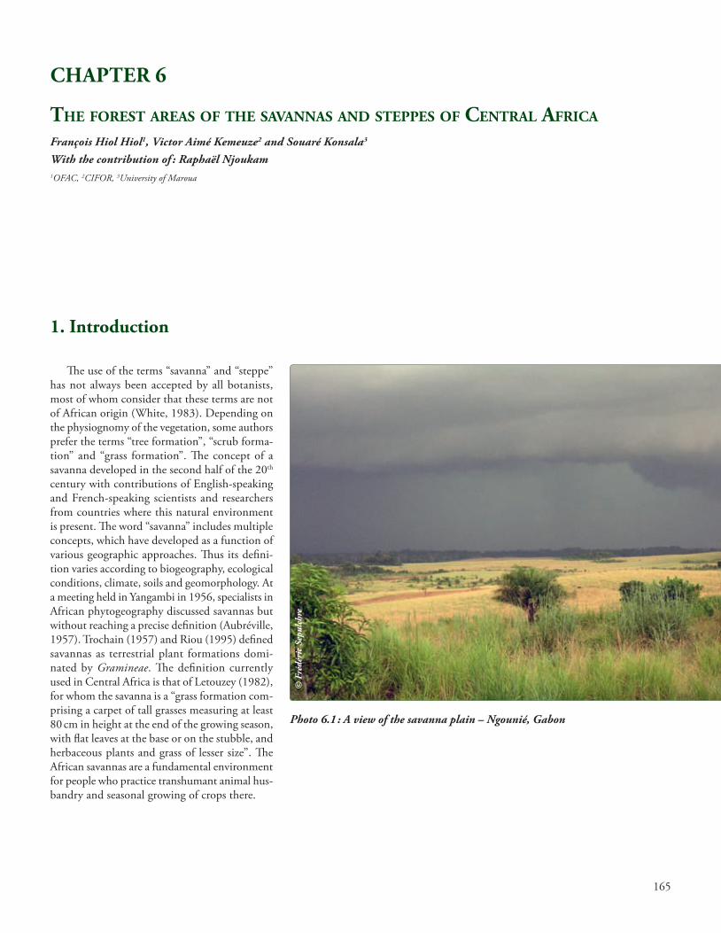
165 1. Introduction CHAPTER 6 THE FOREST AREAS OF THE SAVANNAS AND STEPPES OF CENTRAL AFRICA François Hiol Hiol 1 , Victor Aimé Kemeuze 2 and Souaré Konsala 3 With the contribution of : Raphaël Njoukam 1 OFAC, 2 CIFOR, 3 University of Maroua e use of the terms “savanna” and “steppe” has not always been accepted by all botanists, most of whom consider that these terms are not of African origin (White, 1983). Depending on the physiognomy of the vegetation, some authors prefer the terms “tree formation”, “scrub forma- tion” and “grass formation”. e concept of a savanna developed in the second half of the 20 th century with contributions of English-speaking and French-speaking scientists and researchers from countries where this natural environment is present. e word “savanna” includes multiple concepts, which have developed as a function of various geographic approaches. us its defini- tion varies according to biogeography, ecological conditions, climate, soils and geomorphology. At a meeting held in Yangambi in 1956, specialists in African phytogeography discussed savannas but without reaching a precise definition (Aubréville, 1957). Trochain (1957) and Riou (1995) defined savannas as terrestrial plant formations domi- nated by Gramineae. e definition currently used in Central Africa is that of Letouzey (1982), for whom the savanna is a “grass formation com- prising a carpet of tall grasses measuring at least 80 cm in height at the end of the growing season, with flat leaves at the base or on the stubble, and herbaceous plants and grass of lesser size”. e African savannas are a fundamental environment for people who practice transhumant animal hus- bandry and seasonal growing of crops there. Photo 6.1 : A view of the savanna plain – Ngounié, Gabon © Frédéric Sepulchre
-
Upload
truongkiet -
Category
Documents
-
view
216 -
download
3
Transcript of The forest areas of the savannas and steppes of Central Africa
165
1. Introduction
CHAPTER 6
The foresT areas of The savannas and sTeppes of CenTral afriCa François Hiol Hiol1, Victor Aimé Kemeuze2 and Souaré Konsala3
With the contribution of : Raphaël Njoukam1OFAC, 2CIFOR, 3University of Maroua
The use of the terms “savanna” and “steppe” has not always been accepted by all botanists, most of whom consider that these terms are not of African origin (White, 1983). Depending on the physiognomy of the vegetation, some authors prefer the terms “tree formation”, “scrub forma-tion” and “grass formation”. The concept of a savanna developed in the second half of the 20th century with contributions of English-speaking and French-speaking scientists and researchers from countries where this natural environment is present. The word “savanna” includes multiple concepts, which have developed as a function of various geographic approaches. Thus its defini-tion varies according to biogeography, ecological conditions, climate, soils and geomorphology. At a meeting held in Yangambi in 1956, specialists in African phytogeography discussed savannas but without reaching a precise definition (Aubréville, 1957). Trochain (1957) and Riou (1995) defined savannas as terrestrial plant formations domi-nated by Gramineae. The definition currently used in Central Africa is that of Letouzey (1982), for whom the savanna is a “grass formation com-prising a carpet of tall grasses measuring at least 80 cm in height at the end of the growing season, with flat leaves at the base or on the stubble, and herbaceous plants and grass of lesser size”. The African savannas are a fundamental environment for people who practice transhumant animal hus-bandry and seasonal growing of crops there.
Photo 6.1 : A view of the savanna plain – Ngounié, Gabon
© F
rédé
ric
Sepu
lchr
e

166
The savannas of Central Africa can be divided into three large complexes :
- the savannas on the southern border of the equatorial forest massif ; in Congo they are to be found along the coast, in the Niari valley, in the Bateke region and in the Congo Basin. They extend in the north towards Gabon and in the south towards a large part of the Democratic Republic of Congo (DRC) ;
- the savannas on the northern edge of the equatorial forest massif, together with the for-est, form a mosaic ; this is the transitional zone between the semi-deciduous forest in the south and the Sudano-Guinean savannas to the north ;
- the integrated savannas within the forest massifs, e.g. the Lopé savannas in Gabon and the Northern Impfondo savannas in the Congo Basin.
The steppes are open grass formations, com-prising a discontinuous herbaceous carpet and composed mainly of annual species, with the occasional presence of a few timber species. They are associated with either the degree of aridity (climatic steppe) or to the soil (edaphic steppe). The timber stratum is of low density and less than 10 m in height (Letouzey, 1982). According to Aubréville (1957), depending on the amount of timber growth there are three types of steppe : grass steppe, scrub steppe and bush or tree steppe. The steppe differs from the savanna in having scanter vegetation, replacement of large Gramineae by smaller Gramineae, and fewer tree and scrub species, the latter being adapted to the aridity (smaller leaves, thorns).
The three savanna complexes in Central Africa share several common characteristics : in all regions they coexist with the forests and regu-larly burn during the dry season. The steppes, on the other hand, are protected from fire by the discontinuous nature of the herbaceous carpet, which is mostly composed of annual species that disappear during the dry season (Letouzey, 1982). The steppes, like the savannas, are threatened by desertification and climate change and by non-sustainable agricultural and environmental practices, which is leading to a decrease in their biological diversity and the appearance of inva-sive species. Accordingly, the management of the natural resources of the savannas and steppes are among the major environmental concerns at the global level. The United Nations Convention to Combat Desertification (UNCCD), adopted in Paris on 17 June 1994, defines a framework for developing these ecosystems through an inte-grated approach and measures that will contribute to their sustainable development. Unfortunately, the forest areas within the savannas and steppes of Central Africa have so far received very little attention compared with the dense rainforests. However, all the Central African countries have integrated these areas into their national policies on reduction of greenhouse gases in the forestry sector, notably by promoting measures (payment for environmental services) that will encourage the conservation of these forest areas.
Photo 6.2 : Steppes of the Bateke Plateau, Congo
© D
omin
ique
Lou
ppe
167
The savannas and steppes of Central Africa are subject to substantial climatic variations in the course of the year linked to the movement of the inter-tropical front. Rainfall is low com-pared with that in the dense rainforest areas. It is extremely variable over time, area and inten-sity, which may reach 200 mm/hour. In the dry season the low humidity of the air and the very strong insolation cause generally high air and soil temperatures.
Soils have a number of common character-istics :
• theirevolutionisslowandtheirdepthoftenshallow ;
• theorganicmatterishighlyweathered,andis either scanty and superficial or where more abundant. and distributed throughout the soil profile ;
• thestructureis,ingeneral,poorlydefined;• themineralelementsshowrelativelylittle
deterioration ;• theclaycolloidsarestable;• thesolubleelementsareconcentratedat
one level of the profile and may give rise to nod-ules or calcareous, gypsiferous or saline crusts ;
• hydromorphicareasarefrequent,especiallyin semi-arid conditions ;
• therisksofwindandwatererosionareveryhigh.
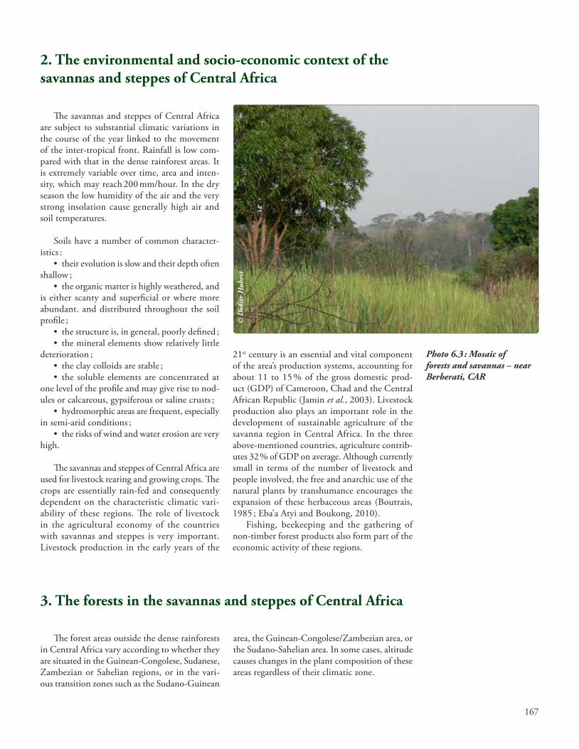
The savannas and steppes of Central Africa are used for livestock rearing and growing crops. The crops are essentially rain-fed and consequently dependent on the characteristic climatic vari-ability of these regions. The role of livestock in the agricultural economy of the countries with savannas and steppes is very important. Livestock production in the early years of the
2. The environmental and socio-economic context of the savannas and steppes of Central Africa
21st century is an essential and vital component of the area’s production systems, accounting for about 11 to 15 % of the gross domestic prod-uct (GDP) of Cameroon, Chad and the Central African Republic (Jamin et al., 2003). Livestock production also plays an important role in the development of sustainable agriculture of the savanna region in Central Africa. In the three above-mentioned countries, agriculture contrib-utes 32 % of GDP on average. Although currently small in terms of the number of livestock and people involved, the free and anarchic use of the natural plants by transhumance encourages the expansion of these herbaceous areas (Boutrais, 1985 ; Eba’a Atyi and Boukong, 2010).
Fishing, beekeeping and the gathering of non-timber forest products also form part of the economic activity of these regions.
Photo 6.3 : Mosaic of forests and savannas – near Berberati, CAR
The forest areas outside the dense rainforests in Central Africa vary according to whether they are situated in the Guinean-Congolese, Sudanese, Zambezian or Sahelian regions, or in the vari-ous transition zones such as the Sudano-Guinean
area, the Guinean-Congolese/Zambezian area, or the Sudano-Sahelian area. In some cases, altitude causes changes in the plant composition of these areas regardless of their climatic zone.
3. The forests in the savannas and steppes of Central Africa
© D
idie
r H
uber
t

168
The peri-forest or integrated savannas :These are large expanses of savanna which
develop as broad massifs on the edges of forests or within the forest massif (integrated savannas). They comprise forest-savanna mosaics which include forest elements and savanna elements. The trees and shrubs in the peri-forest savannas
are scattered, while the grass in these areas forms a continuous carpet (Mayaux et al., 1997). In some cases, strips of forest surrounded by vast areas of savanna are found along alluvial benches : these are forest galleries. They are situated primarily in Cameroon, Gabon, the Republic of Congo, the Central African Republic (CAR), and DRC.
3.1. Forest areas in the savannas of the Guinean-Congolese region
Photo 6.4 : Lopé National Park station, Gabon
This is the transition area separating the Guinean-Congolese and Sudanese regions. White (1986) describes them as a very narrow band of vegetation situated in the north of the Guinean-Congolese region and traversing the following three Central African countries as far as Uganda :
• Cameroon:thehighplateauxinthewest,the Adamaoua plateau, the Mbam and Noun valleys ;
• CAR:accordingtoBoulvert(1980), thecenter around Dekoa and to the south-west of Bouca ; towards the south-east of the country
between Mouka and Obo ; in the south on the Ouaka plateaux and around Bossembelé ; and to the west in the Carnot and Bouar savannas ;
• DRC:north-westofEquateurprovince;north of the Uélés and east of Ituri.
These areas contain grass savannas, wooded savannas, clear forests and dry dense forests, according to the terminology used by Aubréville (1957) and Letouzey (1982). The illustrations of these various formations are taken from Letouzey’s manual on forest botany (1982).
3.2 Forest areas within savannas in the Sudano-Guinean region©
Dom
iniq
ue L
oupp
e

169
3.3 Forest areas in savannas in the Guinean-Congolese/Zambezian transitional region
According to White (1986), these Central African landscapes comprise :
• plant formations equivalent to the drydense forests and clear forests (DRC – provinces of Bandundu and Katanga) ;
• grasssavannas,woodedsavannasandscrubsavannas in the Republic of Congo (Niari valley, cataract plateaux, Bateke) and in DRC (provinces of Bas-Congo, Bandundu, western and eastern Kasaï, and Katanga).
Box 6.1 : Linear forestry in the highland humid savannas of west CameroonR. Njoukam1, Régis Peltier2
1 IRAD, 2 CIRAD
The highland humid savannahs of west Cameroon offer a wide variety of landscapes. The vegetation, modified by human activities, is a mosaic of crops, grasslands and small forest patches (sacred forests, gallery forests, etc.).
High population densities (180 to 250 inhabitants/km²) put heavy pressure on land and natural resources. Farmers have inte-grated trees into their lands, notably in the form of hedges, to obtain needed diverse timber and non-timber products. These hedges have evolved over the years, from multi-use plantations with a combination of numerous woody and shrubby species to a veritable “unilinear”, at times monospecific, tree plantations. In this hedge-and-field system, the following types of hedges are found: mixed or multi-species hedges, Eucalyptus and Pinus sp hedges, Polyscias fulva hedges, Podocarpus latifolius hedges and Entandrophragma candollei hedges.
Mixed hedgerows originally start out as fences made of closely spaced pickets of Ficus sp that will, for the most part, generate shoots. They are linked horizontally by raffia palm fronds attached with raffia twine. These hedgerows are gradually enriched with di-verse species from cuttings or non-grafted plants including Dracaena sp, Croton macrostachyus, Vitex cienkowskii, Ficus thonningii, Schef-flera barteri, Canarium schweinfurthii, Vernonia amygdalina, Kigelia africana, Khaya grandifoliola, Markhamia lutea, Albizia glaberrima, Spathodea campanulata, Adenocarpus mannii, etc.
Eucalyptus sp and Pinus sp hedges: as the growth of local species in mixed hedges is slow, a trend in the last few decades is to plant fast-growing exotic species in monospecific rows. The monospecific hedges do not exhibit the multiple functions of mixed hedges, but serve to demarcate land and to produce wood. The most widely used species is eucalyptus which provides poles, stakes, sawn wood and firewood. Eucalyptus sustainably produces these wood products by growing new shoots through mixed-age coppice. Pine also is planted to mark the boundaries of “concessions”.
Polyscias fulva hedges: this local fast-growing species produces a light wood which is easy to sculpt. In the Foumban region, where it is used to make traditional elongated masks, it has become scarce. Planted in close rows, it grows rapidly (Njoukam et al., 2008).
Podocarpus latifolius hedges: this species, native to Mont Oku in the northwest of Cameroon, grows at altitudes of 2 400 to 2 900 m. Farmers plant them in single, closely packed rows (up to 4 trees per meter) to demarcate their fields. Seeds are sown in the dry season on wetlands. Seedlings are transplanted during the rainy season. Podocarpus produce poles and sawn wood (Temgoua et al., 2011).
Entandrophragma candollei hedges: Kosipo is a mahogany which did not naturally exist in the village of Bayangam in northern Cameroon. It was introduced over a century ago by a peddler who brought in seeds that he planted on his farm. Since then, this species has been planted in hedgerows and on the edges of traditional dance areas. It produces very handsome, straight and cylindrical boles.

170
Figure 6.1 : Dry dense forest (Letouzey, 1982).
The dry dense forests in figure 6.1 have little herbaceous undergrowth ; this is very different from the herbaceous flora of neighboring savan-nas (Schnell, 1976). Rainfall is 1 000 to 1 500 mm per annum with a clearly marked dry season. Exceptionally, they may occupy dry and stony soils in wetter regions. An example of the com-position of these forests in the Sudano-Guinean zone of CAR is given by Boulvert (1980) ; he
gives them the name “dense semi-humid forests with Anogeissus leiocarpus-Abizia zygia”. In the Guinean-Congolese/Zambezian transitional area, White (1986) states that the dry dense forests are scattered over the Kwango plateau (Katanga prov-ince, DRC, where they are known as “mabwati”). The timber species characteristic of the dry dense forests are listed in Annex 3.
Figure 6.2 : Wooded savannas (Letouzey, 1982).
Wooded savannas are formations in which the trees and bushes form a clear cover (20 to 70 % coverage) which allows copious light pen-etration (figure 6.2). The timber species charac-teristic of wooded savannas are listed in Annex 3.
Tree savannas (figure 6.3) are character-ized by a continuous herbaceous stratum of at least 80 cm in height with a very variable timber cover (2 to 20 % of cover). The timber species characteristic of the tree savannas are listed in Annex 3.

171
In Central Africa, these landscapes are found only in the province of Katanga in the DRC. The clear forest is the most widespread type of vegeta-tion and the most characteristic of the Zambezian region (White, 1986). Here, the clear forest of the “miombo” type predominates. In terms of flora and physiognomy, the miombo is very dif-ferent from the other types of clear forest. It is almost always dominated by Brachystegia spe-cies, alone or in association with Julbernardia and Isoberlinia. The dominant species are extremely
gregarious and are found only rarely with other types of vegetation. It is the shape of the domi-nant trees which gives the miombo its character-istic appearance. Their trunks are in most cases short but relatively thin and the branches first climb sharply upwards before spreading out to support the light crown, which is not very thick, and flat at the peak ; it produces feather-shaped leaves. The miombo is generally between 10 and 20 m in height.
Figure 6.3 : Tree savanna (Letouzey, 1982).
Figure 6.4 : Scrub savanna (Letouzey, 1982).
The scrub savannas (figure 6.4) resemble the wooded savanna but the tree stratum is re-
placed by a bush stratum (Annex 3). The pro-portion of bush cover is less than 70 %.
3.4 Forest areas of savanna in the Sudanese region
These are found in a narrow strip which runs through :
• Cameroon:highbasinsofFaro,Bénoué,Mayo-Rey, Northern Vina and Mbéré ;
• CAR:accordingtoBoulvert(1980),thesouthern limit is sinuous (to the west it begins at a latitude of approximately 7° north, at the center the curve descends to 6° North and in the east it descends again to 6°30’ North after rising to 7°45’ north ; the average northern limit is below 8°30’ north ;
• Chad:extremesouth.These landscapes contain mainly clear forests.
The timber species characteristic of the clear forest are listed in Annex 3. Clear forests (figure 6.5) are dominated by legumes and Combrataceae. They are composed of bulky trees with short trunks and a broad crown rising to approximately 20 m and with, in most cases, small deciduous leaves.
3.5 Savanna-forest landscapes in the Zambezian region

172
The Sudano-Sahelian zone forms a transition between the Sudanese region and the Sahelian region and corresponds to a band lying approxi-mately between latitudes 8°30’and 10° North and running through Cameroon, CAR and Chad. The Sudano-Sahelian zone comprises a dry grass savanna, scrub savanna and tree savanna. In CAR, Boulvert (1980) distinguishes a northern and north-western subsector with Daniellia oliveri,
Burkea africana and Lophira lanceolata ; the cen-tral and eastern subsector with Anogeissus leio-carpus, Albizia zygia ; and the southern subsector with Daniellia oliveri and Terminalia glaucescens.
In the north of the Sudano-Sahelian zone is a transition zone leading to the Sahelian region : this is the Sahelo-Sudanese zone. In CAR, Boulvert (1980) situates it between 9°30’ and 10° North (the Sahelo-Sudanese zone of Birao).
Figure 6.5 : Clear forest (Letouzey, 1982).
3.6 Forest landscapes in the Sudano-Sahelian and Sahelo-Sudanese transition zone
These landscapes occur over a great part of Chad and relatively small parts of Cameroon and CAR. The plant formations are principally steppes.
The characteristics common to the various types of steppe relate to physiognomy. Timber vegetation is more or less non-existent or scant. Herbaceous vegetation is discontinuous and plant production, which is highly seasonal, is often very limited.
In accordance with the Yangambi Agreement (Aubréville, 1957) on the nomenclature of types of African vegetation and following the charac-teristics and density of timber species, there are five principal types of steppe : tree steppe and/or scrub steppe, bush steppe, thorn steppe, succulent steppe and grass steppe. These various types of vegetation develop according to the type of soil.
3.7 Forest landscapes in the Sahelian region
3.7.1 Sahelian tree and scrub steppes, and bush steppes
Tree steppes (figure 6.6) develop with precipi-tation between 400 and 600 mm/year. Tree and scrub vegetation is very scant. The timber species of these steppes are listed in Annex 3.
3.7.2 Succulent steppes and grass steppes
Succulent steppes (figure 6.7) are steppes with abundant grassy plants (Cactaceae) with a broad representation of succulent plants (An-nex 3). Grass steppes are steppe-like formations dominated by herbaceous plants such as Lou-detia simplex, Bulbine abyssinica and Panicum turgidum.

173
Figure 6.6 : Tree and/or scrub steppe (Letouzey, 1982).
Figure 6.7 : Succulent steppe and grassy steppe (Letouzey, 1982).
3.8 Forest landscapes in the Afro-mountainous region
These are found mainly in :• thehighplateauxandmountainsofwestern
Cameroon ;• theKivuchainandcontiguoushighpla-
teaux in DRC ;• themountainsofRwanda;• themountainsofBurundi.Between these areas, relics of Afro-
mountainous forest landscapes are intermittently in São Tomé and Príncipe , the Bioko Islands in Equatorial Guinea and Gabon (Vande Weghe, 2002). In Cameroon, Rwanda and Burundi these forests have been subjected to strong agricultural and pastoral anthropic pressure.
According to White (1986), on each moun-tain vegetation is highly variable. In addition, White (1986) states that, although the floristic differences are often very marked from one group to another on the same mountain, the flora of a particular massif as a whole generally appears fairly close to that of other massifs, whether nearby or distant, so that the collective flora of the “Afro-mountainous archipelago” shows remark-able continuity and uniformity. The timber spe-cies characteristic of the Afro-mountainous forest landscapes are listed in Annex 3.
Apart from the Afro-mountainous dense rainforest (1 200 to 1 500 m in altitude), White (1986) draws attention to the presence of the following plant formations :
• theundifferentiated Afro-mountainous forest : it usually replaces the rainforest at higher altitudes on wet slopes and at a comparable altitude on dry slopes ; it generally receives less precipitation than the Afro-mountainous dense rainforest ;
• the bush formation and the Afro-mountainous evergreen thickets are found on most of the high mountains of Africa ; their flo-ristic composition varies greatly but comprises certain elements of the Ericaceae family ;
• theAfro-mountainous scrub formation replaces the bush formation and the above-men-tioned Ericaceae thickets on the surface soils of high mountains, in particular on exposed rocky crests ; these low scrub formations are very mixed formations in which the following are observed beside the scrub : Gramineae, Cyperaceae, herba-ceous plants (mainly geophytes), bryophytes and lichens.
174
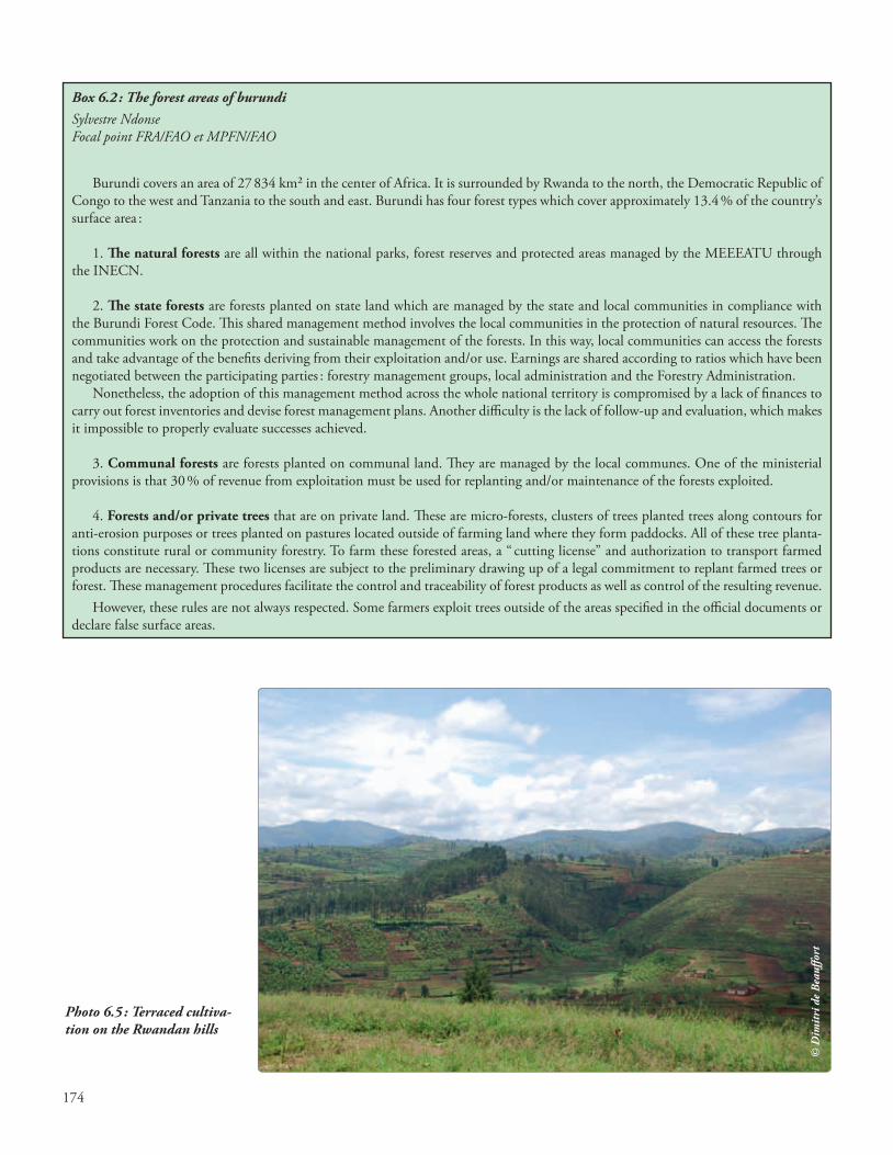
Photo 6.5 : Terraced cultiva-tion on the Rwandan hills
© D
imit
ri d
e B
eauf
fort
Box 6.2 : The forest areas of burundiSylvestre Ndonse Focal point FRA/FAO et MPFN/FAO
Burundi covers an area of 27 834 km² in the center of Africa. It is surrounded by Rwanda to the north, the Democratic Republic of Congo to the west and Tanzania to the south and east. Burundi has four forest types which cover approximately 13.4 % of the country’s surface area :
1. The natural forests are all within the national parks, forest reserves and protected areas managed by the MEEEATU through the INECN.
2. The state forests are forests planted on state land which are managed by the state and local communities in compliance with the Burundi Forest Code. This shared management method involves the local communities in the protection of natural resources. The communities work on the protection and sustainable management of the forests. In this way, local communities can access the forests and take advantage of the benefits deriving from their exploitation and/or use. Earnings are shared according to ratios which have been negotiated between the participating parties : forestry management groups, local administration and the Forestry Administration.
Nonetheless, the adoption of this management method across the whole national territory is compromised by a lack of finances to carry out forest inventories and devise forest management plans. Another difficulty is the lack of follow-up and evaluation, which makes it impossible to properly evaluate successes achieved.
3. Communal forests are forests planted on communal land. They are managed by the local communes. One of the ministerial provisions is that 30 % of revenue from exploitation must be used for replanting and/or maintenance of the forests exploited.
4. Forests and/or private trees that are on private land. These are micro-forests, clusters of trees planted trees along contours for anti-erosion purposes or trees planted on pastures located outside of farming land where they form paddocks. All of these tree planta-tions constitute rural or community forestry. To farm these forested areas, a “ cutting license” and authorization to transport farmed products are necessary. These two licenses are subject to the preliminary drawing up of a legal commitment to replant farmed trees or forest. These management procedures facilitate the control and traceability of forest products as well as control of the resulting revenue.
However, these rules are not always respected. Some farmers exploit trees outside of the areas specified in the official documents or declare false surface areas.

175
Box 6.3 : Forest areas in the savannas of rwandaThaddée HabiyambereCEFDHAC
Rwanda, with a surface area of 26 338 km², is also known as the land of a thousand hills. Its terrain is characterized by steep slopes and altitudes ranging between 900 and 4 507 m. The climate is temperate, with an average annual temperature of 18.5°C and 1 250 mm of rainfall.
A natural forest in the northern volcano chain contains many of the last remaining mountain gorillas. A relic of dense mountain rainforest remains on the Congo-Nile Ridge to the west. On the more gently sloping hills in the center, the natural vegetation has all but disappeared because of crop and livestock farming. The altitude of the plateaus and plains of the southeast and east is less than 1500 m. They were originally covered with wooded savannah and shrubland that were heavily degraded by clearing for agriculture and the cutting of fuel wood for Kigali city. Apart from a few scattered exceptions, the remaining wooded savannah and shrubland is located in Akagera National Park, which covers 108 500 ha.
The assessment of the national forest cover carried out in 2012 included all woodland areas larger than 0.25 ha. The assessment was conducted by “The Geographic Information Systems & Remote Sensing Research and Training Center” of the National University of Rwanda (CGIS – NUR) and by the “Reforestation Support Program” (PAREF)/Rwanda Natural Resources Authority (RNRA). The assessment revealed that wooded savannah covers 1 772 ha and shrubland 260 674 ha. The majority of these forest types are located in districts of the Eastern (258 491 ha) and Southern (695 ha) provinces, and the districts of Kigali City (59 ha).
Natural forest occupies a total of 385 226 ha in Rwanda, with wooded savanna and shrubland comprising 262 446 ha, or 68% of the forest.
Photo 6.6 : Slopes of Karisimbi Volcano - part of Volcanoes National Park, Rwanda
© D
imit
ri d
e B
eauf
fort
176
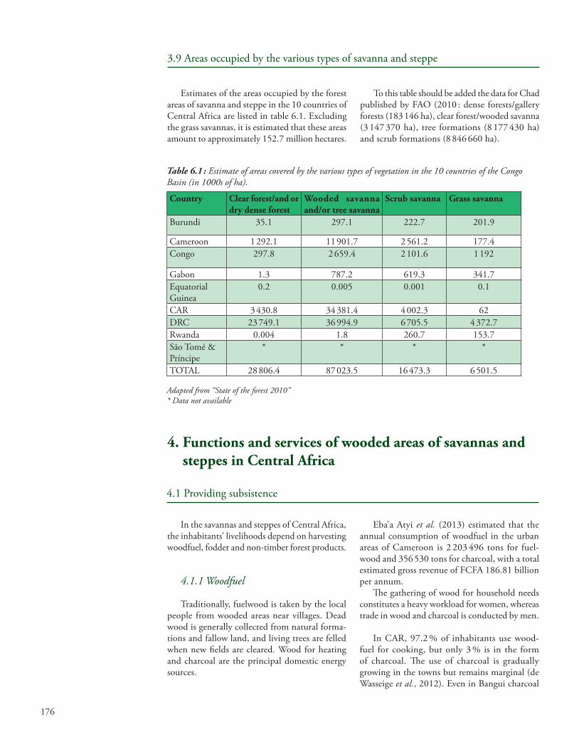
Table 6.1 : Estimate of areas covered by the various types of vegetation in the 10 countries of the Congo Basin (in 1000s of ha).
Country Clear forest/and or dry dense forest
Wooded savanna and/or tree savanna
Scrub savanna Grass savanna
Burundi 35.1 297.1 222.7 201.9
Cameroon 1 292.1 11 901.7 2 561.2 177.4Congo 297.8 2 659.4 2 101.6 1 192
Gabon 1.3 787.2 619.3 341.7Equatorial Guinea
0.2 0.005 0.001 0.1
CAR 3 430.8 34 381.4 4 002.3 62DRC 23 749.1 36 994.9 6 705.5 4 372.7Rwanda 0.004 1.8 260.7 153.7São Tomé & Príncipe
* * * *
TOTAL 28 806.4 87 023.5 16 473.3 6 501.5
Adapted from “State of the forest 2010”* Data not available
3.9 Areas occupied by the various types of savanna and steppe
Estimates of the areas occupied by the forest areas of savanna and steppe in the 10 countries of Central Africa are listed in table 6.1. Excluding the grass savannas, it is estimated that these areas amount to approximately 152.7 million hectares.
To this table should be added the data for Chad published by FAO (2010 : dense forests/gallery forests (183 146 ha), clear forest/wooded savanna (3 147 370 ha), tree formations (8 177 430 ha) and scrub formations (8 846 660 ha).
In the savannas and steppes of Central Africa, the inhabitants’ livelihoods depend on harvesting woodfuel, fodder and non-timber forest products.
4.1.1 Woodfuel
Traditionally, fuelwood is taken by the local people from wooded areas near villages. Dead wood is generally collected from natural forma-tions and fallow land, and living trees are felled when new fields are cleared. Wood for heating and charcoal are the principal domestic energy sources.
4. Functions and services of wooded areas of savannas and steppes in Central Africa
4.1 Providing subsistence
Eba’a Atyi et al. (2013) estimated that the annual consumption of woodfuel in the urban areas of Cameroon is 2 203 496 tons for fuel-wood and 356 530 tons for charcoal, with a total estimated gross revenue of FCFA 186.81 billion per annum.
The gathering of wood for household needs constitutes a heavy workload for women, whereas trade in wood and charcoal is conducted by men.
In CAR, 97.2 % of inhabitants use wood-fuel for cooking, but only 3 % is in the form of charcoal. The use of charcoal is gradually growing in the towns but remains marginal (de Wasseige et al., 2012). Even in Bangui charcoal

177
Photo 6.7 : Treating eucalyptus for fuelwood – Bukavu, DRC
accounts for only 5.5 % of domestic energy con-sumed (Salbitano, 2009, cited in State of the Forest 2010). Numerous tree species are sought for fuelwood or charcoal because of their energy qualities, which may threaten the existence of dense slow-growing species such as Dalbergia melanoxylon or Prosopis africana and certain fruit- or timber-producing species. The most widely used species in the Cameroonian savannas are listed in table 6.2.
Photo 6.8 : Woodfuel collection in a savanna zone
Table 6.2 : Savanna species currently used as woodfuel in the savannas of Cameroon
Spontaneous species Species protected by manAfrormosia laxiflora, Annona senegalensisBurkea africana, Prosopis africanaCombretum glutinosum Bombax costatumDetarium microcarpum Dalbergia melanoxylonHexalobus monopetalus Diospyros mespiliformisLannea fructicosa Khaya senegalensisStrychnos spinosa Vitellaria paradoxaSecuridaca longipedunculata Ximenia americanaXerroderis stühlmannii,Gymnosporia senegalensis Terminalia avicennioïdes Terminalia glaucescens Mitragyna inermis
The species listed in table 6.3 are commonly used in the Cameroonian steppes (Kemeuze et al., 2013).
The volume of standing fuelwood is estimated at 8.5 m3/ha in the tree and scrub steppes of Cameroon. Total consumption of fuelwood and charcoal in this region has been estimated at 666 536 tons and 20 058 tons respectively (Eba’a Atyi et al., 2013). In general, the demand for fuel-wood and charcoal in the tree and scrub steppes of Central Africa outstrips natural growth. To meet this demand, appropriate reforestation pro-grams are needed.
Table 6.3 : Steppe species commonly used as woodfuel in Cameroon
Spontaneous species Species protected by manBauhinia rufesens, Acacia albida, Boscia senegalensis, Balanites aegyptiaca, Cassia sieberiana Dalbergia melanoxylonCombretum microcarpum Diospyros mespiliformis,Ficus spp., Sclerocarya birrea,Grewia bicolor, Vitex donianaGrewia tenax, Lannea acida, Leptadenia pyrotechnicaPiliostigma thonningiiPterocarpus lucens, Sterculia setigera, Ziziphus mauritiana
© F
rédé
ric
Sepu
lchr
e
© F
ongn
zoss
ie E
vari
ste

178
4.1.2 Wood for the manufacture of handles of tools and other utensils
Various tools and utensils (mortars, pestles, tool handles, etc.) are made from the wood of numerous species, including Anogeissus leiocar-pus, Balanites aegyptiaca, Dalbergia melanoxylon, Sclerocarya birrea, etc. (Fondoun, 2001).
4.1.3 Fodder
In the savannas and steppes, trees and bushes constitute an important stock of fodder for live-stock which provides essential nutrients includ-ing proteins, vitamins and minerals (Bergonzini, 2004). This type of fodder is essentially sought at the end of the dry season for new leaves and in the middle of the dry season for fruit (pods). Acacia pods are particularly appreciated by livestock producers, who store them to feed their cattle during the dry season. Pastoral farming is depen-dent on aerial dry-season fodder (persistent leaf species or species which bud off-season), which may then constitute over 50 % of the cattle’s feed requirement, exceeding dry straw. Fodder can also be produced by species such as Acacia nilotica, Faidherbia albida, A. Senegal, Prosopis africana planted in the open or in hedges or managed in agro-forest parks.
The steppes of Central Africa are an impor-tant pasture area. Cattle in the extreme north of Cameroon are estimated to number 2 100 000 (Moumini, 2012). However, the discontinu-ous nature of the herbaceous cover is a factor which limits livestock production. Unlike the
Photo 6.9 : Hoes and axes with wooden handles
savanna regions in the strict sense, the available herbaceous biomass is produced only during the brief rainy season. The timber species are highly dispersed, and mostly thorny, but constitute an important fodder resource, notably for goats and camels. The principal timber forage plants found in the area are : Acacia spp., Adansonia digitata, Annona senegalensis, Balanites aegyptiaca, Borassus aethiopum, Boscia senegalensis, Bauhinia rufescens, Detarium senegalensis, Diospyros mes-piliformis, Faidherbia albida, Ficus sp., Grewia bicolor, Hyphaene thebaica, Prosopis juliflora, Sclerocarya birrea, Sterculia setigera, Tamarindus indica, Terminalia brownii, Ziziphus mauritiana. Shrubs over 3 m in height are trimmed by the farmers in the grazing areas to feed their cattle.
In the steppes, livestock production is sea-sonal and there are three types of producer : trans-humant, sedentary and semi-sedentary. In addi-tion, the productivity of natural pastures is low (3-4 tons dry matter/ha/year) (Awa et al., 2004) while stockbreeding practices remain essentially extensive. Under these circumstances, sustainable pasture management techniques and fodder crops are high priorities.
4.1.4 Non-timber forest products
The forest areas of the savannas and steppes of Central Africa provide numerous non-timber forest products, among which the most exploited are gum arabic (Acacia nilotica, A. Senegal, A. seyal, etc.), shea nuts (Vitellaria paradoxa), the fruit and leaves of Balanites aegyptiaca, tamarisk pods (Tamarindus indica), the fruit of Hyphaene thebaica, the jujube seed (Ziziphus mauritiana ; Z. spina-christi), dates from Phoenix dactylifera and medicinal products from Khaya senegalensis. These and many other species have multiple uses (medicinal plants, cosmetics, human food, etc.).
Straw is another of the most exploited resources and is used to make roofing for houses, matting, fences, etc.
Honey is an important resource which is used, inter alia, to make mead. This drink is very popular and gives rise to a thriving business. The honey is harvested in hives or directly from hol-lows in tree trunks. The hives are often made from tree bark (Khaya senegalensis). This activity is an important source of income for local people.
© F
ongn
zoss
ie E
vari
ste
179
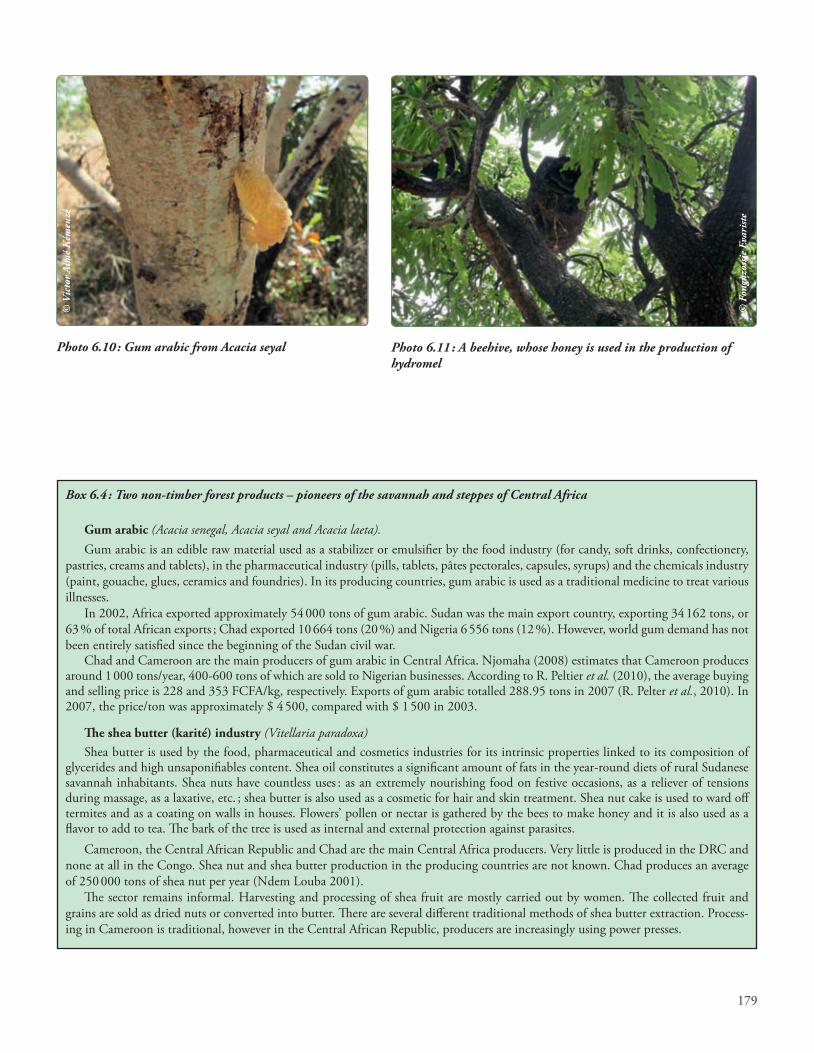
Photo 6.10 : Gum arabic from Acacia seyal Photo 6.11 : A beehive, whose honey is used in the production of hydromel
© V
icto
r Ai
mé
Kém
euzé
© F
ongn
zoss
ie E
vari
ste
Box 6.4 : Two non-timber forest products – pioneers of the savannah and steppes of Central Africa
Gum arabic (Acacia senegal, Acacia seyal and Acacia laeta).Gum arabic is an edible raw material used as a stabilizer or emulsifier by the food industry (for candy, soft drinks, confectionery,
pastries, creams and tablets), in the pharmaceutical industry (pills, tablets, pâtes pectorales, capsules, syrups) and the chemicals industry (paint, gouache, glues, ceramics and foundries). In its producing countries, gum arabic is used as a traditional medicine to treat various illnesses.
In 2002, Africa exported approximately 54 000 tons of gum arabic. Sudan was the main export country, exporting 34 162 tons, or 63 % of total African exports ; Chad exported 10 664 tons (20 %) and Nigeria 6 556 tons (12 %). However, world gum demand has not been entirely satisfied since the beginning of the Sudan civil war.
Chad and Cameroon are the main producers of gum arabic in Central Africa. Njomaha (2008) estimates that Cameroon produces around 1 000 tons/year, 400-600 tons of which are sold to Nigerian businesses. According to R. Peltier et al. (2010), the average buying and selling price is 228 and 353 FCFA/kg, respectively. Exports of gum arabic totalled 288.95 tons in 2007 (R. Pelter et al., 2010). In 2007, the price/ton was approximately $ 4 500, compared with $ 1 500 in 2003.
The shea butter (karité) industry (Vitellaria paradoxa)Shea butter is used by the food, pharmaceutical and cosmetics industries for its intrinsic properties linked to its composition of
glycerides and high unsaponifiables content. Shea oil constitutes a significant amount of fats in the year-round diets of rural Sudanese savannah inhabitants. Shea nuts have countless uses : as an extremely nourishing food on festive occasions, as a reliever of tensions during massage, as a laxative, etc. ; shea butter is also used as a cosmetic for hair and skin treatment. Shea nut cake is used to ward off termites and as a coating on walls in houses. Flowers’ pollen or nectar is gathered by the bees to make honey and it is also used as a flavor to add to tea. The bark of the tree is used as internal and external protection against parasites.
Cameroon, the Central African Republic and Chad are the main Central Africa producers. Very little is produced in the DRC and none at all in the Congo. Shea nut and shea butter production in the producing countries are not known. Chad produces an average of 250 000 tons of shea nut per year (Ndem Louba 2001).
The sector remains informal. Harvesting and processing of shea fruit are mostly carried out by women. The collected fruit and grains are sold as dried nuts or converted into butter. There are several different traditional methods of shea butter extraction. Process-ing in Cameroon is traditional, however in the Central African Republic, producers are increasingly using power presses.

180
4.2.1 Conservation of biodiversity
The savannas and steppes constitute habitats for numerous animal and plant species. A large number of protected areas have been created in the savannas and steppes of the various countries of Central Africa. By way of example, Cameroon counts nine protected areas in the savanna and steppe regions. In CAR there are at least ten protected areas. The types of wildlife living in these environments have already been described in previous reports in the State of the Forest of Central Africa, notably the State of the Forest 2010 (de Wasseige et al., 2012).
Apart from this wild fauna, numerous plant species useful to man – for food, medicine, etc. – are conserved in these protected areas (Betti and Mebere Yemefa’a, 2011).
4.2.2 Protection of soils and watershed areas
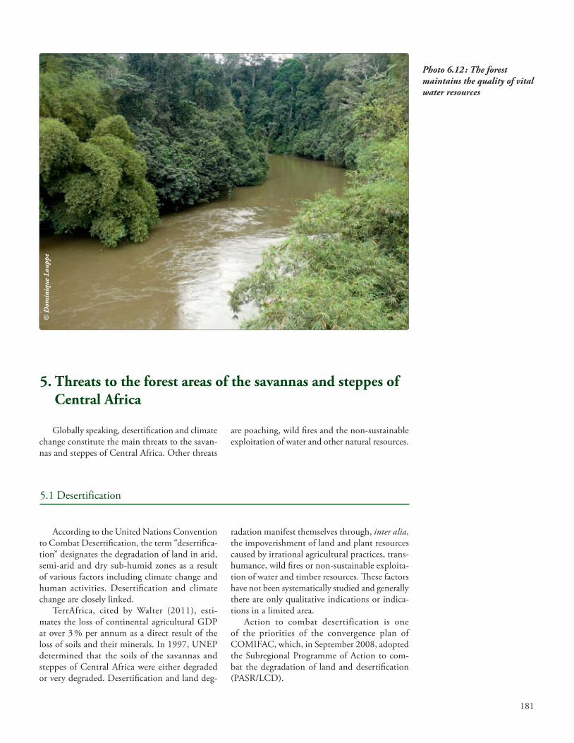
The timber species in the savanna and steppe areas provide a multitude of ecosystems services : reduction of flooding and runoff and reduction of soil loss from erosion (Boli Baboule, 1996 ; Hiol Hiol, 1999), maintaining the water qual-ity of springs and rivers, and buffering the local microclimate (Myers, 1988 ; Hamilton and Taylor, 1991).
4.2.3 Carbon sequestration
Although it has been demonstrated that forest ecosystems store more carbon than those of the savanna regions, the fact remains that savannas, through their substantial cover, constitute carbon sinks that can contribute to the mitigation of climate change. We have as yet very little infor-mation on the storage capacity of these open environments. However, it is estimated that 2 791 million tons of carbon are stored in the miombos (dry forests with Julbernardia), 4 149 million tons in the deciduous wooded and scrub savannas, and 1 770 million tons in grass savannas, brush and scattered trees (Nasi et al., 2009). Little or nothing is known about the carbon stock of the steppes of Central Africa.
4.2 Services provided by the forest areas of savannas and steppes in Central Africa
4.2.4 Cultural roles
Traditional rites are generally conducted within forests or sacred woods. These islands of forests are forest relics protected by the local inhabitants. The sacred forests, once conserved for socio-cultural reasons, are increasingly proving to be veritable ecological reservoirs. They influ-ence the microclimate, constitute refuges for certain endangered species, and constitute small “hotspots” of biodiversity, endemism and pools of genetic resources. They regulate the hydraulic regime and protect the banks of the watercourses along which they are generally situated.
The sacred woods or forests also function as botanic gardens, especially for medicinal plants. Nectar-bearing plants encourage beekeeping, an important source of income for the local inhabit-ants. In the Adamaoua, the sacred forests cover an area of about 1 600 ha and about 1 050 ha in the far north of Cameroon. Sacred woods or forests are also reported in Chad, CAR, Congo and DRC.
4.2.5 Leisure activities
The protected areas in the savanna regions are visited by many tourists each year. These ecosys-tems with open landscapes are popular because tourists can readily view the wildlife. The tour-ists come from Europe, Asia, America and also other African countries. The statistical data on the number of tourists visiting these ecosystems are not currently available but according to the OFAC National Group for Chad, over 63 040 tourists visited Chad in 2010.
181
Photo 6.12 : The forest maintains the quality of vital water resources
According to the United Nations Convention to Combat Desertification, the term “desertifica-tion” designates the degradation of land in arid, semi-arid and dry sub-humid zones as a result of various factors including climate change and human activities. Desertification and climate change are closely linked.
TerrAfrica, cited by Walter (2011), esti-mates the loss of continental agricultural GDP at over 3 % per annum as a direct result of the loss of soils and their minerals. In 1997, UNEP determined that the soils of the savannas and steppes of Central Africa were either degraded or very degraded. Desertification and land deg-
radation manifest themselves through, inter alia, the impoverishment of land and plant resources caused by irrational agricultural practices, trans-humance, wild fires or non-sustainable exploita-tion of water and timber resources. These factors have not been systematically studied and generally there are only qualitative indications or indica-tions in a limited area.
Action to combat desertification is one of the priorities of the convergence plan of COMIFAC, which, in September 2008, adopted the Subregional Programme of Action to com-bat the degradation of land and desertification (PASR/LCD).
5. Threats to the forest areas of the savannas and steppes of Central Africa
Globally speaking, desertification and climate change constitute the main threats to the savan-nas and steppes of Central Africa. Other threats
are poaching, wild fires and the non-sustainable exploitation of water and other natural resources.
5.1 Desertification
© D
omin
ique
Lou
ppe
182
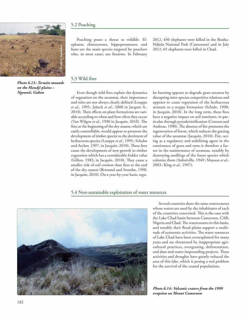
Photo 6.13 : Termite mounds on the Mandji plains – Ngounié, Gabon
Poaching poses a threat to wildlife. El-ephants, rhinoceroses, hippopotamuses, and lions are the main species targeted by poachers who, in most cases, use firearms. In February
2012, 450 elephants were killed in the Bouba-Ndjida National Park (Cameroon) and in July 2012, 65 elephants were killed in Chad.
5.2 Poaching
Even though wild fires explain the dynamics of vegetation on the savannas, their importance and roles are not always clearly defined (Louppe et al., 1995 ; Jeltsch et al., 2000 in Jacquin A., 2010). Their effects on plant formations are vari-able according to when and how often they occur (Van Wilgen et al., 1990 in Jacquin, 2010). The fires at the beginning of the dry season, which are easily controllable, would appear to promote the development of timber species to the detriment of herbaceous species (Louppe et al., 1995 ; Scholes and Archer, 1997, in Jacquin, 2010). These fires cause the development of new growth in timber vegetation which has a considerable fodder value (Gillon, 1983, in Jacquin, 2010). They cause a smaller risk of soil erosion than fires at the end of the dry season (Bertrand and Sourdat, 1998, in Jacquin, 2010). On a year-by-year basis, regu-
lar burning appears to degrade grass savanna by disrupting inter-species competitive relations and appears to cause regression of the herbaceous stratum to a steppe formation (Schule, 1990, in Jacquin, 2010). In the long term, these fires have a negative impact on soil nutrients, in par-ticular through pyrodenitrification (Crutzen and Andreae, 1990). The absence of fire promotes the regeneration of forest, which reduces the grazing value of the savannas (Jacquin, 2010). Fire, act-ing as a regulatory and stabilizing agent in the coexistence of grass and trees is therefore a fac-tor in the maintenance of savannas, notably by destroying seedlings of the forest species which colonize them (Aubréville, 1949 ; Mayaux et al., 2003 ; King et al., 1997).
5.3 Wild fires
Several countries share the same watercourses whose waters are used by the inhabitants of each of the countries concerned. This is the case with the Lake Chad basin between Cameroon, CAR, Nigeria and Chad. The watercourses in this basin, and notably their flood plains support a multi-tude of economic activities. The water resources of Lake Chad have been overexploited for many years and are threatened by inappropriate agri-cultural practices, overgrazing, deforestation, and dam and water-impounding projects. These activities and droughts have greatly reduced the area of this lake, which is posing a real problem for the survival of the coastal populations.
5.4 Non-sustainable exploitation of water resources
Photo 6.14 : Volcanic craters from the 1999 eruption on Mount Cameroon
© F
rédé
ric
Sepu
lchr
e
© F
RM

183
The forest areas of the savannas and steppes of Central Africa are heterogeneous and occupy a substantial area, estimated at 154.4 million hect-ares. They comprise a rich biodiversity used by local inhabitants as fodder, medicine and food, woodfuel, etc. These people also harvest non-tim-ber forest products which have fostered impor-tant economic activity such as gum arabic and shea. In addition, these forests provide numerous environmental services, notably carbon capture which remains largely undocumented, soil and watershed protection, water balance regulation and cultural and recreational facilities.
However, inappropriate agricultural practices, overgrazing, the excessive cutting of woodfuel, the irrational exploitation of water resources, together with recurrent droughts and flooding constitute the main threats noted in the forest areas of the savannas and steppes of Central Africa.
The effects of fires on the dynamics of savan-nas are not always clearly known. They either cause a regression of the herbaceous stratum to a steppe formation, or they permit the maintenance
of the savannas, but in any event the uncontrolled fires at the end of the dry season constitute a threat to the forest areas of both savannas and steppes.
The present chapter has described the vari-ous functions of the savannas and steppes which make these areas discrete ecosystems adapted to xeric conditions. In addition, the exposure of these areas to natural disasters (floods, droughts, sandstorms, etc.), desertification and the risks of genetic erosion makes them very vulnerable. It is therefore necessary that they receive particu-lar attention. The integration of these areas into national REDD+ strategies already constitutes a notable step forward. Initiatives on a regional scale must be undertaken, as in the case of dense rainforests, to ensure the sustainable manage-ment of these ecosystems. Financing is essential in order to implement the Subregional Programme of Action to combat land degradation and deserti-fication (PASR/LCD) because the savannas and steppes deserve to be areas for priority action.
6. Conclusion and prospects
Photo 6.15 : UFE Mouliéné – scrub savannas – Mouyondzi, Congo
© F
RM