THE EASTBOURNE NATURAL HISTORY EASTBOURNE NATURAL HISTORY ... This collection of archaeological...
15
THE EASTBOURNE NATURAL HISTORY & ARCHAEOLOGICAL SOCIETY Founded 1867 AUTUMN NEWSLETTER No 80 September 2014 Lawrence and Pat Stevens with the new ENHAS book “Eastbourne - Aspects of Archaeology, History and Heritage” edited by Michael J Allen. This book is a tribute to Lawrence and Pat for all their contributions to local archaeology over the years. See page 6 for more details about the book and how you can purchase your copy. www.eastbournearchaeology.org.uk
-
Upload
vuonghuong -
Category
Documents
-
view
216 -
download
2
Transcript of THE EASTBOURNE NATURAL HISTORY EASTBOURNE NATURAL HISTORY ... This collection of archaeological...

THE EASTBOURNE NATURAL HISTORY &
ARCHAEOLOGICAL SOCIETYFounded 1867
AUTUMN NEWSLETTERNo 80 September 2014
Lawrence and Pat Stevens with the new ENHAS book “Eastbourne- Aspects of Archaeology, History and Heritage”
edited by Michael J Allen. This book is a tribute to Lawrence and Pat forall their contributions to local archaeology over the years. See page 6 for
more details about the book and how you can purchase your copy.www.eastbournearchaeology.org.uk

EASTBOURNE NATURAL HISTORY &ARCHAEOLOGICAL SOCIETY
Founded 1867PRESIDENT: Olive Woodall
Chairman Robin ReffellRobin Cottage12 The Village
Meads, Eastbourne BN20 7RDTel: 01323 648226
Hon. Treasurer & Membership Secretary John Warren49 Prideaux Rd
Eastbourne BN21 2NETel: 01323 731792
Hon. Secretary & Newsletter Editor Helen Warren (contact details as above)
Programme Secretary Lawrence StevensTel: 01323 734496
Ass. County Archaeologist Greg ChuterTel: 01273 481608
Committee: Patricia Stevens, Derek Leppard, Alison Selmes, Hayley Forsyth
A Message from the EditorDear Members,There certainly has been a lot going on this summer. In this Newsletter you can read about our Symposium and the new ENHAS publication launched at that event: “Eastbourne - aspects of archaeology, history and heritage”. Also read about Ken Brooks’ fossil hunt and Greg Chuter’s guided walk at Coombe Hill, both on glorious sunny days and well attended by members and friends. Also thanks to Lawrence Stevens for leading the walk at Folkington and to Sabrina Harcourt Smith for the tour of Folkington Church. Only sorry that we could not make it!The dig continues on Pocock’s Field (Kings Drive) and it is hoped to organise a Society visit to the site just before work ceases prior to development. There is a full programme of meetings listed on page 16. The first talk by Casper Johnson is all about the amazing finds from the Bexhill and Hastings bypass.Please let me have copy for the December Newsletter by November 24.Happy reading, Helen, Hon. Secretary and Newsletter Editor

The Symposium, A Look into the Distant Past, held at the Town Hall on 19th July this year was a great success. With several turning up on the day, it was very nearly fully subscribed, with spaces remaining for just two or three people, and all six of the speakers were excellent. A minor irritation was that all of them refused to use the microphone provided by the Town Hall staff, which made theminaudible to a few of the delegates. It is more annoying that a clip-on collar mike was available, but that the staff refused to get it out for our use even when asked to; we must insist on it should there bea next time. A further alarum was that Julia Galvin’s mother had a fall, passing out in the process. A paramedic attended, who recommended a visit to A&E for a check-over, but she would have none of it, and insisted on staying through the day. I hope I am as able when I am over 90! Each speaker had a timed slot, and kept to them pretty well, so that the breaks for coffee/tea and lunch went more or less as planned.
I had intended to write up each speaker’s talk in detail, but time and other constraints have dictated against this, so I simply describe the subjects covered as a simple narrative.
1. Mike Allen compared dry and wetland areas within Eastbourne, ie the farming valley around Motcombe spring as illustrated by Lawrence Steven’s Eastbourne Urban Medieval Excavation Projectin Old Town, and the Shinewater marsh, our own unique wetland trackway first recognised for what it was by Lawrence Stevens. Using his research with soil cores and studies of molluscs, gastropods, seeds and pollen, Mike described the various changes in the lagoon from freshwater to salt, and dealtwith the Bronze Age ritual deposits along and around the trackway and platforms, as well as the development of the medieval farming landscape.
2. David Ruddling described his interest in the development of Roman Sussex, with particular focus on a villa/round house farming site on Bullock Down. The only identifiable Roman town in Sussex is Chichester, but the road network, which divided up the country with an East to West, and North to South grid, had a profound effect on the development of farming which extended analready well developed landscape of Iron Age field systems, and industry, which included iron working, with associated charcoal production and woodland management, salt production, pot making and stone quarrying. The road grid encouraged trade, but also settlements and shrines at crossroads. An intriguing question was “Where are the Roman dead in Sussex?”, as there do not not seem to be enough cemeteries for the period. There were also unexpected signs of wealth in the Roman peasantry, with 20,000 coins being found in the Eastbourne area alone.
3. Lisa Jane Fisher gave an overview of work done at Rookery Hill, Bishopstone, where occupation can be traced back to the Neolithic period. Since then all periods are mixed up together, with early Anglo Saxon finds being very well represented. As well as the graves discovered during the second half of the last century, there are an estimated 60 buildings in a 3 hectare settlement. Lisa then focussed on the excavation of several sunken buildings, orgrubenhauses, which contained loom weights, intriguing patterns of post holes and floor
“A Look into the Distant Past”Symposium held at The Town Hall on
19th JulyReport by John Warren

wear, which may indicate positions of looms. Lisa also suggested that the damp caused by the buildings being sunk into the ground may have helped the weaving process.
Following lunch Robin Reffell gave a surprise presentation to Lawrence Stevens of the book: “Eastbourne - aspects of archaeology, history and heritage”, organised and edited by Mike Allen. The book is a tribute to Lawrence (and Pat) for their lifetime’s interest and involvement with local archaeological investigation. For more details about how to purchase a copy of the book see page 6.
4. Elizabeth Hughes explained the historical and environmental records and documents available at The Keep at Falmer, now the site of The County Records Office, which could have value to archaeological research. This revolved mainly around maps, but also includedmanorial records, probate inventories and rental books which describe land use, as well as records of the beating of Parish bounds. The tithe maps give extraordinary detail, especially if accompanied by their ‘key’ document, but the large scale Ordnance Survey maps are those most popularly consulted. Photographs are also held there, with aerial photos ofparticular interest, especially of, or following the wartime periods, when there were more cameras in operation, and before tractor-powered deep ploughing obliterated many downland features.5. Stephanie Smith was very enthusiastic about the Portable Antiquities Scheme (PAS), and the way it had bought the metal detecting fraternity into the archaeology circuit. A certain amount of finds still get away, but she estimates that the majority of material now come into the public domain. Other unorthodox sources include dog-walkers, gardeners, hikers and campers, with rabbits as the most consistent diggers! It is typically difficulty to place the finds in any context, so much of the archaeological value is lost, but the PAS does provide horizontal contexts, though without stratification, and has a broad database of all finds showing hotspots of activity and finds which can inform more traditional and thorough investigations. The PAS requires a lot of liaison with detector groups, particularly to educate the finders not to polish away the value of objects, coins particularly, which have been treated with all sorts of stuff to make them shiny, tomato ketchup being the most damaging.
6. John Bleach gave us insights into the ecclesiastical landscape of the Cuckmere region, 1050-1200. He told two stories, of a change from a Minster landscape of 50-60,000 acres, to
a Parochial landscape of 10-12,000 acres, brought about following the Norman invasion. A relief map illustrated the general area covered, which showed the river gaps in the downs, and the sandstone ridge running from Fairlight to Horsham, an ancient route that crosses noriver boundaries. Using comparisons of pre and post Norman types of religious houses described in Domesday Book, he described the different workings of enclosed orders, and secular colleges, which worked through the communities. His teasing clues led to the revelation that a CollegiateChurch could well have existed within Pevensey Castle, with responsibility for and control of different parcels of land being transferred from the Anglo Saxon foundations to Norman.
All speakers invited a short period of questions, and all were introduced and thanked by Robin Reffell, to the wholehearted acclamation of all present.
More about the book…
Eastbourne - aspects of archaeology, history and heritageEdited by Michael J. Allen
A tribute to Eastbourne Archaeologist Lawrence StevensPublished 2014 by ENHAS
This collection of archaeological essays provides an easy insight intothe wealth and diversity of archaeology and heritage in the Eastbourne area. Many of the projects descry bed have been undertaken with interested local volunteers, often channelled throughthe auspices of ENHAS. Included is evidence from the Neolithic to the Romans on the Beachy Head downs, to Bronze Age burial mound at Crowlink, and snippets of post-medieval archaeology in Old Town and mills of the area. Evidence is outlined of the changing and diverse landscape and of prehistoricfarming, fields and settlement in Old Town.
Extra News about that Chicken Cup by Rowland JenkinsFurther to the brief article in the Summer Newsletter relating to the sale of the Ming Dynasty Chicken Cup for £19.6 million (HK$281m), I thought you may be interested to learn that the buyer was a Mr Liu Yiquan, reputed to bethe 200th richest person in China, and he used his American Express Centurion Card to make the purchase. His card had to be swiped 24 times because the American Express system can only process HK$12m at a time.Mr Liu had an unexpected bonus by using his card - he earned 422 million American Express points which he can convert into 28 million frequent flyer miles. They do say that money comes to money!
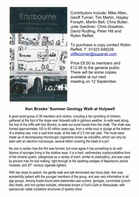
Contributors include: Mike Allen, Geoff Turner, Tim Martin, HayleyForsyth, Martin Bell, Chris Butler, Julie Gardiner, Chris Greatrex,David Rudling, Peter Hill and Robin Reffell.
To purchase a copy contact RobinReffell, T: 01323 [email protected]
Price £8.50 to members and £12.95 to the general public. There will be some copies available at our nextmeeting on 12 September.
Ken Brooks’ Summer Geology Walk at Holywell
A good sized group of 38 members and visitors, including a fair sprinkling of children, gathered at the foot of the slope near Holywell café in glorious weather, to walk west along the foot of the cliffs with Ken Brooks, to seek out some fossils from the chalk. The chalk wasformed approximately 100 to 60 million years ago, from a white mud or sludge at the bottom of a shallow sea, over a vast time scale, at the rate of 2.5 mm per year. The muds were made up of decomposing microscopic organisms known as colcoliths, which can only be seen with an electron microscope, several billion covering the head of a pin!
No one is certain how the flint was formed, but most agree it has something to do with blooms of sponges living in the shallow seas. It is a hard, sedimentary cryptocrystalline formof the mineral quartz, categorized as a variety of chert, similar to chalcedony, and was used by ancient man for tool making, right through to the sparking wedges of Napoleonic period muskets, and 20th century cigarette lighters.
With two stops to search, the gentle walk and talk terminated two hours later. Ken was wonderfully patient with the younger members of the group, and was very informative to all age groups. Among fossils found were belemnites sea urchins, sponges, conchoidal (conch-like) shells, and iron pyrites nodules, otherwise known a Fool’s Gold or Marquisate, with spectacular radial crystalline structures of sparkly silver.
One piece of sound advice was that one should never sit with ones back against the foot of the cliffs on the beach, as falls can occur suddenly, without warning, depositing tonnes of material on the beach. Despite that, members of the group still went near the base of the cliff in their search.
For details of the geology please see my report on Ken’s talk to the society in the summer Newsletter. One interesting fact I will remember is that some of the sea defences opposite Holywell spring are alien insertions, which Ken jokingly commented would intrigue future geologists. One barrier there consists of huge boulders of an igneous rock from near Oslo, in Norway, and another of 400 million year old carboniferous limestone from France. Both are designed to prevent the tides from scouring the foot of the cliffs, and so prevent cliff fall erosion. Ken was thanked by Robin Reffell, and applauded by the group, which then gradually dispersed, many clutching their fossil treasures.
Report by John Warren
Walk led by Greg Chuter on Coombe Hill - Report by John WarrenFollowing his talk to the society of 25th April 2014 about the archaeology to be found there, Greg led a walk to Coombe Hill above Willingdon, to point out the features still to be found visible on the ground.
On a beautiful morning, a group of thirty six, members and visitors, assembled at Butts Brow car park to accompany Greg in a circular walk through 5,000 years of land use. Greg explained that the Downs have been a constantly used landscape since the repopulation of Britain following the last Ice Age. Settlements and living went on near the water sources, along the spring line or in the valleys, but pasturage and plough land would have been easier to clear on the chalk uplands than in the heavy clay of the valley bottoms, and travel would always have been easier along the ridges. The South Downs Way is but one example of such a long distance route, starting in Eastbourne and travelling largely by the chalk ridges all the way to Winchester.
Boundaries were often, and burials nearly always, were placed prominently along ridge lines, usually visible from the settlement areas in the coombes or valleys, and also visible from all around. These burials, or barrows, were last resting places of the dead, but also could have been boundary markers, or statements of land ownership by families, groups or tribes. The earliest type were long barrows, built apparently to store the disarticulated bones of group members, who may have been exposed after death, and interred when de-fleshed. Round barrows initially contain a single central burial, and are often arranged in a closely set series, usually interpreted as family groups. Their locations always seem to have been respected by later groups, who often placed their own burials next to, or within the monuments. Iron Age, Roman, Saxon cremations or burials have been discovered.
The first barrow visited was 4,000 years old, from the late Neolithic or early Bronze Age period. This is unexcavated, but has been dug into in antiquity, has associated later burials, and also an adjacent WWII dugout with corrugated iron, and associated slit trenches. It is of a simple type with a circular ditch around a burial, and the spoil heaped in the middle. All these barrows are now scheduled monuments, and protected, but still need to be looked after because of subsidence, and incursions by treasure seekers and burrowing rodents.

We walked to the col of lower land on the ridge above Chalk Farm and Willingdon golf course, between two high spots, where Greg pointed out the bostal ways, or eroded trackways, leadingup from the valley. The steep sided coombes of valleys were formed by ice-melt run-off during one of the past Ice Ages. The bostal ways usually rise gradually to a low point on the ridge, where the tracksdiverge into different directions, and reflect continuous use over severalthousand years. The Saxons often buried their dead at such junctions. There were several chalk pits visible, the Romans used the chalk for road building, and the chalk was used to make lime mortar for building from the medieval period, and for marling the clay rich fields to improveyields.
A second Bronze Age Barrow was pointed out which had been dug across in antiquity, possibly even in the Roman period, and a third, a ring Barrow, where the spoil had been thrown both onto the burial, and to make a ridge around the ditch. This type is later in date than the other two, andis of a type more common in Wessex. It contained a cremated female burial.
Lastly on the ridge, we arrived at the causwayed camp, where Greg led the group around the ditch, toillustrate its size, which is quite modest in relation to other examples. The camp is one of the first of its kind, earlier that the round barrows, mid Neolithic, and is a non–defensible, circular structure of two ditches, with 16 paths through the ditches. There are 16 in the country, with a new example foundrecently at a rescue did prior to a building development at Sittingborne in Kent, but there are also others in France and Germany. We will never be sure what their purpose was, but it is thought that they were meeting places for different adjoining communities, where feasting took place, with probably markets, and other forms of trade and exchange, possibly also for marriage.
Musson excavated it in the 1940s, and Seaton-Williams in the 1960s, where he found seeds and snails indicating a wooded environment, and 3 Neolithic stone axes, which are thought to have been ritually buried at one of the ditch ends, possibly in thanks or propitiation for clearing thewoodland to make the circular camp. Three and a half mid-bronze age axes had also been found in one of the round barrow ditches, possibly for the same purpose. In 1946, Burston found lots of Roman pottery shards in association with the disturbance caused by the Canadiansoldiers’ activities, driving tanks and digging trenches during training. These are thought to be associated with cremation burials on the downs, many of them near to the barrows and other monuments.
The group walked down a steep slope, into a long valley leading to Jevington, past Neolithic field system lynchets standing to five or six feet. These lynchets are the boundaries at the edges of fields where the soil builds up, or falls away over long use. The whole area was covered in them, but many were deliberately ploughed or bulldozed out for ease of ploughing. The associated settlement is
probably under Jevington near the still active water spring, but Greg speculated where he may prefer his ideal residence to be.
The talk being over, the group wound its way back to Butts Brow car park, where Robin Reffell thanked Greg profusely for his detailed and fascinating walk.
An archaeological walk at Tide Mills, Newhaven
Helen & I went on a most informative visit to the Tide Mills excavations between Seaford and Newhaven, which have been run by the Brighton & Hove Archaeology group every Thursday, rain or shine, through the digging season, for eight years, currently led by Luke Barber.
Historical background: the River Ouse has changed its course continuously over time, the mouth of the river moving back and forth according to the laws of longshore drift and breaching by storm surges. In Roman times it ran along the line of the cliffs where the main road now runs, but by the Saxon period had moved out to the position of the present tidal lagoon, with its outlet at Splash point in Seaford. There were always silting issues, but by the 13th Century Seaford was a locally important,outlier Cinque Port, though this had virtually closed by the 14th century when the shingle bank moved across the harbour mouth, and the town was depopulated by the Black Death. A cut was made through the bank below the village of Meeching in the 16th Century, forming the aptly named New Haven, to allow traffic up the Ouse to Lewes again, though the channel through the lagoon towards Seaford was still open and tidal in a map of 1698. In the 18th Century the river was again re-cut to thecoast, and a mole, or pier, built to stop the longshore drift across the harbour mouth, it was also straightened and deepened up river to allow faster flow to scour the river bed of silts to form a good, deep harbour, with anchorage along the lagoon to the Buckle. In 1761 three millers from Chichester built a tidal mill at the present site. It changed hands in 1790, and in 1801 a William Catt bought the mill. It was the period of the Napoleonic Wars, and Catt was something of an entrepreneur, with military contracts to supply flour from the mill, which he enlarged, and also meat, beer and coal to the army and local population.
It was the largest mill in Sussex, with originally two mill races driving two undershoot wheels, enlarged to three wheels and races, finally driving sixteen pairs of stones. It was a four story, rectangular structure, massive in the landscape. A sluice allowed the rising tide to pass to a mill pond beyond the mill towards Seaford, and the mill was worked on the falling tide. A secondary mill pond was excavated to provide sufficient water for the third wheel, but that was filled in with railway ballast in the 20th Century to provide more land. A complete village for the necessary workers was built to have them ready to hand at all times of the day and night, as naturally the tidal times changed constantly from day to day. The Repeal of the Corn Laws in 1846 allowed cheap grain into the country, and the railway link to the Newhaven to Dieppe ferry brought improved transport, with the mill village having its own halt on the Seaford extension built in 1864, but the harbour authorities wanted to block the sluice to the mill at Newhaven which threatened the whole existence of the mill, amove successfully resisted. Catt died in 1853, and his son William took over until 1878, when his widow sold the concern to the Harbour and Railway Company. The mill was worked until 1883, when the gear was sold off to the cement works at South Heighton, and in 1900 the mill building itself was demolished. It is now only evident in the culverts of the mill race under the road bridge, and three forlorn metalsticking up out of the still tidal lagoon marking the far side of the mill, and which once stopped seaweed and debris getting through to damage the water wheels. The line of wharfs is still discernable to the North-West of the mill site.

The village was still there though, housing 150 workers and families, and work was found at Newhaven docks, increasing in importance as WWI occurred. In 1917 a seaplane base was established, the concrete aprons for which still survive. The seaplanes flew anti-submarine patrols up and down the channel, originally working out of a timber hanger, which was moved to Wimbledon railway yard when taken down, with a steel structure going up in 1920. Concrete piles for the harbour’s Eastern quay were cast in the steel structure in the 1920s. Railway carriages were used forholiday accommodation in the inter-war period, the timber, railway sleeper, hard standing for which are still there, and a large Chailey Sanatorium built to nurse children with illnesses such as polio and rickets, built along the top of the shingle bank overlooking the sea. In the late 1920s, a racing stable was established in the village to nurse lame horses by a seawater treatment, though this had ended by 1940. In the late 1930s a slum clearance order was placed on the village, and some improvementswere putin hand, evident in the ground, but war in 1939 forced evacuation and the army took over, having identified the area as a probable site of landings by German invasion forces. Post war analysis of German records proved this to have been the case. The army built three belts of anti-tank obstacles and ditches, plus anti-aircraft & anti-shipping gun pits, and the Canadians used the buildings when training for house-to-house fighting, considerably knocking it all about. The site was abandoned in 1945 virtually all demolished, and used as a quarry forbuilding materials and hard core to the 1960s and 70s.
The site is now officially protected, but is still subject to vandal damage, and it needed recording to sort out the phases and establish what evidence was still existing for the historical record. Naturally it is a very complex, multi-phase site, and investigation began with the aural record, as there were people still living who were residents in 1940, this was supplemented by maps, documentary and photographic evidence, but little was known of the earlier phases apart from tantalising mentions in documents. The investigations began in 2006 with trial trenches and test pits, and has become more focused over time. The initialbuild used material from the demolished Bishopstone Hall, and that material was re-used over and over again. Much of it was jerry built, with good facades, and the rear of structures thrown together willy-nilly, so that it is very difficult to separate the phases by building material type or structural methods. It was apparently a locked village, with access being shut off at 10.00pm, and allotments were provided for residents to grow their own vegetables. Catt himself was fond of exotic fruits and had complex and extensive greenhouses, all evident in the ground.
It was a fascinating and thought provoking walk through history, and we can highly recommend a visitto the site, and to the sweep of Seaford Bay, which was virtually deserted, even on a beautifully sunny summer’s day.

COUNCIL FOR BRITISH ARCHAEOLOGY SOUTH EASTANNUAL GENERAL MEETING 2014
Venue: University of BrightonSaturday November 1st 2014
ASPECTS OF PREHISTORY IN SOUTH-EAST ENGLANDThe conference this year will be held jointly with Sussex School ofArchaeology and will commemorate the work of the late ProfessorPeter Drewett and launch the book 'Archaeology and Land Use of
South-East England to 1066'.
The conference will be held in The Huxley Lecture Theatre, Cockcroft Building,University of Brighton, Lewes Road, Moulescombe. The fee will be £30(conference plus mid-morning and mid-afternoon teas) or £35 (same plus buffetlunch); or reduced price for CBA SE members and full-time students: £27 or £32 (with lunch). CBASE AGM at 2pm.
Bookings: contact: [email protected]/events.htm
The Wartling Parish Local History Group
6TH LOCAL HISTORY EXHIBITION
SATURDAY, 11th. OCTOBER
Reid Hall, Boreham Street 2.00pm – 6.00pm
Entry £4.00 (under 16 free)WARTLING, BOREHAM STREET, WINDMILL HILL plus BODLE STREET GREEN,
COWBEECH, GARDNER STREET, HERSTMONCEUX, NINFIELD, HOOE,CATSFIELD, PEVENSEY, WESTHAM, AND ASHBURNHAM
PLUS A SPECIAL FEATURE ON THE 1914-1918 WAR
Over 400 old photographs, documents & maps,RAF Wartling & RAF Pevensey,
local history and archeological groups,genealogy, books & postcards, refreshments


The Eastbourne Heritage Service - a report from Katherine Buckland
Heritage Open Days at Motcombe Dovecote We will be opening the Motcombe Dovecote for Heritage Open Days (11-14 September 12-4 pm) so everyone can discover the real history of the Motcombe Dovecote . Between 29th July and 4th August, the Eastbourne Heritage Service undertooka Community Archaeological Excavation in Motcombe Gardens. They had been asked to try to determine the date of the Dovecote so that it could be better understood and interpreted in the future.Two trenches were excavated; one that looked at the foundations of the building in the south east quadrant while trying to get some chronological phasing of a brick buttress that appears in images of the building from at least 1909. The other, a few metres south of the Dovecote, was to see if any associated surfaces or buildings had survived beneath the ground. Although the excavation on the foundation of the Dovecote gave us some clues to its’ origins, it is the inspection of the interior that gave further information about its development. One of the recent discoveries came from a closer inspection of the large quantity of nest boxes within the building. These boxes seem to stop roughly 0.9m from the floor although in actual fact, these nesting holes once went all the way down to the exposed flint wall (roughly 0.3m from the floor) giving a further three rows or roughly 100 more boxes.They have each been carefully filled by two inserted bricks of the 18th or early 19th century. The roosting ledge that once ran above the lower two rows as also been removed by roughly chopping it off flush to the wall. The question must now be answered as to why this was carried out, and the answer may be rats! Come and see us at the Dovecote to find out more!
Summerdown Camp Project We have finished sorting the finds from the Summerdown Camp excavation on the Compton Drive playing fields and have uncovered some really interesting stories. From the discarded pieces of a YMCA mug in the area of the latrines, to the base of the wooden steps leading up to a sleeping hut, this excavation yielded artefacts from the wounded soldiers in Eastbourne as well as evidence of the enormous hutted camp and significantly, its tented beginnings.There were a few anomalies – the lack of drainage pipes (although evidence of where they had been)and a silver half groat of Henry VII 1493-99 from the Canterbury mint on a First World War convalescent camp site was unexpected! All of the information and stories gleaned from this excavation and the research our gallant volunteers have been conducting will feature in an emotive exhibition at the Pavilion, opening 16th March 2015 to mark the centenary of the opening of the camp. Visitors can discover the inspiring stories of brave soldiers and valiant women as well as the pioneering medical treatments carried out at the camp. Summerdown Camp was the first convalescent camp to trial the revolutionary Almeric Paget Military Massage Corps and practiced innovative occupational therapies including embroidery, carpentry and basket making. Visitors can even have a go at basket making in the exhibition! Visitors can also find out about the tragic tales of the soldiers suffering from shellshock or the effects of gas attacks and the fleeting romances betweenconvalescing soldiers and local women. The exhibition reveals unique objects made at the camp including sweetheart brooches made by soldiers in the tin workshop, seen for the first time in 100 years.

More things to do and see on Heritage Days 11th—14 Sept
East of the Pier Heritage Walk: Eastbourne guided walk starting from the Redoubt Fortress. Learn about the Salvation Army riots when many Salvationists were sent to prison; the history of the oldest public building in Eastbourne; discover a hidden jewel of a theatre and Tom Thumb Cottages. Lasting over two hours, it is full of information, humour and fascinating facts. A number of stopping points will be open for a peep inside. Saturday at 11.30.
Eastbourne Heritage Centre, 2 Carlisle Road. Explore Eastbourne's heritage: original town plans for mid-Victorian seaside resort with displays about cinema heritage, architectural features, the Winter Garden, scale models of Railway Station, Bandstand, and Sovereign Harbour, local views reproduced as postcards by early C20 artist James Owen, a cinema showing vintage and modern local films.
Leaf Hall Community Arts Centre, 51 Seaside. Opened in 1864, Leaf Hall is the oldest public building in Eastbourne. It has a round tower and a wooden vaulted main hall. Now run by a charity, the hall holds classes and events but isn't always fully open to the public. Opening Times Thursday: 1000-1200 Friday: 1000-1200 Saturday: 1300-1500 Sunday: 1300-1500.
St Mary the Virgin Church, Eastbourne: St Mary's church is the oldest church in Eastbourne. Resting on the slope of the Bourne stream, the church was built late in the 12th century with Caen stone from Normandy. It was considerably enlarged in the 14th cent. and extensively restored in the 19th century. It has numerous interesting, and beautiful architectural and decorative features. Volunteers on hand to talk about the church building. Children and families are welcome. Opening Times Saturday: 1000-1600.
The Lamb Inn - Vaulted Cellar, High Street, Eastbourne BN21 1HH. Visit the late-Norman crypt. Event not suitable for children. Opening Times: Saturday: 1000-1500. The tour is free but pre-book: http://hod-lambinn.eventbrite.co.uk.
The Wish Tower (Tower 73): The Wish Tower is a Napoleonic Martello tower that has only recently been reopened to the public. Visitors will be limited in any one tour for reasons of safety, but hard hats, torches and hi-viz vests will be supplied. Accompanied children welcome; care is needed in some parts of the tower. Opening times Saturday: tours 1030, 1230, 1430, 1630, Sunday tours 1030, 1230, 1430, 1630. Booking email: [email protected]
Towner - Behind the Scenes: free Collection Store Tours, Saturday 1100, 1200, 1400 & 1500 Sunday: Tours 1100, 1200, 1400 & 1500. Pre-booking of tours advised: www.townereastbourne.org.uk
For more info on any of the above see www.heritageopendays.org.uk

ENHAS Autumn and Spring Programme
Friday 12th Sept The Archaeology of the Bexhill and Hasting bypassCasper Johnson, East Sussex County Archaeologist, oversaw the project. His talk will highlight one of the most amazing archaeological discoveries.
Friday 10th Oct Lewes Castle and its centuries old history Sally WhiteSally will outline the history of the castle and its changing role in the community.
Friday 14th Nov Pococks Field Excavation 2014 – some early thoughts on thisexciting archaeological site. Giles Dawkes is the director of this extensiveexcavation and will share with his thoughts on this exciting archaeological site.
Friday 12th Dec Four brief talks by Society Memberswith a raffle and seasonal refreshments.
Friday 9th Jan The Archaeology of Poplin Marsh 1992 Lawrence Stevens whodirected the Society’s excavation, will talk about this Iron Age and Roman site found during the construction of Cross Levels Way Eastbourne.
Friday 13th Feb Eastbourne’s extensive early Anglo-Saxon Cemetery and thediscovery of an Iron Age Settlement in 1990Patricia Stevens was Director of this Society’s excavation of the site at St. Annes Hill. She will illustrate her talk showing the evidence for Iron Age settlement, the early Anglo-Saxon cemetery and it’s burials, together with reference to the later Anglo-Saxon Cemetery on Ocklynge Hill.
Friday 13th Mar Iron Age Sussex – A Social HistoryJohn Manley will provide an overview of Iron Age roots in Sussex and show how they were organised, developed and changed. It will be a focus on people – not so much pots or post holes! The talk will thus provide a background to and compliment the talks by Giles, Lawrence and Patricia. www.timetalks.co.uk
Friday 24th Apr Annual General Meeting followed byThe Life and Archaeology of Augustus Henry Lane-Fox Pitt RiversDescribed as “The Father of Scientific Archaeology” Pitt Rivers was an innovator who looked beyond the obsession of the time of burial mounds. He recognised the value of finds and their context and conducted experiments to back up analysis. His work in Sussex will be highlighted.
Our meetings are held at:
St Saviour’s Church Hall, Spencer Rd, Eastbourne BN21 4PAMeetings start at 7.30 pm, doors open: 7.15 pm. Members free, visitors £2
For more details contact www.eastbournearchaeology.org.uk E: [email protected] or T: 01323 648226