Blueprint of Coastal Wetland Conservation and Management ...

Thomas H. Eason
December 13, 2012
The Cooperative Conservation
Blueprint in Florida
Linking landscape priorities with
incentive-based approaches to
conservation

Why does it
matter?

Florida Population Forecast
2060 2005
17.9 Million
35.8 Million

Current Situation
Developed Land
Conservation Lands
Permanently Protected

2060 Projection
Developed Land
Conservation Lands
Permanently Protected
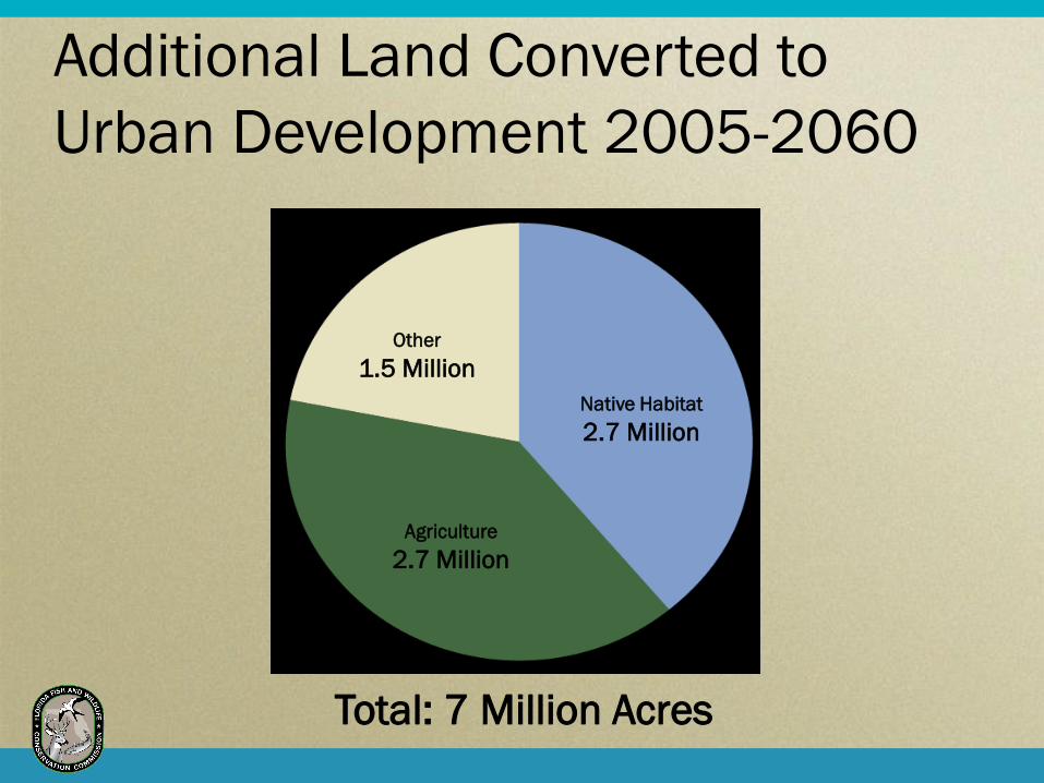
Additional Land Converted to
Urban Development 2005-2060
Native Habitat
2.7 Million
Agriculture
2.7 Million
Other
1.5 Million
Total: 7 Million Acres

Habitat loss
2.3 million acres of black bear habitat
2.1 million acres of wild turkey habitat
700,000 acres of gopher tortoise habitat
How important are fish and wildlife species to you?
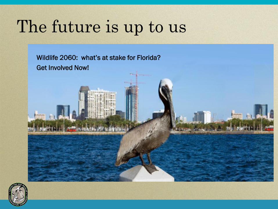
The future is up to us
Wildlife 2060: what’s at stake for Florida?
Get Involved Now!

Landscape
Modeling-
CLIP
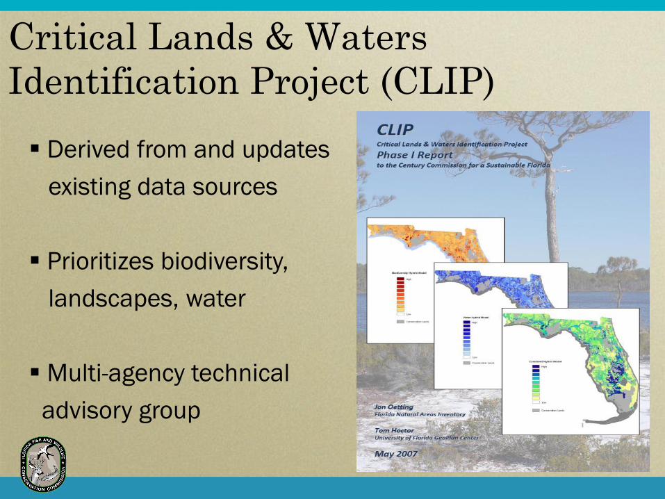
Critical Lands & Waters
Identification Project (CLIP)
Derived from and updates
existing data sources
Prioritizes biodiversity,
landscapes, water
Multi-agency technical
advisory group

Biodiversity Surface WaterLandscape Ground Water
Combined Model
Strategic Habitat
Conservation Areas
Under-Protected
Natural Communities
Biodiversity
Hotspots
Rare Species Habitat
Conservation Priorities
Landscape Integrity
Florida Ecological
Greenways Network
Intermediate Aquifer
Vulnerability
Shoreline
Complexity IndexSurficial Aquifer
Vulnerability
Hard Bottom/
Coral Habitat
Floridan Aquifer
Vulnerability
Seagrass Habitat
Significant
Surface Waters
Natural Floodplain
Wetlands
MarineBiodiversityBiodiversity Surface WaterSurface WaterLandscapeLandscape Ground WaterGround Water
Combined Model
Strategic Habitat
Conservation Areas
Under-Protected
Natural Communities
Biodiversity
Hotspots
Rare Species Habitat
Conservation Priorities
Landscape Integrity
Florida Ecological
Greenways Network
Intermediate Aquifer
Vulnerability
Shoreline
Complexity IndexSurficial Aquifer
Vulnerability
Hard Bottom/
Coral Habitat
Floridan Aquifer
Vulnerability
Seagrass Habitat
Significant
Surface Waters
Natural Floodplain
Wetlands
Marine
CLIP Data Structure

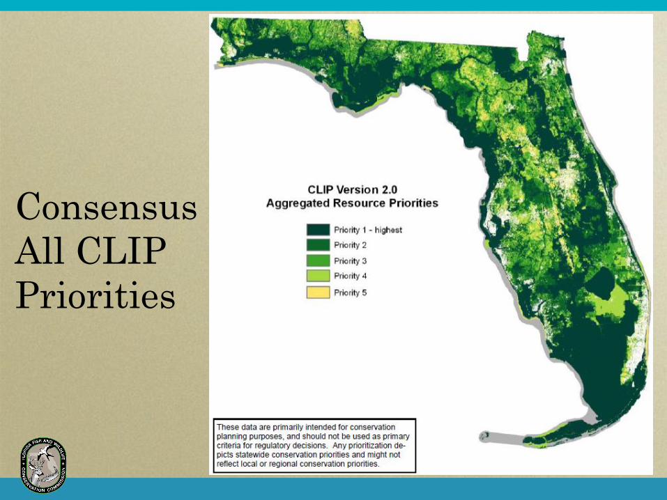
Consensus
All CLIP
Priorities

Landscape
Planning-
CCB

Cooperative Conservation Blueprint
CLIP is the first step
Expert science product
A unified GIS application
Decision support tool
Blueprint
Builds on CLIP
Cross links with social and economic priorities
Creates a consensus GIS overlay and policies to implement

CCB Organizational Structure
CCB Steering Committee
CCB Core Team
Water Incentives
Working Group
Land Incentives
Working Group
Carbon Incentives
Working Group
Interagency
Coordination Team
CLIP Technical
Advisory Group
Florida Forever
Advisory Council

Consensus
Priority
1 & 2

Land
– Safe Haven Master Strategy (Lg. landholdings)
– Conservation Development (Sm. landholdings)
Water
– Self Supply Water Security & Resource Restoration
Partnerships
– Hydrologic Restoration of Natural Systems
Carbon Markets
– Carbon Offset Program
– Inventorying Carbon Credits
Incentive Ideas
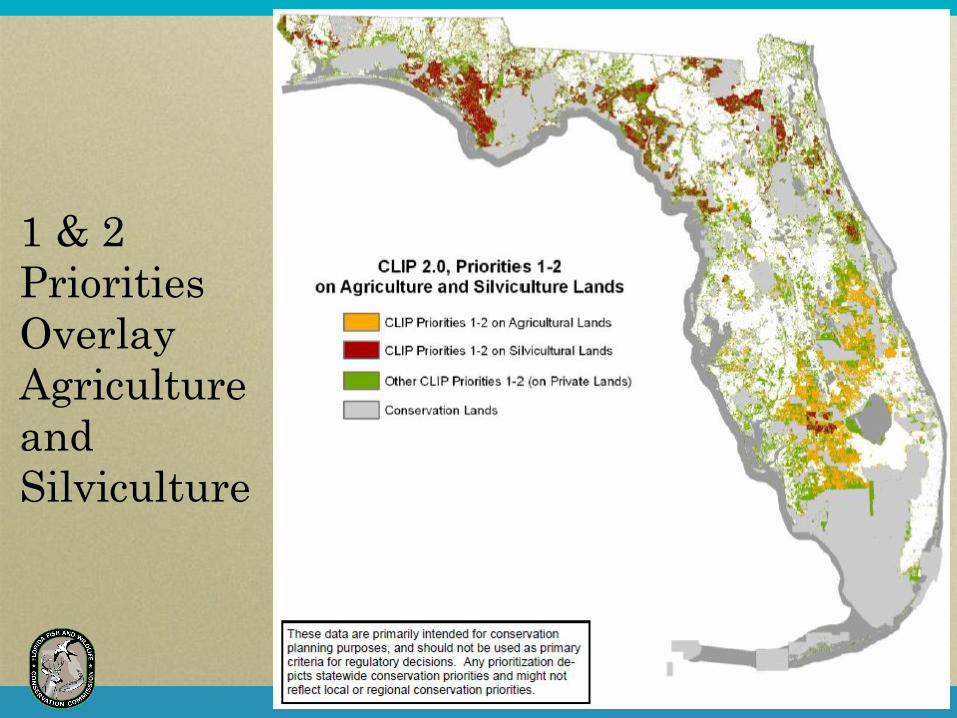
1 & 2
Priorities
Overlay
Agriculture
and
Silviculture

Regional
Pilot Study

Blueprint-
Regional
Pilot


Southwest
CCB Priority
Connections
“Arrow Map”
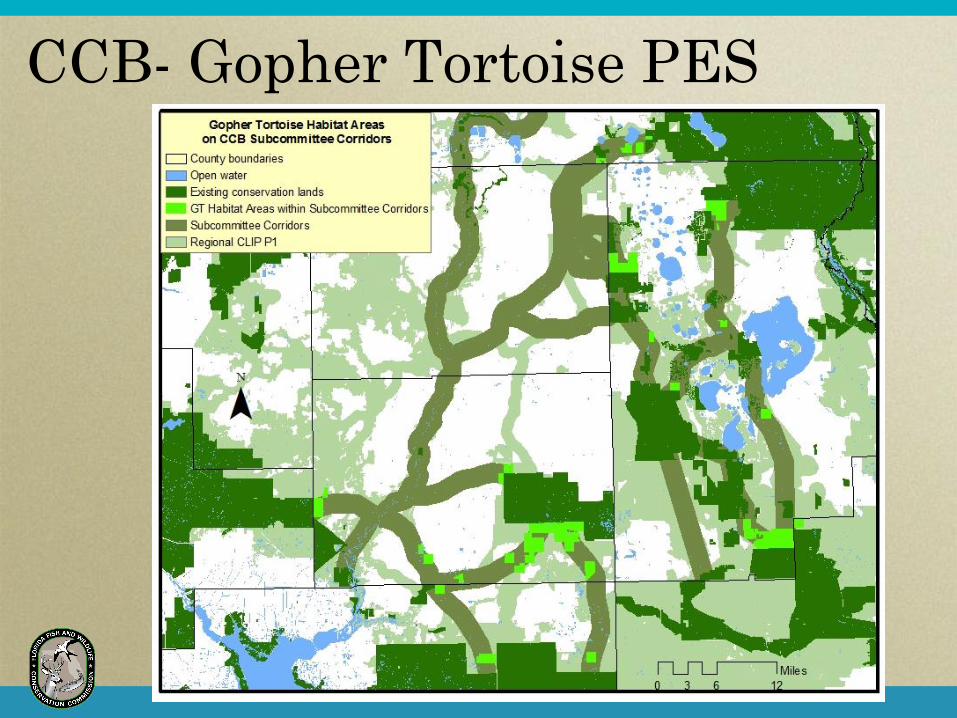
CCB- Gopher Tortoise PES

Where from
Here?
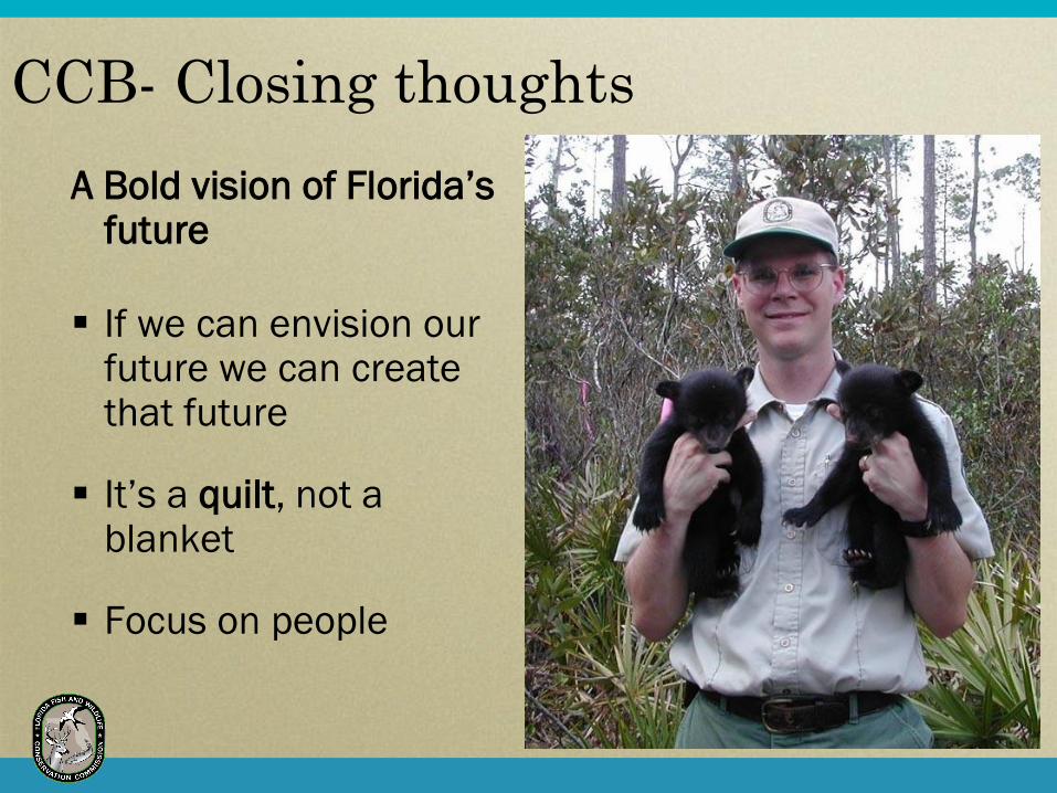
CCB- Closing thoughts
A Bold vision of Florida’s future
If we can envision our future we can create that future
It’s a quilt, not a blanket
Focus on people


FLORIDA 2060 A Research Project of 1000 Friends of Florida

Florida 2060
Trend analysis of urban development
Results of incremental decisions
Question of legacy leadership
Prepared by:
GeoPlan Center of UF and
CQG&RD at Georgia Tech

Assumptions
1. Moderate Population Growth
(BEBR trend line)
2. New population consumes land at same
density as existing development, by County
3. New population distributed geographically
based on land suitability (existing urban,
roadways, water, coastline, wetlands)

Statewide Land Use Allocation
(millions of acres)
2060 2005
Agriculture, Other
Undeveloped Lands
19.5
Urban
Development
6.0
Urban
Development
13.0
Water
2.0
Water
2.0
Permanently
Protected
Conservation
10.8
Permanently
Protected
Conservation
10.8 Agriculture, Other
Undeveloped Lands
12.5
Total: 38.3 Million Acres

Reserve Network for Florida
Core Preserves
Buffer Zones and Corridors
Source: Noss & Cooperrider 1994

Wildlife 2060: What’s at stake for Florida?
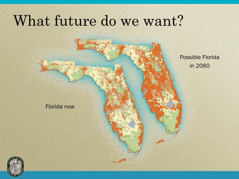
What future do we want?
Florida now
Possible Florida
in 2060

Issues to consider
Habitat loss
Habitat isolation
Coastal challenges
Water quality and quantity
Wildlife/Human interactions
Access to land and water

Habitat isolation
Now 2060
How do you burn when you are surrounded by a sea of development?

Coastal challenges
What happens to our coasts if sea level rises?
Height above sea level

Current Core Data Layers
Strategic Habitat Conservation Areas FWC
Biodiversity Hotspots FWC
Rare Species Habitat Conservation Priorities FNAI
Under-Protected Natural Communities FNAI
Ecological Greenways UF / OGT
Significant Surface Waters FNAI / DEP
Natural Floodplain FNAI / DEP
Wetlands FNAI / NWI
Aquifer Recharge FGS / FNAI

Additional Data (Potential Core Layers
and Overlays)
Landscape Integrity UF
Estuarine Shoreline Complexity FWRI
Seagrass Beds and Hardbottom/Coral FWRI
Impaired Water Basins DEP
CBRA Coastal Barrier Resources USFWS/FEMA
Developments of Regional Impact DCA
Population/Development Projections UF
Agricultural/Silvicultural Lands WMDs
Future Transportation Corridors FDOT
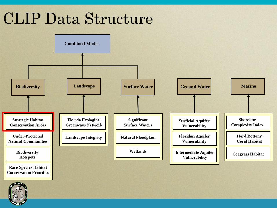
Biodiversity Surface WaterLandscape Ground Water
Combined Model
Strategic Habitat
Conservation Areas
Under-Protected
Natural Communities
Biodiversity
Hotspots
Rare Species Habitat
Conservation Priorities
Landscape Integrity
Florida Ecological
Greenways Network
Intermediate Aquifer
Vulnerability
Shoreline
Complexity IndexSurficial Aquifer
Vulnerability
Hard Bottom/
Coral Habitat
Floridan Aquifer
Vulnerability
Seagrass Habitat
Significant
Surface Waters
Natural Floodplain
Wetlands
MarineBiodiversityBiodiversity Surface WaterSurface WaterLandscapeLandscape Ground WaterGround Water
Combined Model
Strategic Habitat
Conservation Areas
Under-Protected
Natural Communities
Biodiversity
Hotspots
Rare Species Habitat
Conservation Priorities
Landscape Integrity
Florida Ecological
Greenways Network
Intermediate Aquifer
Vulnerability
Shoreline
Complexity IndexSurficial Aquifer
Vulnerability
Hard Bottom/
Coral Habitat
Floridan Aquifer
Vulnerability
Seagrass Habitat
Significant
Surface Waters
Natural Floodplain
Wetlands
Marine
CLIP Data Structure

All species with SHCA (1994)
17 species identified with habitat threats in ‘Habitat Conservation Needs of Rare and Imperiled Wildlife in Florida’
Species with recent habitat threats or subject to proposals for change in listing status.
62 species selected
– 14 amphibians and reptiles
– 32 birds (8 species wading birds – as a group)
– 16 mammals
SHCA - Species Selection

SHCA – Project Flow
Landscape
DataField
Studies Experiments
GIS
Layers
Demographic
Data
Population
Model
Metapopulation
Model
Habitat Suitability
Map
Patch
Map+
Risk Assessment
Landscape
DataField
Studies Experiments
GIS
Layers
Demographic
Data
Population
Model
Metapopulation
Model
Habitat Suitability
Map
Patch
Map+
Risk Assessment
Potential habitat mapping
Population Viability Analysis
(PVA)

Strategic
Habitat
Conservation
Areas
Map

Biodiversity
Category
Priorities
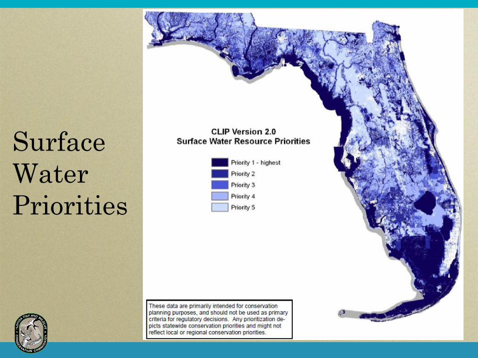
Surface
Water
Priorities

Landscape
Category
Priorities

Florida’s Wildlife Action Plan
Statewide Actions
Develop incentive-based
programs
Acquire important lands and
waters
Coordinate conservation
efforts
Educate the public
Cooperative Conservation
Blueprint

How is the Blueprint Different?
1) Unified GIS layers of priority conservation areas,
working landscapes, and development areas
2) Online application to make GIS layers available to
all Floridians
3) Package of incentives and policies needed to
implement the land use priorities statewide
A process to build common land use priorities with three main components:

ArcIMS I
complete
ArcIMS
update
Brief key legislators,
Governor and agencies
Go to legislature
Blueprint Development Process
Outreach to 2-4
legislative chairs
2008
February
March
April
May
June
July
*August
September
October
November
December
January
2009
Technical ArcIMS Incentives Coalition
Outreach
CLIP complete
Blueprint overlay
draft due
1:1 outreach
3-5 Draft incentives
Materials
complete
1:1 outreach
50 supporting organizations
* Benchmark – Decide to move forward or not to the Governor and Legislature
Blueprint complete ArcIMS update Incentives detail complete Partners confirmed

Blueprint Outreach and Partnering
Core Team
3 Incentive Working Groups
Internet Delivery
Steering Committee
GIS Technical Group
Stakeholder Outreach

Blueprint Steering Committee
University of Florida - Tom Hoctor
Florida Natural Areas Inventory - Gary Knight
Defenders of Wildlife - Laurie Macdonald
Century Commission - Steve Seibert
FWC - Thomas Eason
Evans Properties - Ron Edwards
Family Lands Remembered - Ernie Cox
WilsonMiller - Georgianne Ratliff
Florida Chamber of Commerce –Tony Carvahal
The Nature Conservancy – Doria Gordon
Trust for Public Lands – Andy McCloud
Florida Division of Forestry – Steve Bohl

Blueprint Partnering
Century Commission
Collins Center for Public Policy
Defenders of Wildlife
Florida Natural Areas Inventory
Florida State University, FREAC
FWC
UF GeoPlan Center
Wildlife Foundation of Florida
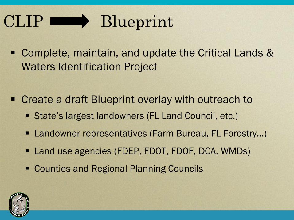
CLIP Blueprint
Complete, maintain, and update the Critical Lands &
Waters Identification Project
Create a draft Blueprint overlay with outreach to
State’s largest landowners (FL Land Council, etc.)
Landowner representatives (Farm Bureau, FL Forestry…)
Land use agencies (FDEP, FDOT, FDOF, DCA, WMDs)
Counties and Regional Planning Councils

Cooperative Conservation Blueprint
A consensus starting point
for building our future
A unified vision for
Florida’s natural
landscape
Incentives and policies
to achieve it
Internet availability to
use it

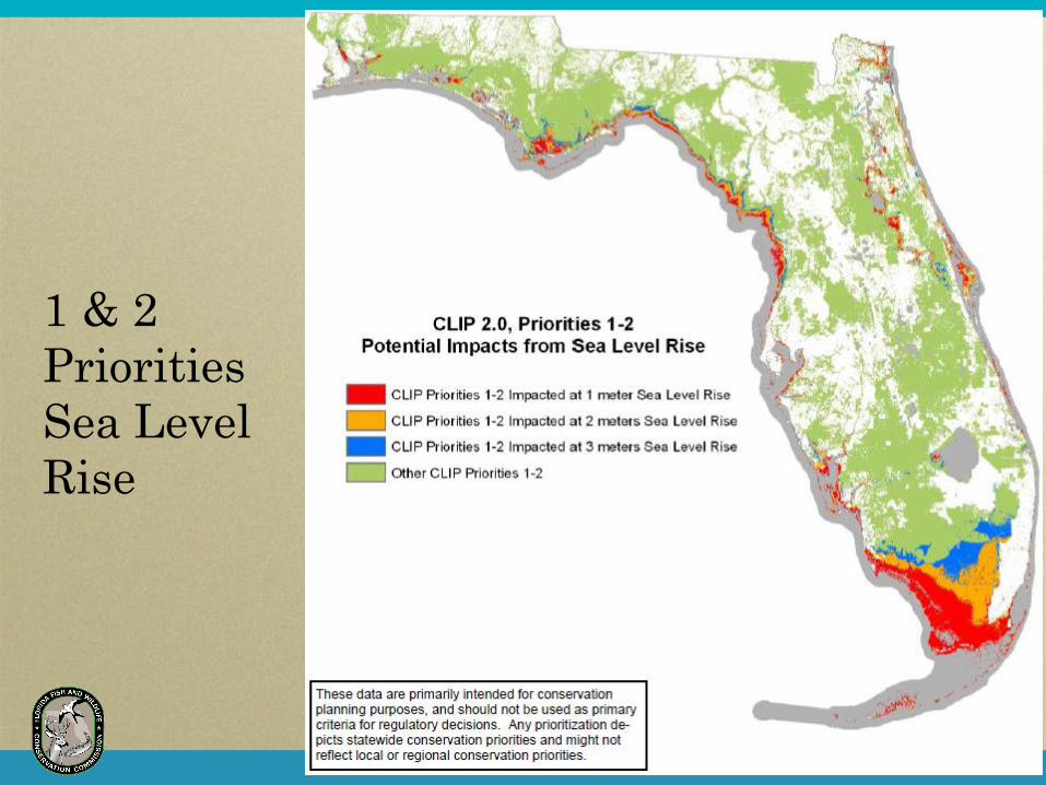
1 & 2
Priorities
Overlay
2060 Growth
Projection
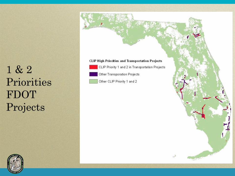
1 & 2
Priorities
FDOT
Projects
1 & 2
Priorities
Sea Level
Rise

Regional Pilot Study Areas Southwest
Christine Small
Build on Babcock Ranch
Connectivity work
Heartland
Mary Oakley
Partner with Heartland
2060 effort
Upper Kissimmee Basin
Kim Love
Focus on water
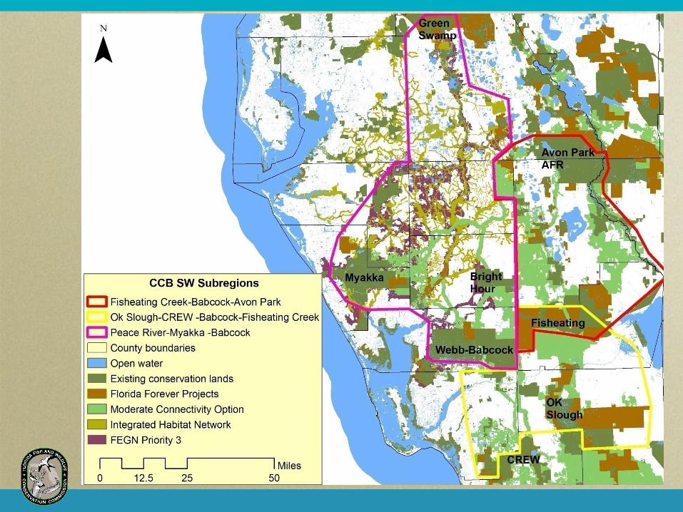

Regional Pilot Study Areas Southwest
Christine Small
Build on Babcock Ranch
Connectivity work
Heartland
Mary Oakley
Partner with Heartland
2060 effort
Upper Kissimmee Basin
Kim Love
Focus on water

Regional Pilot Study Areas Southwest
Christine Small
Build on Babcock Ranch
Connectivity work
Heartland
Mary Oakley
Partner with Heartland
2060 effort
Upper Kissimmee Basin
Kim Love
Focus on water

CCB -
Regional
Pilot
Study
Areas
Combined

64
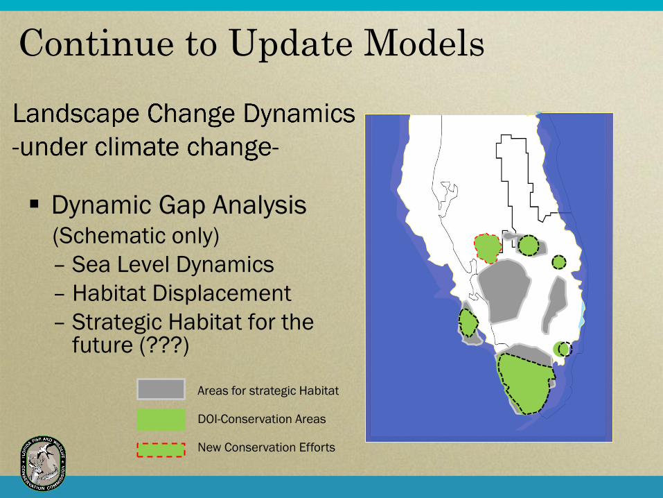
Dynamic Gap Analysis (Schematic only)
– Sea Level Dynamics
– Habitat Displacement
– Strategic Habitat for the future (???)
Areas for strategic Habitat DOI-Conservation Areas New Conservation Efforts
Continue to Update Models

FL Wildlife Corridor
Gopher Tortoise Payment for Ecosystem Services
Create new regional efforts across state
House within Wildlife Action Plan and Florida LCC
Build into Southeast blueprint work
Expand & Use with Other Efforts

Keys to Success
Open, transparent process
Full understanding and buy-in
Strong partnerships
Best available GIS modeling
Incentives and policies to allow use
Capturing current alignment of interest and need

SHCA Map

Congruency

Cooperative Conservation Blueprint
A Bold vision of Florida’s future
If we can envision our future we can create that future

Critical Lands & Waters
Identification Project (CLIP)
Derived from and updates
existing data sources
Prioritizes biodiversity,
landscapes, water
Multi-agency technical
advisory group

Landowner Assistance Program
Focusing
Landowner
Assistance
Using Priority
Habitat Focal
Areas
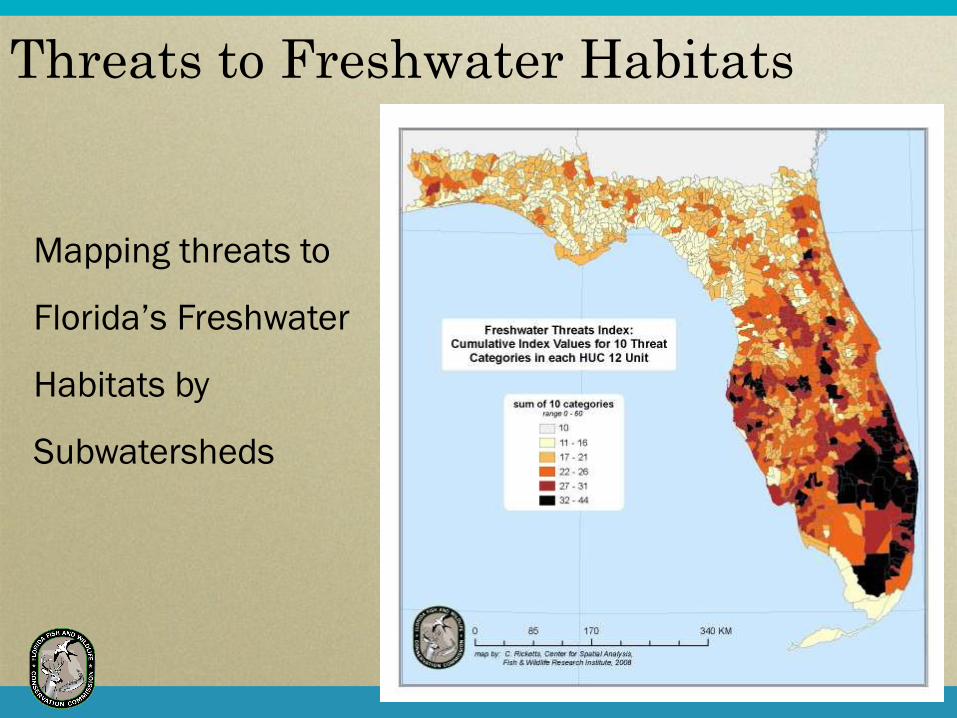
Threats to Freshwater Habitats
Mapping threats to
Florida’s Freshwater
Habitats by
Subwatersheds

Greater
Everglades
Refuge
Planning
Areas
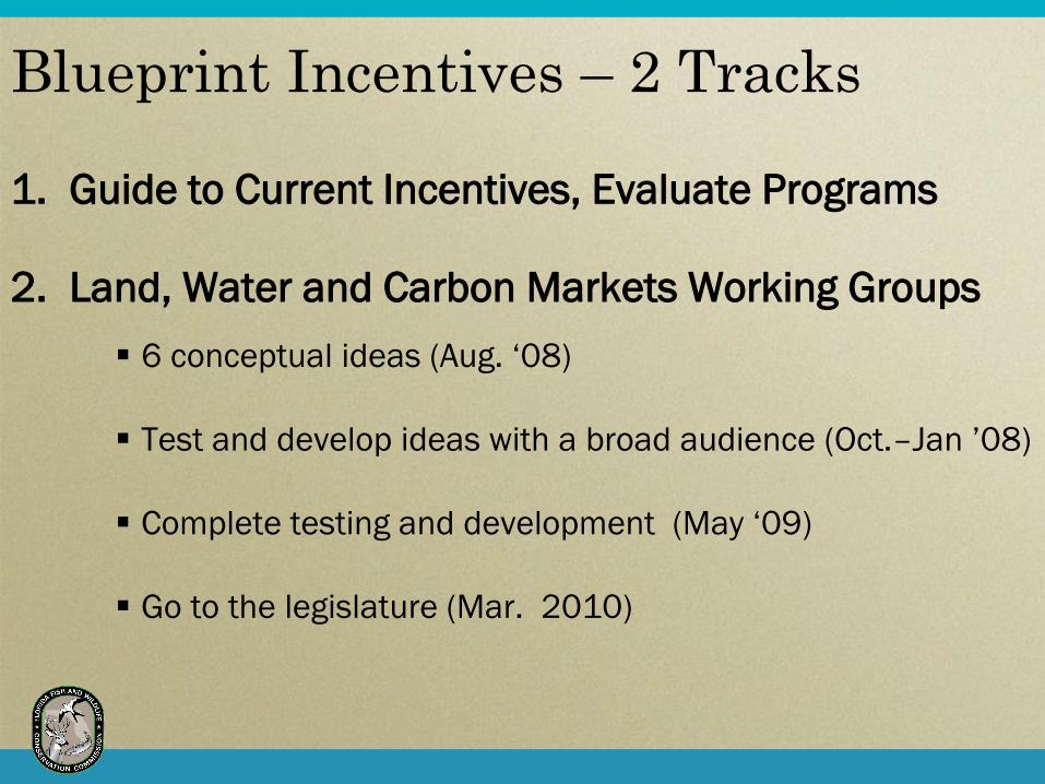
Blueprint Incentives – 2 Tracks
1. Guide to Current Incentives, Evaluate Programs
2. Land, Water and Carbon Markets Working Groups
6 conceptual ideas (Aug. ‘08)
Test and develop ideas with a broad audience (Oct.–Jan ’08)
Complete testing and development (May ‘09)
Go to the legislature (Mar. 2010)
Incentive Ideas - Land
A Safe Haven Master Strategy (Lg. landholdings)
– Parcel evaluation and planning with “time-out” on
new land use, permit and regulations
– Landowner “time-out” no increase density and land
use intensity proposals
Conservation Development (Sm. landholdings)
– Identify the areas protected and how, and areas to
be developed and how

Incentive Ideas - Water
Self Supply Water Security & Resource
Restoration Partnerships
– Long-term water permit for existing permitted
quantities
– Eligible for regional resource restoration
partnerships with other water users
Hydrologic Restoration of Natural Systems
– Incentivize private investment for the restoration
of hydrologic restoration target areas
Carbon Offset Program
– Establish unlimited carbon offset program as an
integral part of a cap-and-trade program
Inventorying Carbon Credits
– Establish accounting of carbon credits to enable
private landowners to benefit financially from
emerging carbon markets
Incentive Ideas – Carbon Markets

Online Application
CLIP & Blueprint available to use
CLIP v2.0 update completed
Display draft Blueprint overlay
Phases
– Viewing and understanding
– Review and comment
– Use and analysis


Partners, partners,
partners!
Landscape scale
Focal species / issues
Modern challenges
require multi-
organizational approach
Build on existing efforts
Closing Thoughts