THE 5 THEMES OF GEOGRAPHY Chapter 1 North America South America Europe Asia Africa Australia...
36
-
Upload
briana-marshall -
Category
Documents
-
view
219 -
download
2
Transcript of THE 5 THEMES OF GEOGRAPHY Chapter 1 North America South America Europe Asia Africa Australia...


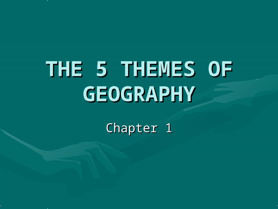
THE 5 THEMES OF THE 5 THEMES OF GEOGRAPHYGEOGRAPHY
Chapter 1Chapter 1

North America
South America
Europe
Asia
Africa
Australia
Antarctica
Pacific Ocean
Atlantic
Ocean
Arctic Ocean
Indian Ocean

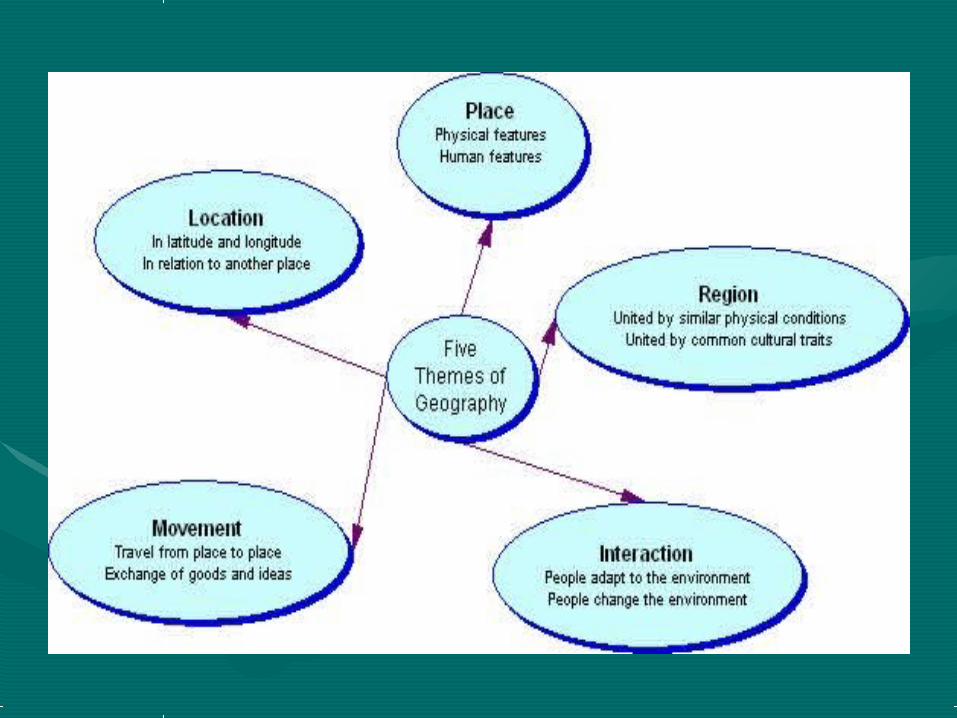
THE FIVE THEMES OF THE FIVE THEMES OF GEOGRAPHYGEOGRAPHY
•LocationLocation•PlacePlace•Human-Environment Human-Environment
InteractionInteraction•MovementMovement•RegionsRegions
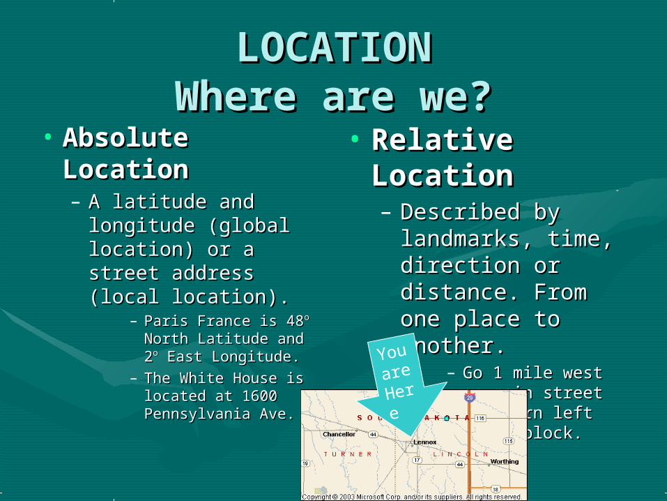
LOCATIONLOCATIONWhere are we?Where are we?
• Absolute Absolute LocationLocation– A latitude and A latitude and
longitude (global longitude (global location) or a street location) or a street address (local address (local location).location).
– Paris France is 48Paris France is 48o o
North Latitude and 2North Latitude and 2oo East Longitude.East Longitude.
– The White House is The White House is located at 1600 located at 1600 Pennsylvania Ave. Pennsylvania Ave.
• Relative Relative LocationLocation– Described by Described by
landmarks, time, landmarks, time, direction or direction or distance. From one distance. From one place to another.place to another.
– Go 1 mile west on Go 1 mile west on main street and main street and turn left for 1 turn left for 1 block.block.
You
are
Her
e

Latitude and Latitude and LongitudeLongitude
How do we find places on How do we find places on maps?maps?

LatitudeLatitude
What is Latitude?What is Latitude?
• Lines of Latitude run Lines of Latitude run horizontallyhorizontally• Latitude is measured in degrees.Latitude is measured in degrees.• The The EquatorEquator is 0 degrees Latitude. is 0 degrees Latitude.• Lines of Latitude Are used to locate places Lines of Latitude Are used to locate places
and measure distances and measure distances North North or or SouthSouth of of the Equator.the Equator.

LongitudeLongitude
• Lines of Longitude run Lines of Longitude run vertically.vertically.• They are also called They are also called Meridians.Meridians.• The The Prime Meridian Prime Meridian is found in is found in
Greenwich, England.Greenwich, England.• The Prime Meridian is 0 degrees The Prime Meridian is 0 degrees
Longitude.Longitude.• Lines of Longitude are used to locate Lines of Longitude are used to locate
places and measure distances places and measure distances East East oror WestWest of the Prime Meridian. of the Prime Meridian.

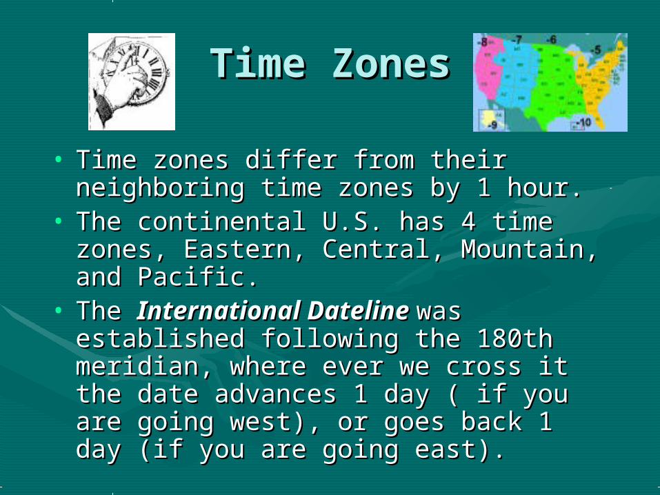
Time ZonesTime Zones
• Time zones differ from their neighboring Time zones differ from their neighboring time zones by 1 hour.time zones by 1 hour.
• The continental U.S. has 4 time zones, The continental U.S. has 4 time zones, Eastern, Central, Mountain, and Pacific.Eastern, Central, Mountain, and Pacific.
• The The International Dateline International Dateline was was established following the 180th established following the 180th meridian, where ever we cross it the meridian, where ever we cross it the date advances 1 day ( if you are going date advances 1 day ( if you are going west), or goes back 1 day (if you are west), or goes back 1 day (if you are going east).going east).

Time ZonesTime Zones
• In the Spring we shift the clocks 1 In the Spring we shift the clocks 1 hour ahead. This is called hour ahead. This is called Daylight Daylight Saving TimeSaving Time. . (Arizona and (Arizona and Hawaii DO NOT observe DST)Hawaii DO NOT observe DST)
• In the Fall we shift the clocks 1 In the Fall we shift the clocks 1 hour back.hour back.
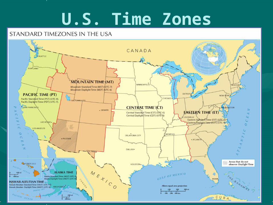
U.S. Time Zones
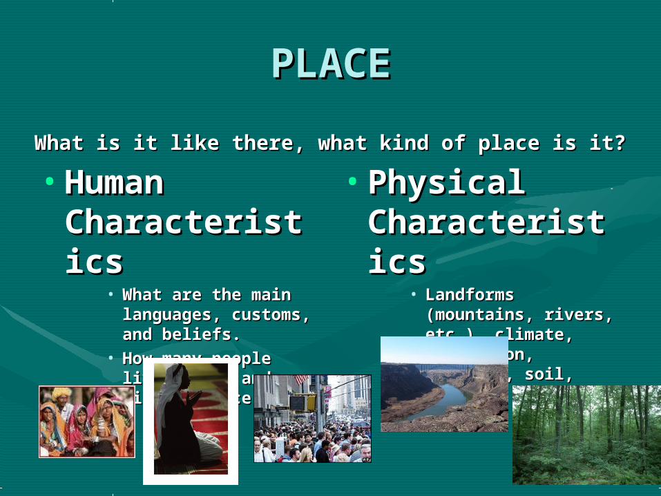
PLACEPLACE
What is it like there, what kind of place is it?What is it like there, what kind of place is it?
• Human Human CharacteristiCharacteristicscs
• What are the main What are the main languages, customs, languages, customs, and beliefs.and beliefs.
• How many people How many people live, work, and visit live, work, and visit a place.a place.
• Physical Physical CharacteristiCharacteristicscs
• Landforms Landforms (mountains, rivers, (mountains, rivers, etc.), climate, etc.), climate, vegetation, wildlife, vegetation, wildlife, soil, etc.soil, etc.
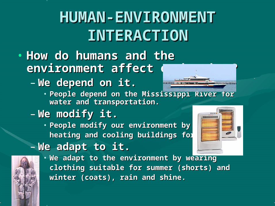
HUMAN-ENVIRONMENT HUMAN-ENVIRONMENT INTERACTIONINTERACTION
• How do humans and the How do humans and the environment affect each other?environment affect each other?– We depend on it.We depend on it.
• People depend on the Mississippi River for People depend on the Mississippi River for water and transportation.water and transportation.
– We modify it.We modify it.• People modify our environment by People modify our environment by
heating and cooling buildings for comfort.heating and cooling buildings for comfort.
– We adapt to it.We adapt to it. • We adapt to the environment by wearing We adapt to the environment by wearing
clothing suitable for summer (shorts) and clothing suitable for summer (shorts) and winter (coats), rain and shine.winter (coats), rain and shine.

MOVEMENTMOVEMENT
• How are people, goods, ideas moved How are people, goods, ideas moved from place to place?from place to place?– Human MovementHuman Movement
• Trucks, Trains, PlanesTrucks, Trains, Planes
– Information MovementInformation Movement• Phones, computer (email), mailPhones, computer (email), mail
– Idea MovementIdea Movement• How do fads move from place to place? How do fads move from place to place?
TV, Radio, MagazinesTV, Radio, Magazines
MOVEMENT
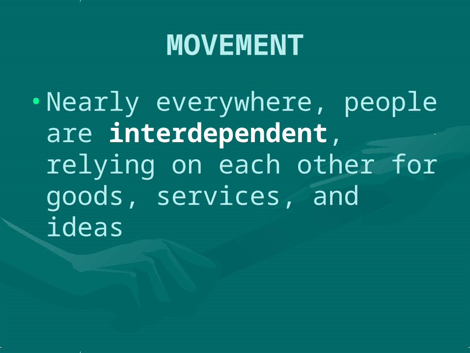
•Nearly everywhere, people are interdependent, relying on each other for goods, services, and ideas
REGIONSREGIONS
• How are Regions similar to and How are Regions similar to and different from other places?different from other places?– Formal RegionsFormal Regions
• Regions defined by governmental or administrative Regions defined by governmental or administrative boundaries (States, Countries, Cities)boundaries (States, Countries, Cities)
• Regions defined by similar characteristics (Corn Belt, Regions defined by similar characteristics (Corn Belt, Rocky Mountain region, Chinatown).Rocky Mountain region, Chinatown).
– Functional RegionsFunctional Regions• Regions defined by a function (newspaper service Regions defined by a function (newspaper service
area, cell phone coverage area).area, cell phone coverage area).
– Vernacular Regions (Not in your book)Vernacular Regions (Not in your book)• Regions defined by peoples perception (middle east, Regions defined by peoples perception (middle east,
the south, etc.)the south, etc.)

Remembering the 5 Remembering the 5 themesthemes
• If you canIf you can’’t remembering what t remembering what they are just ask for HELP!!!they are just ask for HELP!!!•MM – Movement – Movement•RR – Regions – Regions•HEHE – Human Environment – Human Environment interactioninteraction
•LL – Location – Location•PP - Place - Place
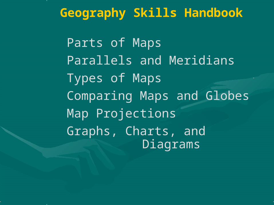
Geography Skills Handbook
Parts of MapsParallels and MeridiansTypes of Maps Comparing Maps and GlobesMap ProjectionsGraphs, Charts, and Diagrams


KEY
COMPASSROSE
KEY SCALE BAR

1. What line of longitude passes close to Bordeaux?
2. What city is located east of 5◦E and south of 45◦ N?

Physical Maps show landforms and bodies of water..
General Purpose Maps

Political Maps show
national and regional
boundaries and cities.
General Purpose Maps
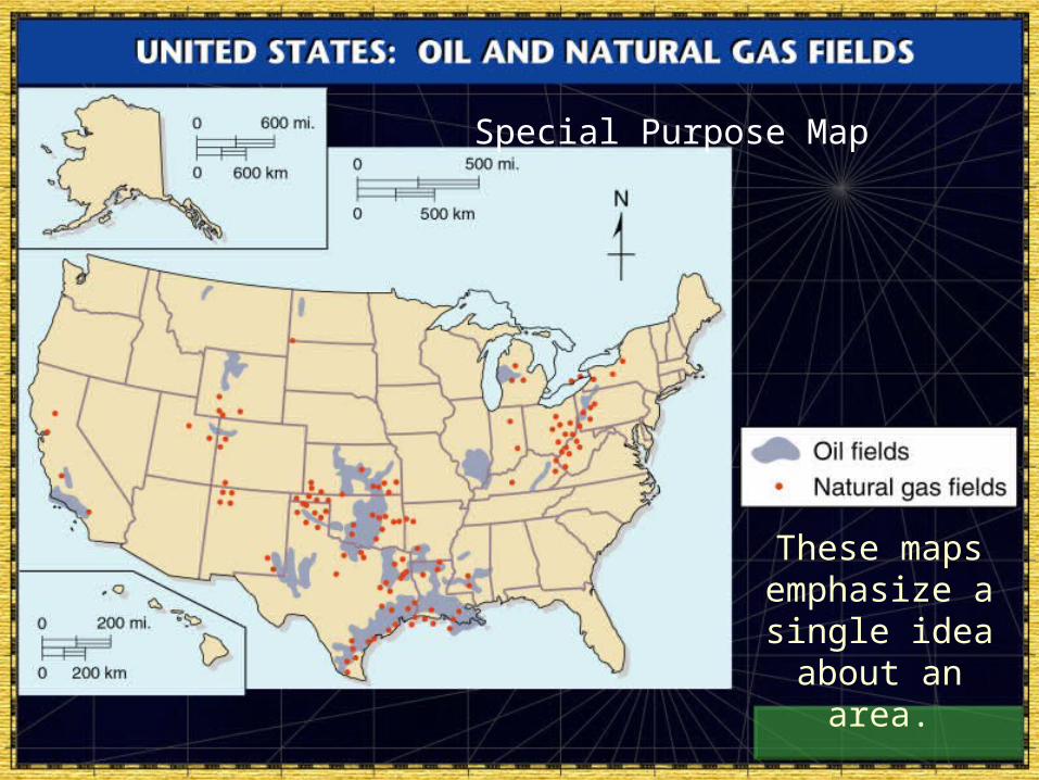
These maps emphasize a single idea about an
area.
Special Purpose Map
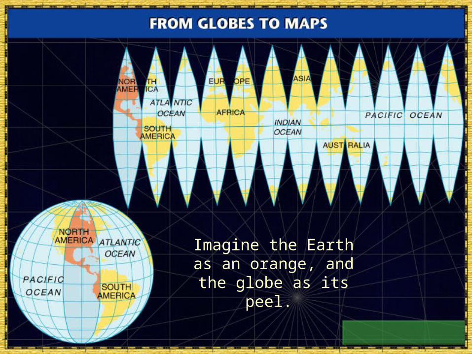
Imagine the Earth as an orange, and the globe as its peel.
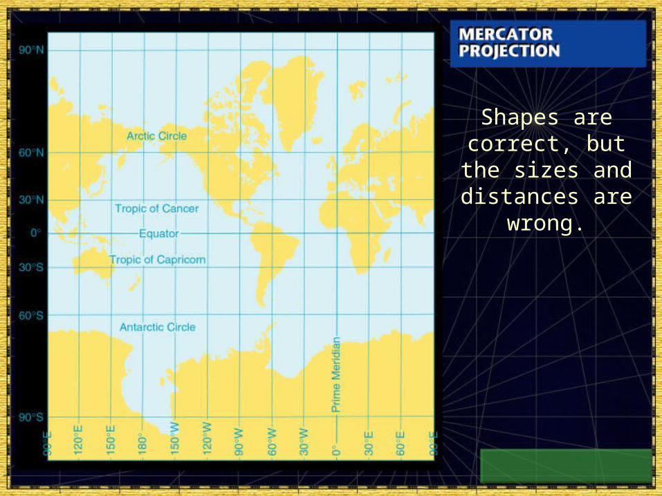
Shapes are correct, but the sizes and distances are
wrong.
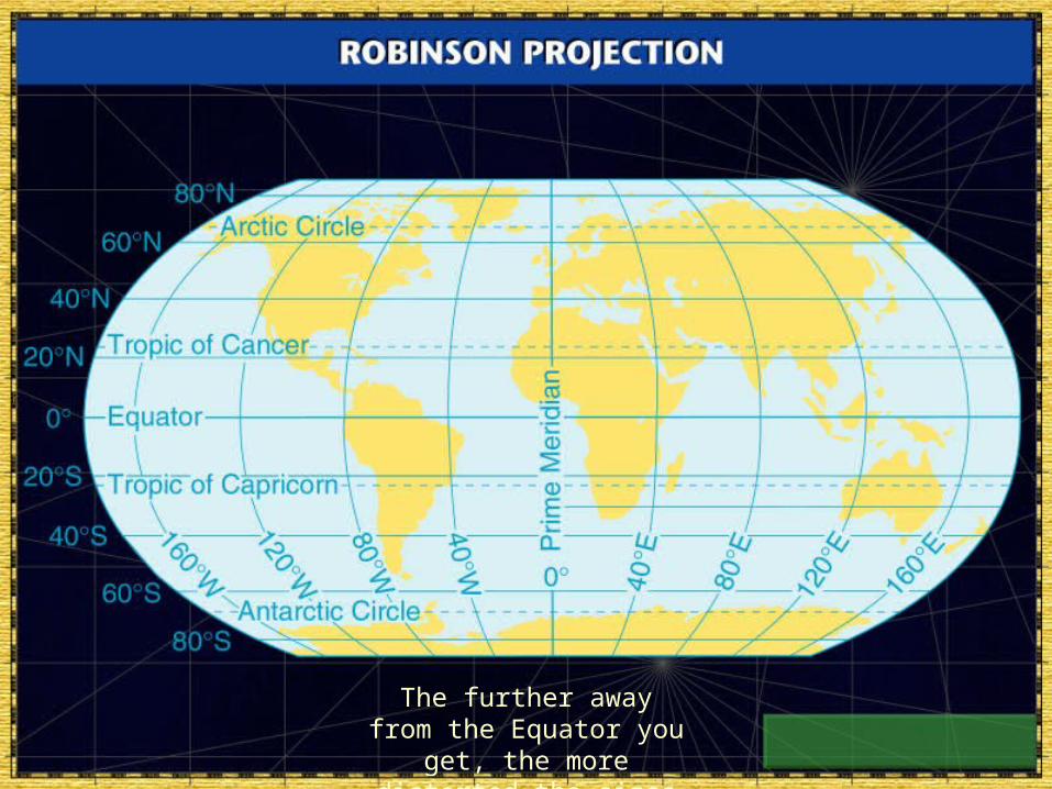
The further away from the Equator you get, the more distorted the sizes
get.

Graphs
These are charts uses to present data visually.
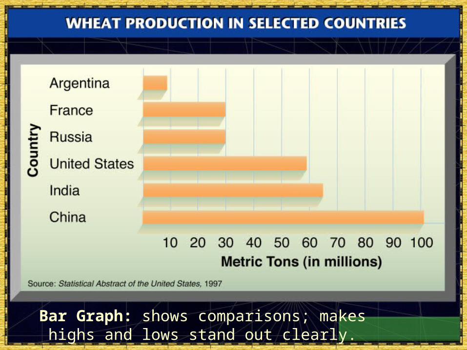
Bar Graph: shows comparisons; makes highs and lows stand out clearly.

Line Graph: shows a change between two variables.

Circle Graph (pie chart):
uses percentages to
show how parts of the
whole compare to one another.
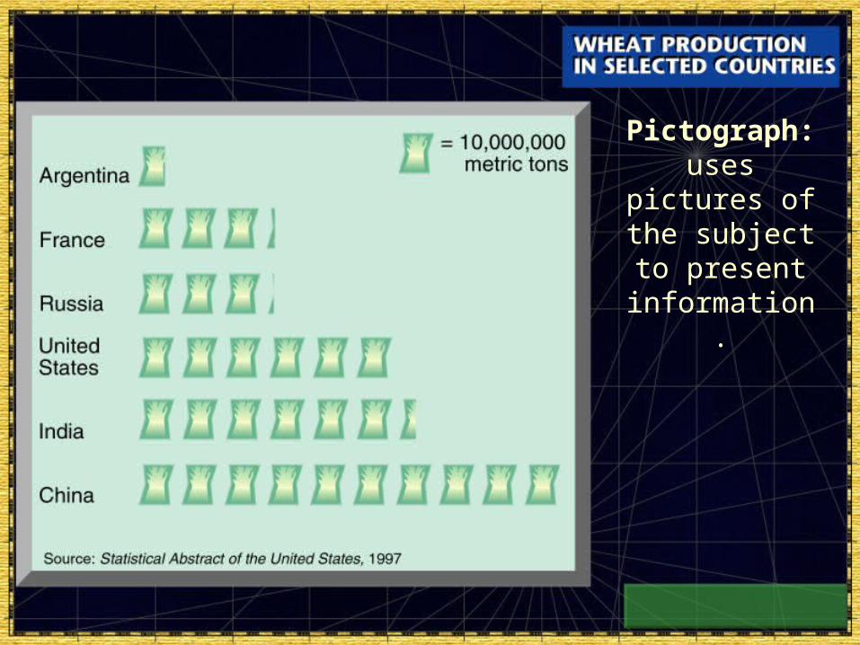
Pictograph: uses
pictures of the subject to present
information.

Tables: present information in a organized manner.