th Ave Bozeman, MT 59718 February 7,...
37
1400 South 19 th Ave Bozeman, MT 59718 February 7, 2011 To: Governor’s Office, Mike Volesky, State Capitol, Room 204, PO Box 200801, Helena, MT 59620-0801 Environmental Quality Council, State Capitol, Room 106, PO Box 201704, Helena, MT 59620-1704 Dept. of Environmental Quality, Metcalf Building, PO Box 200901, Helena, MT 59620-0901 Dept. of Natural Resources & Conservation, PO Box 201601, Helena, MT 59620-1601 Montana Fish, Wildlife & Parks: Director’s Office Parks Division Lands Section FWP Commissioners Fisheries Division Legal Unit Wildlife Division Design & Construction MT Historical Society, State Historic Preservation Office, PO Box 201202, Helena, MT 59620-1202 MT State Parks Association, PO Box 699, Billings, MT 59103 MT State Library, 1515 E. Sixth Ave., PO Box 201800, Helena, MT 59620 James Jensen, Montana Environmental Information Center, PO Box 1184, Helena, MT 59624 Janet Ellis, Montana Audubon Council, PO Box 595, Helena, MT 59624 George Ochenski, PO Box 689, Helena, MT 59624 Sean O’Callaghan Mike Harris Montana Rail Link, Inc, PO Box 16390, Missoula, MT 59808 Mel Weigum, 11220 Front St, Logan, MT 59741 Gallatin County Commissioners, 311 W Main; Room 306, Bozeman, MT 59715 City of Logan, General Delivery, Manhattan, MT 59741-8060 Francis A. Orr, 9910 Circle R Dr, Escondido, CA 92026-5707 Gary Rutledge, 11155 Railroad St, Manhattan, MT 59741-8060 Jonathan Danz & Sandra Weigum, 327 Sirius St, Olympian Village, MO 63020 Richard & Edythe Macrow, 11275 River St, Manhattan, MT 59741-8154 James Groenendal, 11090 Front St, Manhattan, MT 59741-8037 Craig Susag & Shana Chauli Susag, PO Box 276, Manhattan, MT 59741-0276 Glen Jorgenson, 5520 Frontage Rd, Manhattan, MT 59741-8048 Erwin Entzel, PO Box 306, Three Forks, MT 59752-0306 Northern Pacific RY Co, Property Tax Dept, 2650 Lou Menk Dr, Fort Worth, TX 76131-2830 Brent Schmoll, 51 whisper Ln, Bozeman, MT 59718-7137 John Zuelke, 101 Carpenter Rd, Three Forks, MT 59752-9730 Gail Bagaoisan, 4560 Parent St, Missoula, MT 59808-1470 Bonita May Goforth, 11133 Railroad St, Manhattan, MT 59741-8060 Merv Gunderson, 407 Helen Dr, Belgrade, MT 59714-3112 Ladies and Gentlemen: The enclosed Environmental Assessment (EA) has been prepared for the proposed development of a Fishing Access Site (FAS) along the Gallatin River in the town of Logan, Montana.
Transcript of th Ave Bozeman, MT 59718 February 7,...

1400 South 19th Ave Bozeman, MT 59718
February 7, 2011
To: Governor’s Office, Mike Volesky, State Capitol, Room 204, PO Box 200801, Helena, MT 59620-0801 Environmental Quality Council, State Capitol, Room 106, PO Box 201704, Helena, MT 59620-1704 Dept. of Environmental Quality, Metcalf Building, PO Box 200901, Helena, MT 59620-0901 Dept. of Natural Resources & Conservation, PO Box 201601, Helena, MT 59620-1601 Montana Fish, Wildlife & Parks: Director’s Office Parks Division Lands Section FWP Commissioners Fisheries Division Legal Unit Wildlife Division Design & Construction MT Historical Society, State Historic Preservation Office, PO Box 201202, Helena, MT 59620-1202 MT State Parks Association, PO Box 699, Billings, MT 59103 MT State Library, 1515 E. Sixth Ave., PO Box 201800, Helena, MT 59620 James Jensen, Montana Environmental Information Center, PO Box 1184, Helena, MT 59624 Janet Ellis, Montana Audubon Council, PO Box 595, Helena, MT 59624 George Ochenski, PO Box 689, Helena, MT 59624 Sean O’Callaghan Mike Harris Montana Rail Link, Inc, PO Box 16390, Missoula, MT 59808 Mel Weigum, 11220 Front St, Logan, MT 59741
Gallatin County Commissioners, 311 W Main; Room 306, Bozeman, MT 59715 City of Logan, General Delivery, Manhattan, MT 59741-8060 Francis A. Orr, 9910 Circle R Dr, Escondido, CA 92026-5707 Gary Rutledge, 11155 Railroad St, Manhattan, MT 59741-8060 Jonathan Danz & Sandra Weigum, 327 Sirius St, Olympian Village, MO 63020 Richard & Edythe Macrow, 11275 River St, Manhattan, MT 59741-8154 James Groenendal, 11090 Front St, Manhattan, MT 59741-8037 Craig Susag & Shana Chauli Susag, PO Box 276, Manhattan, MT 59741-0276 Glen Jorgenson, 5520 Frontage Rd, Manhattan, MT 59741-8048 Erwin Entzel, PO Box 306, Three Forks, MT 59752-0306 Northern Pacific RY Co, Property Tax Dept, 2650 Lou Menk Dr, Fort Worth, TX 76131-2830 Brent Schmoll, 51 whisper Ln, Bozeman, MT 59718-7137 John Zuelke, 101 Carpenter Rd, Three Forks, MT 59752-9730 Gail Bagaoisan, 4560 Parent St, Missoula, MT 59808-1470 Bonita May Goforth, 11133 Railroad St, Manhattan, MT 59741-8060 Merv Gunderson, 407 Helen Dr, Belgrade, MT 59714-3112
Ladies and Gentlemen:
The enclosed Environmental Assessment (EA) has been prepared for the proposed development of a Fishing Access Site (FAS) along the Gallatin River in the town of Logan, Montana.

Montana Fish, Wildlife & Parks invites you to comment on the attached proposal. If requested, FWP will schedule and conduct a public meeting on this proposed project. Public comment will be accepted until 5:00 p.m. on March 11, 2011. Comments should be sent to the following:
Logan Fishing Access Site Proposed Development Montana Fish, Wildlife & Parks, Region 3 1400 South 19th Ave Bozeman, MT 59718
Or emailed to: [email protected].
Sincerely,
Gerald Walker Region Three Parks Manager

DRAFT ENVIRONMENTAL ASSESSMENT
LOGAN FISHING ACCESS SITE PROPOSED DEVELOPMENT
February 2011

2
Logan Fishing Access Site Proposed Development
Draft Environmental Assessment MEPA, NEPA, MCA 23-1-110 CHECKLIST
PART I. PROPOSED ACTION DESCRIPTION
1. Type of proposed state action: In December 2010, Montana Fish, Wildlife & Parks (FWP) acquired 1.5 acres of land along the Gallatin River within the town of Logan for the purpose of establishing a fishing access site (FAS) and providing public access to this stretch of the Gallatin River. FWP proposes to develop a FAS including a gravel access road, parking area to accommodate ten vehicles, a singlewide concrete boat ramp, a vault latrine, regulatory and informational signs, and boundary fencing.
2. Agency authority for the proposed action: The 1977 Montana Legislature enacted Section 87-1-605, Montana Code Annotated (MCA), which directs Montana Fish Wildlife and Parks (FWP) to acquire, develop and operate a system of fishing accesses. The legislature earmarked a funding account to ensure that the fishing access site program would be implemented. Sections 23-1-105, 23-1-106, 15-1-122, 61-3-321, and 87-1-303, MCA, authorize the collection fees and charges for the use of state park system units and fishing access sites, and contain rule-making authority for their use, occupancy, and protection. Furthermore, Section 23-1-110, MCA, and Administrative Rules of Montana (ARM) 12.2.433 guides public involvement and comment for the improvements at state parks and fishing access sites, which this document provides.
ARM 12.8.602 requires the Department to consider the wishes of the public, the capacity of the site for development, environmental impacts, long-range maintenance, protection of natural features and impacts on tourism as these elements relate to development or improvement to fishing access sites or state parks. This document will illuminate the facets of the proposed project in relation to this rule. See Appendix A for HB 495 qualification.
3. Name of project: Logan Fishing Access Site Proposed Development
4. Project sponsor: Montana Fish, Wildlife and Parks, Region 3 1400 South 19th Ave Bozeman, MT 59718 (406) 994-4042
5. Anticipated Schedule: Estimated Public Comment Period: February 2011 Estimated Decision Notice: March 2011 Estimated Construction/Commencement Date: Summer 2011 Estimated Completion Date: Summer 2011 Current Status of Project Design (% complete): 0%

3
6. Location: Logan FAS is located within the town of Logan, Montana along the Gallatin River, one half mile north of Interstate 90 and seven miles east of Three Forks in Gallatin County in Section 36, Township 2 North, Range 2 East.
Figure 1. Logan FAS General Location
Figure 2. Logan FAS Highway Map Location
Logan Fishing Access Site

4
Figure 3. Gallatin and Madison Rivers FAS Map
LoganGallatin Forks
Four Corners
Missouri Headwaters State Park

5
Figure 3. Proposed Logan FAS Draft Development Concept Plan
7. Project size: Acres Acres
(a) Developed: (d) Floodplain (100 year) .5 Residential 0 Industrial 0 (e) Productive: Irrigated cropland 0 (b) Open Space/ 0 Dry cropland 0 Woodlands/Recreation Forestry 0 (c) Wetlands/Riparian 0 Rangeland 0 Areas Other 0
8. Local, State or Federal agencies with overlapping or additional jurisdiction:

6
(a) Permits: Agency Name Permit Montana Fish, Wildlife & Parks (FWP) 124 MT Stream Protection Act Montana Dept. of Environmental Quality 318 Short Term Water Quality Standard
for Turbidity Gallatin County Floodplain Permit and Sanitation Permit US Corps of Engineers 404 Federal Clean Water Act
(b) Funding: MT Fish Wildlife & Parks FAS Development $100,000
(c) Other Overlapping or Additional Jurisdictional Responsibilities:Agency Name Type of Responsibility Natural Heritage Program Species of Concern (See Appendix B) State Historic Preservation Office Cultural Clearance Gallatin County Weed District Weed Management Coordination and Approval of Weed Management Plan
9. Narrative summary of the proposed action: There are nine fishing access sites managed by FWP along the Gallatin River system, with one located on the East Gallatin River near Bozeman, seven on the West Gallatin River, and the undeveloped Logan FAS on the Gallatin River. The proposed development of the newly acquired FAS at Logan (river mile 6) would provide the only public access to the Gallatin River between Gallatin Forks FAS (river mile 13) and Missouri Headwaters State Park (river mile 0).
The development of this 1.5-acre parcel along the Gallatin River would allow FWP to preserve this stretch of riparian and open-space habitat and allow for permanent public access to this stretch of a popular river for fishing, rafting, boating, floating, and wildlife viewing.
The Gallatin River rises in two branches on the north face of Three Rivers Peak in Yellowstone National Park. It flows northwest 120 miles, 97 of which are in Montana, to Three Forks, Montana where it converges with the Jefferson and Madison Rivers to form the Missouri River. Meriwether Lewis named the river in 1805 for Albert Gallatin, the U.S. Treasury Secretary from 1801 – 1812. The central fork was named for Secretary of State James Madison and the western fork for President Thomas Jefferson. In addition to being a very popular fly fishing destination, with portions being designated as a Blue Ribbon trout stream and the remainder designated Red Ribbon by FWP, the Gallatin River is also popular for scenic and other recreational values. The river is very popular for all levels of whitewater rafting, with a one-mile section of class IV rapids called the “Mad Mile”. The Gallatin River is also scenic, winding through high alpine meadows, dropping into the rocky Gallatin Canyon, and flowing out into the Gallatin Valley.
The Gallatin River is about twelve miles long from the confluence of the West and East Gallatin Rivers to Three Forks, Montana, where it joins the Jefferson and Madison Rivers to form the Missouri River. In this section, the river flows through a narrow valley consisting of agricultural and grazing lands. The banks are primarily undercuts and long, deep pools provide much of the fish cover. Except for the East and West Gallatin Rivers, tributaries to the Gallatin River are limited to a few spring creeks. Water can be slightly

7
turbid year-round due to the sediment input from the East Gallatin River. The Gallatin River below the confluence of its forks suffers from sedimentation, warm temperatures, dewatering, and the presence of M. cerebralis, the causative agent of whirling disease. Trout populations decline in the lower river due to these factors and a variety of other cumulative impacts. Recent surveys conducted by FWP show that the Gallatin River from river miles 0 – 12 (Logan is at river mile 6) supported an average of 9,628 angler days per year between 2001 and 2007, with a high of 20,316 and low of 5,195 and statewide rankings for fishing pressure ranged from a high of 31 to a low of 105. The Gallatin River from river miles 12 – 98 supported an average of 36,046 angler days per year with state rankings ranging from to 10 to 25 for the same time period. Despite lower trout populations in the lower Gallatin River, based upon the popularity of the Gallatin River, it is still likely that the angler use of the 0 – 12 mile stretch would be higher with public access to this stretch, which currently only has inconvenient and dangerous access at a nearby bridge crossing. Game fish opportunities include rainbow trout, brown trout and mountain whitefish.
Common wildlife species whose habitat distribution overlaps Logan FAS include white-tailed deer, mule deer, beavers, otters, muskrat, mink, raccoons, and skunks. On occasion, black bears and mountain lions move through the riparian habitat. A wide variety of resident and migrant bird species use or move through the area on a seasonal basis including Canada geese, ducks, and numerous songbirds. The site is also a very popular place for raptors, specifically osprey and the occasional golden eagle.
Vegetation found on Logan FAS consists of upland grassland with small areas of riparian grasses along the riverbank. The grassland consists primarily of crested wheatgrass with reed canarygrass, smooth brome, and sedges along the riverbank. With the exception of several black cottonwood trees and Wood’s rose shrubs along the riverbank, very few trees or shrubs are found on the property. Common introduced species found on the property include annual pepperweed and crested wheatgrass. The property is relatively noxious weed free, with small amounts of spotted knapweed on the flood control dike and on drier sites and leafy spurge and common tansy along the river.
Development of the FAS is proposed to include a gravel access road, a parking area to accommodate ten vehicles, a singlewide concrete boat ramp, concrete vault latrine, boundary fencing, and directional, instructional and regulatory signs.
Construction of the access road would require obtaining a road easement to the FAS property from either the American Legion or Burlington Northern Santa Fe Railway Company (BNSF), depending upon the selected concept design.
FWP would construct and maintain fencing along the property boundaries. FWP Parks Maintenance staff would also continue implementing the FWP Statewide Integrated Noxious Weed Management Plan to mitigate the spread of noxious weeds on the property.
Construction of a single-wide concrete boat ramp would require modification of the flood control dike along the Gallatin River bank to give enough room for vehicles to maneuver and for a boat ramp. FWP would conduct a hydrologic survey to determine the best location of the dike to accommodate the boat ramp while still protecting neighboring properties from flooding. FWP would coordinate with the Gallatin County Flood Plain

8
Administrator on this issue. FWP would obtain any necessary approvals and permits before construction begins.
The property would be managed under existing FWP public use regulations and would be routinely maintained. Protection of the natural resources, the health and safety of visitors and consideration of neighboring properties would all be considered and incorporated into development plans for this site. Development of the parking area and latrine would enhance visitor use of this site as well as provide long-term protection for the resources not impacted by the development footprint. The FAS would be for day use only and overnight camping, hunting, and the discharge of firearms would not be allowed on the site.
PART II. ENVIRONMENTAL REVIEW
1. Description and analysis of reasonable alternatives:
Alternative A: No Action If no actions were taken and the property was not developed as an FAS with an access road, the only physical access to the property would be float-in access from the Gallatin River. Boat launching from this property would not be possible without development of an access road and boat ramp and use of the dangerous and inconvenient pioneered boat launch at the Logan Trident Road Bridge would continue. Without a parking area, safety hazards could develop from parking along Railroad Avenue and trespass issues could arise if anglers walk across BNSF property to access the FAS.
Alternative B: Proposed ActionIn December 2010, Montana Fish, Wildlife & Parks acquired 1.5 acres of land along the Gallatin River within the town of Logan for the purpose of establishing a FAS and providing developed public access to this stretch of the Gallatin River. FWP proposes to construct an access road, parking area to accommodate ten vehicles, a singlewide concrete boat ramp, and a concrete vault latrine; and install regulatory and informational signs and boundary fencing. This proposed action would provide usable public access to this stretch of the Gallatin River.
2. Evaluation and listing of mitigation, stipulation, or other control measures enforceable by the agency or another government agency: FWP employs Best Management Practices which are designed to reduce or eliminate sediment delivery to waterways during construction. FWP would develop the final design and specifications for the proposed project. All county, state and federal permits listed in Part I 8(a) above would be obtained by FWP as required. A private contractor selected through the State’s contracting processes would complete the construction.

* Include a narrative explanation under Part III describing the scope and level of impact. If the impact is unknown, explain why the unknown impact has not or cannot be evaluated.
** Include a narrative description addressing the items identified in 12.8.604-1a (ARM). *** Determine whether the described impact may result and respond on the checklist. Describe any minor or potentially significant
impacts.**** Include a discussion about the issue in the EA narrative and include documentation if it will be useful.
9
PART III. ENVIRONMENTAL REVIEW CHECKLIST
Evaluation of the impacts of the Proposed Action including secondary and cumulative impacts on the Physical and Human Environment.
A. PHYSICAL ENVIRONMENT
1a. The proposed development would not affect existing soil patterns, structures, productivity, fertility,
erosion, compaction, or instability. The property is primarily pasture, which is occasionally used by neighbors for grazing horses. Soil and geologic substructure would remain stable during and after the proposed work.
1b. There currently is not a boat ramp at this location though a pioneered ramp is located less than one mile to the west at the base of the Logan Trident Road Bridge over the Gallatin River. Floaters and rafters frequently use this relatively steep and dangerous site to launch and remove rafts because no other launching facilities are available on this stretch of the Gallatin River. A boat ramp at Logan FAS would provide a safe and convenient alternative to using the pioneered ramp at the Logan Trident Road Bridge.
1d. The concrete boat ramp would have no long-term effects on the river channel or on flows because the river channel is relatively straight in this stretch.
1. LAND RESOURCES
Will the proposed action result in:
IMPACT �
Unknown � None Minor � PotentiallySignificant
Can Impact Be
Mitigated �
CommentIndex
a. ��Soil instability or changes in geologic substructure?
X 1a.
b. Disruption, displacement, erosion, compaction, moisture loss, or over-covering of soil, which would reduce productivity or fertility?
X Yes Positive 1b.
c. ��Destruction, covering or modification of any unique geologic or physical features?
X
d. Changes in siltation, deposition or erosion patterns that may modify the channel of a river or stream or the bed or shore of a lake?
X 1d.
e. Exposure of people or property to earthquakes, landslides, ground failure, or other natural hazard?
X .
* Include a narrative explanation under Part III describing the scope and level of impact. If the impact is unknown, explain why the unknown impact has not or cannot be evaluated.
** Include a narrative description addressing the items identified in 12.8.604-1a (ARM). *** Determine whether the described impact may result and respond on the checklist. Describe any minor or potentially significant
impacts.**** Include a discussion about the issue in the EA narrative and include documentation if it will be useful.
10
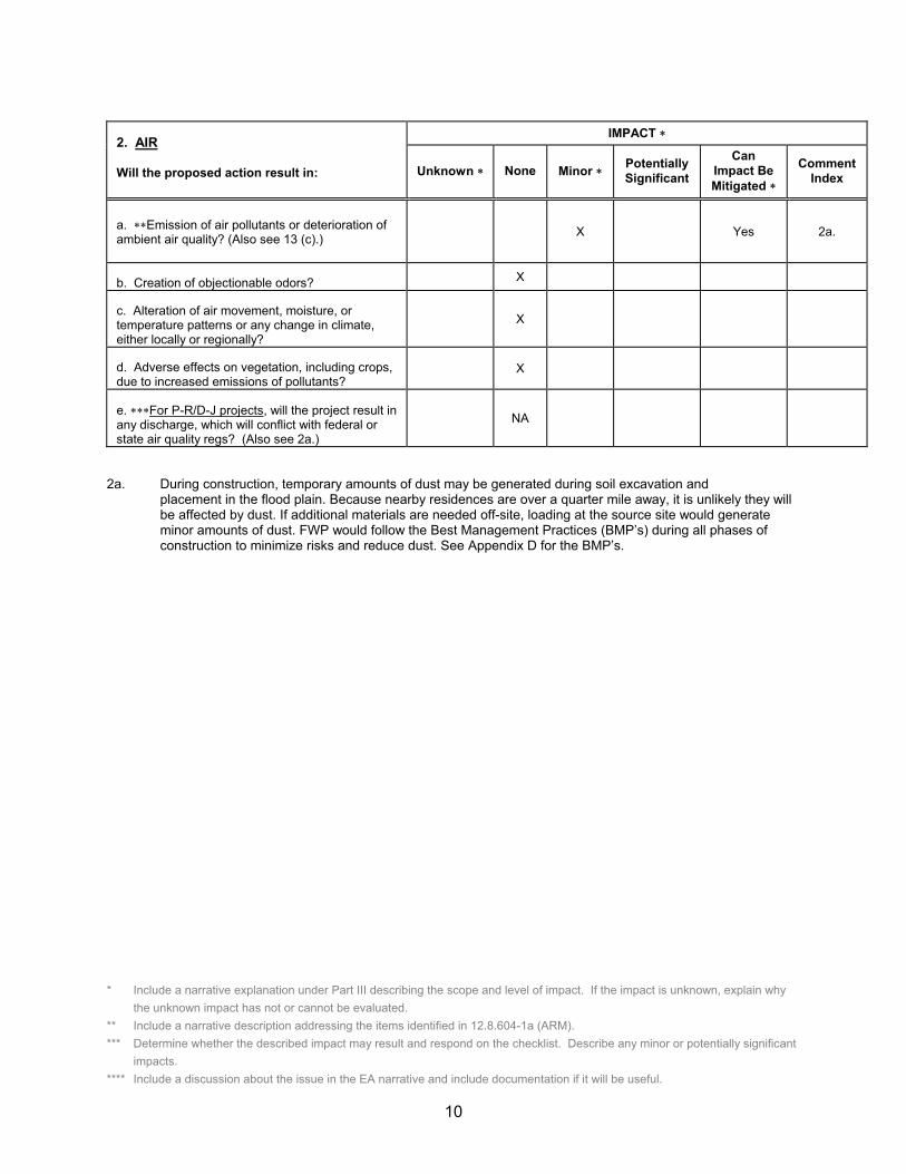
2a. During construction, temporary amounts of dust may be generated during soil excavation and placement in the flood plain. Because nearby residences are over a quarter mile away, it is unlikely they will be affected by dust. If additional materials are needed off-site, loading at the source site would generate minor amounts of dust. FWP would follow the Best Management Practices (BMP’s) during all phases of construction to minimize risks and reduce dust. See Appendix D for the BMP’s.
2. AIR
Will the proposed action result in:
IMPACT �
Unknown � None Minor � PotentiallySignificant
CanImpact Be Mitigated �
CommentIndex
a. ��Emission of air pollutants or deterioration of ambient air quality? (Also see 13 (c).) X Yes 2a.
b. Creation of objectionable odors? X
c. Alteration of air movement, moisture, or temperature patterns or any change in climate, either locally or regionally?
X
d. Adverse effects on vegetation, including crops, due to increased emissions of pollutants?
X
e. ���For P-R/D-J projects, will the project result in any discharge, which will conflict with federal or state air quality regs? (Also see 2a.)
NA

* Include a narrative explanation under Part III describing the scope and level of impact. If the impact is unknown, explain why the unknown impact has not or cannot be evaluated.
** Include a narrative description addressing the items identified in 12.8.604-1a (ARM). *** Determine whether the described impact may result and respond on the checklist. Describe any minor or potentially significant
impacts.**** Include a discussion about the issue in the EA narrative and include documentation if it will be useful.
11
3a. Modification of the flood control dike and construction of the access road, parking lot, concrete boat ramp, and latrine may cause a temporary, localized increase in turbidity in the Gallatin River. FWP would obtain a Montana Department of Environmental Quality (DEQ) 318 Authorization Permit for Short Term Water Quality Standard for Turbidity. FWP BMP’s would be followed (Appendix D).
3b. Modification of the flood control dike and construction of the access road, parking lot, concrete boat ramp, and latrine may alter surface runoff. The proposed work would be designed to minimize any effect on surface water, surface runoff, and drainage patterns. FWP BMP’s would be followed (Appendix D).
3c./3e. Logan FAS and the nearby residential subdivision fall entirely within the 100-year flood plain of this section of the Gallatin River. As a result, the Army Corps of Engineers likely built a flood control dike in Logan in the 1940’s or 1950’s to protect these properties from flooding. During this era, Congress passed several
3. WATER
Will the proposed action result in:
IMPACT �
Unknown � None Minor � PotentiallySignificant
Can Impact Be
Mitigated �
CommentIndex
a. �Discharge into surface water or any alteration of surface water quality including but not limited to temperature, dissolved oxygen or turbidity?
X Yes 3a.
b. Changes in drainage patterns or the rate and amount of surface runoff?
X Yes 3b.
c. Alteration of the course or magnitude of floodwater or other flows?
X Yes 3c.
d. Changes in the amount of surface water in any water body or creation of a new water body?
X
e. Exposure of people or property to water related hazards such as flooding?
X Yes 3e.
f. Changes in the quality of groundwater? X
g. Changes in the quantity of groundwater? X
h. Increase in risk of contamination of surface or groundwater?
X Yes 3h.
i. Effects on any existing water right or reservation?
X
j. Effects on other water users as a result of any alteration in surface or groundwater quality?
X
k. Effects on other users as a result of any alteration in surface or groundwater quantity?
X
l. ����For P-R/D-J, will the project affect a designated floodplain? (Also see 3c.)
NA
m. ���For P-R/D-J, will the project result in any discharge that will affect federal or state water quality regulations? (Also see 3a.)
NA

* Include a narrative explanation under Part III describing the scope and level of impact. If the impact is unknown, explain why the unknown impact has not or cannot be evaluated.
** Include a narrative description addressing the items identified in 12.8.604-1a (ARM). *** Determine whether the described impact may result and respond on the checklist. Describe any minor or potentially significant
impacts.**** Include a discussion about the issue in the EA narrative and include documentation if it will be useful.
12
iterations of the Flood Control Act authorizing the construction of dams and levees to protect communities from seasonal flooding. In order for a boat ramp to be constructed, the dike would need to be modified to provide space for the ramp and for vehicles to maneuver to launch boats. FWP would conduct a hydrologic survey to determine if the existing flood control dike can be moved and, if so, where it could be located and still provide flood protection to the FAS and surrounding properties. Any plan to modify the dike would be subject to approval by the Gallatin County Floodplain Administrator, who would evaluate any potential impacts on the susceptibility of the area to flooding.
3h. The use of heavy equipment during construction may result in a slight risk of contamination from petroleum products and an increase in sediment delivery to the river. FWP BMP’s would be followed during all phases of construction to minimize these risks. (Appendix D). The application of herbicides to manage noxious weeds would be applied according to the guidelines in the FWP Statewide Integrated Noxious Weed Management Plan.

* Include a narrative explanation under Part III describing the scope and level of impact. If the impact is unknown, explain why the unknown impact has not or cannot be evaluated.
** Include a narrative description addressing the items identified in 12.8.604-1a (ARM). *** Determine whether the described impact may result and respond on the checklist. Describe any minor or potentially significant
impacts.**** Include a discussion about the issue in the EA narrative and include documentation if it will be useful.
13
4a./4b. Modifying the flood control dike and construction of the access road, parking lot, boat ramp, and latrine would have a minor impact on the vegetation, removing existing vegetation in the area of construction and altering the diversity of the plant community on the site. Because the property is primarily a fallow hay field, the plant diversity on the site is low and impacts from construction would be minor.
Vegetation found on Logan FAS consists of upland grassland with small areas of riparian grasses along the riverbank. The grassland consists primarily of crested wheatgrass with reed canarygrass, smooth brome, and sedges along the riverbank. With the exception of several black cottonwood trees and Wood’s rose shrubs along the riverbank, very few trees or shrubs are found on the property. Common introduced species found on the property include annual pepperweed and crested wheatgrass. The property is relatively noxious weed free, with small amounts of spotted knapweed on the flood control dike and on drier sites and leafy spurge and common tansy along the Gallatin River, according to John Ansley of the Gallatin County Weed Control District.
4c. A search of the Montana Natural Heritage Program’s (MNHP) Species of Concern database found no vascular or non-vascular plants of significance on or near Logan FAS.
4d. The property is a pasture that is occasionally used by neighbors for horse pasture.
4e. Soils disturbed during construction would likely colonize with weeds. Disturbed areas will be re-seeded with native grasses where necessary to reduce the establishment of weeds. In conjunction with Gallatin County Weed Control Board, FWP would continue implementing the Statewide Integrated Weed Management Plan using chemical, biological and mechanical methods to control weeds on the property. Weed management would facilitate the establishment of native vegetation and prevent the spread of weeds. Vehicles would be restricted to the parking area and access road, which would be maintained as weed-free, and vehicles would not be allowed on undisturbed areas of the site to minimize the spread of noxious weeds. FWP estimates that weed control would cost approximately $300 during fiscal year 2011.
4f. No wetlands designated by Montana Department of Environmental Quality or prime farmlands are found on the FAS.
4. VEGETATION
Will the proposed action result in?
IMPACT �
Unknown � None Minor � PotentiallySignificant
CanImpact Be Mitigated �
CommentIndex
a. Changes in the diversity, productivity or abundance of plant species (including trees, shrubs, grass, crops, and aquatic plants)?
X Yes 4a
b. Alteration of a plant community? X Yes 4b.
c. Adverse effects on any unique, rare, threatened, or endangered species?
X 4c.
d. Reduction in acreage or productivity of any agricultural land?
X 4d.
e. Establishment or spread of noxious weeds? X Yes 4e.
f. ****For P-R/D-J, will the project affect wetlands, or prime and unique farmland?
NA 4f.

* Include a narrative explanation under Part III describing the scope and level of impact. If the impact is unknown, explain why the unknown impact has not or cannot be evaluated.
** Include a narrative description addressing the items identified in 12.8.604-1a (ARM). *** Determine whether the described impact may result and respond on the checklist. Describe any minor or potentially significant
impacts.**** Include a discussion about the issue in the EA narrative and include documentation if it will be useful.
14
5b/5c. According to FWP game and non-game wildlife biologists Julie Cunningham and Claire Gower and a review of Natural Resource Program Tracker, common wildlife species whose habitat distributions overlap Logan FAS include white-tailed deer, mule deer, beavers, otters, muskrat, mink, raccoons, and skunks. On occasion, black bears and mountain lions move through the riparian habitat. A wide variety of resident and migratory bird species seasonally use or move through the area, including Canada geese, ducks, and numerous songbirds. The site is also a very popular place for raptors, specifically osprey and the occasional golden eagle. The entire cottonwood gallery, up and down river of the FAS, is ideal habitat for great-blue herons and bald eagles. Specifically, there are known active bald eagle nests and a large heron rookery in the cottonwood gallery to the west of the site. However, because Logan FAS is located in a developed area with a nearby residential subdivision, interstate freeway and rail line, the proposed work is expected to have no bearing on the game or non-game wildlife species that frequent the property. The area is also not considered critical habitat for any species.
According to FWP fisheries biologist Mike Vaughn and a review of Montana Fisheries Information System (MFISH), longnose dace, mottled sculpin and mountain whitefish are abundant in this stretch of the Gallatin River; brown trout, rainbow trout, longnose suckers, and white suckers are common; and brook trout are rare, based upon only one capture. According to recent surveys by FWP, the number of angler days per year between 1997 and 2007 averaged 9,303, with a low of 5,195 in 2001 and a high of 20,316 in 2005. The state ranking for this stretch of river ranged from 31 to 105 during this same period. Common game fish include brown trout, rainbow trout, and mountain whitefish.
�� 5. FISH/WILDLIFE
Will the proposed action result in:
IMPACT �
Unknown � None Minor � PotentiallySignificant
Can Impact Be
Mitigated �
CommentIndex
a. Deterioration of critical fish or wildlife habitat? X
b. Changes in the diversity or abundance of game animals or bird species?
X Yes 5b.
c. Changes in the diversity or abundance of nongame species?
X 5c.
d. Introduction of new species into an area? X
e. Creation of a barrier to the migration or movement of animals?
X
f. Adverse effects on any unique, rare, threatened, or endangered species?
X 5f.
g. Increase in conditions that stress wildlife populations or limit abundance (including harassment, legal or illegal harvest or other human activity)?
X 5g.
h. ����For P-R/D-J, will the project be performed in any area in which T&E species are present, and will the project affect any T&E species or their habitat? (Also see 5f.)
NA
i. ���For P-R/D-J, will the project introduce or export any species not presently or historically occurring in the receiving location? (Also see 5d.)
NA

* Include a narrative explanation under Part III describing the scope and level of impact. If the impact is unknown, explain why the unknown impact has not or cannot be evaluated.
** Include a narrative description addressing the items identified in 12.8.604-1a (ARM). *** Determine whether the described impact may result and respond on the checklist. Describe any minor or potentially significant
impacts.**** Include a discussion about the issue in the EA narrative and include documentation if it will be useful.
15
According to Mike Vaughn, fish populations in this reach of the Gallatin River are well below their biological potential due to chronic dewatering, heavy sedimentation and high summer water temperatures. At present, use by anglers is light and the river is open to angling year round. Standard fishing regulation limits for combined trout apply, which are five trout, with only one over 18 inches. The addition of a boat ramp in this reach has the potential to lead to increased use by anglers, which could negatively impact trout numbers in the lower 12 miles of the Gallatin River. If so, impacts may need to be mitigated by adoption of more stringent fishing regulations. Use of adjacent fishing access sites on the East and West Gallatin Rivers could be diverted to Logan FAS, reducing pressure on those sites and redistributing angler use of the Gallatin River.
5f. A search of the Natural Resources Information System (NRIS) provided by the Montana Natural Heritage Program showed that the bald eagle, a federally threatened species, is found within 2.5 miles of Logan FAS. Two bald eagle nests, at least one of which is active, are found in the Missouri Headwaters area, 2.4 miles and 3.6 miles NW of the FAS and one is approximately 2.2 miles east of the FAS. The proposed development is unlikely to have any impact on bald eagles since there is so much activity and disturbance already in the area from nearby residential subdivisions, railroad lines, and the interstate freeway. NRIS also identified the greater short-horned lizard, a sensitive species, within two miles of the proposed acquisition property. The proposed project is unlikely to have any impact on the greater short-horned lizard since it’s habitat consists of stony soils with sparse cover of grass and sagebrush, which is not found on the proposed acquisition site. (Appendix B – Native Species Report)
According to Mike Ross, FWP wolf biologist, gray wolves do not frequent the area, and there are no documented packs in the area. Therefore, wolves would not be affected by the proposed development.
According to Mike Vaughn, FWP fisheries biologist, no fish species of concern are found in the vicinity of Logan FAS.
5g. The improved facilities at Logan FAS may result in increased use of the area. However, the site is located within the small town of Logan, is adjacent to a county park, is near a residential subdivision, and runs parallel to the rail road track, so it is already part of an existing development. Development of Logan FAS would not contribute to additional disturbance of the area and would have no impact on the existing wildlife or wildlife habitat.
The proposed development of Logan FAS would not have any detrimental consequences on any terrestrial wildlife species nor cause any permanent, detrimental change in habitat quality.
The addition of a boat ramp in this reach could lead to increased use by anglers, which could negatively impact trout numbers in the lower 12 miles of the Gallatin River. If so, negative impacts could be mitigated by adoption of more stringent fishing regulations. The development of Logan FAS could result in reduced use of adjacent fishing access sites and could reduce fishing pressure on adjacent stretches of the Gallatin River.

* Include a narrative explanation under Part III describing the scope and level of impact. If the impact is unknown, explain why the unknown impact has not or cannot be evaluated.
** Include a narrative description addressing the items identified in 12.8.604-1a (ARM). *** Determine whether the described impact may result and respond on the checklist. Describe any minor or potentially significant
impacts.**** Include a discussion about the issue in the EA narrative and include documentation if it will be useful.
16
B. HUMAN ENVIRONMENT
6a. Construction equipment would cause a temporary increase in noise levels at this site. Proximity to the highway and the railroad with much higher sustained noise levels would likely mask any increase in noise level at the construction site.
6b. A small residential subdivision is located with a half mile to the east of the FAS and a ranch house is located on the property adjacent to the FAS to the west. Visitor use and motorized boats could increase noise levels and disturb neighbors. However, no camping would be allowed and a noise buffer created by a county park and American Legion property located between the residential neighborhood and the FAS could reduce noise disturbance.
The property is currently a fallow pasture, occasionally used for horse grazing, and is not currently used for commercial purposes. In addition, no primitive parking or launching facilities are located on the property. The proposed development would not alter or interfere with the productivity or profitability of the existing land use of the property. The addition of a boat launch and parking area would increase use in the area but would provide a designated public use area which may help reduce the use of the dangerous, pioneered boat launch at the Logan Trident Road Bridge.
6. NOISE/ELECTRICAL EFFECTS
Will the proposed action result in:
IMPACT �
Unknown � None Minor � PotentiallySignificant
Can Impact Be
Mitigated �
CommentIndex
a. Increases in existing noise levels? X Yes 6a.
b. Exposure of people to severe or nuisance noise levels?
X Yes 6b.
c. Creation of electrostatic or electromagnetic effects that could be detrimental to human health or property?
X
d. Interference with radio or television reception and operation?
X
7. LAND USE
Will the proposed action result in:
IMPACT �
Unknown � None Minor � PotentiallySignificant
Can Impact Be
Mitigated �
CommentIndex
a. Alteration of or interference with the productivity or profitability of the existing land use of an area?
X
b. Conflict with a designated natural area or area of unusual scientific or educational importance?
X
c. Conflict with any existing land use whose presence would constrain or potentially prohibit the proposed action?
X
d. Adverse effects on or relocation of residences? X

* Include a narrative explanation under Part III describing the scope and level of impact. If the impact is unknown, explain why the unknown impact has not or cannot be evaluated.
** Include a narrative description addressing the items identified in 12.8.604-1a (ARM). *** Determine whether the described impact may result and respond on the checklist. Describe any minor or potentially significant
impacts.**** Include a discussion about the issue in the EA narrative and include documentation if it will be useful.
17
8a. Physical disturbance of the soil during construction may introduce noxious weeds to the site. In conjunction with Gallatin County Weed District, FWP would implement an integrated approach to control any new occurrence of noxious weeds, as outlined in the FWP Statewide Integrated Noxious Weed Management Plan. The integrated plan uses a combination of biological, mechanical and herbicidal treatments to control noxious weeds. The use of herbicides would be in compliance with application guidelines to minimize the risk of chemical spills or water contamination and applied by people trained in safe handling techniques.
The concrete latrine would be constructed behind the flood control dike to minimize contamination of the Gallatin River in the event flooding.
A Hazardous Materials Inspection was conducted by Earl Griffith of Griffith Environmental Consulting, Inc. to assess the presence of hazardous materials on the property (Appendix E Hazardous Materials Inspection). Mr. Griffith determined that the property has never been used to store or dispose of hazardous materials.
8c. Construction of a boat ramp at Logan FAS would improve public safety by reducing the use of the steep and dangerous pioneered boat ramp less than one mile west of the FAS at the Logan Trident Road Bridge by providing safe, developed access to this stretch of the Gallatin River.
The road to the property crosses three railroad tracks, on which 20 to 30 trains cross per day, according to Montana Rail Link. Although this railroad crossing is not located on the property, it is possible there would be an increase in the number of accidents at this crossing as a result of increased vehicular traffic to the property. This crossing is a designated public crossing and as such is evaluated by Montana Department of Transportation (MDT) engineers annually. It is currently equipped with gates and flashing lights.
The old wooden water tower found within 100 yards of the southeast corner of Logan FAS, owned by the local water association and located on property owned by Burlington Northern Railroad, has a ladder reaching from the ground to the top of the tank. This could become an attractive nuisance if the FAS is developed and more people visit the site though a local preservation group wants to save the tower. In the event the tower is not removed, precautions would need to be taken, such as fencing the tower or removing the ladder, to prevent injuries to the public. BNSF, the local water association, and the local preservation group would be contacted by FWP to assess safety options.
Construction of a parking lot on the property would reduce or eliminate the hazards and nuisance of parking along Railroad Avenue.
8. RISK/HEALTH HAZARDS
Will the proposed action result in:
IMPACT �
Unknown � None Minor� PotentiallySignificant
Can Impact Be
Mitigated �
CommentIndex
a. Risk of an explosion or release of hazardous substances (including, but not limited to oil, pesticides, chemicals, or radiation) in the event of an accident or other forms of disruption?
X Yes 8a.
b. Affect an existing emergency response or emergency evacuation plan, or create a need for a new plan?
X
c. Creation of any human health hazard or potential hazard?
X Yes 8c.
d. ���For P-R/D-J, will any chemical toxicants be used? (Also see 8a)
NA

* Include a narrative explanation under Part III describing the scope and level of impact. If the impact is unknown, explain why the unknown impact has not or cannot be evaluated.
** Include a narrative description addressing the items identified in 12.8.604-1a (ARM). *** Determine whether the described impact may result and respond on the checklist. Describe any minor or potentially significant
impacts.**** Include a discussion about the issue in the EA narrative and include documentation if it will be useful.
18
Hunting and the discharge of firearms would not be allowed on the site.
9c. The proposed project is likely to improve tourism in the area by increasing the number of visitors to the town of Logan, which would benefit local retail and service businesses (Appendix C - Tourism Report).
9e. Establishing public access at Logan FAS would likely increase vehicle trips per day in and out of Logan, which may slightly increase traffic hazards.
9. COMMUNITY IMPACT
Will the proposed action result in: Unknown � None Minor � PotentiallySignificant
CanImpact Be Mitigated �
CommentIndex
a. Alteration of the location, distribution, density, or growth rate of the human population of an area?
X
b. Alteration of the social structure of a community?
X
c. Alteration of the level or distribution of employment or community or personal income?
X Yes Positive 9c.
d. Changes in industrial or commercial activity? X
e. Increased traffic hazards or effects on existing transportation facilities or patterns of movement of people and goods?
X Yes 9e.

* Include a narrative explanation under Part III describing the scope and level of impact. If the impact is unknown, explain why the unknown impact has not or cannot be evaluated.
** Include a narrative description addressing the items identified in 12.8.604-1a (ARM). *** Determine whether the described impact may result and respond on the checklist. Describe any minor or potentially significant
impacts.**** Include a discussion about the issue in the EA narrative and include documentation if it will be useful.
19
The proposed development would have no impact on public services, taxes or utilities .
10b. There would be no change in the tax base since FWP would pay property taxes in an amount equal to that of a private individual.
10e. Logan FAS would be operated for day use only and camping facilities would not be provided so there would be no revenue from camping fees.
10f. Projected annual operating, maintenance, and personnel expense for fiscal year 2011 is estimated to be approximately $2150. FWP projects that noxious weed control will cost an additional $300 annually.
Initial costs to add FWP signage for the highway approach, regulation and information signs are estimated to cost approximately $1000 including staff time and mileage.
10. PUBLIC SERVICES/TAXES/UTILITIES
Will the proposed action result in:
IMPACT �
Unknown � None Minor � PotentiallySignificant
Can Impact Be
Mitigated �
CommentIndex
a. Will the proposed action have an effect upon or result in a need for new or altered governmental services in any of the following areas: fire or police protection, schools, parks/recreational facilities, roads or other public maintenance, water supply, sewer or septic systems, solid waste disposal, health, or other governmental services? If any, specify:
X
b. Will the proposed action have an effect upon the local or state tax base and revenues?
X 10b.
c. Will the proposed action result in a need for new facilities or substantial alterations of any of the following utilities: electric power, natural gas, other fuel supply or distribution systems, or communications?
X
d. Will the proposed action result in increased use of any energy source?
X
e. ��Define projected revenue sources X 10e.
f. ��Define projected maintenance costs. X 10 f.

* Include a narrative explanation under Part III describing the scope and level of impact. If the impact is unknown, explain why the unknown impact has not or cannot be evaluated.
** Include a narrative description addressing the items identified in 12.8.604-1a (ARM). *** Determine whether the described impact may result and respond on the checklist. Describe any minor or potentially significant
impacts.**** Include a discussion about the issue in the EA narrative and include documentation if it will be useful.
20
11a. The FAS would be operated for day use only, with no camping allowed, and development would include a gravel access road, parking area, concrete boat ramp, concrete vault latrine, new boundary fencing, and signs. The boat ramp would be visible from the river and the remaining facilities would be visible from Railroad Avenue and Interstate 90.
11c. The proposed development of Logan FAS would allow for public use for fishing, rafting and wildlife viewing, improving recreational opportunities along the popular Gallatin River and obtaining public access to the lower Gallatin River, which has been a high priority for FWP.
A clearance from the State Historic Preservation Office (SHPO) would be obtained before any groundbreaking activity is initiated. If cultural materials are discovered during the project, work would cease and SHPO will be contacted for a more in depth investigation.
�� 11. AESTHETICS/RECREATION
Will the proposed action result in:
IMPACT �
Unknown � None Minor � PotentiallySignificant
CanImpact Be Mitigated �
CommentIndex
a. Alteration of any scenic vista or creation of an aesthetically offensive site or effect that is open to public view?
X Yes 11a.
b. Alteration of the aesthetic character of a community or neighborhood?
X
c. ��Alteration of the quality or quantity of recreational/tourism opportunities and settings? (Attach Tourism Report.)
X Positive 11c.
d. ���For P-R/D-J, will any designated or proposed wild or scenic rivers, trails or wilderness areas be impacted? (Also see 11a, 11c.)
NA
12. CULTURAL/HISTORICAL RESOURCES
Will the proposed action result in:
IMPACT �
Unknown � None Minor � PotentiallySignificant
Can Impact Be
Mitigated �
CommentIndex
a. ��Destruction or alteration of any site, structure or object of prehistoric historic, or paleontological importance?
X
b. Physical change that would affect unique cultural values?
X
c. Effects on existing religious or sacred uses of a site or area?
X
d. ����For P-R/D-J, will the project affect historic or cultural resources? Attach SHPO letter of clearance. (Also see 12.a.)
NA

* Include a narrative explanation under Part III describing the scope and level of impact. If the impact is unknown, explain why the unknown impact has not or cannot be evaluated.
** Include a narrative description addressing the items identified in 12.8.604-1a (ARM). *** Determine whether the described impact may result and respond on the checklist. Describe any minor or potentially significant
impacts.**** Include a discussion about the issue in the EA narrative and include documentation if it will be useful.
21
SIGNIFICANCE CRITERIA
During construction of the proposed improvements, there may be minor and temporary impacts to the physical environment, but the impacts would be short-term and the improvements would benefit the community and recreational opportunities over the long-term. The proposed development would have no negative cumulative effects on the biological, physical, and human environments. When considered over the long-term, the proposed development poses positive effects towards the public’s access of the scenic Gallatin River, a popular river for recreation.
13. SUMMARY EVALUATION OF SIGNIFICANCE
Will the proposed action, considered as a whole:
IMPACT �
Unknown � None Minor � PotentiallySignificant
CanImpact Be Mitigated �
CommentIndex
a. Have impacts that are individually limited, but cumulatively considerable? (A project or program may result in impacts on two or more separate resources that create a significant effect when considered together or in total.)
X
b. Involve potential risks or adverse effects, which are uncertain but extremely hazardous if they were to occur?
X
c. Potentially conflict with the substantive requirements of any local, state, or federal law, regulation, standard or formal plan?
X
d. Establish a precedent or likelihood that future actions with significant environmental impacts will be proposed?
X
e. Generate substantial debate or controversy about the nature of the impacts that would be created?
X
f. ���For P-R/D-J, is the project expected to have organized opposition or generate substantial public controversy? (Also see 13e.)
NA
g. ����For P-R/D-J, list any federal or state permits required.
NA
22
PART III. NARRATIVE EVALUATION AND COMMENT
During construction of the proposed improvements, there may be minor and temporary impacts to the physical environment, but the impacts would be short-term and the improvements would benefit the community and recreational opportunities over the long-term. The proposed action would have no negative cumulative effects on the biological, physical, and human environments. When considered over the long-term, the proposed development poses positive effects towards the public’s access of the scenic Gallatin River, a popular river for recreation.
The minor impacts to the environment that were identified in the previous section are small in scale and would not influence the overall environment of the immediate area. The natural environment would continue to provide habitat to transient and permanent wildlife species and would be open to the public for access to the river.
Based upon the weed inventory conducted by the Gallatin County Weed Control District, Logan FAS is relatively weed free, with small amounts of common tansy, leafy spurge and spotted knapweed on the property. FWP would continue implementing the Statewide Integrated Weed Management Plan using biological, chemical and physical methods of weed control to prevent the establishment or spread of noxious weeds.
The proposed development would have no negative impact on the local wildlife species that frequent the property; would not increase negative conditions that stress wildlife populations; and the property is not considered critical habitat for any species. Even though the area is within the habitat of bald eagles, the proposed development is unlikely to have any impact on this species since there is already so much activity and disturbance in the area from the residential subdivision and nearby rail lines and interstate freeway. While it is possible for wolves to travel through the project area, none have been sighted and there is no pack located in the area so it is unlikely that the proposed development would impact gray wolves.
This stretch of the Gallatin River has historically supported an excellent fishery for angling and, based upon FWP surveys, has supported an average of 9,303 angler days per year since 1997, with a high of 20,316 in 2005. It is likely that angler use of this stretch of the Gallatin River would increase with improved access. It is also possible that having an additional fishing access site on the Gallatin River could cause visitor use to be redistributed, thereby reducing the pressure on neighboring fishing access sites.
Fish populations in this reach of the Gallatin River are well below their biological potential due to chronic dewatering, heavy sedimentation and high summer water temperatures. At present, use by anglers is light and the river is open to angling year round. Standard fishing regulation limits for combined trout apply, which are five trout only one over 18 inches. The addition of a boat ramp in this reach has the potential to lead to increased use by anglers, which could negatively impact trout numbers in the lower 12 miles of the Gallatin River. If so, impacts may need to be mitigated by adoption of more stringent fishing regulations. Use of adjacent fishing access sites on the East and West Gallatin Rivers could be diverted to Logan FAS, reducing pressure on those sites and redistributing angler use of the Gallatin River.
The proposed development of Logan FAS along the Gallatin River would allow FWP to

23
provide public access for anglers, floaters, rafters, and other recreationists to the Gallatin River, increasing other public recreational opportunities and providing safe and developed access to a stretch of river that has been a high priority for FWP and the public.
PART IV. PUBLIC PARTICIPATION
1. Describe the level of public involvement for this project, if any, and, given the complexity and the seriousness of the environmental issues associated with the proposed action, is the level of public involvement appropriate under the circumstances?
The public will be notified in the following manners to comment on the Logan Proposed Acquisition:� Two public notices in each of these papers: the Three Forks Herald, the Bozeman Daily
Chronicle, and the Helena Independent Record� Public notice on the Fish, Wildlife & Parks web page: http://fwp.mt.gov.� Direct notice will be given to adjacent landowners. � Draft EA’s will be available at the FWP Region 3 Headquarters in Bozeman and the FWP
State Headquarters in Helena. � A news release will be prepared and distributed to a standard list of media outlets
interested in FWP Region 3 issues. � Copies of this environmental assessment will be distributed to the neighboring
landowners and interested parties to ensure their knowledge of the proposed project.
This level of public notice and participation is appropriate for a project of this scope having limited impacts, many of which can be mitigated.
If requested within the comment period, FWP will schedule and conduct a public meeting on this proposed project.
2. Duration of comment period.The public comment period will extend for at least (30) thirty days following the publication of the second legal notice in area newspapers. Written comments will be accepted until 5:00 p.m., March 11, 2011 and can be e-mailed to [email protected] or mailed to the address below:
Logan Fishing Access Site Proposed Development Montana Fish, Wildlife & Parks, Region 3 1400 South 19th Ave Bozeman, MT 59718
PART V. EA PREPARATION
1. Based on the significance criteria evaluated in this EA, is an EIS required? NO If an EIS is not required, explain why the EA is the appropriate level of analysis for this proposed action.
24
Based on an evaluation of impacts to the physical and human environment under MEPA, this environmental review revealed no significant negative impacts from the proposed action: therefore, an EIS is not necessary and an environmental assessment is the appropriate level of analysis. In determining the significance of the impacts, Fish, Wildlife and Parks assessed the severity, duration, geographic extent, and frequency of the impact, the probability that the impact would occur or reasonable assurance that the impact would not occur. FWP assessed the growth-inducing or growth-inhibiting aspects of the impact, the importance to the state and to society of the environmental resource or value affected; any precedent that would be set as a result of an impact of the proposed action that would commit FWP to future actions; and potential conflicts with local, federal, or state laws. As this EA revealed no significant impacts from the proposed actions, an EA is the appropriate level of review and an EIS is not required.
2. Persons responsible for preparing the EA: Todd Garrett Andrea Darling Region 3 Fishing Access Site Manager FWP EA Contractor 1400 South 19th Ave 39 Big Dipper Drive Bozeman, MT 59718 Montana City, MT 59634 [email protected] [email protected](406) 994-4042
Jerry Walker Regional 3 Parks Manager 1400 South 19th Ave Bozeman, MT 59718 [email protected]
(406) 994-4042
3. List of agencies consulted during preparation of the EA: Gallatin County Floodplain Administrator
Montana Department of Commerce – Tourism Montana Fish, Wildlife & Parks Parks Division Design and Construction Section Fish and Wildlife Division Fisheries Bureau Wildlife Bureau Lands Unit
Legal Unit Montana Natural Heritage Program – Natural Resources Information System (NRIS)
APPENDICESA. MCA 23-1-110 Qualification Checklist B. Native Species Report - Montana Natural Heritage Program (MNHP) C. Tourism Report – Department of Commerce D. Best Management Practices E. Hazardous Materials Inspection for Logan FAS

25
APPENDIX A 23-1-110 MCA PROJECT QUALIFICATION CHECKLIST
Date: January 31, 2011 Person Reviewing: Andrea Darling
Project Location: Logan Fishing Access Site is in the town of Logan along the Gallatin River, 7 miles east of Three Forks, Montana and one-half mile north of Interstate 90 in Gallatin County, Section 36 T2N R2E.
Description of Proposed Work: In December 2010, FWP acquired 1.5 acres of land along the Gallatin River within the town of Logan for the purpose of establishing a fishing access site. FWP proposes to construct a gravel access road, parking area to accommodate ten vehicles, a singlewide concrete boat ramp, and a vault latrine; and install regulatory and informational signs and boundary fencing.
The following checklist is intended to be a guide for determining whether a proposed development or improvement is of enough significance to fall under 23-1-110 rules. (Please check � all that apply and comment as necessary.)
[ X ]A. New roadway or trail built over undisturbed land?Comments: An access road will be constructed from Railroad Avenue to the parking area over fallow land.
[ ] B. New building construction (buildings <100 sf and vault latrines exempt)? Comments: No buildings will be constructed other than a vault latrine.
[ X ]C. Any excavation of 20 c.y. or greater? Comments: Yes, for the boat ramp and modifying the flood control dike.
[ X ]D. New parking lots built over undisturbed land or expansion of existing lot that increases parking capacity by 25% or more?Comments: Yes, a new parking lot will be constructed to accommodate ten vehicles.
[ ] E. Any new shoreline alteration that exceeds a doublewide boat ramp or handicapped fishing station? Comments: No shoreline alteration except for the boat ramp.
[ ] F. Any new construction into lakes, reservoirs, or streams? Comments: No new construction.
[ ] G. Any new construction in an area with National Registry quality cultural artifacts (as determined by State Historical Preservation Office)? Comments: No. SHPO clearance would be obtained before any ground-breaking activity begins.
[ ] H. Any new above ground utility lines? Comments: No new utility lines.
[ ] I. Any increase or decrease in campsites of 25% or more of an existing number of campsites?
Comments: No camping would be allowed.
[ ] J. Proposed project significantly changes the existing features or use pattern; including effects of a series of individual projects? Comments: No. The property is occasionally used as horse pasture. The flood control dike would be moved to
accommodate the boat ramp but would still be present on the property.
If any of the above is checked, 23-1-110 MCA rules apply to this proposed work and should be documented on the MEPA/HB495 CHECKLIST. Refer to MEPA/HB495 Cross Reference Summary for further assistance.

26
APPENDIX B NATIVE SPECIES REPORT – MONTANA NATURAL HERITAGE PROGRAM
Sensitive Plants and Animals in the Logan Fishing Access Site Area
Species of Concern Terms and DefinitionsA search of the Montana Natural Heritage Program (MNHP) element occurrence database (http://nris.mt.gov) indicates occurrences of the federally listed threatened bald eagle within 2.5 miles of the proposed development site. No other occurrences of federally listed endangered or threatened animal or plant species have been found within the vicinity of the proposed development site. The search indicated that the project area is within the habitat for the greater short-horned lizard and gray wolf. More information on these species is included below.
Montana Species of Concern: The term “Species of Concern” includes taxa that are at-risk or potentially at-risk due to rarity, restricted distribution, habitat loss, and/or other factors. The term also encompasses species that have a special designation by organizations or land management agencies in Montana, including: Bureau of Land Management Special Status and Watch species; U.S. Forest Service Sensitive and Watch species; U.S. Fish and Wildlife Service Threatened, Endangered and Candidate species.
Status Ranks (Global and State) The international network of Natural Heritage Programs employs a standardized ranking system to denote global (G -- range-wide) and state status (S) (Nature Serve 2003). Species are assigned numeric ranks ranging from 1 (critically imperiled) to 5 (demonstrably secure), reflecting the relative degree to which they are “at-risk”. Rank definitions are given below. A number of factors are considered in assigning ranks -- the number, size and distribution of known “occurrences” or populations, population trends (if known), habitat sensitivity, and threat. Factors in a species’ life history that make it especially vulnerable are also considered (e.g., dependence on a specific pollinator).
Status RanksCode Definition
G1S1
At high risk because of extremely limited and/or rapidly declining numbers, range, and/or habitat, making it highly vulnerable to global extinction or extirpation in the state.
G2S2
At risk because of very limited and/or declining numbers, range, and/or habitat, making it vulnerable to global extinction or extirpation in the state.
G3S3
Potentially at risk because of limited and/or declining numbers, range, and/or habitat, even though it may be abundant in some areas.
G4S4
Uncommon but not rare (although it may be rare in parts of its range), and usually widespread. Apparently not vulnerable in most of its range, but possiblycause for long-term concern.
G5S5
Common, widespread, and abundant (although it may be rare in parts of its range). Not vulnerable in most of its range.

27
MFWP Conservation Need: Under Montana’s Comprehensive Fish and Wildlife Conservation Strategy of 2005, individual animal species are assigned levels of conservation need as follows:
Tier I. Greatest conservation need. Montana FWP has a clear obligation to use its resources to implement conservation actions that provide direct benefit to these species, communities and focus areas.
Tier II. Moderate conservation need. Montana FWP could use its resources to implement conservation actions that provide direct benefit to these species communities and focus areas.
Tier III. Lower conservation need. Although important to Montana’s wildlife diversity, these species, communities and focus areas are either abundant or widespread or are believed to have adequate conservation already in place.
Tier IV. Species that are non-native, incidental or on the periphery of their range and are either expanding or very common in adjacent states.
SENSITIVE PLANTS AND ANIMALS IN THE VICINITY OF LOGAN FAS
1. Haliaeetus leucocephalus (Bald Eagle) Natural Heritage Ranks Federal Agency Status:State: S3 U.S. Fish and Wildlife Service: DMGlobal: G5 U.S. Forest Service: Threatened
U.S. Bureau of Land Management: SensitiveFWP CFWCS Tier: 1
Element Occurrence data was reported of bald eagle within two miles of the project area. Last observation date was 2006.
2. Canis Lupus (Gray Wolf) Natural Heritage Ranks Federal Agency Status:State: S3 U.S. Fish and Wildlife Service: DMGlobal: G4 U.S. Forest Service: Sensitive
U.S. Bureau of Land Management: SensitiveFWP CFWCS Tier: 1

28
Element Occurrence data was reported of gray wolf within two miles of the project area. Last observation date was 2006.
3. Phrynosoma hernandesi (Greater Short-horned Lizard) Natural Heritage Ranks Federal Agency Status:State: S3 U.S. Fish and Wildlife Service:Global: G5 U.S. Forest Service: Sensitive
U.S. Bureau of Land Management: SensitiveFWP CFWCS Tier: 1
Element Occurrence data was reported of greater short-horned lizard within one mile of the project area. Last observation date was 1903.

29
APPENDIX C TOURISM REPORT
MONTANA ENVIRONMENTAL POLICY ACT (MEPA) & MCA 23-1-110
The Montana Department of Fish, Wildlife and Parks has initiated the review process as mandated by MCA 23-1-110 and the Montana Environmental Policy Act in its consideration of the project described below. As part of the review process, input and comments are being solicited. Please complete the project name and project description portions and submit this form to:
Carol Crockett, Visitor Services Manager Montana Office of Tourism-Department of Commerce 301 S. Park Ave. Helena, MT 59601
Project Name: Logan Fishing Access Site Development Project
Project Description:In December 2010, Montana Fish, Wildlife and Parks (FWP) acquired 1.5 acres of land along the Gallatin River within the town of Logan, for the purpose of establishing a fishing access site and provide public access to this stretch of the Gallatin River. FWP proposes to construct a gravel access road, parking area to accommodate ten vehicles, a singlewide concrete boat ramp, and a vault latrine; and install regulatory and informational signs and boundary fencing.
1. Would this site development project have an impact on the tourism economy? NO YES If YES, briefly describe:
Yes, as described, the project has the potential to positively impact the tourism and recreation industry economy. We are assuming the agency has determined it has necessary funding for the on-going operations and maintenance once this project is complete.
2. Does this impending improvement alter the quality or quantity of recreation/tourism opportunities and settings?
NO YES If YES, briefly describe:
Yes, as described, the project has the potential to improve quality and quantity of tourism and recreational opportunities. We are assuming the agency has determined it has necessary funding for the on-going operations and maintenance once this project is complete.
Signature Carol Crockett, Visitor Services Manager Date: January 14, 2011

30
APPENDIX D MONTANA FISH, WILDLIFE AND PARKS
BEST MANAGEMENT PRACTICES FOR FISHING ACCESS SITES 10-02-02
Updated May 1, 2008
I. ROADS A. Road Planning and location
1. Minimize the number of roads constructed at the FAS through comprehensive road planning, recognizing foreseeable future uses. a. Use existing roads, unless use of such roads would cause or aggravate an
erosion problem. 2. Fit the road to the topography by locating roads on natural benches and following
natural contours. Avoid long, steep road grades and narrow canyons. 3. Locate roads on stable geology, including well-drained soils and rock formations that
tend to dip into the slope. Avoid slumps and slide-prone areas characterized by steep slopes, highly weathered bedrock, clay beds, concave slopes, hummocky topography, and rock layers that dip parallel to the slope. Avoid wet areas, including seeps, wetlands, wet meadows, and natural drainage channels.
4. Minimize the number of stream crossings. a. Choose stable stream crossing sites. “Stable” refers to streambanks with
erosion-resistant materials and in hydrologically safe spots.
B. Road Design1. Design roads to the minimum standard necessary to accommodate anticipated use and
equipment. The need for higher engineering standards can be alleviated through proper road-use management. “Standard” refers to road width.
2. Design roads to minimize disruption of natural drainage patterns. Vary road grades to reduce concentrated flow in road drainage ditches, culverts, and on fill slopes and road surfaces.
C. Drainage from Road Surface1. Provide adequate drainage from the surface of all permanent and temporary roads.
Use outsloped, insloped or crowned roads, installing proper drainage features. Space road drainage features so peak flow on road surface or in ditches will not exceed their capacity. a. Outsloped roads provide means of dispersing water in a low-energy flow
from the road surface. Outsloped roads are appropriate when fill slopes are stable, drainage will not flow directly into stream channels, and transportation safety can be met.
b. For insloped roads, plan ditch gradients steep enough, generally greater than 2%, but less than 8%, to prevent sediment deposition and ditch erosion. The steeper gradients may be suitable for more stable soils; use the lower gradients for less stable soils.
c. Design and install road surface drainage features at adequate spacing to control erosion; steeper gradients require more frequent drainage features.

31
Properly constructed drain dips can be an economical method of road surface drainage. Construct drain dips deep enough into the sub-grade so that traffic will not obliterate them.
2. For ditch relief/culverts, construct stable catch basins at stable angles. Protect the inflow end of cross-drain culverts from plugging and armor if in erodible soil. Skewing ditch relief culverts 20 to 30 degrees toward the inflow from the ditch will improve inlet efficiency.
3. Provide energy dissipators (rock piles, slash, log chunks, etc.) where necessary to reduce erosion at outlet of drainage features. Cross-drains, culverts, water bars, dips, and other drainage structures should not discharge onto erodible soils or fill slopes without outfall protection.
4. Route road drainage through adequate filtration zones, or other sediment-settling structures. Install road drainage features above stream crossings to route discharge into filtration zones before entering a stream.
D. Construction/Reconstruction 1. Stabilize erodible, exposed soils by seeding, compacting, riprapping, benching,
mulching, or other suitable means. 2. At the toe of potentially erodible fill slopes, particularly near stream channels, pile
slash in a row parallel to the road to trap sediment. When done concurrently with road construction, this is one method to effectively control sediment movement and it also provides an economical way of disposing of roadway slash. Limit the height, width and length of these “slash filter windrows” so not to impede wildlife movement. Sediment fabric fences or other methods may be used if effective.
3. Construct cut and fill slopes at stable angles to prevent sloughing and subsequent erosion.
4. Avoid incorporating potentially unstable woody debris in the fill portion of the road prism. Where possible, leave existing rooted trees or shrubs at the toe of the fill slope to stabilize the fill.
5. Place debris, overburden, and other waste materials associated with construction and maintenance activities in a location to avoid entry into streams. Include these waste areas in soil stabilization planning for the road.
6. When using existing roads, reconstruct only to the extent necessary to provide adequate drainage and safety; avoid disturbing stable road surfaces. Consider abandoning existing roads when their use would aggravate erosion.
E. Road Maintenance1. Grade road surfaces only as often as necessary to maintain a stable running
surface and to retain the original surface drainage. 2. Maintain erosion control features through periodic inspection and maintenance,
including cleaning dips and cross-drains, repairing ditches, marking culvert inlets to aid in location, and clearing debris from culverts.
3. Avoid cutting the toe of cut slopes when grading roads, pulling ditches, or plowing snow.
4. Avoid using roads during wet periods if such use would likely damage the road drainage features. Consider gates, barricades or signs to limit use of roads

32
during wet periods.
II. RECREATIONAL FACILITIES (parking areas, campsites, trails, ramps, restrooms) A. Site Design
1. Design a site that best fits the topography, soil type, and stream character, while minimizing soil disturbance and economically accomplishing recreational objectives. Keep roads and parking lots at least 50 feet from water; if closer, mitigate with vegetative buffers as necessary.
2. Locate foot trails to avoid concentrating runoff and provide breaks in grade as needed. Locate trails and parking areas away from natural drainage systems and divert runoff to stable areas. Limit the grade of trails on unstable, saturated, highly erosive, or easily compacted soils
3. Scale the number of boat ramps, campsites, parking areas, bathroom facilities, etc. to be commensurate with existing and anticipated needs. Facilities should not invite such use that natural features will be degraded.
4. Provide adequate barriers to minimize off-road vehicle use
B. Maintenance: Soil Disturbance and Drainage1. Maintenance operations minimize soil disturbance around parking lots,
swimming areas and campsites, through proper placement and dispersal of such facilities or by reseeding disturbed ground. Drainage from such facilities should be promoted through proper grading.
2. Maintain adequate drainage for ramps by keeping side drains functional or by maintaining drainage of road surface above ramps or by crowning (on natural surfaces).
3. Maintain adequate drainage for trails. Use mitigating measures, such as water bars, wood chips, and grass seeding, to reduce erosion on trails.
4. When roads are abandoned during reconstruction or to implement site-control, they must be reseeded and provided with adequate drainage so that periodic maintenance is not required.
III. RAMPS AND STREAM CROSSINGS A. Legal Requirements
1. Relevant permits must be obtained prior to building bridges across streams or boat ramps. Such permits include the SPA 124 permit, the COE 404 permit, and the DNRC Floodplain Development Permit.
B. Design Considerations1. Placement of boat ramp should be such that boats can load and unload with out
difficulty and the notch in the bank where the ramp was placed does not encourage bank erosion. Extensions of boat ramps beyond the natural bank can also encourage erosion.
2. Adjust the road grade or provide drainage features (e.g. rubber flaps) to reduce the concentration of road drainage to stream crossings and boat ramps. Direct drainage flow through an adequate filtration zone and away from the ramp or crossing through the use of gravel side-drains, crowning (on natural surfaces) or

33
30-degree angled grooves on concrete ramps. 3. Avoid unimproved stream crossings on permanent streams. On ephemeral
streams, when a culvert or bridge is not feasible, locate drive-throughs on a stable, rocky portion of the stream channel.
4. Unimproved (non-concrete) ramps should only be used when the native soils are sufficiently gravelly or rocky to withstand the use at the site and to resist erosion.
C. Installation of Stream Crossings and Ramps1. Minimize stream channel disturbances and related sediment problems during
construction of road and installation of stream crossing structures. Do not place erodible material into stream channels. Remove stockpiled material from high water zones. Locate temporary construction bypass roads in locations where the stream course will have a minimal disturbance. Time the construction activities to protect fisheries and water quality.
2. Where ramps enter the stream channel, they should follow the natural streambed in order to avoid changing stream hydraulics and to optimize use of boat trailers.
3. Use culverts with a minimum diameter of 15 inches for permanent stream crossings and cross drains. Proper sizing of culverts may dictate a larger pipe and should be based on a 50-year flow recurrence interval. Install culverts to conform to the natural streambed and slope on all perennial streams and on intermittent streams that support fish or that provide seasonal fish passage. Place culverts slightly below normal stream grade to avoid culvert outfall barriers. Do not alter stream channels upstream from culverts, unless necessary to protect fill or to prevent culvert blockage. Armor the inlet and/or outlet with rock or other suitable material where needed.
4. Prevent erosion of boat ramps and the affected streambank through proper placement (so as to not catch the stream current) and hardening (riprap or erosion resistant woody vegetation).
5. Maintain a 1-foot minimum cover for culverts 18-36 inches in diameter, and a cover of one-third diameter for larger culverts to prevent crushing by traffic.

34
APPENDIX E HAZARDOUS MATERIALS INSPECTION FOR LOGAN FAS
Griffith Environmental Consulting Inc. 5089 Hedges Drive Helena, MT 59602 406-458-5720406-459-4830 (cell) 406-422-0017 (fax) e mail: [email protected]
13 December 2010 Mr. Hugh Zackheim MT. Dept. of Fish Wildlife and Parks Field Services Division, Land Section 1400 Eighth Avenue Helena, MT 59601
RE: Hazardous Material Inspection for the Logan FAS at Logan, MT. Dear Mr. Zackheim,
On December 12, 2010 I visited Mr. Earl Campbell at his gift shop across from the Silo's Bar on Highway 12 near Townsend. Mr. Campbell believed that his father bought the subject property in 1937 and ran the hotel up until the late 1950's when the railroad's conversion to diesel was completed. He does not believe that there were any buildings to the west of the hotel in the open field that was comprises the parcel being evaluated for the FAS. The only buildings that he remembered were a chicken coop and a small storage shed to the north. Mr. Campbell joined the army in 1964 and had not lived in the state until four years ago.
Based on Mr. Campbell's revelations, I drove to Logan and inspected the property. Though the lot was covered by about 6 inches of snow, my inspection of the parcel was not hampered by the snow. The entire parcel is fenced and appears to have a very good crop of crested wheatgrass. There were no areas of bare ground or “dead” vegetation. Both the small dike to the north along the river and the drainage ditch along the west side of the property were well vegetated. I found no sign of any historic construction, orphan drums, excavations, or use of the property for disposal of any hazardous materials. My inspection did not reveal any debris of any kind on the parcel. The only interesting aspect of my inspection was the electrical service drop pole at the NE corner of the parcel near the river. The pole had a 110 volt duplex weather proof outlet on it and its purpose is unclear. Other than this

35
pole, there was no other sign of development on the parcel. Based on this inspection and my interview with Mr. Campbell, I do not believe the parcel has ever been used to store or dispose of hazardous materials.
Respectfully, Earl F Griffith P.G. Wyoming #1033