temp.aucklandcouncil.govt.nztemp.aucklandcouncil.govt.nz/EN/ratesbuildingproperty/consents/get... ·...
96
Transcript of temp.aucklandcouncil.govt.nztemp.aucklandcouncil.govt.nz/EN/ratesbuildingproperty/consents/get... ·...


C:\DOCUME~1\ADMINI~1\LOCALS~1\Temp\BCL Technologies\easyPDF 4\@BCL@DC046857\@[email protected] Page 1
AUCKLAND REGIONAL COUNCIL
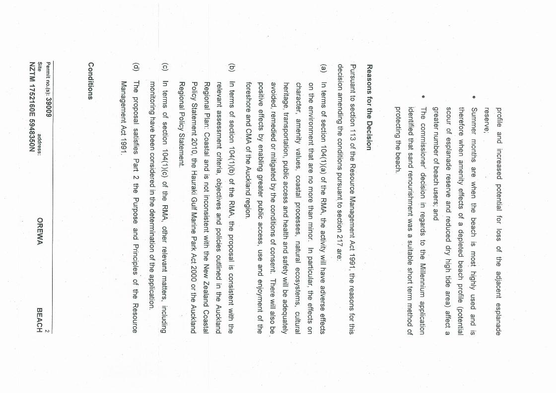
SUBJECT: Coastal Permit Application by the Rodney District Council to occupy and use the coastal marine area (CMA) at the southern end of Orewa Beach with a rock groyne, and to periodically transfer sand from the southern end of Orewa to the central beach.
FROM: Matthew McNeil FILE: 19076
Environmental Resources Officer
PERMIT NO.: 32605, 32606
TO: Group Manager, Consents and Consent Compliance
DATE: 8 June 2006
(This report is confidential until it has been considered and is not to be construed as Council policy until adopted.)
1. APPLICATION
1.1 APPLICANT: Rodney District Council
1.2 LOCATION: In the CMA, at Orewa Beach.
Approximate map reference: NZTM 1752160E 5948350N
1.3 PROPOSAL:a) To periodically transfer up to 25,000m3 annually of sand
from the southern end of Orewa Beach to the central area of Orewa Beach in accordance with Sections 12(1)(c), 12(1)(d) and 12(2)(b) of the Resource Management Act 1991 and;
b) To occupy and use part of the CMA with a rock groyne for the purposes of erosion control in accordance with Sections 12(2)(a) & 12(3) of the Resource Management Act 1991.
1.4 LOCATION MAP:
Site location
C:\DOCUME~1\ADMINI~1\LOCALS~1\Temp\BCL Technologies\easyPDF 4\@BCL@DC046857\@[email protected] Page 2
2. ACTIVITY STATUSThe area of the proposal is subject to the provisions of the Auckland Regional Plan: Coastal (ARPC). In terms of the ARPC the proposal is within a generalmanagement area.
The proposal requires consent for disturbance of the foreshore and disposal of sand during sand transfer in terms of Section 12(1)(c) and 12(1)(d) of the Resource Management Act 1991 (RMA). The application for disturbance during sand transfer is a restricted discretionary activity under Rule 16.5.12. The application to deposit sand in the CMA is a discretionary activity under Rule 17.5.1 of the ARPC.
The proposal requires consent to occupy part of the publicly owned CMA in terms of Section 12(2) of the RMA. The proposed occupation of the CMA with a groyne is a discretionary activity under Rule 10.5.9 of the ARPC.
In terms of Section 12(3) of the RMA, the proposed use of the CMA with the groyne for erosion control falls as a discretionary activity under Rule 11.5.5 of the ARPC.
3. NOTIFICATIONThe application was processed without notification in accordance with Section 93(1) of the RMA, as the adverse effects are considered to be minor.
The subject groyne has been in place for approximately 20 years, and acts to trap sand and control erosion at the southern end of the beach. No changes to the structure are proposed. Sand transfer along Orewa Beach has occurred on 9 previous occasions since 1988, in order to address the loss of sediment from the northern and central parts of the beach due to long shore drift.
Both the groyne and sand transfer are for public benefit, and have not resulted in any significant adverse effects on the environment or other users of this area.
In accordance with Section 94(2) of the RMA, notice was not served on the application because written approval has been obtained from every person who, in the opinion of the consent authority, may be adversely affected by the granting of this Resource Consent.
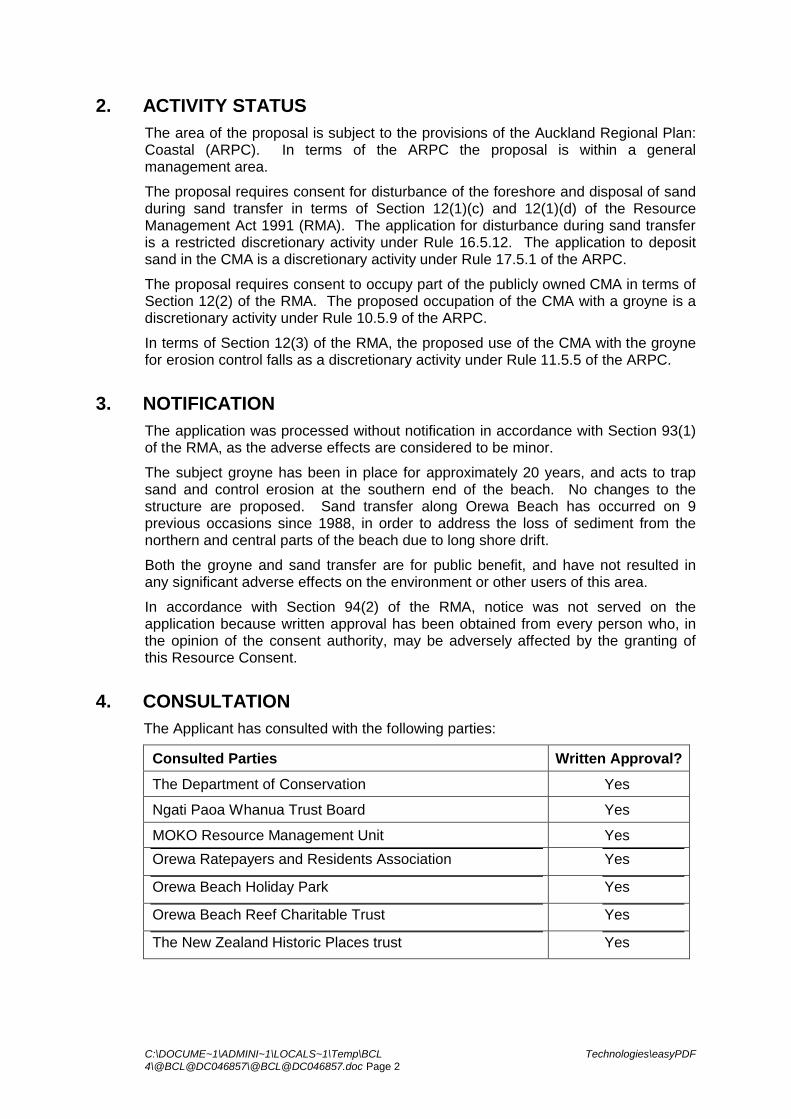
4. CONSULTATIONThe Applicant has consulted with the following parties:
Consulted Parties Written Approval?
The Department of Conservation Yes
Ngati Paoa Whanua Trust Board Yes
MOKO Resource Management Unit Yes
Orewa Ratepayers and Residents Association Yes
Orewa Beach Holiday Park Yes
Orewa Beach Reef Charitable Trust Yes
The New Zealand Historic Places trust Yes

C:\DOCUME~1\ADMINI~1\LOCALS~1\Temp\BCL Technologies\easyPDF 4\@BCL@DC046857\@[email protected] Page 3
5. PROPOSAL
5.1 LOCATION DESCRIPTION AND BACKGROUND
Orewa Beach is located on the east coast, just north of the Whangaparoa Peninsula. The beach faces northeast, and extends for close to 3km long. An Esplanade Reserve runs for the majority of its length, backed by significant residential development.
The beach is typically exposed to low wave energies, with periodic storm events that can result in significant wave heights. Waves heights of approximately 2.25m have been recorded during storm events (Tonkin & Taylor Ltd, 1997. Orewa Beach Erosion Control Works Monitoring Report). The beach has a gentle dissipative gradient.
Sediment transport at Orewa Beach is driven by longshore drift, particularly during storm events which transport sand to the southern end. The applicant undertakes beach profile surveys at four monthly intervals from established cross sections along the length of the beach. Beach profile monitoring over the last two decades indicates that the beach is currently in a state of dynamic equilibrium (ASR Ltd 2004. Orewa Beach Reef – Feasibility Study). The equilibrium beach orientation is controlled by the northern headland and the southern groyne. It is also considered that a significant volume of sand is presently held within the estuary.
Previous Modification
Prior to modification the ebb tidal jet from the Orewa estuary was angled more to the north, resulting in the re-circulation of some of the sand transported to the south, back to the central beach face. Realignment of the Orewa Estuary entrance took place in the 1960’s, with the tidal jet being redirected more to the east. This interrupted the flow of sediment back to the north.
Levelling of dunes for foreshore development and the placement of ad hoc tipped rock seawall protection along part of the shoreline also occurred. A groyne structure was added at this time on the northern side of the estuary mouth to control estuary flow. The groyne was reconstructed in 1986 in order to trap sand that would otherwise be transported into the estuary, and prevent erosion at the southern end of the beach.
In 1988 the District Council applied to the ARC to take some of the sand that had accumulated immediately north of the groyne, known as the groyne ‘embayment’, and use it to replenish the central part of the beach. This was undertaken a number of times through the 1990’s in response to storm events, with sand also being sourced from the estuary in 1988 and 1998. The central beach was last renourished in 2001, with 25,000m2 of sand sourced from the groyne embayment.
The coastal permits for the groyne and the periodic sand transfer have since expired.
5.2 PROPOSED PROJECT
The applicant seeks to retain the existing groyne structure, and to periodically transfer sand from the groyne embayment to the central part of the beach.
5.2.1 Groyne
The current groyne extends for approximately 160m perpendicular to the shoreline at the southern end of the beach, and is up to approximately 2-3m in width where exposed. The groyne was constructed of large basalt rocks, and is in good condition remaining intact.

C:\DOCUME~1\ADMINI~1\LOCALS~1\Temp\BCL Technologies\easyPDF 4\@BCL@DC046857\@[email protected] Page 4
The applicant seeks a 35 year term of occupation for the groyne, in order for the structure to continue trapping sand, and to prevent erosion at the southern end of the beach. No maintenance works are proposed, however would be undertaken as and when necessary.
5.2.2 Sand Transfer
It is proposed to periodically excavate sand from the beach area immediately north of the groyne, and place it along the central 1500 metres of beach. This is to provide a greater buffer for the adjacent land against storm events, and to enhance recreational opportunities through the provision of a wider high tide beach face. It is proposed that a maximum of 25,000m3 of sand would be transferred in any one year, and envisaged that sand transfer may not be required in some years.
Methodology
Sand would be placed in trucks by a loader, with trucks to travel along a defined route along the beach. Sand would then be placed at a one metre depth at the rock wall on the central beach, sloping to zero at 25m seaward of the wall.
Trigger Levels for Transfer
Sand transfer would only take place when central beach sand levels drop below defined trigger levels, and when there would be enough sand retained in the groyne embayment.
Trigger levels to indicate the need for sand transfer would be based on surveying from the established profile lines on the central beach area. When beach profile surveys show the average horizontal excursion from the survey pegs to the 1.5m contour is less than 10m, then sand transfer would be considered by RDC.
Past beach profiles undertaken following past nourishment events have shown the sediment budget in the groyne embayment averages between 60,000m3 and 75,000m3. Transfer would only take place when there would be at least 60,000m3 of sediment left in the groyne embayment, as based on beach profiles.
5.3 OTHER CONSENTS REQUIRED
The above aside, no other resource consent requirements have been identified.
6. STATUTORY EVALUATION This section of the report outlines the statutory framework that the resource consent application is evaluated against.
6.1 RESOURCE MANAGEMENT ACT
The matters to which the ARC as the consent authority must have regard to when considering the applications are set out in Section 104 of the RMA.
6.1.1 Section 104 Consideration of Applications
In summary, subject to Part II the following matters in Section 104(1) of the RMA are relevant to the consideration of the proposal.
1. When considering an application for a resource consent and any submissions received, the consent authority must, subject to Part II, have regard to–

C:\DOCUME~1\ADMINI~1\LOCALS~1\Temp\BCL Technologies\easyPDF 4\@BCL@DC046857\@[email protected] Page 5
a) any actual and potential effects on the environment of allowing the activity; and
b) any relevant provisions of—
i) a national policy statement:
ii) a New Zealand coastal policy statement:
iii) a regional policy statement or proposed regional policy statement:
iv) a plan or proposed plan; and
c) any other matter the consent authority considers relevant and reasonably necessary to determine the application.
Due consideration has been given to Section 104 of the RMA. The consideration of the actual and potential effects of the activity and any measures being taken to avoid, remedy or mitigate these effects is discussed in the sections below.
6.1.2 Purpose and Principles
Part II of the RMA (Sections 5 to 8) describes the purpose and principles of the Act. Section 5 describes the purpose, which is “to promote the sustainable management of natural and physical resources”.
The proposal meets sub-Sections 5(2)(a), (b) and (c) of the RMA which relate to the sustainable management of natural and physical resources. Similarly, it is considered that the proposal would not contravene any of the matters of national importance (Section 6), and “other matters” (Section 7), including taking into account the principles of the Treaty of Waitangi (Section 8).
It is considered that the proposal is consistent with the purpose and principles of promoting sustainable management as prescribed in Part II of the RMA.
6.2 NEW ZEALAND COASTAL POLICY STATEMENT (NZCPS) AND AUCKLAND REGIONAL POLICY STATEMENT (ARPS)
The ARPC cannot be inconsistent with the NZCPS and ARPS. This proposal is for activities that will not have significant adverse effects on the environment (see assessment below). Regard of the provisions of the NZCPS and ARPS has been made in the consideration of the ARPC, which follows. It is considered that the proposal is in general accordance with the NZCPS and ARPS.
6.3 HAURAKI GULF MARINE PARK ACT (2000) (HGMPA)
In accordance with the HGMPA, a consent authority is required to have regard to Sections 7 and 8 when determining resource consent applications affecting the marine park. Section 10(1) of the HGMPA provides that Sections 7 and 8 constitute an additional New Zealand coastal policy statement. This requires the inter-relationship between the Hauraki Gulf, its islands and catchments and the ability of that inter-relationship to sustain the life supporting capacity of the environment of the Hauraki Gulf and its islands to be matters of national significance.
It is not considered that this proposal will have adverse effects on these matters of national significance.

C:\DOCUME~1\ADMINI~1\LOCALS~1\Temp\BCL Technologies\easyPDF 4\@BCL@DC046857\@[email protected] Page 6
6.4 AUCKLAND REGIONAL PLAN: COASTAL (Dated October 2004) (ARPC)
Chapter 12 of the ARPC specifically addresses structures in the CMA. The ARPC provides for appropriate structures in the CMA, while remedying or mitigating adverse environment effects. The ARPC makes provision for the assessment of such proposals through a series of criteria, policies and rules. The assessment of effects of this proposal and the provisions of the ARPC have been considered in the assessment of actual and potential effects below. Other specifically relevant policies of the ARPC are as follows:
Relative objectives in Chapter 10 regarding occupation of the CMA, consider that efficient use should be made of the CMA, and that where appropriate, the open space nature of the coastal environment shall be maintained. It is considered that the existing groyne acts to maintain the open space nature of Orewa Beach.
Policy 12.4.3 considers that structures in the CMA should as far as practicable, be of an appropriate scale, design and location so as to avoid or mitigate any adverse effects on the coastal environment. The groyne is considered a large structure in the CMA. However it is effectively operating in the manner in which it was designed, and is largely covered by sand at most states of the tide.
Policy 12.4.10 states that any proposal for coastal protection structures shall demonstrate that;
the adjoining landward area is at risk from a coastal hazard; doing nothing or relocating landward development are not practicable
options; the proposed structure is the most appropriate method for remedying or
mitigating a natural coastal hazard; and, that the design will not lead to undermining of the foundations at the base,
erosion behind or around the ends of the structure, movement or dislodgement of individual structural components, offshore or longshore loss of sediment from the immediate vicinity, or any increase in the coastal hazard in question.
The groyne was installed in conjunction with the estuary inlet realignment, to mitigate the erosion risk to the adjacent land. It has been effective in building the beach face at the southern end, and thereby providing a buffer for the adjacent land. The existing groyne may not necessarily be the most appropriate method for mitigating the erosion hazard, however its removal may result in some significantly adverse effects due to associated erosion and loss of sand from the beach into the estuary.
Relative policies of Chapter 14, extraction, consider that such disturbance of the foreshore shall not result in significant adverse changes to bathymetry, foreshore contours, or physical coastal processes, will not cause or exacerbate coastal erosion, and will not give rise to significant adverse effects on the recreational and amenity values of the area. The transfer of sand would temporarily alter foreshore contours, however such changes would be beneficial in terms of erosion control and recreational and amenity values of the area.
Policy 21.4.2 directs that natural features such as beaches, that buffer subdivision, use and development from coastal hazards be protected. Policy 21.4.4 directs that coastal protection measures should generally use non structural methods, including beach nourishment, rather than structural methods. The nourishment of the central beach with sand from the groyne embayment is considered consistent with these policies, and reduces the need for additional hard shoreline protection structures along Orewa Beach.

C:\DOCUME~1\ADMINI~1\LOCALS~1\Temp\BCL Technologies\easyPDF 4\@BCL@DC046857\@[email protected] Page 7
7. ASSESSMENT OF EFFECTS ON THE ENVIRONMENT
7.1 NATURAL CHARACTER AND LANDSCAPE
Levels of human development, operation of physical coastal processes, functioning of ecosystems, landscape values and landforms are elements that contribute to the natural character of the coastal environment.
Orewa Beach is not afforded any landscape ratings under the ARPS or ARPC. It is however considered that this location does retain some natural character and landscape elements of note. These include the long stretch of sandy beach and adjacent open seascape. The landward area is however dominated by built environment, with a relatively thin stretch of esplanade reserve running for most of the length of the beach. The rock wall backing the length of the beach also detracts from natural character and landscape values of the beach.
The proposed transfer of sand would enhance existing natural character and landscape values of the beach, through increasing the central beach width, thereby enhancing the visual presence of the beach.
As a significantly large structure extending perpendicular from the beach, it is considered that the groyne has some adverse effects on natural character and landscape values. It has however been in place for a significant period of time, is partially covered by sand, and can now be considered part of the existing modified environment.
7.2 COASTAL PROCESSES
Orewa Beach is considered a closed sediment system, with a limited source of new sand arriving from the adjacent sandstone cliffs and the surrounding catchment. Sand lost from the central beach due to longshore drift to the south, is unlikely to return north naturally, given closed sediment system and past realignment of the estuary tidal jet. The proposed transfer of sediment would not have any significant adverse effects on natural longshore sediment transport, rather redistribute existing sand in an already dynamic environment.
As designed, the groyne acts as a partial barrier to littoral drift and resulting sediment transport. The resulting trapping of sediment is considered beneficial in terms of retaining sand on the beach and mitigating against erosion.
It is considered that effects on coastal processes as a result of the proposal would be beneficial from an erosion control and amenity point of view.
7.3 ECOLOGICAL
Past investigations by Bioresearches Ltd concluded that the ecological values of the groyne embayment, where sand has been taken from in the past, are low, due in part to the largely dry area of beach.
It is considered that the usage of trucks to transport sand north along the beach would have no more than minor adverse effect on shellfish, and that shellfish populations would recover quickly from any associated disturbance.
7.4 COASTAL MATTERS OF SIGNIFICANCE TO TANGATA WHENUA
In assessing any applications for developments in the CMA, the ARC must recognise and provide for the relationship of Maori and their culture and traditions with their ancestral taonga (Policy 6.4.1).
Consultation has been undertaken with representatives of Ngati Paoa Whanua Trust Board and the MOKO Resource Management Unit, who have provided their written
C:\DOCUME~1\ADMINI~1\LOCALS~1\Temp\BCL Technologies\easyPDF 4\@BCL@DC046857\@[email protected] Page 8
approvals for the proposal. It is therefore considered that no significant cultural or spiritual values would be affected by the proposal.
7.5 PUBLIC ACCESS
The enhancement of public access to and along the CMA is recognised as a matter of national importance by the RMA, and one of the key objectives of the ARPC is “To maintain and enhance access to, along and within the coastal marine area.” (Policy 7.3.1).
The transfer of sand would increase the high tide beach area available along the central beach for public access and recreation, for the period that the sand stays in place. Increasing the central beach width would also provide an extra buffer to protect the adjacent Esplanade Reserve, which provides pedestrian access to the majority of the beach length.
There would be some minor restrictions on pedestrian access along the beach during sand transfer activities. However such impacts would be temporary in nature, and result in an overall benefit on public access and amenity values.
The groyne does act as a barrier to pedestrian access along the beach. However it also holds sand in place creating a wider beach face, and therefore benefits public access overall.
7.6 MONITORING
Recommended consent conditions require that the Consent Holder submit for the approval of the Manager, a detailed monitoring programme. This programme is in order to enable a measurable assessment of the performance and physical effects of undertaking the project.
7.7 NAVIGATION AND SAFETY
A copy of the application was forwarded to Maritime New Zealand (MNZ) as required by Section 395 of the RMA. MNZ has chosen not to report on the application.
The RDC Harbour Master has been contacted in regards to the applicant, and considers there to be no concerns in relation to navigation and safety.
Through restricting the movement of sediment into the estuary from the beach, the groyne helps maintain an open channel at the estuary mouth. This is beneficial from a navigation point of view for vessels that are launched from the boat ramp inside the estuary. The groyne itself does not extend into the main navigable channel, and therefore is not considered a navigation hazard. The transfer of sand would have no effects on navigation and safety.
7.8 EXPIRY DATE
The previous occupation consent for the groyne was granted a 7 year term of consent, on the basis that at the time there was no formal long term management strategy in place for Orewa Beach. In 1999 RDC adopted the Long Term Sustainable Management Strategy for Orewa Beach. Policies in that strategy consider that the groyne should be retained, that its removal would result in significant readjustment and erosion at the southern end of the beach with little if any benefit to others, and that sand be transferred from north of the groyne to the central beach when appropriate.

C:\DOCUME~1\ADMINI~1\LOCALS~1\Temp\BCL Technologies\easyPDF 4\@BCL@DC046857\@[email protected] Page 9
The applicant has sought a 35 year term of consent for the groyne and sand transfer. This is considered appropriate given the proposal is for public benefit, and that there would be no significant adverse effects on the environment or other users of the area.
8. CONCLUSIONOn the basis of the information submitted to the ARC by the Applicant, and having assessed the proposal against the relevant matters detailed in Section 104, 104A-104D, and 105 of the RMA, it is considered that the proposal is consistent with Part II of the RMA and the relevant policies of the NZCPS, ARPS, HGMPA, and ARPC. For the reasons described in this report, it is considered that the adverse effects on the environment of the activities for which the permit is sought will be satisfactorily avoided, remedied or mitigated, provided the conditions as appended to this report are complied with.
9. RECOMMENDATIONSBased on the information available, it is recommended that:
a. The Consent be granted subject to the conditions stated on the consent document appended to this report, and
b. The Consent to periodically transfer up to up to 25,000m3 annually from the southern end of Orewa Beach to the northern end expires on 10 June which corresponds to a term of 35 years.
c. The Consent to occupy and use part of the CMA with a rock groyne expires on 10 June which corresponds to a term of 35 years.
Signed by Processing Officer:
Matthew McNeilEnvironmental resources Officer
Report reviewed by:
Andrew BensonCoastal Projects Leader

AUCKLAND REGIONAL COUNCIL
RESOURCE CONSENT
Granted pursuant to the Resource Management Act 1991
PERMIT NO. 32606
CONSENT HOLDER: Rodney District Council
FILE REFERENCE: 19076
CONDITIONS OF CONSENT
Duration of Consent: This Consent shall expire on 10 June 2041 unless it has lapsed, been surrendered or been cancelled at an earlier date pursuant to the Resource Management Act 1991.
Purpose of Consent: To periodically transfer up to 25,000m3 of sand annually from the southern end of Orewa Beach to the central area of Orewa Beach in accordance with Sections 12(1)(c), 12(1)(d) and 12(2)(b) of the Resource Management Act 1991
Site Location: Orewa Beach.
Adjacent Territorial Authority: Rodney District Council
Approximate Map Reference: NZTM 1752160E 5948350N
DEFINITIONS:
Council: Means the Auckland Regional Council.
Manager: Means the Group Manager, Consents and Consents Compliance, Auckland Regional Council, or nominated Council staff acting on the Manager’s behalf.

PERMIT NO. 32606
Page 2
GENERAL CONDITIONS
1. That the servants or agents of the Council shall be permitted access to the relevant parts of the property at all reasonable times for the purpose of carrying out inspections, surveys, investigations, tests, measurements or taking samples.
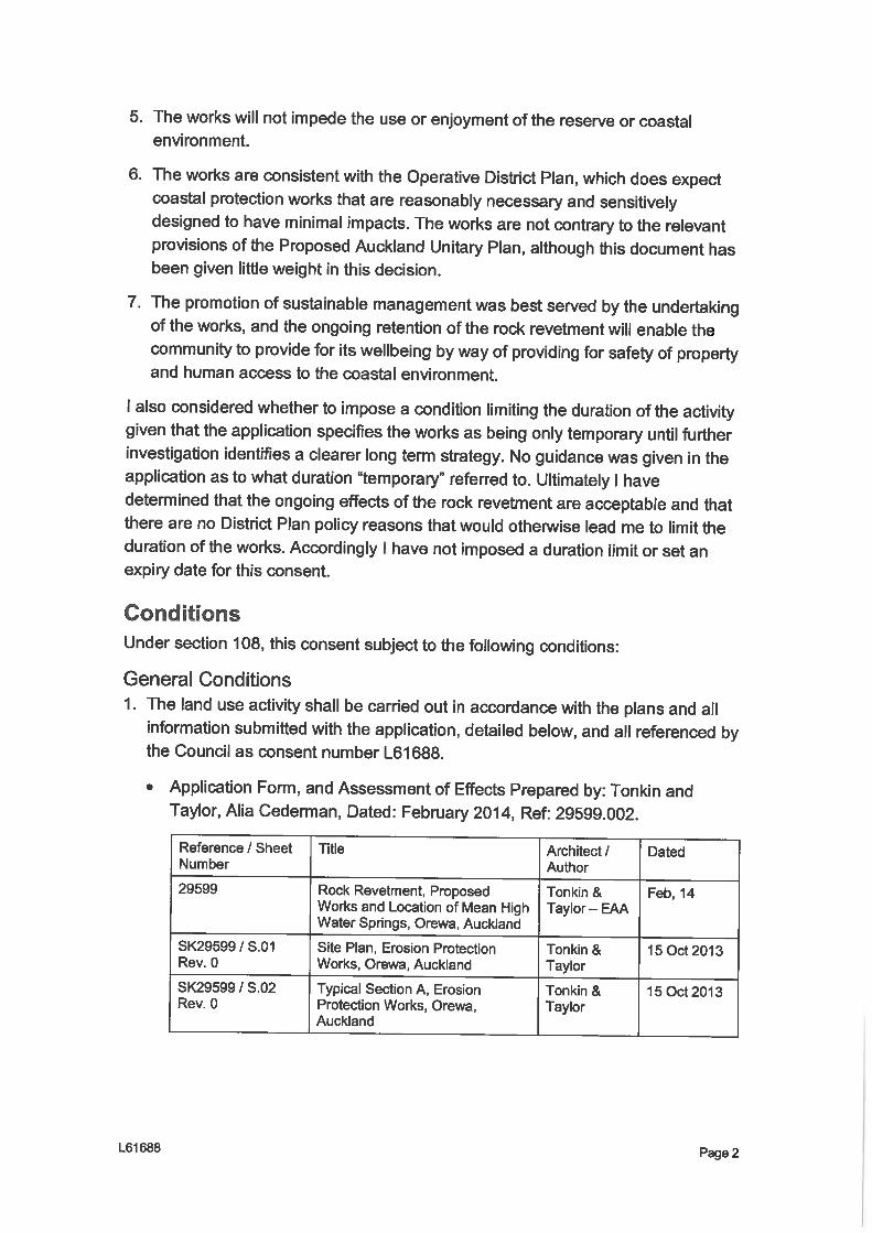
2. The Consent Holder shall carry out the activities permitted by this Consent in accordance with the Officer’s report and the documentation submitted in support of the Application as identified below:
(a) Coastal Permit Application dated: May 2006.
(b) Plans: Figure 3: Rodney District Council Orewa Beach Erosion Control Location Plan. Drawn by Tonkin and Taylor Ltd, December 1997.
SPECIFIC CONDITIONS
Notification of Works Start and Finish, Provision of Plans
3. The Consent Holder shall notify the Council in writing of the proposed date of commencement of the proposed works covered by this consent, at least 10 working days prior to any transfer of sand.
4. The Consent Holder shall notify the Council in writing of the date of completion of the works, within 2 weeks of any transfer of sand.
5. The Consent Holder shall submit for the approval of the Manager, at least 15 working days prior to sand transfer, an Occupation Safety and Health Management Plan, in regards to undertaking the sand transfer works.
Construction Period/Remedial Works
6. All works in the Coastal Marine Area (CMA) shall be restricted to the hours between 7.30am to 6.00pm Monday to Saturday. No work shall occur on Sundays or Public Holidays.
7. No work in the CMA shall be undertaken between November and March.
8. Excavation of sand from the groyne embayment shall be taken from that area within which the seabed level is above a level half way between mean sea level and mean high water neap.
9. For the duration of the works, the Consent Holder shall maintain the site in good order and shall, as far as practicable, remedy all damage and disturbance caused by vehicle traffic, plant and equipment to the foreshore, to the satisfaction of the Manager.
10. During the construction period, the Consent Holder shall comply with the noise restrictions as outlined in the Auckland Regional Plan: Coastal and the relevant District Plan.
11. That in the event of archaeological evidence being uncovered (e.g. shell midden, hangi or ovens, pit depressions, defensive ditches or human bones), work shall cease in the vicinity of the discovery and the Council archaeologist shall be

PERMIT NO. 32606
Page 3
contacted so that the appropriate action can be taken before work may recommence there.
Monitoring
12. The Consent Holder shall submit for the approval of the Manager, at least 15 working days prior to sand transfer, a detailed monitoring programme. Before any sand transfer work is undertaken on site, the Manager’s written approval of the monitoring programme must be obtained.
The purpose of the monitoring programme is to enable a measurable assessment of the performance and physical effects of undertaking the project. The monitoring programme shall specify, but not necessarily be limited to:
a) The beach profile survey methodology that will be used. This will include details of:
- the method;- the location of profiles on Orewa Beach;- the frequency of the surveys (including but not limited to: immediately prior
and post and sand transfer event); and,- duration of the programme.
b) The trigger levels for initiating future transfer of sand.c) The estimation of a sediment budget and quantification of the processes,
exchanges and rates of sediment transport operating within the system.d) The consideration of the long term shoreline trend, rates of change, and the
magnitude and recovery of short-term shoreline fluctuations.e) A schedule for reporting to the Manager on the results of the monitoring
programme.
13. The Consent Holder shall ensure that any person undertaking any monitoring shall have suitable qualification and experience.
REVIEW CONDITION
14. That the conditions of this consent may be reviewed by the Manager, pursuant to Section 128 of the Resource Management Act 1991, by the giving of notice pursuant to Section 129 of the Act, in June 2008 and every two years thereafter in order:
(a) To deal with any adverse effect on the environment which may arise from the exercise of the consent and which it is appropriate to deal with at a later stage; or
(b) To deal with any other adverse effect on the environment on which the exercise of the consent may have an influence.
ADVICE NOTES
1. The Consent Holder is advised that this Coastal Permit is one of resource consents granted by the Council for the project, and that they must comply with all Coastal Permits numbered 32605 and 32606.
2. The Consent Holder is advised that they will be required to pay to the Council any administrative charge fixed in accordance with Section 36(1) of the Resource
PERMIT NO. 32606
Page 4
Management Act 1991, or any additional charge required pursuant to Section 36(3) of the Resource Management Act 1991 in respect of this Consent.
3. The Consent Holder is advised that the date of the commencement of this Consent will be as determined by Section 116 of the Resource Management Act 1991, unless a later date is stated as a condition of consent. The provisions of Section 116 of the Resource Management Act 1991 are summarised in the covering letter issued with this Consent.
4. The Consent Holder is advised that, pursuant to Section 125 of the Resource Management Act 1991, this Resource Consent lapses on the expiry of five years after the date of commencement of this Consent unless the Consent is given effect to or other criteria contained within Section 125 are met.
5. The Consent Holder is advised that, pursuant to Section 126 of the Resource Management Act 1991, if this Resource Consent has been exercised, but is not subsequently exercised for a continuous period of five years, the Consent may be cancelled by the Council unless other criteria contained within Section 126 are met.
6. The Consent Holder is advised that should they wish to transfer this Permit to any other person they must do so by advising the Council in writing in accordance with Section 135(1)(a) of the Resource Management Act 1991. A fee is payable at the time of transfer to cover the cost of administration.
This Consent has been granted by the Auckland Regional Council pursuant to the Resource Management Act 1991.
Group ManagerConsents and Consent ComplianceAuckland Regional Council Date:

AUCKLAND REGIONAL COUNCIL
RESOURCE CONSENT
Granted Pursuant to the Resource Management Act 1991
PERMIT NO. 32605
CONSENT HOLDER: Rodney District Council
FILE REFERENCE: 19076
CONDITIONS OF CONSENT
Duration of Consent: This Consent shall expire on 10 June 2041 unless it has lapsed, been surrendered or been cancelled at an earlier date pursuant to the Resource Management Act 1991.
Purpose of Consent: To authorise the occupation and use of part of the coastal marine area (CMA) with a rock groyne for the purpose of erosion control in accordance with Section 12(2)(a) and 12(3) of the Resource Management Act.
Site Location: Orewa Beach.
Adjacent Territorial Authority: Rodney District Council
Approximate Map Reference: NZTM 1752160E 5948350N
DEFINITIONS:
Council: Means the Auckland Regional Council.
Manager: Means the Group Manager, Consents and Consents Compliance, Auckland Regional Council, or nominated Council staff acting on the Manager’s behalf.

PERMIT NO. 32605
Page 2
GENERAL CONDITIONS
1. That the servants or agents of the Council shall be permitted access to the relevant parts of the property at all reasonable times for the purpose of carrying out inspections, surveys, investigations, tests, measurements or taking samples.
2. The Consent Holder shall carry out the activities permitted by this Consent in accordance with the documentation submitted in support of the Application as identified below:
(a) Coastal Permit Application dated: May 2006.
(b) Figure 3: Rodney District Council Orewa Beach Erosion Control Location Plan. Drawn by Tonkin and Taylor Ltd, December 1997.
3. The Consent Holder shall ensure that any structure permitted to occupy the Coastal Marine Area (CMA) by this Consent is maintained in a good and sound condition, and shall make any repairs that are necessary, subject to obtaining any necessary resource consents.
4. The Consent Holder shall not carry out, modify, extend, alter or reconstruct any works in the part of the CMA subject to this Consent without first obtaining any other resource consents for such works which are required.
Extent of Occupation
5. The right to occupy part of the CMA, as defined by the Resource Management Act 1991, shall be limited to the area of the structures identified in the plans listed in Condition 2 above.
6. The right to occupy part of the CMA shall not be an exclusive right.
Removal Condition
7. At the expiry or sooner termination of this Coastal Permit, the Consent Holder shall, if requested by the Council, at the Consent Holder’s own expense remove the structures in their entirety and restore the site to its original condition, to the satisfaction of the Manager.
REVIEW CONDITION
8. That the conditions of this Consent may be reviewed by the Manager, pursuant to Section 128 of the Resource Management Act 1991, by the giving of notice pursuant to Section 129 of the Act, in June 2008 and every 5 years thereafter in order:
(a) To deal with any adverse effect on the environment which may arise from the exercise of the Consent and which it is appropriate to deal with at a later stage; or
(b) To deal with any other adverse effect on the environment on which the exercise of the Consent may have an influence.

PERMIT NO. 32605
Page 3
ADVICE NOTES
1. The Consent Holder is advised that pursuant to Section 122(5)(c) of the Resource Management Act 1991, the Permit Holder may not exclude the public or any class of persons from the area for which the Occupation Consent is granted.
2. The Consent Holder is advised that this Coastal Permit is one of resource consents granted by the Council for the project, and that they must comply with all Coastal Permits numbered 32605 and 32606.
3. The Consent Holder is advised that they will be required to pay to the Council any administrative charge fixed in accordance with Section 36(1) of the Resource Management Act 1991, or any additional charge required pursuant to Section 36(3) of the Resource Management Act 1991 in respect of this Consent.
4. The Consent Holder is advised that the date of the commencement of this Consent will be as determined by Section 116 of the Resource Management Act 1991, unless a later date is stated as a condition of consent. The provisions of Section 116 of the Resource Management Act 1991 are summarised in the covering letter issued with this Consent.
5. The Consent Holder is advised that, pursuant to Section 125 of the Resource Management Act 1991, this Resource Consent lapses on the expiry of five years after the date of commencement of this Consent unless the Consent is given effect to or other criteria contained within Section 125 are met.
6. The Consent Holder is advised that, pursuant to Section 126 of the Resource Management Act 1991, if this Resource Consent has been exercised, but is not subsequently exercised for a continuous period of five years, the Consent may be cancelled by the Council unless other criteria contained within Section 126 are met.
7. The Consent Holder is advised that should they wish to transfer this Permit to any other person they must do so by advising the Council in writing in accordance with Section 135(1)(a) of the Resource Management Act 1991. A fee is payable at the time of transfer to cover the cost of administration.
This Consent has been granted by the Auckland Regional Council pursuant to the Resource Management Act 1991.
Group ManagerConsents and Consent ComplianceAuckland Regional Council Date: