TELKWA PROPERTY 1995 to 1998 GEOLOGICAL ASSESSMENT REPORT · 1995 to 1998 Geological Assessment...
78
TELKWA PROPERTY 1995 to 1998 GEOLOGICAL ASSESSMENT REPORT Property Name: Coalfield: General Nature of Report: Specific Licenses Involved: Location (U.T.M.): Owner: Operator: Author(s) of the Report: Date of Performed Work: Report Due Date: Report Submission Date: Telkwa Property Telkwa Coalfield N.T.S. 93Ull 1995 to 1998 Geological Assessment Report Telkwa South 604.5000/611500 to 6056000/628500 Luscar Limited (formerly Manalta Coal Limited) Luscar Limited (formerly Manalta Coal Limited) Mr. Angelo Ledda, B.Sc. Geology Summer and Fall of 1995,1996,1997 and 1998 January, 1999 Januarym
Transcript of TELKWA PROPERTY 1995 to 1998 GEOLOGICAL ASSESSMENT REPORT · 1995 to 1998 Geological Assessment...

TELKWA PROPERTY
1995 to 1998 GEOLOGICAL ASSESSMENT REPORT
Property Name:
Coalfield:
General Nature of Report:
Specific Licenses Involved:
Location (U.T.M.):
Owner:
Operator:
Author(s) of the Report:
Date of Performed Work:
Report Due Date:
Report Submission Date:
Telkwa Property
Telkwa Coalfield
N.T.S. 93Ull
1995 to 1998 Geological Assessment Report
Telkwa South
604.5000/611500 to 6056000/628500
Luscar Limited (formerly Manalta Coal Limited)
Luscar Limited (formerly Manalta Coal Limited)
Mr. Angelo Ledda, B.Sc. Geology
Summer and Fall of 1995,1996,1997 and 1998
January, 1999
Januarym

0 TABLE OF CONTENTS
1.0 INTRODUCTION ................................................................................................................ 1
1.1 GENERAL.. ............................................................................................................. 1
1.2 LOCATION AND ACCESS.. ................................................................................... 1
1.3 PHYSIOGRAPHY ................................................................................................... 4
1.4 TENURE ................................................................................................................. 5
1.5 HISTORICAL PERSPECTIVE.. .............................................................................. 8
1.6 ACKNOWLEDGEMENTS ..................................................................................... 19
2.0 GEOLOGICAL WORK ..................................................................................................... 21
2.1 SCOPE OF WORK.. ............................................................................................ 21
2.1 .I Drilling ....................................................................................................... 22
2.1 .l.l Drill-hole Numbering .................................................................... 25
2.1.1.2 Geophysical Logging.. ................................................................. 26
2.1 .I .3 Drill-hole Logging, Sampling and Analysis.. ................................ 26
2.1.2 Bulk Samples.. .......................................................................................... 27
2.1.3 Reclamation.. ............................................................................................ 28
3.0 GEOLOGY ........................................................................................................................ 29
3.1 REGIONAL GEOLOGIC SETTING ...................................................................... 29
q.2 STRATIGRAPHY.. ................................................................................................ 31
3.2.1 Unit I.. ........................................................................................................ 31
3.2.2 Unit II.. ....................................................................................................... 31
3.2.3 Unit Ill.. ...................................................................................................... 32
3.2.4 Unit IV.. .......................... . .......................................................................... 33
3.3 STRUCTURAL GEOLOGY .................................................................................. 33
3.4 DETAILED GEOLOGY ......................................................................................... 34
3.4.1 Unit I Coal Stratigraphy. ............................................................................ 35
3.4.2 Unit Ill Coal Stratigraphy ............................................................................ 37
3;5 RESOURCE AREAS; TELKWA NORTH ............................................................. 41
1

0
0
3.6
3.5.1 Pit #7 Resource Area ................................................................................ 41
3.5.2 Pit #8 Resource Area ................................................................................ 42
3.5.3 Whalen Block Resource Area ................................................................... 43
3.5.4 Northwest Area ......................................................................................... 43
RESOURCE AREAS; TELKWA SOUTH.. ............................................................ 44
3.6.1 Goathorn East (Pit #3) Resource Area ..................................................... 44
3.6.2 Goathorn West (Pit #6) Resource Area.. .................................................. .46
3.6.3 Tenas Cr@ek Resource Area .................................................................... .47
3.6.4 Cabinet Creek Resburce Area ................................................................... 49
3.6.5 Helps Resource Area ................................................................................. 50
4.0 COAL QUALITY ............................................................................................................... 51
4.1 QUALITY CHARACTERISTICS ........................................................................... 52
5.0 COAL RESOURCES . . . . . . . . . . . . . . . . . . . . . . . . . . . . . . . . . . . . . . . . . * . . . . . . . . . . . . . . . . . . . . . . . . . . . . . . . . . . . . . . . . . . . . . . . . . . . . . . . . . . . . . . 54
5.1 RESERVE / RESOURCE CRITERIA . . . . . . . . . . . . . . . . . . . . . . . . . . . . . . . . . . . . . . . . . . . . . . . . . . . . . . . . . . . . . . . . . . . 55
5.1 .l Goathorn East (Pit #3) Reserve . . . . . . . . . . . . . . . . . . . . . . . . . . . . . . . . . . . . . . . . . . . . . . . . . . . . . . . . . . . . . . . . 58
5.1.2 Goathorn West (Pit #6) Resetve . . . . . . . . . . . . . . . . . . . . . . . . . . . . . . . . . . . . . . . . . . . . . . . . . . . . . . . . . . . . . . . 58
5.1.3 Pit #7 Reserve . . . . . . . . . . . . . . . . . . . . . . . . . . . . . . . . . . . . . . . . . . . . . . . . . . . . . . . . . . . . . . . . . . . . . . . . . . . . . . . . . . . . . . . . . . 58
5.1.4 Pit #8 Reserve . . . . . . . . . . . . . . . . . . . . . . . . . . . . . . . . . . . . . . . . . . . . . . . . . . . . . . . . . . . . . . . . . . . . . . . . . . . . . . . . . . . . . . . . . . 59
5.1.5 Tenas Creek Reserve . . . . . . . . . . . . . . . . . . . . . . . . . . . . . . . . . . . . . . . . . . . . . . . . . . . . . . . . . . . . . . . . . . . . . . . . . . . . . . 60
5.1.6 Whalen Reserve . . . . . . . . . . . . . . . . . . . . . . . . . . . . . . . . . . . . . . . . . . . . . . . . . . . . . . . . . . . . . . . . . . . . . . . . . . . . . . . . . . . . . . 60
5.1.7 Northwest Area Reserve . . . . . . . . . . . . . . . . . . . . . . . . . . . . . . . . . . . . . . . . . . . . . . . . . . . . . . . . . . . . . . . . . . . . . . . . . . . . 60
5.1.8 Cabinet Creek Reserve . . . . . . . . . . . . . . . . . . . . . . . . . . . . . . . . . . . . . . . . . . . . . . . . . . . . . . . . . . . . . . . . . . . . . . . . . . . . . . 61
5.1.9 Helps Reserve . . . . . . . . . . . . . . . . . . . . . . . . . . . . . . . . . . . . . . . . . . . . . . . . . . . . . . . . . . . . . . . . . . . . . . . . . . . . . . . . . . . . . . . . . . . 61
6.0 COSTS INCURRED . . . . . . . . . . . . . . . . . . . . . . . . . . . . . . . . . . . . . . . . . . . . . . . . . . . . . . . . . . . . . . . . . . . . . . . . . . . . . . . . . . . . . . . . . . . . . . . . . . . . . . . . . . 62
7.0 SUMMARY . . . . . . . . . .._.......................................................................................................... 63
8.0 CONCLUSIONS . . . . . . . . . . . . . . . . . . . . . . . . . . . . . . . . . . . . . . . . . . . . . . . . . . . . . . . . . . . . . . . . . . . . . . . . . . . . . . . . . . . . . . . . . . . . . . . . . . . . . . . . . . . . . . . 65
2

9.0 REFERENCES . . . . . . . . . . . . . . . . . . . . . . . . . . . . . . . . . . . . . . . . . . . . . . . . . . . . . . . . . . . . . . . . . . . . . . . . . . . . . . . . . . . . . . . . . . . . . . . . . . . . . . . . . . . . . . . . . 66

0 ii
LIST OF ENCLOSURES
Enclosure No.
1.0
2.0
3.0
4.0
5.0
6.0
7.0
8.0
9.0
10.0
11.0
12.0
13.0
0 14.0
15.0
16.0
17.0
18.0
19.0
20.0
21 .o
22.0
23.0
24.0
25.0
Telkwa Property Location Map
Telkwa Property Coal License Map
Regional Geology Map
Telkwa Exploration Summaries: 1995,1996,1997 8 1998
Telkwa Property; Drill-hole Co-ordinate listing
Telkwa Property Geophysical Logs; 1995,1996,1997 8 1998
1995 to 1998 Exploration; Core Description Sheets
1995 to 1998 Exploration; Cuttings Description Sheets
Telkwa Property Typical Stratigraphic Columns
Telkwa North; Geology Map
Pit#7; Coal Seam Intersection Summary
Pit #7; Drill-hole Summary
Pit #7; Geological Cross-sections (7A & 7C)
Pit #8 Coal Seam Intersection Summary
Pit #8; Drill-hole Summary
Pit #8 Geological Cross-sections (8B, 8D, 8F, 8H 8 8J)
Whalen Freehold Block; Drill-hole Summary
Northwest Area; Drill-hole Summary
Goathom Resource Area; Geology Map
Goathom East; Cross-sections XS52500, XS53000
xs53500, xs54000, xs64500 84 xs55100
Goathom West; Cross-sections XS54100 8 XS54400
Tenas Creek Area: Geology Map
Tenas Creek Area; Coal Seam Intersection Summary
Tenas Creek Area; Drill-hole Summary
Tenas Creek Area; Geological Cross-sections
(XS5, IO, 15,20, 25 & 30)
2of2
2of2
2of2
2of2
2of2
cl 4
26.0 Tenas Creek Area, Seam Thickness Maps; c, 1 U & l-seam
27.0 Helps Area; Geology Map
28.0 Coal Quality, Ply Analyses; 1995, 1996, 1997 & 1998
29.0 Coal Quality, Composite Analyses; Tenas, Goathom,
Bowser and Northwest Area
30.0 Cost Summary Report: 1995,1996,1997 & 1998
2of2
2of2
2of2
2of2
2of2
5

. . . III
LIST OF FIGURES
Figure No.:
1.1 Telkwa Property Location Map 3
2.1 Exploration Drilling Summary 23
3.1 Tectonic Elements of British Columbia 30
Page:

0 iv
LIST OF TABLES
Table No.:
1.1 Telkwa Property; Coal License Summary
1.2 Tekwa Property; Exploration Summary
4.1 Telkwa Property; Coal Quality Summary
5.1 Estimated In-Situ Coal Reserves/Resources; Telkwa Property
Page:
6-7
9
53
57
0

1.0 INTRODUCTION
-.
cl
1.1 GENERAL
This report presents the geological work undertaken to date on the Telkwa coal
licenses in west-central British Columbia held by Luscar Ltd. (formerly within the
holdings of Manalta Coal Limited). Cumulative work completed during the 1995,
1996, 1997 and 1998 exploration programs is emphasized, detailing the geology,
coal reserves and coal quality of affected license areas. Since taking over the
Teikwa Property in May of 1992, Manalta Coal Limited has undertaken annual
exploration programs. In November, 1998, Luscar Limited acquired Manalta Coal,
including the land and license holdings of the Telkwa Property.
1.2 LOCATION AND ACCESS
The Telkwa Coal Property is located in west-central British Columbia approximately
15 kilometers south ofthe city of Smithers and about 2 kilometers southwest of the
community of Telkwa (Enclosure I), both of which are situated along the
Yellowhead Highway (Highway #16) 11 kilometers apart. Smithers, in turn, is
located 380 kilometers by rail east of Prince Rupert and the Ridley Island coal
handling facilities (Figure 1.1). Smithers is serviced by commercial aircraft on a
daily basis.
The Telkwa Property currently consists of 15,166 hectares held under 60 coal
license blocks, measuring approximately 20 kilometers in the north-south direction
by 14 kilometers east-west. The Telkwa River flows eastward bisecting the property
with both halves containing coal measures of economic significance.
0

0 Access to the north side of the property is via Smithers along an all-weather public
road that approximately parallels the Bulkley and Telkwa Rivers. The south side of
the property is accessed from the community of Telkwa, again by an all-weather
road. Logging roads are common, especially on the southern half of the property
allowing access to more remote locations via four-wheel drive and all-terrain
vehicles.
The area is serviced by a 500 KV powerline which bisects the property in an
approximate east-west direction, running along the south side of the Telkwa River.
In addition, Pacific Northern operates an underground natural gas transmission line
which also traverses the property, paralleling the south side of the Telkwa River
and branching northward towards Smithers along the eastern license blocks.
0 2


Cl
I cl
1.3 PHYSIOGRAPHY
The physiographic setting for the Telkwa property is typically foothills, intermediate
to the Bulkley Range of the Hazelton Mountains and the low-lying gently rolling
relief of the Nechako Plateau. The Bulkley Range is obvious to the north and west
of the property where the landscape is bedrock controlled, while within the property
limits and to the east, topography is rounded and covered with widespread glacial
drift. Bedrock on the property is usually obscured as glacial sediments form a
shallow mantle over much of the area, exceptions occurring sporadically or along
sections of deeply eroded river and stream valleys such as Goathom Creek.
The principal drainage system on the property is the Telkwa River, which flows east
across the property until it ultimately drains into the Bulkley River at the community
of Telkwa. Major tributaries to the Telkwa River include Pine Creek which drains
much of the area on the northern licenses, and Tenas and Goathom Creeks which
drain the south.
Elevations within the property limits range from a low of 530 meters above sea level
at the Telkwa Rivers eastern contact with the property boundary to a high of 1375
meters at the property’s southernmost extremity near Cabinet Creek. Most
elevations, however, lie within 600 and 900 meters.
Vegetation at lower elevations along watercourses consist mainly of cottonwoods,
spruce and shrubs. The tree layer is typically composed of large, widely spaced
cottonwoods with scattered hybrid spruce and trembling aspen. The understorey is
composed of a rich diversity of shrub species which include high-bush cranberry,
red-osier dogwood, alder, prickly rose, snowberry and black twinberry. At higher
elevations the predominant vegetational cover consists of lodgepole pine, balsam
fir and spruce. Understorey species include alder, willow, black twinberry and
prickly rose (TAESCO, 1965). Some of the area has been commercially logged and
4

0 a number of areas have been cleared for agricultural purposes.
Pacific Inland Resources Ltd. of Smithers harvests timber within the license area for
the production of commercial building products. One of the principal mills in the
area is situated on the outskirts of Smithers along the access road to the north side
of the property.
Soils in the vicinity vary in thickness and have developed on glacial till, outwash
sediments and occasionally on weathered parent material. Parent material
generally tends to be represented by either sedimentary sandstones and siltstones
of the Skeena Group, br volcanic sediments of the Hazelton Group.
1.4 TENURE
Q The Telkwa Property currently consists of 15,166 hectares (37,475 acres) held
under Crown coal licenses as well as 1,295 hectares (3200 acres) of Freehold land
collectively held by Luscar Ltd. (Manalta Coal Limited) (Enclosure 2). Surface
ownership rights are held in part by the Crown (approximately 70% of the property
surface area), in part by Luscar Ltd. (approximately 8% in the form of Freehold
land) and in part by third party landowners. The property coal licenses are
summarized on Table 1 .I.
0 .-,
5

TABLE 1.1: TELKWA PROPERTY - COAL LICENSE SUMMARY .?4-Mar-99
Lessee PropertyName Description LicenseNo. LicenseExpiryD Hectares AnnualRental
Manalta Coal Ltd.
TELKWA TELKWA TELKWA TELKWA TELIWA TELKWA TELKWA TELKWA TELKWA TELKWA TELKWA TELKWA TELKWA TELKWA TELIC’VA TELWA TELKWA TELKWA TELKWA TELKWA TELKWA TELKWA TELKWA TELKWA TELKWA TELWA TELIWA TELKWA TELKWA TELKWA TELKWA TELKWA TELKWA TELKWA TELIWA TELKWA TELKWA TELKWA TELKWA TELWA TELWA TELKWA TELKWA
Coal License 327828 327829 327830 327831 327832 327833 327834 327838 327837 327838 327839 327840 327841 327842 327843 327844 327845 327846 327856 327860 327861 327862 327863 327864 327865 327866 327936 327944 327945 327946 327948 327949 327951 327952 327953 327954 327955 327956 327963 327964 327965 327966 327967
19991105 140 $980.00 19990530 130 $1,950.00 19990530 260 $3,900.00 19990530 260 $3,900.00 19990905 259 $3,885.00 19990905 259 $3,885.00 19990905 259 $3,885.00 19990624 130 $1,950.00 19990920 259 $3,885.00 19990623 259 $3,885.00 19990623 259 $3,885.00 19990623 259 $3,885.00 20000201 259 $3,885.00 19991231 259 $3,885.00 19990623 259 $3,885.00 19990623 259 $3,885.00 19990623 259 $3,885.00 19990623 259 $3,885.00 19990623 259 $3,885.00 19990623 259 $3,885.00 19990901 259 $3,885.00 19990901 259 $3,885.00 19990901 259 $3,885.00 19990901 259 $3,885.00 19990901 259 $3,885.00 19990901 259 $3,885.00 19990901 2.39 $3,885.00 19990901 259 $3,885.00 19990901 259 53,885.OO 19990901 259 $3.885.00 19990901 259 $3,885.00 19990901 259 $3,885.00 19990901 259 .$3,885.00 19990901 259 $3,885.00 19990901 259 $3,885.00 19990901 259 $3,885.00 19990901 259 $3,885.00 19990901 259 $3,885.00 19990901 259 $3,885.00 19991007 259 $3,885.00 19991007 259 $3,885.00 19991007 259 $3,885.00 19991007 259 $3,885.00
.-
0
-
0

0-.
-
0
Lessee PropertyName Description LicenseNo. LicenseExpiryD Hectares AnnualRental TELWA 327968 19991007 259 $3,885.00 TELKWA TELWA TELKWA TELKWA TELR'VA TELKWA TELWVA TELtWA TELWA TELWA TELKWA TELKWA TELWA TELKWA TELKWA TELKWA
327971 19991007 259 327972 19990730 259 328323 19990730 259 328672 19990530 260 334059 19990920 259 334060 19990530 259 353440 19990530 259 353441 19991105 259 362522 20000206 259 362523 19990512 259 362524 19990512 259 362525 19990512 259 362526 19990512 259 362527 19990512 259 362528 19990512 259 366754 19990512 259
Coal License Total: 15166
$3,885.00 $2,590.00 $2,590.00 $3,900.00 $3,885.00 $2,590.00 $2,590.00 $1,813.00 51,813.OO $1,813.00 $1.813.00 $1,813.00 $1.813.00 $1,813.00 $1,813.00 $1.813.00
$202,542.00
-
0

0 1.5 HISTORICAL PERSPECTIVE
i) (-
Coal was initially discovered in the Telkwa area about 1900, although production
did not commence in the Goathom Creek area until 1918. On the north bank of the
Telkwa River the Aveling (Telkole) Mine produced coal from 1921 to 1922 and
again from 1940 to 1945. Telkwa Colliery (McNiel Mine) on the south side of the
Telkwa River began producing in 1923 (Malott, 1990). Initially production was
mainly for local consumption until after 1930 when underground operations were
initiated at Bulkley Valley Collieries near Goathom Creek. Production since that
time has been sporadic with underground operations often curtailed by structural
complications and inadequate pre-development exploration.
Since 1950 the Telkwa Coalfield has been actively prospected by a variety of
companies. Table 1.2 provides a summary of the exploration activities completed
on the property since that time, while a descriptive summary of the area’s
exploration activities follows. A map illustrating the regional geology, annual
exploration drill-holes, and identified resource areas of the Telkwa Property is found
within Enclosure 3.
. 1951 - The Government of Canada conducted a regional survey,
much of which included the Telkwa license area.
. 1969 - Canex Aerial Limited completed a drilling program of
approximately 20 boreholes on the Telkwa North licenses.
. 1977 to 1978 - Cyprus Anvil Mining completed a rotary drilling
program within the Telkwa South licenses.
8

0 0
Table 1.2
Telkwa Property; Exploration History
TOtEd ‘renehea ARD TRCr
wtktal Gly Sore-holes
IWAR canex Aerial Ltd. Cyprus Anvil Mining

. 1979 - Shell CanadalCrowsnest Resources Ltd. completed 13 rotary
drill-holes, 4 of which were located on Telkwa South licenses, and the
remaining 9 situated on the north side of the Telkwa River. Chip
samples were not recovered for analytical testing.
. 1981 - Shell CanadalCrowsnest Resources Ltd. completed a
mapping and exploration drilling program which consisted of 11 rotary
holes and one diamond drill-hole, all of which were spaced randomly
throughout the Telkwa property. Coal samples were recovered from 4 of
the rotary holes as well as the diamond drill-hole for analyses.
l 1982 - Shell CanadalCrowsnest Resources Ltd. drilled 72 boreholes
on the property, the majority of which were located on the south side of
the Telkwa River. Of the 72 holes, 7 were rotary drill-holes and 65 were
diamond drill-holes. Coal samples were collected and analyzed from all
holes that intersected significant coal units.
l 1983 - Shell CanadalCrowsnest Resources Ltd. completed 69
diamond drill-holes on the Telkwa South licenses, most of which were
located within what has been designated as the.Goathom East (Pit #3)
resource area. Included within the program were a small number of
large-diameter core-holes which, along with all other drill-holes that
intersected significant coal units, were sampled and had coal analyses
performed. Of the 69 boreholes completed, 11 were situated within the
proposed Pit #3 test-pit limits providing a preview of the pit
development.
Based upon drill-hole information a 219 tonne bulk sample from 7
seams was subsequently extracted from a test-pit located within the Pit
#3 area. A full suite of coal quality analyses was performed, including
10

Cl testing on various simulated washplant products.
0
. 198.4 - Shell CanadalCrowsnest Resources Ltd. completed 44
diamond drill-holes, the majority of which were located within the Pit #3
resource area on the south side of the Telkwa River. Less than 10% of
the holes were drilled on the Telkwa North coal licenses. All significant
coal units were sampled and analyzed.
. 1985 - Shell CanadalCrowsnest Resources Ltd. completed 4
diamond drill-holes, all of which were located north of the Telkwa River.
All significant coals were sampled and analyzed.
. 1986 - Shell CanadaKrowsnest Resources Ltd. completed 4
diamond drill-holes, again located on the Telkwa North coal licenses
within an area that was designated as the Pits #7 and #I3 Resource
Area. Coal analyses were performed on all significant seams.
l 1988 - Shell CanadalCrowsnest Resources Ltd. completed an
exploration program exclusive to the Telkwa North licenses which
consisted of initially completing approximately 3.5 kilometers of surface
geophysics to highlight potential target locations. The area was
subsequently drilled with 14 diamond drill-holes from which coal
samples were collected and analyzed.
. 1989 - Shell CanadalCrowsnest Resources Ltd. completed an
exploration program consisting of drilling, trenching and surface
geophysics on the Telkwa North coal licenses, and reflection seismic
exploration within the Pit #3 area of the Telkwa South licenses. In
addition a large-diameter coring program was undertaken specifically
targeted’at obtaining a bulk sample from the Pit #7 resource area.
11

The conventional exploration drilling program included 31 bore-holes,
18 of which were rotary drill-holes, and the remaining 13 continuous
core diamond drill-holes. Coal samples for analyses were collected from
all holes that intersected significant coal units, although only cored bore-
holes were provided a full analyses. Analytical results from recovered
rotary chip samples were not considered representative.
At proposed waste dump and tailings pond locations, 16 trenches were
completed to evaluate the characteristirs of the surficial lithologies. The
Telkwa North surface geophysics included approximately 15.4
kilometers of geophysics shared between the Pit #7 resource area, the
Pit #8 proposed waste dump area and the proposed infrastructure
facilities location.
Upon completion of the conventional exploration program four
previously drilled sites in the Pit #7 area were selected as locations for
large-diameter @-inch) core-holes. A cumulative bulk sample from 7
seams was extracted and a complete analysis run.
As part of a joint investigation managed by the Coal Mining Research
Company of Devon, Alberta, 4 seismic lines totaling 4.9 kilometers were
laid out and a reflection seismic exploration program completed. The
area chosen for the investigation was within the Pit #3 resource area
where reasonable drill-hole control had previously been established.
l 1989 - The Geological Survey of Canada, as part of a province-wide
study of coal quality, drilled 9 core-holes for a combined total length of
280 meters in the vicinity of the old Bulkley Valley Collieries site near
Goathom Creek. Two of the holes were drilled in the vicinity of the
12
0 historic Aveling Mine. All coal intersections were sampled and
subsequently analyzed.
. 1992 - Manalta Coal Ltd. of Calgary, Alberta acquired the Telkwa
Property coal licenses on May I”, 1992 from Shell CanadafCrowsnest
Resources Ltd.. Later that same year Manalta Coal conducted an
exploration program that included 3.6 kilometers of surface geophysics,
a regional airborne magnetic survey review, 5 track-hoe trenches and
43 drill-holes. The surface geophysics, trenches and 39 of the 43 holes
drilled were located on the Telkwa North licenses, while the remaining 4
drill-holes were completed on the south side of the Telkwa River in the
vicinity of Tenas Creek.
Of the 43 bore-holes completed, 19 were diamond core-holes, 3 were
rotary core-holes and 21 were drilled utilizing conventional rotary drilling
techniques. Three of the 4 holes completed in the Tenas Creek area
were rotary drilled, and one was rotary cored through the coal
measures. All significant coal seam intersections from cored drill-holes
were sampled and analyzed.
Representatives from the British Columbia Ministry of Energy, Mines
and Petroleum Resources (MEMPR), and the Institute of Sedimentary
and Petroleum Geology (ISPG) were on site to conduct coalbed
methane desorption tests on selected Telkwa coal samples coincidental
with the exploration drilling program. The study conducted by the
MEMPR and the ISPG was part of a regional study of methane
desorption in British Columbia coalfields.
0
l 1993 - Manalta Coal Ltd. completed an exploration program consisting
of 53 drill-holes shared between the Telkwa North and Telkwa South
13

0
Cl
coal licenses. A geotechnical and surficial geology program was also
completed by Piteau Engineering on behalf of Manalta Coal Ltd. It
included rock strength testing on selected cores, approximately 19
kilometers of surface geophysics and 10 till sample sites. All surface
geology studies were completed within a proposed tailings pond
investigation area located near the Pit #7 and #6 resource areas.
The Tenas Creek exploration area on the south side of the Telkwa River
was the focus of 26 drill-holes, targeted at obtaining additional coal
quality information and further delineation of the field’s limits. Also 5
core-holes were completed within the Pit #3 Telkwa South coal licenses
resource area to obtain additional coal quality information.
Exploration completed on the Telkwa North coal licenses consisted of 2
drill-holes within the limits of the Pit #8 resource area, 11 drill-holes
delineating the coal trend beyond current Pit #8 limits, and 9
reconnaissance drill-holes completed proximal to the Pits #7 and #8
resource areas.
Of the 53 bore-holes completed in 1993, 11 were diamond drilled core-
holes, 10 were rotary core-holes (including one 1993 core-hole on a site
utilized the previous year) and 33 were drilled with conventional rotary
techniques. All significant coal seam intersections from cored drill-holes
were sampled and analyzed.
. 1994 - Manalta Coal Ltd. completed their third annual exploration
program, consisting of geological surface mapping end the completion
of 56 rotary drill-holes, 8 of which were partially cored. Work was
undertaken on both sides of the Telkwa River, although dominated
slightly by drilling activities on the southern coal licenses where 32 drill-
14

holes were completed.
Of the 32 drill-holes completed on the Telkwa South coal licenses 13
were dedicated to further exploration of the Tenas resource area, while
19 exploratory drill-holes were completed to evaluate the coal-bearing
potential of the Tenas West coal licenses. Drilling on the Telkwa North
licenses included 14 exploratory drill-holes within the MCL (Whalen)
Freehold Block, 8 within tentative waste dump areas between Pit #8 and
the Whalen Block, and 3 drill-holes completed proximal to the Pit #7
resource area. All cored coal seam intersections were sampled and
subsequently analyzed.
l 1995 - Manalta Coal Ltd. completed a summer exploration program,
limited exclusively to the Telkwa South coal licenses. A cumulative total
of 83 drill-holes totaling approximately 9600 meters, and 5 track-hoe
trenches were completed. of the 83 drill-holes, 3 were continuously
cored ,using a heliportable diamond drilling rig in environmentally
sensitive areas near Cabinet Creek, while 9 additional core-holes within
the Tenas resource area were completed using conventional coring
methods. Coal samples were collected from all cored holes where coal
measures were intersected, while rock samples were collected from 3 of
the Tenas core-holes. Coal samples were analyzed for their coal quality
properties while host rock samples were evaluated for their acid
generating potential.
As in some previous years, a geotechnical and hydrogeological
program was carded out coincidentally with exploration activities,
supported by Piteau Engineering Consultants. Four piezometer
installations were completed to monitor groundwater flows in the Tenas
area, and 5 track-hoe trenches, also in the Tenas area, were completed
15
to investigate the surficial lithologies of potential waste dump sites. The
lithologic units intersected by these trenches were sampled and
analyzed to evaluate their acid generating potential.
l 1996 - Manalta Coal Ltd. conducted an extensive exploration program
on the Telkwa South coal licenses, which included the completion of
155 rotary drill-holes, 10 trenches, 18 shallow surttcial drill-holes and the
extraction of an 80 tonne bulk coal sample. Drilling activities were
restricted mainly to the Tenas and Goathom East resource areas, while
the bulk sample was collected from two small pits dug near the western
subcrop edge of the Tenas resource area.
From the bulk sample test-pits tie 3 mineable Tenas seams (c-seam,
IU-seam and l-seam), as well as proportional amounts of host roof
and floor rocks, were individually sampled. The 1 U-seam, l-seam and
associated host lithologies were collected from the main pit, while the
c-seam and related host rocks were collected from the 2”d, smaller pit.
A complete suite of coal quality analytical tests were subsequently
performed, including testing on various simulated proposed products.
Of the 155 rotary drill-holes completed, 19 were partially cored. Six of
the core-holes were completed within the proposed bulk sample test-pit
area prior to pit development to determine seam oxidation levels and to
evaluate the suitability of the site for the collection of a representative
bulk sample. The 13 other core-holes, completed within the Tenas (10)
and Goathom East (3) resource areas, were continuously cored for acid
base accounting and coal quality.
The 18 shallow drill-holes were completed to investigate the surface
geology of potential tailings pond and waste dump locations.
16

Piezometerswere installed within near surface lithologies of 7 of the
bore-holes, while an additional 8 piezometers were installed within the
coal seams at 6 conventional drill-sites. Piezometers were also installed
within the coal horizons of the 2 test pits prior to backfilling in order to
collect groundwater samples and monitor its flow.
Of the 10 trenches completed in 1996, 6 were completed within the
confines of the Tenas test-pits for the purpose of channel sample
collection. All of the remaining trenches were completed randomly in the
Tenas resource area for the purposes of investigating the regional
surficial lithologies, and collecting acid base accounting data.
l 1997 - Manalta Coal Ltd. conducted an exploration drilling program,
again limited exclusively to the Telkwa South coal licenses. Completed
within the scope of the program were 121 geology drill-holes and 3
geotechnical bore-holes. Twenty-seven trenches, targeted at further
investigating the near surface lithologies of the plantsite, tailings pond
and Goathom East resource areas, were also completed.
Included within the conventional drilling component of the program were
72 drill-holes within the Goathom East (Pit #3) area, 43 within the Tenas
area and 6 within the Goathom West (Pit #6) area. The surficial bore-
holes were completed within potential wastedump locations of Tenas
and Goathom areas, while the 3 geotechnical holes were completed
within the 1983 Pit #3 test-pit reclamation area.
Of the 121 conventional drill-holes completed during the 1997 program,
8 were continuously cored and sampled for coal and rock sample
collection purposes. All coal samples were subsequently analyzed for
seam quality determinations, while rock samples were tested for their
17

acid generating potential. Sixteen of the trenches and each of the
reclamation pit drill-holes were also sampled and analyzed for their acid
generating potential.
Piezometers were installed in conventional drill-holes at 11 locations,
including 4 nested sites where multiple stratigraphic horizons were
investigated. Each of the 3 reclamation pit drill-holes, and all of the
shallow overburden bore-holes, had piezometers installed to monitor
groundwater flow characteristics.
. 1998 - Manalta Coal Ltd. conducted an exploration program restricted
locally to the Telkwa South coal licenses. The program included 37
drill-holes, 8 core-holes, and 32 track-hoe trenches. Of the 8 core-holes,
5 were largediameter from which bulk samples of the Tenas main
mineable seams were collected. For control purposes, each of these
bulk sample holes was cored at a previously drilled site. In addition, 3
conventional continuous core-holes were completed for acid base
accounting purposes and to collect coal samples for seam quality
determinations.
The trenching component of the exploration program was supported by
Piteau Engineering Consultants of Calgary, and was targeted at
investigating the surticial lithologies of the proposed plantsite, tailings
pond, loadout and haul route corridors. Host rock samples were
collected from 19 trench locations and subsequently analyzed for their
acid generating potential.
Included within the conventional drilling component of the program
were 20 drill-holes within the Goathom East (Pit #3) area, 8 within
Tenas area, 9 within the proposed tailings pond location and 3 within
18

0
0
the Goathom West (Pit #6) area. Continuous cores were collected
from among the Tenas, Goathorn East and tailings pond areas.
Piezometers were ultimately installed within drill-holes of the Goathom
East and West resource areas.
1.6 ACKNOWLEDGEMENTS
The work undertaken for the Telkwa geological investigation between 1995
and 1998 was conducted by various contractors and consultants under the
management and supervision of Manalta Coal Ltd. Staff. This report was
prepared by Mr. A. Ledda of Manalta Coal Ltd. with input from the following
groups:
. Birtley Labs (GWIL industries) for bulk sample coal quality analyses.
l Chemex Labs Ltd. for geochemical analyses.
. Dr. Barry Ryan of the British Columbia Ministry of Employment and
Investment (MEI).
. Loring Laboratories Ltd. for coal quality analyses.
l Norecol, Dames and Moore for geochemistry technical support.
l Piteau Engineering Ltd. for geotechnical and hydrogeological studies.
Mr. Angelo Ledda of Manalta Coal Ltd. received a Bachelor of Science
Degree in Geology (1986) from the University of Calgary as well as a
Diploma in Petroleum Technology; Geology (1982) from the Southern
Alberta Institute of Technology (S.A.I.T.). Since university graduation he has
been employed as an exploration and development geologist with Gulf
Canada Resources Ltd., taught evening classes in the Petroleum
Technology; Geology program at S.A.I.T., and was employed as the Chief
Geologist with Manalta Coal Ltd.
19

Mr. Angelo Ledda .is a Professional Geologist, registered with the
Association of Professional Engineers, Geologists and Geophysicists of
Alberta (APEGGA). His 12 years of work experience as a geologist includes
some work within the oil and gas industry although the majority of his
experience has been within the coal industry on deposits situated
throughout western Canada. Much of his coal experience lies within studies
conducted in the Bowser Basin including the Klappan, Groundhog and
Telkwa Coalfields.
20
2.0 GEOLOGICAL WORK
On the basis of geobgical work carded out in previous years by Manalta Coal Ltd. and
various other groups, the exploration programs conducted between 1995 and 1998 were
designed to further delineate high potential mining targets and to initiate reconnaissance
exploration of other areas. They were also intended to provide additional data on the
geology, reserves and coal quality of those potential mining targets.
2.1 SCOPE OF WORK
All exploration work undertaken between 1995 and 1998 was conducted on the
Telkwa South coal licenses, spread between infill drilling within established
resource areas and, to a lesser degree, reconnaissance exploration drilling in yet
unexplored areas. Over the span of the four exploration programs a cumulative
total of 404 exploration drill-holes, 22 shallow surticial bore-holes, 3 geotechnical
drill-holes and 74 trenches were completed. In addition, from the Tenas resource
area, an 80 tonne bulk sample was recovered in 1998 and, in 1998, 5 large-
diameter core bulk samples were also collected and analyzed.
Of the 404 completed conventional drill-holes, 46 were cored for acid base
accounting and coal quality purposes. Most of this coring was undertaken within the
Tenas resource area, although Goathom East, Goathom West, Cabinet Creek and
proposed infrastructure areas were also targeted. The same areas were also
targeted with conventional infill and exploration drilling, while wide-spaced
reconnaissance drilling was undertaken within the corridor between the Tenas
Creek and Goathom Creek drainages.
The shallow bore-hole drilling undertaken during the programs was geotechnical in
nature, designed to investigate the surficial lithologies of potential infrastructure and
21

wastedump locations. This geotechnical component was supported by Piteau
Engineering Consultants of Calgary who conducted investigations to determine the
suitability of the site substrates for wastedump and infrastructure locations. Three
holes within the reclaimed Goathom East 1983 testpit were drilled in 1997 to
provide groundwater samples via piezometers, and to collect rock samples to test
their potential for generating acid effluent.
Much of the trenching was also geotechnical in nature, specifically those completed
during the 1997 and 1998 calendar years. Besides providing lithology and
substrate infomlation, many of the trenches also yielded samples for analysis to
increase the areas’ acid base accounting database.
In most instances, exploration activities were conducteddurlng the summer and fall
months, nom-rally reaching completion by late October. Reclamation efforts took
place coincidentally with drilling activities and continued until adverse weather
conditions prevailed.
2.1.1 Drilling
A cumulative total of 404 exploration drill-holes, 22 shallow surticial bore-
holes, 3 geotechnical drill-holes and 74 trenches were completed over the
span of exploration between 1995 and 1998. Each of the drill-holes was
geophysically logged upon completion and surveyed prior to site
reclamation. Exploration summaries for each of these years is provided
within Enclosure 4, while Figure 2.1 compares drilling completed during
annual exploration programs.
22


To date, as detailed on Figure 2.1 and Table 1.2, a cumulative total of 828
drill-holes have been completed on the Telkwa Property since 1979. Of
those, 507 were drilled using conventional rotary methods, while 321 were
cored. A complete drill-hole listing of all drilling completed to date is
provided within Enclosure 5. Within 47 of the drill-holes 59 piezometers
were selectively installed at various stratigraphic levels. Thirty-five suticial
bore-holes and 88 mechanical trenches have also been completed to date
on the property.
Wireline as well as conventional wring techniques were employed during
each of the exploration programs undertaken between 1995 and 1998.
Diamond drill-holes, utilized for the 1995 heli-portable drilling program in
environmentally sensitive areas of Cabinet Creek, were continuously cored
extracting 3.80 centimeter diameter core from the top of competent strata
throughout the entire length of the hole. More commonly, however, rotary
wire-line techniques were employed to extract cores from the Telkwa
property. Where continuous coring was not required a conventional rotary
pilot hole was drilled initially at the site location and subsequently a second
adjacent hole was drilled, where selected coal units were cored. Commonly
rock units between core intervals were conventionally drilled. At rotary core
locations 10.0 centimeter diameter core was typically recovered. Core
recoveries from both coring methods were good, although notably better on
the larger diameter cores. Core recoveries on the larger core normally
ranged from 80% to 100%.
For each of the exploration programs conducted between 1995 and 1998
Failing 1250 and lngersol Rand TH60 truck-mounted drilling rigs were used
to complete the rotary component of the program while an Acker Diamond
Drilling Rig completed all diamond drill-holes. McAuley Drilling Co. of
Spruce Grove, Alberta, SDS Drilling of Calgary, Alberta and Cora Lynn
24

Drilling of Strathmore, Alberta completed the rotary component of the
programs. J.T. Thomas Diamond Drilling of Smithers, British Columbia
completed all diamond drilling requirements. Mechanical equipment and rig
support was provided by Bruce Kerr Contracting of Smithers, British
Columbia.
2.1.1.1 Drill-hole Numbering
Drill-holes completed on the Telkwa Property between 1979 and
1989 were not numbered utilizing a common numbering scheme.
As a result, in 1992, all drill-holes completed on the property to date
were renamed to retlect a common numbering system. The original
numerical component of the name was retained to avoid confusion
but prefixes denoting the year drilled and the type of drikhole were
made consistent. An example of the adopted system would be
T85D-502 where:
T - denotes it as a Telkwa Property drill-hole; TOB as a
Telkwa Surfrcial bore-hole and TRC as a trench.
85 -categorizes it as being drilled in 1985.
D - denotes it as a diamond drill-hole; R as a rotary.
502 - is its original numerical component.
For rotary core-holes a C would follow the numerical component. A
complete drill-hole listing is provided within Enclosure 5.
25
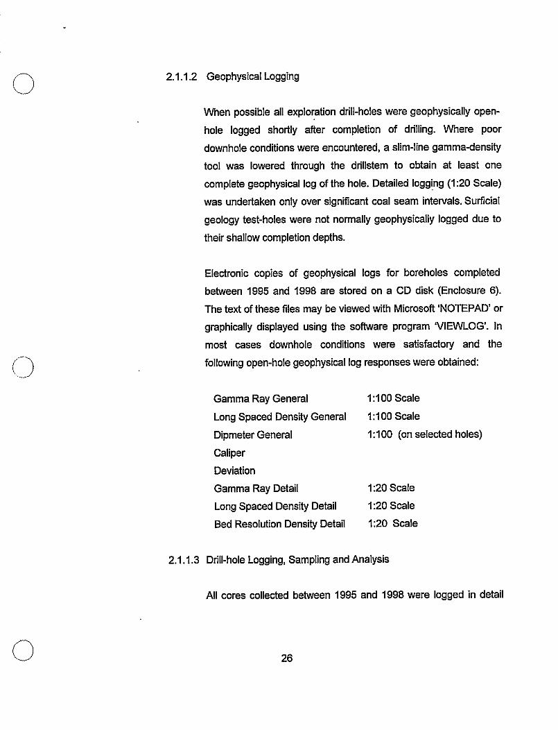
cl 2.1 .I .2 Geophysical Logging
(0
When possible all exploration drill-holes were geophysically open-
hole logged shortly after completion of drilling. Where poor
downhole conditions were encountered, a slim-line gamma-density
tool was lowered through the drillstem to obtain at least one
complete geophysical log of the hole. Detailed logging (I:20 Scale)
was undertaken only over significant coal seam intervals. Surticial
geology test-holes were not normally geophysically logged due to
their shallow completion depths.
Electronic copies of geophysical logs for boreholes completed
between 1995 and 1998 are stored on a CD disk (Enclosure 6).
The text of these files may be viewed with Microsoft ‘NOTEPAD’ or
graphically displayed using the software program ‘VIEWLOG’. In
most cases downhole conditions were satisfactory and the
following open-hole geophysical log responses were obtained:
Gamma Ray General
Long Spaced Density General
Dipmeter General
Caliper
Deviation
Gamma Ray Detail
Long Spaced Density Detail
Bed Resolution Density Detail
IA00 Scale
I:100 Scale
I:100 (on selected holes)
I:20 Scale
I:20 Scale
I:20 Scale
2.1.1.3 Drill-hole Logging, Sampling and Analysis
All cores collected between 1995 and 1998 were logged in detail
26

0
i:_>
(Enclosure 7) by geologists on site. Once described and measured,
the coals and selected host rock samples were bagged and labeled
for subsequent analysis. In 1995 a total of 154 coal ply samples
were collected, 263 in 1996 (plus 39 from trenches), 145 in 1997,
and in 1996 there were 189 coal samples recovered. Additionally,
during each exploration season, rock samples from representative
core-holes were also collected for subsequent analyses to
determine potential acid rock drainage (ARD) characteristics. A
cumulative total of 936 rock samples were collected from 28
continuous cores between 1995 and 1998. Additionally 37 samples
were collected via rotary chip sampling, and 129 from trench
sampling. Cuttings descriptions from all rotary drill-holes, as
described in the field, are found within Enclosure 8. Specific details
of analyses conducted and test results are discussed in Section
4.0.
2.1.2 Bulk Samples
Bulk samples have contributed considerably to the understanding of the
quality characteristics of the Telkwa coals and have been extracted from
three of the main resource areas. On each, a completesuite of coal quality
analyses was performed, including testing on a variety of simulated
washplant products. In 1983 a 219 tonne bulk sample was collected from 7
major seams within the Goathom East (Pit #3) area. In 1989 a bulk sample
was extracted from the Bowser (Pit #7) area via large-diameter coring and,
on two occasions bulk samples were collected from the 3 mineable seams
of the Tenas area.
0
Bulk samples were collected from the Tenas resource area on two
27

occasions, initially in 1996 through the excavation of a pair of testpits, and
again in 1996 via large-diameter coring techniques. In 1996 an 60 tonne
bulk sample was collected from 2 adjacent testpits located along the
western subcrop edge of the IIIU-seam and c-seam respectively. The ftrst,
and largest of these testpits exploited the IU and l-seams. Combined these
seams form approximately 60% of the identified mineable Tenas reserve.
The second, smaller testpit was targeted at collecting a sample of c-seam,
which lies approximately 13 meters stratigraphically above the IU-seam.
A complete suite of analytical testing was conducted on the sample
including individual seam analysis, product testing, complete washabilities
and a bum test. Washplant and process design work was also conducted,
based upon the analytical results. Most of the analytical testing was
conducted by Birtley Labs of Calgary, while the test bum and resultant
analytical work was performed by Canmet in Ottawa. All process design
work was completed by H.A. Simons of Calgary.
2.1.3 Reclamation
Reclamation was undertaken in areas disturbed by current exploration
activities, as well as those areas from previous years that required
additional work. All disturbed areas were recontoured, reseeded and
fertilized using Forestry approved mixtures. Access trails on sloping ground
were water barred for erosion control, and additional topsoil was added to
areas that inhibited new plant growth. All work was carded out in
accordance with the regulations and guidelines of B.C. Forestry. Areas that
were not reclaimed in the disturbance year due to the onset of adverse
weather were completed the following spring.
26

3.0 GEOLOGY
3.1 REGIONAL GEOLOGIC SETTING
During Jurassic and Cretaceous time much of the western portion of British
Columbia was formed as the result of several terranes that moved slowly toward
and eventually collided with the North American craton. The Telkwa Coalfield is the
product of sedimentation that occurred as one such terrane, the Stikine Terrane,
pushed eastward to eventually become sutured to the North American landmass
(Richards, 1988).
Successor basins, which formed in response to the approaching terrane, were the
focus of rapid sedimentation, subsidence and increased tectonic activity. One such
successor basin, the Bowser Basin, had developed during Middle Jurassic time
near the presentday location of Smithers. It was a center of deposition, bounded
on the north by the Stikine Arch, on the south by the Skeena Arch and on the east
by the early uplifling of the Columbian Orogeny. The Tel&a Coalfield developed
along the northern flank of the Skeena Arch near the southern limit of sedimentary
rocks in the Bowser Basin (Figure 3.1) (Palsgrove and Bustin, 1991).
Deposition of the coal-bearing sediments in the Telkwa area was initiated into the
Bowser Basin during the Lower Cretaceous, following uplift and erosion of the
Skeena Arch. Although this sedimentation initially came from the south and west,
an eastern provenance soon dominated, a response to the increased uplift of the
Columbian Orogeny. The result in the Telkwa area is represented by more than
500 meters of coal-bearing strata referred to as the Lower Cretaceous Skeena
Group. In the Telkwa Coalfield Skeena Group sediments unconformably overlie
Jurassic Hazelton volcanics.
29

(3
I
S = Cenozoic
M = Mesozoic
P = Paleozoic and Proterozoic
'0 200
Km \
Figure 3.1. Tectonic Elements of British Columbia (R.J. Palsgrove, 1990).

Cl
Cl
3.2 STRATIGRAPHY
Sedimentation of Skeena Group sediments occurred throughout the Lower
Cretaceous, during which time deposition was influenced by two regressive I
transgressive episodes. As a result the stratigraphic sequence (Enclosure 9) is
divisible into four lithostratigraphic units (Palsgrove and Bustin, 1989) further
described in the text which follows. Porphyritic Tertiary and Cretaceous intrusive
dykes and sills commonly disrupt local stratigraphy as does a large Tertiary
granodiorite plug identified on the northern coal licenses.
3.2.1 Unit I
The basal unit, Unit I, was deposited in a fluvial environment on an eroded
Hazelton volcanic basement of Jurassic age. In the Telkwa area Unit I may
be in excess of 100 meters in thickness and consists mainly of
conglomerate, sandstone, mudstone and coal. Sands and gravels were
typically deposited in braided channels and bars while mudstones
accumulated in floodplains. Coals within this unit, collectively referred to as
Coal Zone 1, formed in poorly drained backswamps and are characterized
by lateral variation throughout the study area. Deposition of Unit I ended
with a marine transgression and deposition of Unit Ii.
3.2.2 Unit II
Unit II was deposited within a dsltaic I shallow marine environment and
consists of up to 140 meters of sandstone, silty mudstone and occasional
thin coaly mudstone. Sands were deposited in distributary channels and
mouth-bars while mudstones and silty mudstones accumulated in
31

interdistributary bays. Thin discontinuous peat beds, none of which are of
economic significance, accumulated in local salt marshes.
3.2.3 Unit Ill
Unit Ill is indicative of the second regressive episode for the area and
represents the deposition of the main coal-bearing stratigraphic sequence.
The unit averages 85 meters in thickness and comprises of sandstone,
siltstone, carbonaceous mudstone and thick, laterally extensive coal seams.
Restricted nearshore marine, tidal flat and coastal swamp environments
persisted throughout much of the deposition of Unit Ill. Sandstone units
were deposited within tidal channels while interbedded sandstones and
siltstones were deposited nearshore within intertidal environments.
Mudstones are representative of tidal flat deposits. Indications are that there
was significant marine influence during deposition of the entire unit.
Coal Zones 2 through 11 are represented in Unit Ill, collectively consisting
of up to 17 coal seams of economic significance. The coal zones were likely
formed in freshwater peat swamps, located landward of the tidal flat,
somewhat isolated from influxes of brackish water. The presence of sulphur
in some of the coal seams suggests, however, that the peat was infiltrated
periodically by marine water. Thus, the major coal seams are interpreted to
have formed from peat accumulated in a freshwater marsh that was
proximal to a brackish environment. The Snuggedy Swamp of South
Carolina is considered a modem analog for the paleoenvironment in which
Unit Ill was deposited.
32
Cl
0
3.2.4 Unit IV
Unit IV overlies the coal measures and represents a marine transgression
that terminated coal deposition over the study area. The unit exceeds 150
meters in thickness and consists of sandstone overlain by silty mudstone.
The basal sandstone is a transgressive lag deposit while the remainder
represents deposition within a near-shore, shallow marine environment.
3.3 STRUCTURAL GEOLOGY
Since deposition of the Skeena Group sediments during the Lower Cretaceous the
Telkwa area has undergone at least two episodes of structural significance. The
Upper Cretaceous of the Bowser Basin reflects a time of deformation, when high
angle faulting and plutonic intrusions were occurring eastward within the Omineca
Crystalline Belt, and increasing uplift was occurring to the west. This was a result of
the suturing of the Stikine Terrane to the North American craton and also the
effects of additional terranes approaching from the west. Although folding in the
Telkwa area was not as significant as in other portions of the basin, high angle
faulting roughly trending in a north-south direction are apparent in the Telkwa
Coalfield, especially on the south side of the Telkwa River. Porphyritic Late
Cretaceous dykes and sills also occur locally within the coal measures.
During the Tertiary much of the area on the north side of the Telkwa River was
intruded by a large granodiorite and quark monzonite intrusion. The igneous body,
which vertically intruded the Skeena sediments, complicated the structural geology
of the area further. This is particularly apparent at close proximities to the intrusive
body on the northern coal licenses. Structural repercussions in the Skeena
sediments appear to be represented by high angle faulting, establishing a mosaic
33

of structural blocks that have been rotated and tilted into a variety of odentations.
No well defined fault orientation has been observed although faults in concentric
geometries are apparent near the intrusive body and also appear to crudely radiate
from the intrusive edge. Fault displacements have been observed to range from
only a few meters to more than 150 meters.
Although bedding orientations within the Telkwa Property resource areas tend to be
controlled by fault blocks. each with independent orientations, dips normally range
from 10 to 30 degrees. In the fault blocks associated with the Pit #3 resource area
dips are typically 20 degrees to the east, while within the blocks of Pit #7 & #8 they
average 17 degrees to the east and northeast respectively. In the Northwest Area,
block orientations are to the southeast and southwest, with dips ranging from 10 to
35 degrees. In the Tenas area the west limb of the Tenas syncline normally dips
from 9 to 22 degrees, while the east limb dips much steeper, up to 50 degrees.
Within the MCL Whalen Block orientations vary but typically range from 15 to 25
degrees to the east/southeast.
3.4 DETAILED GEOLOGY
All exploration work completed by Manalta Coal between 1995 and 1998 was
conducted’on the Telkwa South coal licenses. The majority of this work occurred
within the Tenas and Goathom East (Pit #3) resource areas, which represent
those fields where mining will initially proceed under the proposed mine plan.
Reconnaissance exploration drilling, limited to the 1995 and 1998 exploration
seasons, typically took place along the corridor between Tenas and Goathom
Creeks, and on selected coal licenses near Hubert and Helps Creeks.
Geotechnical and surficial lithology investigations were typically targeted at
proposed infrastructure and haul route locations.
34

Cl
0
The economic coals found represented within the Pits #7, 88, Northwest area and
most of Goathom resource area are those of lithostratigraphic Unit III (Seams #2 -
11). In contrast, in the Tenas, Cabinet, Whalen areas, and a small block of
Goathom East the main seams of interest are those of the l-seam coal sequence
of Unit I.
The stratigraphic columns for each of the main resource areas (Enclosure 9) clearly
illustrate the typical stratigraphy found within each of the resource areas. It also
depicts some of the regional variations and trends that occur within seam and
interseam lithologies throughout the Telkwa Coalfield.
3.4.1 Unit I Coal Stratigraphy
The coal seams within lithostratigraphic Unit I, collectively referred to as the
l-seam package, are separated from the overlying coals of Unit Ill by
sediments up to 140 meters thick of shallow marine origin. Unit I coal
horizons have been drilled extensively since 1992 in the Tenas resource
area. Unit I has also been occasionally identified in the fault blocks of
Goathom East. Its coal sequence remains consistently thick although has,
to date, been encountered only near maximum mineable cutoff depths.
Where encountered in the Cabinet and Whalen resource areas the Unit I
coals are notably thinner. Correlation of the Unit I seams within Cabinet and
Whalen areas remains sketchy. Additional information is required to further
determine the lateral continuity of individual seams. Intersections of the #I
seams within the MCL Whalen Block indicate that the seam, at least in this
area, is considerably variable, a result of erosional forces by fluvial systems.
In the Tenas resource area the Unit I coals are represented by up to 13 coal
seams spread over a 45 meter stratigraphic section. Most of these seams
35

I 3
cl ‘,
are not of sufficient thickness to be considered mineable. Some of the more
notable trends identified within the main mineable seams, labeled c, IU and
1 in descending order, are described as follows:
. c-seam, the uppermost and thinnest of the mineable Tenas seams,
averages 1.49 meters in thickness and is separated from the underlying
IU-seam by approximately 13 meters. The c-seam, like many of the
thinner Tenas seams, is well developed throughout most of the Tenas
area but is subject to local variations in thickness, presumably a result of
depositional factors and erosional forces by fluvial systems. It is locally
absent from parts of the Tenas field, most notably the deepest part of
the basin formed by the Tenas syncline. In the Pit #3 area, where the
Unit I stratigraphy is identified, the c-seam is typically absent from the
local stratigraphy.
l The IV-seam in the Tenas and Goathom areas is a very well
developed and laterally consistent seam, averaging 1.77 meters in
thickness. Its sulphur content does not display the same uniformity,
fluctuating in the Tenas area, often over short lateral distances. The
seam has not been studied sufficiently to draw such conclusions for the
Goathom area. In the Tenas area the IU-seam is typically separated
from the underlying l-seam by a siltstone parting that ranges from 0.0 to
2.5 meters in thickness. Typically, the parting is absent in the south-
central part of the field, increasing progressively in thickness
northwesterly across the deposit.
. The l-seam is the thickest and most consistent seam of the Unit I coal
measures. It averaging 4.12 meters in thickness in the Tenas area, and
slightly less in the Goathom area. Where identified in the Cabinet area it
thins substantially, averaging 2.02 meters in thickness. Laterally
36

0
Cl .
consistent in the Tenas area, l-seam is normally absent of significant
partings and consists of up to 5 individual seam plies. The l-seam is
consistently and predictably low in sulphur content and comprises
greater than 50% of the Tenas deposits reserve base. The l-seam
plies are occasionally undefined due to local thinning ornondeposition.
3.4.2 Unit Ill Coal Stratigraphy
Up to 17 coal seams represented in lithostratigraphic Unit Ill collectively
contribute 20.5 meters of coal to the Unit’s 85.0 meter average thickness.
Unit Ill coals are found within the Goathom East, Goathom West, Northwest,
Pit #7 and Pit #8 resource areas. The main coal zones of Unit Ill, typically
labeled Seams #2 to #II in ascending order, display some lateral
variability. Some of the more notable seams and seam trends are described
as follows.
l Seam #2 remains consistent throughout much of the property although
thin partings are apparent within the Pit #3 and PM7 resource areas.
The seam does, however, exhibit some thickness variability over short
distances especially within the northwest portion of Pit #8. Seam ?Y2
Upper, which overlies Seam #2, is thin and developed only within the
eastern resource areas north of the Telkwa River. Seam #2 Lower,
which directly underlies Seam #2, also occurs on the northern side of
the river but remains significant only within the western resource areas.
l Seam #3 remains one of the most consistent seams in the stratigraphic
sequence of Unit Ill. It is found throughout the resourceareas which
exploit Unit Ill, and is consistently split into Seams #3 Lower and Upper
by a mudstone parting which rarely exceeds one meter in thickness.
37

l Seam #4 is normally well developed throughout each of the resource
areas but is locally absent from a small area in the southeast portion of
Pit #3. Seam #4 Upper, which overlies the #4 Seam, is absent from Pii
#7 and the eastern half of Pit #S, but occurs throughout the western part
of Pit #3, the Northwest Area, and Pit #3. The parting thickness between
Seam #4 and #4 Upper increases progressively in a northwesterly
direction attaining a maximum thickness of more than 7.0 meters in the
Northwest Area.
F Seam #5, a very well developed seam, is found throughout the property.
It splits, however, midway through Pit #3 where it is represented in the
Northwest area and the west half of Pit #5 as Seams #5 Lower and #5
Upper.
l Seam #5ex is undeveloped throughout most of the property but
progressively develops within the Pit #3 resource area, becoming
increasingly apparent on the west half of Pit #Et. Within the Northwest
Area the seam continues to thicken and represents one of the thickest
and best developed seams of the area.
l Seam #5 is considerably variable between resource areas, splitting from
a single seam in Pit #3 to as many as 3 seams in Pit #7. Throughout Pit
#7, Pit #3 and Northwest Area the seam is represented as #SLower
and #6 Upper, separated by,a parting normally averaging one meter in
thickness. In the Pit #7 area Seam #6 Lower is further split by another
parting normally not exceeding 0.50 meters in thickness.
l Although generally thin and considered uneconomic throughout most of
the resource areas Seam #7 is laterally continuous and shows little
38

variability throughout the coalfield. The exception is within Pit #7 where
the seam is absent from the sequence.
l Seam #I%, although present throughout most of the resource areas,
exhibits considerable variation in seam thickness, often over short
lateral distances. Seam #8, and those seams which overly it, are not
well represented within the Pit #7 area since most of the upper portion
of the Unit Ill sequence was eroded from that area prior to glaciation.
. Seam #9, due to its inconsistent thickness and poor quality
characteristics, is rarely considered of economic significance. The seam
is characterized by visible pyrite banding and as a result has higher than
average raw sulphur values in comparison to other seams. Like
underlying Seam #8 it often exhibits seam thickness variability and
lateral discontinuity.
. Seam #IO is a relatively consistent seam, present throughout most of
the Pit #3, Pit #8 and Northwest areas. The seam varies in thickness,
however, often over short lateral distances.
. Seam #II, the roof of which forms the top of lithostratigraphic Unit Ill, is
found throughout the Telkwa North resource areas where it is usually a
consistent, continuous seam. It does, however, exhibit some regional
thinning within the northeast segment of Pit #S.
Host rock lithologies between seams are dominated by siltstones and fine
grained sandstones, with lesser amounts of mudstone and carbonaceous
mudstone. Four notable sandstone units identified within or proximal to the
Unit Ill stratigraphy are described as follows:
39

l The #2 Sandstone, which underlies the #2 and #2 Lower seams
represents the thickest, most consistent and predictable sandstone unit
of the four. Forming the top of lithostratigraphic Unit II, it is a massive
sandstone in excess of 10 meters in thickness which has been
observed to commonly contain pelecypod shells or shell fragment
horizons within it. The sandstone unit is most strongly developed on the
north side of the Telkwa River.
l The #3 Sandstone, stratigraphically located in Unit Ill between Seams
#3 Upper and #4, is present throughout all of the resource areas but
remains thickest and best developed within the Pit #3 area south of the
Telkwa River. The sandstone unit thins considerably in Pit #7 and
continues to thin, becoming finer-grained westward into Pit #3 and
Northwest Area.
. The #7 Sandstone is situated stratigraphically within Unit Ill between
Seam #7 and #3 and is laterally continuous throughout the resource
areas on both sides of the Telkwa River, although is most strongly
developed in the Pit #3 area. The unit commonly is interbedded with
finer-grained lithologies, most apparent on the north side of the Telkwa
River.
. The #I 1 Sandstone, or Unit IV Sandstone as it is referred to, represents
the base of lithostratigraphic Unit IV and usually directly overlies Seam
#I 1. This marine sandstone is regionally correlatable across the
resource areas, displaying only minor variability. The unit does,
however, tend to be slightly thinner in Pit #3 than within Pit #8 and
Northwest Area.
40

3.5 RESOURCE AREAS; TELKWA NORTH
No additional work has been performed on the Telkwa North licenses ante 1994.
As such, the latest model update for the Pit #7 and #I9 resource areas was
completed in 1993 and 1994 respectively utilizing the Lynx Mine Modeling System.
The resultant models are considered to be an accurate representation of the
geological information obtained to date. The Northwest Area and Whalen Block
have not been computer modeled to date, as additional drilling is considered
necessary to accurately determine their geometries. The reader is referred to the
1.993/94 Assessment report for additional detail on the geology of the Pit #7, Pit #8,
Whalen and Northwest resource areas.
3.5.1 Pit #7 Resource Area
To date 19 drill-holes have intersected the Unit ill coal measures (Seams
#2 - 11) within the Pit #7 area (Enclosure 10). The drill-hole spacing for the
area is currently approximately 125 meters. Enclosure 11 presents a
summary of all seam intersections and average seam thicknesses
encountered within the Pit #7 resource area to date. Individual drill-hole
details and seam intersection data is provided within Enclosure 12.
The coal measures trend in a north-south direction and dip east to
northeastward until they terminate against a northeast-southwest trending
near vertical fault. This normal fault exhibits considerable displacement
(approximately 150 meters) juxtaposing thin coal seams possibly of the #I
seams against the Unit Ill coal seams found in Pit #7. The coal measures
also abruptly terminate to the north where Skeena sediments have been
intruded by a large Tertiary granodiorite plug. The intrusive truncates the
sediments at nearly 90 degrees to bedding and extends beyond Pit #7,
41

0
Cl
further disrupting the coal measures of Pit #8 and Northwest Area. Small-
scale faulting has been identified at close proximities to the intrusive contact
in other areas and is suspected in Pit #7 as well. The coal seams subcrop
to the west and south, as illustrated on cross-sections 7A and 7C
(Enclosure 13). Cross-section locations are referenced on the Telkwa North
Geology Map, Enclosure 10.
3.5.2 Pit #8 Resource Area
Current exploration for the Pit #I% resource area is such that 55 drill-holes
intersect the coal measures of the #2 to #II seam package of Unit Ill,
providing a drill-hole spacing of approximately 150 meters or less. Drill-hole
data has identified that the area consists of two main parallel-trending fault
blocks which present a repetition of the Unit ill coal-bearing sequence
(Enclosure 10). Displacement on the normal fault separating the twoblocks
ranges from 40 meters, near its southeastern end, to 80 meters at its
northwestern limit, terminated by the Tertiary intrusive body. Further normal
faulting, identified within the southeast portion of Pit #!8, trend approximately
perpendicular to the regional strike of the area and have displacements
ranging from 20 to 80 meters. They are known to break and juxtapose the
#2 to #I 1 coal seam package into a series of smaller fault blocks. Several
smaller-scale displacement faults have also been identified, normally
occurring at close proximities to the intrusive body.
The coal seams subcrop to the southwest and are constrained on the
northeast by the granodiorite intrusive. An area of intense faulting and the
absence of coal-bearing sediments terminates the Pit #8 resource area to
the northwest. Although displaced by normal faulting the coal trend
continues to the southeast, and may continue as far south as the Telkwa
42

River, where it is presumed fault terminated. Indications are that the coals
historically exploited by the Aveling Mine are extensions of the same seam
package, suggesting that additional normal faulting may occur beyond the
current limits of drill-hole control. Additional exploration is required to further
determine the coal structure in proximity to the Telkwa River.
Bedding orientations throughout the resource area are generally to the
northeast as indicated by area cross-sections 8B, 8D, 8F, 8H and 85
(Enclosure 16). Cross-section locations are referenced on the Telkwa North
Geology Map, Enclosure 10. Seam intersection data has been summarized
within Enclosure 14 while specific. drill-hole details and coal quality
information are found within Enclosure 15.
3.53 Whalen Block Resource Area
To date within the Whalen Block, 24 exploration drill-holes have been
completed. The coals found there include representations from both the
Unit I and Unit Ill stratigraphic coal zones. The area is, however, structurally
complex and requires additional exploration to fully evaluate the seam
geometries. The Telkwa North Geology Map, Enclosure 10, illustrates the
approximate subcrop position of the #I Seam based upon findings to date.
Specific drill-hole details for the Whalen Block are provided within Enclosure
17.
3.5.4 Northwest Resource Area
The most recent geological work conducted on the Northwest area coal
licenses was completed during the 1992 exploration season. To date, 15
43

0
Cl
drill-holes have been completed in the area, targeted at the coal measures
of the Unit 111 stratigraphy. The Northwest Area geology is included on the
Telkwa North Geology Map, Enclosure 10, while a drill-hole summary is
provided within Enclosure 18.
3.6 RESOURCE AREAS; TELKWA SOUTH
All exploration activities undertaken between 1995 and 1998 on the Telkwa
property were completed on the Telkwa South coal licenses, with particular
emphasis on the Tenas and Goathom resource areas, and proposed infrastructure
and facility locations. Some exploration drilling was dedicated to Cabinet area, while
reconnaissance drilling in 1996 near Helps and Hubert Creeks has led to the
identification of an additional resource area, known locally as Helps area.
3.6.1 Goathom East (Pit #3) Resource Area
Between 1979 and 1984 the Goathom East resource area had been
extensively explored resulting in considerable information accumulated on
the area’s Unit Ill coal measure stratigraphy. Occasional exploration took
place periodically thereafter until 1995 when considerable drilling was
conducted, further developing the field’s limits and providing additional
insight on the numerous faults that transect the area. Between 1995 and
1998, 123 drill-holes were completed in the Pit #3 area and an additional 19
were completed further north within the proposed tailings pond and plantsite
areas. To date approximately 300 drill-holes, 8.4 kilometers of surface
geophysics, and the removal of a 219 tonne bulk sample have been
completed on the Goathom East coal licenses.
44

Cl
cl
The Goathom East area is typically characterized by an east-dipping
stratigraphy, repeatedly broken by a series of north/south trending normal
faults. Regional dips range from 10 to 35 degrees, averaging 20 degrees,
while normal fault displacements typically range up to 20 meters. Large
displacement thrust faults are also known to disrupt the local stratigraphy,
most commonly occurring along the southeast edge of the deposit, trending
in a north/south direction. Typical geological cross-sections, referenced on
the Goathorn Geology Map, Enclosure 19, are presented in Enclosure 20.
On occasion the Goathom East thrust faulting has resulted in horst
structural features which have transported Unit I coal measures within
proximity of the Unit Ill stratigraphy. The resultant uplifted wedge is
correlatable to the Unit I coal measures found in Tenas and Cabinet Creeks.
The dominant seam stratigraphy in the area, the #2 - #I 1 seam package,
subcrops along the west side of the deposit, roughly paralleling the
Goathom Creek valley. Most of the seams deteriorate southeasterly,
becoming thinner and poorly developed suggesting that locally, during
deposition, a restricted nearshore marine environment persisted to the east
(Palsgrove, 1990).
The most recent geological model for Goathom East resource area was
generated late in 1997 using Medsystem mine modeling software upon
which detailed engineering work was initiated and resources calculated.
After completion of 1998 exploration activities the model was partially
updated to reflect the major changes resultant to the new exploration. The
area affected by the model update was the north part of the resource area
where most of the 1998 drilling was conducted.
45

0
0
3.6.2 Goathorn West (Pit # 6) Resource Area
The coal measures identified on the west side of Goathorn Creek, and
illustrated on the Goathorn Geology Map, Enclosure 19, represent the
Goathorn West (Pit #6) resource area. Both the Unit I and Unit Ill coals are
represented within identified fault blocks, separated by normal faults with
displacements of up to 120 meters. Some of the Goathorn West resource
area was mined during the 1940s and early 1950s by the underground
mining activities of Bulkley Valley Collieries, #2 Mine. Underground shafts
were collared in outcrops found along the banks of the Four and Goathom
Creeks, and driven northwest following seam bedding planes (particularly
the #2 seam).
Relative to other resource areas identified on Telkwa Property, the
Goathorn West resource area is small in comparison and to date, 30 drill-
holes have been completed in the area. These include 18 core-holes, one
of which was continuously cored and. rock samples recovered for ARD
studies. A drill-hole spacing of 150 to 200 meters is currently established
in the area.
Like the Goathom East area, the local stratigraphy of Goathom West is
disrupted by numerous faults, resulting in a series of structural blocks tilted
at different orientations. Bedding orientations throughout the area are
random, ranging from less than 5 degrees to greater than 45 degrees.
Enclosure 21 illustrates typical cross-sections through the area. The
cross-sections, as well as underground mine workings, fault traces and all
drill-hole locations, are referenced on the Goathorn Geology Map,
Enclosure 19.
In 1997 the Goathorn West area was modeled as part of the complete
46

Cl
.- c>
Goathom Medsystem geological model, upon which detailed engineering
work was completed and resources calculated. All geological information
collected to yearend 1997 was utilized in the construction of the model.
3.6.3 Tenas Creek Resource Area
The coal measures of Tenas Creek Resource area (Enclosure 22) are
representative of the #I Coal Zone of Unit I and are presumed correlatable,
although fault displaced, to seams found in the vicinity of Cabinet Creek. To
date a drill-hole spacing of less than 150 meters has been established at
Tenas Creek and 207 drill-holes have intersected the seam sequence. Of
the 207 drill-holes 44 were cored, including 5 large-diameter cores, yielding
seam quality information. Twenty of the core-holes were continuously cored
throughout the entire length of the hole and their host rock analyzed for acid
base accounting purposes. Exploration between 1995 and 1998 has
established field limits for the deposit and provided a detailed understanding
of the seam quality and host rock characteristics. A summary of drill-holes
and seam intersection data in the Tenas Creek area is provided within
Enclosure 23. Specific drill-hole details and coal quality are presented within
Enclosure 24.
The Tenas Creek resource area was drilled extensively between 1995 and
1998, and was initially modeled via Mincom Mine Modeling software in
1995. The geological model was subsequently updated early in 1997, and
is currently pending a further update to include most recent drilling.
Exploration conducted after the last model update has not altered the
geological interpretation for the area, but has provided additional geological
control.
47

cl
-- 0
Compressional forces directed from the southwest have shaped the
Tenas resource area into a closed synclinal structure that today lies as an
erosional remnant of Units I and II stratigraphy. The local strike of the
stratigraphy is approximately 145 degrees, with the syncline axis trending
roughly parallel to regional strike. The syncline axis plunges gently from
both directions into the interior of the field, forming a basin bound on all
sides by subcrop. Bedding dips on the west limb of the syncline range from
9 to 22 degrees east/northeast, gradually increasing towards the southern
limits of control in the resource area. Dips along the steeper, east limb
range up to 50 degrees to the southwest. Tenas Creek coal-bearing
sediments lie unconfomlably over Jurassic Hazelton volcanic rocks.
Unlike many of the Telkwa resource areas the Tenas area is not affected by
major faulting. Small-scale normal faulting is identified along thewest side
of the field, where a portion of the coal-beartng stratigraphy has been
repeated. The presence of small-scale faulting is also suspected within the
Tenas Syncline axis.
Except for areas affected by nmdeposition or erosion, the Unit I coal
measures are laterally continuous throughout their range. Erosional
channeling is interpreted in some areas where complete and partial seams
have been affected, although additional exploration is required to fully
evaluate the paleochannel mechanisms.
At the field’s northern limits poorly consolidated Quatemary sediments,
presumably associated with the glacial paleochannel of the Tenas Creek
drainage, overlie the local coal measures stratigraphy. These sediments
become increasingly thicker in a northerly direction. Within the confines of
the paleochannel, the thickly interbedded sand, silt and gravel blanket is
in excess of 85 meters.
48
0
0
The typical stratigraphic column for the Tenas Creek area is included within
Enclosure 9. Although several seams occur within the Unit I stratigraphy of
Tenas Creek most are thin and not of economic significance. Three seams
however, currently identified as c-seam, l-Upper seam, and l-seam, are
consistent in nature and form the mineable component of the Tenas Creek
resource. Cross-sections through the area, as referenced on the area
geology map (Enclosure 22) are included as Enclosure 25. Seam
thickness maps for each of the main mineable seams are presented in
Enclosure 26.
3.6.4 Cabinet Creek Resource Area
The Unit I coal trend identified in the Tenas syncline continues, although
fault displaced, southeastward into the Cabinet area. Drilling and field
mapping completed to date on the Cabinet resource area indicate that
coal occurrences in the area are sporadic and discontinuous. To date,
field mapping and 20 drill-holes have been completed within area
boundaries, 3 of which were cored. All but 4 of the drill-holes, including the
core-holes, were completed during the 1995 and 1996 exploration seasons.
Much of the area, particularly the southern half of the resource area, is
capped by thick accumulations of Quatemary gravels. Where coal
measures have been intersected the stratigraphy has been subjected to
considerable structural stresses, as faulting and variability in structural
orientation is apparent.
0 49

3.65 Helps Resource Area
The Helps area, identified by reconnaissance exploration drilling in 1996,
has been interpreted to hold coal measures of the Unit III stratigraphic
sequence. To date a drill-hole spacing of 650 to 1200 meters is
established for the area. A total of 5 drill-holes, none of which were cored,
intersect the sequence. Drilling has indicating that the area likely contains
some faulting, as bedding orientations are variable between drill-holes.
Enclosure 27, which details the Helps resource area and Mine Access
Corridor, illustrates the area geology and all drill-holes completed in the
area to date.
50

4.0 COAL QUALITY
0
Coal in the Telkwa Coalfield vanes from High Volatile A bituminous to semi-anthracite by
the ASTM classification of coal rank. The vast majority of the area coals, however, are a
High Volatile A bituminous product with RoMax vitrinite values generally ranging from 0.80
to 1.00 percent. Within the coal measures of the Skeena Group sediments, observations
are that, coal rank generally tends to decrease slightly for coal units situated higher in the
stratigraphic column. As such, ranks of the coals situated within Unit I are typically slightly
higher than those found within Unit Ill. Localiied occurrences of medium-volatile and semi-
anthracite coals are thought to have resulted from either post-Cretaceous heat sources,
deeper burial and subsequent uplift of some coal-bearing units, or from localized higher
heat flux from the pre-Cretaceous basement (Ryan, RD., 1992). Increases in coal rank
have been observed in coals situated at close proximities to the Tertiary intrusive on the
northern resource areas as well as some coals within the Cabinet Creek area.
The evaluation of coal quality for the 1995 to 1998 exploration programs is based upon the
analytical results of core obtained from drill-holes, and from bulk samples collected from
the Tenas area in 1996 and 1998. The primary purpose of the coring programs was to
obtain sufficient samples of significant coal seams for reliable determinations of the raw
and clean quality characteristics of the Telkwa Coalfield. In 1996 an 80 tonne bulk sample
recovered from the Tenas field provided sufficient size and quantity of delivered coal to
simulate raw feed operations and perform the testing necessary to conduct a complete
processing plant design. The large-diameter coring program completed in 1998 provided
small-scale bulk samples from 5 additional Tenas locations such that comparisons could
be drawn between different locations, and also from between the large-diameter and
conventional cores.
Typically, specitic lab analyses on core samples were performed by Loring Laboratories
Ltd. of Calgary, Alberta. Most samples collected were representative of selected coal units,
although seam roof, floor and parting lithologies were also collected regularly and
51

analyzed. Bulk sample analyses were typically completed by Birtley Labs, also of Calgary.
4.1 QUALITY CHARACTERISTICS
Coal quality parameters have been determined from core samples recovered since
1979 from each of the resource areas identified thus far in the Telkwa Coaltield.
The results presented in this report represent a compilation of all analytical results
thus far accumulated within the resource areas identified on the Telkwa North and
Telkwa South coal licenses. No seam quality information is available for the Helps
area since no coring has been done to date.
Analytical results from all ply samples recovered between 1995 and 1998 are
presented for each year within Enclosure 28. In turn, the analytical results for seam
composites are compiled for the Tenas Creek, Goathom East, Pit #7, Pit #8 and
Northwest resource areas within Enclosure 29. Table 4.1 summarizes the average
coal quality for each of the main resource areas found within the Telkwa coalfield.
While the majority of Telkwa coals are relatively consistent with respect to raw
calorific value, volatile matter and fixed carbon values, variations in raw ash and
sulphur values occur between seams. Sulphur content variations between some
seams is attributed to periodic iniWations of marine water into the developing peat
swamp, while inundations are thought to have terminated development of some of
the coal seams.
52

Table 4.1
Telkwa Evaluation to yearend. 1997
Clean Coal Quality Summary; Core Washabilities Reported on a Dry Basis
Resource Area: Seams
Goathorn East (Pit #3): Z-10 Goathorn West (Pit #6): Z-10
Bowser East (Pit #-I): 2-6U Bowser West (Pit #8): 2-11
Tenas: 0, IU, 1
____.......________________________ Seam Quality Characteristics . ..---- .Immmemme-------- - --.------
Ash Sulphur Specific Gravity Calorific Value Volatile Matter Fixed Carbon F.S.I. (%) (%) (A-D.) (kcallkg) wa (%) (Range: Avg)
10.20 1.04 1.37 7393 29.43 60.38 1.7 10.34 1.24 1.38 7220 27.12 62.54 - 9.22 0.90 i.36 7567 28.96 61.94 0.5 - 6.5; 2.5 12.61 0.99 1.40 7273 27.32 59.72 0.5 - 7.5; 2.1 11.04 1.02 1.38 7500 25.38 65.56 1.0 - 4.0; 2.0

5.0 COAL RESOURCES
Coal volumes prepared for this report have been classified according to the Standardized
Coal Resource/Reserve Reporting System for Canada compiled by the Geological Survey
of Canada (1989). Due to the nature of the Telkwa deposit, the resource areas identified
thus far within the coalfield have been classified as geologicallycomp/ex.
Resources are coal quantities that because of a favorable combination of thickness, depth,
quality and location are considered to be of immediate interest for possible exploitation.
Reserves are coal quantities that are anticipated to be mineable and have undergonea
feasibility study using current economic conditions and existing technology. In this report
the reserve volumes listed are not included in the resource figures.
Quantities of in-situ coal listed in this report have been determined from information of drill-
hole seam intersections gathered between 1979 and 1998. Specific areas have been
identified, each of representing an independent deposit within the limits of the Telkwa
Coalfield. Each possesses unique characteristics with respect to deposit geometries and all
target the coal measures of either Unit I or Unit Ill.
Within the immediate proximity of the proposed mining areas of the Telkwa property there
is a calculated 30,593,OOO proven clean metric tonnes of mineable reserve plus an
additional 3,066.OOO probable clean metric tonnes. The overall strip ratio is 8.36:1
bcm/clean tonne.
There are additional recoverable coal resources in the Telkwa project area which to-date
have not.been economically assessed, but have sufficient data to reasonably interpret the
extent and structure of the coal seams. Within the assurance-of-existence classification of
measured there is a calculated 750,000 in-situ raw metric tonnes (RMT), plus an additional
8,532,OOO RMT of indicafed and 31,462,OOO RMT ofinferred coal.
54
0
0
Outside these reserve/resource limits but still within the Telkwa property boundary limits
exist further coal resources, however due to lack of detailed analysis a volume estimate
has not been reported at this time.
5.1 RESERVE I RESOURCE CRITERIA
Coal volume estimates have been prepared based upon drill-hole seam intercept
information established from geophysical log signatures. Areas for which geological
computer models were generated include Goathom, both Bowser blocks and
Tenas. As such, total in-situ reserves were determined for these areas via
computer modeling sohare. For the Northwest, Cabinet, Whalen and Helps areas,
resource estimates are based upon simpler, more direct measurement methods.
In-situ geological resource and reserve figures for the Telkwa property are
tabulated in Table 5.1.
The criteria utilized to conduct coal volume estimates varies between areas due to
such factors as structural complexity, drill-hole density and seam stratigraphy. For
both Bowser blocks and the Goathorn areas, criteria for seam selection is based
primarily upon seam thickness. Generally seams which exhibit thicknesses of 0.50
meters or greater (1.0 meter or greater for Goathom) were included in theresource
calculations. Partings with thicknesses exceeding 0.30 meters (0.50 meter for
Goathom) were considered separable and were not included. Similarly for the
Northwest, Whalen Block, Cabinet and Helps areas only those seams which were
of technically recoverable thickness (0.50 meter or greater) were included. Depth of
burial was not a considered factor.
Reserve volumes reported in the 1.2 million tonnes per year mine plan for the
Tenas and Goathom areas were calculated using a minimum cutoff thickness for
economically recoverable coal of 0.5 meters, and a separable parting thickness of
0.5 meters or greater.
0 55

For the Cabinet, Whalen, Northwest and Helps areas resource calculations are
based upon direct measurement methods. Average seam thickness values were
calculated and subsequently the surface area that each seam occupied was
measured. The resultant resource estimates are based upon the following formula:
R=AxThxSG
Where: R = Coal Resource (tonnes).
A = Area occupied by a particular seam (m’).
Th = average seam thickness for a particular resource area (m).
SG = the Specific Gravity of a particular seam (glen? = ffm3).
56

cl 0 1’3 !
Table 5.1
Telkwa Property: Surface Reserves (REPORTED IN CLEAN METRIC TONNES)
Pit/Area Proven Coal Probable Coal Possible Coal Total Coal Strip Ratio ( ) (000 tonnes) (000 tonnes) ( ) ( ) 000 tonnes 000 tonnes BCMlCMT
Tenas 16,667 16,667 0.57 Goathom East (Pit #3) 6,476 2,159 8,635 8.14
Bower East (Pit #7) 2,862 2,862 7.43 Bower West (Pit #8 Extension) 4,588 4,588 8.69
Goathom West Satellite Pits 0 907 907 8.01
Pit Totals: 30,593 3,066 0 33,660 8.36 I
Telkwa Reserves: 33,660 (OpO) clean tonnes
Telkwa Property: Surface Resources (REPORTED IN RAW METRIC TONNES)
Pit/Area Measured Coal (000 tonnes)
Indicated Coal (000 tonnes)
Inferred Coal (000 tonnes)
Total Coal (000 tonnes)
Helps Pit 7,310 7,310 Whalen Block, 8,634 8,634 Cabinet Creek 3,708 3,708
Northwest 11,060 11,060 Bower West (Pit 6% Extension) 5,032 5,032
Goathom East (Pit #3) 750 3,500 750 5,000
Pit Totals: 750 8.532 31,462 40,744
Telkwa Property Resource: 40,744 (000) insitu raw tonnes

5.1.1 Goathom East (Pit#D) Reserve
The Pit #3 resource area was computer modeled via Medsystem Mine
Modeling software in 1997 by Manalta Coal Ltd. It was subsequently
partially updated in 1998 to include some of the drilling completed during
the 1998 exploration program. Based upon the 1997 geological model in-
situ resource estimates are currently estimated at 5,000,OOO raw tonnes. A
coal reserve of 8,835,OOO clean tonnes is included within the current
mineplan, at a strip ratio of 8.14:1 bcmlclean tonne.
51.2 Goathom West (Pit #8) Reserve
The Goathom West area was modeled via Medsystem mine modeling
software consecutively with the Goathom East area in late 1997. Based
upon the model the coal reserve identified for the area is 907,000 clean
tonnes at a strip ratio of 8.Ol:l bcmlclean tonne. No resource figures have
been calculated.
51.3 Pit #7 Reserve
A computer model was generated for the Pit #7 resource area via the Lynx
Mine Modeling System in 1993 by Manalta Coal Ltd.. An additional drill-
hole, completed in 1994, did not alter the deposit significantly and, as such,
did not immediately warrant a model update.
Only those seams that attained potentially mineable thickness were
modeled, and thus ultimately considered within the reserve calculations of
the Pit #7 resource block. Seams overlying the #8 coal package were not
58

13 considered as they were intersected only by one drill-hole and are not
adequately represented within the field. The reserve currently included
within the mineplan totals 2,862,OOO clean tonnes at a strip ratio of 7.43:1
bcmlclean tonne. No resource figures are calculated.
5.1.4 Pit #8 Reserve
Like the Pit #7 area the Pit #8 resource area was modeled via the Lynx
Mine Modeling System in 1993. The Pit #8 model, however, was fvrther
updated in 1994.
Pit #6 represents a more complex geological deposit than Pit #7, consisting
of two main fault blocks and several smaller fault zones that exhibit minor
displacement. In addition the Pit #B resource area is considerably larger,
within which the entire Unit Ill coal package is well represented.
The reserve estimates are inclusive of all modeled coal seams within the
current limits of geological control. Seam extrapolations extend
southeastward as far as the Telkwa River valley where they are believed to
fault terminate. The total in-situ coal resource established to date for the
complete Pit #8 resource area is 5,032,OOO raw tonnes. A coal reserve of
4,588,OOO clean tonnes is included in the current mineplan, at a strip ratio of
8.69:1 bcm/clean tonne.
59

Cl 51.5 Tenas Creek Reserve
cl
The Tenas resource area was most recently modeled in 1997 via Mincom
Mine Modeling software and is currently pending a further update to reflect
most recent additional drilling in the area. Based upon the latest geological
model the total in-situ coal reserve identified for Tenas Creek Area is
16,667,OOO clean tonnes, at a strip ratio of 6.57:1 bcm/clean tonne. This is
based upon the 3 potentially mineable seams found in the Tenas deposit,
the c-seam, IU-seam and l-seam.
5.1.6 Whalen Reserve
The total in-situ coal resource for the current explored limits of the Whalen
resource area has been estimated at 6,634,OOO raw tonnes for all seams
considered mineable. Additional work is necessary to further delineate field
limits, deposit geometry and ultimately bring the coal reserve to a measured
level.
51.7 Northwest Reserve
The Northwest area has not been computer modeled to date nor has its
coal measures been included within any detailed mineplans. An in-situ coal
resource for the Northwest area has been established at 11,060,000 raw
tonnes.
60

5.1.8 Cabinet Creek Reserve
An in-situ coal resource of 3,708,OOO raw tonnes has been established for
the Cabinet Creek resource area. Additional work is required to fully
evaluate the complexity of the deposit.
5.1.9 Helps Reserve
The Helps resource area has not been modeled to date nor is there a coal
quality database established for the deposit. Based upon manual methods,
an in-situ coal resource of 7,310,OOO raw tonnes is established for the Helps
area.
61

6.0 COSTS INCURRED
Details of costs incurred for work conducted between the 1995 to 1998 expbration
programs is provided within the Cost Summary Report (Enclosure 30). The summary
presented represents the total expenditures to date relating to the Telkwa Project
exploration activities.
62

0
(II
7.0 SUMMARY
The Skeena Group sediments of the Telkwa Coalfield are an erosional remnant of Lower
Cretaceous sedimentary rock deposited along the southern flank of the Bowser Basin.
Throughout the Lower Cretaceous sedimentation occurred during which time deposition
was influenced by two regressive I transgressive episodes. As a result the stratigraphic
sequence is divisible into four lithostratigraphic units, Units I through IV. The lithologies
within Units I and Ill are representative of the regressive episodes and, in turn, the periods
of significant peat development in the Telkwa area. The coals within Unit I, collectively
referred to as Coal Zone 1 are separated from the Unit Ill coals by as much as 140 meters
of predominantly marine sediment. Coal seams #2 through #II, represented in Unit Ill,
collectively contribute 20.5 meters of coal to the Unit’s 85.0 meter average thickness.
Since deposition the Skeena Group sedimentary package has been modified by faulting
and minor folding resultant from continental stresses that persisted throughout much of the
Upper Cretaceous and Tertiary Periods. In addition, during the Eocene Epoch, an igneous
body intruded the Skeena sediments, further disrupting and faulting the sedimentary
package. As a result, much of the area is characterized by high angle faulting. This breaks
the area into a mosaic of structural blocks that have been rotated and tilted into a variety of
orientations. Each of the resource areas identified to date are representations of such fault
blocks.
Several resource prospects have been identified in the Telkwa area and since the early
1900s have been sporadically mined, exploiting the Unit I and Unit Ill coals. It was not until
the late 1980s however, that drilling as a means of identifying potential resource areas was
utilized. Between 1979 and 1989 Shell CanadsJCrowsnest Resources completed several
exploration programs, completing 263 drill-holes and highlighting several resource areas,
most of which were located on the south side of the Telkwa River.
The Telkwa Property coal licenses were held by Manalta Coal Limited from May 1992 until
63
November 1998, at which time Luscar Limited acquired the operations ofManalta Coal,
including the land and license holdings of the Telkwa Property. Between 1995 and 1998
Manalta focused exploration activities on the Telkwa South resource areas. Coal samples
were collected from all cored drill-holes for subsequent analysis as were rock samples from
representative cores for ARD testing.
The vast majority of the Telkwa area coals e@ored to date are a High Volatile A
bituminous product by ASTM classification of coal rank. Medium Volatile bituminous as well
as occurrences of semi-Anthracite coal are also known to exist. While the majority of
Telkwa coals are relatively consistent with respect to raw calorific value, volatile matter and
fixed carbon values, variations in raw ash and sulphur values occur between seams.
Sulphur content variations between some seams is attributed to periodic infiltrations of
marine water into the developing peat swamp, while inundations are thought to have
terminated development of some of the coal seams.
Coal volumes calculated for the main Telkwa resource areas by Manalta Coal Limited were
completed using computer models constructed via the Lynx, Mincom and Medsystem Mine
Modeling systems. For other resource areas manual methods for resource estimates were
utilized. Estimated in-situ geological coal rasemes for the main resource areas detailed in
this report total 33.66 million clean tonnes. In-situ resources for resource areas identified
thus far within the Telkwa Property limits are estimated at 40.74 million raw tonnes.
64

8.0 CONCLUSIONS
Significant reserves of High Volatile A bituminous coal have been identified within the
Telkwa Coal Property limits currently held by Luscar Limited (formerly Manalta Coal Ltd.).
While the primary value of Telkwa coal is as a thermal product, some of its properties allow
it consideration as a low grade coking coal. The coal reserve identified thus far within the
property licenses is represented by the coals associated with Unit I and Unit Ill, most of
which has been identified within the Goathom, Pit #7, Pit #8, Northwest Area and Tenas
Creek resource areas.
The coal reserve identified to date is known to lie within individual fault blocks, or resource
areas, each with independent field limits and deposit geometries. Results from the 1995 to
1998 exploration programs have aided in further definition of the geology of the Tenas and
Goathom resource areas, providing additional coal quality information and better
understanding of deposit geometries. In 1996 another resource area, the Helps area, was
identified although additional exploration in this area is required to evaluate its resource
potential.
65

9.0 REFERENCES
Hughes, J.D., Klatzel-Mudry, L., Nikols, D.J. (1989): A Standardized Coal Resource I
Reserve Reporting System for Canada; Geological Survey of Canada, Paper 88
27, 18 pages.
Malott, M.L. (1990): Telkwa Coal North (93L 152); B.C. Ministry of Energy, Mines and
Petroleum Resources, pages 175-179.
McKinstry, B.W. (1990): Telkwa 1989 Geological Assessment Report; Unpublished, 13
pages.
Palsgrove, R.J. (1990): Stratignqhy, Sedimentology and Coal Quality of the Lower
Skeena Group, Telkwa Coalfield, Central British Columbia (93Ull); Masfer’s
Thesis, University of British Columbia, 135 pages.
Palsgrove, R.J. and Bustin, R.M. (1990): Stratigraphy, Sedimentology of the tower
Skeena Group, Telkwa Coalfield, Central British Columbia (93Ull); B.C. Ministry of
Energy, Mines and fefroleum Resources, Geological Fieldwork 1989, Paper 1990-
1, pages 449-464.
Palsgrove, R.J. and Bustin, R.M. (1991): Stratigraphy, Sedimentologyand Coal Quality of
the Lower Skeena Group, Telkwa Coaltield, Central British Columbia, NTS 93Ull;
B.C. Minisfry of Energy, Mines and Petroleum Resources, Paper 1991-2.60 pages.
Richards, T. (1988): Geologic Setting of the Stikine Terrane;Abstracfs of fhe Geology and
Metallogeny of Northwesfem British Columbia Workshop, Smithers, B.C, pages
A76A81 _
68
Ryan, B.D. (1992): Coal Rank Variations in the Telkwa Coalfield, Central British Columbia
(93Ull); B.C. Ministry of Energy, Mines and Petroleum Resources, Geological
Fieldwork 1991, Paper 1992-1, pages 451-460.
Ryan, B.D. (1991): Density of Coals from the Telkwa Coal Property, Northwestern British
Columbia (93Ull); B.C. Ministry of Energy, Mines and Petroleum Resources,
Geological Fieldwork 1990, Paper 1991-1, pages 399-406.
TAESCO Consultants Limited (1985): Telkwa Project, Vegetation - Forestry - Wildlife,Un-
published, 129 pages.
Tipper, H.W. and Richards,T.A. (1976): Jurassic Stratigraphy and History of North-central
British Columbia, Geological Survey of Canada, Bulletin 270, 73 pages.
67